
Canal Walks |
||
|
|
||
|
New photos added here July 13, 2026 (captions in red) |
||
|
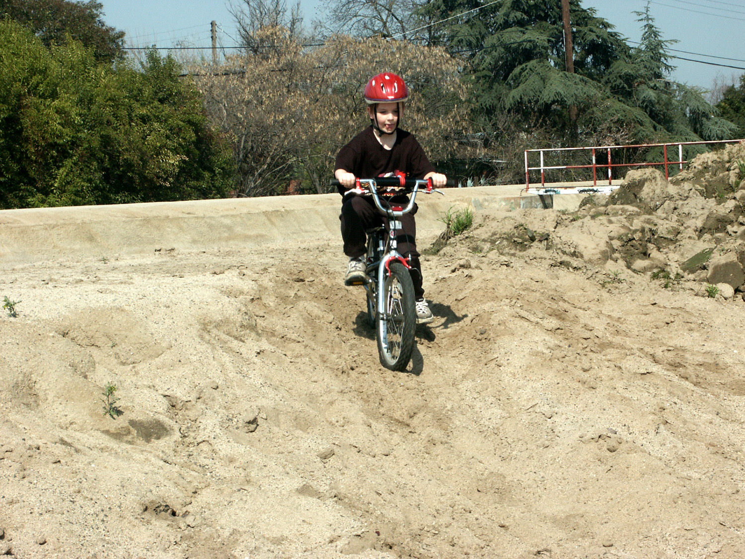
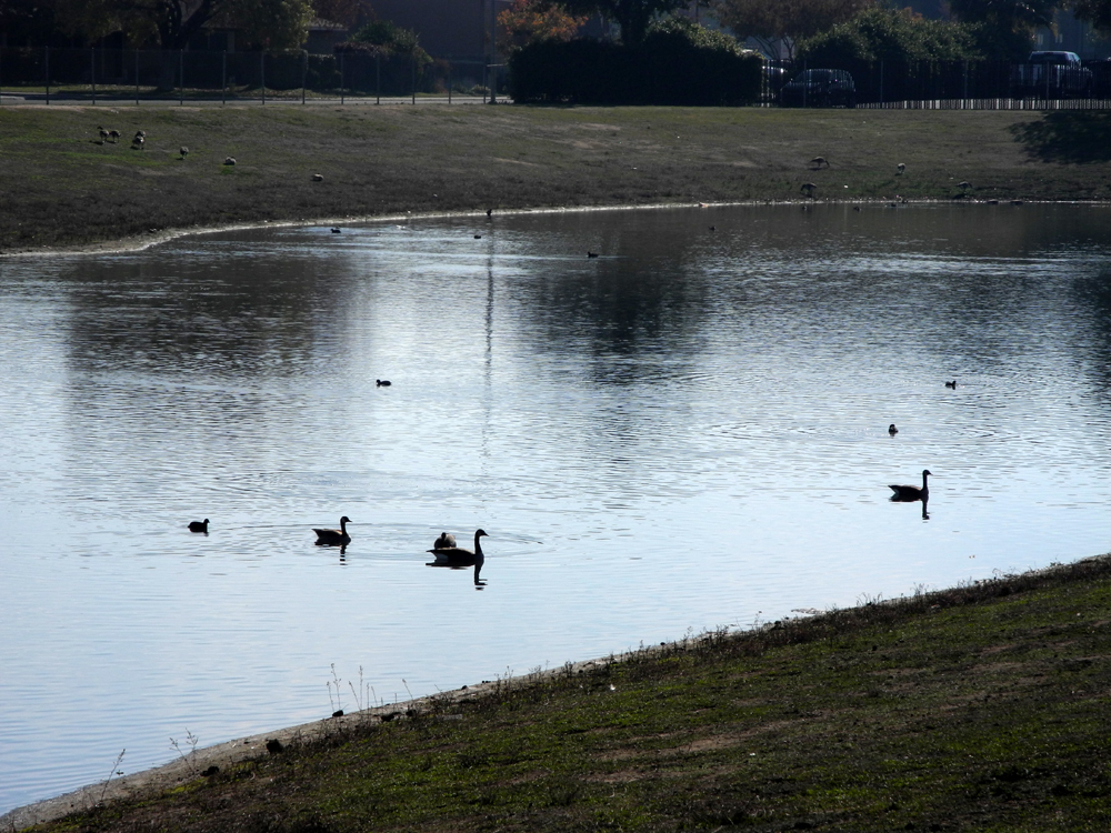
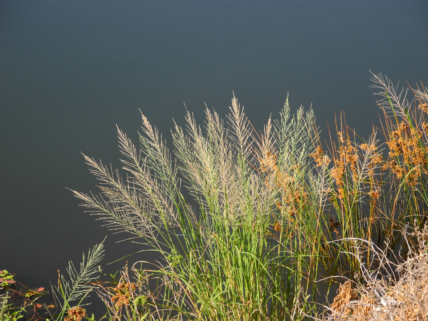
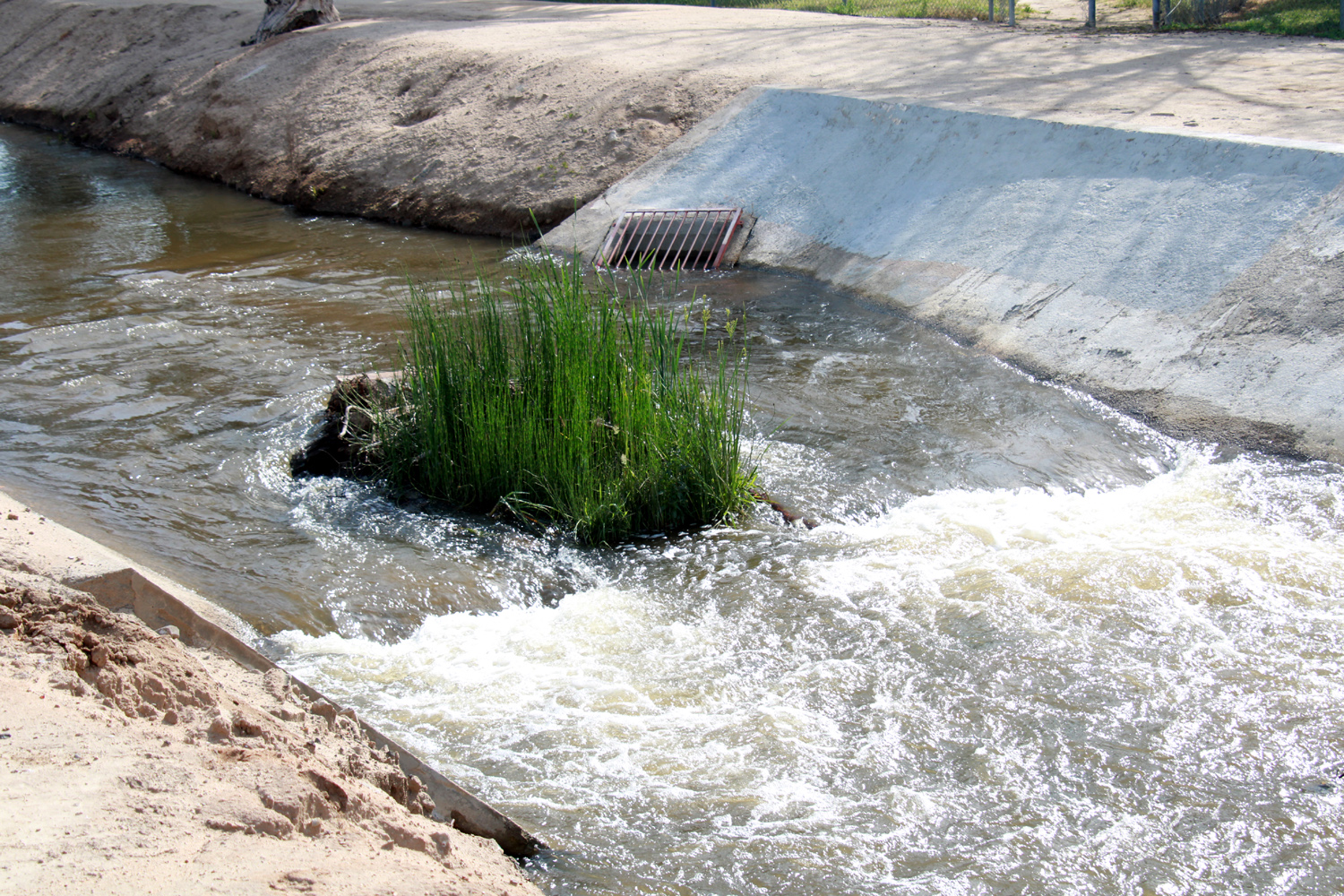
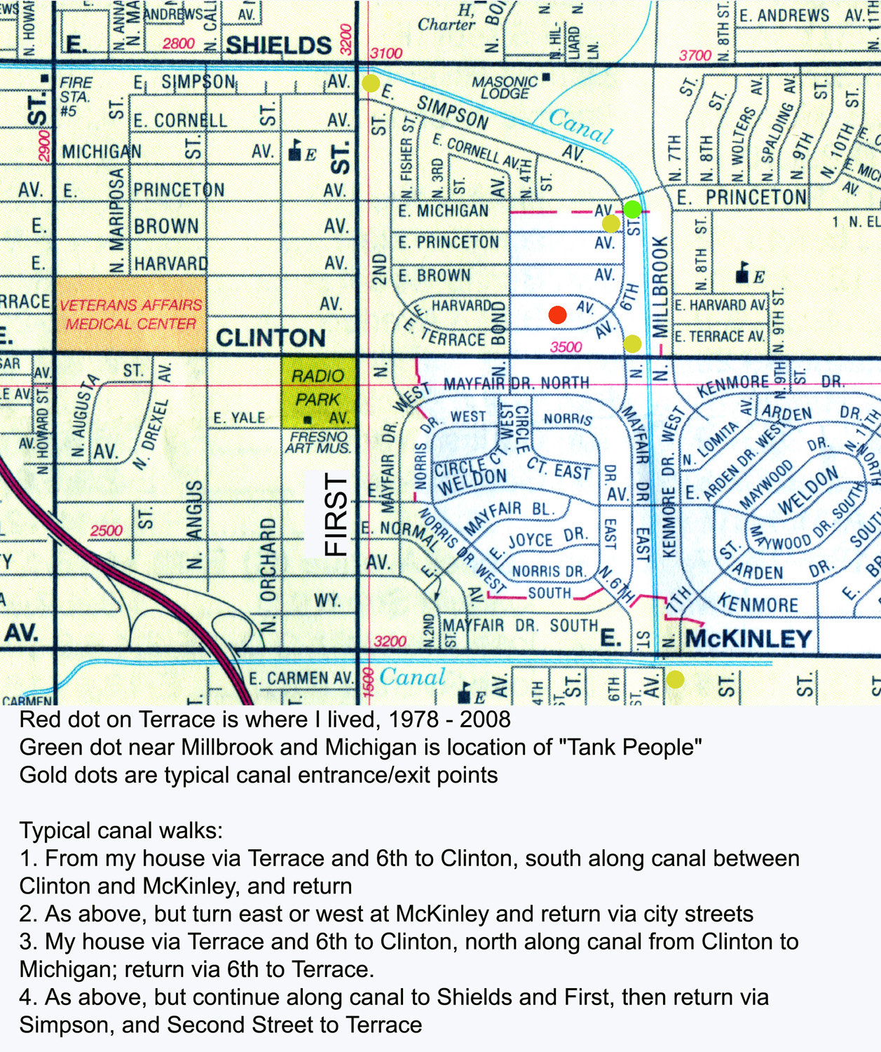
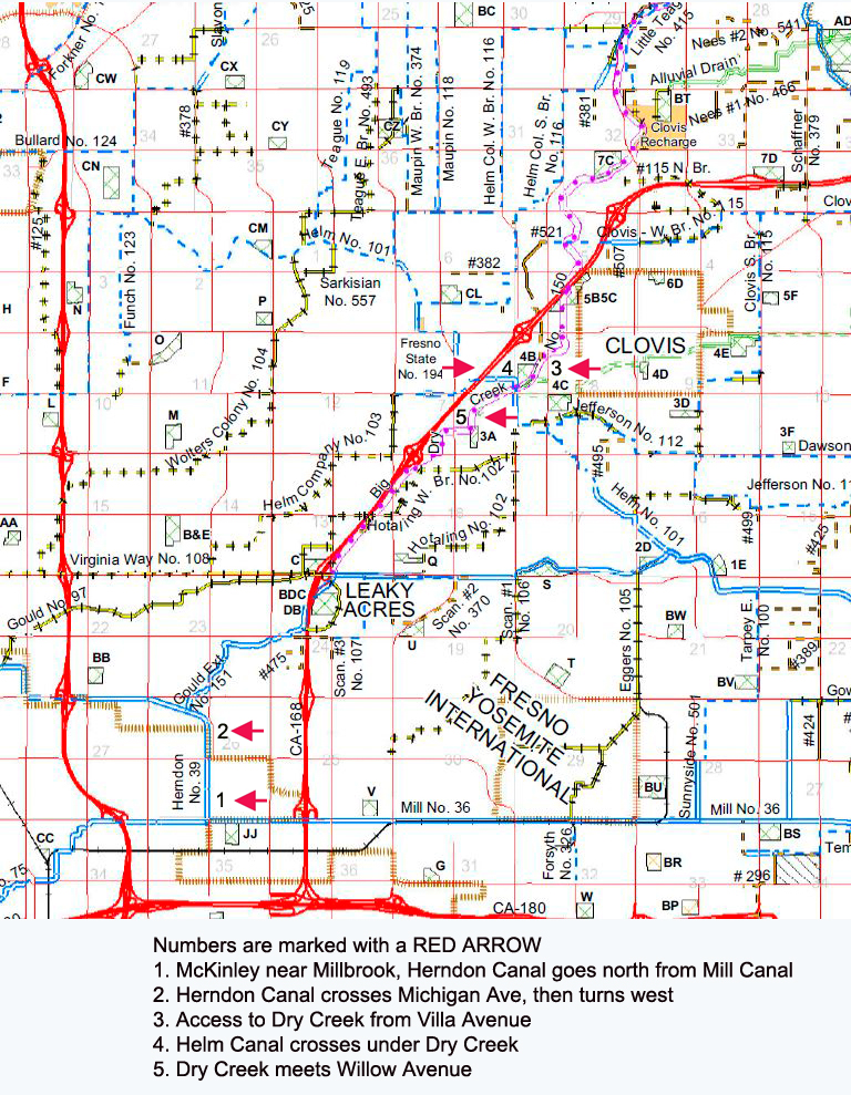
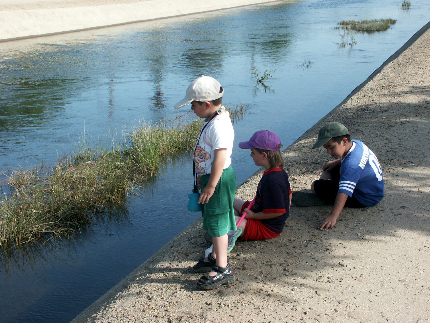
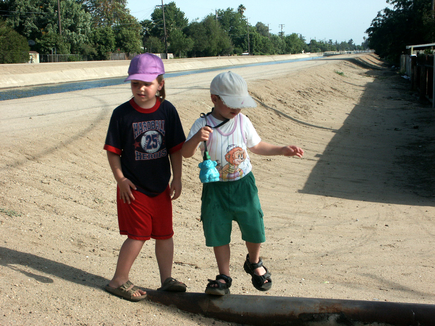
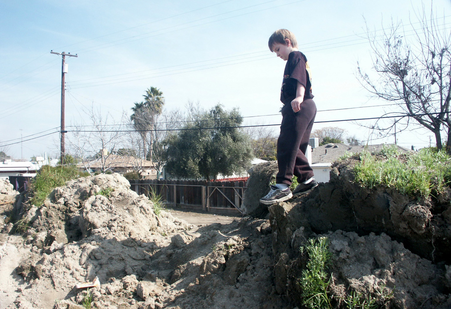
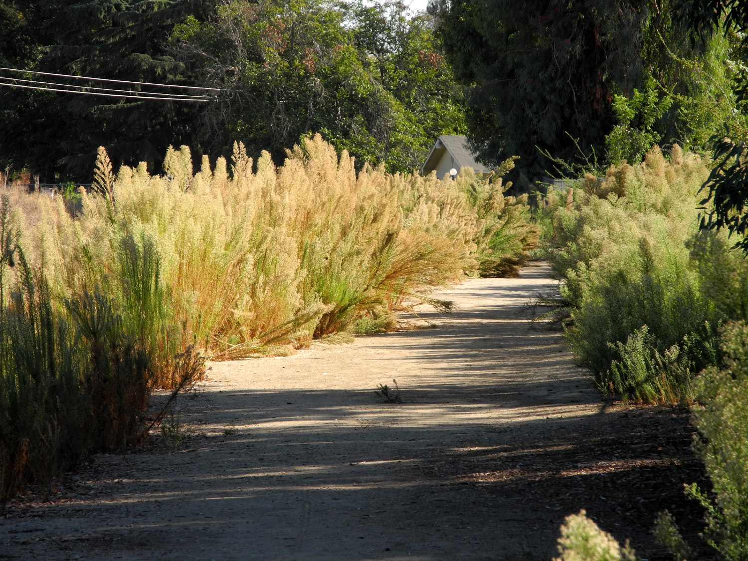
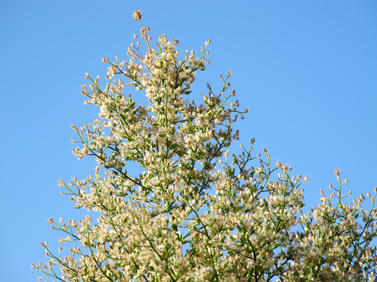
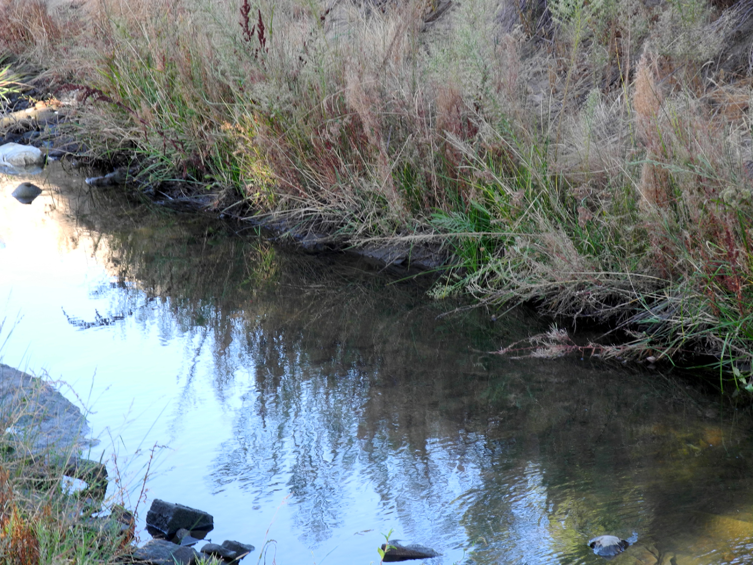
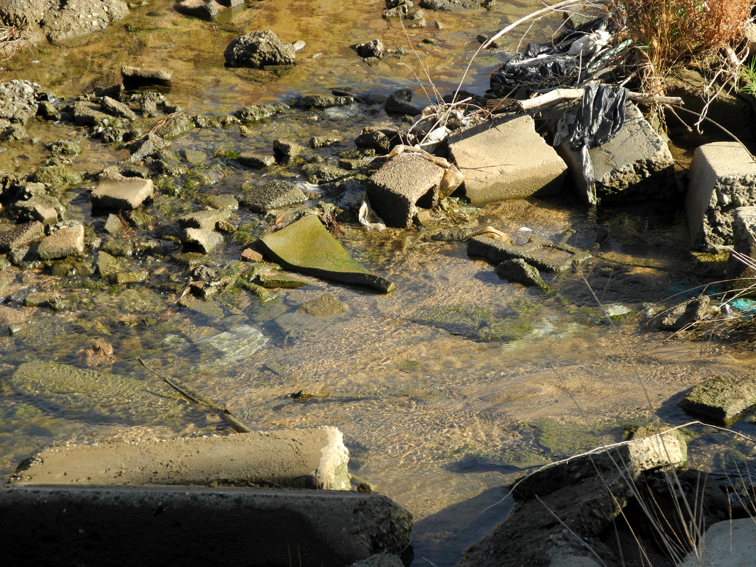
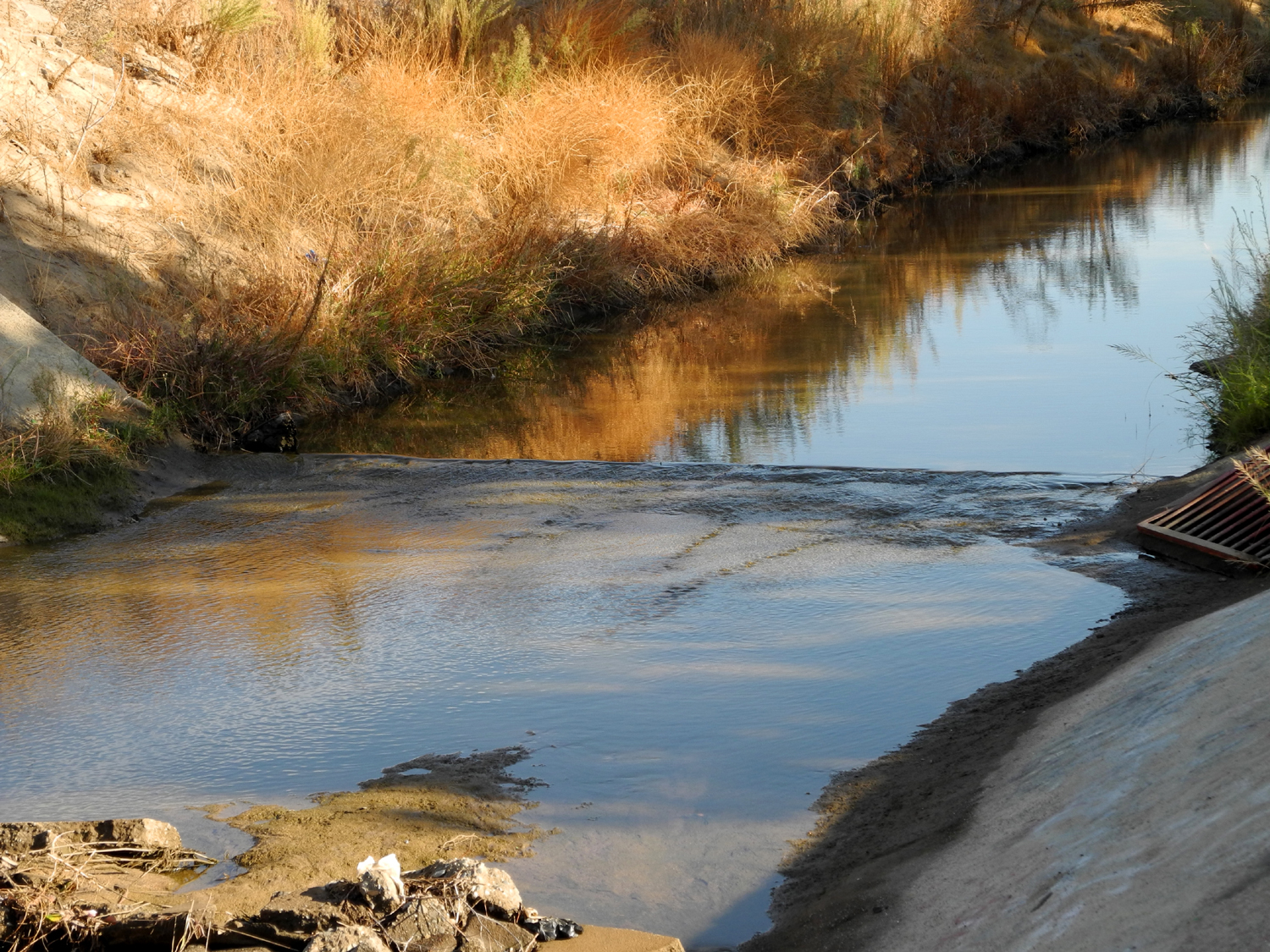
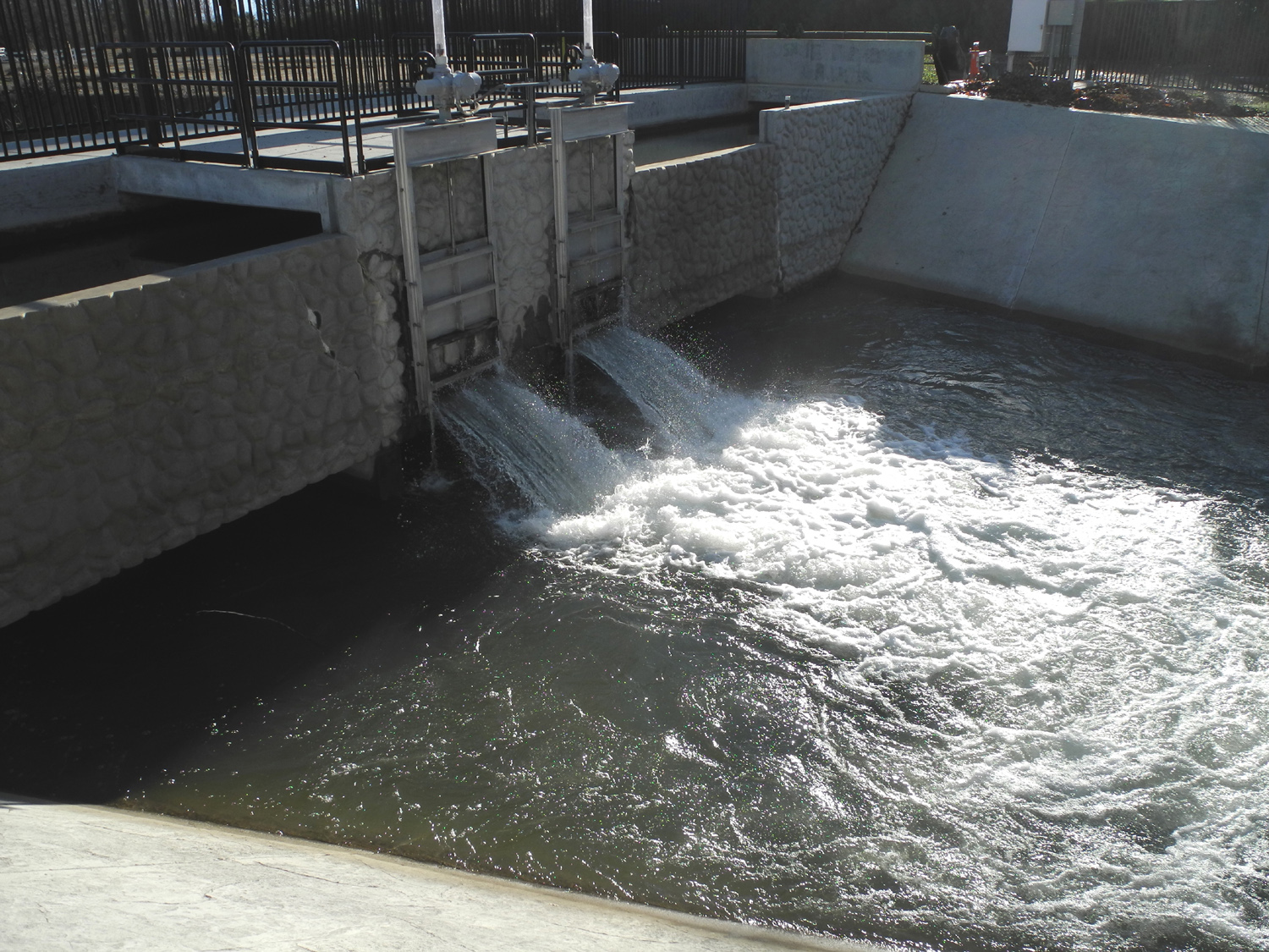
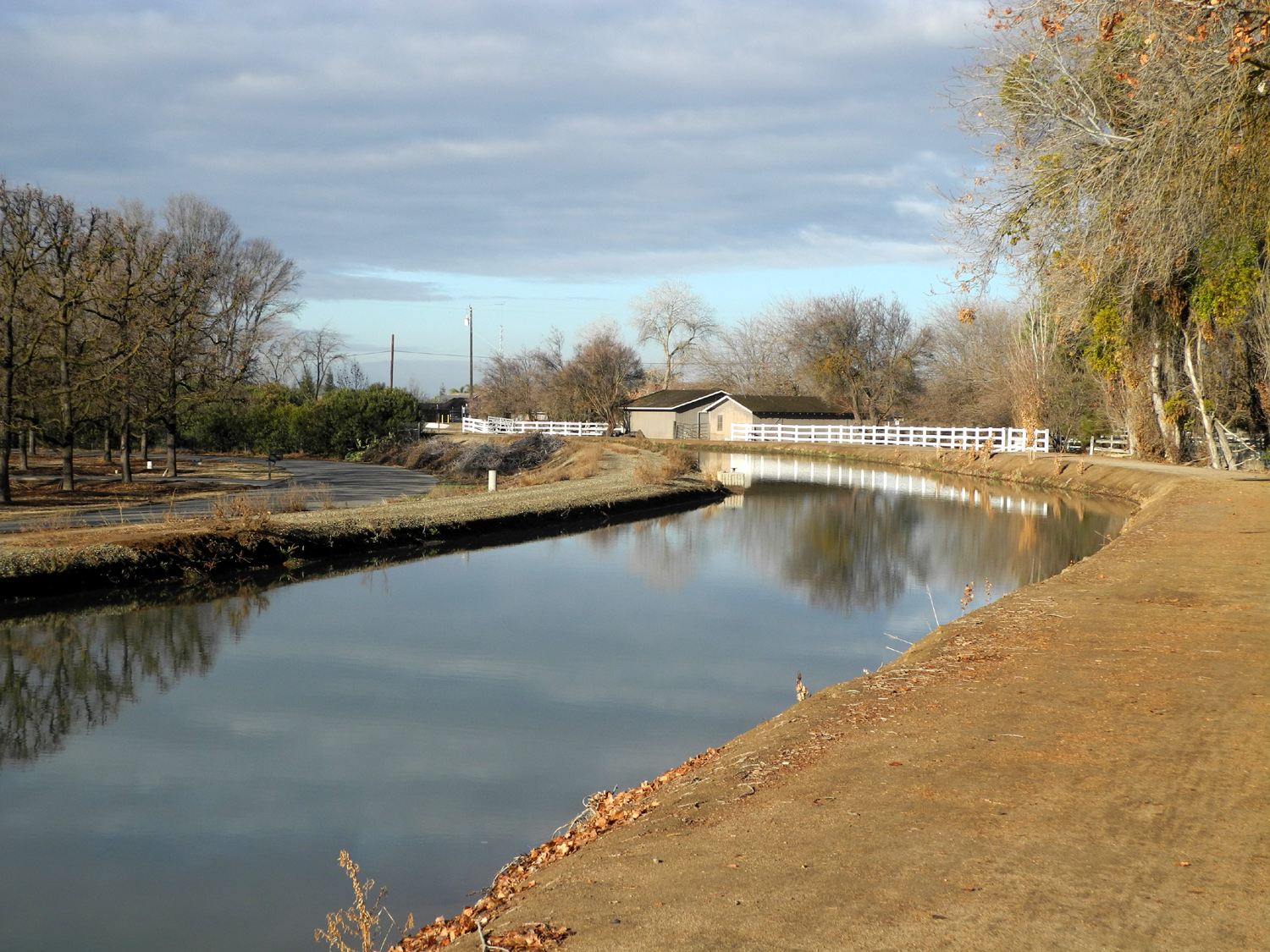
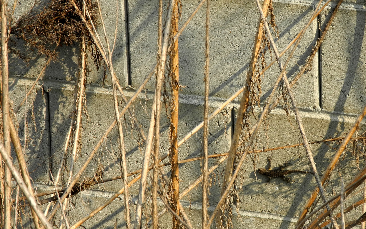
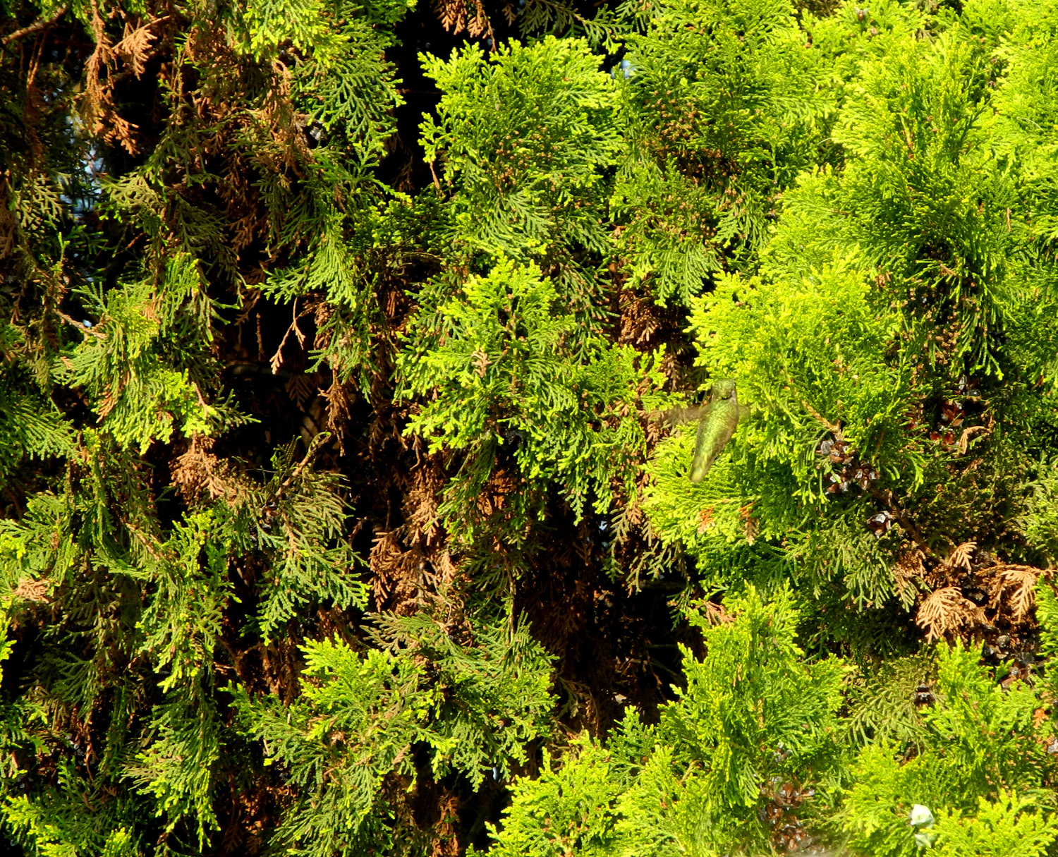
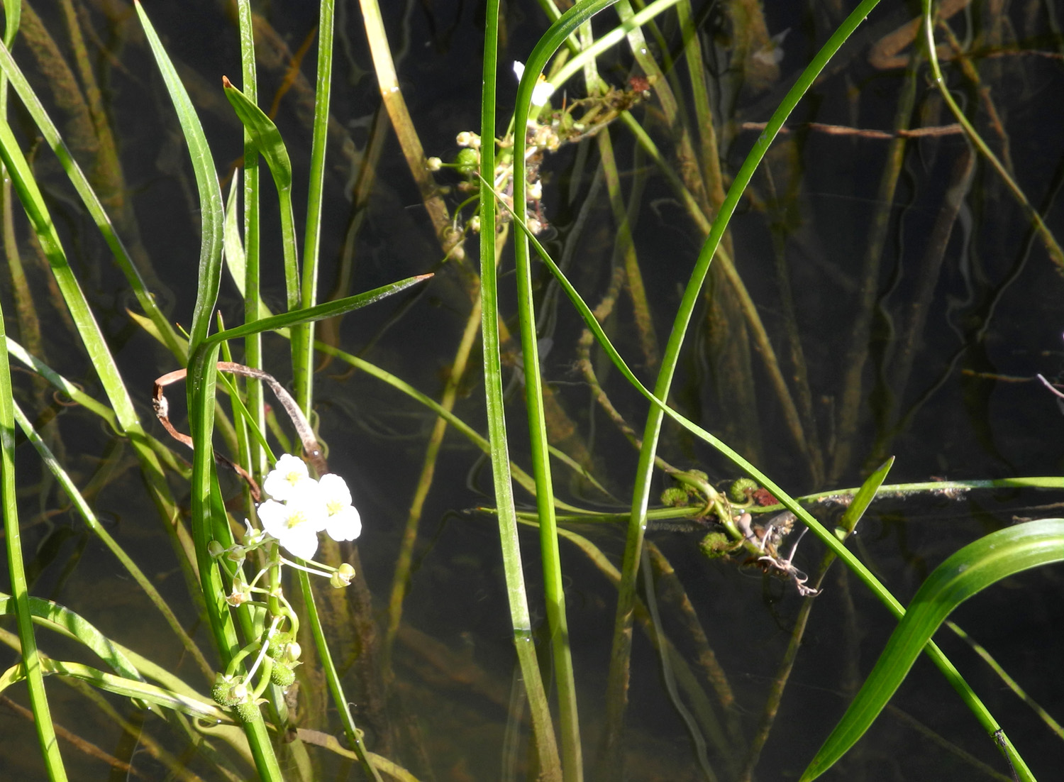
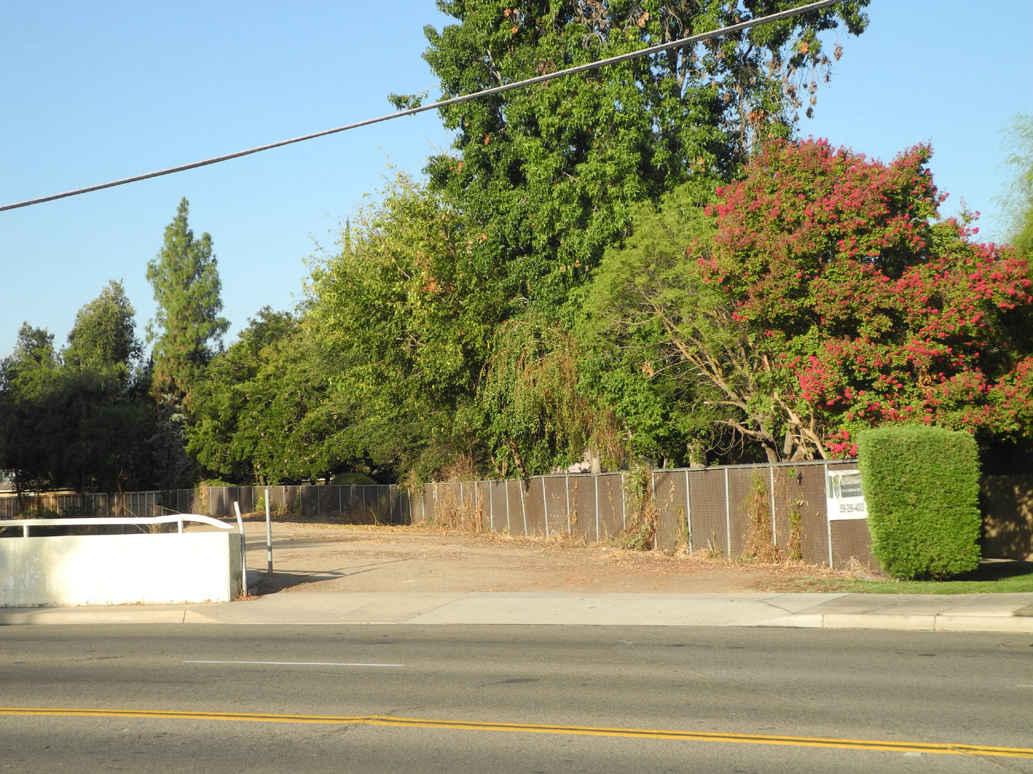
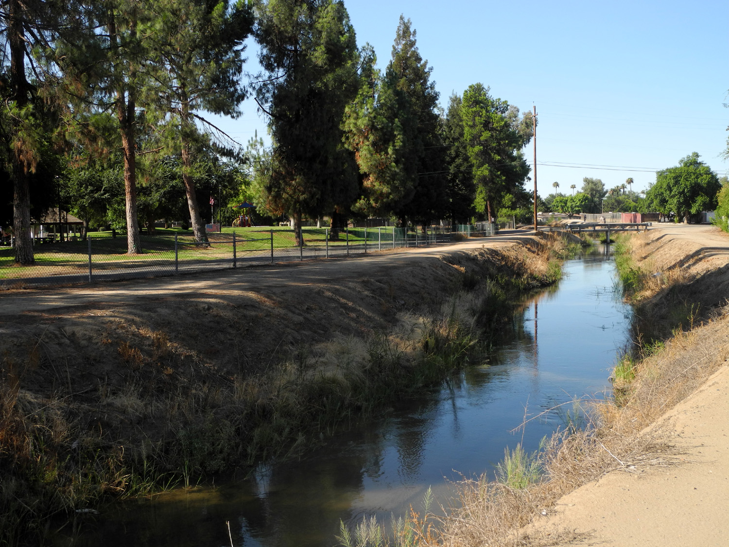
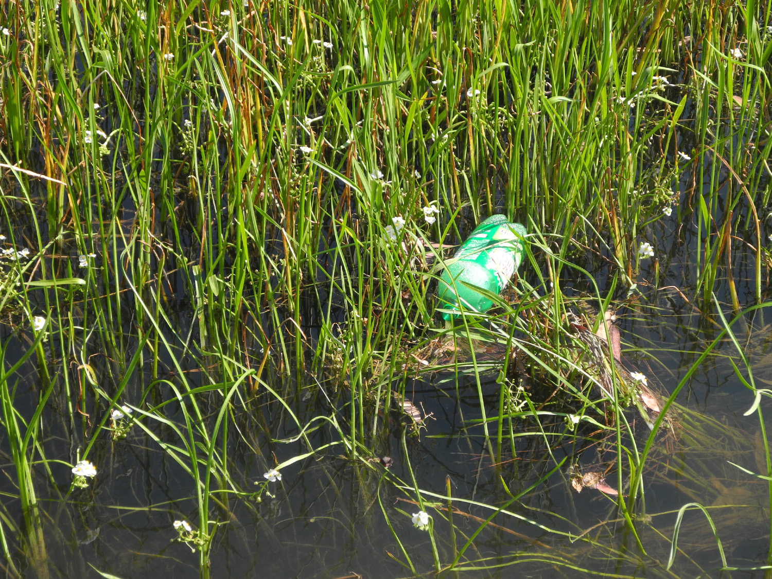
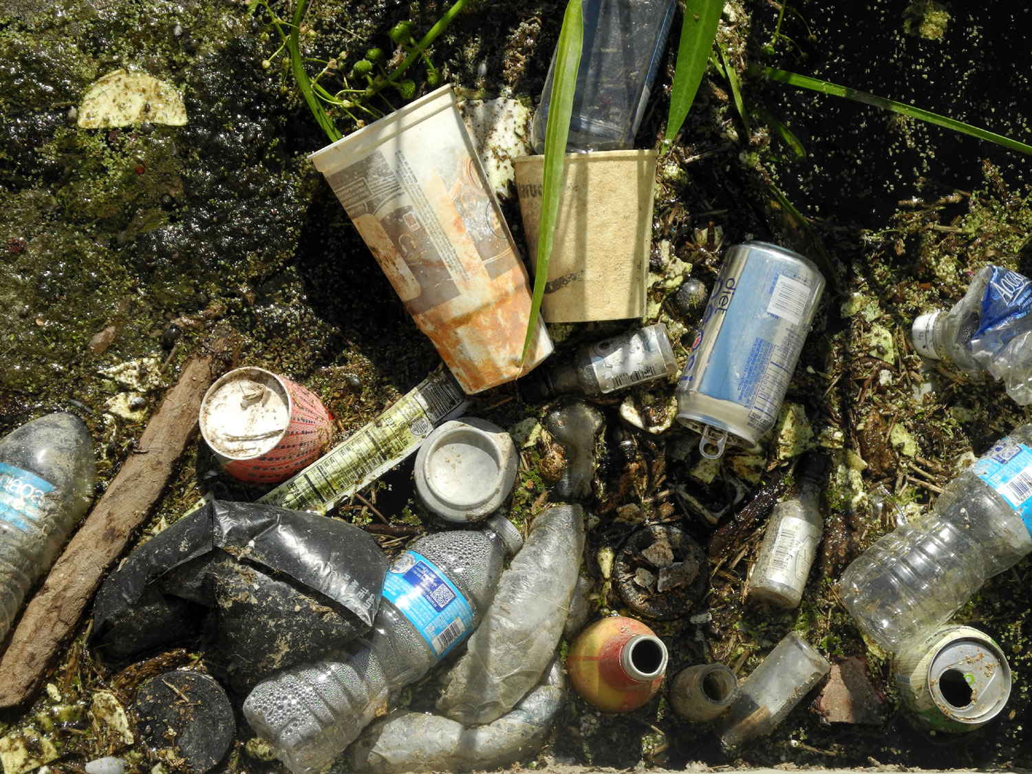
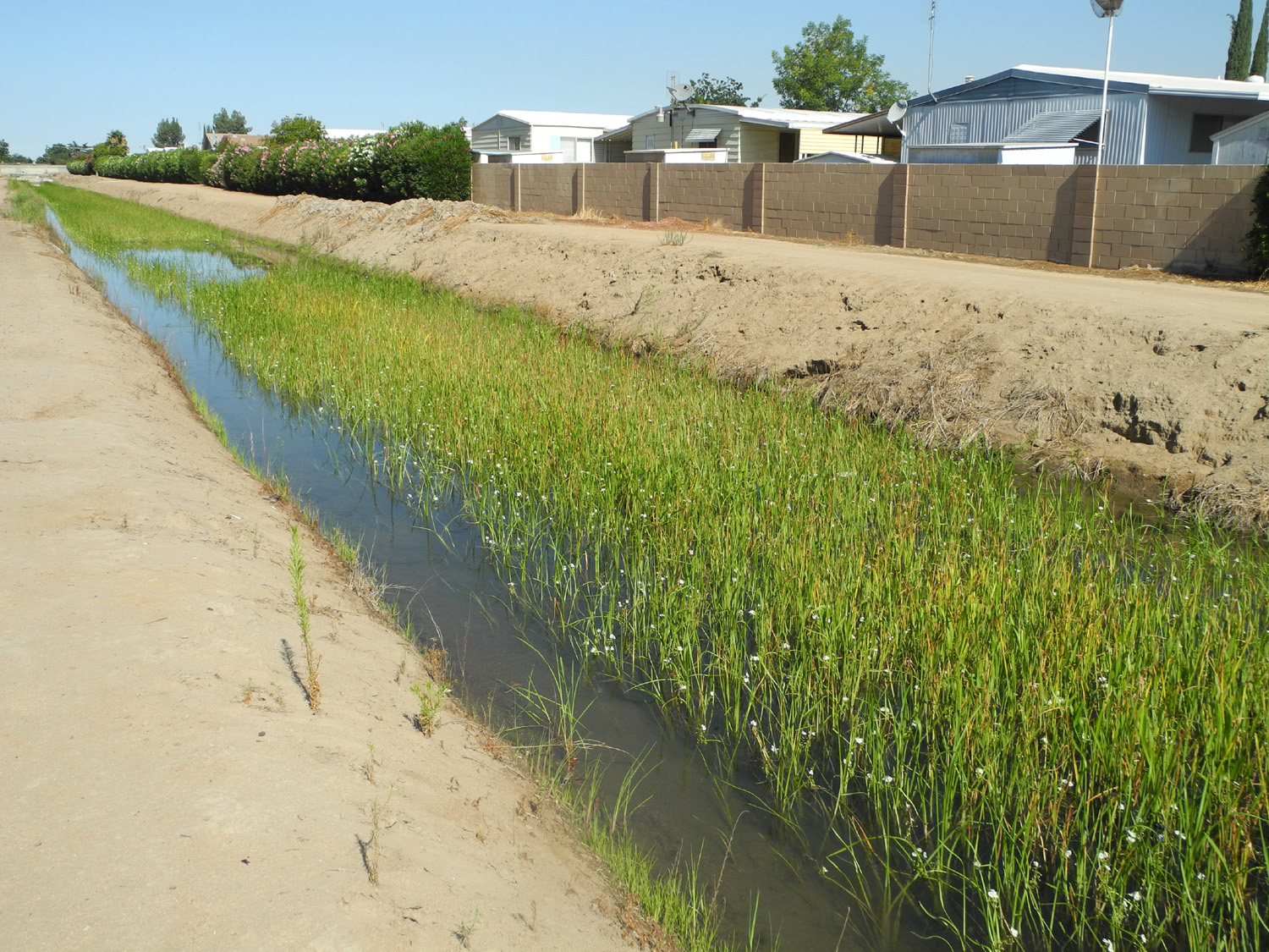
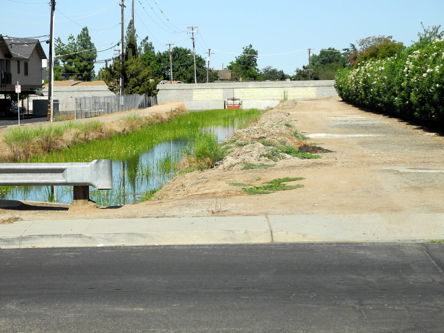
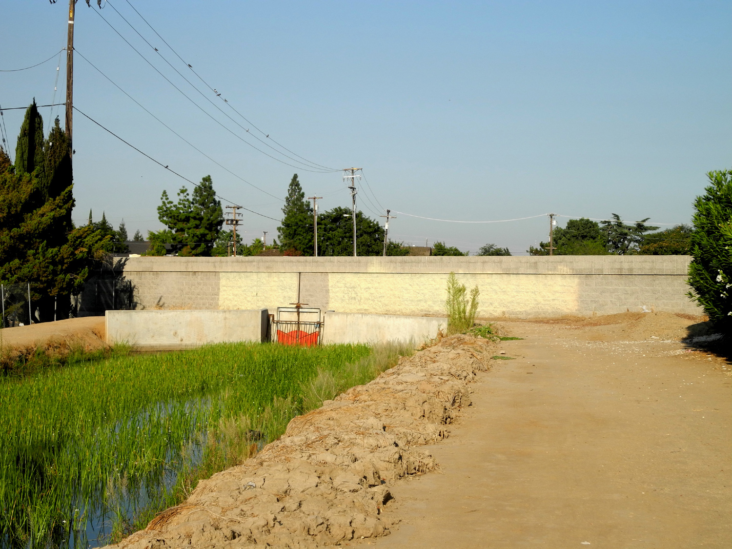
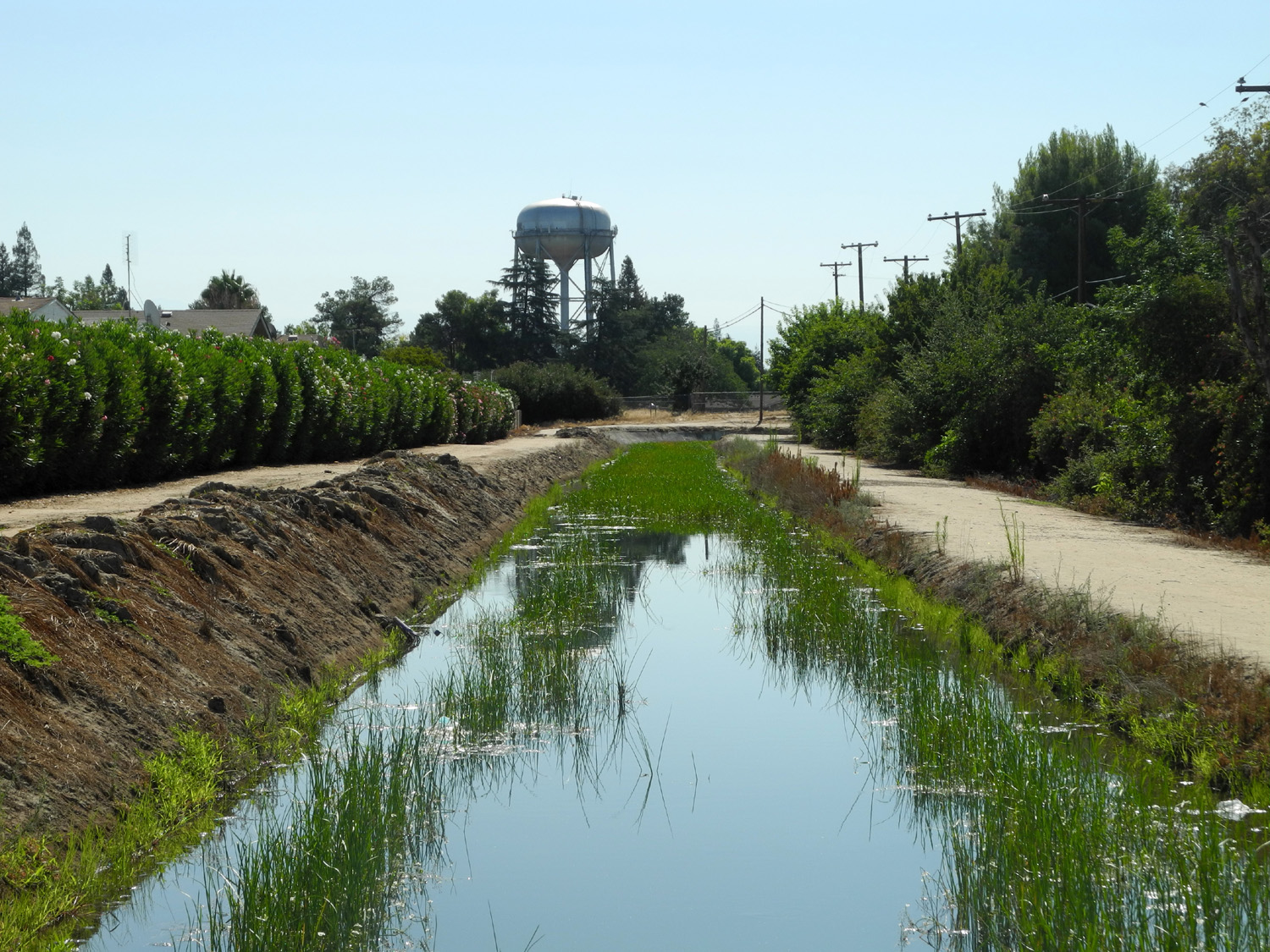
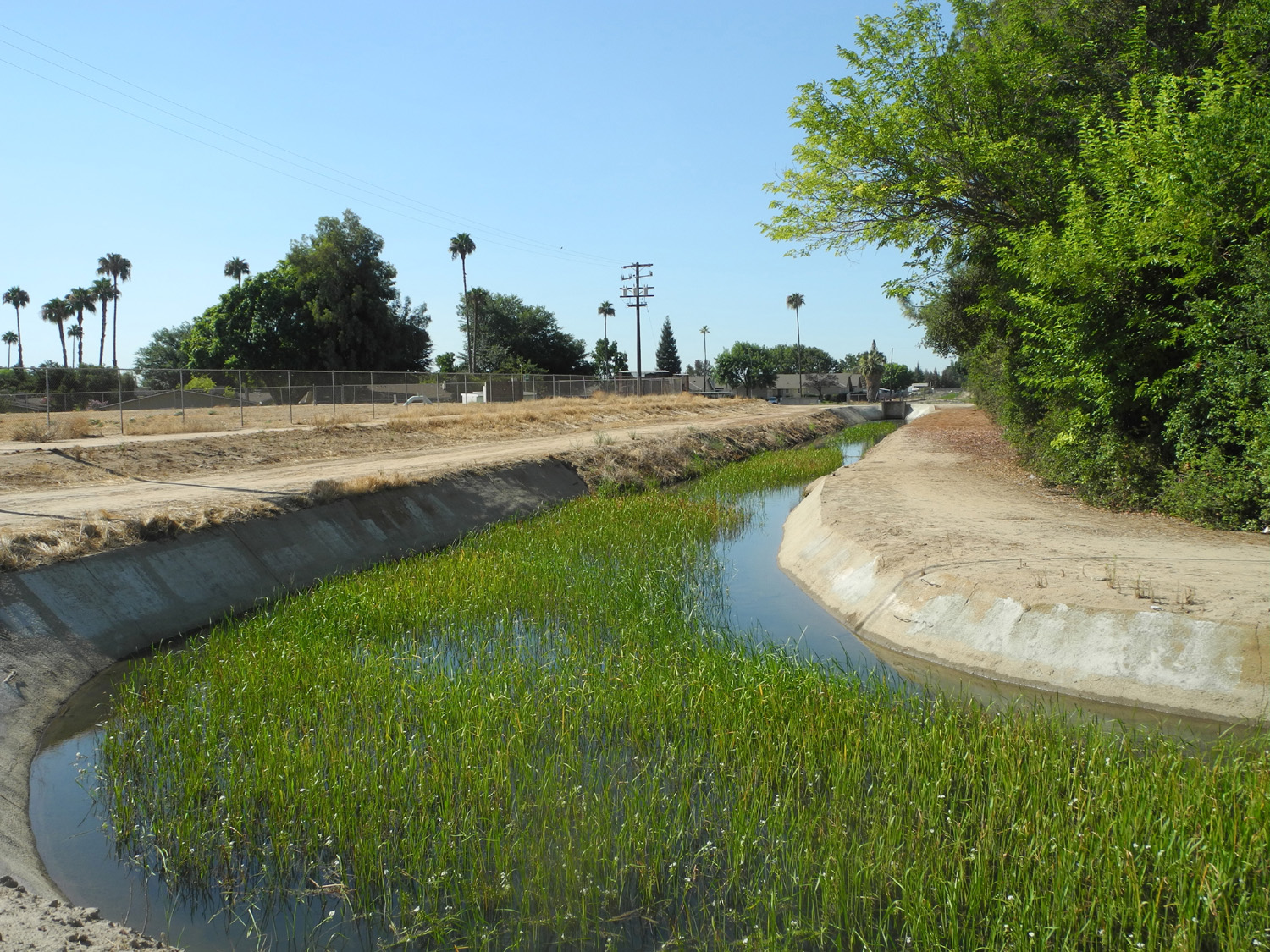
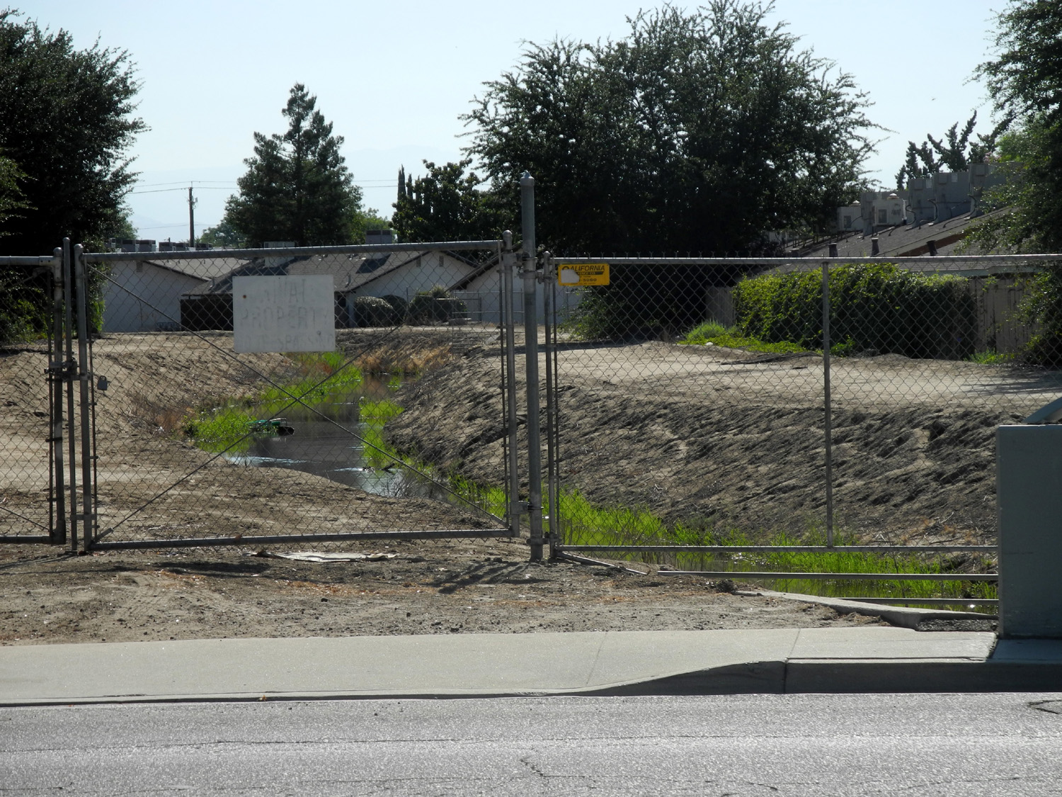
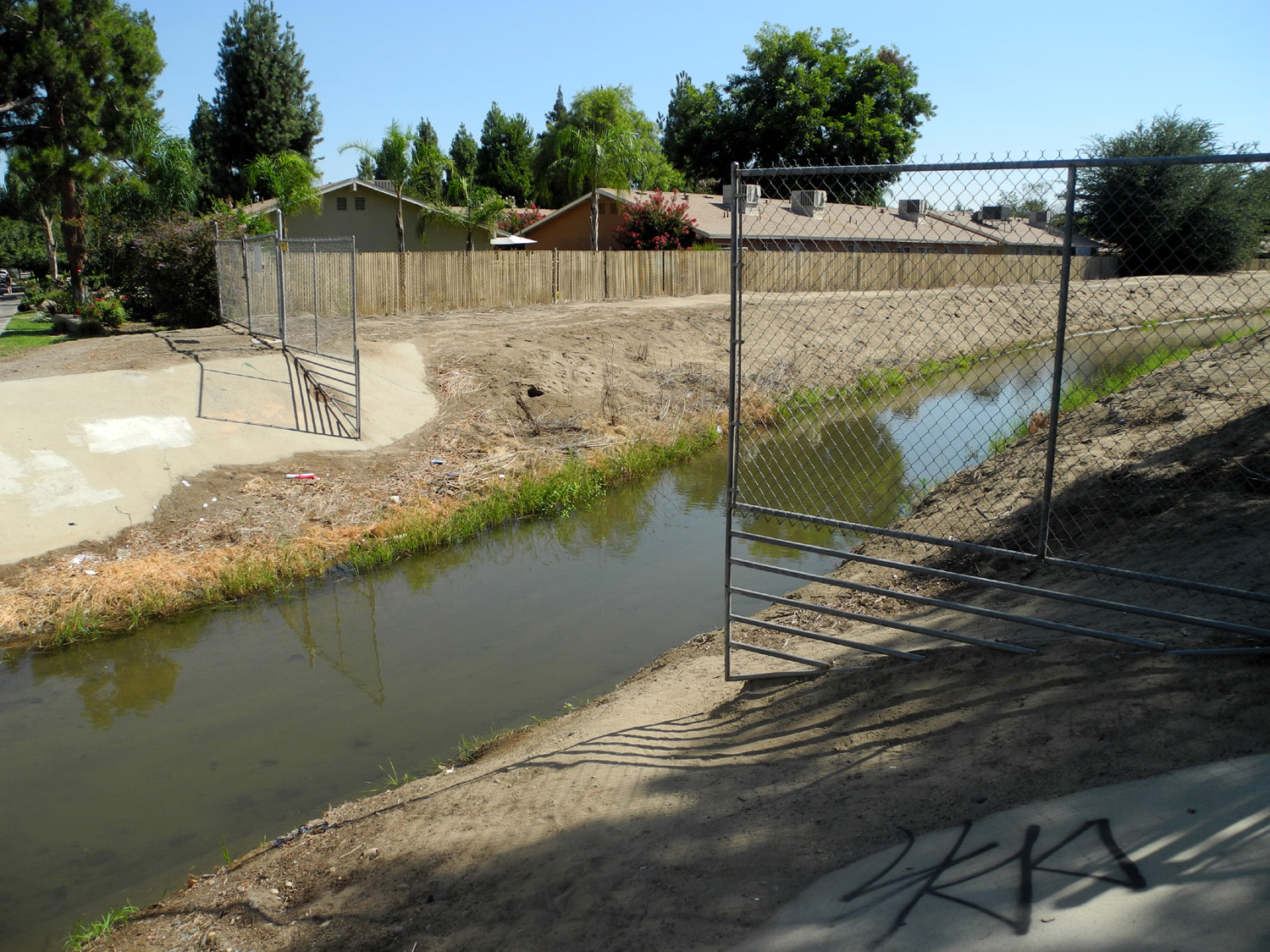
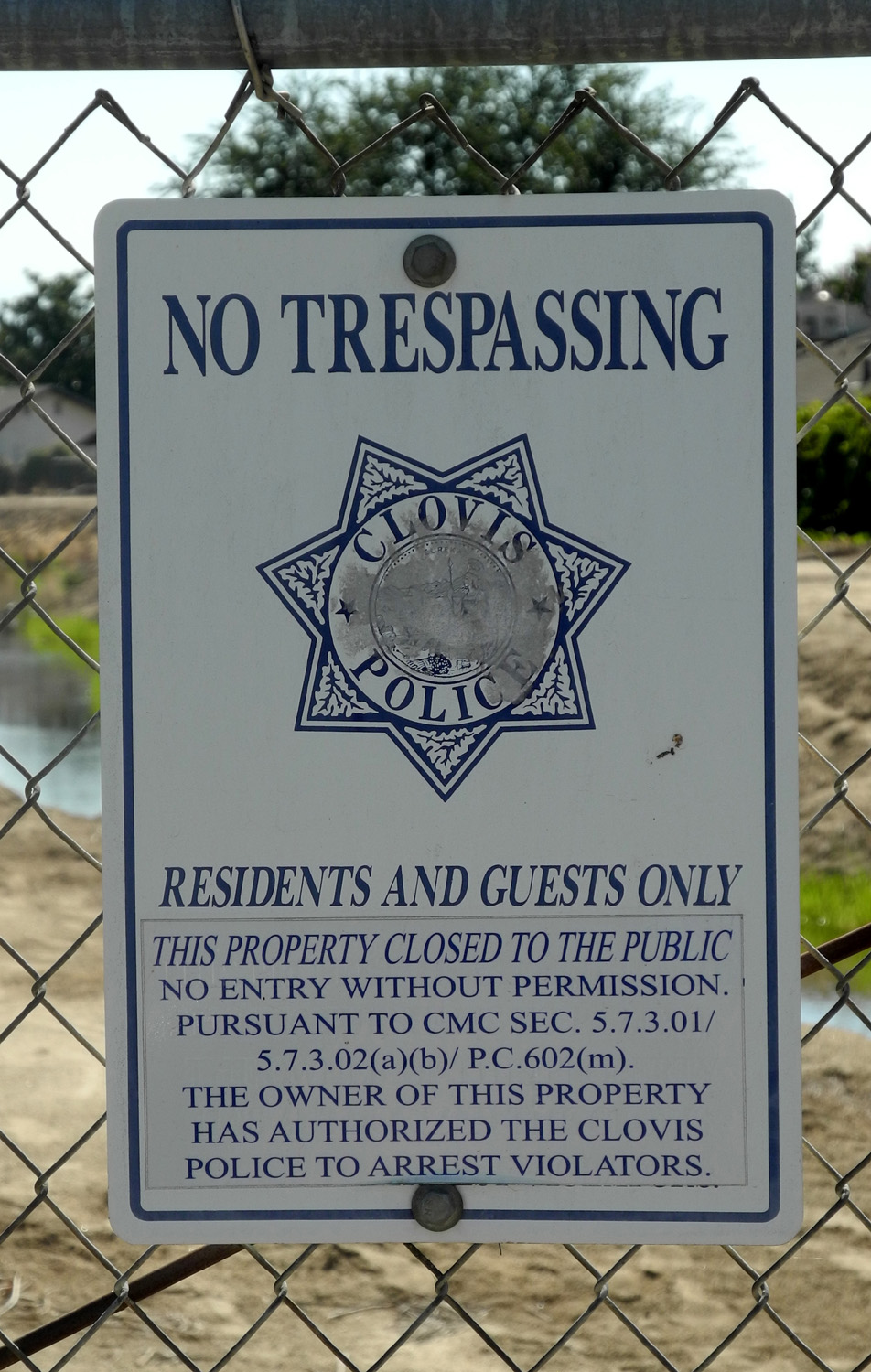
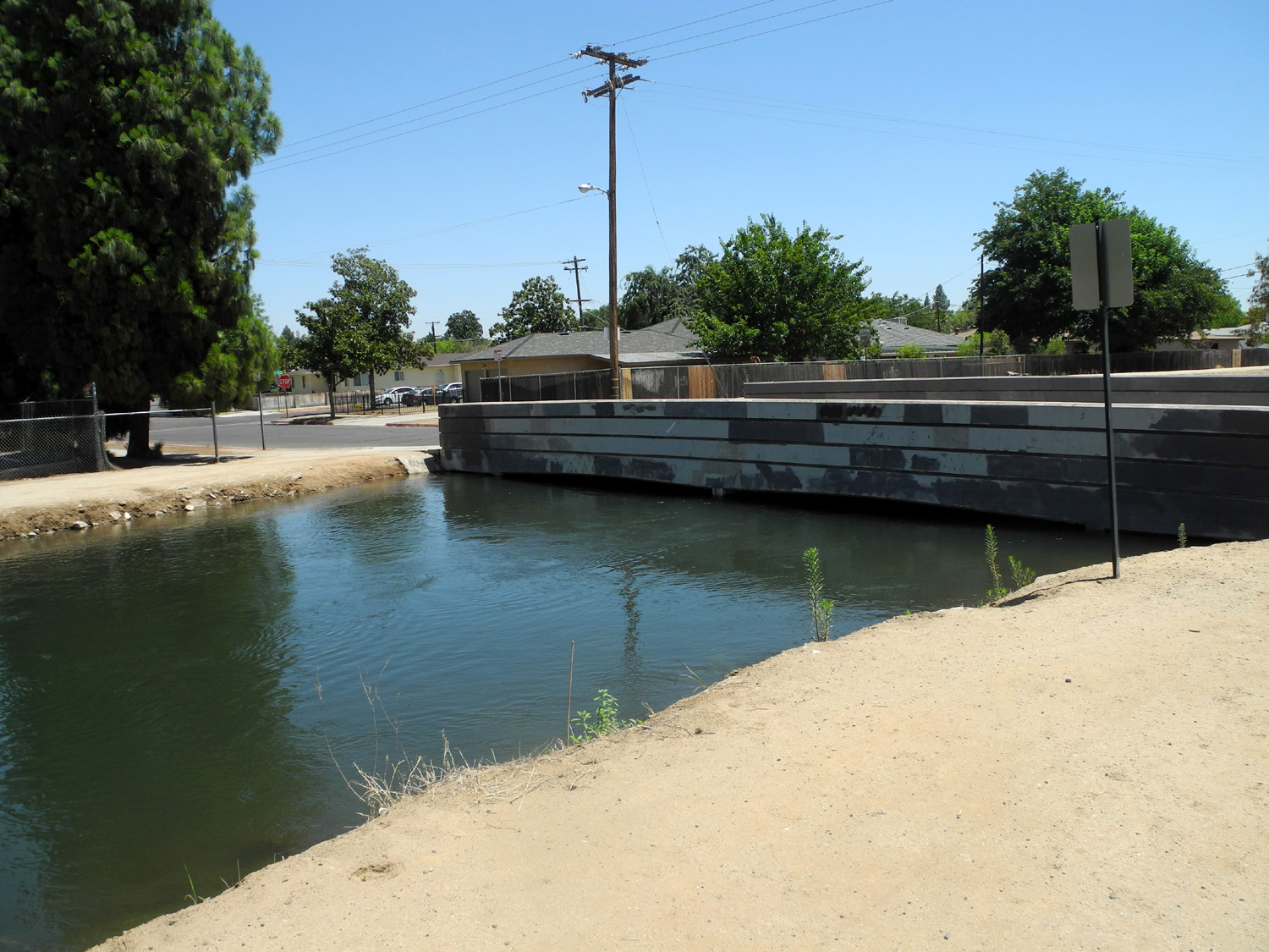
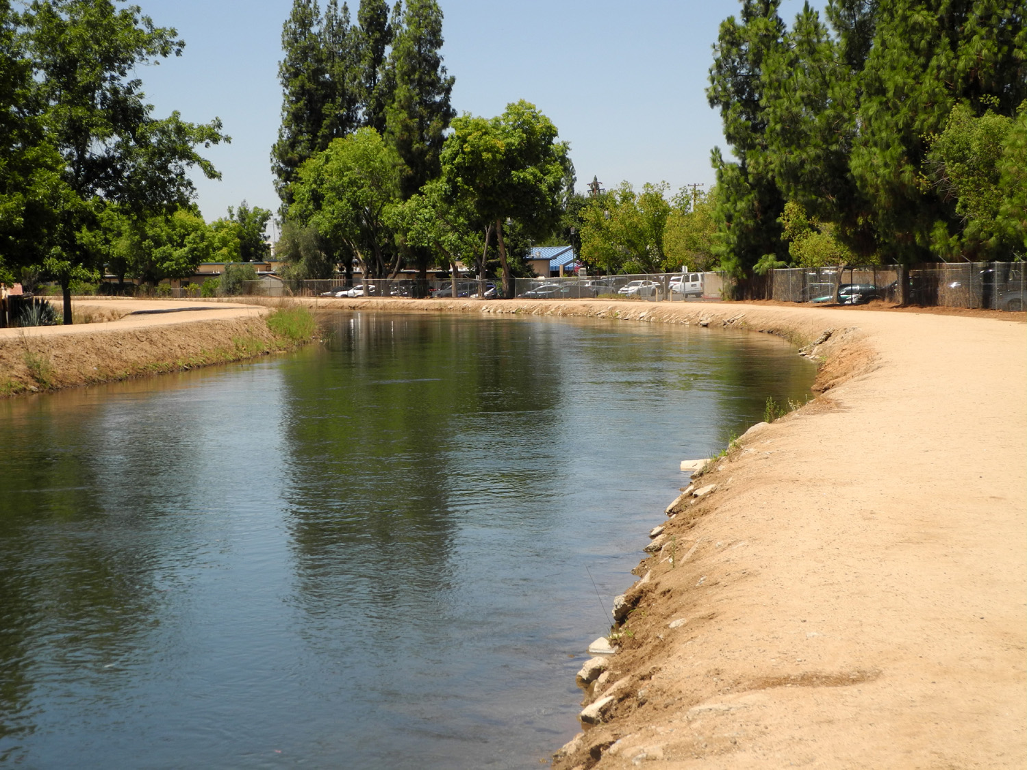
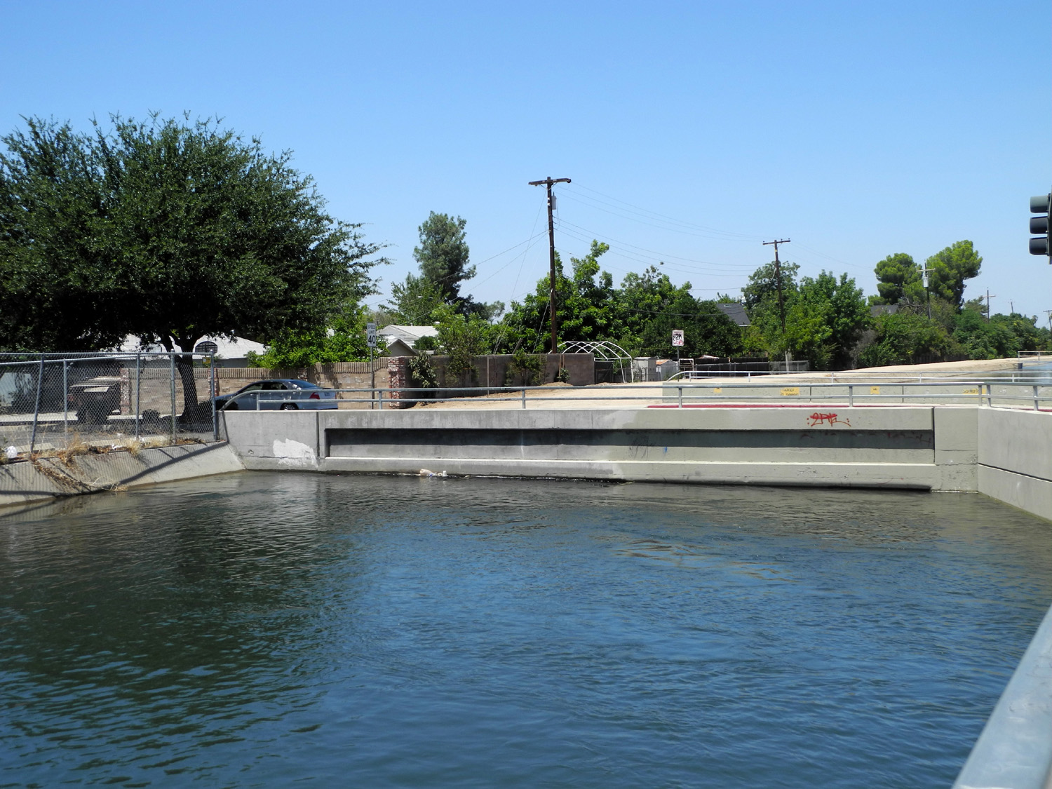
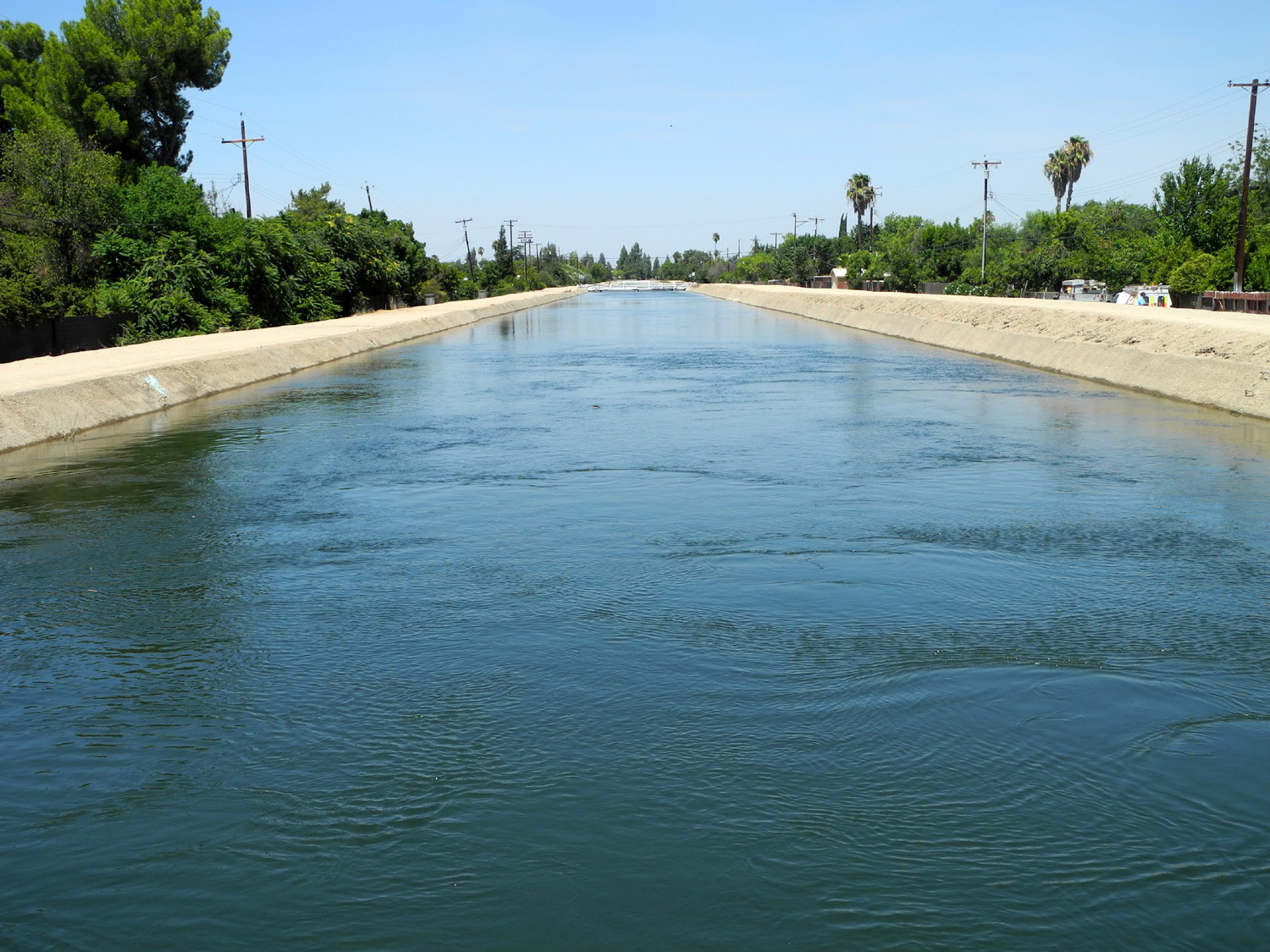
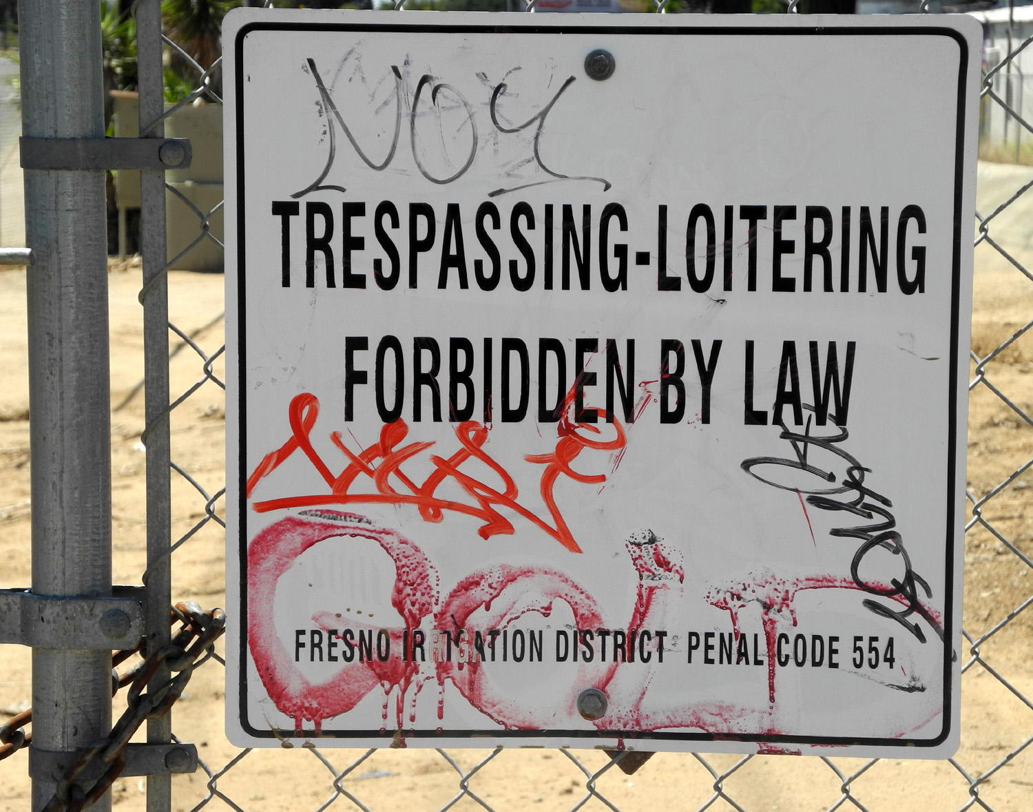
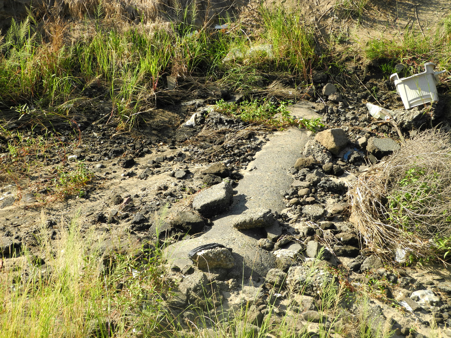
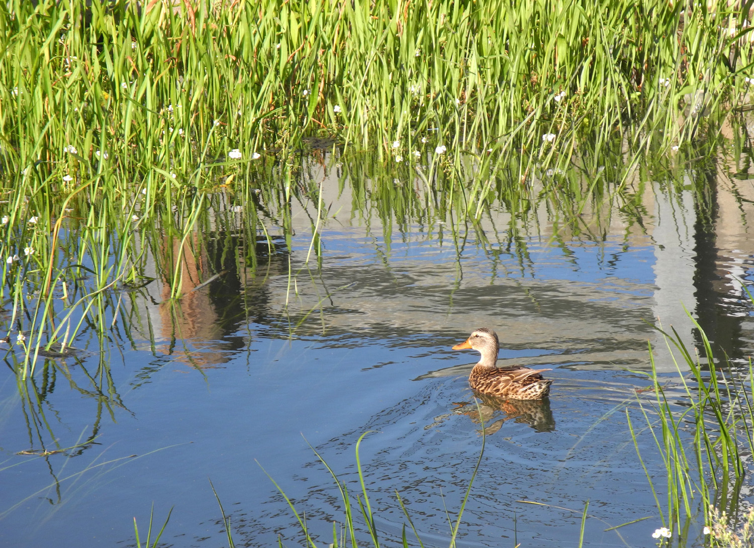
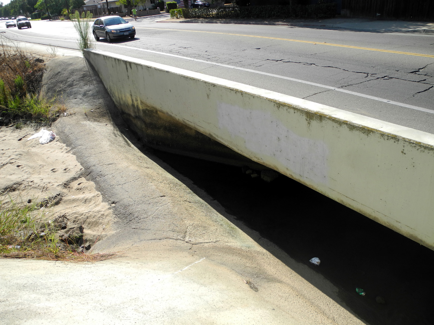
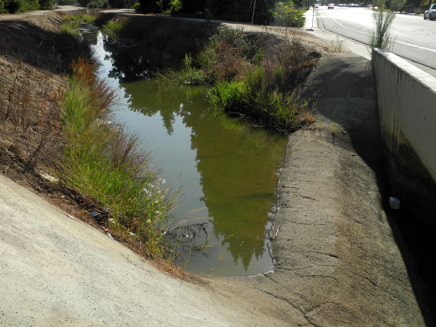
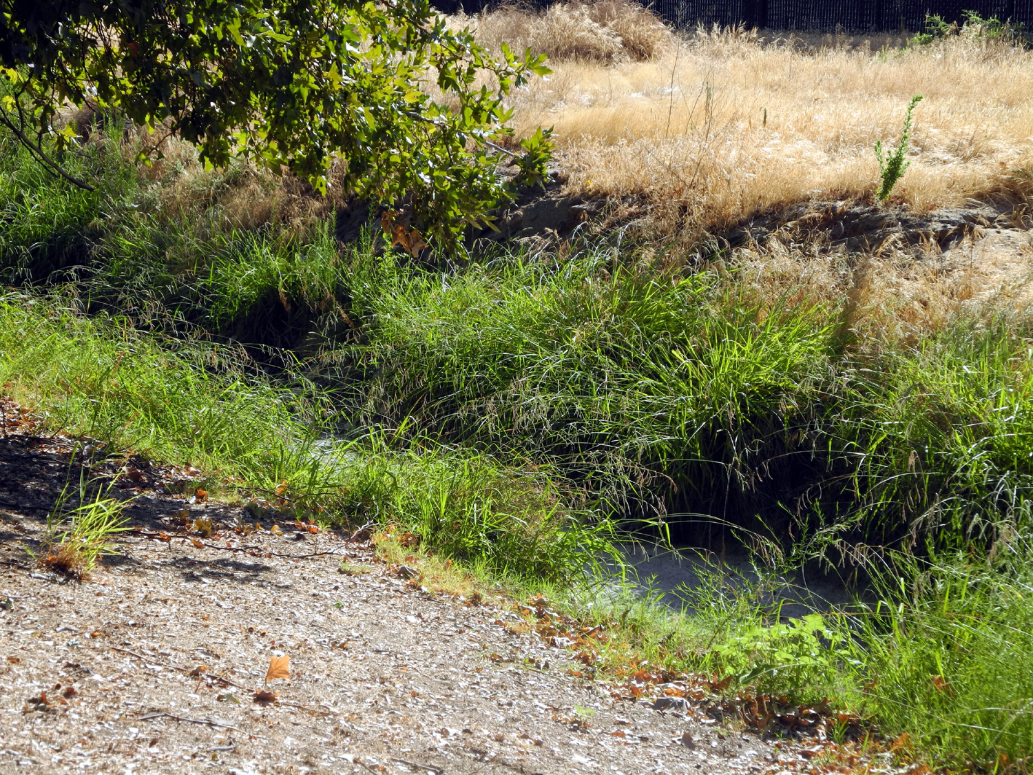
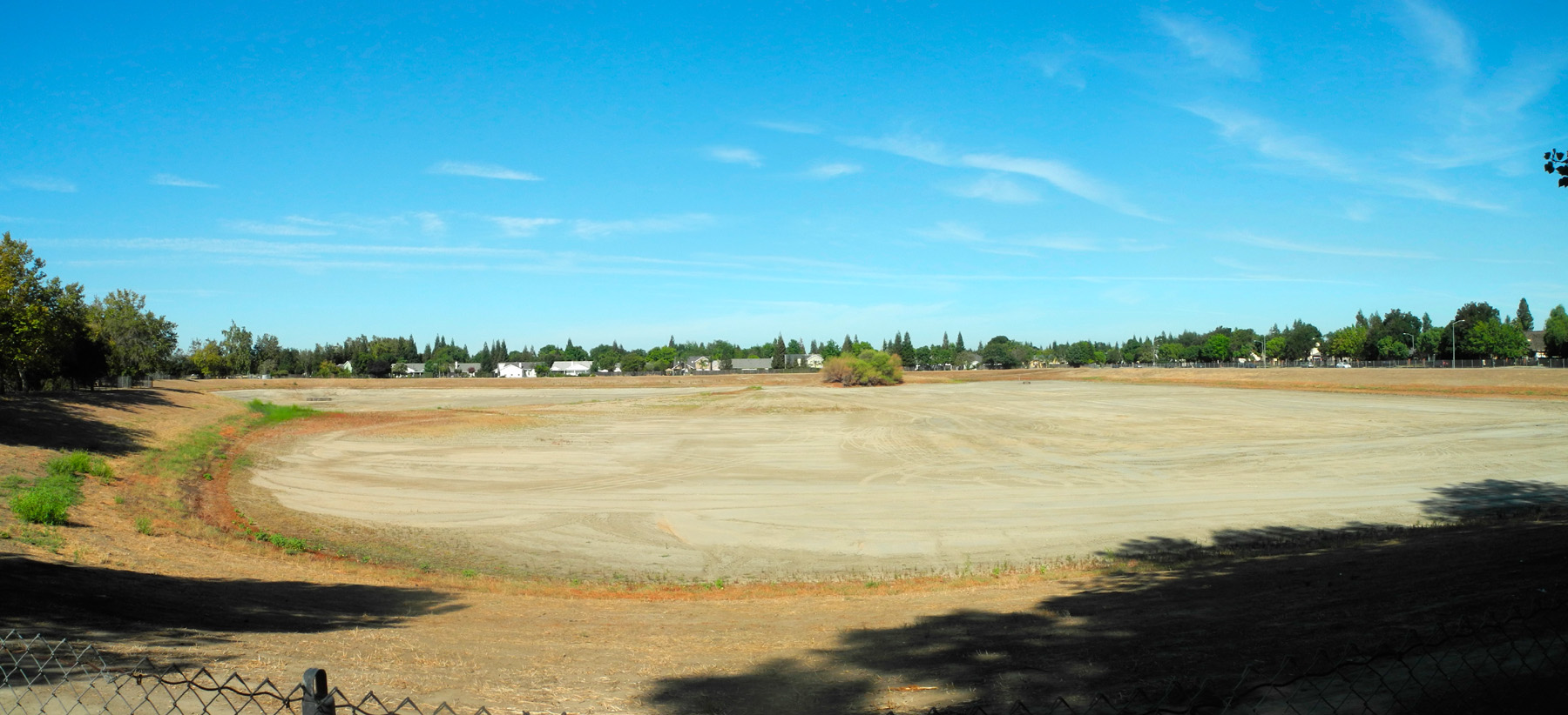
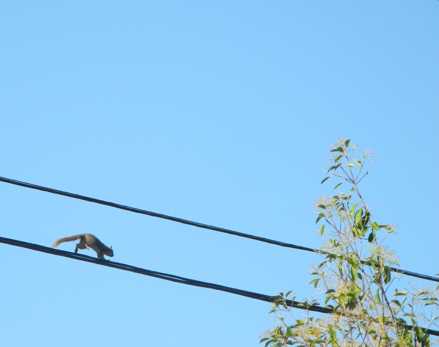
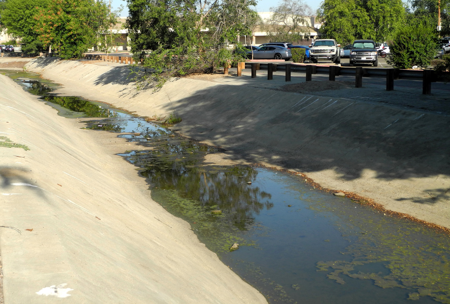
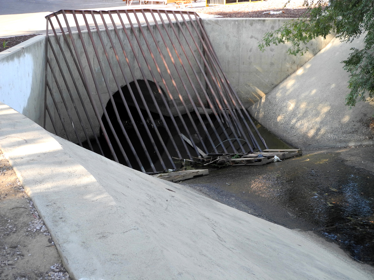
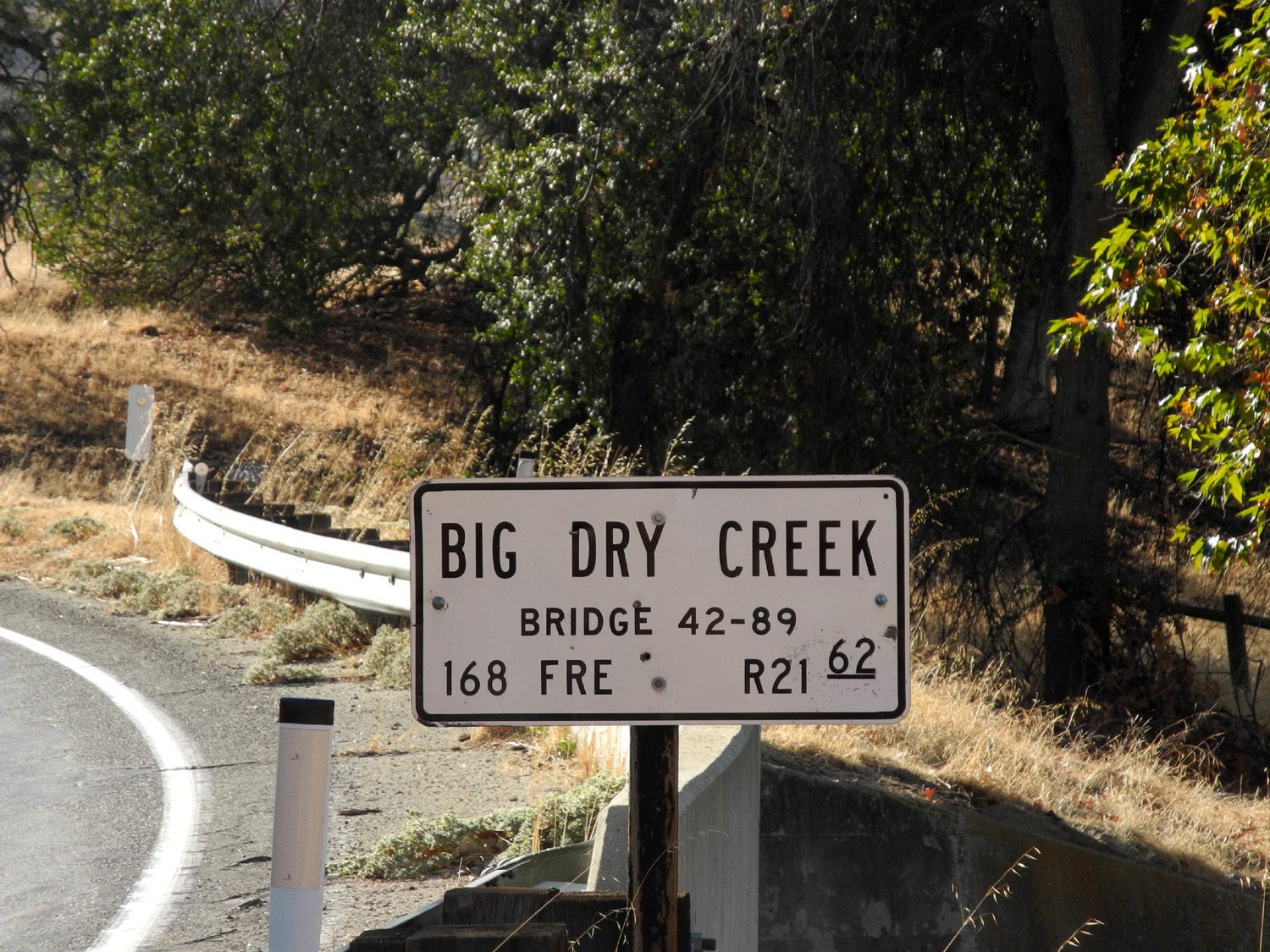
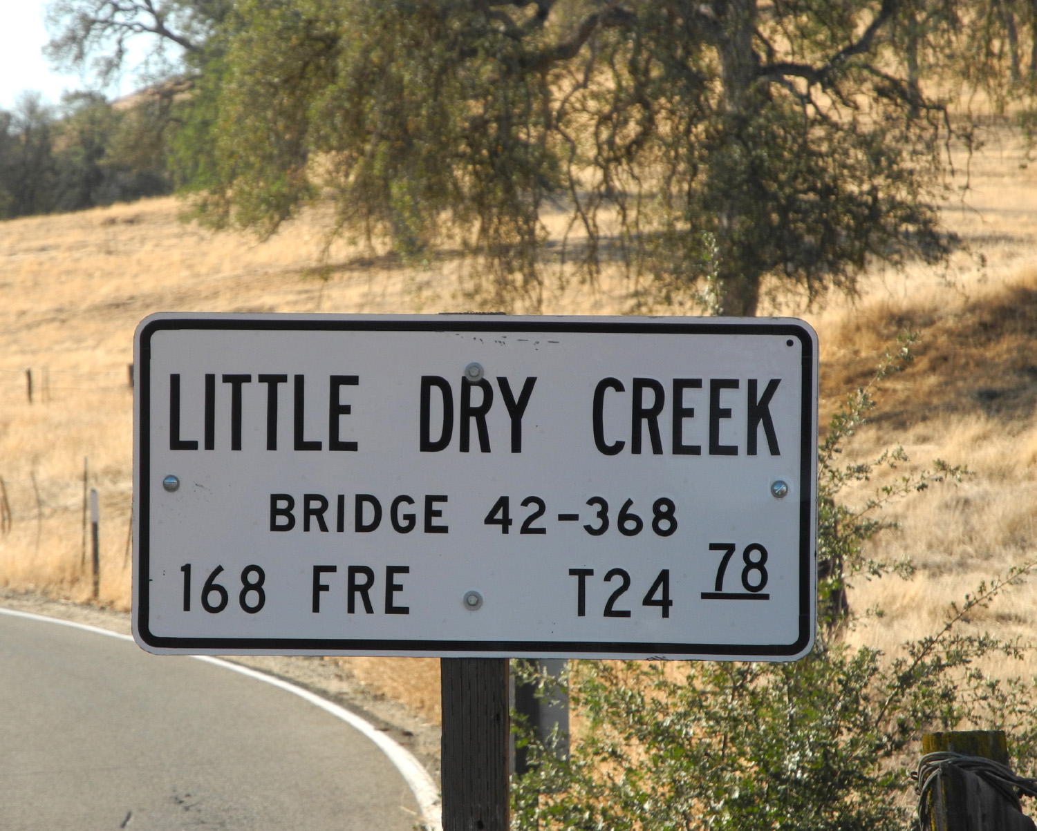
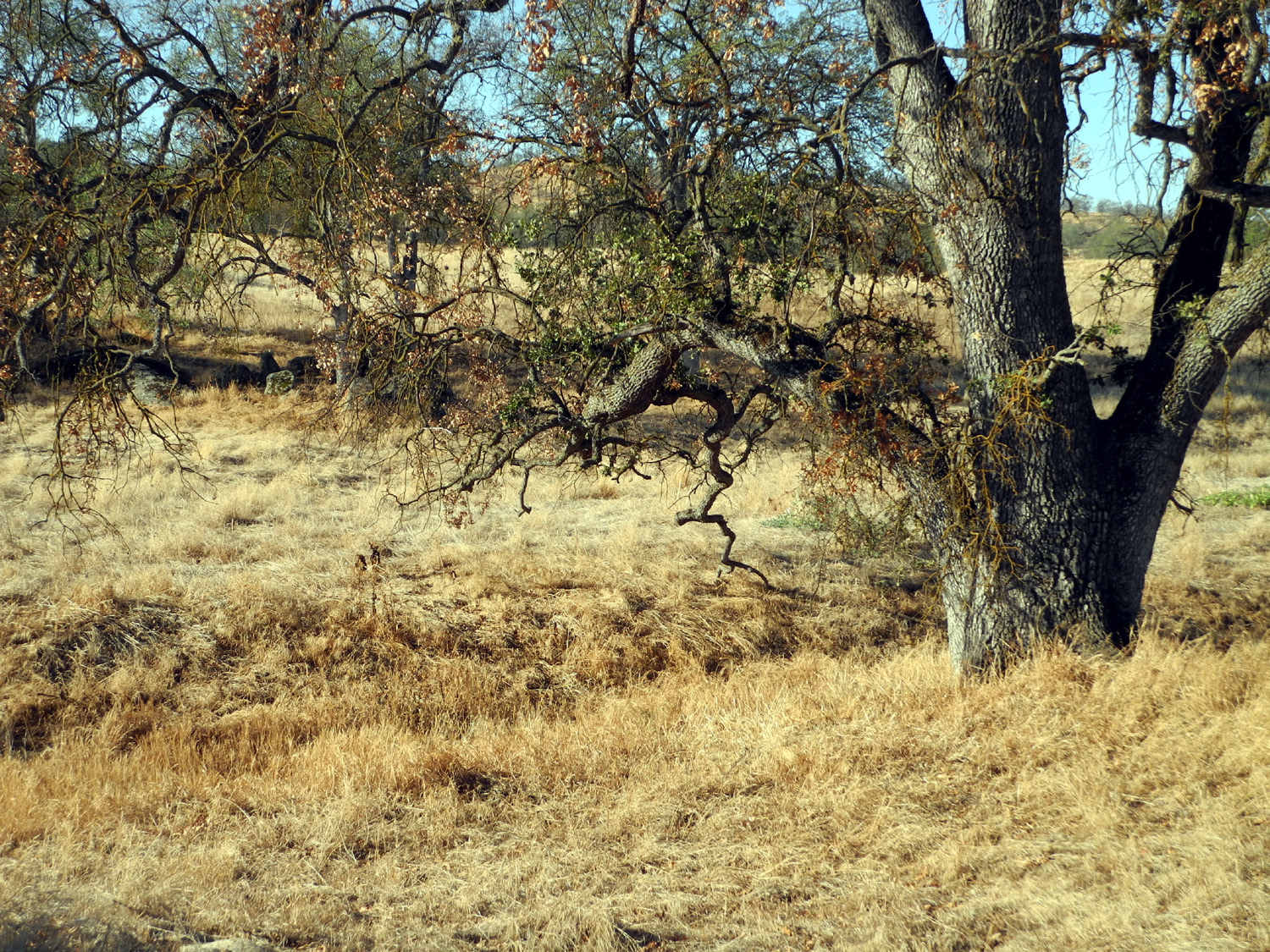
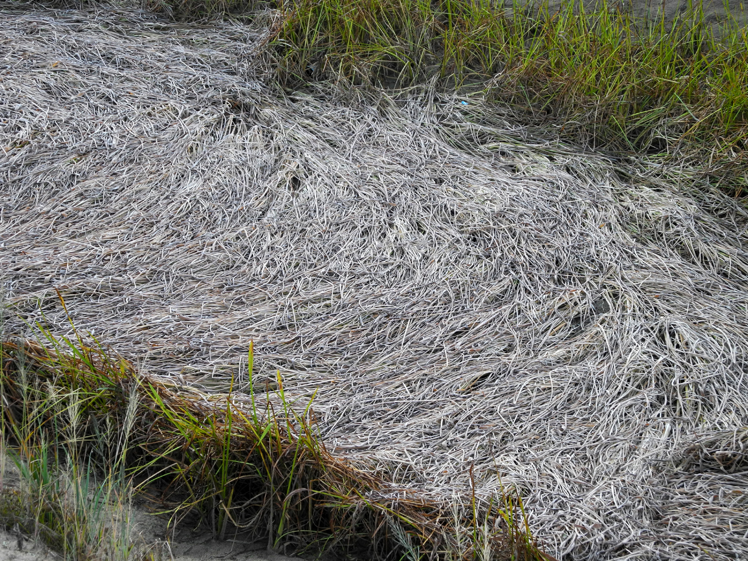
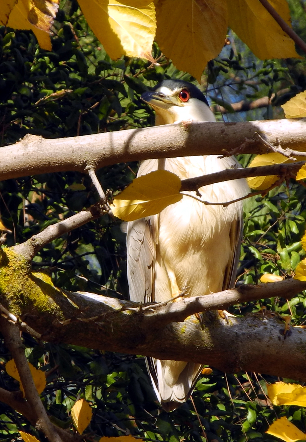
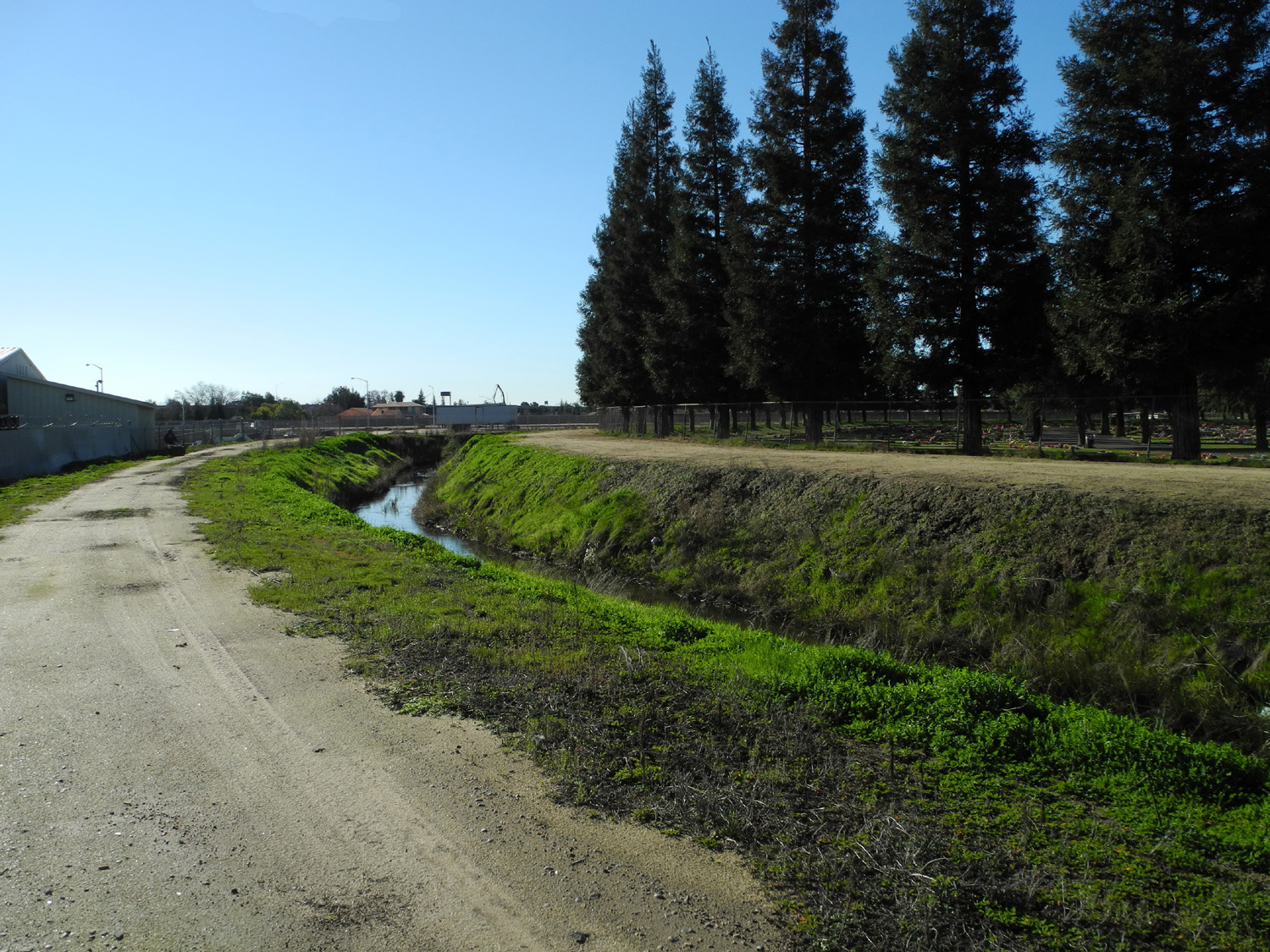
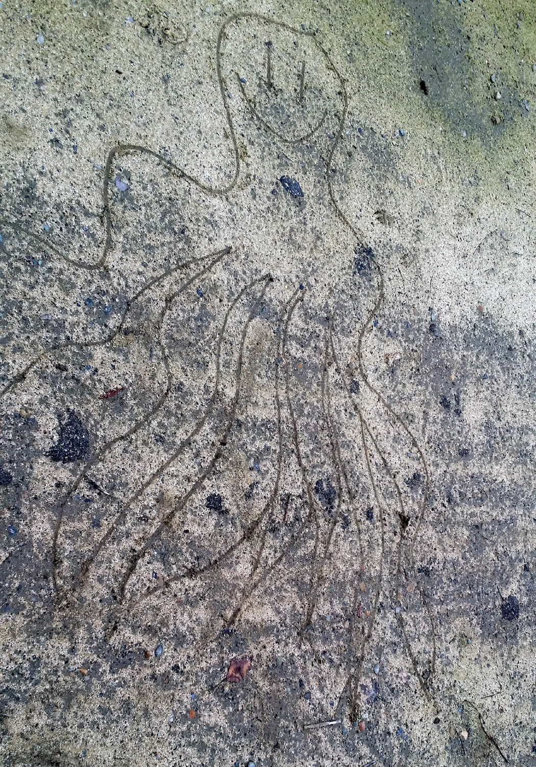
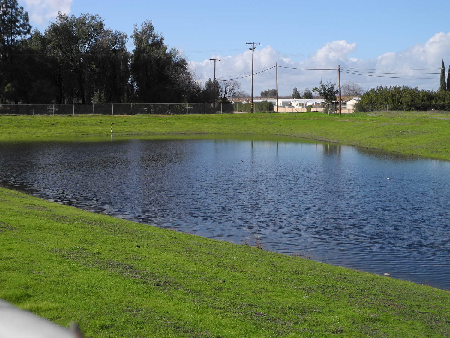
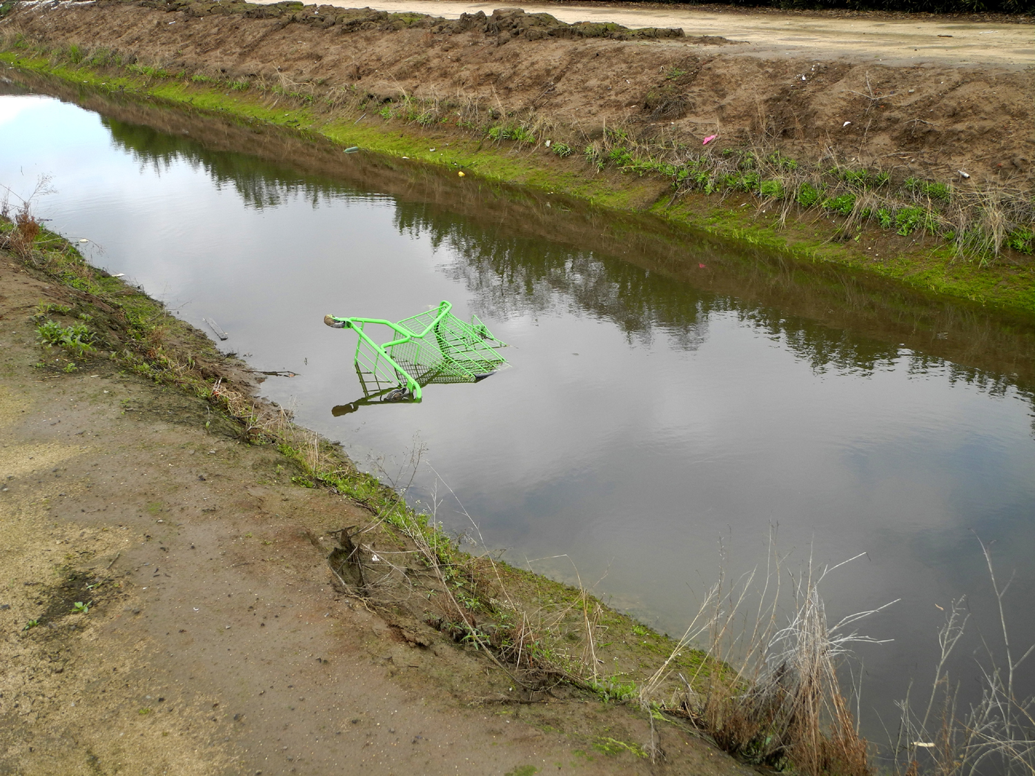
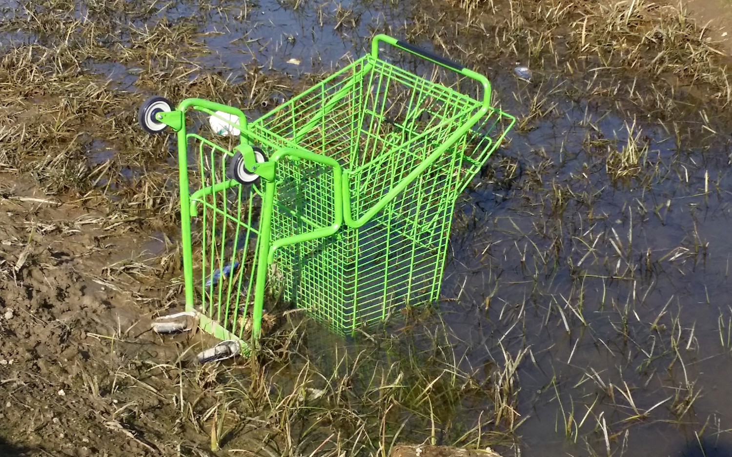
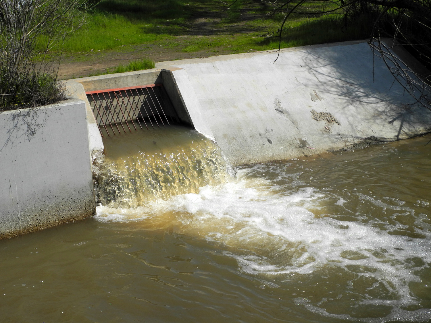
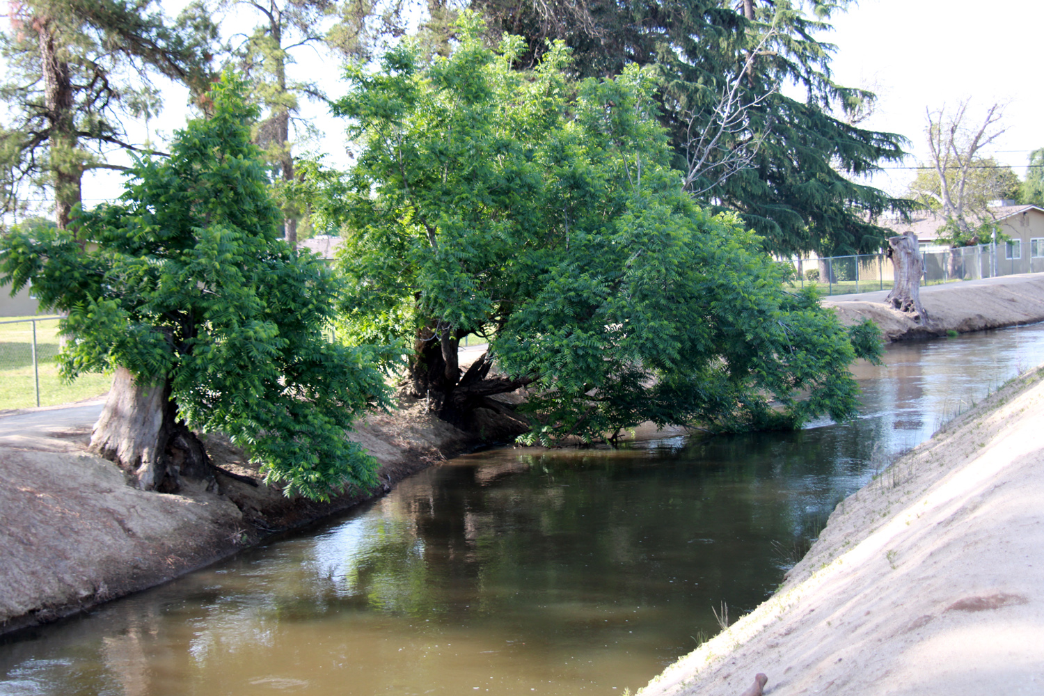
Canal Bank Walks (Updates are added to the original text starting here; latest one here) (Note: The terms Dry Creek, Dry Creek Canal, Big Dry Creek and Big Dry Creek Canal all refer to a creek that runs through Clovis and Fresno, and has been channeled and lined with concrete in many places and converted to a canal.) This report is not about a specific trip or hike, but rather a round-up of things seen and done while walking on the canal banks of Fresno and Clovis, starting in the 1970s and going through the present day. The Fresno Irrigation District operates many miles of canals throughout the metro area, built to carry water from rivers and reservoirs to farmland all over the San Joaquin Valley. The district works in cooperation with the Metropolitan Flood Control District, which has nearly 100 flood control basins connected to the canal system, with water being moved as needed for ground water recharge, irrigation, and flood prevention. Virtually all the canals have hard-packed dirt banks, which are perfect for walking, running and bicycling. A few areas are fenced off, but the vast majority are accessible. My first use of the local canal banks was actually around 1967, when I started jogging along a narrow ditch on the west side of town where we lived. This activity did not last long, and this particular canal is either filled in or piped underground, most likely the former. After that, I did not set foot on a canal bank until I moved to central Fresno, near First and Clinton, in 1978. From my house it was a fairly short walk to the Herndon Canal, which runs parallel to Millbrook Avenue, north from McKinley Avenue, across Clinton and Michigan Avenues. From there it curves around to the west and runs parallel to Shields Avenue. The major streets are typically a half mile apart, so it was easy to measure the approximate distance one traveled; i.e. McKinley to Clinton = 1/2 mile. I started backpacking in 1979, and quickly realized I needed some regular exercise, so once again my use of the canal banks was for jogging. When my effort and discipline in this activity were at their peak, I ran nearly every morning, from my doorway, on the streets to where the canal crossed Clinton, down to McKinley, and back, a daily distance of about 1.5 miles. I don't recall how long I kept this up, but at some point I became lazy and didn't run at all. Eventually the running was too hard on my knees, and I limited my activity to walking. Throughout the time I lived in that location, I also did a lot of canal walks just for fun, alone and with other people. This included various friends, my daughters, and a couple of young men who were around a lot, one of whom became daughter Teri's husband for a number of years. But my favorite walks were with my grandsons. First there was Johnny, often along with his friend BJ who lived two doors away. Mikie was born 13 years later, so by the time Johnny was busy with other activities, Mikie was ready to accompany me. Some of these walks included his friends Pablo and Librado, who lived next door. Near where the canal crossed Michigan Avenue there was a municipal pump station, with a huge storage tank. Sometime during the early years of frequenting this area we developed the myth of the Tank People, who lived in the tank. We didn't make up any details beyond saying things like, "here's where the Tank People live." A big pipe ran out from the pump station, then underground across the bank, and out over the canal. This pipe proved to be an excellent place to sit and rest, and was also a great place for young boys to test their balance by walking on it, on the side away from the canal where it was close to the ground. Of course, canal banks aren't just for walking. They also make good bike paths - most of the time. Naturally, there are weeds along the bank, and there is a particularly pernicious species we call puncture vine, which produces seeds about a quarter inch in diameter, with sharp spikes sticking out in several directions. On one ride, both Johnny and I ended up with flat tires, pushing our bikes back home after encountering an area covered with these seeds. Even if they didn't make a hole, they would get stuck in the treads, requiring a session of careful seed removal. When I was walking on a regular basis, I would see other "regulars." Most of us said "hello" to each other, but that was the extent of our interaction. However, I did come up with names for some of them. One group of three or four included a woman who carried a short stick, presumably for protection against dogs. She became "Mrs. Roosevelt." Most people who were couples walked within touching distance, and some held hands. But one couple walked almost as far apart as possible, at least six feet apart. I called them "The Wide Couple." Finally there were two men and a woman of apparent Germanic ancestry. In recognition of a leftist militant group that had gained notoriety in Germany, these innocent folks became "The Baader-Meinhof Gang." Nameless, but interesting nonetheless, were occasional groups of teenagers who would gather under the bridge when the water flow was shut off. By observation, they were using the area to engage in illegal smoking. The canal I walk most in Clovis has provided a hang-out place for homeless people from time to time, although conditions have kept them on the move. There used to be several large black walnut trees at the water's edge, and the overhanging branches provided shady and inconspicuous places for people to rest. These trees were cut down, probably because of the water they took from the canal, and the homeless moved to a table at the back of a park adjacent to the canal bank. This table was removed, almost surely to push the people out, and now they have a shaded spot right next to a fence behind Abe's Mini-Mart. They have a couple of chairs and some boxes to serve as tables, but there are rarely more than two people there. Some of the stumps have put out extensive sucker growth, but nothing like the shady "caves" they used to provide. The canals in central Fresno had several narrow foot bridges. At least one of these was removed during my time in the area, which covered a 30 year time span. The one I crossed the most was about three feet wide, made of metal grating, and in the early days, had no railings. I remember riding my bike across it with no railing, an adventure I didn't repeat more than once or twice. I was much more comfortable, even just walking, after the railings were installed. Like any artifact made to transport water, the flow could be controlled, and there was quite a variation, mostly somewhat predictable, and based on irrigation needs. Typically water would begin to flow on April 1, although it could be delayed in dry years, or started early in wet ones. The shut-off date seemed be be August 31, but of course, this was also subject to variation. When the water was shut off, probably at a gate on a major canal coming out of Millerton Lake, it took a day or two for the water flow to stop completely. There was a narrow channel in the middle of the canal bottom, lower than the rest of the bed, and there would be standing water in many areas for some time, often into the winter. Additionally, a small canal which drained out of the water recharge facility ran into the Herndon Canal northwest of Michigan, and sometimes this caused a small flow, more like a creek than a canal. The sides of the canal were lined with concrete in many area, and there were rebar ladders every so often. Although they were no doubt intended as a safety feature for people to climb out, they were also in invitation for people to climb IN. As soon as the water was low enough to expose part of the canal bottom, people started going down into it. I would like to say these were kids, but I went down a number of times, usually with a grandson. We waited till it was dry enough to walk on solid ground, but there were always some adventurous folks who had to pay a visit as soon as there was a place to walk. These incursions were detectable by the existence of deep footprints in the mud, often the first day it was possible to get down into the channel. The canals also offered opportunities to watch fast moving and falling water, which seems to have fascinated humans since prehistoric times. The Mill Canal that ran parallel to McKinley went through a gate and dropped several feet; at the same location, the Herndon Canal ran north. There were electrical boxes in this area, which presumably operated pumps and gates, making it an interesting area to visit. With a constant flow of water, off and on, year after year, it is natural that sand and silt are carried into the canal, and dropped when the water flow stops. Every so often the irrigation district would come in with backhoes and other equipment, and dig out tons of soil from the canal, piling it on top of the bank. This happened twice during my 30 years in central Fresno, and is going on this year in the Clovis area canals that I walk on. In some cases the big dirt piles nearly blocked access to the banks, but intrepid walkers soon created paths along the side. As the piles dried out, adventurous folks began walking on top of the piles, eventually creating a solid walkway most of the way. I have a number of photos of my grandson Mikie sitting and walking atop these hills. Eventually the dirt is trucked away. In 2015 dirt had been excavated and piled up on Dry Creek Canal where I walk between Barstow and Willow. Heading down the west side one morning, I saw a backhoe on the opposite side, and was concerned that I might not be able to walk on that side as I usually do. However, the operator was just sitting in the machine, which was not running, and I soon realized he must be waiting for trucks to return. On the way back I stopped to talk, and he was indeed waiting for the trucks, which were taking the material a considerable distance away. One truck had broken down, so there was a longer wait than usual. He also told me that they had removed over 700 truck loads from a one mile section of another canal to the east. Dirt is not the only thing that ends up in the canals. Quite a few people seem to think that these facilities were created as a place to dump trash. You probably can't name something that people throw away that I have not seen in the canal or along the bank - furniture, concrete, bricks, scrap lumber, bottles, cans, yard waste, dead cats. auto parts, appliances, household items, toys (especially balls), and what seemed to be a favorite, shopping carts. In Clovis, but not in Fresno, I have seen a few piles of clothing, possibly abandoned by a homeless person. The shopping carts were not there because their owners had thrown them away - they were taken by people transporting their groceries home, vandals stealing them for whatever reason, homeless people who used them as a mobile closet. No doubt many were abandoned by the person who removed them from the store, and put in the canal by someone else. There are people who drive around in pickups, rescuing shopping carts from the canal and elsewhere, and returning them to the store for a fee. I rescued a small hand-held shopping basket that I still use. There was a section of the canal in Fresno that was a veritable shopping cart graveyard, but I have seen only one cart in Clovis (since I first wrote this, the count has gone up). Lots of the stuff thrown in the canal floats, and when the water passes under a bridge where the surface is at or above the bottom of the bridge, these items collect against the bridge. The only photo I have shows a fairly small amount of stuff, but I have seen a virtual "garbage island" three feet wide across the full width of the canal, with bottles, cans, plastic cups, balls and other items. No doubt a significant amount of this trash came from the people who lived adjacent to the canal. In many places the canals run behind residential areas. Why bother with cutting your tree limbs down to a size acceptable to the trash company when you can simply throw them over the back fence. With the canal running next to residential back yards in some areas, there are places where the canal is actually an access road for the property owners. Not all yards, but some, have gates, and most often you can see that the access is used to get a boat or RV into the back yard. It also proved handy for a couple of enterprising gardeners. In two locations along the canal between McKinley and Clinton, there were extensive vegetable gardens in the area between the actual canal bank and the fence. I don't know what the legal ownership of this area is, but apparently it never caused any concern for the irrigation district. The canal bank is not only a good walking surface, it's a good medium for communication, and over the years various messages were scratched in the dirt, most of them short-lived. An exception, just north of the little bridge that crossed the canal near McKinley, was a heart drawn deep into the dirt. It was there at least from the early 80's through 2002. At first it said "God loves you;" later it became "God loves us." I am certain that more than one person maintained it over the years, and of course it gets messed up, deliberately or otherwise. One day it said "Fuck god." I never touched it, but I continued to check it whenever I walked. In late September 2002 the original "God Loves Us;" had been changed to "God Save Us" or "God Help Us," perhaps more appropriate for those post 911 times. The last time I took note of it, it read "God vs. Us," which seems to be perhaps a fundamentalist viewpoint. Since we're talking about a place where water flows, it should not be a surprise that various plants grow along and in the canal. Most of these would be categorized as weeds, but none of them are worse than the puncture vines. This is a low-growing plant that puts out horizontal stems in all directions from the central root, and produces dozens if not hundreds of small, spiny seeds. These can go through a bike tire, and certainly through the skin of a bare foot, as well as getting stuck in the treads of tennis shoes. When the water is shut off, nearly every inch of the dirt canal bottom produces plants of some kinds. A lot of these don't get started till late August, but still manage to grow to a good height before winter knocks them down. Then there are the plants that grow in the water. There was some type of plant that usually grew in the canal near my old house, producing long stems that waved back and forth in the flow of the water. One section of the canal in Clovis that I walk by has a long section filled with what appears to be a type of grass, with very small white flowers. Downstream a ways, conditions this year (2015) have been especially good for puncture vines, with some growing up to six feet across. One recent year there was a massive crop of very tall weeds, so thick that narrow parts of the bank had only three or four feet of pathway. These did not appear in 2015, no doubt due to the extended drought. One section of the Dry Creek Canal north of Alluvial and West of Clovis Avenues goes by an area where there are a number of large homes, on the opposite side of the canal, and mostly hidden by large eucalyptus trees. These are not tract homes of any kind, but appear to be part of large rural properties, maybe former ranches. Some of them have horses, and in one place there are a dozen or so old cars and trucks, partly hidden in the trees. Perhaps the most interesting sights along the canals are the animals, both wild and tame. Of course, the "wild" life is not large, dangerous nor particularly wild. (But see the 6/15/23 update below.) Most common are birds of various species. The first birds I noticed, back in my early canal walking days, were ducks and egrets. At that time I could stand on the edge of the bank and look down at the ducks, and they would go about their business, ignoring me. Over the years they became more skittish, and would swim away whenever a person got close. Some of this I attribute to a kid I saw throwing rocks at them, while his proud (asshole) parents watched. However, those ducks and most of their descendents are long gone, so I suspect the caution of the current birds has more to do with a general increase in human presence around the canals. The egrets are particularly enjoyable. They are over two feet tall, and stand on the bank or in the canal near the water when it's low, watching for whatever it is they eat. They will not allow a human to approach closer than about 50 feet. Typically they will fly up and along the canal, and come to rest 100 feet away or so. Then as I continue to approach, they repeat this action. At the third approach they finally decide that the invader is not going away, and fly up and away from the canal to await a more opportune time to hunt. There was a place near the canal in Fresno where pigeons were thick. I would see dozens sitting on the utility wires, and until I approached, they were all over the bank. There was a house near this spot where I think the people fed them. My opinion is that they should have been fed buckshot. I began to see Canada geese in the canal for the first time in 2015. They have taken up permanent residence in the valley, and in the winter there is virtually no park or large public lawn area that does not have a flock of 25 or more. Apparently the canal offers a good nesting place, since what I saw in the canal or on the bank was pairs of geese with a bunch of babies. Sometimes they were swimming; sometimes standing up on the bank. The geese have far less fear of humans than the ducks. If they were on the bank on the side I was walking, they would come to full alert, with the babies standing up and ready to move, but would hold their ground as long as I kept to the far side of the bank. If they were on the opposite side, the kids were resting and the adults just kept an eye on me. Once I was taking photos, fairly close to some geese on the side I was walking. Apparently this was too much for the birds, as the gander made a move toward me and said something very rude in Canadian. However, I only saw them abandon the bank and head into the water one time. During the spring of 2015, in various locations, I saw baby ducks, baby geese, and baby egrets. The latter were on a sand bar in a huge flood basin, far away from any place humans could approach. On the other hand, some of the young geese were in a nearby park, while their parents kept watch from the other side of the chain link fence surrounding the basin. In the summer of 2015, I saw hummingbirds by the canal on a fairly regular basis. In the late fall I encountered what I believe was a kingfisher. Dogs, mostly on a leash and accompanied by their humans, were also common, with the occasional stray or loose dog causing a certain amount of concern. A free ranging dog is indicative of an irresponsible owner, so neither are to be trusted, especially when the owner is nowhere to be seen. Cats are less common, though I have seen them making their way down the bank to get a drink, and they no doubt stalk small birds and rodents. Adjacent to the canal I walk by most is the Clovis Animal Shelter. This seems to be a favorite hangout place for what I assume are feral cats. I usually see anywhere from two to five of them outside the shelter area, on the upper bank of a big flood basin. The canal bank offers a perfect location for the construction of what I call "ground squirrel condos" - holes at various elevations in the bank, and these creatures can be seen on maybe 90% of my hikes in Clovis. The conditions did not seem to favor them at the Fresno canals. Update: In the spring of 2016, a section of the Enterprise Canal north of Clovis collapsed, flooding a street and two yards. Water was up to the door at one home. The event was blamed on ground squirrels digging in the canal bank. There are also huge populations of red squirrels in the Fresno-Clovis metro area, and I have often seen them walking on utility wires along the canal banks, running up trees, and frolicking in adjacent parks. One of the most interesting mammals I saw appeared unexpectedly one day. I was walking on the bank with some friends when we saw something swimming on the surface of the canal, its tail waving back and forth behind it. Our first thought was a beaver, but we immediately saw that the tail was long and skinny, and we realized it must be a muskrat. Over the years, I saw them many times, but eventually, sightings became rare. I told my grandson about them, but despite many walks with Johnny, it seemed he would never see one. Then one day we saw one well upstream. Most muskrat sightings were very quick, as the animals tended to dive deep when they saw humans, but this one swam toward us, diving and resurfacing several times, so Johnny got a good look. Years later with Mikie, we had the same problem, but then he too saw one that stayed visible for a half a minute. However, by the time I moved from Fresno in 2008, I had not seen one in years, nor have they made an appearance in Clovis. Somewhat related to the muskrats, there were a few tiny shells along the bank, but there were places just above water line under a bridge where there were hundreds of them. Since I saw muskrats in this area several times, I believe they dined on the shellfish. Probably the most unlikely animal spotted on the canal bank was a horse, There was a gentleman who would ride throughout the city, and occasionally came our way on the bank. This created another interesting result. This area was one where the back yards of houses were 20 feet or so from the canal bank. Dogs in the yards would occasionally bark at me, but it wasn't a big deal. However, this day the dogs obviously smelled something unusual, and dogs up and down the bank were barking furiously. By far the most common animals over the years have been reptiles and amphibians. My favorite event in this department took place one fall after the water had been shut off, but there were ponds in the middle channel for some time. Johnny and I were walking in the canal bed when we realized the ground was moving under our feet. In fact, it was hundreds of tiny toads, most not more than an inch long. It was hard to walk without stepping on them. We returned soon after with a plastic bucket and collected about 20 of them to put in my yard, which already had some large toads helping keep the slugs and other pests under control. We saw quite a few of them around the yard the next few days, and some for a few weeks, but I don't think many survived the move. On our way back from the canal we saw my neighbor Donna out in front of her house with her little grandson Mason, so we showed him the toads, to his great delight. There was never again a "good toad year" like that in the Fresno canals, but a few years ago, there were dozens of them crossing the canal bank in Clovis, between a flood basin and the canal. There was one year when I saw either toads or frogs hanging out on the floating plants after the canal started running at full capacity. And in 2015 in Clovis I heard two splashes right by the edge of the water as I approached, and the area had floating plants where small frogs could have found a perch. The most unusual and unexpected reptile was a turtle I saw sitting on the concrete side of the bank one day just north of Clinton Avenue. I assumed that it was probably carried down from the foothills, and was certainly not in an ideal spot for such a creature. I don't recall seeing lizards by the canals in Fresno, but I saw enough in one day in Clovis to make up for it. In March of 2015 I walked on the canal bank that goes south and west from Barstow to Willow. Along the side I started on is a light-colored concrete block fence, which proved to be a favorite hangout for lizards. I counted 30 of them, and no doubt missed some. There were many holes and cracks in the fence, and the lizards who did not go over the wall quickly slipped through these. The second half of the walk had a perfectly good wood fence, but it apparently did not meet the reptiles’ requirements. Ant
hills are a fairly common occurrence along the banks, and of
course, various insects can be seen scurrying about. Also, I have
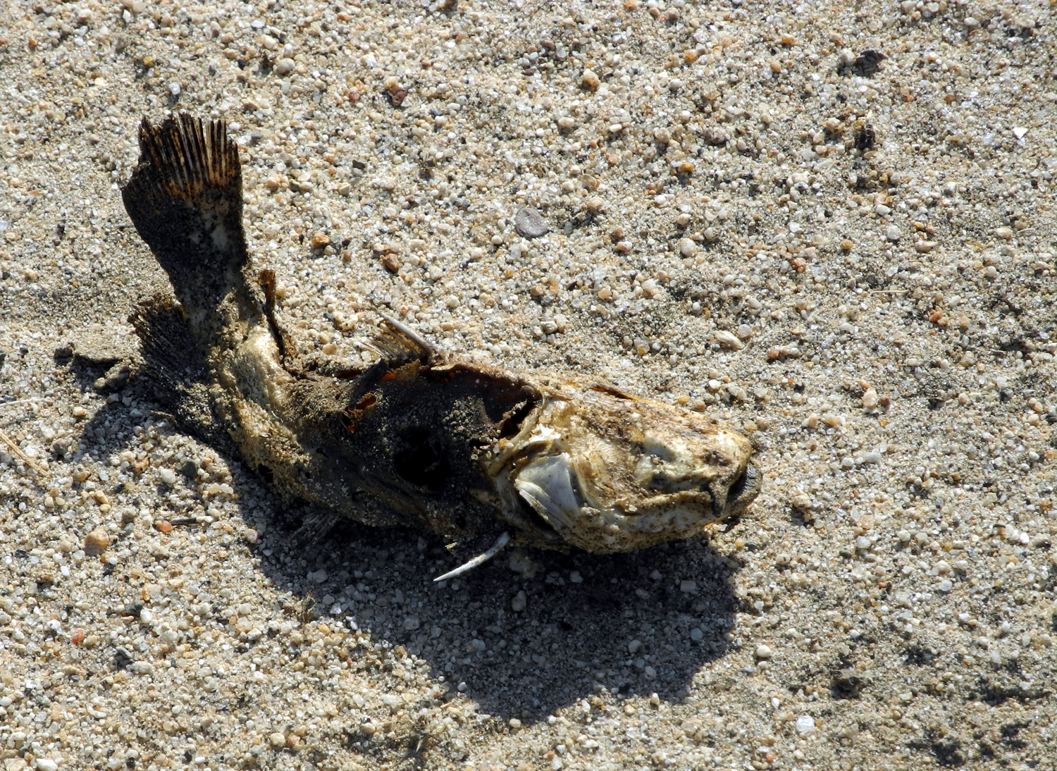
seen fish in the channel that lingers after the water shuts down,
and they are surely there all the time. I have seen a few people
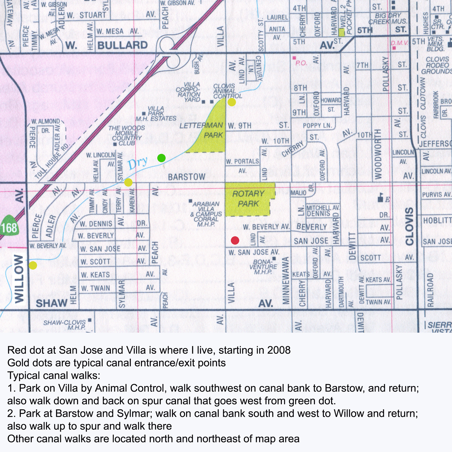
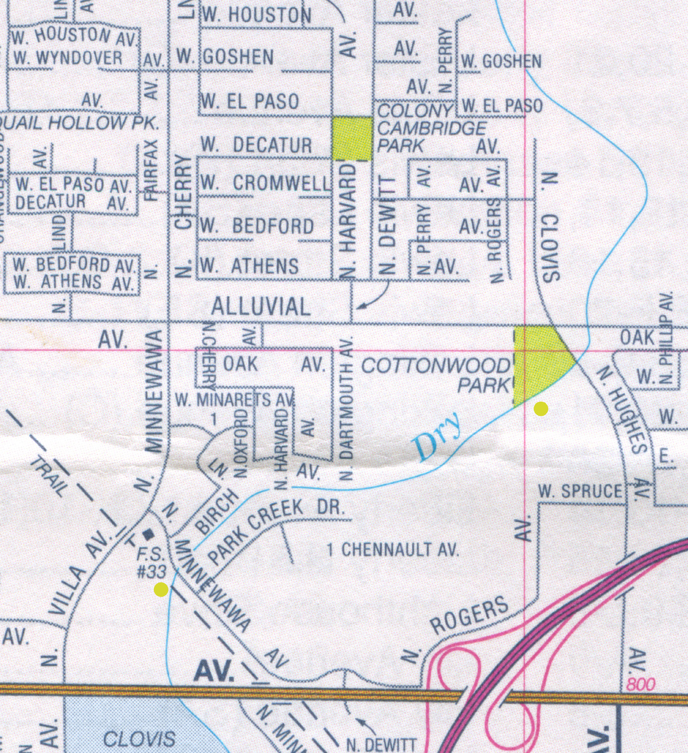
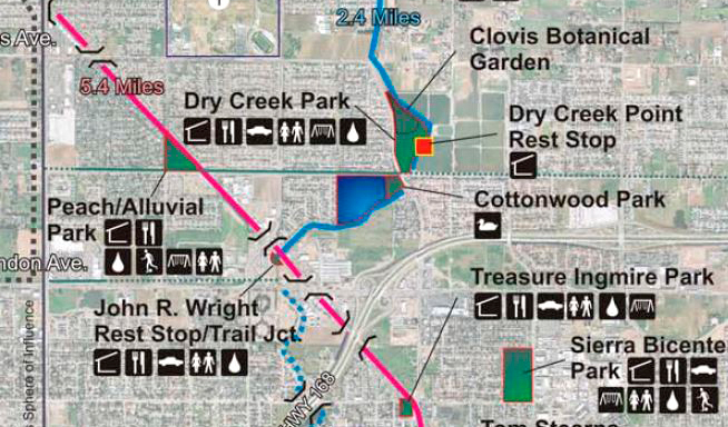
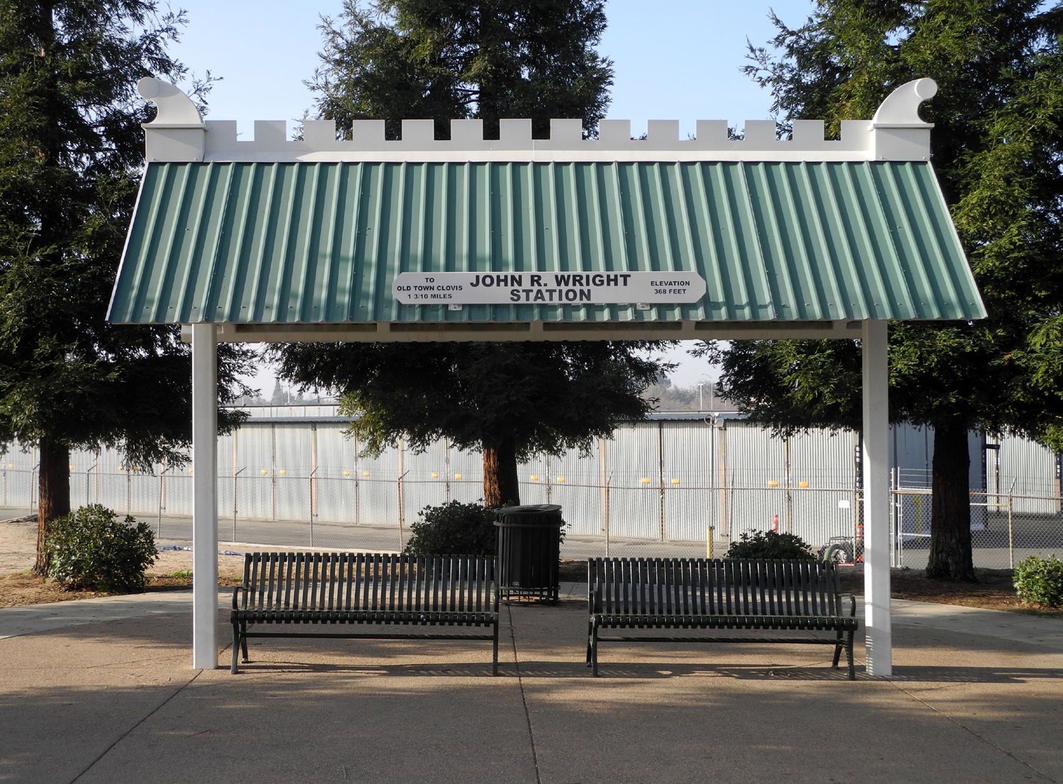
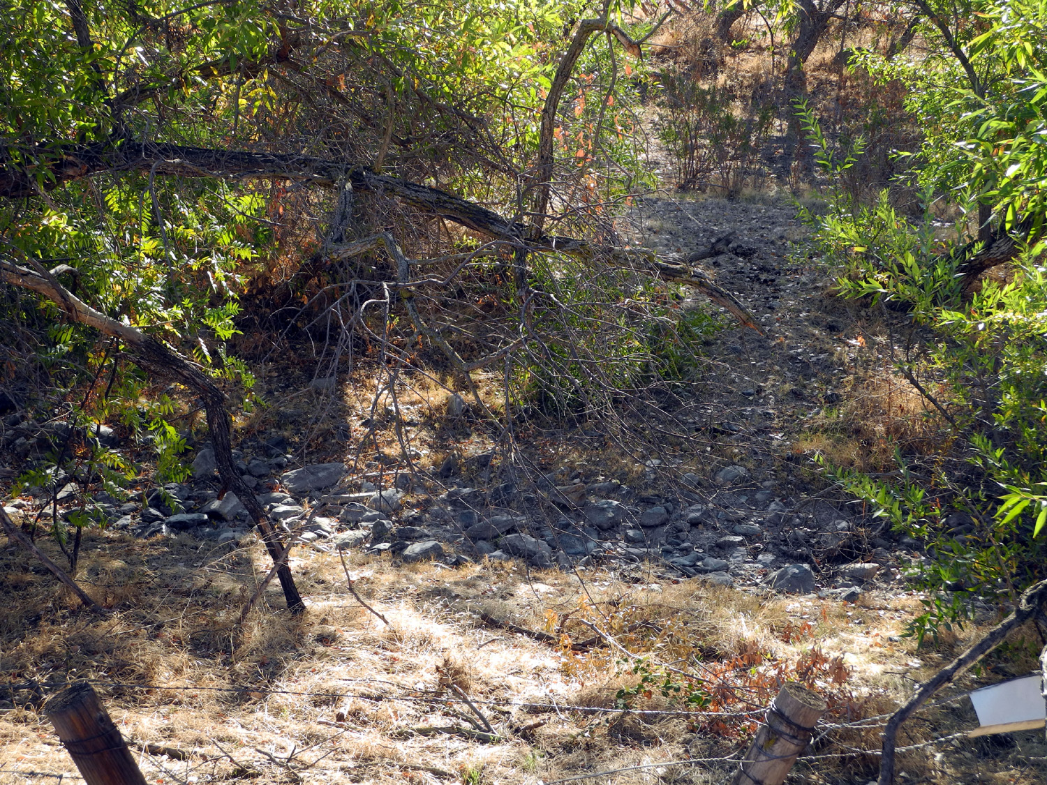
fishing, and one boy with a jar of water containing live fish. My Walking Route: In Clovis I have walked on segments of several canals, but most of my walking is along the Dry Creek channel. The map calls it "Big Dry Creek," but I think of it as a canal. Its winding path shows that it is an actual creek, but there is not an inch of the original creek in the metro area. It has been dug out, sometimes has concrete lining the bank, the flow is mostly controlled by man - all the attributes of a canal. These days canal walking is a matter of serious exercise. As this is written I am participating with my daughter Teri in the Thousand Mile Challenge. She is responsible for 800 miles, leaving me to complete 200 by December 21, 2015. In fact, she is on pace to do the full 1,000 herself, but I must uphold my end of the bargain. My preferred walk starts where Dry Creek crosses Villa Avenue, and runs in a southwesterly direction toward Barstow, which meets Villa at a right angle. About 100 yards from Barstow, another canal runs to the west. I originally thought of this a "spur canal," but the water does not actually come from Dry Creek. It is the Helm Canal and crosses under the Dry Creek canal through a pipe. It goes a short distance then makes a 45 degree turn to the west. It crosses Sylmar Avenue, then goes underground about 100 yards past that, and a solid wall blocks any further pedestrian access. Beyond the wall is the CA Highway 168 freeway. I walk from Villa to the Helm Canal, all the way to where access ends, back on the opposite side, down to Barstow, and back on the east bank of Dry Creek. This route is 1.7 miles long, a good morning walk. Sometimes I cross the Helm at Sylmar, reducing the distance to about 1.6. Another similar walk is to start where Dry Creek crosses Barstow and walk south. The channel winds around to the west, eventually crossing Willow where I turn back. Doing a "down and back" on this is only a little over a mile, but I usually cross the road, walk north up to the Helm, out and back then back to the car. This gives me a distance of 1.8 miles. A short but very pleasant walk is the section of Dry Creek between John Wright Station and Dry Creek Park at Clovis and Alluvial Avenues. This route is actually part of the Clovis Trail System, and is almost like walking beside a real creek. Going all the way around the small Cottonwood Park at the southwest corner of the intersection and back to the start is 1.4 miles. There's a small parking lot at John Wright, and you can also go north to connect with trails into Fresno, or south on the Old Town Trail to downtown Clovis and beyond. These are not canal walks, however.
I have now embarked on a series of photo expeditions to document scenes on the canals in Clovis and Fresno. For the latter, I'm going back to a location I have not visited since 2008, so who knows what changes I will find? There is an on-line map of the entire Fresno Irrigation District. With its huge scale and street names shown only at the edges, it is of limited use to the lay user, but I have included the link for those who want to know more about canals than they ever realized. Because canal walks are ongoing, this section will be updated from time to time, and more photos added. Check back and don't miss out!
--Dick Estel, July 2015, with updates as indicated below |
||
|
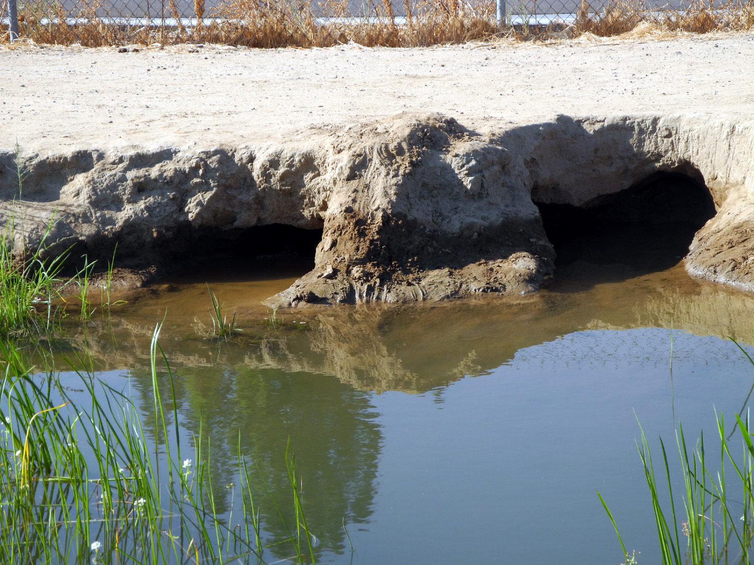
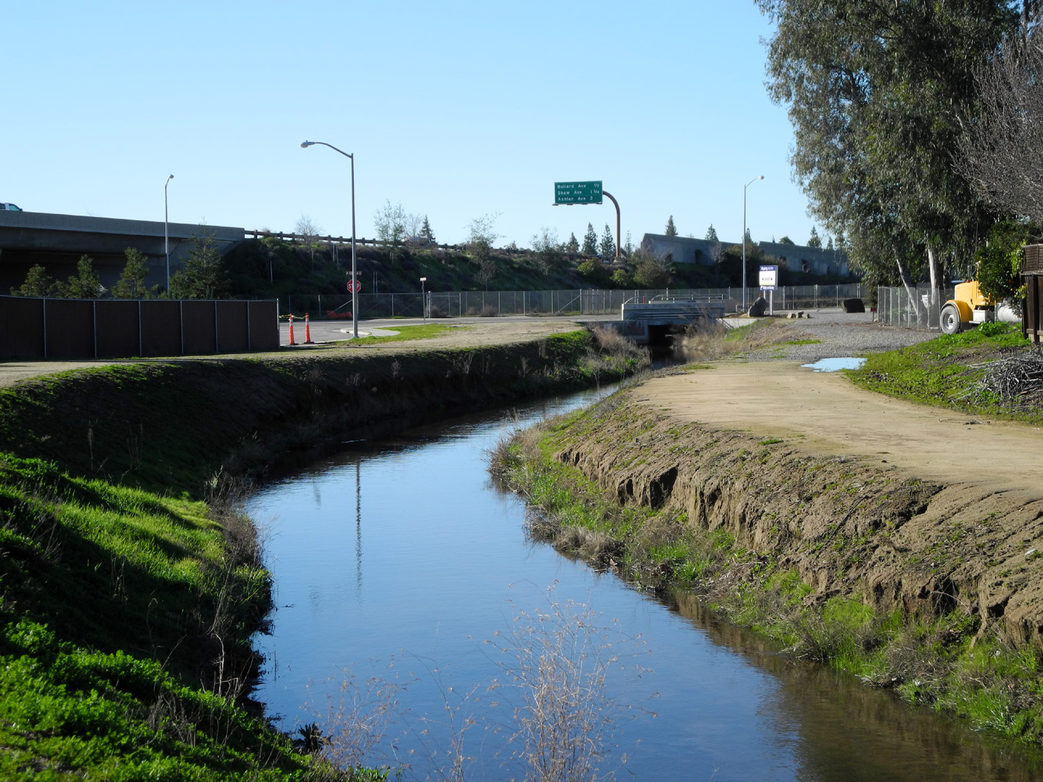
Canal Walk Updates First Update: This comes even before this report has been published. In late July I went to the canal in Fresno where I used to walk, taking photos where it crosses Michigan, and others where it comes north from McKinley. There were changes, one of them kind of sad: The tank, the pump, the pipe the boys balanced on, and presumably the "Tank People" are all gone, leaving nothing but a fenced-in vacant lot. There was no sign of the "god heart." New fencing around the transfer point at McKinley makes it hard to get a good view of the rapids there. On the other hand, there were people jogging and biking (in the middle of a July day), and the water was flowing at 100% of capacity. Update 8/5/15: Today I observed that the flow of the Helm Canal has been turned off, although there is a lot of water in the bottom - too much to get down into the channel. Also it stinks. The lowered water level revealed a small tunnel, just a hole in the bank that goes in about a foot and back out, just below the high water line. I also saw my first Clovis shopping cart, this one flattened as if it had been run over by a truck. Oddly, there was water running into the Dry Creek canal from the west side adjacent to the Helm. Not sure where it comes from. The pipe it runs through is higher than the level of the pipe that carries the Helm under Dry Creek, but it could be going through the pipe and back into Dry Creek. I did not have a chance to check water in the Helm canal south of Barstow.
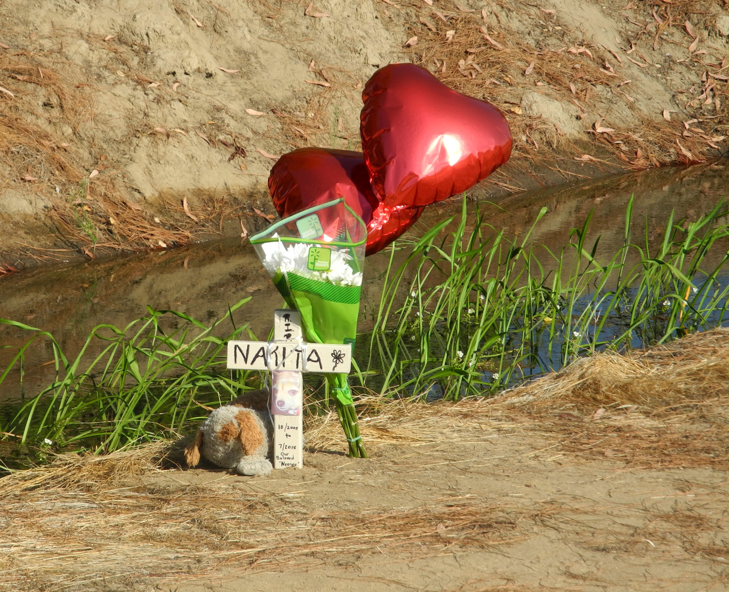
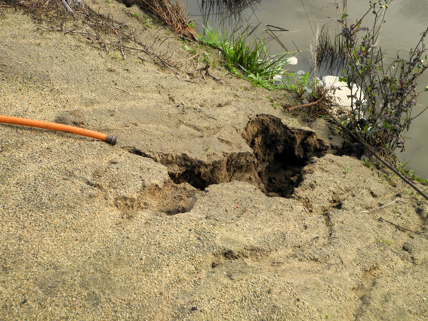
On the north side of the Helm Canal, about 200 feet past the place where it runs under Dry Creek, there is a small cross with "RIP Nakita 10/2005 to 7/2015 Our Beloved Neenge," a teddy bear, and two balloons. The cross has a photo of a dog. I'm not sure of the significance; I can't imagine that a dog drowned in the canal, though I suppose it's possible. More likely, he just liked to walk on the canal bank. I saw several egrets, which were considerably less skittish than usual. One reached down several times to grab a tasty tidbit off the canal bank, and allowed me to get within 15 feet or so.
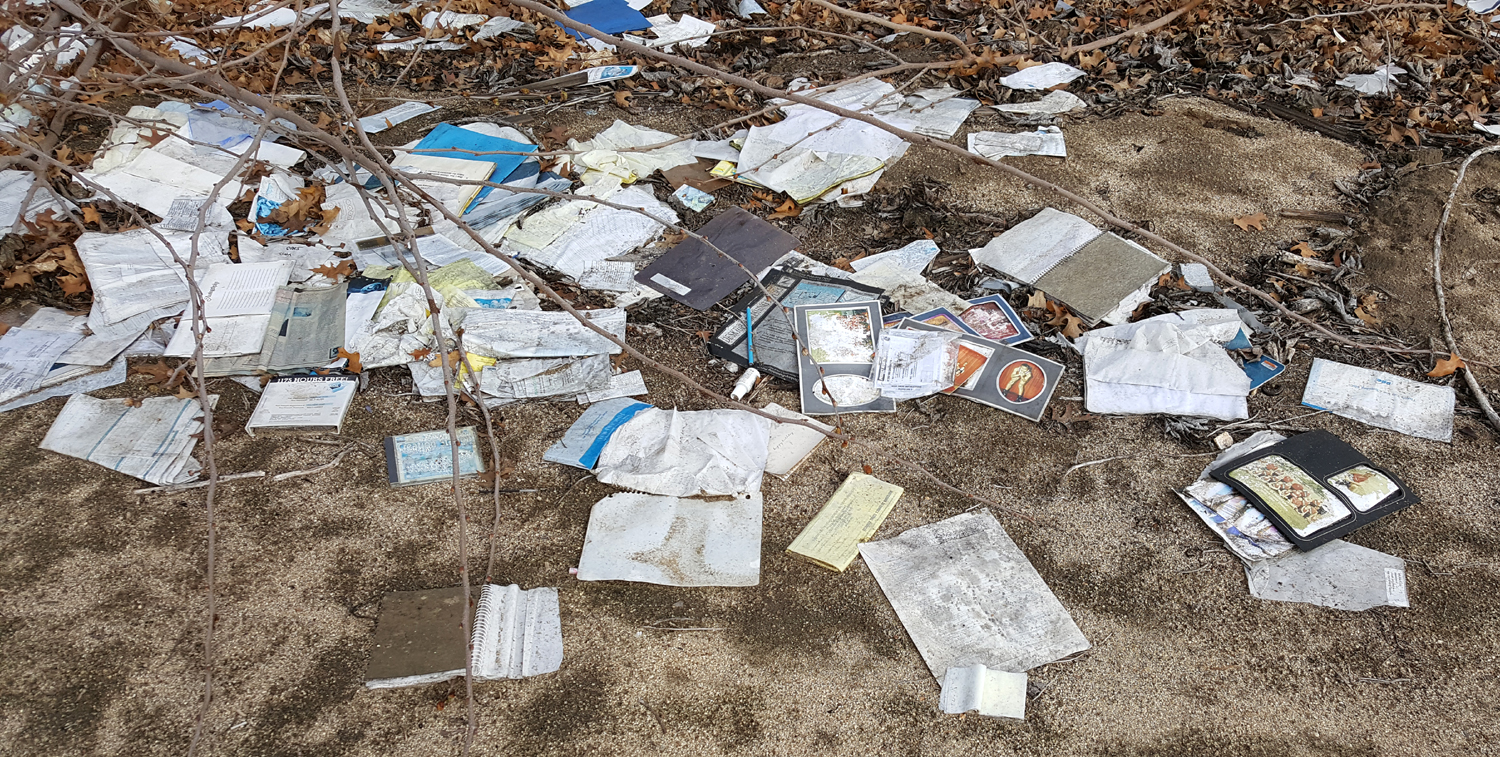
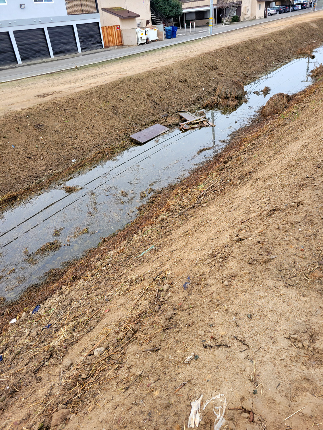
The west bank, which becomes the north bank, is increasingly hard to walk on, because the surface is no longer packed dirt, but instead loose sand. I believe this was caused by heavy equipment being driven on the bank. Very close to Willow, there was a small pile of trash that I first saw at least two or three months ago. It is no ordinary trash - it was a small box, possibly a cigar box, that had contained papers that someone had saved from the middle of the 20th century. I looked at some of the items earlier, and took a closer look today. A partial inventory: Notepad from Royal Furniture Co., Parkersburg, WV with 1938 and 1939 calendars Basketball schedule for Little Kanawha region (West Virginia) listing coach's names and opponents for 14 schools; I couldn't find a date on it Commencement program for the class of 1951, Williamstown High School; speaker was a professor from West Virginia University U.S. Marine band 1948 tour concert program sponsored by Parkersburg Lions Club West Virginia drivers manual dated January 1, 1950 Several typed, mimeographed programs for basketball tournaments and school plays For the first time I decided to follow the canal past Willow Avenue. This is a very busy, 4-lane divided street, so I had to wait for traffic to clear, then cross to the median, and wait again to finish my crossing. There were plenty of long breaks in traffic, so it was perfectly safe as long as I was patient. From Willow the canal goes several hundred feet, then runs under the parking lot of a Home Depot. This stretch had a small puddle of water, and was all lined with concrete, bottom and sides. Heading back up the canal past Willow, I noticed that the big flood basin east of the canal where it curves to the west had a little more water than when I photographed it a few weeks ago. The geese were not around, but there were lots of ducks.
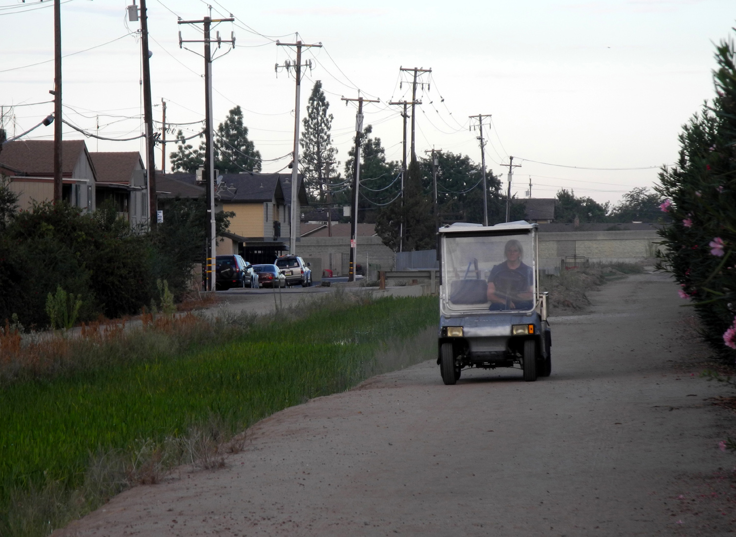
Sometimes due to erosion there are some very narrow places, which helps to discourage such activity. On the part of the Helm Canal where I walk, the banks are very narrow, and you could not drive them without having the adjacent bushes scrape your car. Today I met a golf cart coming down the bank, the first time I've seen any moving vehicle in Clovis. I am 99% certain it was an irrigation district employee making an inspection run. I also saw something I'd never seen before - about a dozen good size chunks of wood, cut up sections of a tree trunk, IN the water. I've seen large pieces of wood on the bank, but never in the canal itself. Due to a fire in Kings Canyon National Park, we've had some spectacular sunrises, as long as you are out early before the sun gets above the bank of smoke to the east.
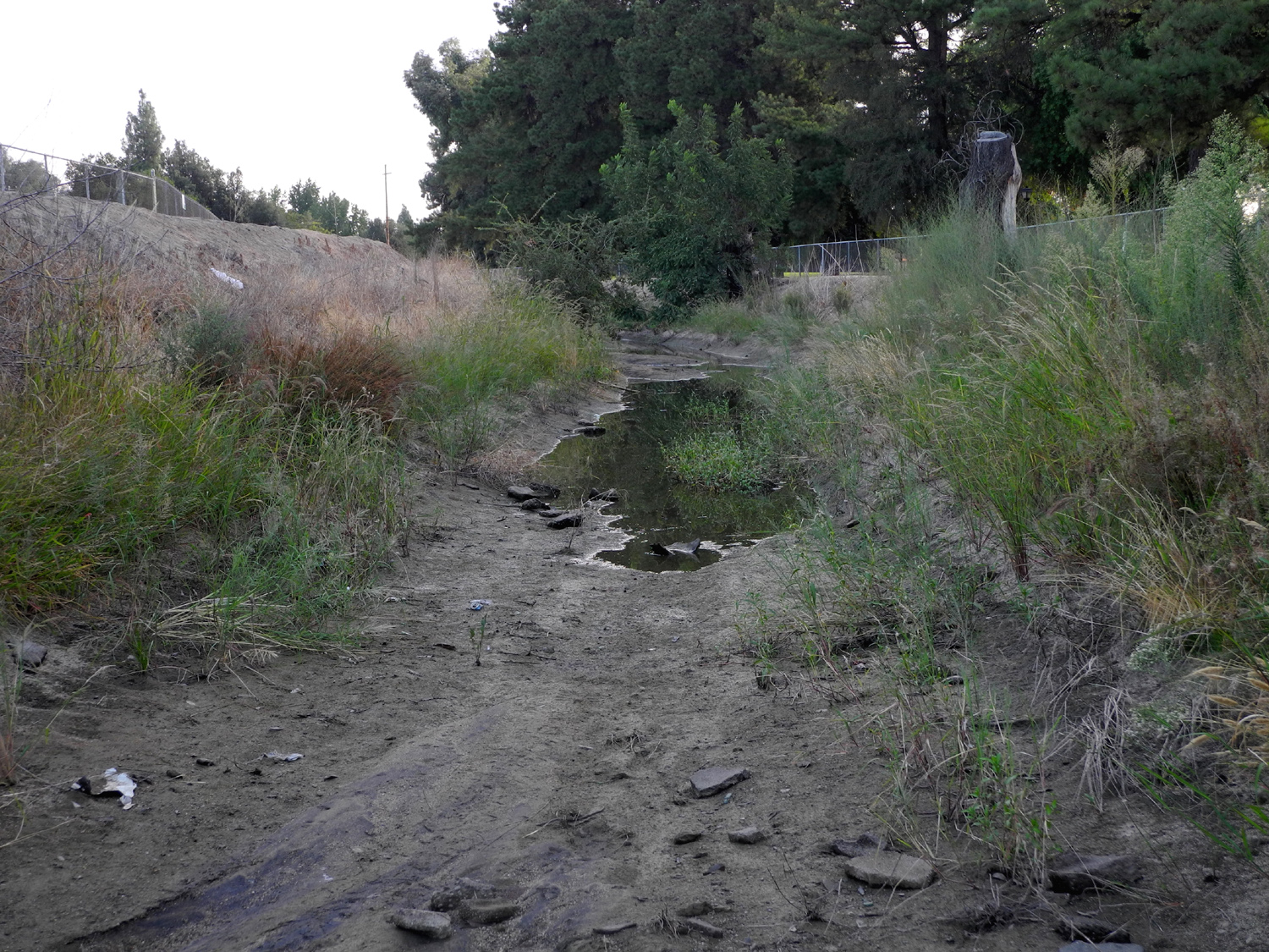
Today I saw a large gray bird fly up from the Helm Canal - I'm pretty sure it was a heron, but he took off before I could get a good look. The Dry Creek canal is virtually 100% dry from Villa to Barstow - just a few shallow puddles in one 100-foot stretch, not more than 50 gallons of water total.
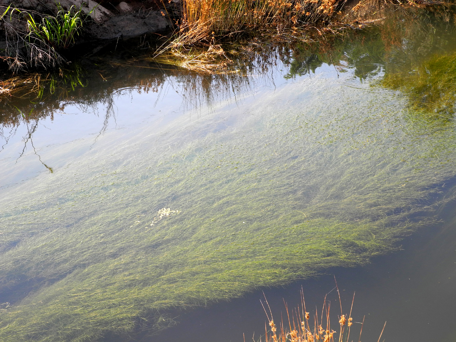
The thick grass-like plants in the Helm Canal, which still has a strong flow, are starting to change color, turning to yellowish brown. Not surprising considering temperatures in the 60s when I start my walks these days.
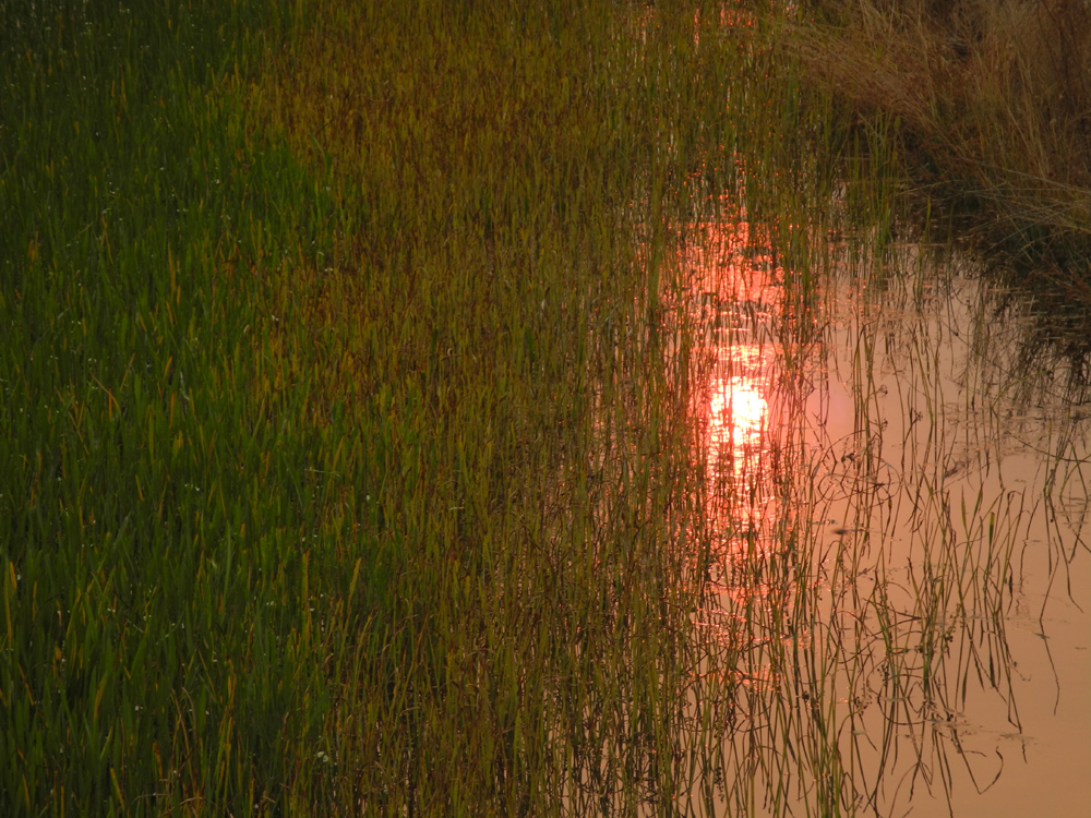
An egret was on the alert at the edge of the water, watching for breakfast, and the smoke-shrouded sun created a dramatic reflection in the water.
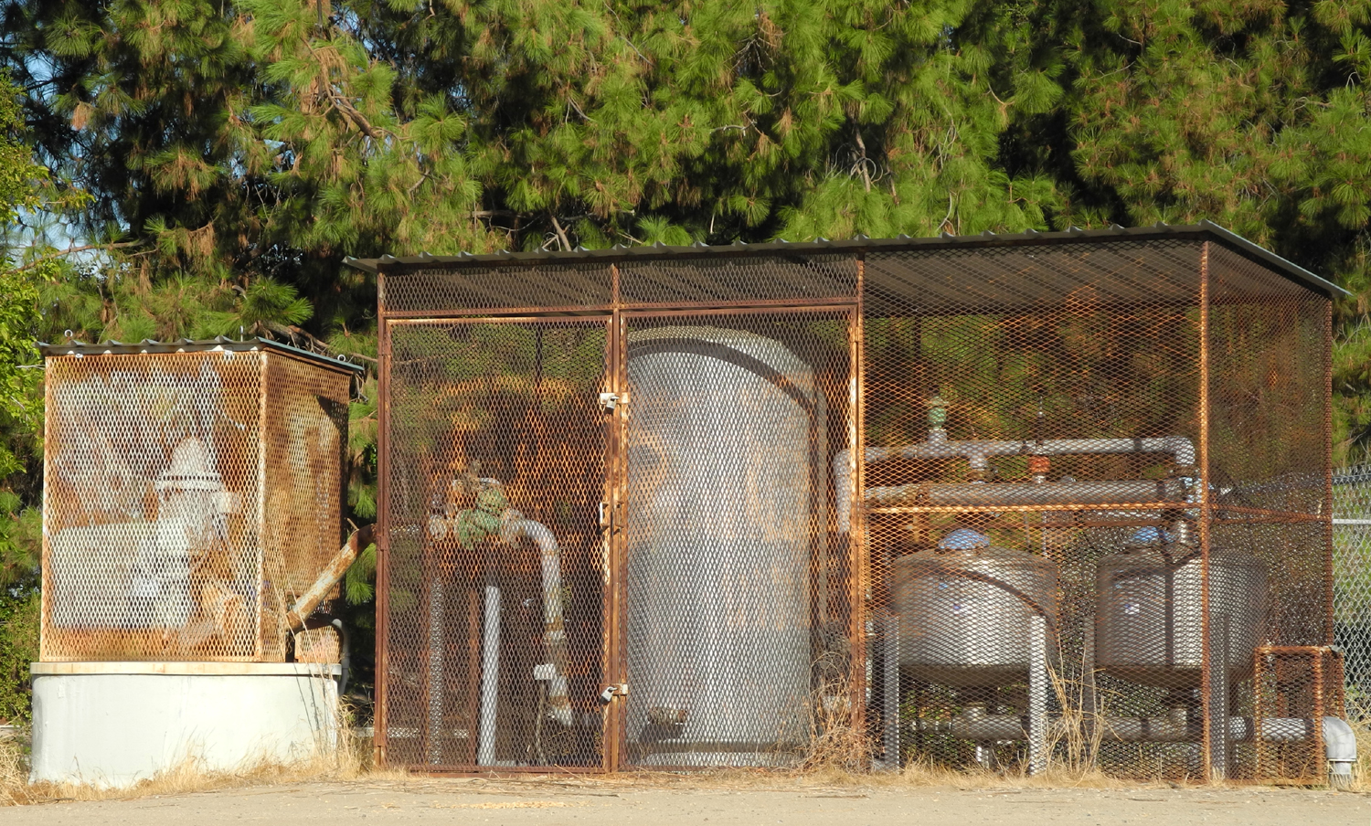
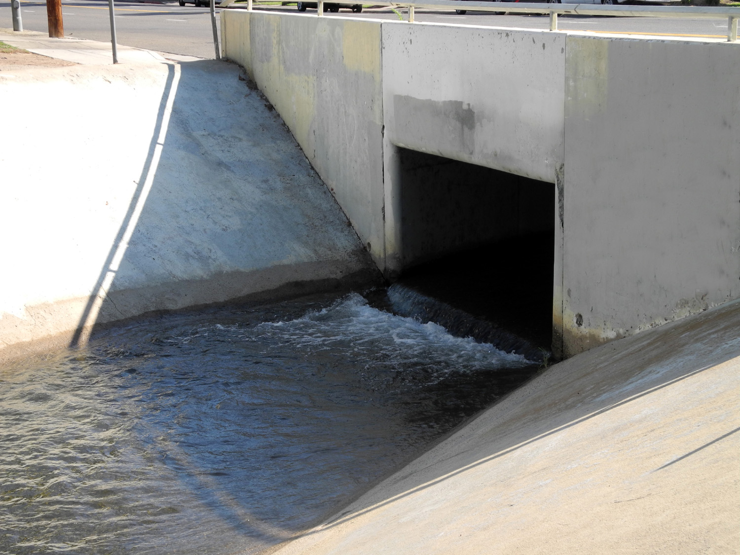
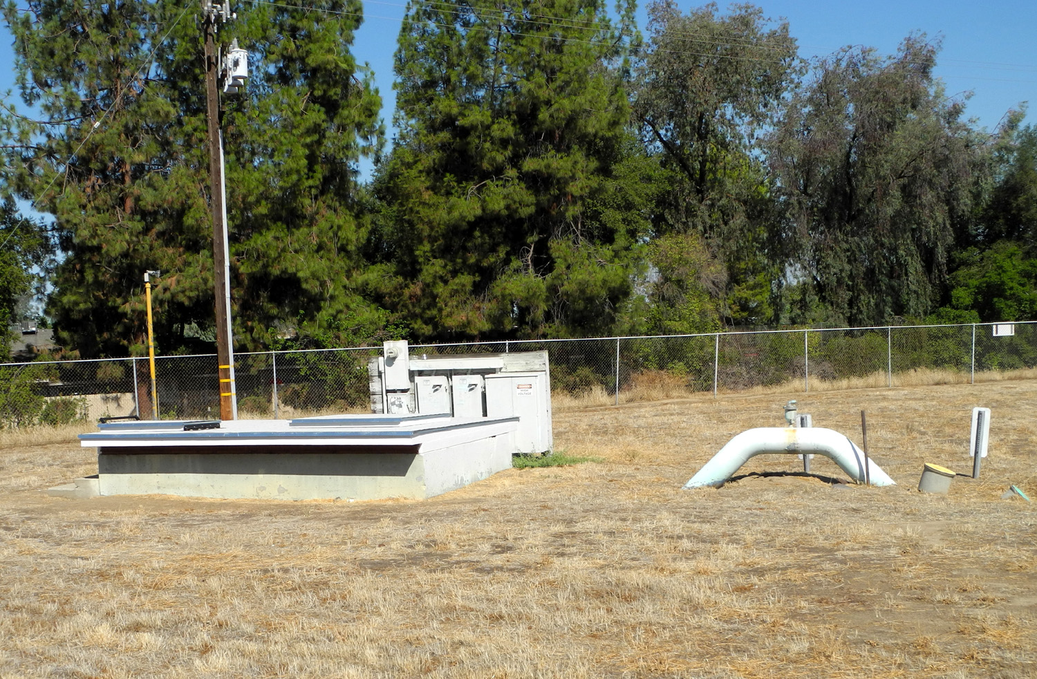
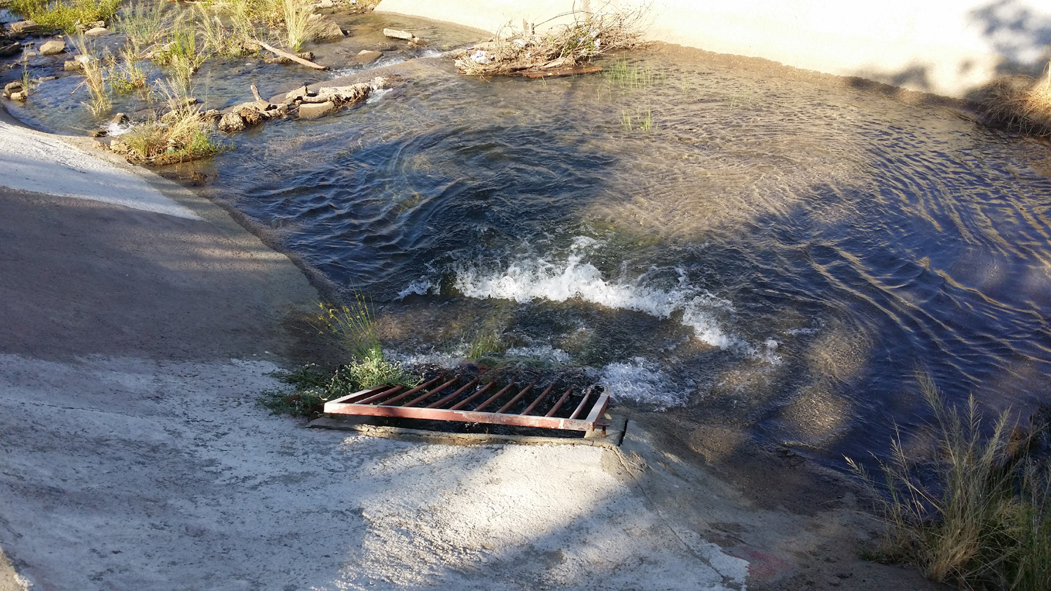
Across from the southwest corner of the park, I observed that the water was coming in through a grate where there has been a tiny trickle the past week or so. Because the canal is almost level here, water was flowing in both directions, both upstream and down. I soon reached a point where the "wrong way" flow was moving into previously dry territory, and realized that the flow had just stared this morning. I didn't go all the way to Villa, but crossed the bridge at the road to the animal shelter, and walked southwest to Barstow. Along this route, the downstream flow of water was just arriving in the dry area about 100 feet from the street. I crossed the Barstow bridge and started back up the west side. At the Helm Canal I found a pickup and a man doing something at a pump complex there. Just then dark brown water came out of a pipe on the west side into the Dry Creek Canal. The workman was with the Clovis water district, and talking with him, I found that he was running water to flush out the filters in the pumps. The water there is used to irrigate the park. He said he was not responsible for the water coming from upstream, but thought that they were doing something similar, flushing the pipes that come from the water tower there. With this second session of education on canal operation (the first being the man who was hauling away sediment dug out of the canal), I have a good start toward a complete understanding of the water and flood control processes in the Fresno-Clovis metro area. If I keep walking another 30 years, I'll be almost an expert.
By the time I got to Barstow it was light enough to see safely, but still well before sunrise. On the good side, I had an amazing view of the moon, Venus and Jupiter, the latter blazing bright when it was dark, and still visible just before sunrise when I got back to my car. Today I walked the same route, and observed that there is a good flow of water all the way in the Dry Creek Canal, the first since mid-August. I've also been noticing ant trails across the banks. These are literal trails, lines in the dirt worn by thousands of tiny feet rushing back and forth on their mysterious missions.
Blue fencing strips have been added to the chain link fence by the Animal Shelter, on the sides facing the canal and the flood basin. I don't know the reason, but one happy result could be that the dogs don't see people walking on the canal, and will bark less. On the other hand, when do dogs need a reason to bark?
This morning I did my normal "long canal" walk from Villa to Barstow and back, with a trip down the Helm Canal to the west. I saw an unusual bird which I think may be some species of kingfisher. He was sitting on the concrete abutment where the Helm Canal disappears toward the Highway 168 freeway. This canal is virtually dry, and a week or so ago there were four large, dead fish among the garbage that is caught where the water runs into the tunnel. They are all gone, and I couldn't help but wonder if my feathered friend had taken advantage of a free buffet. I saw him later, landing in a tree where the Helm crosses Big Dry Creek Canal. By the Villa Avenue bridge, where the Dry Creek Canal is lined with concrete, three boys were riding their bikes down the bank and up the other side, "getting air" on the exit. I had seen boys skateboarding here previously. All the canal sections in this area are mostly dry, with a little trickle in the Dry Creek near Helm. The Helm is choked with dry, dead plants which were growing in the water when it flowed.
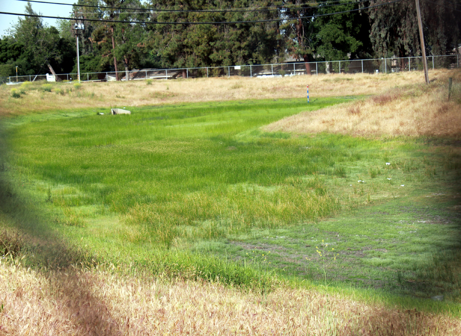
This walk is only a little over a mile, so I walked north from Barstow and out the Helm Canal as far as Sylmar, to get in a longer walk. There was quite a bit of water in the Dry Creek, which has been mostly dry for a few months. Most and probably all this water is coming from a gated opening on the west side, near the big flood basin. I'm 90% sure the water was being pumped out of the basin. I could even see where the water level in the basin had been slightly higher very recently.
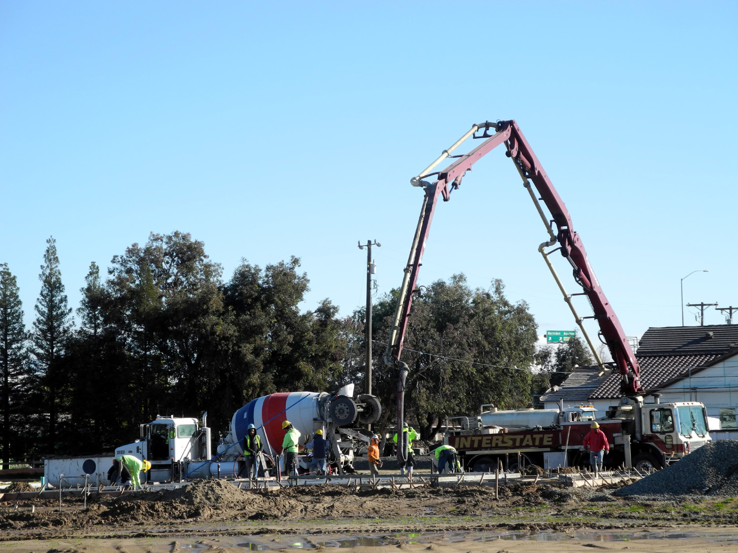
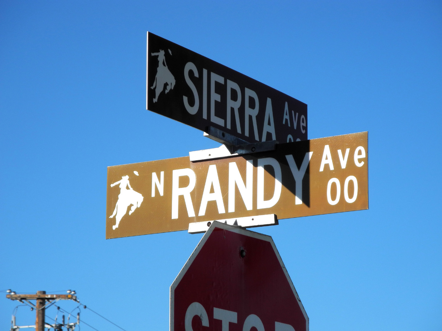
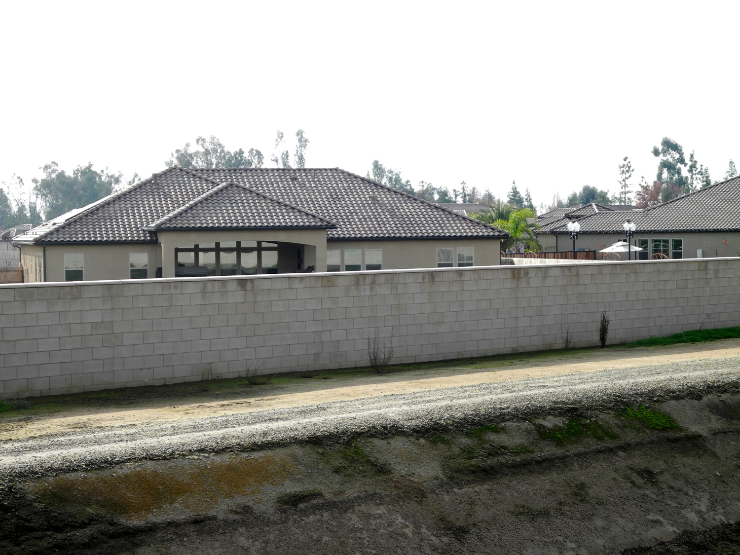
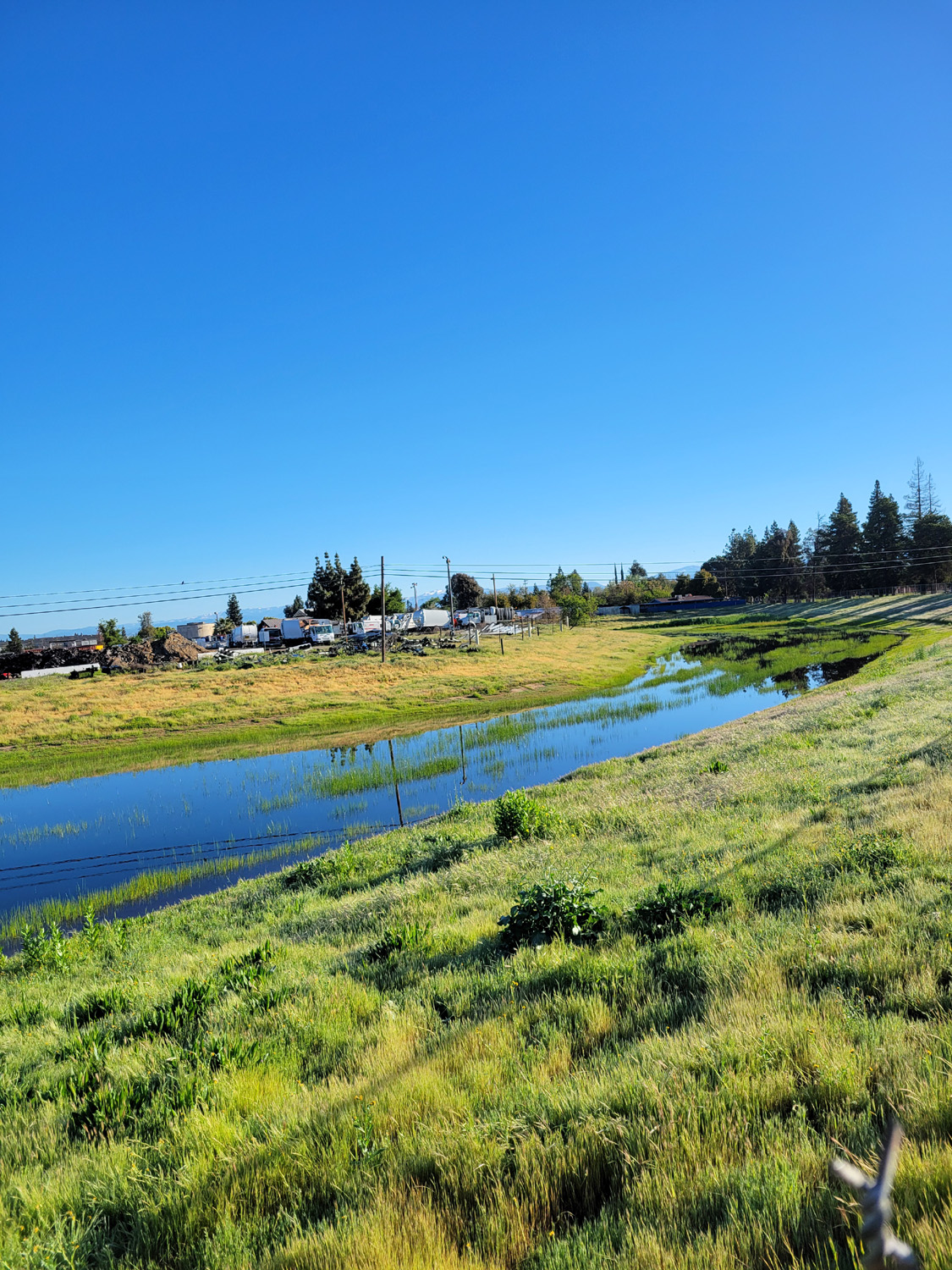
Past the cemetery, there are homes on the west side all the way. On the east there is an RV sales and repair lot, auto repair, and other similar businesses. Past this there is some new home construction, the Sierra Crossing development, which I've also seen walking in from the east on Spud's Spur. The canal crosses Sierra Avenue at Randy Avenue. Beyond here it is fenced off, but a walker can cross the Sierra Avenue bridge and return on the opposite side, which is my usual practice - up one side and back on the other. At the construction site, two men were taking down the orange plastic fence along the side of the property next to the canal, and a cement truck and crane were pouring concrete foundations. This walk was a little shorter than I would have liked, about 1.3 miles. I could have extended it by walking on sidewalks, which I like to avoid. I considered crossing Herndon and going north along the bank to the John Wright Station, then down the Old Town Trail to Herndon again, but it's a very busy six lane road, and I walk slow, so I abandoned that idea as quickly as it formed. Beside the Clovis Dry Creek Trail, but definitely canal-related, is a place where water is pumped into the canal FROM the east. Three feet away water is pumped out through an outlet TO the east. There's still enough left to create a good flow down the canal. There's been water in Dry Creek for about two weeks, but it's impossible to say how much comes from the actual creek and how much is pumped in from various flood basins. We've had lots of rain October to January, and lots more since March 1. The creeks in the foothills are running good. The geese seem to like
this - they have returned to the flood basins and other grassy
areas, although not in the large numbers that are usually seen. Update 4/19/16: Today walking the Dry Creek and Helm Canal banks, I spotted about a dozen tiny toads, barely an inch long. They were mostly hopping out of the grass on the side of the bank away from the canal, and going toward the water. I saw this phenomenon once before several years ago, although the first time there we hundreds of them crossing the bank, requiring care to keep from stepping on them.
Throughout the summer and including today I have noticed a very good flow of water in the Dry Creek Canal. Not sure where it comes from, but it must relate to the good rainfall we had this year. The best part of the walk was a number of orange dragonflies along one section. There were bottle brush bushes in bloom, so perhaps the plants or a bug they attract drew the little flyers.
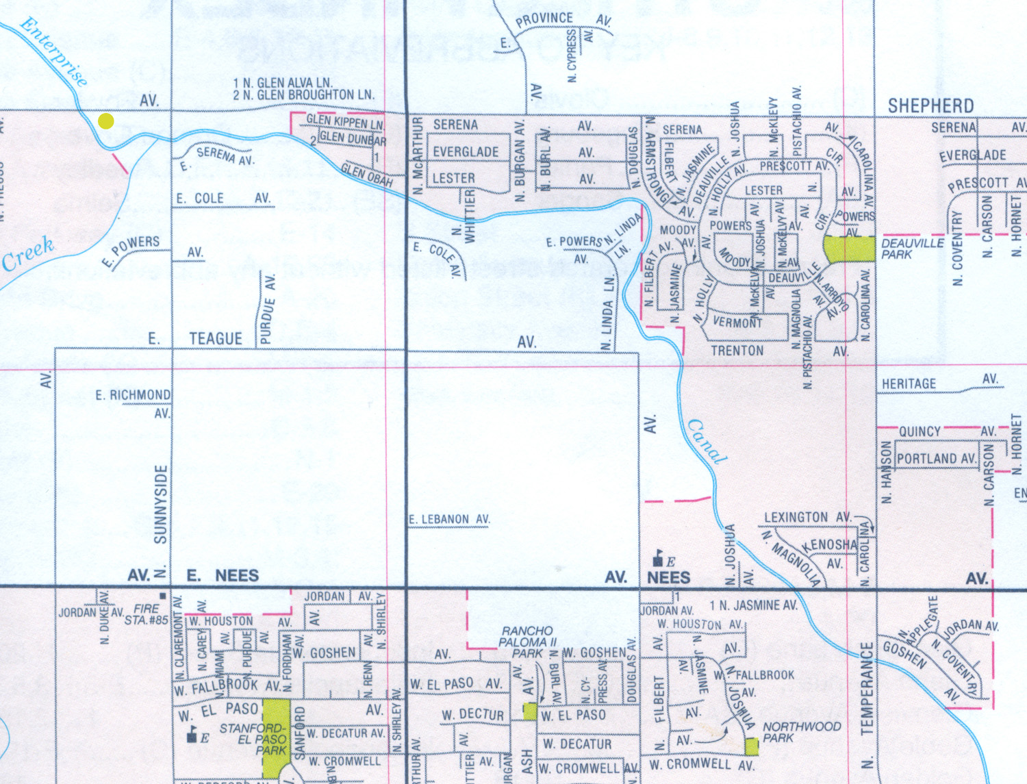
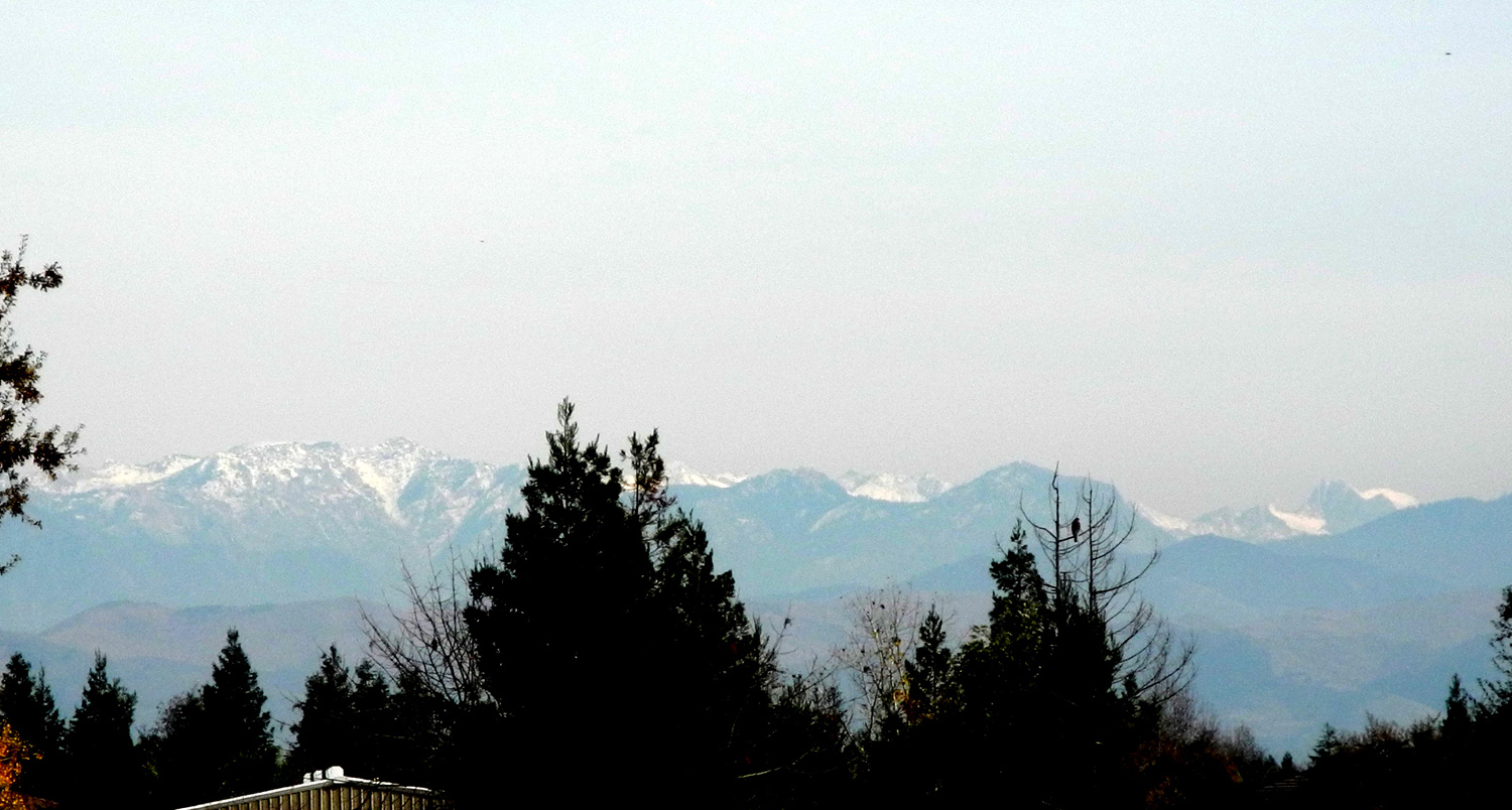
Update 12/14/16: Since the Enterprise Trail parallels the Enterprise Canal throughout its entire distance, this update also appears on the Clovis Trails page. I walked today on the Enterprise Trail, for the first time in at least a year or two. From the Dry Creek Trailhead at Shepherd and Sunnyside, the Dry Creek Trail to the south appears to be the only available trail. But a little cross-country travel takes you to the Enterprise Trail, less than a quarter mile away to the east. In fact, it's a stretch to call it "cross country," since it just involves crossing Sunnyside Avenue and walking on the bank of the Enterprise Canal to where the official trail starts. From there the trail follows the canal for at least a couple of miles, although I have never been to the end of it. I walk it so rarely I don't have an "official" turnaround spot like I do with most "in and out" trails, so today I turned back when I felt I had walked "half of enough." The first thing I noticed while walking on the canal bank was that the banks and the bottom of the canal had been graded. Then I realized there was a new cement lining on the south side of the canal for a considerable distance. This probably has something to do with the fact that a section of this canal bank collapsed in May of 2016, sending thousands of gallons of water into nearby neighborhoods. Burrowing ground squirrels were blamed, and indeed, I have seen large holes and dirt piles on canal and trail banks all around Fresno and Clovis. The new concrete and the grading of the opposite bank should keep the little creatures under control for a few years. On the other hand, the new bank work ends after about a mile, so who knows what lies in store? The local irrigation district does inspect the canal banks on a regular basis, but with over 400 miles of canals, it's possible to miss things or not get to them in a timely manner. i DID see a couple of ground squirrels busily working on the next flood. I could not say for sure, but it also appeared that the bank on the north side, where I was walking, had been made a little higher than it used to be. The canal was dry, and the soil in the bottom of the section that had not been repaired had cracked into large, moss-covered sections. Another change I noticed was near the place where I turned back. The last time I was there a big tract of land south of the canal was being graded and streets laid out. Now most of the lots have large houses on them, a fence hides much of it from view, and another bit of countryside is gone forever. Anyway, I was there for hiking, not to study hydro issues or real estate development. I went at mid-day, and we had been having a spell of above average warm weather, so it was very pleasant. I arrived at the trailhead wearing a long sleeve t-shirt with a sweat shirt. I decided to leave the top layer behind, and within a short time, I was glad I did. There was a slight breeze in my face on the outward trip, but I never felt cold, and the wind was at my back on the return trip. Walking east on the canal bank I had some views of the Sierra Nevada. Most of the range is blocked by trees and houses, but at one point I could see a fairly nice section, with a brilliant white topping of snow. When I turned back, I thought maybe I had not gone quite a mile, but it turned out my total walk was 2.33 miles.
Update 2/12/17: Although it used to be one of my regular routes, I now rarely walk the section of the Dry Creek Canal that runs generally southwest from Barstow Avenue near Sylmar to Willow Avenue halfway between Shaw and Barstow. There are several reasons, the main one being that the soil on parts of the bank is loose and sandy, and uncomfortable to walk on. Another significant reason is that the round trip is only 1.13 miles, and I don't feel like extending it in either direction to get in my normal two-plus miles. When I walked it today I found a few new things, although the sandy bank was as bad as ever, despite having been soaked with over ten inches of rain this season. The rainfall means that the canal is running big, since much of the water comes from seasonal foothill creeks. Of course, with around 150 flood basins, hundreds of pumps, and many miles of piping, the flood control district can increase or decrease the flow at any time. At one place along the bank a homeowner whose back yard is next to the hotel has run a hose over his fence, across the bank and into the channel, probably to pump out water from his back yard (or maybe empty a swimming pool?) Since this was an amateur operation, the hose actually ends right on top of the bank, a few feet from the edge, and and the water flow has washed out a nice little gully. Something that's seen all over town now is that the Canada geese are back, in this case in a flood basin on the east side of the canal not far from Willow. As always, the canal bank is covered with various plants, with a few of them in bloom.
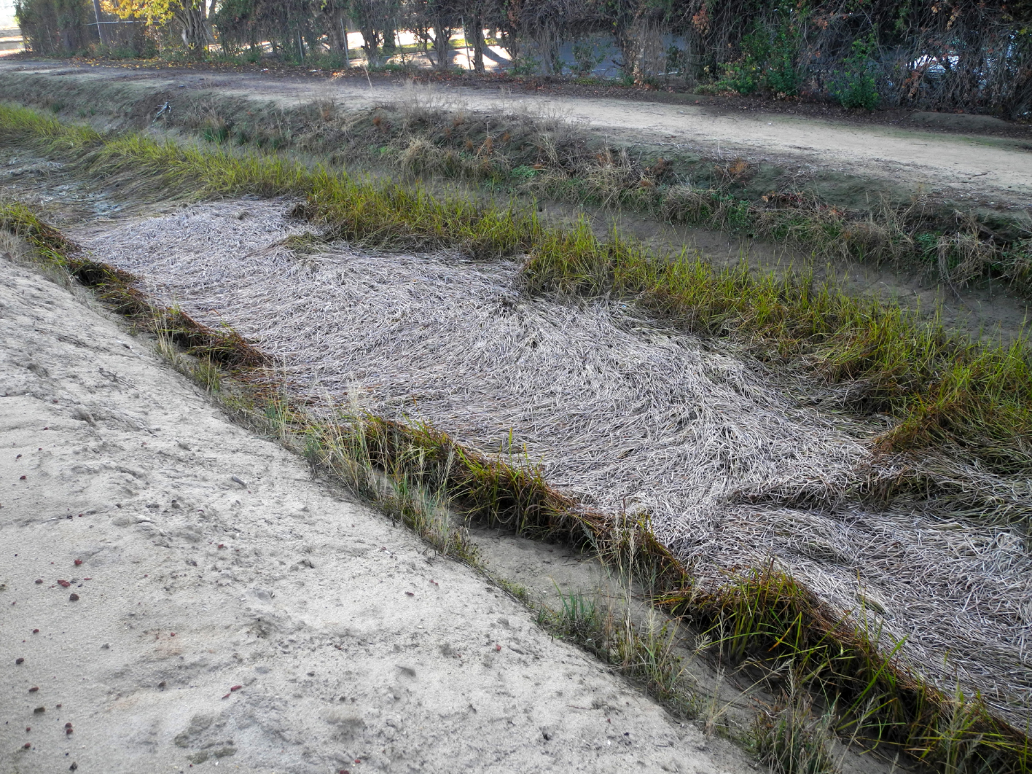
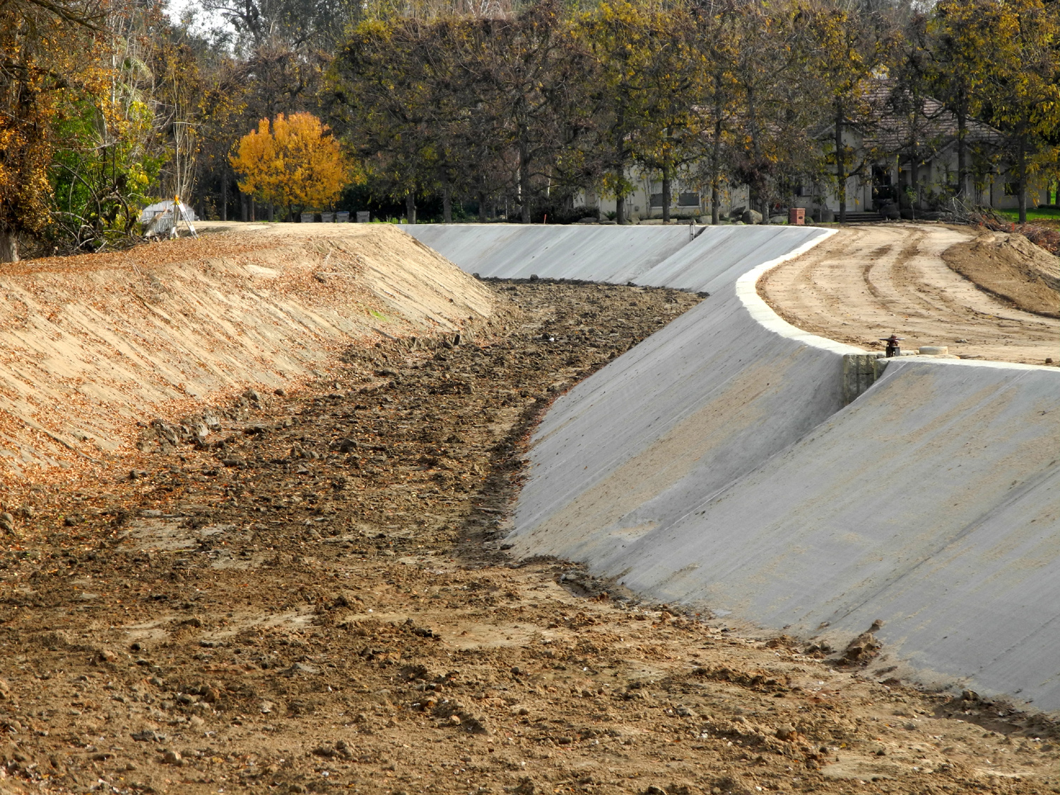
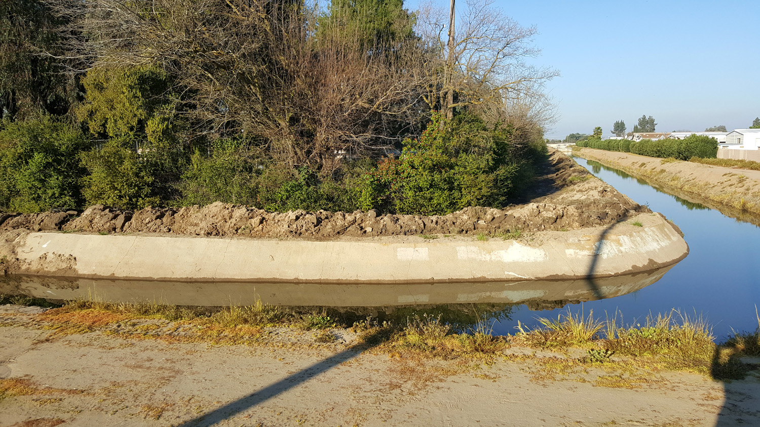
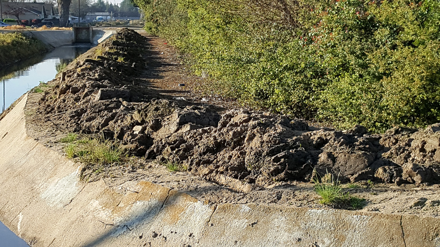
Update 3/14/17: I rarely walk on the canal banks any more, and write about it even less. The canal is more or less a long, narrow garbage dump; and the scenery leaves a lot to be desired. The Clovis Trails are much more pleasant. But once in a while when I don't feel like driving as far as my regular trailhead, I go to where the Dry Creek Canal crosses Villa Avenue, just a little more than half a mile from home. I walk southwest on the bank, turn right where the Helm Canal crosses under Dry Creek, walk down to the dead end where a fence blocks the view and much of the sound from Freeway 168, then back to the Dry Creek, down to Barstow Avenue, and back to my car on the easterly side of the canal. I've posted photos of the vegetation that virtually fills this section of the Helm Canal, and I've contemplated how much water is being wasted on weeds, when it should be flowing somewhere to irrigate crops. Today I was glad to see that the weeds and muck from the canal bottom have been dredged out and piled up on the bank. This is common practice every so often throughout the canal system. After the dirt pile has been allowed to dry out (sometimes for a couple of years), trucks and front loaders are brought in and the dirt is hauled away, to where I can't say. When I saw the big dirt pile, on the south side of the canal, I was not sure I would be able to follow my usual practice of walking down one side and back on the other. Once I got to the turnaround point, I found that there was room to walk between the pile and the edge of the bank, although in some places it was fairly narrow. When I got to the last 100 feet or so, the bank was wet, muddy and slippery - indicting to me that this section had been dug out in the last day or two. It was also very tight against the weeds and other stuff growing at the edge of the bank, but I made it through with nothing worse than a pound or so of mud in the tread of my tennis shoes. Along the way it was like looking at an archeological dig - sticking out from the dirt were many artifacts, some not recognizable. They include lots of plastic cups, paper trash of all kinds, pieces of metal, some of it totally covered in rust, a CD case, chunks of a tree that had been cut up and thrown in the canal about two years ago, an old canning jar, and sticks and boards of various sizes. Who knows, maybe Jimmy Hoffa is under there somewhere. The wet spot was slippery enough to be a little dangerous, so I won't be walking there soon. In fact, I'll probably check it out in a couple of months to see if they have begun to remove the debris.
Update 5/20/17: Today was my first walk on the canal bank since March. I was surprised to note that the dirt that had been cleaned out and piled on the south bank of the Helm Canal had been removed. Most of the time in the past dirt piles have been left for a long time, as much as two or three years. On the other hand, the dirt piles on the north side, which have been there at least three or four years, are still there. The grass-like plant with white flowers that grew in the water of the canal, and covered much of its surface, is making a slight comeback along the edges. It will be interesting to see how this spreads over the next few years. There are quite a few other flowers, mostly what city-dwellers would consider weeds. The most common, and most attractive is a plant about two feet high that has a lot of yellow flowers about an inch long and a half inch wide. They have a resemblance to snapdragons. As soon as we got on the bank he saw water and rocks, and if you know anything about kids you know that throwing rocks into water is an important part of developing their motor skills. So it was five minutes before we moved past that point. He was quite interested in the stuff people throw in the canal, which I discussed when the first version of this page was posted several years ago. We saw a wooden kitchen chair, a tire, and that post-Halloween favorite, a pumpkin. Of course there was plenty of uninteresting trash - bottles, cans, food wrappers, and chunks of concrete. Early in our walk he saw a dead millipede and he asked what it was. To our great good fortune, a few minutes later we saw a live one, the first one I've ever seen on the Clovis trails or canals. He was fascinated with the creature and watched it for several minutes as it made its way to the dry grass at the edge of the canal bank. I had seen a lot of ducks a few weeks earlier, so we were hoping they would still be there, but the water was very low in the Dry Creek and non-existent in the Helm, so the millipede was the only wildlife we saw. We
continued on to where the On
the east side, the canal runs beside Letterman
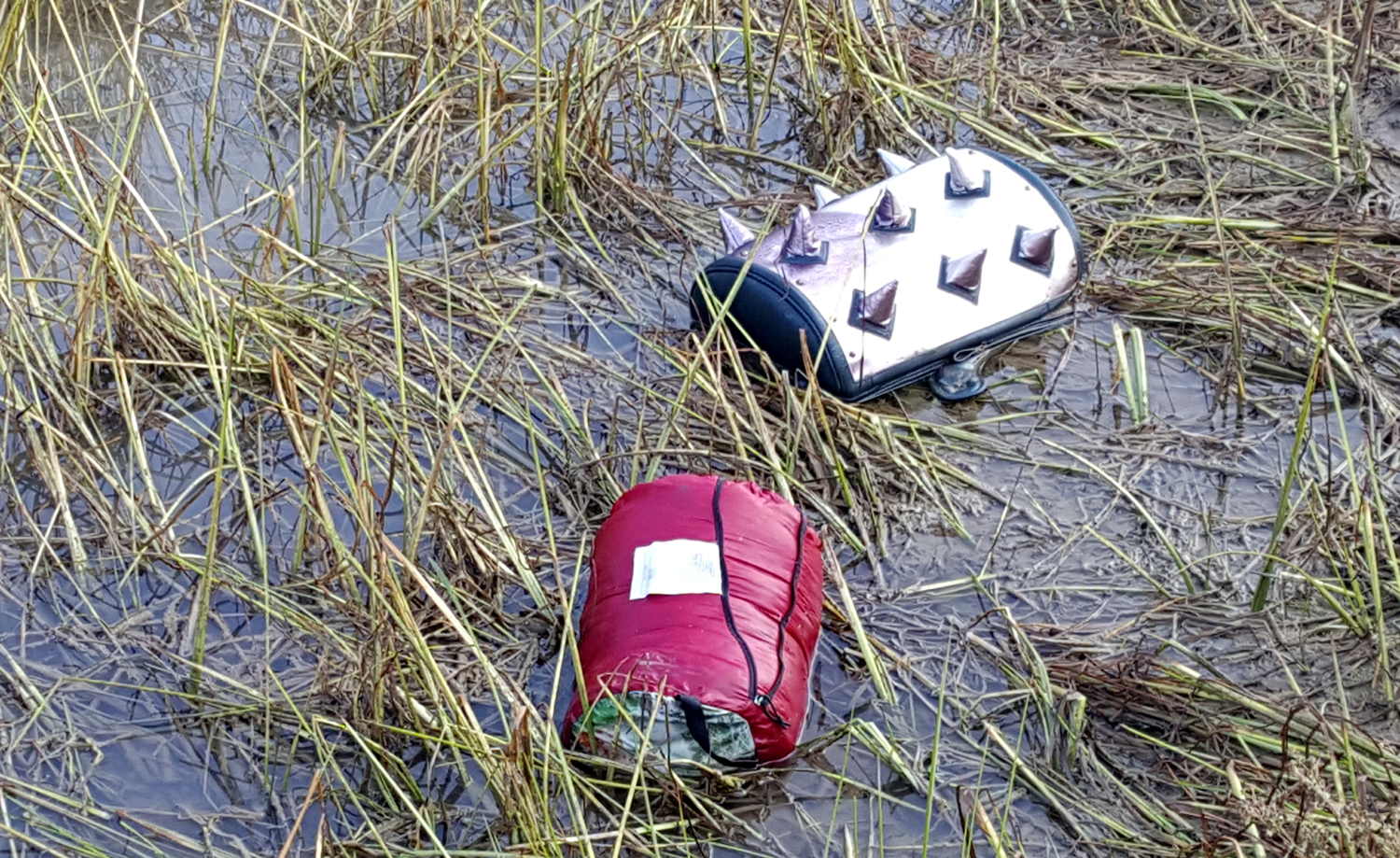
Update 12/1/17: A few days later I did my full walk along these canals. It immediately became obvious that Jack and I had been a week too early. I saw a duck and about a dozen geese. Water was flowing into the canal through one of the gates. And across the flood basin in the city yard, a scoop loader was putting what looked like yard trash into the back of a garbage truck. I also saw something I'd never seen before, a rolled up sleeping bag and an unidentified spiky thing in the water. Jack might have found these two items interesting, but the other stuff would have made a great outing into a perfect one.
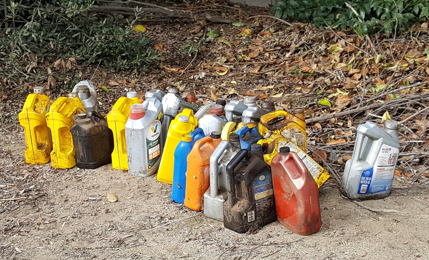
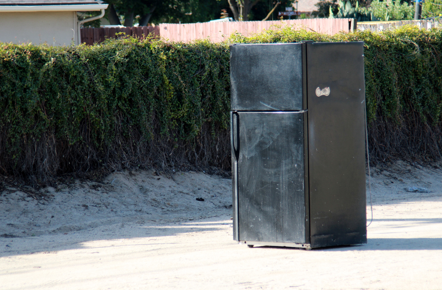
A short distance into my hike I came to a large, scattered pile of papers - not the typical canal bank trash, but various personal items. These included some school class photos, a photo of a man with a small child, and lots of printed matter. One appeared to be a policy manual for some type of business; the section that caught my eye dealt with time off for jury duty. I did not think that the owners of stuff like this would dispose of it this way, and wondered if it was discarded material from a burglary. A little farther down the bank I saw the results of an obvious illegal trash dump - about 20 empty oil and other automotive fluid containers. At least the criminal who left them did not put them into the canal. Update 4/l26/23: This will sound like a repeat of my last entry. I have been very lax about walking at all for a year or two, but today I walked from Barstow along Dry Creek Canal to where it meets Willow Avenue. The first thing I noticed, where I park on the south side of Barstow, was some new plants along the edge of the yard there, mostly cactus and succulents. There's a big prickly pear plant there, but it's now joined by some yucca-style plants and a few other items, as well as these dazzling blooms. As far as the canal is concerned, the bank on the west side is practically one long garbage dump. There's a light-colored concrete block wall for about a third of the distance, and I have seen lizards on the wall several times. Today I counted ten. Of course, when I go this long between walks, there is usually something I've never seen before, and today it was a refrigerator, standing upright on the east bank. I have seen appliances IN the canal, but I don't think there was ever a refrigerator, and definitely not one on the bank. After
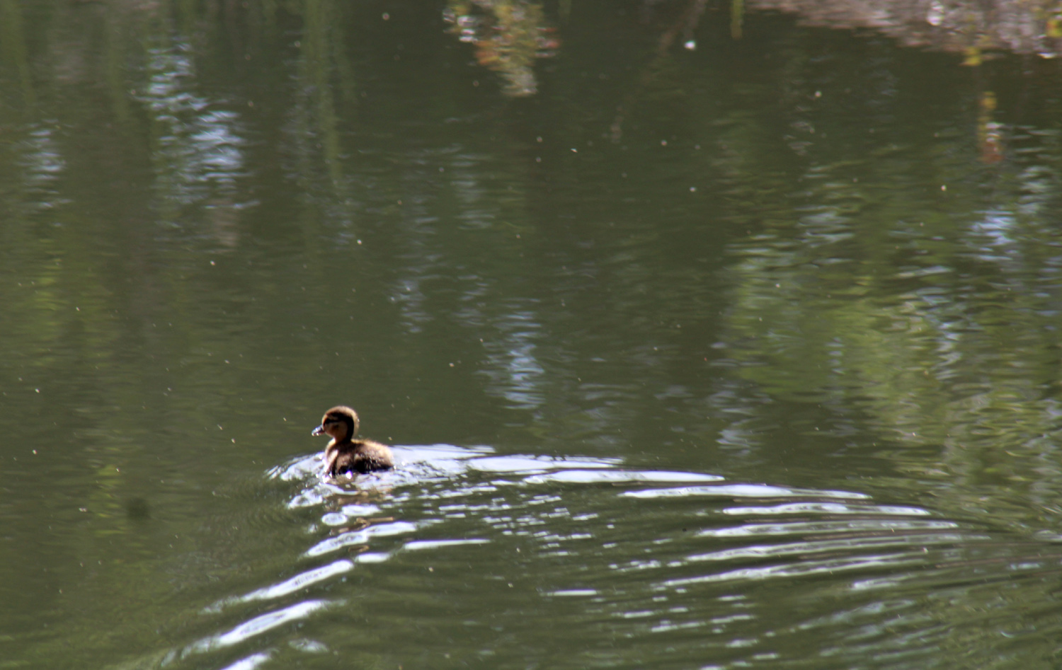
reaching
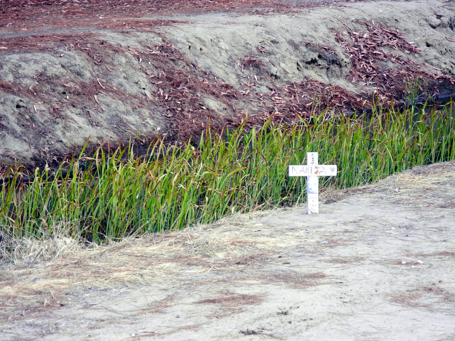
A few days later, on April 29, I walked along the Dry Creek Canal, from Villa Avenue between Barstow and Bullard, diagonally toward Barstow. About 2/3 of the way to Barstow the Helm Canal crosses under the Dry Creek through a pipe, and goes west, and my practice has been to walk along this route to Sylmar Avenue, or to where the canal goes into a pipe that apparently takes it under the CA 168 freeway. At this location there is a large flood basin west of the canal. It stretches at least 200 yards, all the way back to the Clovis Animal Shelter near the start of this walk. It had only a few puddles, but will undoubtedly be filled when the 300% of normal snow pack in the Sierra melts. Today the main object of interest was a lost duckling in the Helm Canal. A woman on the opposite side of the canal asked if I had seen any mama ducks the way I had just come, but the answer was no. The baby was swimming in circles, then up and down the canal, apparently distressed over being separated from his flock. He was much too small to be on his own yet. The Dry Creek Canal was flowing strongly, and it appeared that some bushes have been removed in one section. The Helm also showed signs of silt and vegetation having been removed. Beside the Helm canal, just west of Dry Creek, there is a small wooden cross in the slope above the bank. Several years ago a cross had been placed nearby in memory of Nakita, clearly a beloved dog. Objects next to the cross disappeared, as did the cross itself eventually. I think the current cross is at least the third one that has been placed there. May we all be so well-loved and remembered. Continuing my plan to get back into regular walking, I went from the John Wright Trailhead near Herndon and Minnewawa to Cottonwood Park and back the next day, Sunday April 30. This actually should be in my Clovis Trails report, but this part of the Dry Creek Trail parallels the canal all along the section I walked. There were a lot of people on the trail, walkers, joggers, and bikers, and the water in the canal is flowing swiftly. I did not take my camera, but I almost always have my cell phone, and I photographed a flowering plant that I've seen in many places, dating back to early childhood. One of my daughter's friends says that it is chamomile. Where the trail arrives at Cottonwood Park, there is a Little Library, the first one I ever saw, several years ago. There is rarely anything that interests me, but one of the first books I picked up was Cadillac Desert, a fascinating study of dam-building in the west, or to be more accurate, over-building. I did not read it until last year, and although written in the 1980s, most of what it says is valid today and I recommend it. On today's hike I found a book that caught my fancy - Is it Just Me, or Is Everything Shit? Subtitle is "insanely annoying modern things," and I expect to find quite a few things that annoy me when I get around to reading it.
Update 6/15/23: I've been doing a better job of regular exercise walking, with nine "in town" outings in May, and six so far in June ("in town" as opposed to more challenging foothill and mountain hikes). On June 3, hiking on the bank of the Dry Creek Canal where it angles southwest between Villa and Barstow, I noticed signs on both sides of the bank, warning of coyotes with pups in the area. I didn't give it any further thought until June 14. This time I parked on Sylmar where the Helm Canal crosses, and walked west to where the water goes into a pipe under the CA168 freeway, then back on the other side all the way out to where the Helm goes under the Dry Creek Canal. There is a section where there is a path along the fence of the big flood basin there, about four feet higher than the top of the canal bank. Approaching the place where this section ends, I saw an animal trot across and toward the bushes there. I was in a bright, sunny area, and the animal was in deep shade, and it was hard to get a good look, but he stayed there for a short while. I thought it might be a kit fox, then decided it was just a cat, and finally got a good enough look to realize it was a young coyote, just as advertised in the signs that were about a quarter mile from where I was standing. I pointed my cell phone and pressed the shutter several times. I could not even see the animal in the view finder, but I was lucky and got several photos that were OK, although not as good as I would have liked. Otherwise my recent canal walks were unremarkable, although I was glad to see that the water in Dry Creek was running big, and some nice plants were growing in the water. The Helm had a fair amount of water, flowing slowly, with lots of a flowering plant that seems to favor this section of the canal.
On the north side of the Helm, there has been a continuous row of oleander bushes, photos of which appear on this web page. When I walked this section in July of 2023, I found that all the oleander bushes had been hacked down. Not pruned, not removed cleanly, but just plain butchered. Like all humans, I always want to know WHY? I speculated on two possible explanations: 1. The thick bushes provided places for homeless to sleep. There has been a lot of evidence of this in other nearby locations, but these bushes were so close together that there was not really any usable space between or behind them. 2. There have been coyotes in the area recently, and the bushes were removed to deny the animals a hiding place. Neither of these explanations is really satisfactory, but I can't believe the goal was to make the area ugly, which is what has actually happened. I'll be checking back over the next few months to see if they clean up this abomination. Update 1/6/24: I took a walk on one of my regular canal routes today. The Helm canal flows north from (??? somewhere) under Barstow between Villa and Willow. It then turns west and goes through a pipe under the Dry Creek Canal, going out of sight at a sound barrier wall above and east of the 168 freeway between Shaw and Bullard. I park on Sylmar where the canal crosses, and walk the loop down to the Dry Creek, then to the wall where the canal goes underground to somewhere. There was very little water, just a small flow near the barrier wall. I immediately noticed that the bottom and banks of the canal had been scraped to remove the vegetation that invariably grows where water flows. Along the northern bank the oleander bushes which had been severly butchered last summer were starting to grow back, but were still nowhere near their previous glory. The only thing that never changes is that there is always change.
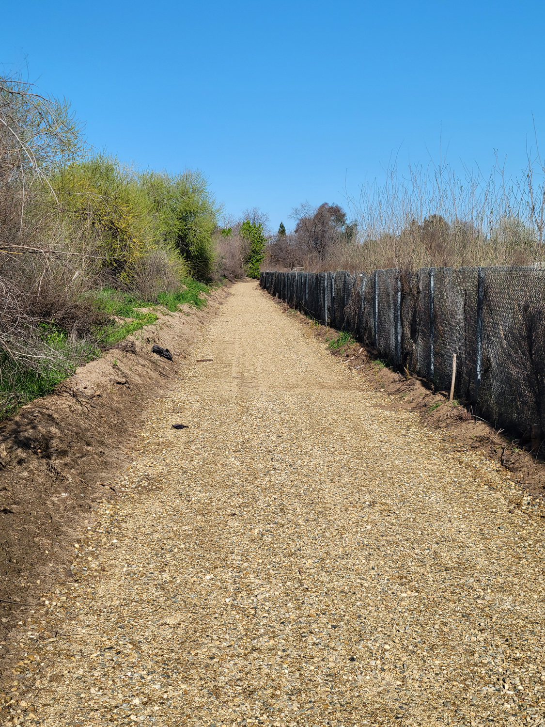
Update 3/1/24: On February 27, I did a canal walk that was mostly new to me. I was only a dozen feet from the familiar Dry Creek Trail north of Dry Creek Park, a path I've walked many times, but between that path and my route was the Dry Creek Canal itself, a section where it is more like a creek with trees and bushes along both banks, making it hard to see the trail. I drove to Dry Creek Park, at Clovis and Alluvial Avenues, walked across the park, and started north on the trail. After just a few feet I spotted a "social trail" that led to the canal/creek, where there was a narrow metal footbridge. I crossed to the east side and found myself on a recently graded one-lane gravel road, which ran along a large flood basin, protected by a high chain link fence. I already knew the pond was there, because it is visible from Alluvial Avenue, and in fact several years ago I had crossed another footbridge to the east side of the canal, but only walked a short distance in that area. After crossing I turned north. I was concerned that the walking might be uncomfortable, but the surface was crushed gravel, with most pieces small enough that I did not feel them through my sneaker soles. I was pretty sure this road would come out at Nees Avenue, since I had walked in from there a short distance, in a cleared area that has recently been used to park equipment (maybe for building this new road?) I came to a gate across the road, intended to keep vehicles out, but not to stop walkers, since I could make my way around the gatepost to the other side, there being no fence on the west side of the gate. Actually that is not 100% accurate. There was a very old fence with some weathered posts and a couple of strands of wire, mostly down on the ground. I did not intend to walk any farther, and it was actually a little challenging to get around the gate, but I needed to do so to get the best angle for photos. The ground just past the gate was uneven and covered in tall grass, so I only went as far as necessary to get the photo. The pond is huge - definitely the biggest flood basin I have seen anywhere in the Fresno-Clovis metro area. It is divided into several sections, and was nearly full to capacity, making this a scenic lakeside hike. I started back but passed by the point where I had first entered. It was my hope and belief that I would arrive at the little footbridge that goes over the canal parallel to Alluvial Avenue, so I could cross back and return to the parking lot. My expectations were met, and I then followed the sidewalk west to Clovis Avenue and north to the park entrance. From here it was a short walk to my car, and a ten-minute drive back home. As I wrote this report, I chastised myself for not taking pictures of the two foot bridges. When I return to that area I will rectify that error and post the pictures on this web page.
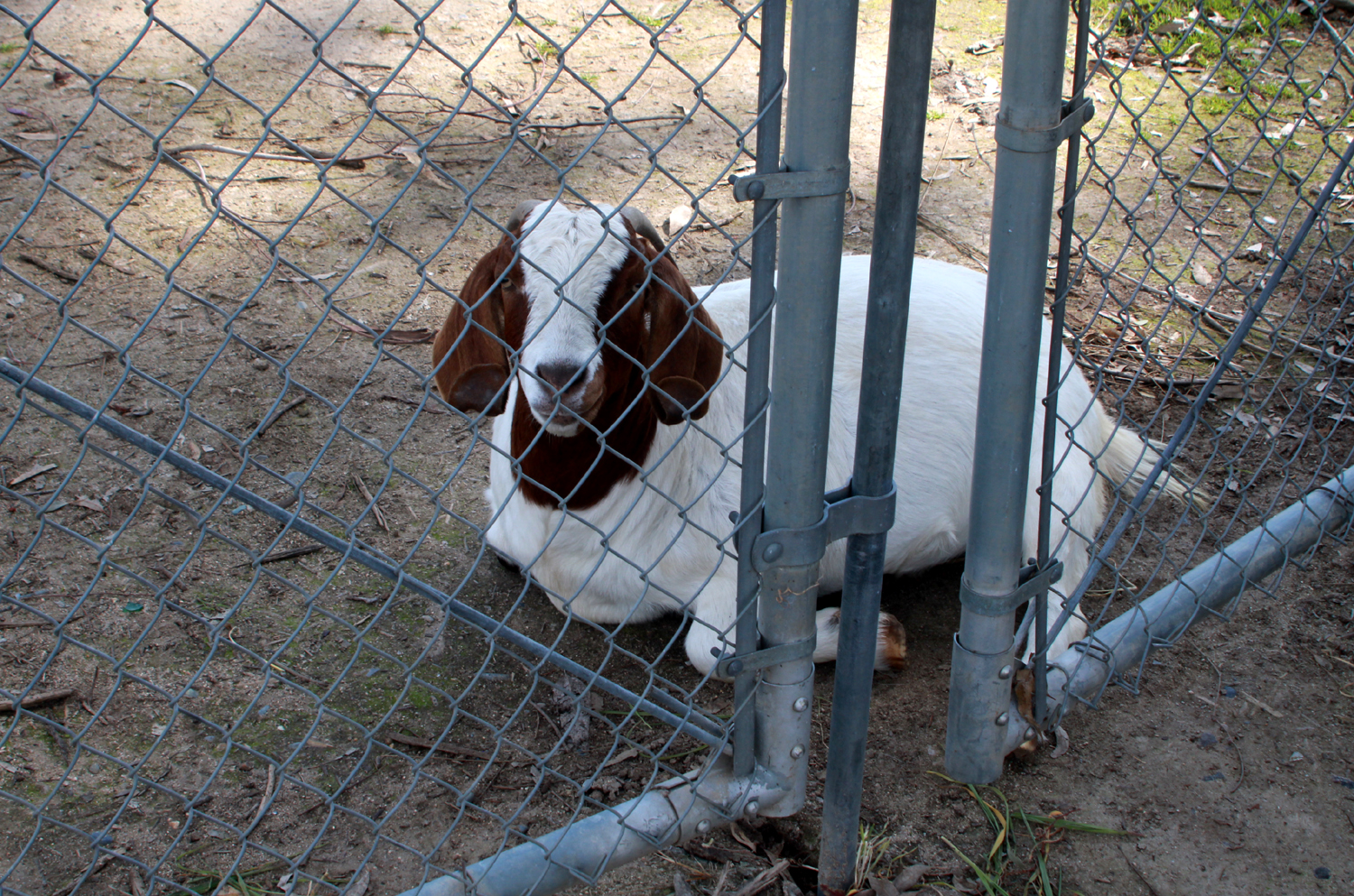
We made our way across the little bridge, immediately seeing a woman and her two young children. They were not the only youngsters present - on the other side of the chain link fence, next to the pond, was a group of four or five goats, including one baby. After chatting with the people and enjoying the goats, we covered the same route that I followed just over a week earlier. This time I got photos of both the bridges we crossed. Neither
of us had eaten a significant breakfast, and our walk gave us a good
appetite to finish up our day with an early lunch at Toledo's
Mexican Restaurant. Two days earlier, on March 7, I had done one of my regular Clovis canal and/or trail walks, along the banks of the Helm Canal between Sylmar Avenue and the Dry Creek Canal. There is currently no water in the Helm, but there was an interesting sight, a well-formed sand delta on the canal bottom, probably caused by water from recent rainstorms creating a washout in the bank. Update 10/7/24: I've been slacking off on my neighborhood hikes, but today I decided to do a short walk along the Helm Canal, from Sylmar Avenue to where the Helm runs through a pipe under the Dry Creek Canal and back, a "strenuous" hike of just over half a mile. The canals were both without water, and the Helm had more vegetation growing in the bottom than I've ever seen - a mini-jungle of grass and other plants. The usual garbage that people dump in these waterways included a very new-looking market cart, as well as the usual plastic, cardboard and other pure trash. The one thing that stood out was the recovery of the oleander bushes along the bank. A year and a half ago they had been severely butchered, NOT pruned. They have grown back to eight feet tall, and some were blooming nicely. Although triple digit temperatures have continued into October well past what we had hoped, I walked early enough that it was cool, and I saw only one other walker. Stay tuned for updates in the future. I won't say NEAR future.
Update 12/2/24: On my first canal walk since early October, I covered mostly the same ground, with an added stretch, west from where I park to where the canal goes underground and further progress is stopped by a tall cinder block wall above the CA 168 freeway. In keeping with tradition, I saw something in the canal for the first time, a vacuum cleaner. I also saw a car upside down. It was only a foot long, but made an interesting photo. I've seen plenty of fruits and vegetables, but today's special was oranges, artistically arranged. Above them on the side of the bank was a nearly full bag and several more loose ones. They all appeared to be well beyond the "sell by" date The total walk was only three quarters of a mile, but when I got home I rewarded myself with a Bloody Mary (as I do most mornings), and a visit to the Colorado Grill (which I do about once a month.)
Update 5/4/25: On April 23 I walked along the Helm Canal bank between the Dry Creek Canal and Sylmar Avenue. As so often happens, there was something new, a fence along the bank next to an apartment complex where the canal makes a 90 degree turn from north to west. Other than a huge filaree plant going to seed, there was nothing else new. Update 5/25/25: I did another walk on the road east of the Dry Creek Canal and trail, where I observed a number of interesting plants and flowers. Puncture vines were thick along the road's edge, and close to the canal I photographed pussy willows and tall dry grass going to seed.
A short distance down this way was a homeless man with his dog, camping against the fence south of the canal. The dog barked at me, but the man got it quieted down. I gave him a greeting and continued on. I did not want to come back that way and get the dog stirred up again, and maybe cause the man to think I was spying on him, so I kept going to where the canal makes a 90 degree turn and goes out to the bank along the Dry Creek Canal, then returned on the side of the Helm canal opposite to the man and dog. While I was resting at the junction another walker asked me, for no obvious reason, if I had served. I told him, in the National Guard, and he thanked me for my service. I didn't give him any details, but it was 60 years ago. I saw a cat down by the water that sat there while I took his (or her) picture A small cat ran up from the plants along the canal edge and across the bank (maybe the other cat's kitten?) and a third cat made a quick appearance as I got back to my car. I also saw a busy ant hill, an abandoned table and a plastic pumpkin decoration on the bank. I was also glad to see that there was a strong flow of water in both the Helm and the Dry Creek canals. I've previously written about the oleanders along the Helm Canal. They were hacked down, grew back to six or eight feet tall, and now have been pretty much killed. In addition to hacking them down, it looks like they have been sprayed with a herbicide. Not sure who has such a hatred for these beautiful flowering bushes. |
||
|
Photos (Click to enlarge; pictures open in new window) |
||
 |
 |
 |
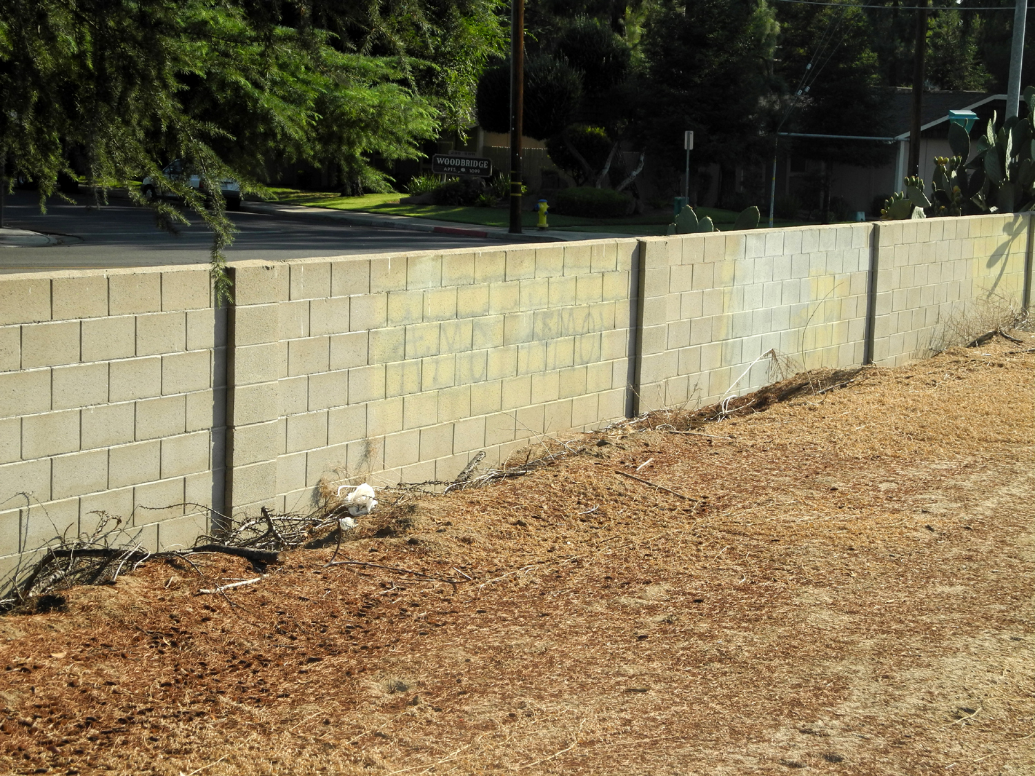
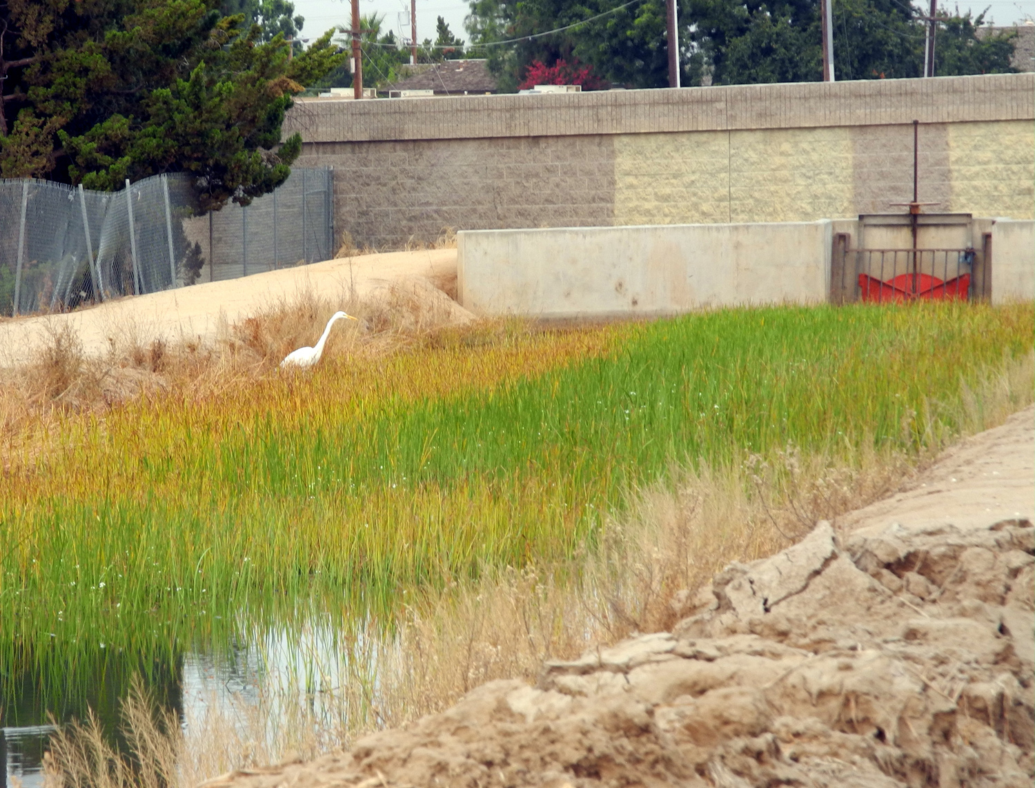
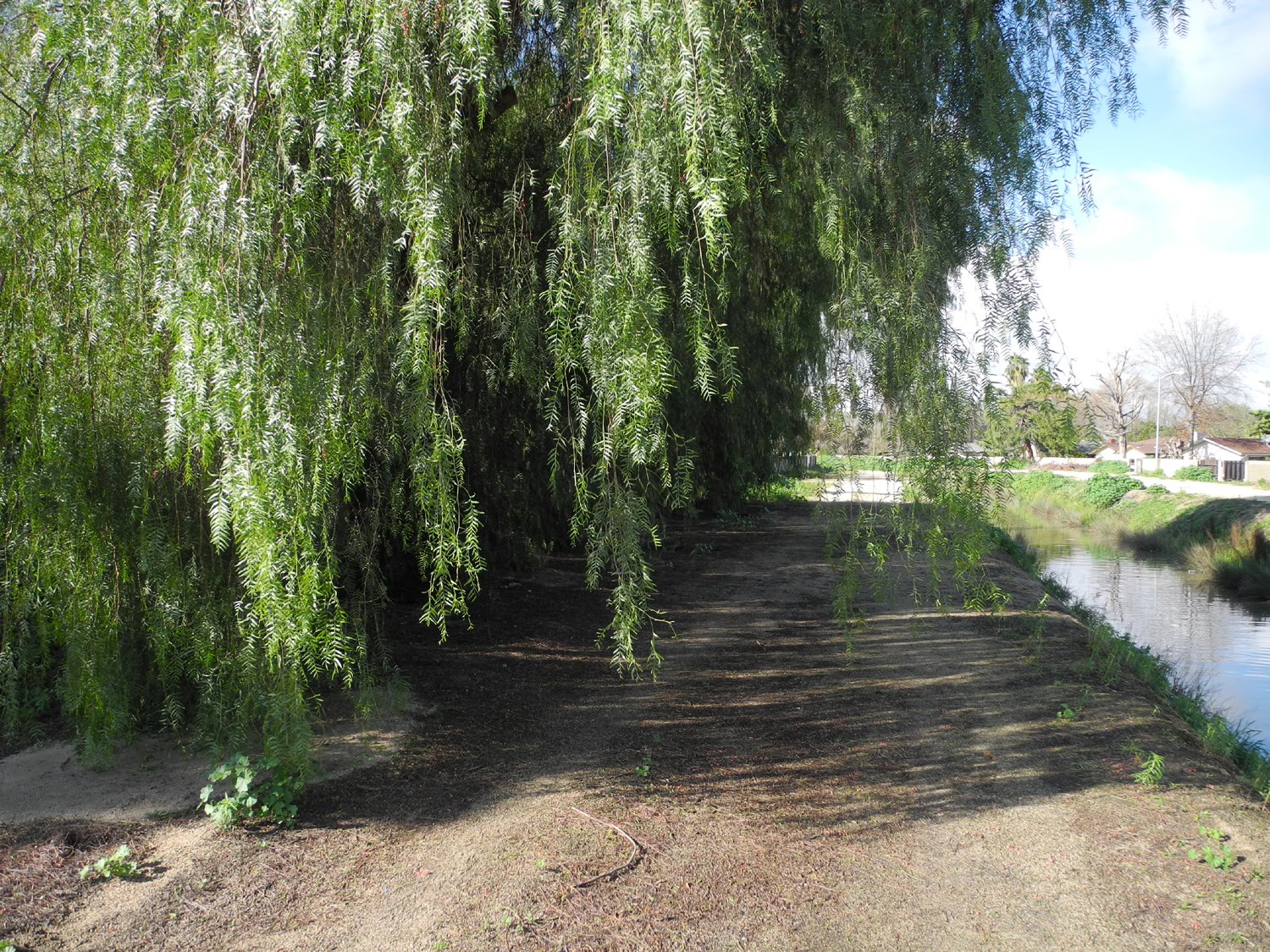
| Area of canal walks in Fresno | And in Clovis |
Part of the Clovis Trail
system |
 |
 |
 |
|
The Enterprise Canal is
paralleled |
Irrigation System map showing Clovis and Fresno walking areas |
A section of the Clovis |
 |
 |
 |
|
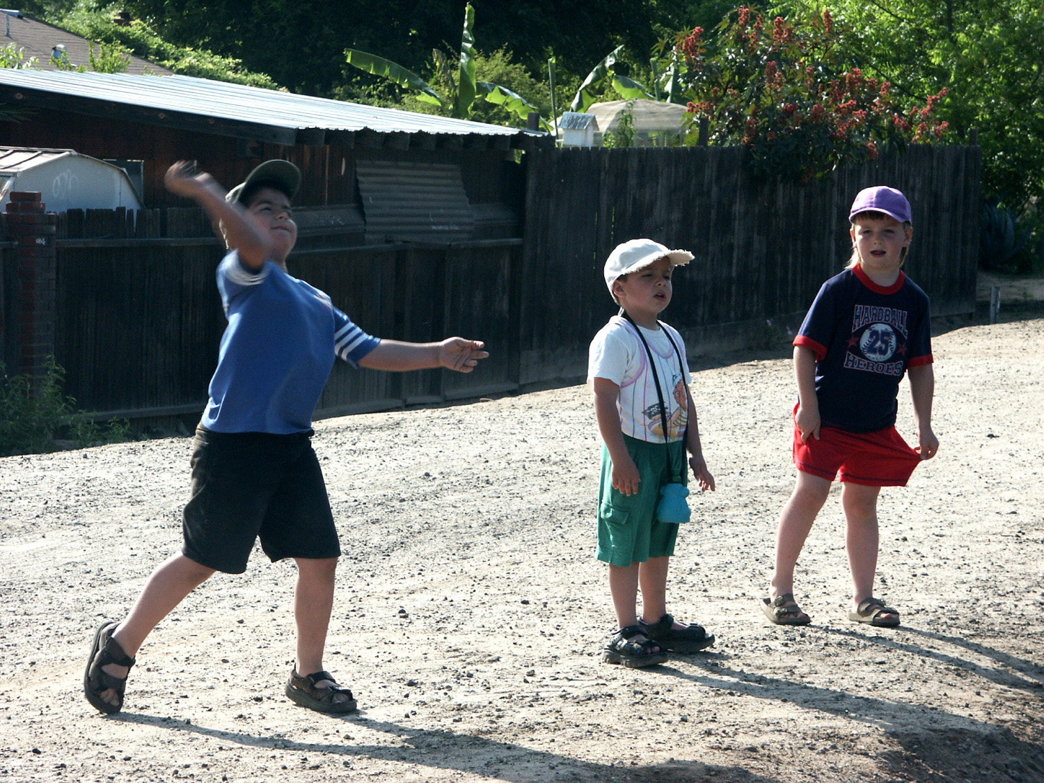
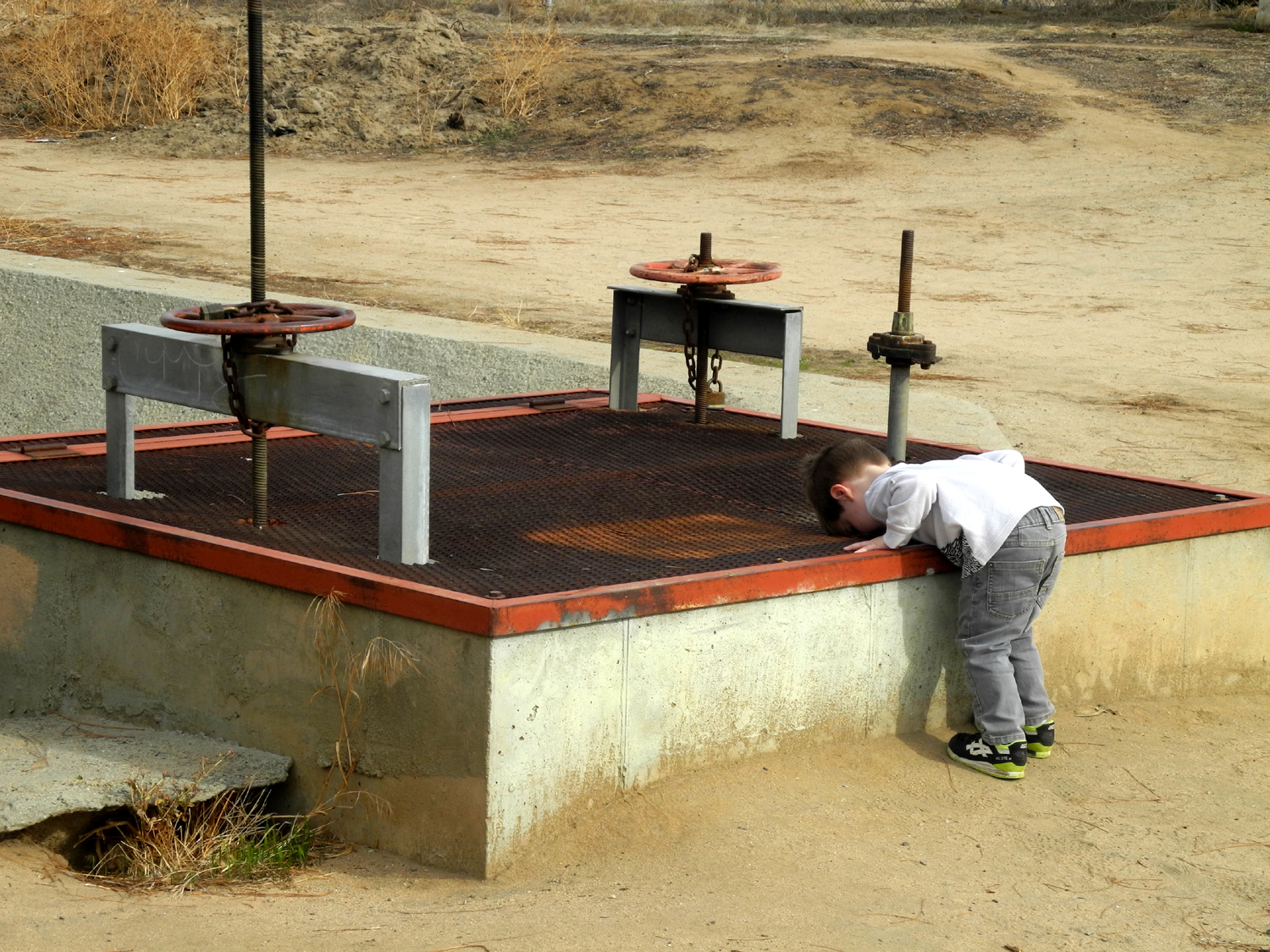
Pablo on the pipe, right next |
Lee, Mikie and Pablo on the bank | Mikie and Lee |
 |
 |
 |
| Mikie tries pipe balancing | Not a creek, but still a good place to throw rocks in water |
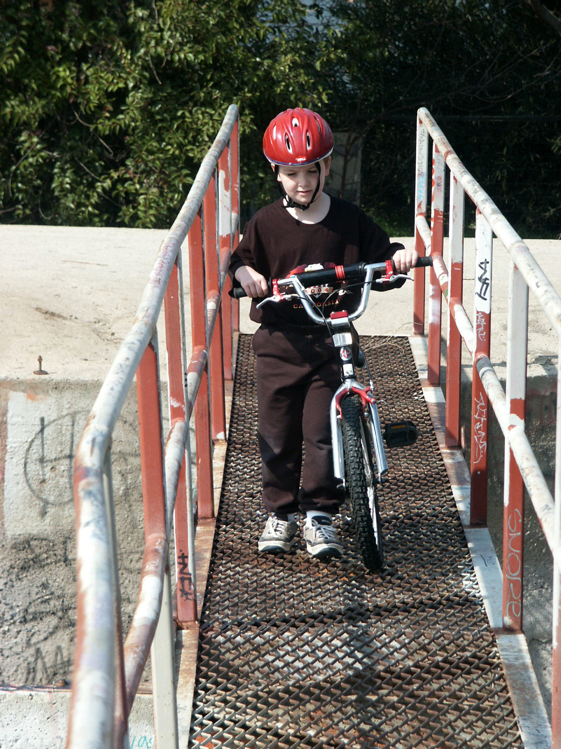
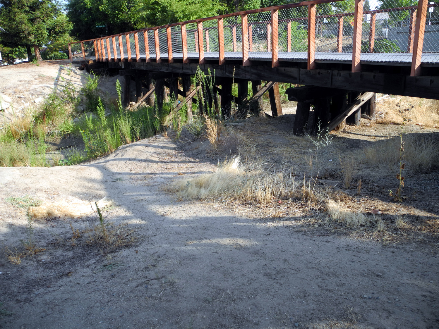
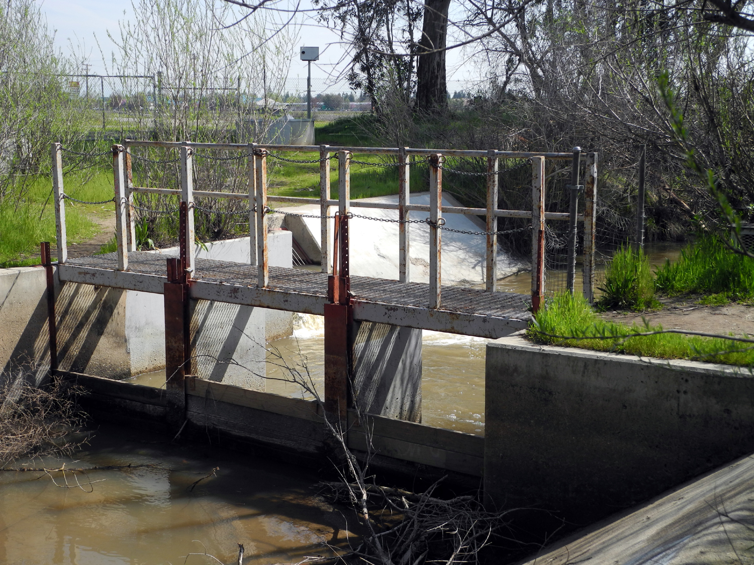
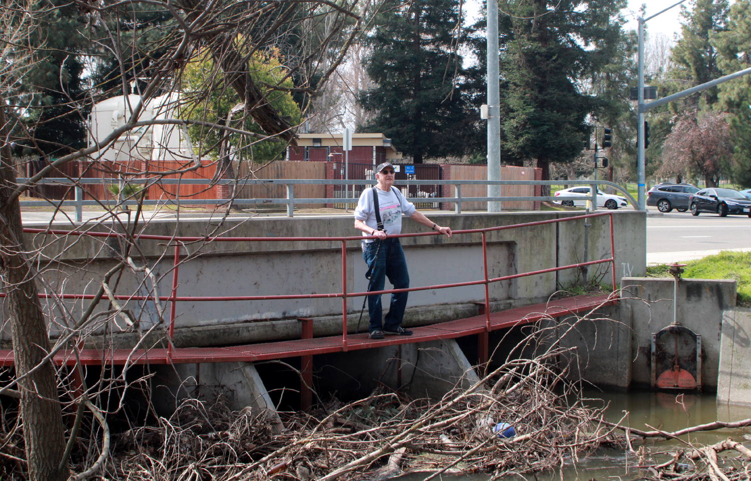
Crossing the narrow bridge |
 |
 |
 |
|
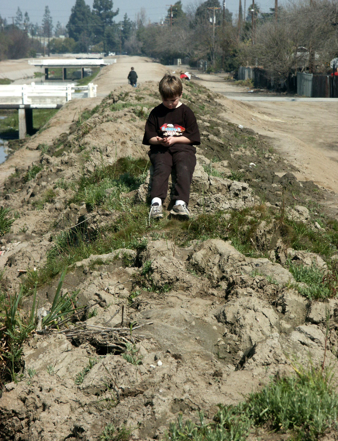
A dried block of mud makes a good seat |
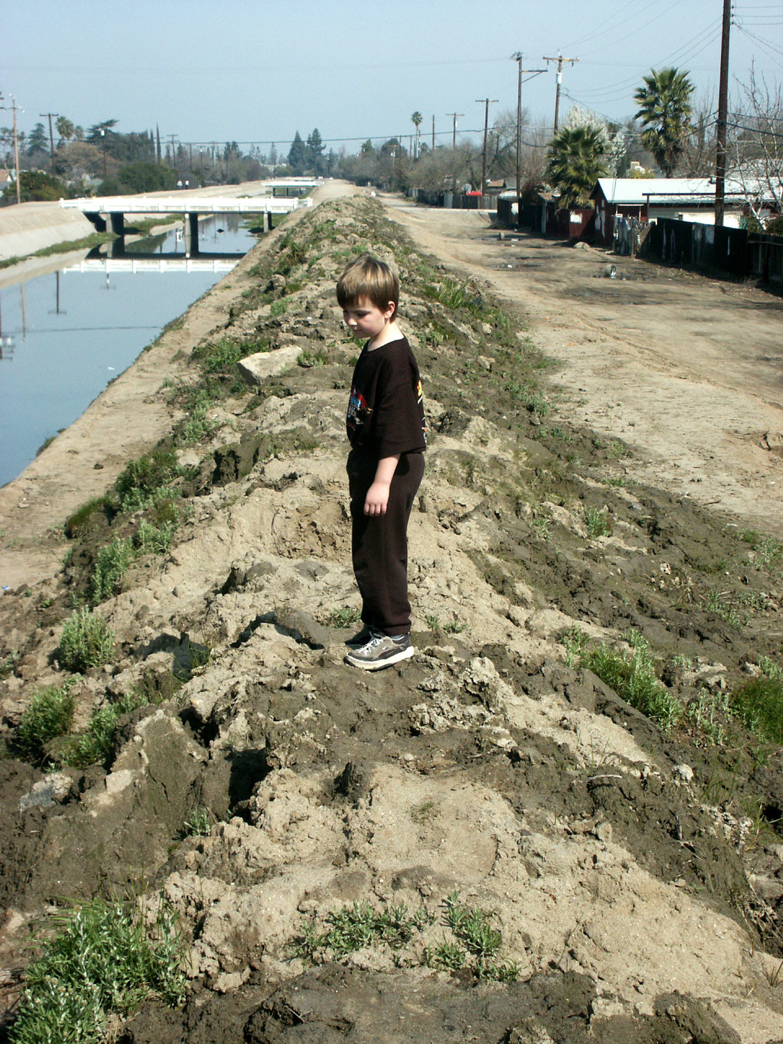
Mikie on the mountain | A place to step with care |
|
 |
 |
| Thrill ride | Weeds along canal in Clovis | A closer view |
 |
 |
 |
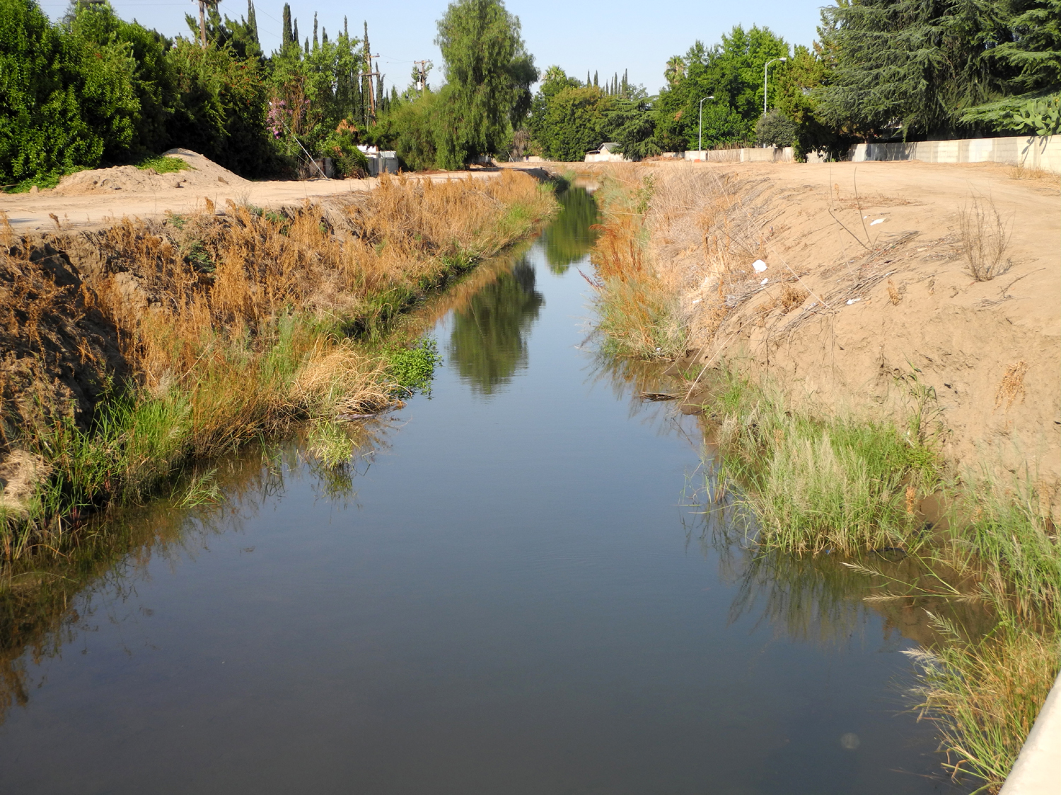
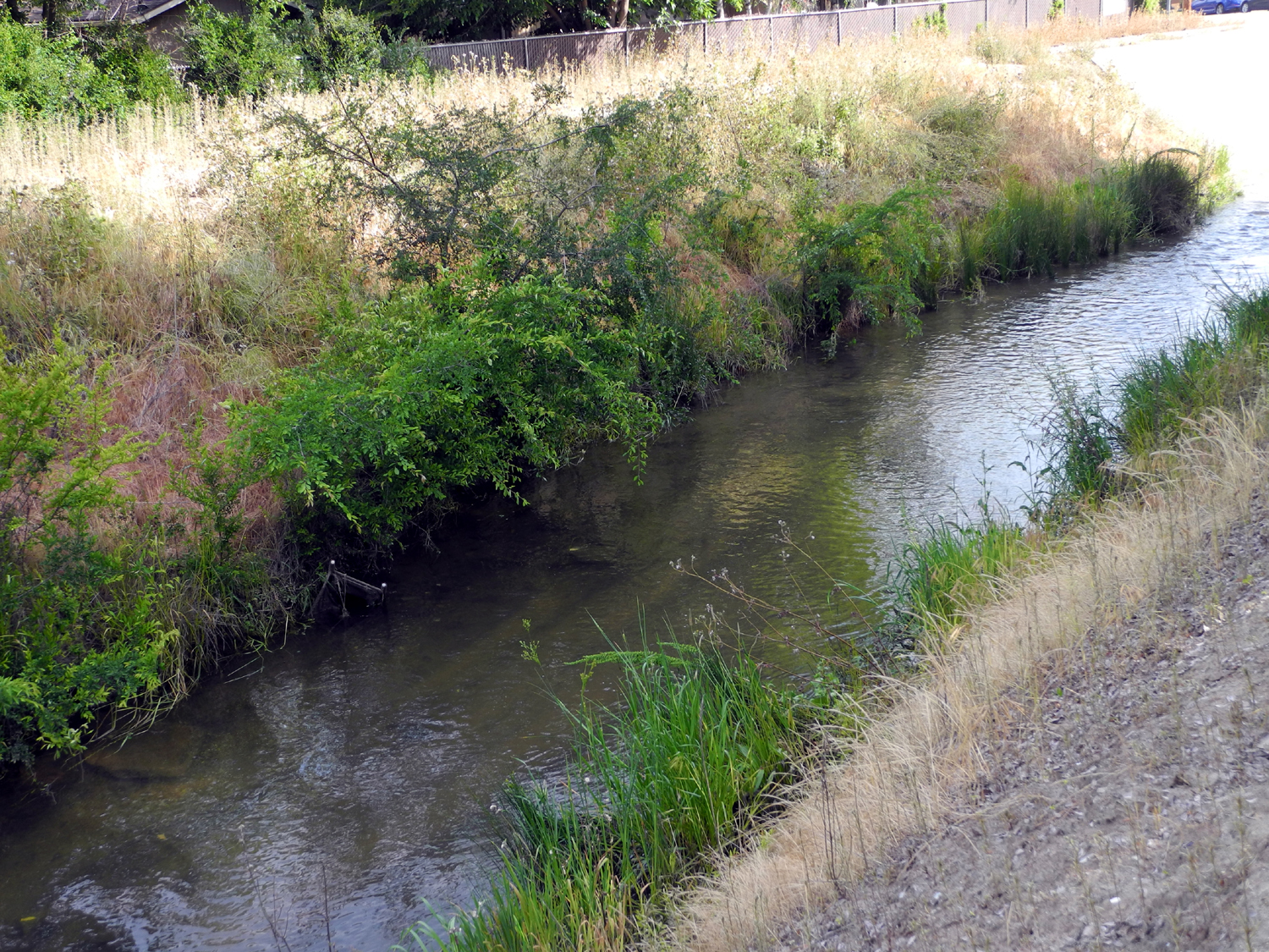
| Pumping equipment | This section could pass for a creek in the country |
But not this section |
 |
 |
 |
| Between Villa and Barstow | Reflections and sand = art |
Residents of the Canal |
 |
 |
 |
| Moving water, always fascinating |
The Enterprise Canal on |
The perfect wall for lizards |
 |
 |
 |
|
There's a green hummingbird |
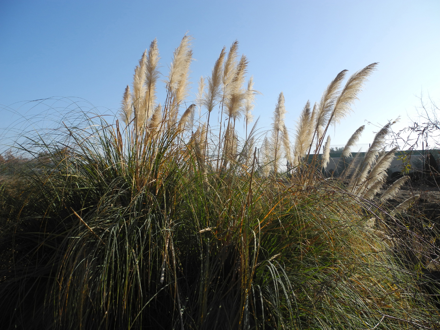
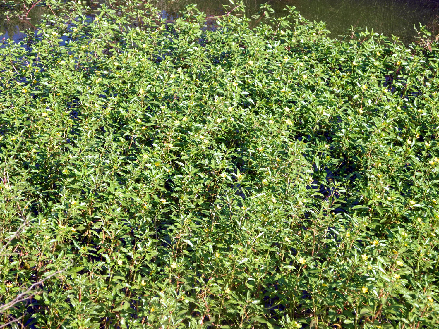
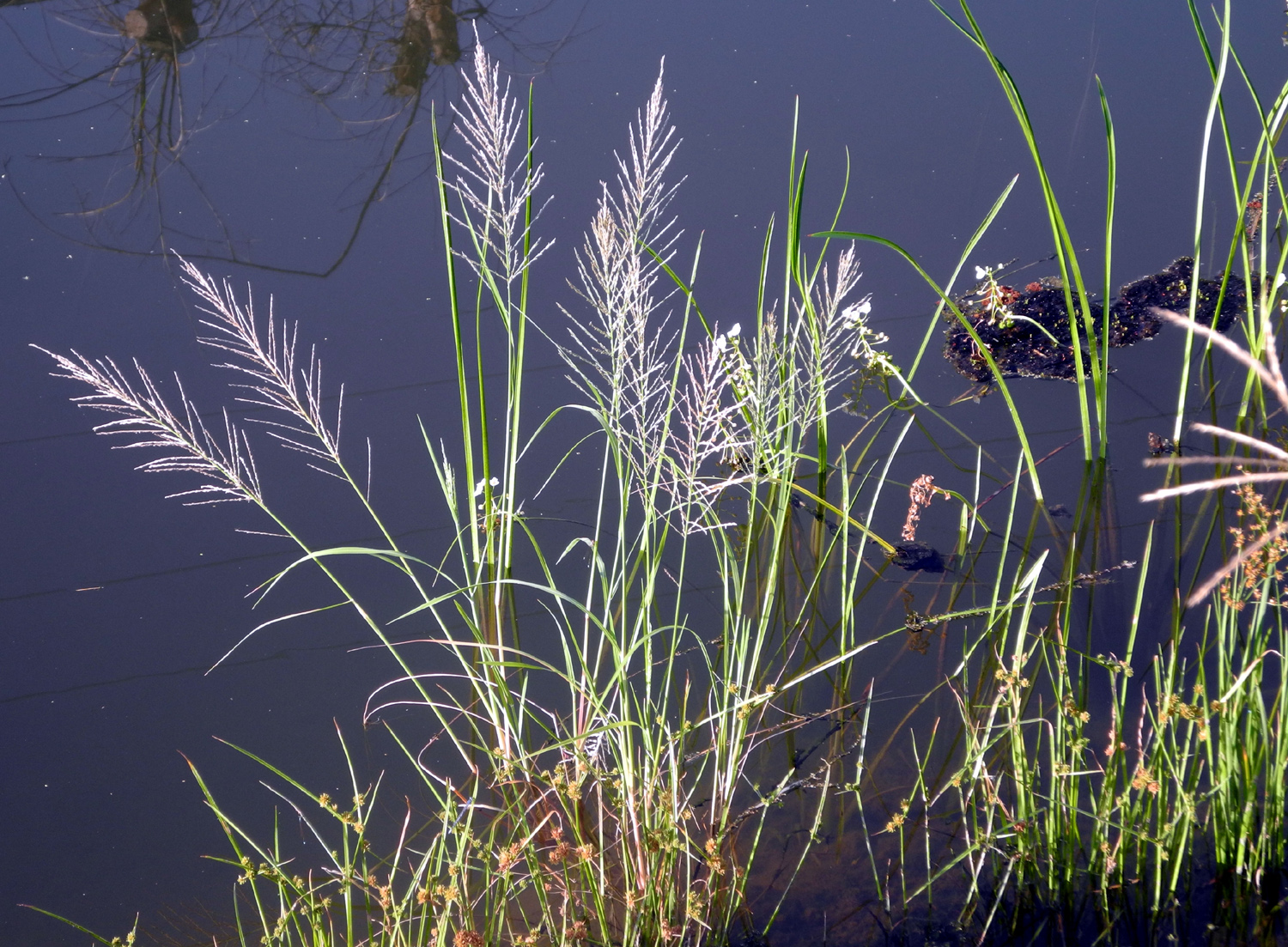
Flowering plants in the canal | A lot of them |
 |
|
 |
|
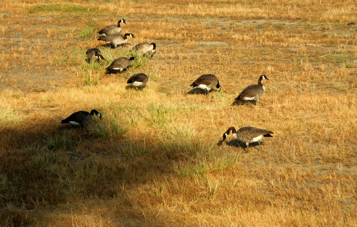
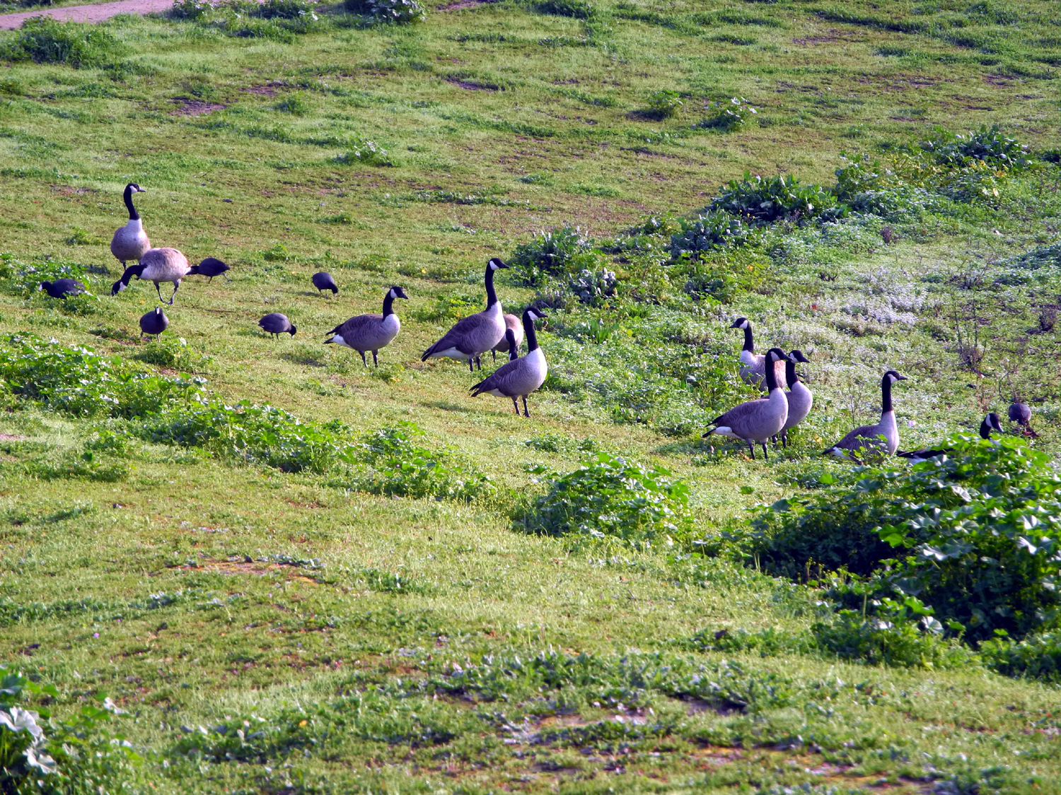
Mother and Father Goose and the kids |
The ducks are very wary of humans |
Old Town Trail Bridge |
 |
 |
 |
|
Nameless
ditch east |
Where my usual Dry |
A few
weeks later, the bushes were cut back severely |
 |
 |
 |
|
Where the canal runs |
Part of the canal runs along Letterman Park |
If you're lazy or
tired, you can |
 |
 |
 |
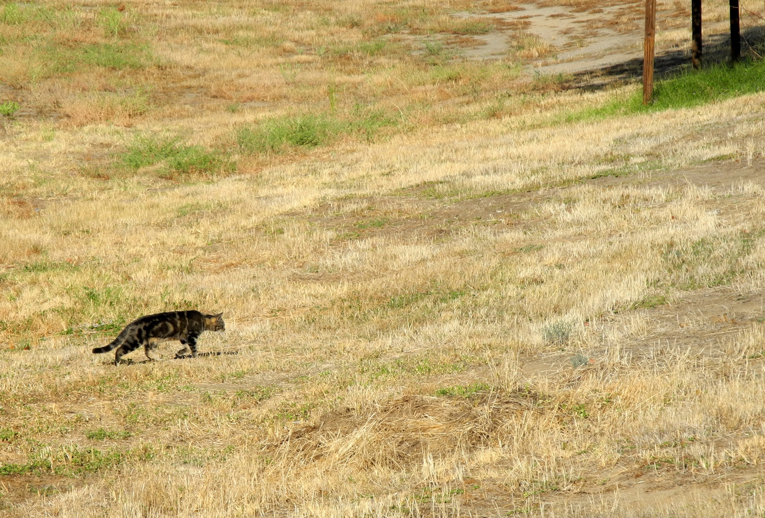
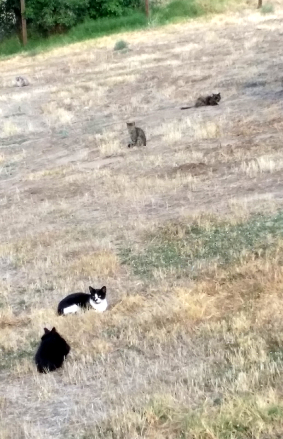
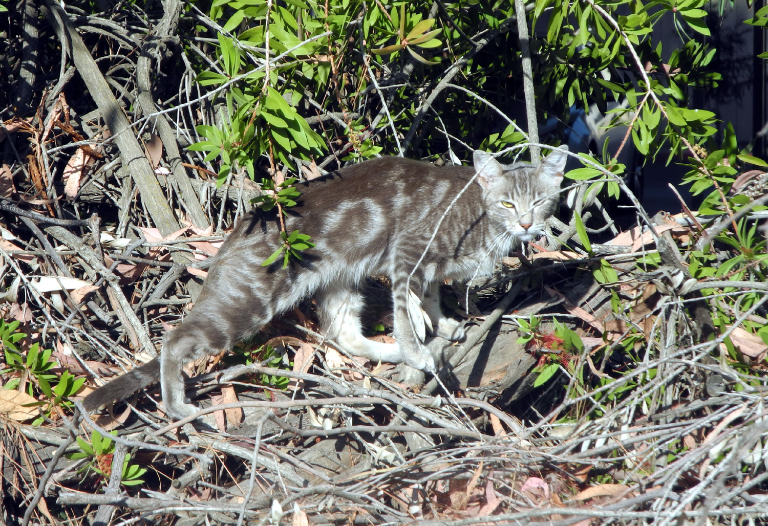
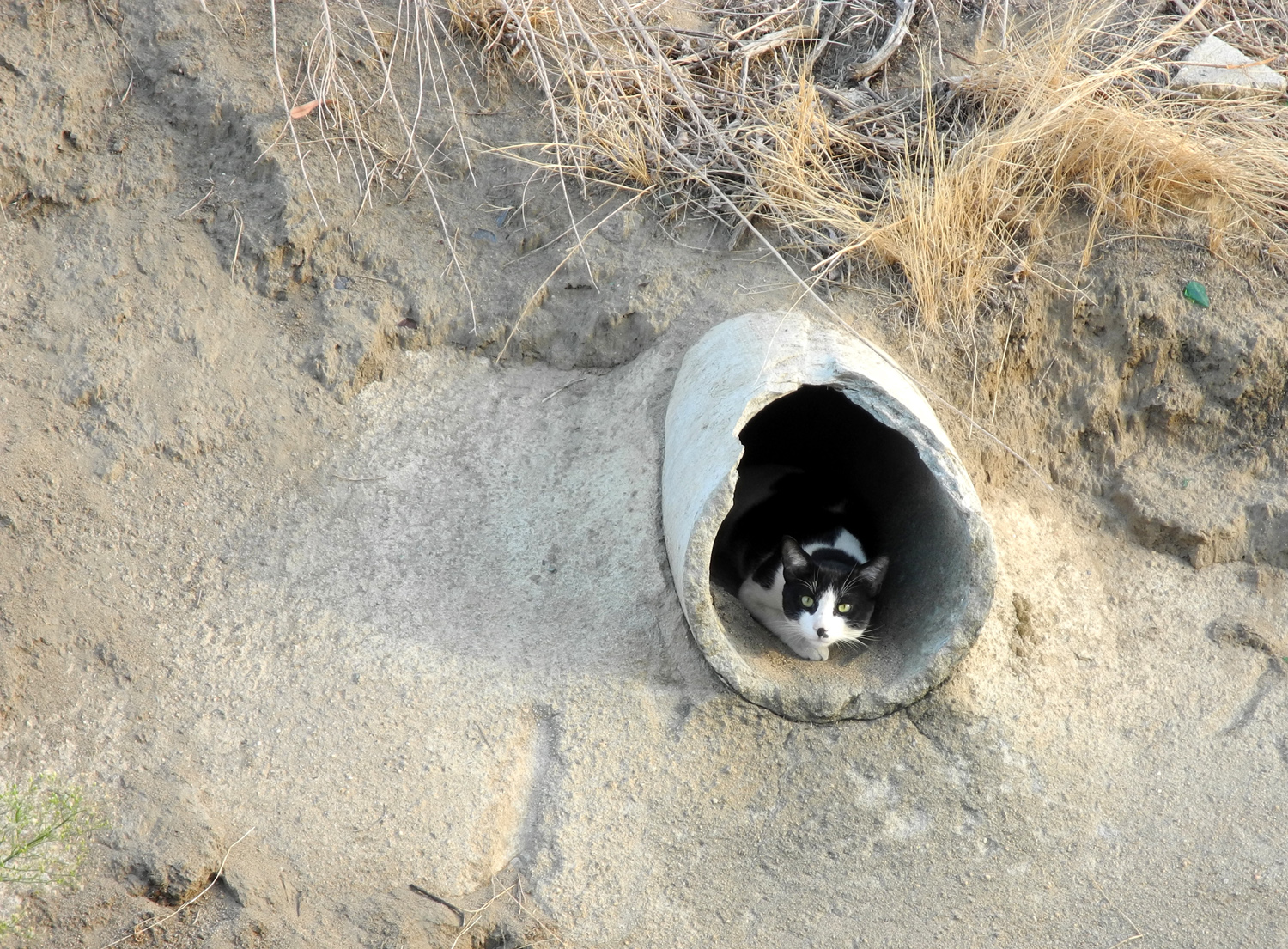
| Feral cat watches canal walkers, keeps an eye on the flood basin, and still sleeps 18 hours a day |
Moon flowers in flood basin |
Where the
Helm Canal |
 |
 |
 |
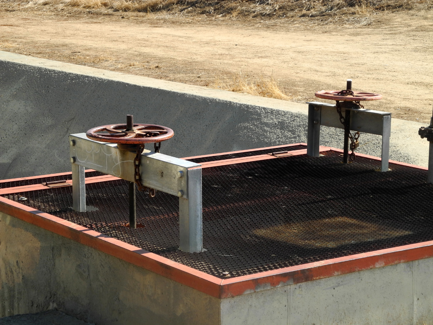
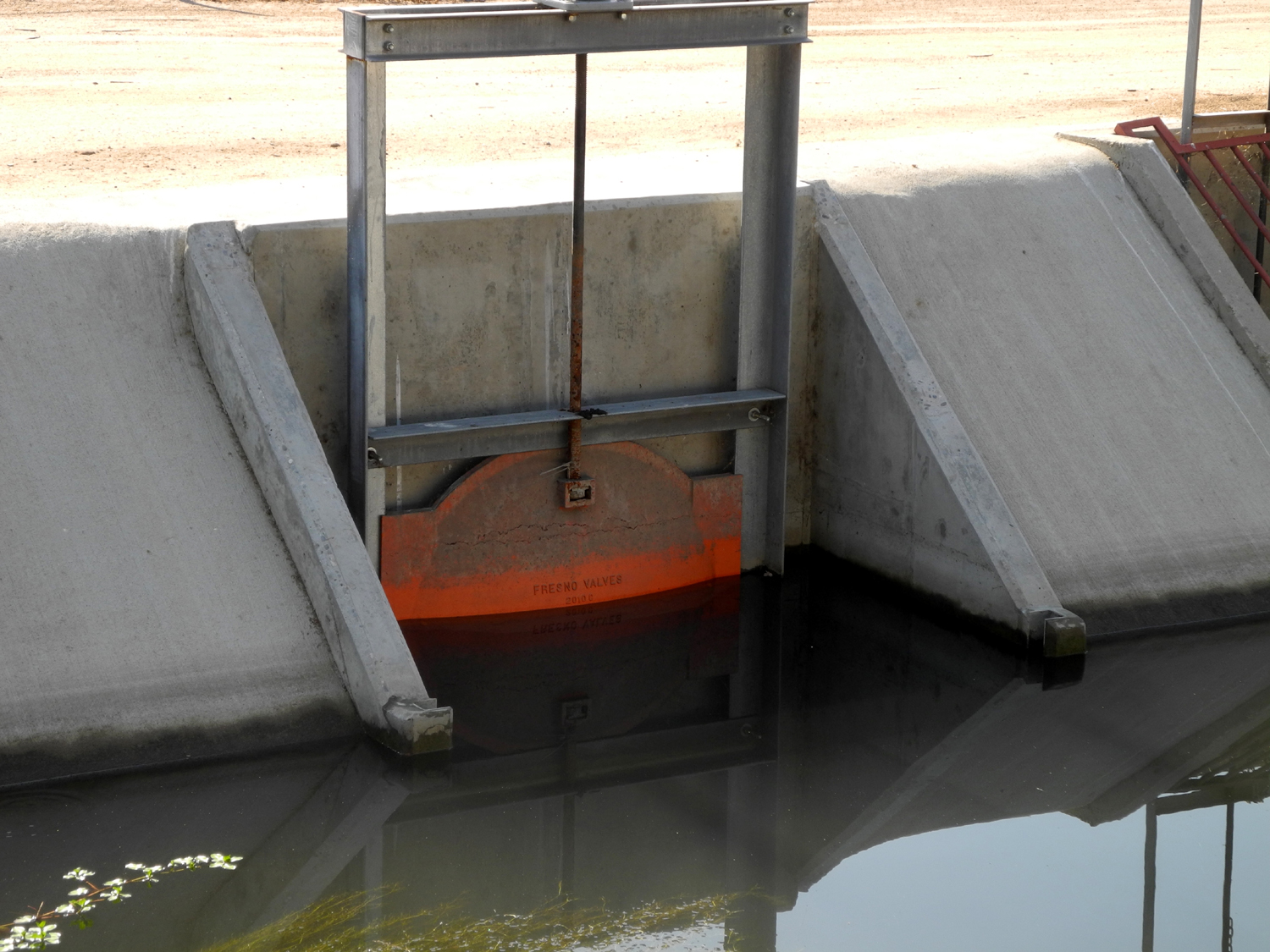
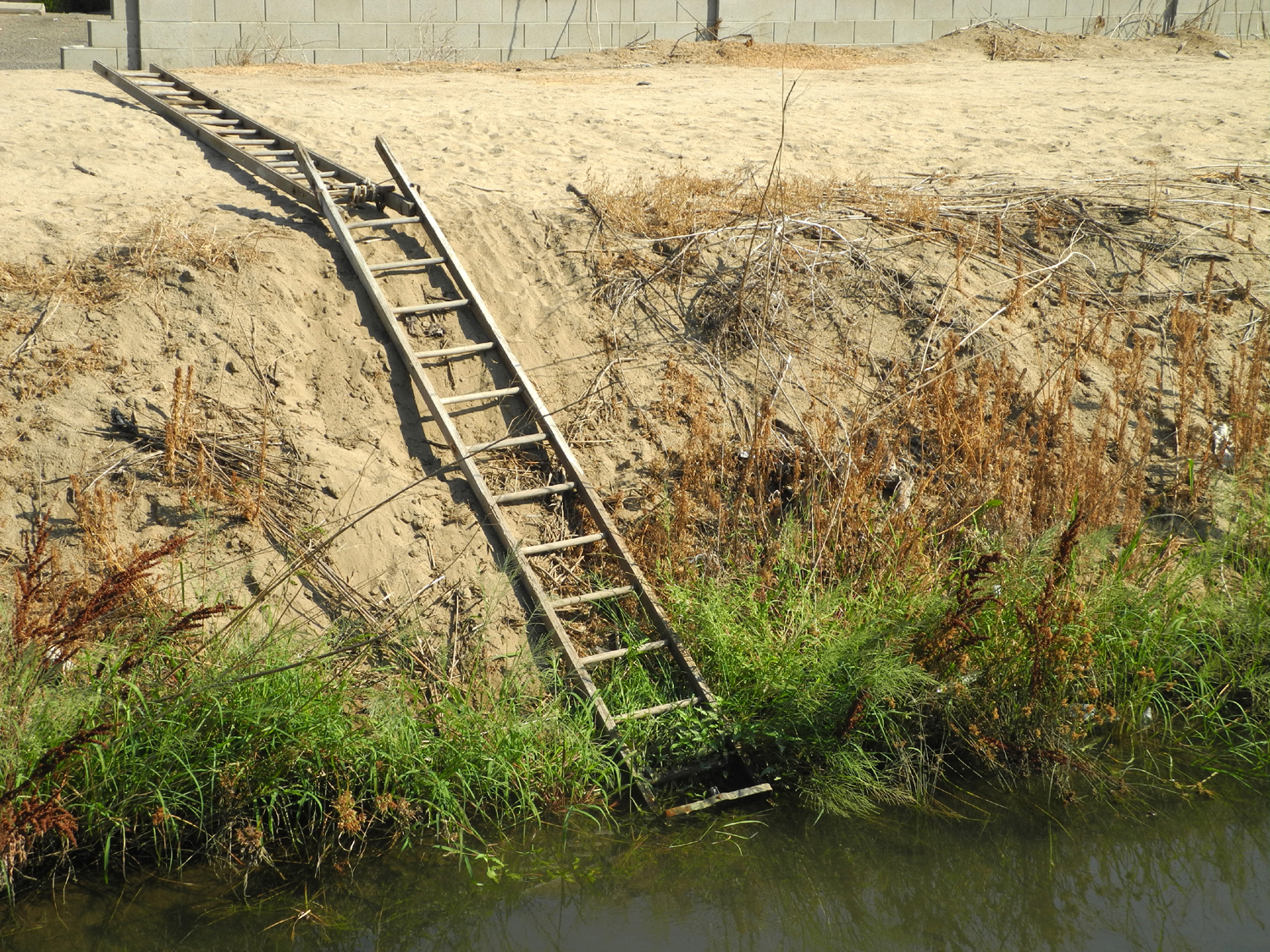
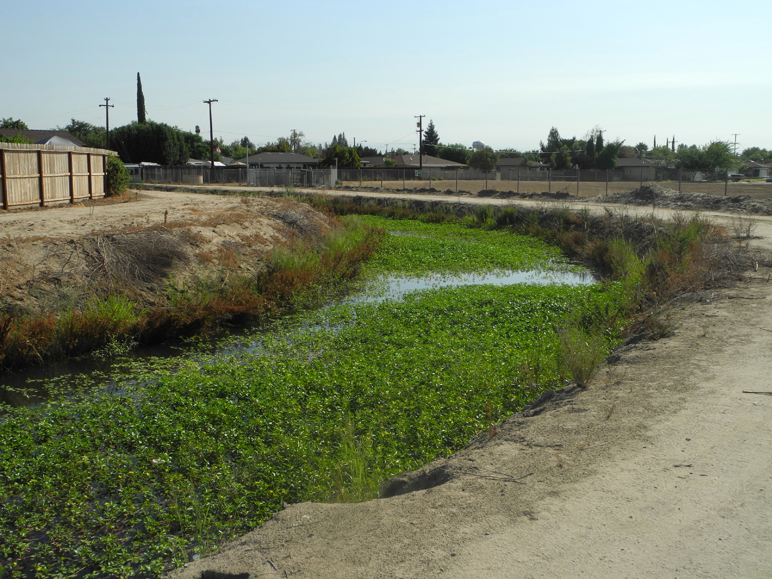
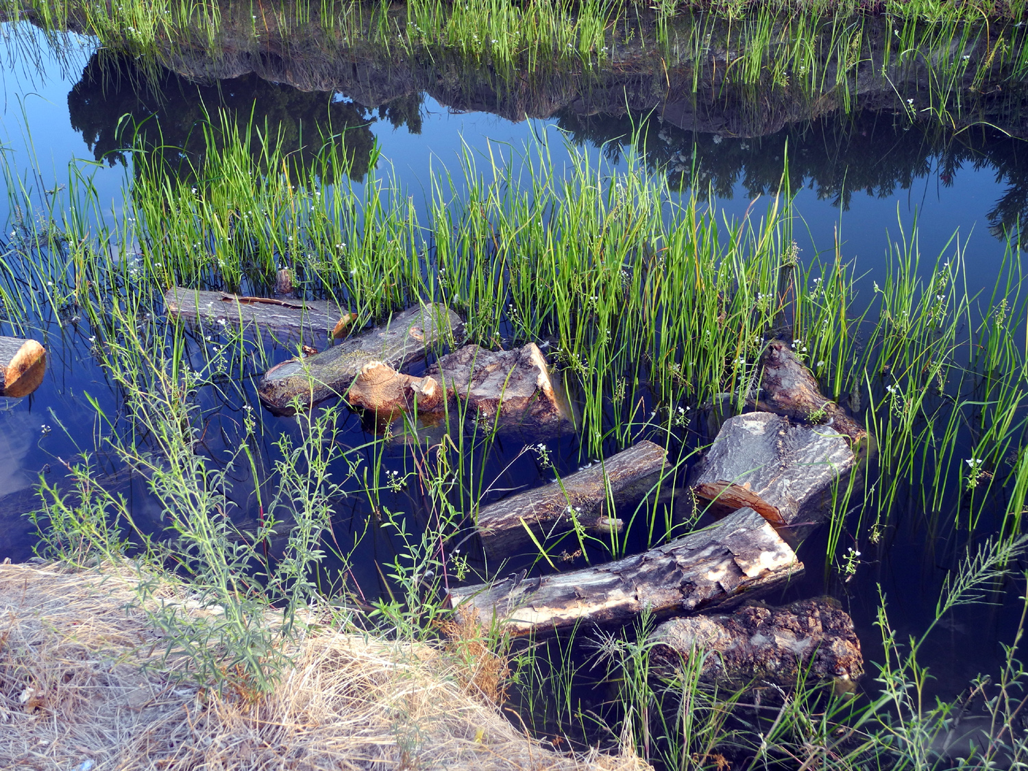
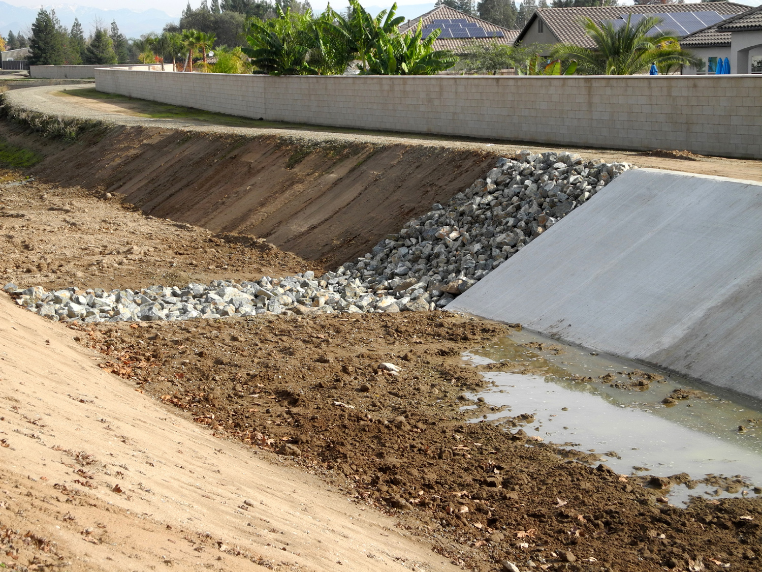
| Valves to control water flow | Escape route | A very small amount of dirt taken out of this canal |
 |
 |
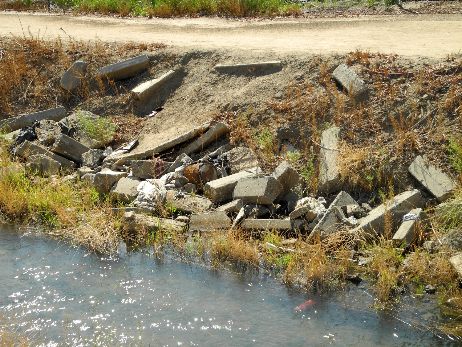 |
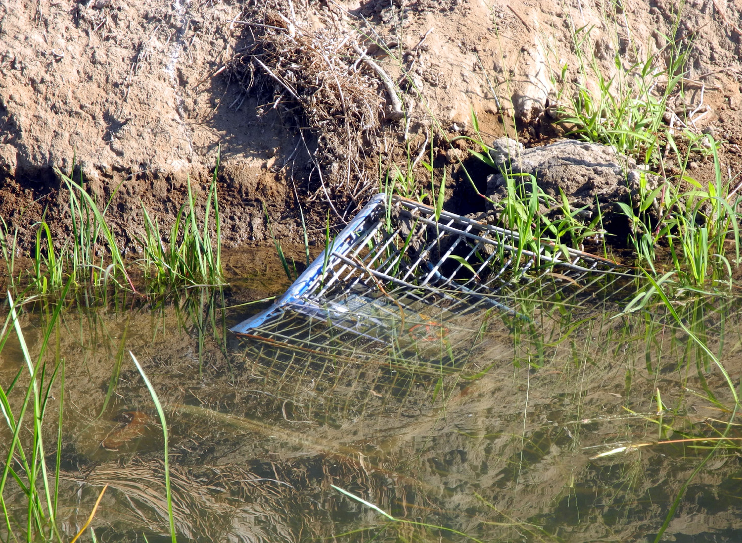
| That's not natural | Yard sale? No, discard pile | Concrete graveyard |
 |
 |
 |
|
Trash piles up where
water |
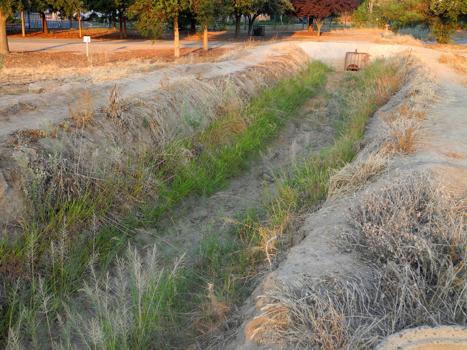
Lots of green in a very dry year |
How
the same section |
 |
 |
 |
| At the wall, the canal goes into a pipe and further access is blocked |
We move closer |
This is what's on the other side of the wall |
 |
 |
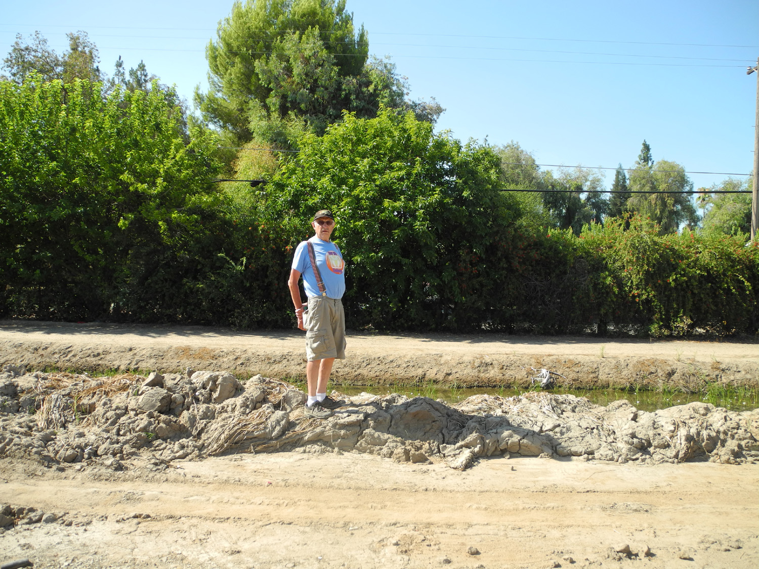 |
| Heading east on the Helm Canal... | ...and around the bend | Dick on a small canal mountain |
 |
 |
 |
|
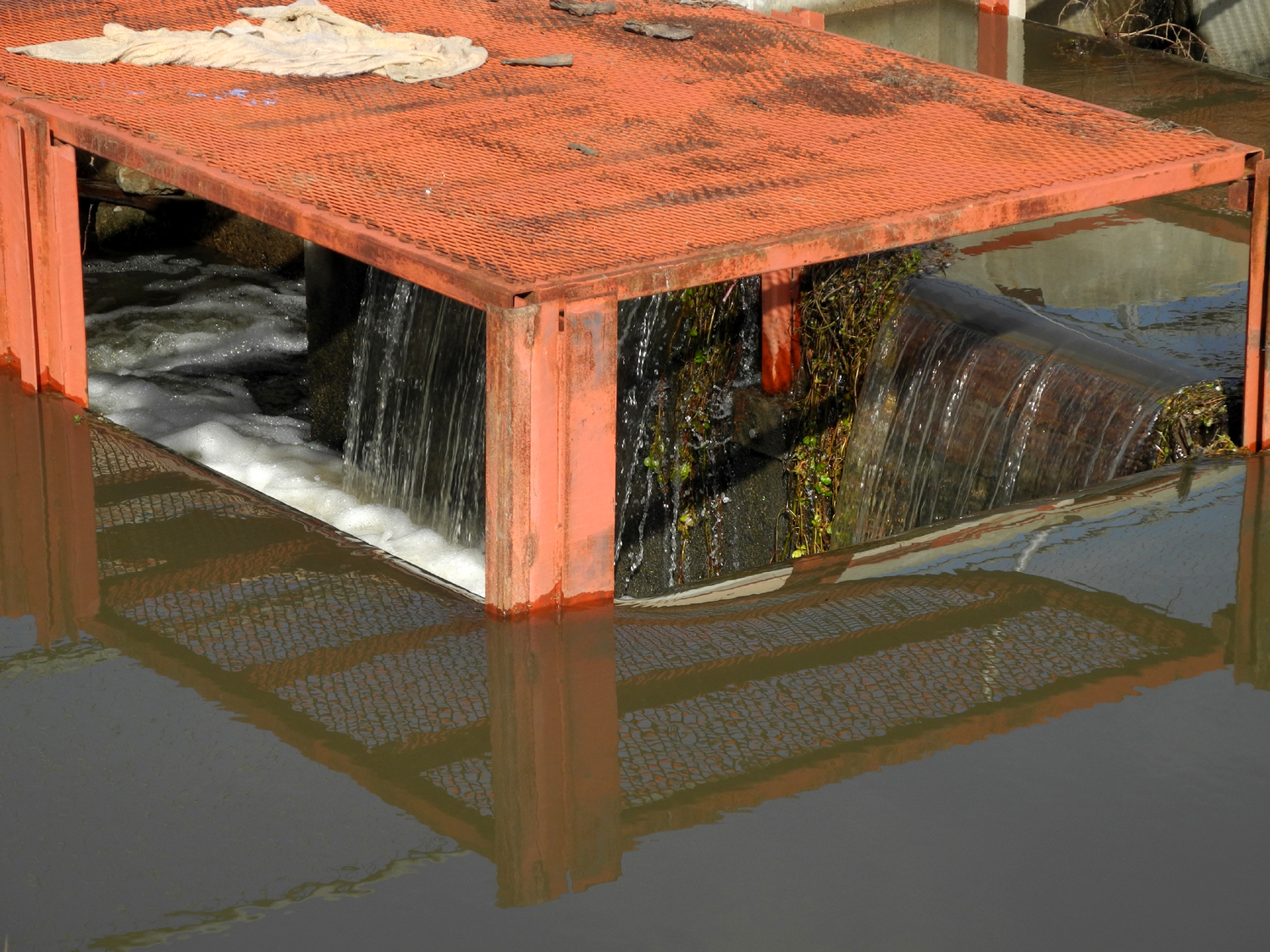
Pipes. electrical panels and other artifacts |
Don't stand too close when photographing the ant hill |
There are things unseen |
 |
 |
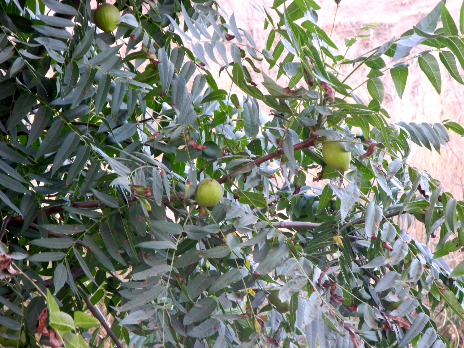 |
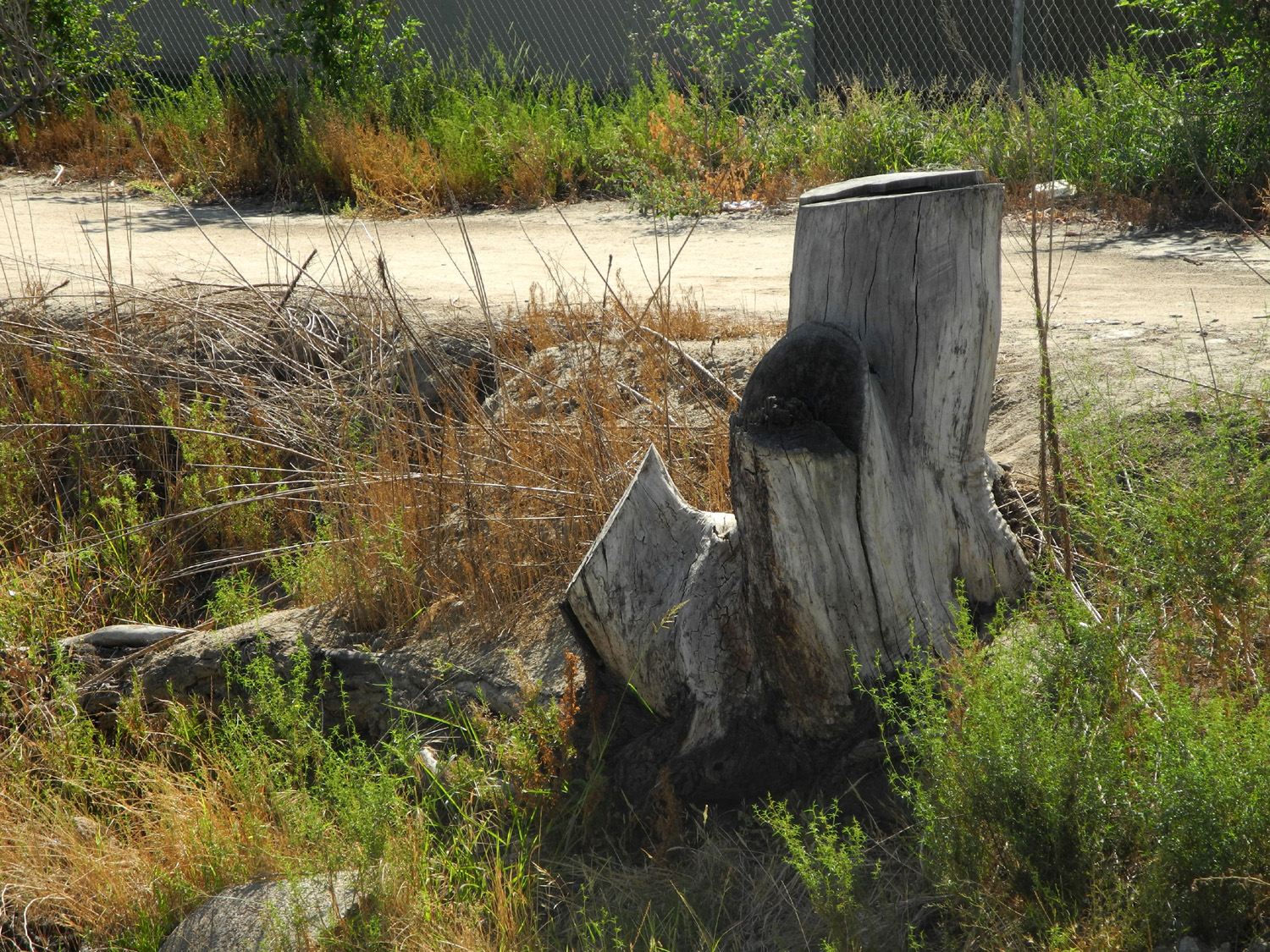
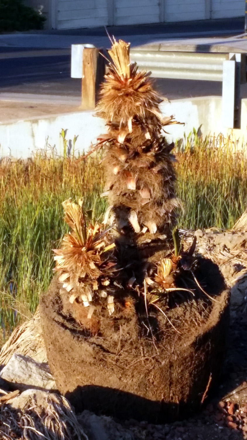
| Stump from black walnut tree | This stump refused to die | It's even producing nuts |
 |
 |
 |
|
Dry Creek canal east of |
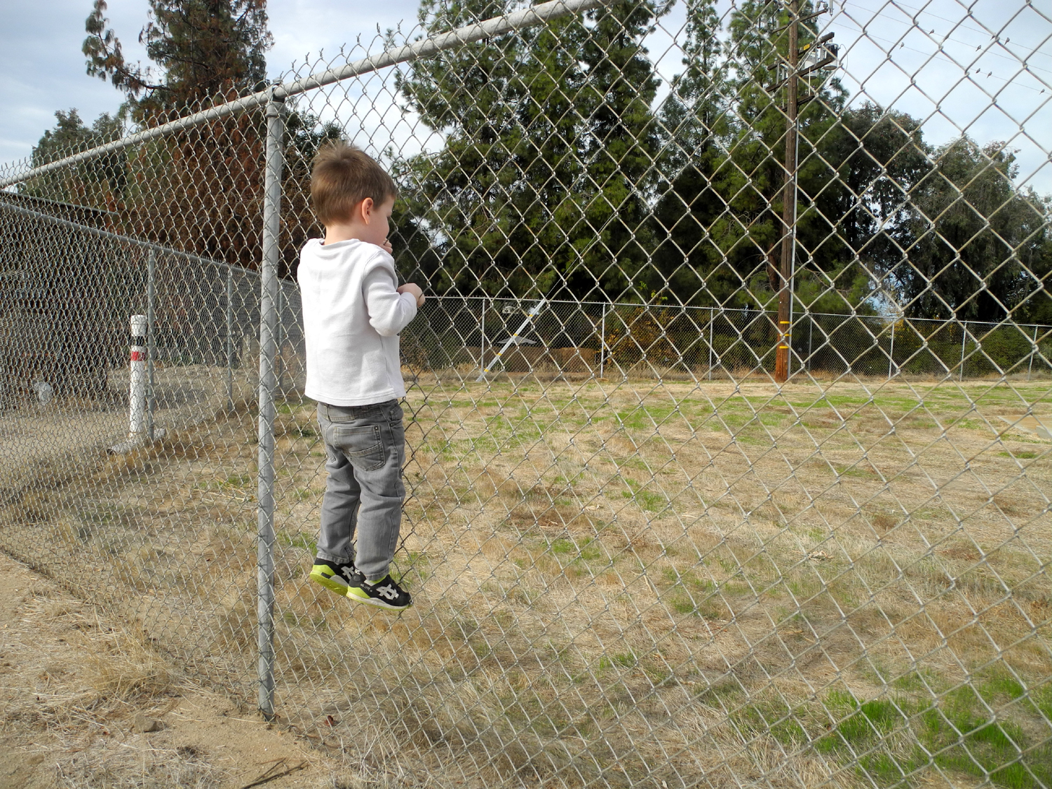
It wouldn't be hard to bypass the barrier... |
...but you might get in trouble! |
 |
 |
 |
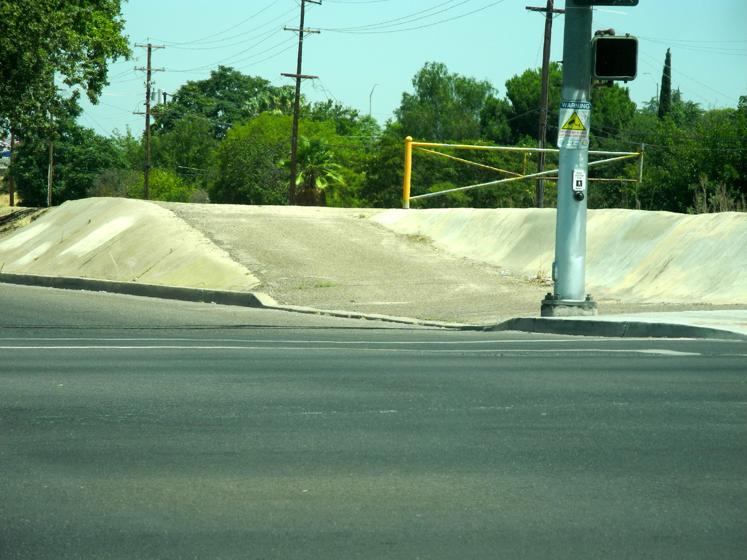
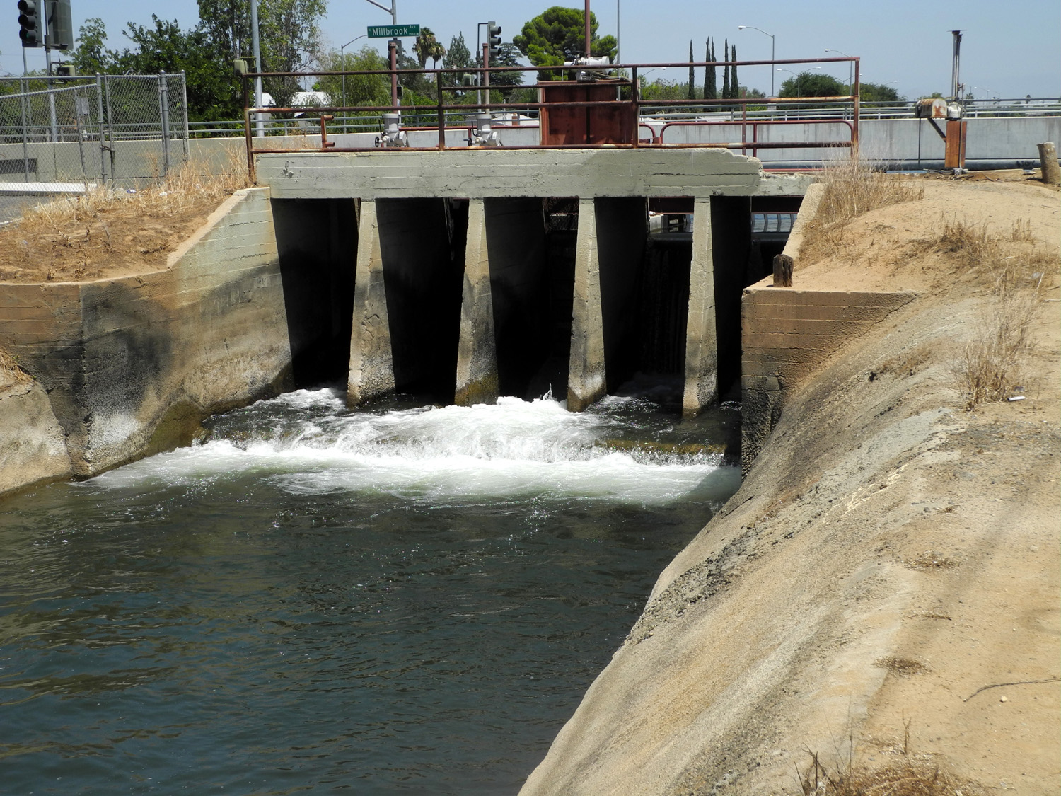
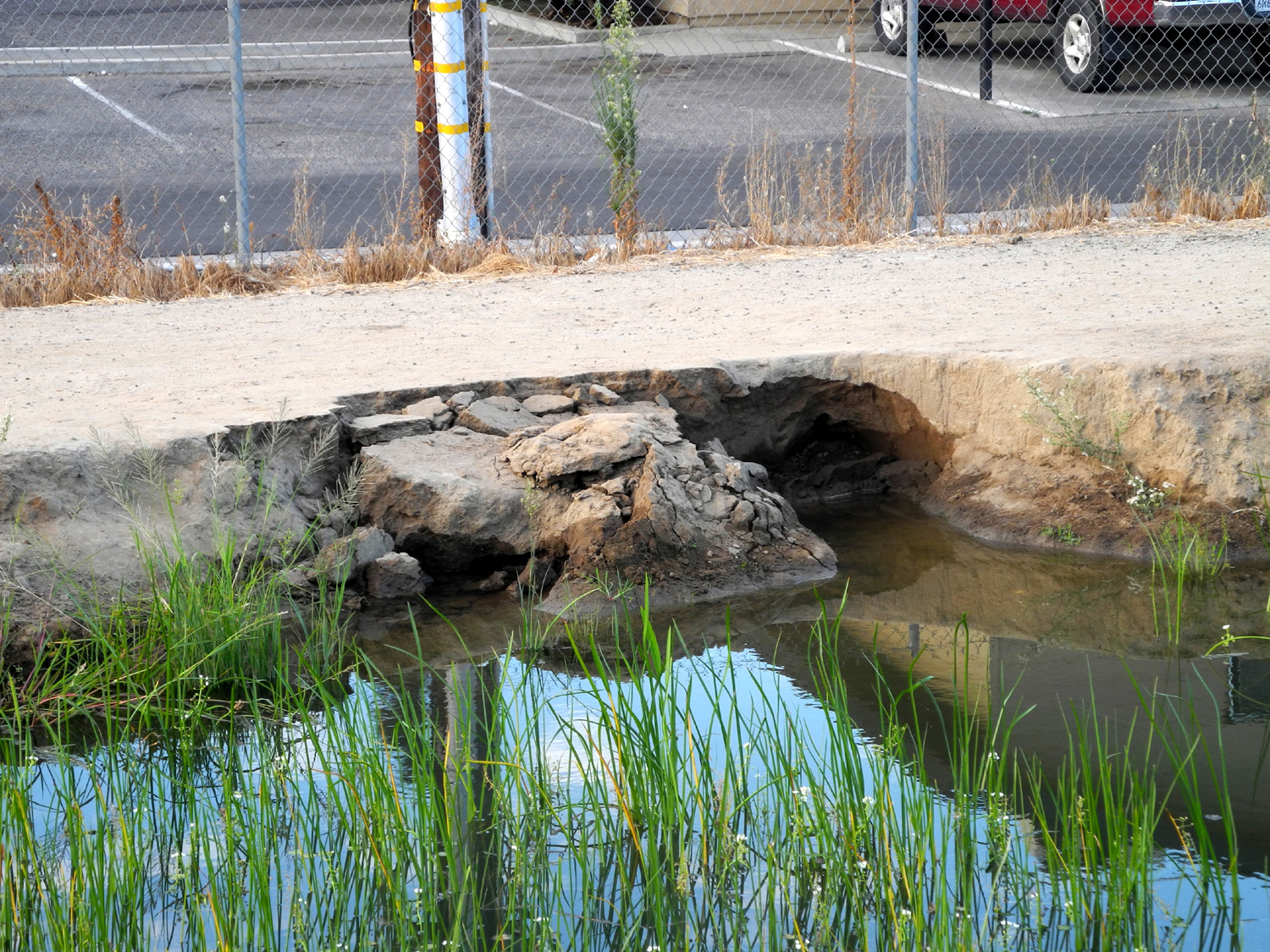
| Where the
Herndon canal runs under Michigan Avenue near Millbrook |
Looking north from Michigan | Where the Tank People lived |
 |
 |
 |
| The junction at McKinley; Mill Canal
flows west with the other canal heading north |
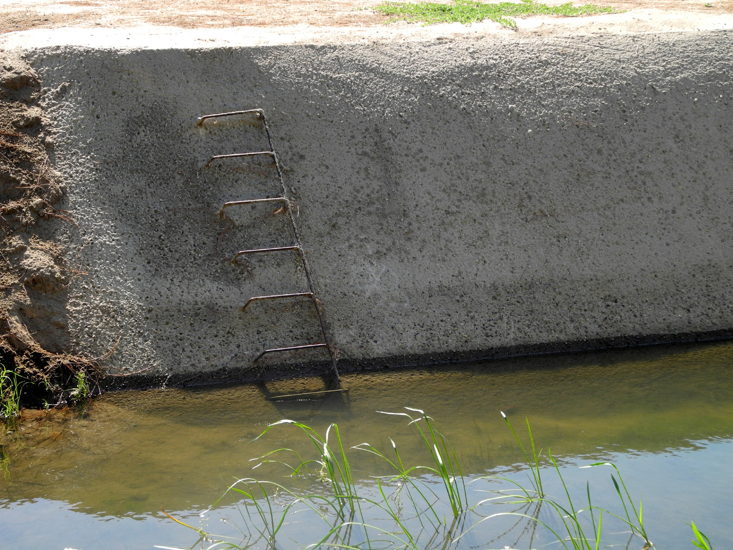
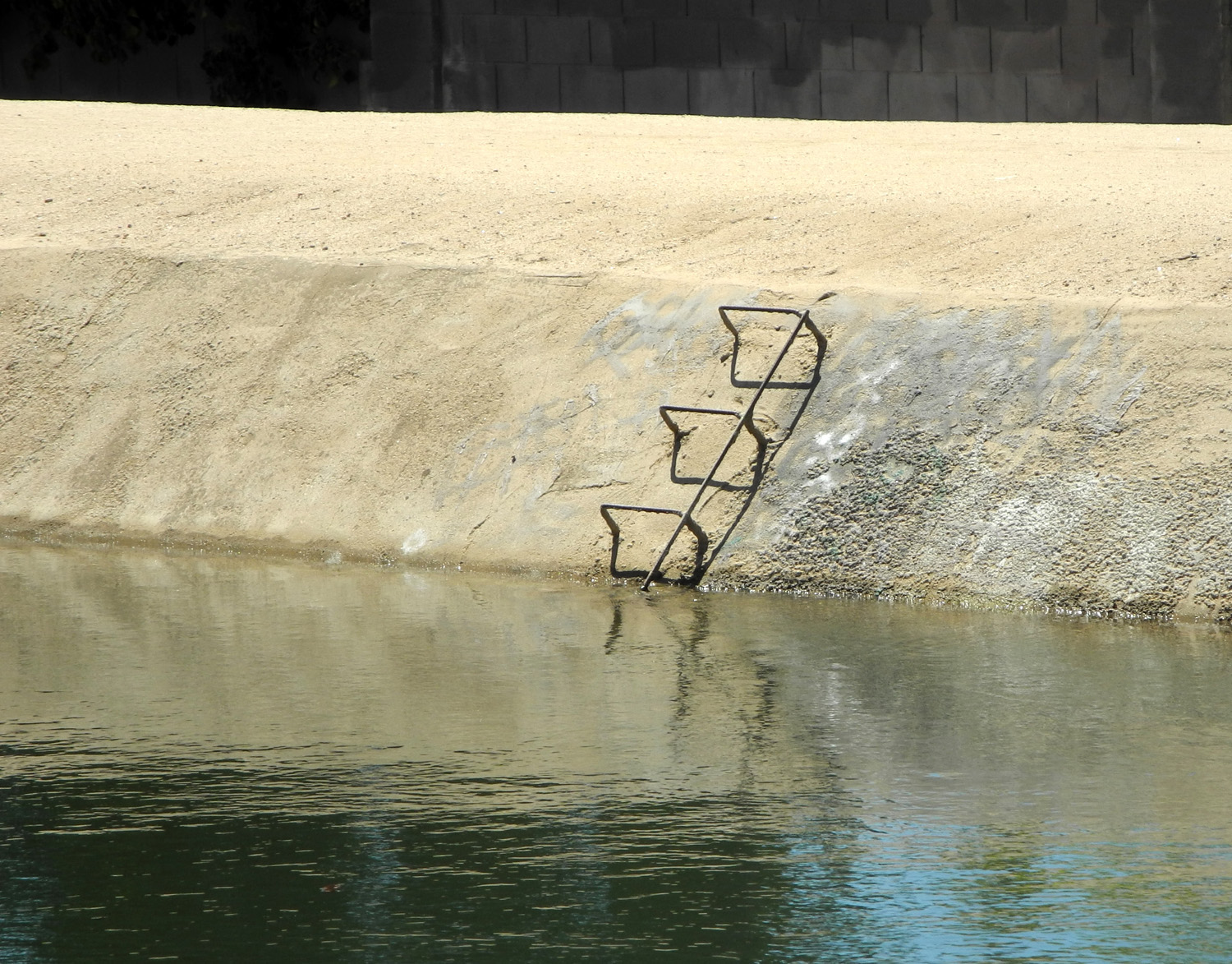
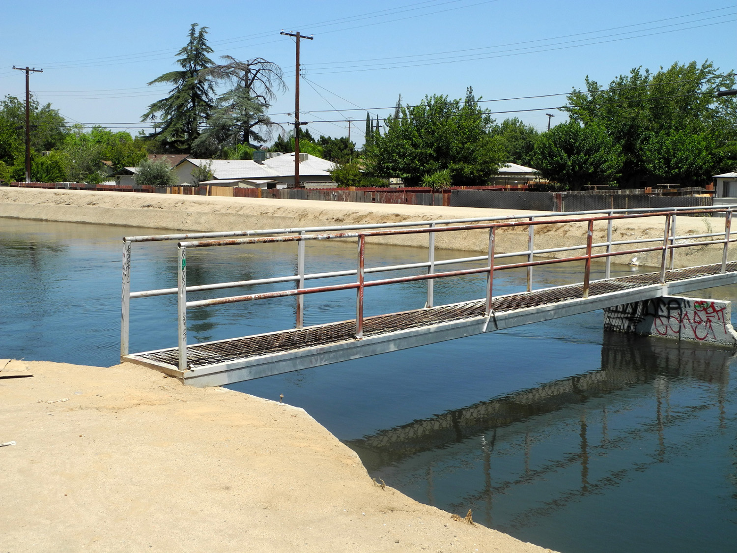
Ladder in the canal near Michigan | The foot bridge near McKinley |
 |
 |
 |
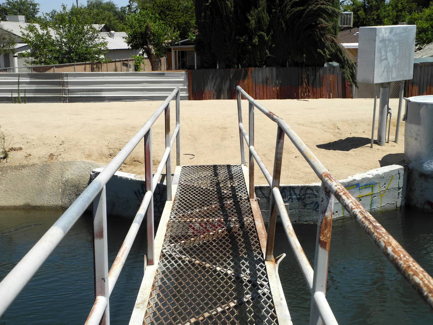
| Getting ready to cross |
The view north from the |
Road access to the
canal |
 |
 |
 |
| Rest stop on the Clovis Trail where Dry Creek comes in |
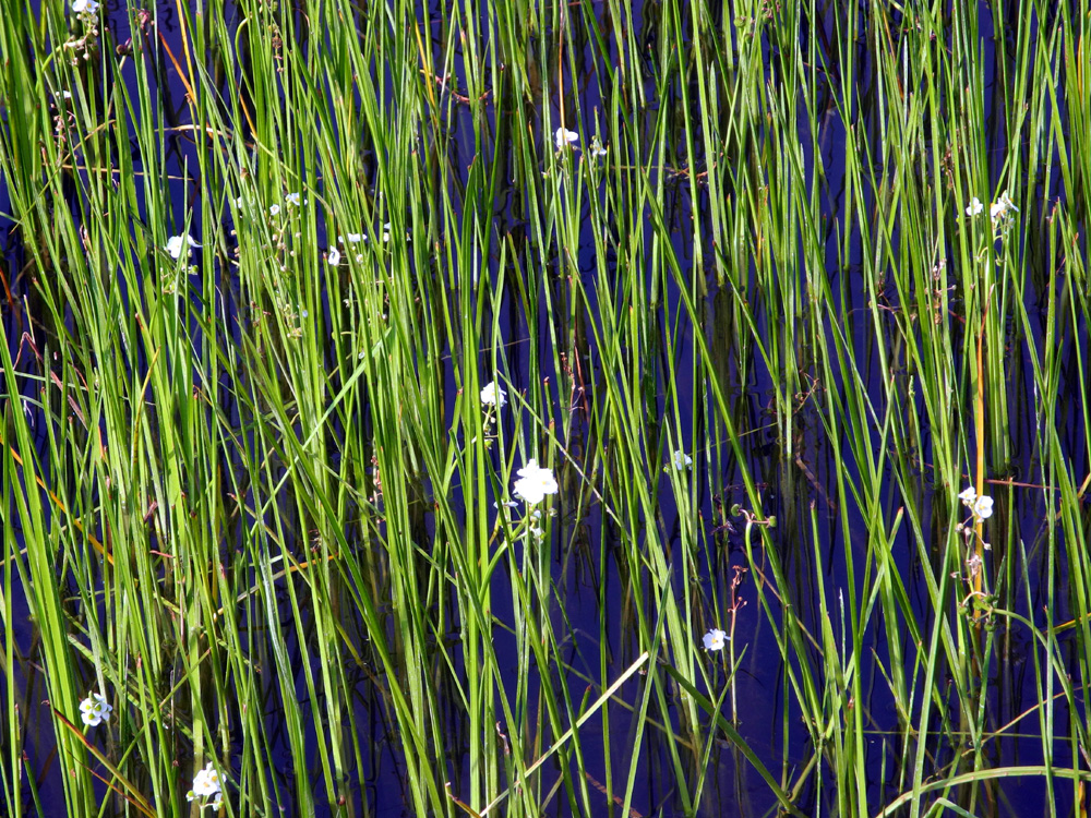
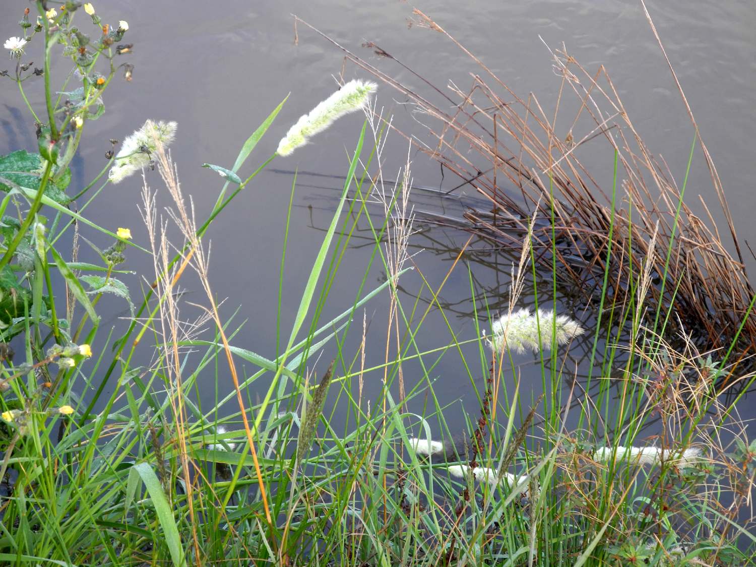
Exotic grass on the bank |
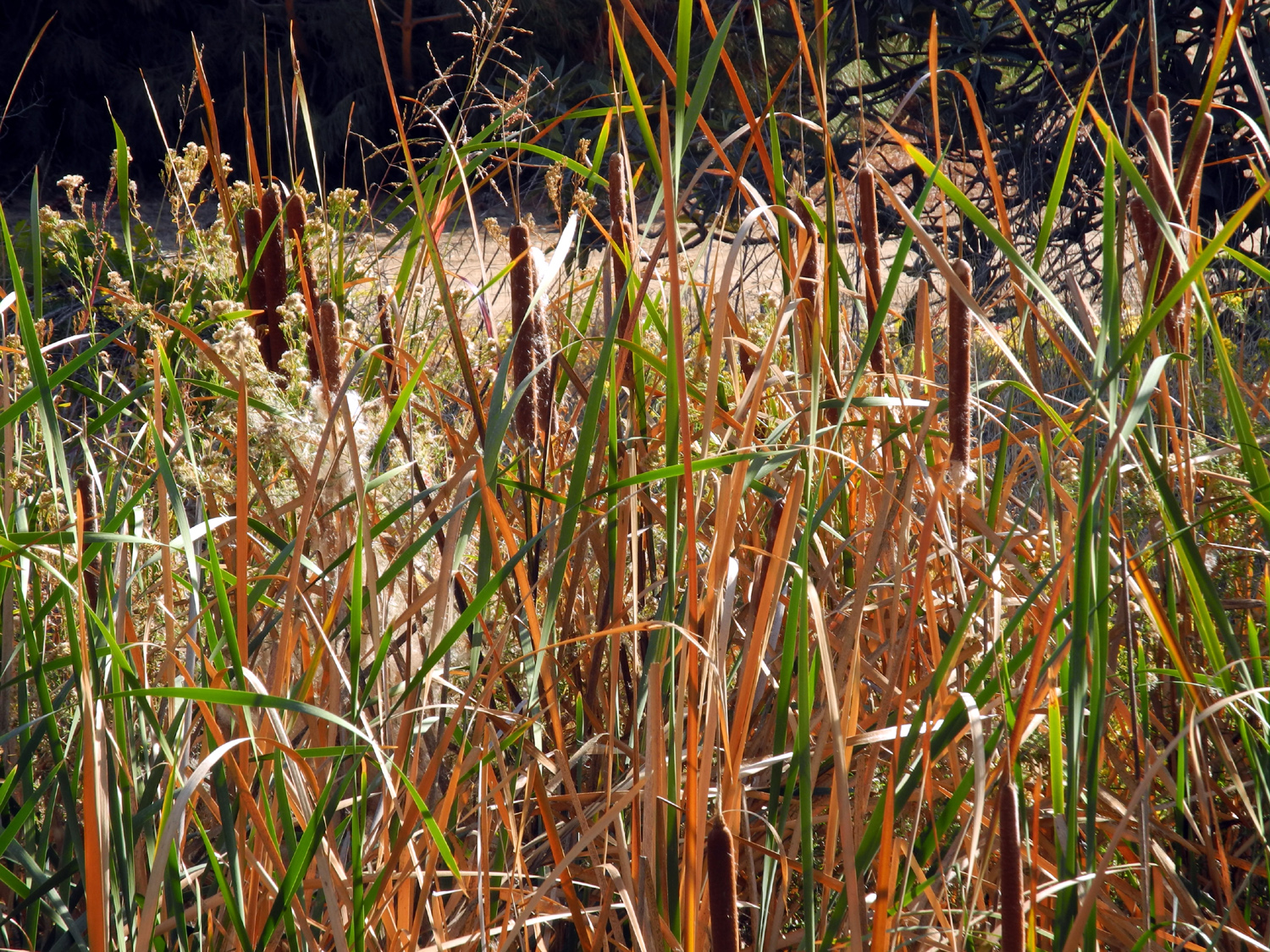
Cattails by Dry Creek (Old Town Trail) |
 |
 |
 |
|
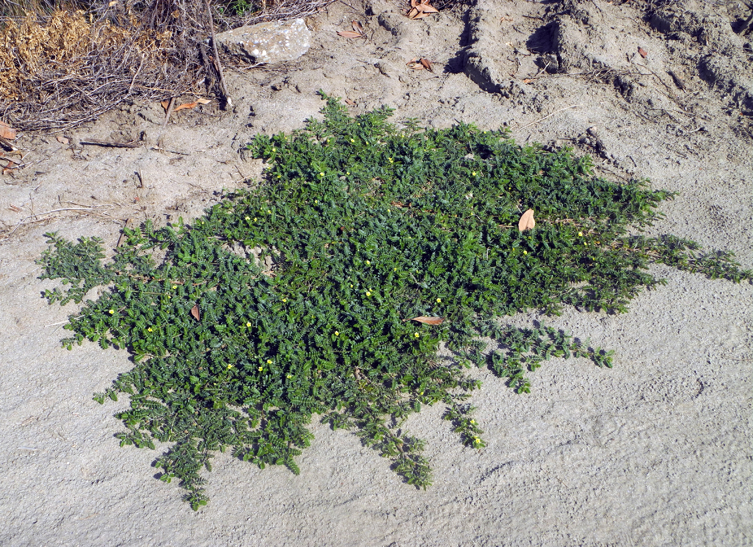
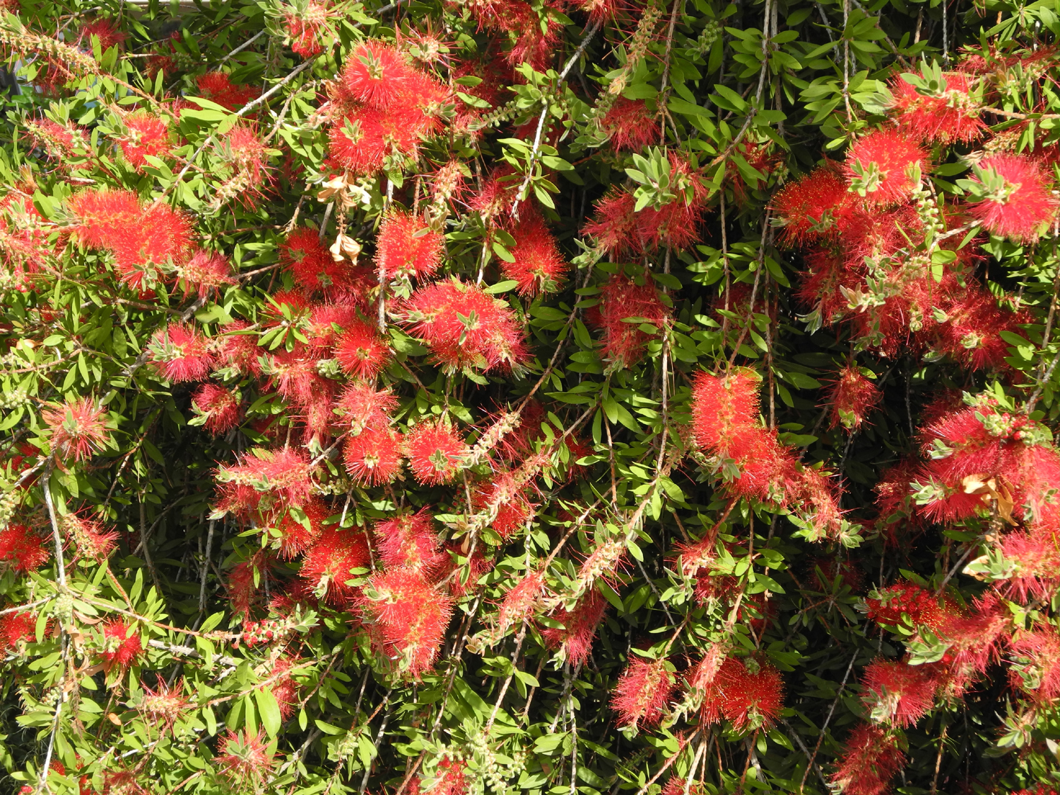
Puncture vine, four feet in diameter |
This one has gone to seed | The Helm Canal where it crosses Barstow Avenue |
 |
 |
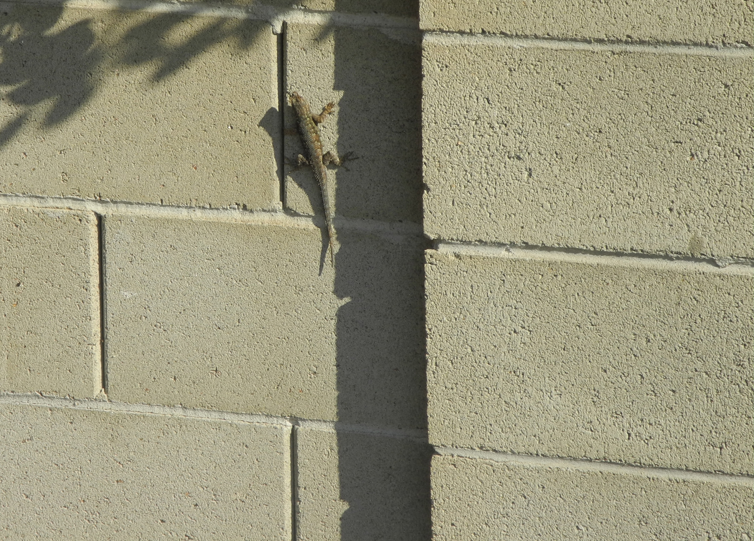 |
| Dry Creek canal south of Barstow | A wall that lizards love | And the lizard that loves it |
 |
 |
 |
|
Discarded cactus clippings sprout anew |
An extremely dead fish | Underwater plants |
|
 |
 |
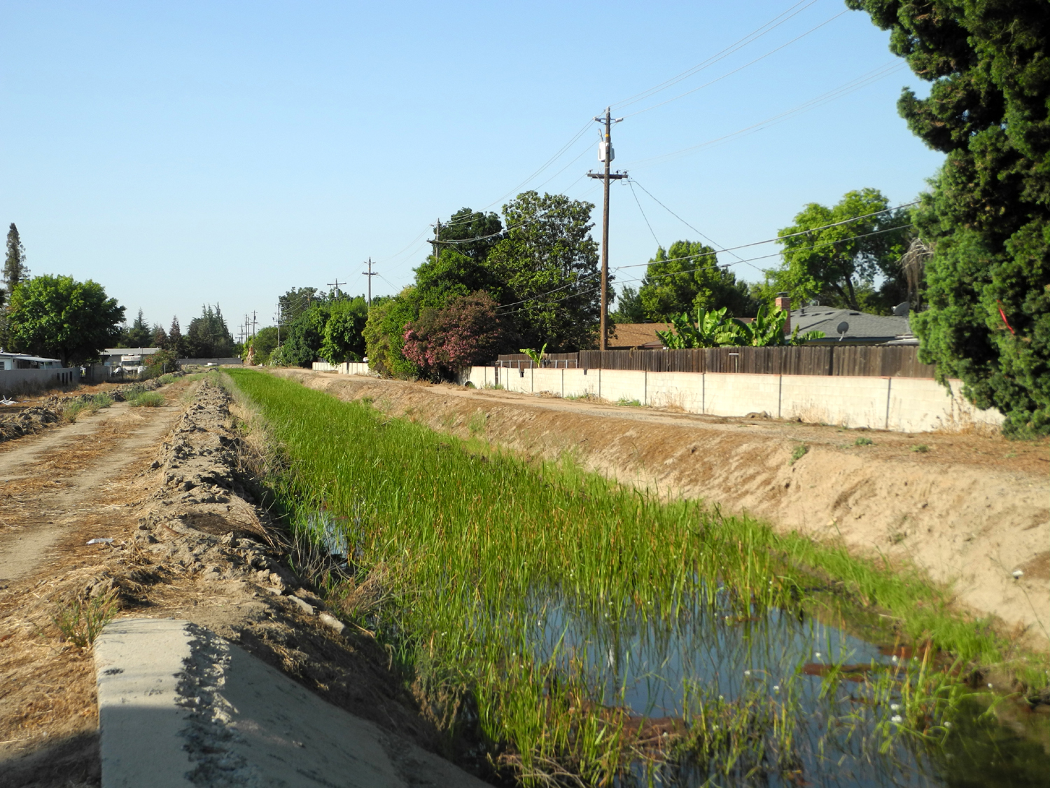
| A scene of tranquil beauty | Water gate on Dry Creek |
Where Dry Creek crosses Willow Avenue |
 |
 |
 |
| This ladder was NOT placed by the irrigation district |
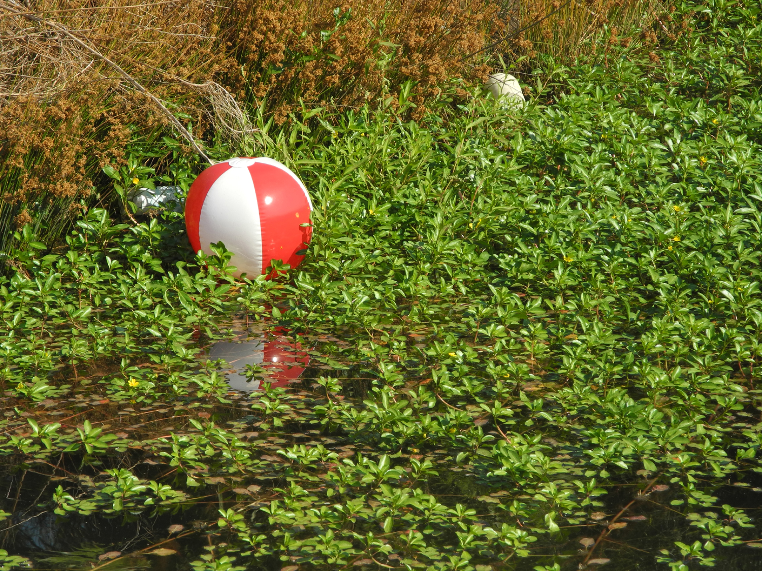
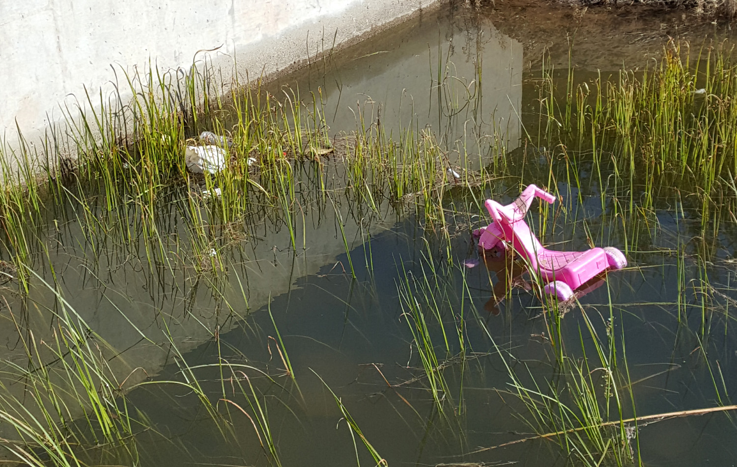
Is this a canal or a lawn? | Anyone missing a beach ball? |
 |
||
| Geese in a nearly dry flood basin | ||
 |
 |
 |
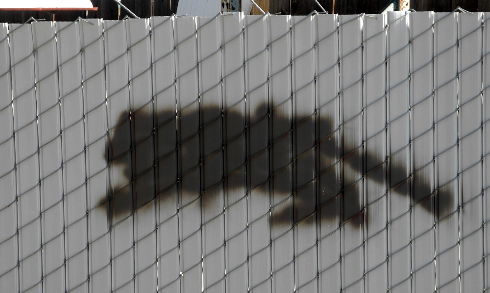
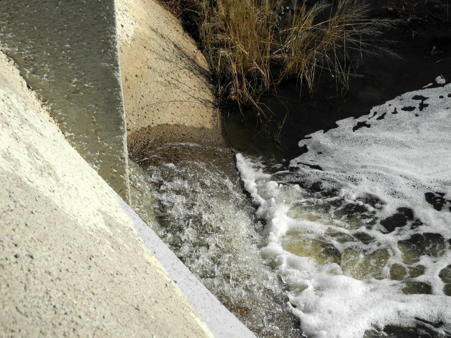
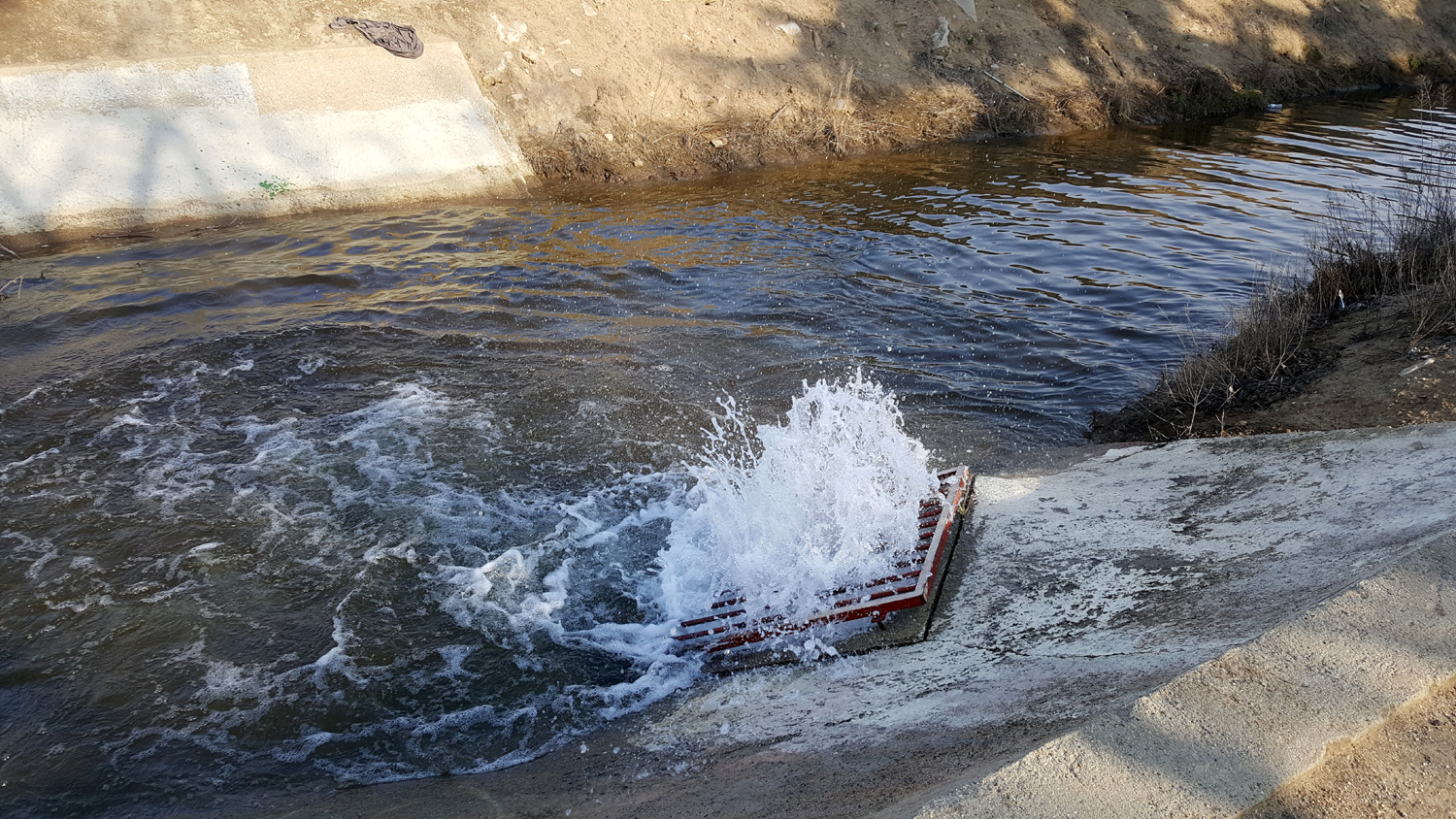
| "Rapids" at McKinley junction | Back in the day we trespassed and loitered to our heart's content |
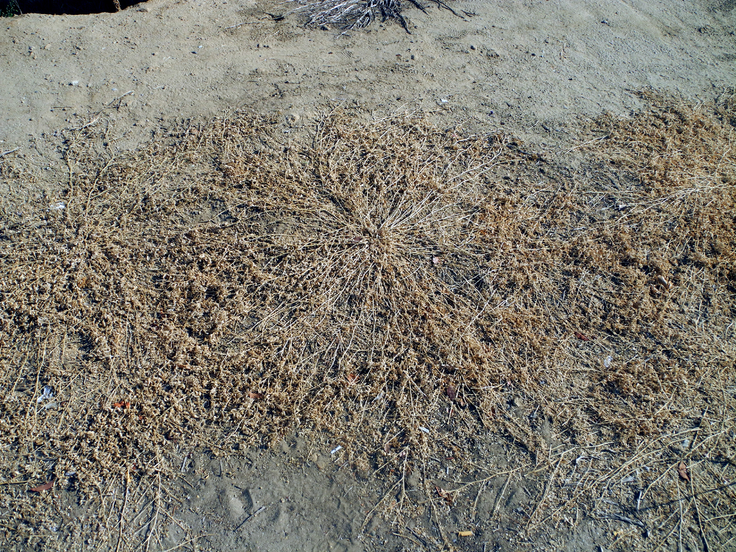
Puncture vine -
beautiful |
 |
 |
 |
|
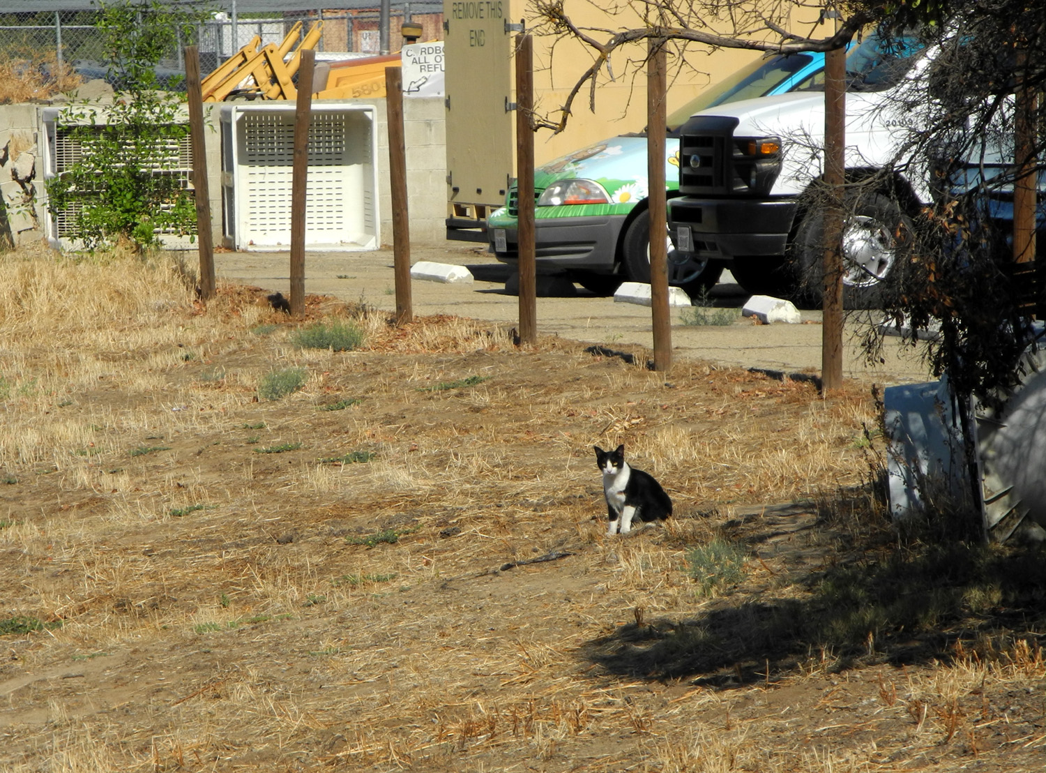
Cat in the flood basin |
Five cats in the flood basin | Three more cats |
 |
 |
 |
| A memorial to Nakita |
A month later, only the cross remains |
Later the cross was stolen,
and replaced with this one. It soon disappeared too |
 |
 |
 |
|
Cat by Helm Canal, |
The "tunnel" in the bank of Helm Canal |
A few
weeks later, the tunnel had collapsed or been stomped |
 |
 |
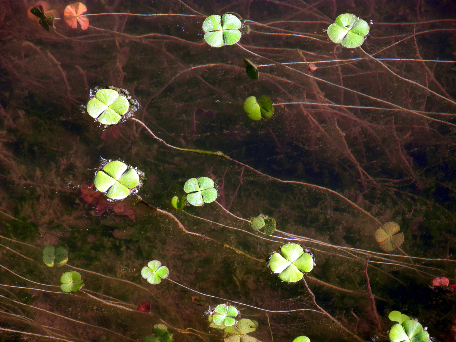 |
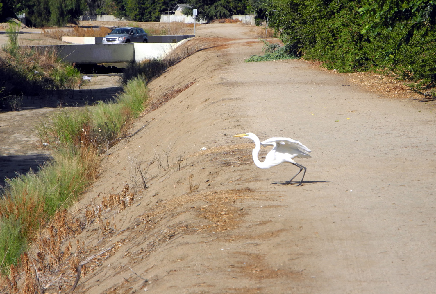
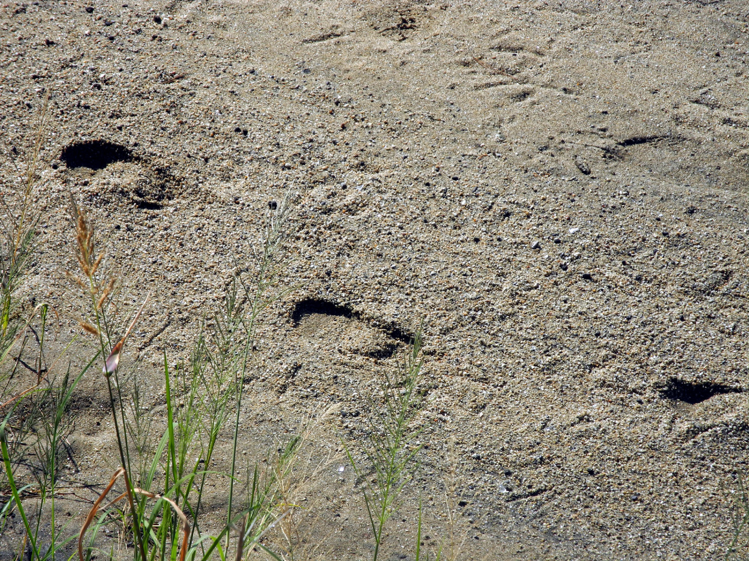
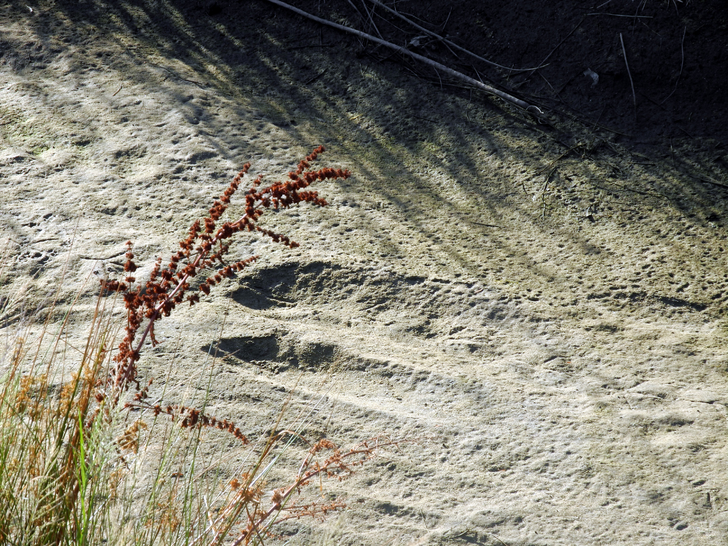
| Egret ready to take flight | Footprints in the canal bottom | Floating plants |
 |
 |
 |
| Flattened shopping cart | This pipe carries the Helm Canal beneath Dry Creek |
Duck in Helm Canal |
 |
 |
 |
| This spot was dry on August 10... | ...but had some water August 14 | A section of Dry Creek that actually looks like a creek |
 |
||
| I've never seen this huge flood basin completely dry before this year - August 15, 2015 | ||
 |
 |
 |
| Squirrel highway |
Vacant field by Dry
Creek |
Cottonwood Park,
adjacent |
 |
 |
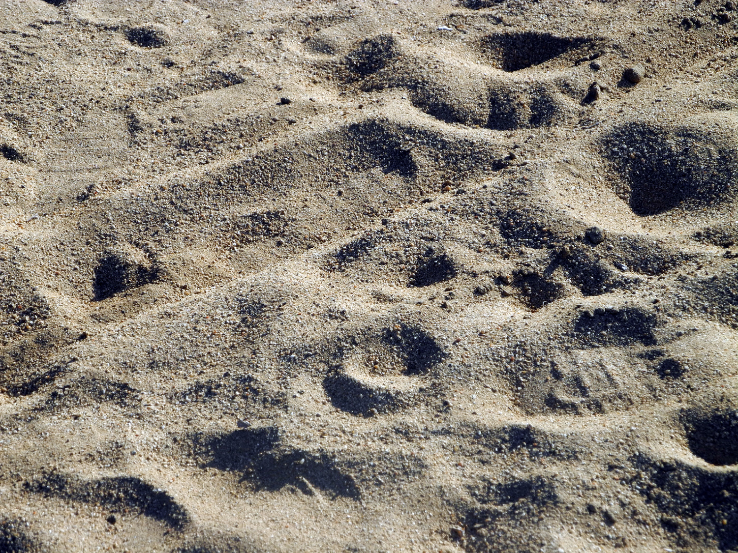 |
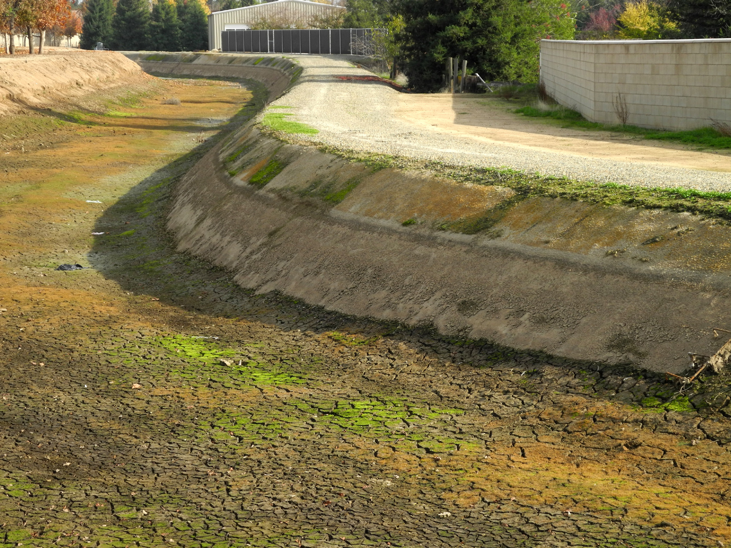
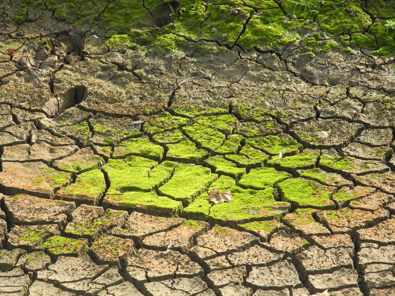
| Damp sandy bottom of Big Dry Creek Canal, late August |
Cones on deodar cedars |
The loose, sandy
surface |
 |
 |
 |
|
These plants grow by |
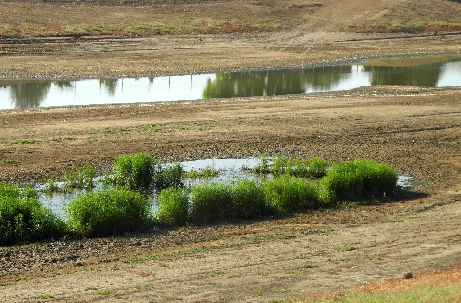
Close-up of a blossom | A bit more water in the flood basin |
 |
 |
 |
| Dry Creek west of Willow Avenue |
Where the canal runs |
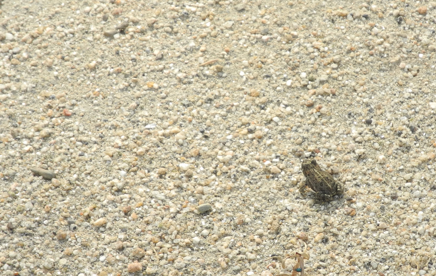
A frog, at last |
 |
 |
 |
| Sunrise over the old water tank from the Helm Canal |
Sunrise over the new water tank | Inspecting the canal |
 |
 |
 |
| Wood chunks in the water | "You can't see me" | View from down in the canal |
 |
 |
 |
|
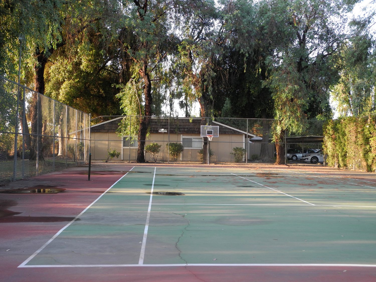
Basketball
court |
Late summer grass |
Geese
find something to |
 |
 |
 |
| A tree grows in the canal |
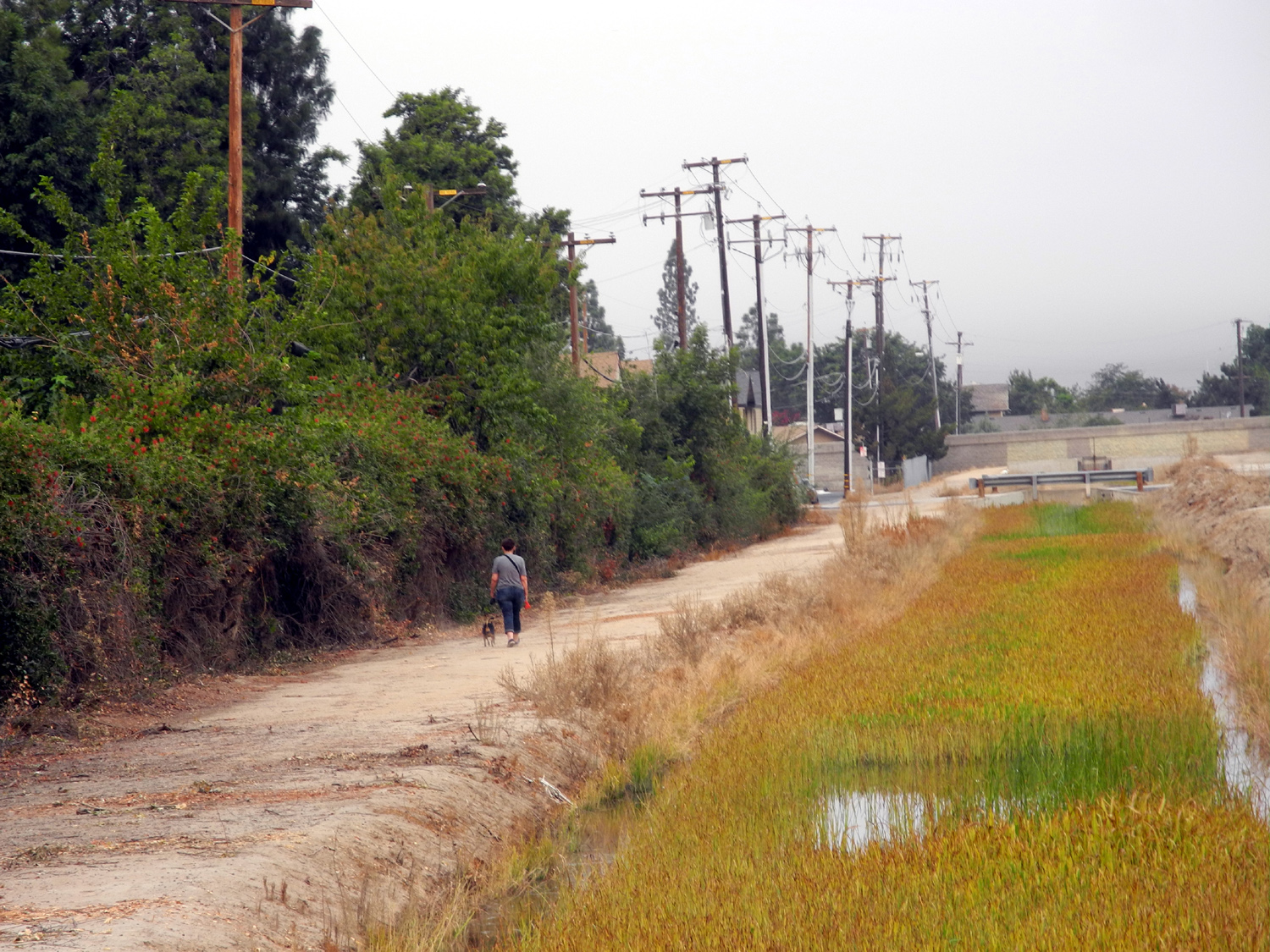
Dog
walker and fall changes |
The Hunter |
 |
 |
 |
| Morning reflection | A sudden
influx of water creates a flow in both directions |
The view from the other side |
 |
||
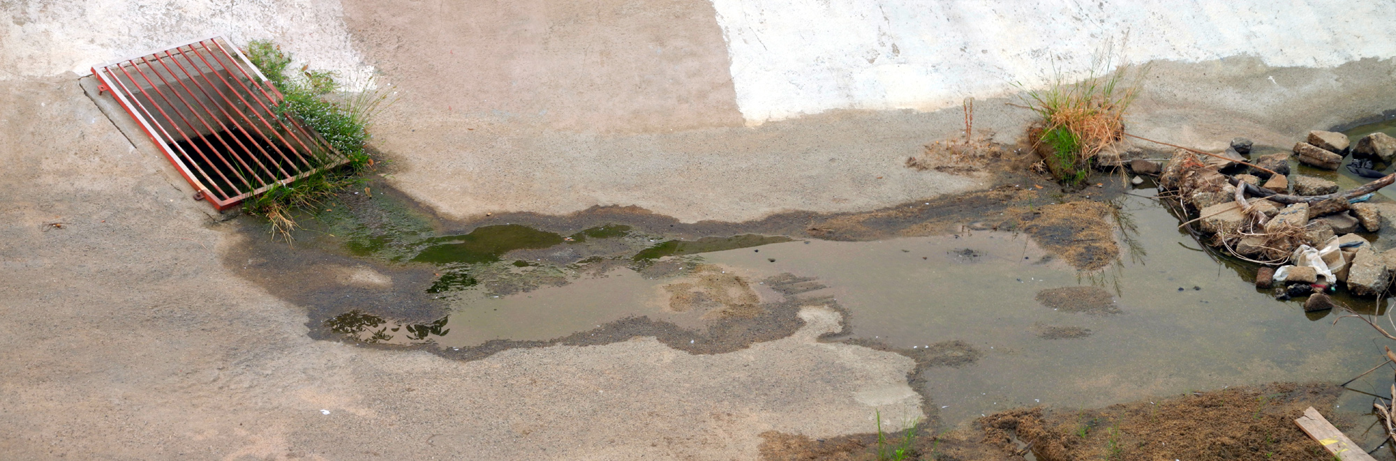
| The only water between Villa and Barstow trickles in through this grate | ||
 |
 |
 |
|
This
palm stump was dumped on the
bank, |
Big Dry Creek east of
Clovis, where it's actually a creek |
It's actually dry, too |
 |
 |
 |
|
Yes, Virginia, there is |
It, too is dry in the fall of 2015 | Ant trail by the Dry Creek Canal |
|
 |
 |
| Early
December - the once-green grass in the Helm canal is dead |
A closer look | The Dry Creek Canal becomes a skate park |
|
|
||
 |
 |
|
| Something
new on the canal bank - I believe it's a kingfisher |
Later he landed in a tree |
Geese enjoy the
formerly dry |
 |
 |
 |
|
Painted
out graffiti takes |
After a
long dry summer, water pours under the Barstow bridge |
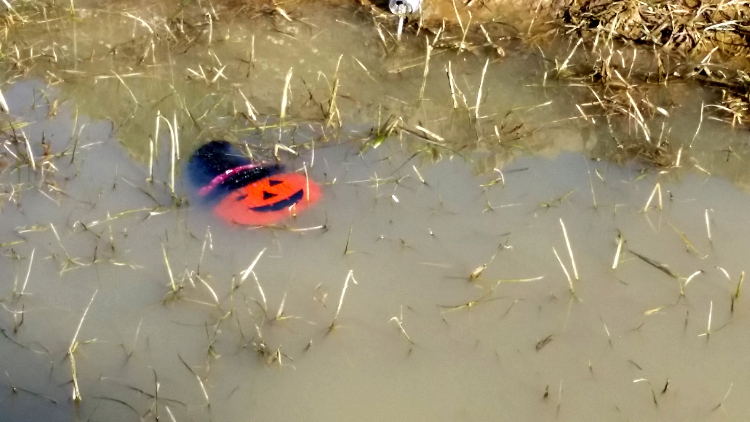
Now we know what happened to Mr. Pumpkin |
 |
 |
 |
|
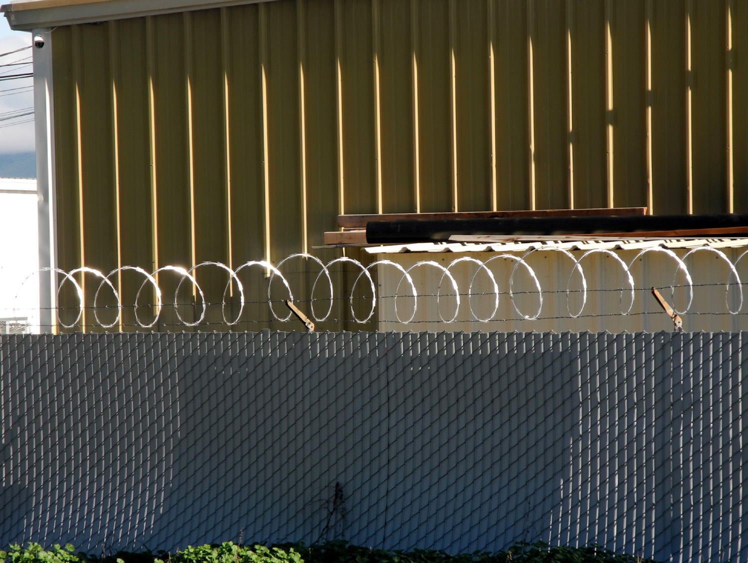
Non-verbal say of saying "keep out" |
Trailers for sale or rent | Dry Creek Canal just south of Herndon Avenue |
 |
 |
 |
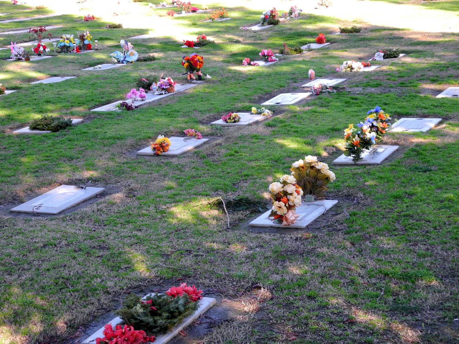
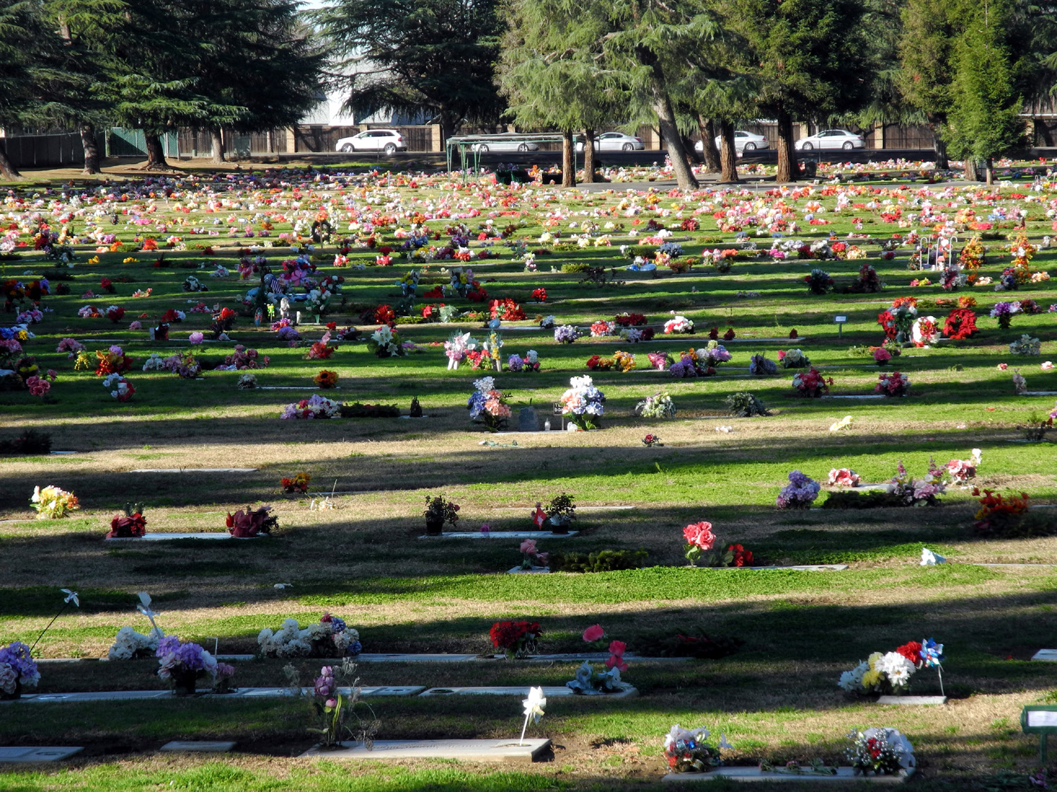
| Clovis Cemetery | A colorful place to "rest" |
Where the canal meets Sierra Avenue |
 |
 |
 |
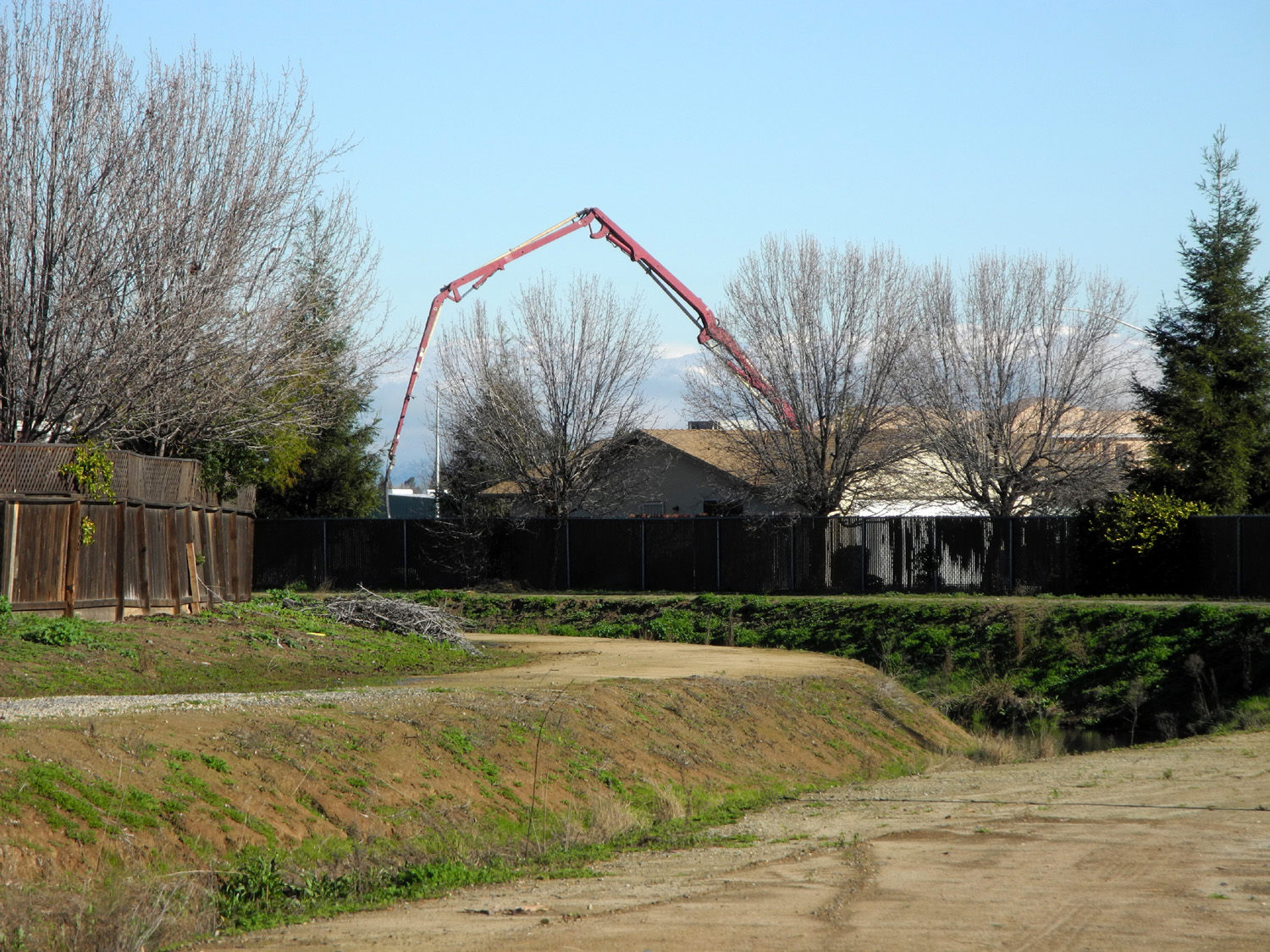
| Concrete delivery boom
frames leafless trees and the Sierra |
Sierra Crossing development takes shape | Beyond this point the canal is fenced off |
 |
 |
 |
|
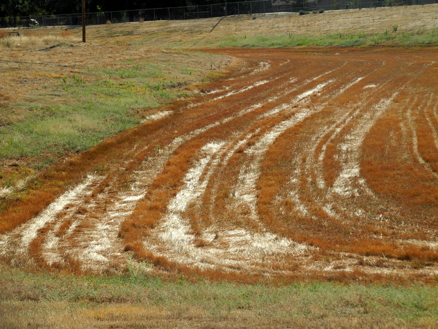
Stripes on the dry flood pond bottom |
An octopus artist has
been at |
Lots of rain keeps the |
 |
 |
 |
| Temporary bridge | Finally, a NICE shopping cart | A closer look |
 |
 |
 |
| Bridge over Dry Creek near Dry Creek Park |
Water is pumped in
here, then out in |
Water drops down to run through a tunnel under the street |
 |
 |
 |
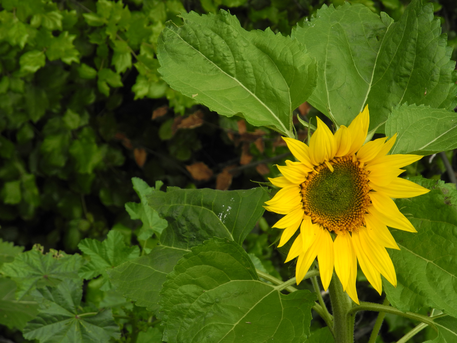
| Sunflower by Dry Creek Canal | Willows make a shady spot | Water flow in Dry Creek Canal in April 2016 |
 |
 |
 |
| Many tiny toads were hopping on the bank in April and May |
Striking pink flower along the bank | Bottle bush by the canal bank |
 |
 |
 |
|
Enterprise
Canal with new |
Rock barrier at end of new concrete section | The "old original" bank |
 |
 |
 |
| Cracked
mud on the canal bottom with some bright green moss |
New development near canal | Distant snow covered Sierra |
 |
 |
 |
| A
nearby homeowner has created a gully while draining his yard |
The geese return | Fuzzy seed heads |
 |
 |
 |
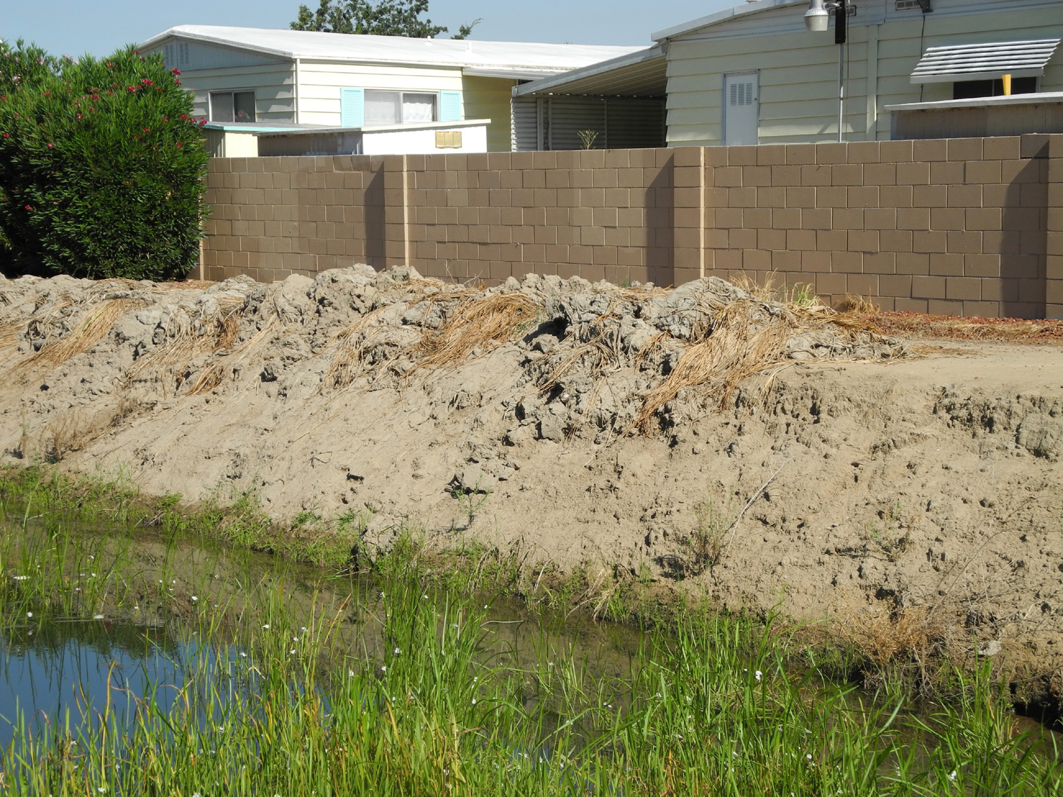
| Mud is piled up on the canal bank after a dredging operation to clean out weeds and silt | ||
 |
 |
 |
| This
section was wet, slippery and a bit dangerous |
Looking
southwest down the Dry Creek Canal |
The main purpose of water - to throw rocks in |
 |
 |
 |
| Observing the millipede | A place of great fascination | I challenged him to climb the fence |
 |
 |
 |
| A
first time sighting of a rolled up sleeping bag, plus an unidentified plastic spiky thing |
Toddler toy in the canal |
In
late September, the bank |
 |
 |
 |
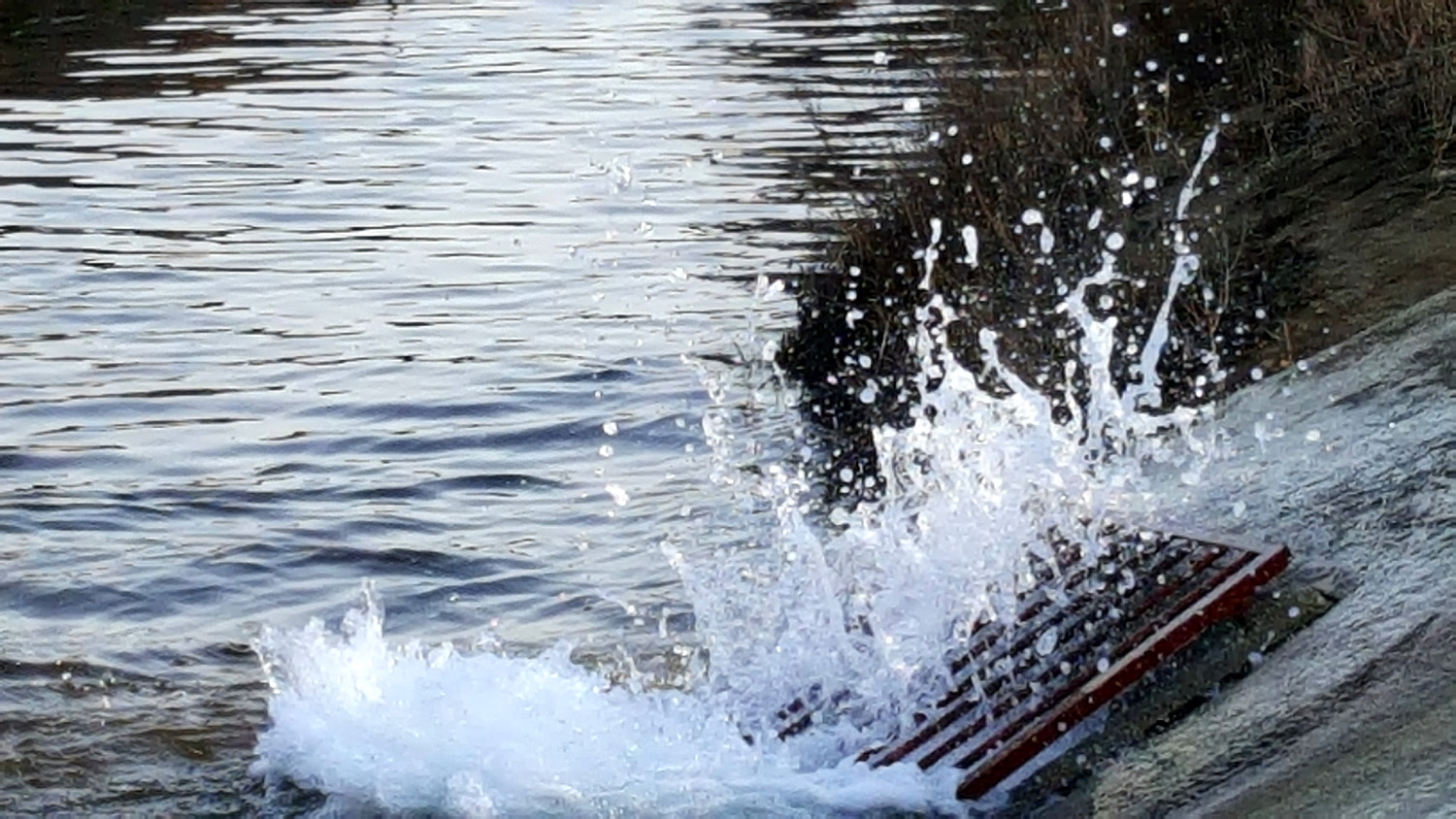
| Where they came from | In March 2019 water flowing into the Dry Creek Canal created a big splash | |
 |
 |
 |
| Signs of a major A-hole on the canal | Scattered
papers, probably not dumped by their owner |
This
spur canal, previously dry and full of weeds, has received a makeover for 2022 |
 |
|
 |
| At
a house near the start of the walk from Barstow to Willow |
Roses by the canal bank | Illegal trash on steroids |
 |
 |
|
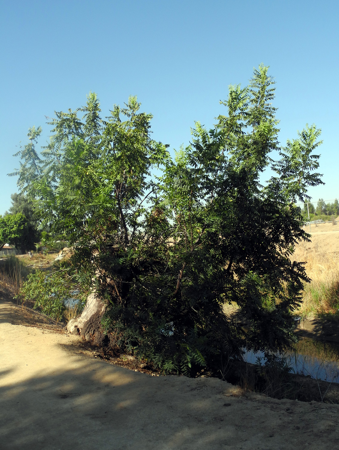
| Flood basin west of the Dry Creek Canal | Black
walnut trees were cut down but are making a comeback |
White water rapids |
 |
 |
 |
| Lost and lonely | A tribute to a beloved pet | We've been told these are chamomile |
 |
 |
 |
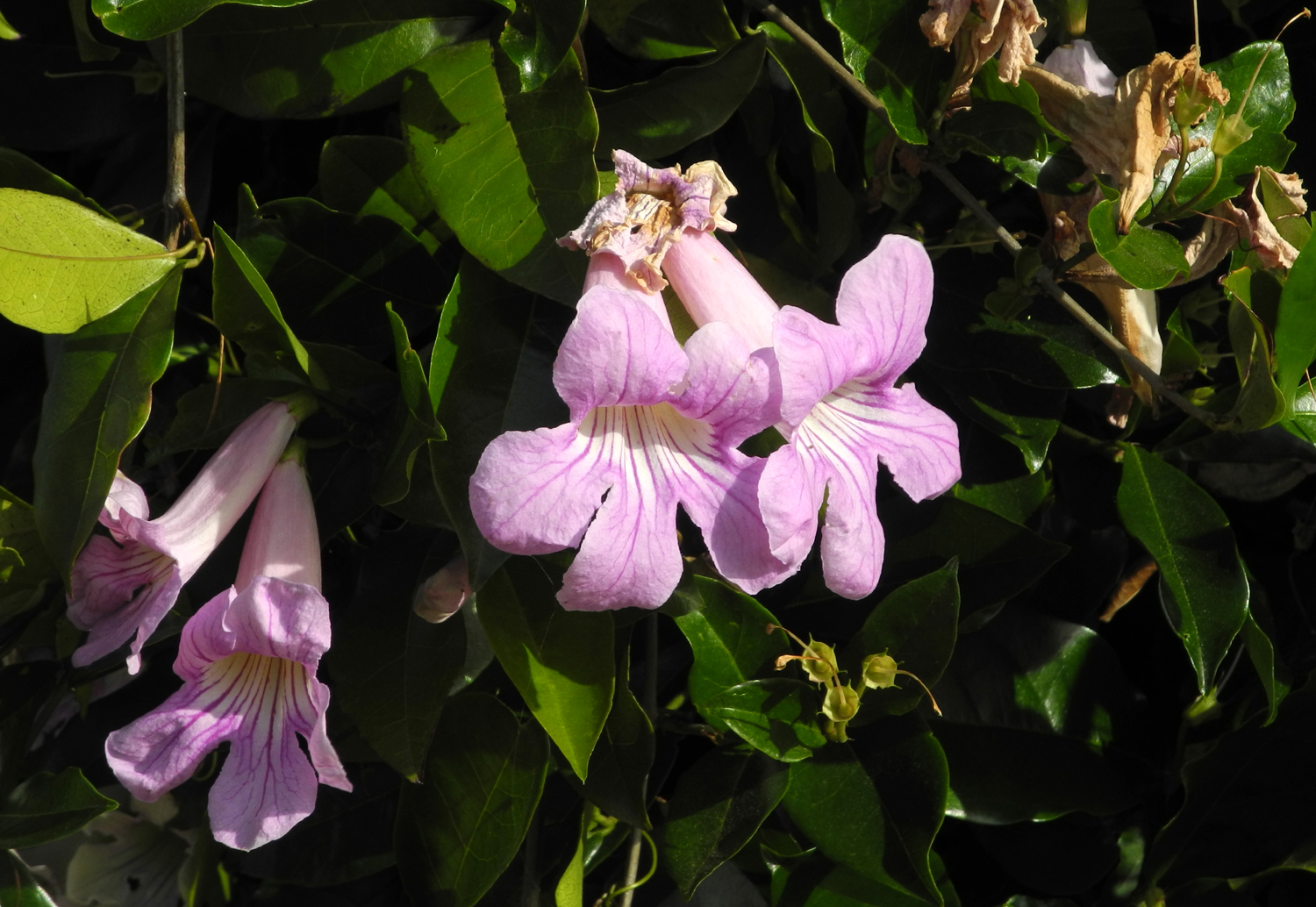
| Oleander
petals decorate the bank of the Helm Canal |
Pink oleander blossoms | Coyote
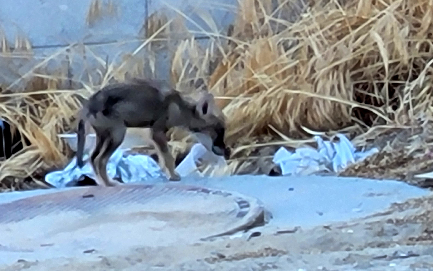
pup near canal, as advertised in this sign a few hundred yards away |
 |
 |
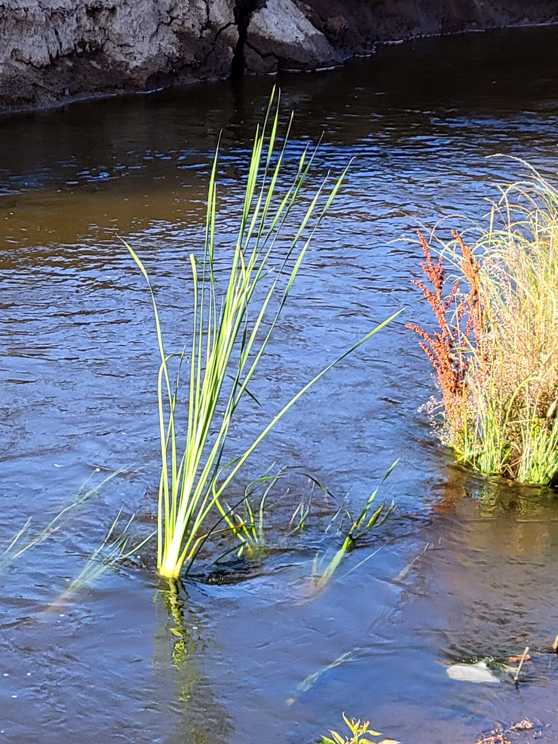 |
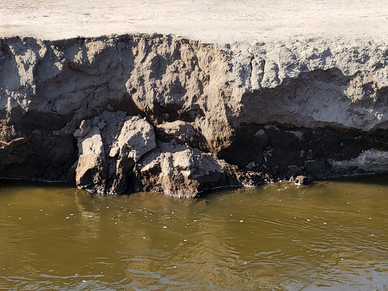
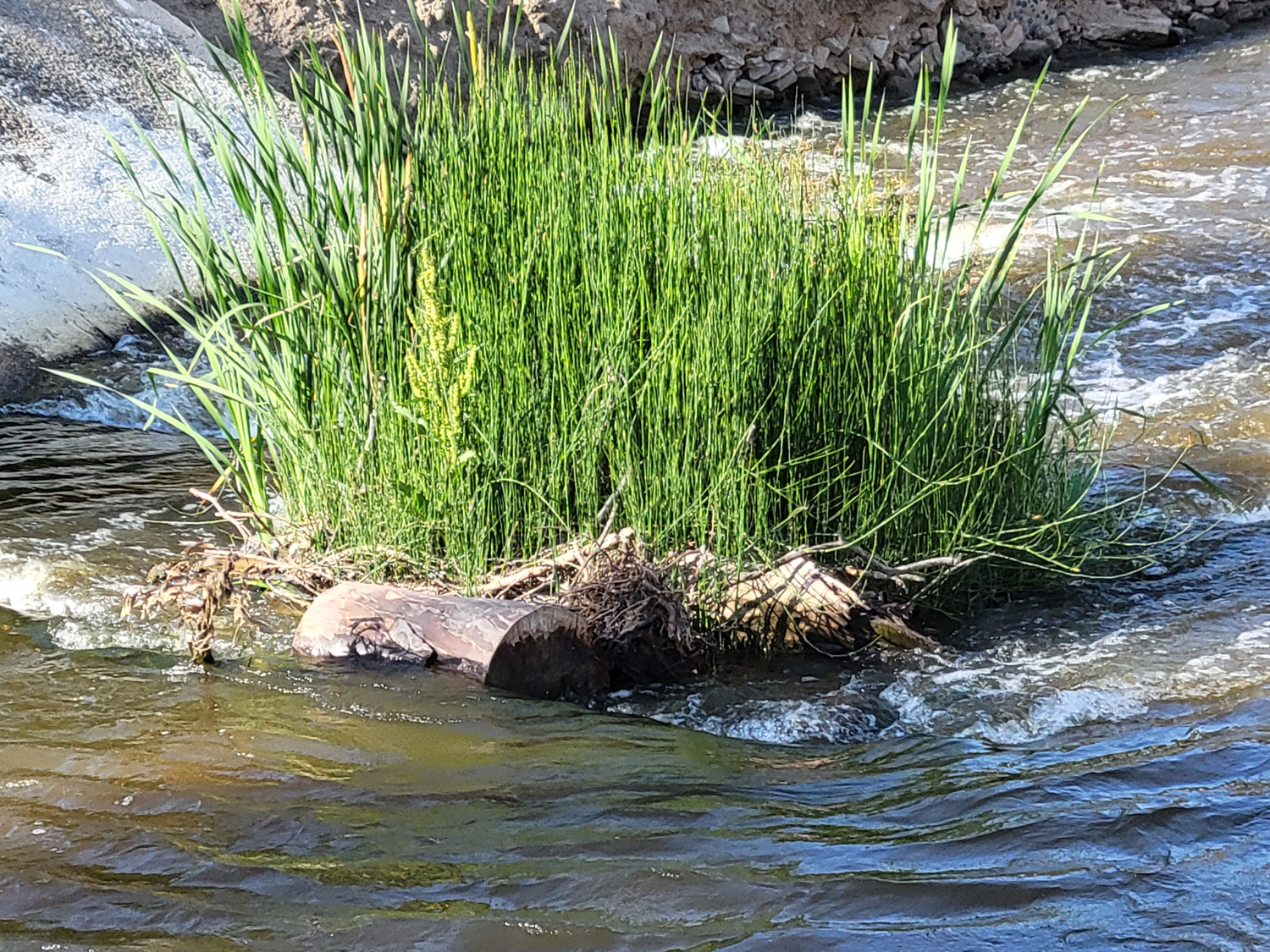
| Collapsed section of bank of Dry Creek Canal | A little island of green in the canal | A single plant waves with the water's flow |
 |
 |
 |
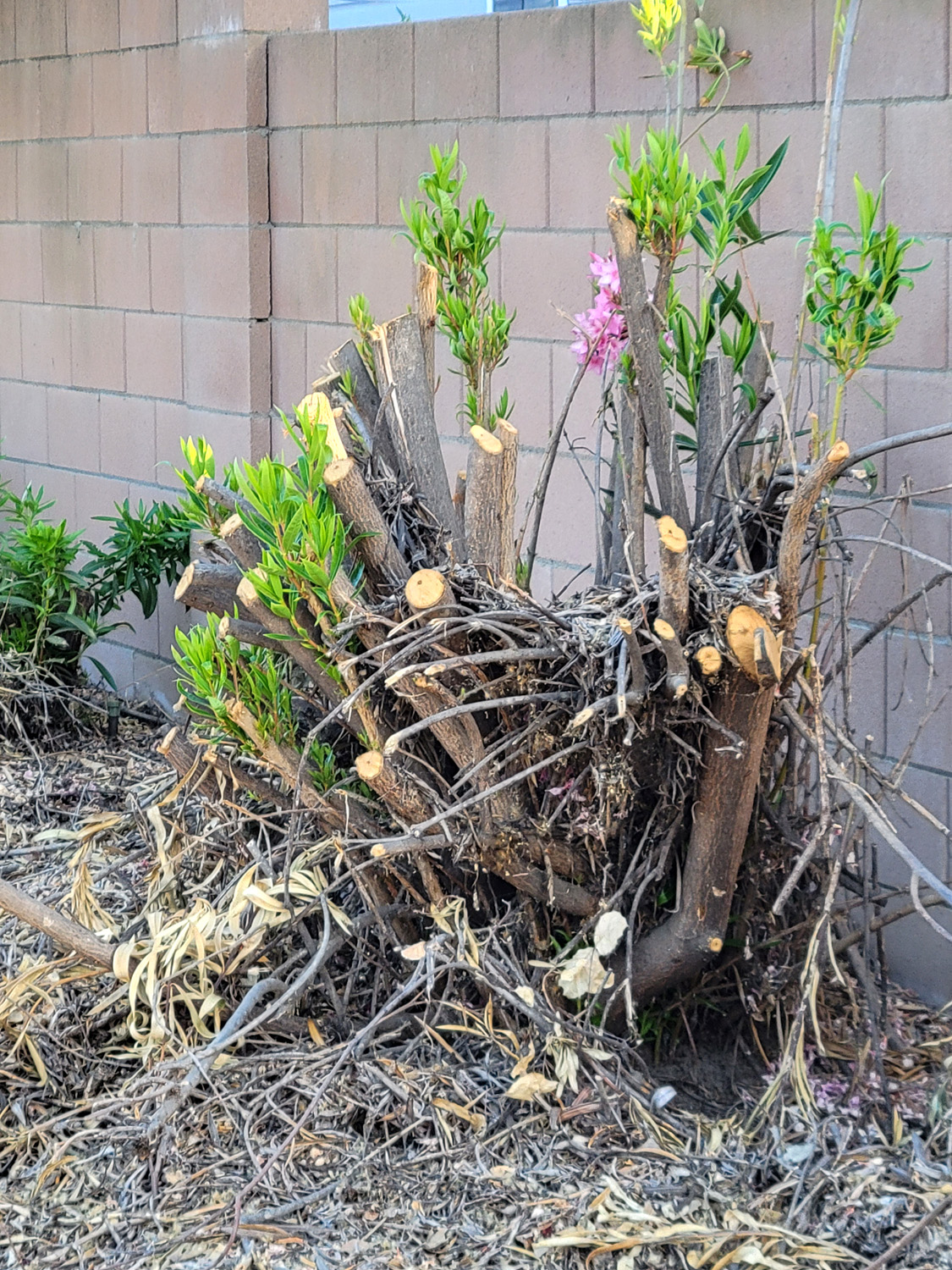
| Several
hundred yards of oleander bushes were brutally butchered in the summer of 2023 |
The
bank shows the result of scraping to remove vegetation |
Canal
banks attract trash; in this case, perhaps proof that Halloween is over |
 |
 |
 |
| The hidden road east of the Dry Creek Trail | The old fence is long past its useful life | Probably a gate |
 |
 |
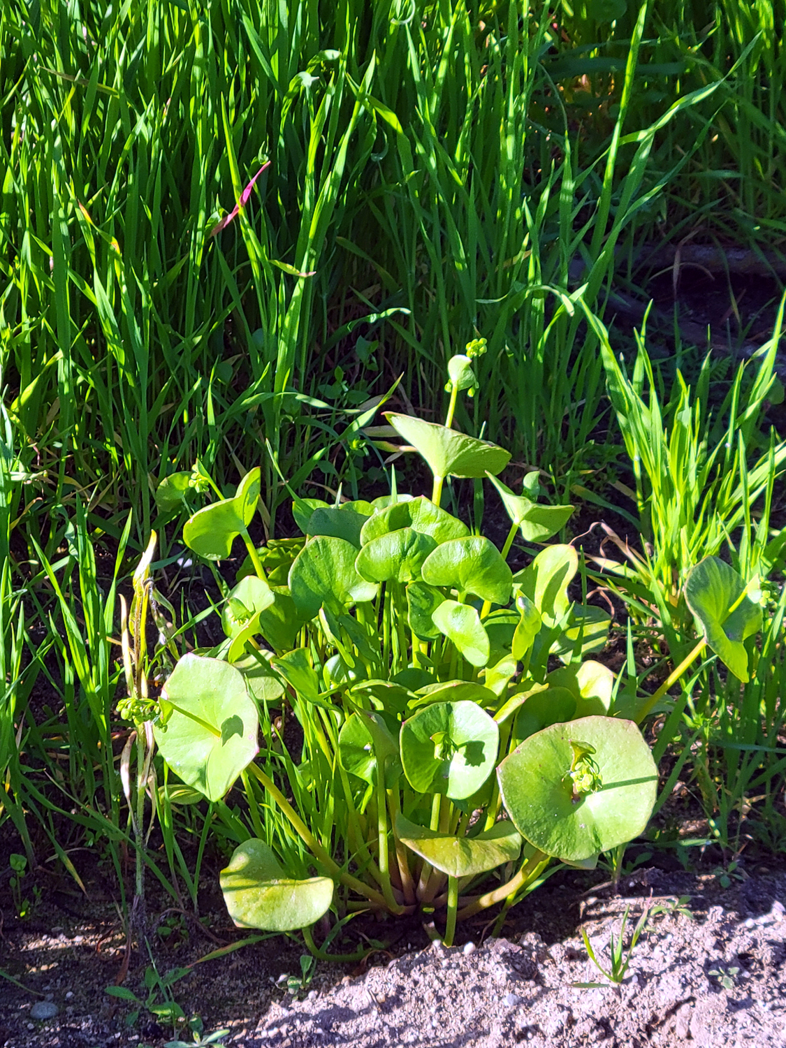 |
| The pond, with houses beyond | Another section of the pond | Miner's lettuce along the trail |
 |
 |
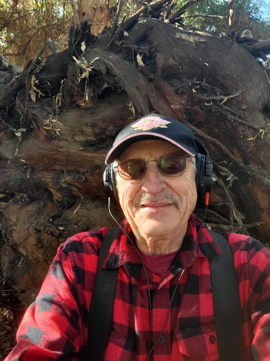 |
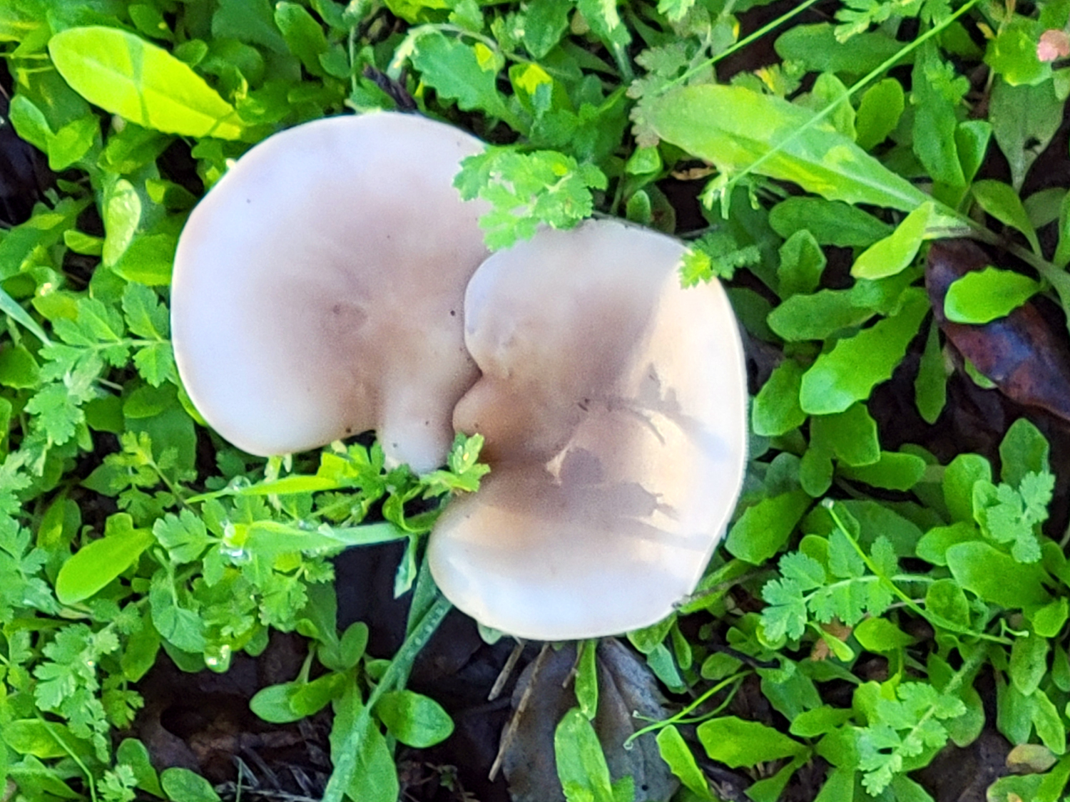
| Mushroom from an earlier walk | A huge fallen eucalyptus | Your fearless reporter by the roots |
 |
 |
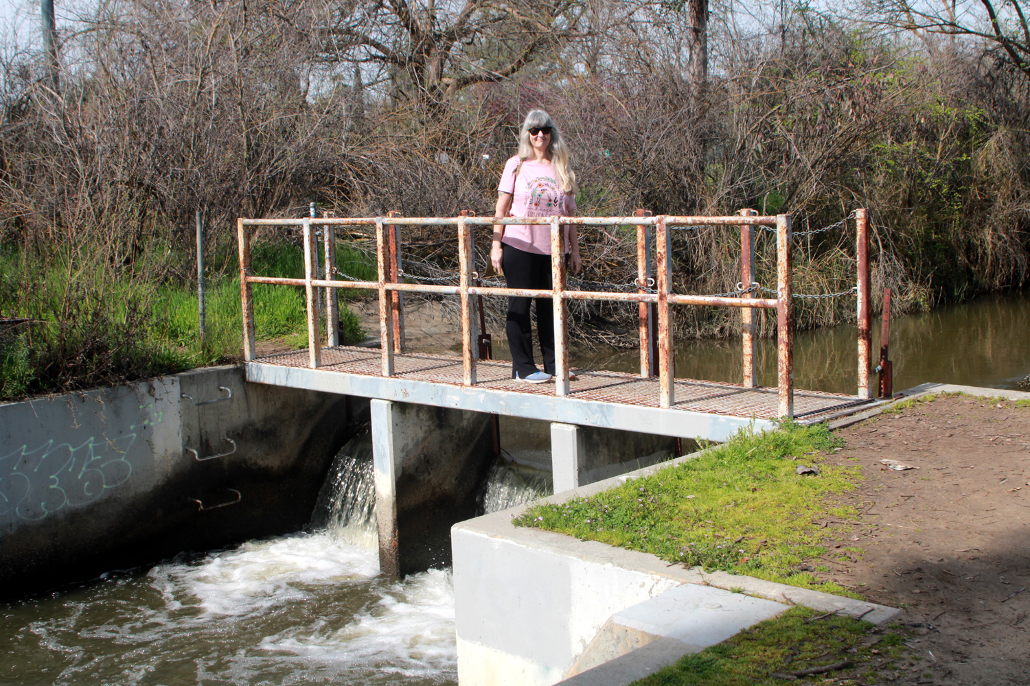 |
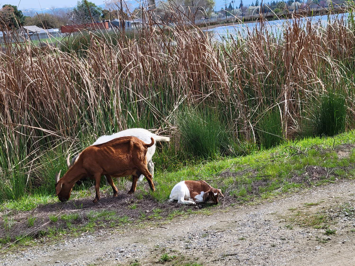
| Goat, looking very cute | The little one grazed lying down | Teri on the bridge near Dry Creek Park |
 |
 |
 |
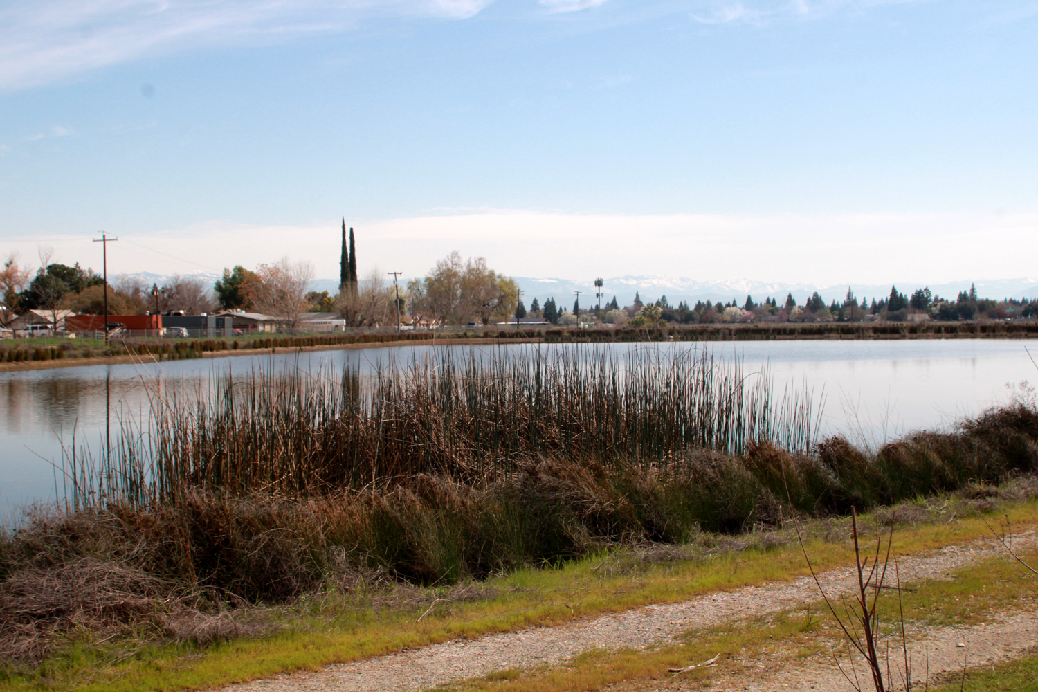
| The big pond | The
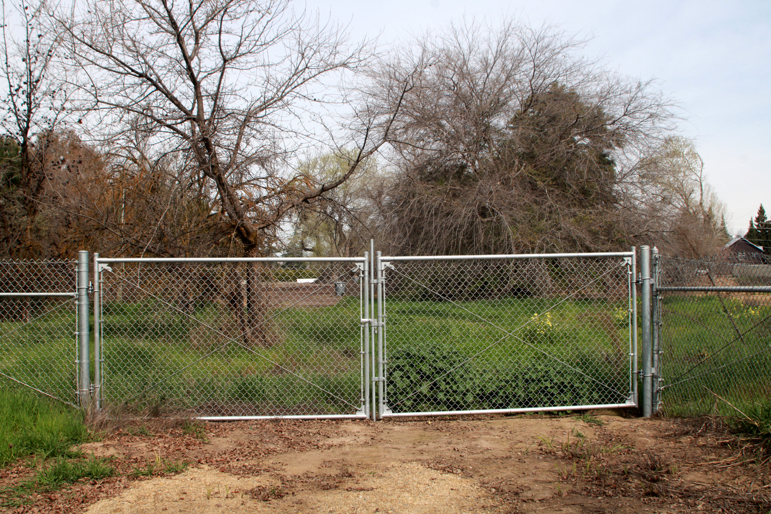
gate at the north end of the road that runs along the edge of the pond |
Dick on the foot bridge by Alluvial Avenue |
 |
 |
 |
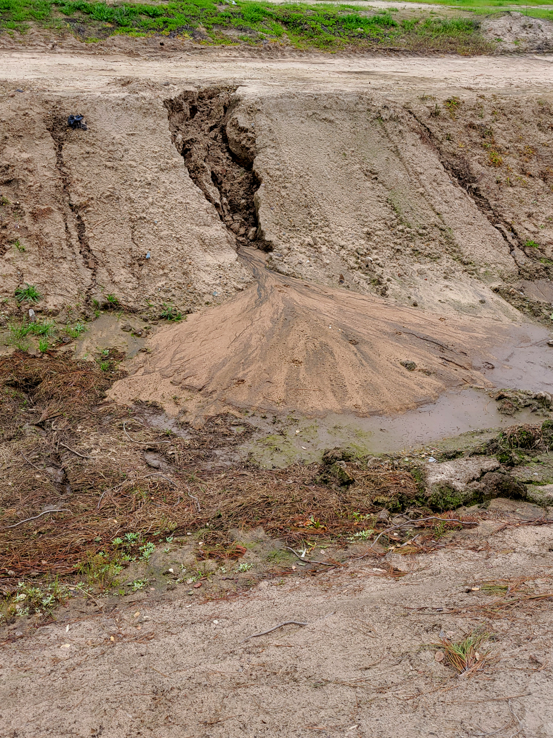
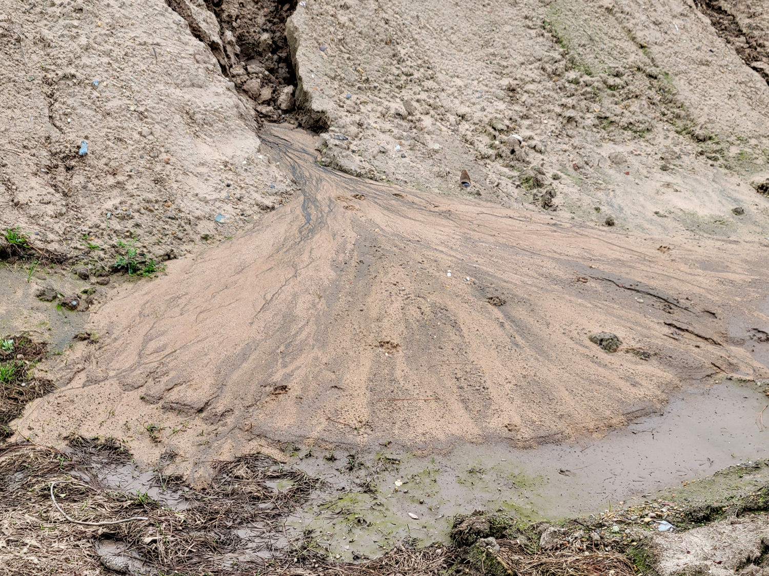
| A
symmetrical delta caused by washout from the bank |
A
close look. This will be gone when the canal starts running |
Flood basin where Dry Creek and Helm Canals meet |
 |
 |
 |
| Grain, maybe a stray corn plant | A fallen eucalyptus by the road | View
of Dry Creek Canal from the little bridge next to Alluvial Avenue |
 |
 |
 |
| After
being severely
butchered a year and a half ago, these Oleanders have grown back to 8 feet tall |
Close up of blossoms | A nice shopping cart in a nasty canal |
 |
 |
 |
| Barb
and Ken were airlifted to the nearest doll hospital |
On
close inspection, these oranges were well beyond the "sell by" date |
Fall leaves along the trail |
 |
 |
 |
| Newly installed fence along the Helm Canal | Filaree - a ubiquitous plant in the valley and foothills | Pussy willow along the Dry Creek Canal |
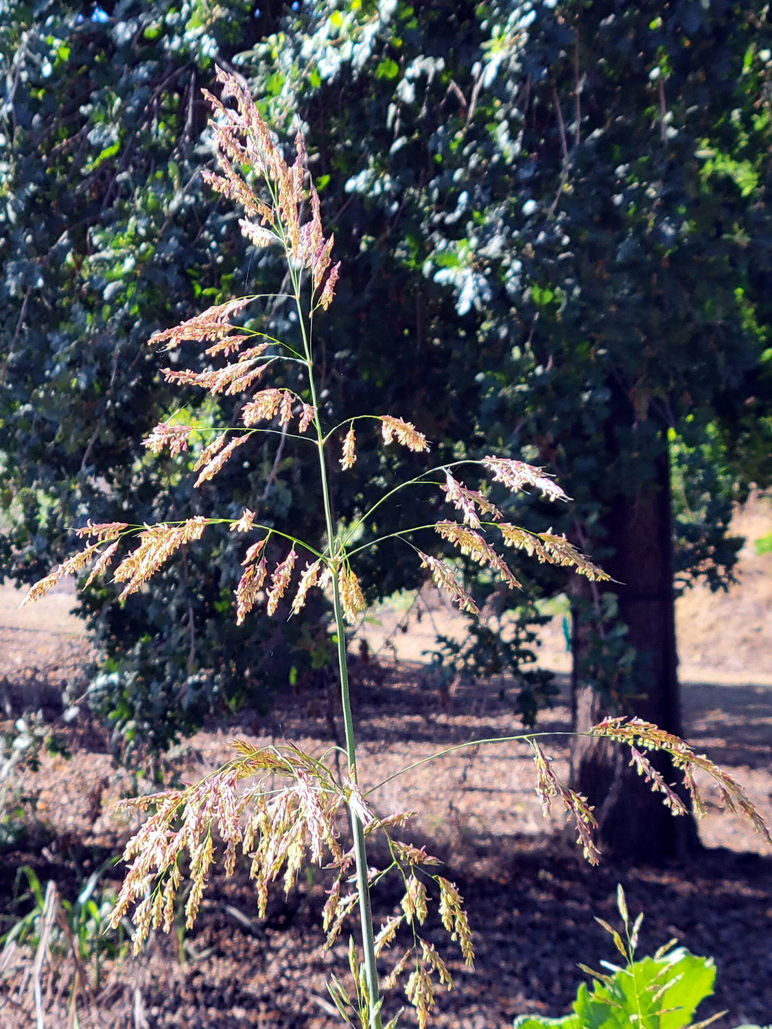 |
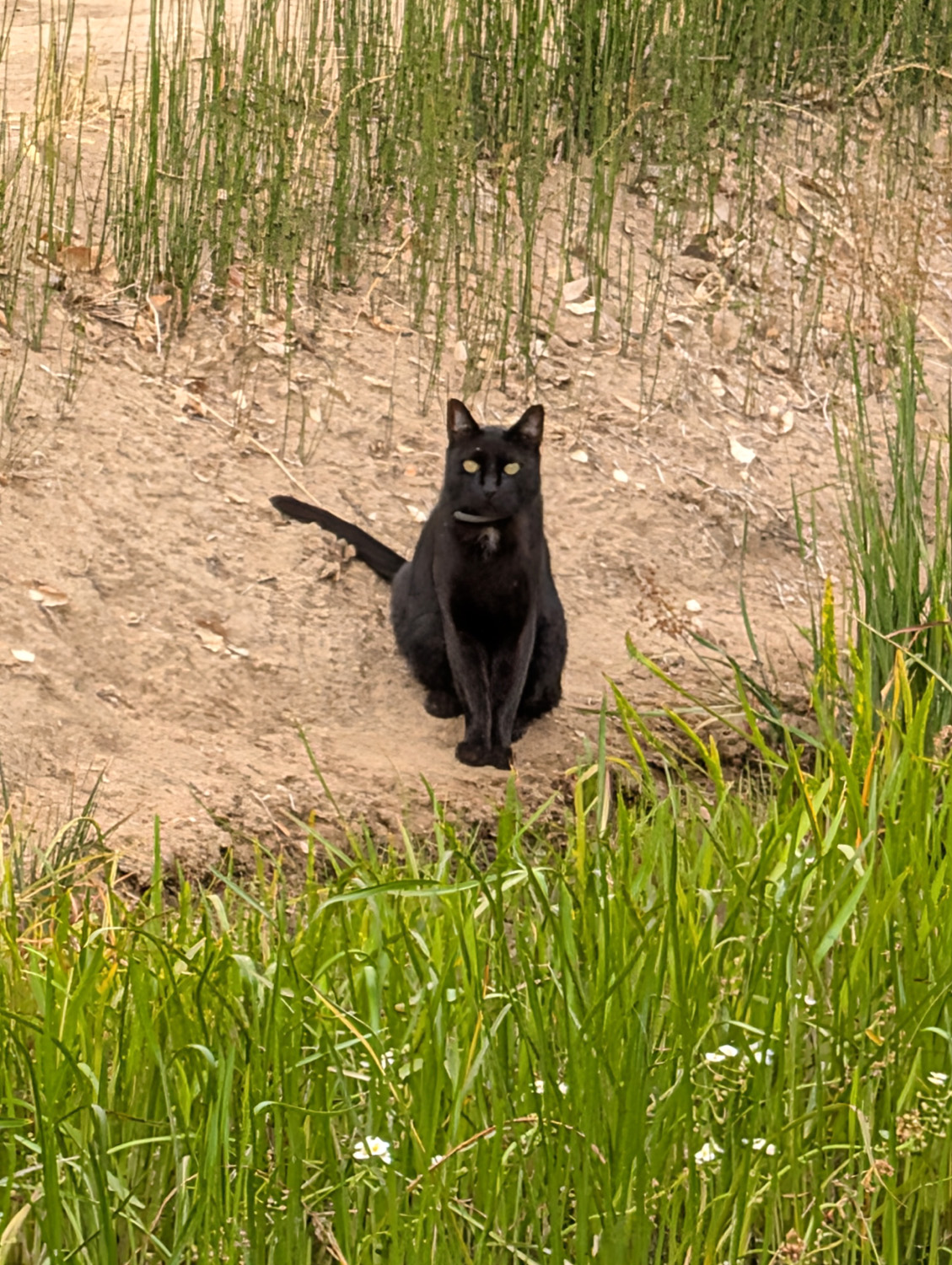 |
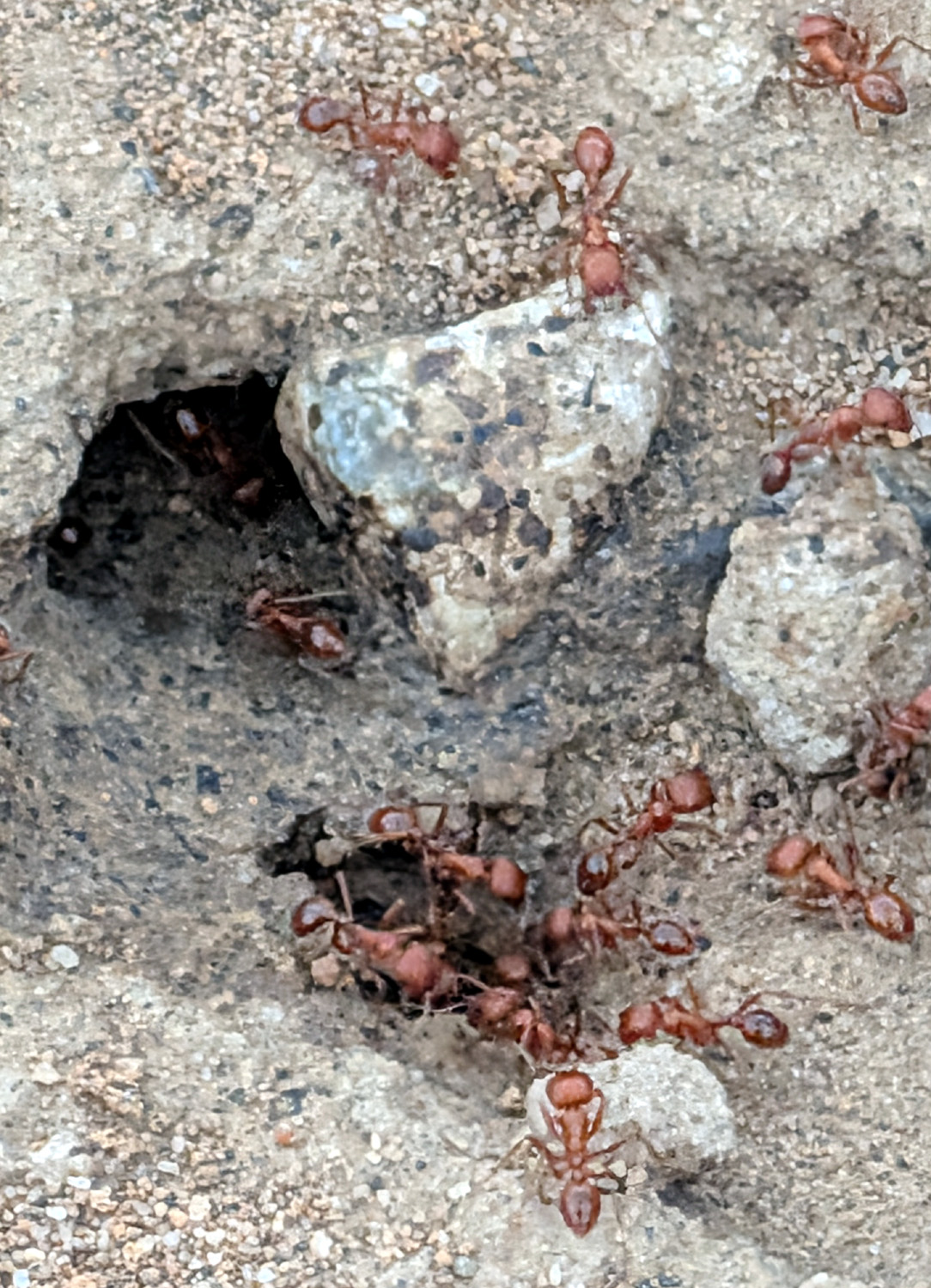 |
| Wild grass, going to seed | Canal cat, July 12, 2026, one of 3 seen that day | Busy, busy, busy |
 |
||
| They look real from a distance | ||
| Related Links | ||
| Fresno Irrigation District | FID Map | Leaky Acres |
| Dry Creek Trailhead | The Dry Creeks of Fresno County | Metropolitan Flood Control District |
| Little Library | Major Fresno County Canals | Oleander Bushes |
| Dry Creek Park | ||
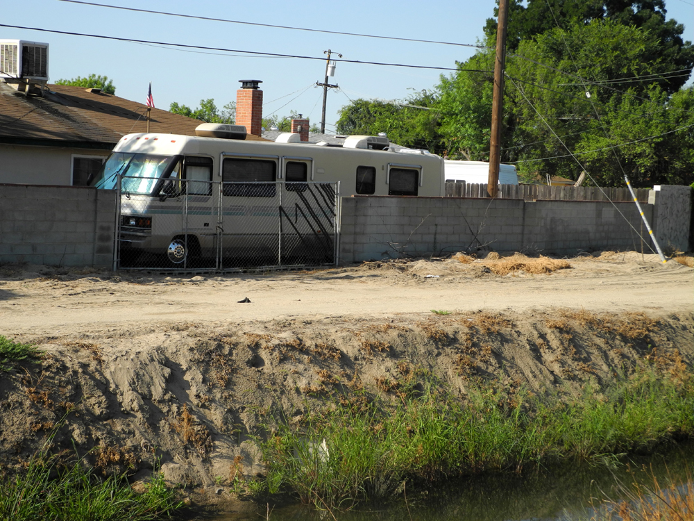
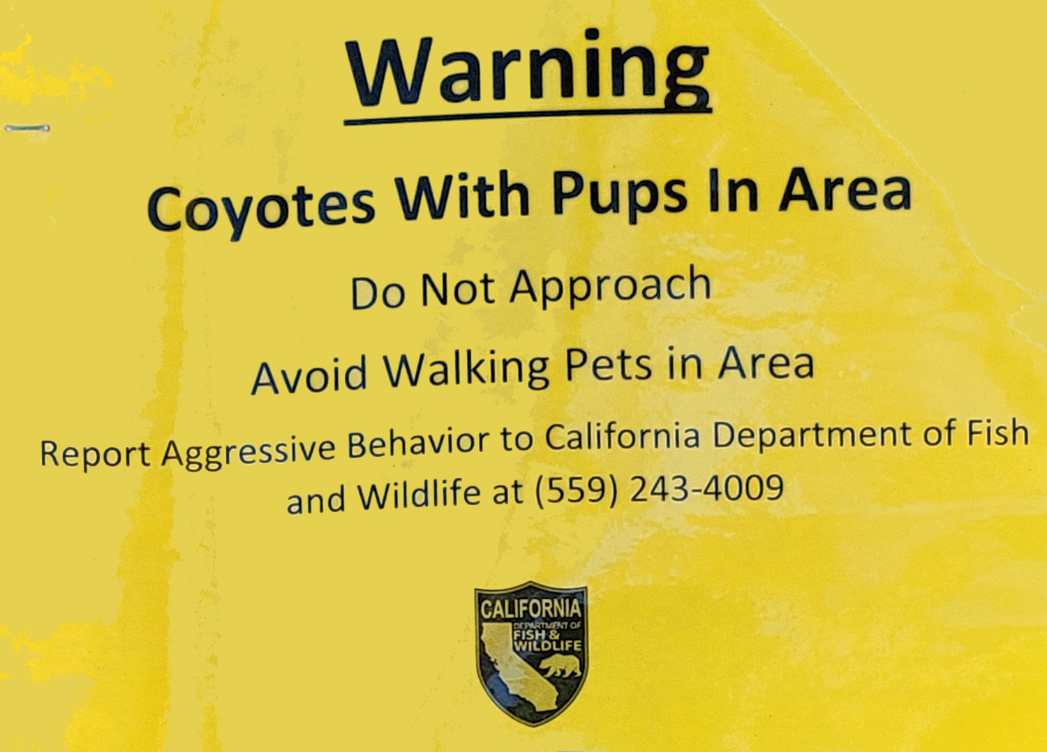
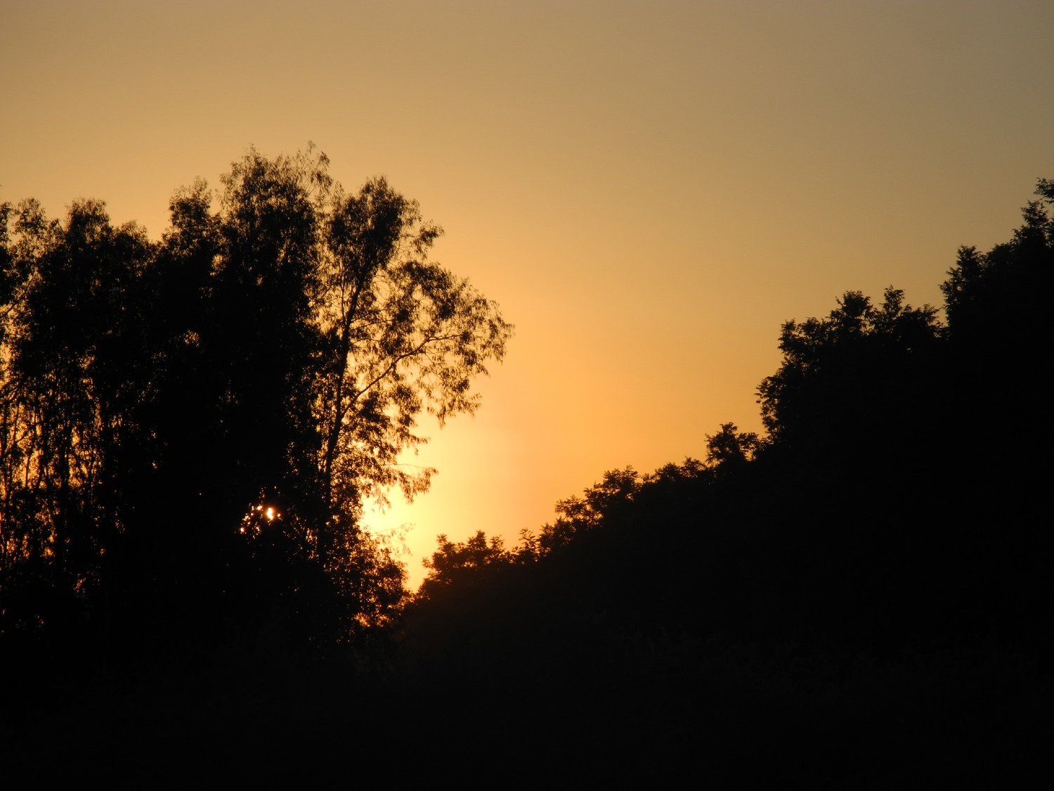
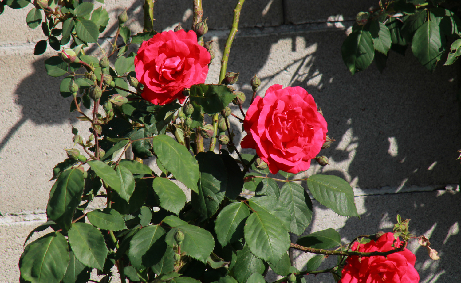
All photos copyright © 2002-2026 by Dick Estel. Permission granted for personal use only; commercial use prohibited.