
Sentinel Dome Hike |
||
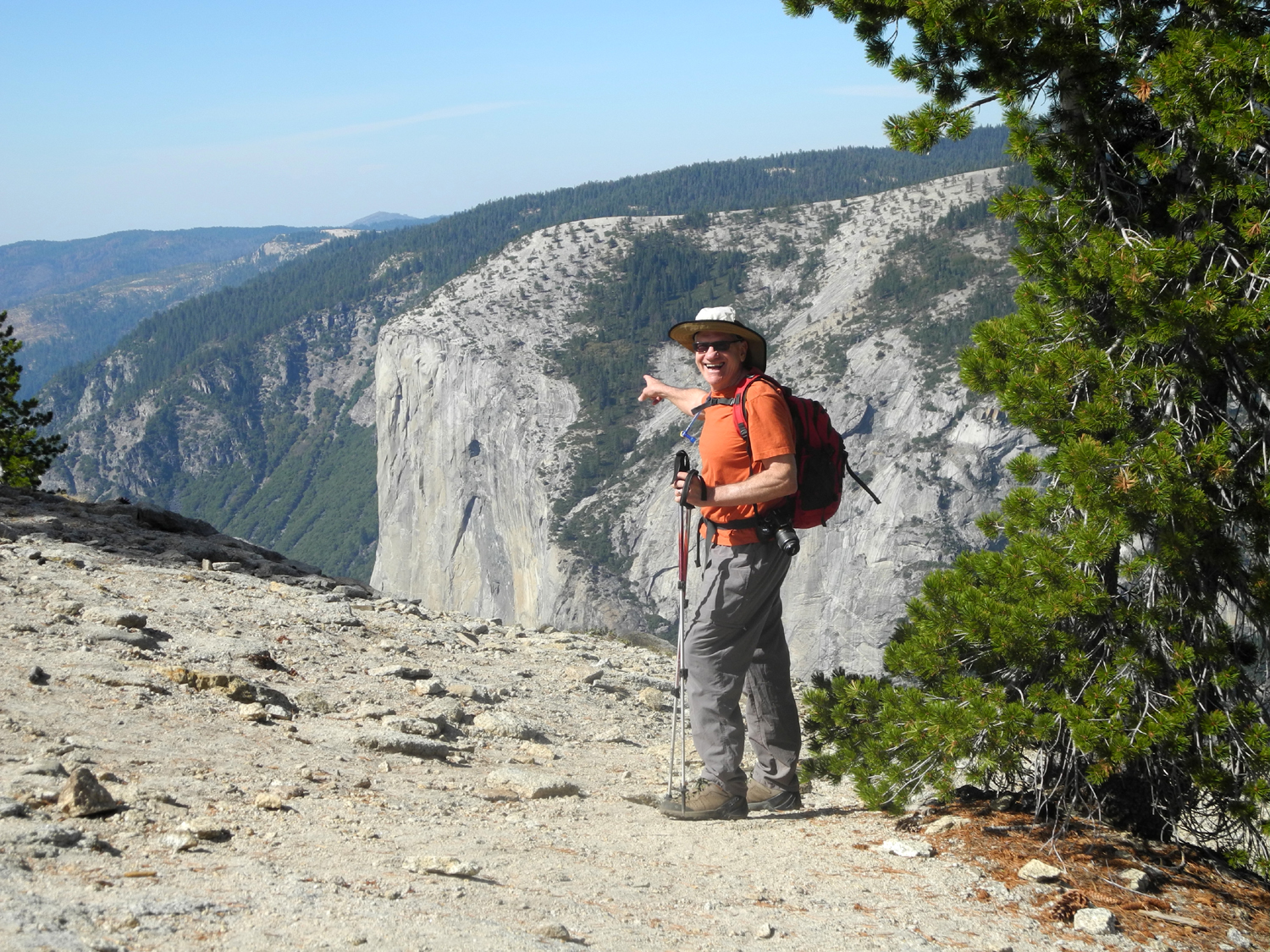
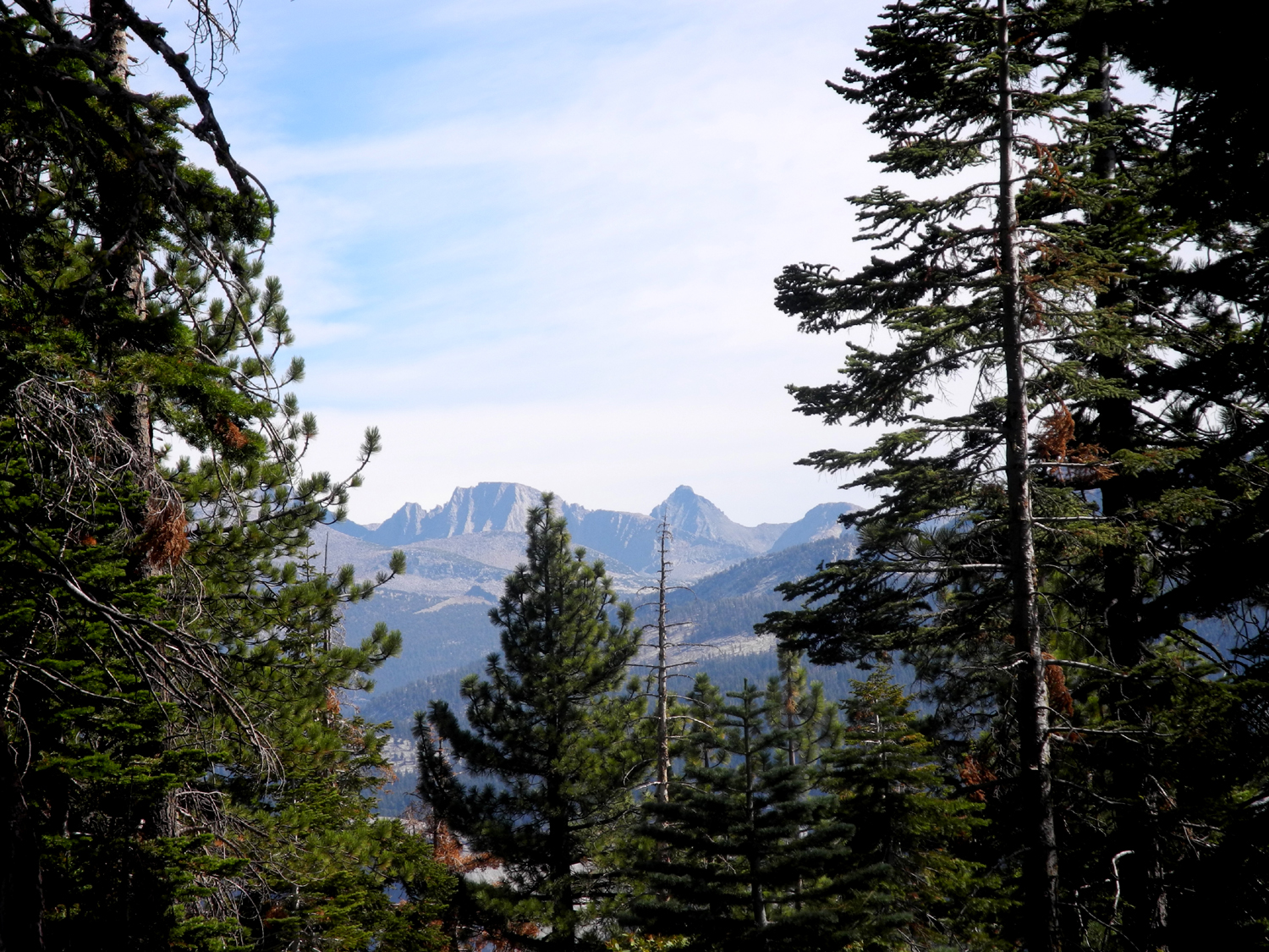
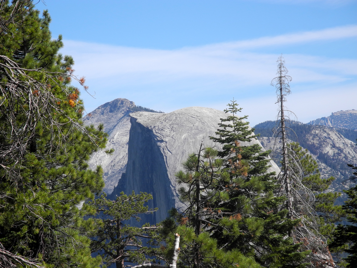
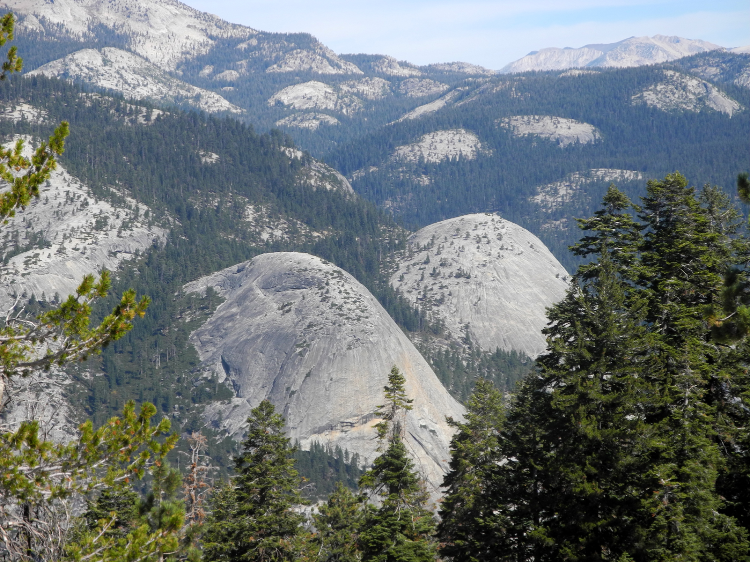
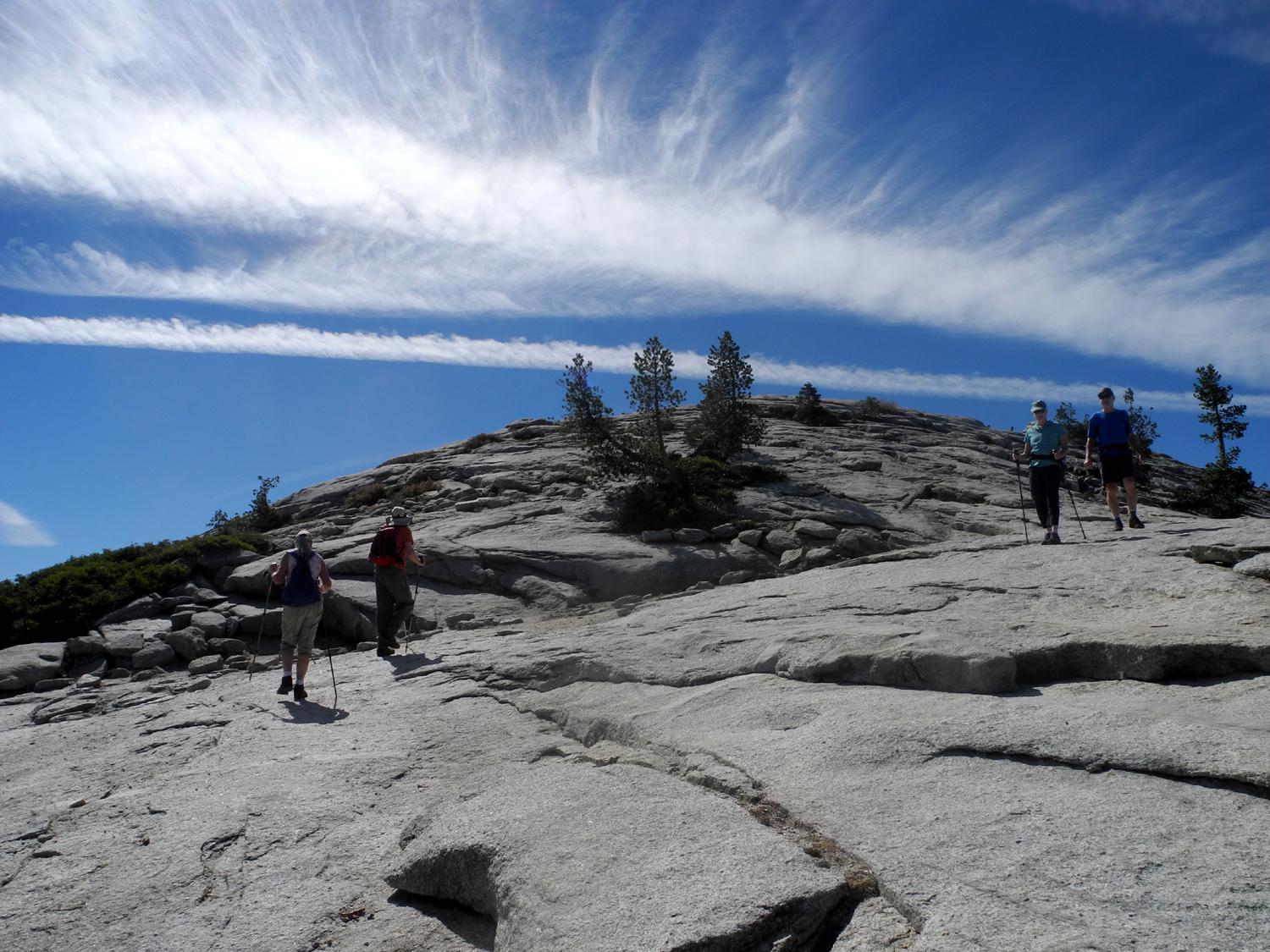
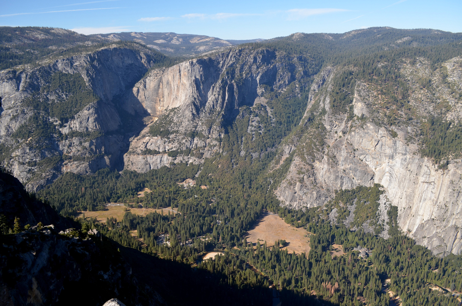
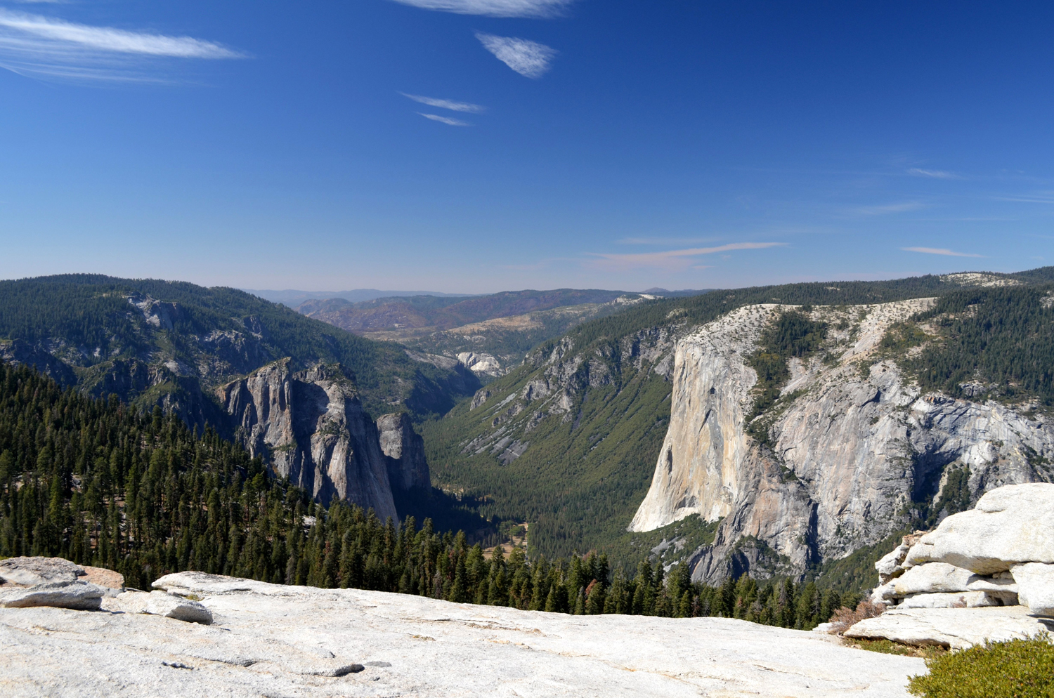
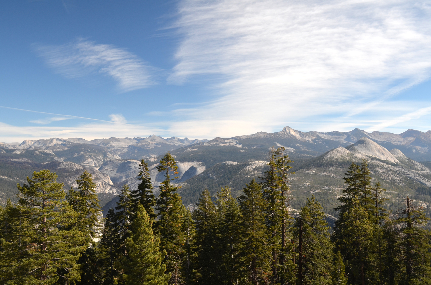
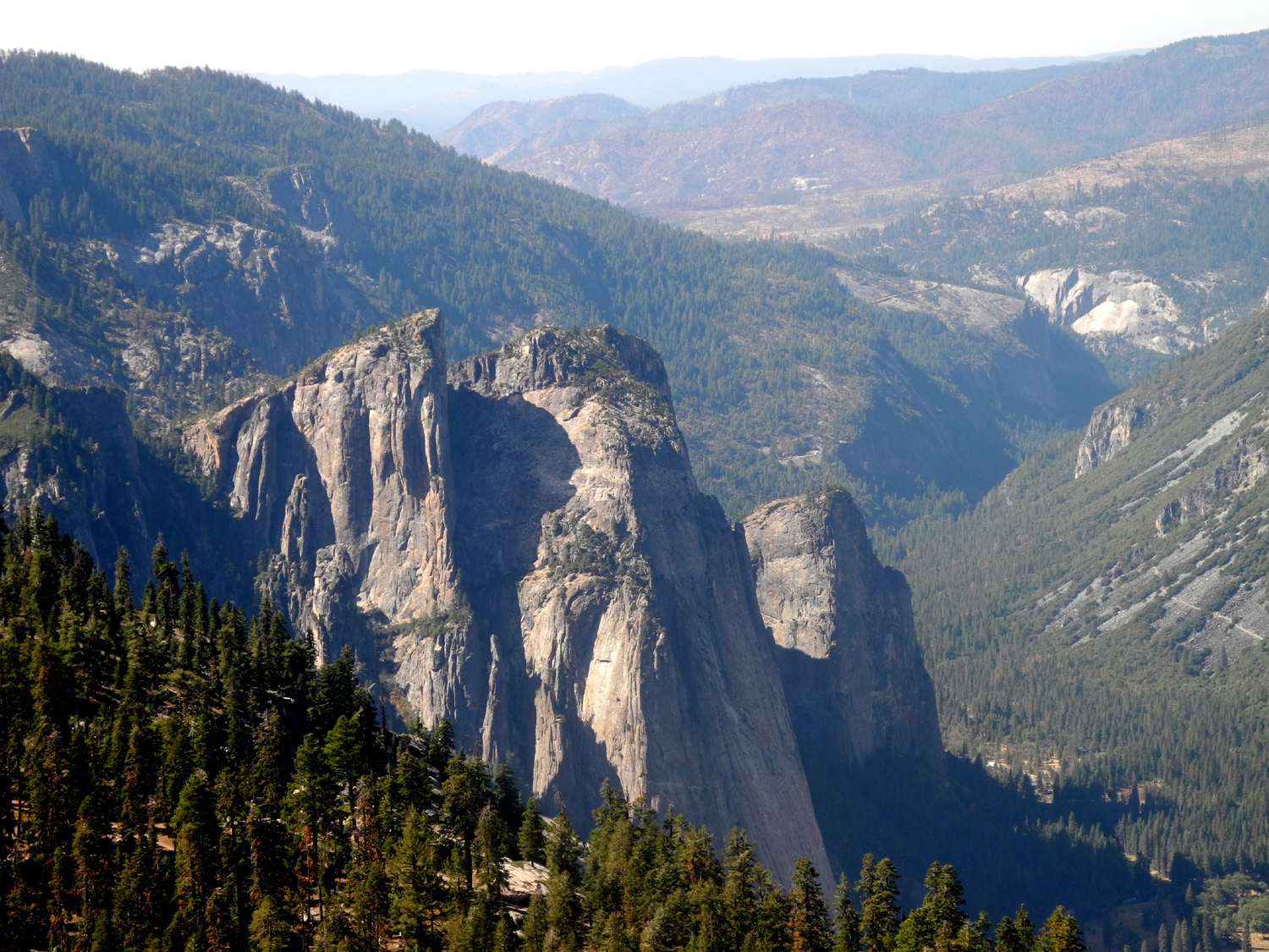
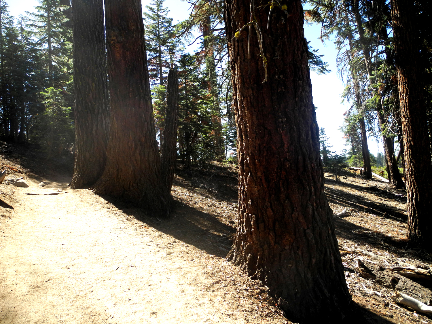
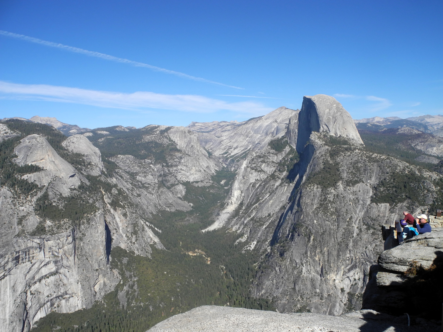
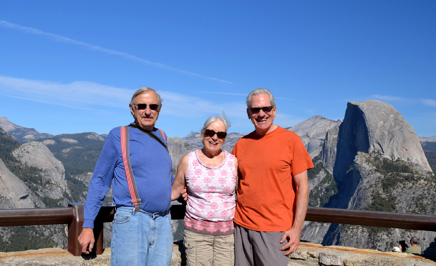
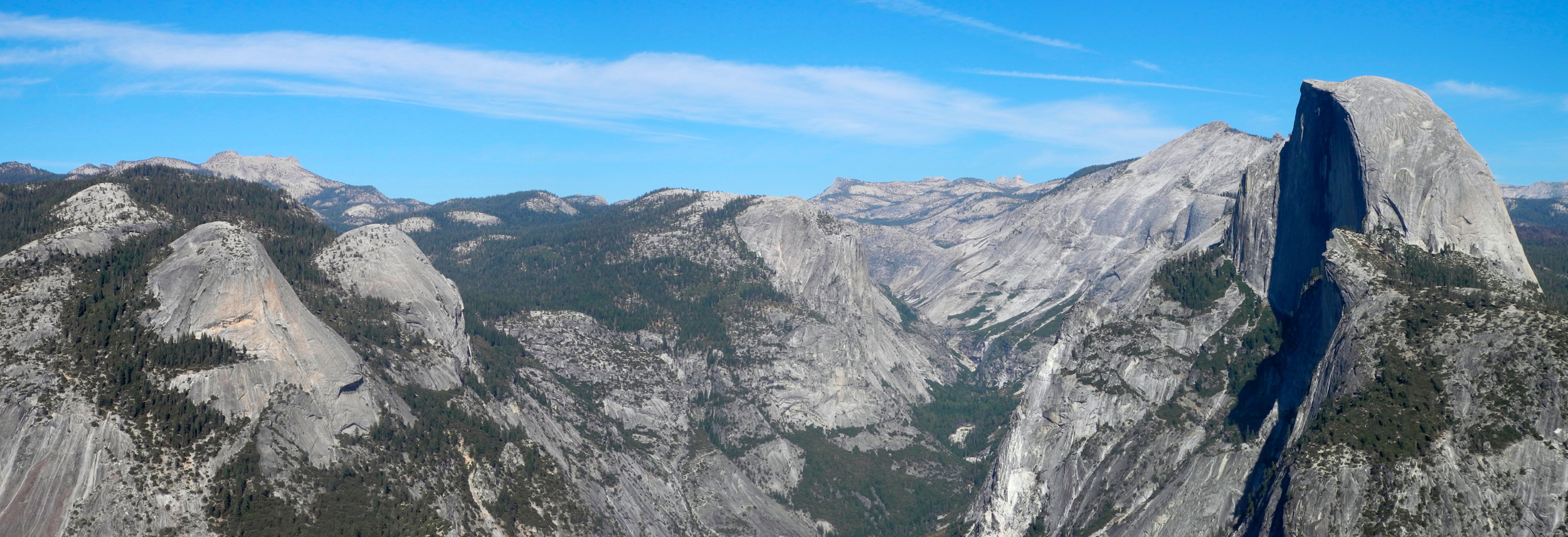
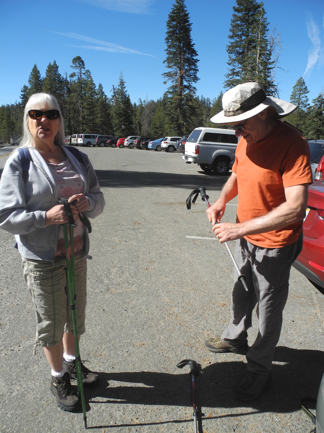
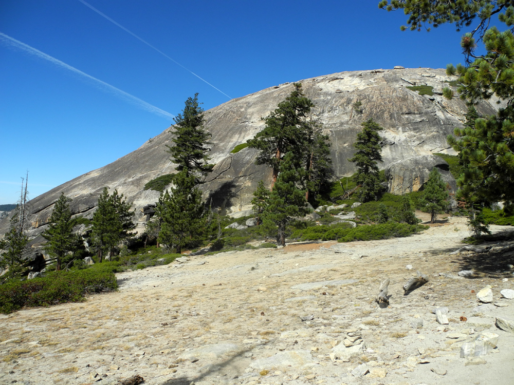
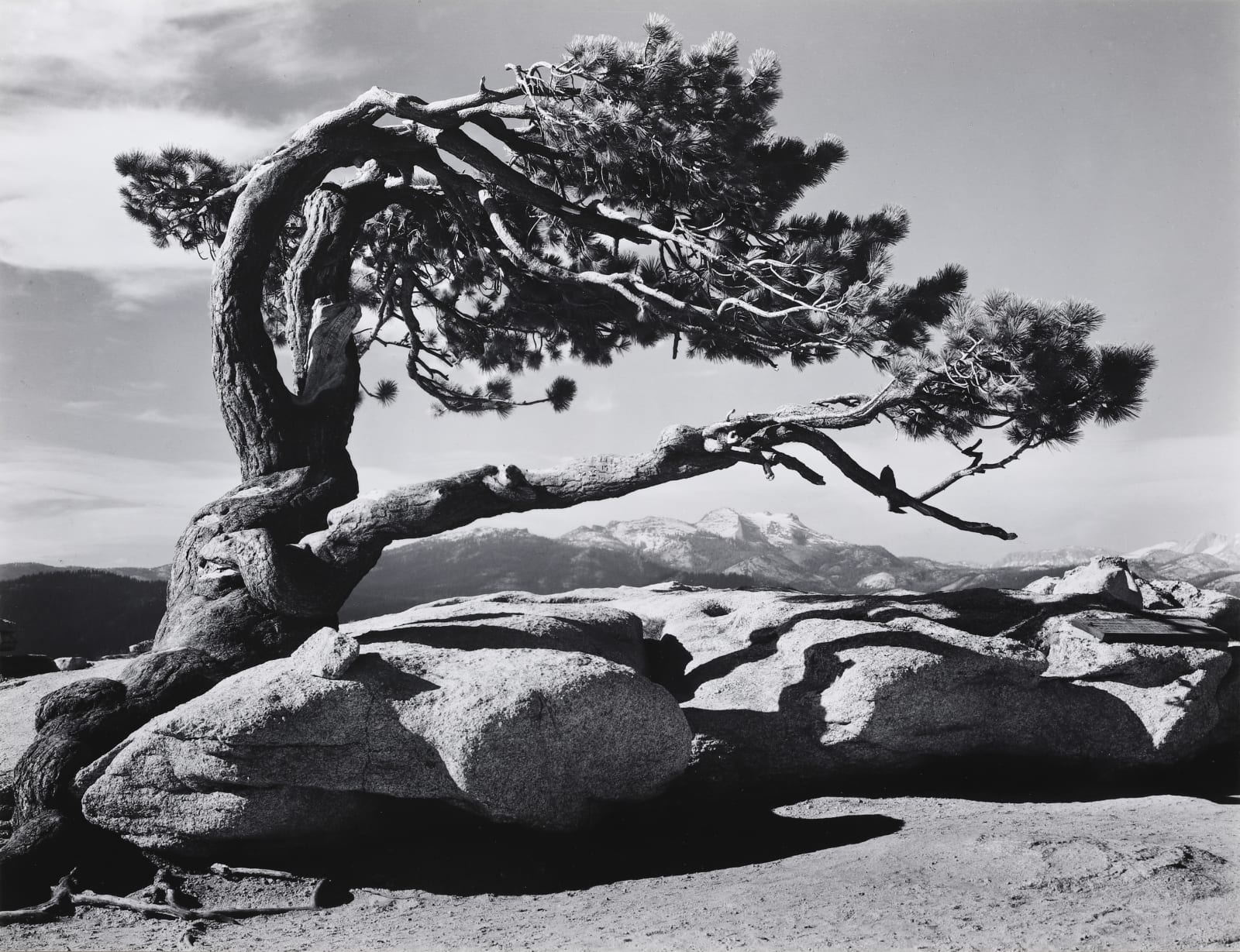
The County Hike Group was once again on the move. Julie Hornback had a funeral to attend, but the rest of us - Wes Thiessen, Carolyn Amicone, and Dick Estel, set off on the morning of October 13, 2014, to hike to the top of Sentinel Dome in Yosemite National Park. This destination is an 8,000 foot dome near Glacier Point. Many years ago you could drive to the base of the dome, and it was just a short walk to the top. That road is now closed to vehicles, and the usual route is a 1.1 mile hike that starts from a trailhead a few miles from Glacier Point. You can also hike 1.4 miles from Glacier Point or walk up the old road, but we took the "normal" trail route. To get to the trailhead we drove up Highway 41 to Oakhurst, 45 miles from Fresno, where we stopped and got sandwiches from the deli at Raley's Supermarket. It's another 15 miles from there to the park entrance just past Fish Camp, then about 20 miles to the junction with the Glacier Point Road at Chinquapin. This location was once a small settlement. Later there was a ski lodge, then a ranger station, and a gas station till the 1990s, but the only thing there now is a restroom. After a quick stop, we turned on to the Glacier Point Road, going past Badger Pass ski area and Bridalveil Creek Campground, heading for the trailhead 14 miles from Chinquapin. Throughout most of our trip we had enjoyable scenery, especially after entering Yosemite National Park. But as Wes says, as soon as you get in the car you're on vacation, so enjoy the journey. The foothills offer their own beauty, even though they are normally dry and brown at this time of year. With a couple of years of below average rainfall, they look even more parched than usual, and another dry year would leave this area virtually barren of grass. The Glacier Point road passes through forests of ponderosa and sugar pine, white and red fir, lodgepole, and many high altitude shrubs. Along the way there are glimpses of the high rocky peaks of the Sierra crest east of our location. We found the trailhead crowded but managed to get the next to last parking space, and soon were on the trail. There are two destinations from this location, Taft Point and Sentinel Dome, both relatively easy hikes of just over a mile one way. I had been to Taft Pont many years ago, but had never hiked the Sentinel Dome trail. There are views of the dome, about a thousand feet higher than the start of the trail, and apparently too steep for climbing, so a bit daunting for Carolyn, who was making her first visit of any kind. Wes had hiked the trail a few times, and I knew that we would work our way around to the east side and find easier going. Similar views presented themselves as we hiked, and even fairly close on the south side, the dome still looked very challenging. Although we were prepared for cool weather, much of the trail is in the sun, and we were very comfortable with jeans and short sleeve shirts, despite the elevation. The trail goes up fairly gradually, and there are no really difficult spots till you get to the dome itself. From here, there is no official marked trail, but Wes guided us up in a zig zag technique that made the climb reasonably comfortable. Even before we reached the rock we started seeing the upper part of Half Dome, as well as other Yosemite landmarks, including Cloud's Rest, Mt. Clark, and Mt. Starr-King. This led to a friendly competition between Dick and Wes over what we were seeing. Before we started our way around the dome, to the northwest we could see the rounded top and a small part of the sheer cliff of El Capitan, one of the more notable features on the north side of Yosemite Valley. Wes was fairly certain that we were actually looking at cliffs farther down the Merced Canyon, so Dick tried to lure him into a lunch bet, but Wes was wise enough, and uncertain enough to avoid this trap. Once we got around to the northeastern side of the rock, Wes admitted that the feature we were looking at was definitely El Capitan. As we made our way up the dome, the views kept getting better and better, ultimately giving us a 360 degree look at Yosemite's high country. We could also see the place where Yosemite Falls should be - the cliff is stained and the path of both the upper and lower falls are clearly visible. But there is no water; the stream is completely dry. Nevada Fall on the Merced River was just a trickle, although there was enough water to maintain a sluggish flow of water through the river bed in the valley. We enjoyed the view and took pictures, spending about 20 minutes on top. Near the very top of the dome is a gnarled Jeffrey pine, now dead, that was living until about 1977. A website that seems to be mostly accurate says: "On top of Sentinel Dome is one of the world's most famous dead trees, the fallen Jeffrey Pine. The tree appeared in the 1940 Ansel Adams photo and became a star. The tree died in 1977 and finally fell over in 2003." This much photographed landmark was famous for its low, twisted stature, despite obviously being probably one or two hundred years old. We made it down the rock and back to the car without mishap, recording a total hiking time of about two hours. Wes had brought along an extra set of hiking poles, and Carolyn tried these for the first time, deciding that they helped enough that it would be a good investment to get her own. Next we drove the short distance to Glacier Point, where we had a similar view of the high peaks, but from a slightly lower elevation, about 7,000 feet. You can also walk out to the edge of the cliff and look down into Yosemite Valley, with some views almost straight down. We took our ice chests out toward the point, found a place where we could sit and eat lunch while gazing at Half Dome and other peaks. We have all been to Glacier Point, dozens of times in my case, but none of us ever tire of this magnificent view. I've taken so many photos there that it is difficult to find a new angle, but this was the first time I had been there with my current camera, which has a panorama setting, so I was able to get some views that were new for me. Everywhere we went, but especially on the trail, Wes had a greeting for everyone we met, always asking where they were from. Most of the people we talked to were from outside the U.S., including Scotland, England, Austria and Israel. After we had enjoyed the area for a while after lunch, we stared our return journey, arriving back in Fresno about 5:30, nine hours after we started. --Dick Estel, October 2014 |
||
|
|
||
|
|
|
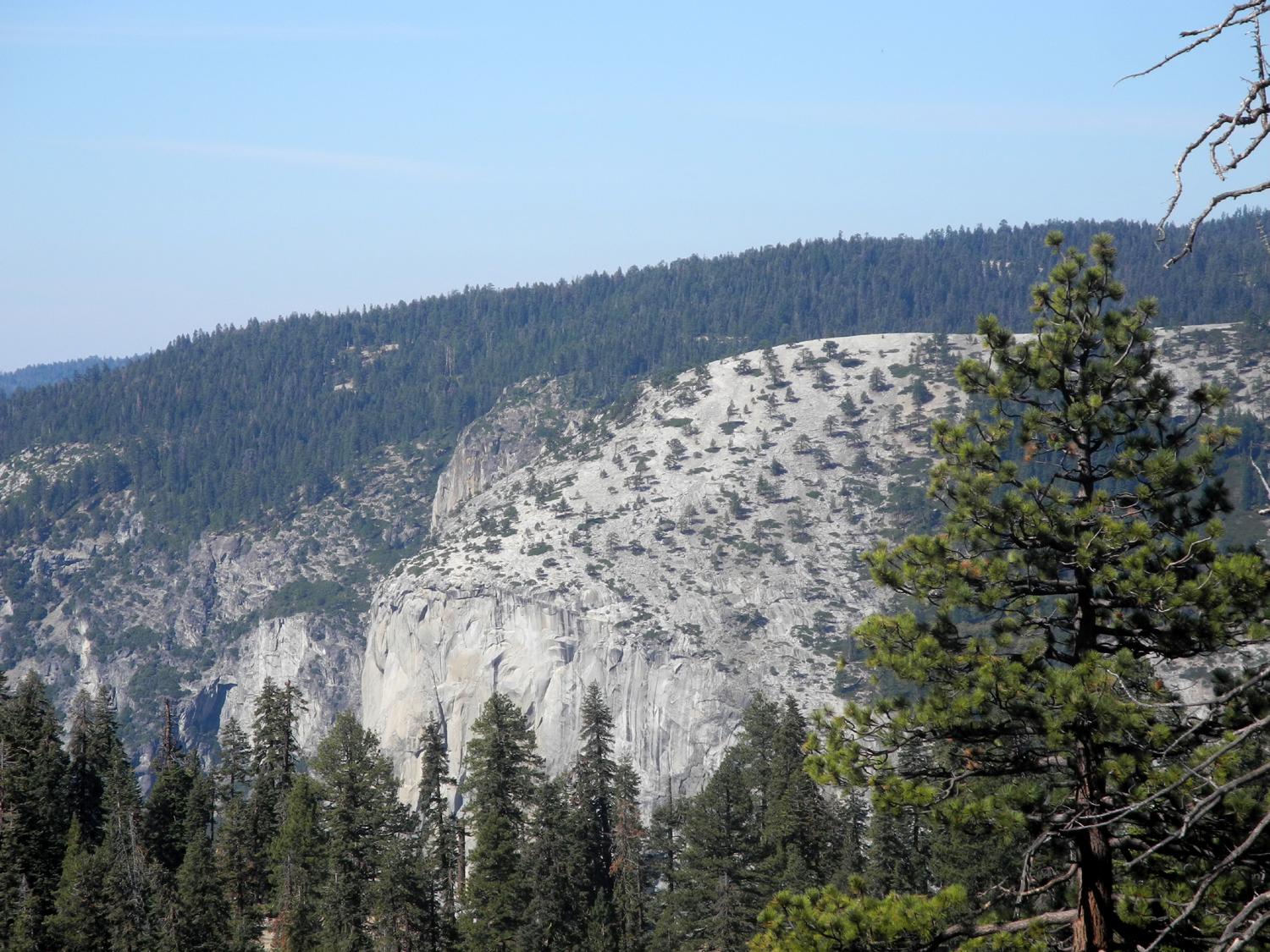 |
| Wes demonstrates how to adjust the hiking poles | Our destination: Sentinel Dome | The top of El Capitan - or is it? |
 |
 |
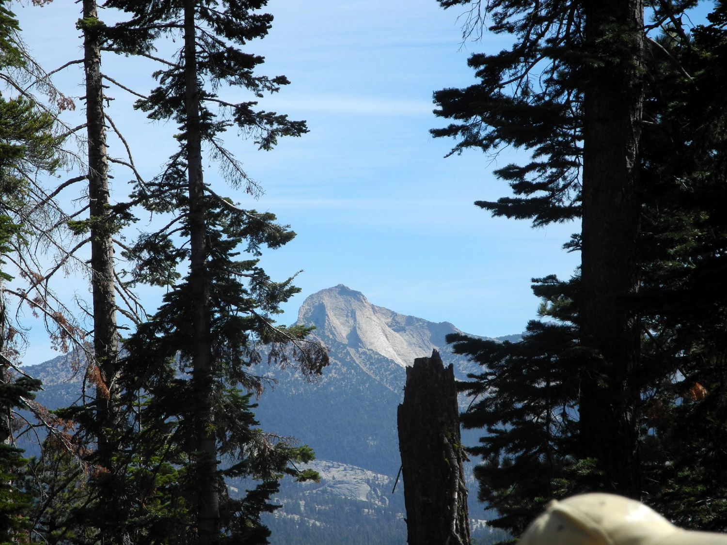 |
| Getting closer to the base | Jet trails decorate the deep blue sky | Mt. Clark from near the base of Sentinel Dome |
 |
 |
|
| More peaks in the Clark Range | First view of Half Dome | Wes admits that what we are seeing is El Capitan |
 |
 |
 |
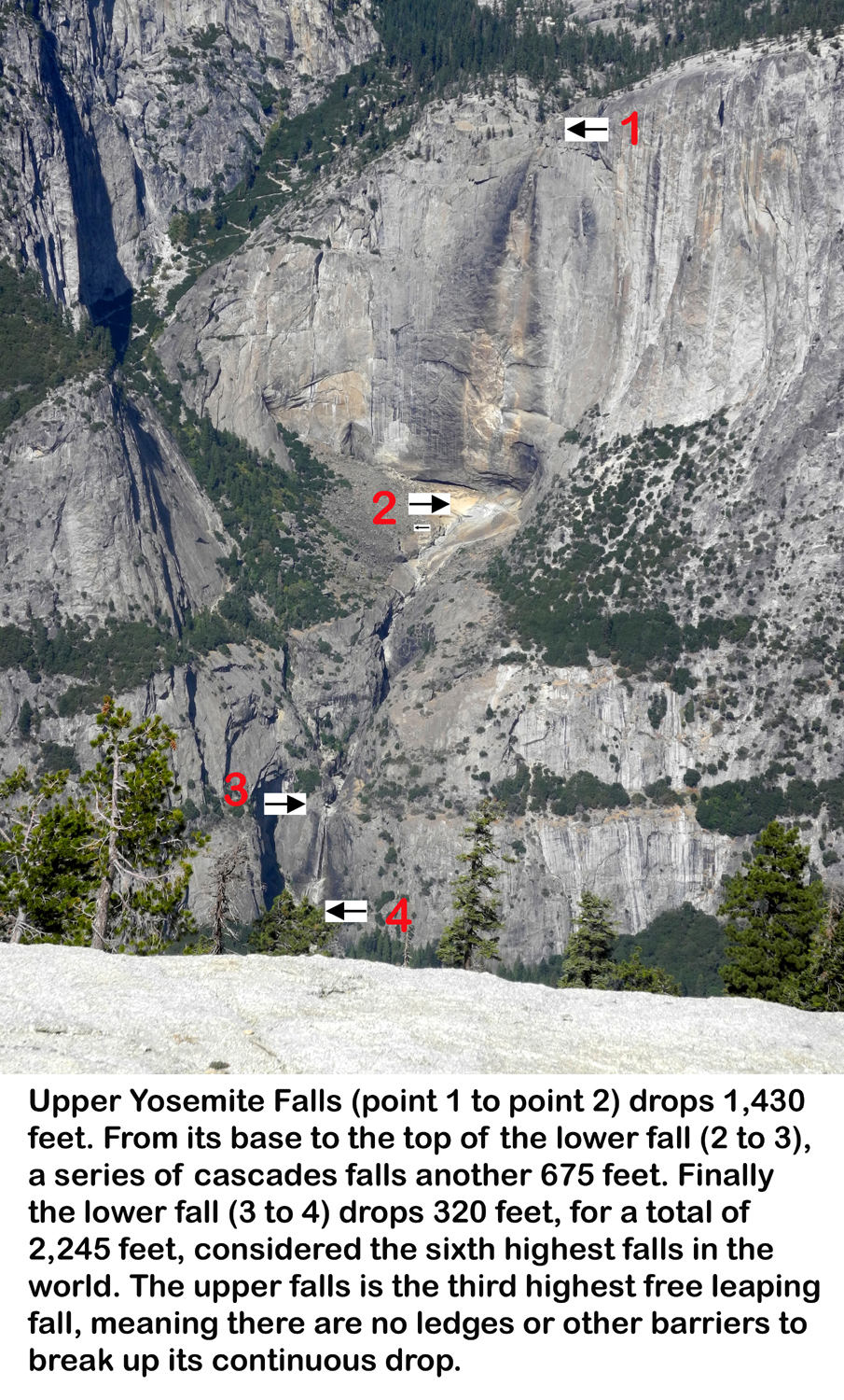
| North Dome and Basket Dome | Heading up the rock | Where Yosemite Falls should be (statistical information) |
 |
 |
 |
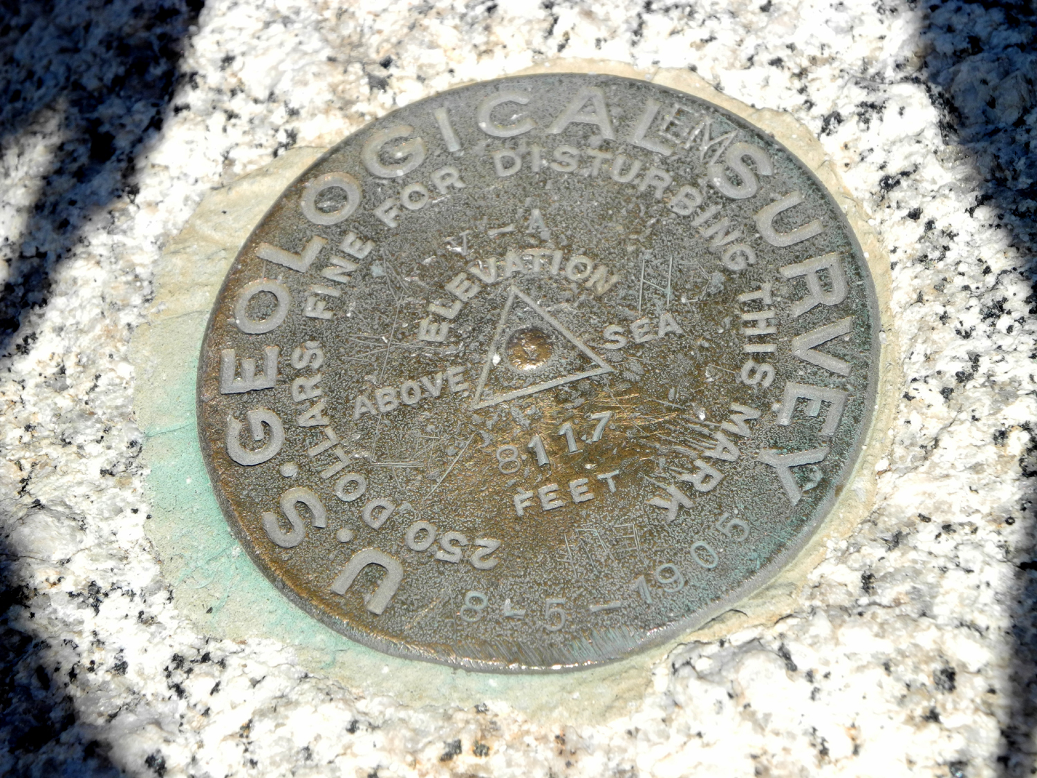
| USGS marker placed in 1905 - 8,117 feet above sea level |
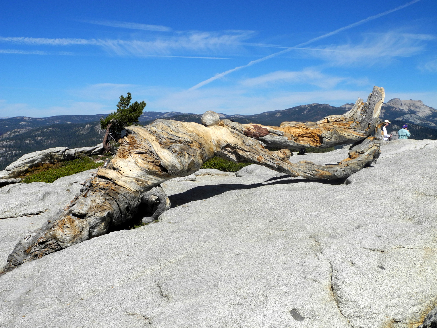
The iconic Jeffrey Pine, dead since 1977 | That tiny trickle in the middle is
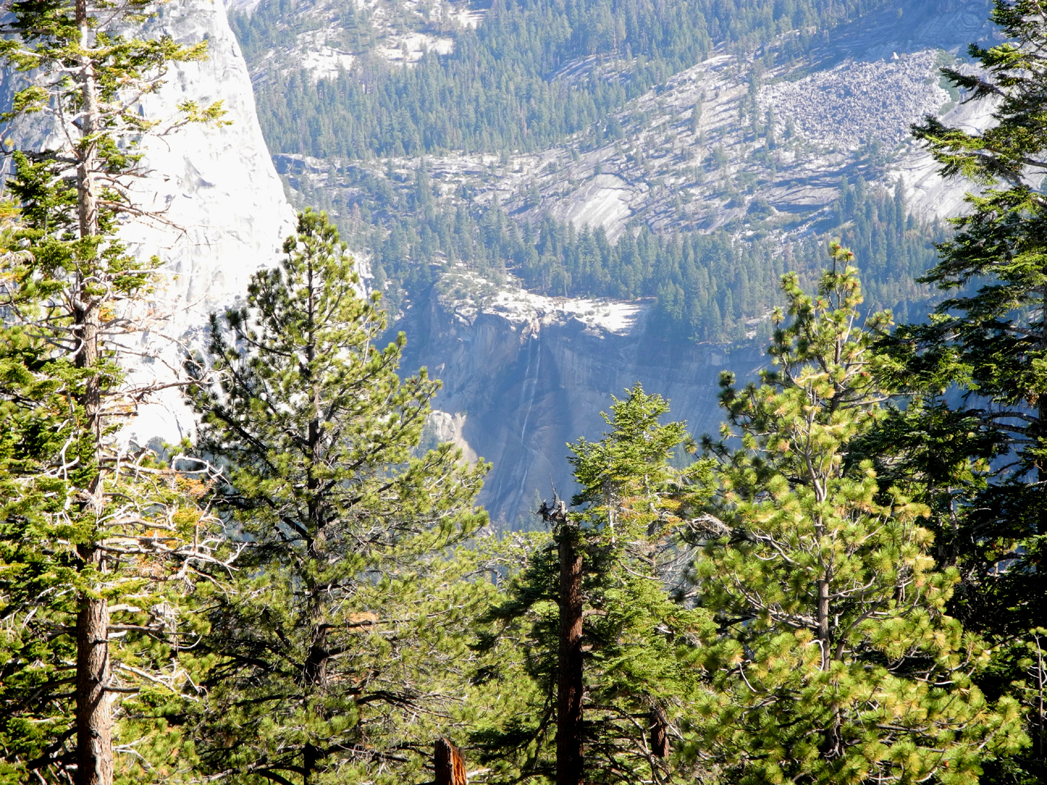
the usually majestic Nevada Falls |
 |
 |
 |
| View into the valley | View to the west, El Capitan on the right; foothills in distance |
High Sierra - highest point right center is Mt. Clark |
 |
 |
 |
| Cathedral Rocks and Merced River Canyon beyond |
Dick on top of the dome | Red firs on the trail |
 |
 |
 |
| Looking up Tenaya Canyon from Glacier Point - famous domes to the left and right |
Dick, Carolyn and Wes at Glacier Point | A last look at Half Dome from the parking lot |
 |
||
| Panoramic view of Basket Dome, North Dome and Half Dome, with Yosemite high country beyond | ||
| Related Links | ||
| Sentinel Dome | Fish Camp | Yosemite National Park |
| Glacier Point | Dick's Waterfall Gallery | Dick's Taft Point Hike |
| Taft Point | Ansel Adams Jeffrey Pine photo | Dick at Taft Point, 1981 |
| Tallest Waterfalls | A
better, wetter view of Yosemite Falls from Glacier Point |
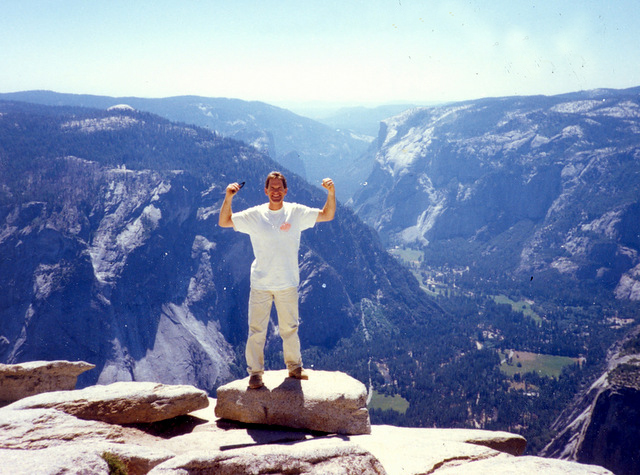
Wes on Half Dome,
1991; Sentinel Dome in distance |
| Dick's Half Dome Hikes: 1979 1980 1986 |
Yosemite Falls Statistical Info | |