

Dick's Adventures of 2017 - Part 2 |
||
|
2017 Part 1 2017 Part 3 2017 Part 4 2017 Part 5 2017 Part 6 |
||
|
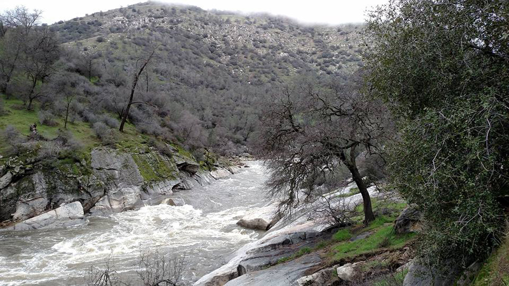
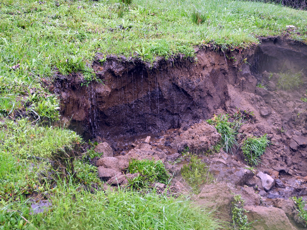
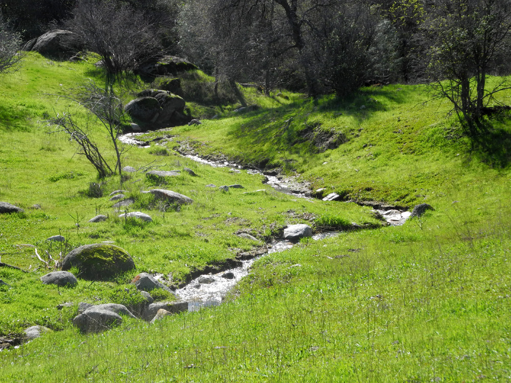
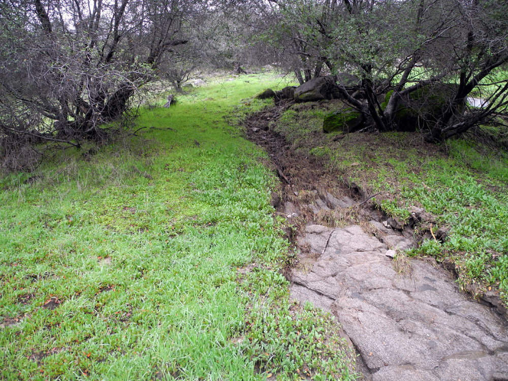
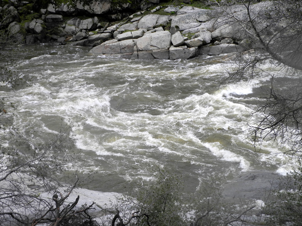
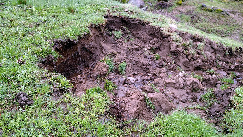
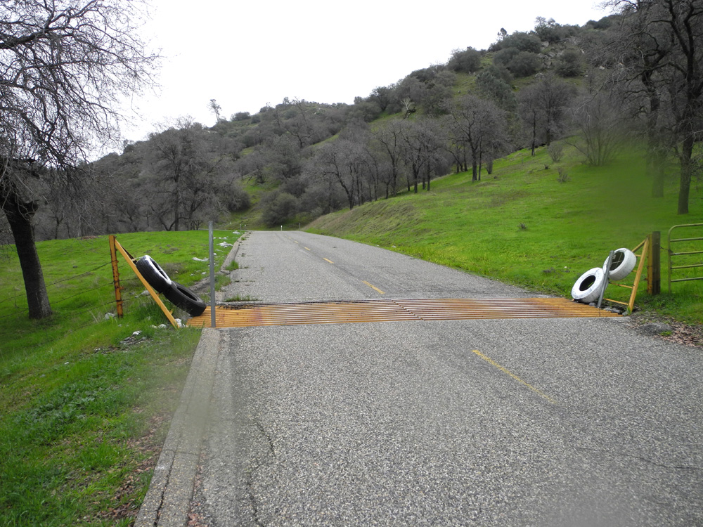
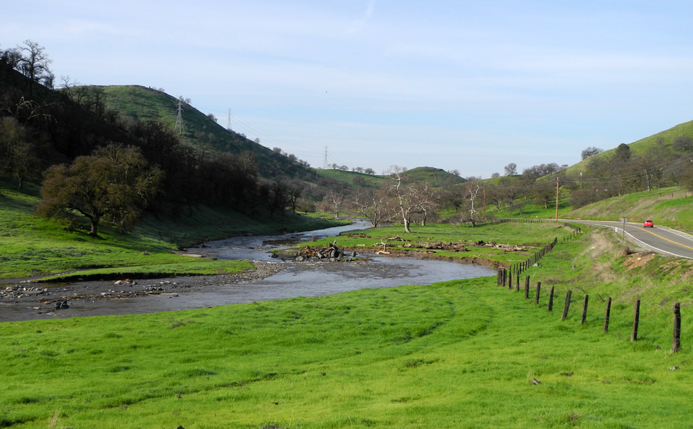
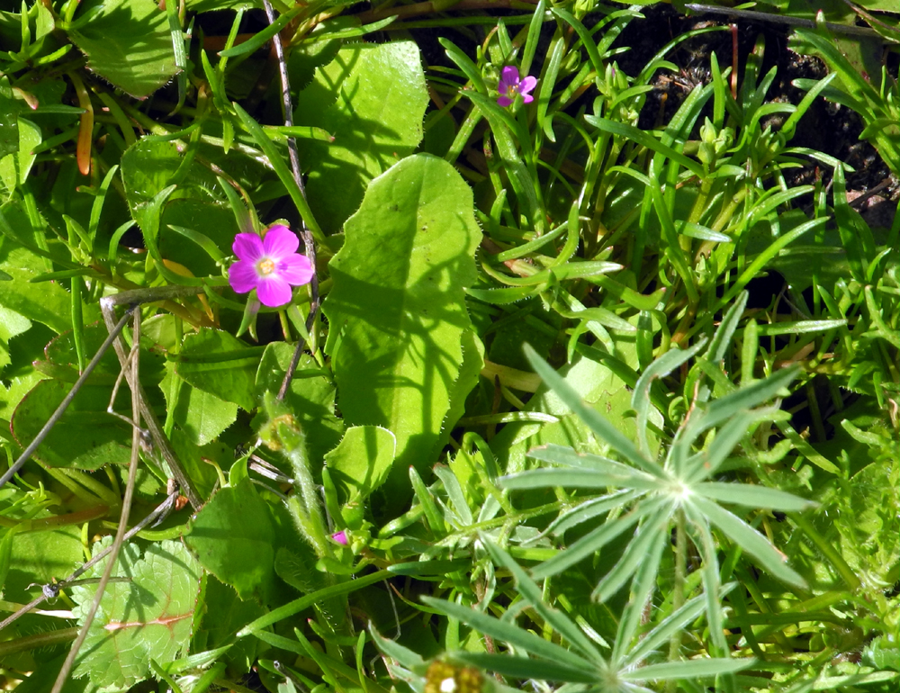
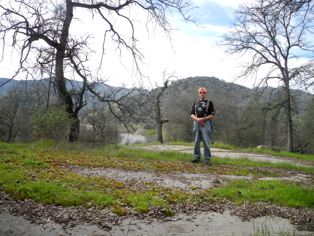
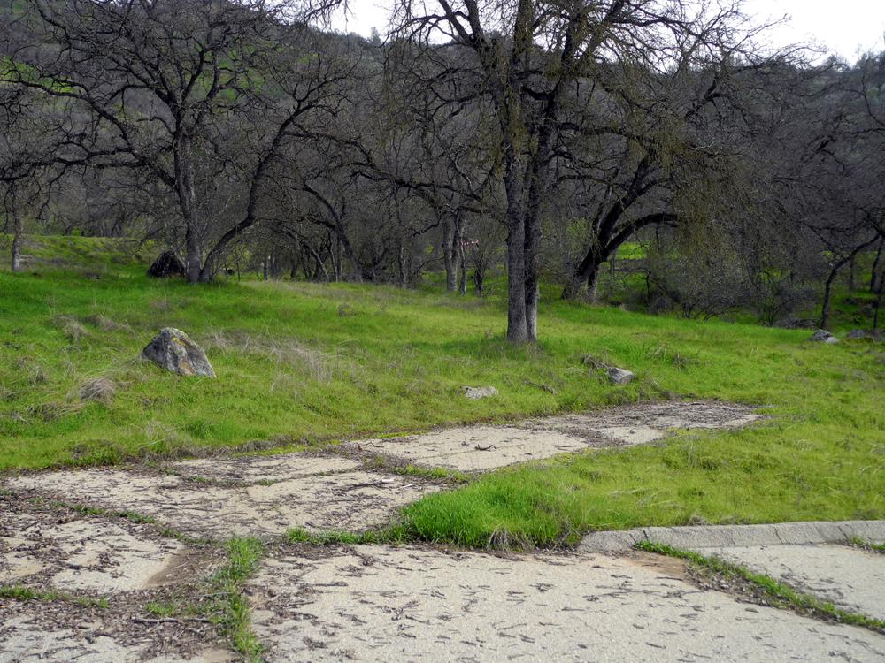
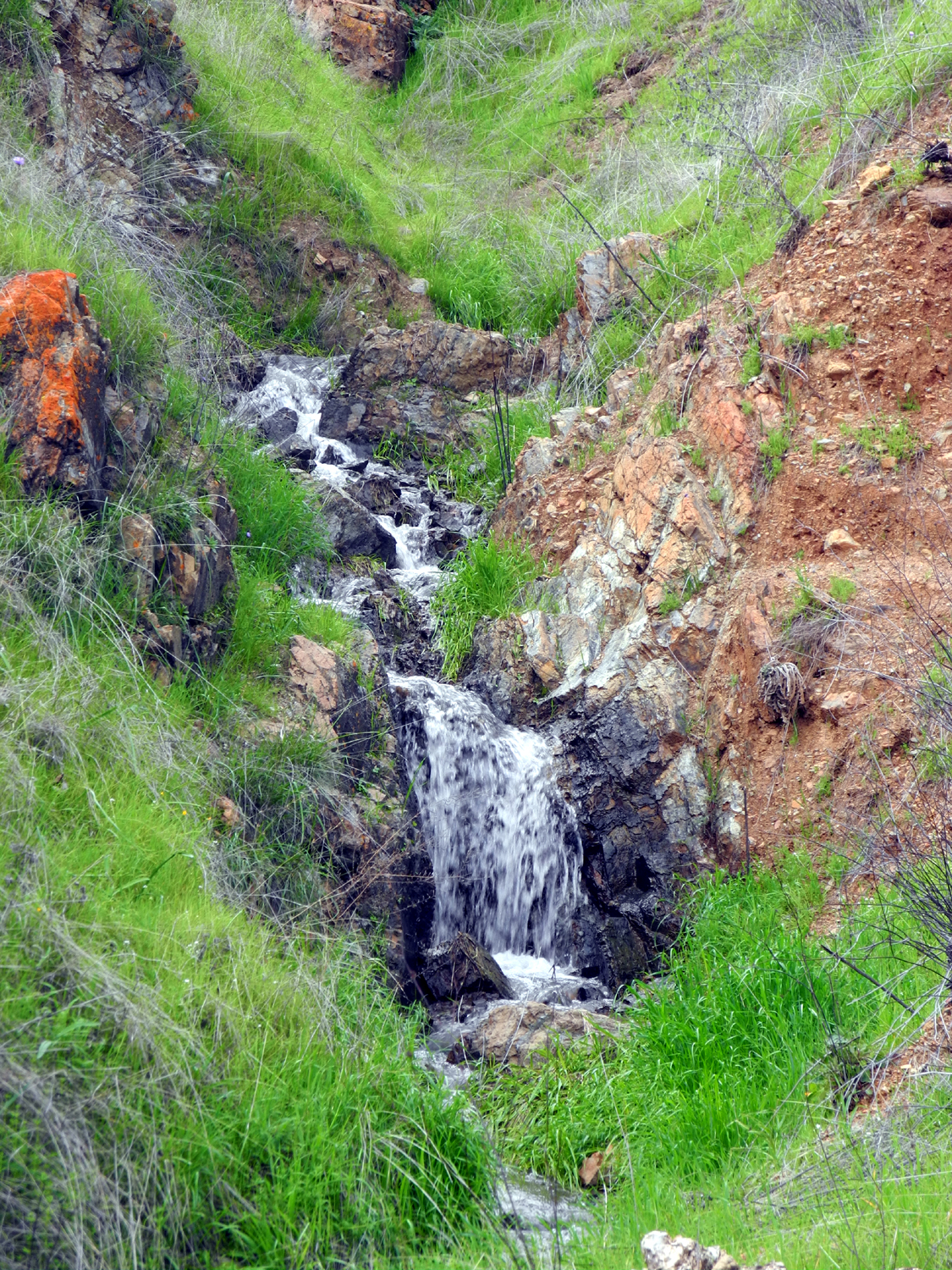
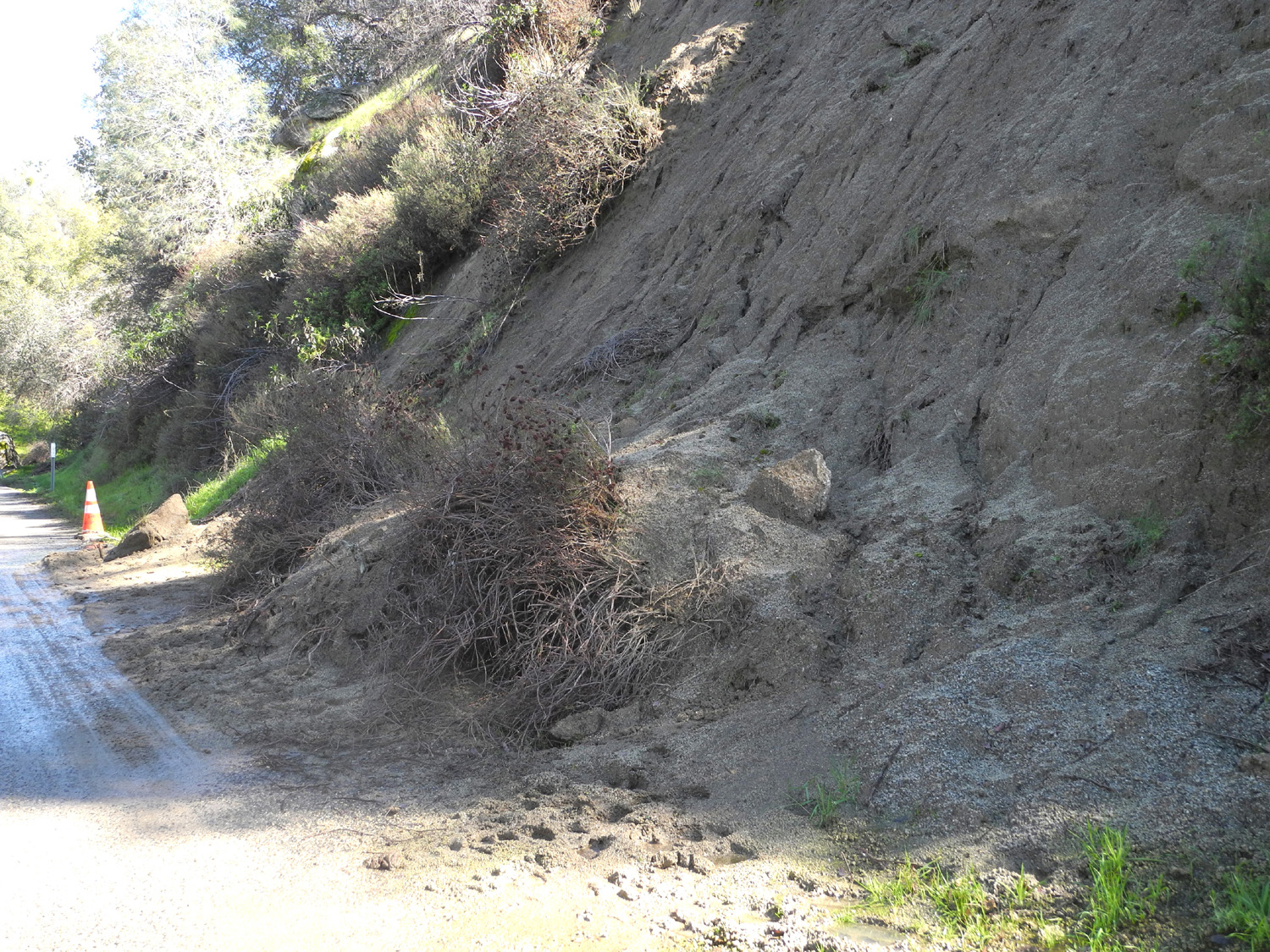
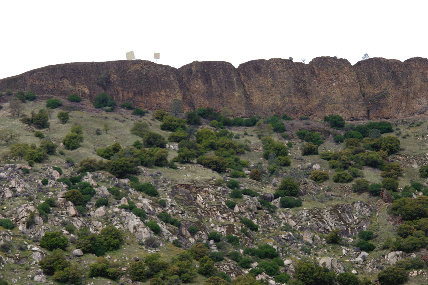
San Joaquin Gorge River Access Trail After a week of rain the forecast for Saturday, February 11 offered the promise of probably dry weather, with clouds and wind. That meant it was time for a hike, so my daughter Teri came over at nine a.m. and we set off in my Honda. As we drove we discussed two possible destinations. Our route could take us to the Finegold trailhead or to the San Joaquin Gorge, and we had about ten miles to go before we had to make a choice. We both leaned toward the Gorge, which we sometimes forget and call by its old name, Squaw Leap. Although this "politically incorrect" name has been removed from signs and the web site, it still applies to the table-top mountain above the area, so go figure. We have had torrential rains, flooding, mud and rock slides, road washouts and other consequences of the torrential rains that have hit California in January and February, and we were interested to see if anything had affected the San Joaquin River Gorge Special Recreation Management Area. We also wanted to see how much water is flowing down the San Joaquin River, since every tiny foothill creek is up to and over its banks, and some of the larger creeks have become raging rivers, especially during the storms. We made a short stop where Auberry Road crosses Little Dry Creek, and observed that it is running even fuller than it was when I drove by January 10. Instead of staying on Auberry Road to Prather, we took Millerton Road where it goes southeast to join Highway 168. Along this section the road crosses Little Dry Creek several times, and we enjoyed the green hills and the views of the water, making one stop. Once on the state highway, we continued to the turnoff for the town of Auberry, then down Smalley Road to the San Joaquin Gorge. There were places where mud slides had been cleared away, and at one place there was a big pile of dirt and rocks and bushes right at the edge of the road, but there was nothing to cause problems driving. About a mile past the parking lot the road ends at the power house, and there is a short trail down to the river. I hiked it last year, but it was new to Teri. Although it was quite short, only 0.57 round trip, it was challenging in spots. It goes down steeply via switchbacks to the river, and water does the same thing. The heavy rains of this year had created numerous new channels, including some right down the middle of the trail. At one point we had to stop and figure out which little creek was really the trail. All along the trail there were little rivulets of water running down, and some had carried enough water during the peak runoff to create small gullies. Near the bottom of the trail there was a small waterfall from a creek that ran down a short distance from the trail. Despite the washouts we were able to get to the end of the trail, about 50 feet above the river, which was running very big and brown with silt. Along the trail we saw a few wildflowers, a total of five different species. They included filaree, popcorn flower (a single blossom), fiddlenecks, and the obligatory "unidentified," all very small and sparse. We made our way back up the trail and drove to the group camp, where we ate lunch at a picnic table. It was overcast all the time we were there, but we were comfortable while hiking. Sitting at the table was a different matter, and by the time we finished eating, we were getting cold. We took a quick walk around the group site, spotting a small patch of fiddlenecks, then hurried to the car and started home. We again took the Highway 168 route, and made a stop where Big Dry Creek crosses the road. Here we saw larger fiddlenecks, in greater numbers. The debris line above the creek indicated it had been much deeper and maybe 50 feet wide during the recent storm. On our way back to my house we stopped at the Upshaw's (Teri's older son) to confer with them about future camping plans. I had reserved a cabin on the Kings River above Pine Flat, and was hoping to have most of our family there in March, but the dirt road is blocked by slides and washouts, and our reservation was cancelled, so we talked about what else we could do instead. We came up with a few ideas, and of course, you know you will be getting a report about wherever we finally decide to go.
|
||
| Other San Joaquin Gorge (Squaw Leap) Reports | ||
| Four 2012 Squaw Leap Hikes | 2012 Bridge Trail Hike | 2013 San Joaquin River Trail Hike |
| 2014 San Joaquin Gorge Campout | 2014 River Trail Hike | 2015 River Trail Hike |
| Thanksgiving at the Gorge | 2016 Bridge Trail Hike | 2016 February Campout |
| 2016 March Campout | Rambler Hike 2015 | Rambling in the Rain 2016 |
| Squaw Leap Backpack March 1980 | Backpacking 1981-82 | Backpacking 1982-83 |
| L/S Expedition | Backpacking 1984-93 | The Last Backpack Trip |
| 2016 Buzzard Road Hike | 2016 San Joaquin River Trail | 2017 Off-Trail Hike |
| February 2017 Camping | 2017 Bridge and Ridge Trails | 2107 Rambler Hike |
|
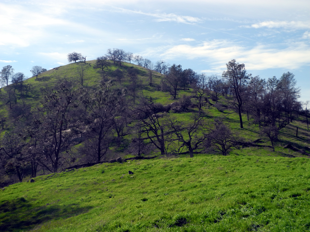
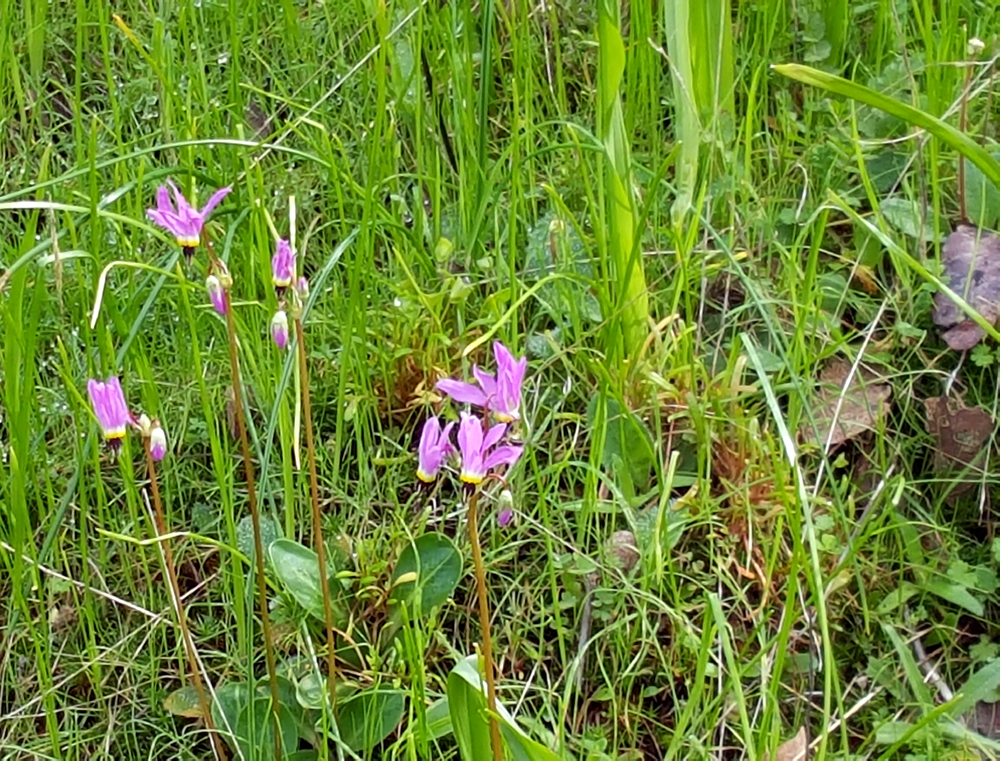
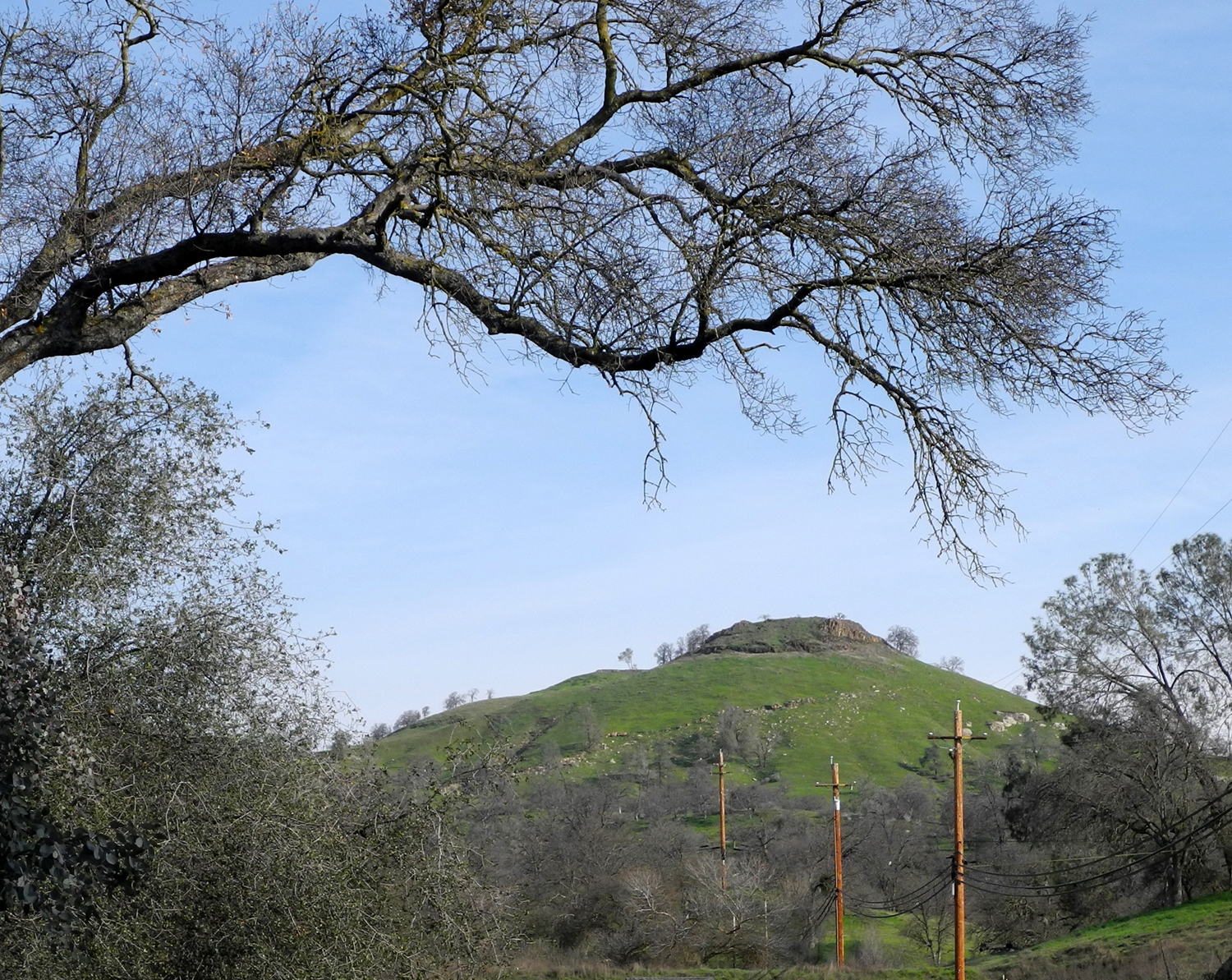
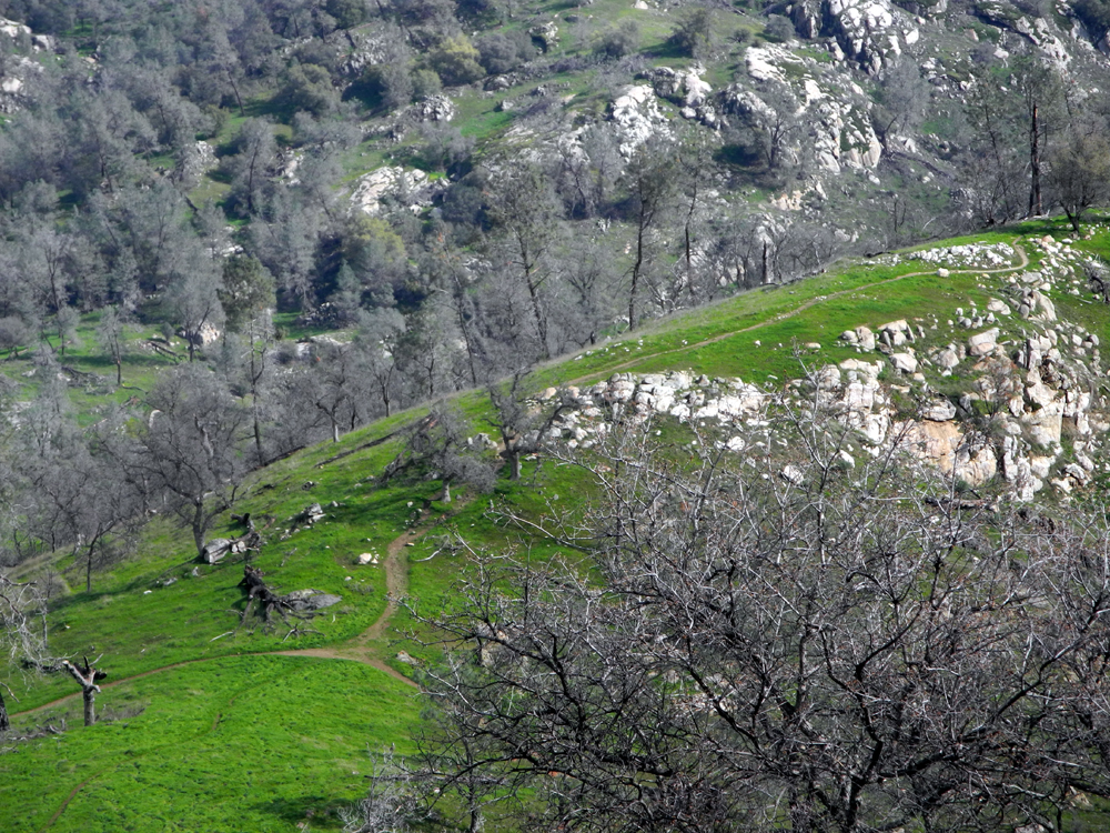
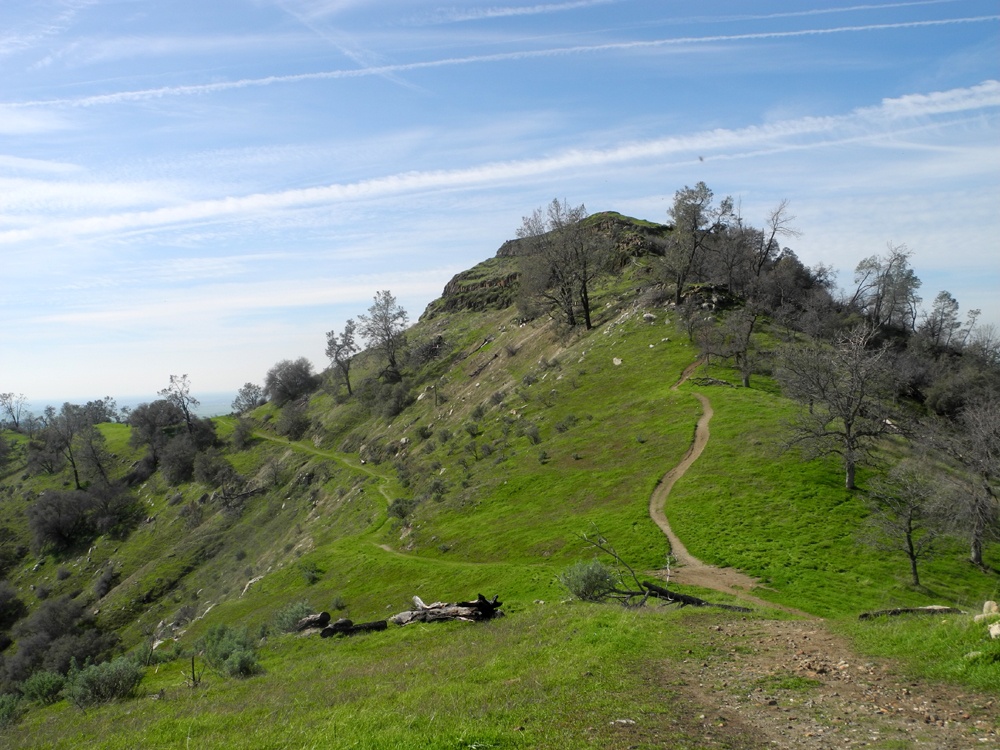
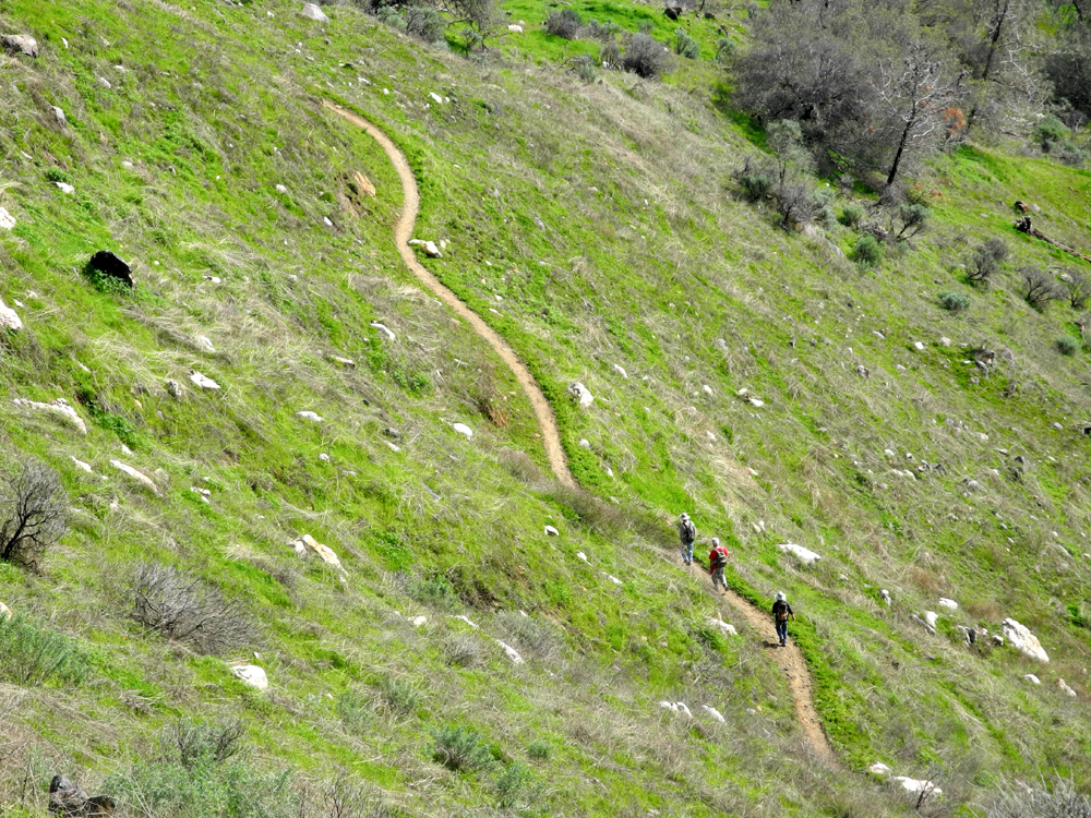
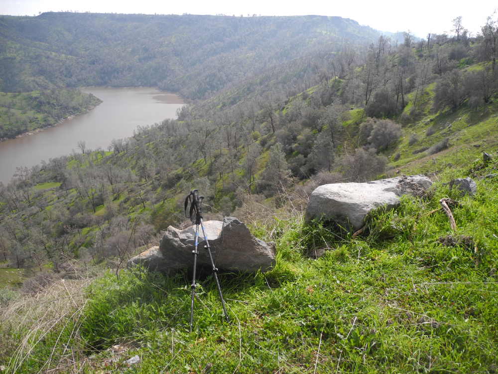
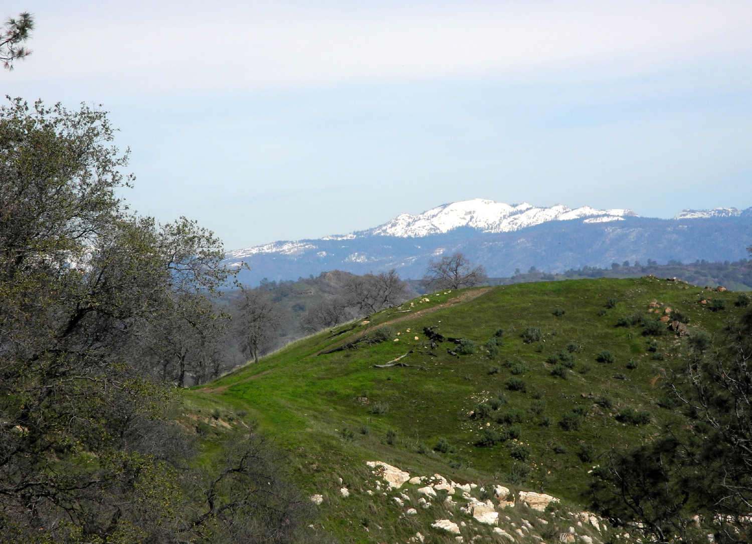
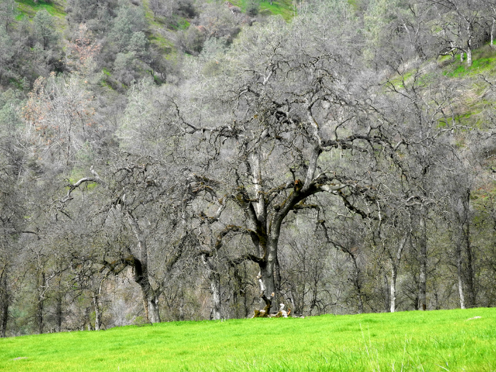
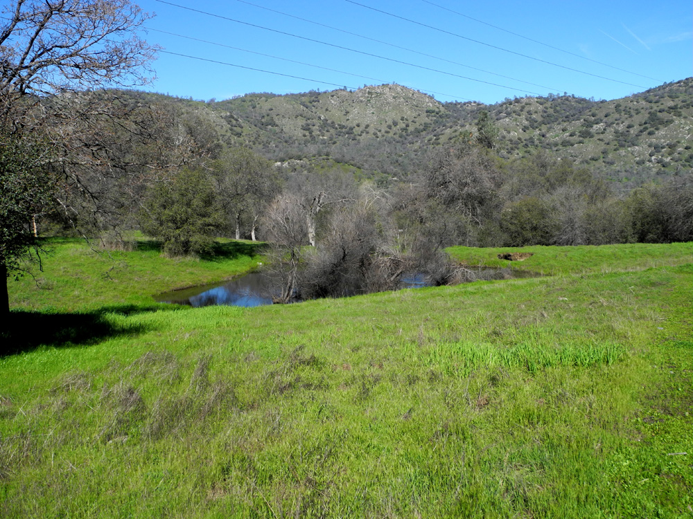
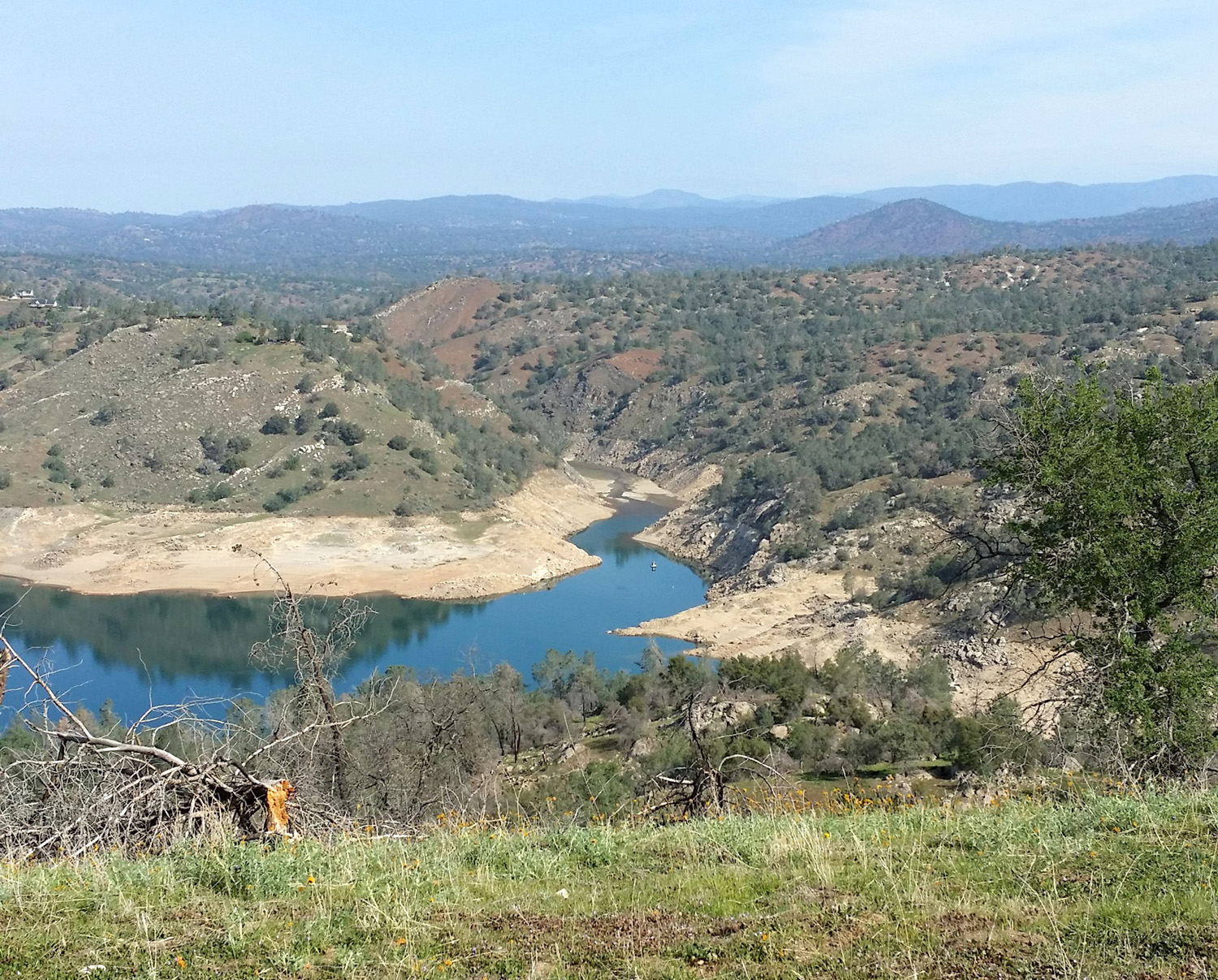
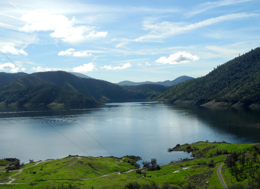
San Joaquin River Trail West Some people just can't seem to get enough camping and hiking, and apparently I'm one of them. Although there has been no camping yet, on February 13 I did my seventh hike of 2017, having had a full day off since the last one. There are a number of hiking choices when you go up the San Joaquin River Trail from the Finegold Picnic Area near Sky Harbor. The truly ambitious can go the 12 miles or so all the way to the San Joaquin Gorge, something that's not in the cards for me. On my first few hikes here I went only to the top of the saddle about one mile up the trail. I did a couple of hikes where I went beyond that point, trying to go farther than ever each time. Another challenging destination is Pincushion Peak, up a steep, rocky trail to the west of the saddle. Since I did that last year, I never have to do it again, but you can see photos and read about it here. For my latest hike I chose a destination I had reached at least once before. About half way to the saddle a trail splits off from the main route and eventually reaches a knoll between the saddle and Pincushion. This branch trail starts off a little steeper than the main trail, then it goes up an even steeper section, then it really goes UP. It's the kind of trail I normally would not take, but this was what I call a WISC hike, as in "I want to do this once more WHILE I STILL CAN." For someone of my capabilities, all that's needed is an understanding that slow, short steps will still get you there, and I took a lot of these. A lot of other people were heading up that same trail. Although it was a Monday, there were 25 cars at the parking area, and I saw at least a dozen hikers going up to or coming down from Pincushion, as well as many going along the main trail or just to the saddle. It was a sunny day, very welcome after a lot of rain and a couple of cool, cloudy days, and I took off my sweatshirt a short distance up the trail. The grass was the same brilliant green seen in our last few hikes, but for the first time there were enough wildflowers to say that the season has truly started. When I hiked here with daughter Teri January 29, we saw not one flower. This time, along the closed road into the parking lot and the first part of the trail I saw fiddlenecks and miner's lettuce blossoms. Higher up, on the sunny side of the hills, there were many more fiddlenecks and lots of popcorn flowers. In limited areas filaree was out in good numbers, and I saw a few fringed redmaids, one poppy, a lone shooting star, and an unidentified flower. Of course, the brilliant fields of color that massive blooms produce are yet to come, but the plentiful water and the early specimens hold out great promise. Like most trails in the foothills, this one had some major areas of erosion, most of them new since the 29th. The steep alternate trail I took is an unofficial route, not maintained and lacking the normal switchback construction that makes such climbs a little easier. Where it goes more or less directly up hill there were deep runoff channels, mostly washed out by this year's heavy rain. When I got to the top of the knoll, I enjoyed the view of the lake on two sides, the snowy Sierra peaks, and the rocky top of Pincushion not far above. From this point the path to Pincushion does not look that bad, but I assure you it really is that bad. Of course, it can be climbed by anyone in reasonably good condition, but once was enough for me. Instead I walked west down off the knoll to a trail that goes around the south side of the peak, then out along a ridge. In this location you are looking across the main lower section of Millerton Lake, with the dam and Little Table Mountain visible beyond. I went only a short distance on this route, but it proved to be a good choice, since it was along this trail that I saw the largest number of wildflowers. I found a nice, almost flat rock at the trail's edge, and sat there while I ate lunch, looking down on the main trail where it goes on past the saddle and around the twists and turns of this narrow section of the lake. I have hiked up the steep trail three times now, but never went back down it, since it is much more tricky to make your way down a route like that. Instead I followed another path that goes around the side of the lower knoll, then down a fairly steep but short way to the saddle. I stopped there only long enough to stretch, then made my way back down to the parking area. Driving home, I stopped at one point to take pictures of the lake, and at another point to enjoy one more meal, this one a burger and fries at In-N-Out in Clovis. With the promise of another great wildflower year, I'll be returning to this location again at least once or twice more before spring is over.
|
||
| Previous San Joaquin River Trail West Hikes | ||
| October 2012 | March 2014 | October 2014 |
| December 2014 | Ramblers 2015 | March 2015 |
| November 2015 | Pincushion Peak February 2016 | April 2016 |
| November 2016 with Teri | January 2017 with Teri | |
|
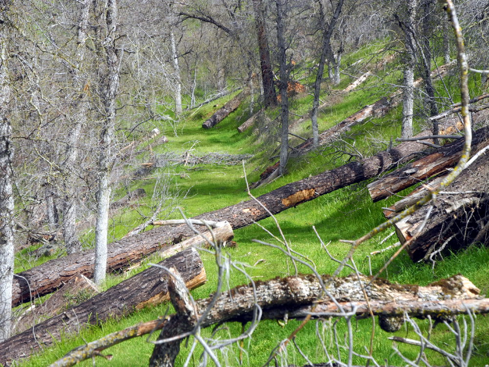
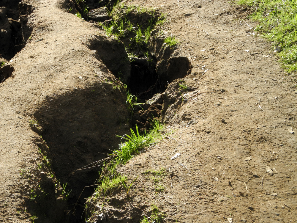
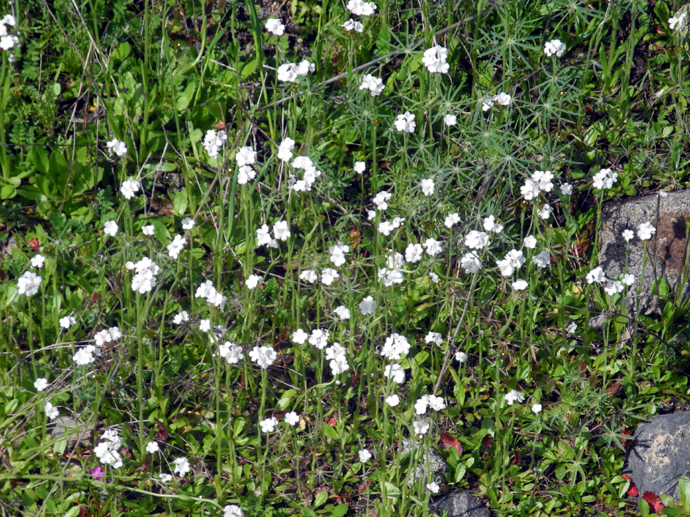
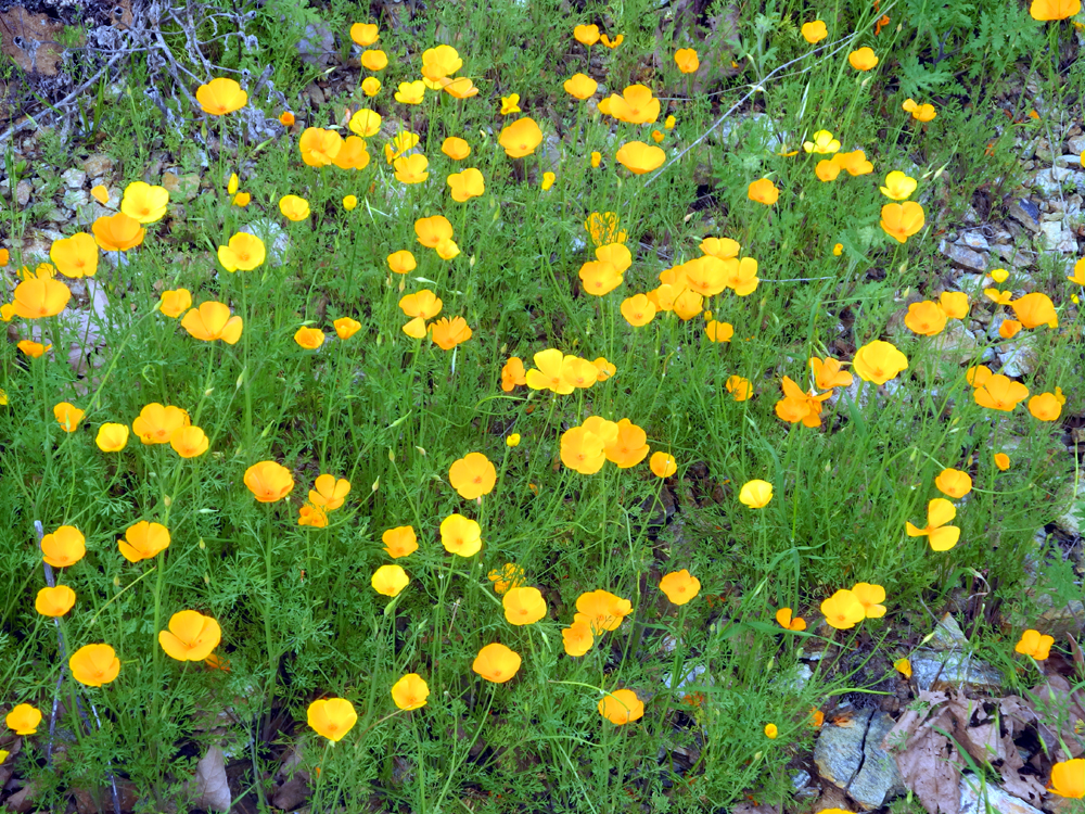
Sycamore Creek Fire Road There are five good hiking spots along Trimmer Springs Road where it runs above the north shore of Pine Flat Lake, and I have now hiked all five of them in 2017, one of them twice. Coming in from the Fresno area, the first one is Edison Point, the only one that's an official trail. It can be a short walk or a long one. The first part of the trail is a half mile of rough dirt road which goes gently up hill to Edison Point, where you have a view of the lake in three directions. From this point, the trail is a steep, narrow path that goes down to the lake in a series of long switchbacks, then back up through several large side canyons and back to the parking area. I've walked the full trail three times and just the road section three times. Two of the three road walks were this year, by myself on January 5, and with my friend Janell on February 4. It's about eight miles to the next spot, what I call the Sycamore Fire Road. This is a rough dirt track that may have been used to access a wild fire 30 or 40 years ago, but which was probably built for ranching purposes. It has become virtually impassible to any type of 4-wheel vehicle, and the hiker must be prepared to bushwhack around fallen trees and go through wet, mushy spots. I don't know how far you can go on this route; until my most recent trip I walked in to a place where the road seemed to disappear, then turned back. I've hiked it solo at least twice, with my friend Carolyn in 2015, and with the Ramblers plus daughter Teri last year. It's only a mile to the next three places, two campgrounds and a picnic area on National Forest land. All three have been closed for decades, but access is allowed on foot, and you can walk the old paved roads or wander off into the grassy, tree-covered area along the way. It's not mandatory, but most times I have walked one of these three locations in combination with Sycamore or Edison, or at least walked more than one of them. On February 15 I left home about 9 a.m. for my third hike in five days. I'm not really as ambitious as that sounds - we had a five-day break between rain storms, and who knows when the next dry spell will arrive? The forecast as I write this is for a possibility of rain every day for the next week. However, this day was dry, mostly sunny, and quite warm. As soon as I made it to the top of the short, steep section at the start of the trail I realized I did not need my sweatshirt, and walked back to the car to leave it behind. I have written about the condition of this trail in my previous reports, so I'll just cover new stuff. First, there are two newly fallen trees across the trail. It's not too hard to walk around them, plus the other four or so that have accumulated since I started walking here, but it looks like it's become too much of a challenge for 4-wheel drive vehicles; the new trees do not have any "tire track" detours. Also there are four creeks running across the section of the trail that I have covered in the past, which is definitely new. There may have been a small trickle in a couple of them in the past, but these are real creeks, tumbling down the hillside above the trail and running down to Sycamore Creek. Above the trail, one of them drops about 20 feet in a 30 linear feet. There are also a lot of places where water seeps across the trail, making for some squishy walking at times. All this water has a positive affect - there are now quite a few wildflowers out, some of them in good quantities, and some in limited numbers. I counted 15 species, which are listed at the bottom for those keeping track. In keeping with my regular plan to go farther each time I walk an "in and out" trail, I did not turn back at the usual place where the old road seems to fizzle out. Instead I hiked up the steep last part of this section, then on over the rounded hilltop, and found that the road continues on the other side. Before starting on this "new" section, I found a somewhat comfortable resting rock and had a snack of walnuts and water. From this point the trail is fairly level and easy to follow. It parallels a fifth creek, and has its own set of fallen trees, including one place where I had to go off the road to get around. I was able to step over the trunks and branches of the other trees. Near the place where the road crosses the creek, a tall, dead bull pine had fallen. It left a big scar on the creek bank across from the trail, and it looks as if the tree may have started sliding down in the saturated soil while still standing, then collapsed into the creek, with the topmost branches falling across the trail. Once I spotted this new section of the trail/road, I considered turning back several times, but then kept going. I hesitated about going past the first fallen log, then planned to stop at the creek, since the road went up out of the drainage fairly steeply on the other side. However, I could see that it reached a ridge top after a very short climb, so I went up that far. Next time I'll keep on going beyond this place! I checked the elevation at the trailhead and at the high point just above Creek 5. I got some inconsistent readings, but I believe the hike involved an elevation gain of about 500 feet. With the brief backtrack to leave my sweatshirt when I started out, and the new section of trail, it was a walk of 1.91 miles. After enjoying my new discoveries, I walked back out to the car, and drove about a mile to the first of the closed campgrounds. I had previously walked through two of them this year, so walking this one completed my five Trimmer Springs Road hikes. This campground had a few flowers, including a half dozen baby blue eyes, which I also saw in limited numbers on the other trail. The area also had two lively creeks running through it, and plenty of green grass and trees. It has been a long time since the lake was close to full, and for the first time I realized that some of the campsites in this location have lake views. Another reason to curse the Forest Service for closing them. By the time I got back to my car I was ready for some food. I did not bring an official lunch, but had vegetables, mixed nuts, orange slices and M & M's, so I set up my chair and a TV tray and enjoyed my snack while reading my current book on my phone's Kindle app. As I drove back down the road, I started seeing poppies along the way near Trimmer. They were in evidence all the way to Winton Park, where the road first goes close to the river. They were no doubt there in the morning, but had not yet opened up; by the time of my return trip the sun had warmed them up enough to show their faces. This trip is one of the longer foothill destinations I've driven this year, a round trip of about 90 miles, so by the time I got back home it was time for a real lunch and a relaxing evening.
--Dick Estel, February 2017 |
||
|
Previous Sycamore Creek Hikes |
||
| Solo April 2014 | With Carolyn February 2015 | Solo February 2016 |
| Ramblers April 2016 | ||
|
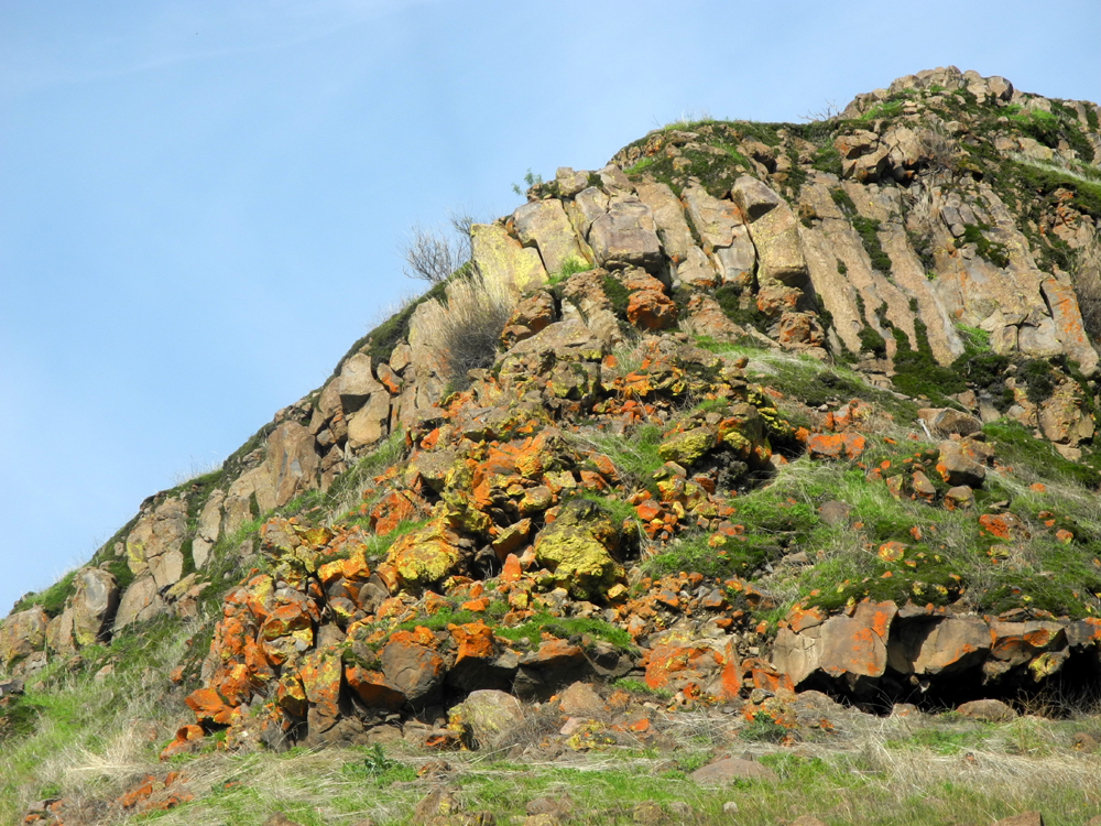
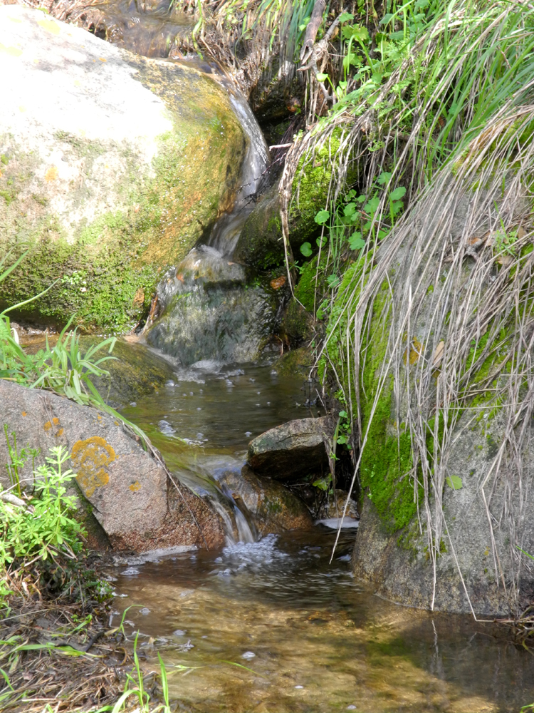
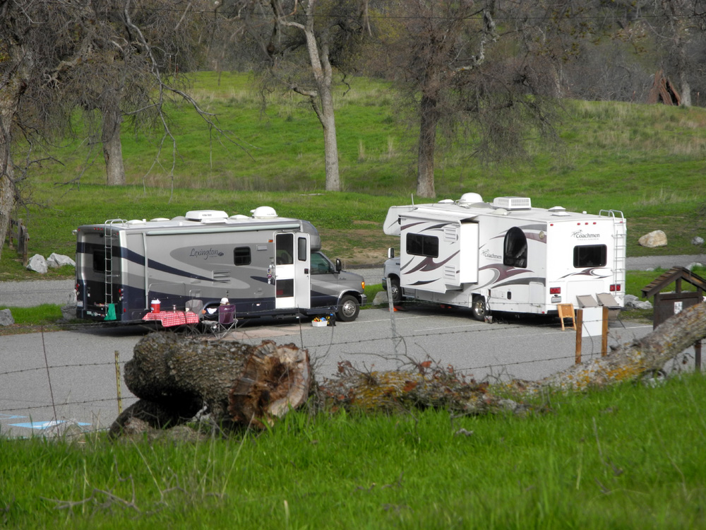
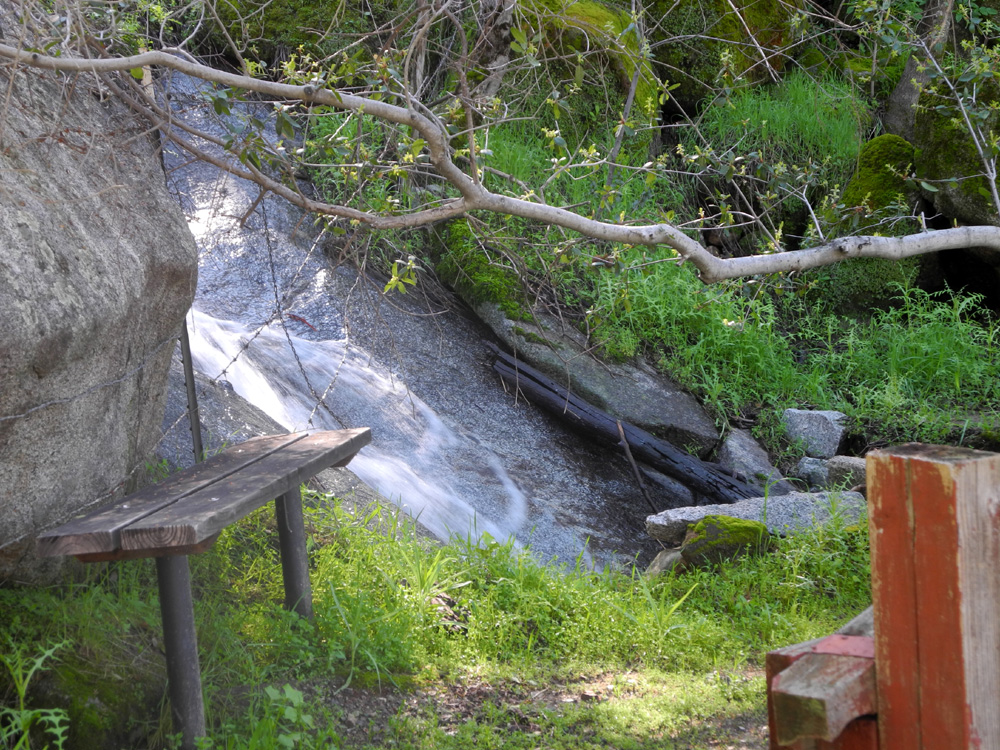
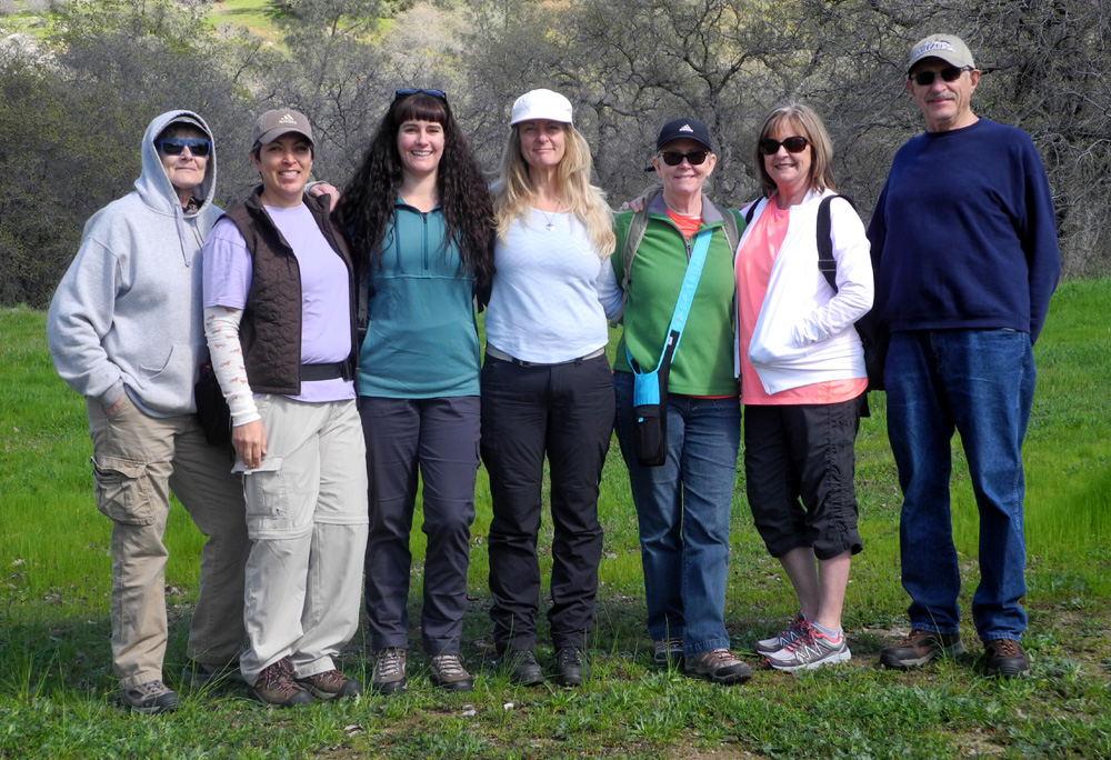
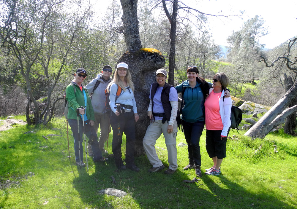
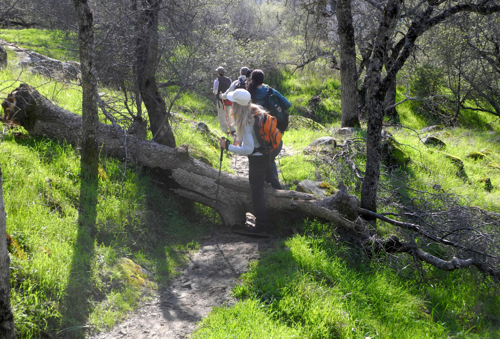
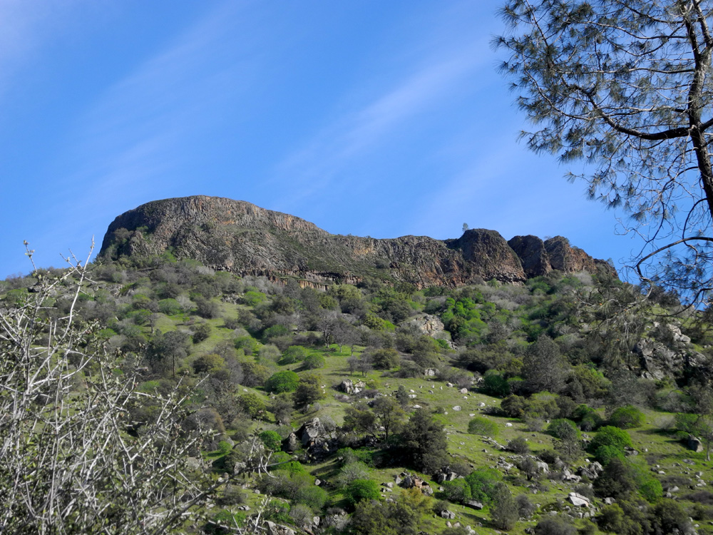
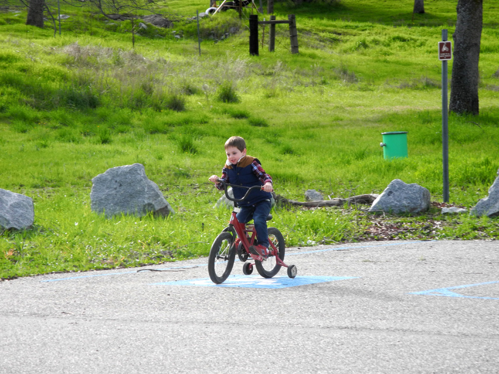
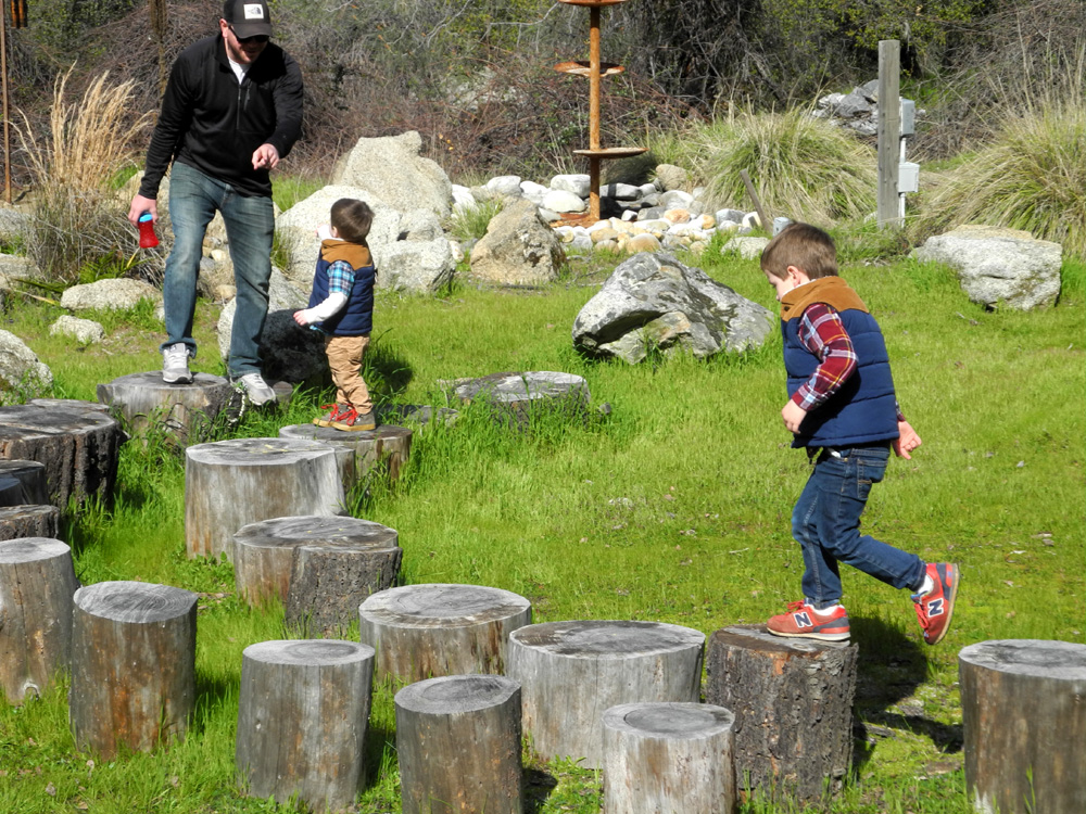
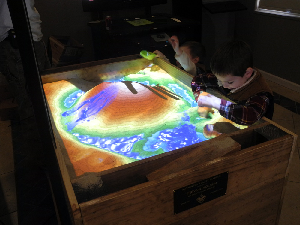
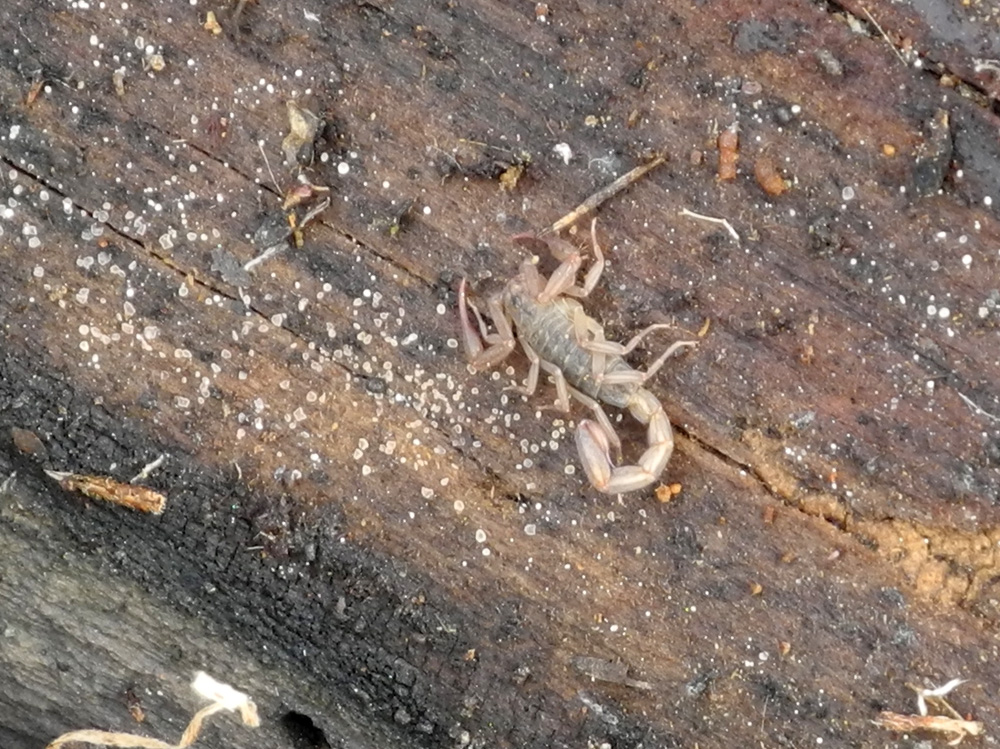
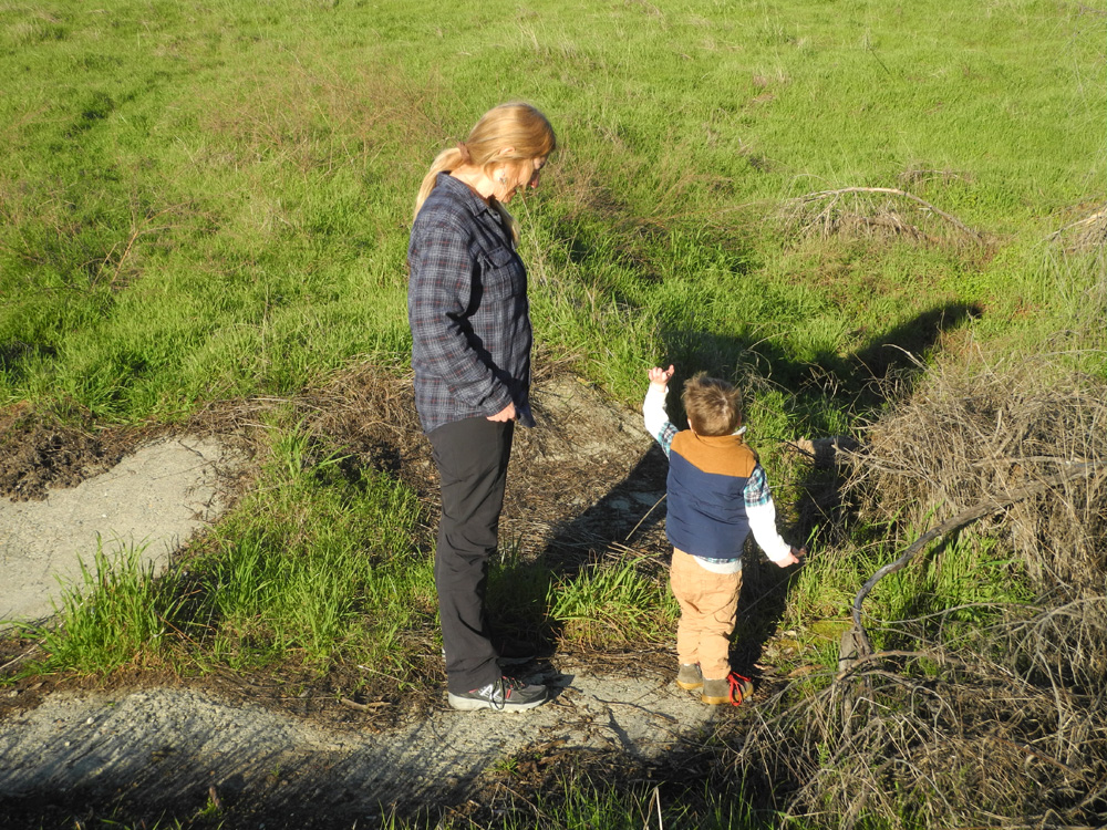
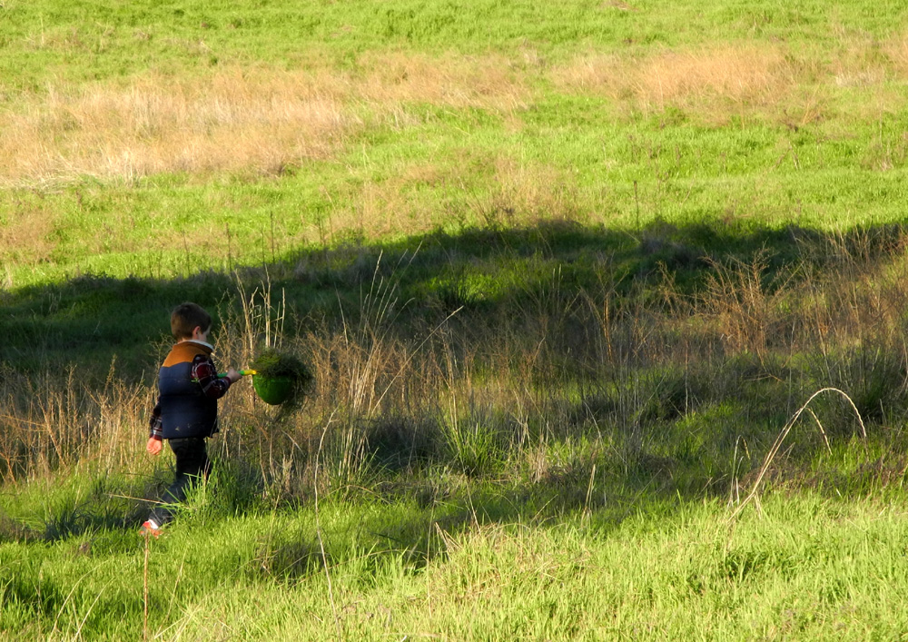
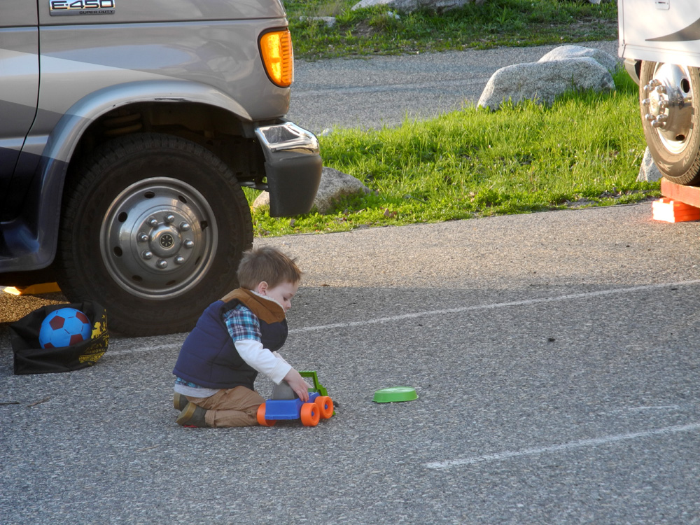
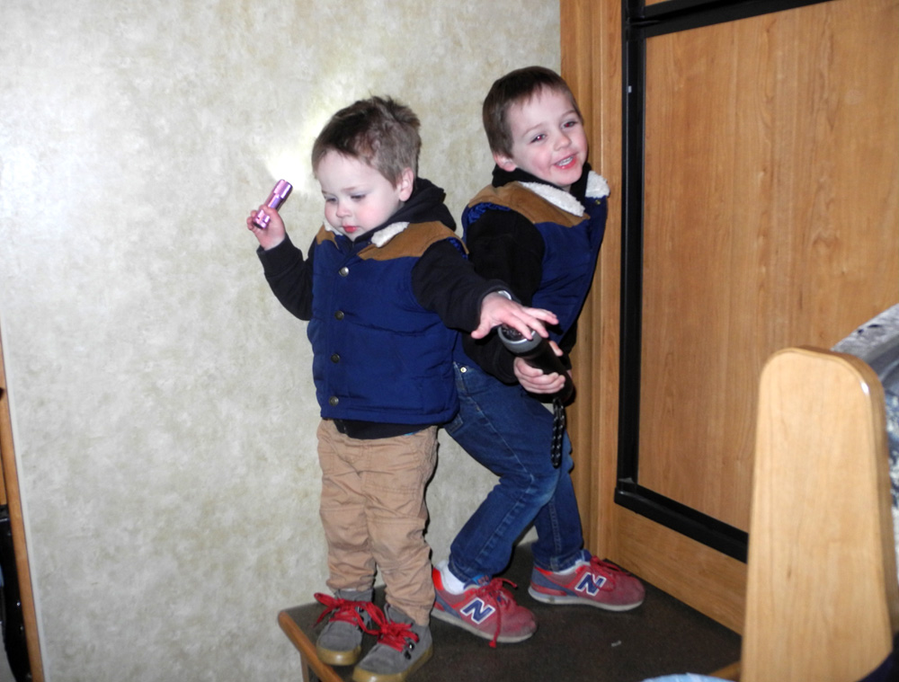
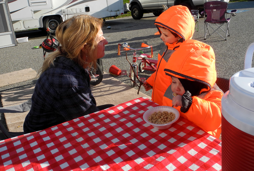
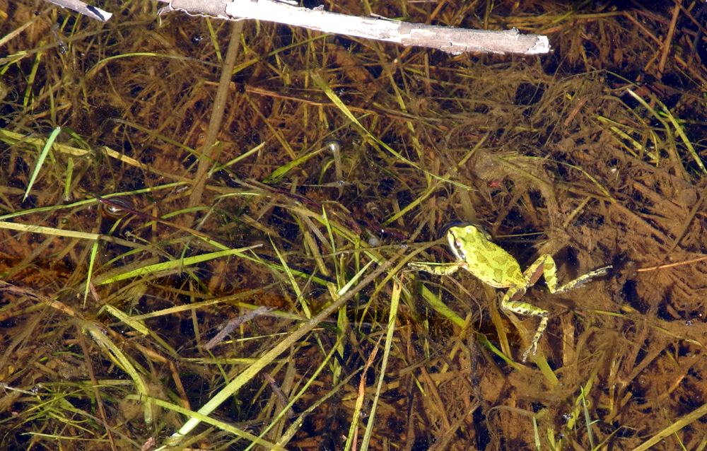
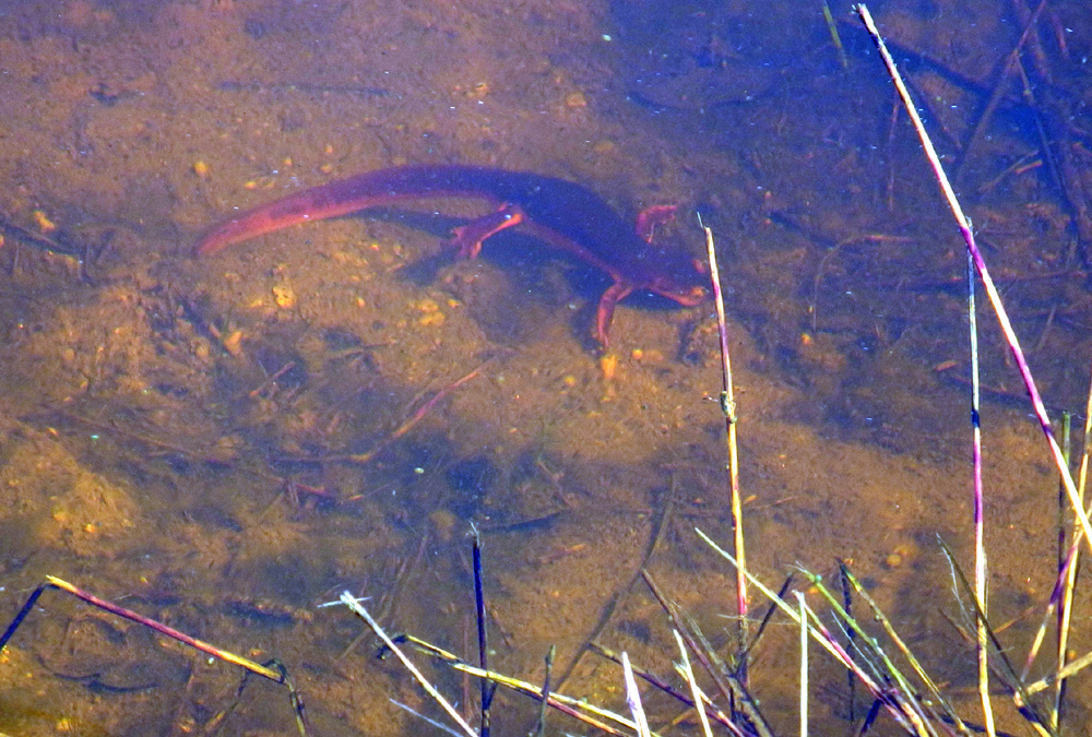
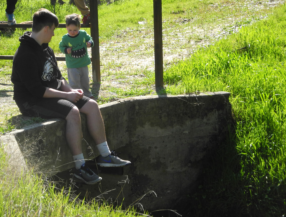
San Joaquin Gorge Camp This year's first campout at the San Joaquin River Gorge Recreation Area provided all kinds of fun experiences - hiking, hanging out with family and friends, and enjoying the antics of my great grandsons. Leading up to the event, the weather forecast indicated no rain Friday or Saturday in the day time, with the likelihood of light rain Saturday night and Sunday. However, as the day of our outing arrived, all mention of rain had been removed from the forecast, and indeed we had dry weather all weekend, although it was quite windy and very cold at night. Teri had to work four hours on Friday, February 24, but we were each taking our separate motor homes, so I drove up fairly early and got set up in the group camping area. Teri planned to arrive around 11:30, and had invited a group of women to join us for hiking that day. I got a head start with a hike around the Nature Trail, which starts a hundred yards or so from our camp, and winds up a creek drainage in a double loop, with signs along the way identifying various plants and trees. I did some additional walking, for a total of about a mile and a half. Just up the road from camp, down the bank out of sight of someone in a car, I spotted the first redbud of the season. Teri arrived and got her vehicle in place, and soon the other five members of our group arrived in three cars - Sandy, Sandra, Emile, Tyra and Debbie. Some had hiked in the area before, but for others it was their first visit. Additionally, the level of hiking experience was varied, but all proved to be willing and able. We got started about 1 p.m. on the San Joaquin River Trail, which goes about 12 miles to Sky Harbor on Millerton Lake. Our plan was to hike about a mile and a half and then return. With the heavy rains of 2017, everything was nice and green, with many wet spots on the trail. In the section we hiked there is one creek that runs a little every year, but on this hike we crossed at least ten creeks worthy of the name. With some of them it was necessary to step in water up over the soles of our boots to cross, and there were wet and muddy spots in places even with no creek. One creek sent about a third of it's water down the trail. We walked to the place where you first see the river, as we are used to thinking of it. It is actually the upper part of the lake, which has not been this full during any of my hikes on this route, which began in 2013. After admiring the view here, we went back a short distance to a place where there was a somewhat level spot with a bunch of rocks to sit on, and had our snack. Along this sector of the trail, you are walking below and around the table top mountain known as Squaw Leap, so you get a view of different angles of the rock cliffs. Of course the same is true for the huge table top across the river, Kennedy Table. The ladies all enjoyed the trail and its many interesting trees, big boulders, endless water, and views of the brilliant green surroundings. When we returned to the parking lot, we had hiked 3.61 miles, which gave me a total of just over five for the day. The group chatted for a while, then the day hikers departed, leaving Teri and me to enjoy the quiet. Teri had a container of soup which had been in the freezer at home, so she transferred it to the motor home refrigerator. When she took it out to fix for supper it was still solid, so we moved over to my motor home and ate the leftover pizza I had brought "just in case." Teri leaves for work very early so she is used to going to bed by 7:30 or so. This day, tired from work and the hike, she turned in closer to 6:30. I read for a while, and got to bed at 8:30, an hour earlier than usual. Adequate rest was essential, since Colton and Jack, age 4 and 2, would be arriving the next morning. When I'm camping, I usually set a thermometer outside, and check the temperature from time to time, including when I get up during the night. Saturday morning it was down to 29 at 3 a.m., and 26 degrees at 6:30. Saturday Teri and I each took care of our own breakfast in our own little traveling house, then got ready for the arrival of her son Johnny and the boys. They drove in around 9:30, and Colton and Jack immediately started riding their bikes around the big paved parking lot. Johnny planned to stay a short while and go walking with us, but had to keep to a schedule since he and Brittany were attending a wedding in the evening. On Friday one of the rangers had stopped by and told us of a new interactive exhibit at the visitor center that kids would like, so we made that our destination. But of course, we could not just walk down the road. Colton quickly turned off on a path that cuts across through a creek to the Equestrian Camp, and we went through that area to a old dirt road that approaches a Learning Center near park headquarters from opposite the road. Along the way, Johnny turned over rocks in hopes of finding some of the thousands of millipedes we saw last year, and which seemed to be mostly absent this year. With the first rock, we discovered a scorpion, and on the second try, two millipedes. These were the only live ones we would see the rest of the trip. We also made a short stop at a large rock by the road where there about a dozen bedrock mortars (Indian grinding holes). Since they were full of water from the recent rains, the boys found rocks to drop in them. The visitor center was locked when we got there, but there were some cut up log rounds placed in two rows nearby, and both boys immediately headed there and started running and jumping from one to another. We also walked down a short path that led to what seemed to be an outdoor classroom, and by this time the ranger arrived and we went inside. The new exhibit is hard to explain. It consists of a box of sand on a table, with a projector overhead that projects color on to the sand, forming contour lines for the different heights of sand mounds. Kids (and adults too) can rearrange the sand by hand or with small shovels. When you hold your hand over the top and slowly open it, blue "rain" falls on the top and runs down the little hill. Both boys enjoyed it, but they enjoy playing in plain old sand too. After our time in the visitor center we walked the road back to camp, and Johnny left. We were just hanging around camp when a car drove in - Johnny again. Teri has one car seat, and we had forgotten to get the second one from Johnny's Jeep. After again saying goodbye, it was time for naps. I'm not sure about Teri, but the boys took a good nap in her motor home, and I went to mine and also managed to sleep for 15 minutes or so. This gave us energy for another walk, a short one to a old dam across from the camp area. It has no water other than a little puddle, and it's hard to see where water came from; it's not on an obvious drainage these days. The walking was challenging because of the tall grass and soft soil, but everyone made it there and back without incident. Colton had brought their bug net, and spent much of his walk pulling up grass and filing the net to overflowing. The purpose was somewhat vague, possibly to feed the cows. Earlier we had noticed a big pine tree down on the opposite side of the road from us, and thought it might be a good place to gather branches for kindling. I went over after my nap, and found that the pine was not as dead as we thought. However, there was a live oak next to it with a broken, dead limb, so I broke off pieces from that and carried a few armloads to the fire ring. Later Teri and the boys went over with me and everyone helped carry back at least a stick. By this time the sun was dropping out of sight, the thermometer was dropping into the 40s, and it was time to start the fire. I used to enjoy hunting firewood around camp, but the dead wood in this area is not good for a campfire, and I am less ambitious anyway, so I just buy cartons of wood at the supermarket. Some of the pieces are a little too big to catch fire easily, so I did get some exercise splitting four or five of the larger pieces. While the fire was getting started Jack and Colton both picked up kindling sticks in each hand and treated us to a drum concert, using the wood benches that are placed around the fire ring. We were expecting Mikie and Lizzie around 5:30, but they arrived a bit later, around 6:15. This was good for them - the fire was nice and warm, and they didn't have to help collect kindling. However, they did have a job to do - take the boys to the frog pond. Of course, it was dark by this time, and Jack was hesitant about going. He finally decided it was OK, and walked down the road with us. When Mikie and Lizzie started through the grass to the pond, Colton joined them, Jack stayed on the road with Teri, and I walked about half way down. To Colton's great delight, they saw a half dozen frogs and several salamanders, plus assorted water insects, and a couple of millipedes, serving as food for the frogs. Along with gathering kindling, we had gathered marshmallow roasting sticks, so when we got back from the pond, Teri brought out ingredients for S'mores. The boys did a pretty good job roasting their marshmallows, especially Colton. They did an even better job eating the yummy snacks. Eventually we put the last piece of wood on the fire, and as it burned down, we moved into the motor homes and prepared for bed. When we camped here last year, Mikie and Lizzie slept in a tent, and were very cold. With six people spending the night this year, both motor homes were needed for comfort. This proved to be a good decision. The low last year was 41; this year it was a frosty 26, and Mikie and Lizzie would have been turned to popsicles. Knowing that their sleeping bags were not intended for extreme cold, I gave them blankets, since the inside of the motor home tends to be only 10 to 20 degrees warmer than the outside. I have a sleeping bag designed for low temperatures, and for the first time ever, I was a little cold in it and put on an extra sweatshirt during the night. The next morning, our final day, there was a layer of frost on our chairs, which we had left by the campfire. There was less than I expected, because it was fairly dry, and there was not as much dew as we usually get. As I brought the chairs over to dry out in the sun near the motor homes, Teri was fixing what she called "First Breakfast" for Colton and Jack, bowls of Cheerios. When we were planning out trip Colton had announced that he liked bacon, and "Jack likes sausage." Johnny assured us that they would both eat both items, so I brought some of each. The menu also was to include eggs and toast. Mikie and Lizzie were sleeping in, and the little ones could not wait to get some fuel for their daily activities, hence the Cheerios. After they ate, I took them for a short walk, up the road that runs by the camp, then up the main road to the cattle guard. We crossed it with care, and walked a little farther; in fact, Colton was ready to just keep going. However, I steered him back across the bars of the cattle guard, and he then took a cross country path through the wet grass back to camp. We finally had our big breakfast, greatly enjoyed by everyone. Due to a failure to communicate we were making toast in both motor homes, and ended up with a slight surplus, although in the end I think only one slice went to waste. The bacon suffered no such fate, as Colton and I ate the last two pieces on top of our already very full stomachs. We had time for one short walk, and Colton wanted to go back to the pond, then the visitor center. Teri stayed behind to get things ready to go, and the rest of us went down to the pond. Jack had no problem with it in the daylight, and was rewarded by seeing a salamander shortly after we arrived at the water. We walked most of the way around the pond, finally seeing five or six frogs. We then went to the old dirt road that runs between the Equestrian Camp and the Learning Center. Mikie, Lizzie and Jack went down into the small creek that runs across the road there, while Colton and I spent our time on the old bridge. He threw rocks and handfuls of mud into the creek, always a favorite pastime for kids when water is near. The others joined us and Jack threw his share of rocks also. We did not have time to go to the visitor center, so we returned to camp, got our stuff gathered up, and soon we were all on our way back home in our three separate vehicles. A week later I was back at the Gorge - but you'll have to wait for page three of the Adventures of 2017 to read about that.
|
||
Photos (Click to enlarge; pictures open in new window) |
||
San Joaquin Gorge River Access Trail San Joaquin River Trail West |
||
|
San Joaquin Gorge River Access Trail |
||
 |
 |
 |
| Torrential rain created this new runoff channel | A delightful waterfall near the bottom of the trail |
One of these little creeks is the trail |
 |
|
 |
| The San Joaquin is a rushing white water river this year | The view upstream | Fiddlenecks, barely getting started |
 |
|
 |
|
A large washout at the start of the trail |
Water drips and runs down everywhere | Cattle guard at the approach to the parking lot |
| San Joaquin River Trail West | ||
 |
 |
 |
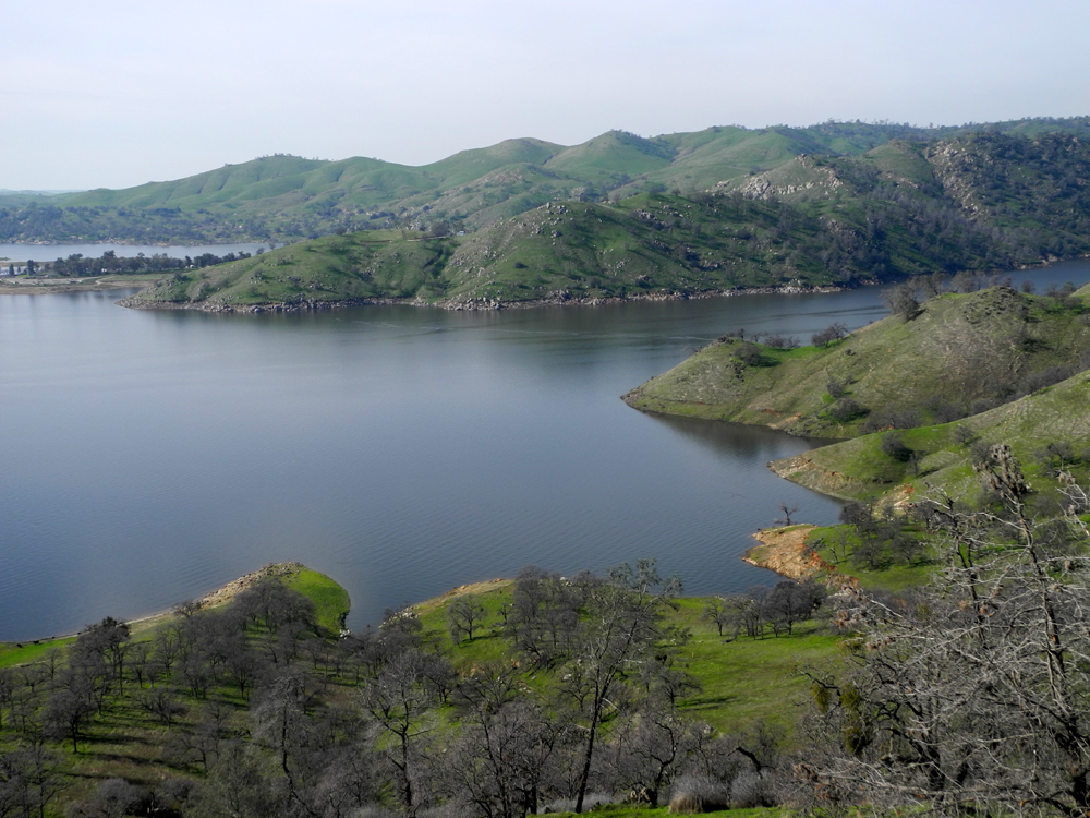
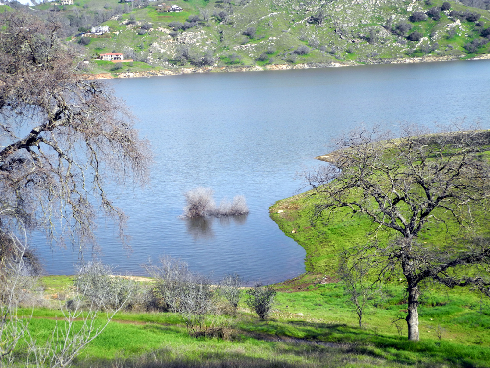
| Little Dry Creek, one of the scenic views along the road | Pincushion Peak from Millerton and Auberry Roads | A nearly full lake, after too many dry years |
 |
 |
|
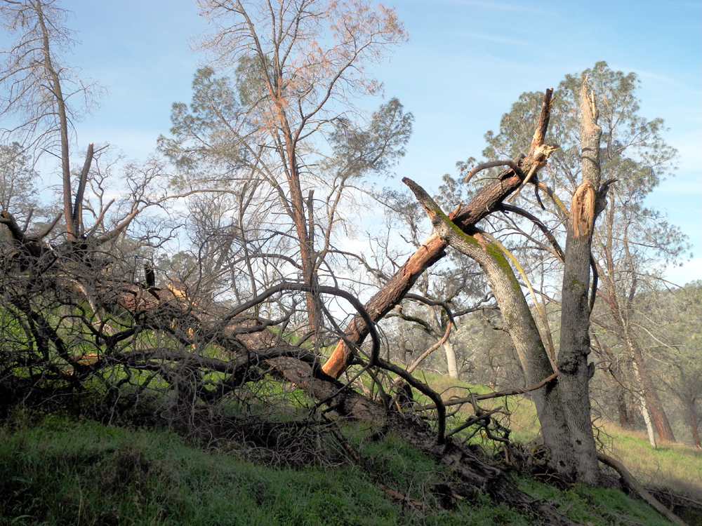
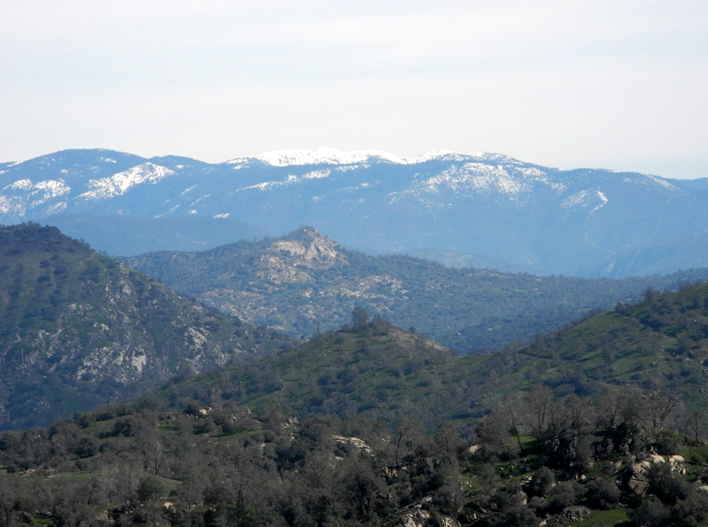
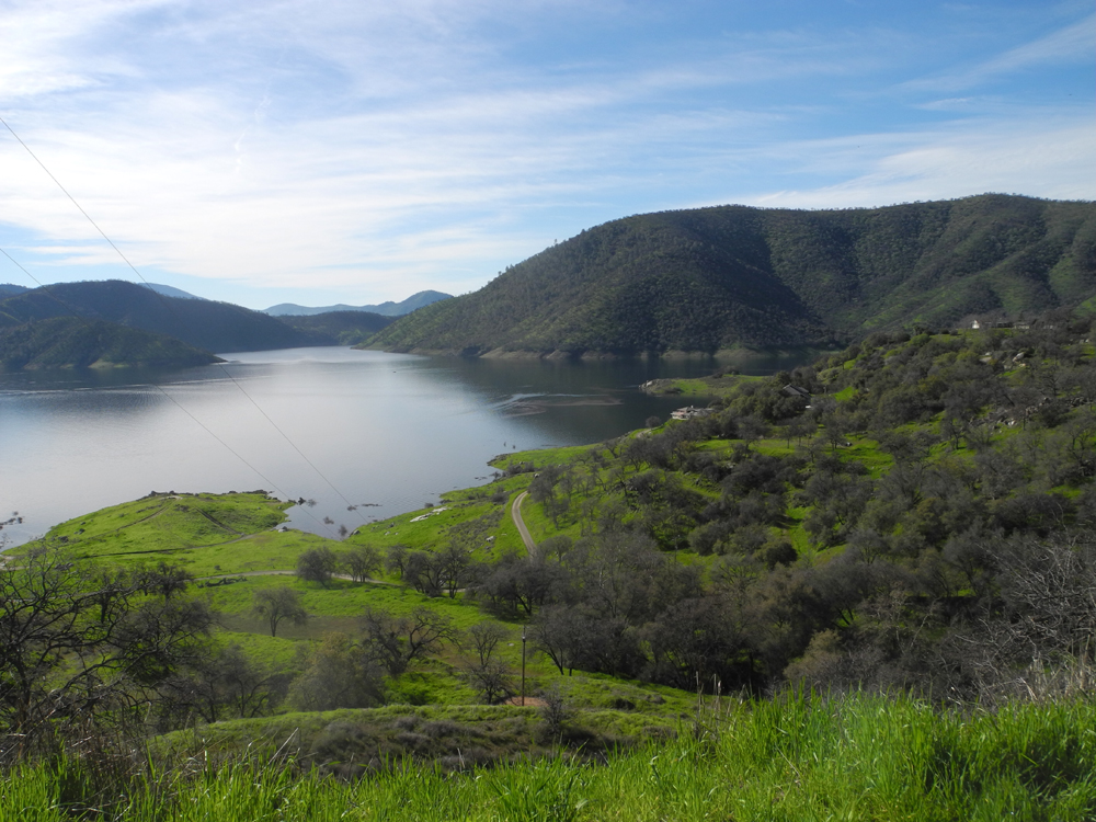
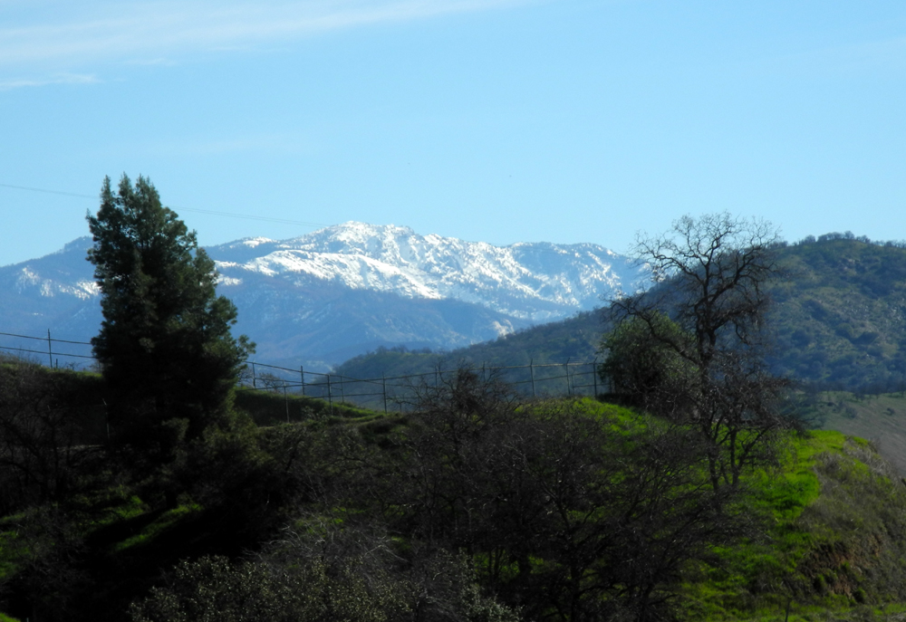
| No one's a winner in this fierce battle between oaks and pines | Despite warm rains, there's still a good snow pack | The Finegold Creek branch of the lake (compare 2104 view) |
 |
 |
 |
| It's steeper than it looks! | Step carefully here; it would be easy to twist an ankle | The main trail crosses this saddle from left to right |
 |
 |
 |
|
The path to Pincushion from First Knoll |
This is more a "tree lupine" than a bush lupine | Hikers on the main trail |
 |
 |
 |
| Popcorn flowers | Fringed redmaids | Fiddlenecks |
 |
 |
 |
| The colorful back side of Pincushion Peak |
A perfect spot to sit and have lunch |
Part of the view from my lunch spot |
|
 |
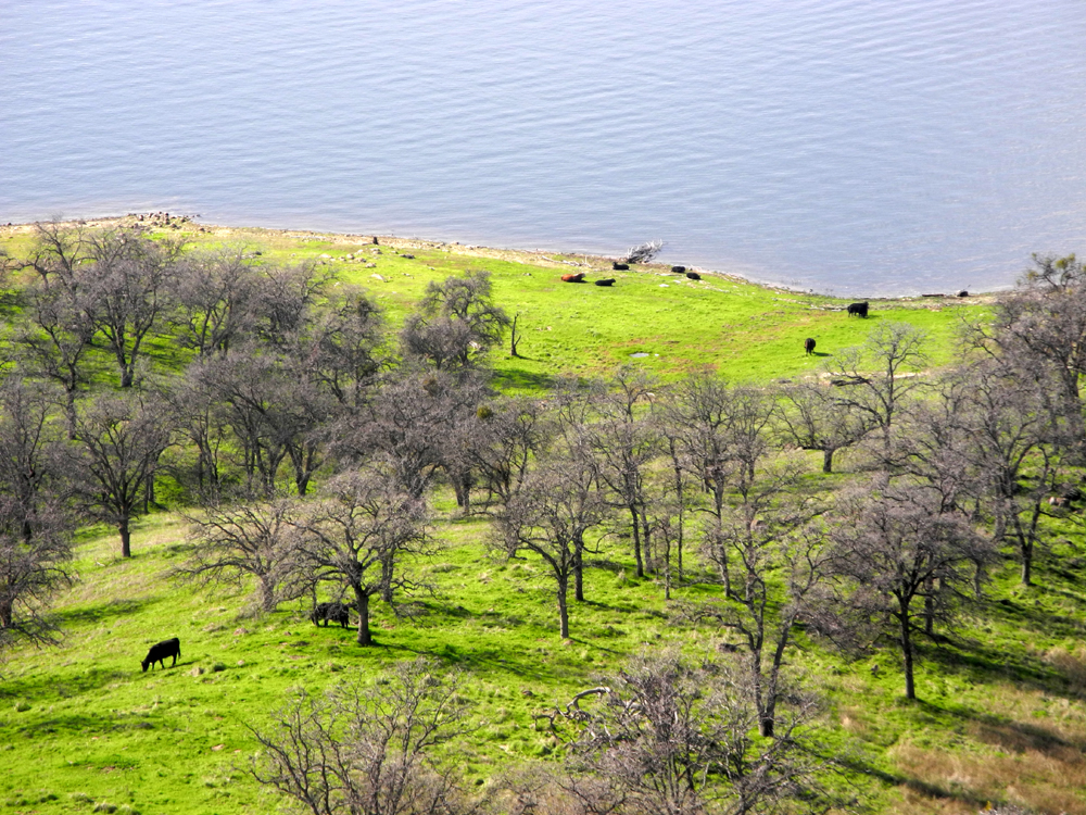 |
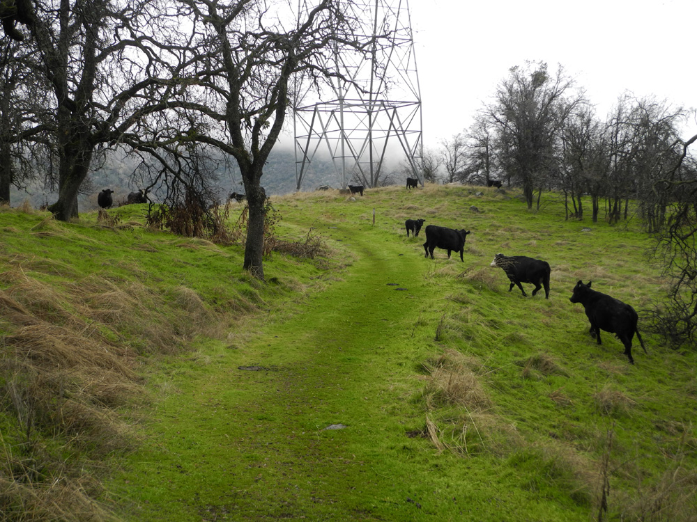
| Looking back at First Knoll from the saddle | Millerton Lake from Sky Harbor Road | Cows enjoy fresh grass, with plenty of water to drink |
| Sycamore Creek Fire Road | ||
 |
 |
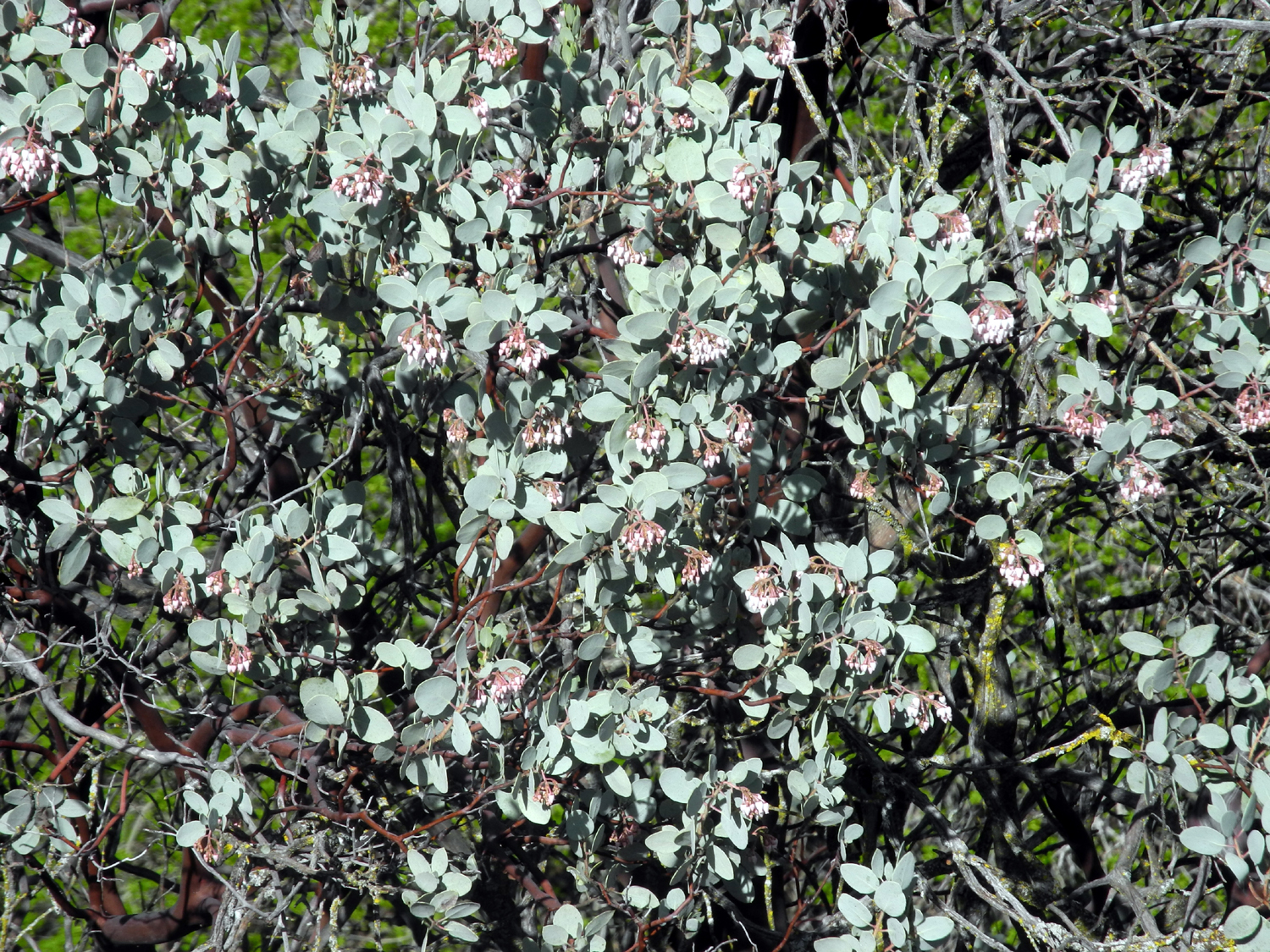 |
| Pine Flat on Feb. 15, 2017, with the water level a little higher than on the 4th | Snow on the Sierra promises even more water for the lake | Manzanita blossoms along Trimmer Springs Road |
 |
 |
 |
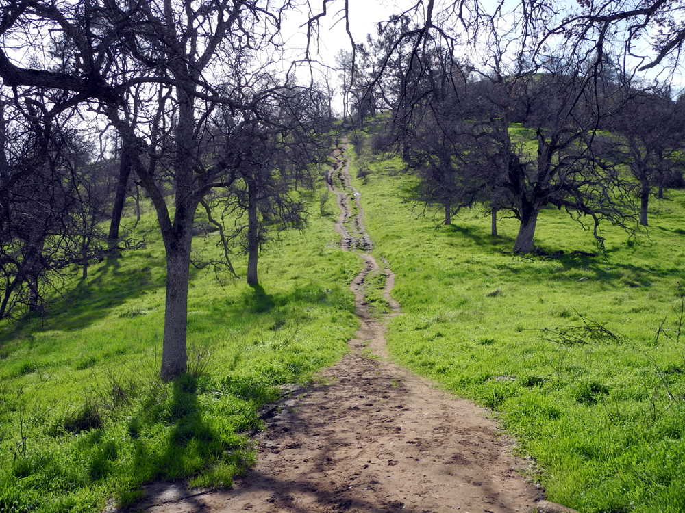
| The start of Sycamore Fire Road hiking route | This flat rock looks right down on the paved road | The first of two newly fallen trees across the trail |
 |
 |
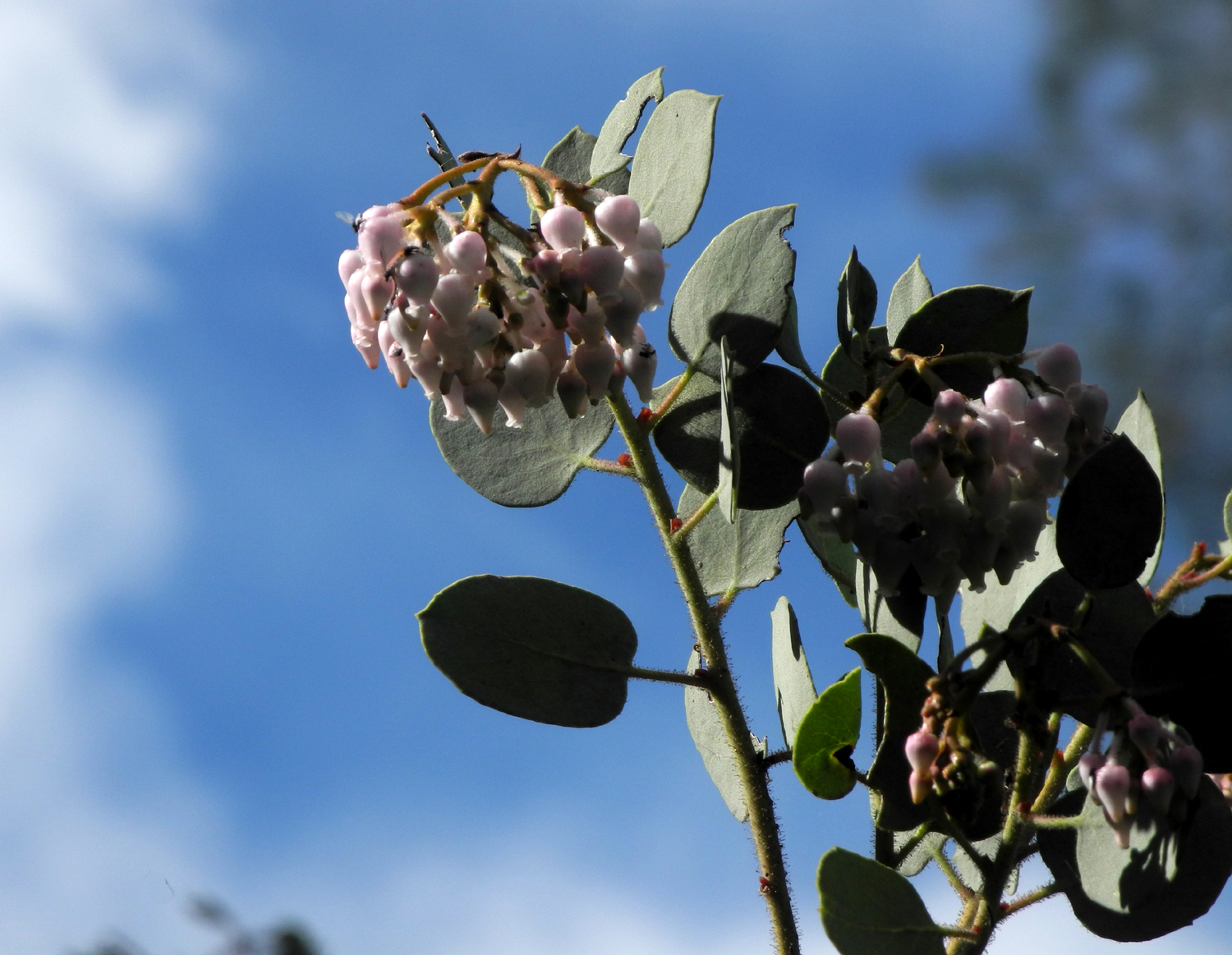 |
| One of five creeks that flow across the trail | Popcorn flowers are out in good numbers | Manzanita blossoms close-up |
 |
|
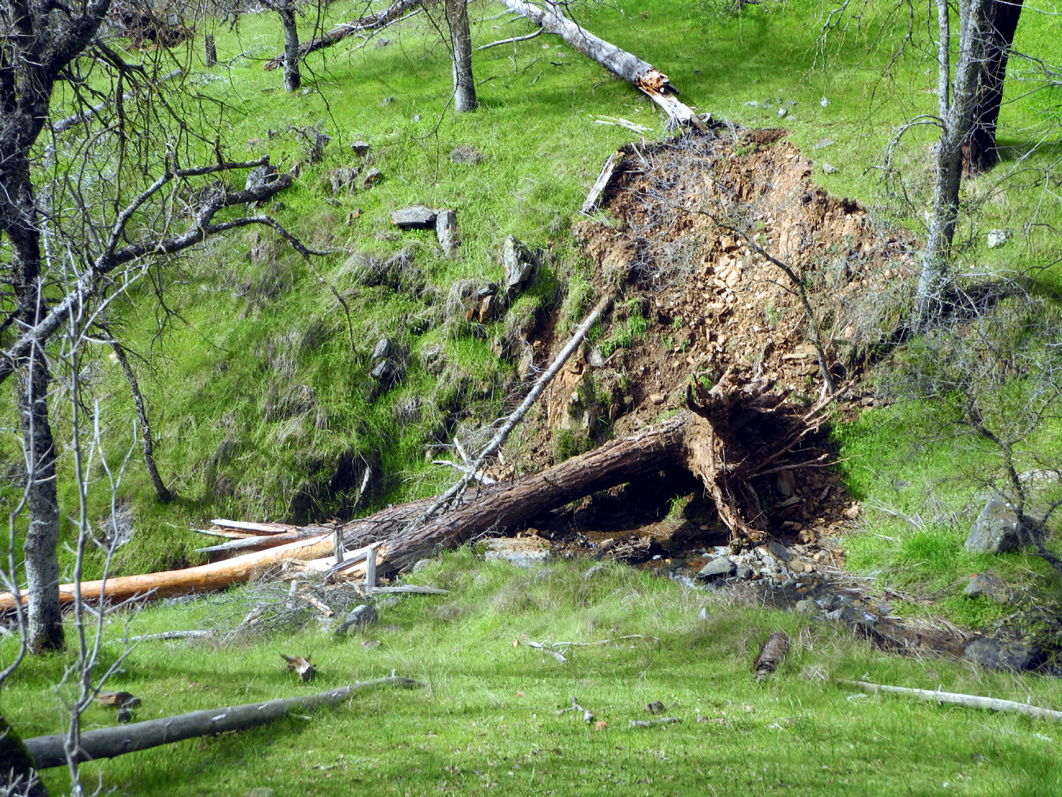 |
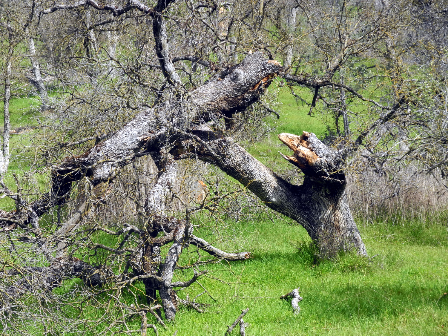
| Every year brings sights like this | Logs create a barrier on the "new" part of the trail | This tree made its mark when it fell |
|
 |
 |
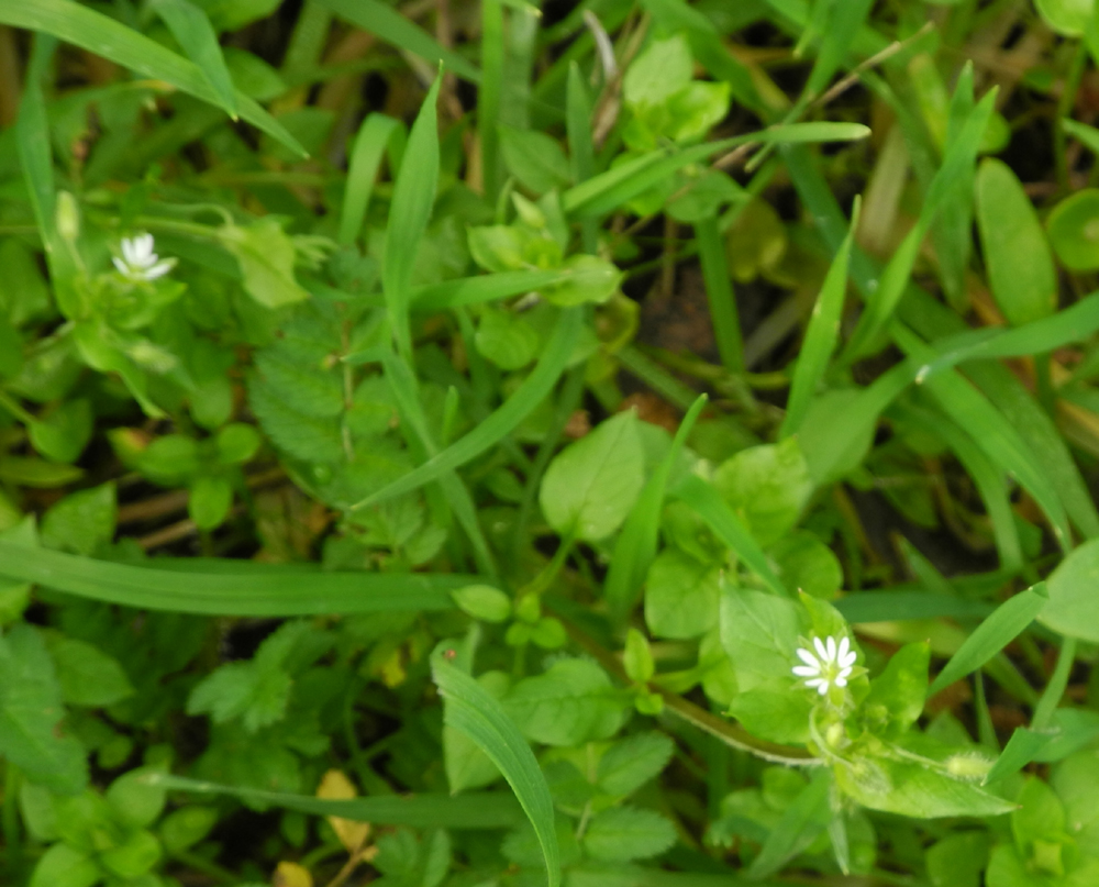
| Shooting stars | These tiny flowers, barely a quarter inch across, have ten petals | A nice stand of blue oaks at the end of my hike |
 |
 |
 |
| In the closed campground | The pavement is still in fair shape after 40 years | Baby blue eyes appear in good numbers in the campground |
 |
 |
|
| Poppies across from Winton Park | A little creek on the north side of the river by the park | |
| San Joaquin Gorge Camp | ||
 |
 |
 |
| Our camp from the main road | The frog pond |
The creek that runs into the Nature Trail area |
 |
 |
|
| Slide area on the road | The hiking crew: Sandy, Sandra, Emile, Teri, Debbie, Tyra, Dick | One of the many creeks that ran across our trail |
 |
 |
 |
|
The ladies were duly impressed by the Big Burl |
Stepping over a log that fell across the trail |
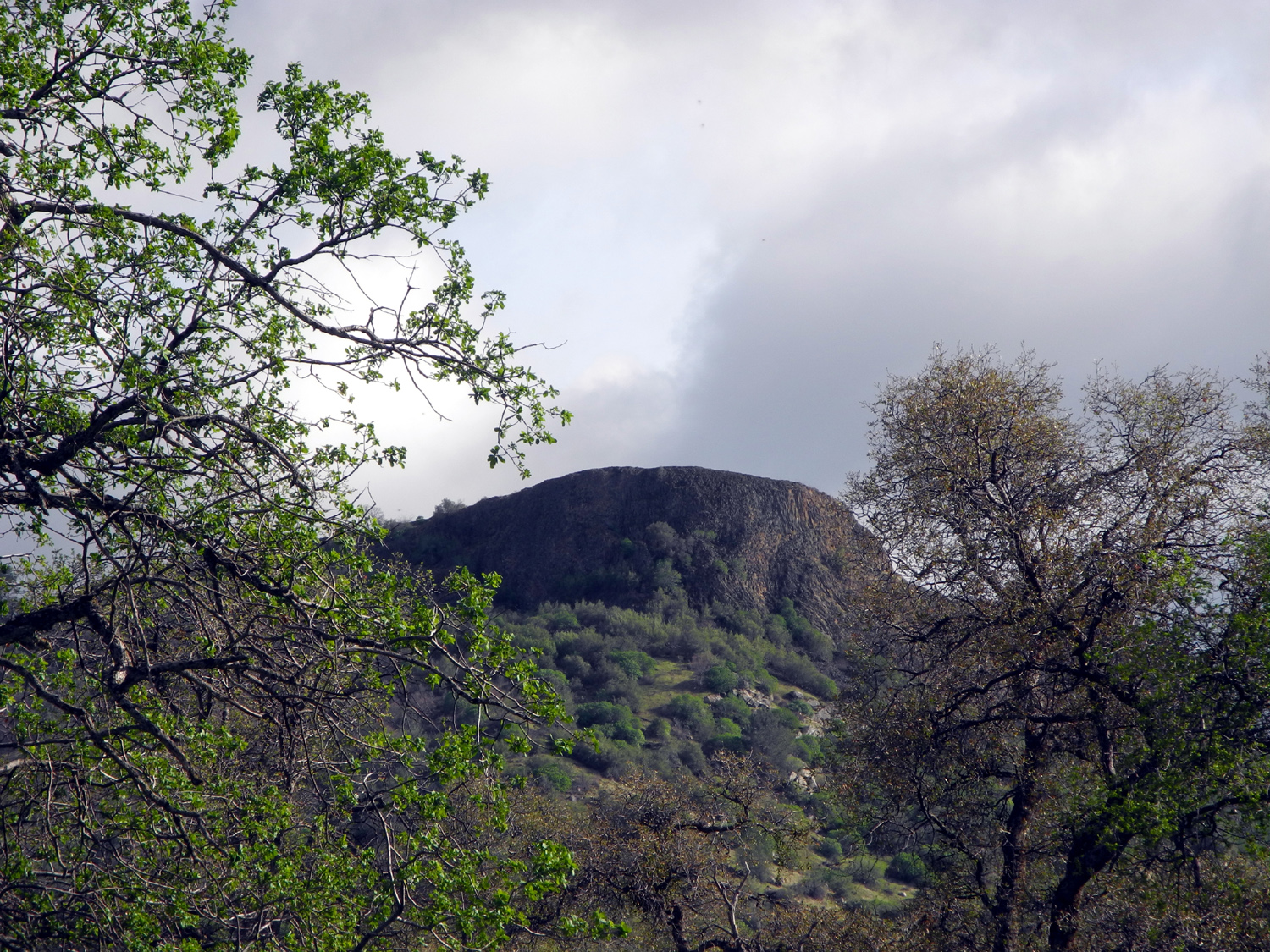
View of Squaw Leap table top mountain from the trail |
 |
 |
 |
|
The next group: Jack, Teri, Colton, Johnny, Dick |
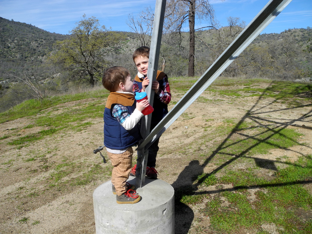
Bike riding fun | How thoughtful of PG&E to provide a climbing tower |
 |
 |
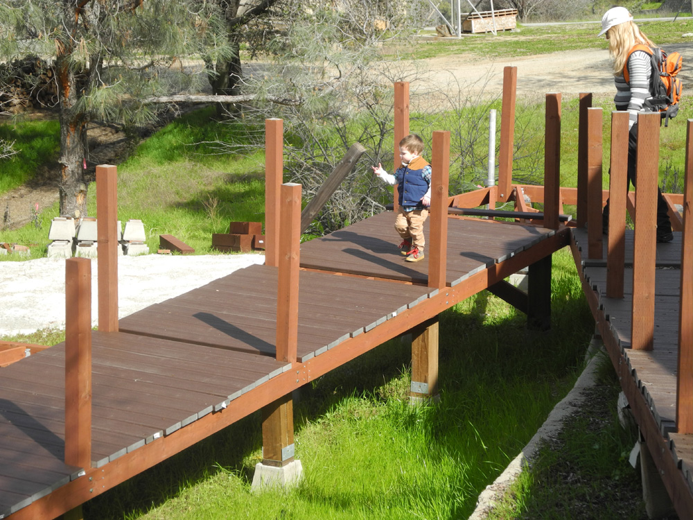 |
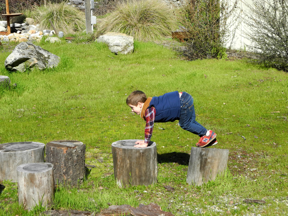
| Stump jumping | Acrobatics | Jack explores the deck at the visitor center |
 |
 |
 |
| The Magic Sand Box | After viewing this creature, we replaced his bark roof |
Teri and Jack in the spillway of the old dam |
 |
 |
 |
| Colton gathering grass for unknown purposes | Boys and trucks always go together |
Upshaw Brothers "on stage" in Great Grandpa Dick's motor home |
 |
 |
 |
|
Teri & Colton talk; Jack is focused on the business at hand |
Lizzie, Jack, Mikie and Colton on a daylight visit to the pond |
One of several frogs we saw |
 |
 |
 |
| Salamander, under water |
Colton throwing dirt and rocks into the creek |
Jack would like very much to step into the water |
 |
|
 |
| Mikie and Jack on the bridge | Lizzie and Colton on the fence |
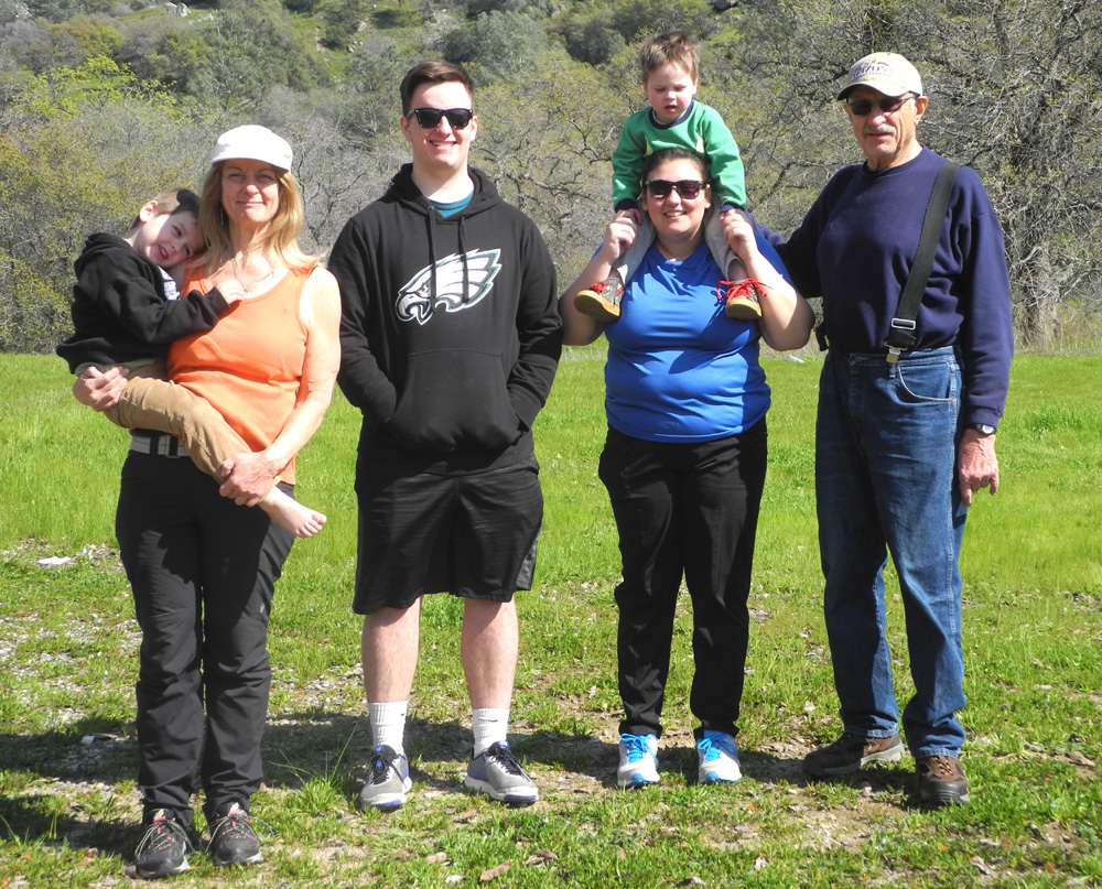
A final group photo: Teri holding Colton, Mikie, Lizzie holding Jack, Dick |
| Related Links | ||
| Other San Joaquin Gorge Reports | San Joaquin Gorge Slide Show | San Joaquin Gorge Photo Album |
| San Joaquin River Gorge Special Recreation Management Area | San Joaquin River | Massive flows after years of drought |
| San Joaquin River Trail | Finegold Picnic Area | Sycamore Creek |
| Trimmer | Pine Flat Lake | Pine Flat Map |
| More About the Gorge | Previous San Joaquin Gorge Travel Reports | |