
|
Dick's Adventures of 2023 - Page 2 |
|
| Photos Related Links More Travel Reports | |
| Adventures
of 2016 Adventures
of 2017 Adventures
of 2018 2Adventures
of 2019 Adventures
of 2020
Adventures of 2021 Adventures of 2022 Adventures of 2023 Part 1 Part 3 |
|
| Upper Kings San Joaquin River Trail West Yosemite & Merced River June Lake | |
| Upper
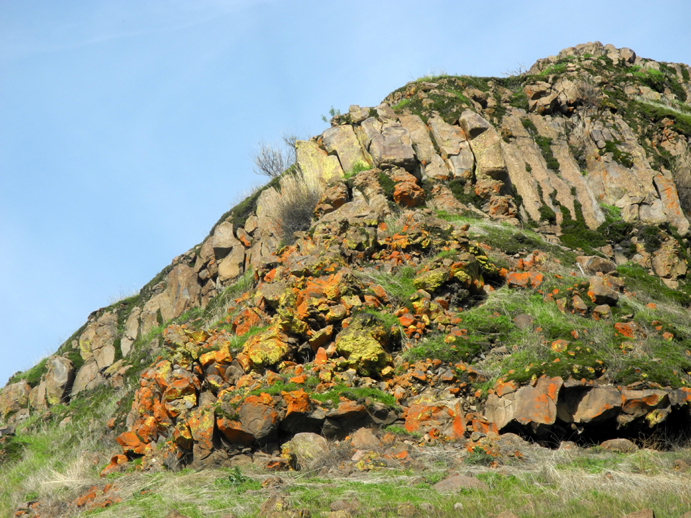
Kings The title phrase generally refers to that portion of the Kings River upstream from Pine Flat Dam. Hikers, fishermen and other adventurers can go up the river by road and trail at least 15 miles above the lake. The paved Trimmer Springs Road, which parallels the lake on the north side, crosses the river just above the upper end of the lake, and continues about two miles to another crossing. At
this point the paved road goes north along the North Fork of the
Kings. Dirt roads follow the main river on both sides, with the
south route still carrying the Trimmer Springs name. It goes three
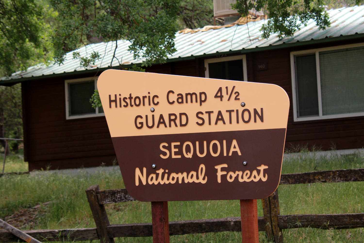
miles past several campgrounds and the Camp
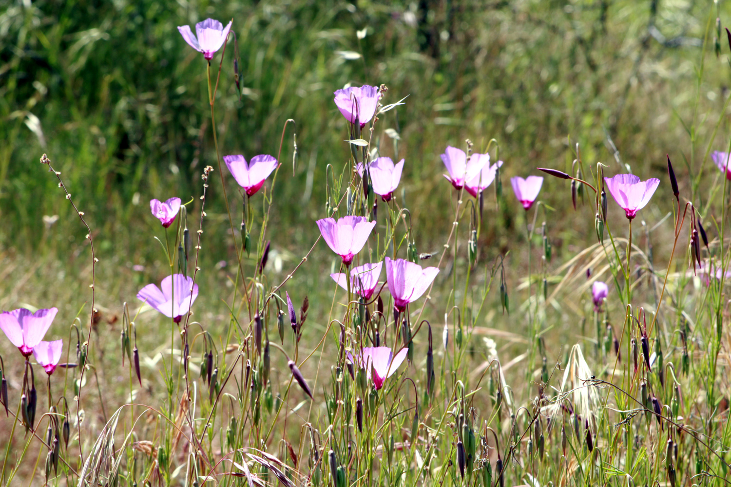
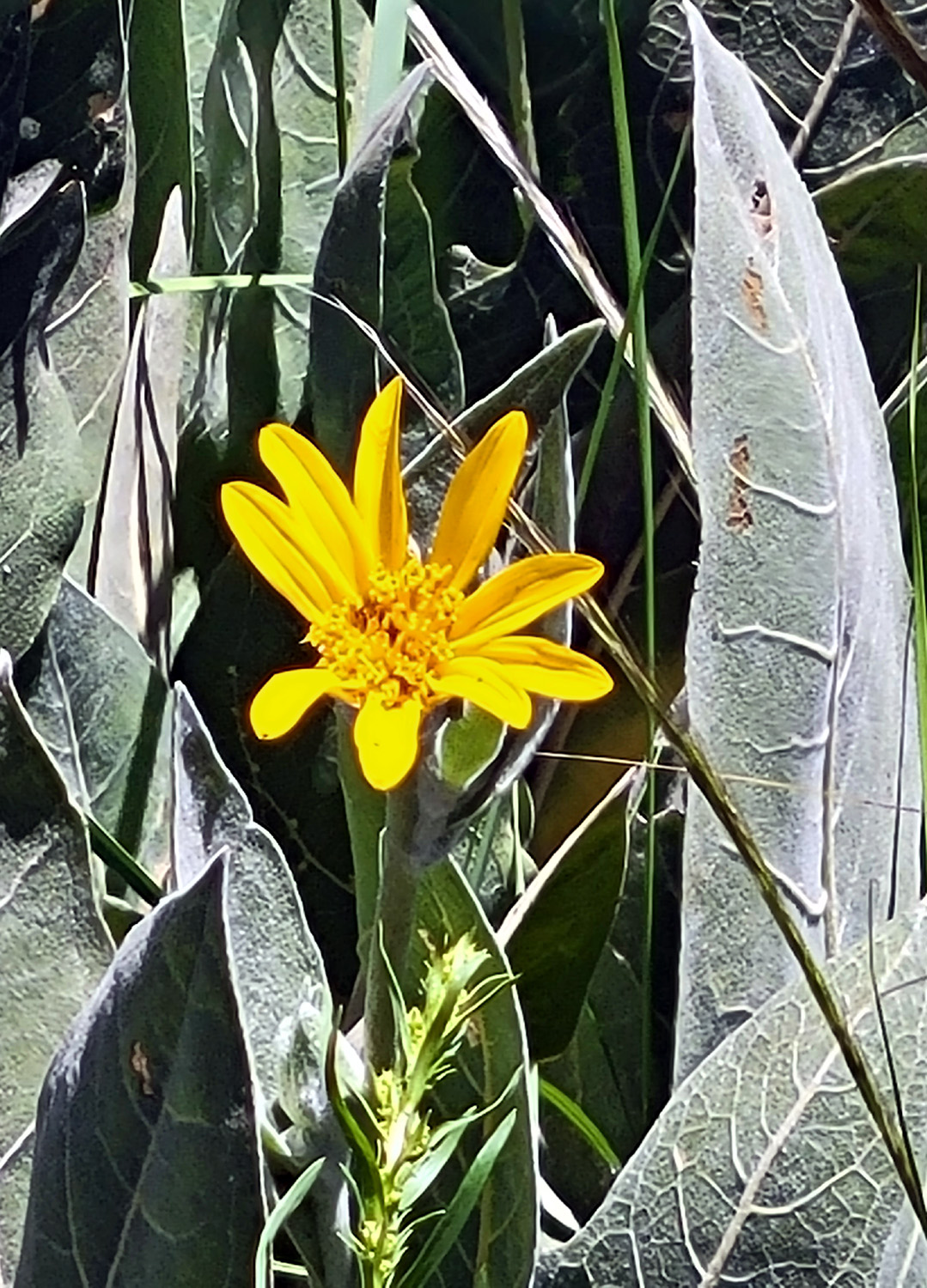
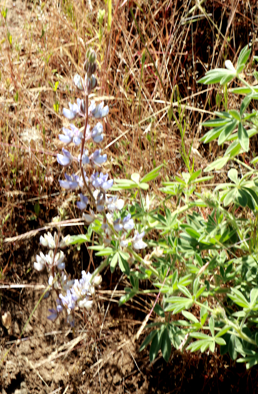
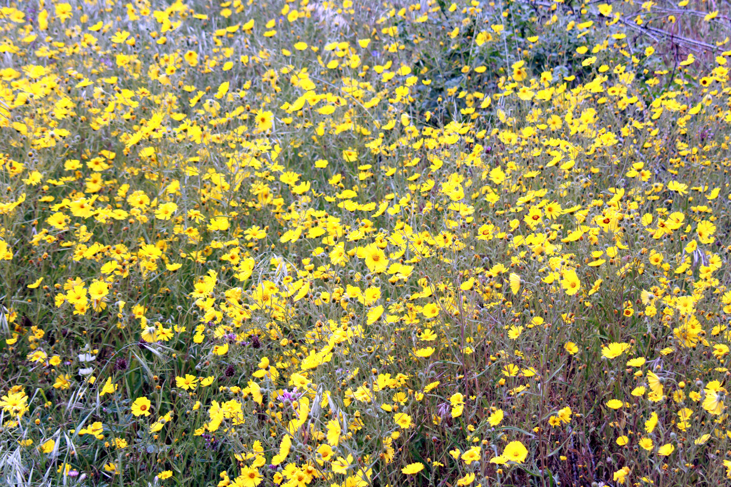
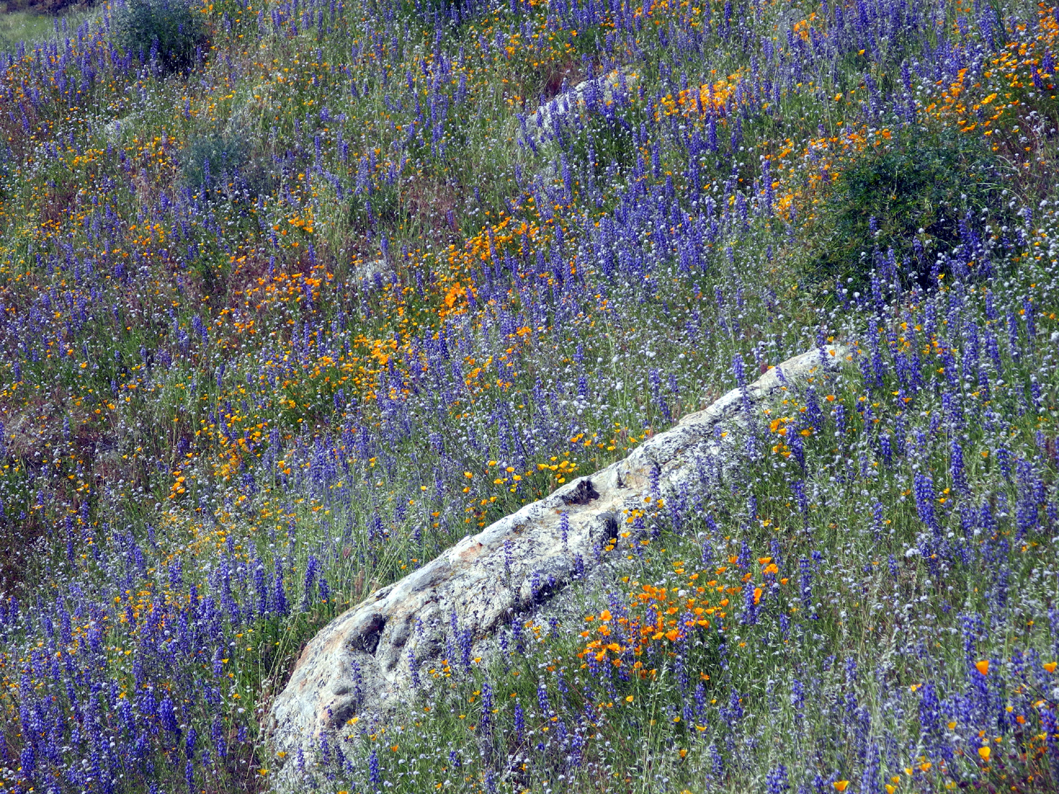
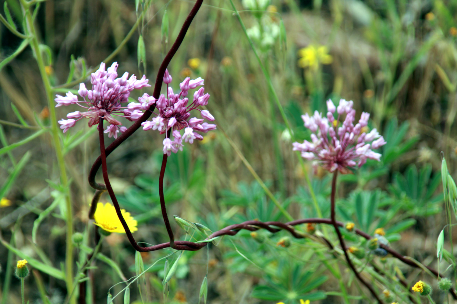
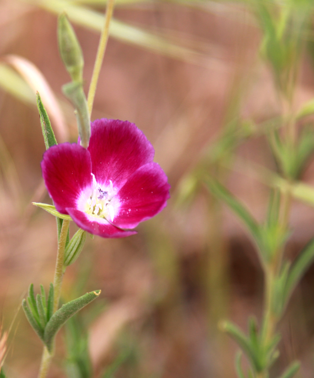
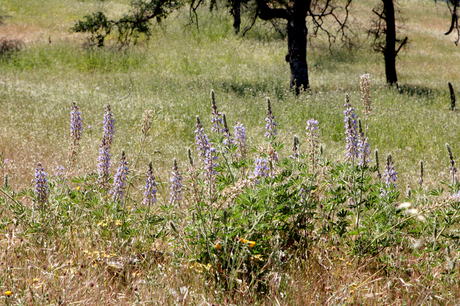
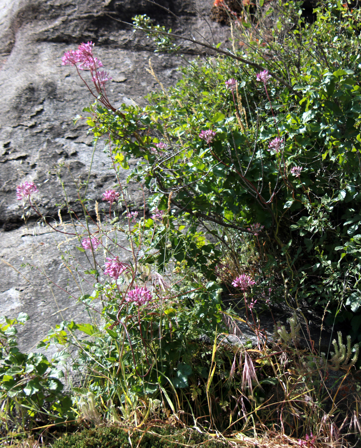
4 1/2 rental cabin The road on the north goes eight miles and ends at Garnet Dike, passing a campground and a junction with the Bear Wallow Trail. A former campground at the end is now the base for a rafting company, which offers trips down the river. At this point the Kings River Trail continues upstream for a number of miles. I've backpacked on this trail about six miles to Garlic Meadow Creek and a short distance beyond, but I don't know how far it goes. The torrential rains of early 2023 caused big and little slides on both dirt roads, with the Garnet Dike route closed until early May. At this time the raft company helped pay for clearing the slides for the first six miles. It looks like the last two miles will remain closed for the 2023 season. (Photo by pathfinderwest2021) I suspected the road on the other side was also closed, so on May 3 Jackie and I drove up there to find out, and to look at wildflowers. My plan was to drive up the dirt road if open, or to walk in a short distance if closed, so I took my Ford 150, which although old enough to vote, still can handle most unpaved mountain roads that are not specifically 4-wheel drive. The floral display began as soon as we began to climb up from the valley to the low foothills along the lake. The most frequent flower was common madea, but there were plenty of farewell-to-spring, various kinds of lupines, and many others. |
|
 |
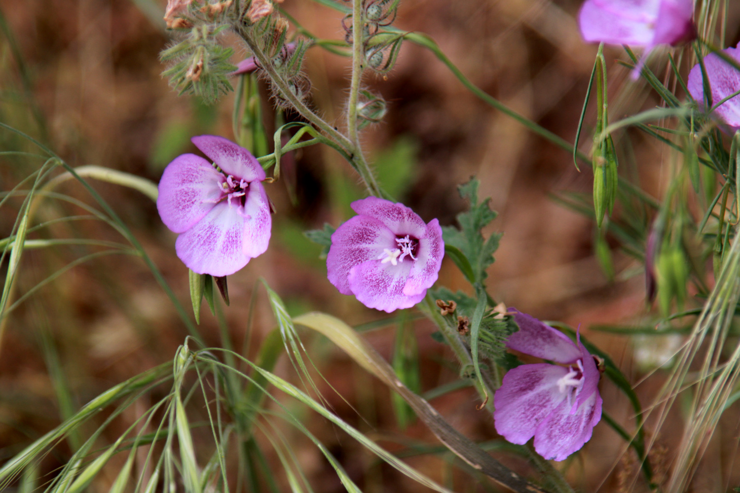 |
| The bright yellow of common madea was everywhere | Farewell-to-spring always appears by the middle of that season |
|
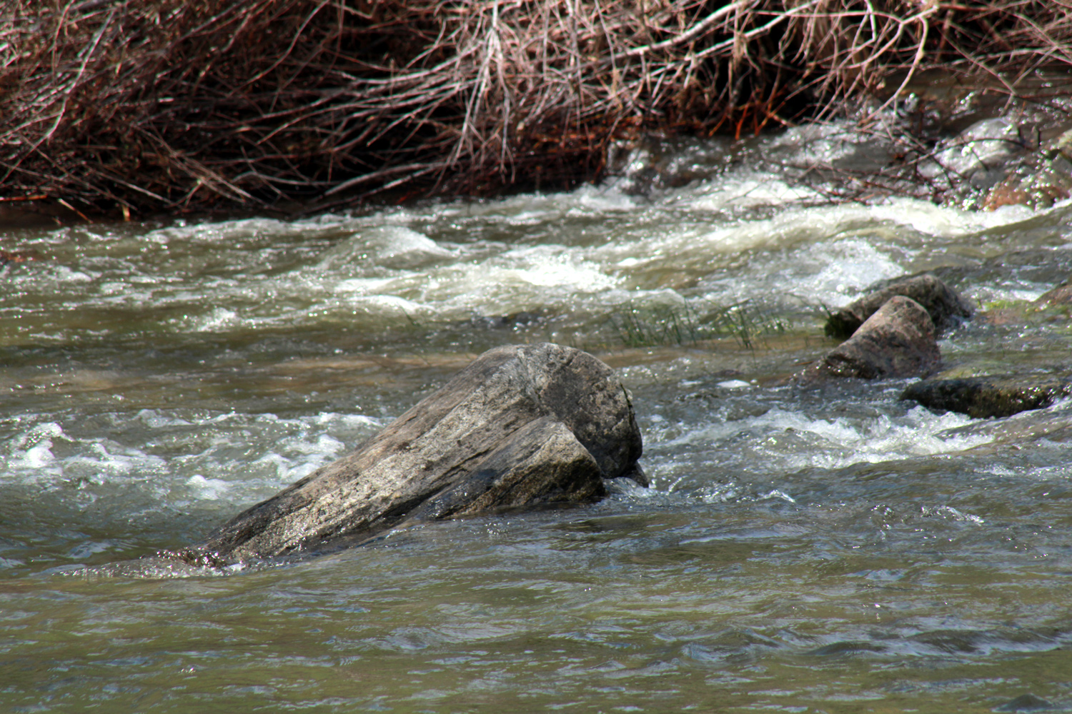
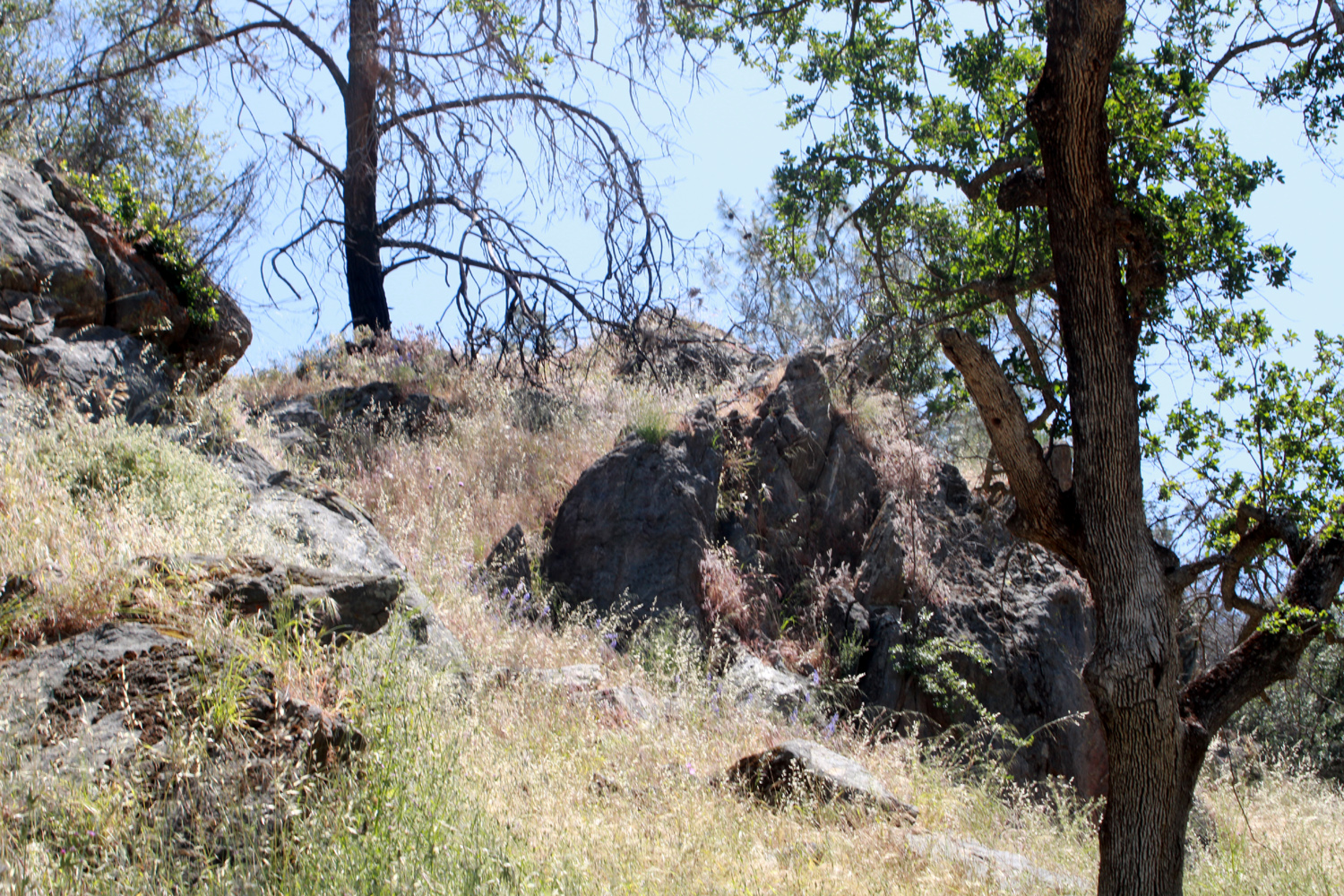
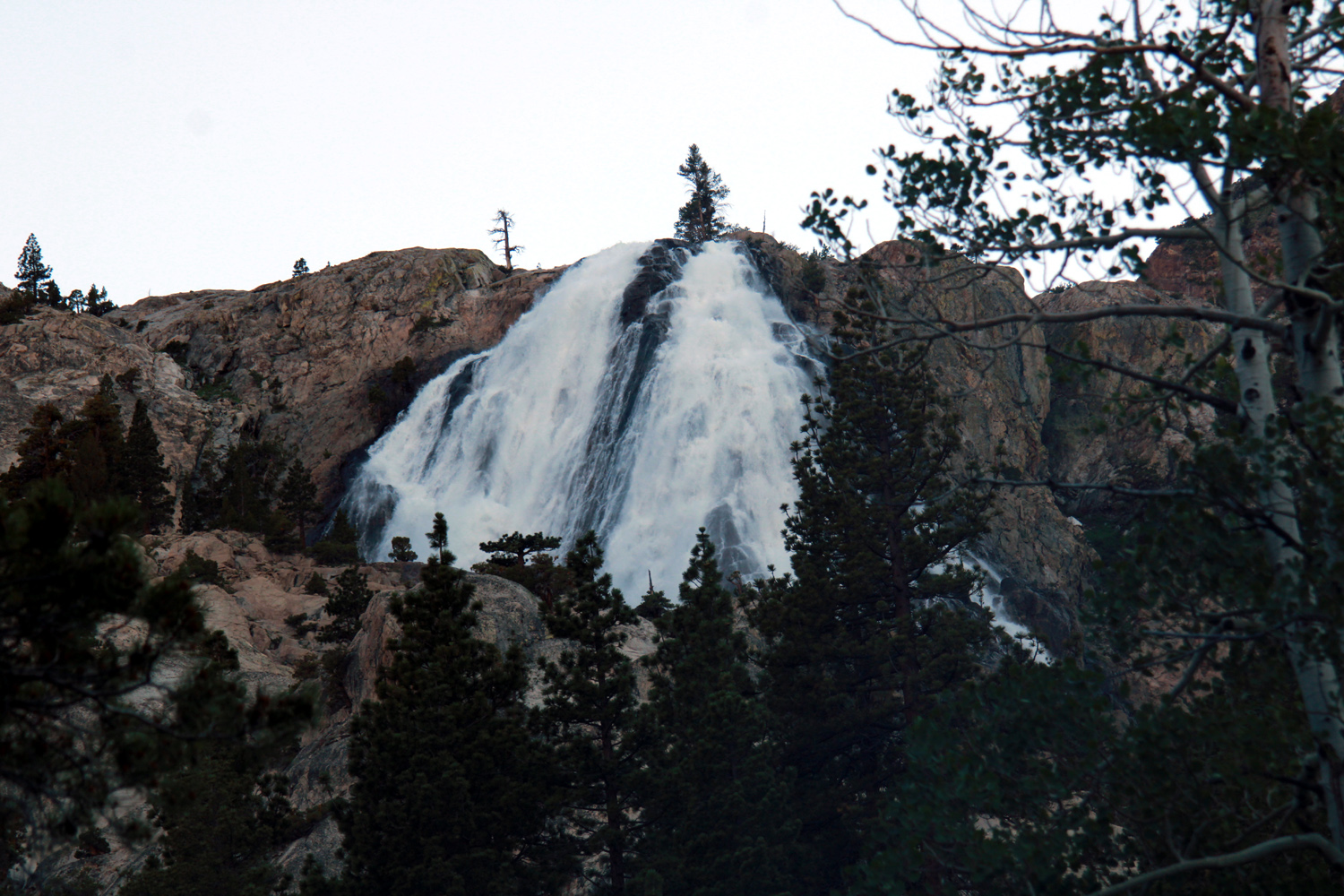
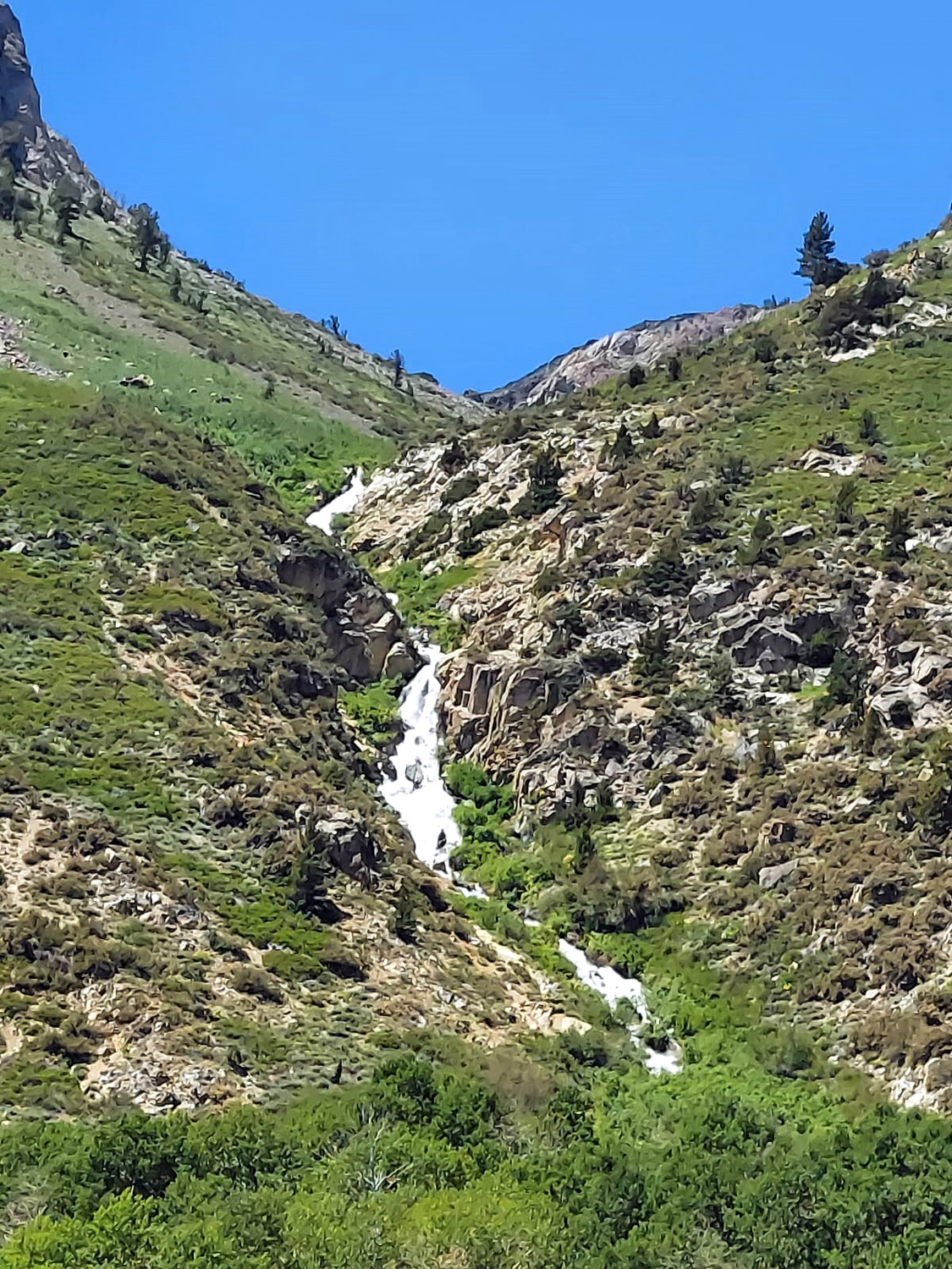
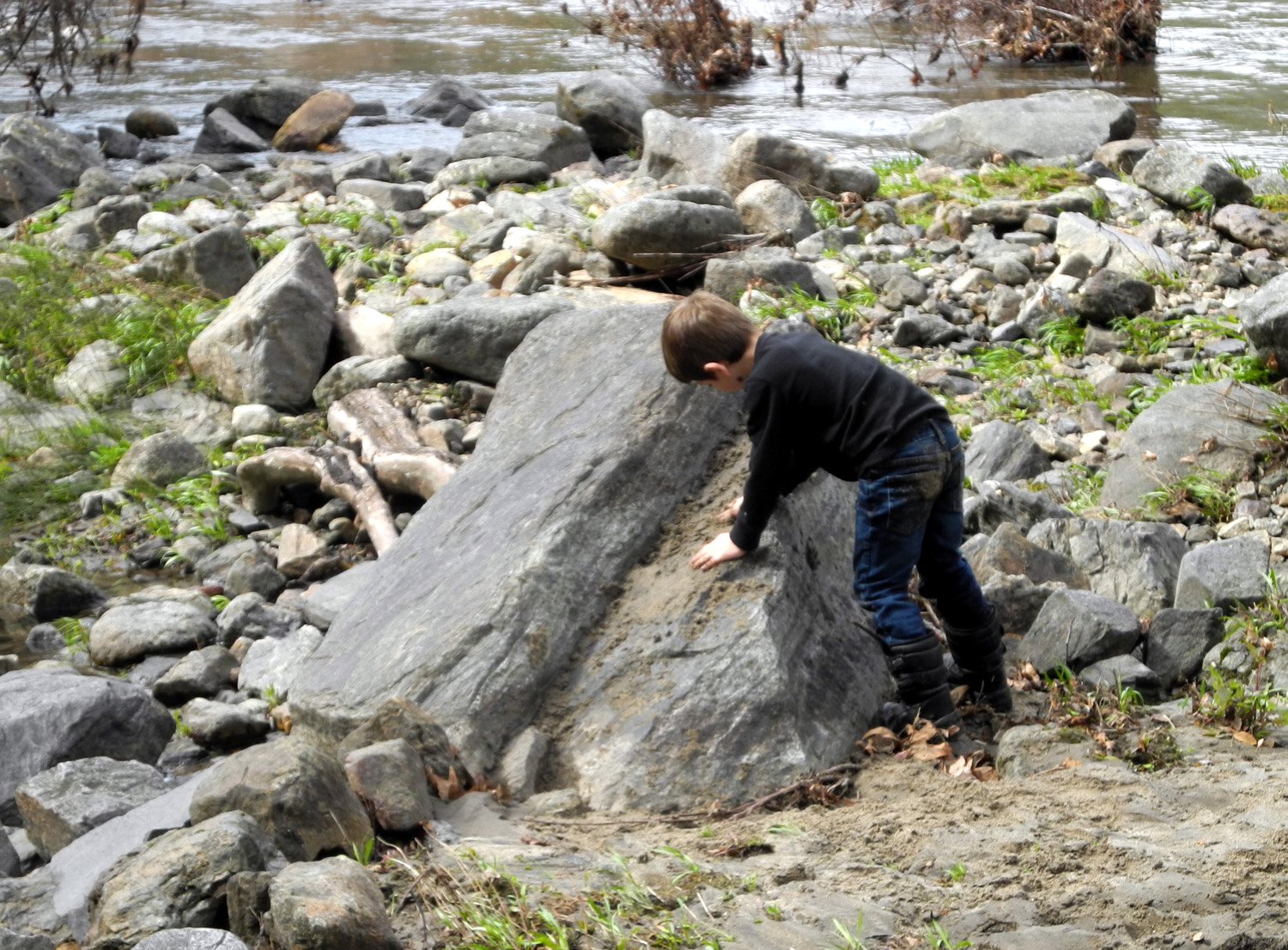
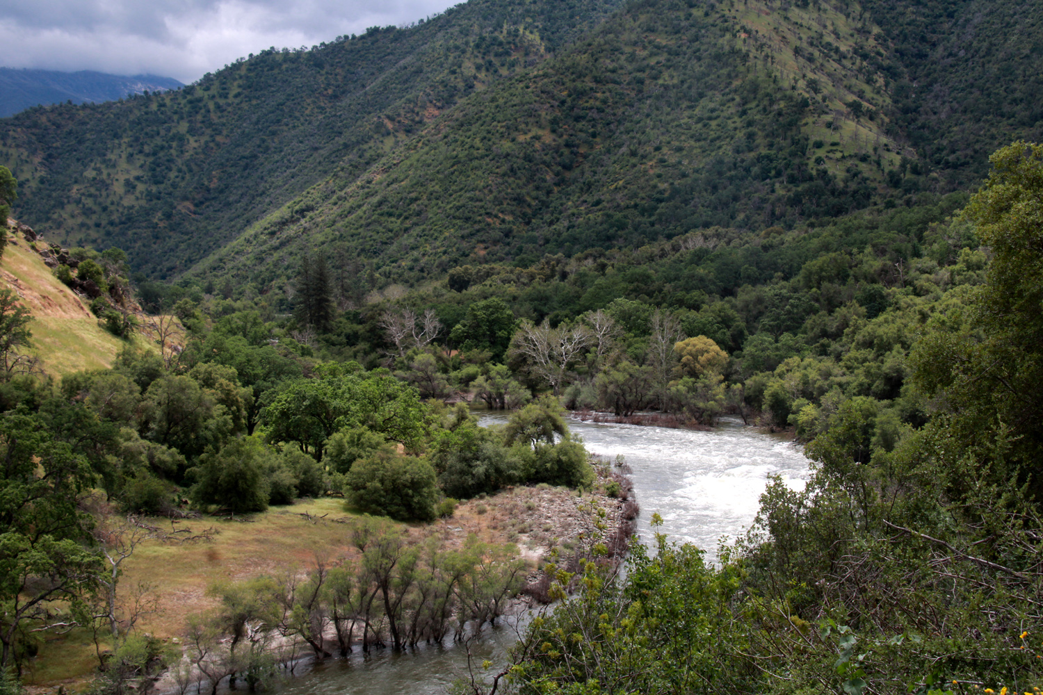
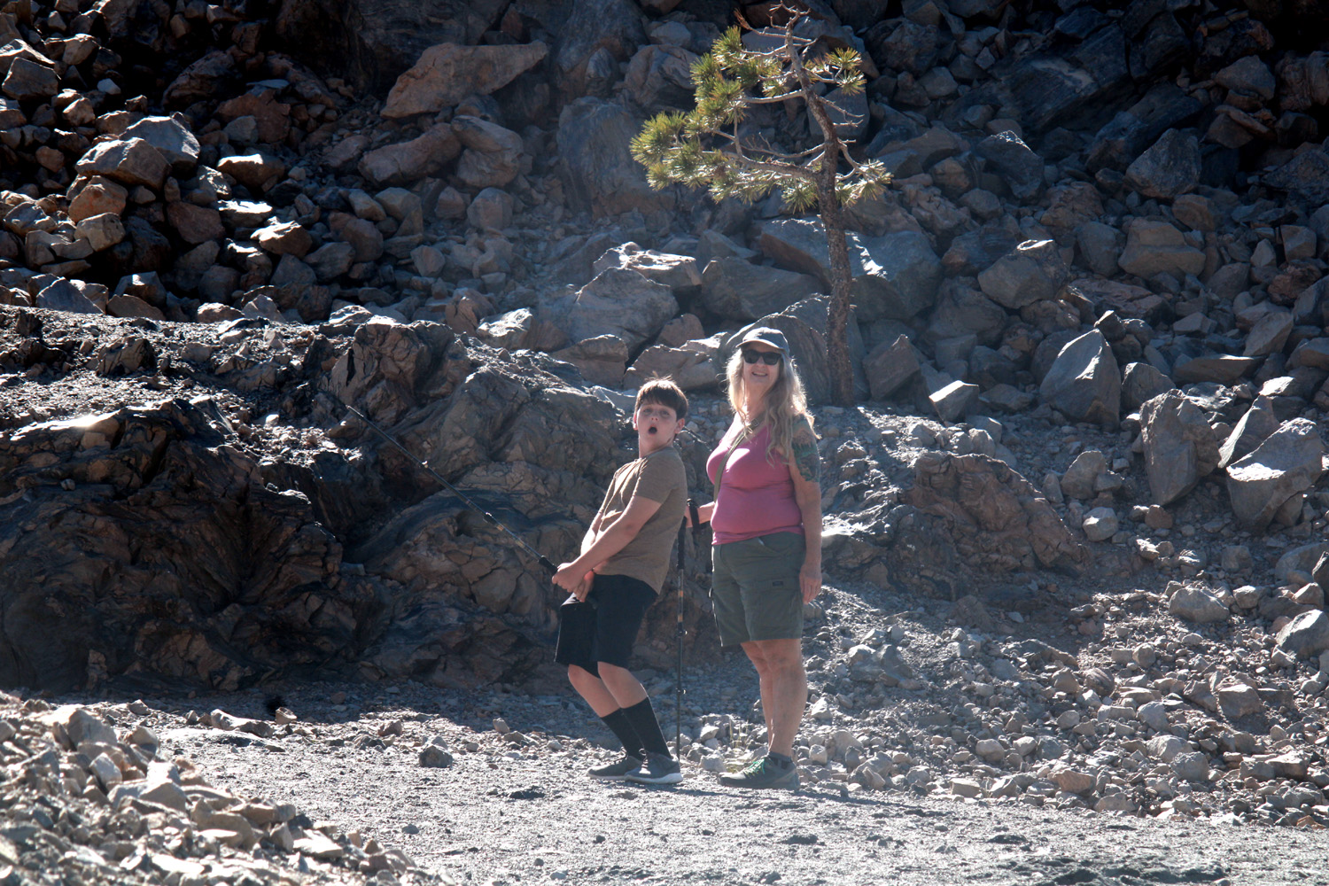
After Trimmer crosses the two major tributaries that come in from the north, Sycamore and Big Creeks, the road rises up to cross over Secata Ridge, then drops back down close to the lake at its extreme upper end. Near the top of the ridge a nice waterfall cascades down the hill, and it was still flowing good even this late in the season. We stopped briefly at Kirch Flat Campground, scene of many camping trips with my younger grandson, an annual event through 2009 known as Frog Camp. The campground has recently been completely refurbished, and everything is new - restrooms, picnic tables, even the posts that line the roads. Additional facilities have been added in the area where raft runners end their adventures. We continued the final short run to the upper bridge, just past where the North Fork joins the main river. Above this point the main stem, which splits into the Middle and South Forks farther up, is unfettered by dams of any kind, so we were now seeing the full force of this year's spring runoff. Happily, the road was open, so we decided to drive at least as far as the cabin. There were a couple of small slides and a large boulder in the road, but there was plenty of room to get past. Jackie had not been to the cabin before, but of course, we could only look at the outside. The windows are all covered with blinds, so peeking in the windows did not help. We walked down to the river, and to a spot where great grandson Colton had spent a half hour or so covering a large rock with damp sand on our first visit. This boulder was now in a small rapids at least ten feet from the shore. |
|
|
|
|
 |
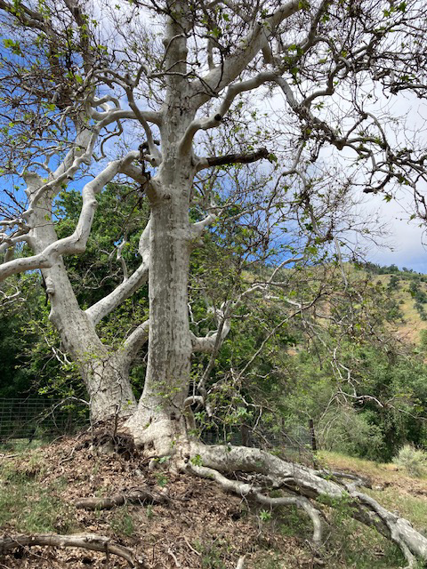 |
| Great grandson Colton piled sand on this boulder in 2018 | Exposed roots of this sycamore always attract photographers |
|
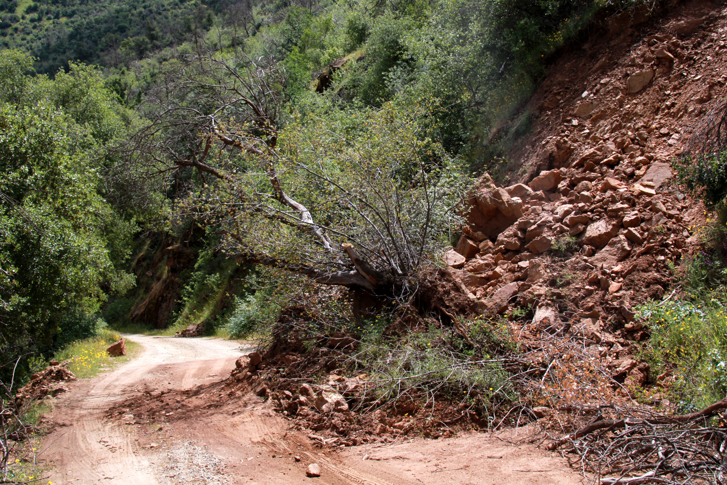
We decided to drive up to one of the campgrounds where we could find a restroom. It's probably less than a mile to the first one, but we did not get that far. We came to a huge slide that contained an oak tree, a smaller tree, large boulders, grass, flowers, and several tons of dirt. Vehicles had gone past it, so we were undaunted. However, the same could not be said of my truck. The front tire came against a small rock, and the rear wheels spun in the sandy road bed. I tried a second time with the same results, and decided we had gone far enough, especially since the truck was tilted toward the river at an uncomfortable angle. |
|
 |
 |
| Jackie contemplates what proved to be an impassible barrier | The view from the opposite side |
|
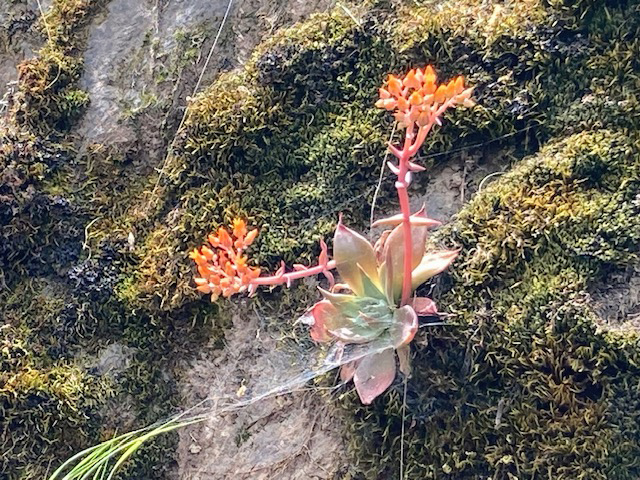
We returned to the cabin, set up our lawn chairs in the driveway behind the building, and enjoyed our lunch surrounded by the spring beauty of the Sierra foothills. On the drive back out to the main road, we observed a few flower species we had missed on the way in. Although it's well past their season, we saw a small stand of poppies, almost hidden in the surrounding common madea, a hillside rock with some delightful succulents, and probably the most globe lilies we had ever seen. |
|
 |
 |
| Succulents cling to to the rock along the road bank | It's a banner year for globe lilies |
|
When we were almost back to the pavement we met a large dump truck followed by an even larger earth mover, with a device to pick up giant boulders and dirt. I had to back up into a narrow, rough space beside the road to allow them to pass. At the conclusion of our adventure we were tired but satisfied that we had enjoyed a fantastic day in the Upper Kings River area. Here let me offer a warning or correction to some information on one of the web sites linked from this report. The site about the Kings River Trail says that Highway 180 turns into Trimmer Springs Road. This is incorrect; from 180 you must take Piedra Road north near Minkler to reach Trimmer, or get off the highway earlier by any of several connecting roads to Belmont Avenue, which DOES turn into Trimmer. --Dick Estel, May 2023 |
|
|
San Joaquin River Trail West
This is one of those places I've hiked a number of times in the last ten years, but I think this will be the last time. More about that later. This trail starts at the Finegold Picnic Area, at the end of Sky Harbor Road, next to Millerton Lake, and goes a little over 12 miles to the San Joaquin River Gorge Management Area. I have stated before that I have not and never will hike the entire distance, but in addition to hikes from the western end, I hike in from the upper end at least once every year. On May 8 I had a light breakfast and drove the 22 miles to the trailhead. With dry grass and almost no flowers along the route I was afraid I might be too late for wildflower season. However, in the Sky Harbor residential area, there were lots of farewell-to-spring, including the rarely seen white variation, as well as common madea, foothill gilia, and many others. |
|
 |
 |
| A white variation of farewell-to-spring | Foothill gilia |
|
The road goes down to the picnic area, but the gate is often locked, and most hikers park along the Sky Harbor Road, avoiding a $10 day use fee. This gives you a 200-yard downhill walk to the trailhead, after which the hike is relentlessly uphill for about a mile. After that mile, the trail arrives at a saddle, and begins to wind around the hills above the lake, with just some gentle up and down, at least as far as I have gone. Although the more exposed hillsides were fully brown, there was a lot of green where the trail went into more shaded area. |
|
 |
 |
| Brown hills above the trail | Green hills along a drainage |
|
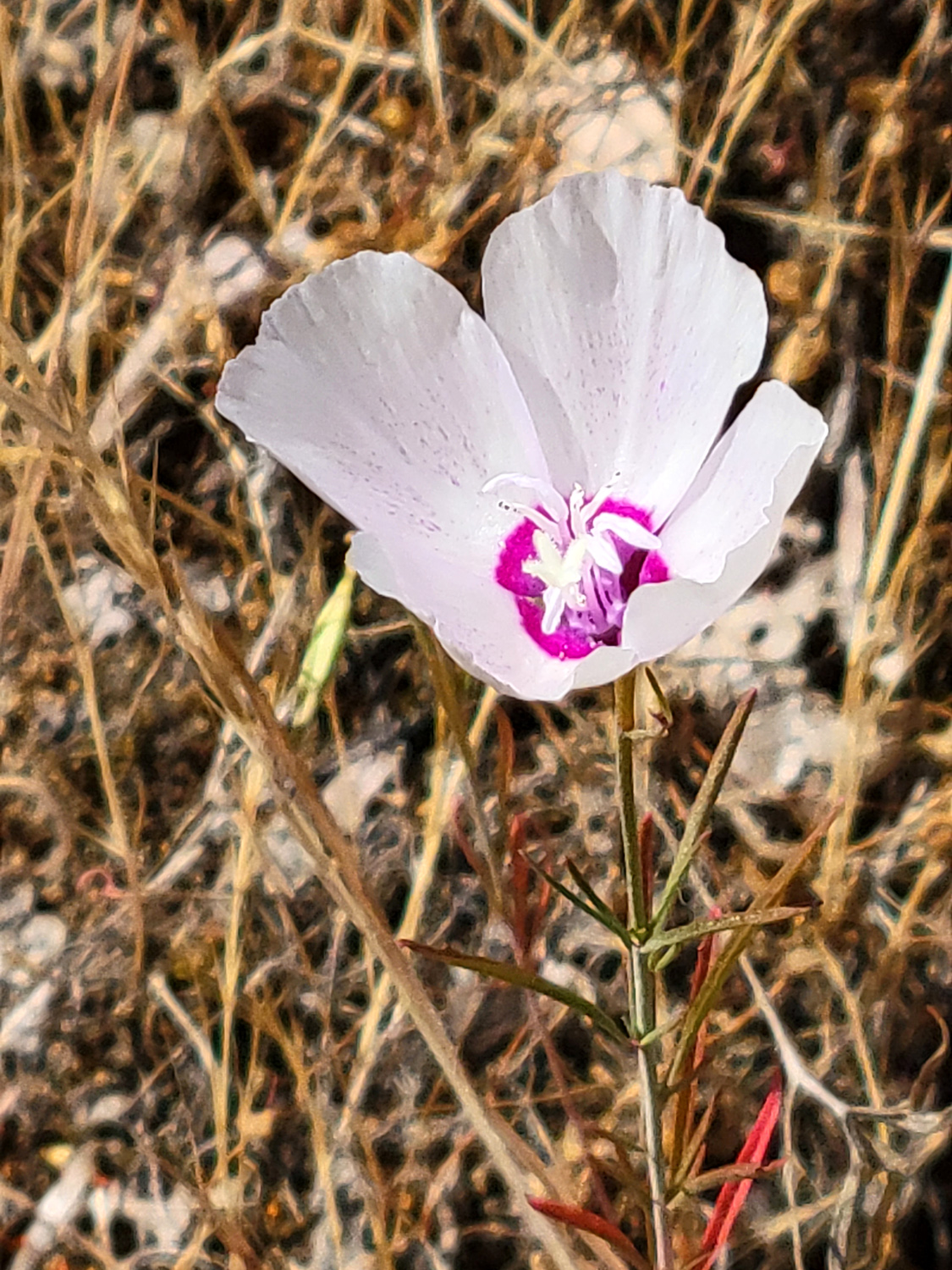
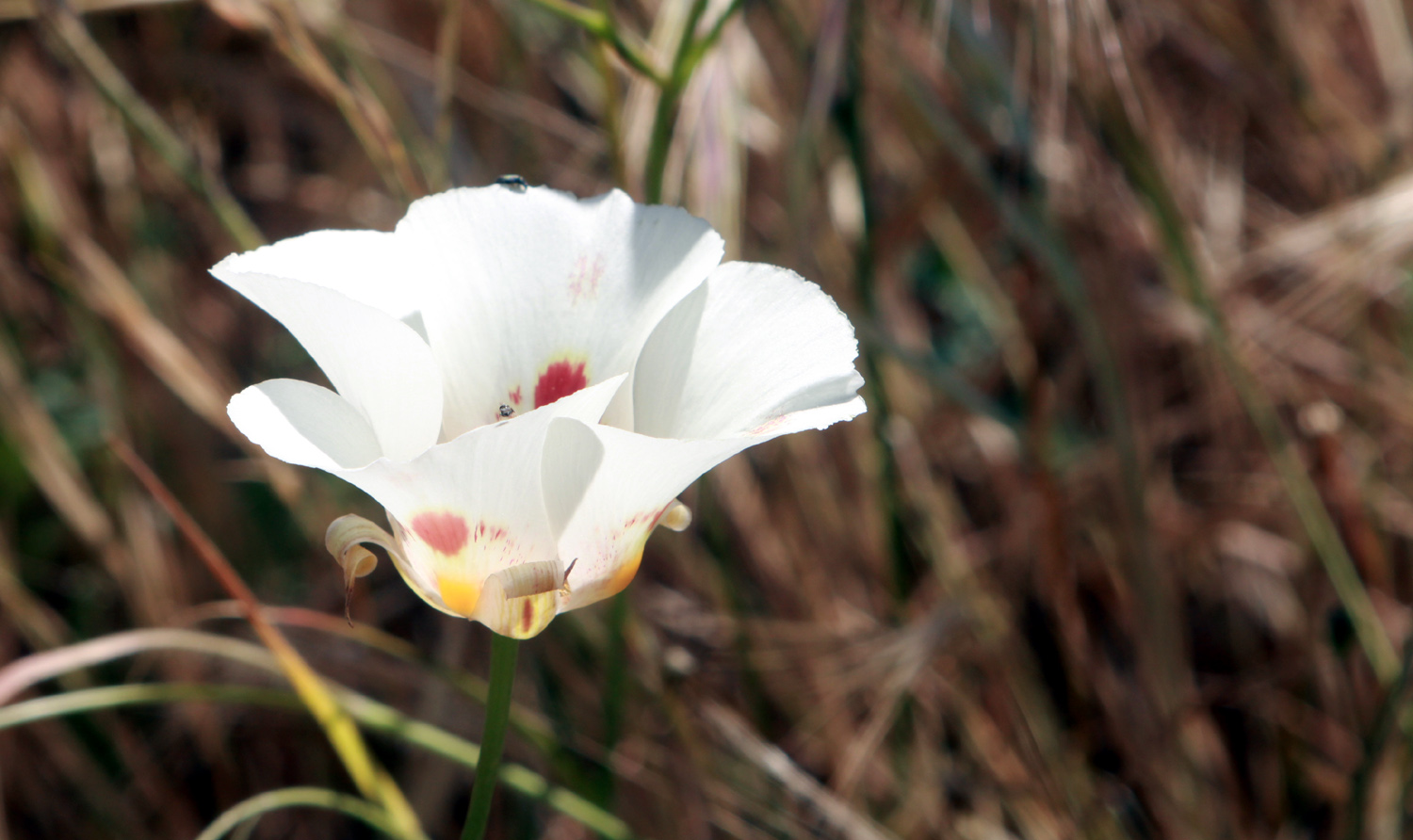
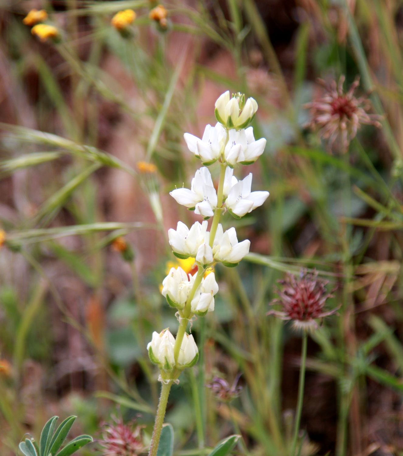
Along most of the trail there were many more flowers than I had expected. The most common were tall plants with a tiny dandelion-like yellow blossom and equally tall thistle plants with tiny pink blossoms. There is a pale blue lupine, as well as the more common dove lupines and tall ground lupines. A Mariposa lily made its appearance, and there was some owl clover, which has been scarce this year. |
|
|
|
 |
| These pale blue lupines grow on a large many-branched plant | A foothill favorite - Mariposa lily |
|
Despite its steepness, the one-mile hike is usually well worth while. In a good rain year, and at the right time of the season, the lupine and poppy display at the saddle is hard to beat. But...I know the trail is not longer or steeper than it used to be, but it is definitely in worse condition. Incessant rain this year has washed a lot of soil away around the many rocks in the trail (and the Sierra Nevada is essentially one big rock pile). There are places where the trail is downright dangerous for older hikers, especially going down hill. It has dried out and there is a lot of loose dirt where one can slip. All in all, it's "no country for old men," and this old man is wise enough to know when to eliminate such areas from my hiking repertoire. Thankfully I've taken a LOT of photos during my 21 previous visits there. And there's still Finegold North. For younger, stronger hikers, it's considered a moderate trail. On my way up I met a CalFire worker jogging down the trail. Later he passed me going back up, then I met him coming down again. He was carrying a hoe, which said was for snakes. He had gone to the top of Pincushion Peak, back down, and half way back up, preparing for an upcoming physical test. I hiked to Pincushion seven years ago with daughters Teri and Jennifer, plus Wes Thiessen. All my family agreed it was one of the most difficult hikes we had ever done. We were glad we had done it, and even gladder we never have to do it again. |
|
 |
 |
| A nice display of farewell-to-spring | Rock outcropping above the trail |
|
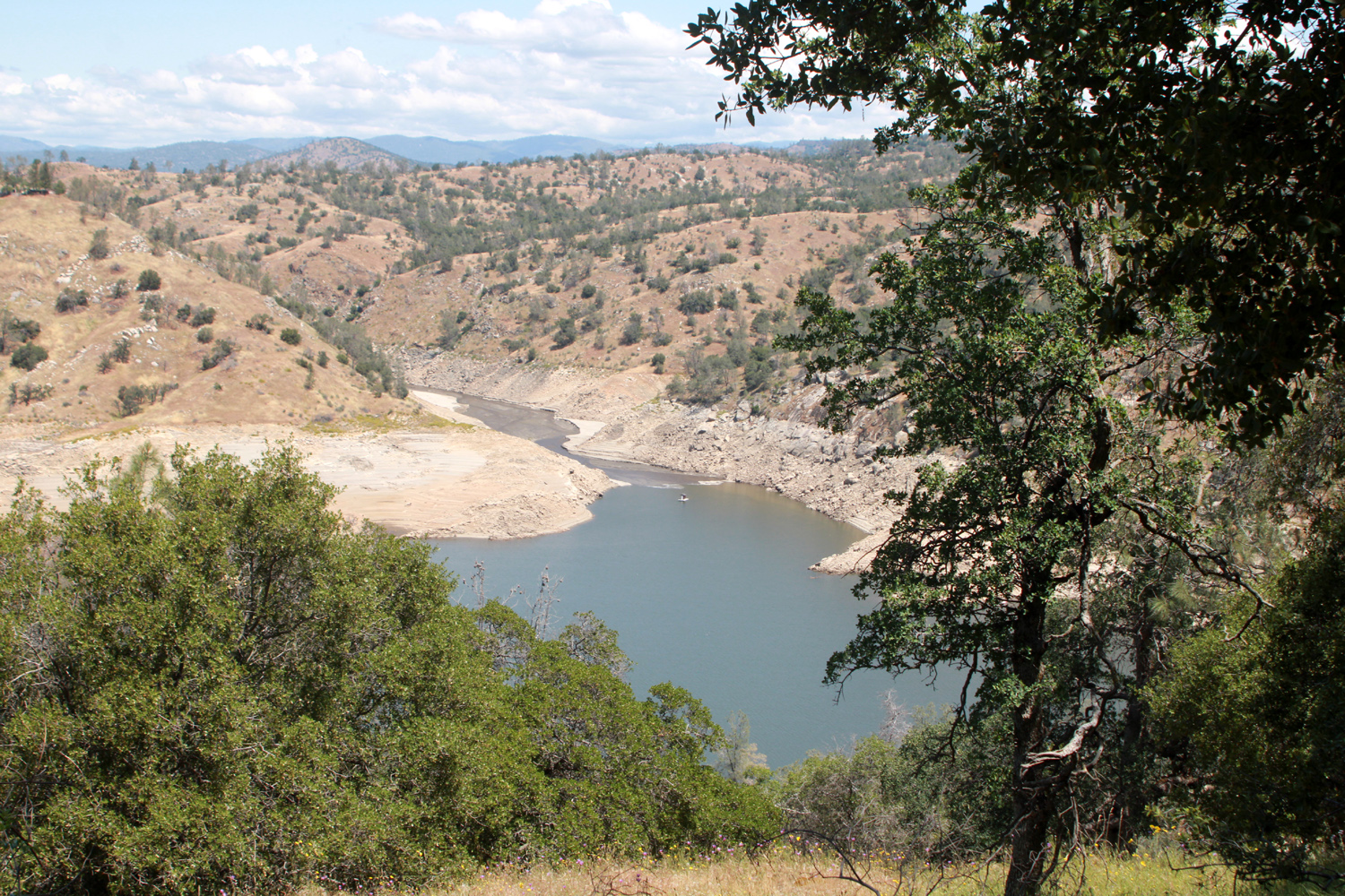
Always hiking with great care, I made it to the spot a little more than half way up where there are some good resting rocks, and made that my turn-around point, just as I had in 2021. From this location I had a view of the branch of the lake that goes up Finegold Creek. The lake has been lowered to 35% of capacity to make room for the coming snow melt, and the water barely entered the Finegold drainage. After resting for 20 minutes or so, I went back down, bidding a sad, final farewell to this wonderful hiking spot. --Dick Estel, May 2023 |
|
|
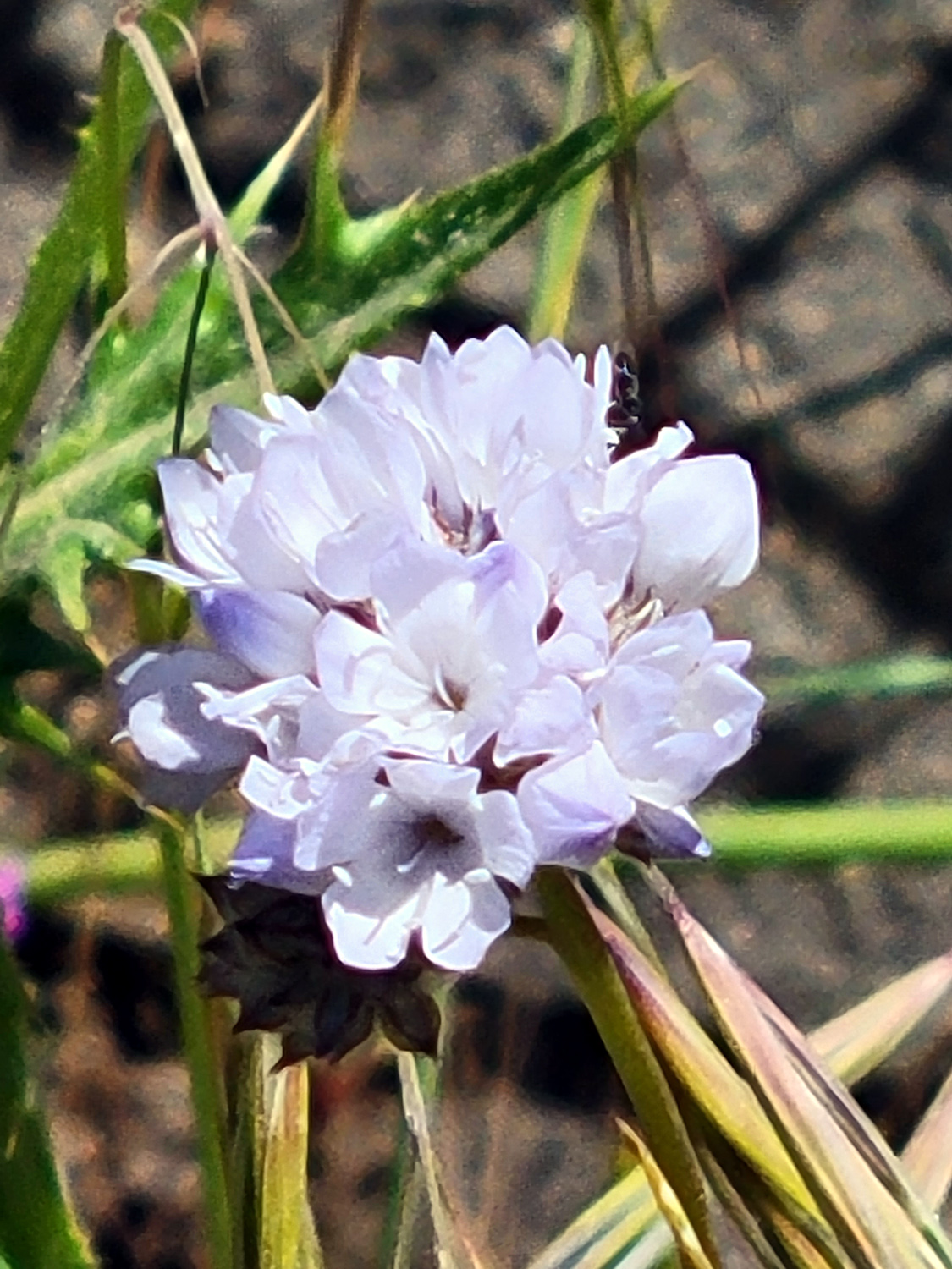
Epilogue: The flowers seen on this trip included yellow and purple brodiaea, yellow-throated gilia, foothill gilia, blue dicks, poppies, milkweed, filaree, farewell-to-spring (including the white variation), thistles, dandelions, common madea, fiesta flowers, lupines (big pale blue, dove, tall ground), clover, a clover-like blossom, owl clover, elderberry, tall and short mystery flowers, Chinese houses, Mariposa lily, phecelia, a tall yellow flower at the resting place, and an unidentified orange blossom down by the little creek (I had seen them only once before, in this same location). |
|
|
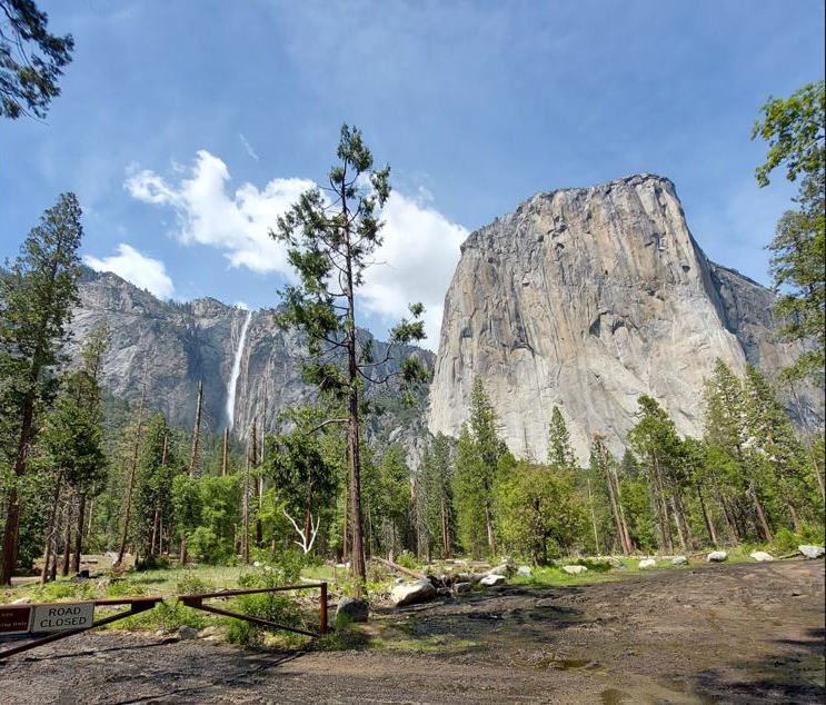
Yosemite & Merced River
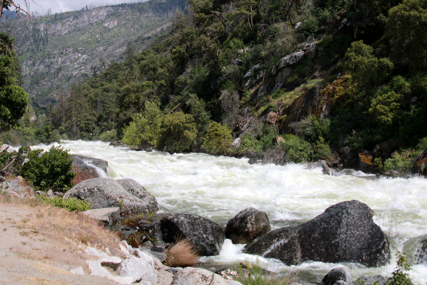
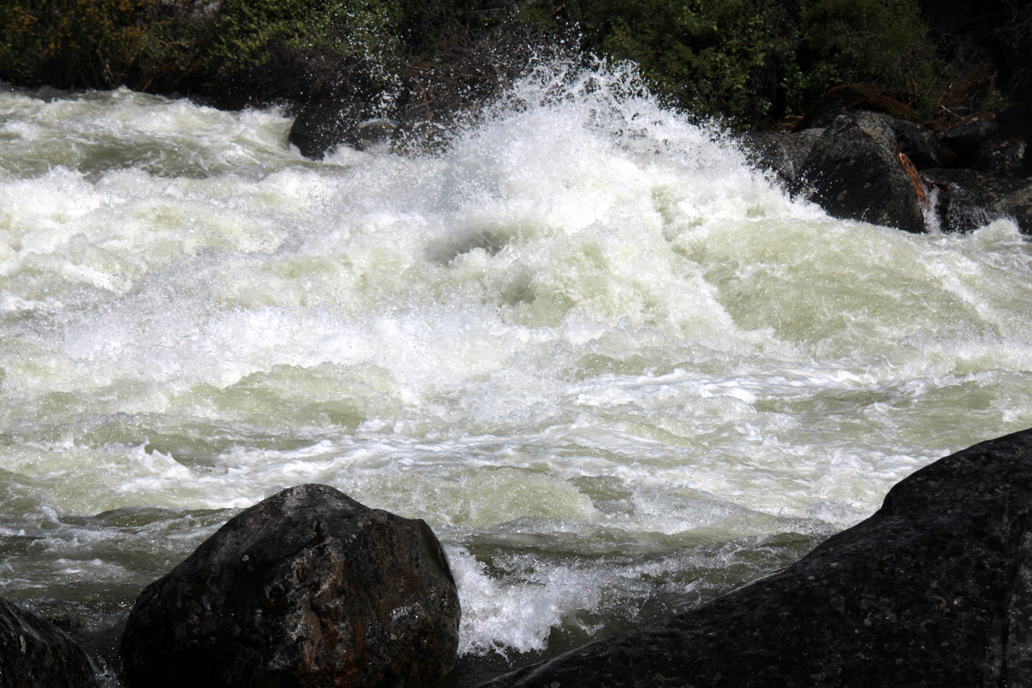
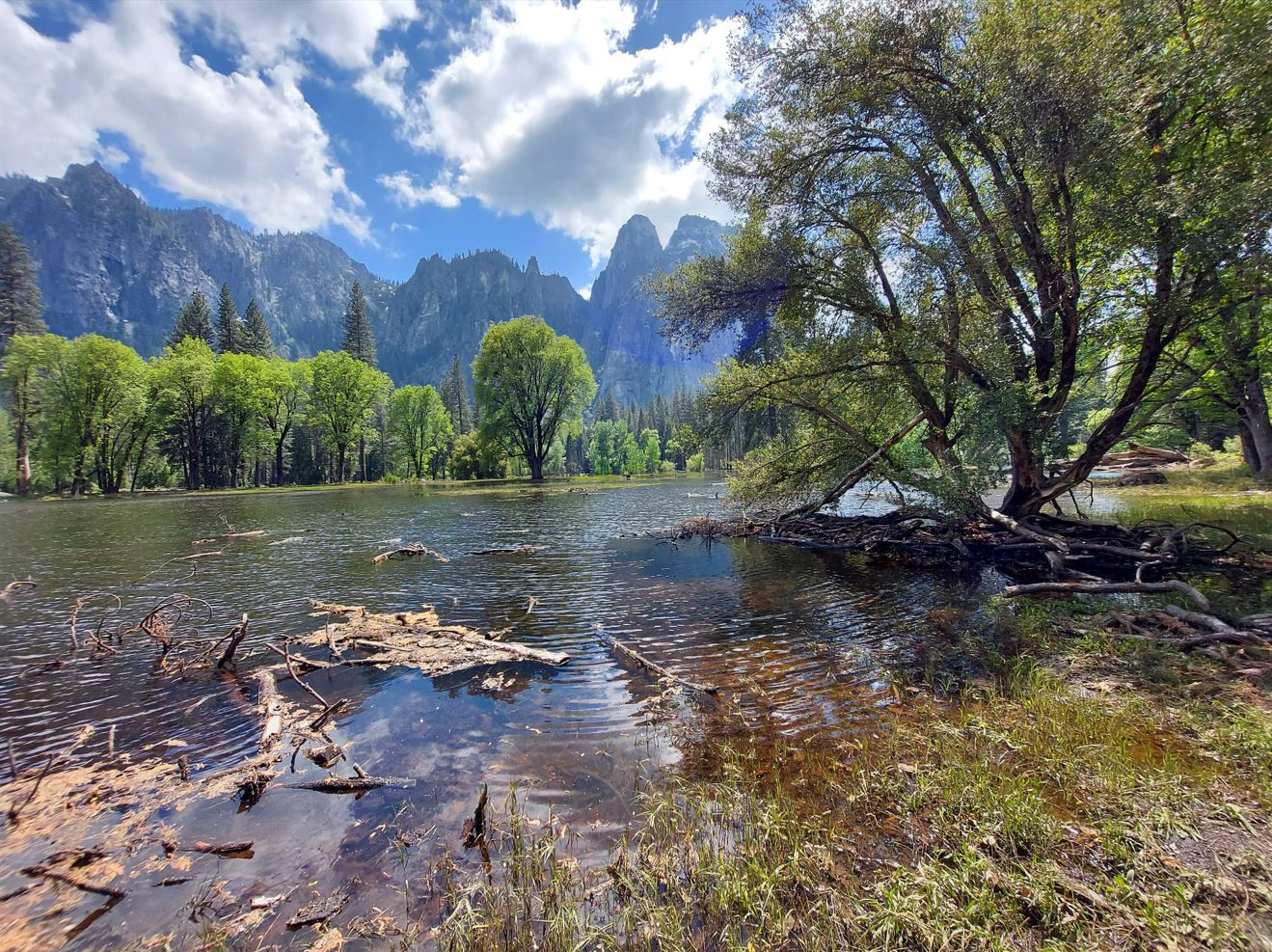
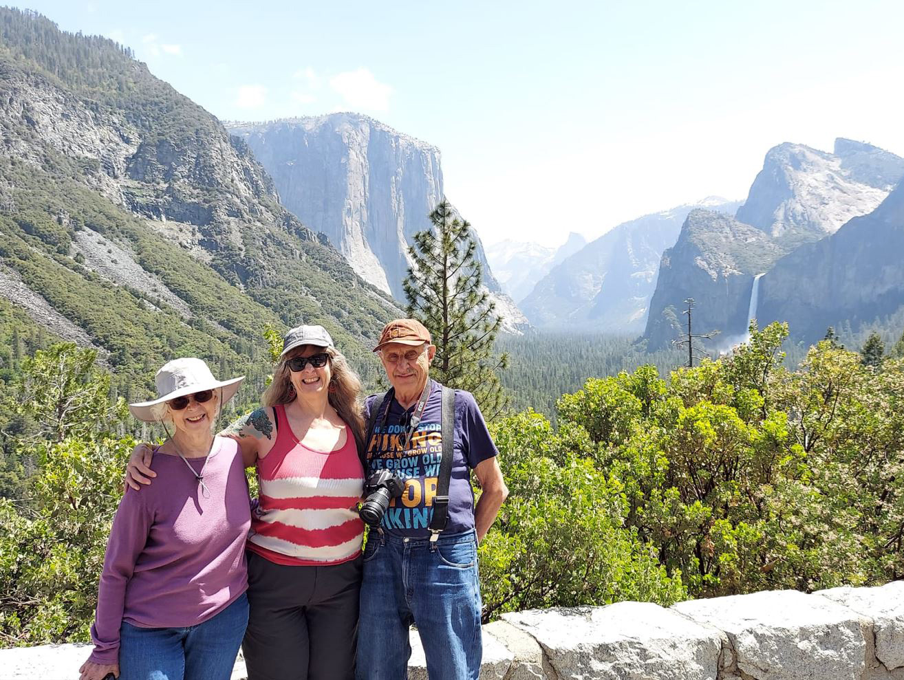
On May 25 my daughter Teri, her mother Jackie, and I went to Yosemite Valley, my first visit since the fall of 2021.. I was tempted to end the text here and just let the photos tell the story, but that doesn't sound like something I would do. I always have more to say. We got started very early and drove up State Route 99, then cut across to SR 140, which goes through Mariposa and into the valley. Our purpose in doing this was to drive along the Merced River, which would be a raging torrent after the record snow and rains early this year. About twelve miles from Mariposa the highway descends to the river canyon, then parallels the waterway for about 30 miles, rising gradually from 1,100 to 4,000 feet. During the last few miles the grade increases significantly, creating dramatic white water rapids. |
|
|
|
| The Merced River is all white water rapids between El Portal and the valley | Wild and dangerous, but beautiful |
|
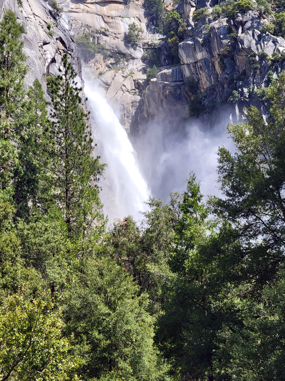
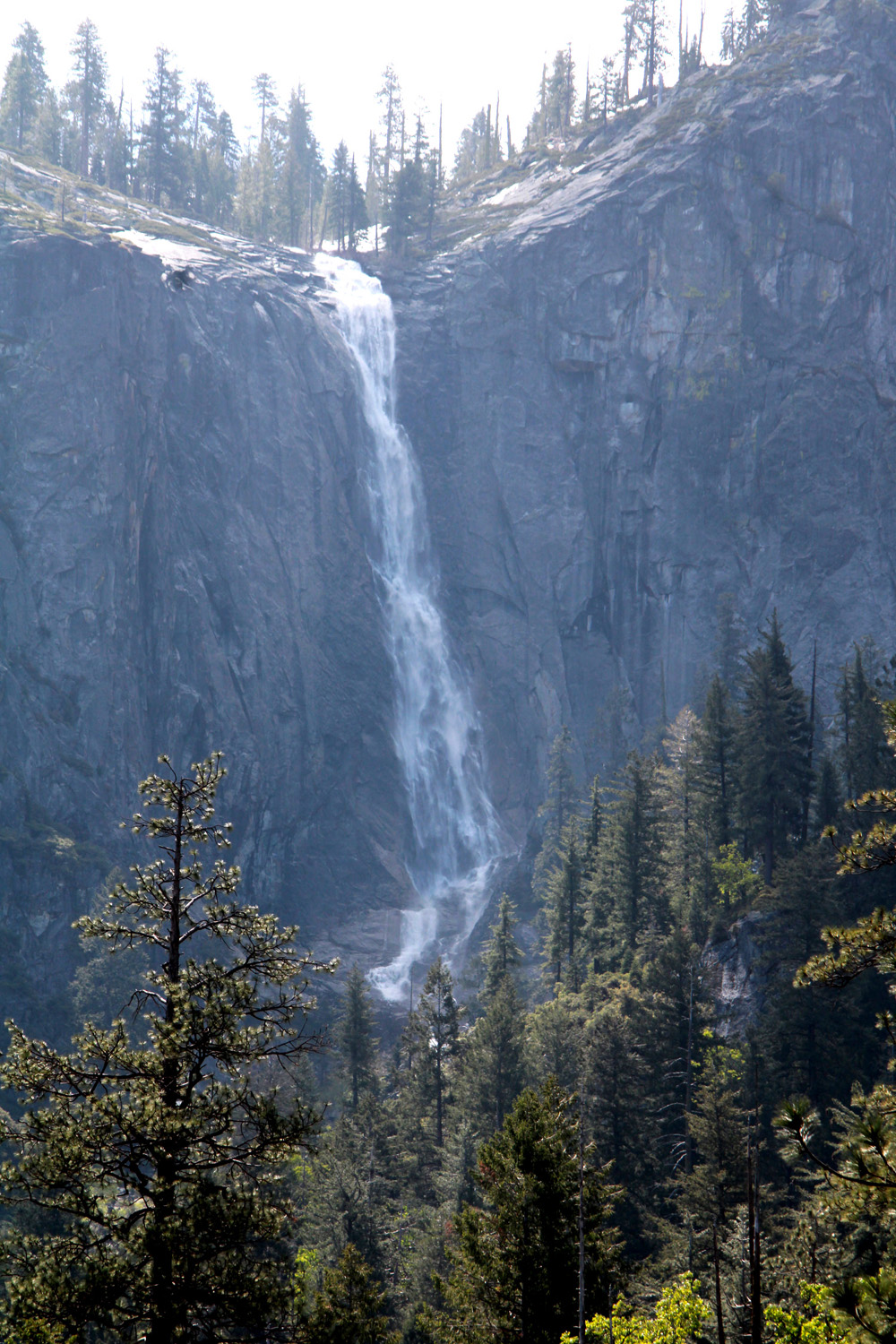
A short distance before you reach the valley proper, you come to the first significant waterfall, known as The Cascades. This stream tumbles down the north side of the canyon in a series of drops and rapids, ending in a nearly vertical jump of 500 feet. During good rain years a number of seasonal (or ephemeral) falls appear, so there were more of these than usual this year. Some have names and some do not. In extremely wet years, these short-term falls can appear to be as big and as important as the famous named falls that crash into the valley. On the south side of the canyon, before we reached the valley, we had seen two that looked really good, and there was another one just west of Cascade on the north side. |
|
|
|
| Cascade Falls, below the west end of the valley | A season falls west of Cascade |
|
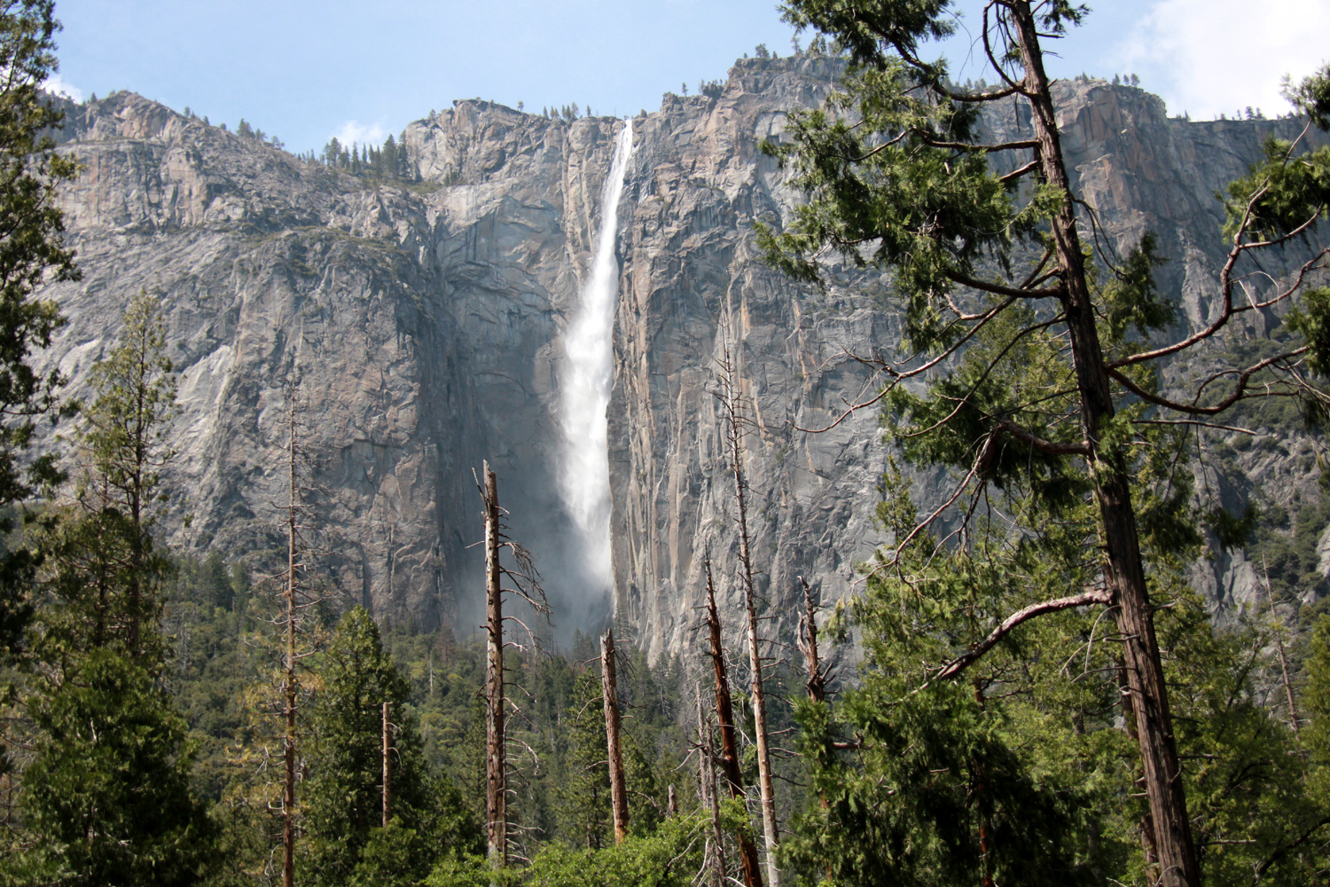
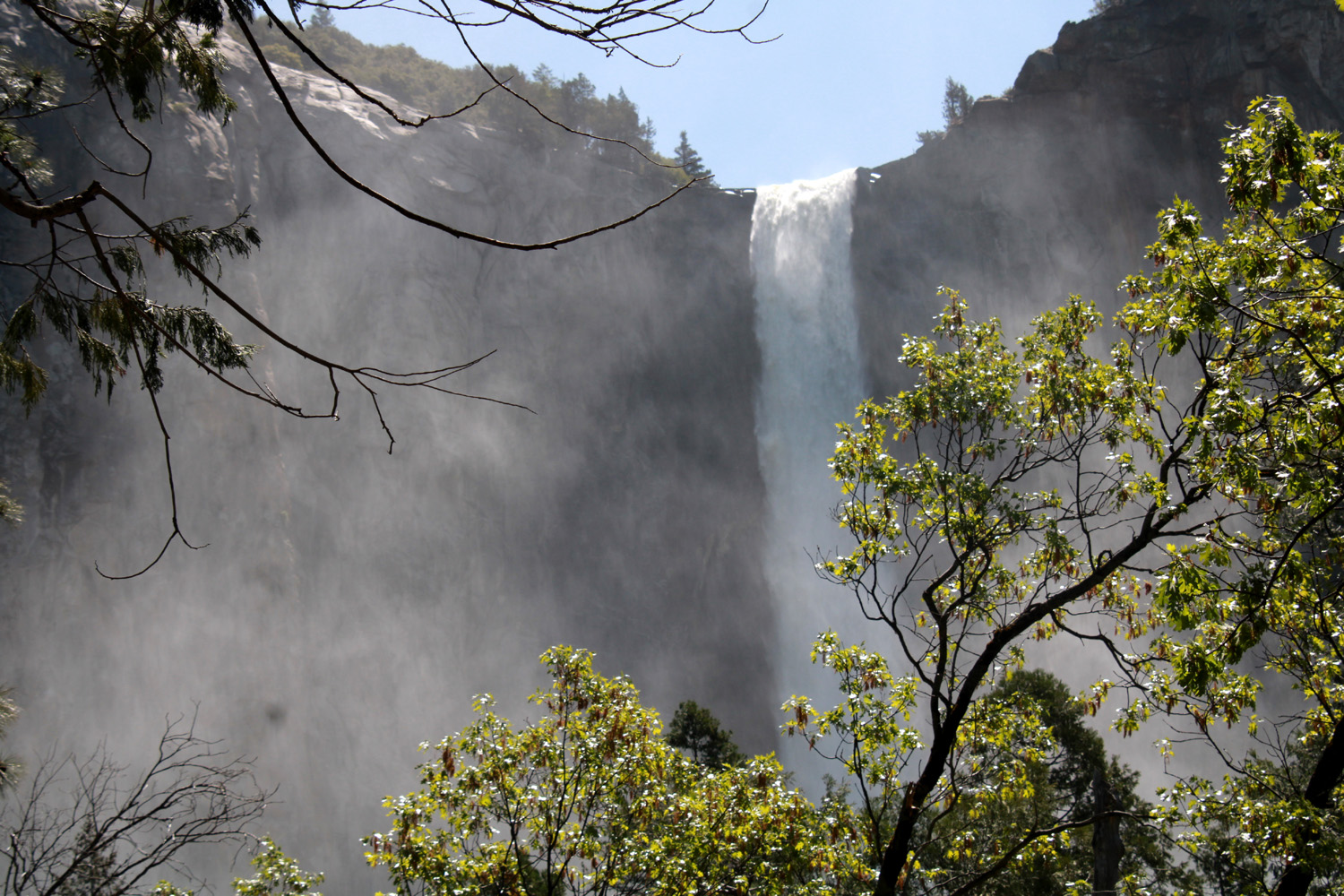
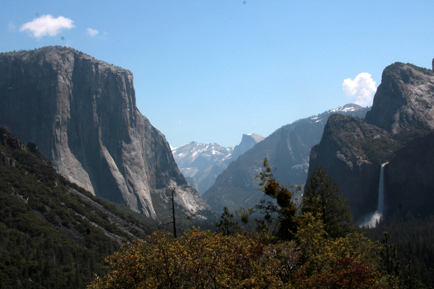
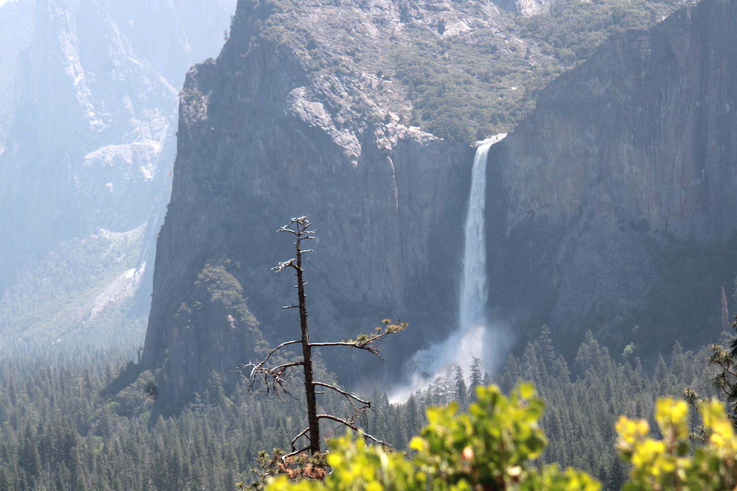
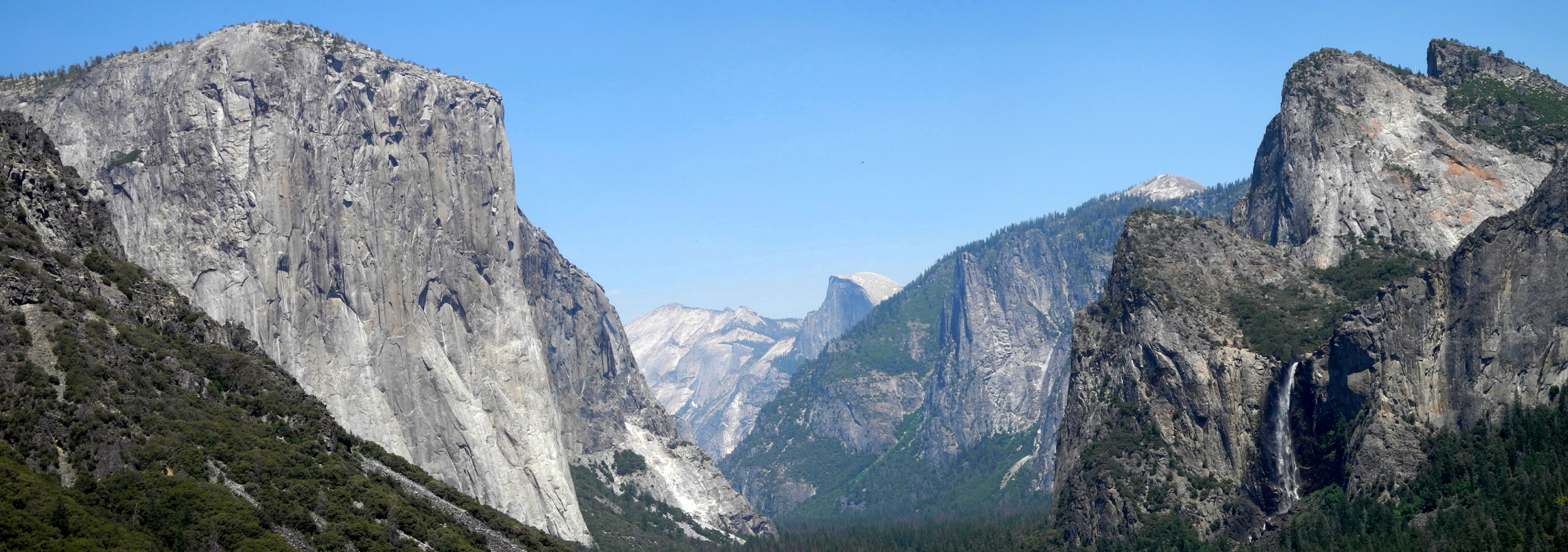
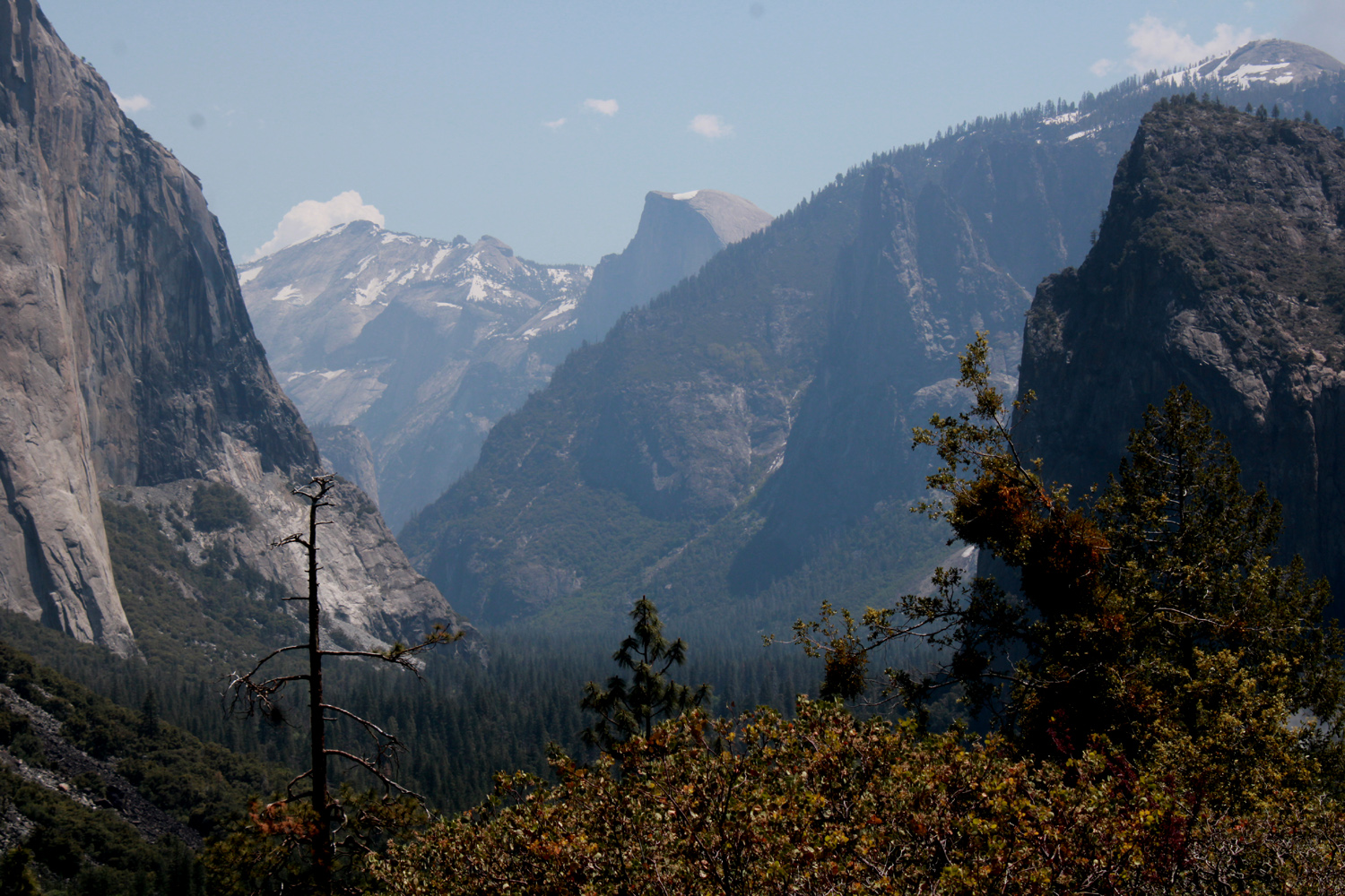
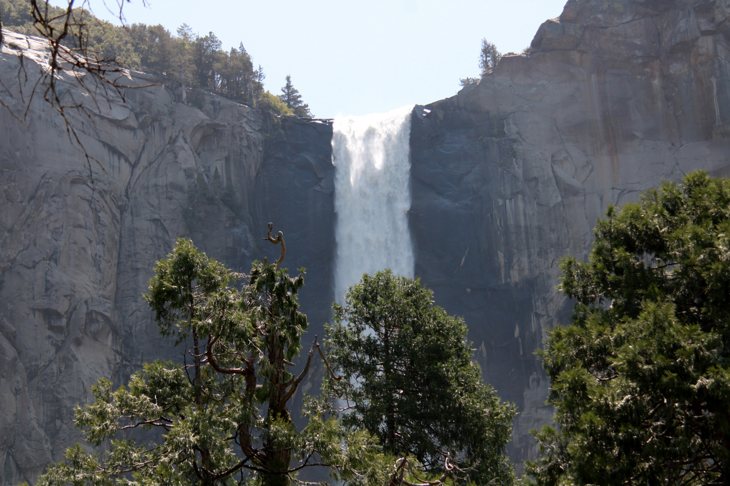
Living so close to Yosemite, we are spoiled and try to avoid the valley during peak tourist season. To quote Yogi Berra, "Nobody goes there anymore. It’s too crowded." However, the crowds are smaller pre-Memorial Day and post-Labor Day, and we did not experience any of the traffic jams that have plagued some of our friends during recent summer visits. There was a line-up at the entrance station, but our wait was not over ten minutes. We wanted to go to the parking lot at the base of 600-foot Bridalveil Falls, which was putting on a show above and beyond its usual magnificence. The parking lot has been closed for a major re-build, and was still not open, so we drove the short distance up the road that goes back down to Fresno, to the mouth of the Wawona Tunnel, where we see the iconic view of the valley, with El Capitan and Bridalveil framing Clouds Rest and Half Dome in the distance. Here we could also see Silver Strand Falls, above the parking lot to the northeast. This feature usually has a small flow in springtime, but like so many others this year, exceeded expectations. |
|
|
|
| Mist from Bridalveil falls drifts high and wide | The classic Valley View from the Wawona Tunnel |
|
|
| Bridalveil from the tunnel view | Silver Strand is best seen from the tunnel parking lot |
|
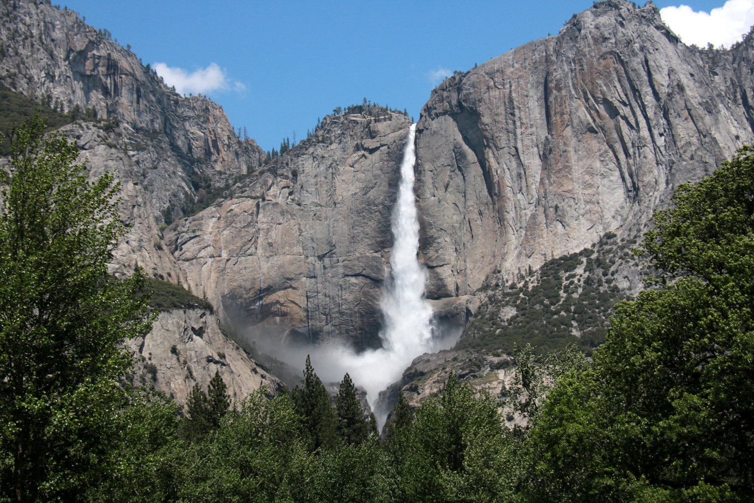
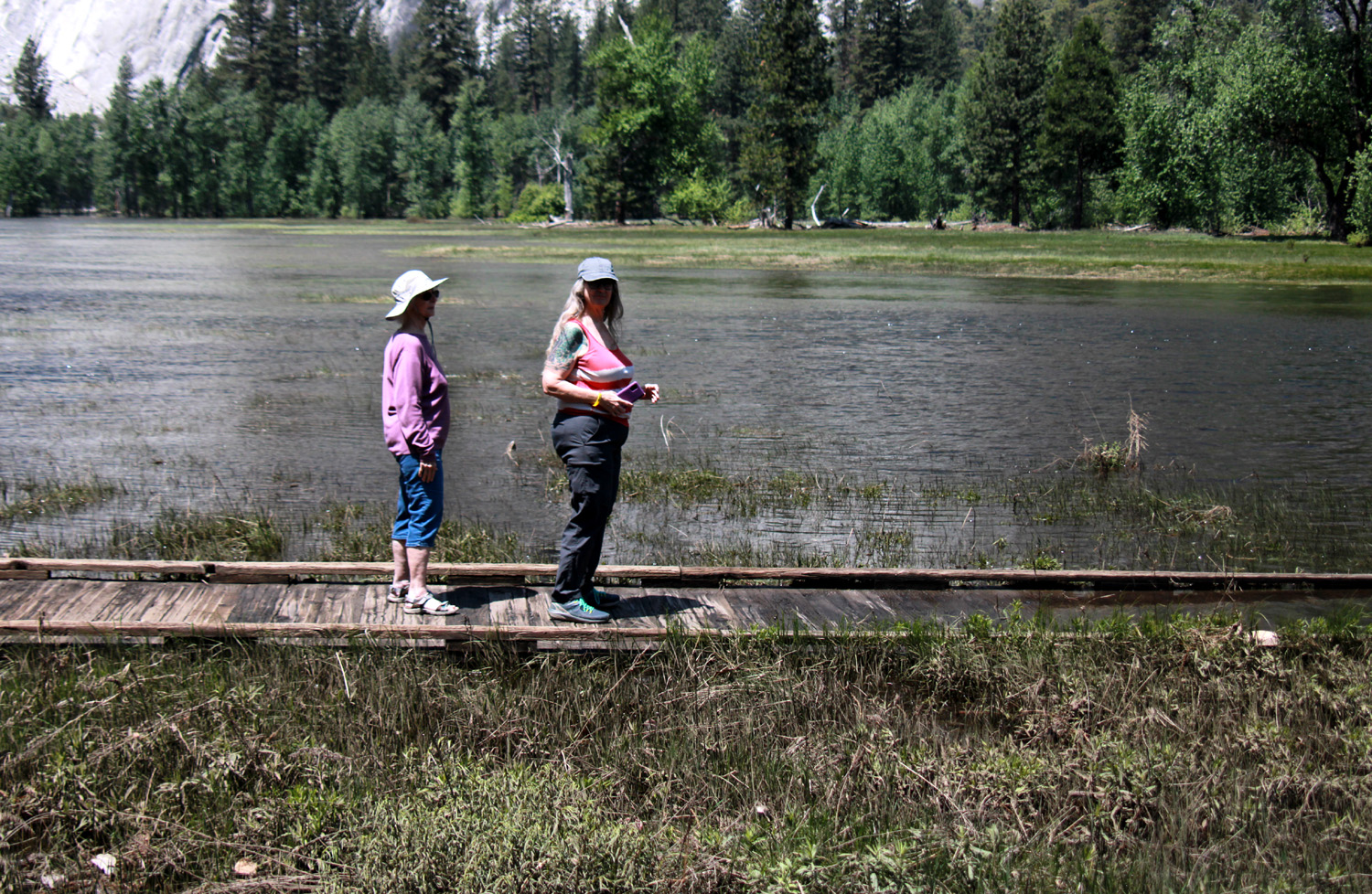
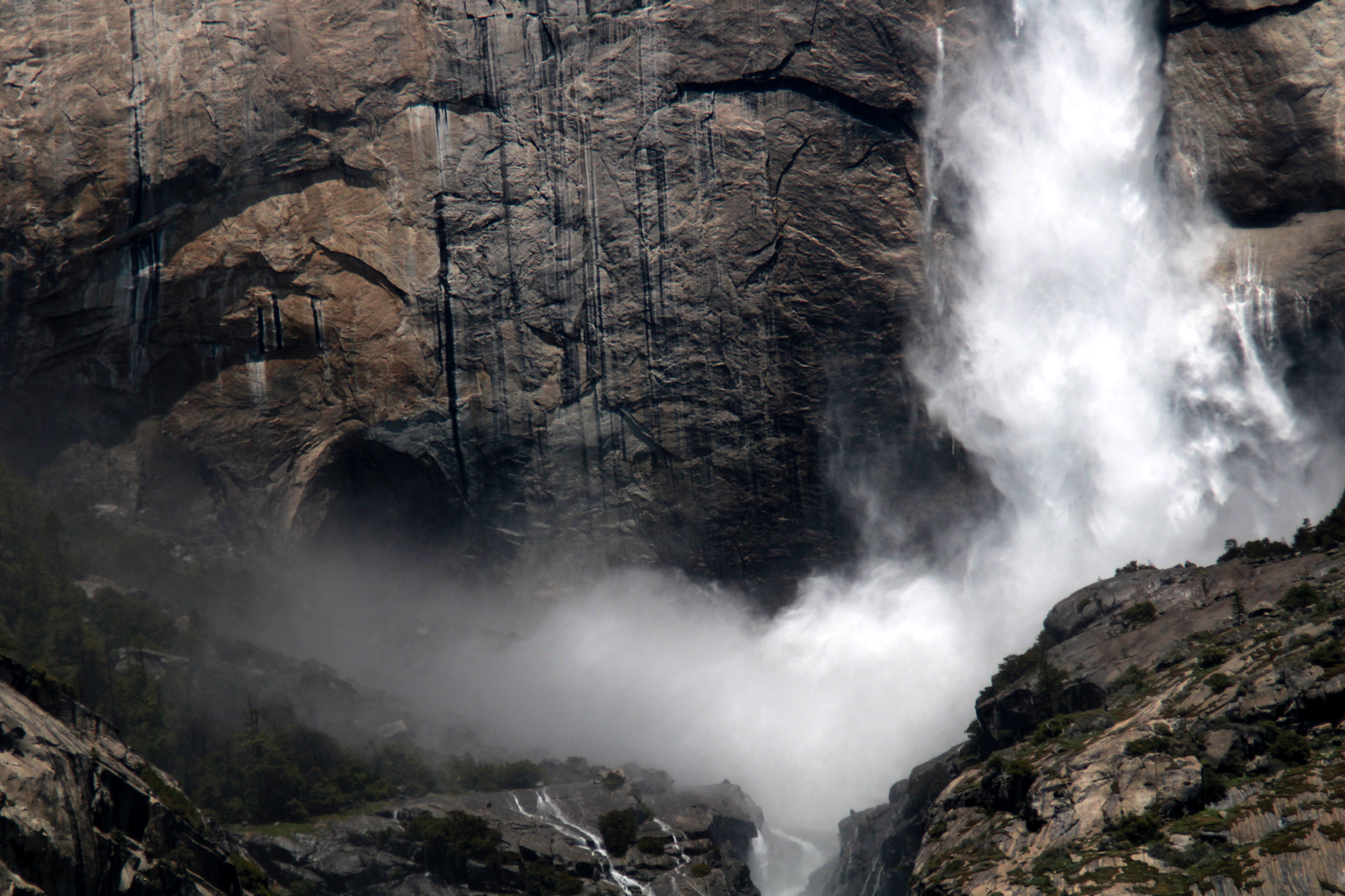
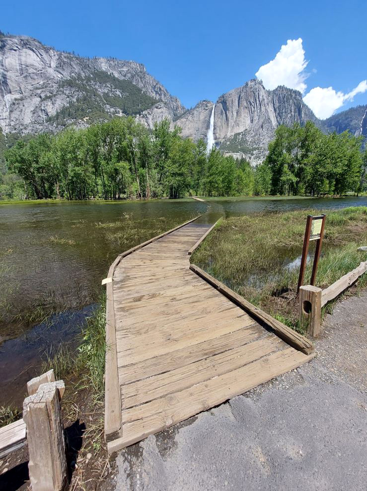
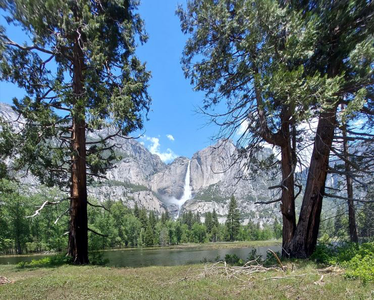
We drove back down to the valley floor, stopping first where we had a partial view of Bridalveil through the trees, then moving on to a section of the road that runs past a meadow and has a lot of parking spaces. You can walk a few steps in either direction and find a good view of Upper Yosemite Falls across the valley. We also had a view of lots of water. The meadow was virtually flooded, as were many low-lying areas along the Merced River. There are a couple of boardwalks that go across the meadow, but both of them were covered with water 30 feet from the meadow's edge. |
|
|
|
| Spray rising up at the base testifies to the power of Yosemite Falls |
Jackie and Teri stopped a few feet before the boardwalk dipped into the flooded meadow |
|
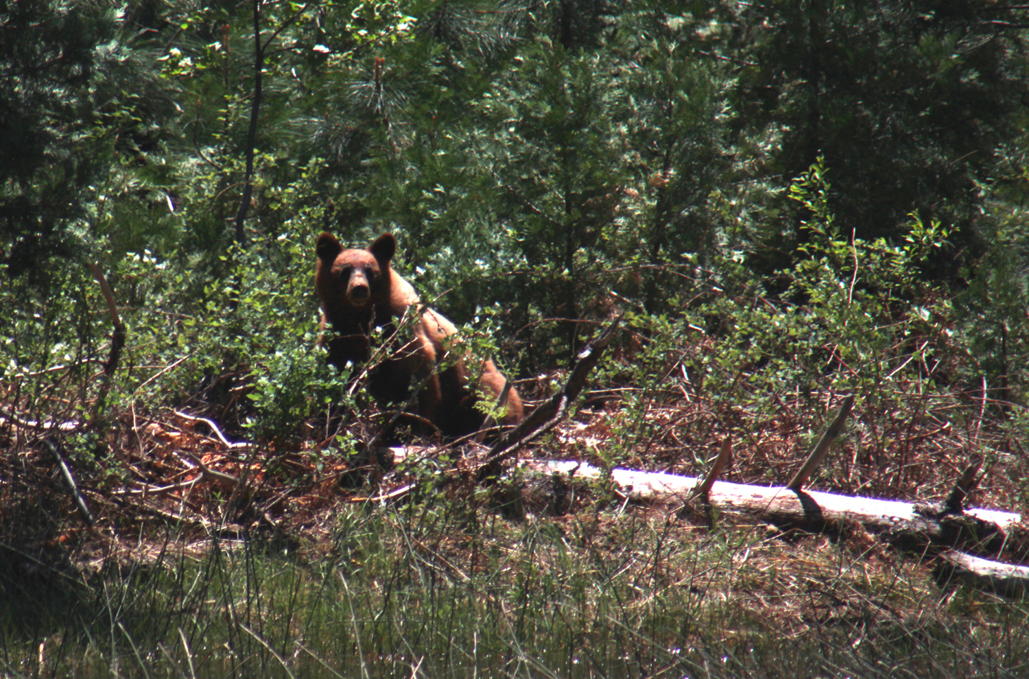
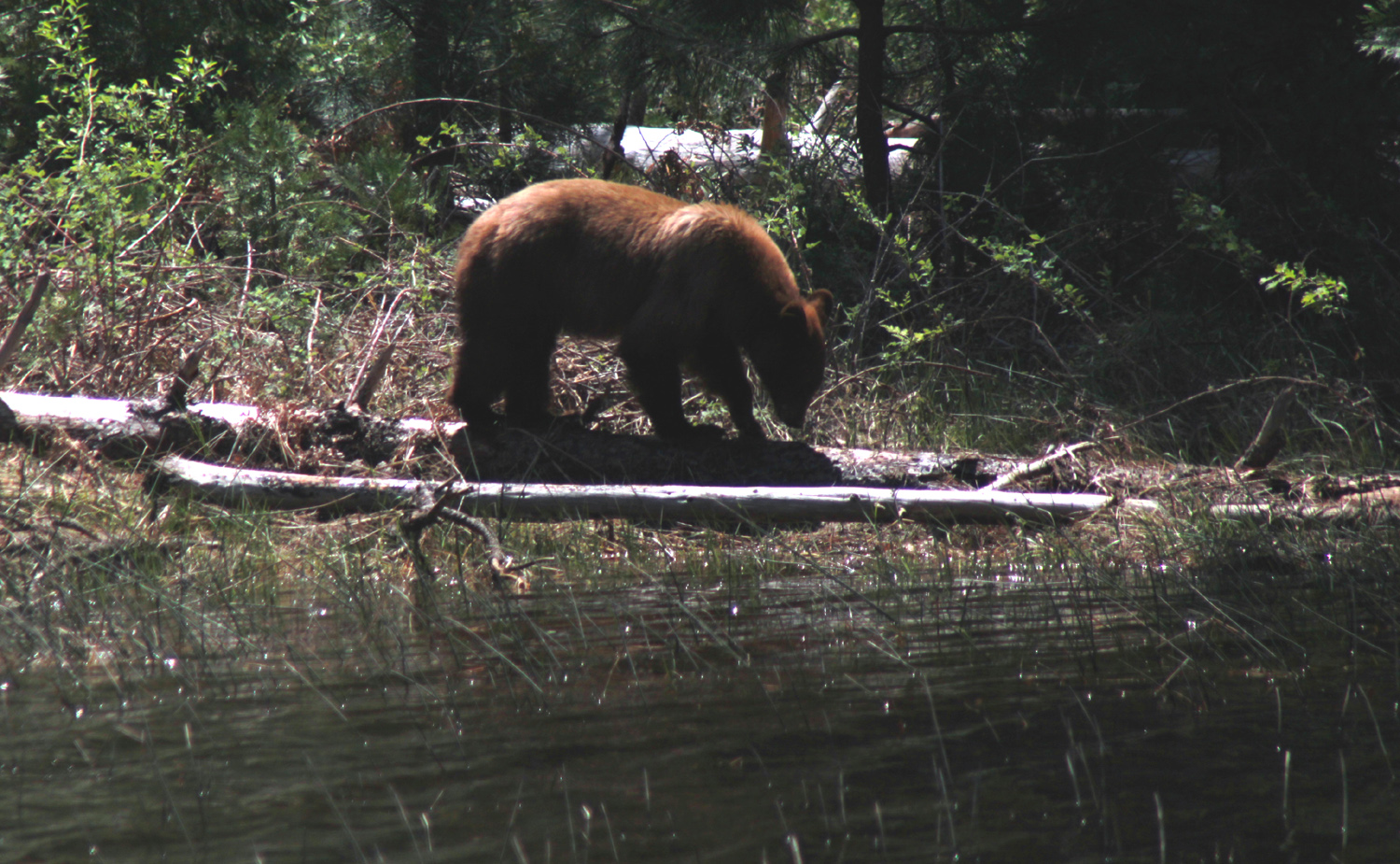
While we were enjoying the view we noticed people across the road focused on something beyond the meadow on that side, and soon heard the popular National Park cry, "There's a bear!" He was about 100 yards away, across a flooded meadow, foraging among the fallen logs and trees where the meadow turned to forest. He gave us a curious glance, but clearly knew that we were no threat, and went back to his search for food. |
|
|
|
| After making sure we were no threat, the bear went back to the important business of foraging for food | |
|
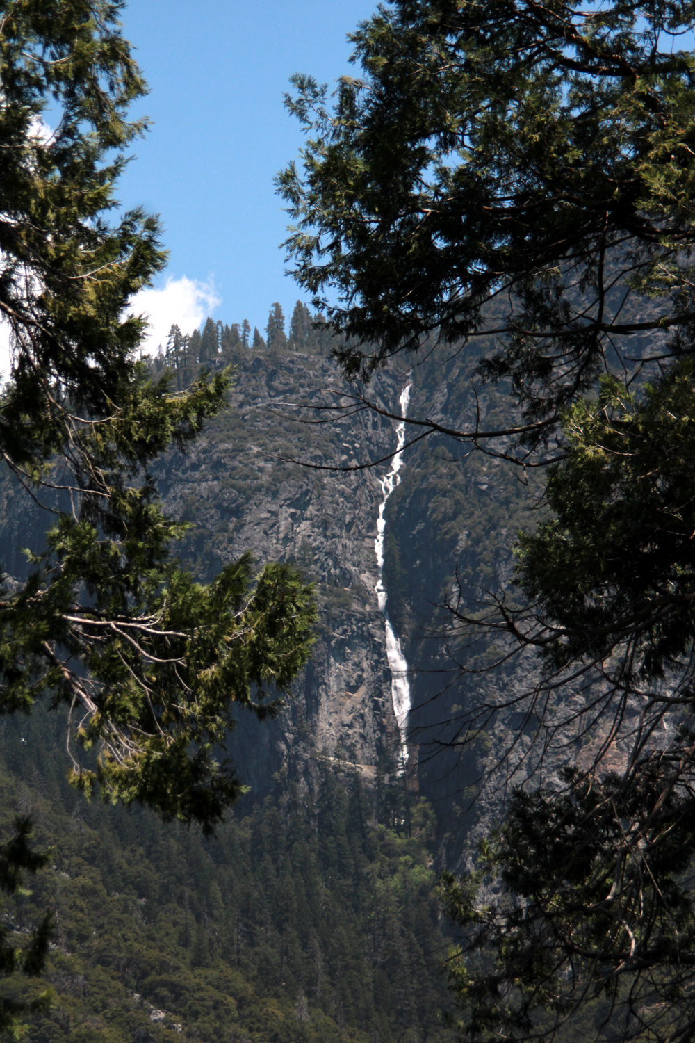
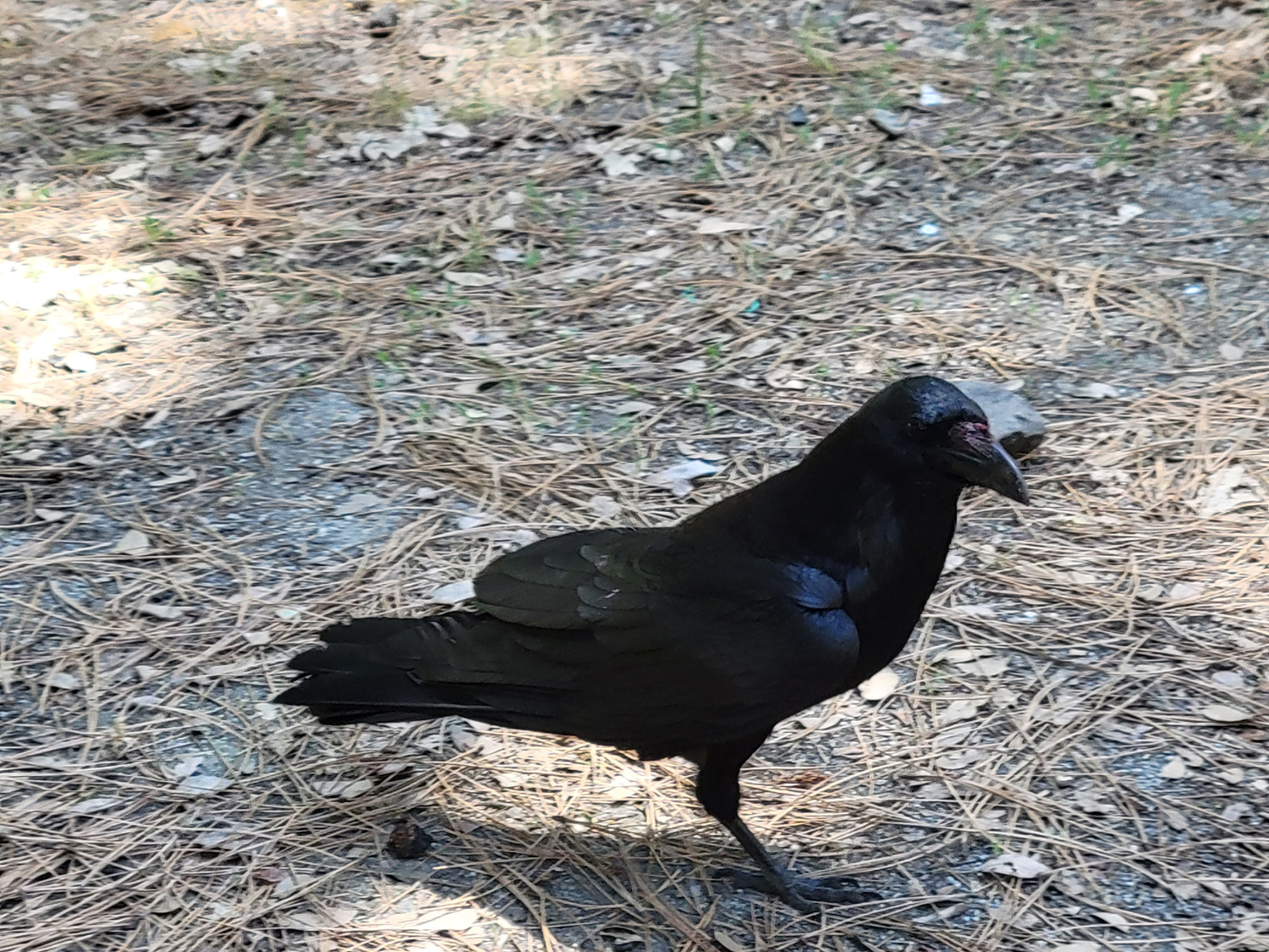
When we finished watching the bear and Yosemite Falls, we drove on a number of roads in the valley, including the Camp Curry area and the parking lot closest to the footpath to the base of the falls. All parking lots were full, and the day parking area for the falls is about a mile from the start of the trail. We realized that in the future we should arrive early, find a parking spot for the day, and ride the free shuttle around the valley. We went to a picnic area toward the west end of the valley, with a look at El Capitan that is different from the usual view in photos. We enjoyed our lunch as a raven swooped in and waited for us to drop something. He was soon joined by a friendly competitor. By
this time we were ready to start our long drive home (about 136
miles). During our drive around the valley we had seen a number of
usually small seasonal falls that looked like they should be part of
the regular tour. We knew the names of some, guessed at others, and
left some unnamed. Close together past Bridalveil were two good size
streams with impressive drops. One of these was probably Sentinel
Falls, which drops 2,000 feet in a series of cascades. We recognized
Stairstep Falls, which drops down the cliffs near Glacier Point,
alternating vertical and horizontal sections. Lahamite
Falls, which retains its native name, is easily missed, being
located in a narrow nearly vertical canyon very close to the much more
impressive Yosemite Falls. Running down the cliffs adjacent to the Royal
Arches is a small falls of the same name. Ribbon Falls, west of El
Capitan, is is a well known sight, but is usually not very big and
disappears by the end of June. It's the tallest falls in |
|
|
|
|
|
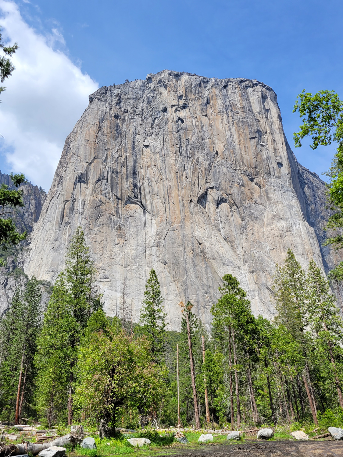
The massive west face of the huge granite monolith that is El Capitan |
|
|
|
Ribbon Falls, west of El Capitan, is the tallest in North America, but usually flows only March through June |
Teri captured this dramatic scene of the flooded Merced River, with the Cathedral Rocks beyond |
|
The weather was perfect, the wildlife was cooperative, the river and falls were beyond spectacular, and the company was delightful. We could not have asked for a better time to spend a day in the incomparable Yosemite Valley. --Dick Estel, June 2023 |
|
|
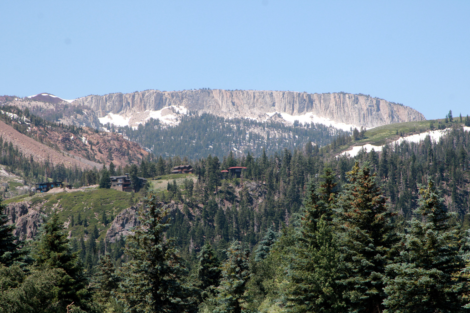
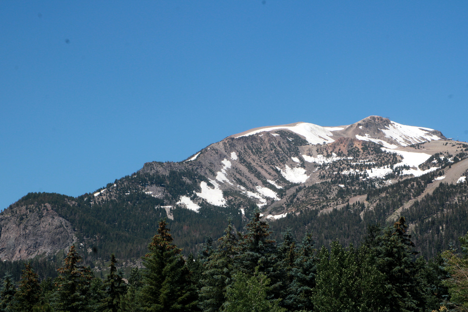
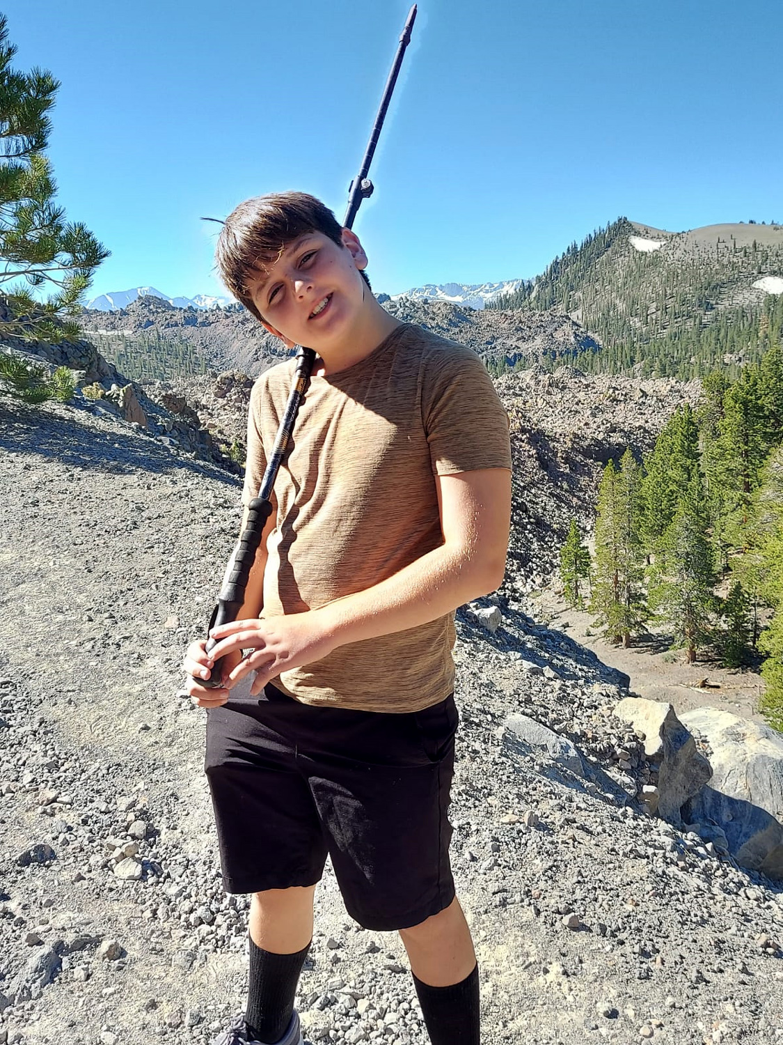
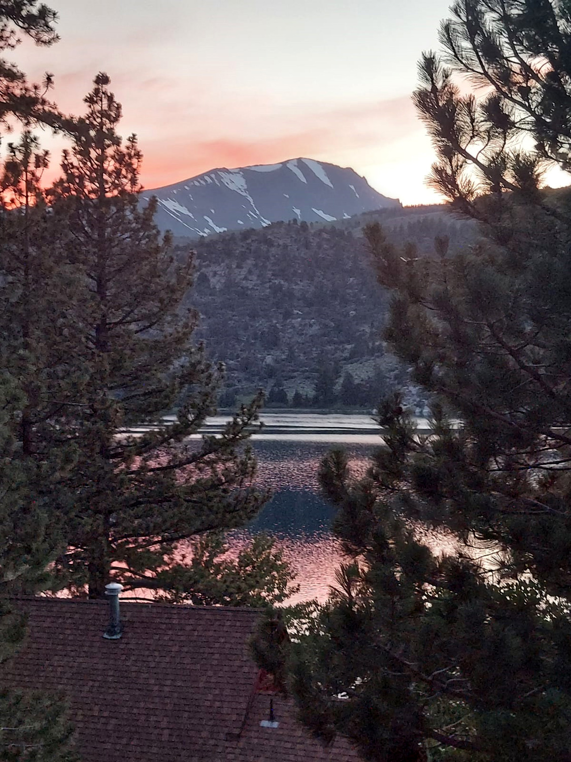
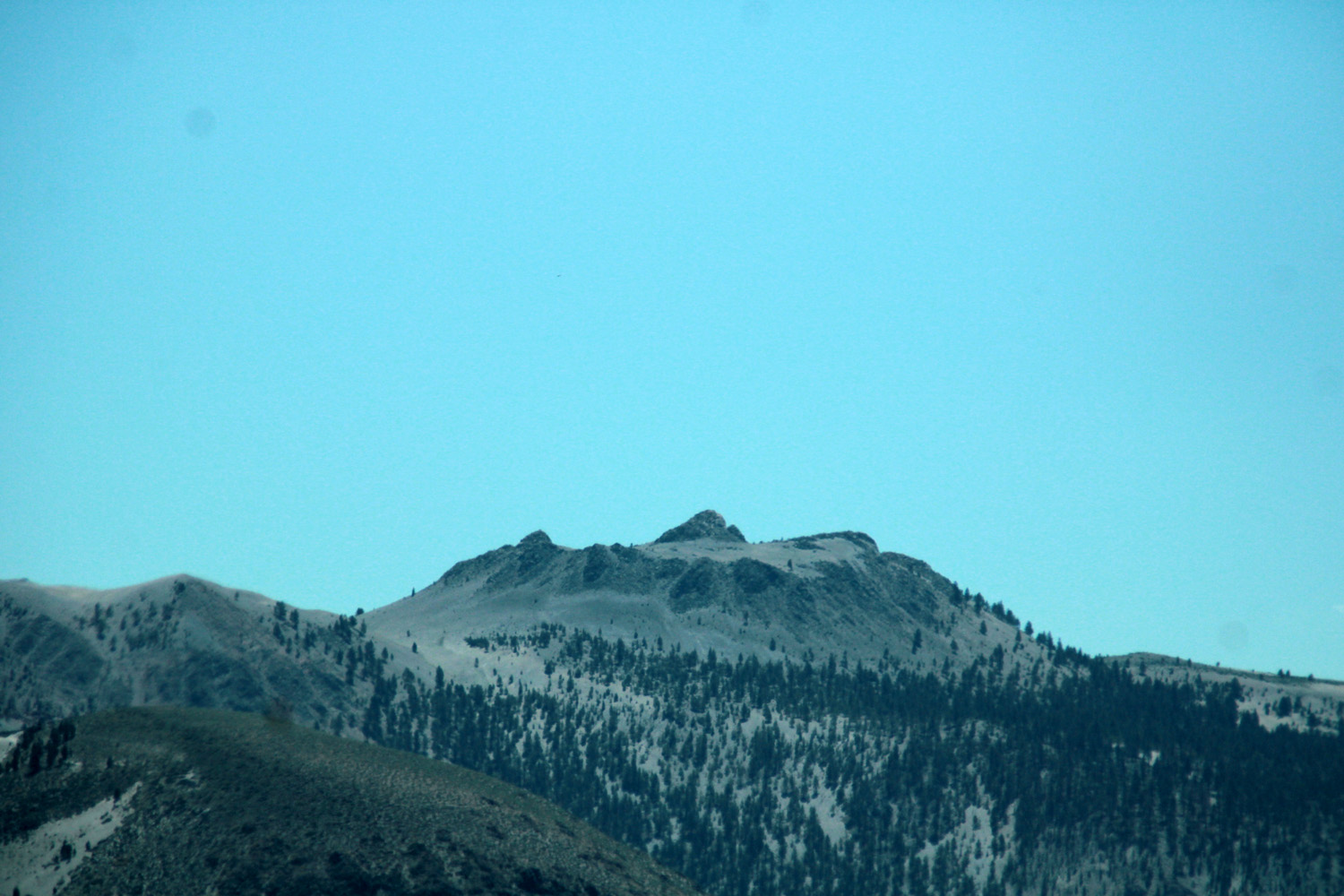
June Lake (Photos by Teri, Jack and Dick) Our visits to June Lake are always much more than that - but it would be awkward to call it "June Lake - Obsidian Dome - Twin Lakes - Mammoth Lakes - Mono Lake - Lee Vining, etc." We've also learned that getting from Fresno/Clovis to June Lake can be a challenge. The shortest route is via Tioga Pass through Yosemite National Park. Last year permits were required to enter Yosemite, even if you were just driving through, and not all of our group were able to get a permit, so had to take longer routes. This year the pass was still closed due to the record snowfall of the past winter. The next closest route is via State Highway 108, through the town of Sonora and over the pass of the same name, at 9,624 feet, only 321 feet lower than Tioga. However, it had opened a few weeks before our trip, so that was our route going to June Lake.
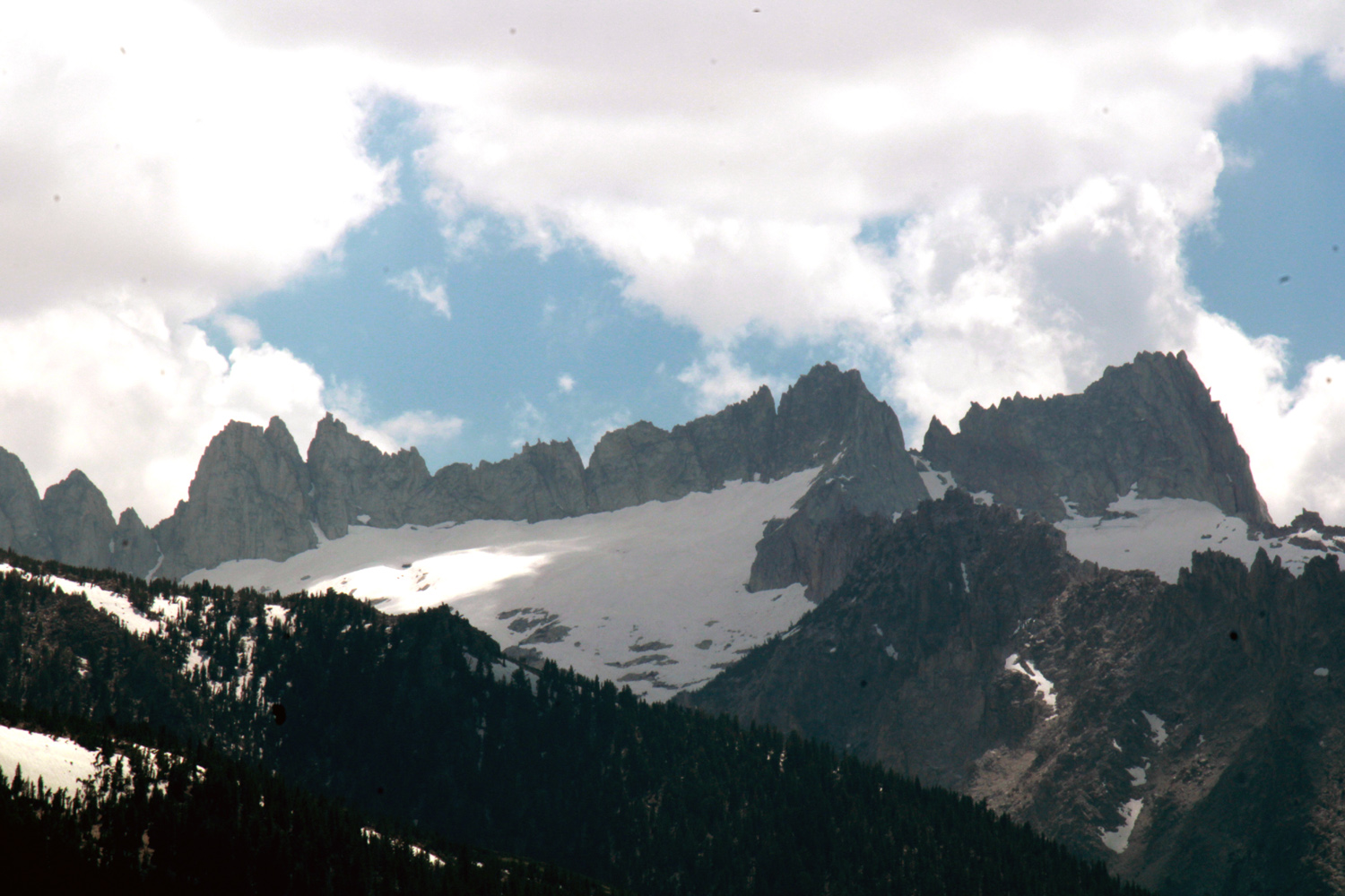
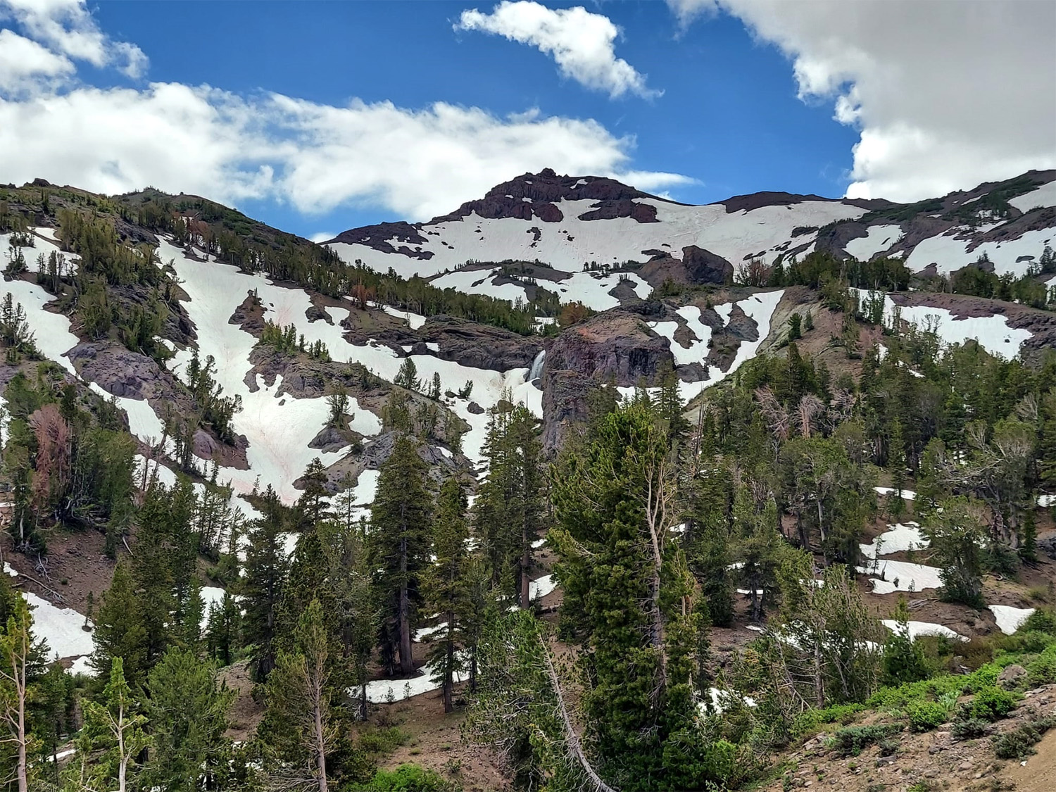
The first part of the drive was through familiar territory - northwest on CA 99 to Merced, then north on CA 59. Short runs on a couple of other state highways took us to Jamestown, where we turned east on CA 108, the first time either Teri or I had driven this road. Although I had heard that it is one of those "scary" roads, most of it is in very good condition, and just the type of normal mountain road I have driven on my whole life. The final climb to the summit was a bit narrow, but there was always a center line, and the scenery made the trip well worthwhile. Much of the time going uphill we were by a fork of the Stanislaus River, and on the other side of the pass, we were by the West Walker River. The Sierra peaks are not as dramatic in this area as in the central part of the range east of our home, but they still offer fascinating views, and there were seasonal waterfalls in several locations. |
|
|
|
| Mountain northeast of Highway 108 | Seasonal waterfall on east side of Sonora Pass |
|
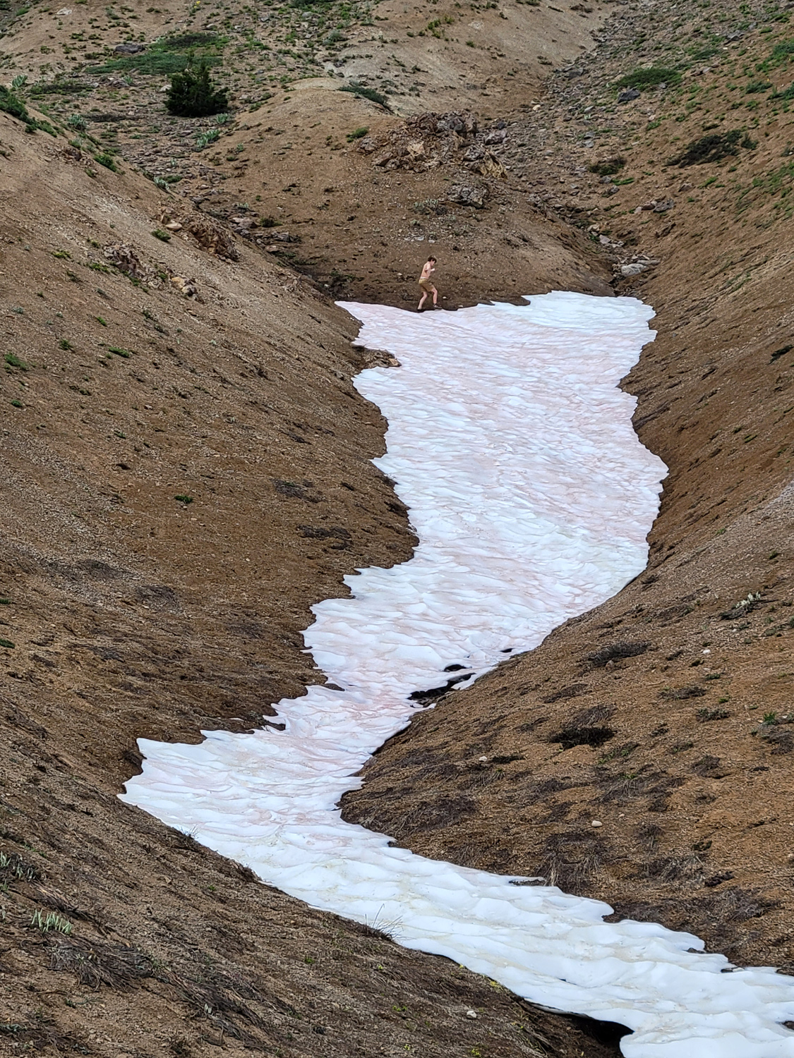
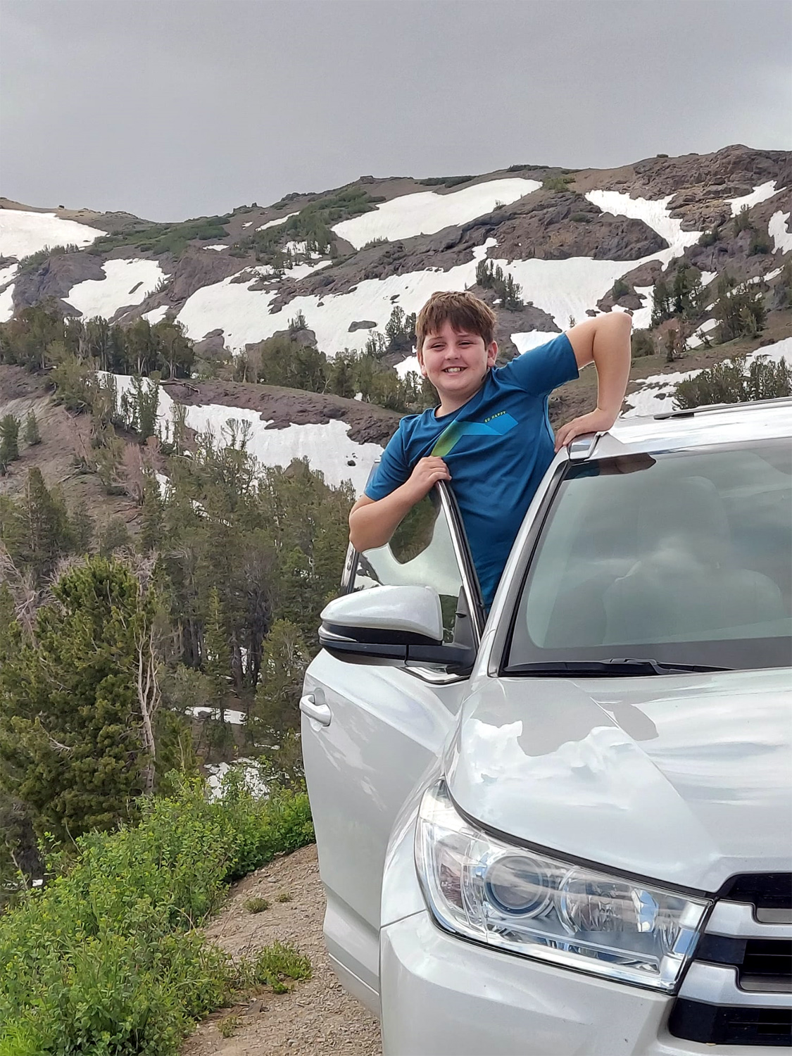
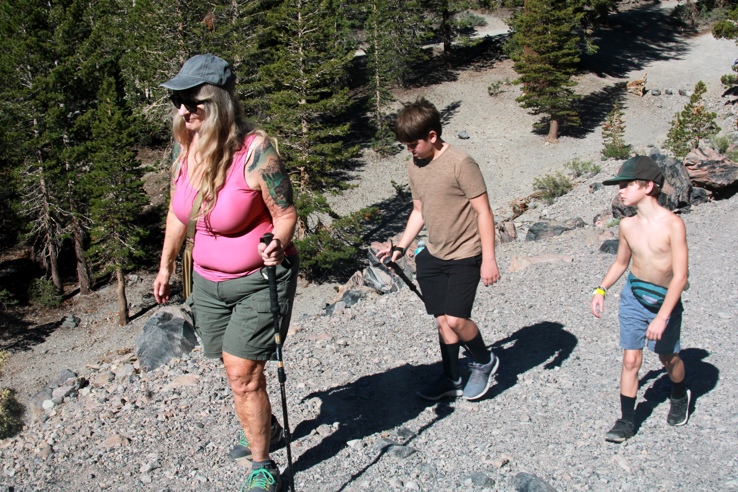
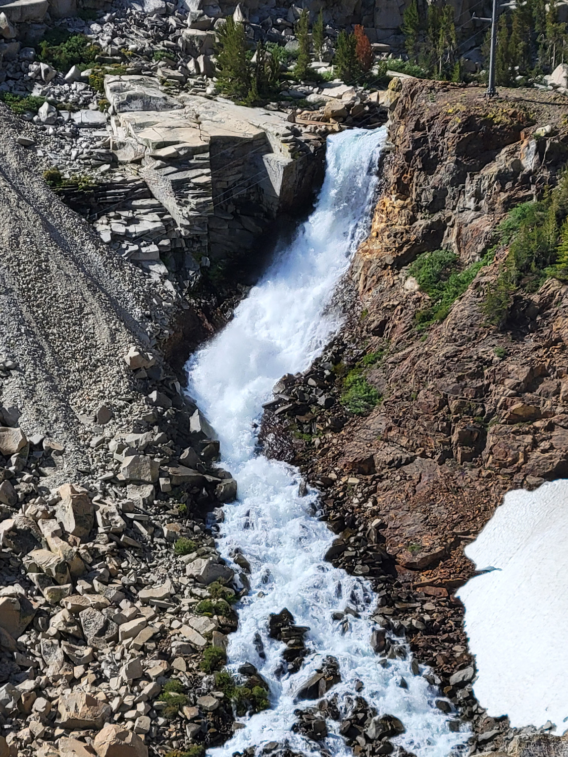
When we left home early on July 19, our party included my daughter Teri, grandsons/great grandsons Colton and Jack and myself. Teri's younger son Mikie and his girlfriend Hayley would join us on Friday, the 21st. On long drives, everyone enjoys the trip more if the boys are separated, so Jack rode with me and Colton with Teri, switching at our lunch stop. Just past the top of the pass we stopped to look a a waterfall. Colton is not as excited as the rest of us by amazing scenery, claiming he can see it just fine without getting out of the car. Jack however, immediately ran up a snow-covered slope. Well, he didn't exactly run, since he sank into the softened snow every few steps, but he did go up a good 50 feet or more. Coming back down also had its challenges. He would slip and slide, sort of "skiing" down, but he made it safely. He reported that his toes were very cold, a normal consequence of playing in the snow while wearing Crocks. |
|
|
|
| That's Jack up at the top of the snow bank | Colton almost gets out of the car |
|
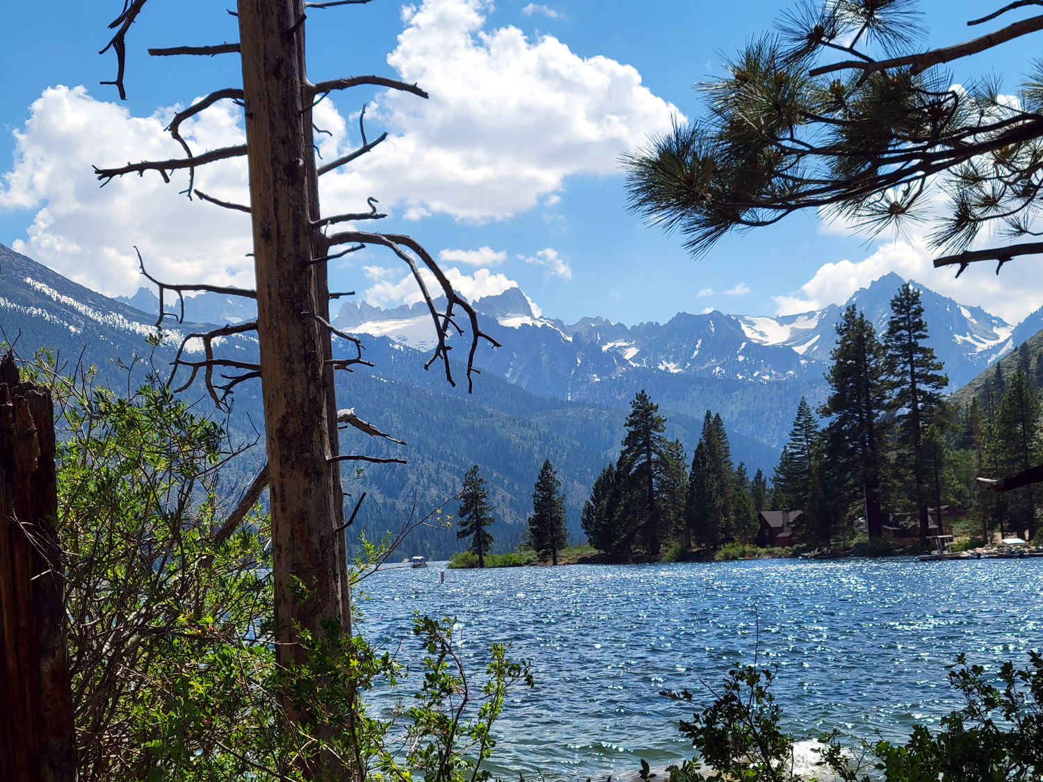
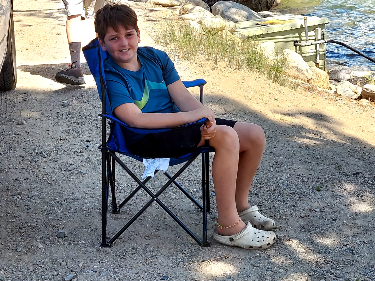
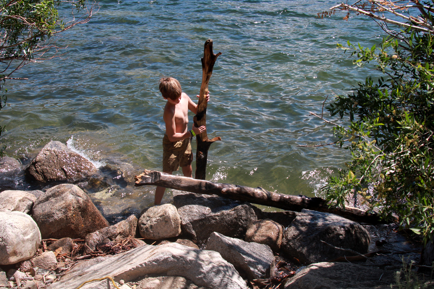
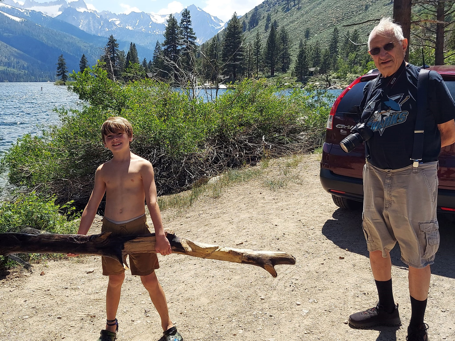
Our road descended to US 395, which runs on the eastern side of California, Oregon and Washington from Mexico to Canada. At this junction we turned south, and in a little over 15 miles, arrived at Bridgeport, the county seat of Mono County, with a population of under 600. Although it seemed like we were down out of the mountains, the elevation there is over 6,000. My grandson Johnny had told us about a place called Twin Lakes, about 15 minutes west of Bridgeport, with spectacular views of the eastern Sierra. We decided to take this side trip, and it proved to be well worth while. The first part of the drive was through a broad, level valley, where the population of cows was greater than the number of human residents of the town. Twin Lakes proved to be a typical tourist destination, with motels and rentals, and businesses catering to boaters and fishermen. The view was everything we expected, and we parked along side the road, just a few feet from the water. Teri and I enjoyed the view, Colton relaxed in a folding chair, and Jack busied himself attempting to rid the lake of sunken tree branches. |
|
|
|
| First of the Twin Lakes | Sierra peaks west of the lakes |
|
|
| Colton takes it easy | Jack gets to work clearing the lake of logs |
|
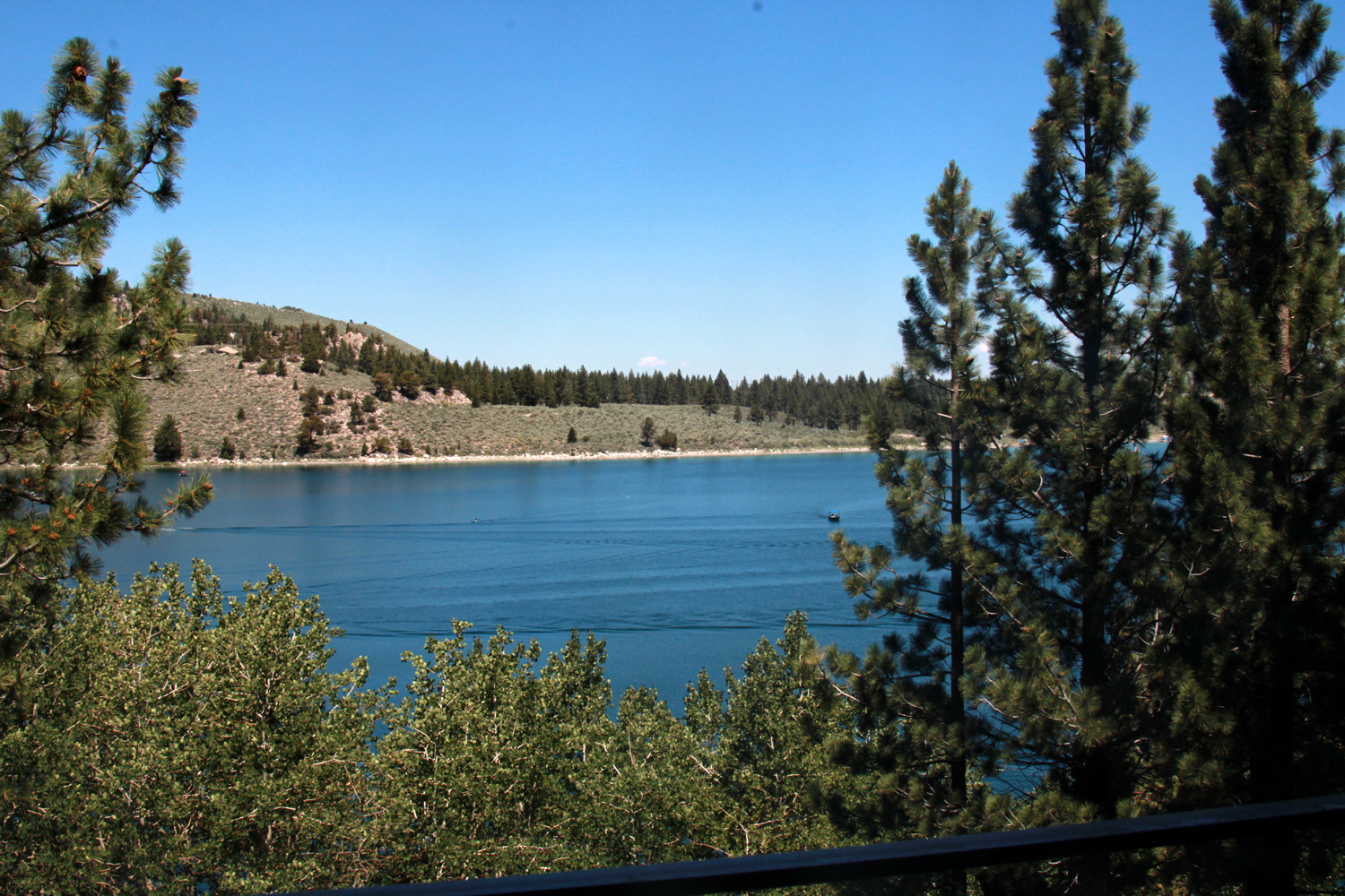
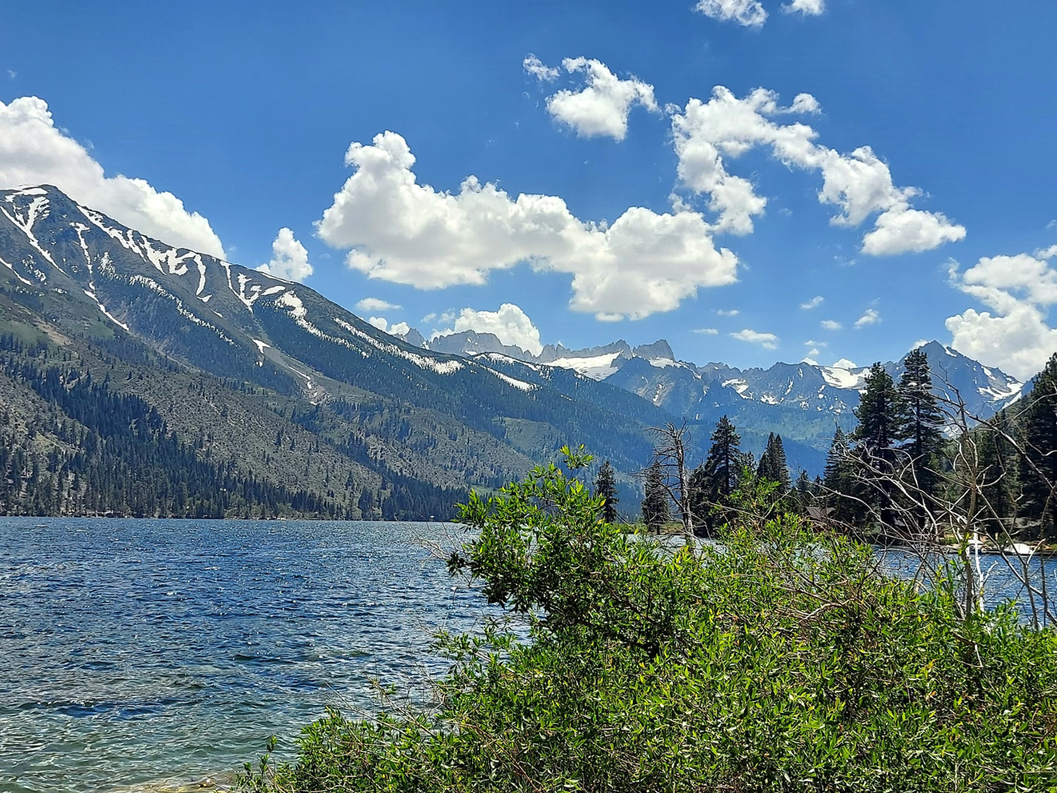
We spent a little less than an hour enjoying the lake and the views, then returned to US 395 and continued south to CA 158, the June Lake Loop. This route leaves 395 a few miles south of Lee Vining, goes into the mountains past several lakes, passes through the village of June Lake, and comes back out to 395 a few miles farther down the highway. We drove in from this southern connection, less than two miles to June Lake village and the Boulder Lodge. It was not only the same place we stayed last year, we had the same room. The biggest differences were more snow on the mountain across the lake, and all the lakes along the Loop were full right up to the road. One of the boys' favorite things from last year was the popcorn machine in the office. There was a supply of bags, and customers could pick up a free bag of popcorn any time. Jack and Colton had their first bags in hand even before we went to the room. |
|
|
|
| June Lake from the balcony of our room | Snowy mountain above the lake |
|
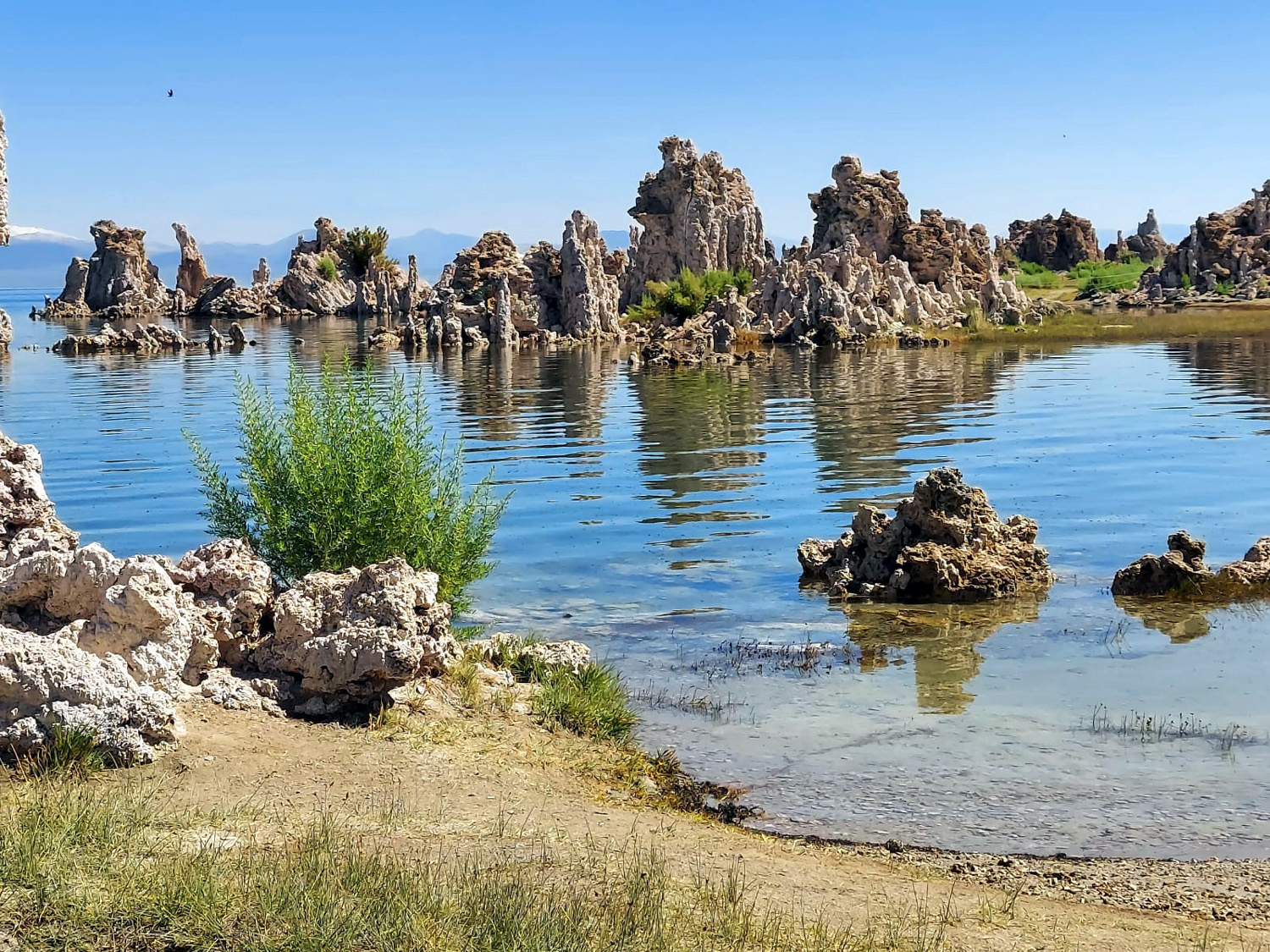
The next day after breakfast we drove north on US 395, then turned east for a short distance on CA 120, to the dirt road that leads to the South Tufa area of Mono Lake. Although a number of cold, fresh streams tumble down the eastern Sierra slope to the lake, there is no outlet, so it is salty, or more properly, a saline soda lake. The lake level has dropped substantially in the last 80 years due to diversion of source streams through the Los Angeles Aqueduct, another of those projects where powerful interests took resources from weaker ones. As the water level dropped, it exposed the calcium carbonate formations that had developed under the surface from the combination of chemicals, similar to the formations found in caves. Dramatic towers of the fragile stone were left standing on the lake shore, providing scenery and a history lesson for visitors. |
|
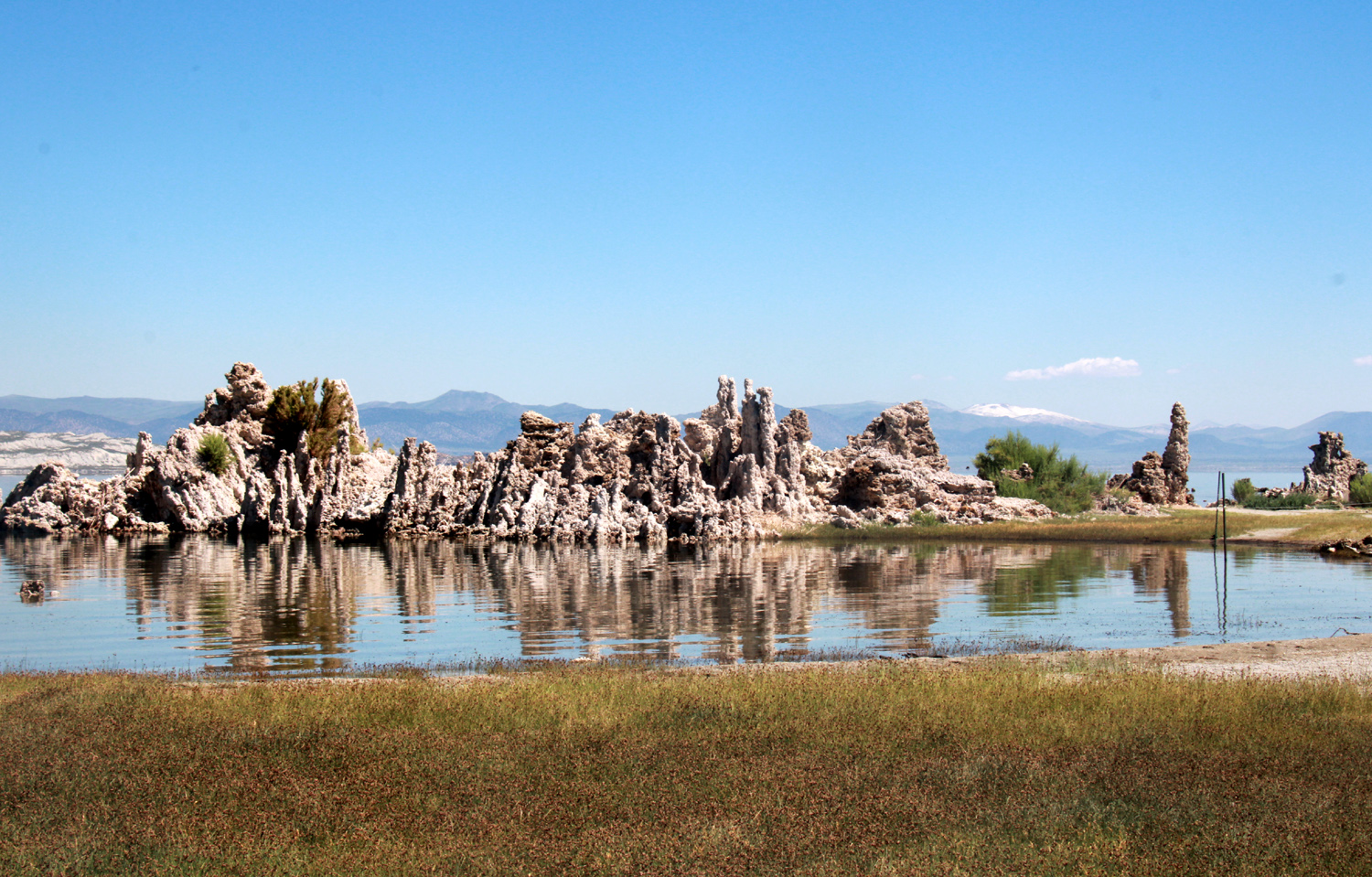
|
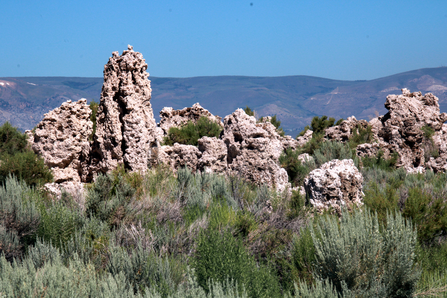
|
|
A year ago this tufa formation was completely above the water - testimony to a record rain year |
Tufa and sagebrush |
|
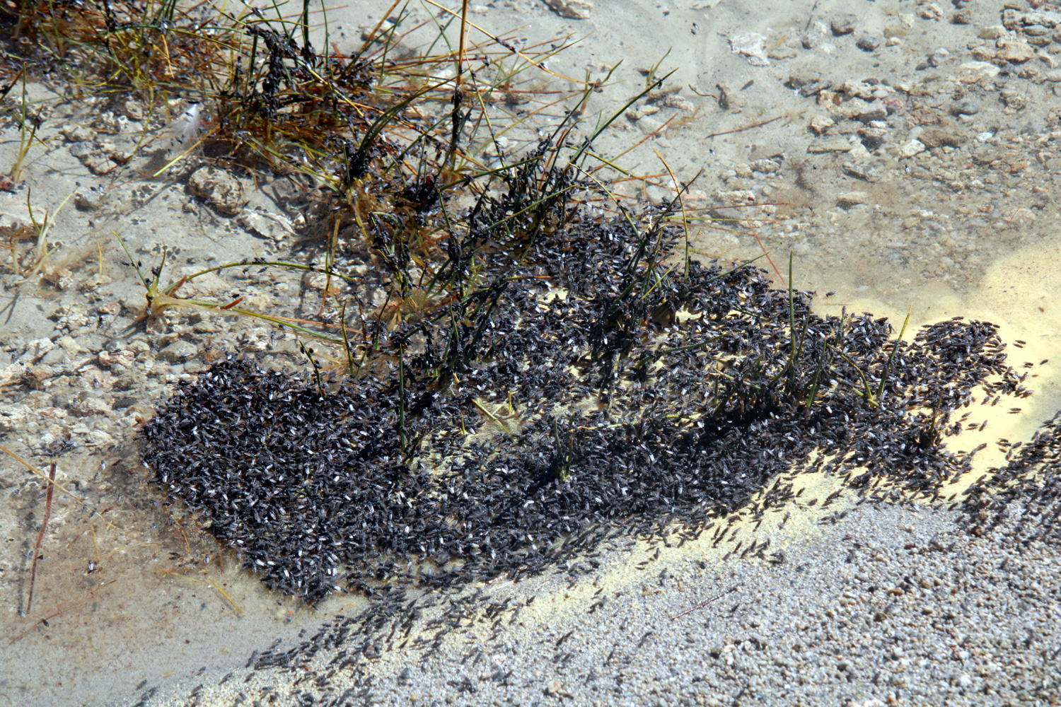
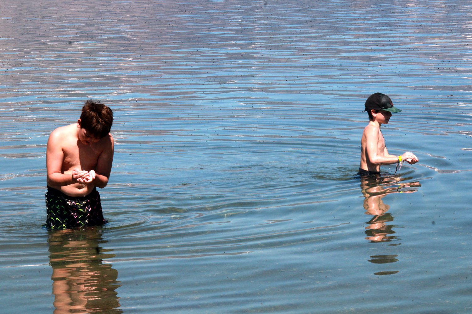
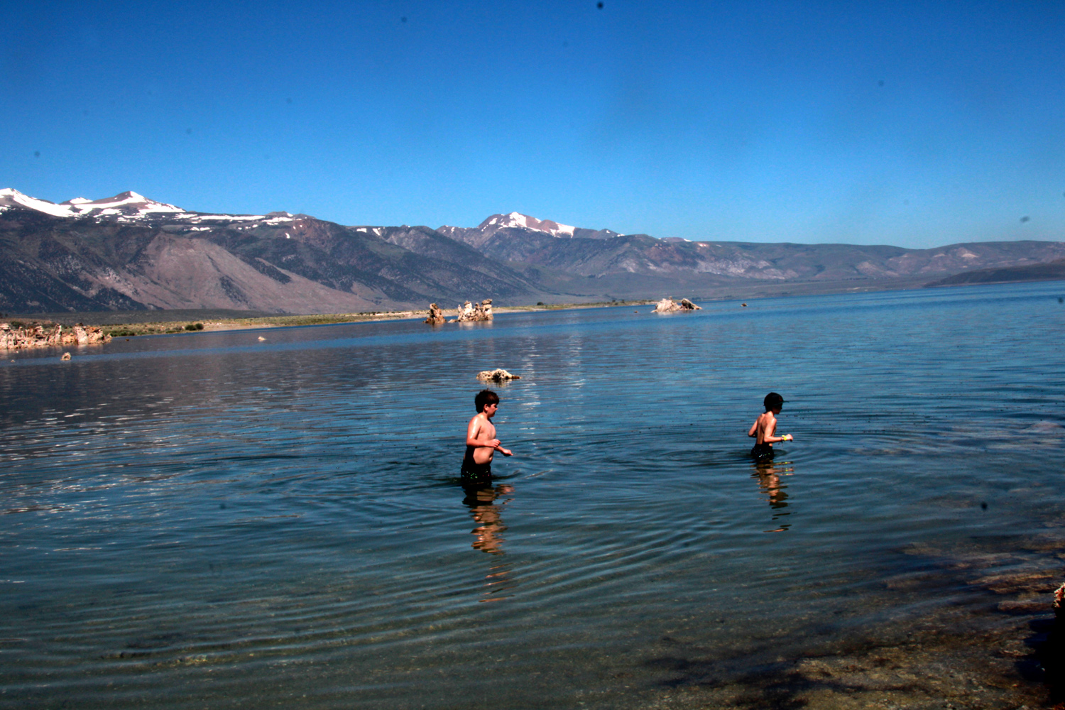
Colton and Jack were interested in the towers, but their main objective was to verify that they could float in the highly saline water. To get out into the lake, they first had to brave the alkali flies that thrive by the millions in the lake. Although the appearance of massive swarms of these flies on the lake surface is somewhat daunting, they do not bite. They move away as humans approach, and they are completely harmless. The boys were soon scooping them up from the shore, along with plenty of sand. The lake's other creatures are tiny brine shrimp, which number in the trillions. Both flies and shrimp feed on decaying algae, and in turn, provide food for seagulls and other birds. |
|
|
|
| Way too many flies | You only get a few catching them from the lake surface |
|
|
| Jack tests the lake's floating capability | Snowy Sierra peaks stand guard above Mono Lake |
|
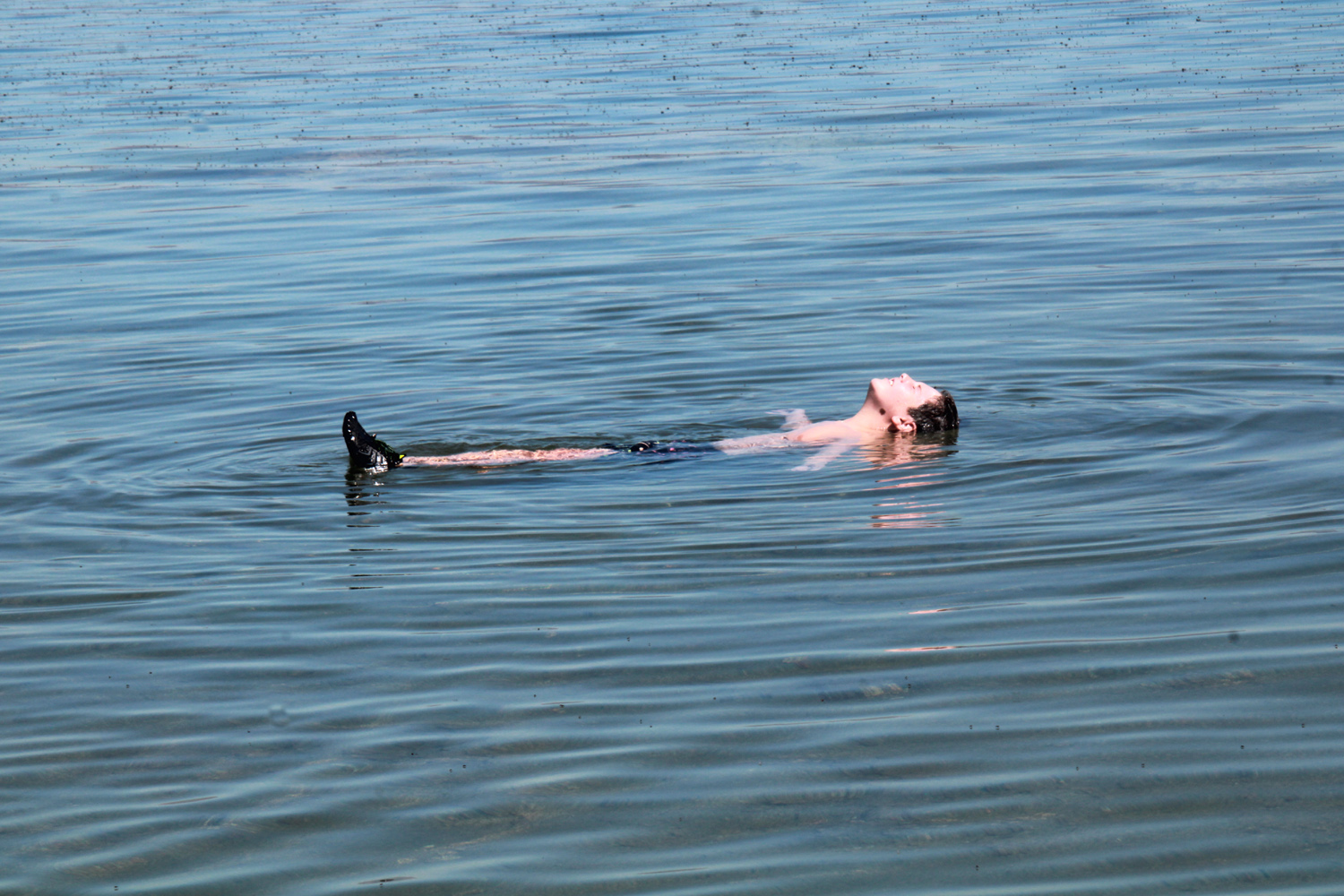
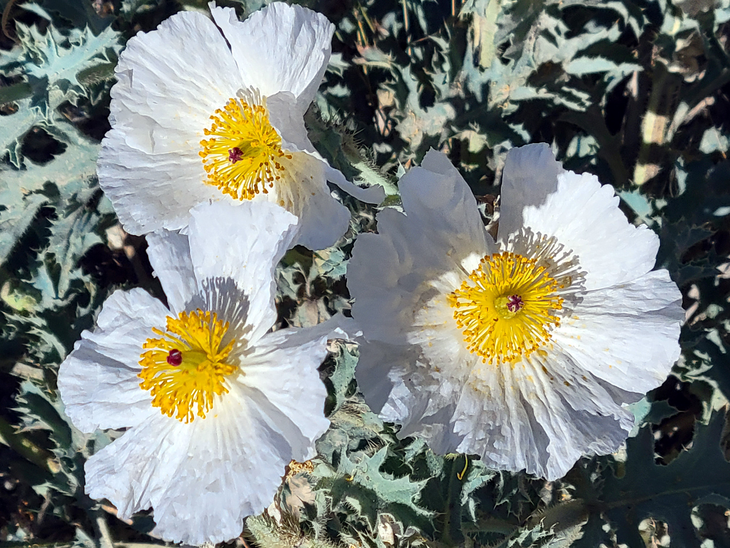
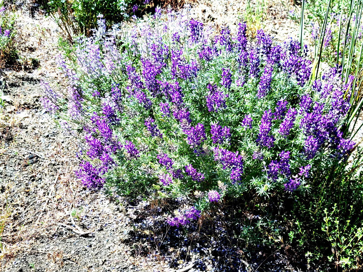
When they emerged from the lake, the boys had white deposits here and there, including white salt sideburns on Jack. Teri was ready with fresh water to rinse them off. We were also fortunate to be there when a park volunteer was discussing some information about the area, as well as shooing people off the tufa formations. He had set up a telescope focused on a nesting osprey with a baby chick visible some of the time. The nesting site was a tufa formation that stuck up out of the water about a hundred yards out. Driving out to the main road, and back to June Lake, we stopped to see and photograph a number of flowers. Nine years ago, in Great Basin National Park in Nevada, I had learned about a plant called prickly poppy. There were hundreds of white blossoms along US 395 and the local roads, and I suspected they were these poppies. A brief examination and a careful touch of the foliage verified this. There were also several varieties of lupine and many flowers we did not recognize throughout the area. |
|
|
|
| Prickly poppy - but only slightly prickly | Lupine with a lovely shade of purple |
|
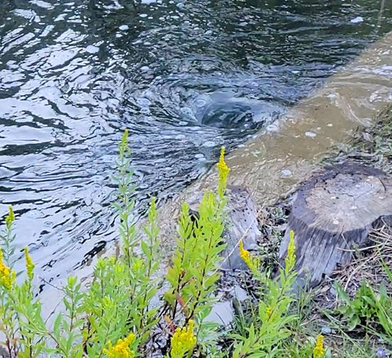
After we returned to the motel and had lunch, Teri and the boys went to the lake for swimming. I no longer go in lakes, rivers, creeks or oceans, so I stayed back and read, napped and made some notes for this report. That evening we drove past the village on the Loop, to where we had a good view of Horsetail Falls, which drops down from the steep rock cliffs that tower above the lake and Loop most of the way. We had viewed this falls on all of our earlier visits, but never knew its name, so thanks to CHW, who sent me a photo of the falls in early July, complete with its name. Where the water from the falls reached the road and ran under it, the flow and the narrow opening created two small whirlpools, one clockwise and one counter clockwise. On the other side of the road you could not identify the creek, because water from Silver Lake was up to the road along that area (download a video of the whirlpool here) |
|
|
|
| Horsetail Falls, with a heavy flow | Little whirlpool where water from the falls goes under the road |
|
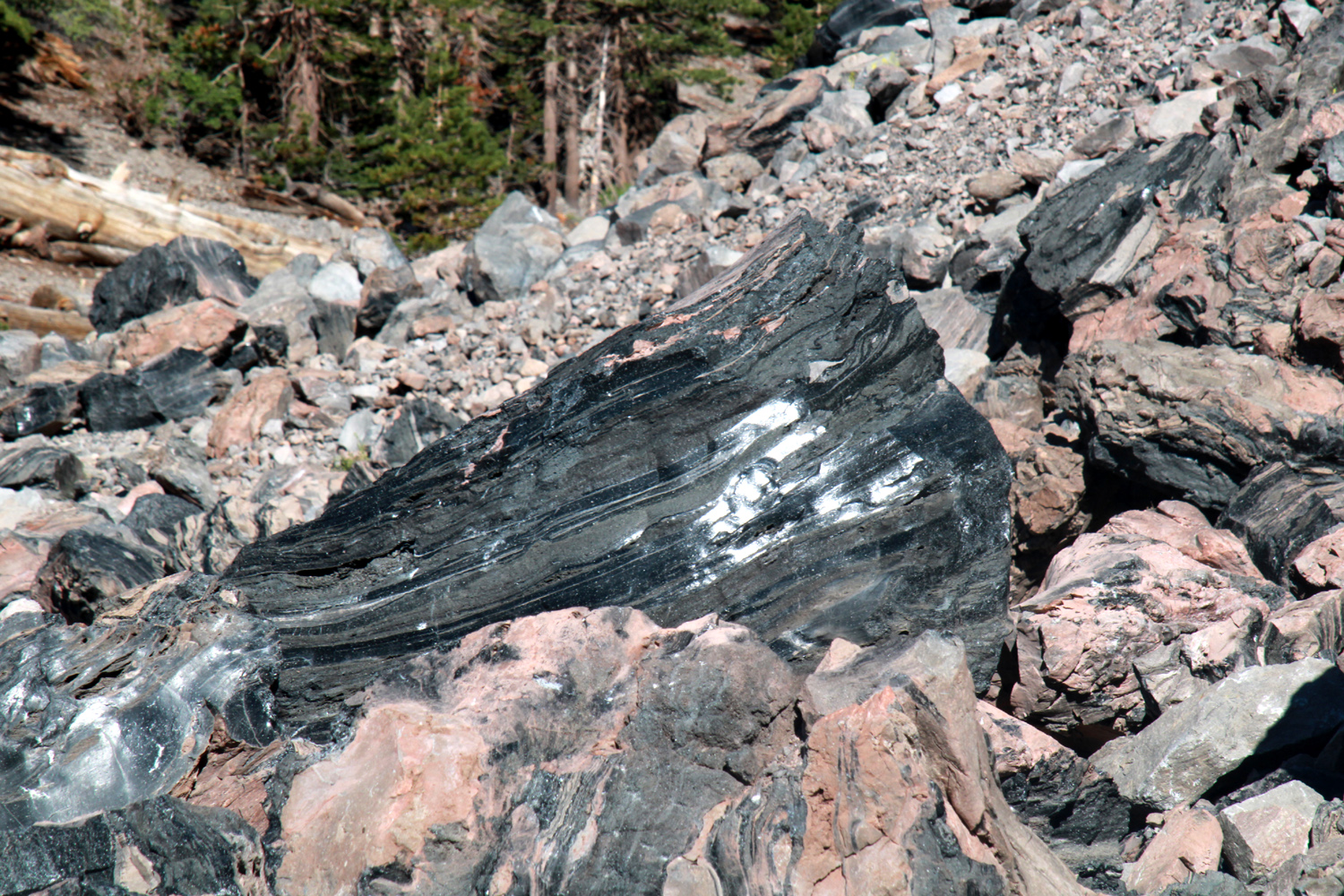
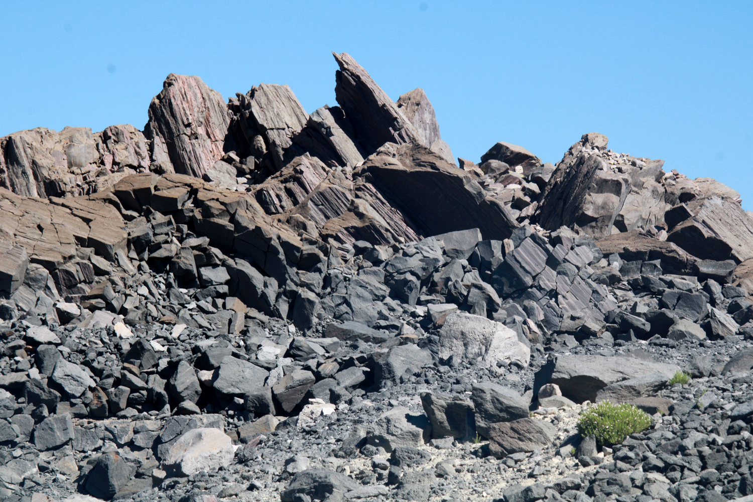
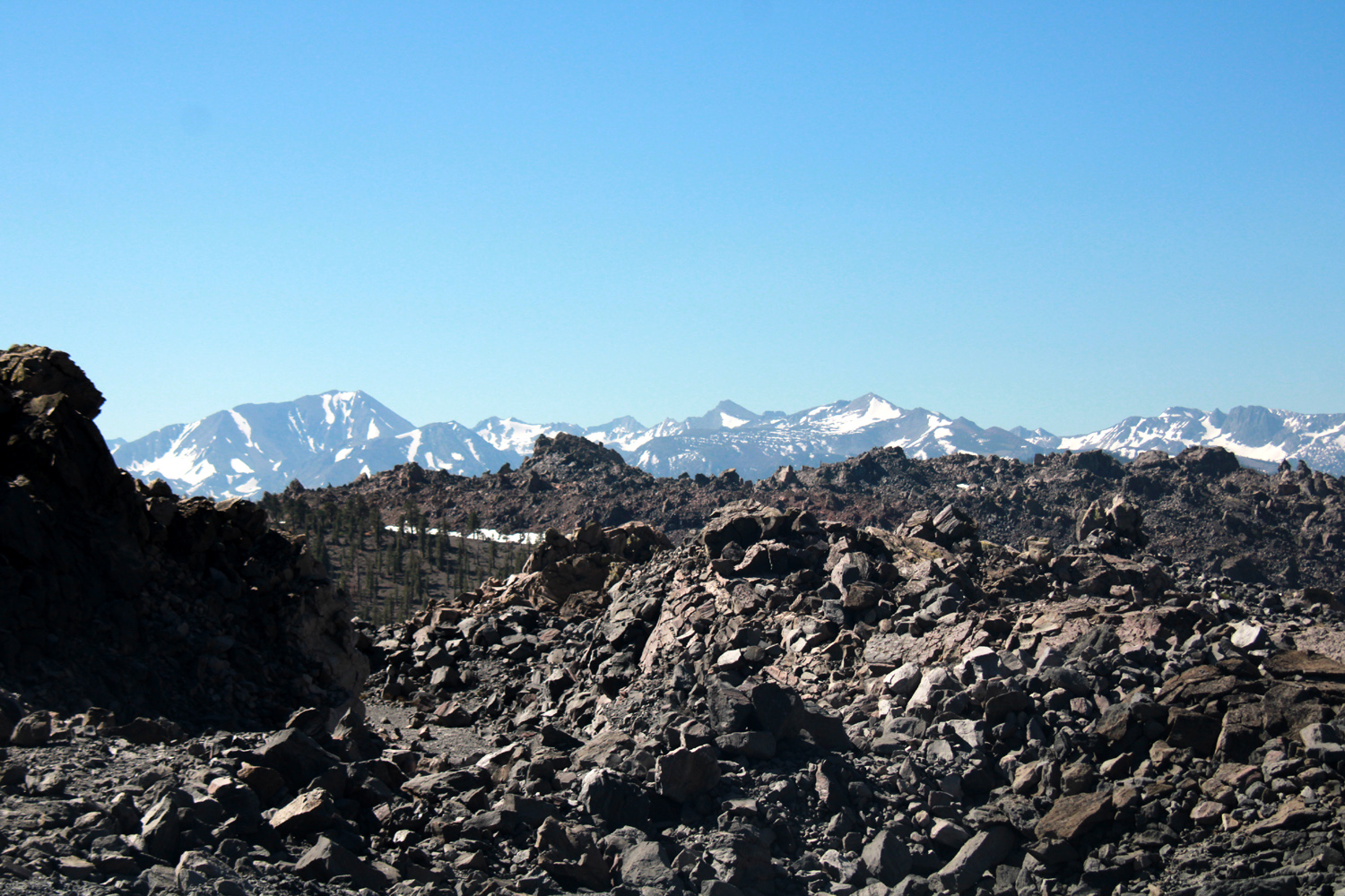
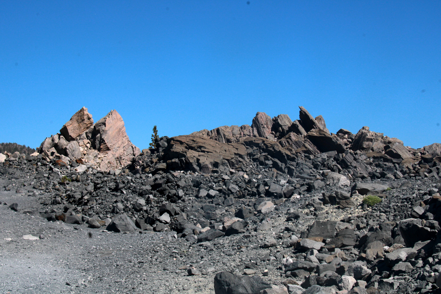
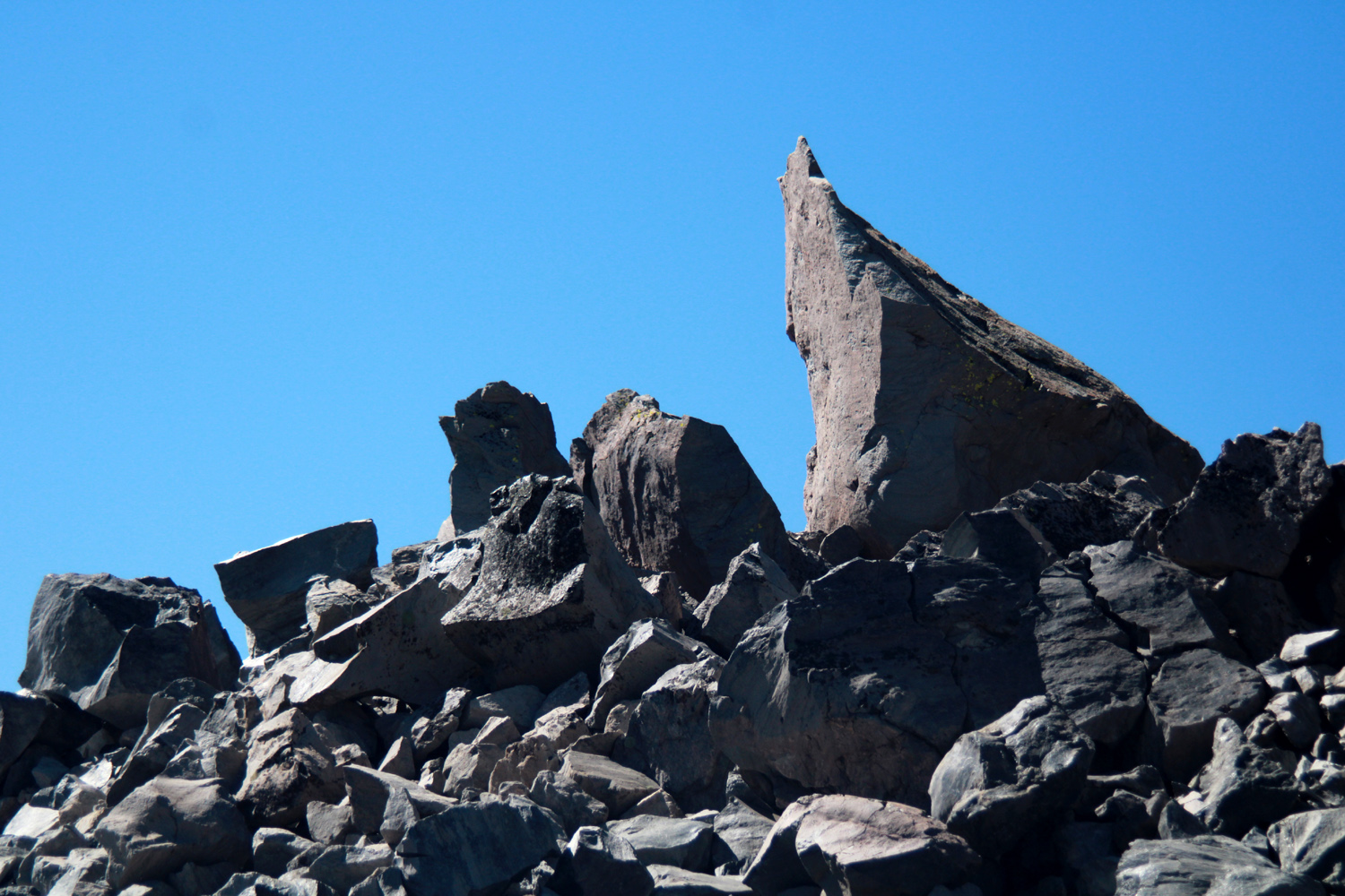
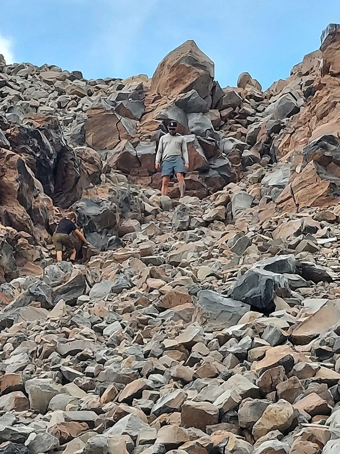
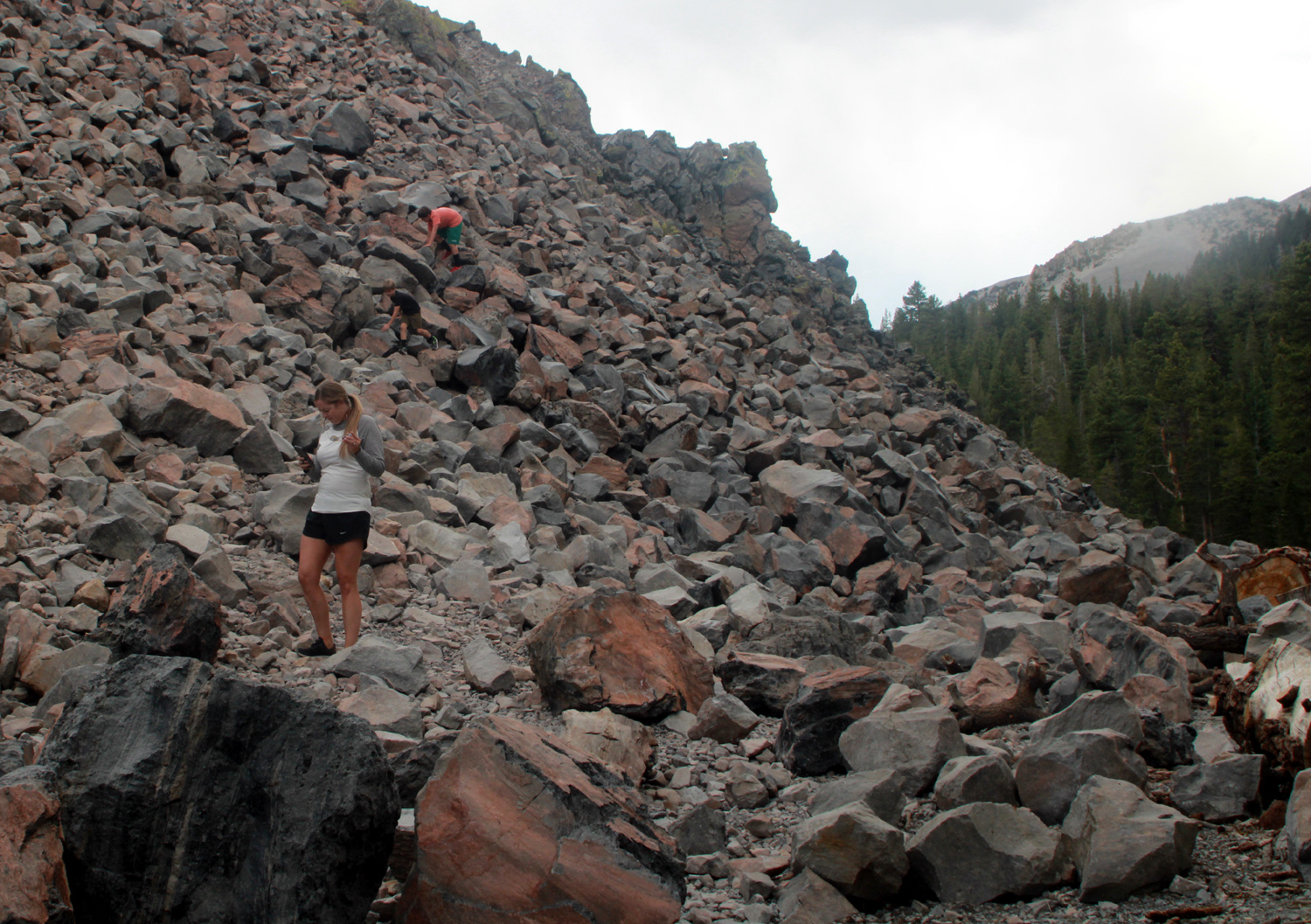
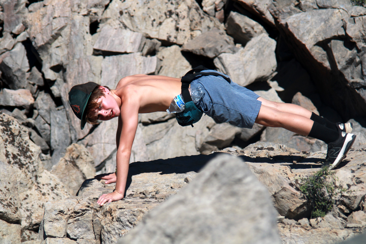
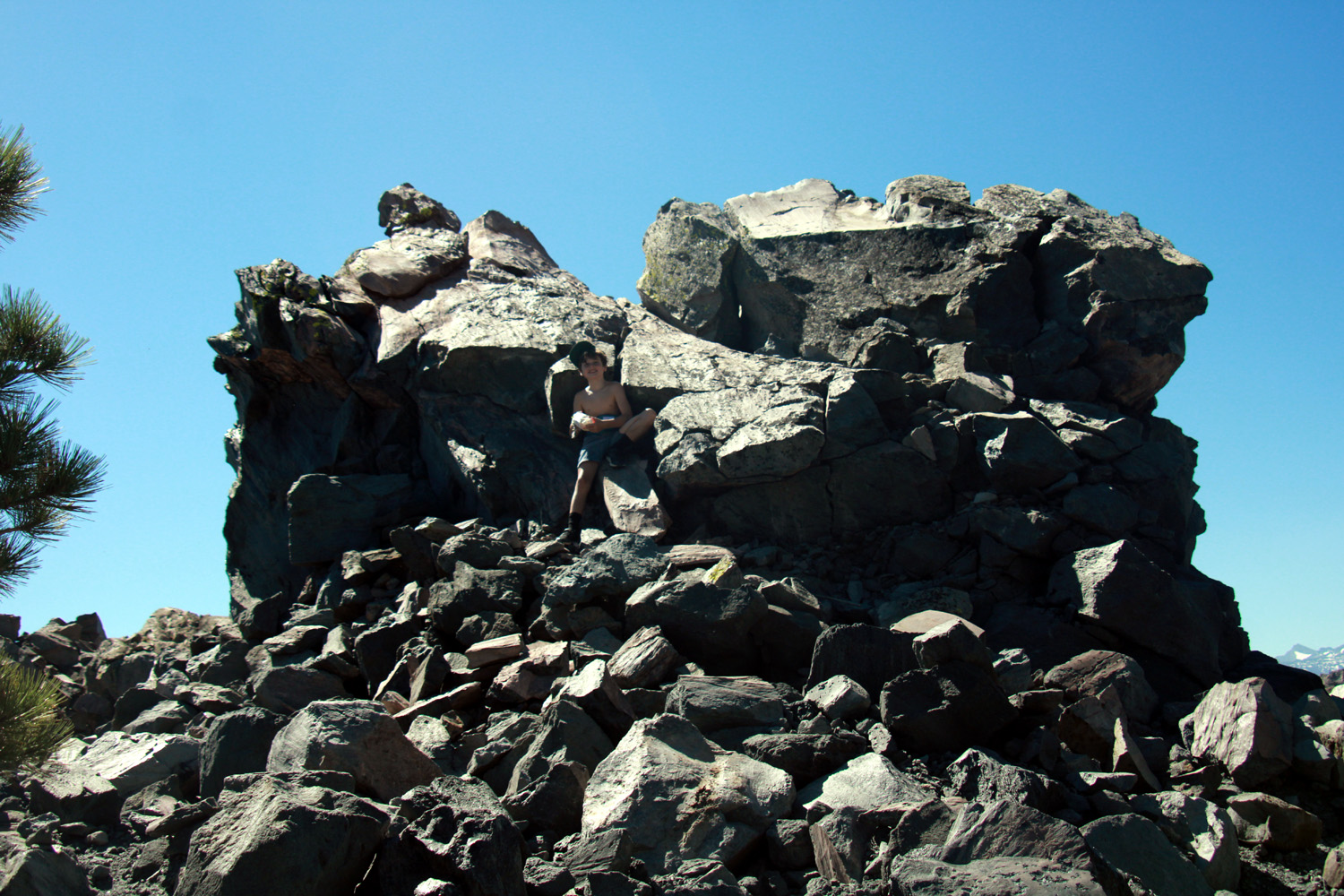
After we left the waterfall we stopped at the village store and got dessert, which we ate back at the motel (ice cream for Teri and me; candy for the boys). Other fun activities that the boys enjoyed included playing with a couple of guest dogs that were tied up behind our building. They also went swimming in the motel pool several times, taking advantage of the basketball hoop that hung out over the pool. At one point Jack made an amazing shot with a mostly deflated small football, from across the pool through the basket, not touching the rim. The next day, Friday, Teri and I and the boys got an early start to hike up Obsidian Dome. It's not a dome in the classic sense that we are used to in Yosemite, but more a pile of obsidian boulders, streaked with pumice. It formed about 600 years ago when magma working its way to the surface hit water, creating steam. The magma then cooled into solid boulders, creating a moonscape of jagged pinnacles and colorful boulders. It's located a bit over a mile west of Highway 395, not far south of the June Lake Loop's southern terminus. The web site says it's hard to climb up very far, but this is not true. Originally I would have agreed with this assessment, since Teri and I visited several times before we discovered the easy trail that goes nearly to the top. It's mostly an old road dating from days of pumice mining, but not accessible to vehicles (tire tracks indicated that dirt bikes and such are an exception). When we visited last year the boys and their parents climbed up the northern slope, but we did not go to the trail, so they were excited to explore further. |
|
|
|
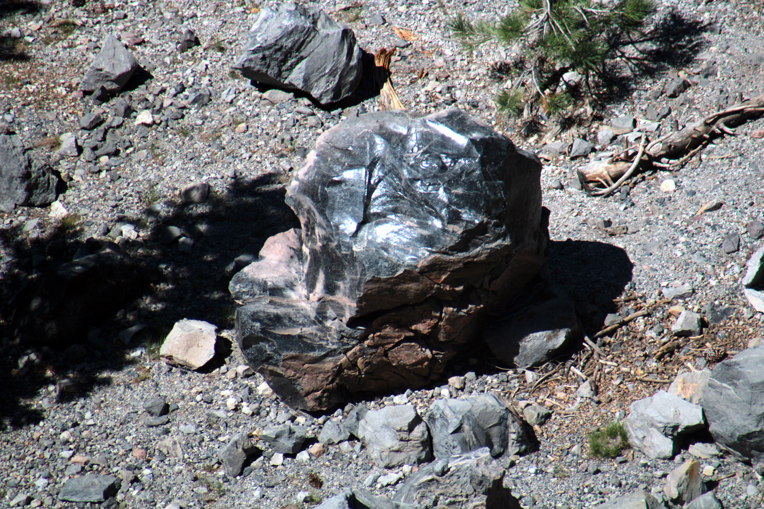
| Teri, Colton and Jack start up the trail | A shiny black obsidian boulder |
|
|
| Shattered rock testifies to the power of superheated steam | Views like this were available in many places along the trail |
|
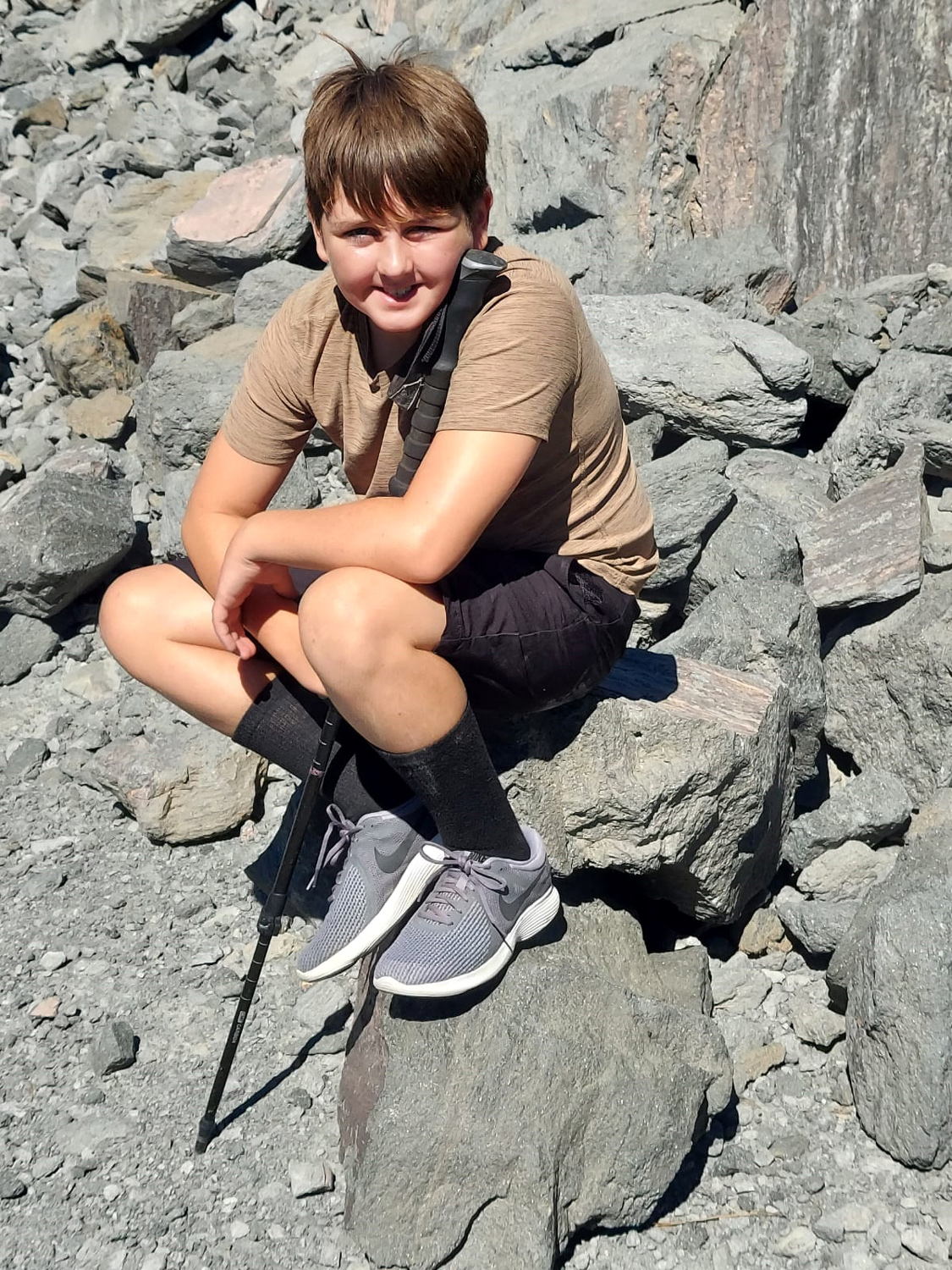
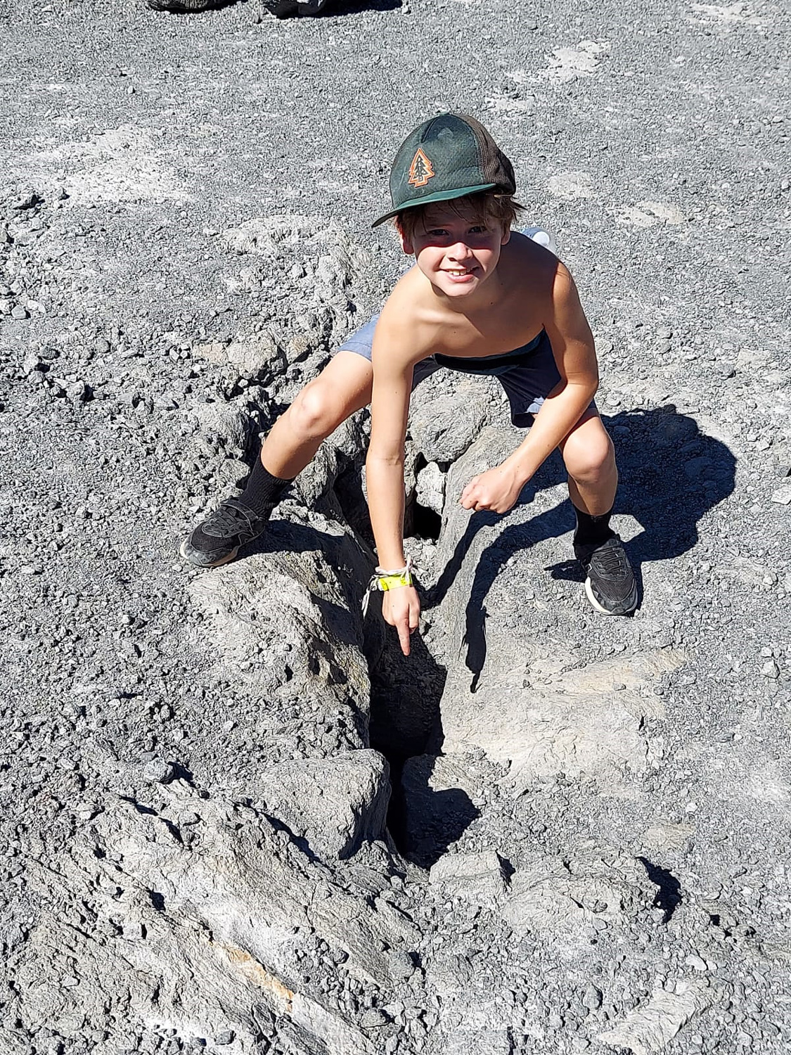
Colton is not enthusiastic about hiking, and has firm limits on how far he will go. When he reached that point, he sat down. Before we moved on, he climbed up a short slope and parked himself in the shade, while Teri, Jack and I went a little farther. Jack had the fun of discovering what we think is a steam vent, a hole into the earth that seems to go down a long way into the formation. The road forks off in a couple of places, but does not form a loop, so we explored a couple of these "side roads," enjoying the tumbled and jumbled formations, before starting back down. |
|
|
|
| Colton takes a break | Jack makes a discovery |
|
|
| A dramatic moonscape | A volcanic Matterhorn? |
|
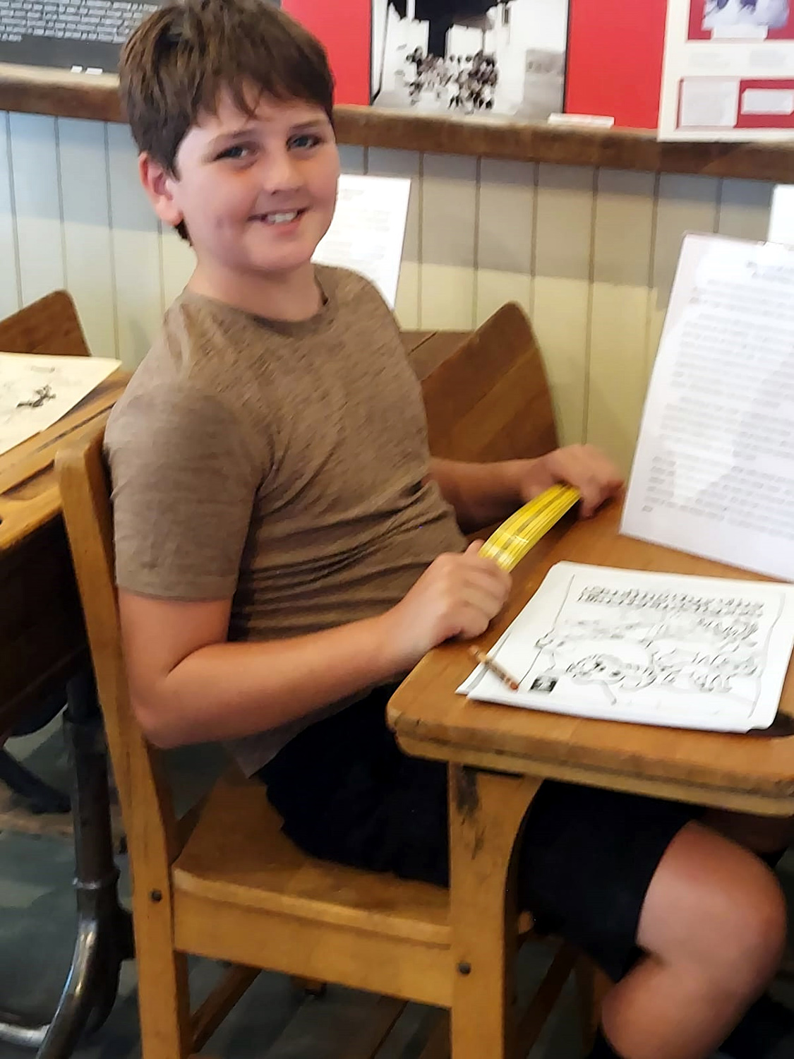
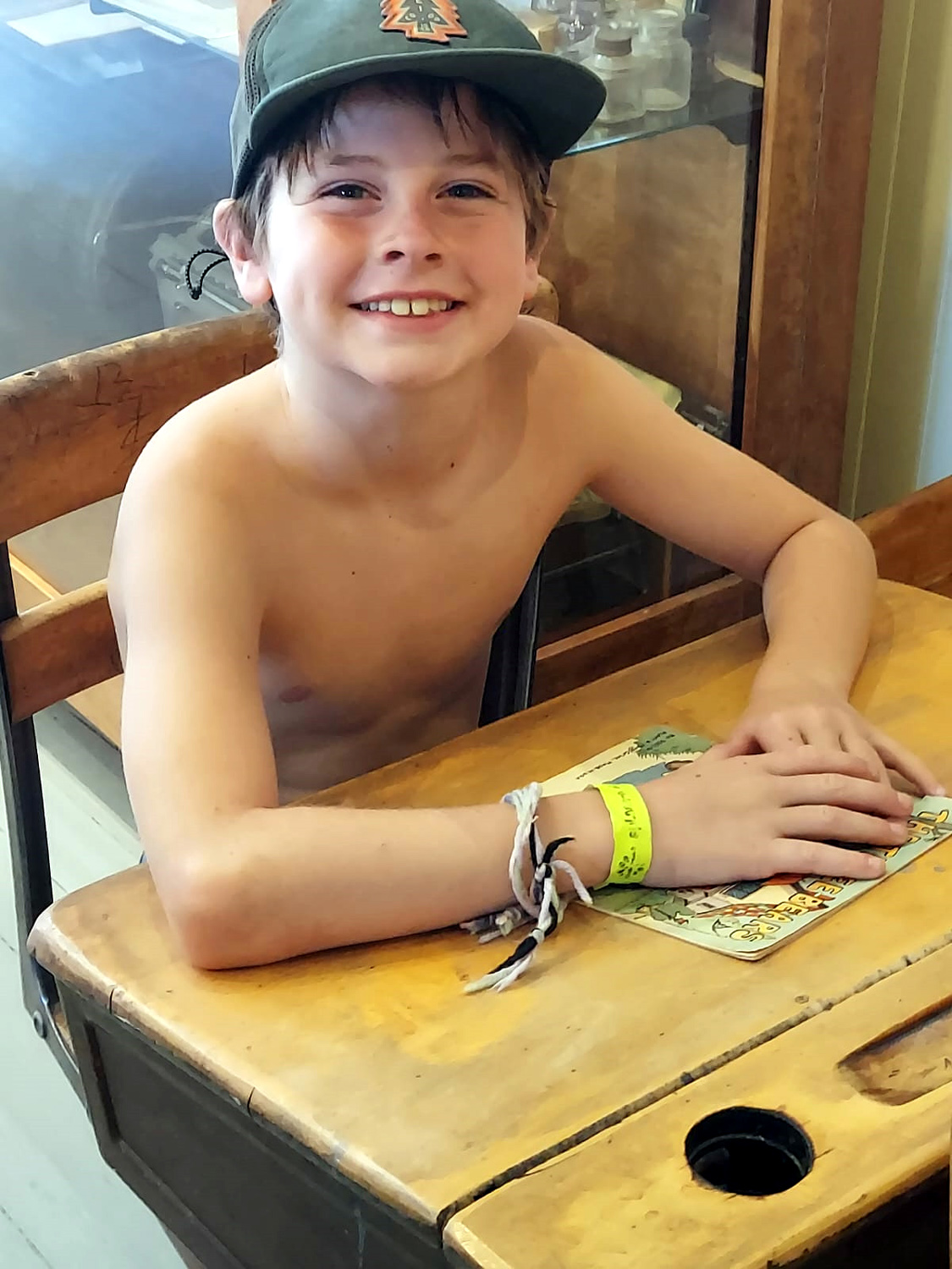
When we finished our hike, we drove out to 395 and north to Lee Vining to visit the Old Schoolhouse Museum, Operated by the Mono Basin Historical Society, this small but well-stocked museum covers the human history of the area, including the original Mono inhabitants. Of most interest to Jack and Colton were several old style school desks, the kind with a place for an inkwell, and a hinged top to allow storage of books and pencils in those days before every kid had a backpack. Both Teri and I used desks like these in elementary school, and their Dad had used one briefly. Outside we explored the famous upside down house, old mining and farming equipment, and a 1935 Chevy dump truck, before heading back to our temporary eastern Sierra "home." We turned west at the southern June Loop junction, and drove past wildflowers, more waterfalls, and the four lakes (Grant, Silver, Gull and June). |
|
|
|
| Colton looks like a proper student of the 1970s | Not sure this meets the school dress code |
|
|
| A nce cascade along the southern section of the June Lake Loop | There were lots of flowers along the road |
|
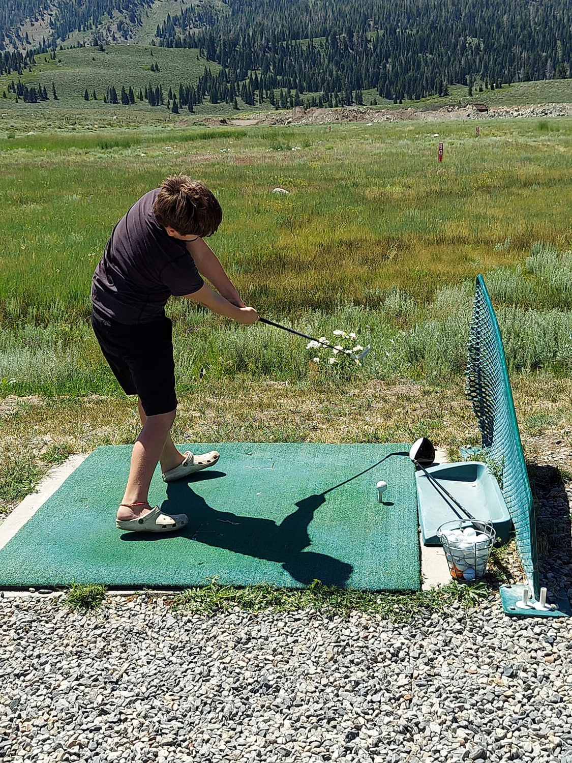
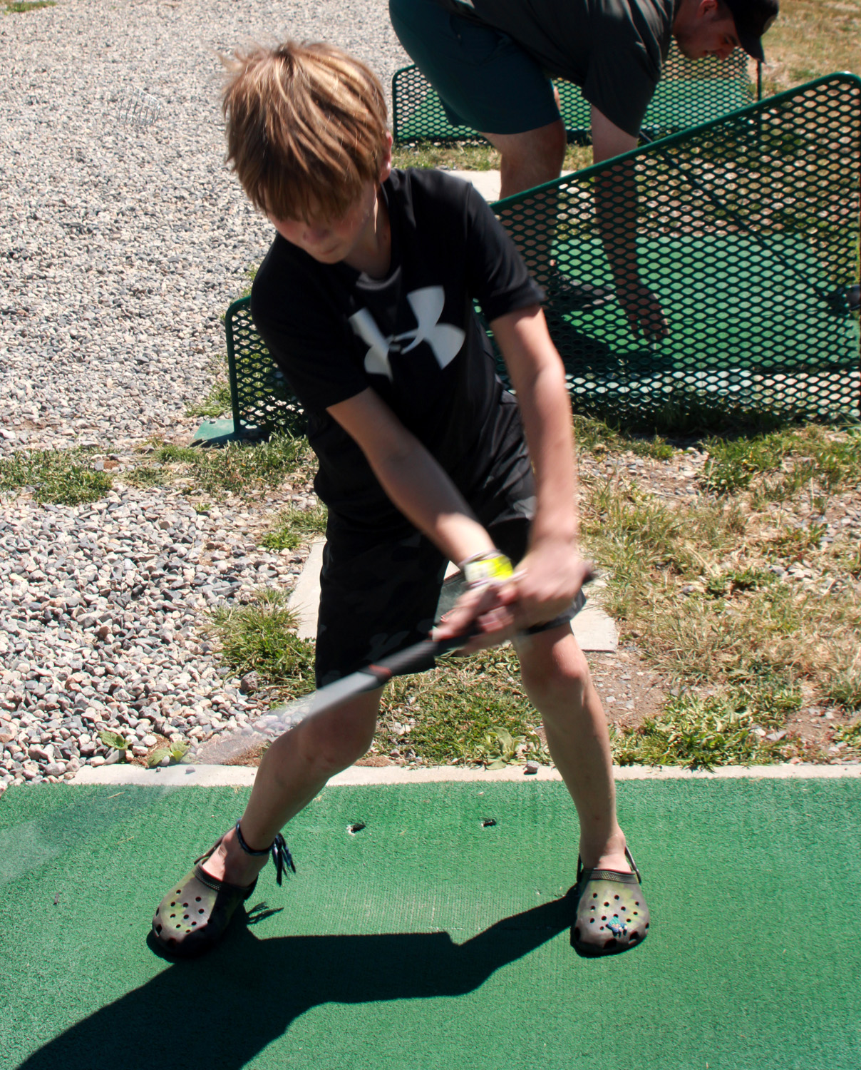
There was much more to come this day. Mikie and Hayley would be arriving in late afternoon. Teri and the boys went to the lake. June Lake was so crowded that the entry road to the shore was closed, so they went instead to Grant Lake. Mikie and Hayley arrived a little after 3, with the lake-goers returning about 4. Since Sunday would be Mikie's birthday, we went out to dinner at the Tiger Bar, which we had patronized last year. It seemed even better this year, and we all enjoyed our food. We still had room for dessert, which was again ice cream or candy from the grocery store. There was also swimming and other stuff, more than I can recall in detail. Last year the boys enjoyed playing at the Mammoth Adventure Center in the town of Mammoth Lakes, which offered a rock climbing wall, zip lines, rope course, trampoline, and motorized bike course, and wanted to go again. This was planned for Saturday, but we learned before leaving the motel that all available times were booked up. Instead they joined Mikie and Hayley at the golf driving range, something they had enjoyed last year also. Teri and I went along as observers. If I had to choose between watching golf or watching paint dry it would take a few minutes to decide, but there was beautiful scenery and flowers to be seen, and a comfortable bench to sit on, and as I have noted elsewhere, when it comes to our grandchildren, we would drive long distances to watch them play tiddlywinks if that was their sport of choice. Colton is a big and strong ten-year old, and could put the ball past the 100-yard marker on some shots. |
|
|
|
| Colton has a lot of power... | ...and Jack is getting there |
|
|
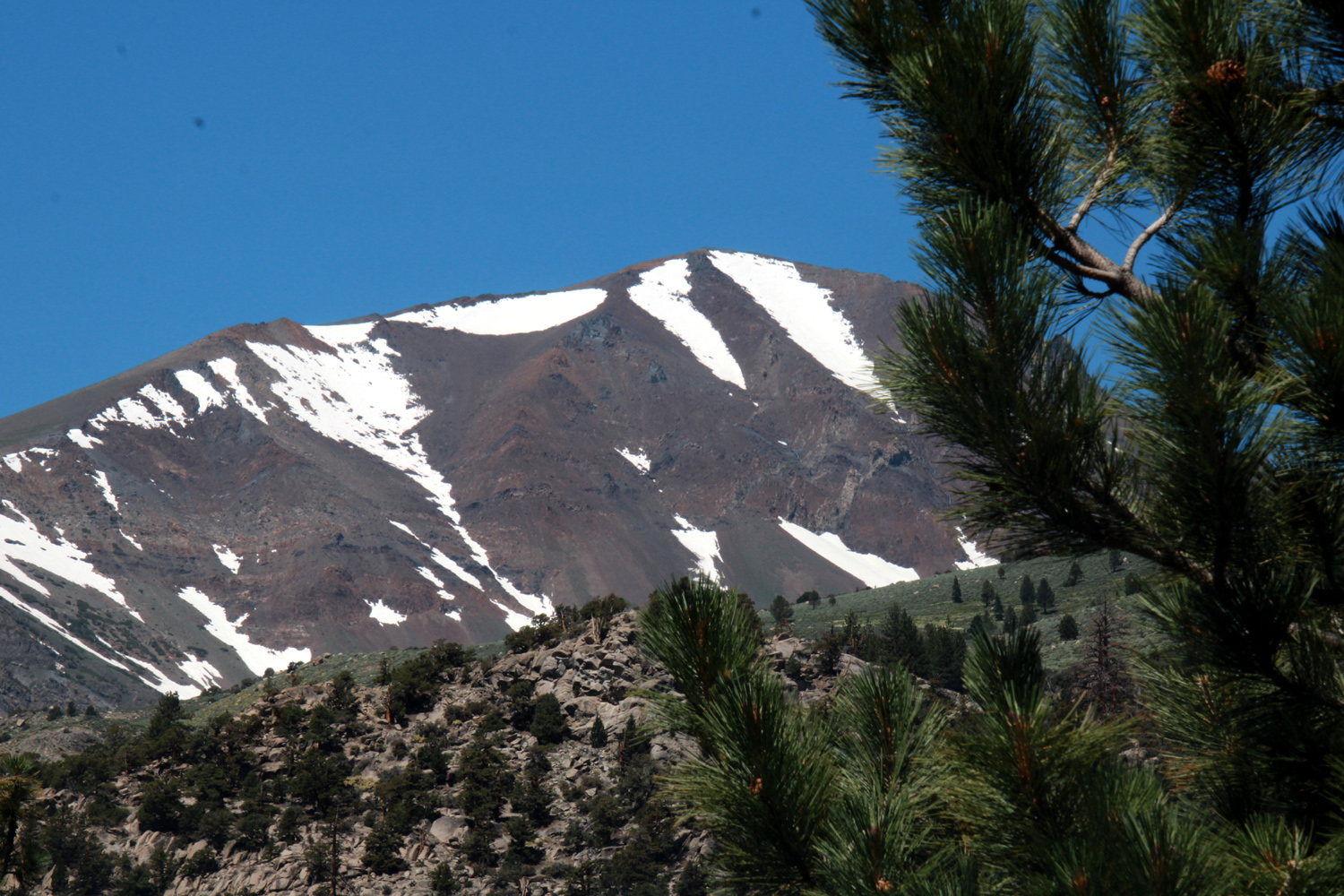
| Scenery visible from the driving range | The famous Mammoth Mountain |
|
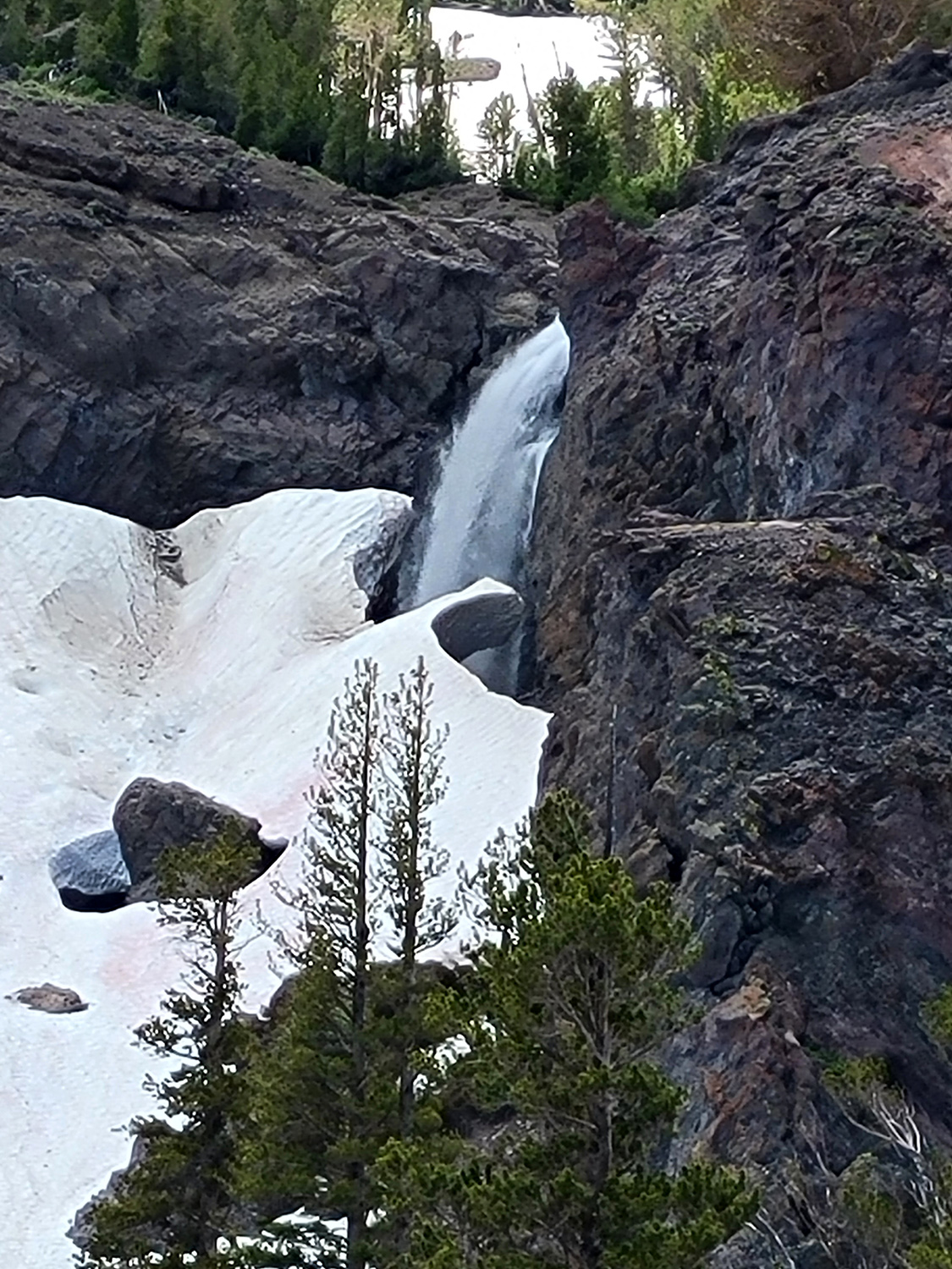
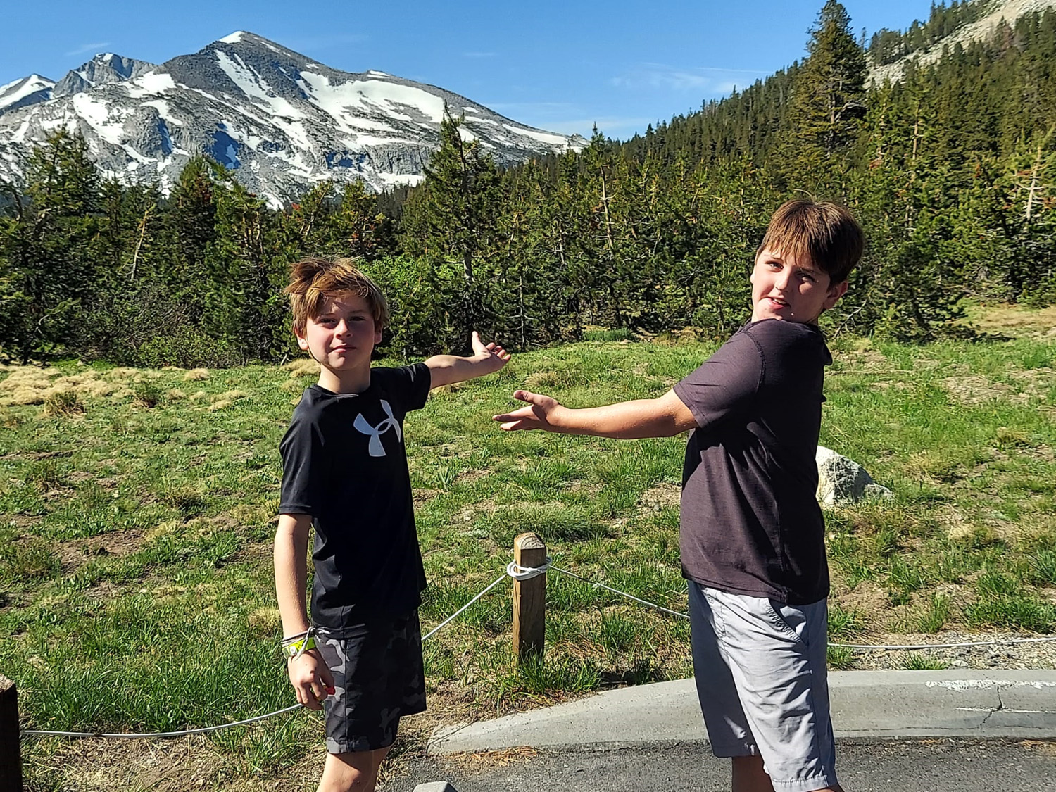
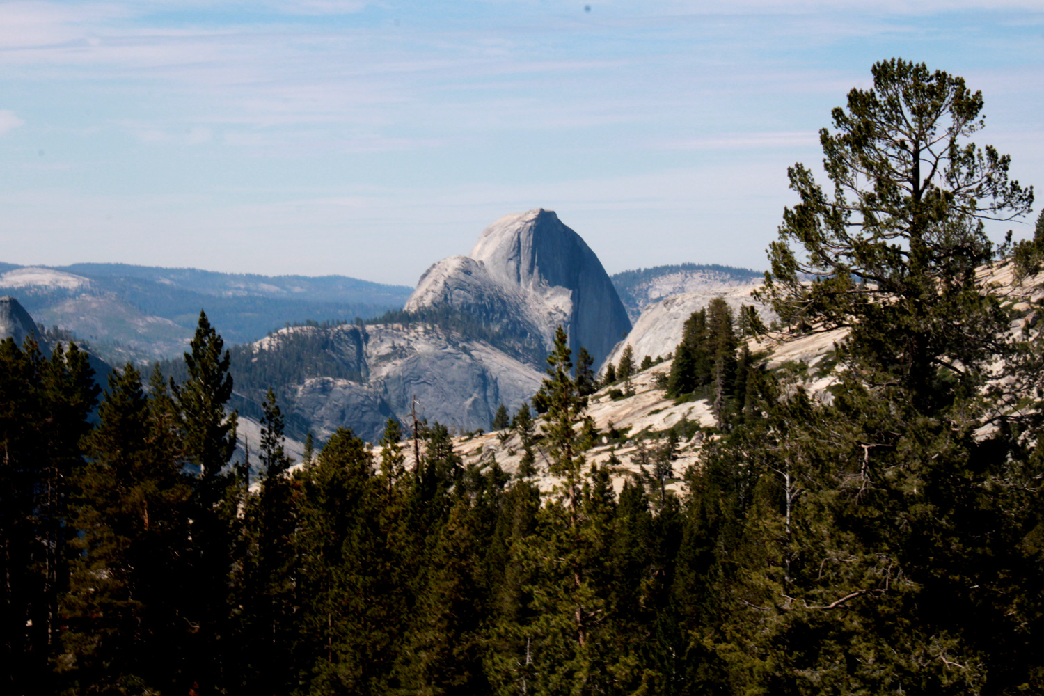
After leaving Mammoth Lakes, it was a relaxed, low-key day, with swimming pool basketball, resting and reading. We continued Mikie's birthday celebration with another restaurant dinner, this time at a local Mexican Restaurant (maybe THE Mexican restaurant). Not surprisingly in this small, remote location, there were some minor issues. They were out of Coke, and did not have enchiladas on the menu. However, the food and service were very good. It did not destroy our appetite for desert, however. At the 395 junction Mikie had spotted a general store that advertised hand made milkshakes, and he treated us to this decadent dessert. The next day was departure day. Mikie and Hayley wanted to play a round of golf at the course in Mammoth Lakes and had scheduled an 8 a.m. tee time, so they were up and gone by 7 a.m. He has only been playing for a little less than two years, so I asked him what his scores were like. He said he is happy if he shoots 90 or less. At Mammoth he had to find happiness just being out in nature. The rest of us got up at a slightly more civilized hour, and were on the road about 8:30. Happily, Tioga Pass had opened the previous day, so we would have a much shorter drive home, and get to enjoy Yosemite's scenery. We stopped at a lake and also a place where we had a view of a waterfall before we reached the pass. Although there were warnings about delays and road repair, it was Sunday, so we did not encounter any problems. There is one place where traffic is one-way, controlled by a light. We made a restroom stop at Tenaya Lake, and an official sight-seeing stop at Olmsted Point, which offers a unique view of Half Dome as well as other landmarks, and on this day, a marmot that peaked out briefly from behind a boulder. |
|
|
|
| Waterfall east of Tioga Pass | The Notorious Upshaw Brothers offer scenic guide services |
|
|
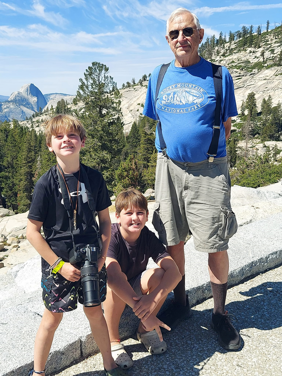
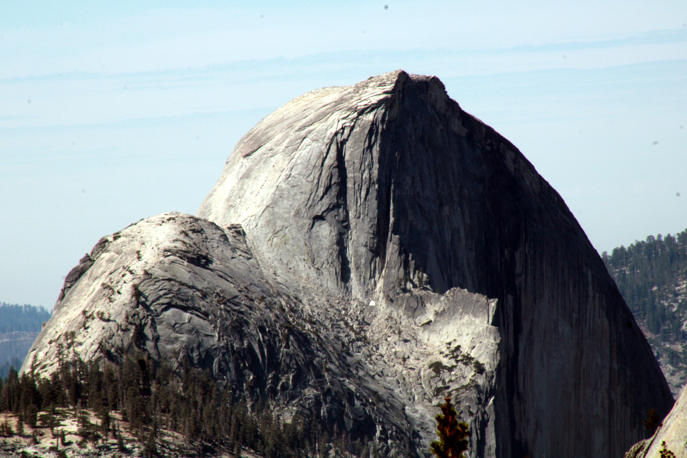
| Jack, Colton and Dick at Olmsted Point | Half Dome from Olmsted |
|
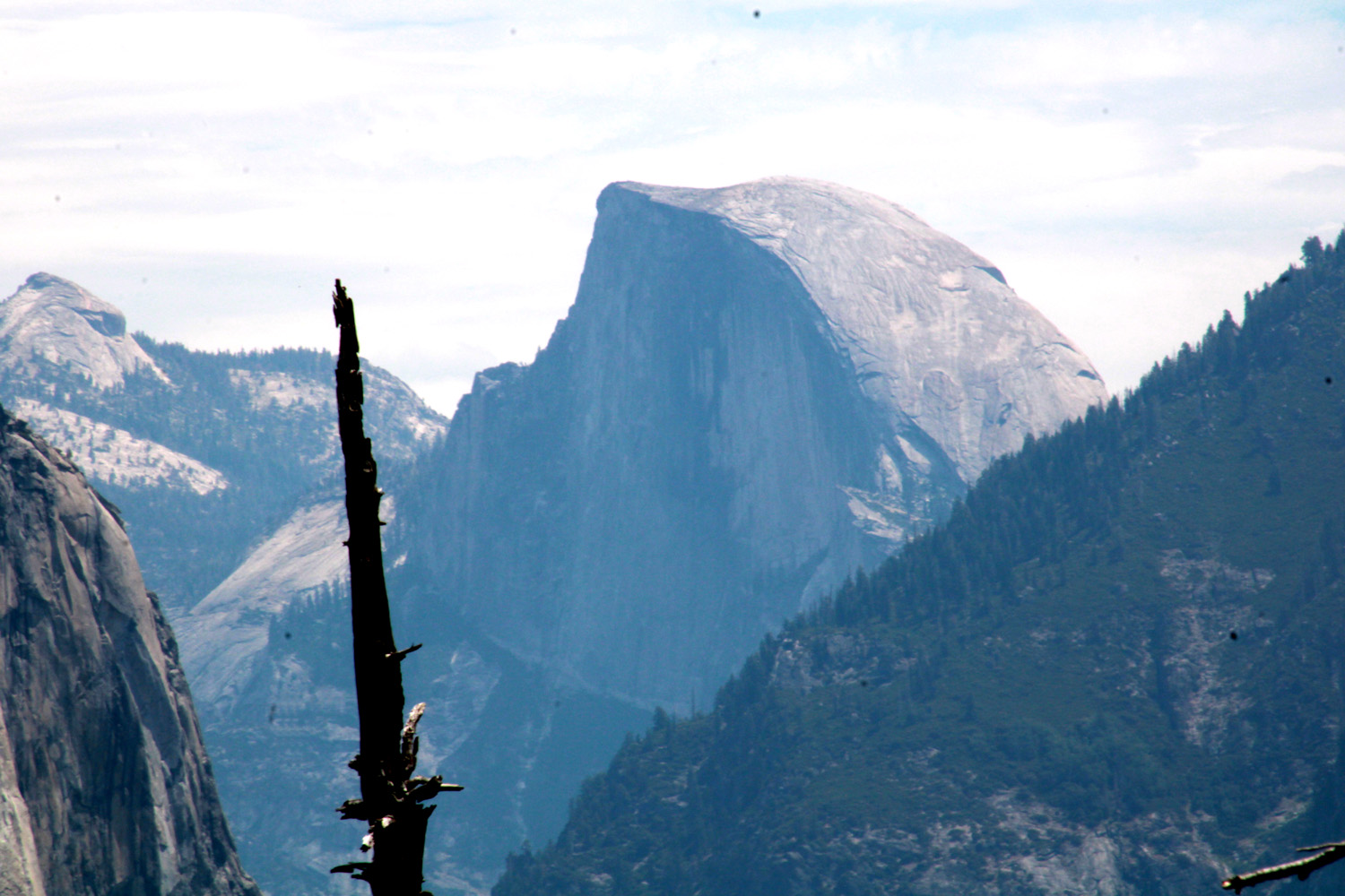
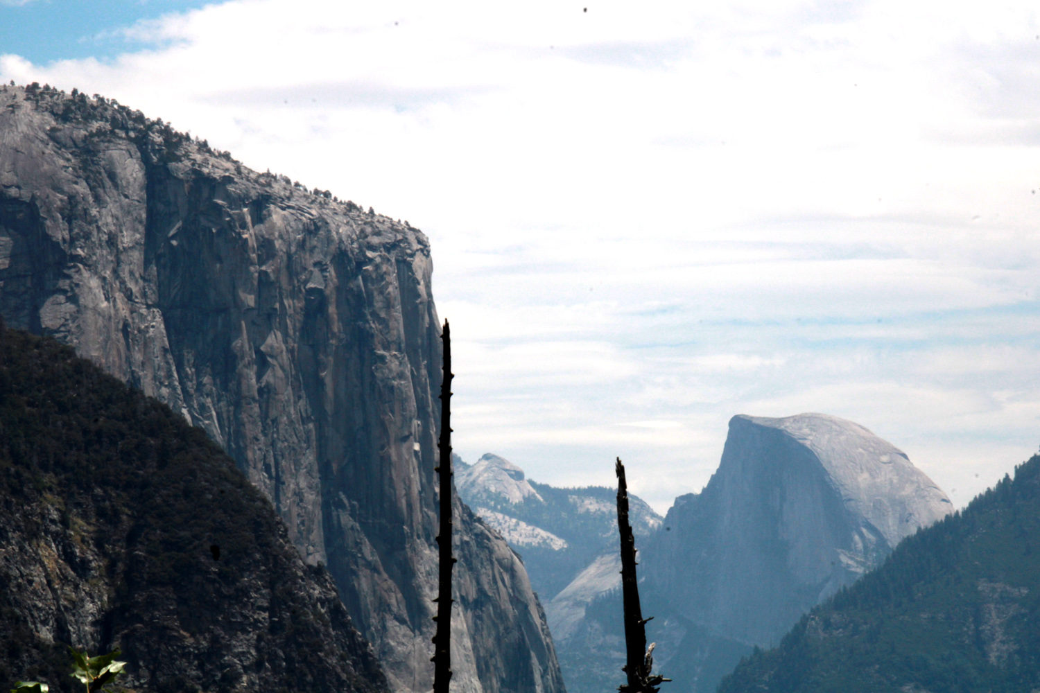
The drive from the Tioga Pass entrance to the south entrance near Wawona is long. It's always scenic, but much of it is fairly routine forest and mountains, with a few spectacular vistas along the way. After Olmsted Point we made only one stop, just south of the Wawona Tunnel, where there is a limited version of the famous valley view found at the other end. We had wanted to stop at the classic tunnel view but parking was impossible. We stopped in Oakhurst and enjoyed a delicious lunch at the Pizza Factory. From there both boys rode with me, since my house is close to theirs, and this allowed Teri to go directly home without a side trip to my side of town. |
|
|
|
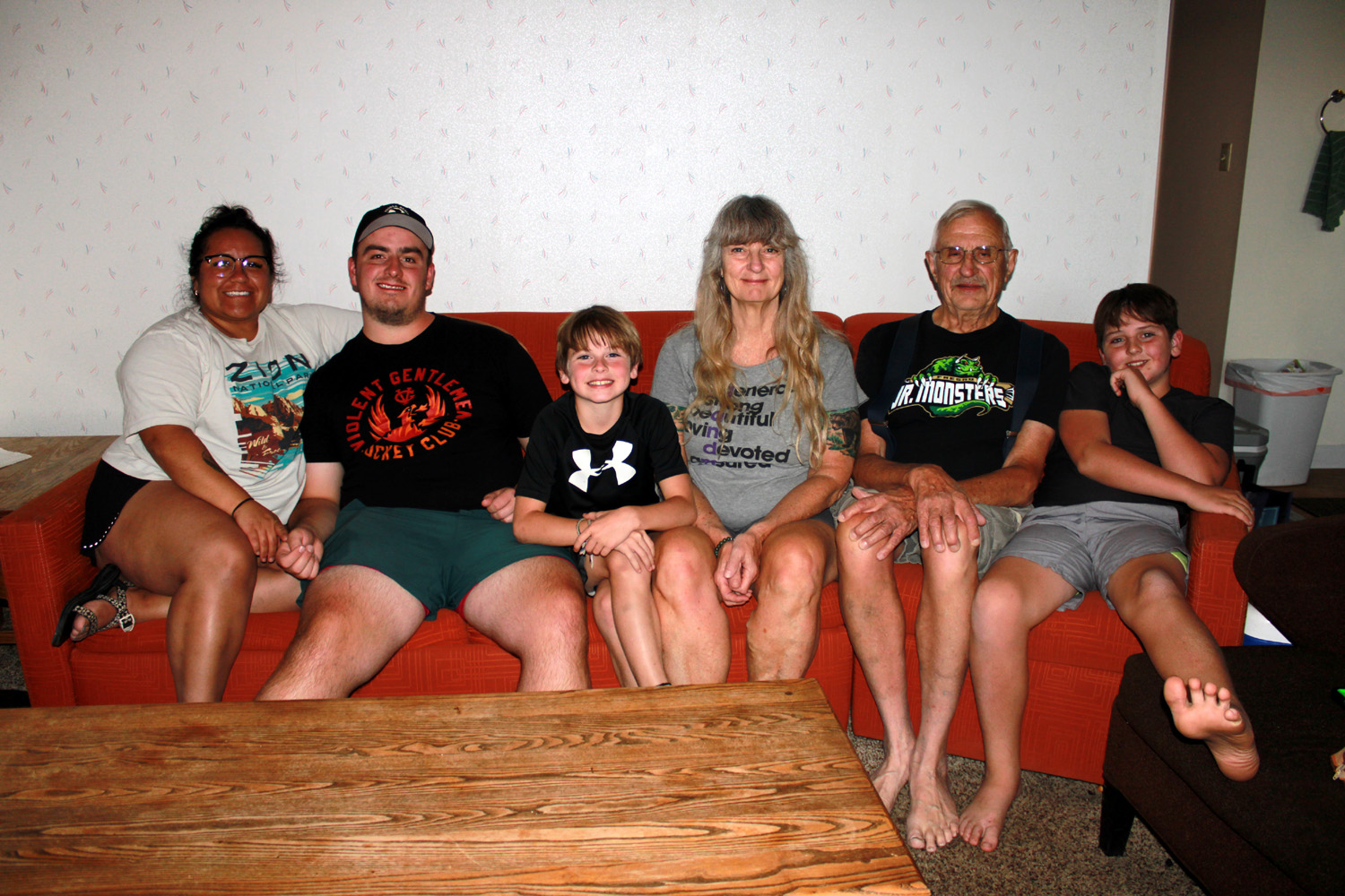
| Half Dome from the "wrong" end of Wawona Tunnel | The whole gang: Hayley, Mikie , Jack, Teri, Dick & Colton |
|
When I tallied up my total mileage, I had driven 532 miles. The long first day accounted for 270 of those. Not surprisingly in the remote rural area we visited, gas prices were more than a dollar higher than at home. At stations along Highway 108 the price was about $6.50, but we paid "only" $5.90 at June Lake. The last tank I bought in Clovis wss $4.38. Even so, we would happily do it all again. --Dick Estel, August 2023 |
|
|
Photos (Click to enlarge; pictures open in new window) |
||
|
Upper Kings San Joaquin River Trail West Yosemite & Merced River June Lake |
||
|
Upper Kings |
||
 |
 |
 |
| Climbing brodiaea | We saw one small patch of poppies | Lots and lots of common madea |
 |
 |
 |
| White lupines were having their peak display | A lovely but unknown blossom | A deep magenta
variation of farewell-to-spring |
|
 |
 |
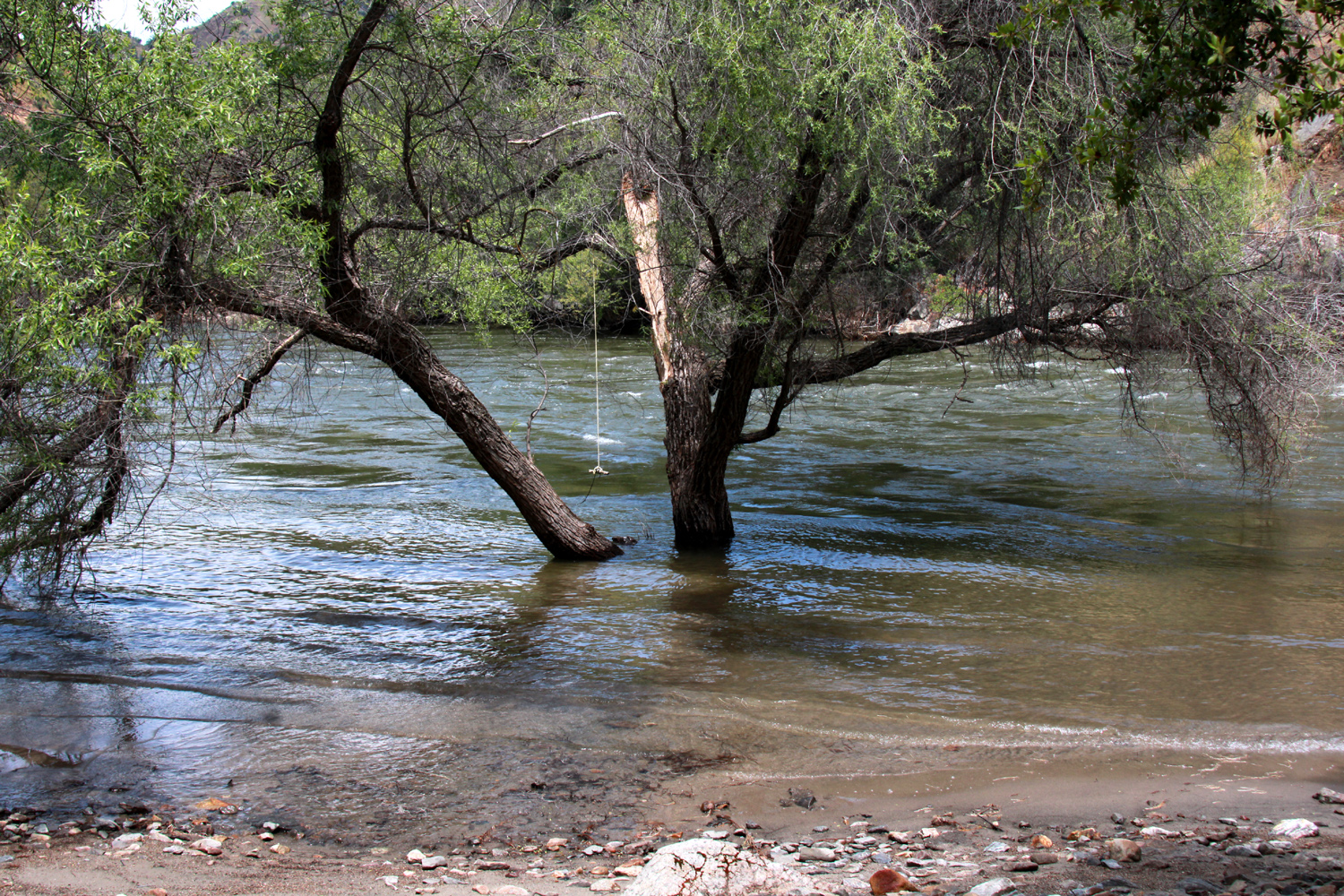
| A few years ago a
friend swung out over the river on this rope. This year not so much |
White water in the
Kings - note trees in the river near lower center |
This sign is new in the last two years |
| San Joaquin River Trail West | ||
 |
 |
|
| A unique and dramatic rock along the trail | We're always trying
to remember how far it is from Sky Harbor to San Joaquin Gorge |
Probably a variation
of yellow-throated gilia |
 |
 |
 |
| Lake water barely
enters the Finegold Creek branch of the lake |
Not quite a bush, but a good size lupine plant | White owl clover - scarce in most areas this year |
| Yosemite & Merced River | ||
 |
 |
|
| A closer view of Clouds Rest and Half Dome | A massive amount of
water is pouring over Bridalveil Falls |
Ribbon Falls is at a near record flow |
 |
 |
 |
| Spray drifts up from the base of Upper Yosemite Fall | Ravens are a common sight in the park | Climbing brodiaea in
the rocks above Highway 140 between El Portal and the valley |
 |
 |
 |
| Where the boardwalk disappears into the water | Yosemite Falls framed by cedar tees | Jackie, Teri and Dick at the Tunnel View |
| June
Lake (Photos by Teri, Jack and Dick) |
||
 |
 |
 |
| Just east of Sonora Pass | Twin Lakes, west of Bridgeport | Jack, harvesting logs from the lake |
 |
 |
 |
| Colton on the Obsidian Dome Trail | Jack does his lizard pushups among the obsidian | Colton and Teri |
 |
|
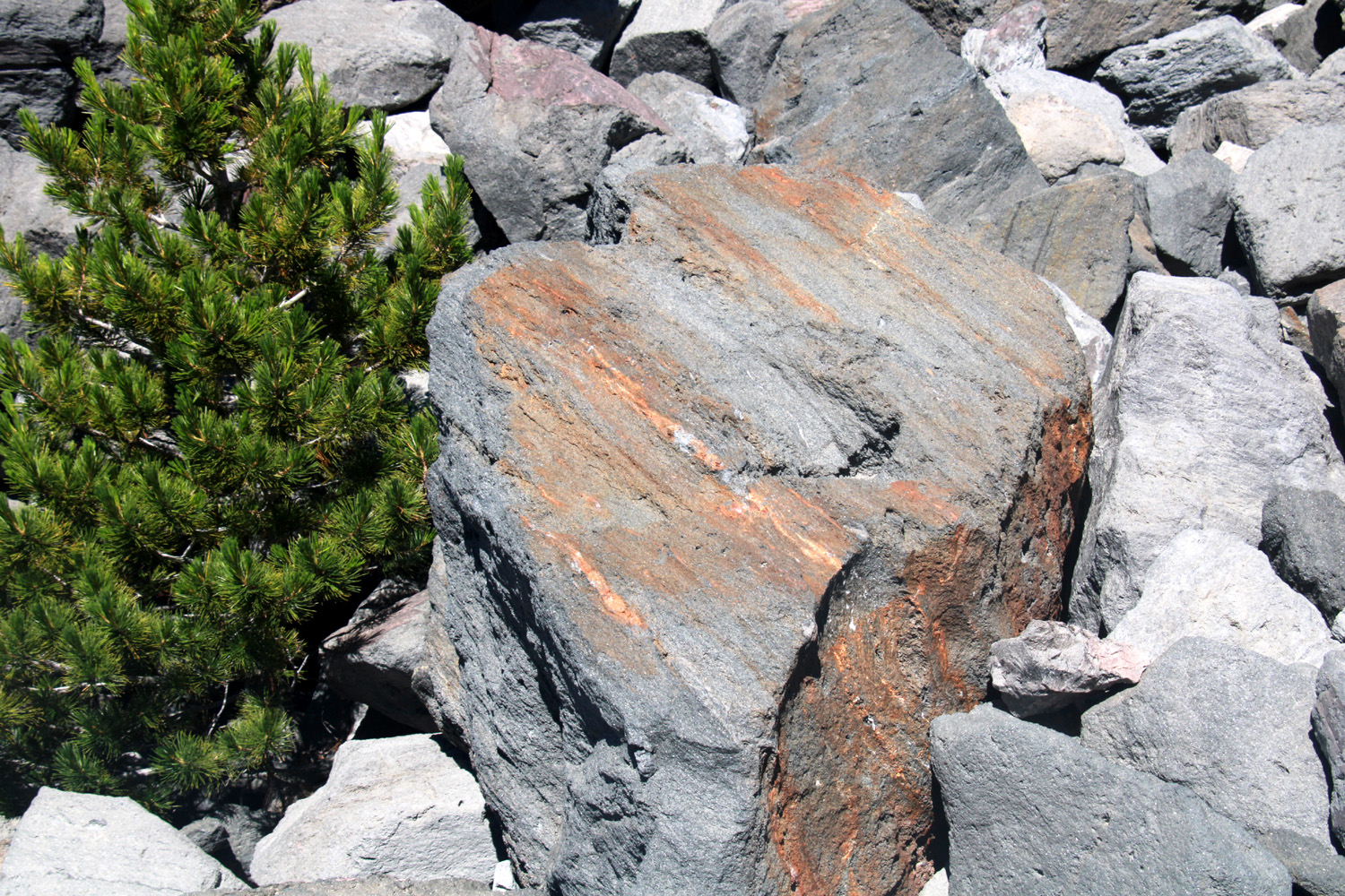 |
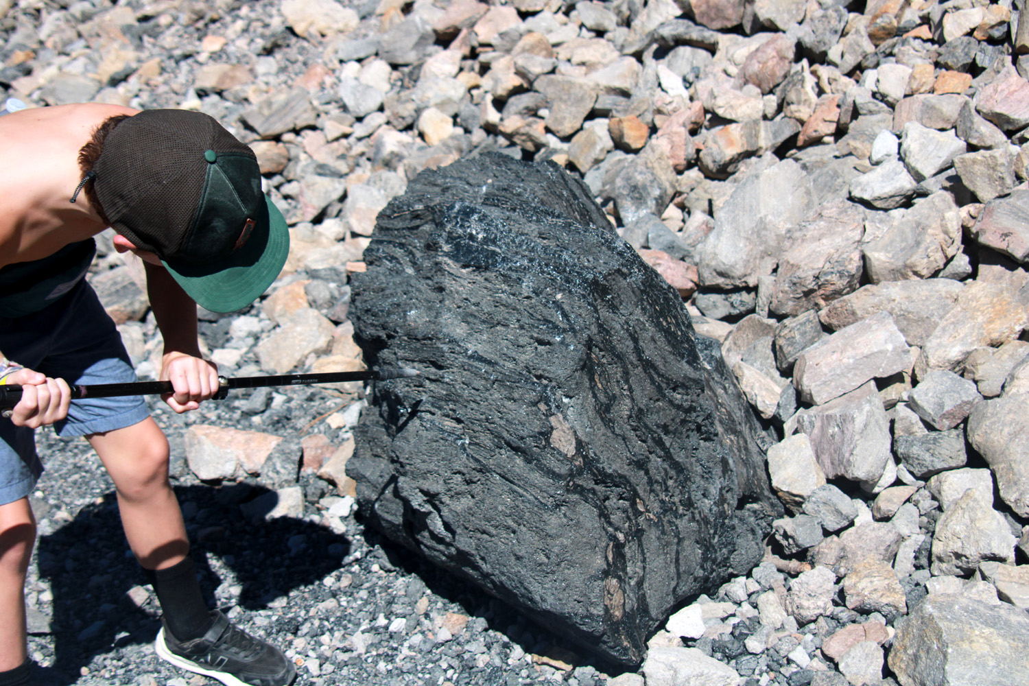
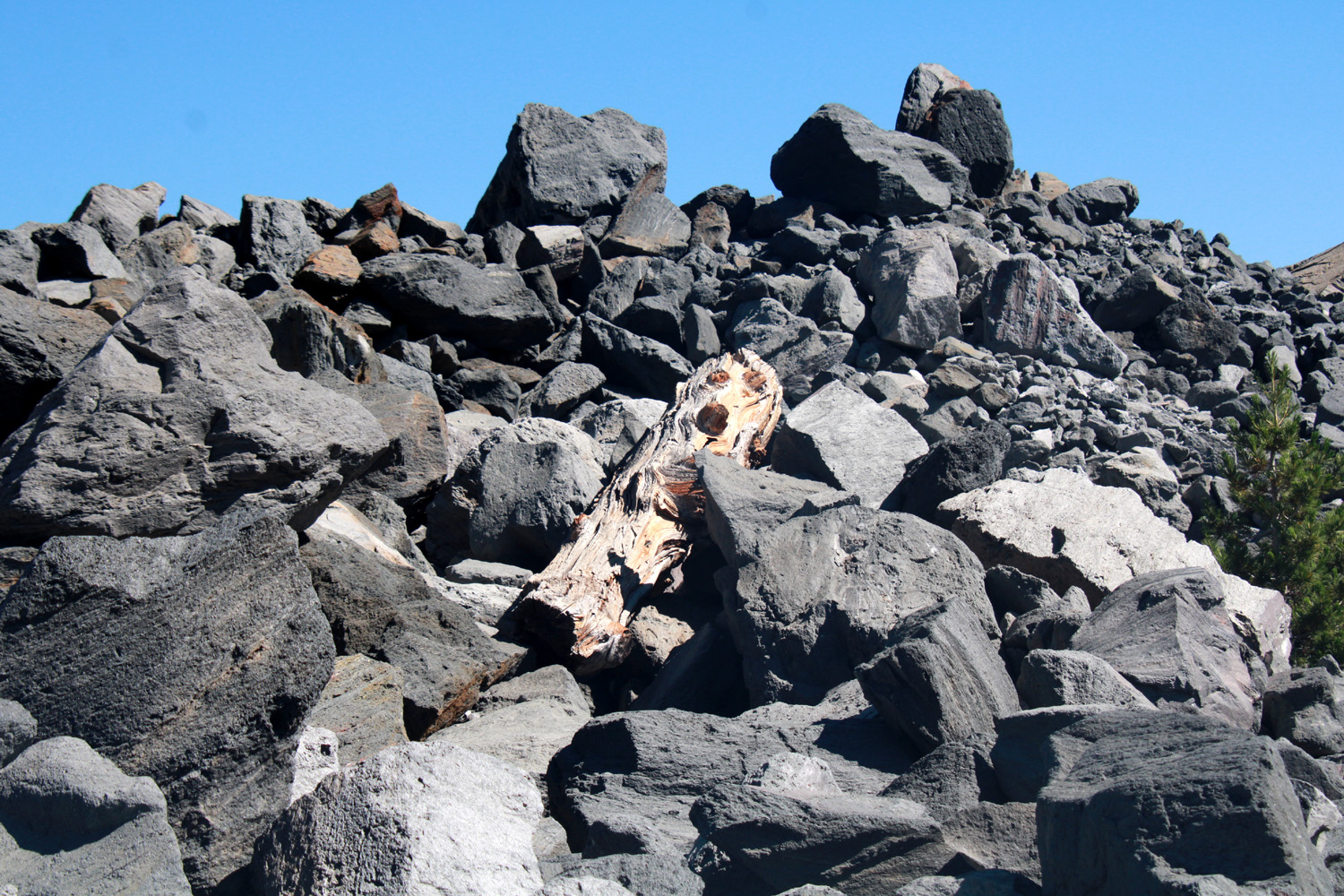
| Ancient dead log in the boulders | Jack examines an unusual black boulder | This boulder is mostly pumice |
 |
 |
 |
| Shiny black obsidian boulder | Jack's up in this rock pile somewhere | Jack is a budding photographer |
 |
 |
 |
| Sunset at June Lake | Remains of a volcano east of US 395 | A nice tufa formation |
|
 |
 |
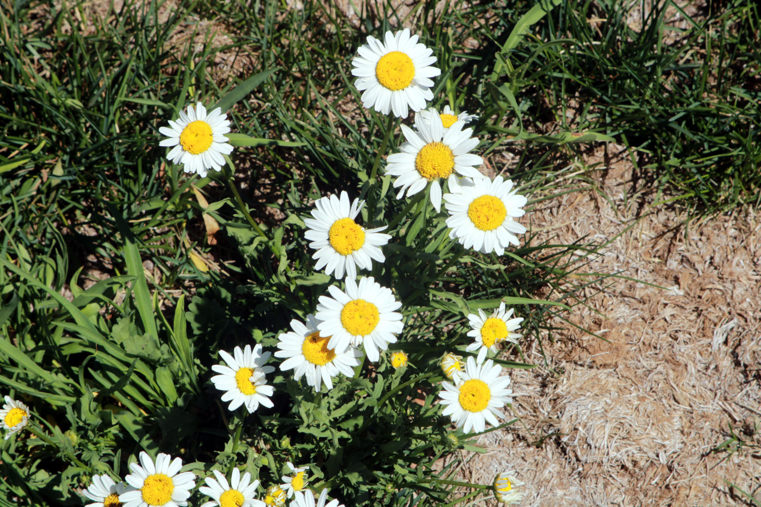
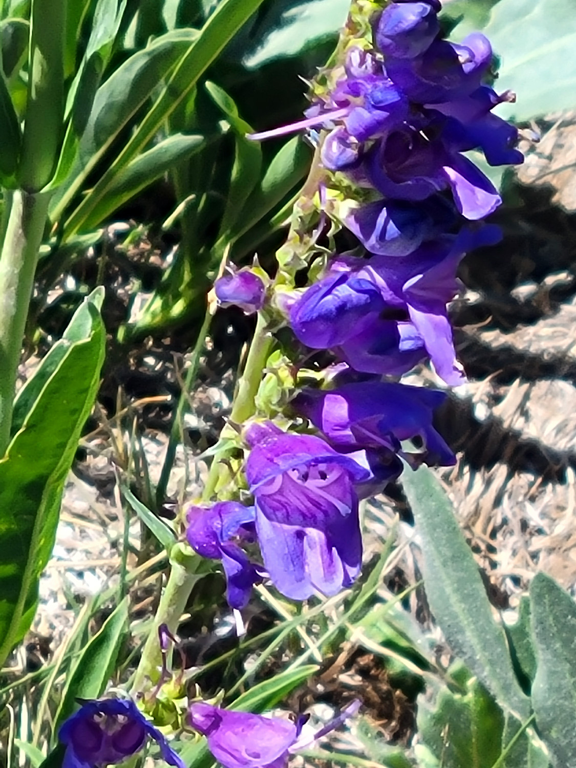
| These daisy-like flowers were everywhere | Maybe a type of penstemon | Another sunset |
 |
 |
 |
| Rugged rocks east of Tioga Pass | Half Dome from Olmsted Point | El Capitan and Half
Dome from west of the Wawona Tunnel |
 |
 |
 |
| Jack shines as a portrait photographer - Grandpa Dick, Uncle Mikie, Aunt Hayley | ||
| Related Links | ||
| Kings River Trail | Camp 4 1/2 Cabin | Bear Wallow Trail |
| March 2023 Drive to Secata Ridge | 2019 Campout at Upper Kings | Bear Wallow Trail in the 1980s |
| San Joaquin River Trail | Millerton Lake | Pincushion Peak |
| Yosemite Waterfalls | List of Yosemite Waterfalls | More About Yosemite Waterfalls |
| Horsetail Falls | Merced River | Yosemite National Park |
| El Portal | Bridalveil Falls | Silver Strand Falls |
| Lahamite Falls | Cathedral Rocks | Yosemite Falls |
| Mariposa | Merced River Video | Mono County |
| Bridgeport | June Lake Loop | Tioga Pass |
| Lee Vining | Mono Lake Tufa | Tufa (Wikipedia) |
| Mono Lake | Los Angeles Aqueduct | Prickly Poppy |
| Alkali Flies | Brine Shrimp | Horsetail Falls Whirlpool Video |
| Swim Pool Basketball (Colton Dunks) | Old School House Museum | Mammoth Adventure Center |
| Obsidian Dome | ||