

Dick's Adventures of 2016 - Part 5 |
||
Adventures of 2016 Part 1 Adventures of 2016 Part 2 Adventures of 2016 Page 3 Adventures of 2016 Part 4 Adventures of 2016 Part 6 Adventures of 2016 Part 7 |
||
|
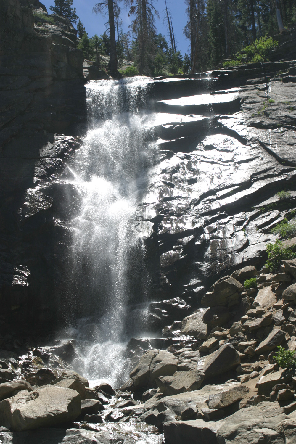
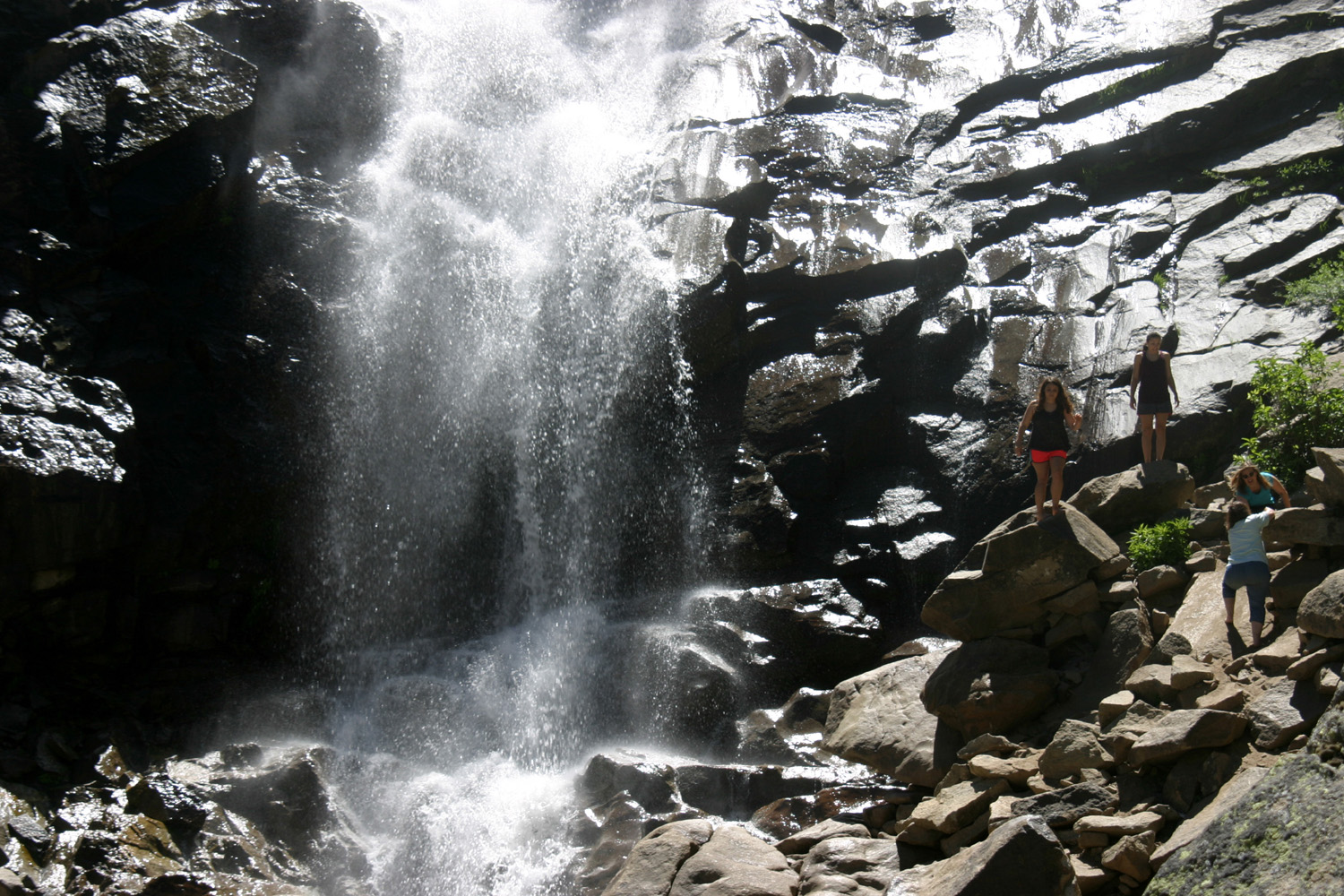
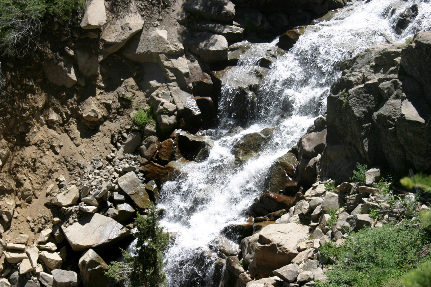
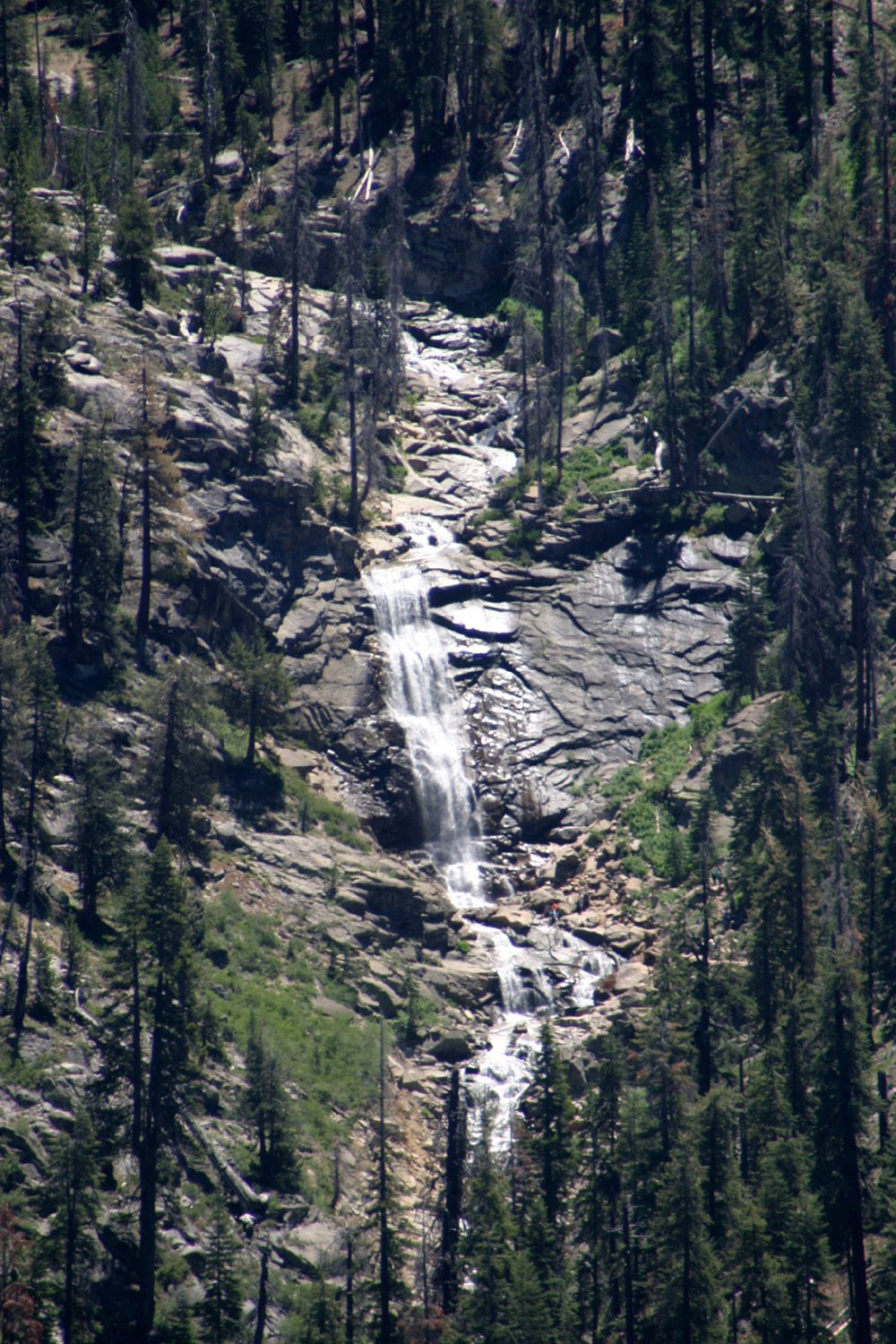
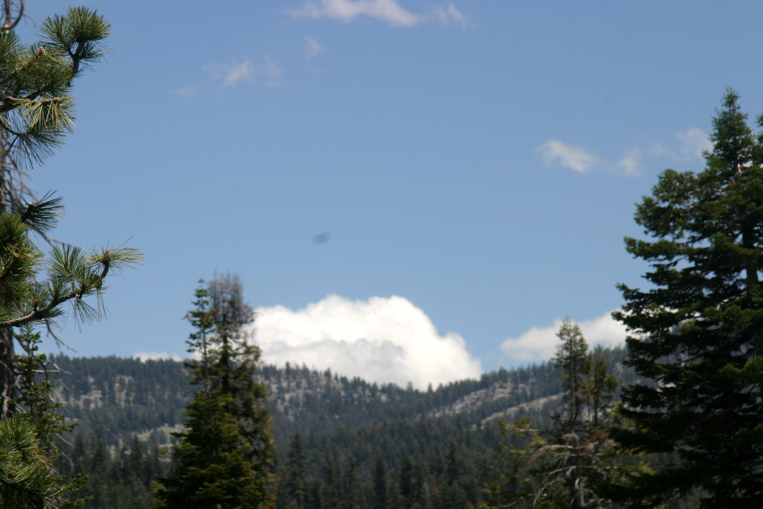
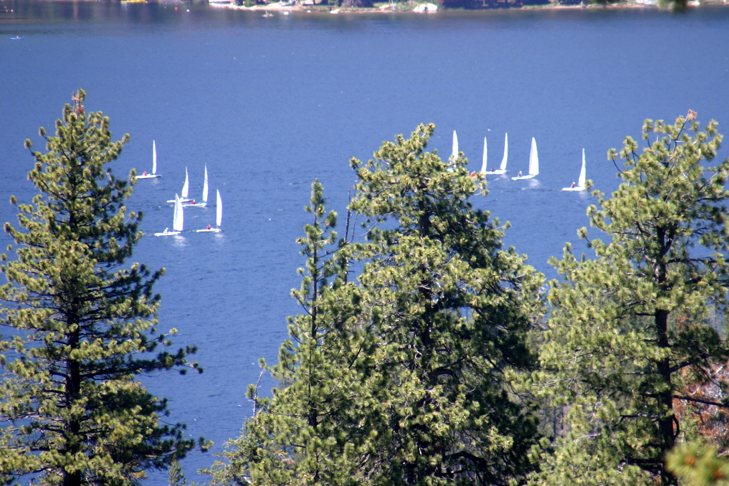
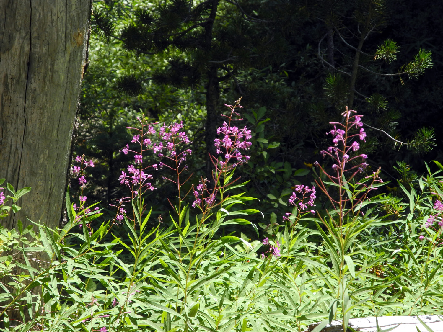
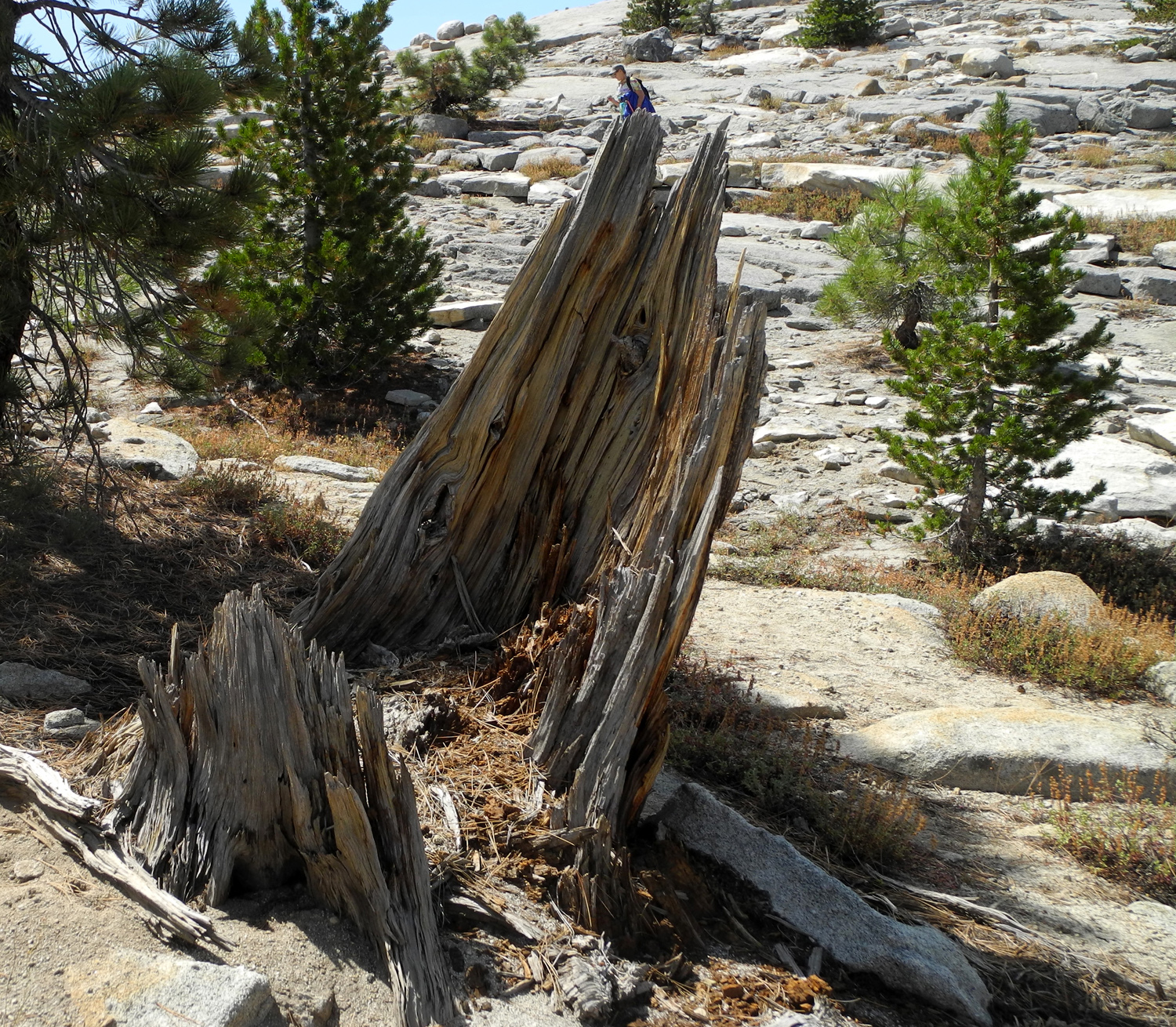
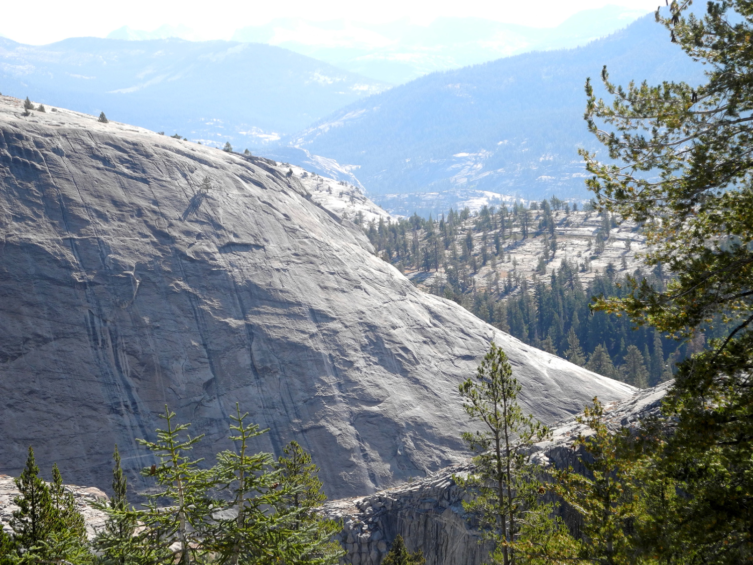
Rancheria Falls On Saturday, July 9, not wanting to walk the Clovis trails for the 100th time, I packed a lunch and drove to the Rancheria Falls trailhead near Huntington Lake. I had been there for the first time ever with the Ramblers on June 15, but wanted to get another look before the water level drops too much. Although I got a fairly early start, the parking lot was nearly full when I get there, unlike the previous trip when we were the second car there. As I started out, a group of about 20 was coming out. I saw another group of at least 15, and several parties of 5 to 10. In all there were well over 100 people on the trail at different times. This is a short, easy trail, rising up gradually along the side of a steep slope, then going around to the south and down into the canyon of Rancheria Creek. The very first part of the trail is slightly steep, and there is another steeper stretch just before the high point. It's wide and there are few rocky places, and most of the time I would have been fine with no hiking poles. I took just one pole because I was carrying a larger camera than usual, and wanted to be less encumbered. The single pole was more than adequate in the "difficult" spots. When I got to the falls, it was immediately obvious that the flow had diminished since we were there three weeks earlier. The water runs over a wide cliff, but the right side of the lip of the falls is slightly higher than the left, and the lower water flow provided just a trickle on the right, effectively reducing the width of the falls by nearly half. Even so, it was a spectacular sight, and if I had not seen it earlier, I would still have thought it one of the better small waterfalls in the Sierra. Needless to say I took some time to take a close look at the flowers along the trail. The bud-like blossoms that had covered some low bushes along much of the trail three weeks earlier were gone, but there were flowers that either were new or had gone unnoticed on the previous trip. Actually the most spectacular flowers were a number of large patches of blue blossoms a mile or two below Huntington Lake. Research shows that these are either azure or royal penstemon. I spent at least 20 minutes at the falls, resting and taking pictures, then started back out. When I got back out to the highway, instead of heading for home I turned right and drove up the Kaiser Pass Road a few miles. I knew there was a place where the falls are visible from that road, but my recollection was that the view was not very good. In fact, there is an excellent view of the falls and the cascades below it, from the top to well down the canyon. My previous views had been when the water was much lower, so the falls did not look like much, but with a good flow of water, the view was very nice, and I took a number of photos there. You can also see the entire lake from this area. A special treat was seeing a sailboat race in progress on the lake, especially since this event was cancelled last year due to low water. Heading back down, I drove into the Potter Pass Cutoff trailhead, hoping to find a shady place to eat lunch. There were no parking spaces except in the sun, and no suitable lunch spots, so I headed back to the highway. As I drove in two young men with very large, heavy-looking backpacks were walking out. When I drove back out, they were on the road, hitchhiking toward Huntington, so I offered them a ride. I planned to find a place to eat near the lake, so I told them I could take them as far as Huntington Lake. They did not know Huntington from Lake Michigan, but I moved my stuff off the seats, and we got their packs in the back, pretty much filling it up. They were looking at their map but could not find Huntington (it was just off the edge of the map). They said, "We just need to get to the nearest main highway; we're trying to get to Mono Hot Springs." Mono is about 20 miles from where were, on the east side of Kaiser Pass, so I explained that they needed to go in the opposite direction. They retrieved their packs and put them back on. I asked where they were coming from. "We started in Mexico; we've gone 800 miles." "Where are you headed?" "We have only four more weeks; we're just going to go as far as we can." They walked off up the road, still hoping for a ride, and I went in the opposite direction, regretting that I didn't think to ask where they were from. A short distance down the road is the Midge Creek Group Camp, so I drove in there. I found many picnic tables and no people, so I got out my ice chest and enjoyed lunch there in the shade. Walking around the campground, I discovered that there was a partial view of Rancheria Falls if you stood in just the right spot. The hike to the falls is fairly short, just 1.5 miles round trip, but I had another short excursion planned that brought my total to two miles. Below the dam that holds back Shaver Lake, about 20 miles below Huntington, there is a small, rugged dome. The creek that flows out of the lake runs beside this feature, and I have wanted to explore it ever since I first drove by there almost 50 years ago. In those days I thought about climbing to the top, but my rock scrambling days are over. However, I discovered a narrow, rough path down from the road, and followed it along the creek for a ways. There is a tiny concrete dam holding back a small pool, with a tall, narrow structure next to it. Most likely this is or was used to measure the flow of the stream. Once I finished my explorations, I returned to the car and continued on down the mountain and back home, having enjoyed a little walking and a lot of beautiful mountain scenery.
|
||
|
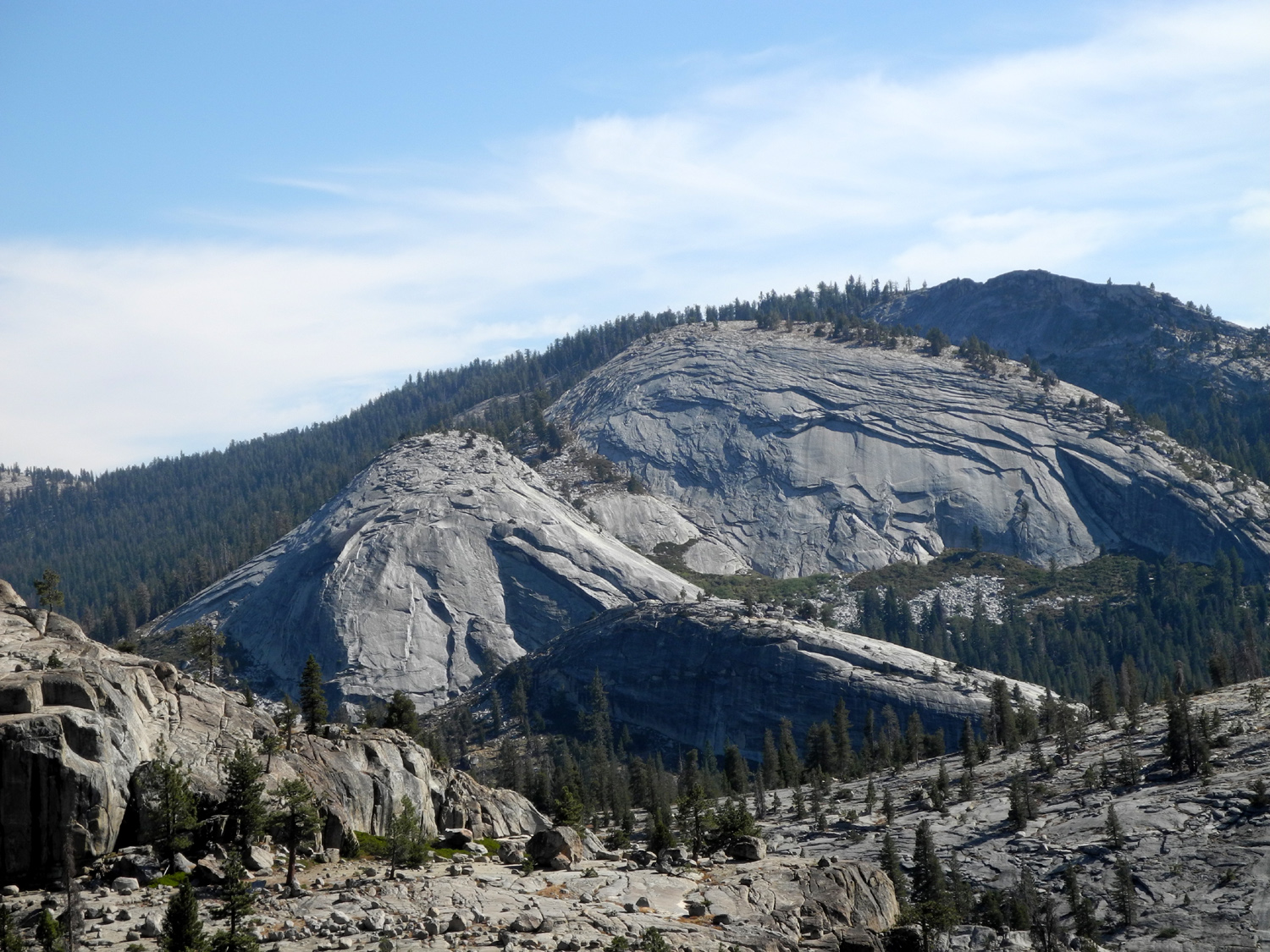
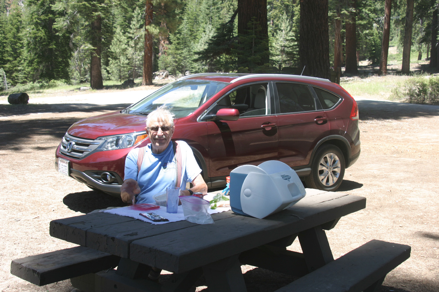
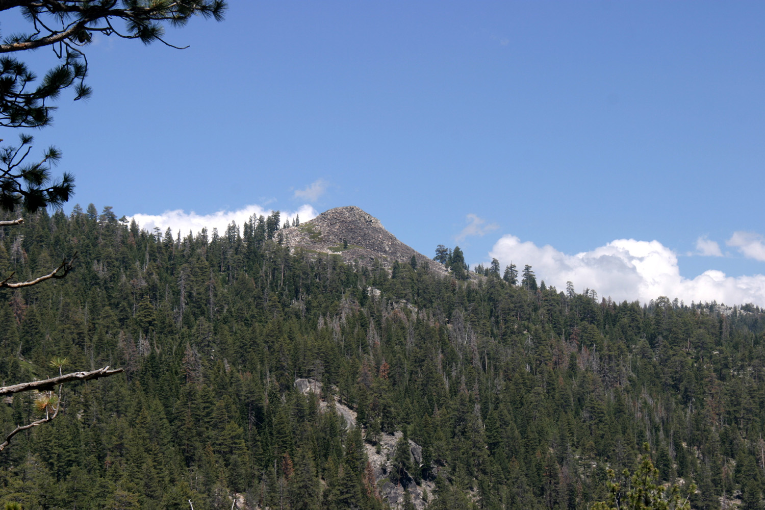
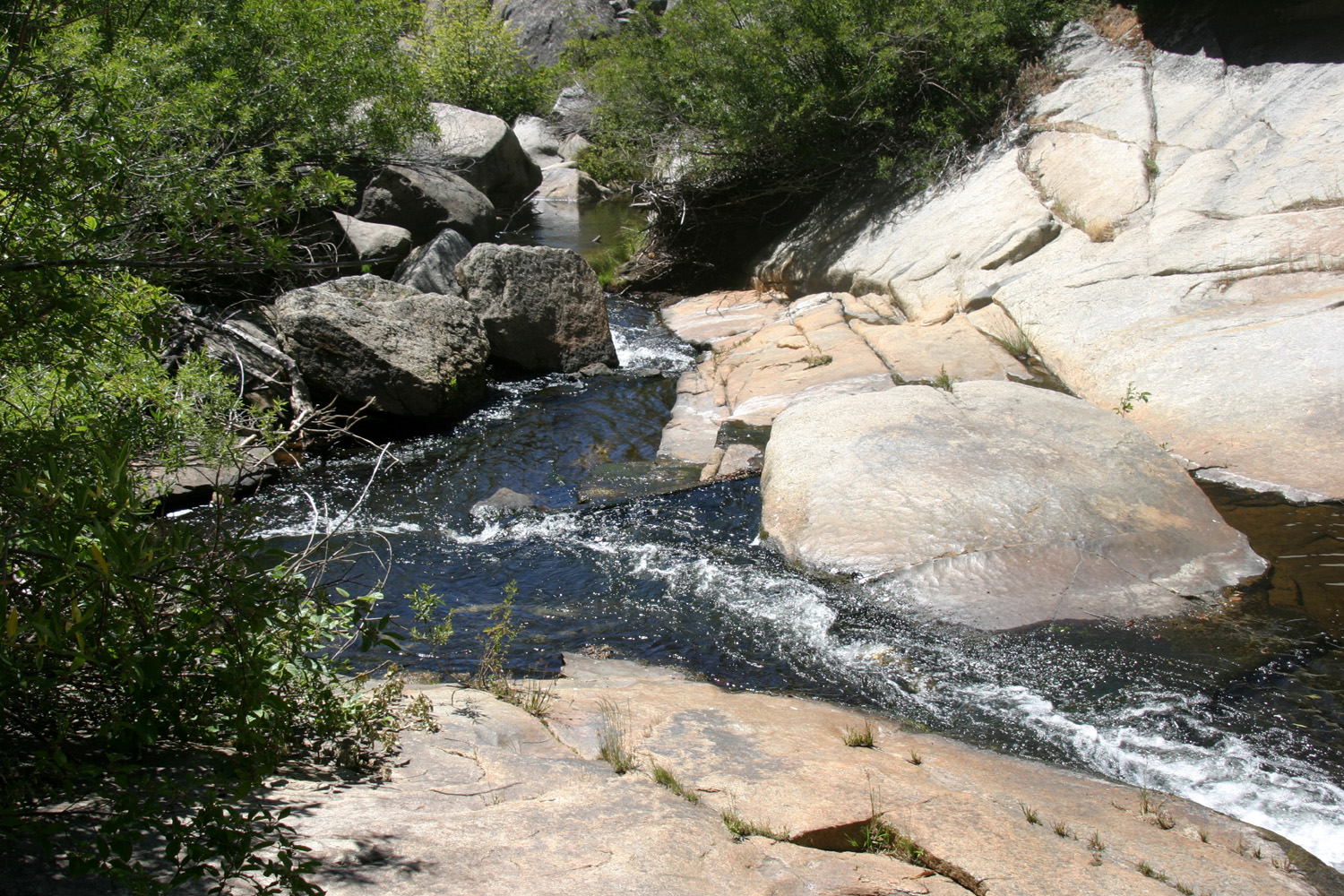
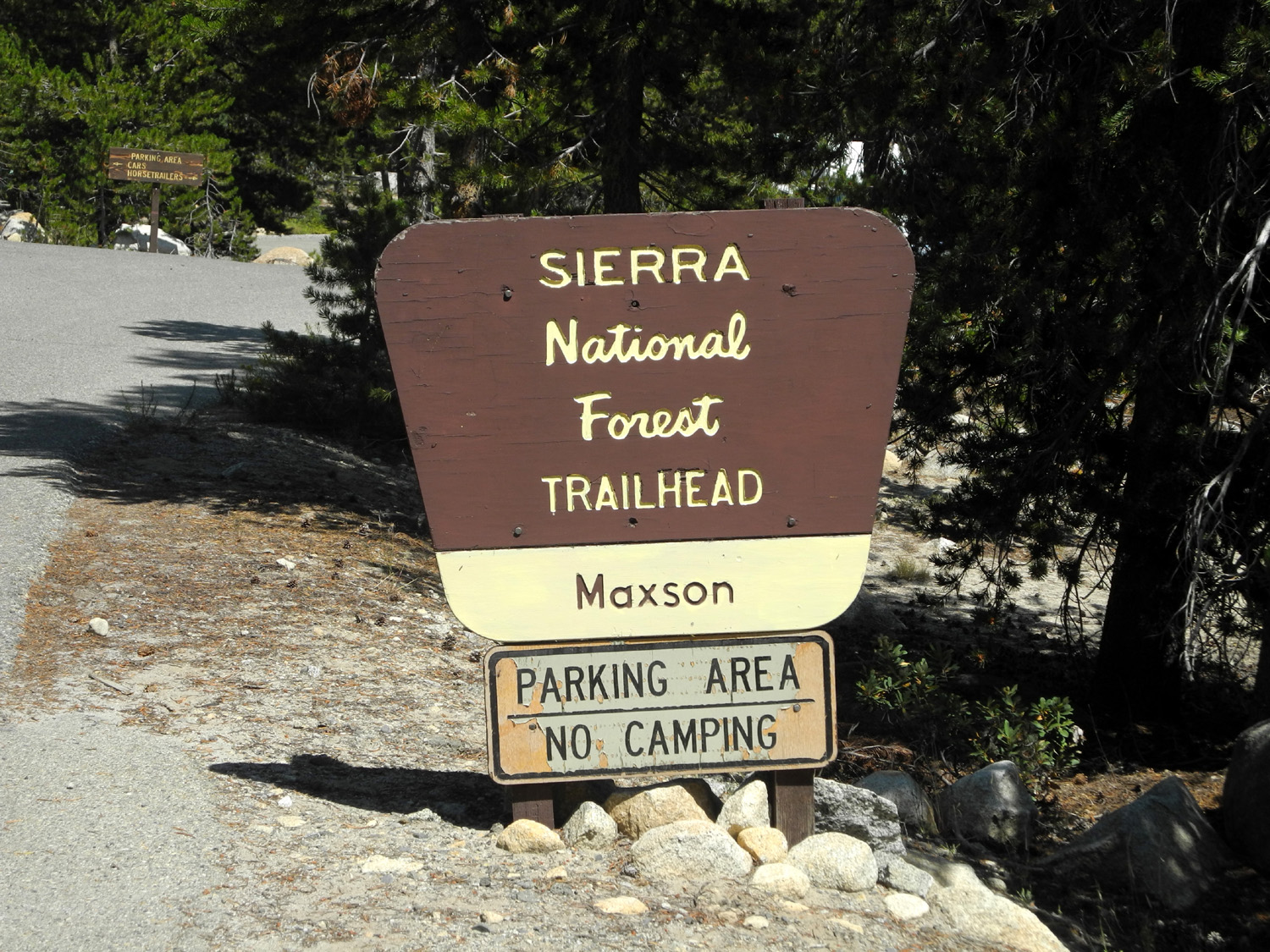
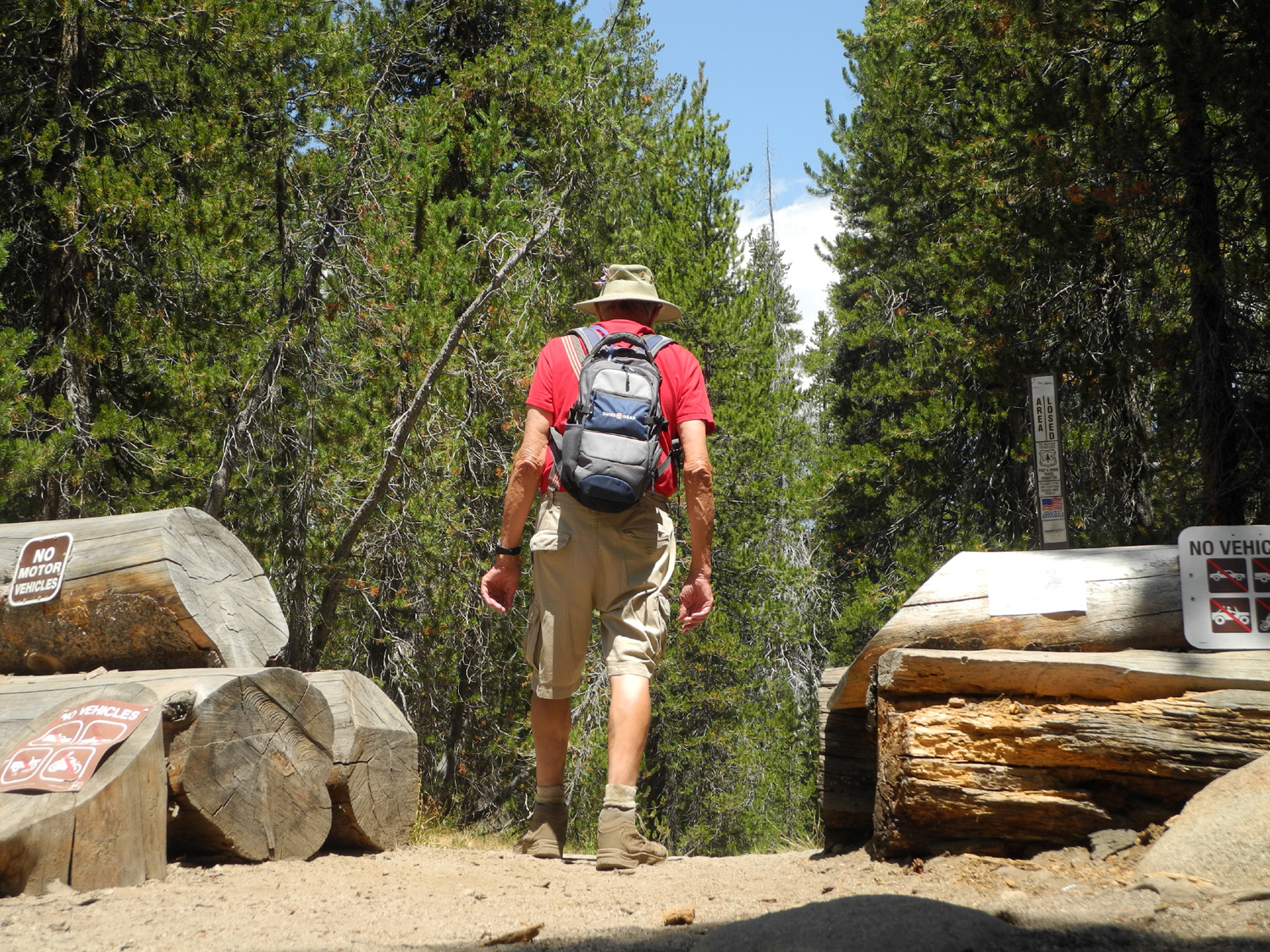
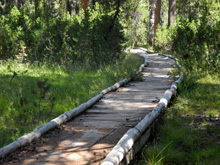
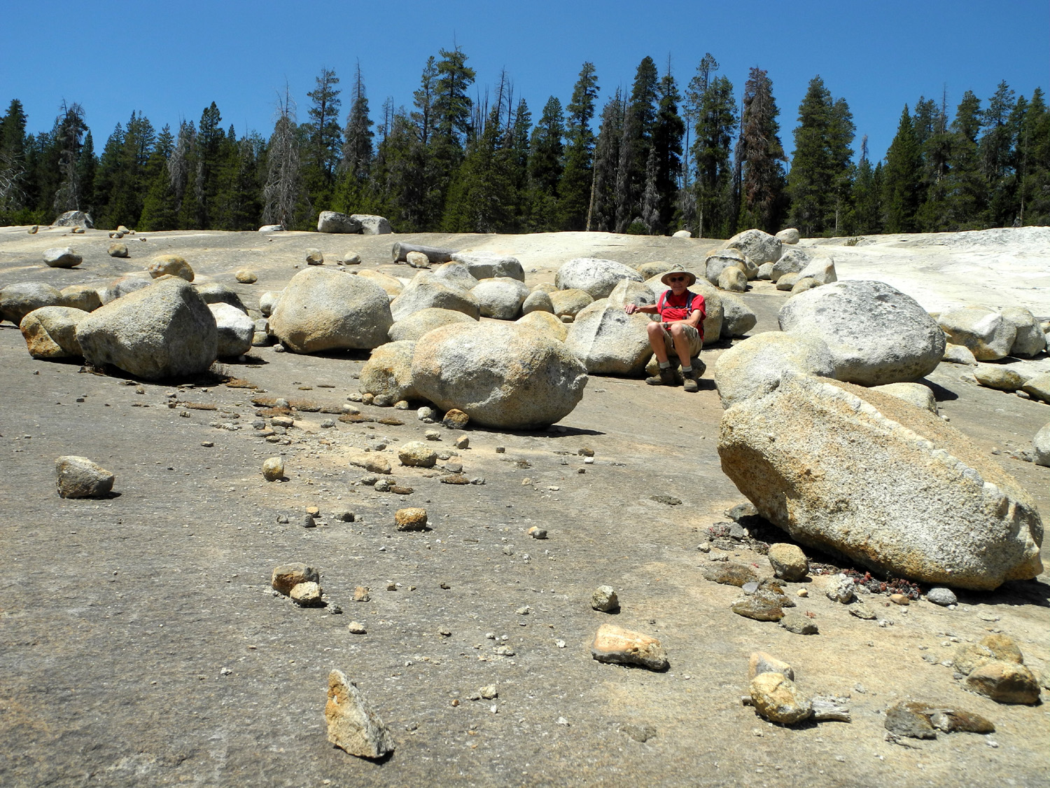
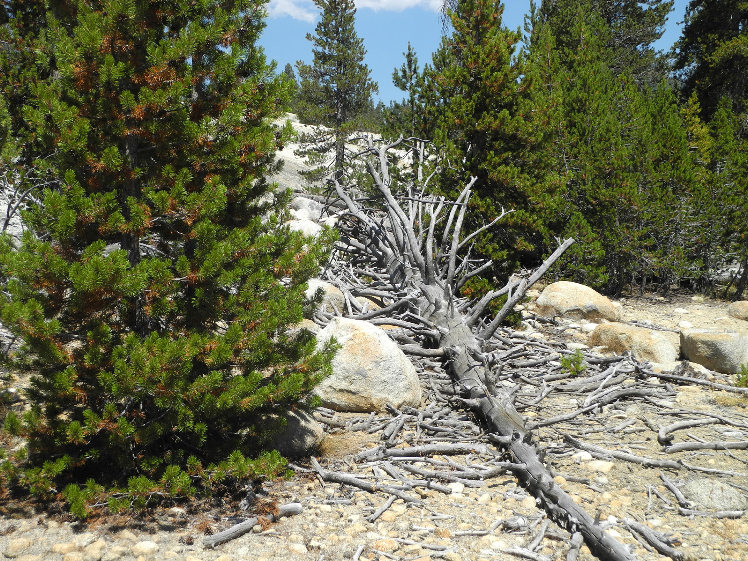
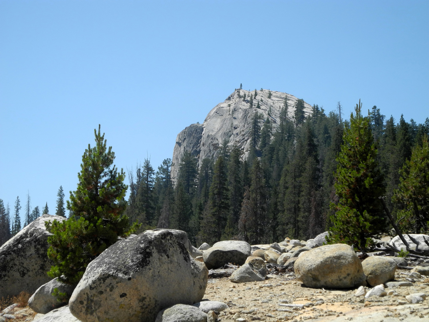
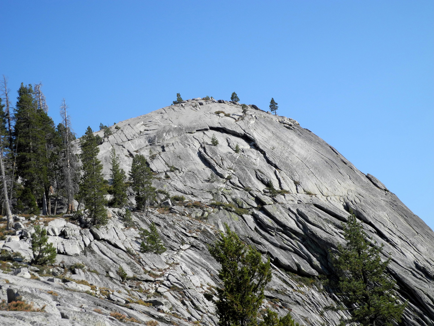
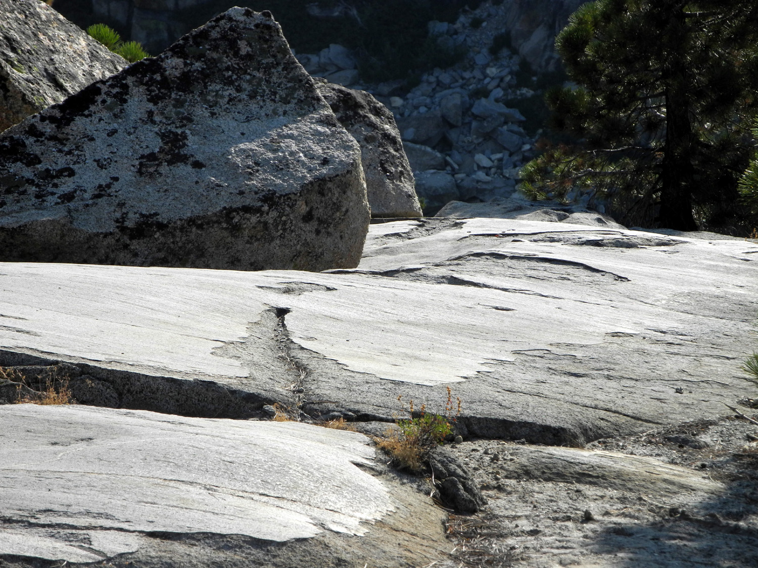
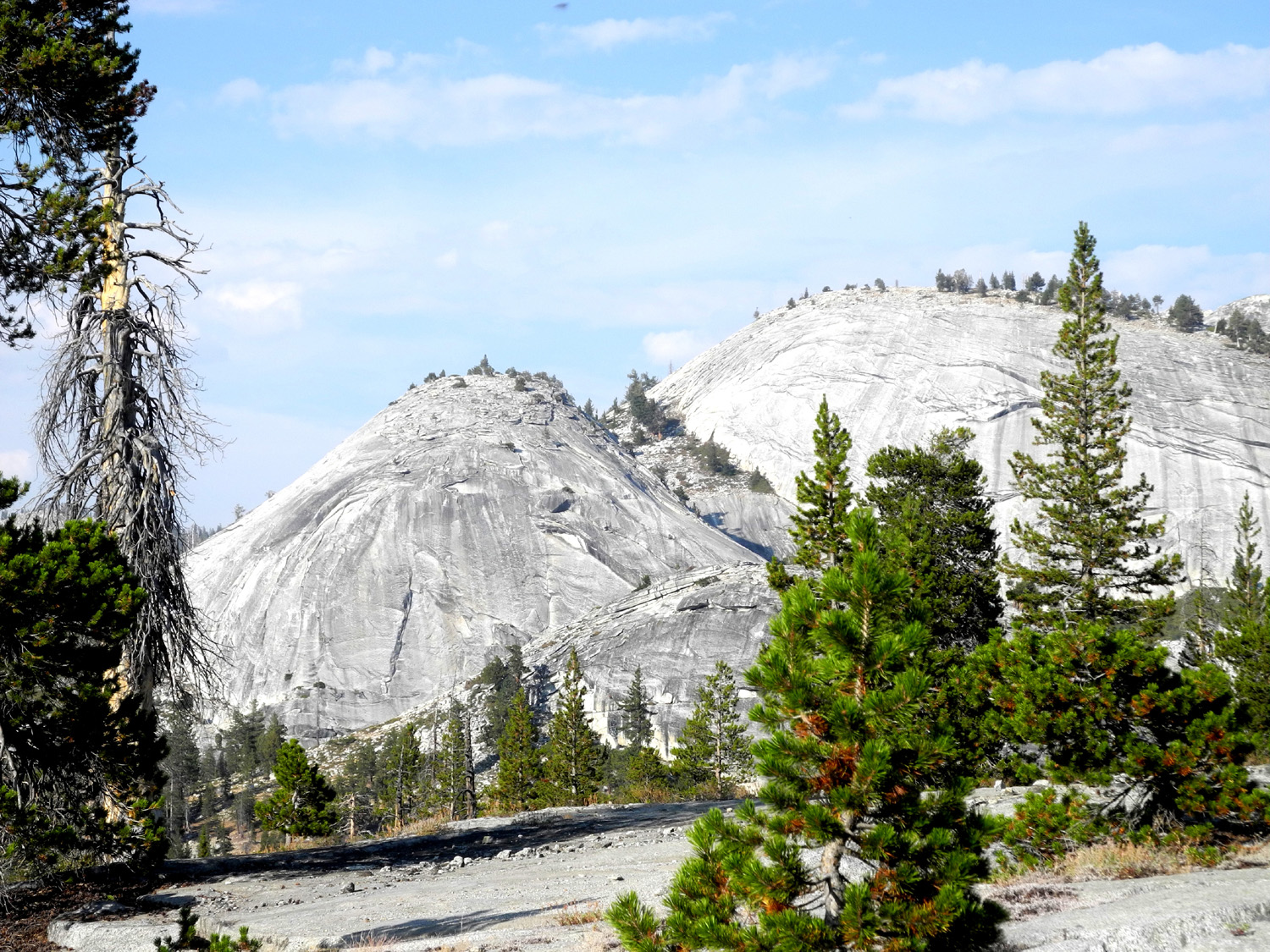
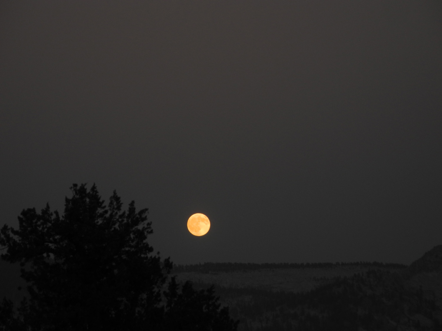
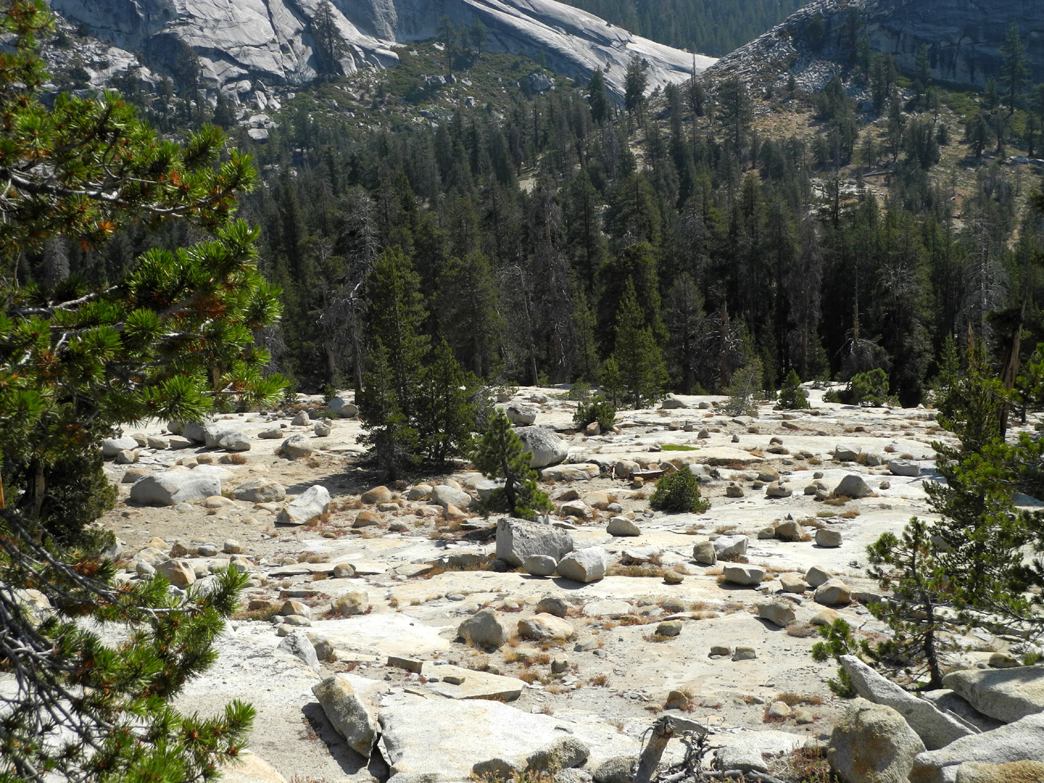
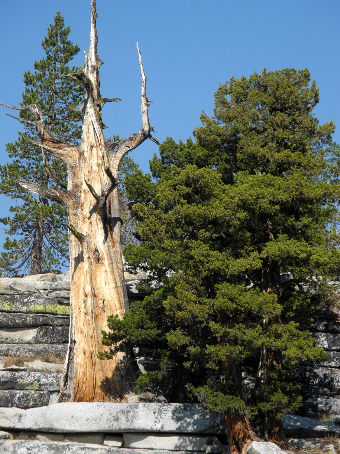
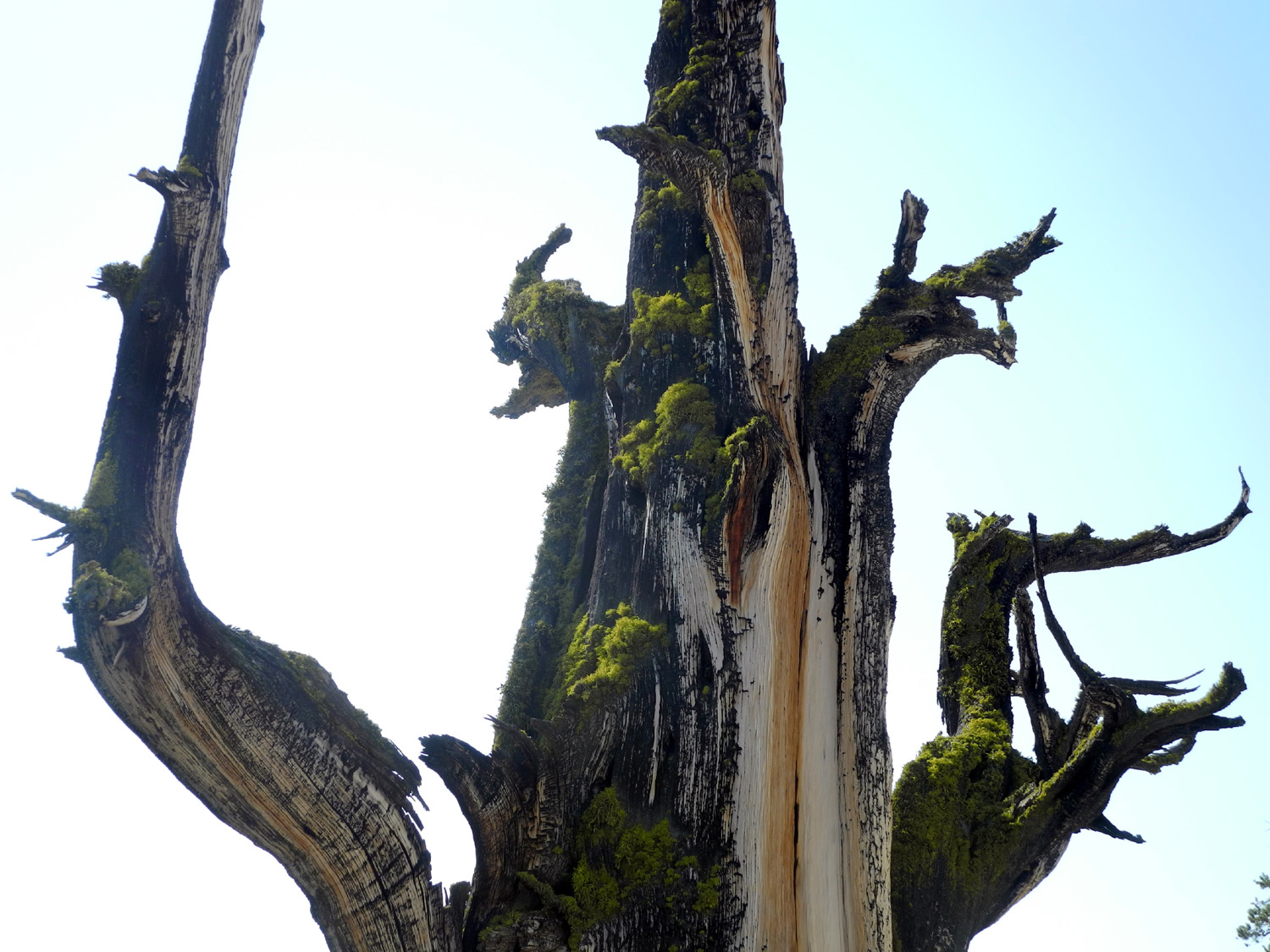
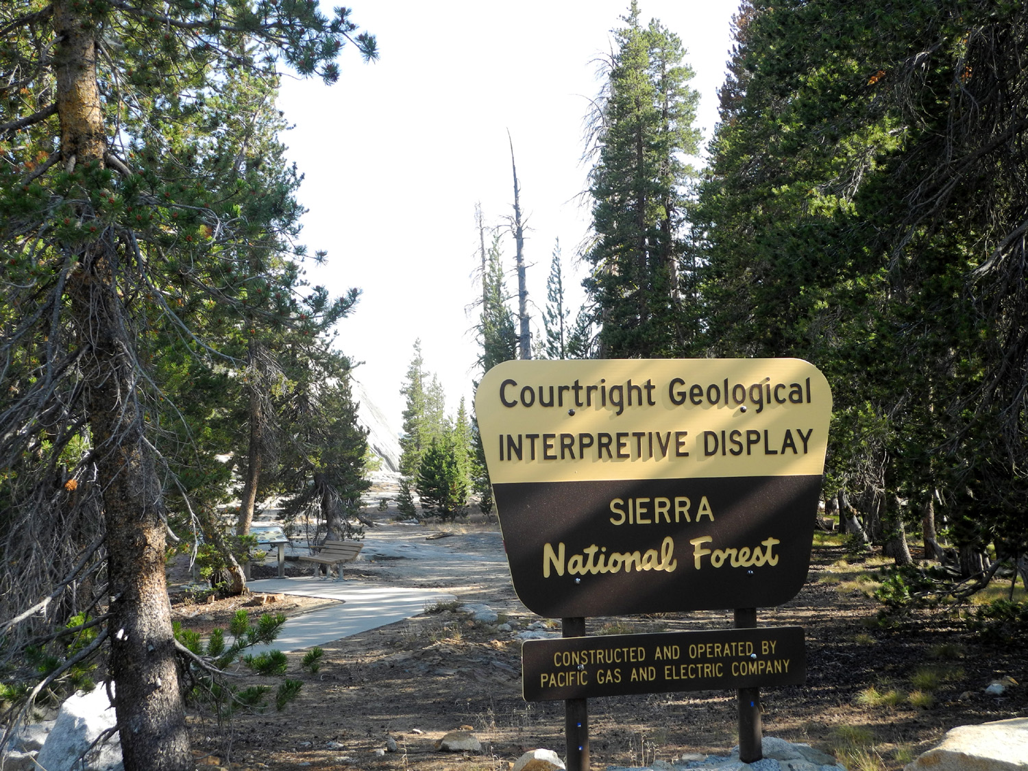
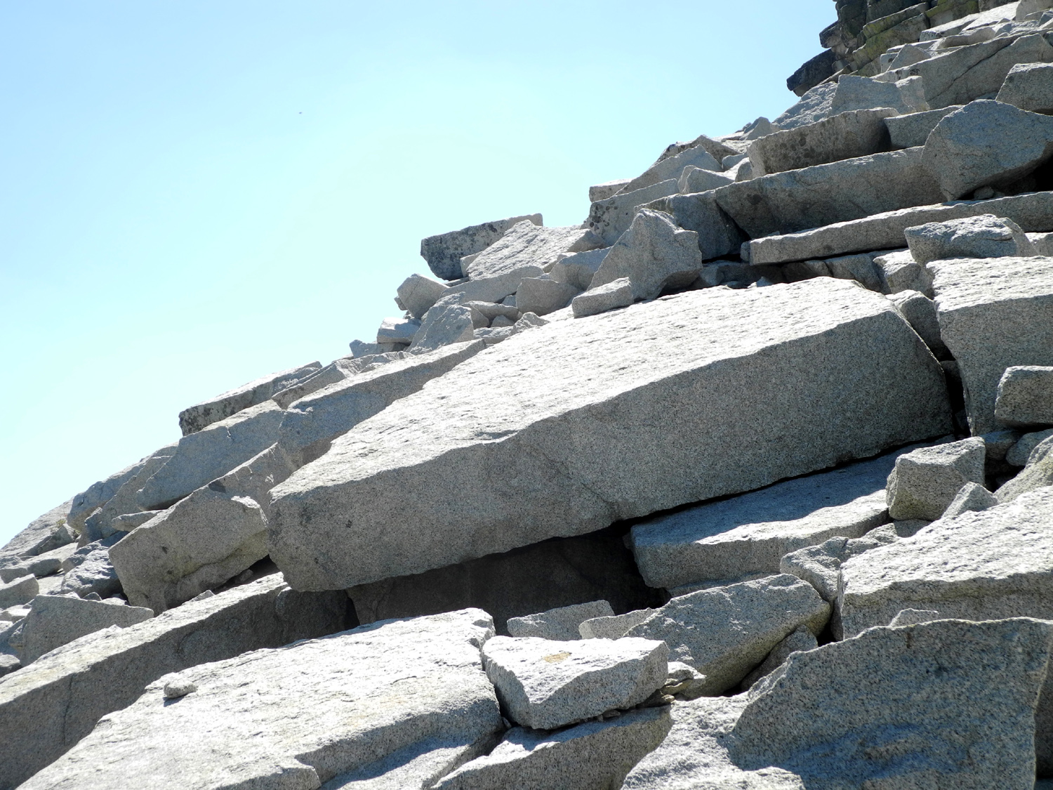
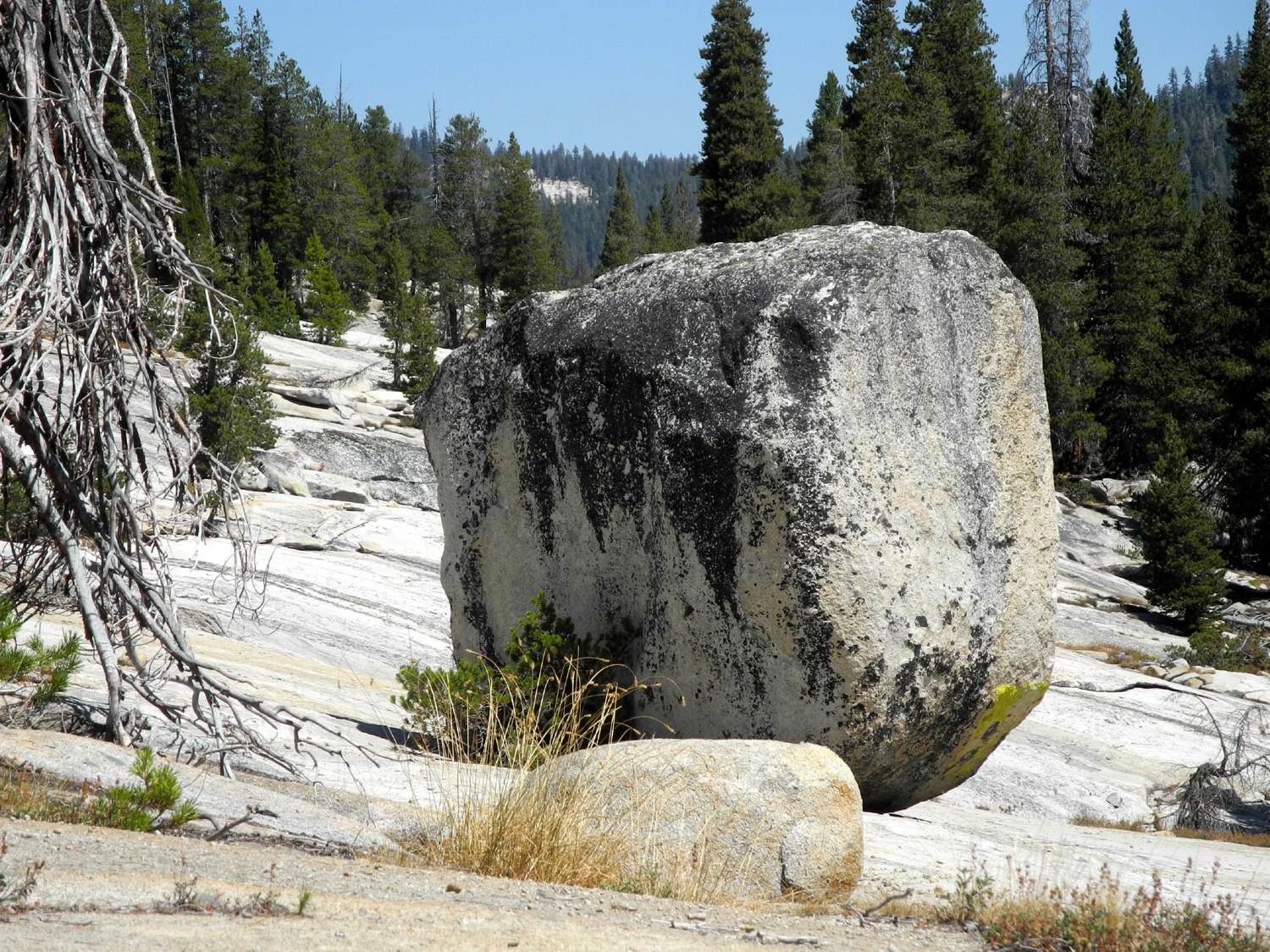
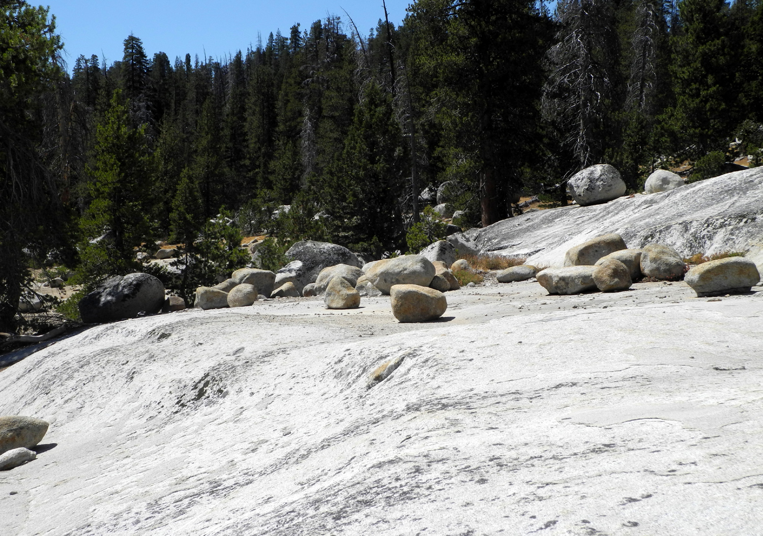
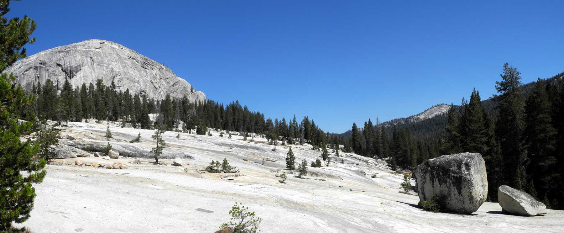
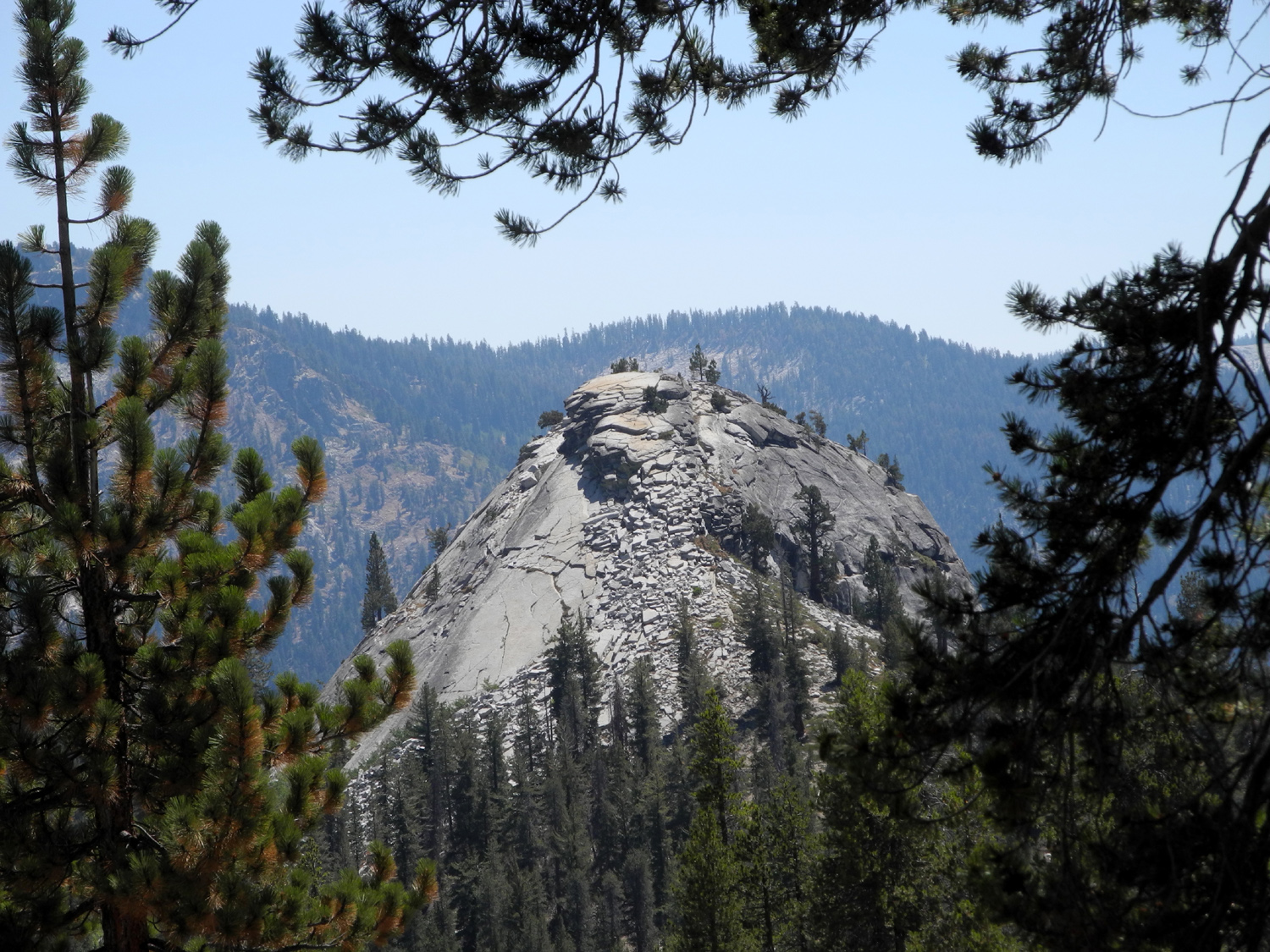
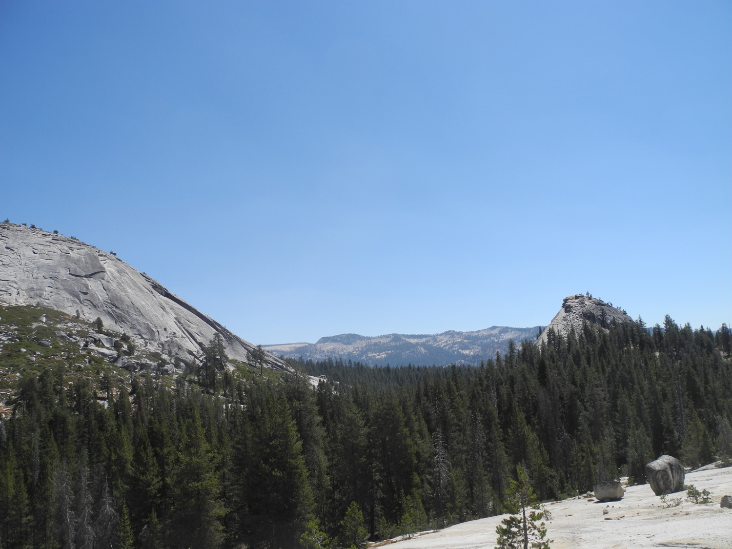
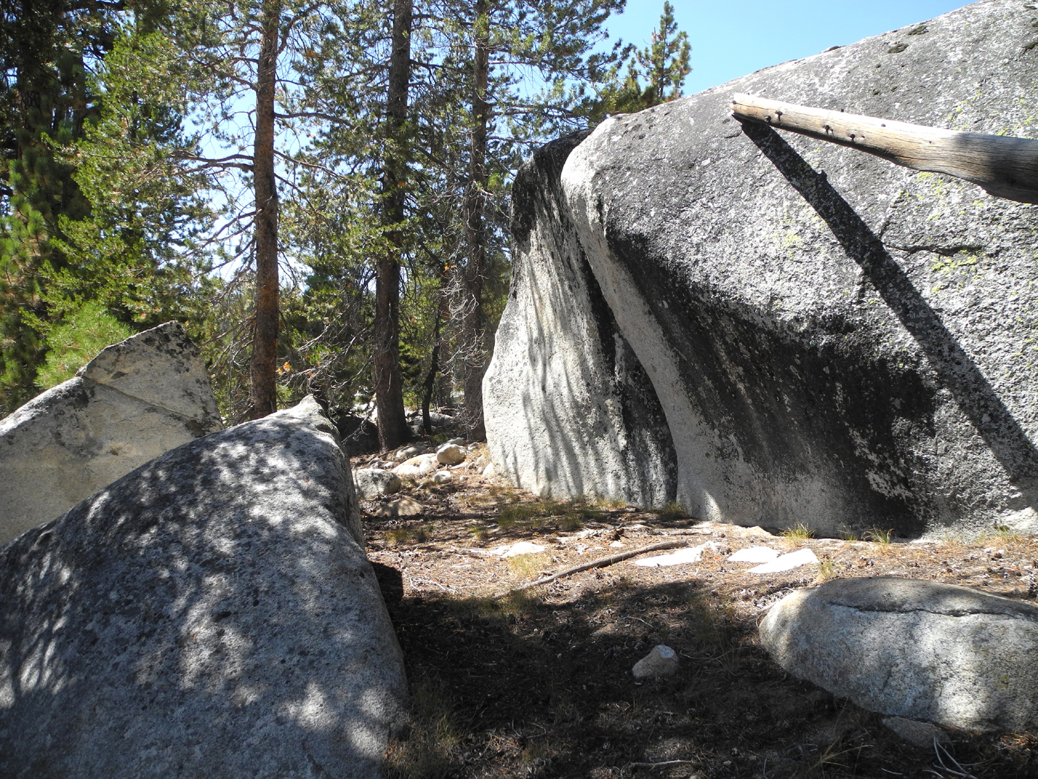
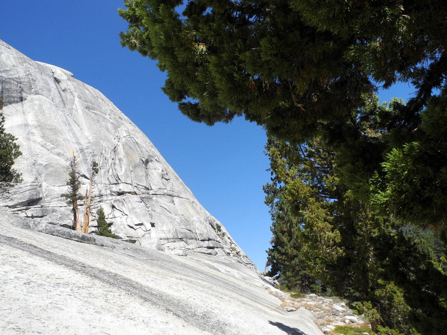
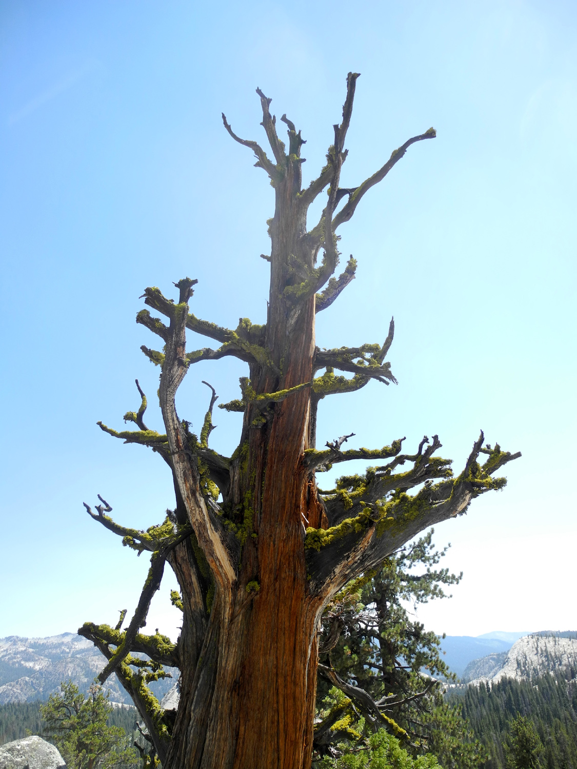
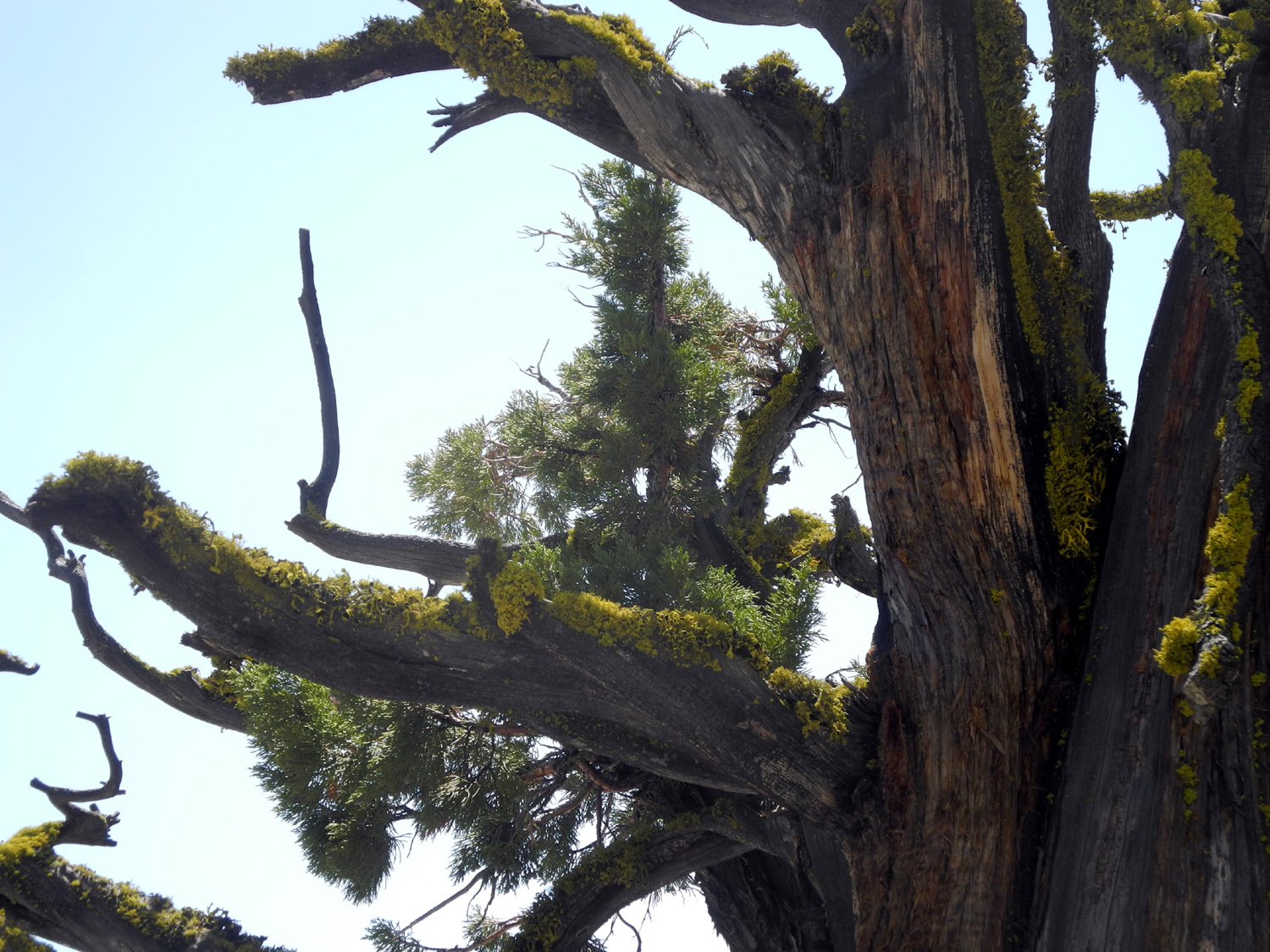
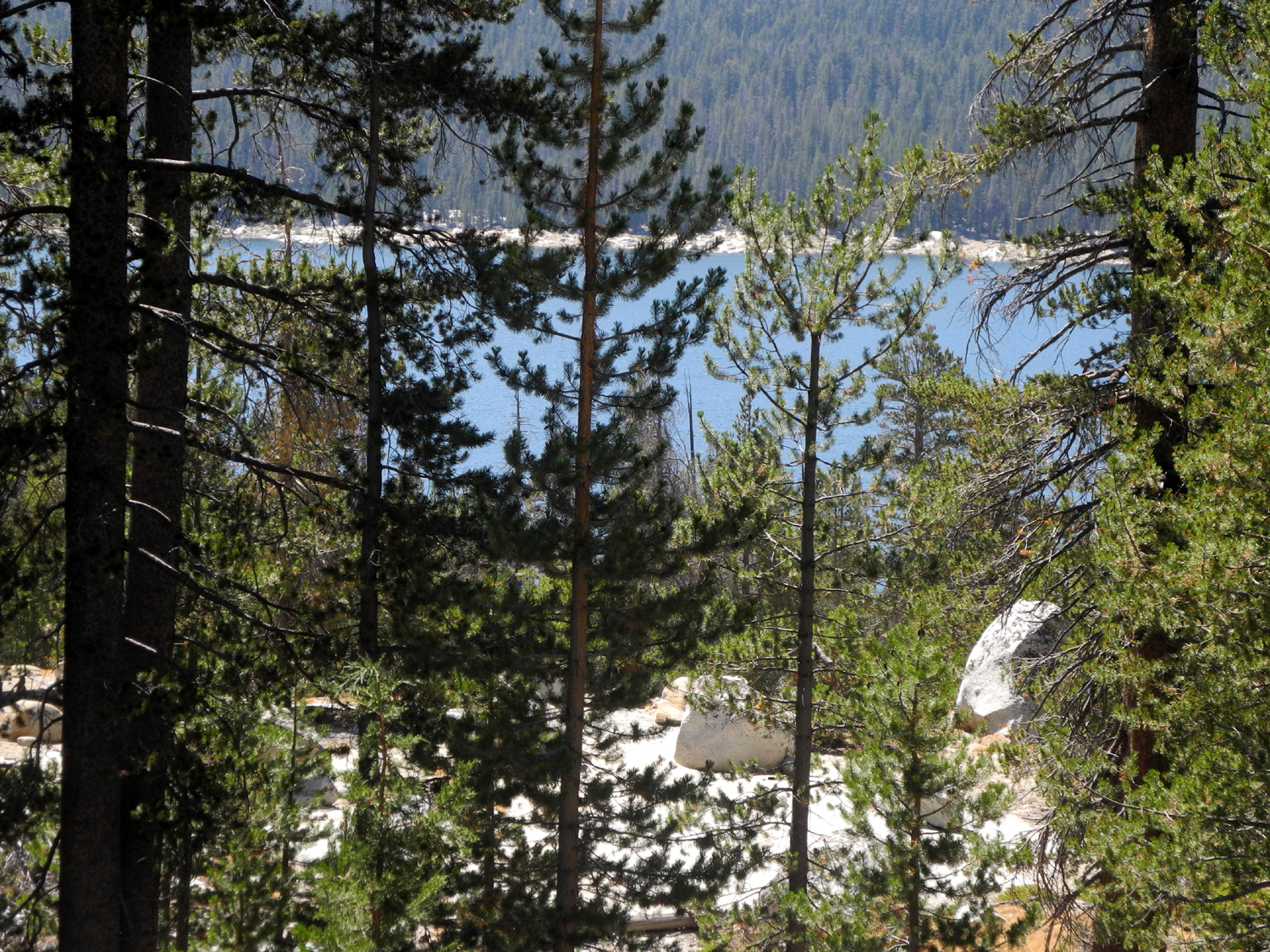
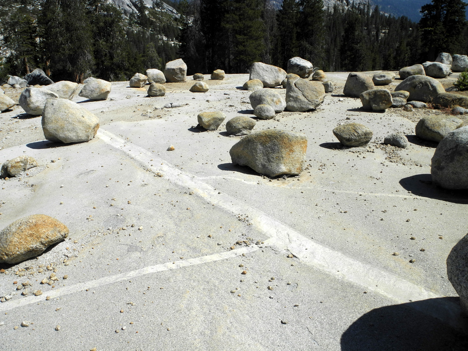
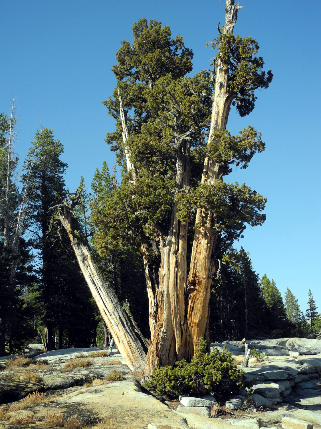
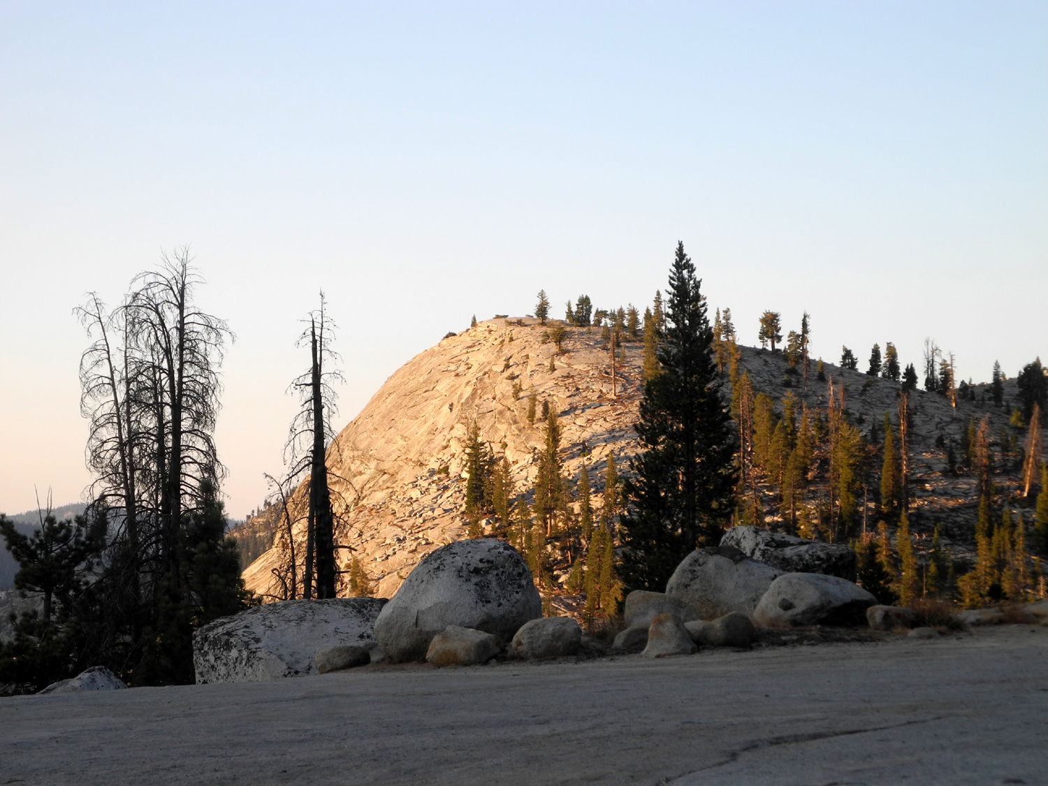
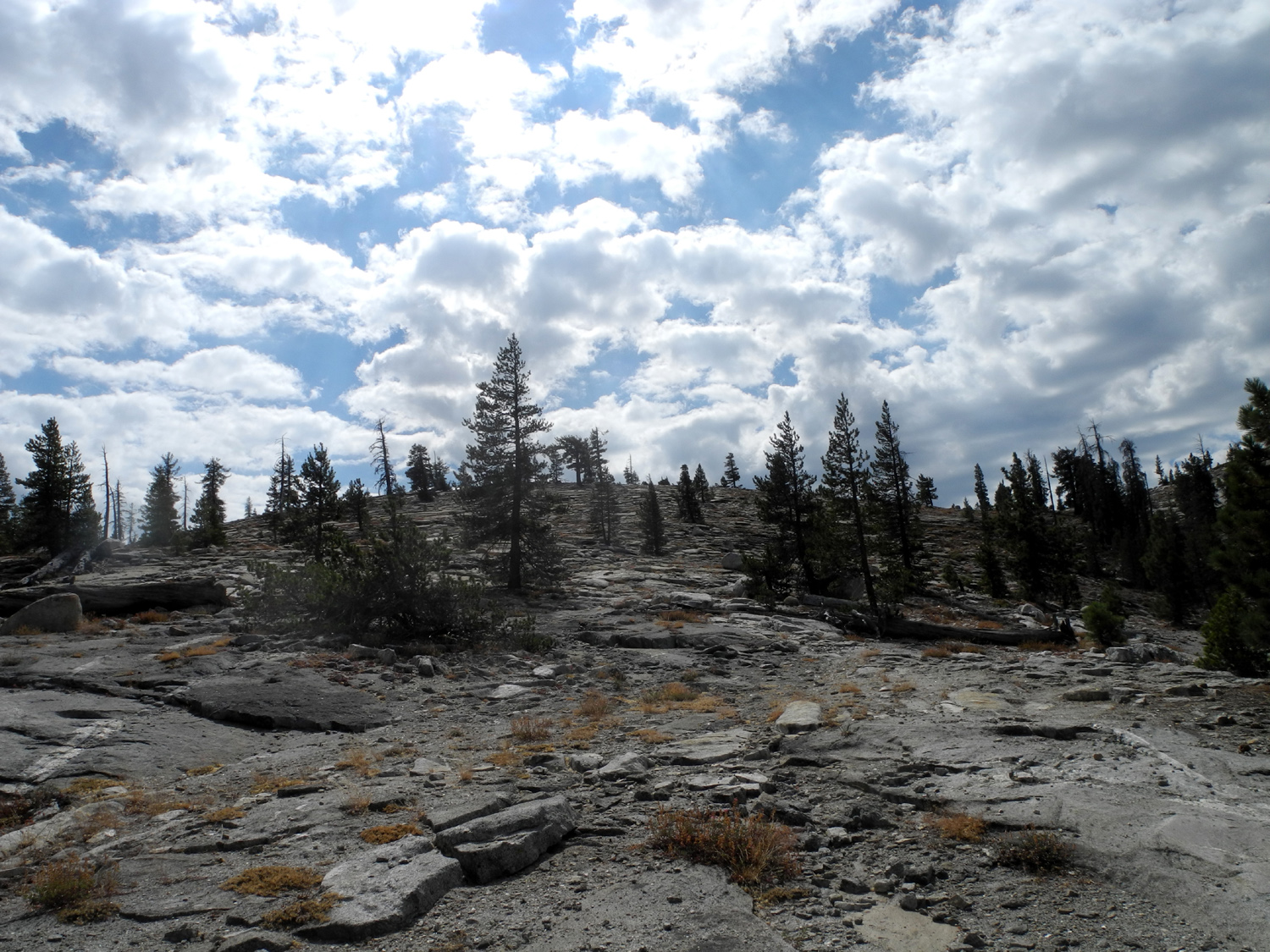
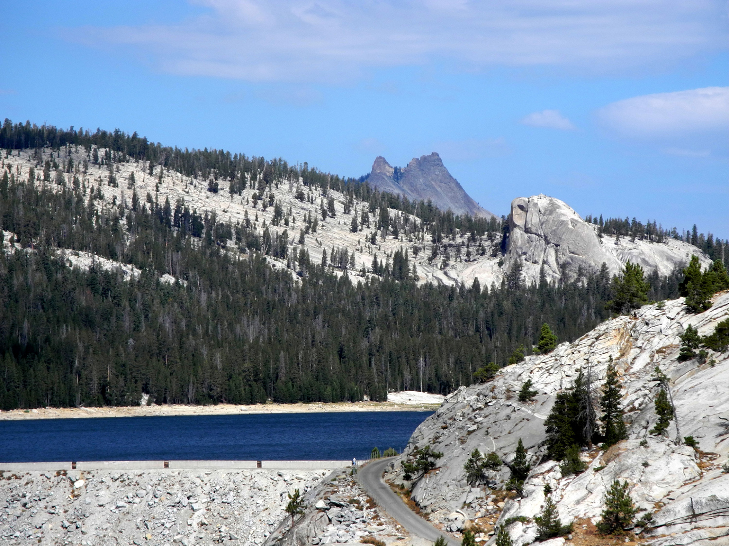
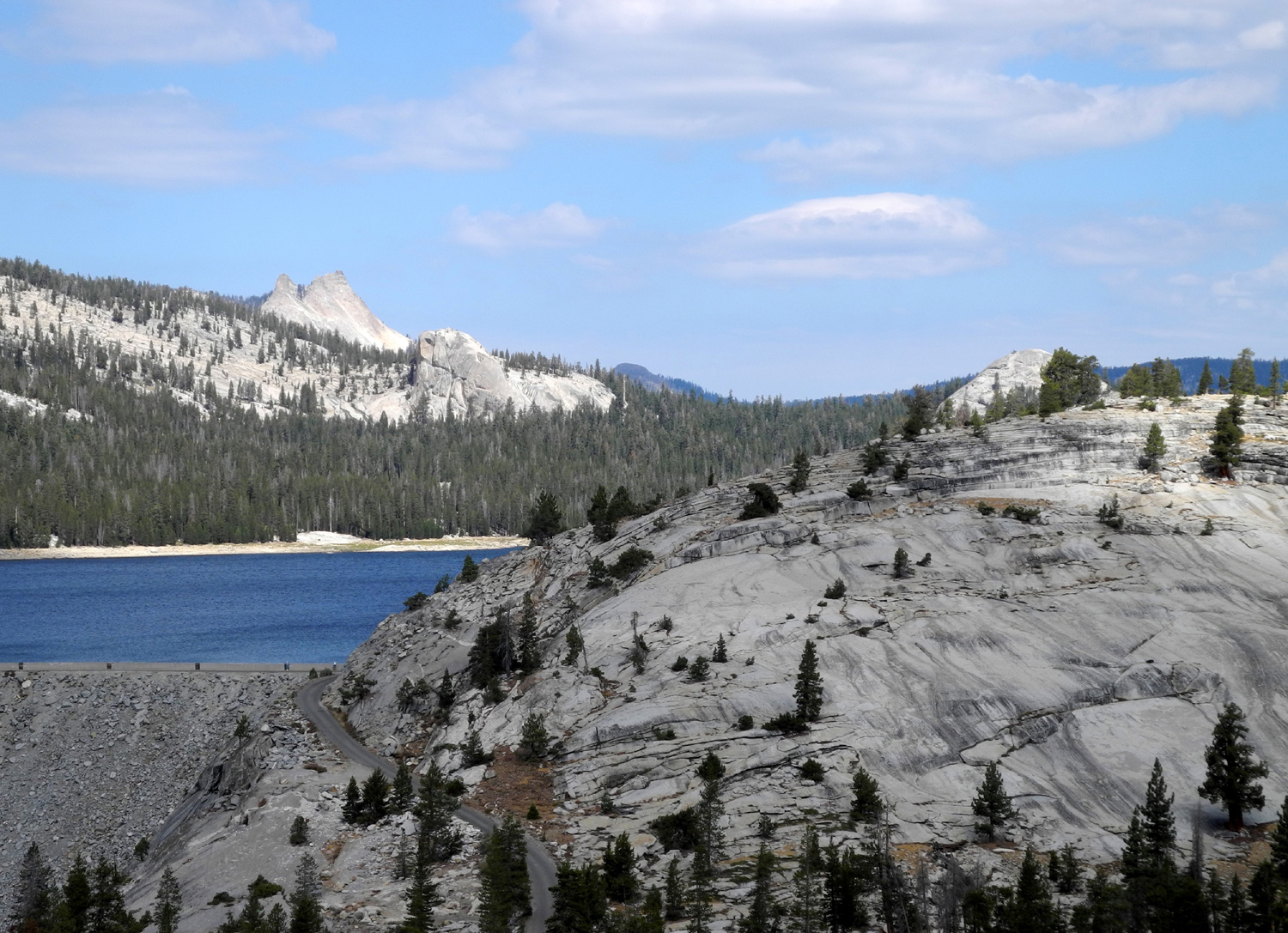
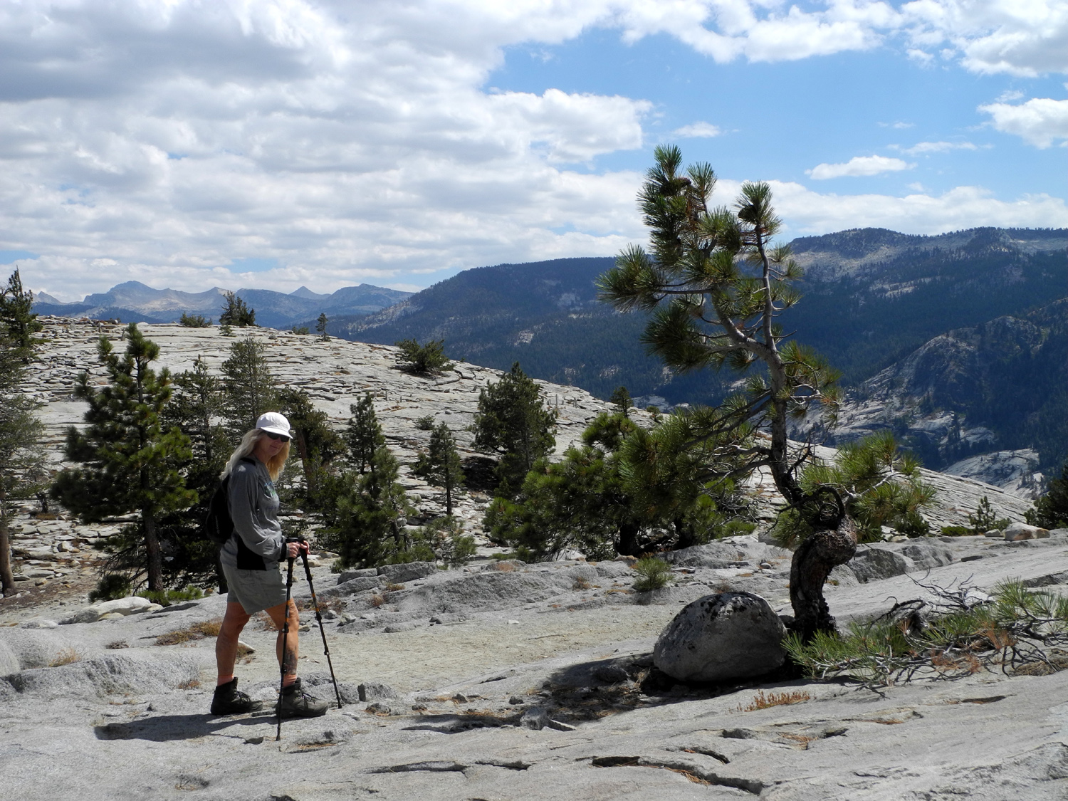
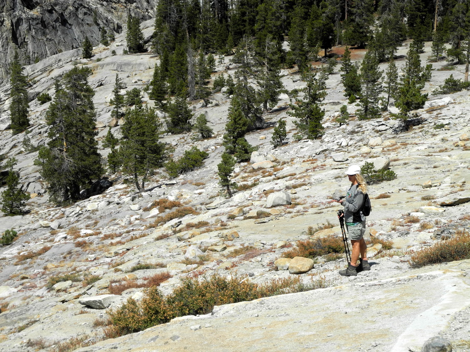
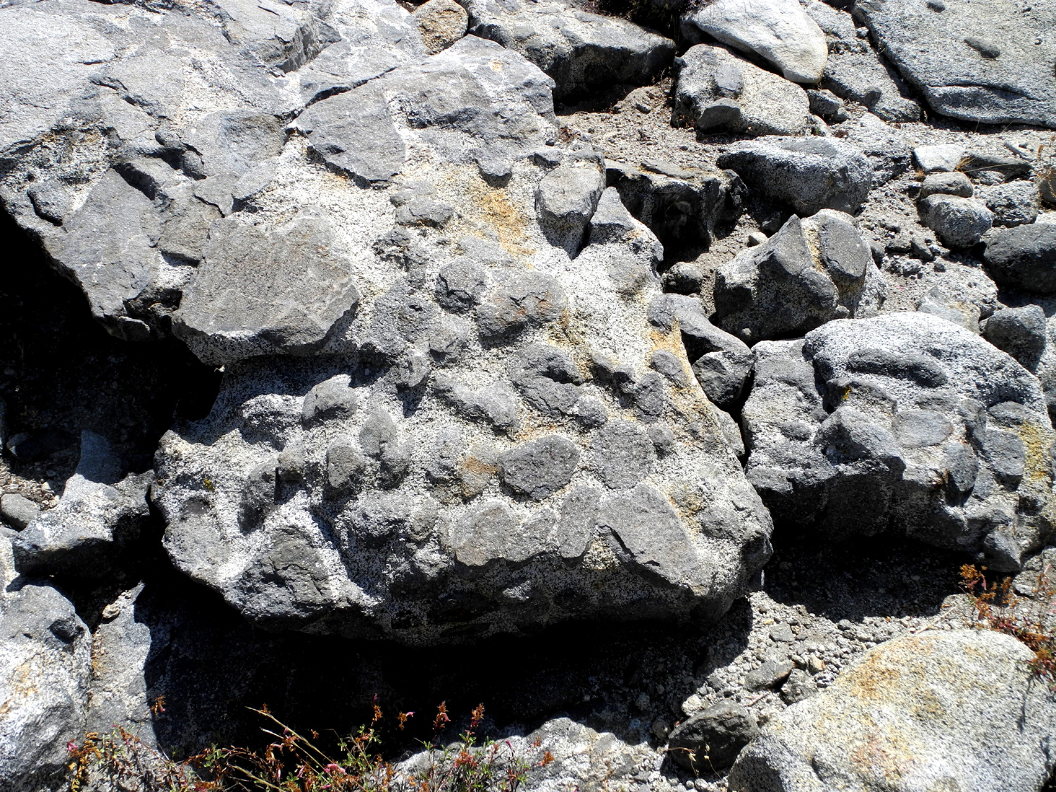
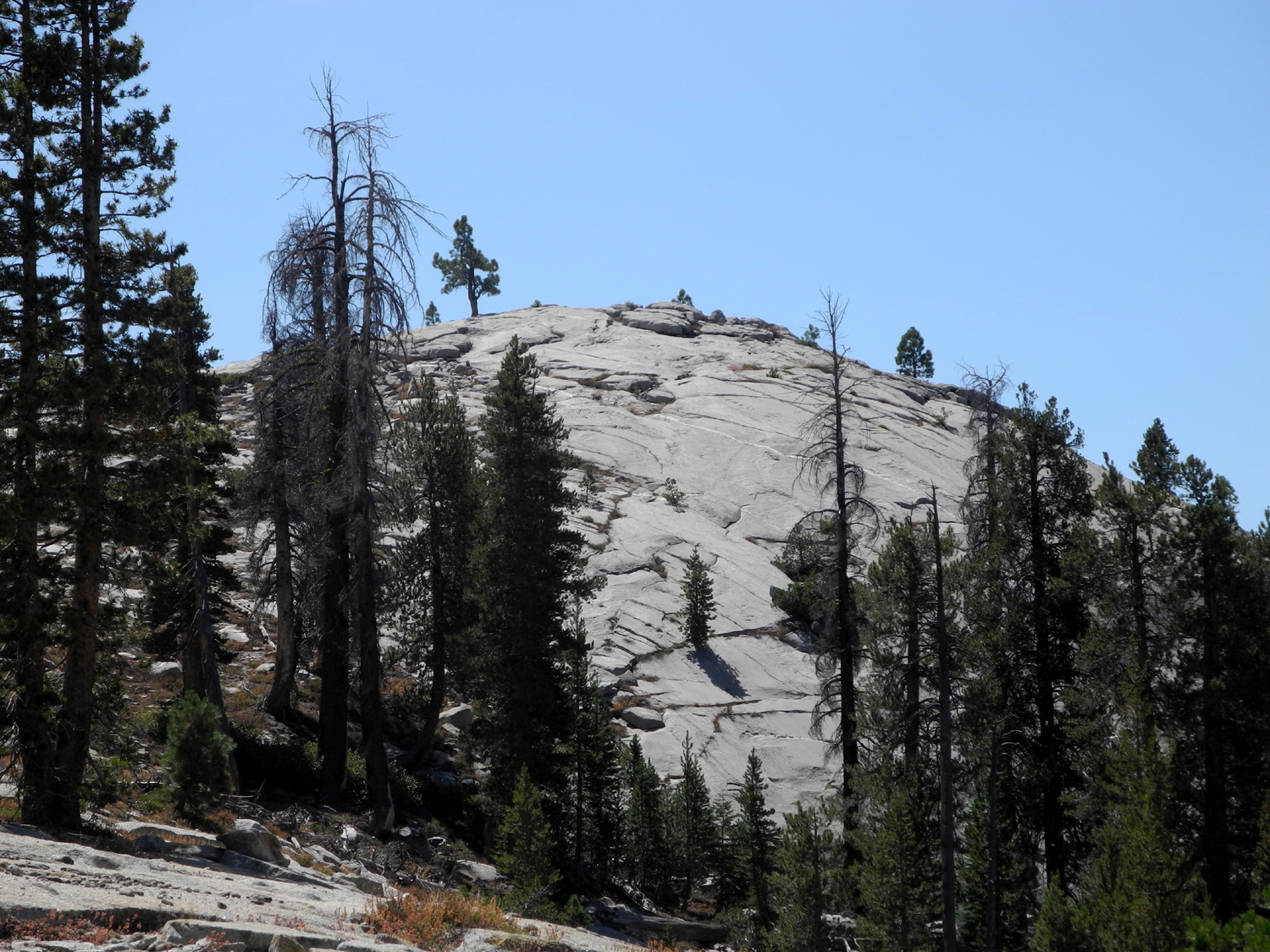
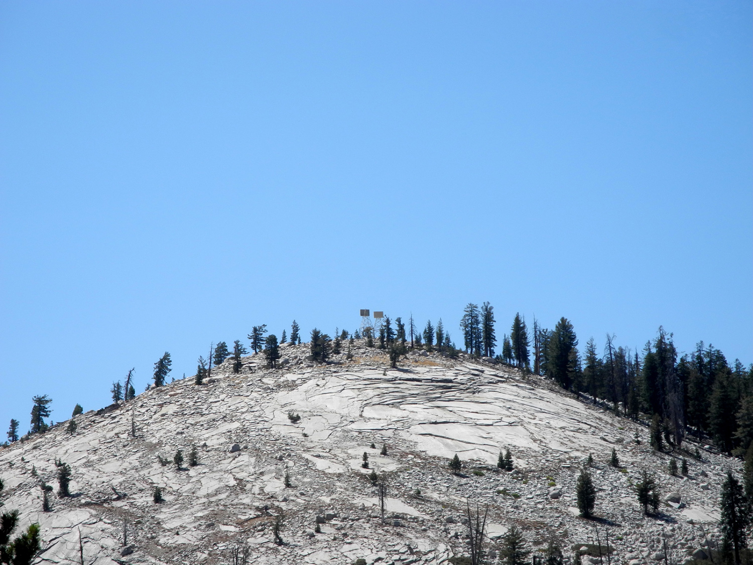
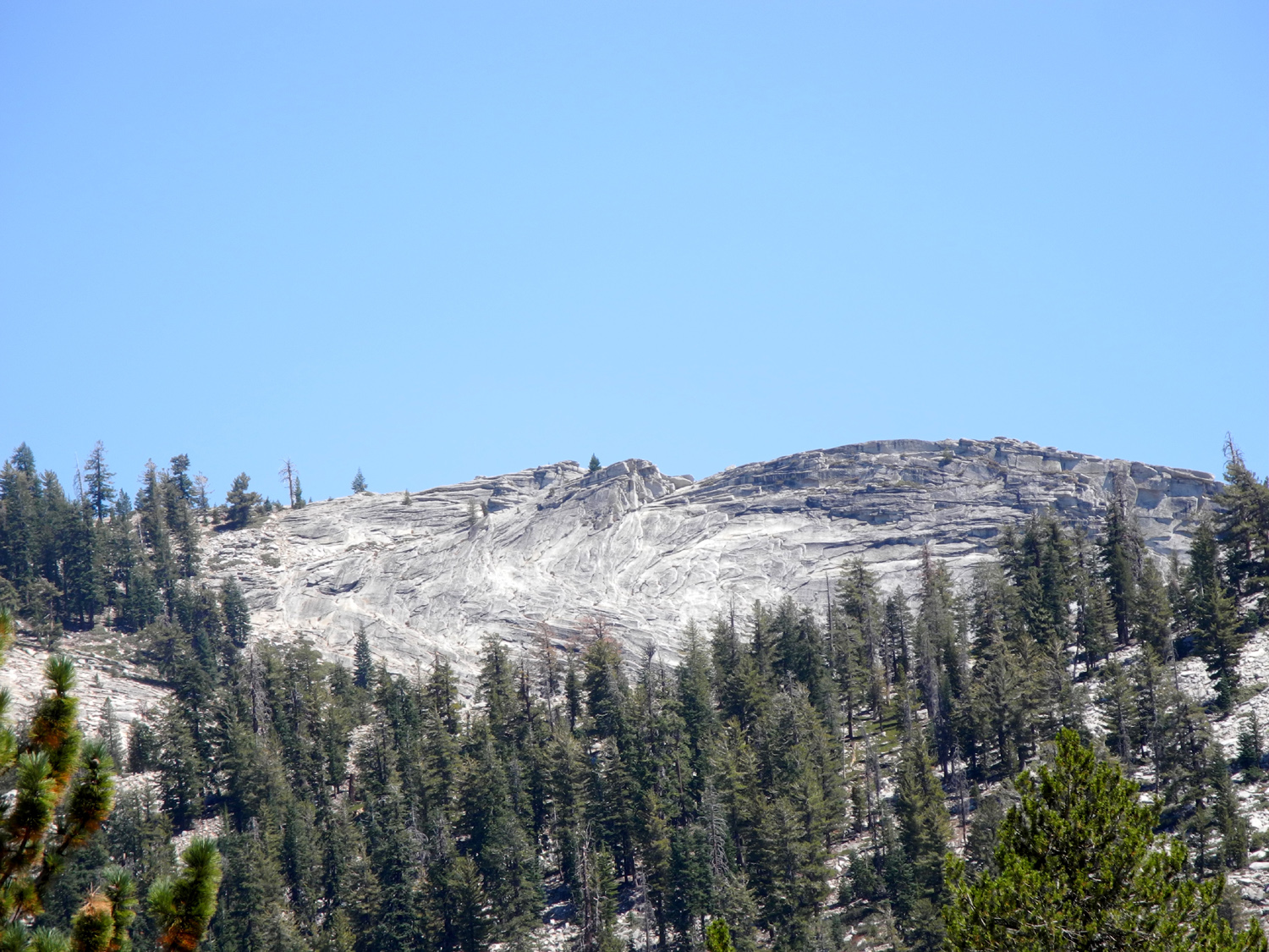
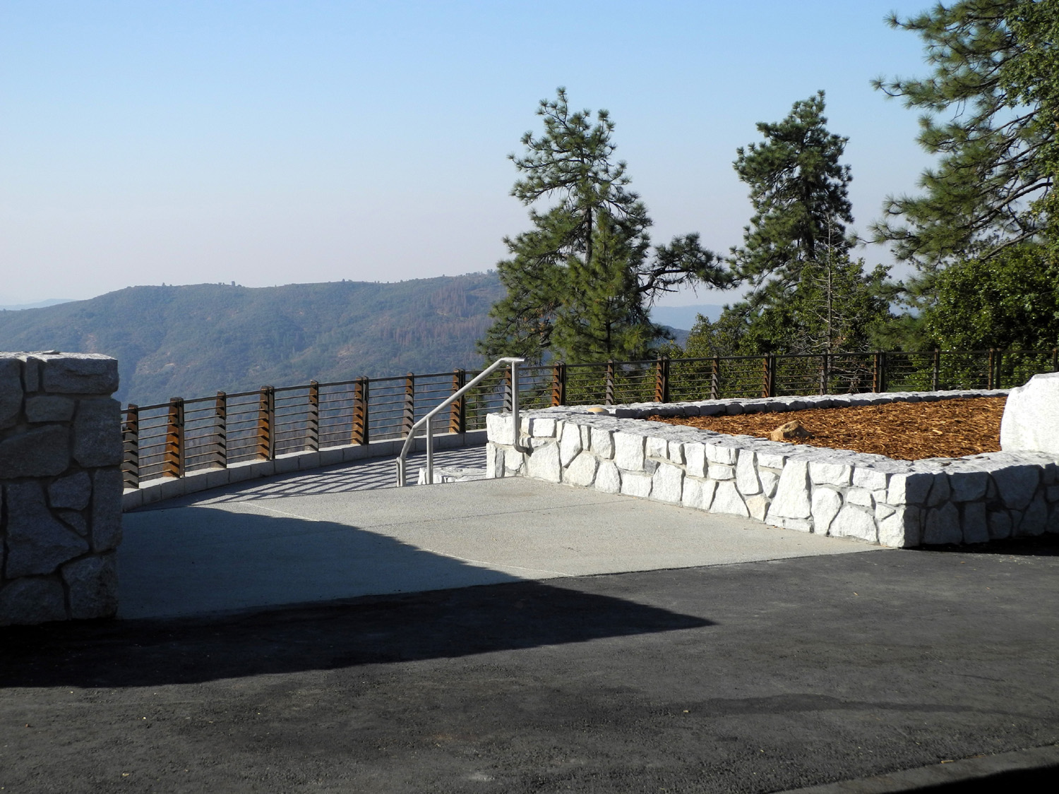
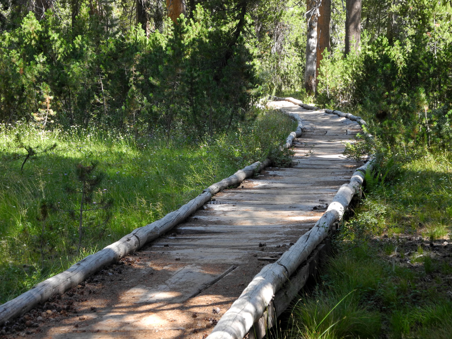
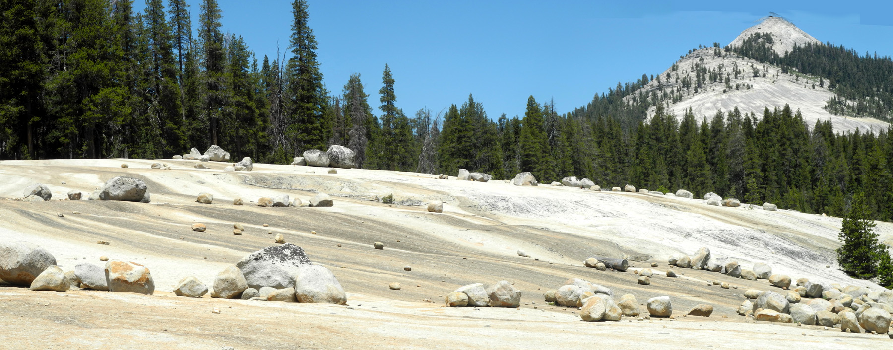
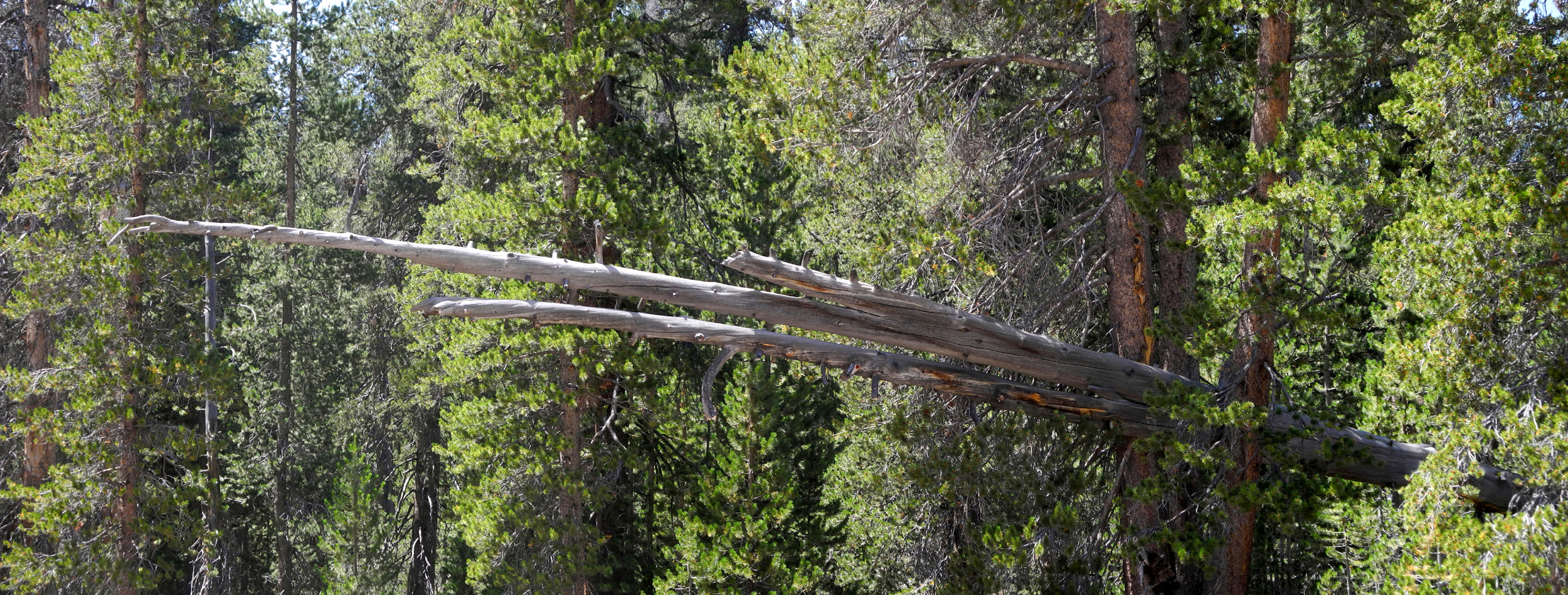
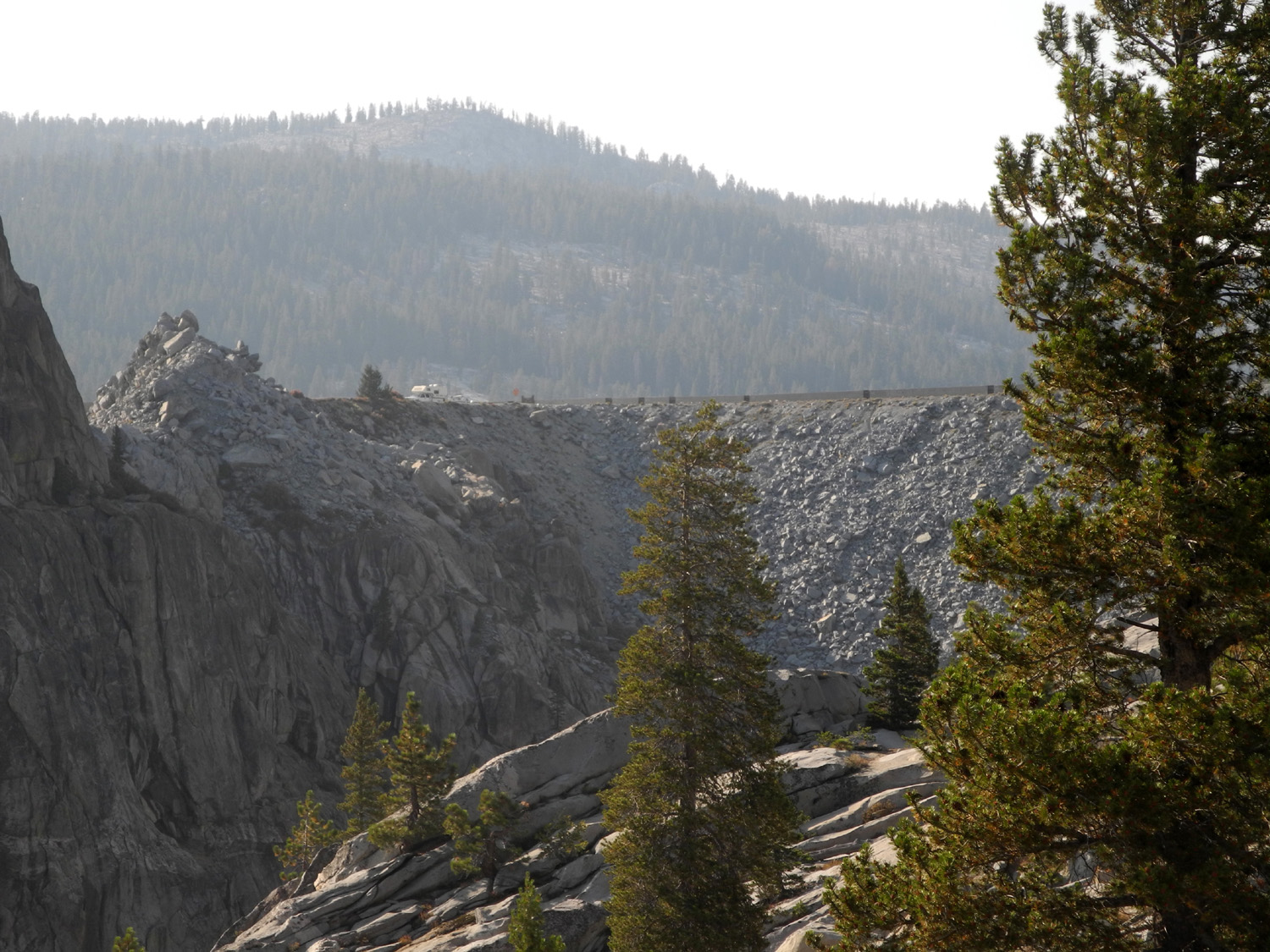
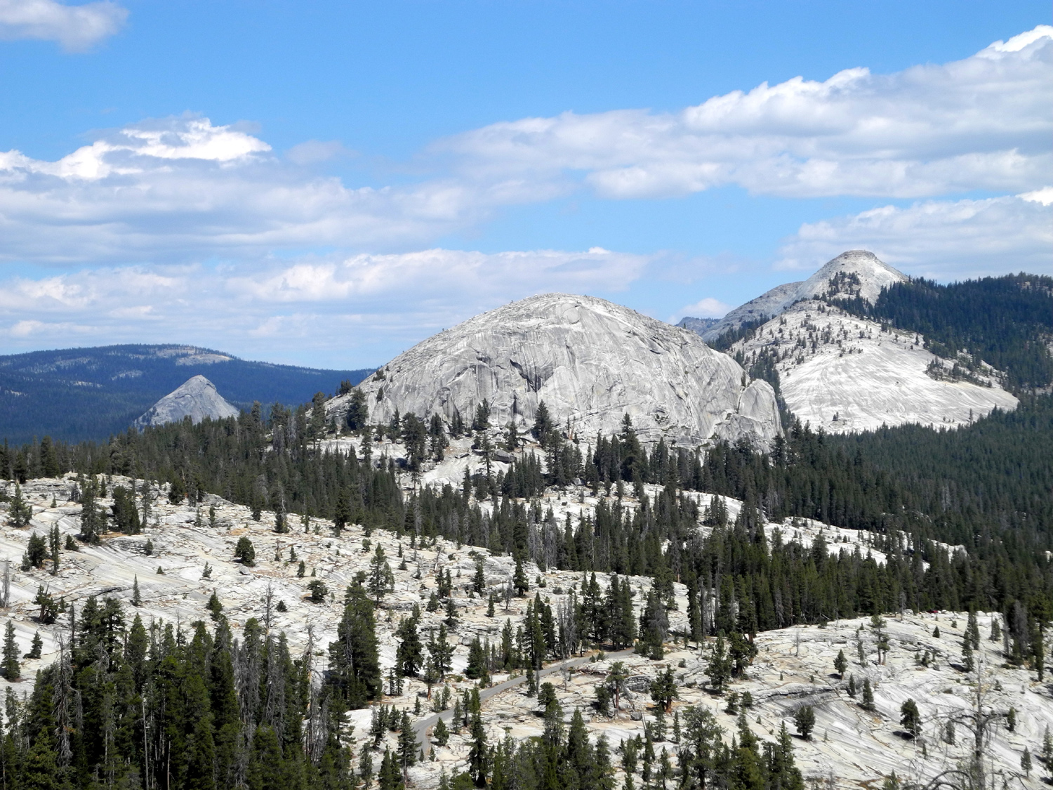
Courtright Car Camp There are a few places I'd like to visit that are not suitable for motor home camping, either because the road or campground does not allow vehicles the size of mine, or because the location requires the ability to move about in a vehicle less cumbersome than an RV. I have slept in the back of my truck, which has a bed cover that rises about a foot above the top of the bed, and getting in and out to go to the bathroom was a challenge. The back seats of my Honda CR-V fold down, creating a fairly long luggage area, and a few months ago I climbed in and lay down to test it. It's about a foot shorter than I am, but I sleep on my side with my knees folded up, so I thought it might work. I have been wanting to camp at Courtright Reservoir, and decided to put my theory to a practical test with a one-night trip. If it didn't work out, I would have only one bad night. So on August 17 I loaded up sleeping bag, air mattress, ice chest, food and other travel necessities, and got started at 7:30 a.m. for the 75 mile drive into the mountains. Courtright is located at 8,000 feet on Helms Creek in the Kings River's north fork drainage. The route is up Auberry Road or Highway 168 to just past Prather, then up the 10 mile long 4-lane section of the highway, which takes you from about 2,000 feet to 4,000 feet elevation. The next six miles are on a winding two-lane road from Cressman's, a gas and grocery stop, to Shaver Lake, then east 15 miles to Dinkey Creek, and another 24 miles to Courtright. My first stop was at the top of the 4-lane, where there is a vista point that has been re-built over the last year or so. It is now much more convenient to use, with a large viewing platform below the parking area, but sadly the view is almost always very hazy. If you are lucky enough to arrive on a clear day, you can see the peaks of the Kings Canyon National Park back country, but I have not been lucky for several years. At the bottom of the 4-lane, I noticed the unmistakable late summer aroma of tarweed, a plant ubiquitous in the Sierra foothills, and soundly hated by landowners. As I approached Cressman's, I noticed a cloud of dust rising beyond the store, and entering the heavily forested section between there and Shaver Lake, I recognized the smell of sawdust. Dust and smell were clear evidence of tree cutting, probably to remove trees killed by drought and beetles. There are piles of cut logs at several locations along the road, and some visible in the forest above the route. Along the last stretch of the trip, a few miles before the lake, there is another vista point, offering a much closer view of some of the Sierra's highest peaks - the LeConte Divide, in the John Muir Wilderness. The massive and magnificent Mt. Goddard is visible at the south end of the divide, but apparently not considered part of it; it's described as being on the Goddard Divide. Due to the early hour, with the sun above the divide, the view was very hazy. I actually hiked to the top of the LeConte Divide, through Hell for Sure Pass, in 1981, but that's the type of hike I can no longer accomplish. I arrived at the lake a little before 10:30, after a slow journey of 75 miles. I stopped beside the lake for a few minutes to take some photos of what I believe is the most scenic man-made lake in the Sierra. The road crosses the dam and goes about a mile beyond to the Maxson Trailhead. The first quarter mile of this section is a one-lane road. At the dam you can clearly see if anyone is coming, but beyond this spot there are a couple of blind curves. The only saving grace is that the condition of the road is such that all sensible people drive very slowly. My daughter Teri had camped in this area with her motor home earlier this summer, and described a large, flat granite area close to the trailhead that was perfect for RV parking. I reasoned that it would work equally well for car camping. There's always the danger that the place you want is already taken, so on the way in, I kept an eye out for possible alternate campsites, spotting quite a few that would have been acceptable. As I approached the trailhead, I was able to easily find the area where I thought she camped, but I later learned that this area was occupied when she was there, and she was actually across the road somewhere. I could have enjoyed my trip just sitting and reading and gazing in wonder at the scenery, but this is a trailhead after all, and I planned to hike more or less the same route we followed in June when I was there with my daughters, grandson Mikie, and Wes. I already had my water bladder filled and in my backpack, and I didn't need to do much more than put on my boots to be ready to hike. I didn't unload anything at this time except my lawn chair, and not long after arriving, I was on the trail. This trailhead is the starting point for an endless array of Sierra destinations. The 4-wheel drive road, known as the Dusy-Ershim Trail, goes 33 miles to the White Bark Vista Point above Kaiser Pass. Recommended driving time is two to three days. Hikers have a wide selection of trails to choose from. On my second-ever backpack trip, I hiked in on this trail, over the ridge to the northeast, then south to the river, an 11-mile trip one way. Later I hiked with Teri's future husband and a friend to several beautiful lakes, and up to the top of Hell for Sure Pass, which goes over the LeConte Divide. Trails branch off to other destinations all along these routes. You have two choices when starting a hike at the Maxson trailhead - you can go down the 4-wheel route, which is steep and rocky, or down a foot trail, slightly less steep and moderately less rocky. The foot trail joins the 4-wheel road after a hundred yards or so, at which point the road begins to level off. There is a fairly long section where you could drive a passenger car, although you could not get to that section without bottoming out and becoming stuck against rocks. This part is almost completely level, and is mostly through forested terrain, with some open granite slopes on the west side in a few places. Eventually there is another fork in the trail, with the jeep road going uphill to the west and north, while the foot trail stays in the bottom of the level valley and continues in a mostly northerly direction. For some distance there is a boardwalk across an area that can be quite swampy in the spring, but was dry during my hike. This walkway, which did not exist during my first hikes in the area, is made of logs and requires some careful walking, especially in places where the wood has started to rot away. Even in dry times, this area is lined with flowers, thanks to the moisture from earlier in the season. There is a dome west of the trail which I have named Constant Dome, because it is visible almost constantly from the trailhead to my final destination about a mile in. From the start it looks like a fairly typical rounded dome. As you hike, the angle changes, and when you get about a third of the way in, it can be seen that it's a very long granite ridge, still well-rounded, but longer than a typical dome. From the northern point of my hike, it looked like a rugged rock mountain top, and its dome characteristics are not readily apparent. I decided to take photos of it all along the way, so I could put together a sequence of photos that showed its different looks. There's another granite dome formation on the east side, above the parking area, that is visible from many places on the trail. Where I camped, there was a small but steep, narrow canyon between my position and the domes. I have pondered whether to call this Double Dome or Triple Dome, but have settled on the latter. From some views, two domes appear to be close together, with the other one separated some distance. From the opposite view, they appear more like one three-part formation. (Two weeks later, after viewing the formation from new angles, I decided the smaller dome was separate. The two upper domes then became Double Dome, and the lower one Hopeless Dome. Read more about this below.) I took quite a few photos of these domes, some of which show only the upper two domes. From my camp the highest dome was almost hidden behind the middle one which was directly in front of it, while the third and smaller dome was off to the right (south). As you come off the boardwalk, the trail jogs to the northeast across a meadow. It was green and had a flowing stream when we were here in June, but is now very dry and golden brown. I followed the trail into the meadow as far as a little bridge over the creek. It was the perfect height from the ground to sit on with my feet where the water would be, so I took off my pack, had a snack, and rested for ten minutes or so. To the west of the trail along this stretch is a huge section of granite bedrock, probably 200 yards wide and close to a quarter mile long. It rises in a moderate slope from just above the trail, then almost levels off to a slight incline. It's covered with large and small boulders, carried along by glaciers, and left where they were when the last of the ice melted. The bedrock is scoured with lines showing the direction the ice traveled, and mostly covered with glacial polish. I've considered several names for the place, including the Giant Marble Game, but I think I'm going to settle on the Big Granite Slope. When I hadn't been here for a number of years, I pictured it as being flat, but it's never actually horizontal, and begins to level off only at the very top. This area fascinated me when I first came to Courtright around 1969, and it still does. On any hike in this area, I always plan to spend some time there, taking photos and just enjoying the wonders of what rock and ice and time can do. This time I decided I would go to the northern edge of the rock, something I had not done in the past. The meadow is not far from that end, so I made the short walk from the dry grass through the trees to the base of the rock, and started up. It's not a difficult climb, but there is enough uphill that I needed to walk slowly and rest frequently. This worked out well, since there was something that required closer examination and/or a photo every few feet. With the passing of 10,000 years since the last ice age, large sections of glacial polish have been worn away, exposing a slightly rougher surface with a lighter color. As I made my way up, I noticed that there was much more "wear and tear" on the steeper lower section than near the top, no doubt due to rock being washed down the slope at greater speed in the steep sections. It also seemed that there were many more smaller rocks on the upper section, whereas these tend to be washed down or otherwise roll down the steeper part of the slope. The four wheel drive road runs across the upper part of the rock, with blue reflective dots marking the way. At the very top of the rock the terrain becomes mostly level forest, and at the northwest corner (upper right as I faced the slope from the bottom) the road leaves the rock and becomes a tree-lined, smooth dirt road that looks like you could drive your Honda on it. Of course, there are many places between there and the trailhead where your Honda would be in serous trouble, and the smooth dirt section becomes steep and rocky in short order. I started my return trip walking south along the upper edge of the rock, going into the woods here and there, checking out interesting rocks and trees and logs, essentially following the 4-wheel drive route. At the southwest corner of the rock, the road goes into the woods, but there is nothing smooth about this part of the route. The road drops down to the bottom of the little valley, with a number of steep, rocky sections. At one point some drivers have tried to go around a particularly challenging spot, but the alternative route does not look any better to me. As is usually the case, walking on this stretch was much easier than driving it would have been. On my hikes, I try to get at least one photo of myself, so I can prove I was really there. I'm not going to carry a heavy tripod, so this usually involves balancing my camera on a rock, sometimes leveling it with twigs or pebbles. On this hike I took more photos of myself than ever before, thanks to a mini-tripod my younger daughter Jennifer gave me for my birthday. The legs are flexible and can be wrapped around objects to help hold the camera, and it is very small and light, so much so that after the first time I used it, I just left it on the camera. I arrived back at camp about 2 p.m., having covered a little over three miles. At the meadow rest stop I ate only half of an energy bar, so I was ready for lunch. First I had to find a place to set up my table and unload what I needed. The large granite area where I was parked offered no shade, so I looked around the edges for a suitable area. The closest possible shady spot was very rocky, but a little below the open area was a nice level spot surrounded by trees. I realized I could drive down fairly close, and even though it was uneven dirt and rock, I was able to position the car so it was level for sleeping purposes. I had to carry my table, chair and food about 15 feet or so, and got set up, made a sandwich, and enjoyed my main meal of the day. Later I would just snack on nuts and stuff. After eating, I inflated my air mattress and tried napping, without much success. I also sat and read for a while, then put my boots on for another hike. This time my destination was closer and on the road instead of a trail. Along the road between the dam and the trailhead there is an area where you can observe geological evidence of nearly every stage of development of the Sierra Nevada. There is a parking area and bench to rest on, and signs that explain the geological development of the range. I walked out from the road toward a couple of domes and what appeared to be a cliff edge. As I got closer I could see that I was approaching the rim of the small, deep canyon of Helms Creek below the dam. I could not get close enough to see the bottom of the gorge, but had good views down the canyon and into an area across and above Helms Creek which I believe is known as Lost Canyon. This is the place where the Helms Pumped Storage Project underground power house is located, and it is accessible only by a private, gated road. I could also see the top of the dam to the north, and close at hand a rocky ridge and a dome that dropped off steeply into Helms Canyon. It looked like it would not be too hard to hike up the ridge and out to the top of the dome, but it was late in the day, I had already hiked nearly four miles, so I realized this was a destination for another day. Walking along the road back to camp I had a great view of the LeConte Divide, as well as lots of intriguing areas with granite boulders and juniper trees. Between the time I first walked out there and my return trip, someone had set up a tent along side the road about half way back to my camp. When I made my first hikes in this area in the 1970s and early '80s, the present trailhead parking lot did not exist. Hikers had to park at the dam and begin their trek there, adding a mile to any trip. The lot was there when my daughter and her husband started going back in their 4-wheel drive vehicles, and I went with them several times around the turn of the century. The "new" trailhead has paved parking with a restroom and room for a lot of vehicles, including horse trailers. I don't know how much parking room there is, but when I walked there the next morning, I counted over 20 vehicles, and there were still plenty of spaces available. My walk to the canyon edge concluded my hiking for the day, although I did take a few short walks around the area where I was parked. I also set up my chair where I had a nice view of Double Dome to the east. I sat there reading and watching the changing light on the domes and the ridge to the southeast above the north fork of the Kings River. At about 7:30 there was just a faint bit of pink light on the very top of Double Dome, and the ridge was tinged with pink but quickly turning gray. At 8 p.m., with the temperature at 62 degrees, I glanced up from reading and was blown away by the sight of a huge, yellow full moon just above the Kings ridge. I realized there would not be much stargazing that night, but the moon would be brilliant. In fact, the moon lit up the area so well that I did not need a flashlight when I got up during the night, and it kept the two closest domes lit up all night. Unfortunately, I was awake enough times to enjoy the moonlight more than I wanted, since my sleeping arrangements proved to be less than ideal. Eventually I opened the hatchback and attached a bunji cord to keep it open about six inches, which allowed me to stretch out reasonably well, although nothing could be done about the fact that an air mattress is just not the same as my customized queen size bed at home. I went to bed earlier than usual, about 9 p.m., but didn't really get any extended sleep time till after midnight. When I checked the temperature at 4 a.m., it was 37 degrees with a strong breeze, but I was warm inside in my sleeping bag. I woke up around 7 a.m. with the sun coming up over the domes to the east, and the weather still cold enough that I wore jeans and several layers for a while. I walked to the parking area to use the restroom, a nice early morning exercise of about a third of a mile. For breakfast I had brought cereal in a bowl, covered with aluminum foil, so I only had to add milk and breakfast was ready. By the time I finished eating, I was ready to take off my flannel shirt. It was warming up fast, and I could tell that it would be back to shorts and t-shirt for hiking. I don't like to exercise right after eating, and had a fairly ambitious hike planned, so I first did some reading and then got most of my stuff loaded up. In order to convert the back of the car to a bedroom, I had piled my ice chest, food box and luggage in the front seat. My goal for the day was relatively short in distance but it would be a challenging effort. Across the road from my camp was a rocky hillside. It consisted of ledges and small cliffs, and was strewn with boulders large and small, with scattered junipers, lodgepole pines and Jeffrey pines. It was fairly steep, but I knew I could zig zag my way up, following the rock fractures and making my way around vertical areas. I was pretty sure that I would be able to see the lake from the top. Looking up at the top from the road, I estimated it would take about an hour to complete my ascent, keeping in mind how many times I would stop to take photos. About half way up I encountered an ancient, gnarly dead juniper, with a young, full-looking companion. It was set against a cliff about 15 feet high, and on top of the cliff were two other junipers displaying the typical rugged look of this species. I got some good photos of the dead tree by itself, and with its companions. When I got up to the top of the cliff, I got some nice close-up photos of the weathered trunk of the living junipers. Then I went a few steps farther to the old ghost tree, where I was looking at the top half from about eight feet way. The upper part of the tree was partly covered in bright green moss. This area was what appeared to be the top when I was looking up from the road, but as often happens, there was still another top higher up. I made my way up there in short order, the entire climb taking just about the expected 60 minutes, and was indeed rewarded with a view of the lake. I took a few pictures here, but my camera battery bit the dust, and my extra battery was in my backpack, which I had chosen not to wear for this hike. It was 15 minutes or so before I remembered that I still had a camera, my cell phone, although it is not as good as my Nikon. In observing this area the night before I thought I could walk down from the ridge to the south, and arrive at the road very near the geological exhibit. I had to study the terrain carefully, and find a way down a small cliff, but I was able to get past that area with no difficulty, and reached the road right where I planned. From there it was a fairly quick and easy walk back to camp. I had left my table and chair set up so I could eat after I returned, but I was not really hungry, so I decided to load up and eat somewhere down the road. I took some final photos near camp, then finished putting everything in the car and started for home. I made another stop at the LeConte Overlook, hoping it might be a little clearer than when I arrived. It was, just barely. About half way between Dinkey Creek and the road junction where you can go to either Courtright or Wishon Reservoir is McKinley Grove, a small stand of giant sequoias. It has a restroom and several picnic tables, and I managed to find a table that was partly shaded, where I sat and had lunch while reading. I saw three deer near this spot on the way up. I made one more restroom stop near Shaver Lake, then drove steadily down the mountain, watching the temperature indicator in my car go up and up. It was not actually as hot as it had been when I left, with a slight breeze and a high of about 95. Still, it seemed hot after the 75 high at Courtright. I've enjoyed some great hikes and camping trips by myself and with friends and family this year, but this one was definitely my favorite solo trip of the year. In fact, I am ready to go back and explore a couple of areas that I missed.
|
||
|
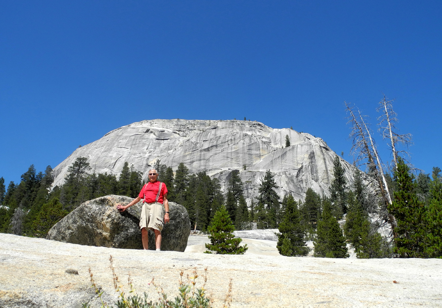
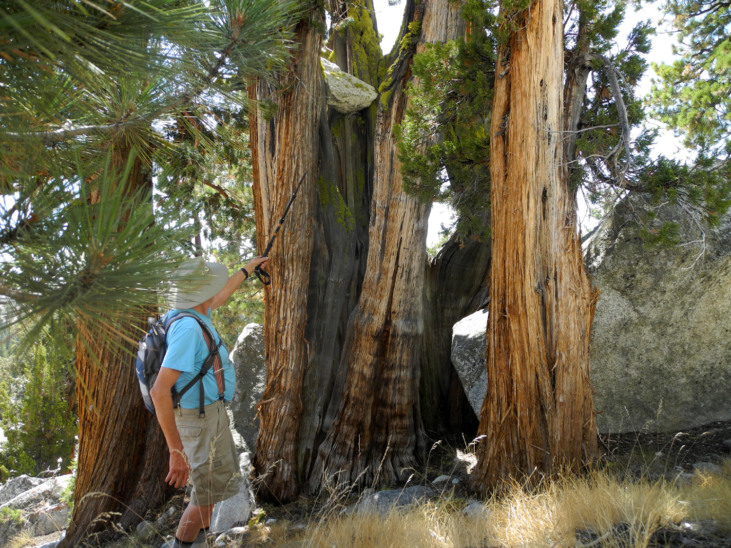
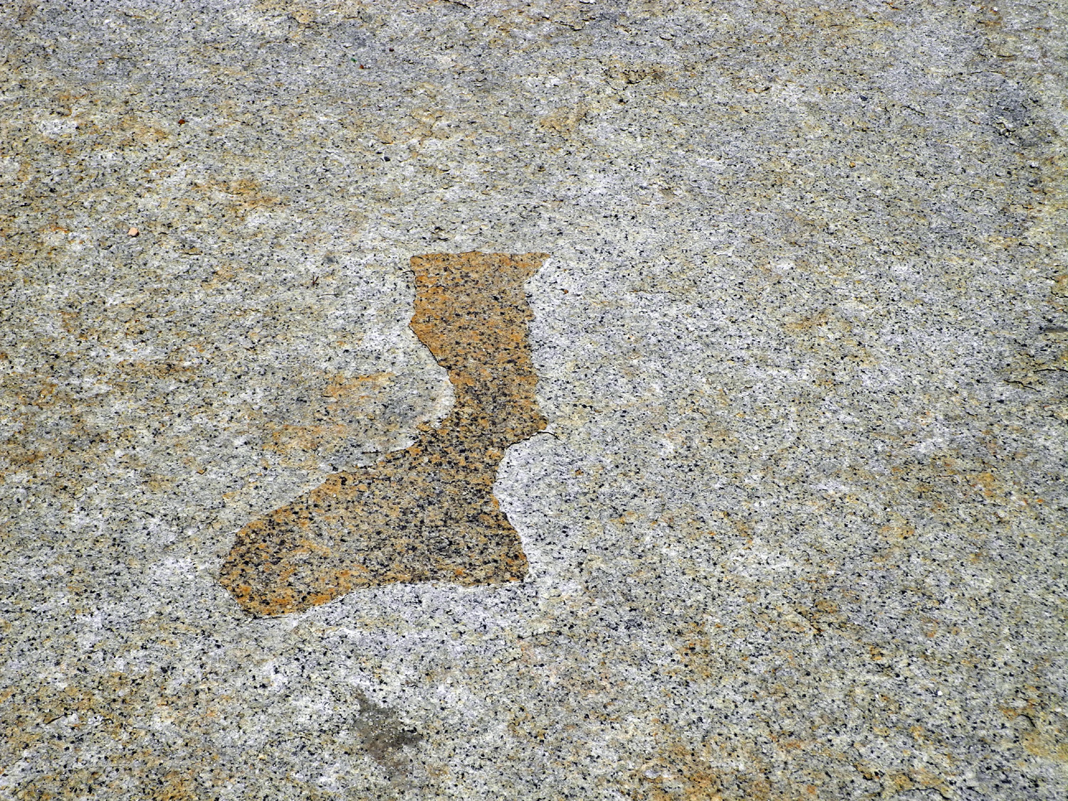
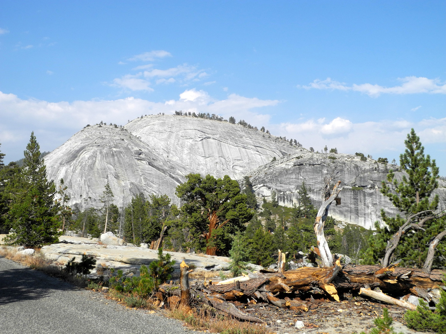
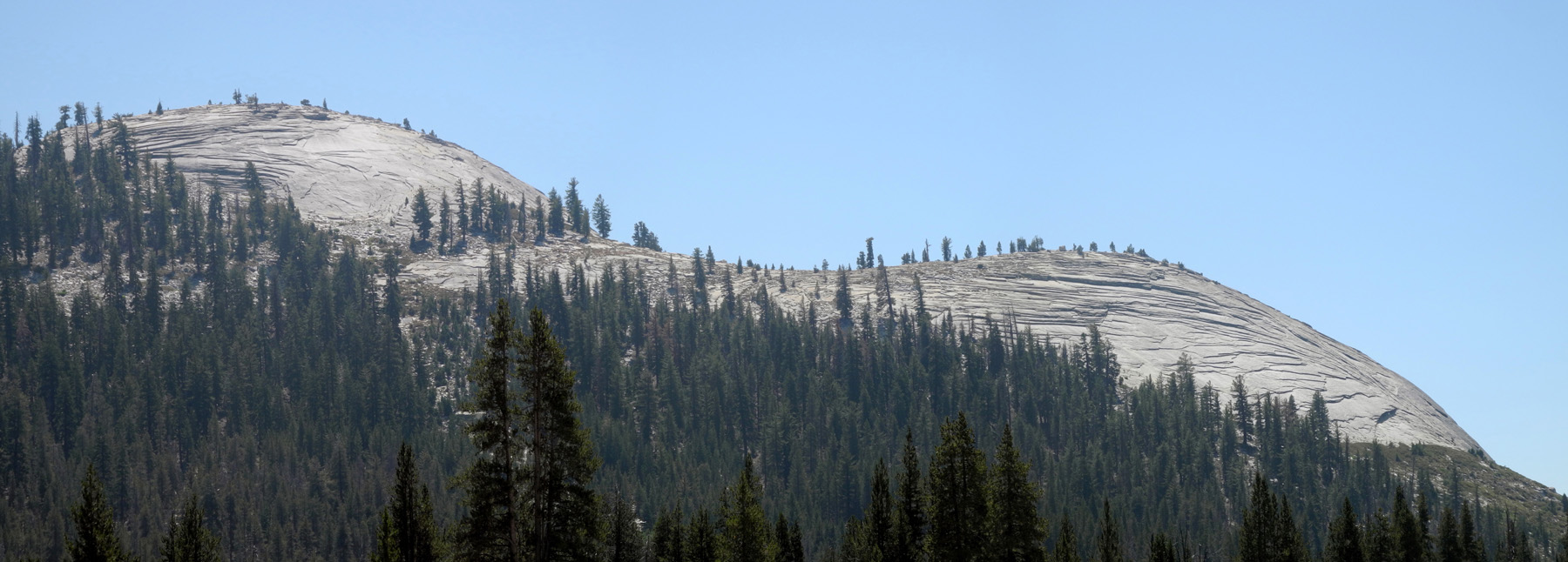
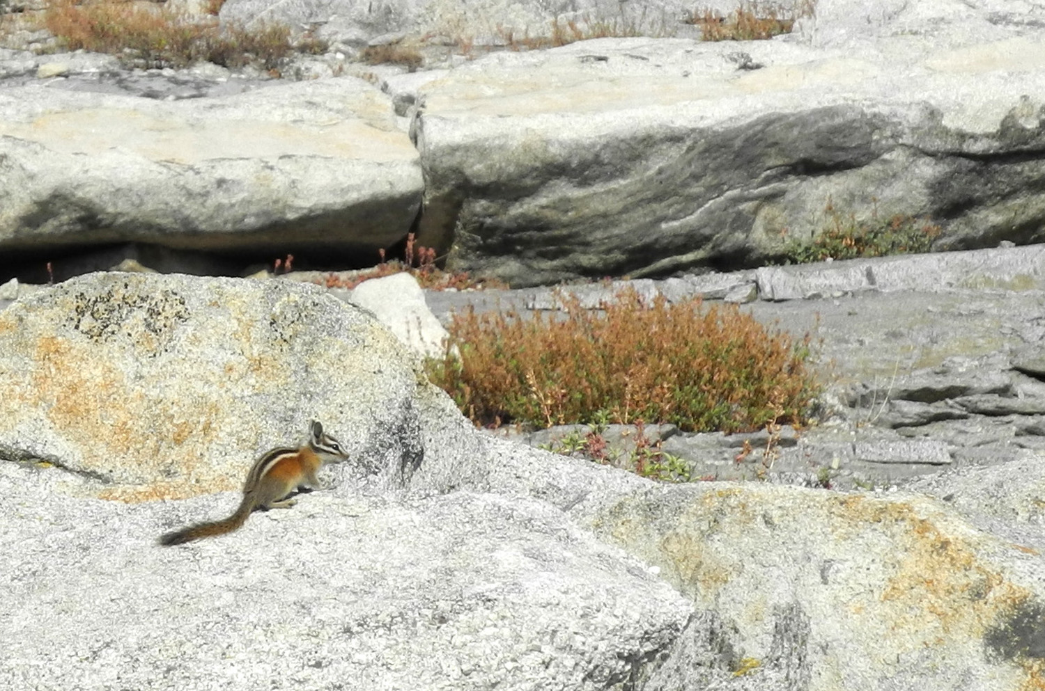
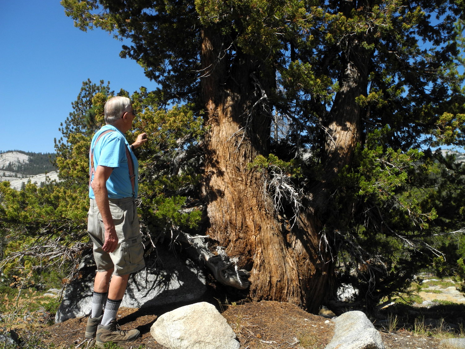
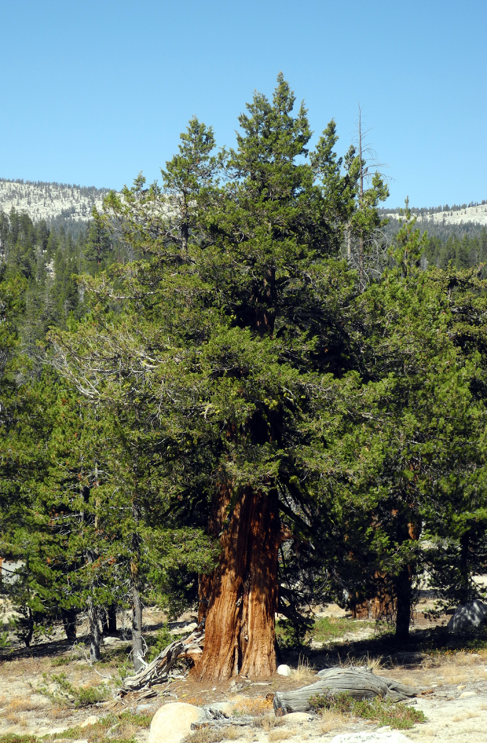
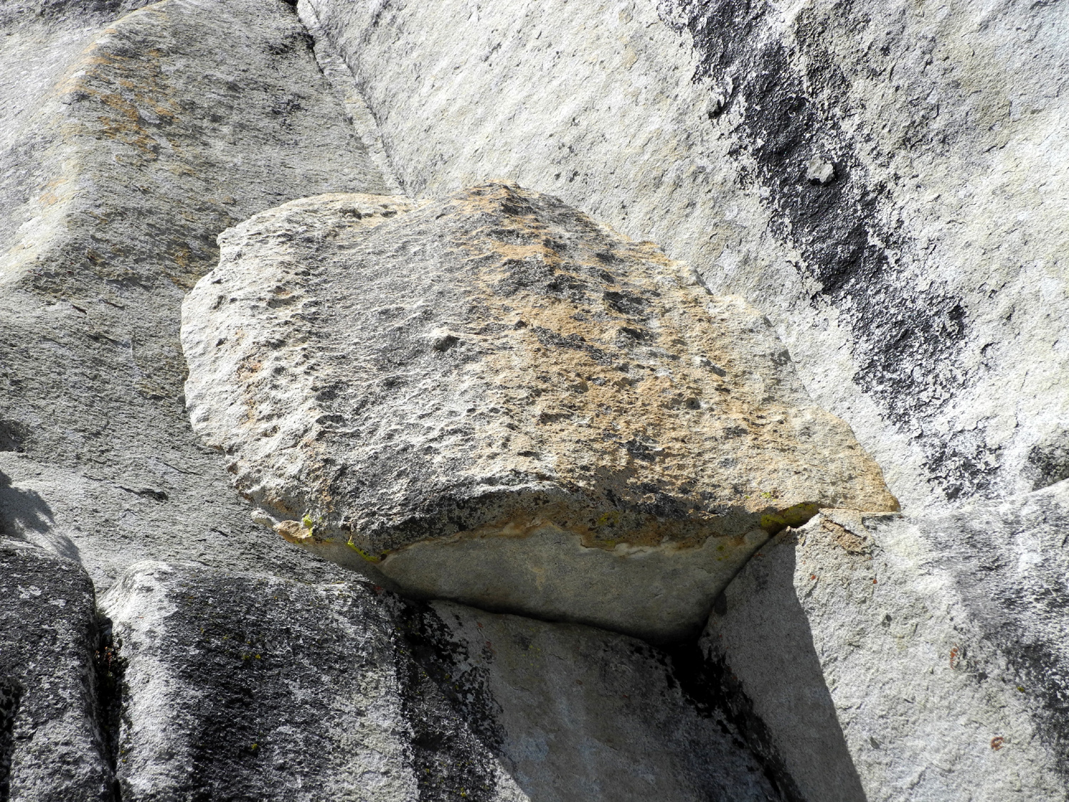
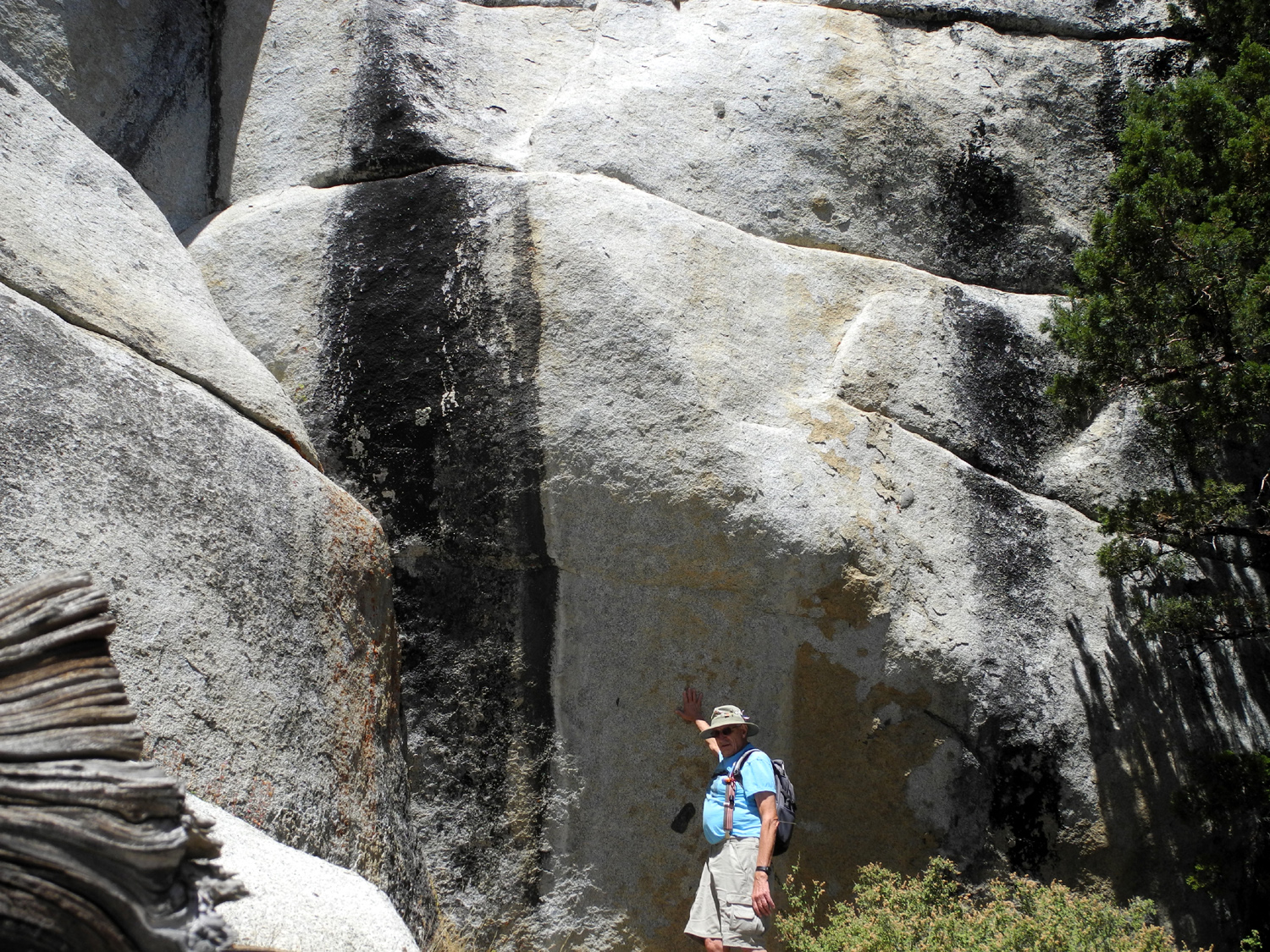
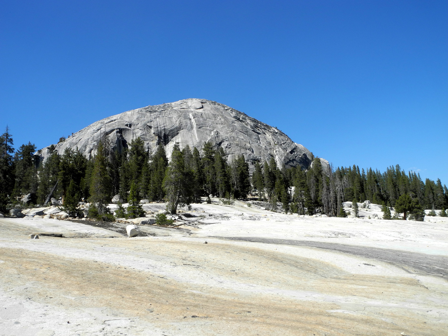
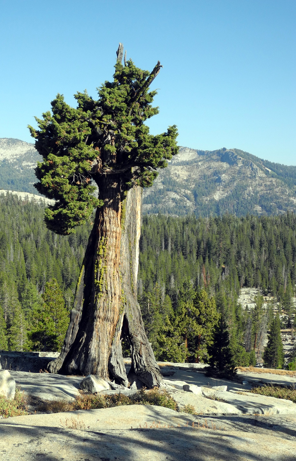
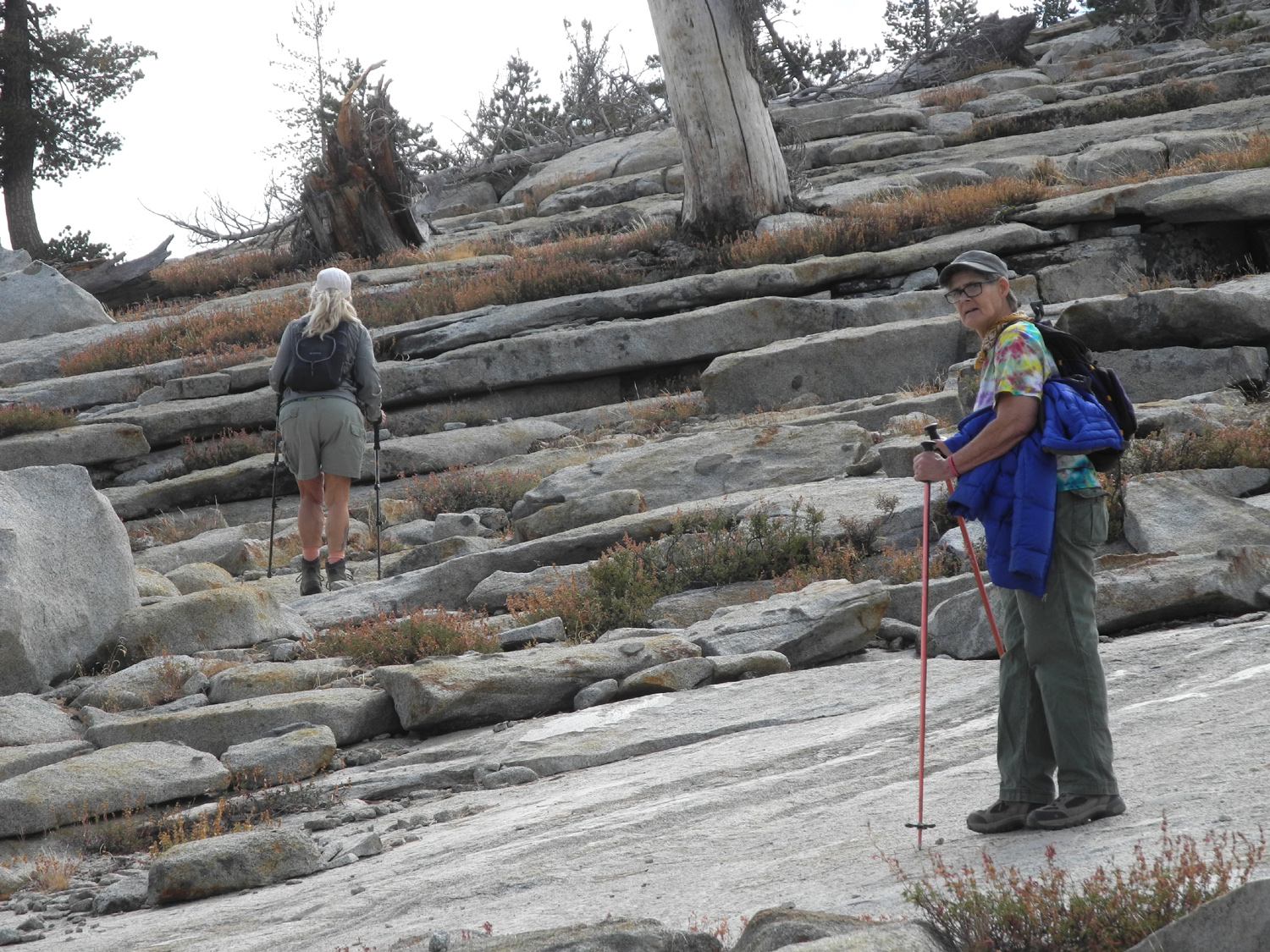
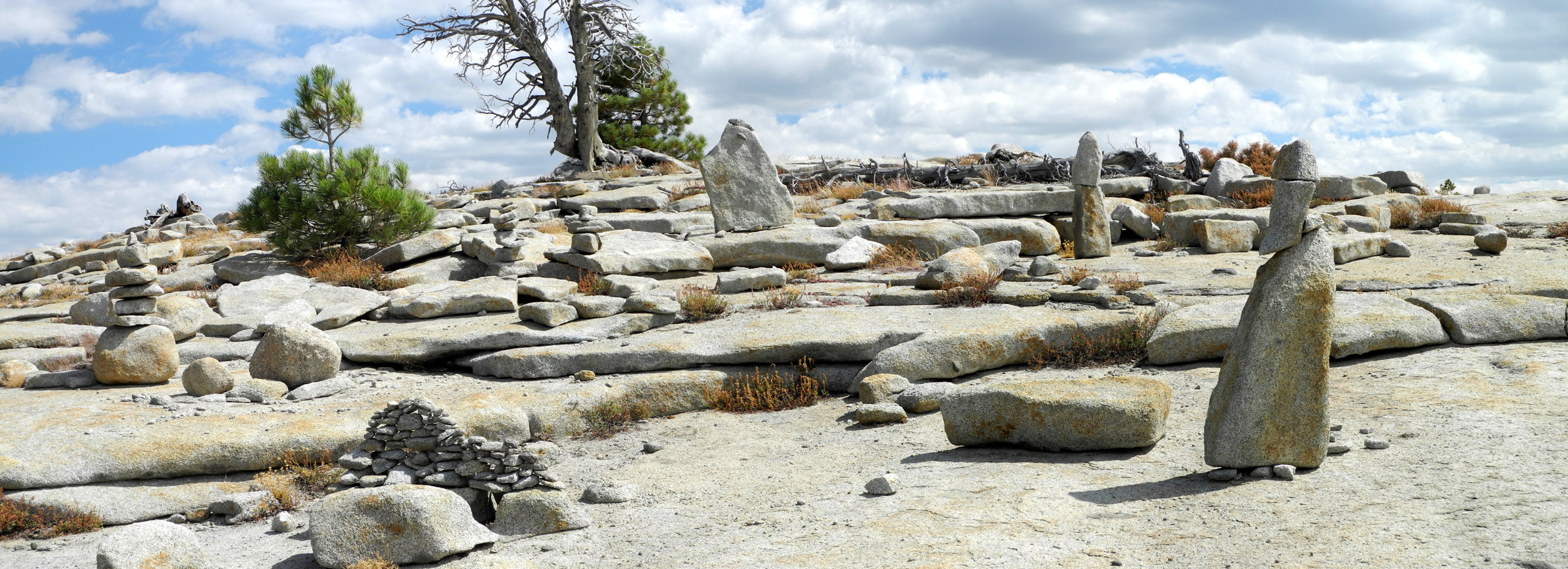
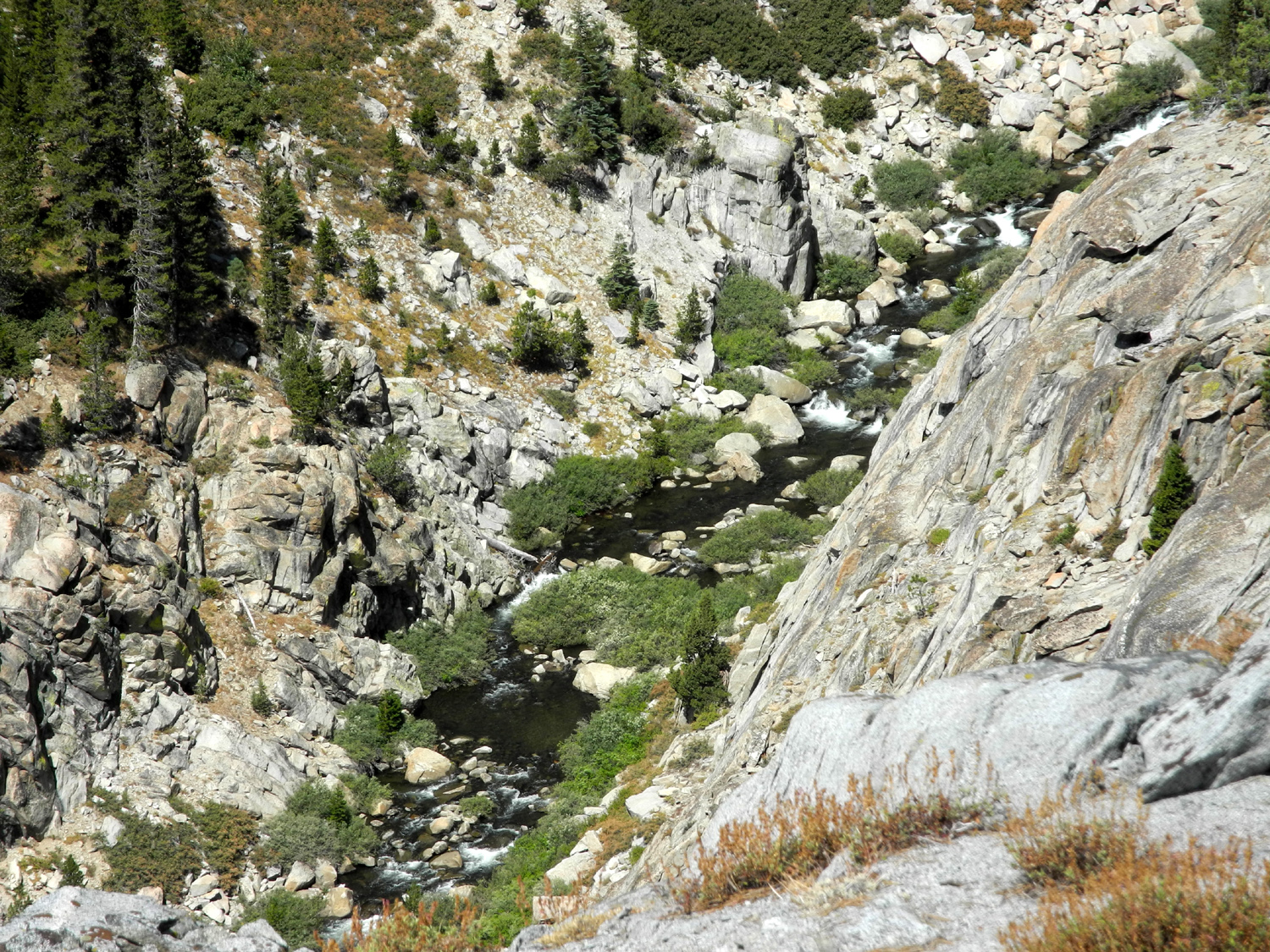
Back to Courtright I concluded the report on my camping trip at Courtright Reservoir in mid-August by saying, "I am ready to go back and explore a couple of areas that I missed." Only 13 days later I made that return trip, and hiked in places where I had not been before. You can read about the location and getting there in my earlier report, so I won't repeat that information. Once again I got on the road about 7:30, this time in my Ford F150 truck. I didn't make as many stops on the way, and arrived at about 10:15, with the temperature at 72 degrees. I had only to put on my boots to be ready to start hiking. For the first day, I had planned to see if I could get to the top of couple of domes near my campsite, then decide on my other destination the next day. However, my daughter Teri and her friend Sandy also had their eye on those two nearby domes, and decided to join me the second day. So I needed to pick my other destination for the first day. Across a small drainage and above the trailhead parking area there is a group of domes I named Triple Dome last time, although I had to change this name (more about that below). It looked as if I could walk up above the trailhead parking lot and go up the lowest dome without much difficulty. I was parked in the same spot as last time, a large, nearly level area of granite bedrock, a few hundred yards from the trailhead, so I walked cross-country down that way through the rocks and trees, then up to the upper end of the parking lot. The first part of the climb was moderately steep but relatively easy. Then I got into more rugged territory, with many large boulders to navigate around. Soon I realized that I was not going to conquer this dome. The ascent became steeper than it had looked from below, and I was essentially in a huge rock pile. At one of our other favorite camping spots, there are a lot of rock slabs, easy to walk up and over, but they are four to eight inches thick. Here they were two feet thick. It seemed that every fourth rock I stepped on tilted a little. They were mostly lodged in fairly good, not perched precariously so that I felt I would fall, but it seemed foolhardy to continue. I could also see that even if someone were to get near the top, it would be hard to get all the way up. It was not rounded like most domes, but consisted of steep, layered rocks forming a cliff on one side, and a nearly sheer rock face on the other. From my highest position I could look across the little valley where the trail runs and see a large granite slope across the way. About a mile in from the trailhead is THE Big Granite Slope, which I wrote about previously. The nearer one is somewhat smaller, and maybe a little steeper. It is divided into several sections, with small areas of soil in between, allowing the growth of little areas of forest. I made my way back down through the parking lot, and down the foot trail to the 4-wheel drive road. Just before the junction of road and trail, I walked a short distance through the trees to the first part of the granite I had seen from above. This section was the very bottom of the valley, and was quite small, but as I went up and to the northeast, I came out to a large expanse of rock. Like the Big Granite Slope, this one was covered with many boulders of all sizes, and lots of small rocks. I had to do a little zig zag hiking to get up past places where there were shelves two or three feet high, but none of it was particularly difficult. At one place I set up my camera on my mini-tripod to take a self-portrait in front of a huge boulder. As I knelt down to focus the camera, I noticed that the granite there was exceptionally smooth, due to a few thousand years of runoff carrying small grains of rock down across it. After taking the picture, I lay down on the rock and rested for five minutes or so. Usually such a place would not be as comfortable as it looked, but I only had to shift my body a little bit once to avoid being poked by an uneven spot. Looking at the slope from above, and walking on it, I thought that I could get up close to the base of Constant Dome, a striking rock formation that is visible almost constantly on the first mile or so of the trail, and which presents a different look at various stages along the way. Not surprisingly, it was farther than it looked, but I kept moving north and west, and eventually got very close to the dome. Before that I stopped and had a snack at a shady, sheltered location that would make a good camp site. It is protected on two sides by tall slabs of rock, it's level, and it had a good flat rock for sitting. After a good rest, I continued on toward my destination. When I got about 100 feet from the base of the dome, my way was temporarily blocked by a huge bench or shelf of granite, about ten feet high. It held a huge, oddly shaped boulder, and many smaller ones, and stretched up to the dome base itself. Where I first approached it, it was too steep to walk up, but a little farther along, I was able to make my way to the top. Most of the rock in this area is what we call "sticky granite," meaning it offers good traction for hiking boots The complete opposite would be rock in a creek bed that has been polished by water-borne sand over the years, and can be dangerously slick even when dry. Close to the base, the route became a little more challenging, mostly due to having to make my way around a big juniper next to the rock. However, I was able to get up and touch the base of the dome, and get a picture of myself doing so. Like all domes, up close it was much more "lumpy" and uneven than it looked from a distance. In fact, it was like being at the base of a vertical rock cliff. About 50 feet above me was a huge square boulder, sitting on a rock shelf. It did not look as if would fall any time soon, but the presence of chunks of rock all around me made it clear that, like all such places, this rock formation was still a work in progress. It was during this hike that I began to question the name I had given to the complex of domes on the east side of the valley above the parking area. From the road approaching the lake, and from the farthest spot on the trail where I went previously, it appears that there are three domes close together, and I named the formation Triple Dome. However, from my close-up view trying to ascend the lower dome, and from the views I had going up the granite slope to the west, it was clear that the dome I tried to climb was distinctly separated from the other two. The two upper domes form a rough stair step as part of the same rock ridge. Since I could see no way to ever get up on the lower dome, I called it Hopeless Dome and declared it a separate feature, leaving the two larger, higher domes to be known as Double Dome. I continued west staying as close to the base of Constant Dome as possible, first stopping at a place where I saw a dramatic dead juniper. When I got closer to it, I realized that it still had a couple of live branches, which is a common development with these hardy trees. Also near this area I saw an "impossible" sight - a good size rock, weighing perhaps 200 pounds, wedged in the branches of another juniper, about 10 feet up from the ground. I came up with three theories: 1. Someone put it there - unlikely considering the weight of the rock, the distance from the ground, and the overall effort involved; 2. It was pushed up as the tree grew - again unlikely considering these trees start out as small, limber seedlings and become small limber saplings; 3. The rock fell from above and landed in the tree - requiring a very precise coincidence, but still the most likely as far as I could figure. Heading past these trees, I started making my way down just as I got my first view of the lake. I could see in the other direction that I had to descend a good 150 feet or so back to my lowest starting point, so I studied the terrain, looking for the best route. I was still on an extension of the rock ledge, and found one possible way down, a chute full of pine cones and other debris - steep but not too far. However, I thought if I could scramble up to the next highest level, about two feet up, I might find a gradual path down the rock - and it turned out this is exactly what happened. I walked down the rock and stepped on to the dirt, then went a ways north and turned east, to go back to the trail. At one point my obvious route led through a grove of evergreens, with fallen logs and branches everywhere on the ground. Getting through stuff like this is difficult and sometimes literally painful, with the risk of scratches from sharp dead twigs. Fortunately I was able to go around the worst of it. This soon brought me back to the granite slope I had ascended earlier, and I was able to carefully walk back down to the trail. I got back to camp around 3:30 p.m. with the temperature at its highest, 76 degrees with a strong breeze. I got my table and chair set up so I could have lunch, and also inflated my air mattress and got my "bedroom" ready. During lunch that day (and the next) I had to contend with yellowjackets (AKA meat bees), who wanted to get inside my sandwich and eat my ham. I finally decided that the best way to deal with them was to give them their own chunk of meat. I shooed them away from my plate until they finally noticed and zeroed in on the offering I had placed on a nearby rock. I thought I would try another hike after lunch, but I realized that my efforts on the big hike were enough for one day. I did take some short walks, including going down the road and just down the hill a ways to a nice looking juniper. I had photographed this one two weeks earlier, and realized that it was the same tree I shot in black and white back in 1969. Looking at the photos side by side, the tree has changed very little in 47 years. Can't say the same about myself. I also walked out again a little later to get a late light view of the Sierra peaks on the horizon. The LeConte Divide lies in that direction, but the mountain farthest left (north) was obviously Mt. Goddard, so I think I was seeing the Goddard Divide. Checking the map, it appears that the two divides are pretty much next to each other. Back at camp, it was reading time. I have two books going, a paperback of All the President's Men, and a Kindle book, The Last Ranch, part of the Kearny Family saga by Michael McGarrity. I read the paperback till it got dark, then switched to my smart phone. It started getting dark noticeably earlier than on my previous trip. There was no moon, but it seemed that it took a long time for stars to appear. Then, as I was reading, I would glance up from the screen, and each time the sky seemed to be darker and there were more stars. Sleeping in the truck, while far from the comfort of home, proved to be much better than in the car. I had my head toward the back, with the tailgate down and the bed cover up, so whenever I opened my eyes, I had a fantastic field of stars to enjoy. Somewhere around 4 a.m., Orion made an appearance, a clear sign that the summer is coming to an end. I also had a good look through binoculars at the Pleiades. The low temperature was about 40 degrees, but there was a strong wind, about 15 MPH, so trips to my outdoor "bathroom" were quite cold. However, I was warm and comfortable in my sleeping bag. During the night I recorded temperatures of 53 at 8 p.m., 48 at 9:05, 47 at 11:00, 44 at 12:45, and 40 at 5:20. During one of my outside excursions at 11:00 I saw a bright meteor with a slight trail, always a welcome sight. At midnight I heard a vehicle and saw a Jeep heading out from the trail. I did not envy him, since he had presumably been on the 4-wheel route in the dark. I got up for the day about 6:45 a.m., packed up my sleeping bag and air mattress, and ate breakfast on my TV table and the tailgate instead of the table down in the shady area. I was done with this and had everything cleaned up by 8:30. By this time it was warming up quickly, and I changed into my hiking clothes (shorts and t-shirt) at 9. I expected Teri some time between 9 and 10, and she drove in at 9:33, just after I heard what I thought was a clap of thunder. There were clouds over the mountains to the east, but nothing that looked threatening, and there was no further sound or any evidence of a storm, so maybe it was something else. Teri's friend Sandy was with her, and we all had previously had the same thought. Looking up at a couple of domes by the geological exhibit area, each of us separately said, I think I could make it up on top of that first dome, then walk across to the other one. A little after 10:30 we set out to prove that we could. Since we did not care to do any road walking, Teri drove her car the short distance to the small parking lot beside the road, and we started to angle our way up the first dome. This rock, which we will call Sandy's Dome, is not a solid, rounded rock, but instead has a lot of loose soil and rocks of various size. For the most part there were no real barriers to getting to the top, we just had to work our way through the best route. It was cool, with a breeze even stronger than the day before, so it was comfortable hiking, and on top the wind was strong enough that we had to worry about losing our hats. As we made our way up, we had views of the dam and lake, and from the top we could see east to the LeConte Divide, with the drainage of the North Fork of the Kings spread out below us to the east and south. We also had a view of the amazing array of domes that make this place so special. At the top and just down the southwest side, people had built various rock sculptures, including this remarkable construction, which is an all-natural phenomenon that required only the addition of the legs to achieve the effect. This mini-stonehenge also captured our attention. We could also see that the nearby dome that appeared to be slightly higher than the one we stood on was actually lower. It had the more typical rounded, solid granite appearance one expects of a dome. Best of all, it was a fairly easy task to go down to the saddle between the domes and get up to the top of the second one, which we decreed was Teri's Dome. All during this time we were kept cool by a very strong breeze, which reached its peak in the saddle between the domes and on the second summit. Like all domes, once we were on the top, the formation was much more lumpy and uneven than it appeared from below. We were now looking down into the very steep and deep canyon of Helms Creek downstream from the dam, with a fairly sheer drop-off on the side of the dome toward the creek. Of course, we could see most of the other domes in the area - Constant Dome, Double, Hopeless, Maxson, and the row of yet to be named domes adjacent to the lake. We saw glacial polish on top of both domes, giving testimony that the ice had reached considerable depth at this location. After we had enjoyed the view and a snack, and successfully battled the wind for control of our hats, it was time to head back down. Teri's Dome is too steep for walking on all sides except the way we had come up, so we made our way back down to the saddle, then across the lower part of Sandy's Dome toward the car. As might be suggested by the choice of this location for a geological exhibit, there are many kinds of rock in the area. Teri and especially Sandy are interested in this subject, and spent some time on the return trip examining various specimens, ranging from small, easily carried examples to big boulders. While I know quartz when I see it, Sandy has made an informal study of the subject and recognizes many types of minerals. We got back to Teri's car, with Sandy carrying a few extra pounds of rock, and made the short drive back to my camp site. I had stuff for lunch left from the day before, and of course, Teri had brought food. Once again we were plagued by yellowjackets, who arrived in even greater numbers than the day before. Once again we bought them off by giving them pieces of meat of their own. After lunch we moved from the shady table area up by my car and enjoyed the sun and the breeze. Even in full sun, the wind was strong enough that I considered putting on a long sleeve shirt. However, we would be leaving soon, so I decided not to bother. There was little more for us to do except load up and go home, which we did. Throughout the two days of hiking and wandering, we saw many lizards and squirrels, but my favorite wildlife sighting was on the way home. Not more than a mile from the lake I came around a bend and saw a half dozen large birds in the road. I quickly realized they were young wild turkeys, about half grown, and like all their relatives, they took their sweet time getting out of the way. I'm thinking about another overnight camp soon. Would it surprise anyone to learn that I'm considering another return to Courtright?
|
||
|
Photos (Click to enlarge; pictures open in new window) |
||
|
Rancheria Falls |
||
 |
|
 |
|
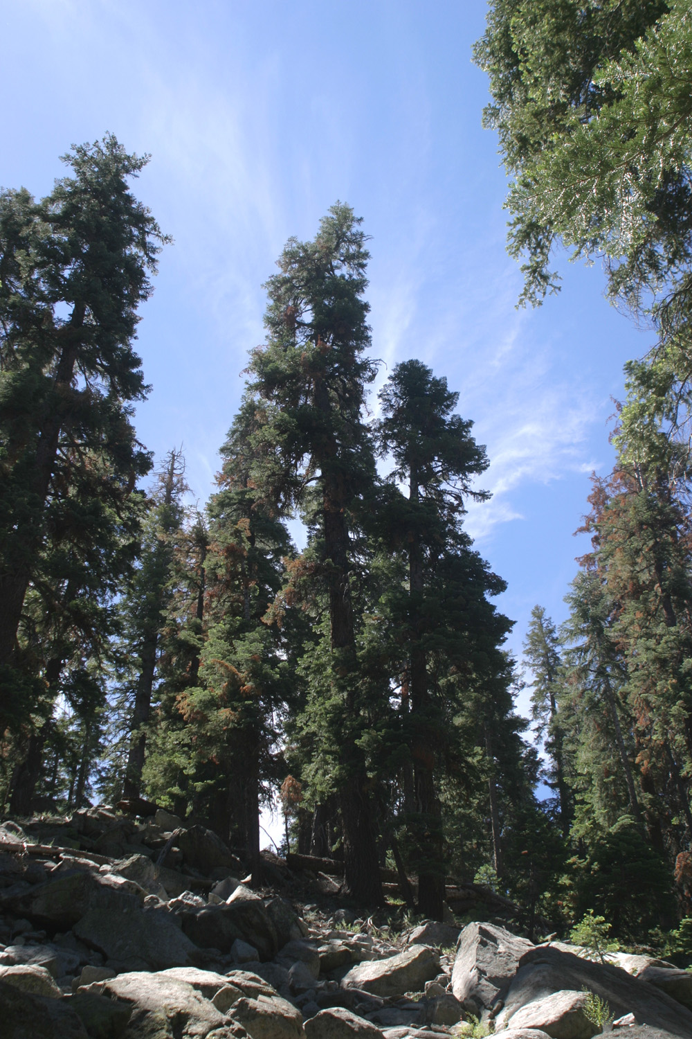
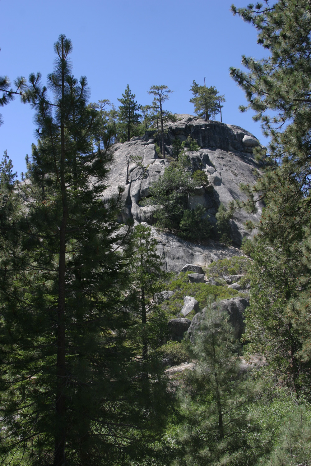
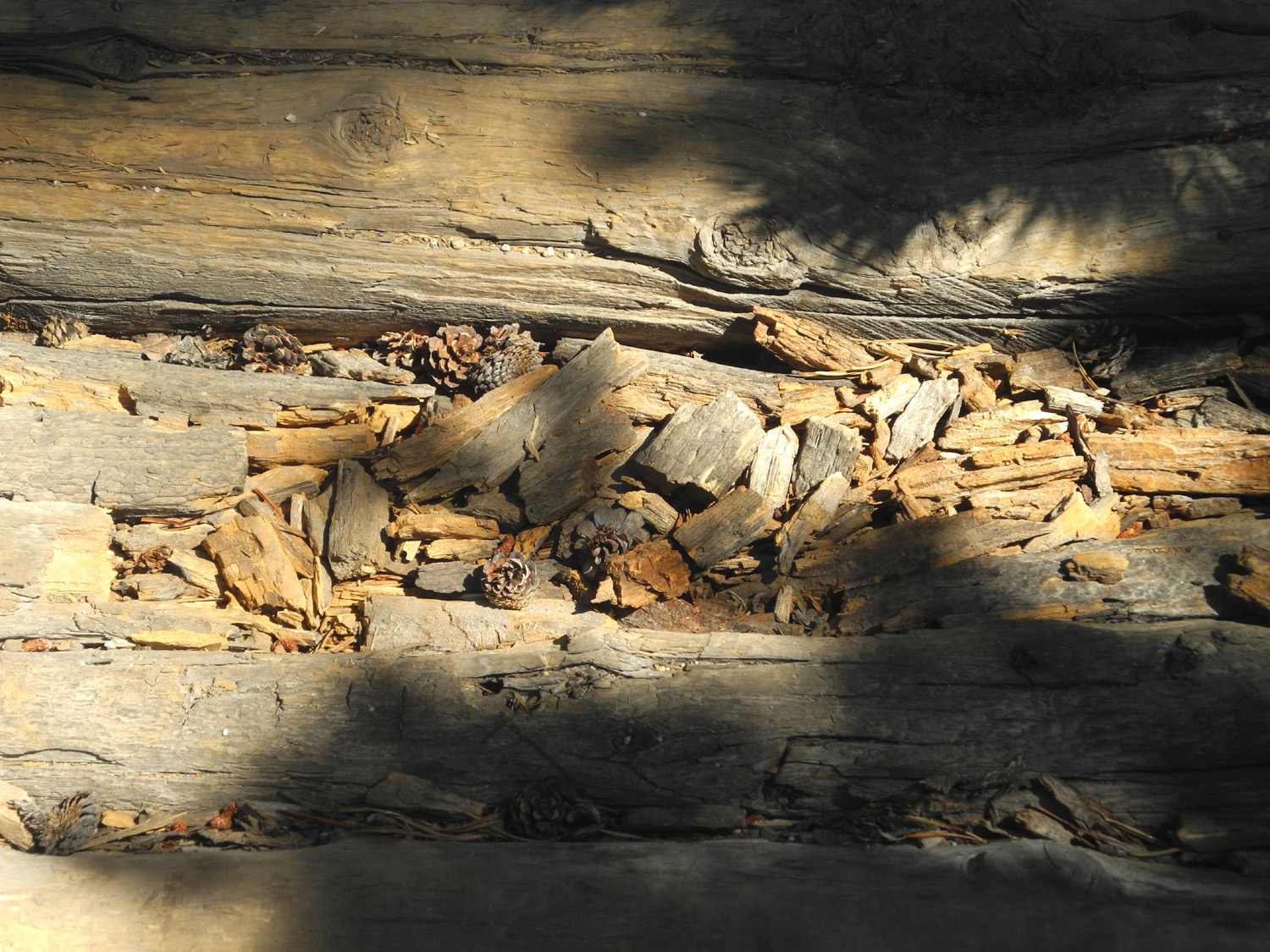
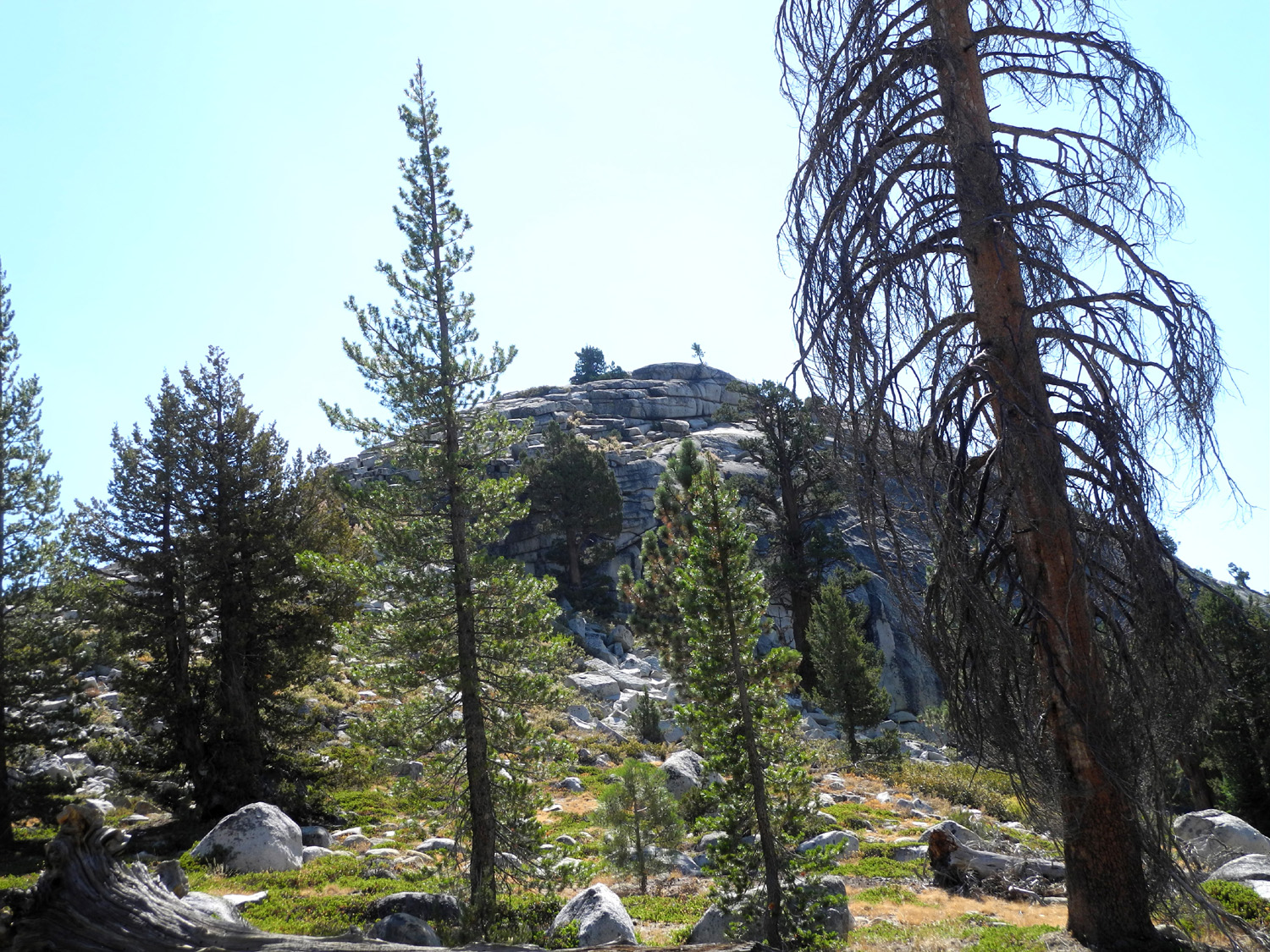
Trees and rocky hillside above the trail |
Red firs beside the trail |
This young fir has a nice crop of cones |
 |
 |
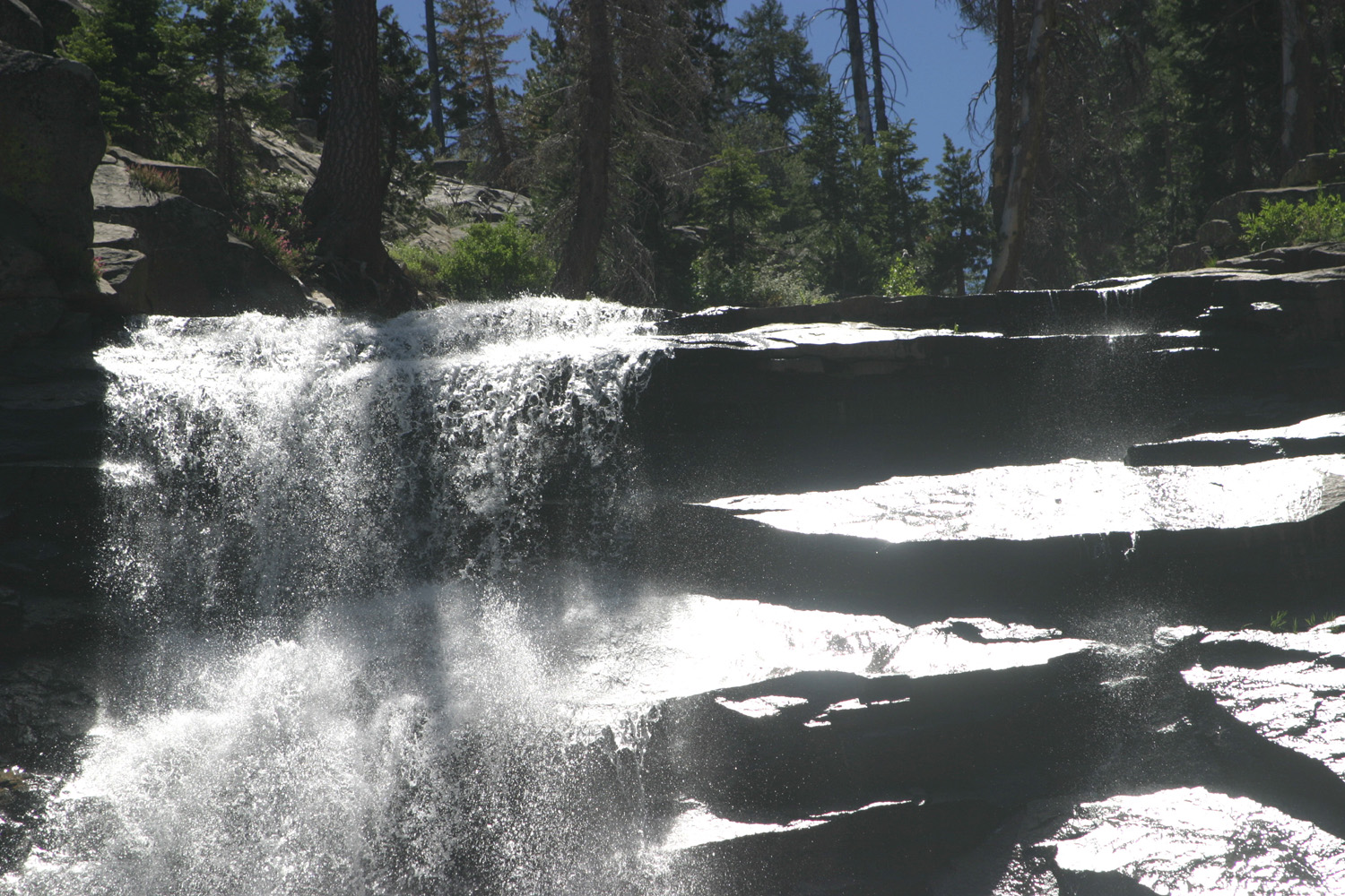 |
| Rancheria Falls | A mini-falls below the main drop | Top of falls - three
weeks earlier the falls was twice this wide |
 |
 |
 |
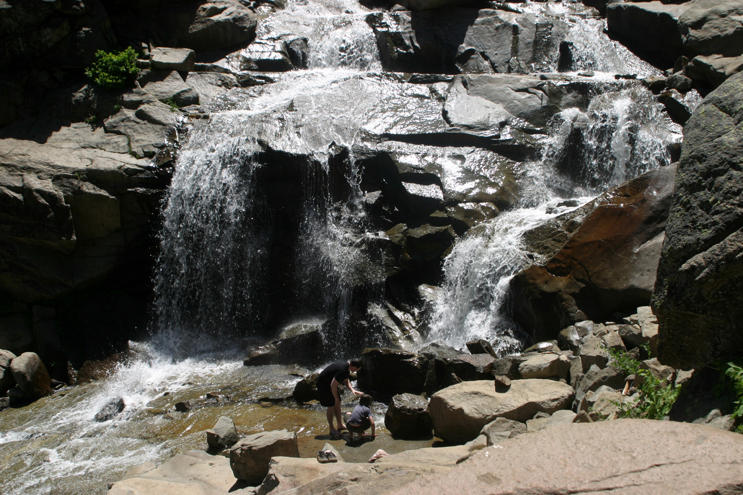
| Visitors enjoy
getting up close to the bottom of the falls |
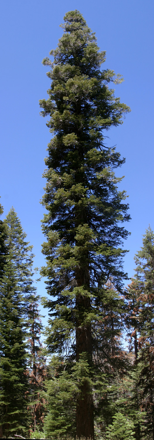
Cascade below the falls | A stately fir towers over its neighbors |
|
 |
 |
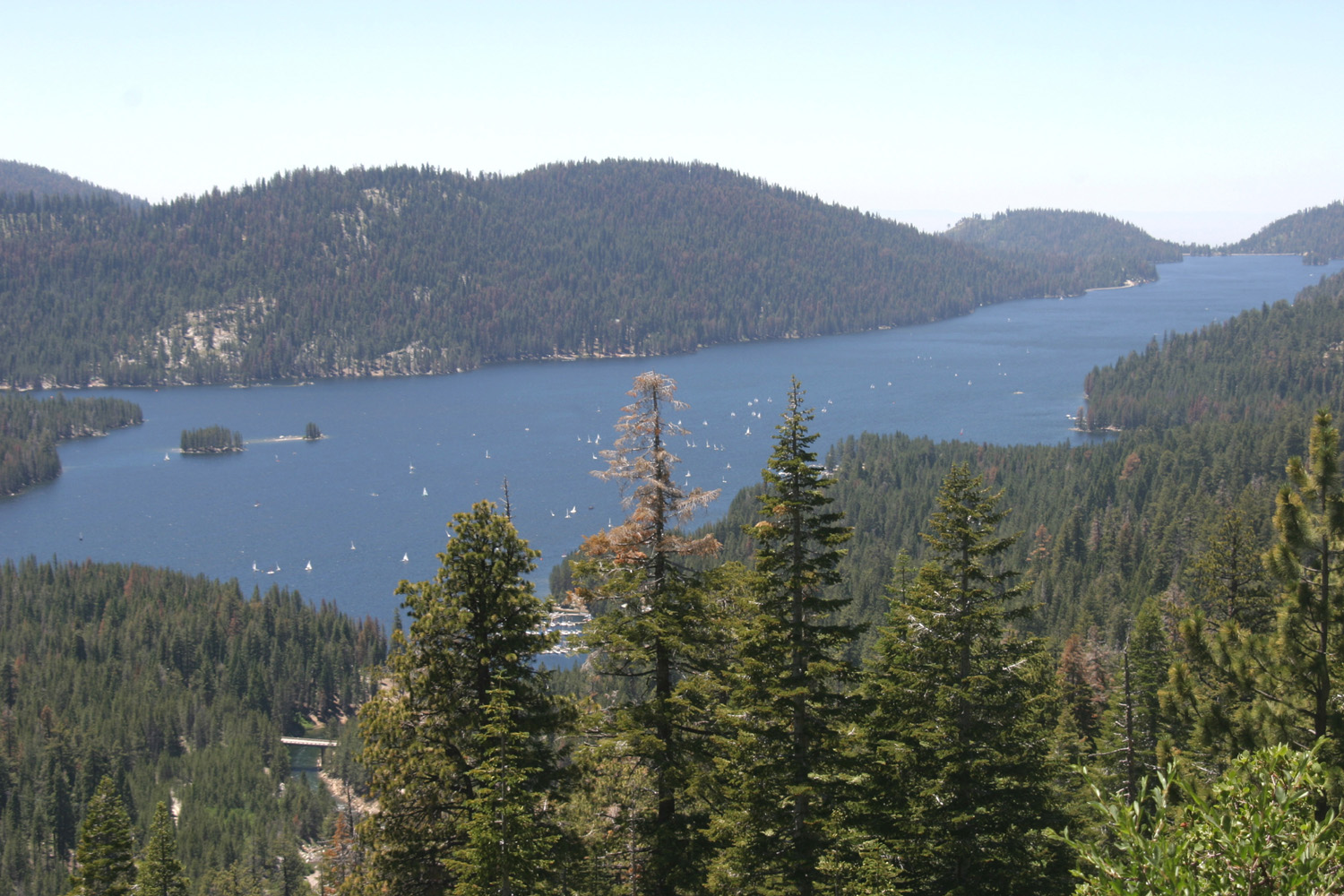
| Huntington Lake from the Kaiser Pass Road | Rancheria Falls
across the canyon from Kaiser Pass Road |
A peaceful Sierra vista |
 |
 |
 |
| Lunch at a quiet campground | Sailboat racing on the lake |
China Peak - a ski resort in the winter |
 |
 |
 |
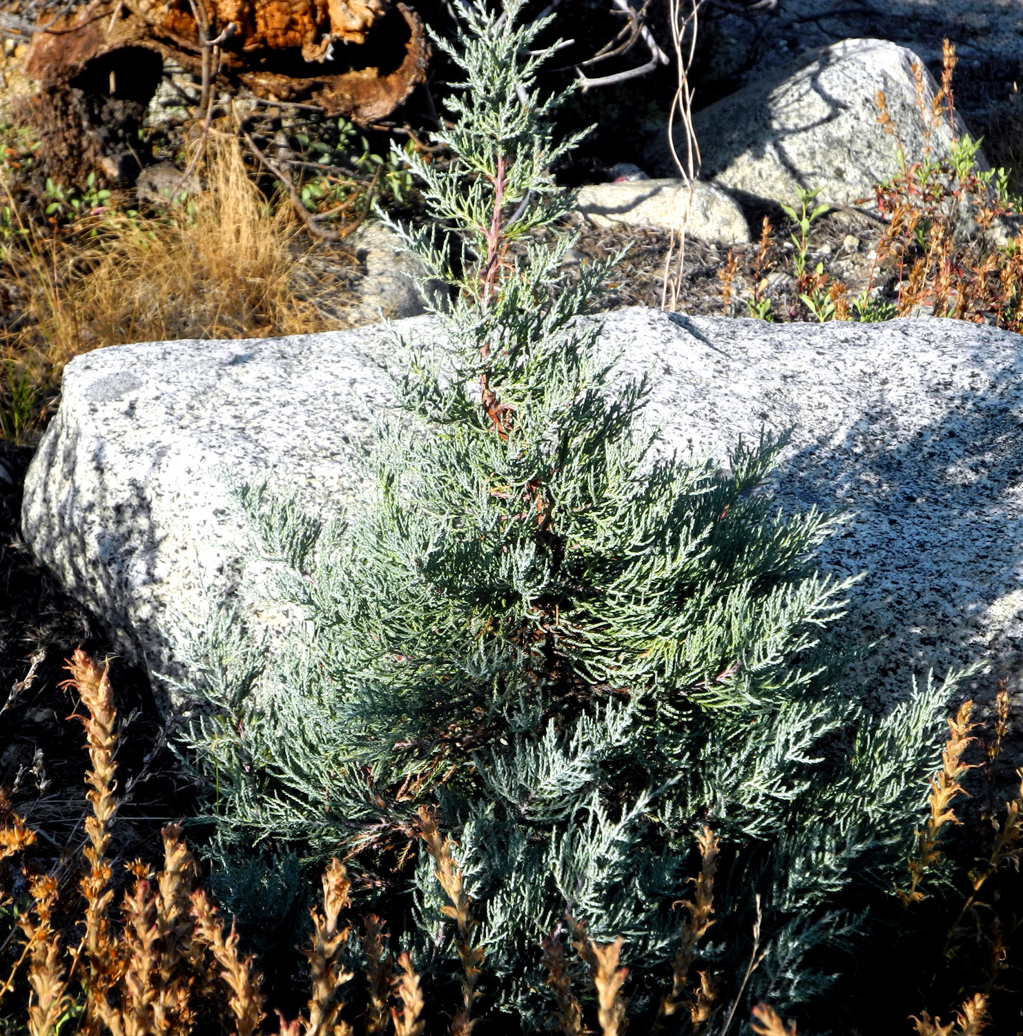
| Rugged little dome below Shaver Lake Dam | The creek beside the dome | More flowers to be identified |
 |
 |
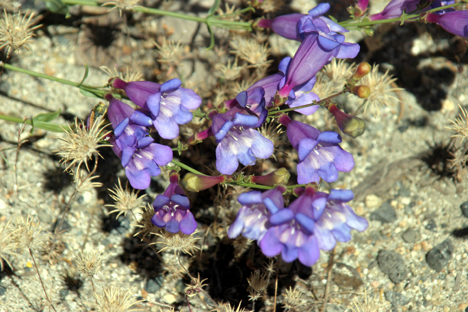 |
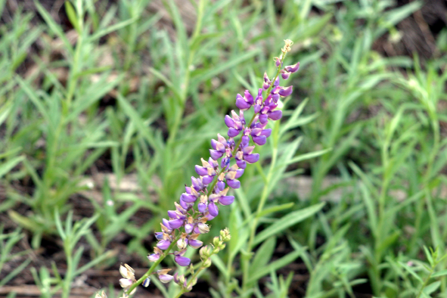
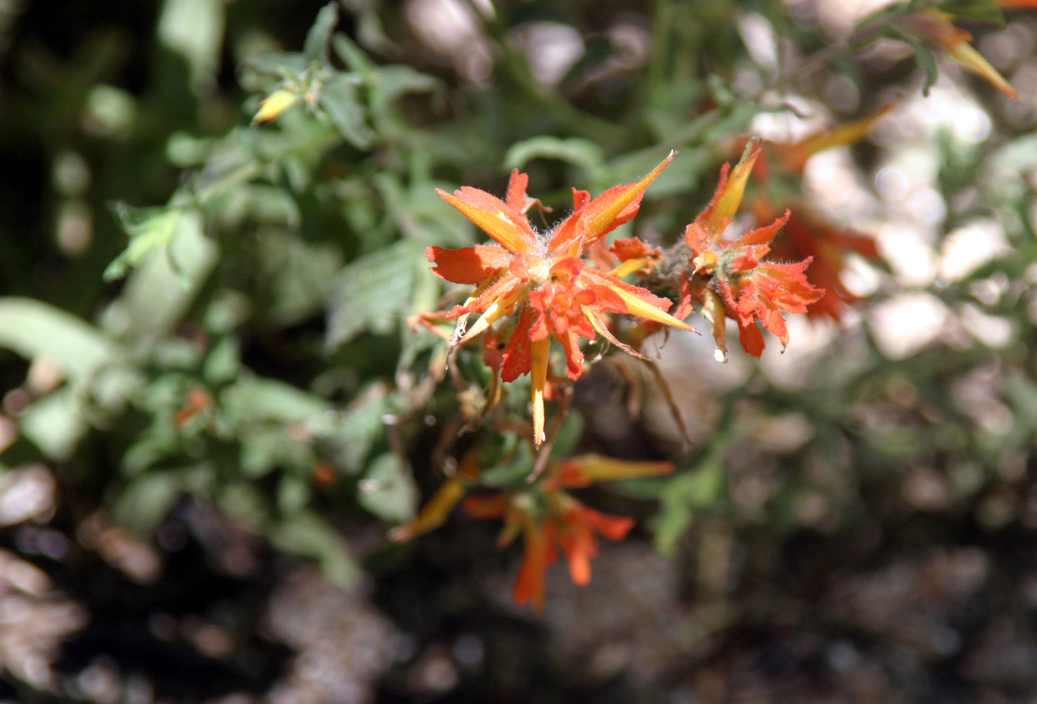
| A high-altitude lupine | Wavyleaf Indian Paint Brush | Either Azure or Royal Penstemon |
| Courtright Car Camp | ||
 |
 |
 |
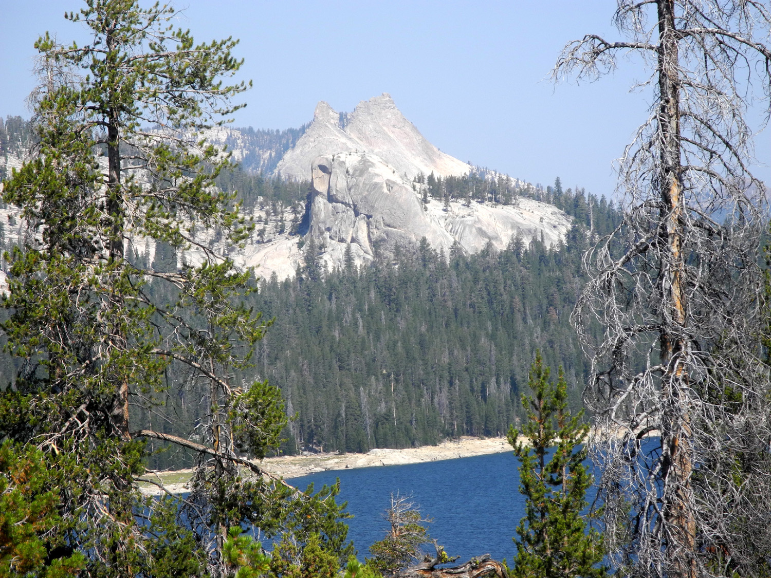
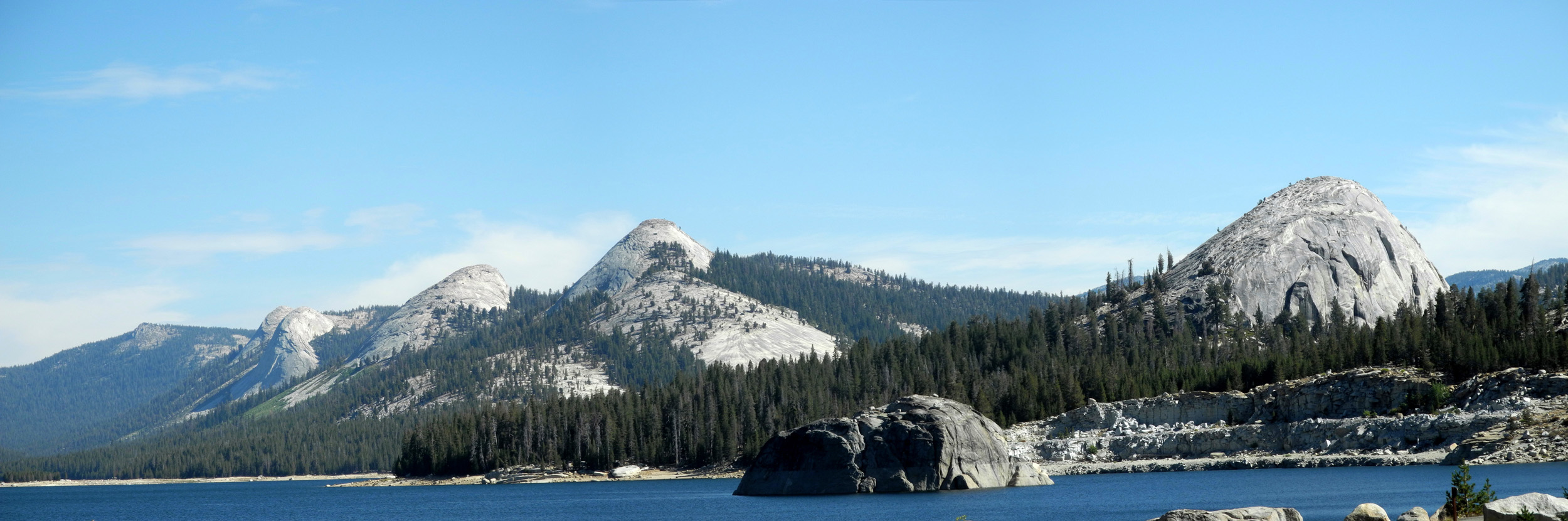
| The Leconte Divide | Courtright Reservoir | Blue and beautiful
and surrounded by granite domes |
 |
 |
|
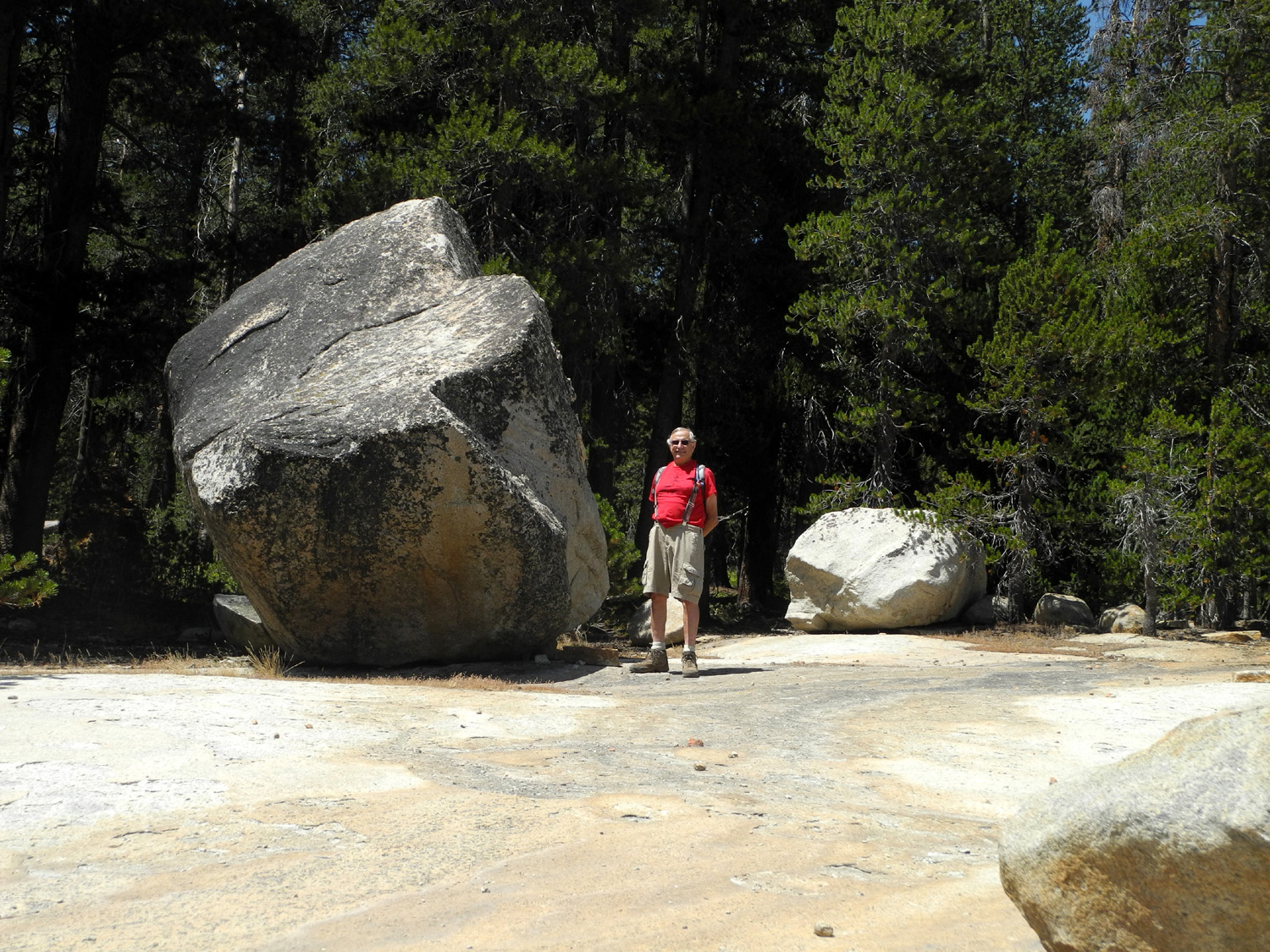
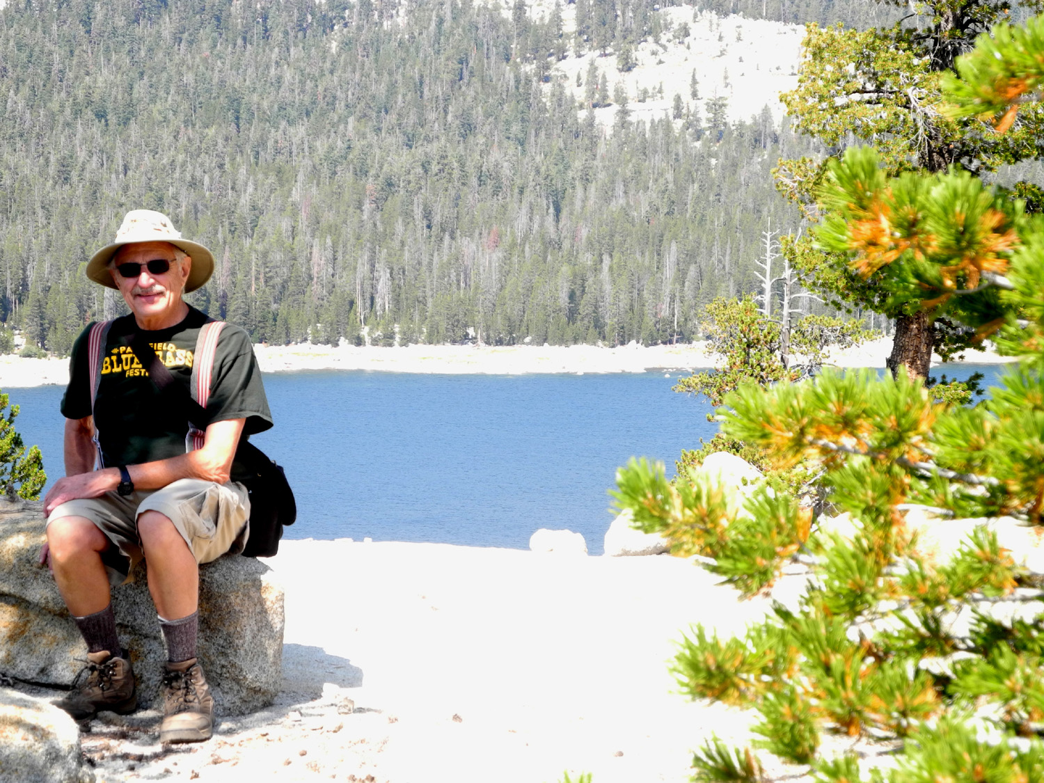
| My camp | The access point for
many fantastic destinations |
Self portrait in front of Constant Dome |
 |
 |
 |
| Where the 4-wheel road and the trail separate | Boardwalk in the woods | Walk carefully in this spot |
 |
 |
 |
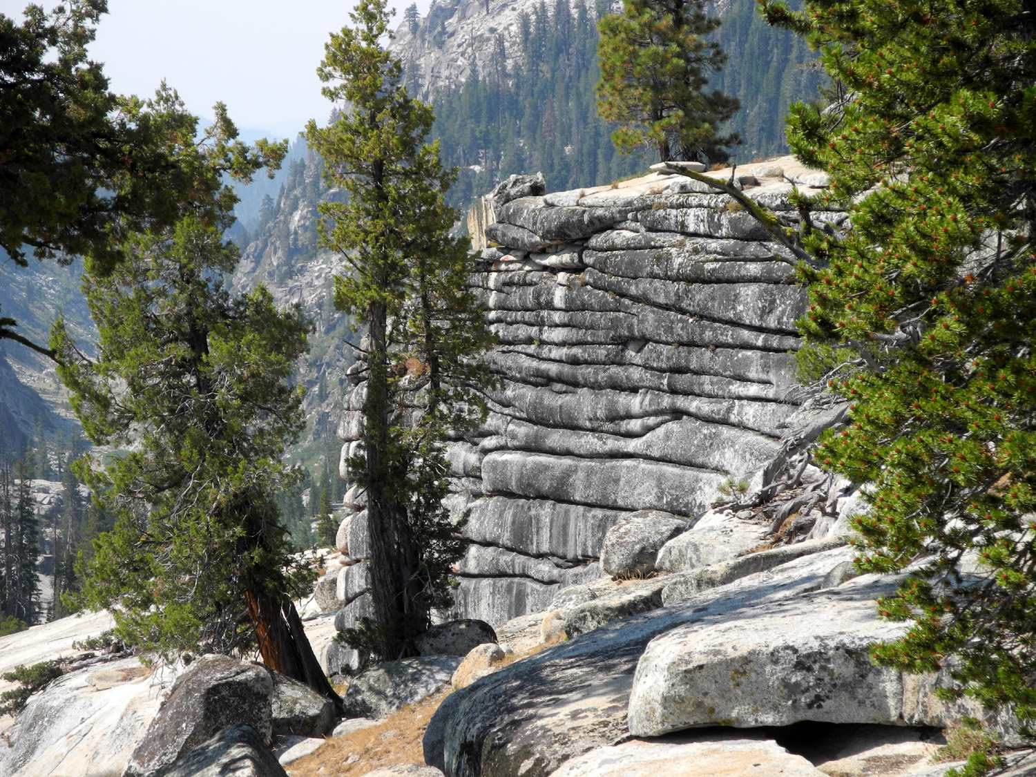
| On the Big Granite Slope | Dead tree, like the
bones of some prehistoric beast |
Boulders large and
small, dropped by the last glacier |
 |
 |
 |
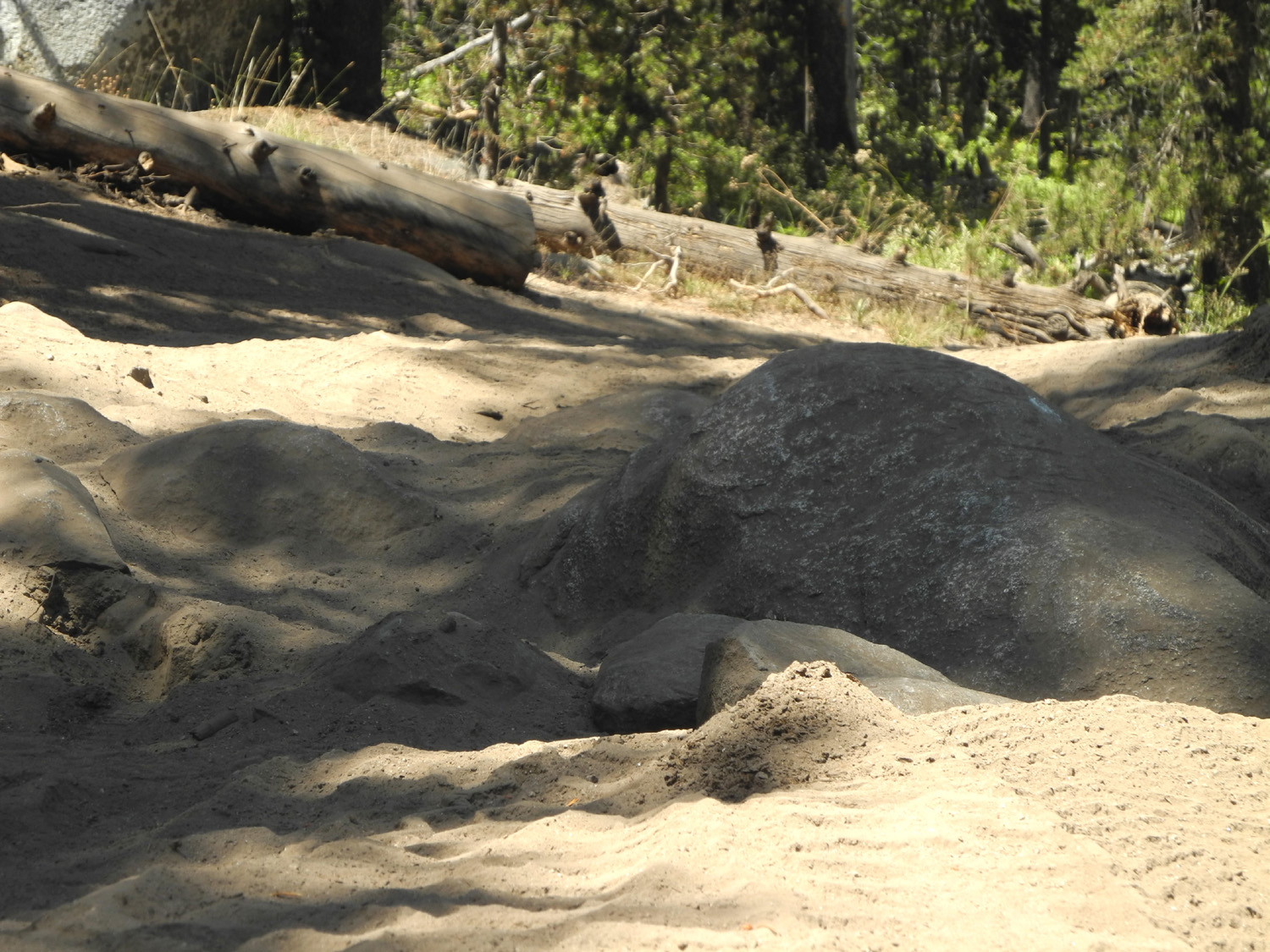
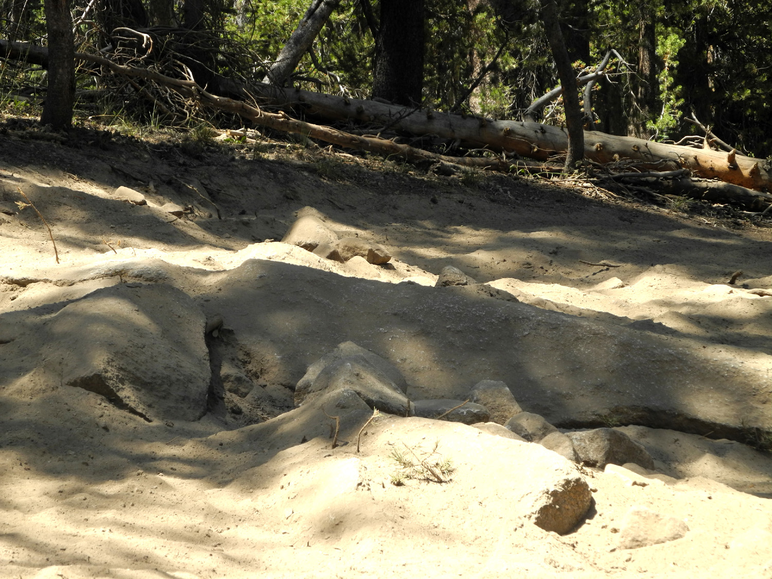
| The dark area in the middle is glacial polish | Real mean don't need blue dots! | Deceivingly easy
section of the Dusy-Ershim Trail |
 |
 |
 |
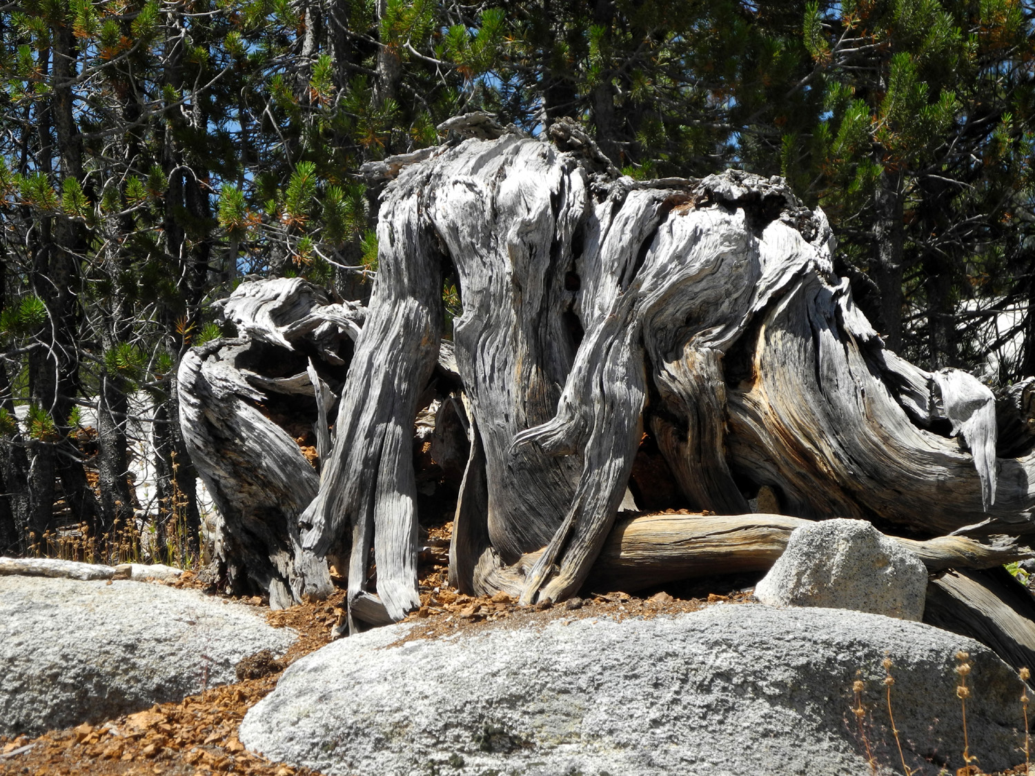
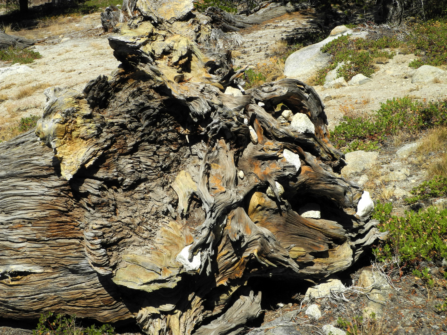
| At the upper side of the slope | Roots of a long-dead tree |
Maxson Dome, north of the granite slope |
 |
 |
 |
| Not the sign you expect to see deep in the woods |
If this section of the road looks too difficult... |
...try this one instead! |
 |
 |
 |
|
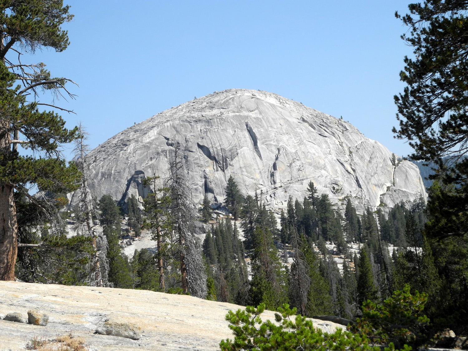
Constant Dome from near my camp |
Constant Dome from the granite slope |
Double
Dome on the left, and Hopeless Dome to the right |
 |
||
| The massive outline of Double Dome from the granite slope | ||
 |
 |
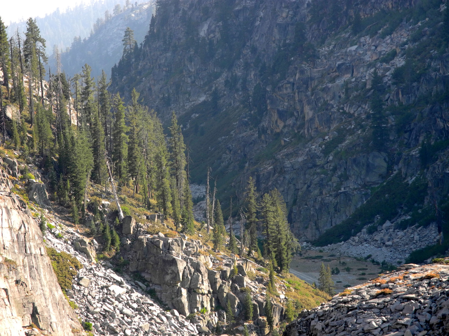 |
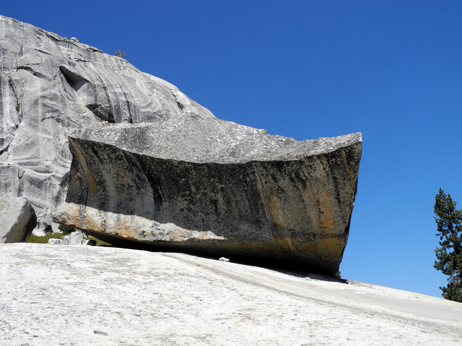
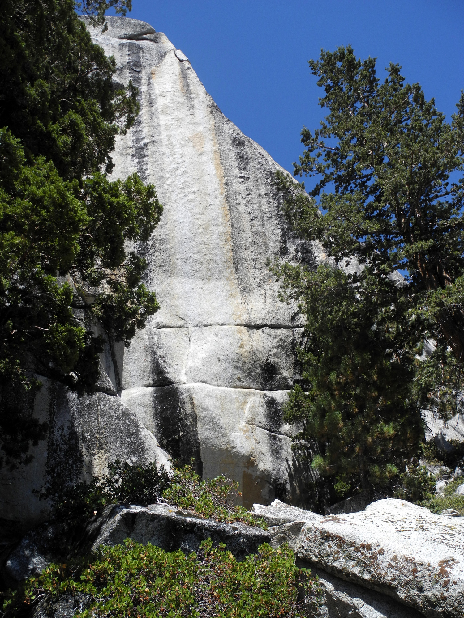
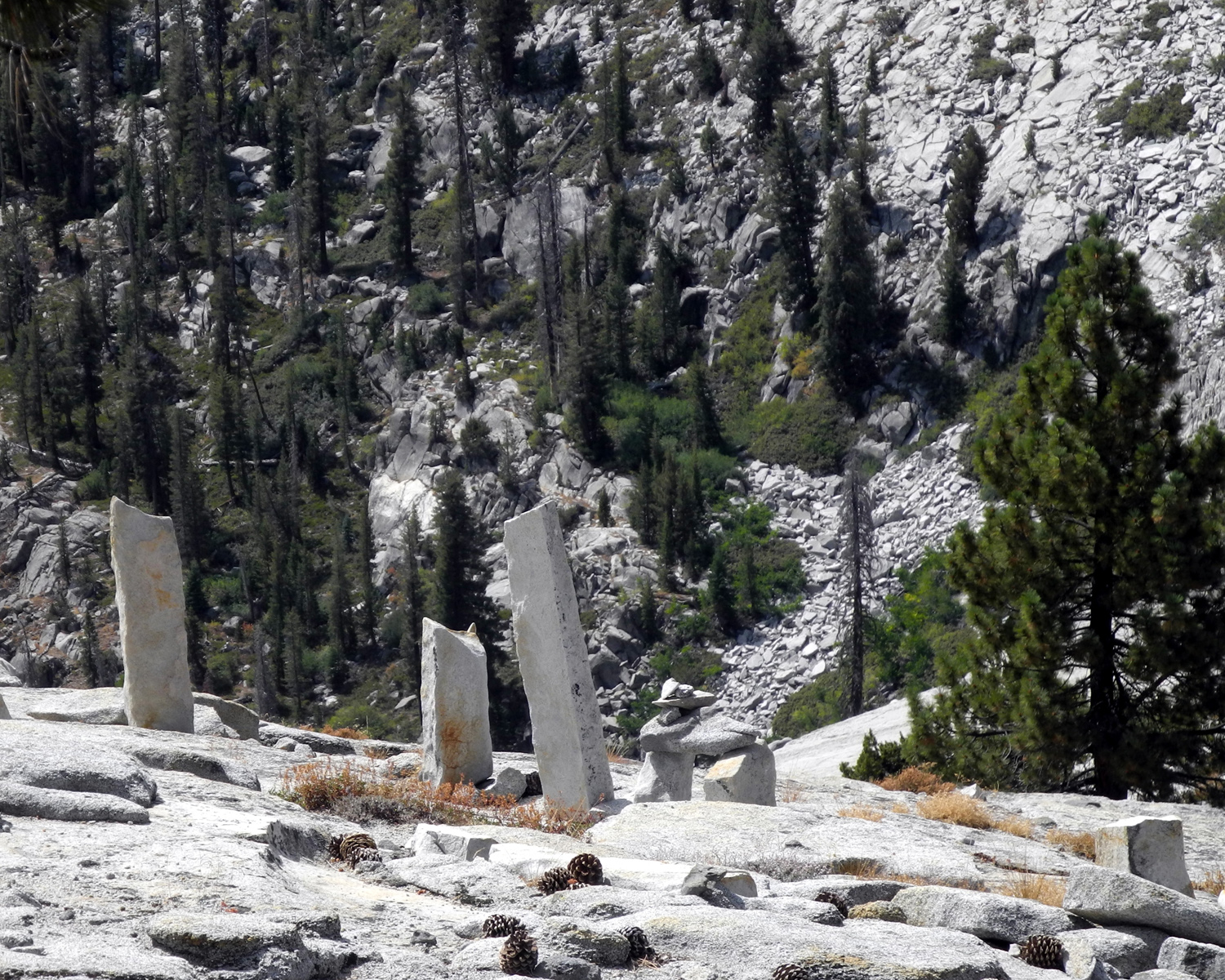
| I suspect this is not a natural formation | Dome above Helms Creek | Lost Canyon |
 |
 |
 |
| Big section of glacial polish |
How those ancient junipers start out |
These guys were
scampering over the rocks all around me |
 |
 |
 |
| The view of Double Dome from near my camp | Full moon rising on August 17 | I made my way up
through these rocks; it's steeper than it looks |
 |
|
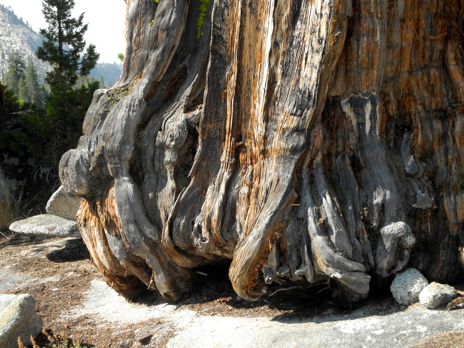 |
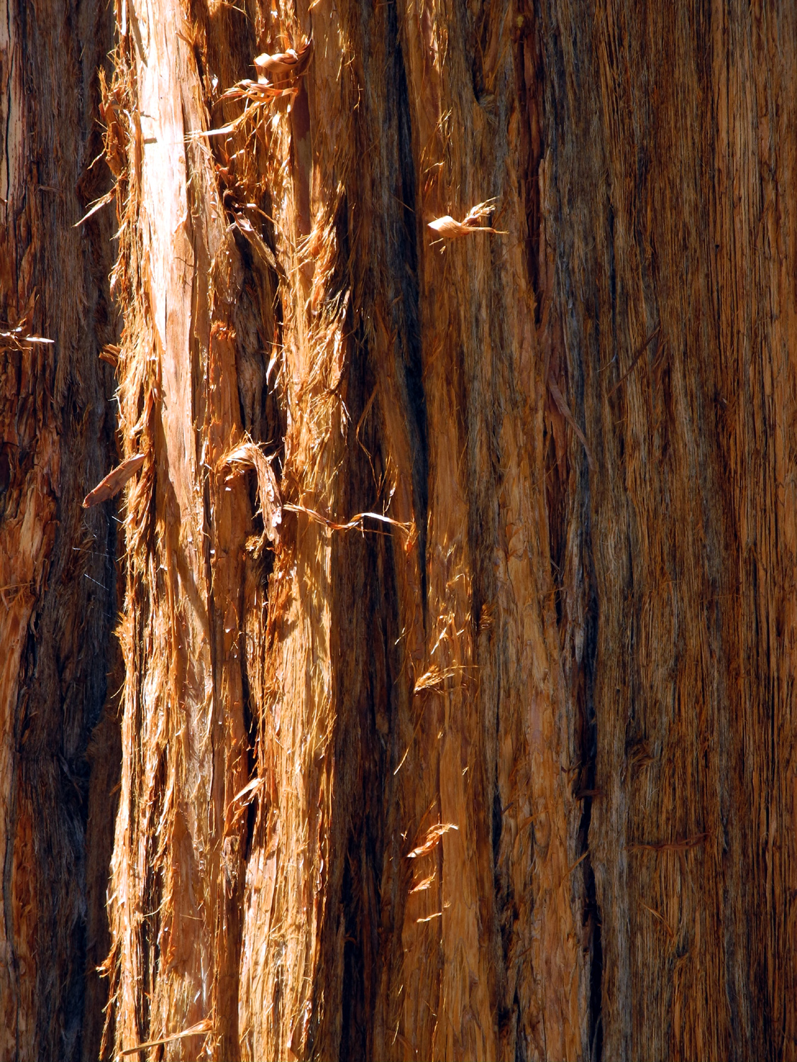
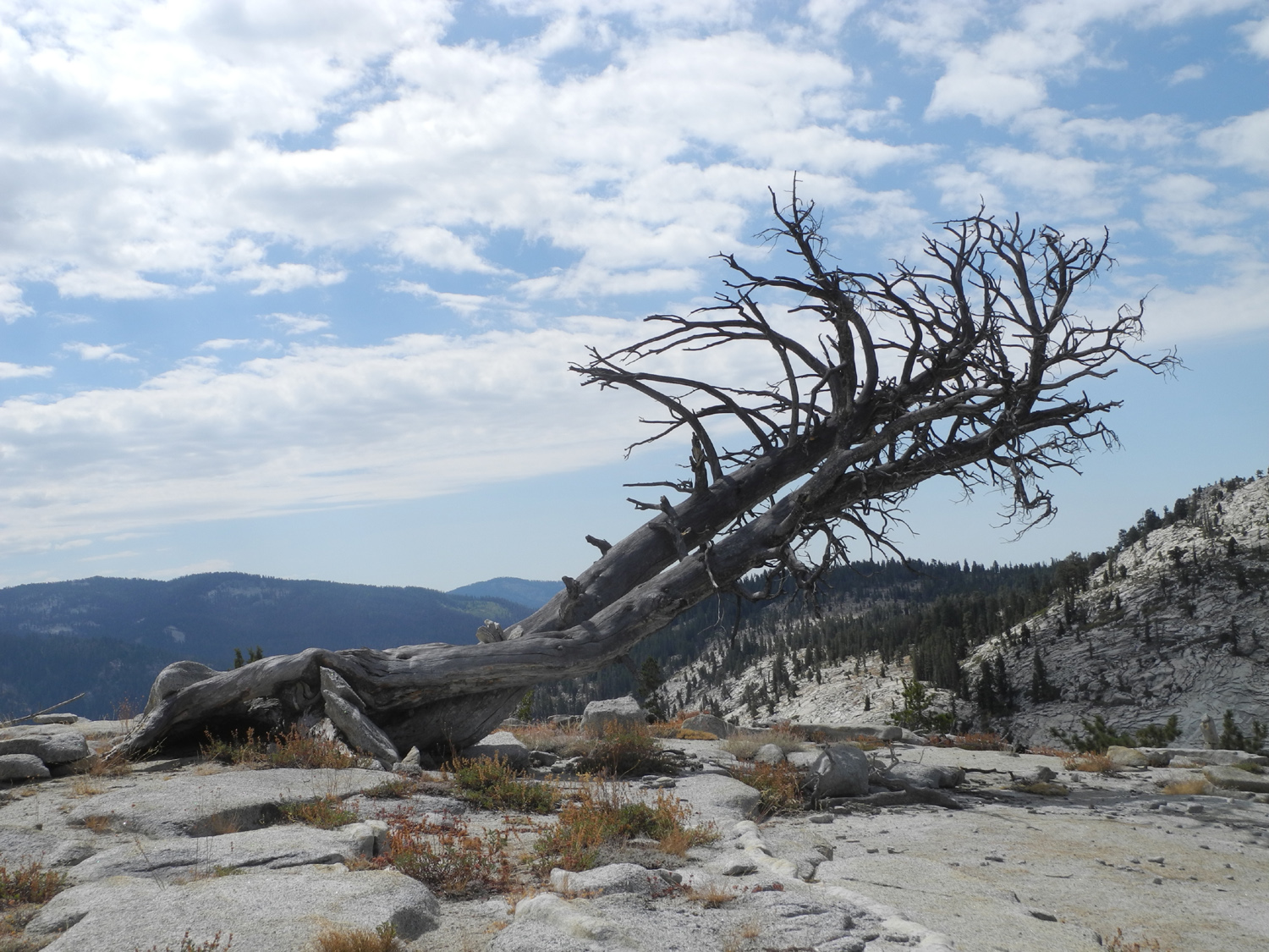
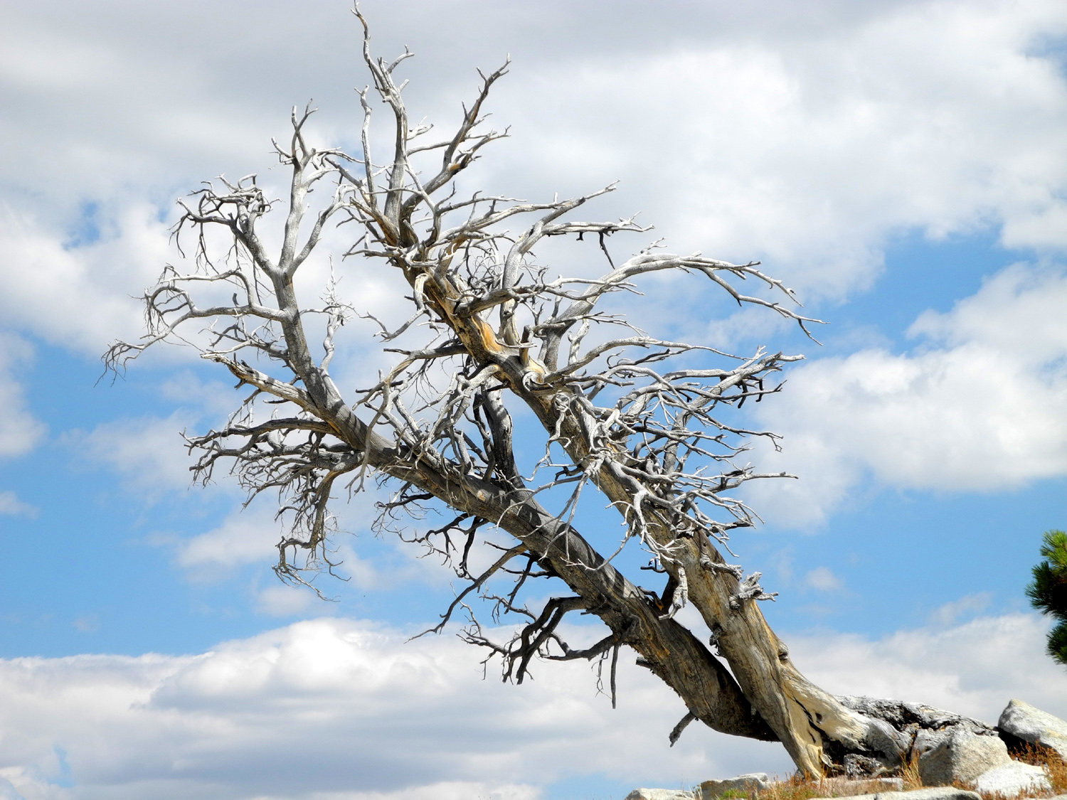
| It's ancient, it's gnarly, it's dead | One of my favorite scenes in the entire area | Base of an ancient, living juniper |
 |
 |
 |
| Detail of bark on the live one | The mossy top of the dead juniper | A dramatic layered rock cliff |
 |
 |
 |
|
Courtright from the ridge above my camp |
It doesn't look it,
but I'm about 100 feet above the lake here |
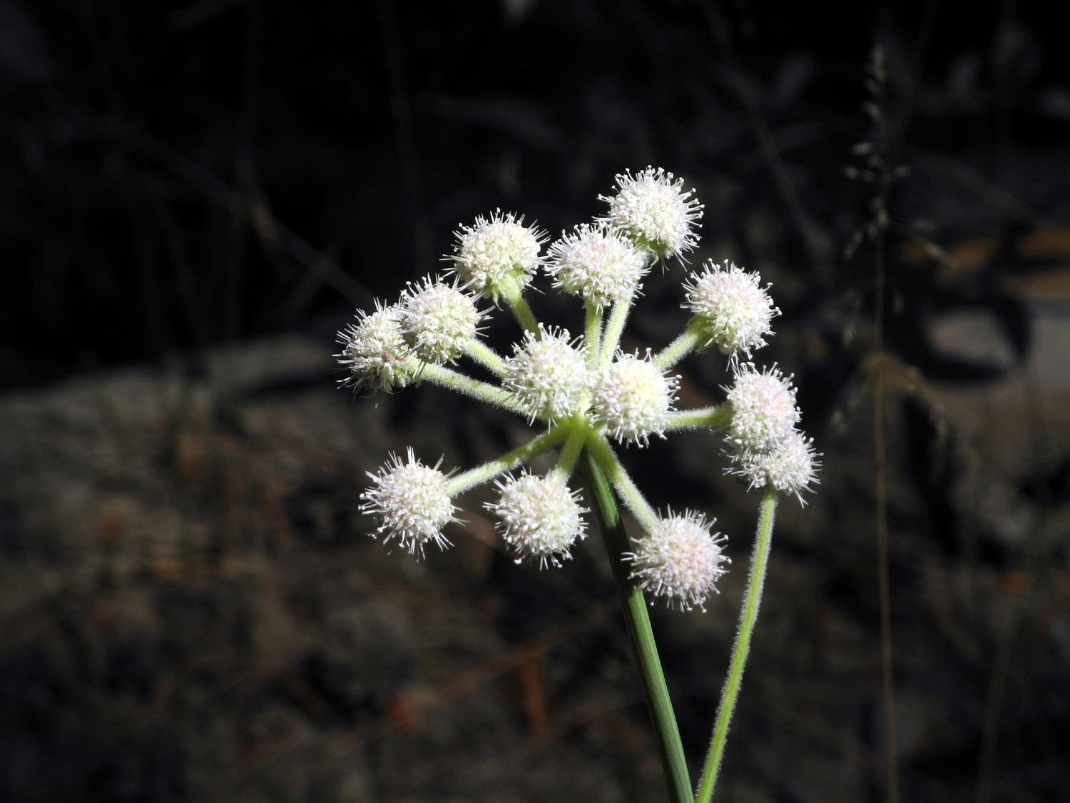
Ranger's Buttons |
 |
 |
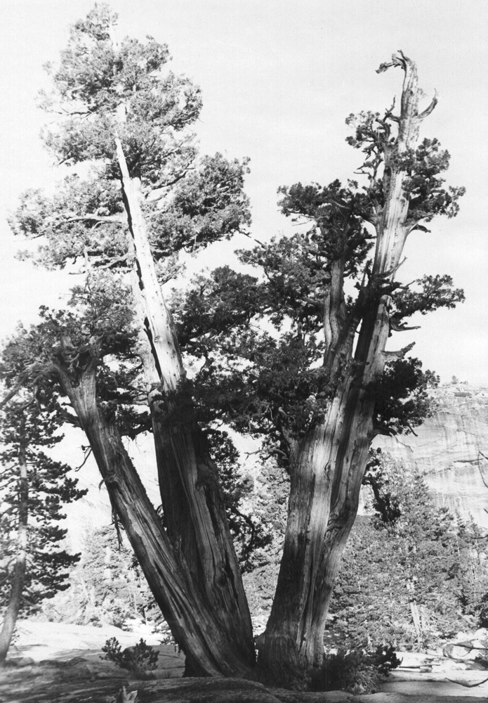 |
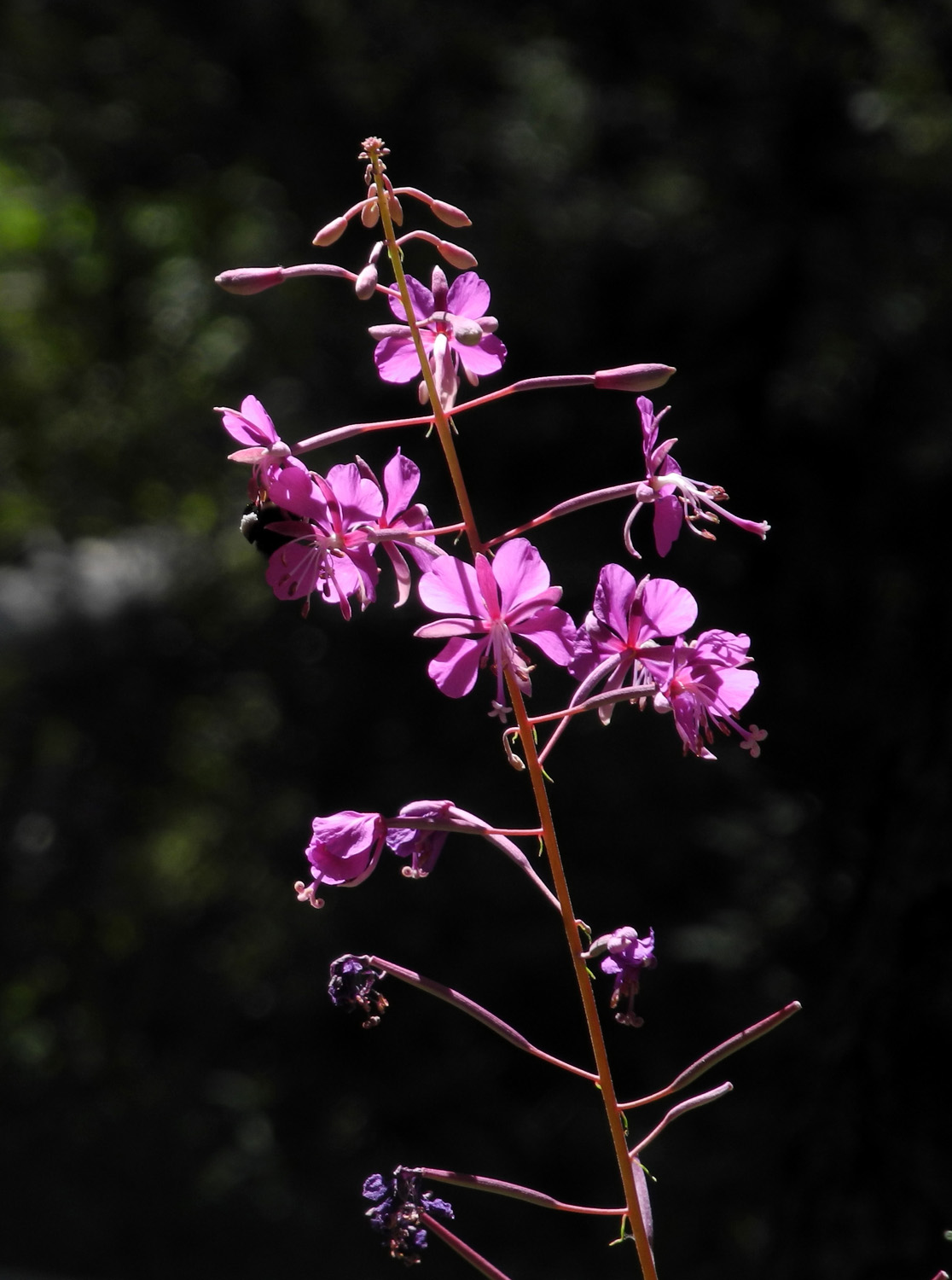
| Fireweed | Juniper below road to camp | Same tree, photographed about 1969 |
 |
 |
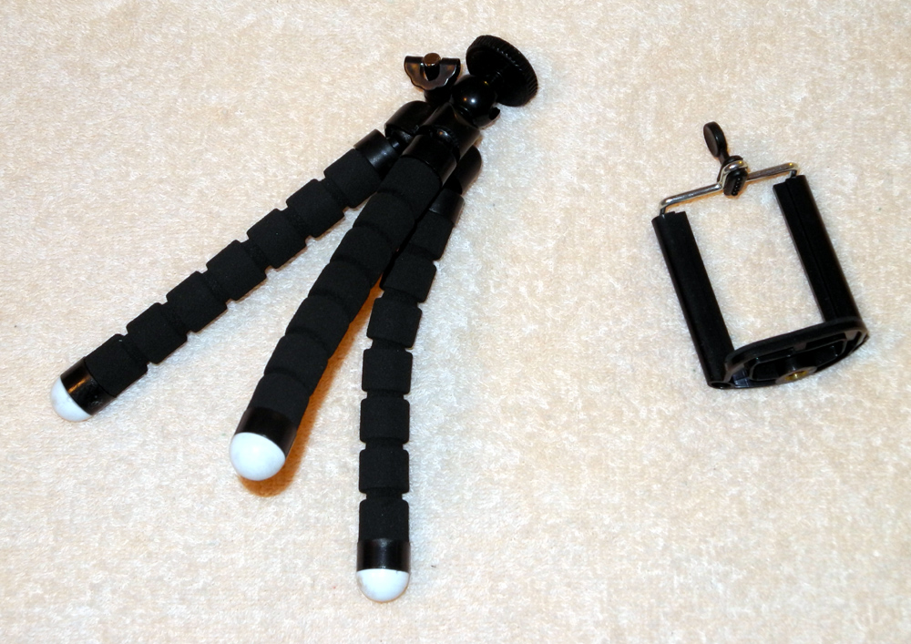 |
| The geological interpretive area | Flowers along the trail | My mini-tripod, with
attachment to hold a cell phone |
| Back to Courtright Photos | ||
 |
|
 |
| Juniper
by the road on the approach to Courtright Reservoir |
Double Dome with Hopeless Dome in front | Double Dome from the north |
 |
||
| Courtright Reservoir, land of many domes | ||
 |
 |
 |
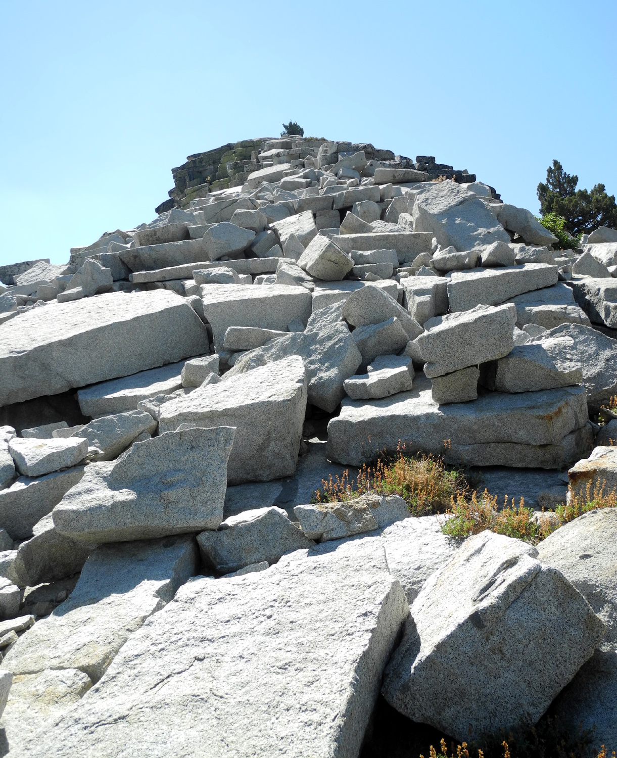
| The approach to Hopeless Dome | In the rock pile on the way up Hopeless Dome | Two-foot thick granite slabs on the side of the dome |
 |
 |
 |
| Admiring
a big juniper tree near the trailhead parking lot |
Rarely,
some junipers are thick and bushy and straight |
Close
up view shows the typical stringy bark of a juniper |
 |
 |
 |
| Rocks trapped in the roots of a fallen tree | Huge boulder on the smaller big granite slope | This shelf is a great place to store your boulders |
 |
||
| The granite slope and Constant Dome | ||
 |
 |
 |
| Hopeless
Dome from the slope below Constant Dome |
View
through the divide between Double and Hopeless Domes |
The perfect resting spot |
 |
 |
 |
| Getting close to the base of Constant Dome | A delightfully jagged boulder next to the dome | Even closer to the base |
|
 |
 |
|
Pondering how that rock got up there |
A closer look | How soon before this rock falls? |
 |
 |
 |
| I touch the base of Constant Dome |
Juniper - looking dead, but actually living |
The few branches still alive |
 |
 |
 |
| First
view of the lake from the base of Constant Dome |
Road map in granite | A last look back up at the dome |
 |
||
| The Goddard Divide | ||
 |
 |
 |
| Nice
juniper just below the road to the parking area |
I
first photographed this tree in 1969 - it hasn't changed much |
Sunrise on Sandy's Dome |
 |
 |
 |
|
Our hiking destination the second day |
Starting up at the bottom of Sandy's Dome | Teri and Sandy on their way up |
 |
 |
 |
| Dogtooth Peak above Courtright | You
can see the road at the bottom, left of center |
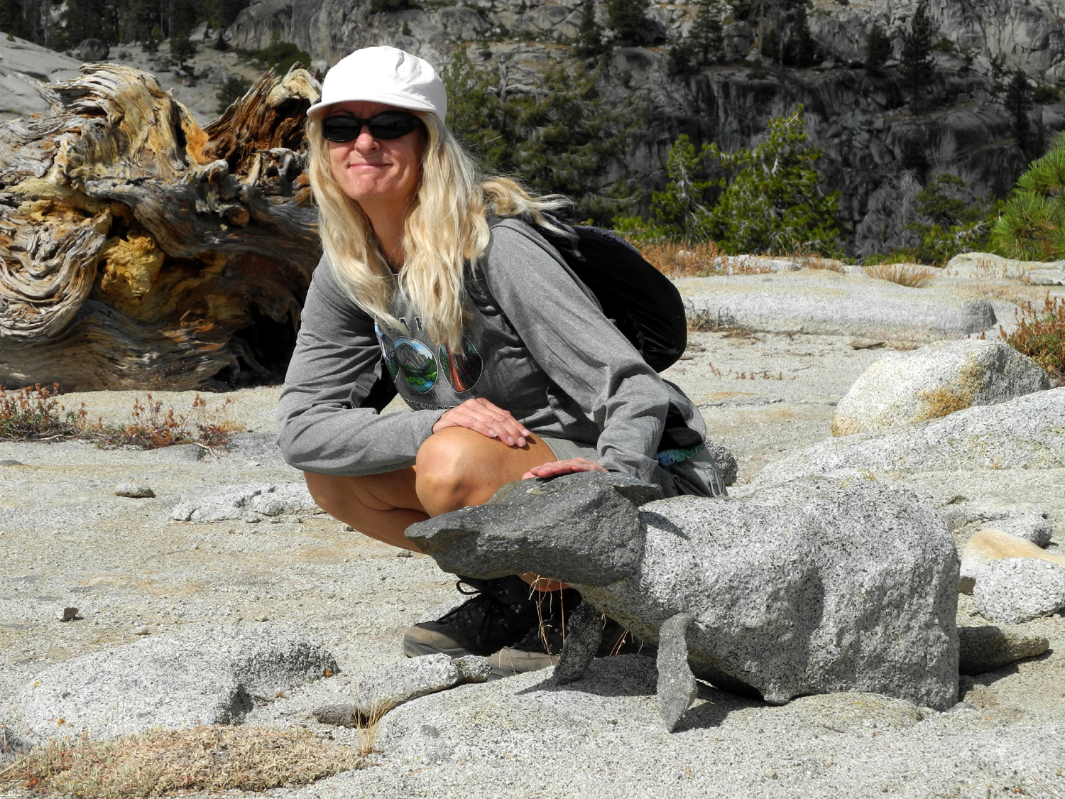
Teri, Dick and Sandy on top |
 |
 |
 |
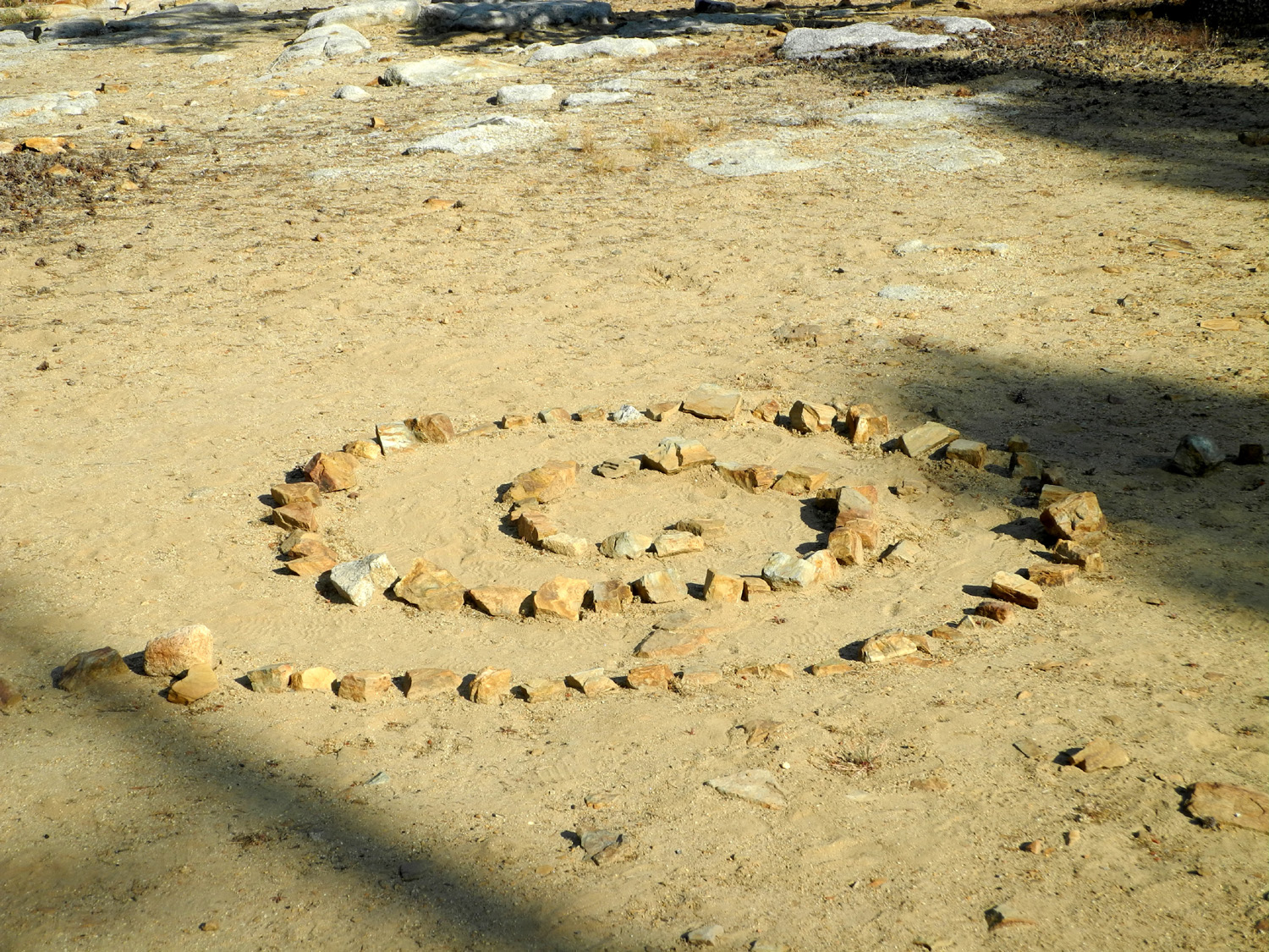
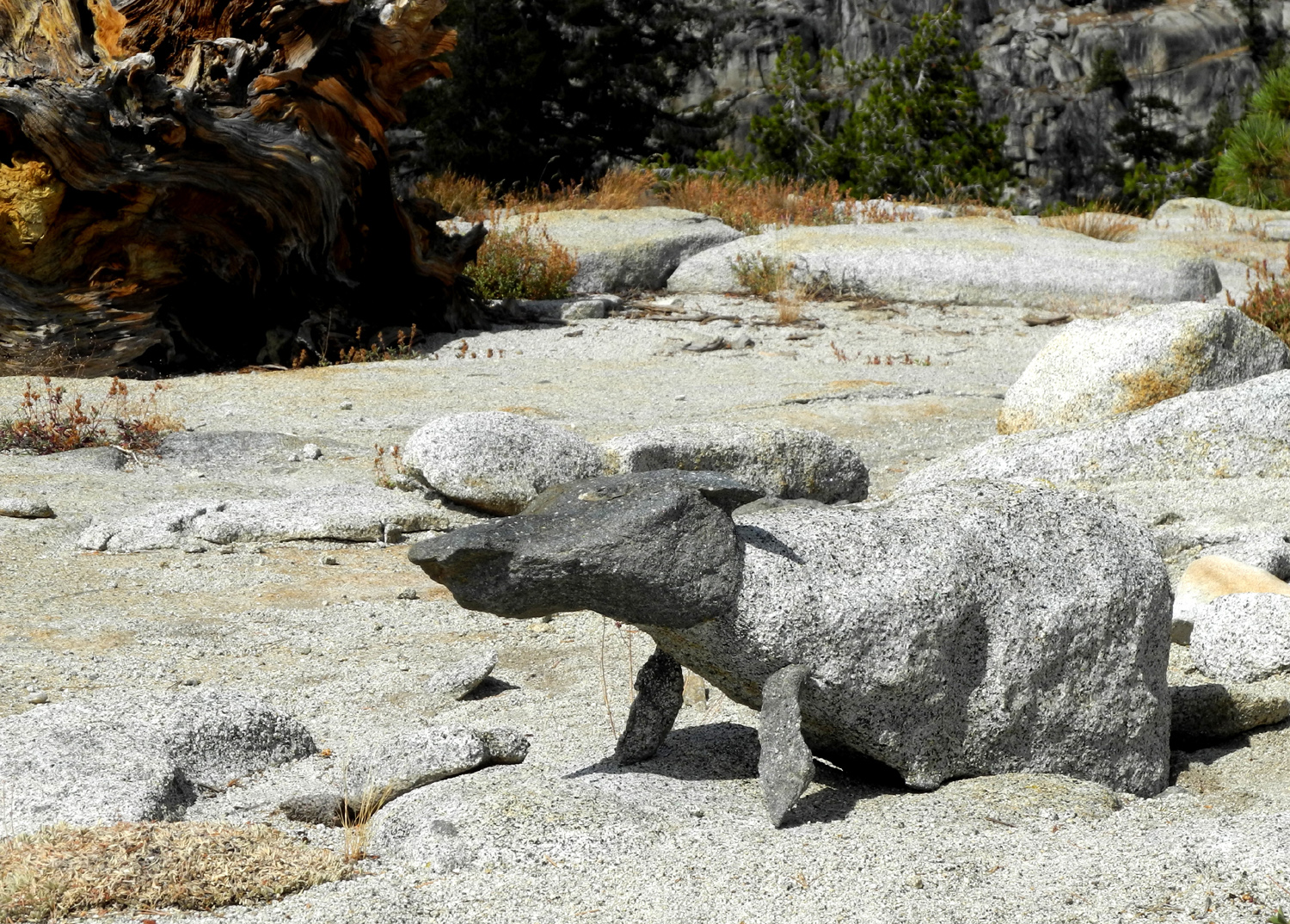
| An
amazing natural sculpture - only the feet were added by humans |
Teri pets the "dog" | A weathered dead tree on top of the dome |
 |
 |
 |
| Another view of the tree | The
work of people with too much time on their hands |
Sandy
in the saddle between "her" dome and Teri's Dome |
 |
||
| More rearranging of nature | ||
 |
 |
 |
| Helm Creek gorge below the dam | Teri on the way down | Another fine ragged stump |
 |
 |
 |
| A rock hound's paradise | Older rock embedded in the granite | A look back at where we were |
 |
 |
 |
| Southwest side of Teri's Dome above Helm Creek | A
dome southwest of the lake with man-made things on top |
Ridge above the trail north of Double Dome |
| Related Links | ||
| Rancheria Falls | Huntington Lake | Shaver Lake |
| Courtright Reservoir | LeConte Divide | Glacial polish |
| Glacial polish photos | Hell for Sure Pass | Dusy-Ershim Trail |
| White Bark Vista | Pleiades | More Pleiades |
| Pleiades photo | Constant Dome Slide Show | Sierra Juniper |