
|
Dick's Travel Roundup #1 |
||
|
Three short trips, taken by car rather than truck & trailer or motor home, in 2007 More Mother Lode A Stormy Night at Grant Grove Yosemite in the Cold |
||
|
More
Mother Lode At
the end of September and the beginning of October 2007, I was in Mariposa
for a longer time than usual, three nights. Although my trips up
there were mainly to work on cleaning out my late parents' house, I was in a “ In the early Gold Rush days, Agua Fria was a bustling city of several thousand, and was the first county seat of Mariposa County. Today it is marked by a “point of historic interest” sign, but there is nothing whatsoever left of the town. In fact, the area where the markers are located is in a rather narrow creek canyon, and I’ve always wondered where the town was. Heading west on Highway 140, the markers (there are actually two of them) are about four miles from town. Just past the markers is Agua Fria Road, which cuts across from Highway 140 to Mt. Bullion on Highway 49. And about a quarter mile in from 140 is another sign which marks the actual town site. Here the creek valley is about 200 yards wide and completely flat – a great place to put a gold rush town. Agua Fria Road
is narrow and winding, but not steep, and is a pleasant drive of
about two miles. Another
two miles north from More
recently the “mint” status of this operation has been called
into question (you can check the sites listed below if you want). I
checked with The
best that we can make of the story is that eight sided ingots were
poured in the smelter of the office building at the The
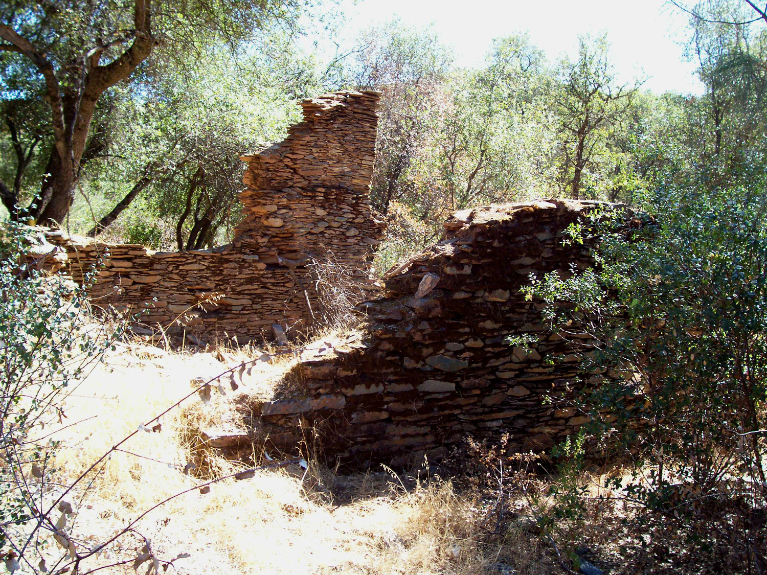
crumbling rock walls of a building, and some other rock work nearby,
are all that is left of the The
walls present at Although
I grew up in |
||
|
A
Stormy Night at Grant Grove Forsaking
my normal modus operandi, I made a reservation at the John Muir
Lodge in During
the planning period the weather had been perfect – highs in the
mid 80s in Highway
180 goes east through fruit orchards and farmland, and crosses the
Kings River at Centerville, turns south at
Minkler, then makes a
sharp left to the east, going through low foothills. As the road
starts uphill, on the right there is a little tongue of the valley
that goes in between some hills, and because it is relatively protected, it
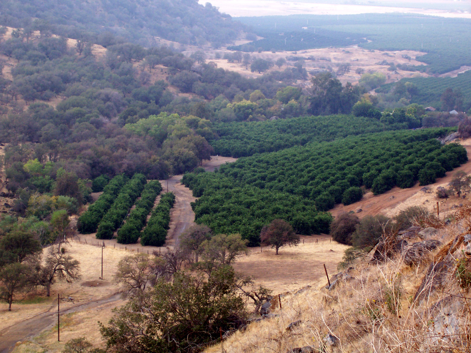
is the site of an extensive citrus
orchard. The road climbs rather
steeply, then levels off and drops gently down into The
true uphill climb starts a few miles past here, winding up through
brush-covered hills, gaining elevation quickly and taking you into
pine covered mountains. The entrance to Just
before you turn down the road to the tree, you arrive at
Grant
Cedar
Grove is the only other road-accessible part of the park, and is about 35 miles into the
Sierra from the Grant Grove section. The road passes through Nearby hills obscured the view into the canyon, so I continued my drive on down the mountain. When the road seems to have reached bottom, it is actually still about 100 feet above the river, which runs through a narrow gorge surmounted by steep, rocky hills. A short distance further the road reaches the actual river level, and parallels the river the rest of the way to Cedar Grove. This
area is a glacier-carved valley similar to It
also lacks the crowds of its more famous neighbor to the north,
making a visit there a peaceful experience even in the summer time.
In late October, I often drove for a mile without seeing another
car. I stopped at one of two waterfalls in the area, The road eventually comes out through a residential area and rejoins the main road at the very entrance to the valley. On the way, I saw a bear strolling down the road in front of me. As soon as he realized I was behind him he took off at a gallop, then headed up the bank. I
returned to While
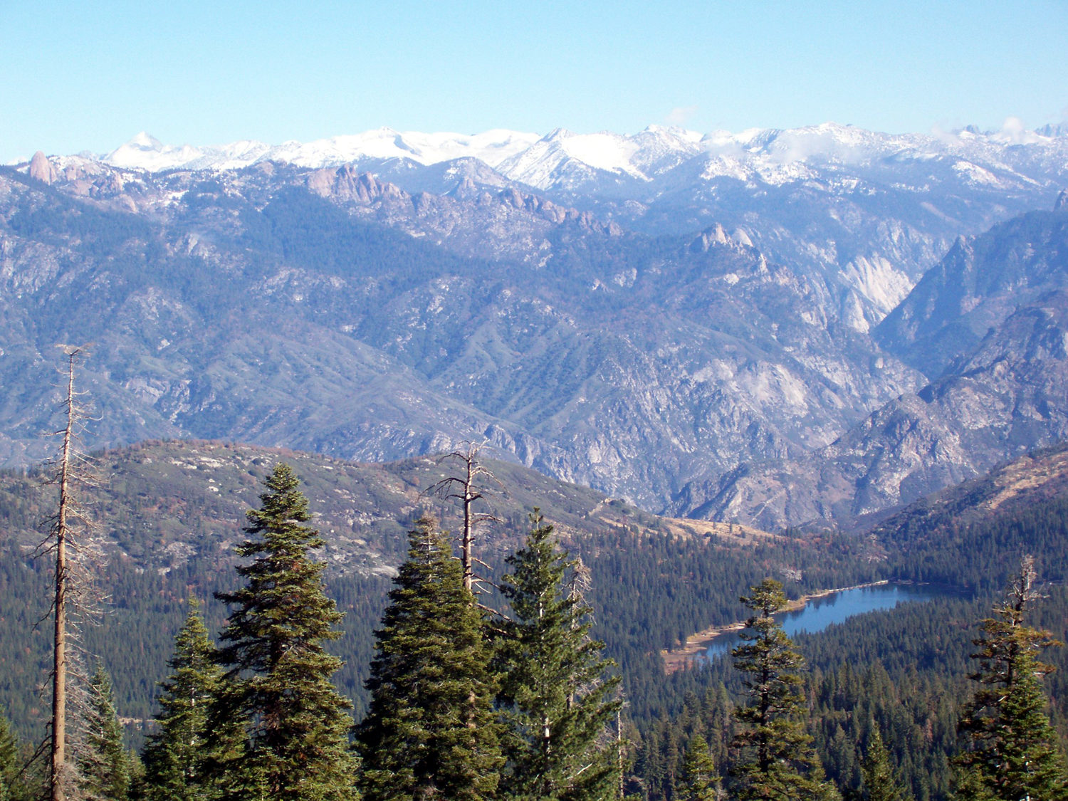
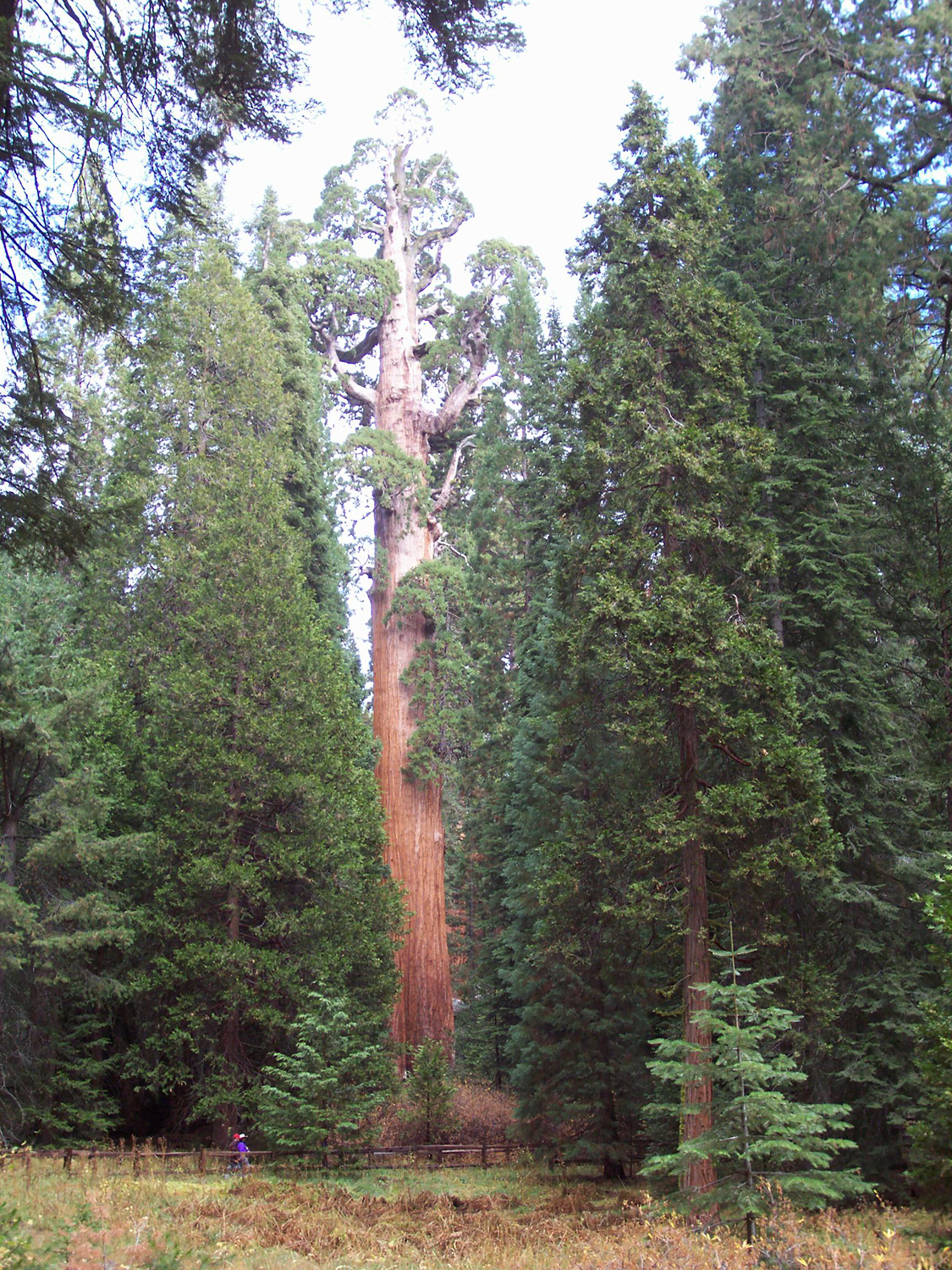
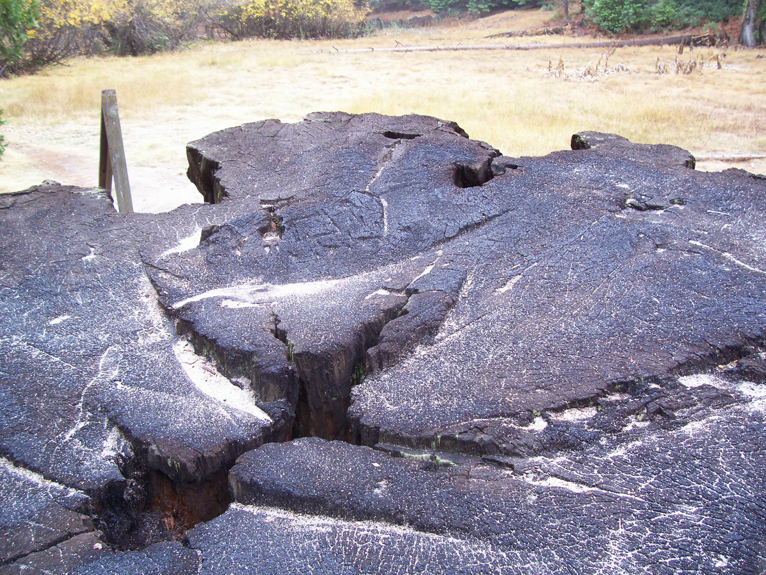
still in the national forest, I took the dirt road into After checking into the lodge, I wanted to drive up to nearby Panoramic Point, which offers a view of the high Sierra peaks. Although I’ve been visiting these parks since the 1960s, I did not know about this location until my younger daughter and her husband worked in the park in the late 1980s. It’s about a two-mile drive, all uphill on a narrow, winding paved road, followed by a 300 yard walk. Driving up the road, I saw two deer. Throughout the day there had been a few drops of rain now and then, not enough to even get wet in, but as soon as I got to the parking area, large cold drops started falling. Realizing (or rationalizing) that all I would see would be clouds, I decided to postpone this walk, and headed back down hill. I had dinner in the restaurant, then settled in for the night. Not long after that the real storm began, and we had a good hard rain for two or three hours. The next morning started out bright and clear, so I headed back to Panoramic Point. With a night’s rest, the trail was quickly conquered, and I was very glad I had returned. There were a few thin patches of snow along the trail, and the view of the high peaks was spectacular. I had caught glimpses of them from various locations the day before, and they were bare rock; today they sparkled with a layer of fresh snow. After checking out of the motel, I visited the gift shop. I have a couple of friends still working who do their “traveling” via souvenir magnets that another retiree and I bring them, so I picked up a couple of those. My next stop was Grant Grove. From the parking lot there is a short loop trail that goes up to the General Grant Tree, passing numerous other large redwoods and a fallen log that you can walk through. There is also a longer trail that goes up the hill above the Grant Tree, but I decided that the shorter trail was enough for me. By the time I left this area, low clouds or fog had drifted in, and soon the tops of the biggest trees were nearly hidden in the mist. On my way out I stopped at the entrance station and walked a few hundred yards to the Mark Twain Stump. This tree was cut down in the 1800s, cut into sections, then exhibited in the east, to prove to skeptical folks back there that the tales of California’s giant trees were true. Although the goal was worthy, the destruction of this magnificent tree for any purpose could not be justified, and would be unthinkable today. Next to the stump is a plaque with an amazing photo of the tree as it fell. This photo also appears in They Felled the Redwoods. When I had finished this short walk, I headed for home, vowing not to wait another ten years before my next return. |
||
|
Yosemite
Draws Crowds Even in the Cold The road to Glacier Point leaves the main road between the valley and the entrance, about 20 miles from the latter. The point is at the 7,200 foot elevation, right on the edge of the cliffs surrounding Yosemite Valley, and offers probably the best view of the high country and the valley that you can get without hiking. The road is closed for the season when the winter snows begin, but we’ve had very few storms so far. There was probably some snow at the end of October, but it’s long gone everywhere below the highest peaks. Parking is difficult at Glacier Point in the summer, but there were plenty of spaces when I arrived about 12:30 on November 25, 2007. Even so, it seemed that there were a lot of people there. If
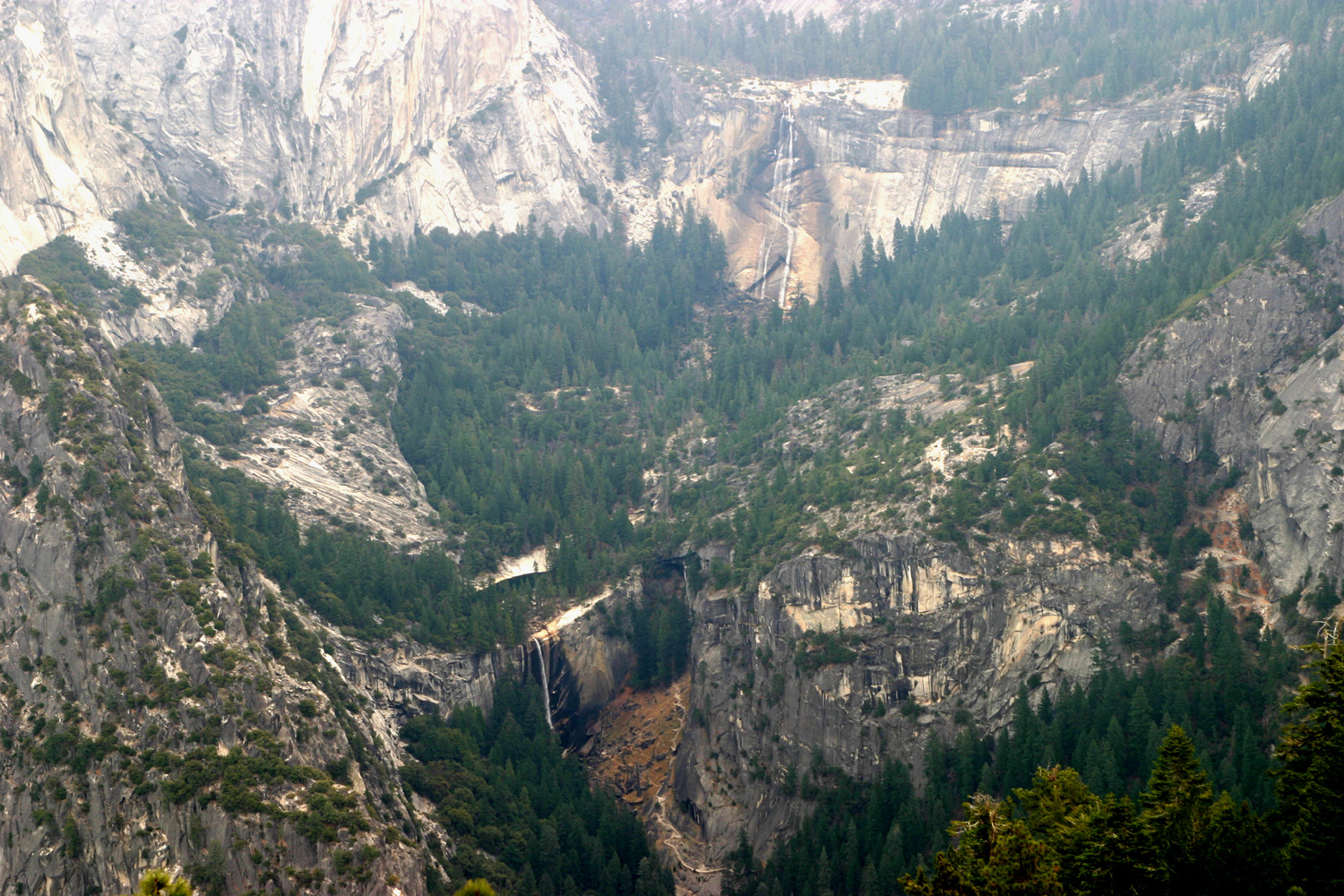
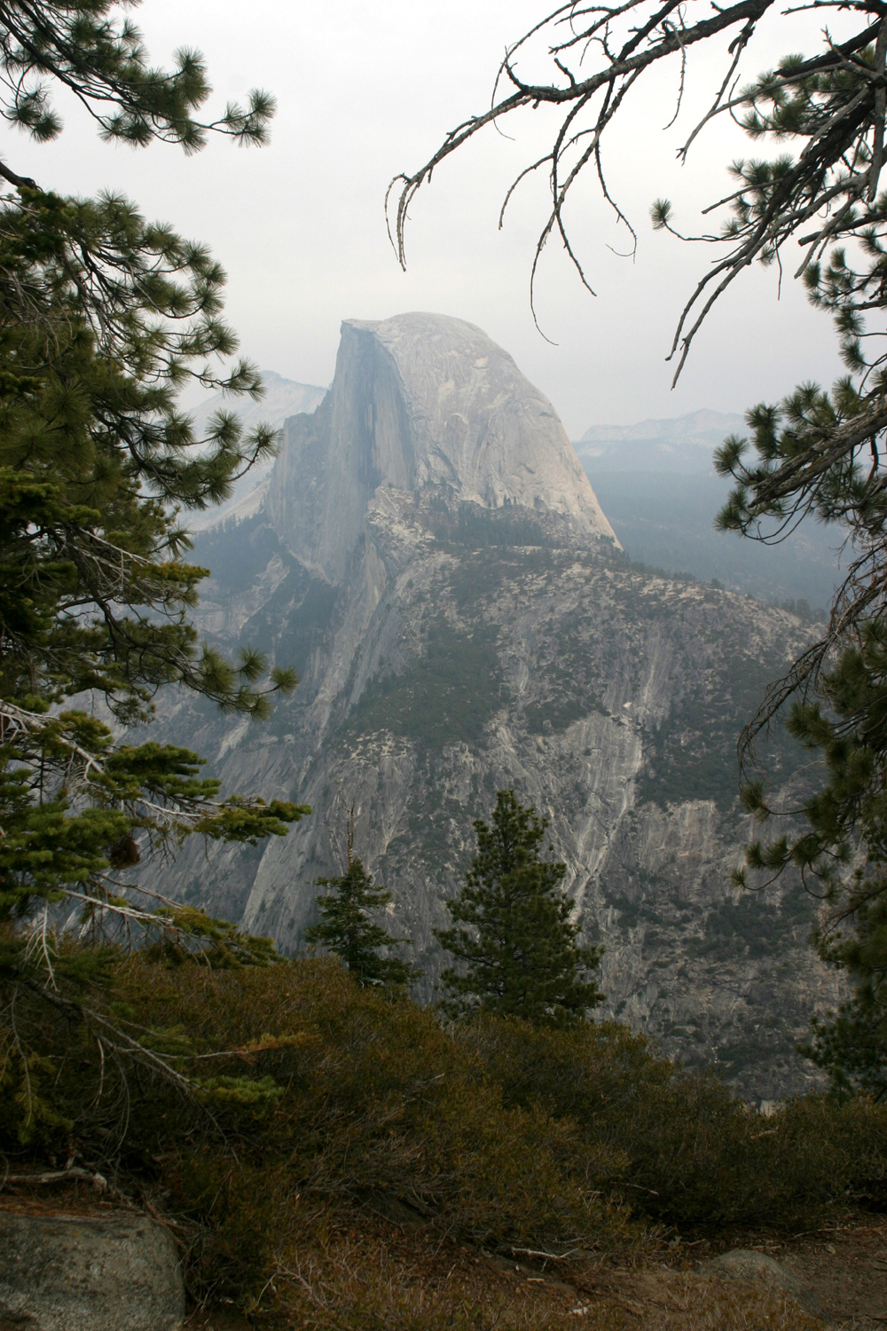
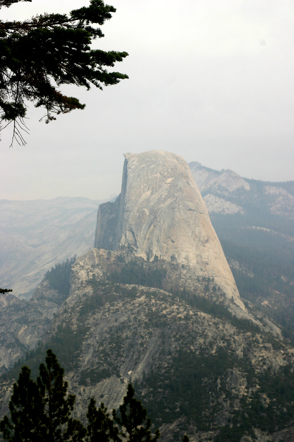
you have never been to It was overcast and quite cold, but the clouds were high and did not hide the mountains. I wore four layers and a warm cap, and was quite comfortable. I have taken so many photos at Glacier Point in the past that it would seem there is nothing new to photograph. However, the last two times I was there I have tried to find some different angles, and I still took a photo of Half Dome for the 40th time or so. We had a very dry winter last year, so the streams in Yosemite are at an all-time low. I've been to Glacier Point in November before, but I have never seen the two big waterfalls on the Merced River, Vernal and Nevada, so low. I spent about an hour there, then headed down the road, which drops three thousand feet into Yosemite Valley, then west toward Mariposa. On the way I stopped at Washburn Point, about a mile from Glacier Point, and 200 feet higher. This place gives you a different view of things. Half Dome is almost in profile, and you seem to look straight down on North Dome and Basket Dome. Even
if you have been to Slide
material was removed and a rock barrier erected, and the road reopened,
but within twelve hours additional material fell and the road was
closed again. The slide remained active for many months, and the
road remained closed during this time, a devastating blow for the
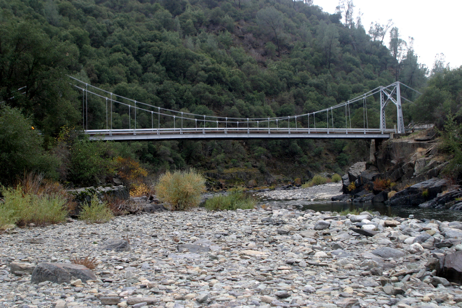
town of Mariposa, which is highly dependent on tourists passing through to By the end of July a temporary bridge was installed, and limited one-way escorted traffic was allowed through the route. Several weeks later a second bridge opened, and one-way traffic, controlled by a light, was permitted for vehicles 28 feet in length or less. The temporary road lies on the old Yosemite Valley Railroad grade. While this helped, it still did not bring things back to normal. Lots of tourist traffic into Yosemite is via bus, and large buses cannot cross the temporary bridges. Several options are under discussion for a permanent fix, the latest of which is a high viaduct over the area. This is the cheapest and quickest method, and probably the best. Other options include abandoning the road and building a tunnel, a long and very expensive proposition. The earliest possible target mentioned is usually 2010. (September 2013 update: The issue is still not resolved, although larger temporary bridges now allow bus traffic. It now appears that a rock shed is the most likely option. (February 2026 update: This is the latest information I could find on this long-delayed project. There's no guarantee this is what will actually happen.) I could not take pictures, because no stopping is allowed on the detour, but some of the links below have photos. Continuing down Highway 140, I stopped at Briceburg, where the highway leaves the river. When I was a kid we came to this area for fishing and swimming, and the old suspension bridge that crosses the river is still in place. After crossing, you can follow the old railroad grade downstream to several nice spots. When I was going there we just called it “Briceburg,” but now it is the Merced River Recreation Area, with several named campgrounds downstream about two to three miles from Briceburg. The area is administered by the Bureau of Land Management. I finished my 160 mile trip to Mariposa just as it was getting dark; ate dinner at the Miner’s Inn, and headed for the house to get to work. --Dick Estel |
||
Photos (pictures open in a new window) |
||
 |
 |
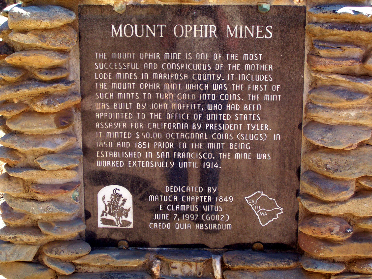 |
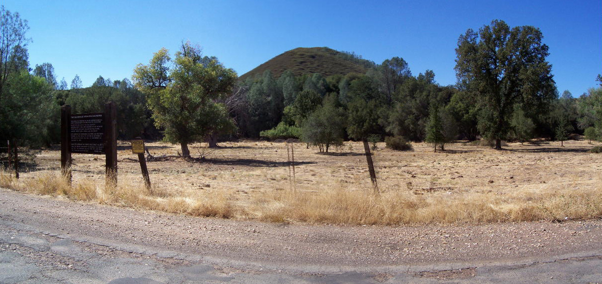
| Agua Fria Town Site sign | Location of Agua Fria | Mt. Ophir Sign |
|
 |
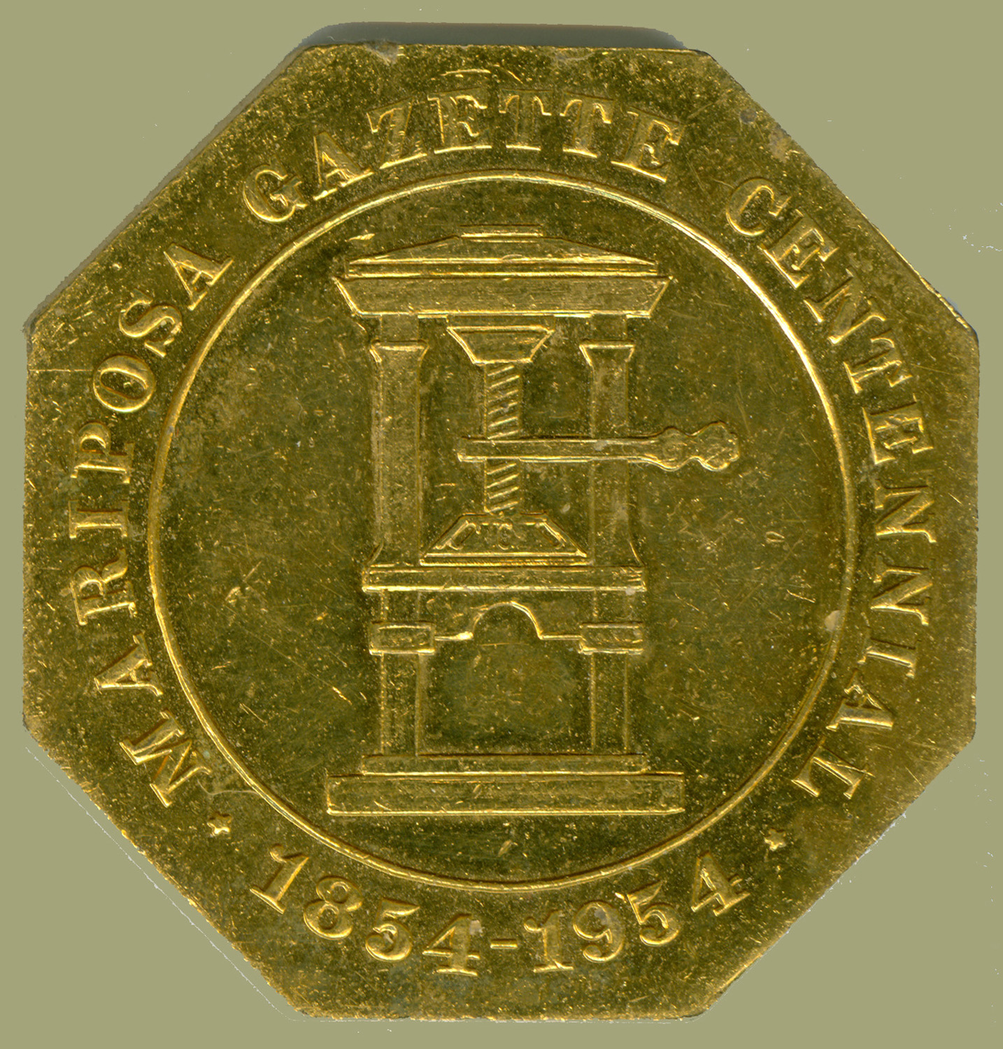 |
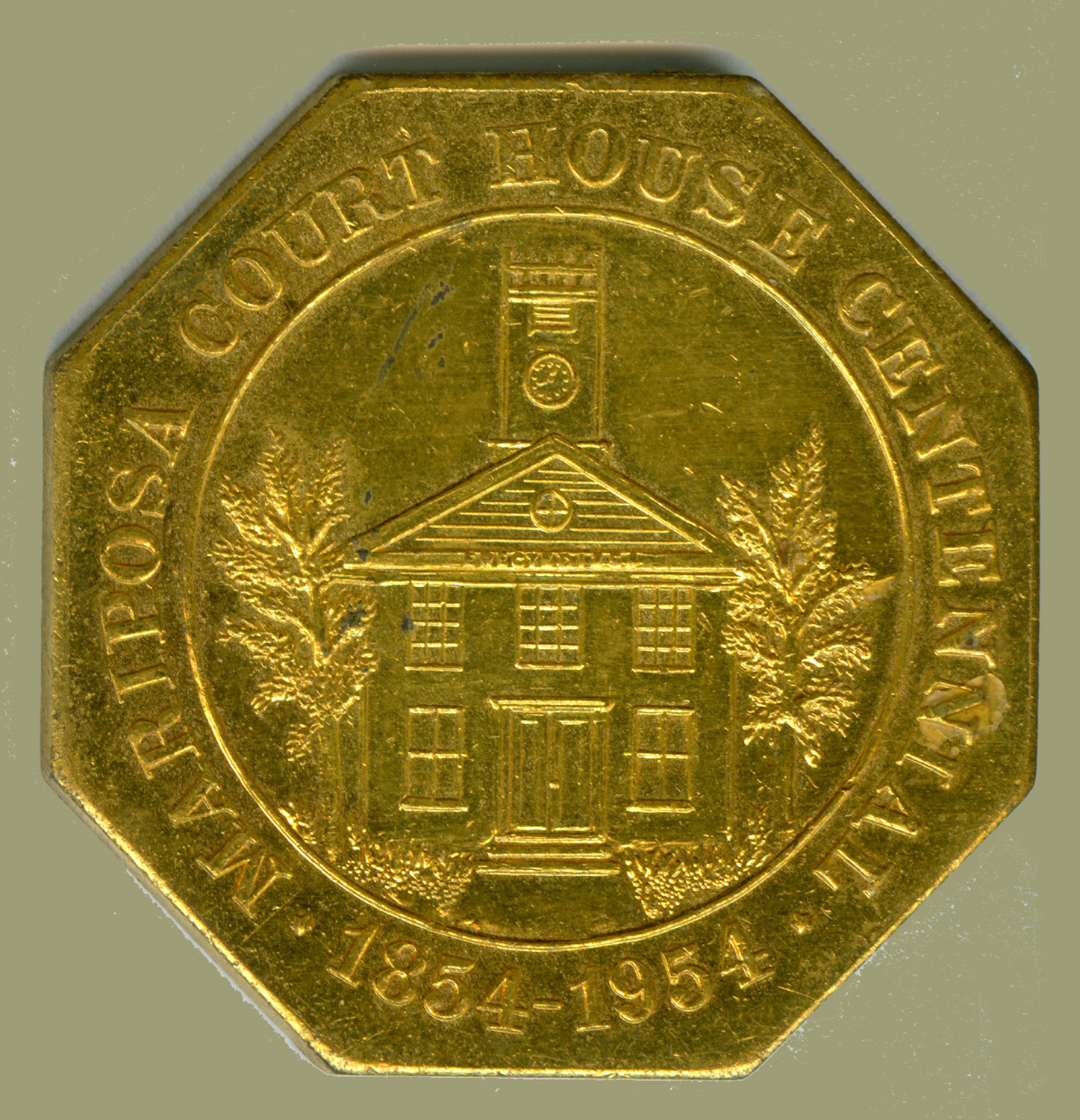
| Rock wall at Mt. Ophir | Octagonal souvenir "coins" honor the Mariposa Courthouse and Mariposa Gazette newspaper's 100th year | |
 |
 |
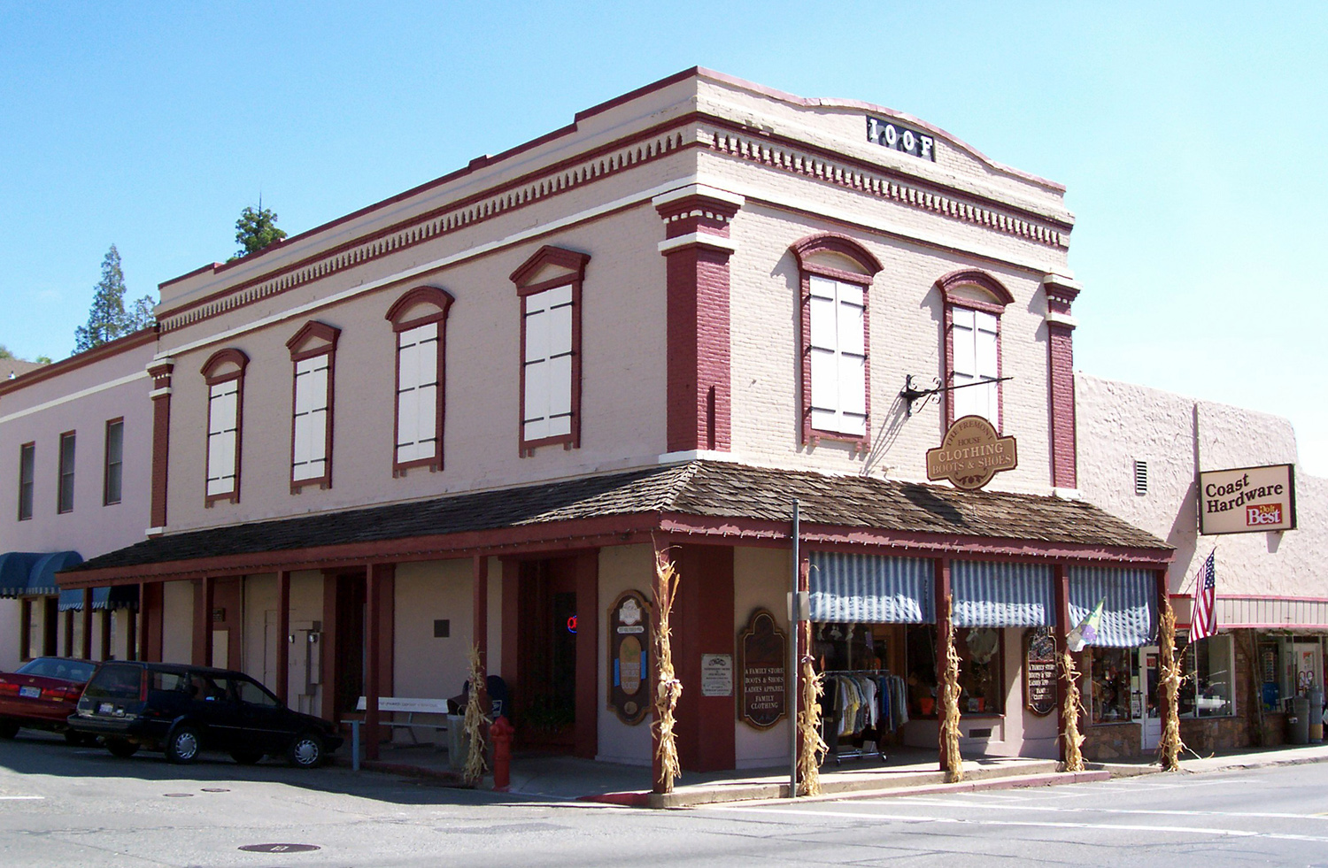 |
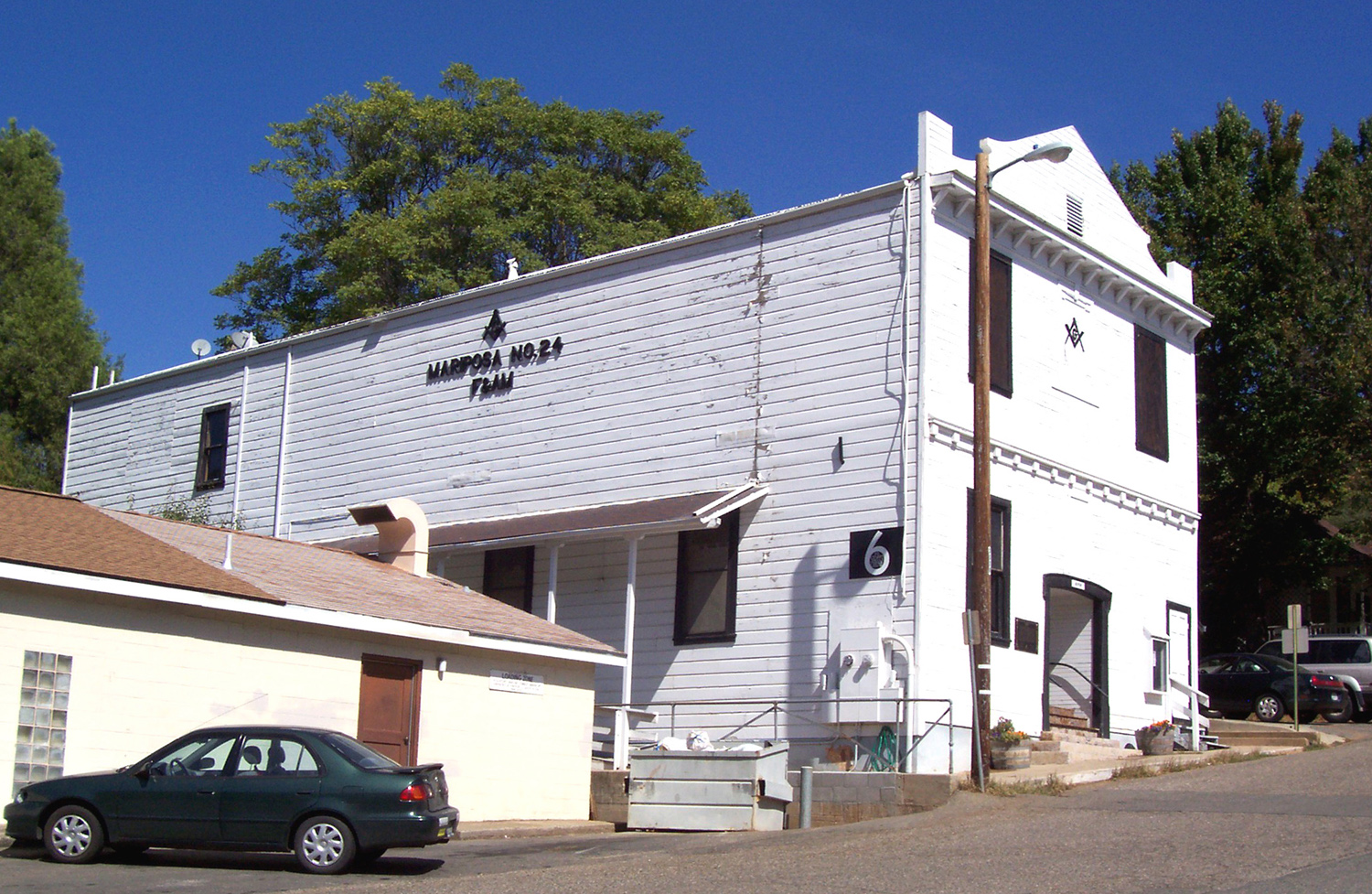
| View east from Mt. Bullion | Two of Mariposa's historic buildings, the Masonic Hall and the Oddfellows Hall | |
 |
 |
 |
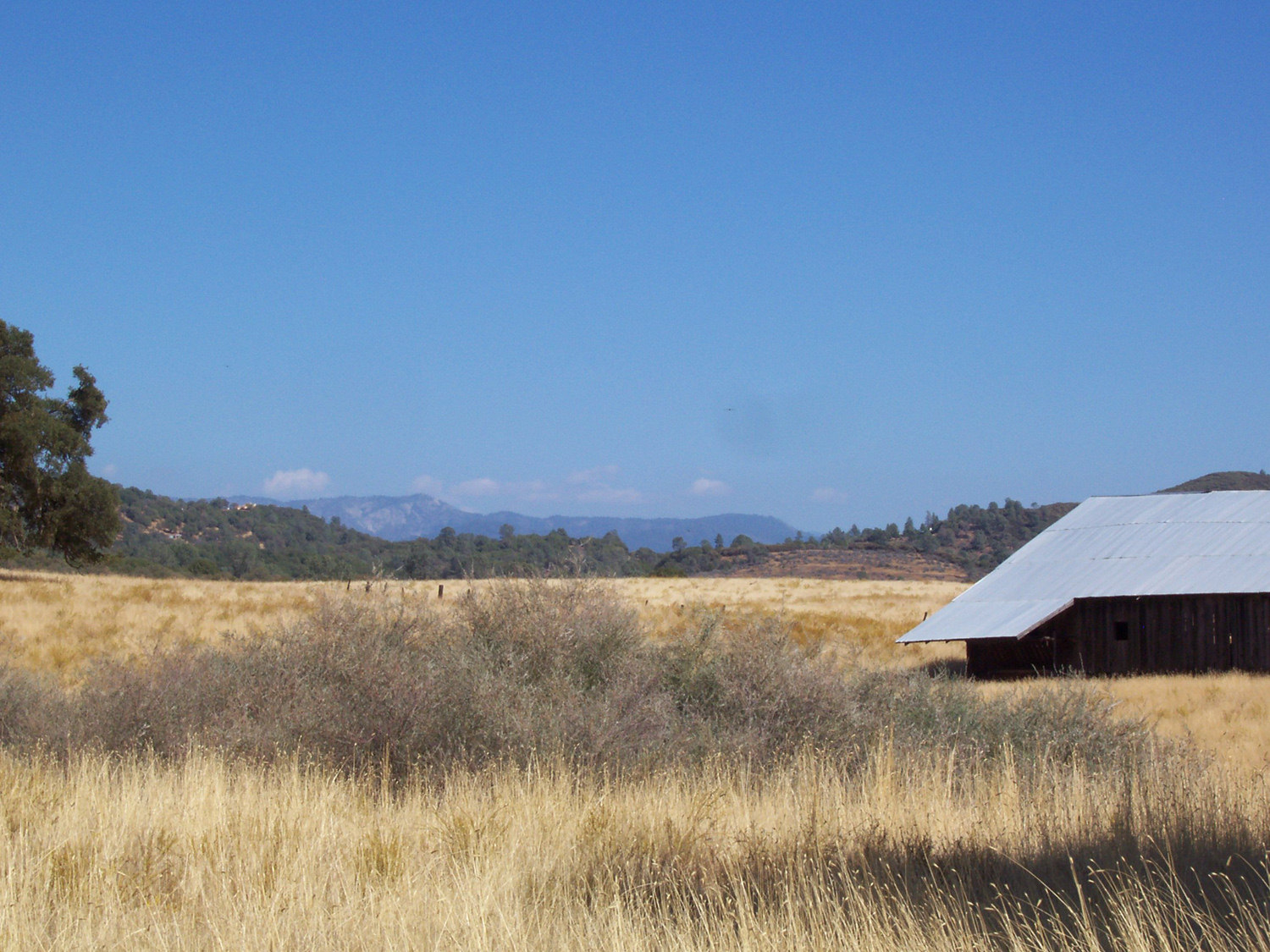
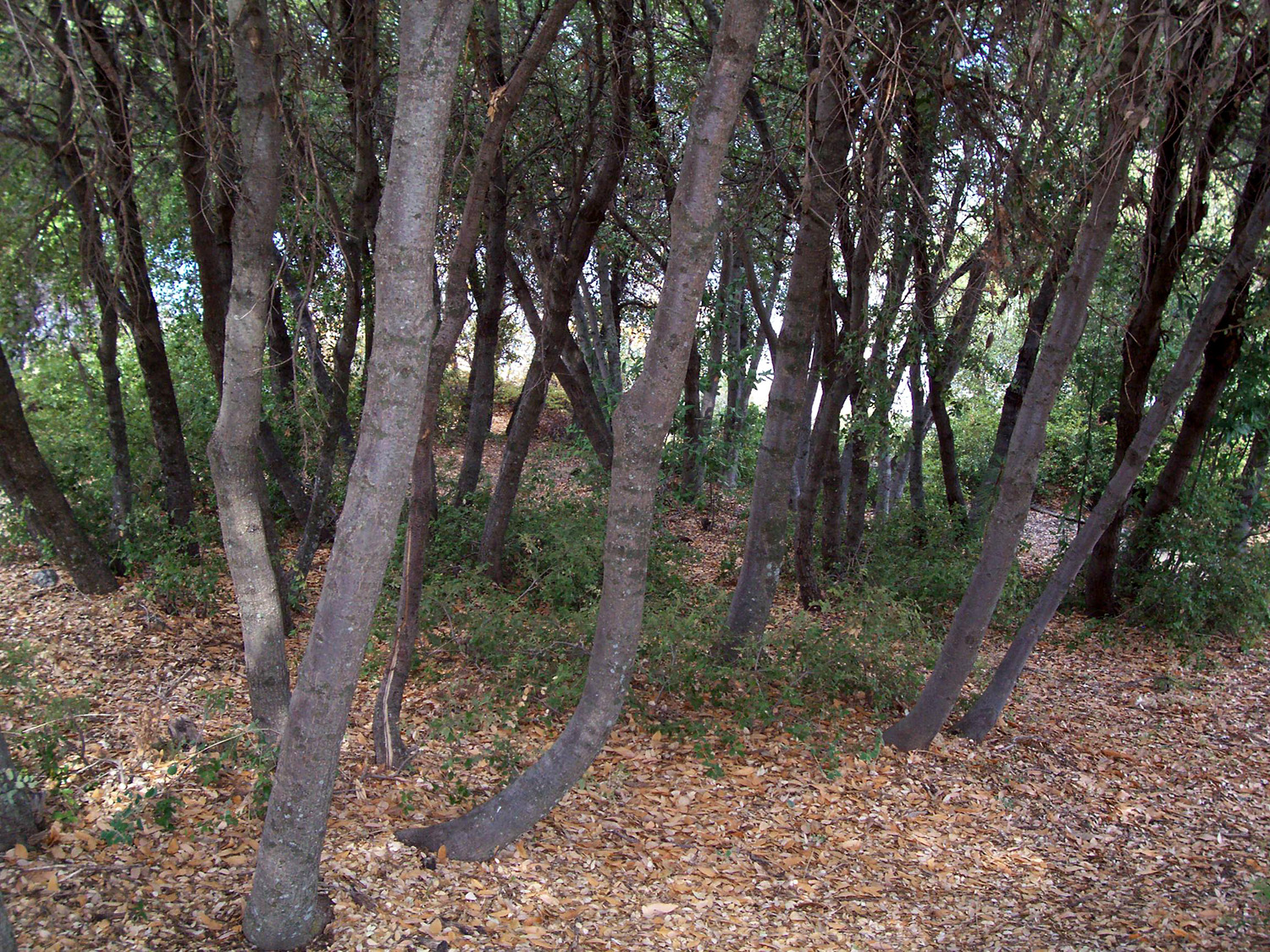
| Orange orchard by Highway 180 | Thick grove of live oaks in Sequoia Forest |
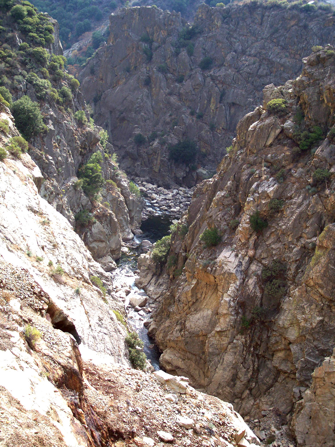
South Fork of the Kings, about a half mile above the confluence with the Middle Fork |
 |
 |
 |
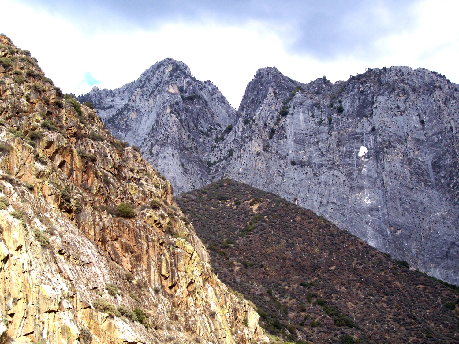
| Marble Mountain above the river |
Roaring River Falls in Cedar Grove |
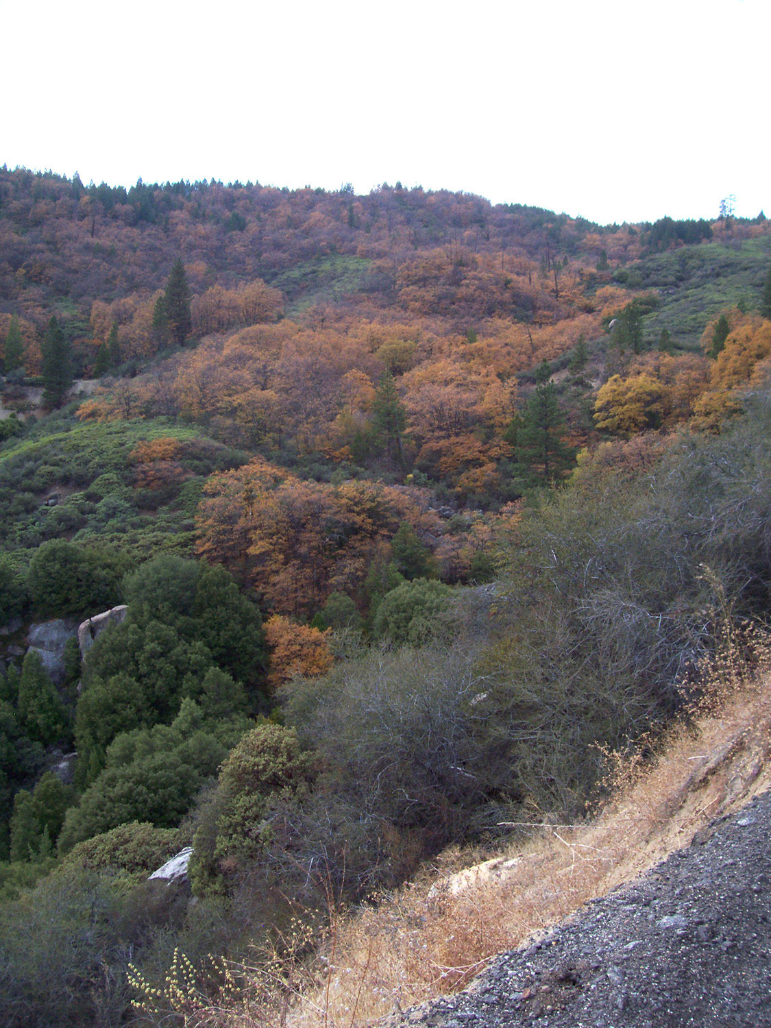
A study in gray, green and orange |
 |
 |
 |
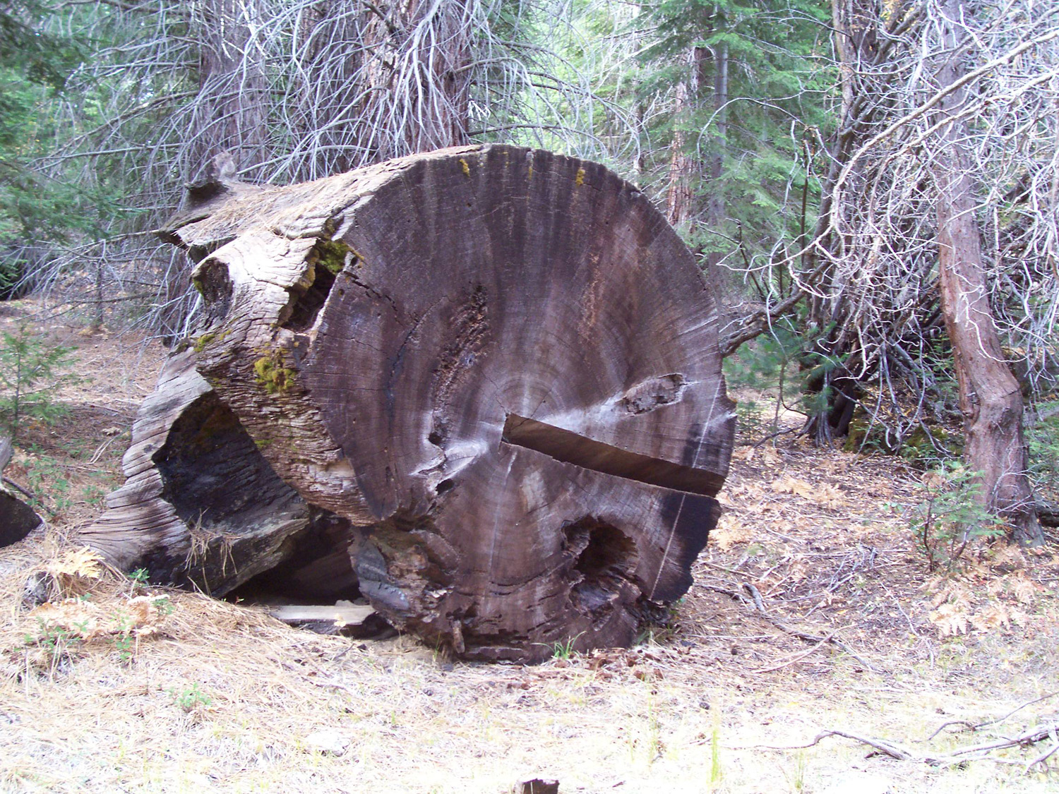
| Big stump in Converse Basin | Abandoned log section in Converse Bsin | View from Panoramic Point, above Grant Grove Village |
 |
 |
|
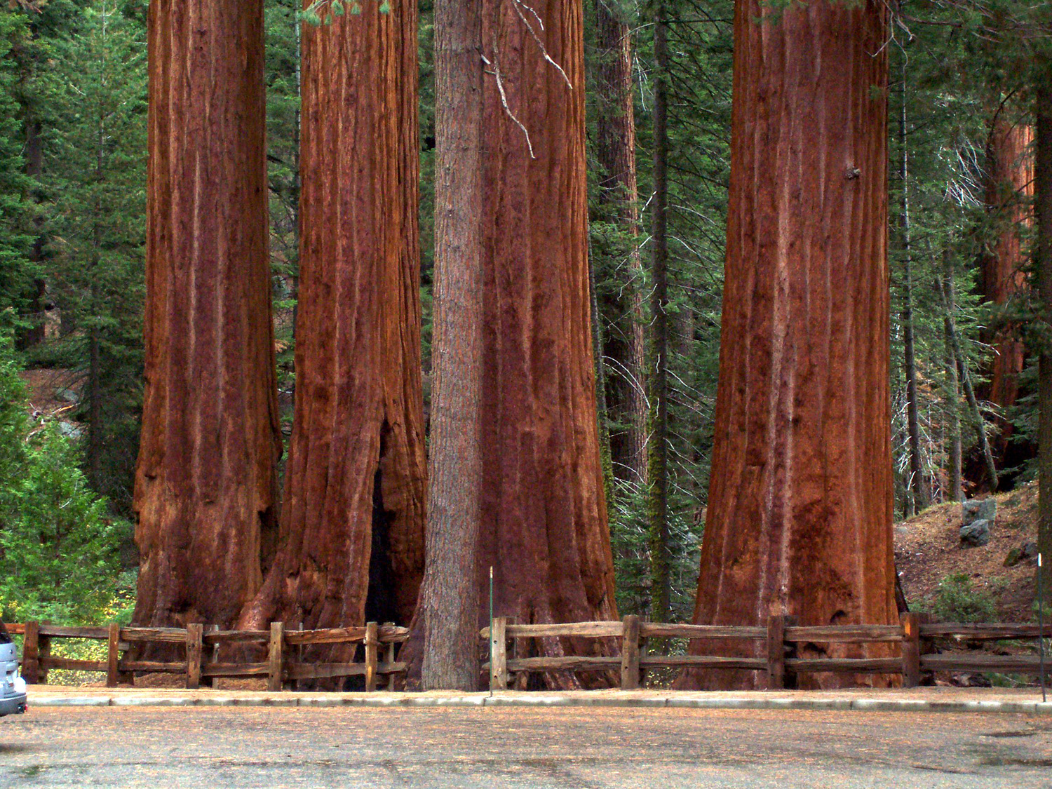
| The General Grant Tree | A closer view of the General Grant | Redwoods by the Grant Grove parking lot |
|
 |
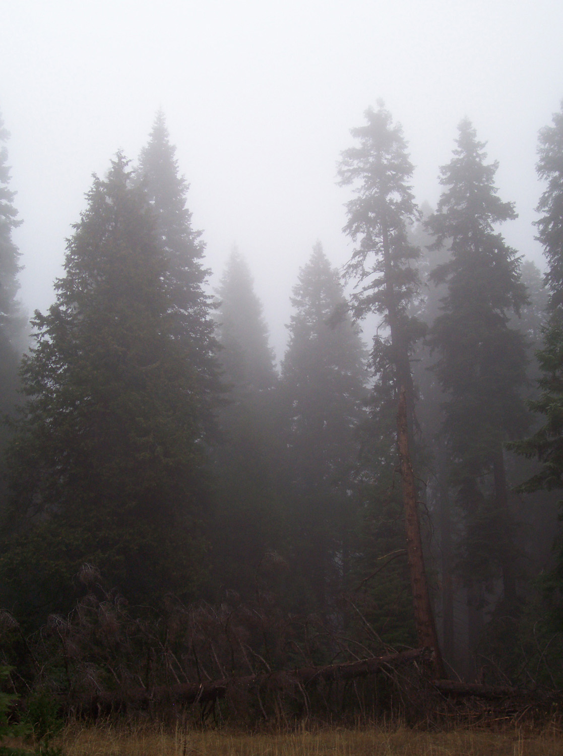 |
| The Mark Twain Stump | Top of the Mark Twain | Mist in the forest |
 |
 |
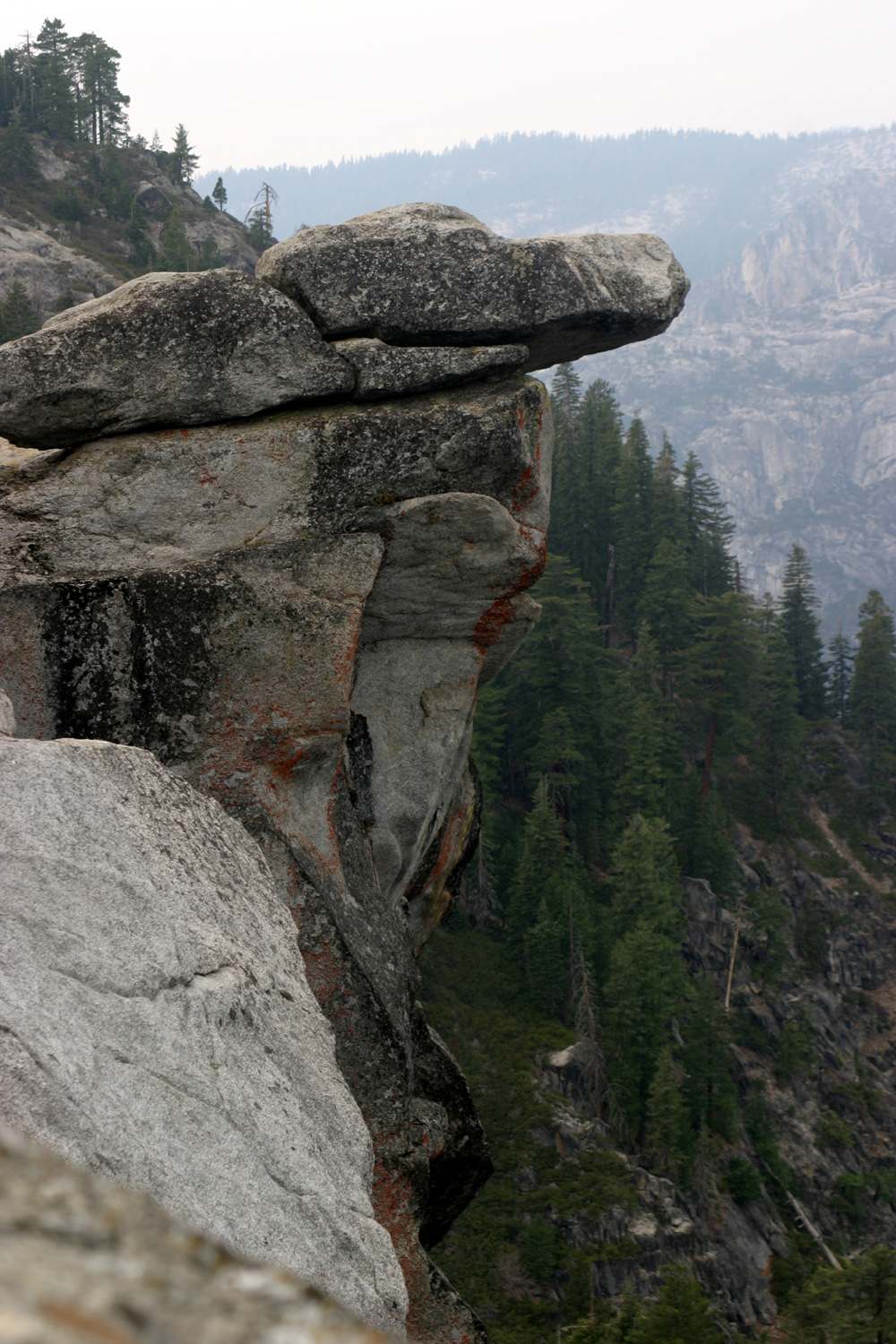 |
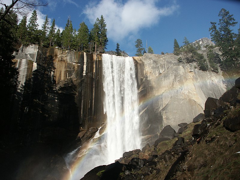
| Vernal & Nevada Falls, almost dry, November 2007 | North Dome & Basket Dome from Glacier Point | The Overhanging Rock (people used to
pose on this, but it's discouraged and illegal) |
 |
 |
 |
| Half Dome, classic view from Glacier Point | From Washburn Point, Half Dome is nearly in profile | Mt. Starr-King |
 |
 |
 |
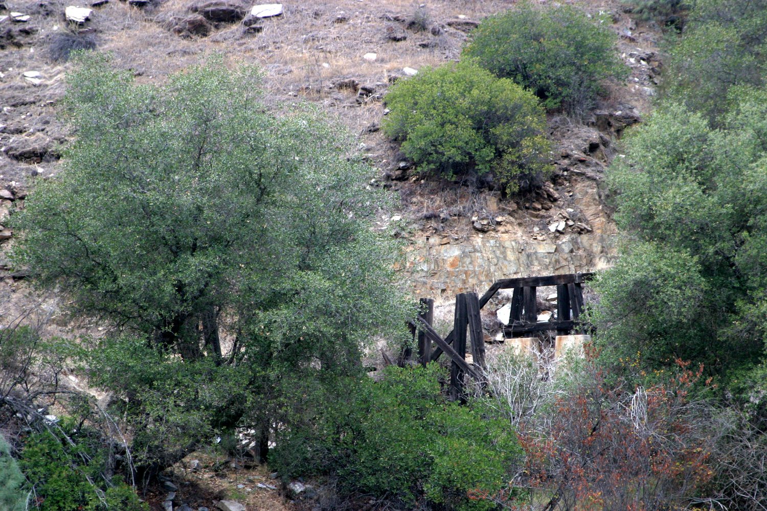
| Suspension Bridge at Briceburg on Merced River | Remains of trestle on Yosemite Valley Railroad grade | Holly berries add a touch of holiday color to the foothills |
|
Related Links |
||
| Mt. Ophir Gold Country Site | Mt. Ophir Wikipedia Entry | Mt. Ophir Info |
| Agua Fria Gold Country Site | Agua Fria History | Sequoia & Kings Canyon National Parks |
| Ferguson Slide Photos | Sierra National Forest | Merced River Recreation Area |
| Yosemite National Park | Vernal Falls photo | Glacier Point |
| Briceburg | Giant Sequoia National Monument | Ferguson Rock Slide |
| Trabucco family | Oddfellows | |