
Dick's Adventures of 2016 - Part 3 |
||
|
Adventures of 2016 Part 1 Adventures of 2016 Part 2 Adventures of 2016 Part 4 Adventures of 2016 Part 5 Adventures of 2016 Part 6 Adventures of 2016 Part 7 |
||
|
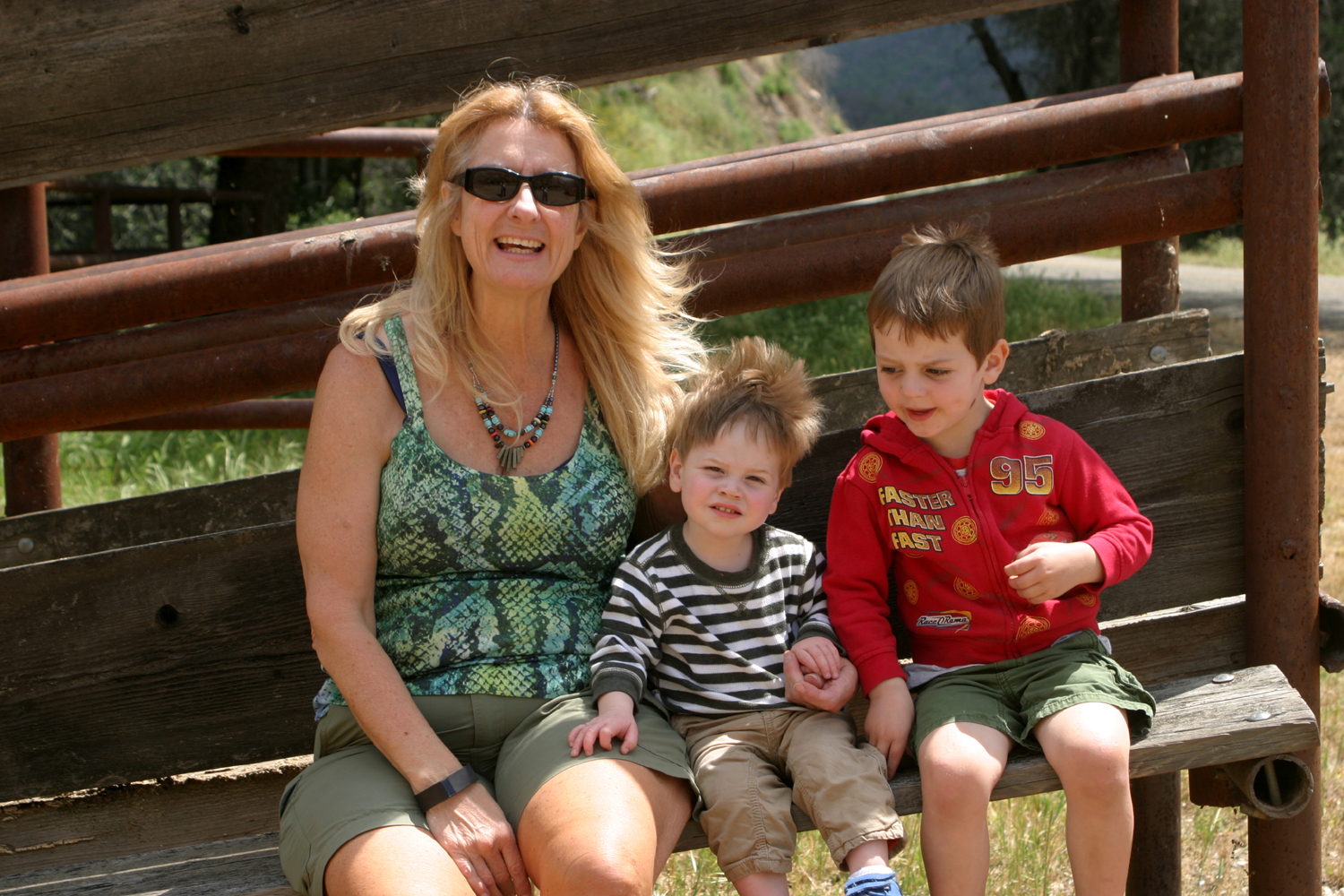
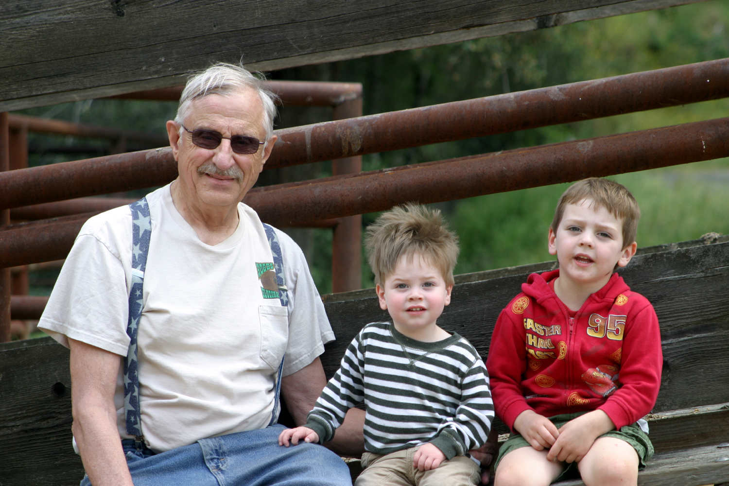
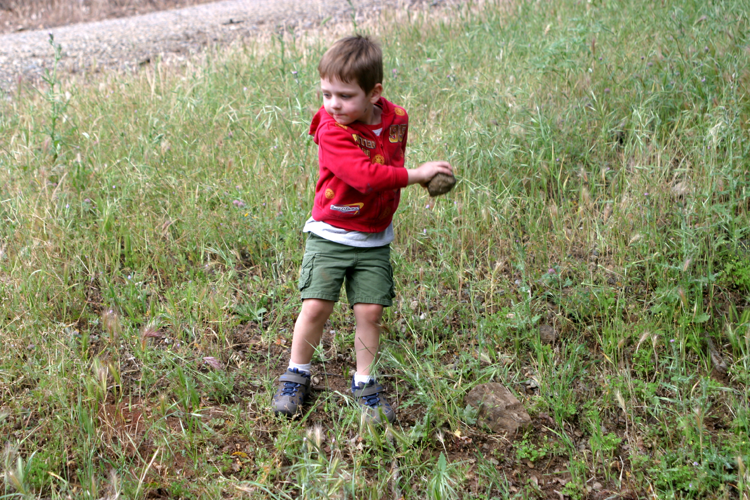
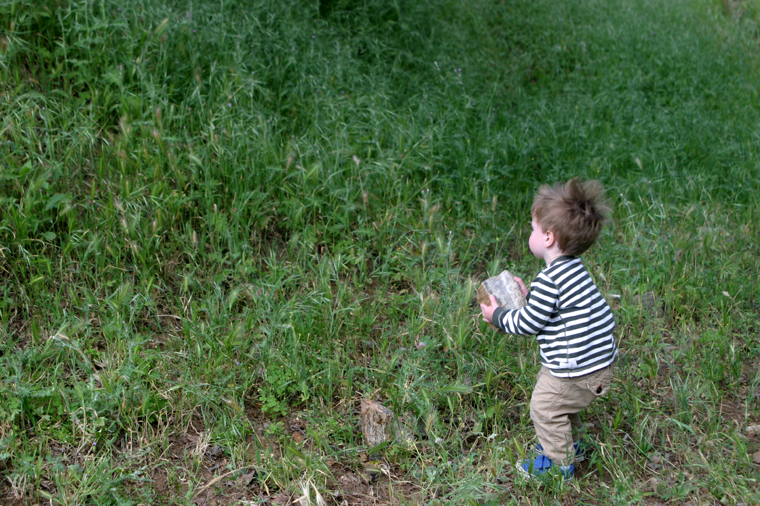
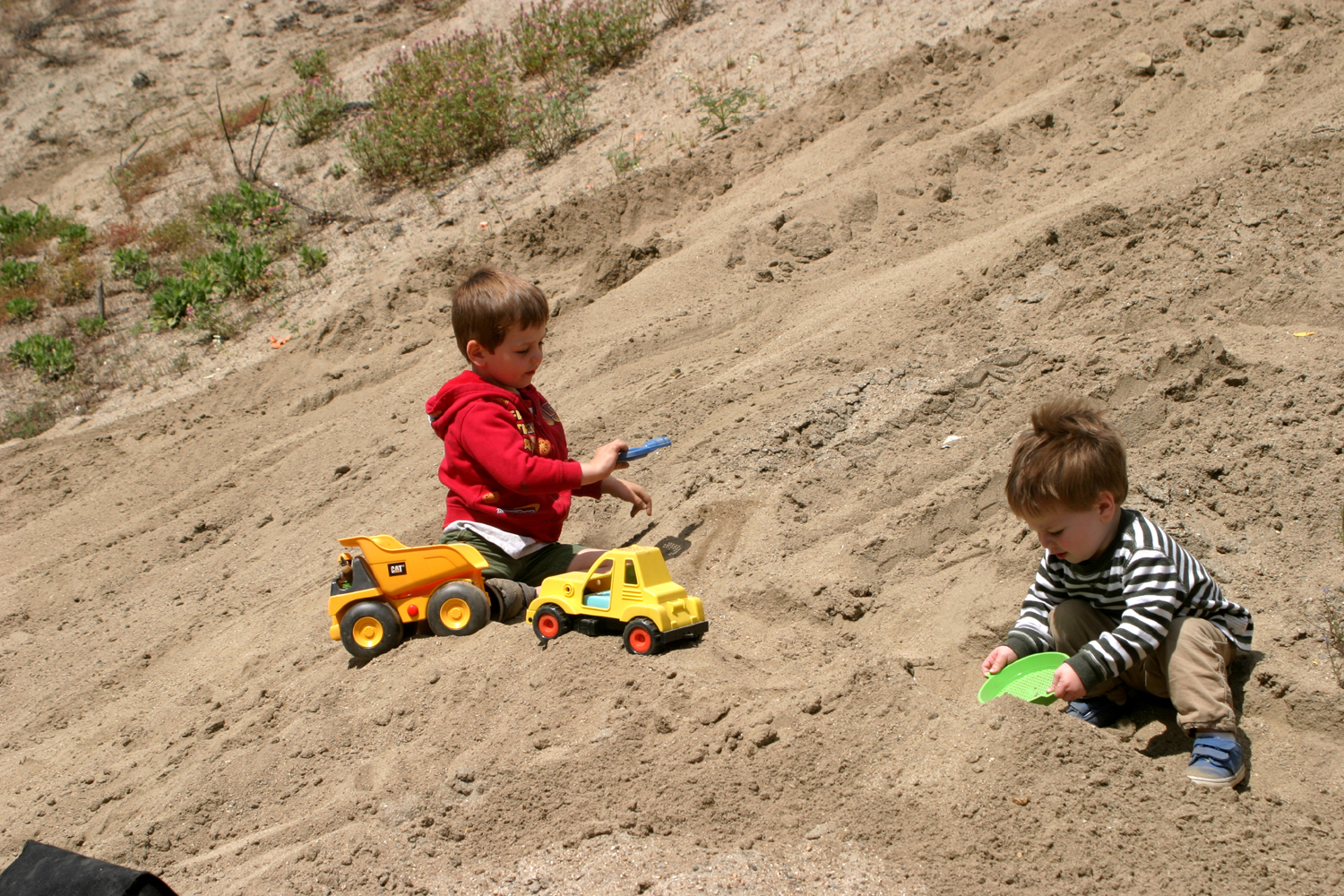
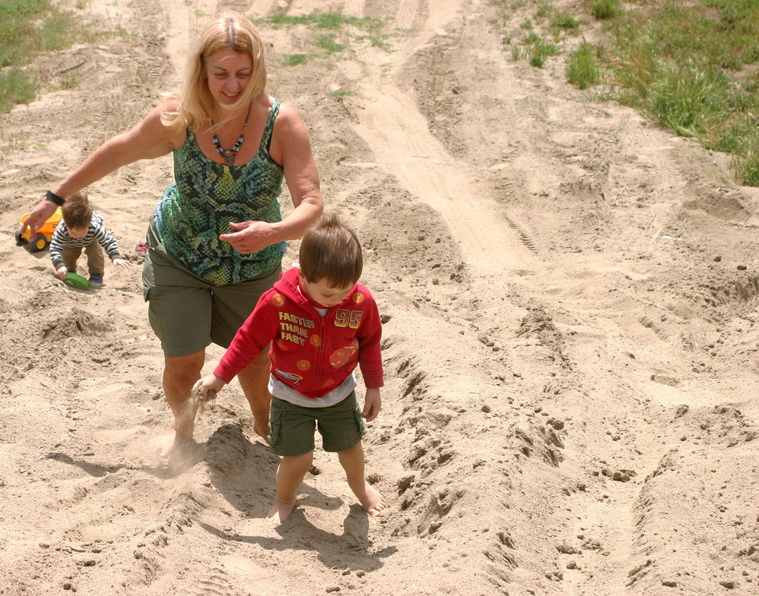
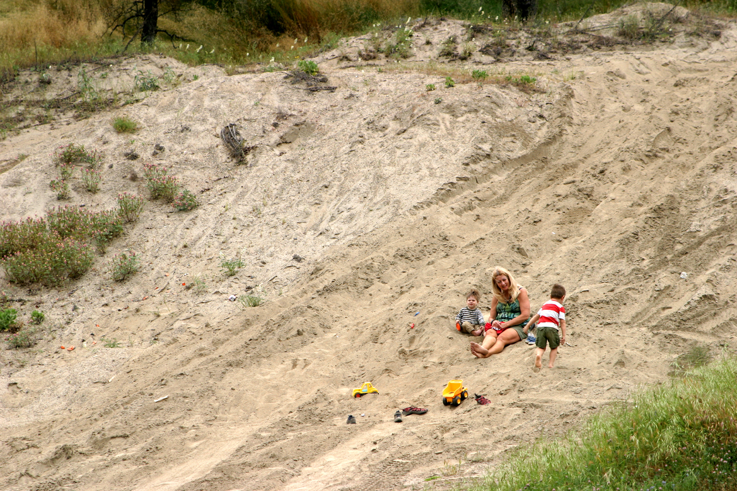
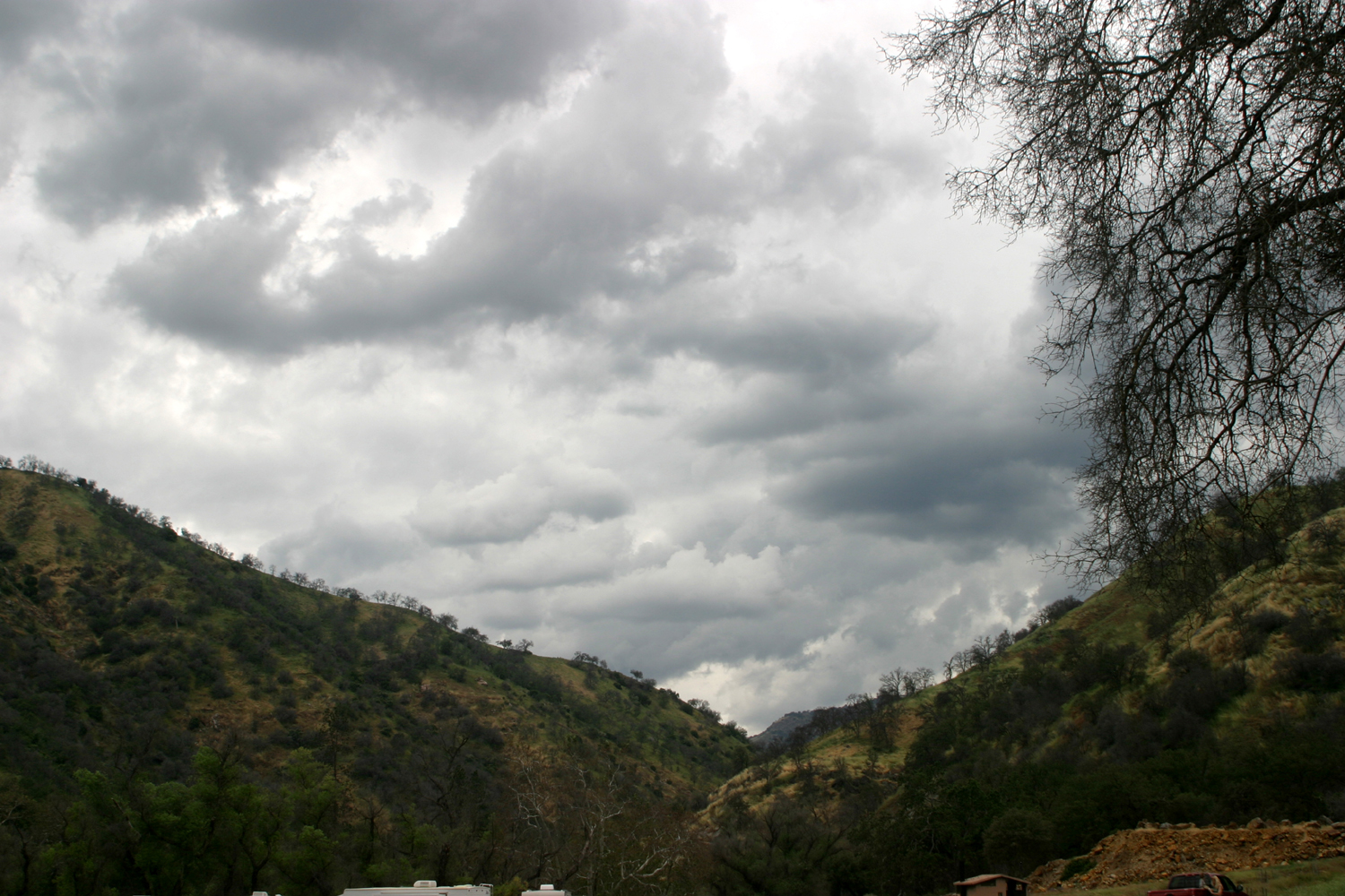
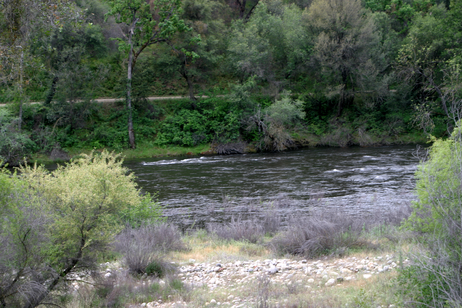
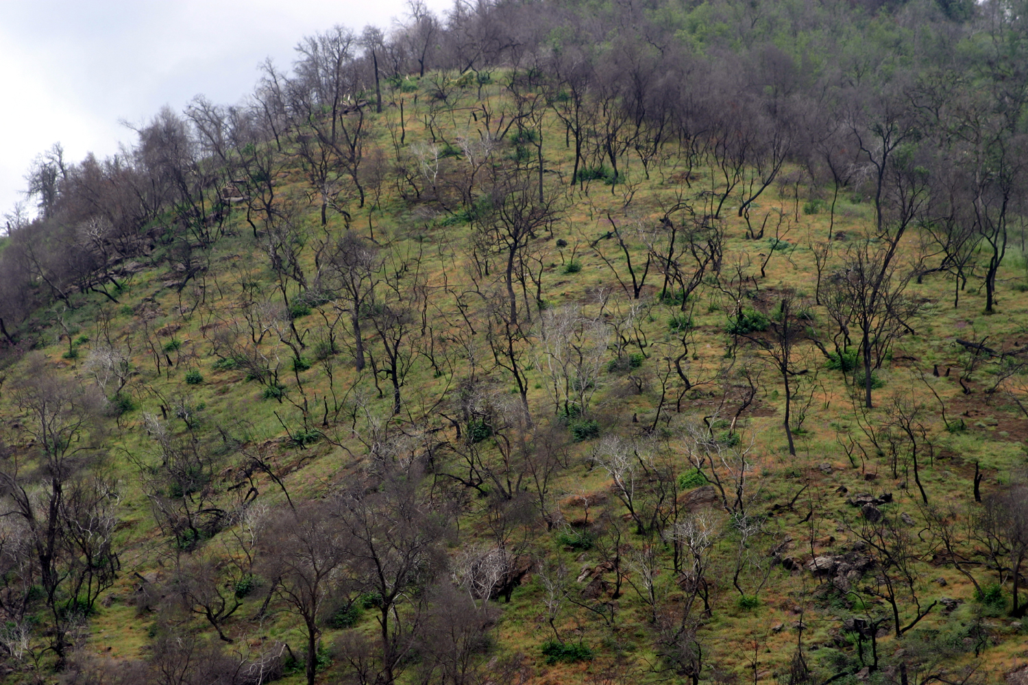
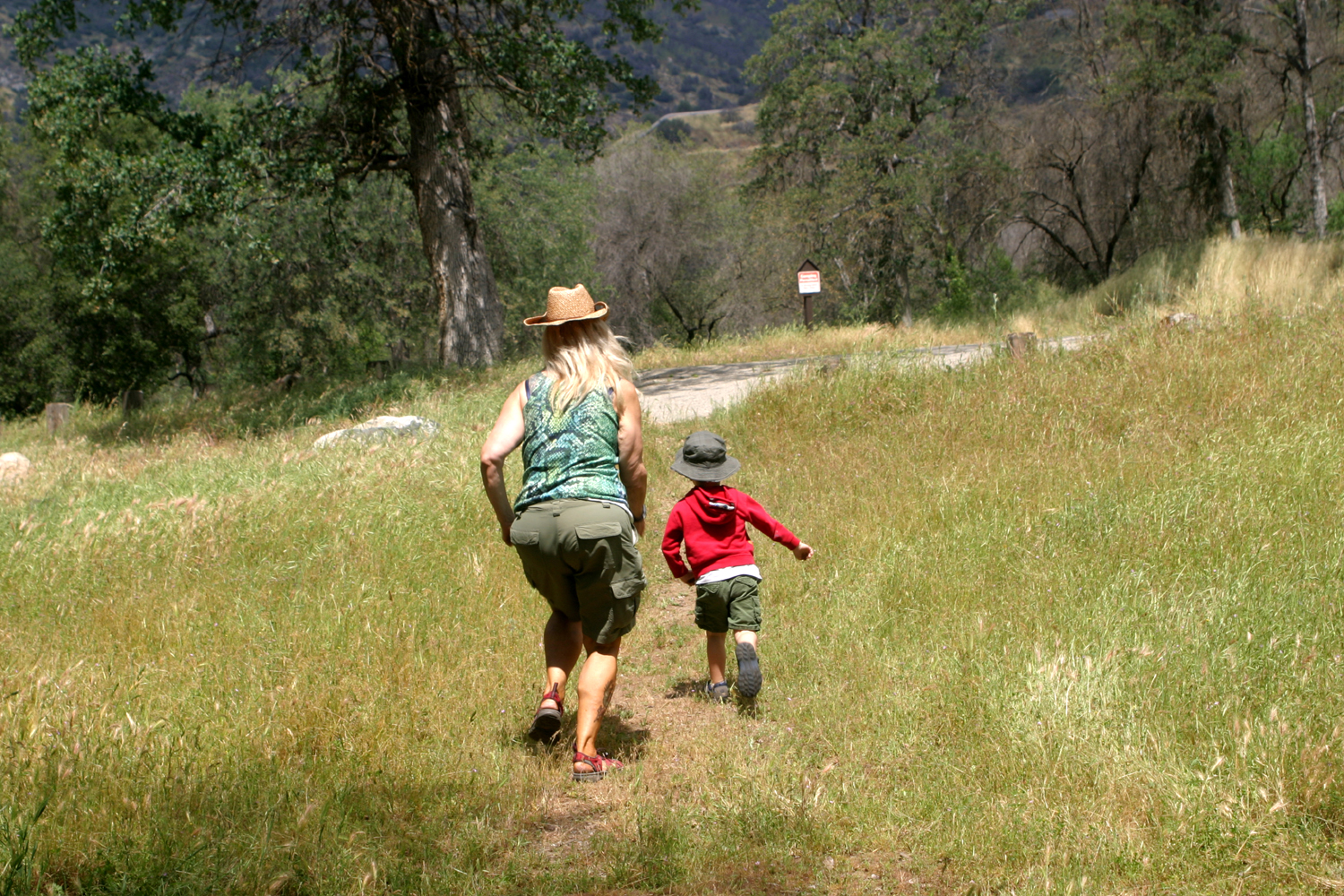
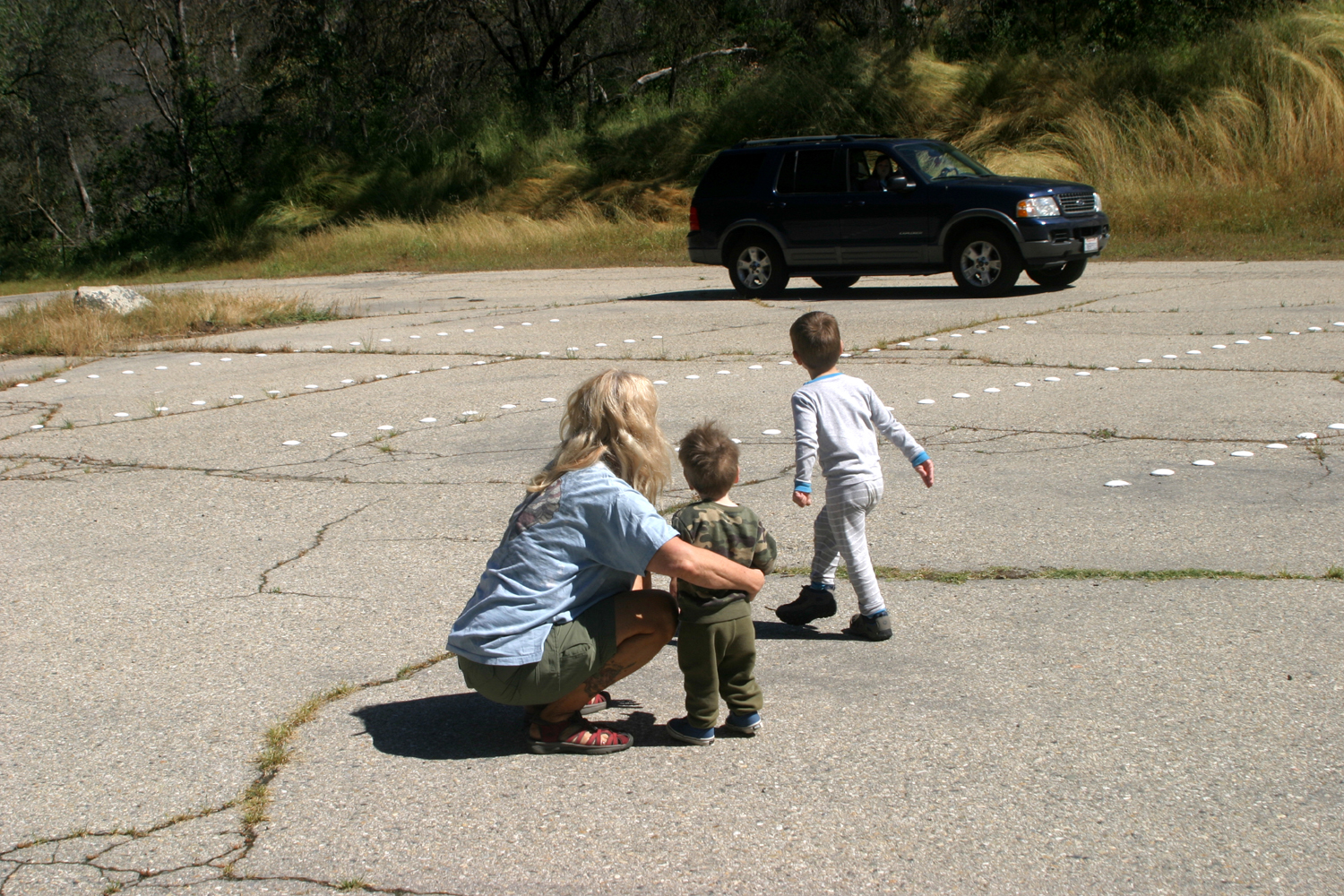
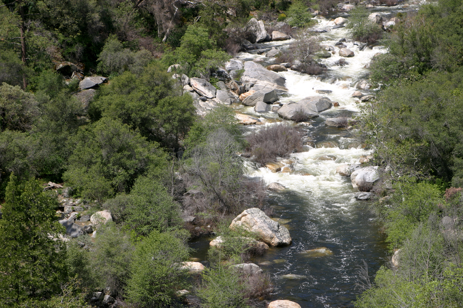
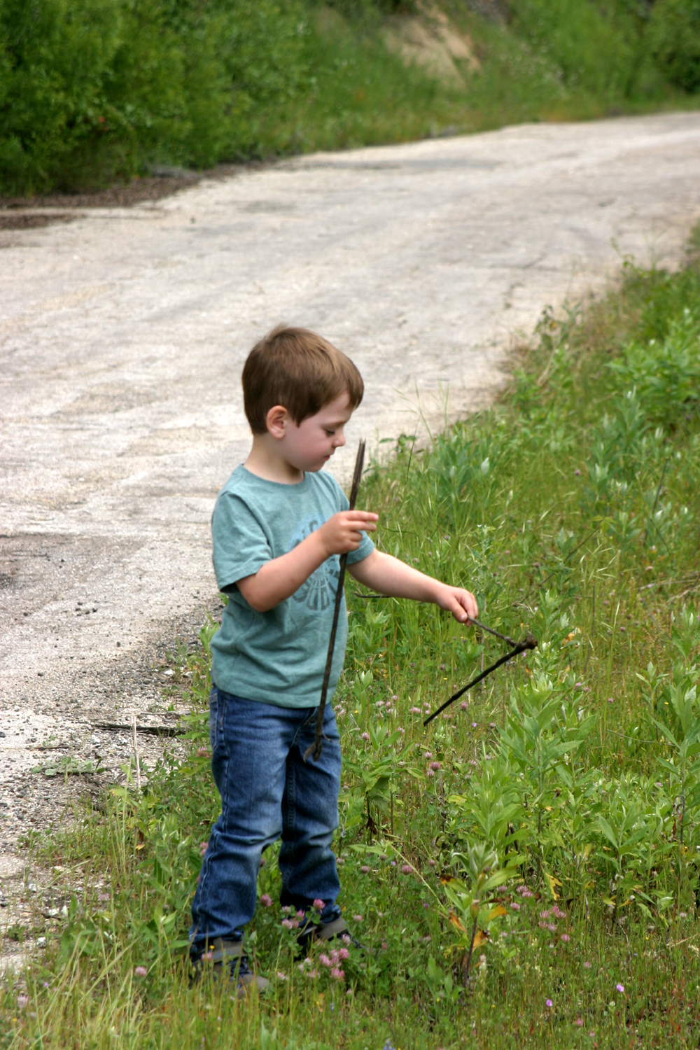
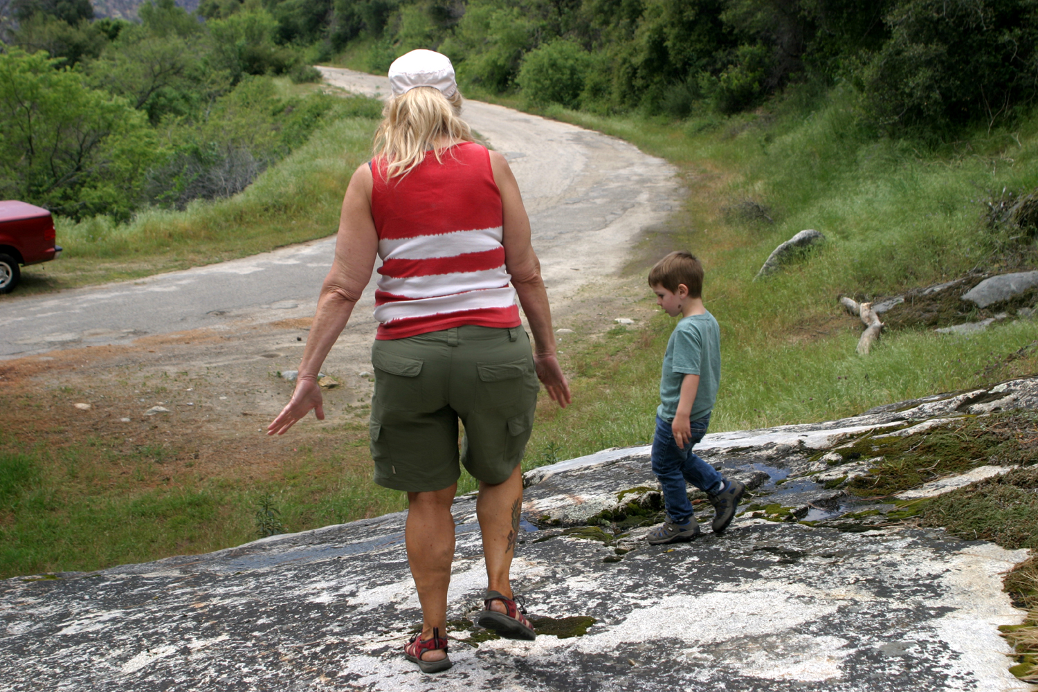
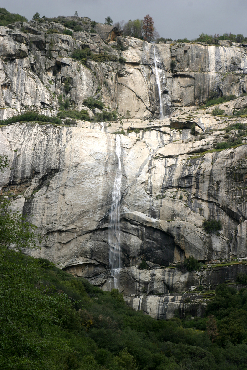
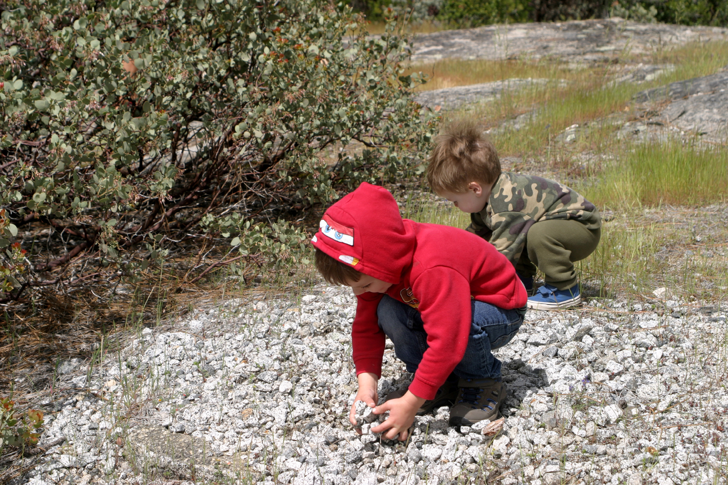
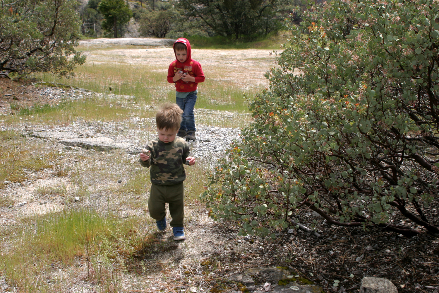
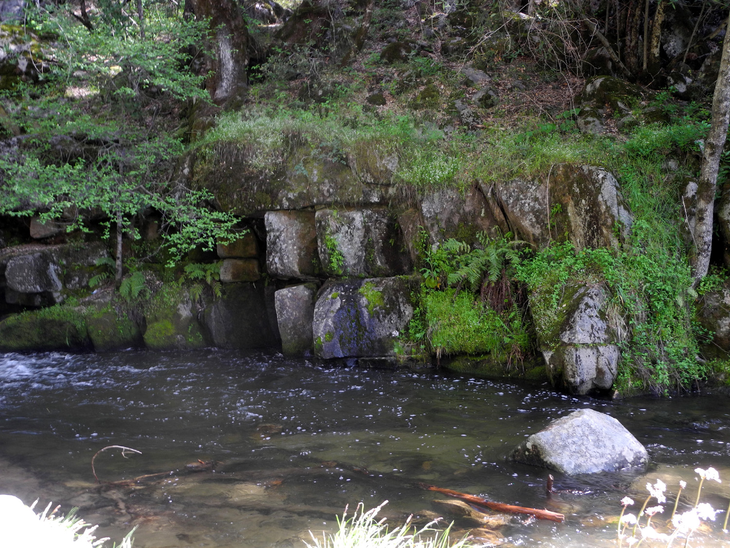
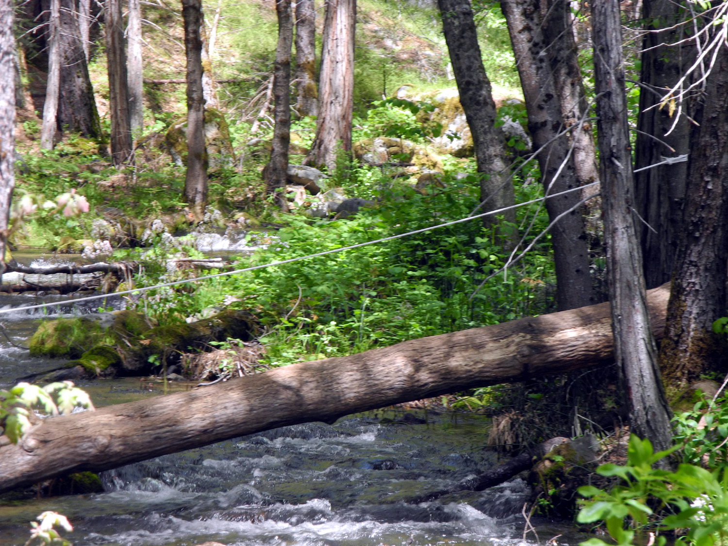
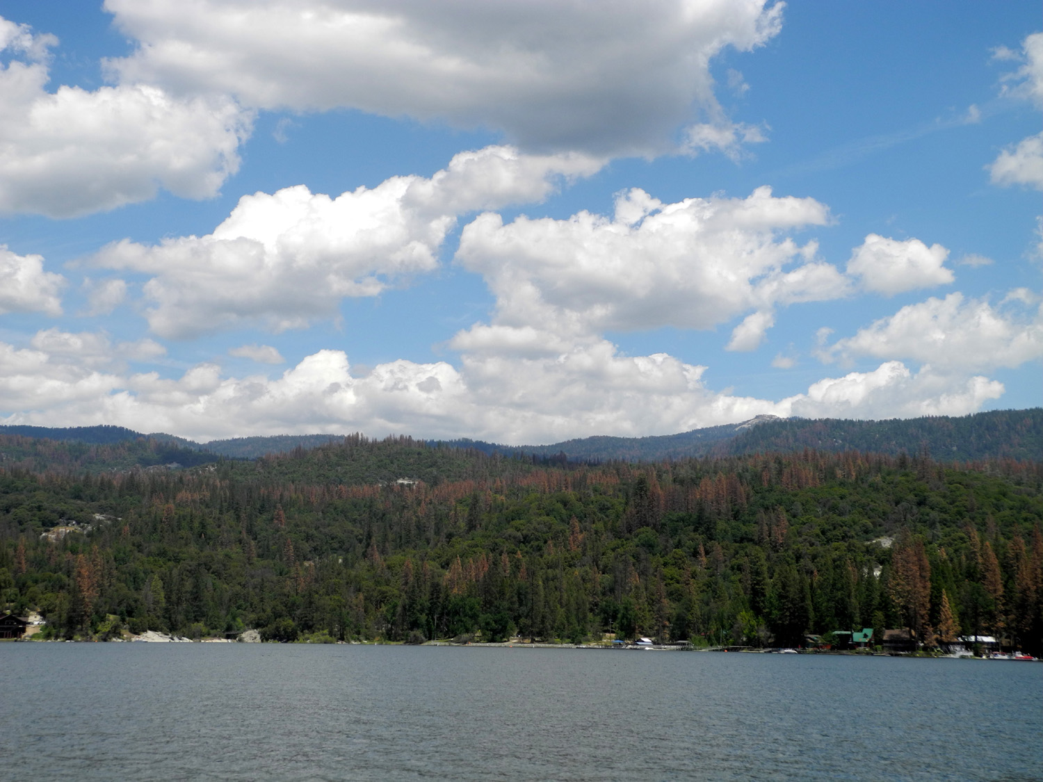
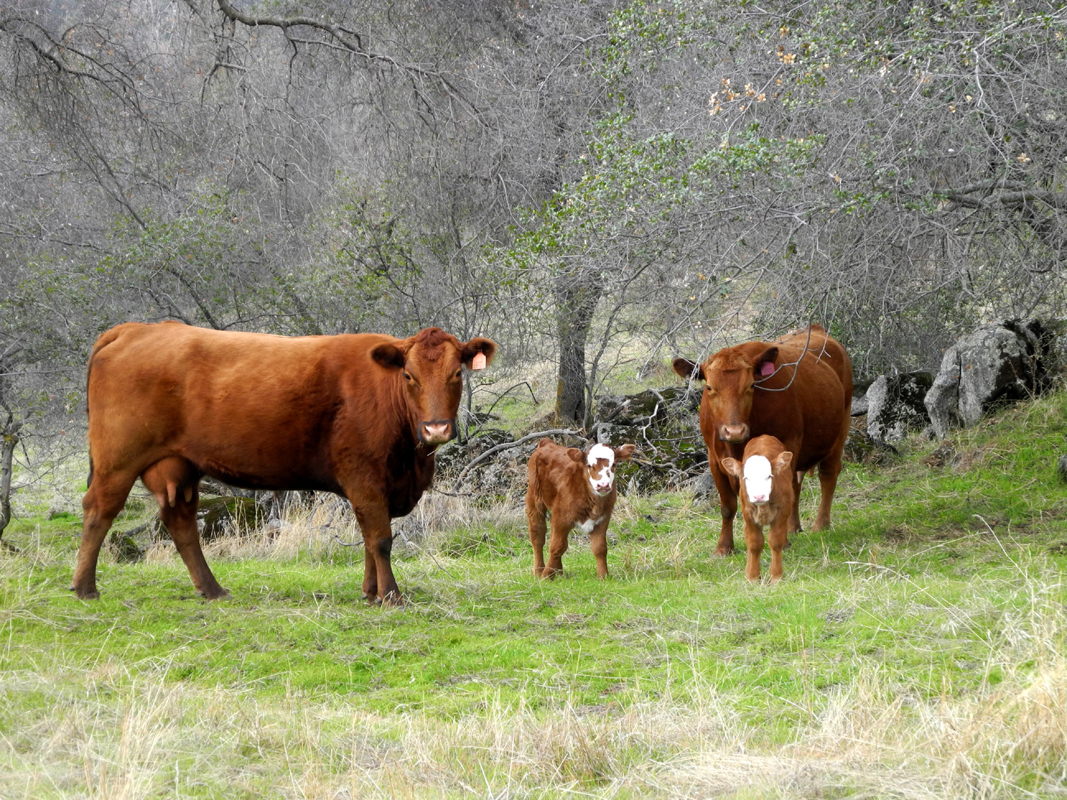
Kirch Flat Camp (Frog Camp 2.0) With all due respect to my other hiking and camping companions, this was probably the most fun trip in a very long time. Like most activities, what made it special was the people I did it with - my daughter Teri and my great grandsons, Colton, age 3 1/3, and Jack, 18 months. Our destination was Kirch Flat Campground, just past the upper end of Pine Flat Lake, at about the 1,000 foot elevation in the Sierra foothills. I had camped there a number of times with Teri's younger son, Mikie, in a series of outings we referred to as Frog Camp. The first few went by before I started documenting them in these on-line reports, so although they started in 2003, the first "official" report covered our trip in 2007. Trips with Mikie ended in 2011 as school and hockey began to take more of his time, so I was happy to be able to return to this special place with the next generation. The boys' dad had to leave for work by 8 a.m., so Teri and I met at their house at 7:30 on Friday, April 22. Teri drove her new motor home, and I took my truck so we would have a vehicle to drive around the area, as I used to do when I took my trailer. I left ahead of Teri while she was still getting the boys settled into the motor home, but she passed me when I stopped to take pictures of flowers along the way. I passed her at a rest stop, but she went ahead again when I stopped to gather some firewood, so by the time I got to the camp she had the motor home in place at a nice spot. When Mikie and I first started these outings there were very few people in the camp, but it seemed to become more and more popular through the years, especially when people who were rafting down the river would stay there. The last couple of times the camp was pretty much full, so I was not sure we would be able to get a spot. As it turned out, there were a number of spaces available when we arrived, although the place was filled close to capacity by Saturday night. Soon after arriving we walked down to the little section of the river that is separate from the main channel and constitutes the frog pond. We did not see or hear any frogs, but this trip was much later in the season than our earlier trips, so perhaps it's just not "frog season." Colton and Jack are very active, always on the go, and I knew going in that this would not be my normal type of camping trip, where I sit around reading a lot. Constant supervision is mandatory, and one adult per child was by no means too many. For the most part, they were well behaved, always finding something to do, and of course, a constant source of entertainment. One of the first games they discovered/invented was "The Dots." Above our campsite the camp road goes into a small parking lot, used primarily by rafting company vehicles. It's been divided into spaces with lines of white plastic dots affixed to the road. Back of our camp a short path led up to the parking lot, and I walked up there with Jack. He immediately focused on the dots, and began walking the line, carefully stepping on each dot. He went back and forth on three or four lines before moving on to something else. Later I took both boys up there and Colton joined in the fun, running the lines rather than stepping carefully. We returned to this unexpected play area several times each day, and it never got old. For our first day's outing, we transferred the child safety seats to my truck and drove up the road toward home a short distance. There is a corral and cattle loading chute here, and I had photographed Mikie there years ago, so I wanted to get pictures of the new generation. After the photo session was done, I walked up a path beside a drainage a short distance, with Jack and Colton tagging along. They managed to find some large rocks that were in the wrong place and moved them to the correct spot. Then we drove back past the camp and crossed two bridges over the Kings. At the second bridge the paved road goes on to Balch Camp, a PG&E facility, while dirt roads go up the river on both sides. We went up the north side, where the road goes seven miles in to a campground and trailhead. However, our destination was a place about two miles in that we always called "the big sand pile," where we had camped when my older grandson Johnny (father of Colton and Jack) was a young boy. The sand pile here is at least 50 feet high, and has tracks up the front and sides where people have driven their 4-wheel drive vehicles (Teri's husband Tim was one of the people doing this back in the day). The vehicles used this time were much smaller, toy trucks along with buckets, plastic shovels and other sand toys. The boys have a sand box at home, but obviously enjoyed having a sand pile bigger than their house. During our early days camping at that location, there were no facilities or official camping areas anywhere along this dirt road. Since that time restrooms and picnic tables have been installed in several locations. The sand pile area is now a group camp known as Gravelly Flats. Teri and I had an assignment from her son Johnny - check out what the Rough Fire had done in the Garnet Dike and Black Rock areas. I walked up the road a few hundred yards from the sand pile and saw one hillside that had been burned, but no other evidence of the big fire from 2015. Most of the fire had been farther into the mountains and at higher elevations. After the boys had enjoyed enough sand play, we got in the truck and continued up the road along the river, enjoying lots of flowers and nice views of the stream, running at a high level for the first time in several years. As we drove, it started to sprinkle, but we continued on to the end of the road. There was no evidence of fire damage visible from this area or any other place along the road. We made a brief rest stop, then started back down the road. The rain got harder and harder as we drove. Both boys were asleep by this time and missed out on the fun. The storm did not hamper our driving, just added to the adventure. The boys were still asleep when we got back to camp, so Teri and I took turns going out in the rain to see if they had awakened. Once they were safely inside the motor home we enjoyed watching the rain and smugly feeling sorry for the people camping in tents. When it came time to go to bed, we faced our greatest challenge. I had planned to sleep in the back of my pickup, but with the rain, we all agreed I should stay in the motor home. Teri had brought a folding crib/playpen for Jack, but there was no room to set it up. I slept on the fold-out couch, Colton was on my air mattress on the floor next to me, and Jack slept in Teri's bed. I get up several times during the night, so the major challenge was getting from my bed to the bathroom without stepping on Colton. The next night I did sleep in the truck, which proved to be unsatisfactory for a number of reasons. Inside, with Jack in his crib and Colton on the couch, there was no way to get from the front of the motor home to the back without crawling across the fold-out bed. I used the facilities outside, but getting in and out of the bed of the truck required a level of agility I no longer posses. We survived all this, and woke up on Saturday to sunshine, with the grass dripping wet. When they went out to play, the boys were instructed to stay in the cleared area of the camp and not go into the wet grass. This worked for a few minutes, but they soon made brief forays into the dripping jungle. When this did not bring any serious consequences, they began to go farther and farther, and soon they were both wet from the waist down. While in camp, one of the major play activities was Play-Doh. Colton attempted to make shapes, while Jack was content to cut his share of the stuff into small pieces with a plastic knife. Of course, we made several visit to The Dots, and at least twice each day walked around all the camp roads from one end to the other. After breakfast and other morning chores, we set out on another expedition. Past the campground, the paved road goes a short distance, then crosses the river from north to south. A mile further on is another bridge, where the paved road leaves the main river and follows the North Fork. The previous day we took the dirt road up the north side of the main river; this time we stayed on the paved road, planning to go through Balch Camp and possibly as far as Black Rock Reservoir. At Balch Camp the North Fork turns east, and Dinkey Creek runs in from the north. Looking at the two streams you would think Dinkey Creek was the main river, since it had about twice as much water as the North Fork. By the time we got this far Jack was asleep, but Teri, Colton and I enjoyed looking at the flowers and the deep, steep canyon below. We stopped at a place where you can see a sliding waterfall on the river, but it is hard to see at best, and with the low water flow, it wasn't much to look at. Much better is Patterson Falls, which runs down Patterson Bluffs about half way to Black Rock. This creek is not very large, but the falls are fairly high and drop straight down in two separate segments, sort of an upper and lower fall. Colton had been to Yosemite recently and had been very much impressed with Bridalveil and Yosemite Falls, which are spectacular and putting out a deluge of spray this year. There was no danger of getting wet from Patterson, but we could stand on the bridge where the creek runs down below the falls, and also walk up a gentle granite slope beside the creek. After enjoying this area and taking pictures, we continued on to Black Rock. We've camped at this location since my daughters were little girls, and it's one of Johnny's favorite fishing spots, so he had taken Colton there recently. As we arrived, Jack woke up, so we got out and walked down a short distance to where we could look down on the dam. We then followed the road into the campground on foot, and stopped at a meadow. Here the boys invented another game that kept them occupied for at least 20 minutes. The area we were in was flat and well away from the lake, with lots of small pieces of granite lying around. First Colton, then Jack, began gathering handfuls of rocks and throwing them into a bush. Colton tends to throw underarm about half the time, and these throws could end up anywhere - flying at his brother's head, rising up above us to come down who knows where, or just about any random direction. When he threw overhand, the rocks went into the bush consistently. It was interesting to note that Jack always threw overhand, and was much safer to be around than his big brother. Once a sufficient quantity of rocks had been transferred from their original location to the bushes, we started our walk back to the car, and made the return drive back to camp. This time it was Colton's turn to nap, which he did all the way back to camp and for a while afterward. The remainder of our time was spent with walks, Play-Doh, running the dots, attempted reading, and eating. There were two favorite activities on our walks through the camp. Although most of the spaces were occupied, there was a vacant one with a long drive-in spur, and a large flat rock at the end. Every time we went past it the boys had to run to the end and back several times, and climb up on the rock. At the camp entrance there is a cattle guard, and Colton found that he was able to walk across it. The spaces between the rails were fairly wide, and it was actually dangerous for Jack to try to cross, so we limited that activity. On Sunday we had breakfast and got ready to leave in a leisurely manner. This included a little more Play-Doh, a final visit to the dots, with the adults gathering up and loading all the stuff we had managed to scatter around our camp. We said our goodbyes and headed back to town, hoping that this can become an annual event, with or without frogs.
|
||
|
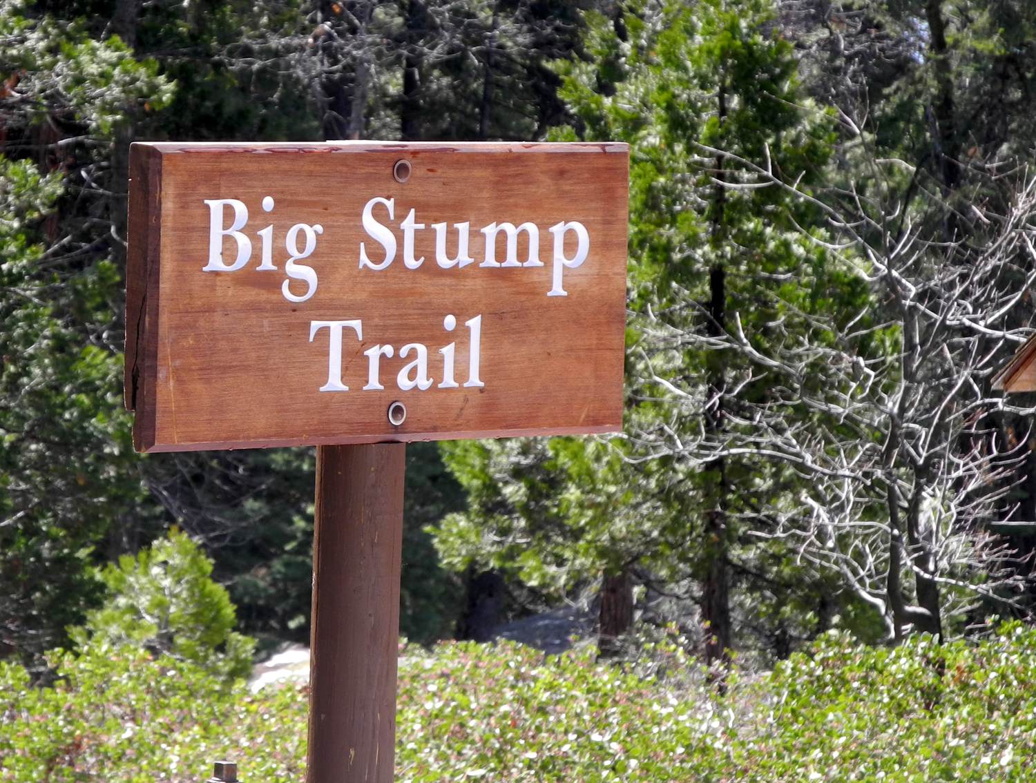
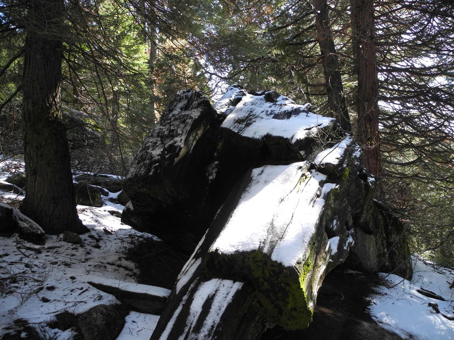
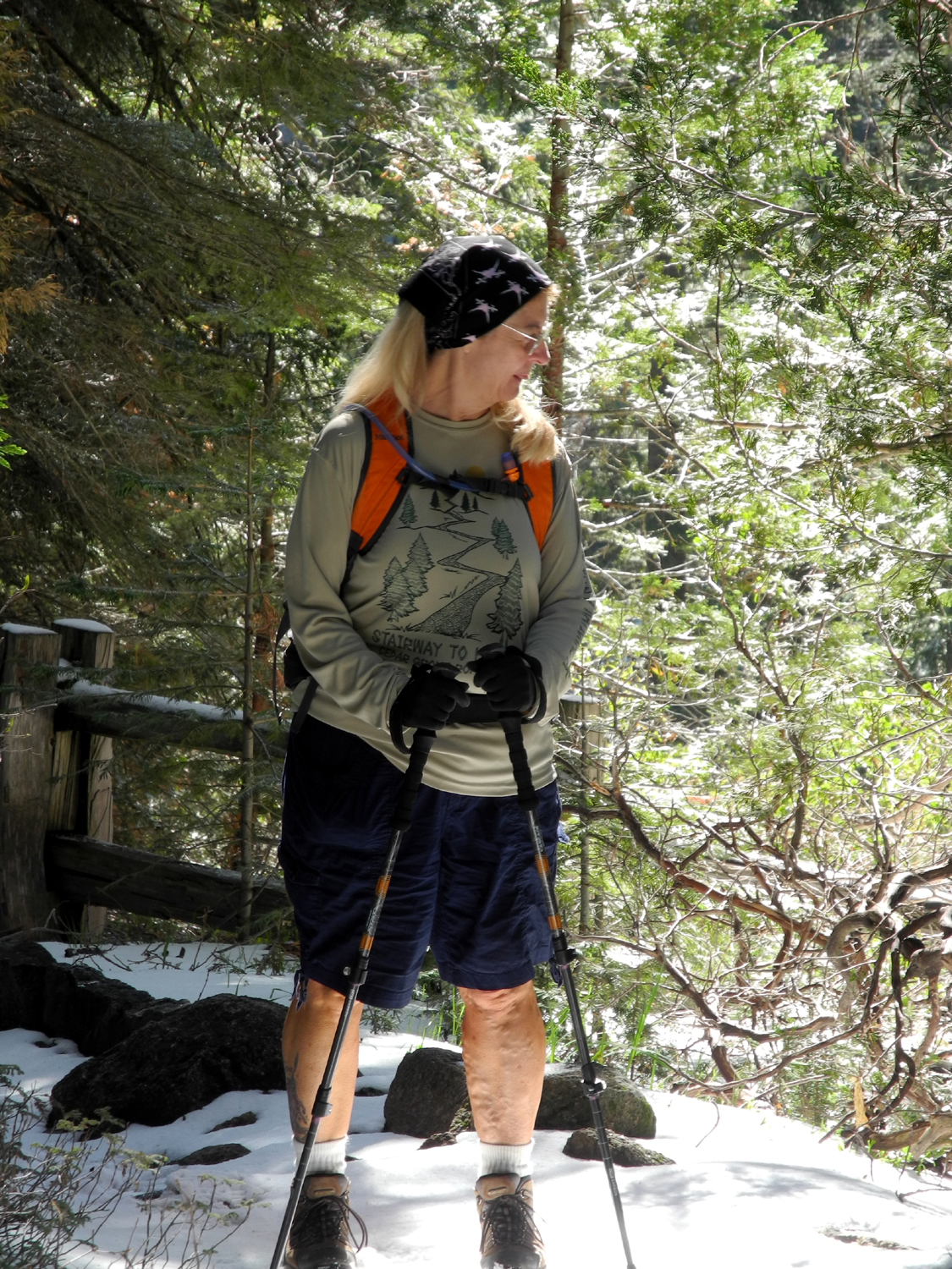
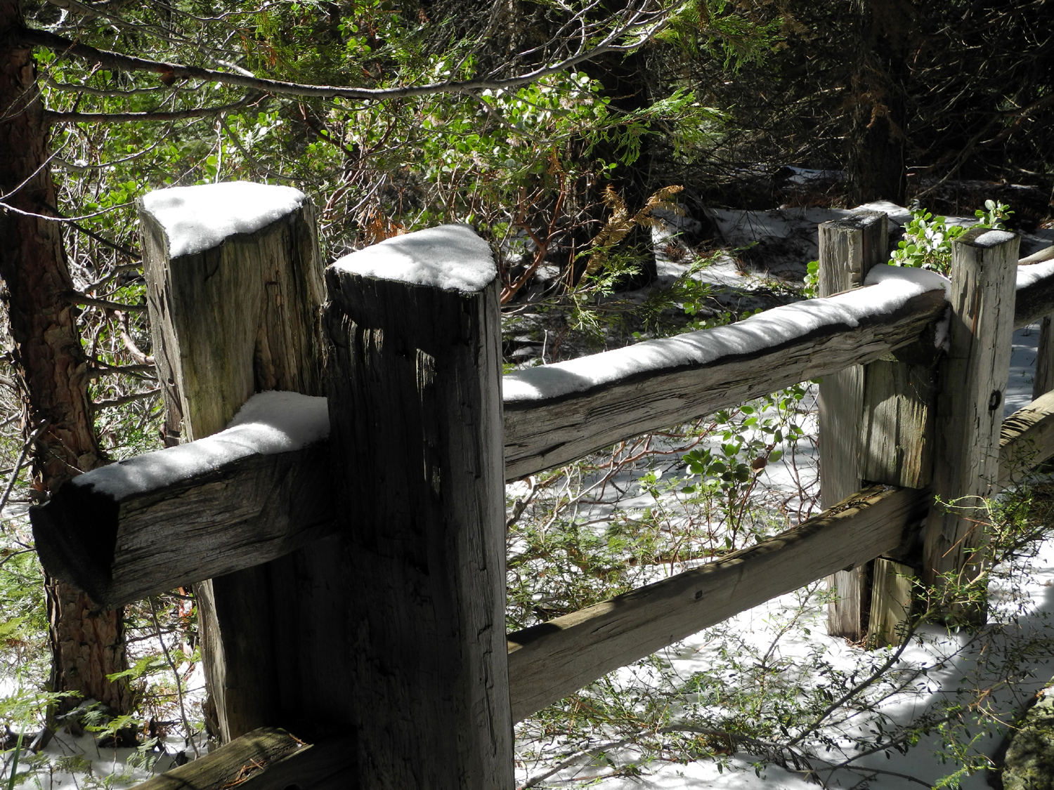
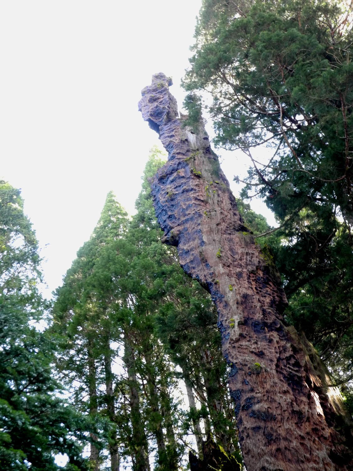
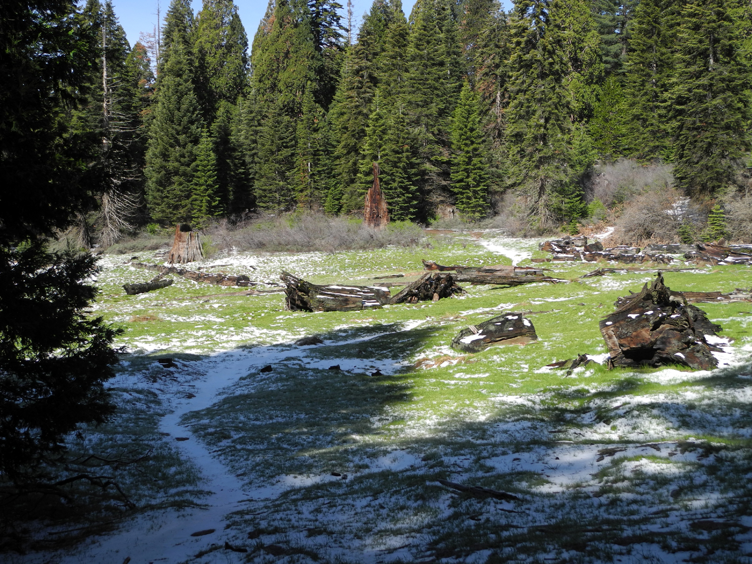
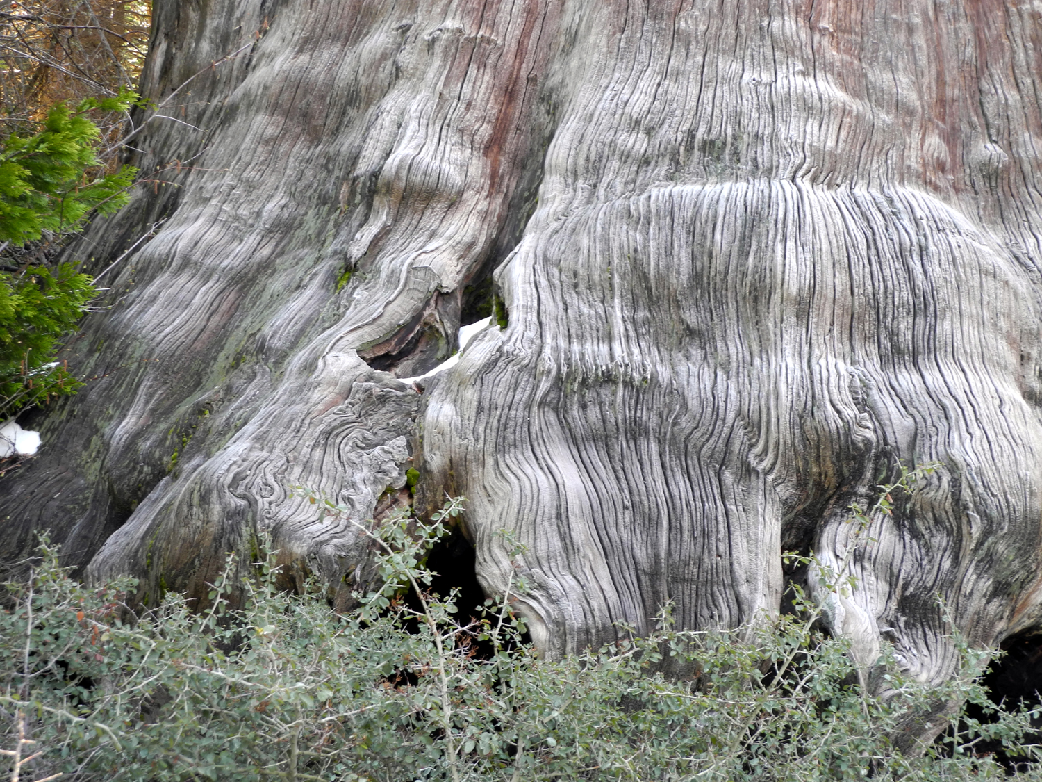
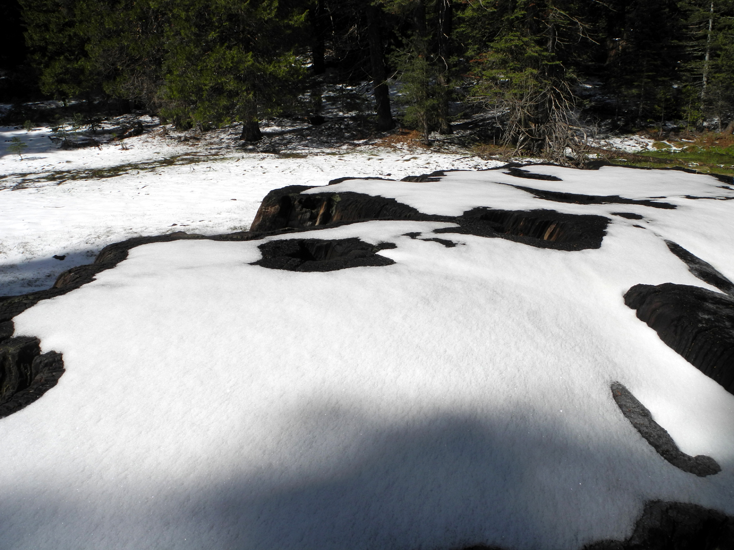
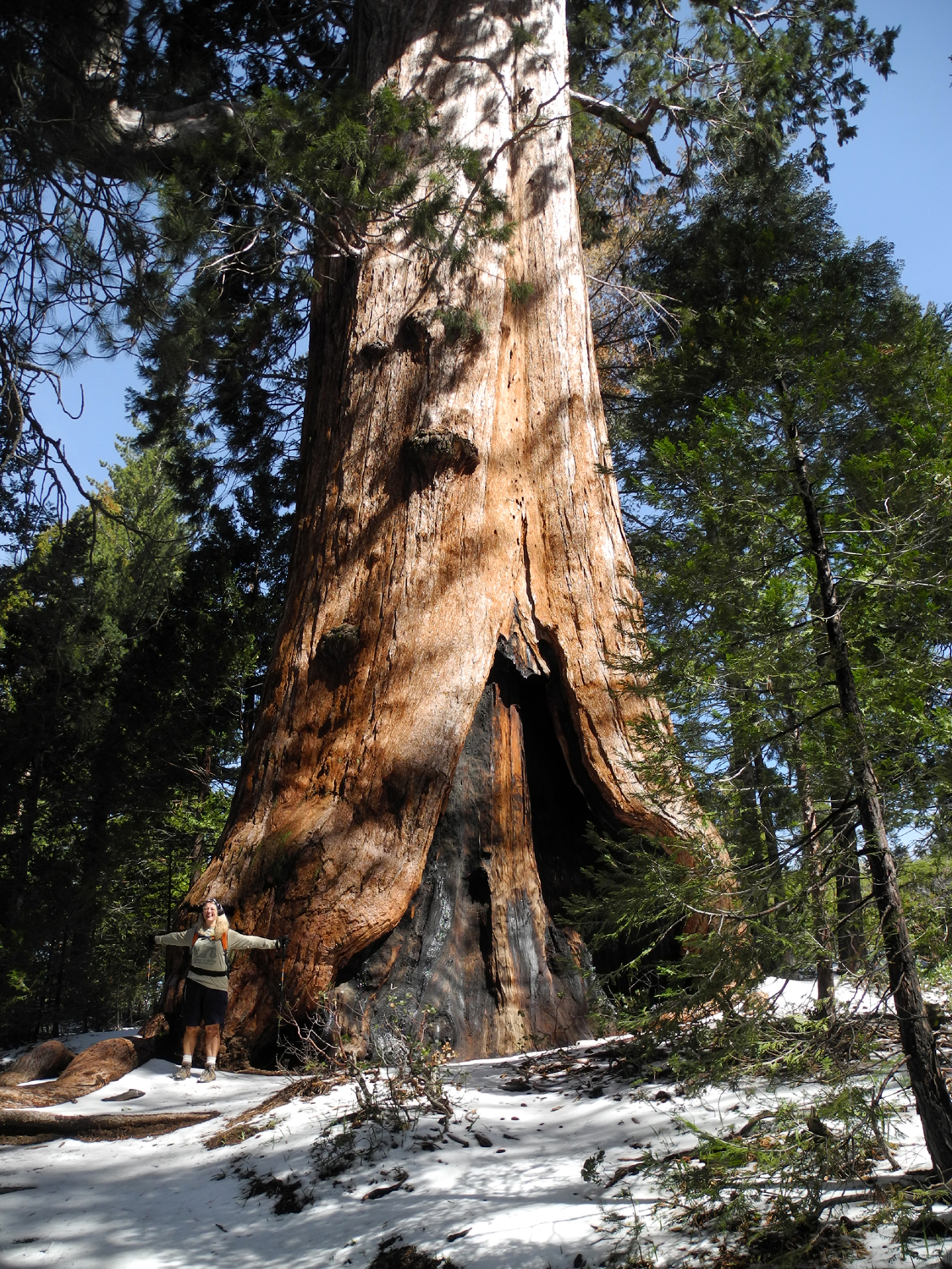
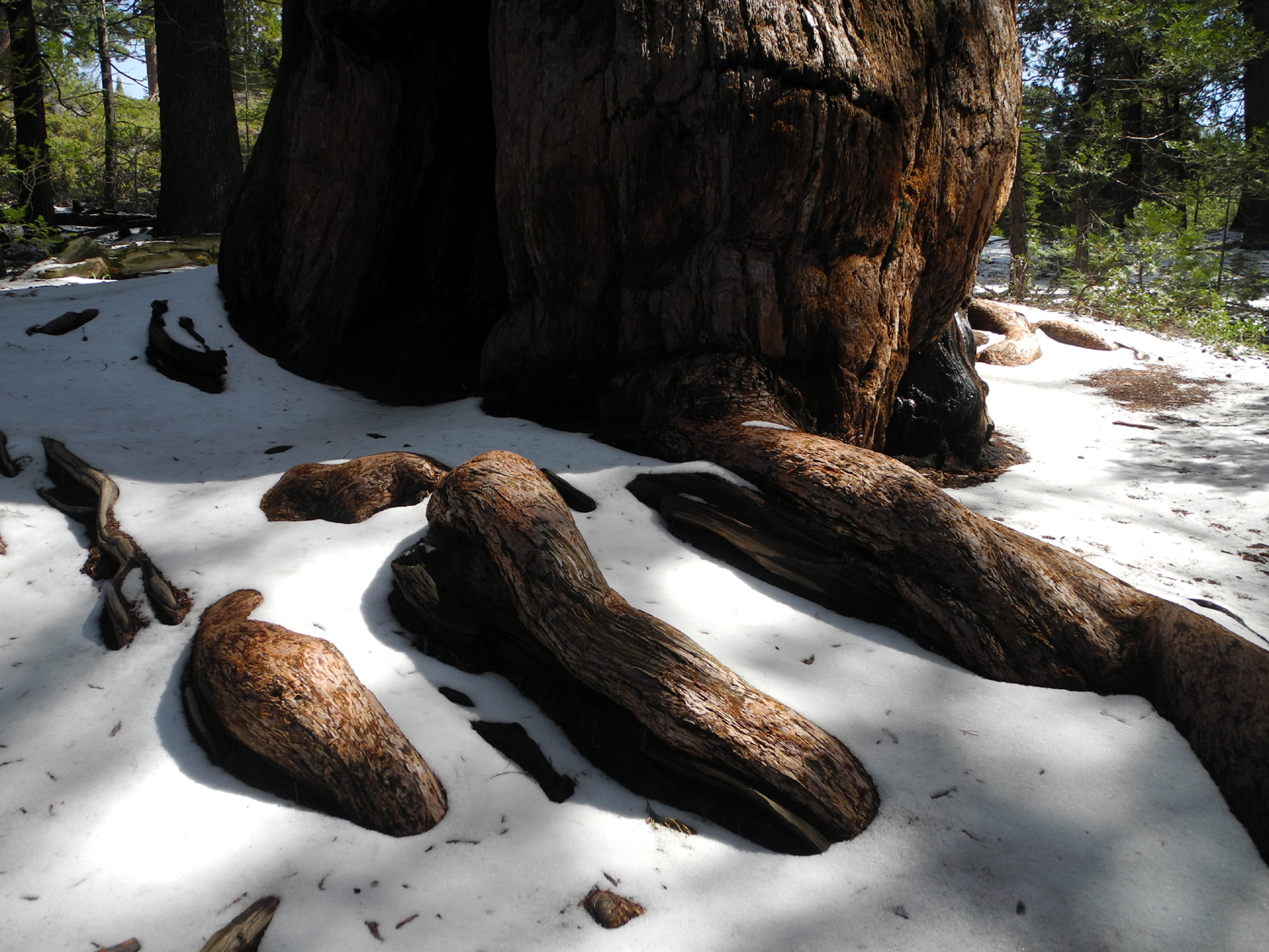
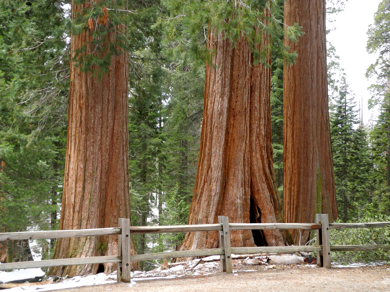
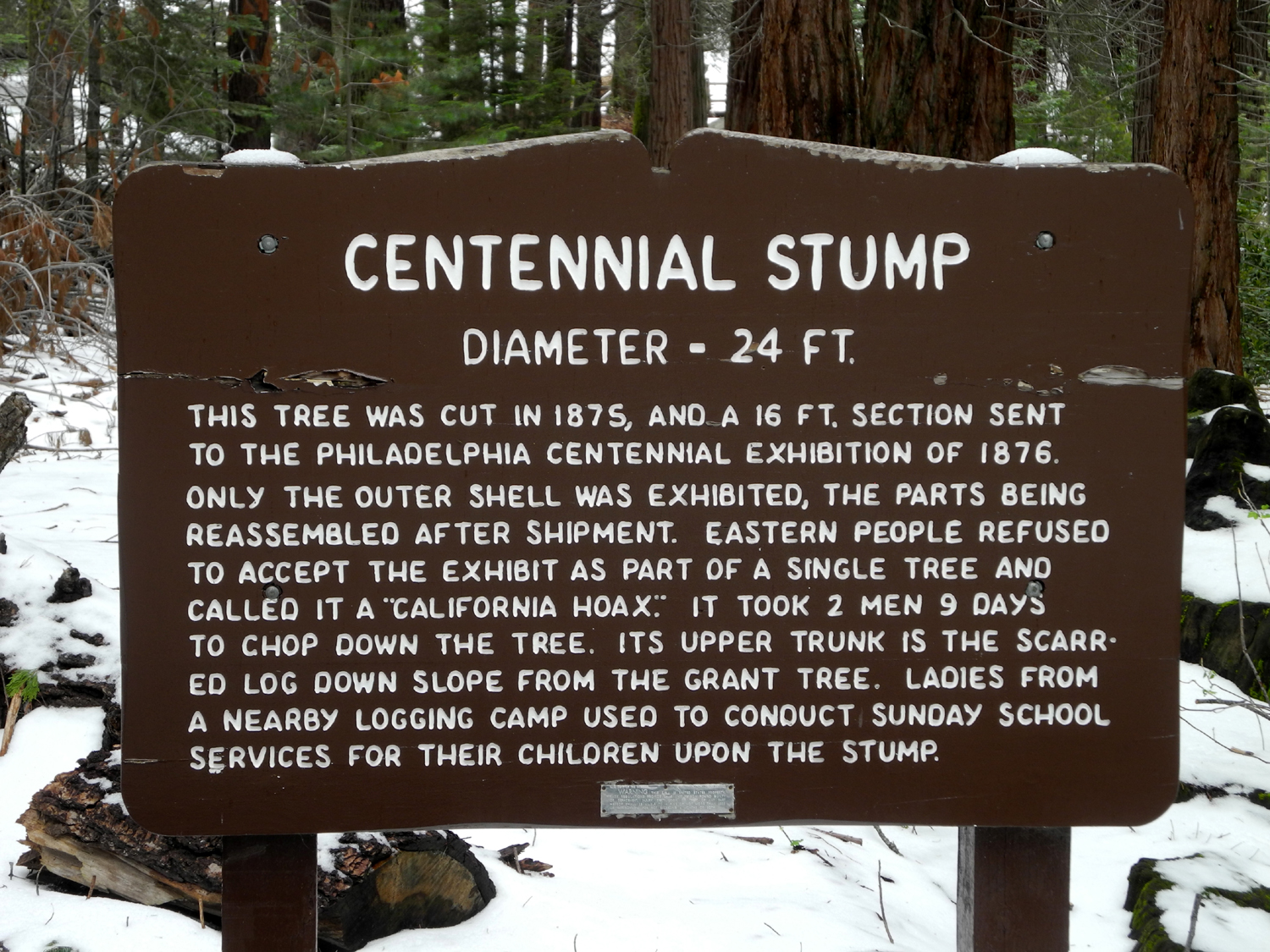
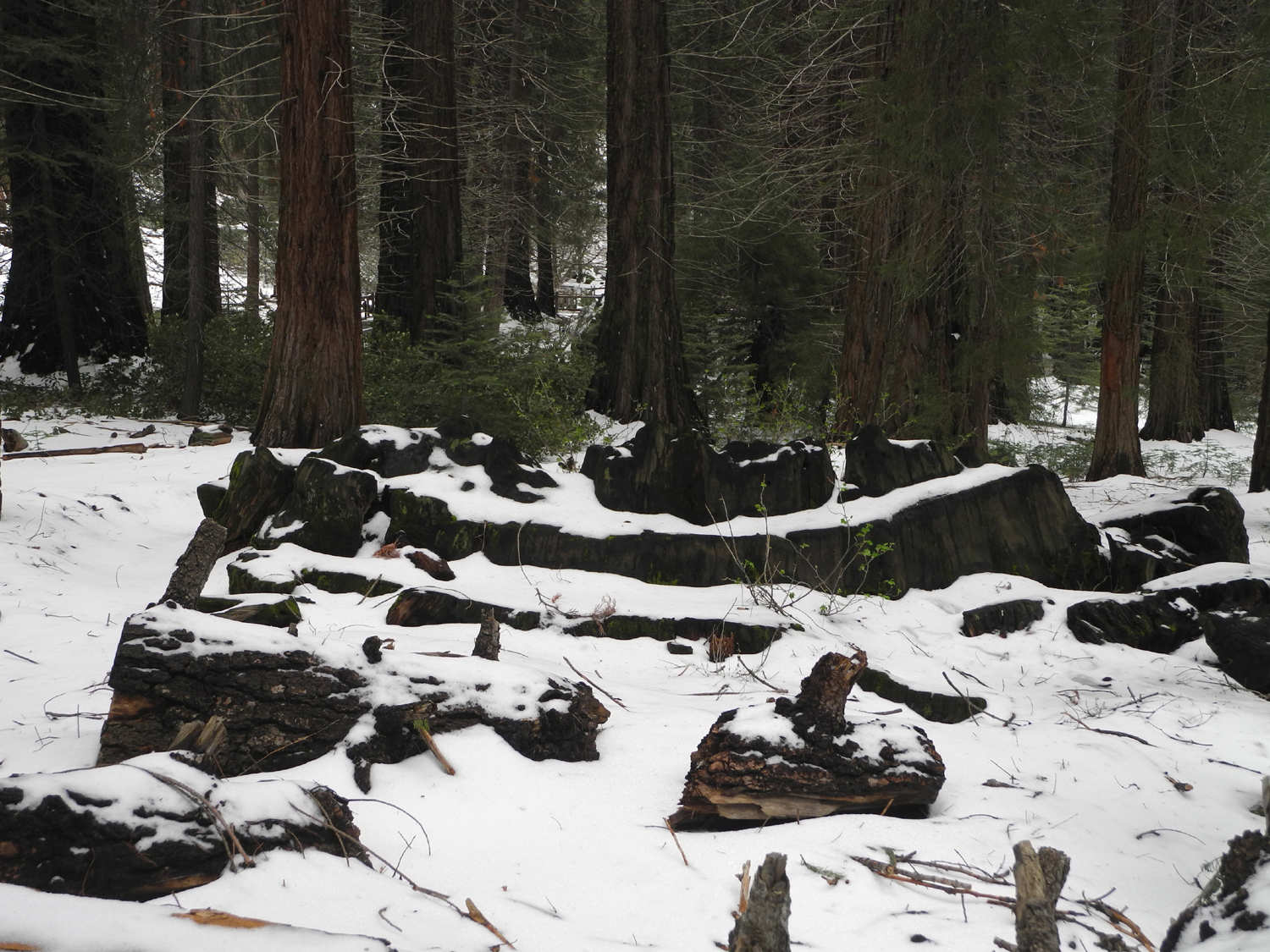
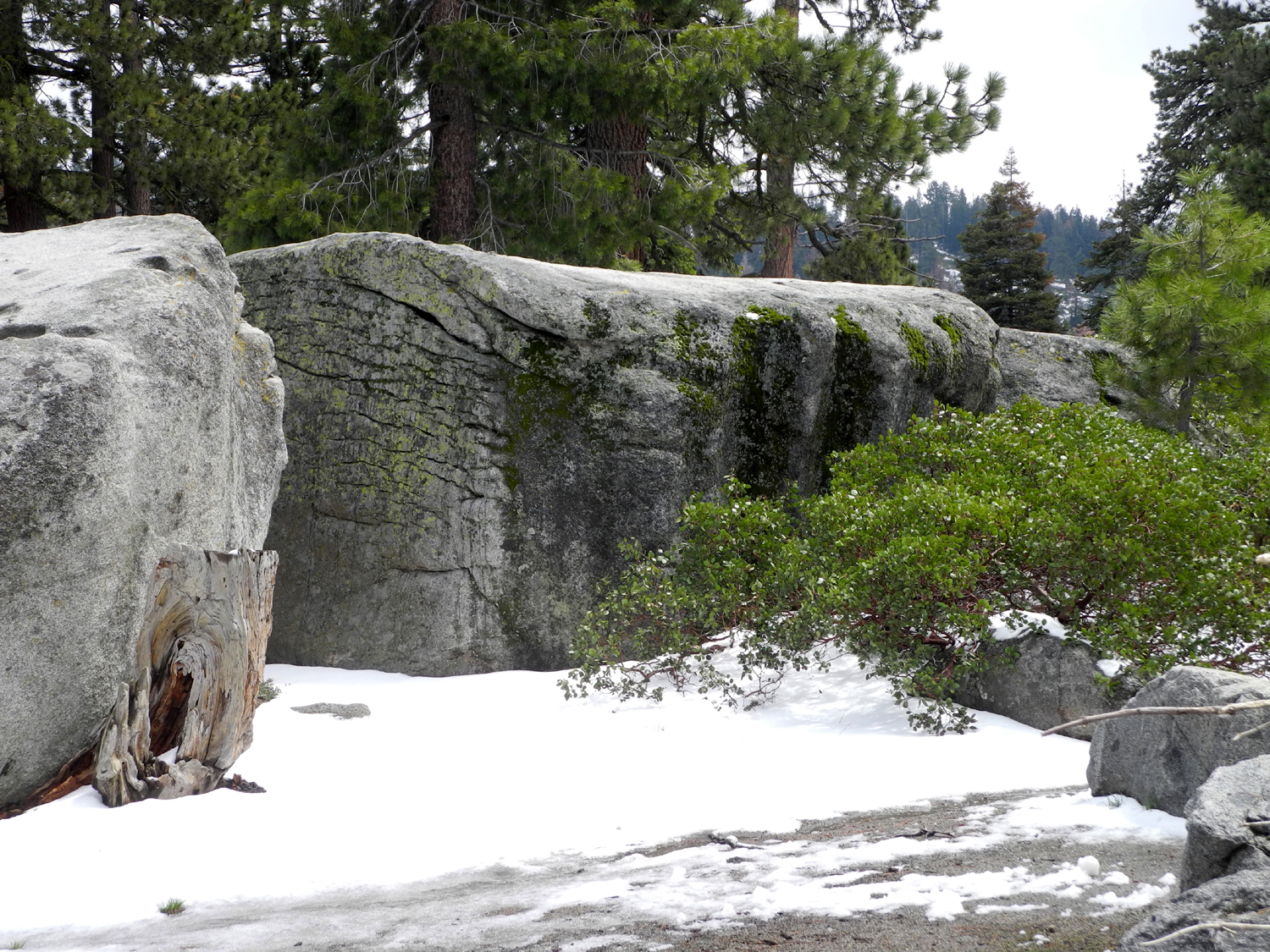
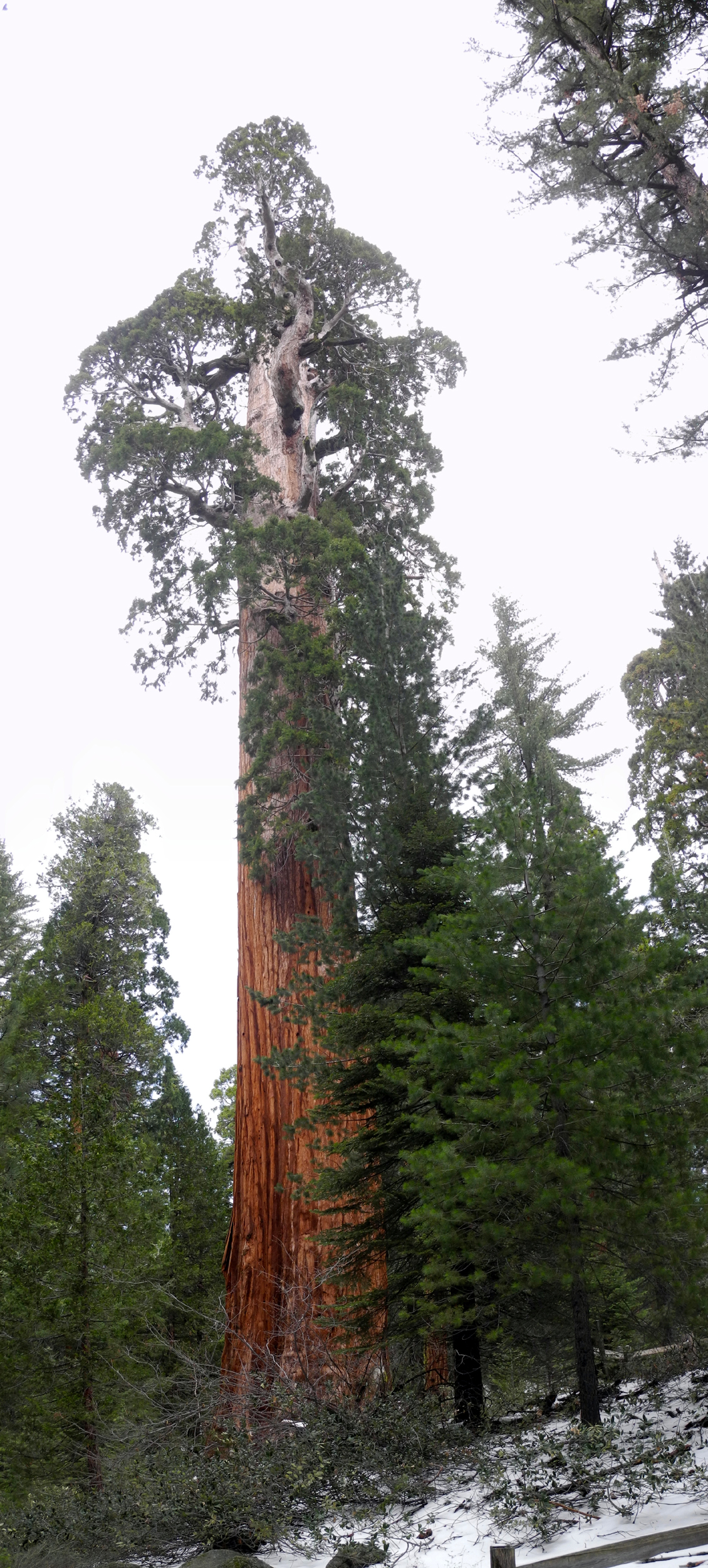
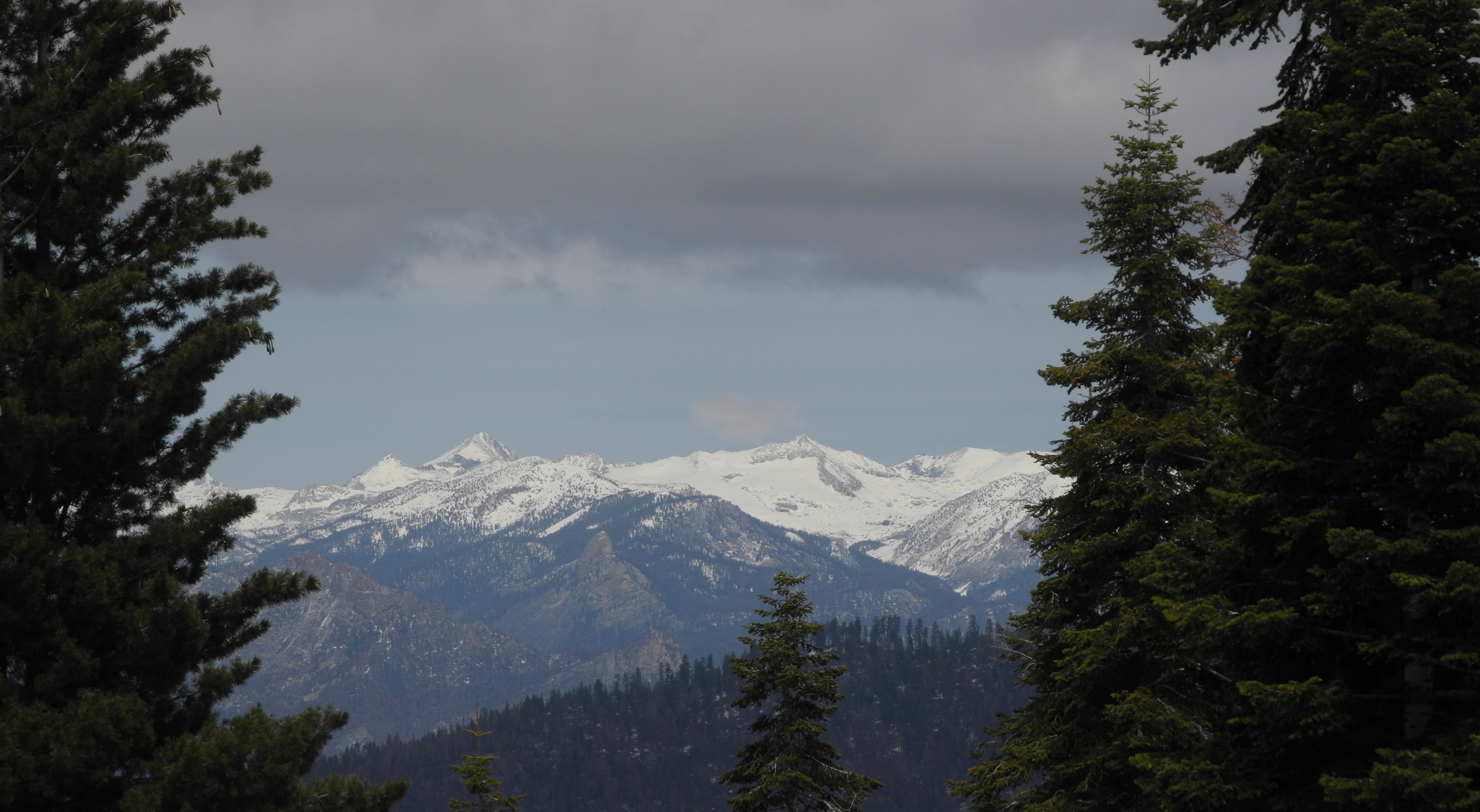
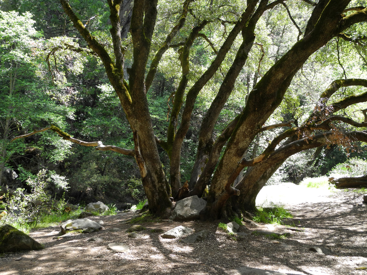
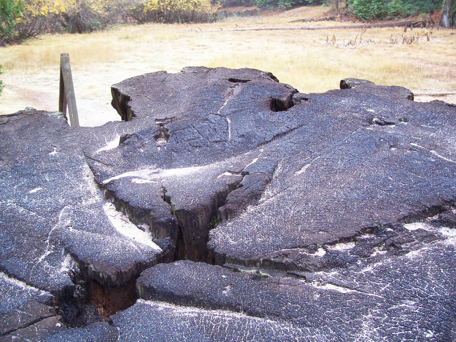
Big Stump Basin My daughter Teri is between jobs, probably till some time in June, and has been taking advantage of this situation to act like a retired person, doing as much hiking and camping as possible - with friends, parents, sisters, and grandkids. In May she will do a three-day backpack trip with her two adult sons. My backpacking days are long past, but Teri and I enjoyed a fantastic hike in Kings Canon National Park on April 26. A recent storm had brought snow to the high country, and we began to see patches along Highway 180 even before we got to the park entrance. A short distance past the entry booth there is a parking lot with restrooms, and a trailhead that leads into Big Stump Basin, an area that was logged in the late 1800s. The trail goes past a number of large, living trees, a dozen or so big stumps, and the remnants of sequoia logs that shattered when they were cut, or proved too large to work with. There was snow on almost every bit of the trail, but it was the "stickiest" snow I've ever encountered. You could try to slide your boot and it would barely move, and we never felt like we were going to slip or slide anywhere on the trail. It made for a beautiful scene, with about an inch of snow on every log, stump and fence rail along the way, and snow still clinging to the branches on many of the trees. There are several highlights along the trail. The first we arrived at is a tall, burned out sequoia snag. I believe that this tree once had a sign with information about it, but if so, it's gone now. My first visit to this area was in the 1960s, so I can't be sure of this memory, but I believe it was once one of the largest trees in the area before falling victim to whatever event reduced it to its present condition. The most dramatic sight along the trail is the Mark Twain Stump. A massive giant, this tree was cut not for lumber but for display in the Museum of Natural History in New York. After 13 days of effort in 1891, the tree was brought down, and cut up into sections for transport to the east. With the snow I could not get a good overall view of the stump, but this link is a photo I took in warmer weather, and several of the related links below provide more photos and information. Here's another photo, with sand on top of the stump instead of snow. On the return loop, the trail passes what is now called the Shattered Giant. This large log shows evidence of a common event during and after logging days. Enterprising woodsmen cut out chunks of abandoned sequoia logs and split them into roof shingles and fence posts. In fact, many trees met this fate, as the wood was found to be too soft for general construction use. Perhaps our favorite highlight on the hike was a set of bear paw prints in the snow for a short distance along the trail. This of course was a one-time treat, but the photo will preserve the event as long as the Internet lasts. This hike was short by the standards Teri and I usually set for ourselves, about a mile and a half, and we planned to hike the fairly long outer trail around the General Grant Grove a few miles farther up the road. However, Teri had been on that trail and said it's not well marked, so we did not want to try it with a covering of snow. Instead we parked at the Grant Grove lot and followed the loop trail that goes past a dozen or more large trees, including the General Grant, designated the Nation's Christmas Tree. This is an easy, paved path, visited by most tourists who come to the area, so there were lots of other people on the trail, though of course, nothing like the crowds that will be there in the summer. We crossed a couple of small creeks, and an area where there were icicles hanging from the roots of a big tree above one of the creeks. Along this trail is the Centennial Stump, the base of another tree that was cut for exhibition at the Philadelphia Centennial in 1876. Easterners refused to accept the display as a single tree, and called it "the California Hoax." This walk was .8 mile, so combined with our previous hike, we had worked hard enough to be ready for lunch, which we ate at our next stop. A strong wind had come up, so we dined in the car. We had planned to drive the two miles from Grant Grove Village to the Panorama Point Trail. This quarter mile path leads to a fantastic view, but the road was still closed, so we drove south on the General's Highway to the Kings Canyon Overlook, a few miles from where the road comes in from the San Joaquin Valley. The air was crystal clear, so we had a good view of some of the High Sierra Peaks in the national park back country. About two hundred yards from the parking area is the trailhead to Buena Vista Peak, which I hiked in slippery snow with Carolyn Amicone in November of 2013 and the next May with the Ramblers. This trail had snow right at the start, but footprints indicated that intrepid hikers were not deterred. By this time we were ready for the trip home, an easy 60-mile drive down State Route 180 into Fresno and Clovis. P.S.: Teri camped at Grant Grove a week later, and all the snow was gone.
|
||
|
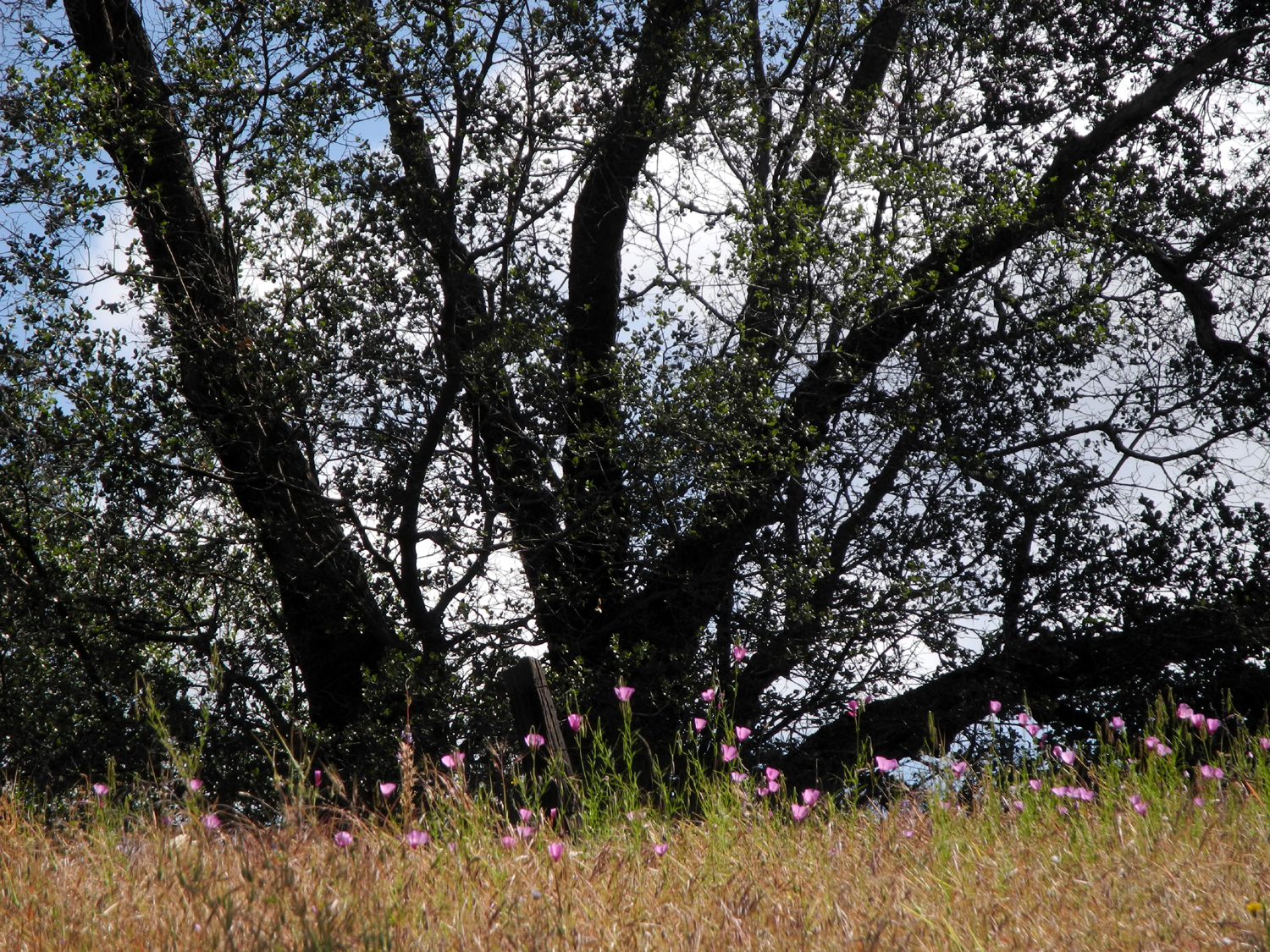
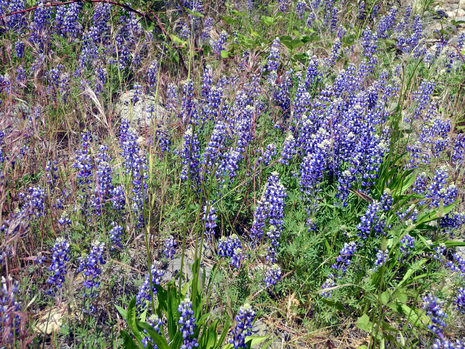
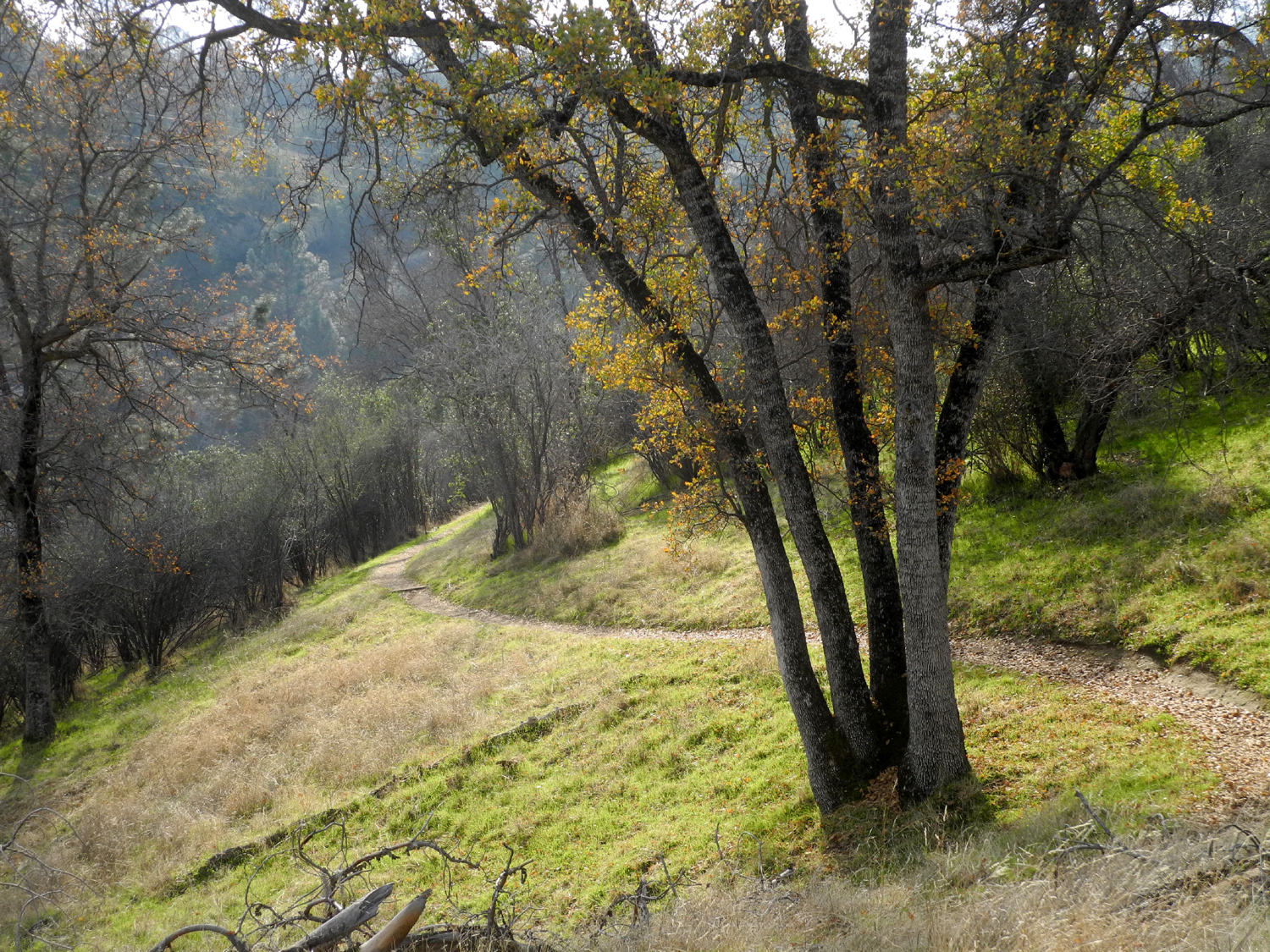
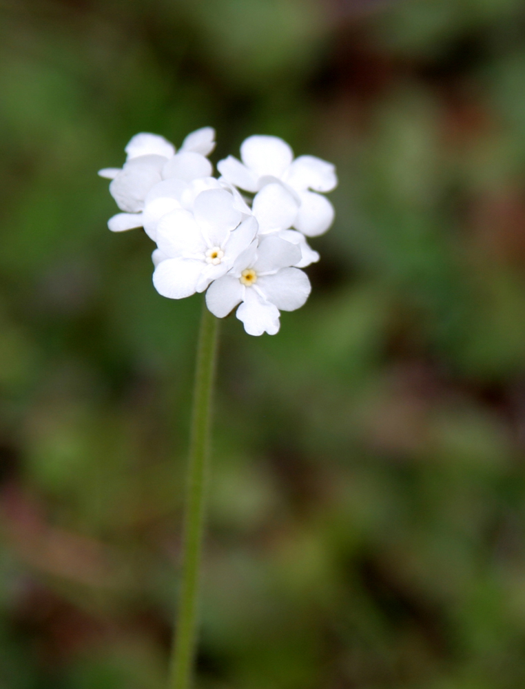
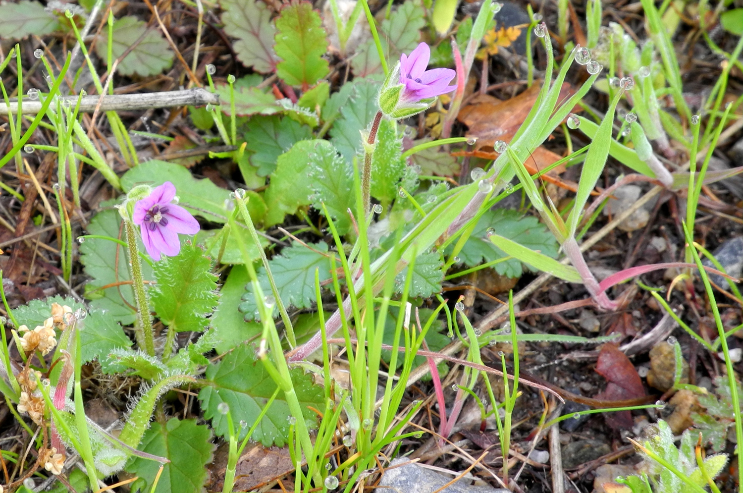
San Joaquin Gorge Bridge & Ridge Trail We have had such a spectacularly beautiful spring in the Sierra foothills this year that I don't want it to end. I want to keep hiking and camping in my favorite spots until heat and stickers drive me up to higher elevations. The weather was still reasonably cool on April 30, so I drove to the San Joaquin Gorge Recreation Area to get in at least one more hike. I've written a lot about this area, so I won't repeat information I've covered before. For anyone wanting to know more, here is a link to my Travel Report Menu with links to all my reports. The road into the parking lot and most of the BLM land is open cattle range, and as I drove the last mile, I was stopped by a bunch of cows in the road. They apparently had no intention of moving, and I ended up gently nudging one with my car. It grudgingly moved out of the way, the others followed, and I drove on to the parking lot. My last two hikes here took me down the River Access Trail and the San Joaquin River Trail, so my plan this time was to take the Bridge Trail, then bear right at the junction just past the bridge, and walk a short distance on the Ridge Trail. On each hike this year, at the Gorge or elsewhere, I've noticed a new batch of wild flowers as some species go to seed and others take their turn at dominance. This time the three most common flowers were common madia, mustang clover and farewell to spring. There were a lot of the latter along Auberry Road on the way up the hill from home, but they were even more spectacular along the trail. The mustang clover and madia were probably even more numerous, but of course there were many other species in small and large numbers. As I had done on several previous hikes, I kept track and counted about 45 separate species, about half of which I could identify. On the trail beyond the bridge I saw several very nice looking flowers I did not recall seeing anywhere before. I also noticed that many of the earliest flowers still maintain a small presence, as if to say, "Remember when we were number one?" My theory is that the rain has allowed a few plants to germinate later than the bulk of their species, maintaining the large variety. Early species in small numbers included blue dick, popcorn flowers, and poppies. In some places the flowers were very tall. I saw madia and farewell to spring that were waist high, and mustang clover up to 18 inches. It occurred to me that the early flowers stand out clearly against the short, new grass, but later species bloom when the grass has grown tall, and have to stretch up to compete. Two non-floral sightings stood out: At the small creek that crosses the trail about half way down, there were a number of monarch butterflies. And a slope below the trail that was covered with sprouting buckeye seeds in February now has a dozen 18-inch high buckeye trees. When I crossed the bridge, I stopped to rest on a big flat rock. A man and his two young daughters were behind me and also stopped. He was telling them something about an ancestor. I heard him mention the name "Watkins," which was my maternal grandmother's birth name. I asked him when his ancestor had come to America and he said something to the effect that I would hear the whole story. I expected some historical information, but in fact it was essentially a religious treatise about how his great, great, great grandfather, John Watkins, converted to Mormonism, then came to America and to Utah to be with other Mormons. The man did tell one brief story of historical interest. The area John Watkins came to had a big river, and every time a bridge was built over it, a flood would wash it out. Watkins was an architect and engineer, and said he could build a bridge that would not wash out. The city fathers were skeptical, but agreed to pay yearly installments with interest each year that the bridge held. The next year there was a record flood; the bridge held up, and the councilmen, convinced that the bridge was permanent, decided to pay the full amount and avoid future interest costs. We have not been able to learn when our Watkins ancestors came to America, but my fourth great grandparents, Robert and Rachel Watkins, were living in Delaware in the late 1700s, information I shared with my fellow trail walker. I continued on up the short distance to the fork, where the Ridge Trail goes east and the River Trail goes north. I had walked on the Ridge Trail twice in recent years, and I was hoping to go a little farther than my last trip. This was not to be, for after about a half mile I realized that I needed more rest and more importantly, some fuel. I found a semi-comfortable rock off the trail and enjoyed my snack there. Once I had finished, I decided to head back rather than going any farther this trip. On, my last two hikes down to the bridge and back, I have felt better than I have in a long time, and the climb seemed much easier than I anticipated. One reason is the pace I set, which involves stopping a lot to take a close look at some flowers, takings lots of pictures, and just generally moving for fun, not to get somewhere. About a half mile from the parking lot, I saw what looked like a snake at the edge of the trail 30 feet ahead. I got confirmation when it began moving into the grass, and by the time I got to it, it was completely off the trail. It was moving very slowly through the thick grass, and I managed to get two photos in which you can barely see a part of the creature, a harmless species with black and white stripes. I am going to call him a "jailbird snake." There were a lot of people on the trail, all the campsites were occupied, and there was a large group at the Group Camp. I took advantage of these conditions to conduct a little semi-political activity. A proposal has been in the works for some time to build a dam at Temperance Flat, at the upper end of Millerton Lake and just downstream from the San Joaquin Gorge BLM area. This dam would create a lake which would entirely drown the parking area, campgrounds, visitor center and most of the trails, not to mention two existing power houses. I discussed this with the park ranger earlier this year, and she told me the river is under consideration for wild and scenic status. If this is granted, it should preclude construction of this environmental disaster of a dam. The best way to promote this action is to write to the Secretary of the Interior, who will be making a recommendation on wild and scenic status. I wrote a letter to Secretary Sally Jewell a few weeks earlier, and also sent an email asking for support from friends and relatives. At the parking lot, I talked with a number of people, letting them know about the dam proposal and asking them to write to the Secretary. Most were receptive, and some had already written to legislators, another useful approach. There is no doubt major political pressure on the Secretary to let the dam go forward, so the more she hears from the public about the value of this place for recreation, the better. Most of the land in the Sierra foothills is fenced and in private hands - there is simply no comparable public facility like the San Joaquin Gorge anywhere near. When I got back to the trailhead, all the camp sites were still occupied, so I drove over to the Equestrian Camp, set up my lawn chair, and enjoyed a small lunch. Just below the corrals is the start of the Nature Trail, which I've discussed in the past. This time I did not walk much of the trail, but just past the gate I made a delightful discovery. Carpenteria, one of the plants on the trail, is very rare, and I had seen it only after it had finished blooming. This time it was showing off with spectacular white flowers, about two inches in diameter. I took a half dozen pictures of these, then returned to the car for the drive home.
--Dick Estel, May 2016 |
||
|
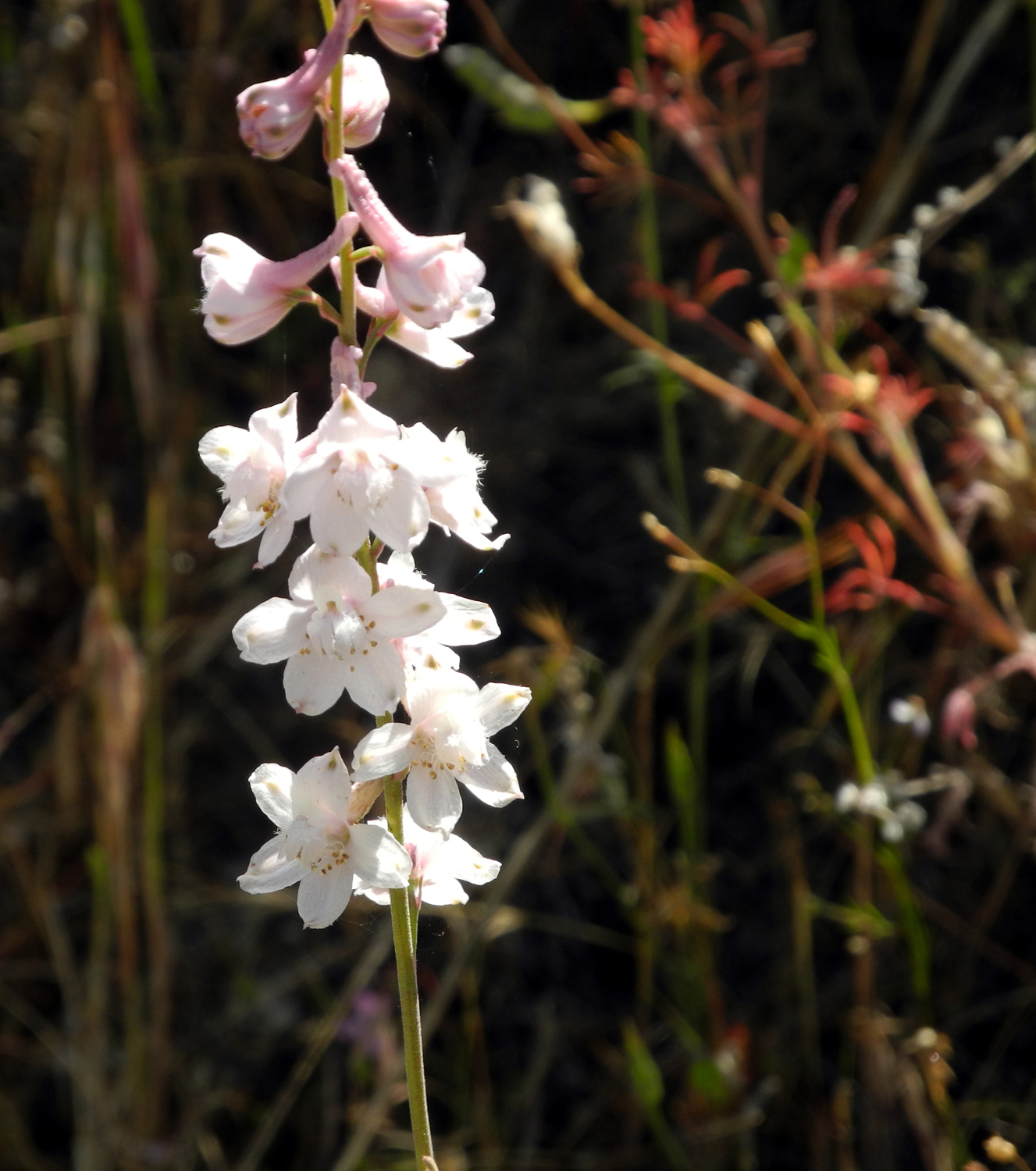
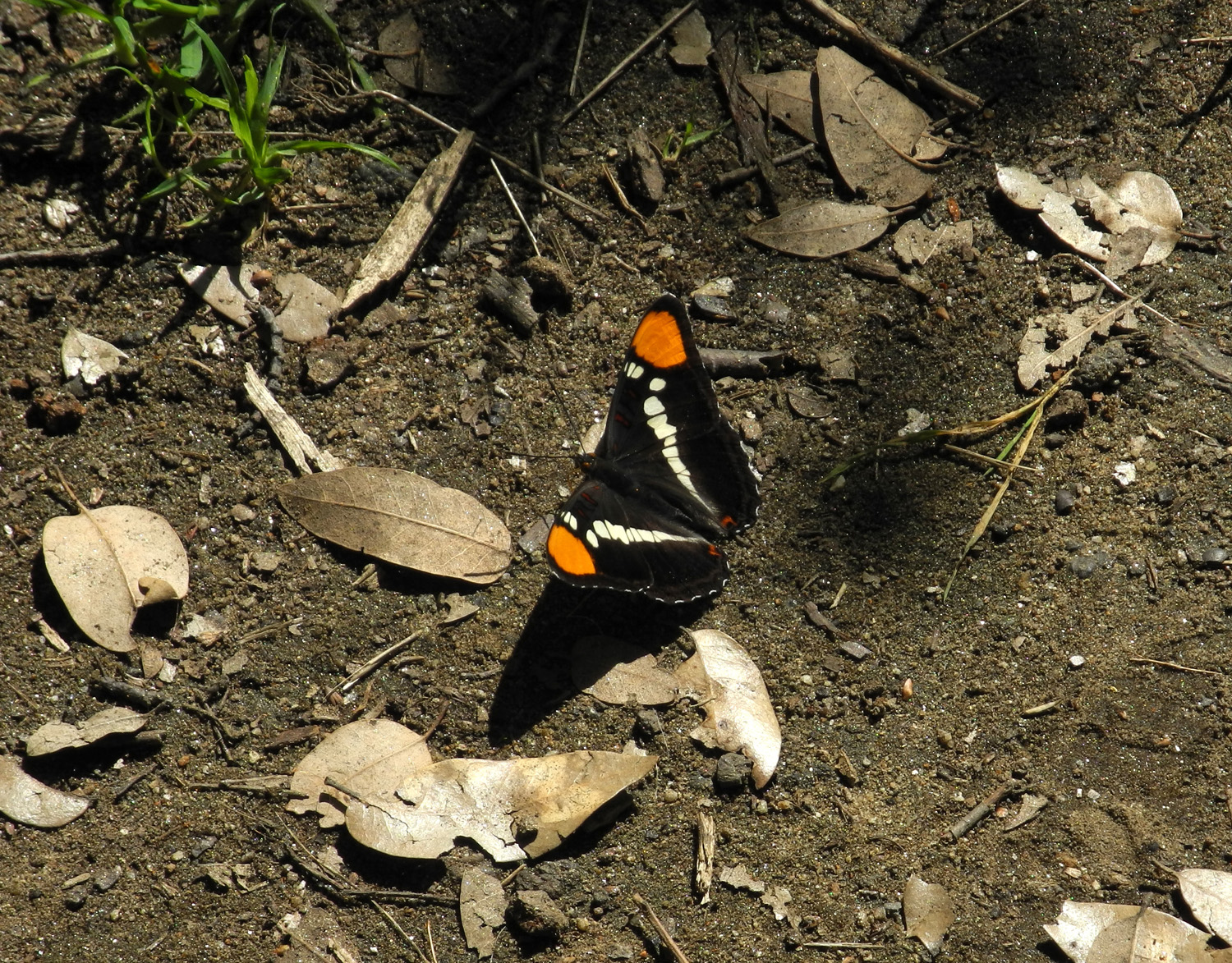
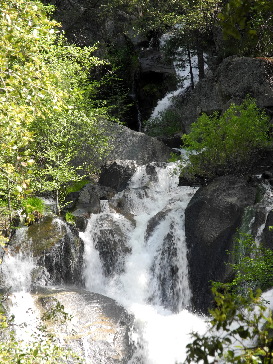
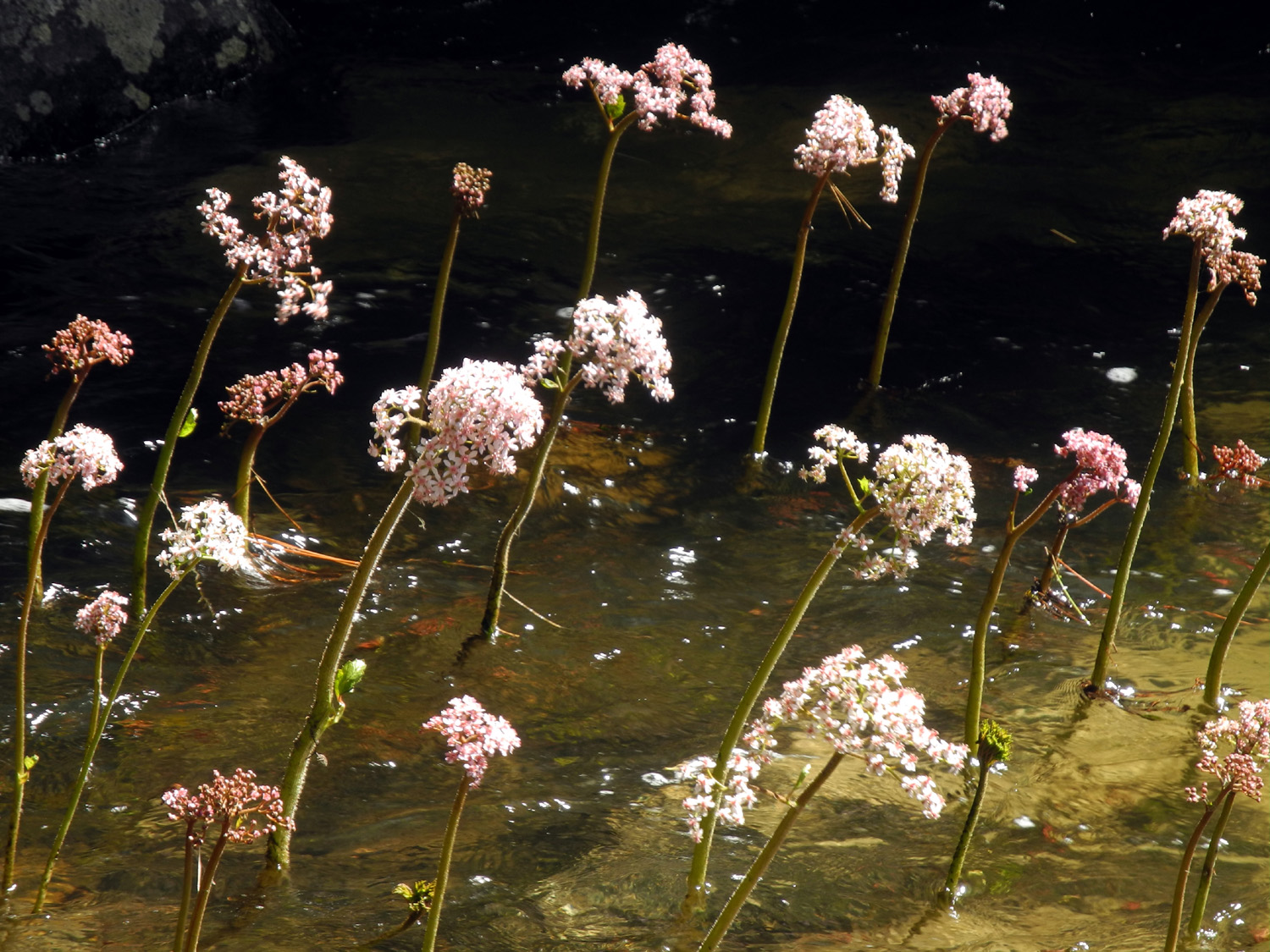
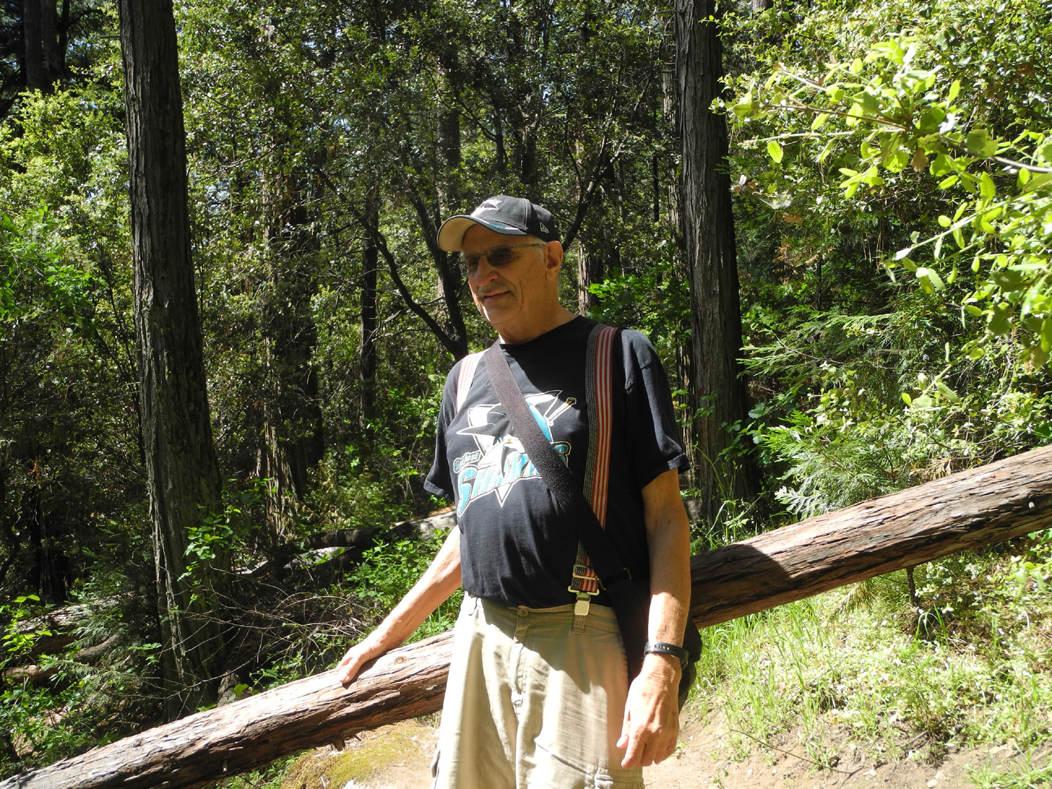
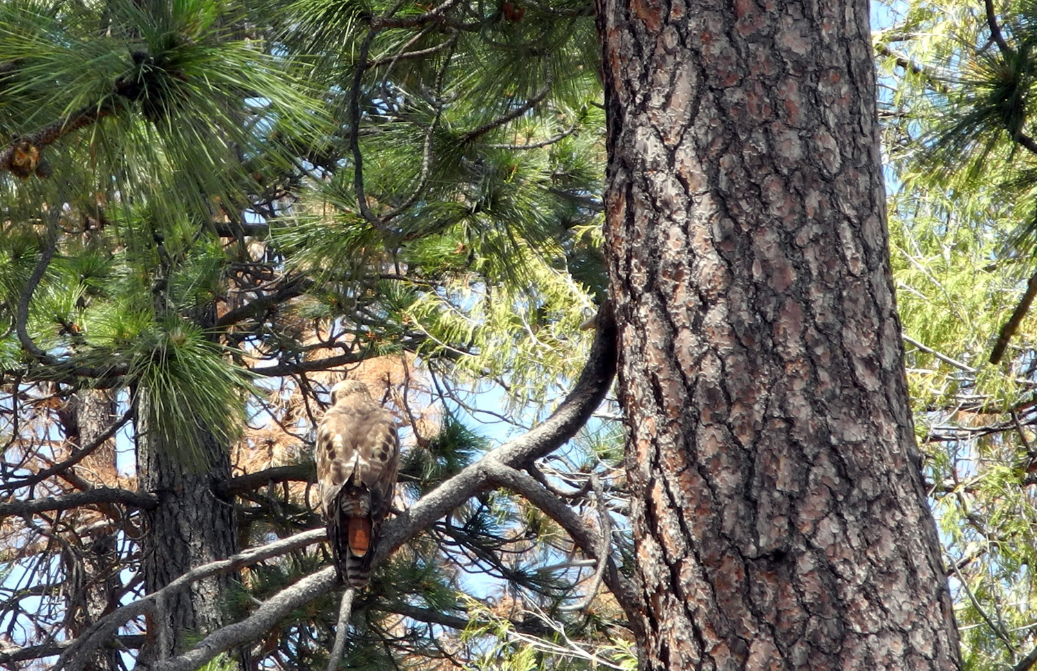
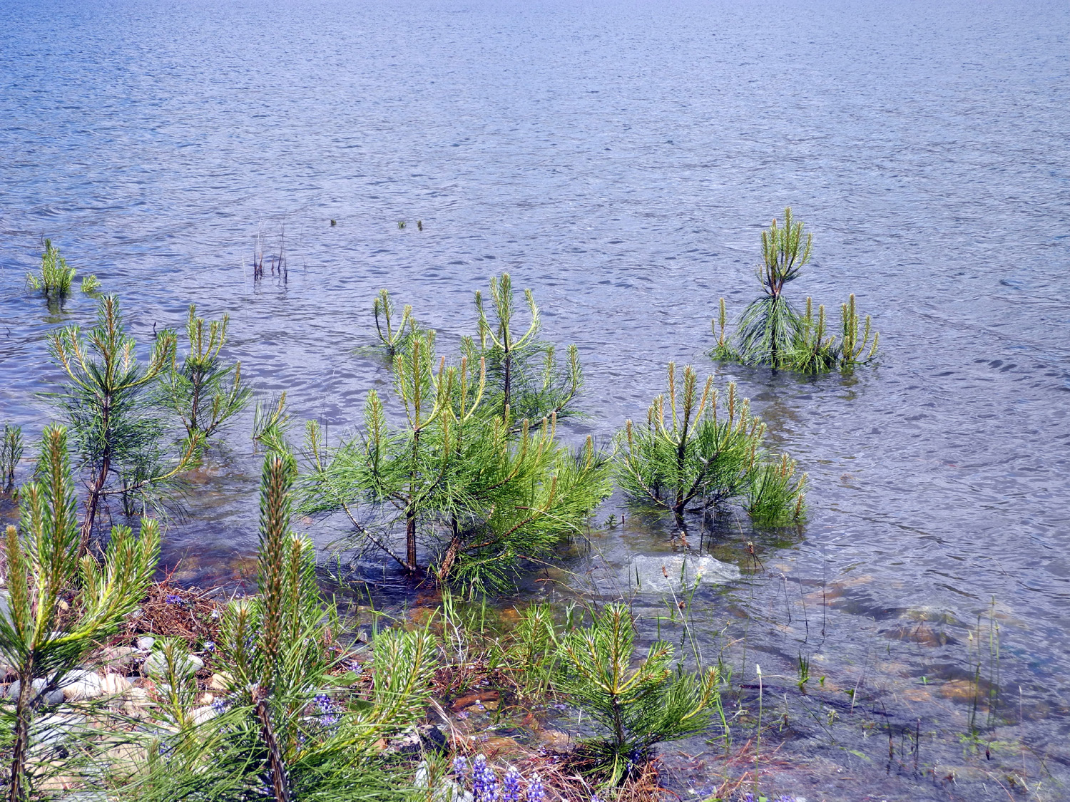
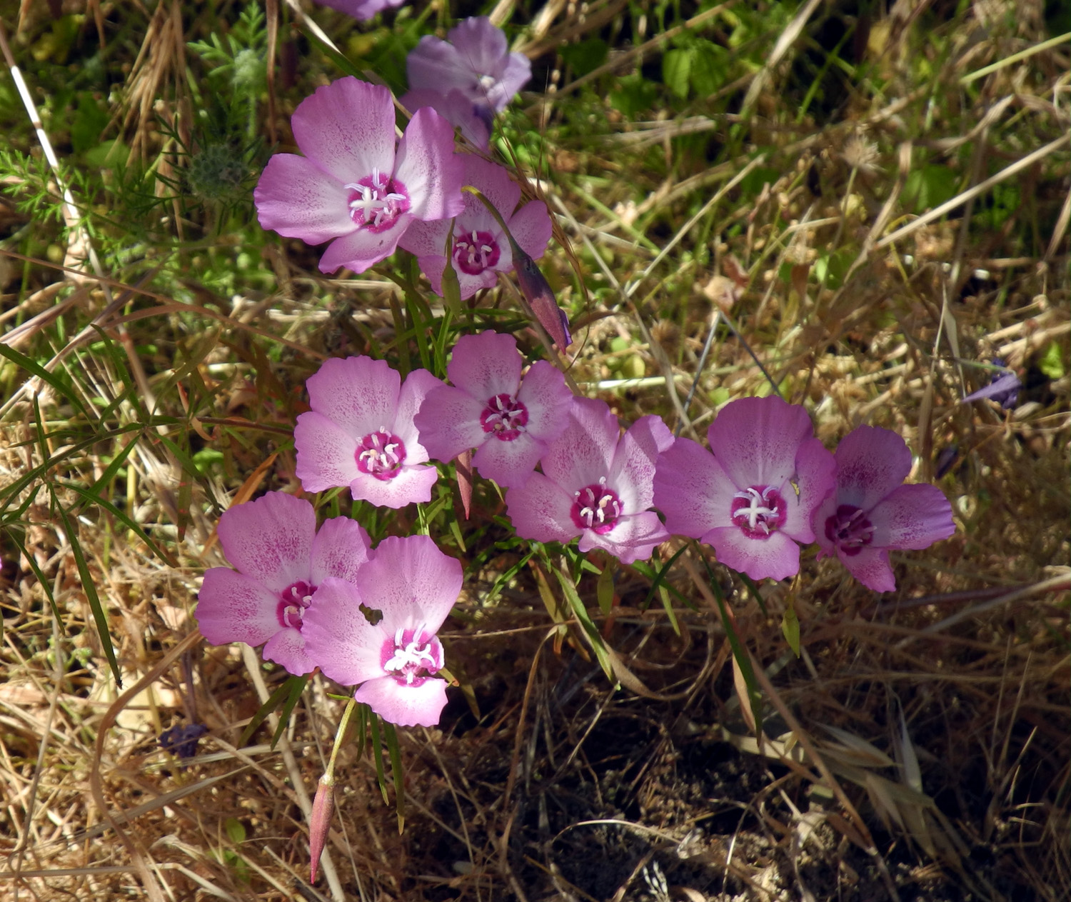
Corlieu Falls (Lewis Creek Trail) This was a short hike, so I'll try to make the report short also. I have hiked on the Lewis Creek Trail several times, both the upstream and downstream branches. I have been to Corlieu Falls (downstream) with friends, with my younger daughter Jennifer, and by myself. This was the first time my older daughter Teri had been to this location, although the three of us hiked the upstream trail last year. Teri came to my house early on May 19 and we drove up Highway 41 a few miles past Oakhurst to the trailhead. A short distance from the start the northbound trail goes down to a crossing on Lewis Creek. Taking the southbound trail as we did puts you on a steep path down into a cool, fascinating canyon environment with big boulders, ancient canyon live oaks, lush growth, and lots of flowers and plants. The most common identifiable flowers were Indian pinks and wild iris. They were accompanied by a large number of tiny pink and white flowers, names unknown. After a short distance there is a viewing platform which offers a good look at the falls, which is running loud and full in this Year of El Nino. It's not a straight drop, but rather a series of cascades about 80 feet high. It's only a half mile round trip to this point, but older or unsteady hikers (I'm both) should use poles and allow plenty of time. There are things to see along the way, so I always find reason to stop several times even in a distance this short. The trail continues on down to the creek below the falls, and some distance on into Cedar Valley, an area of cabins and vacation homes. I've never gone much past where the trail reaches the creek, but Teri and I continued on a few hundred yards farther. You can get close to the creek, which at this season has the tall stalks and striking flower heads of Indian rhubarb growing right in the water. Our turnaround point was a log across the trail. We could have got past it easily, but we had a couple of other destinations, so we took it as a sign to start back up. When we reached the junction, we went on the upstream trail as far as the creek to see what the crossing was like. When I hiked there with the Ramblers last year, and with my daughters, there were several big log sections in the creek to aid in crossing. There used to be a bridge, but it washed out a year or two ago, and a replacement is in the works. This year two of the the three log sections had washed down stream, and crossing at the trail looked difficult and dangerous. Just upstream there is a log across the creek, and someone has tied a rope above it to provide a "railing" of sorts - also difficult and dangerous. Fortunately, we had no plans to continue on the trail in that direction. We decided to go to nearby Bass Lake to have our lunch at one of the picnic grounds. Most of these are still closed, but we parked at the entrance and walked in a short distance to a table. We were treated to more flowers here, especially a large stand of lupines close to the lake. The water is up to the highest level, something that has not been seen in a number of years. A bunch of small ponderosa pines that germinated when the lake was low are now standing in water two to ten feet from the shore. Unlike the rhubarb, this is not a natural or supportive environment for them. Part of the time we had a red tail hawk just 30 feet or so from us in a tree, keeping watch for his own lunch, and saw another large bird, possibly an eagle, flying above us. We were also sad to see many dead pines, the result of years of drought and beetle attacks. The weather in both locations was perfect, with a nice breeze at the lake. When it was time to leave, we continued on the drive that skirts the lake on the west side, then drops down through the foothills to the village of North Fork. Here we turned west toward Highway 41, but did not go that far; instead we drove on a narrow paved road that will take you either to Millerton Lake, or out to Route 41 via Route 145. Along the way home we stopped at one place where there were hundreds of Farewell to Spring turning the road bank pink, and took some final pictures, having enjoyed Sierra beauty from the 1,000 foot level up to 3,000 feet.
|
||
|
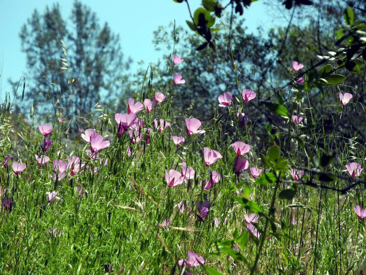
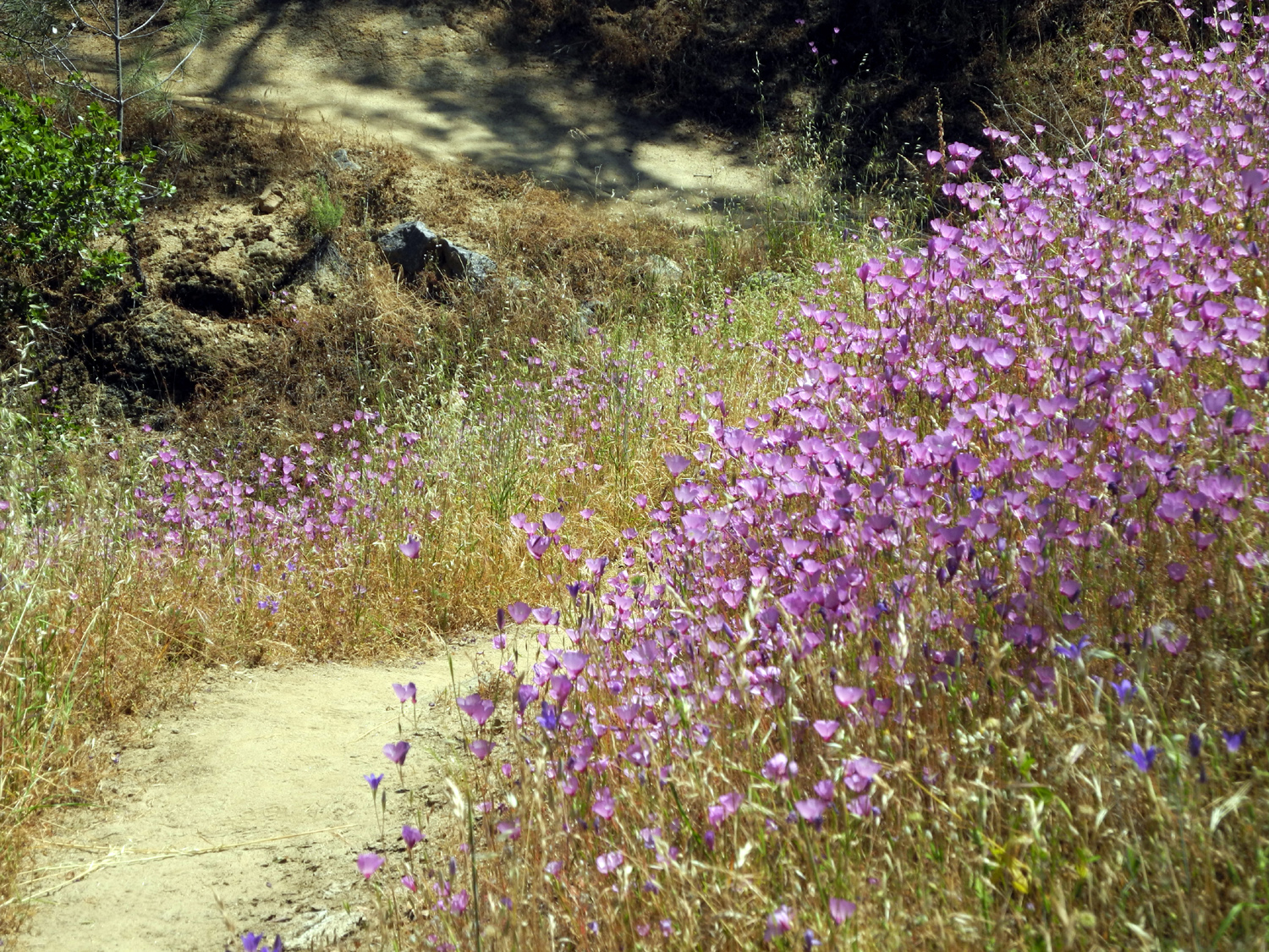
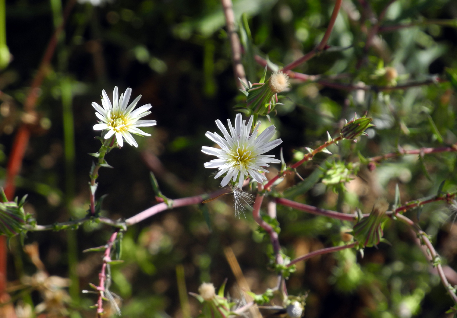
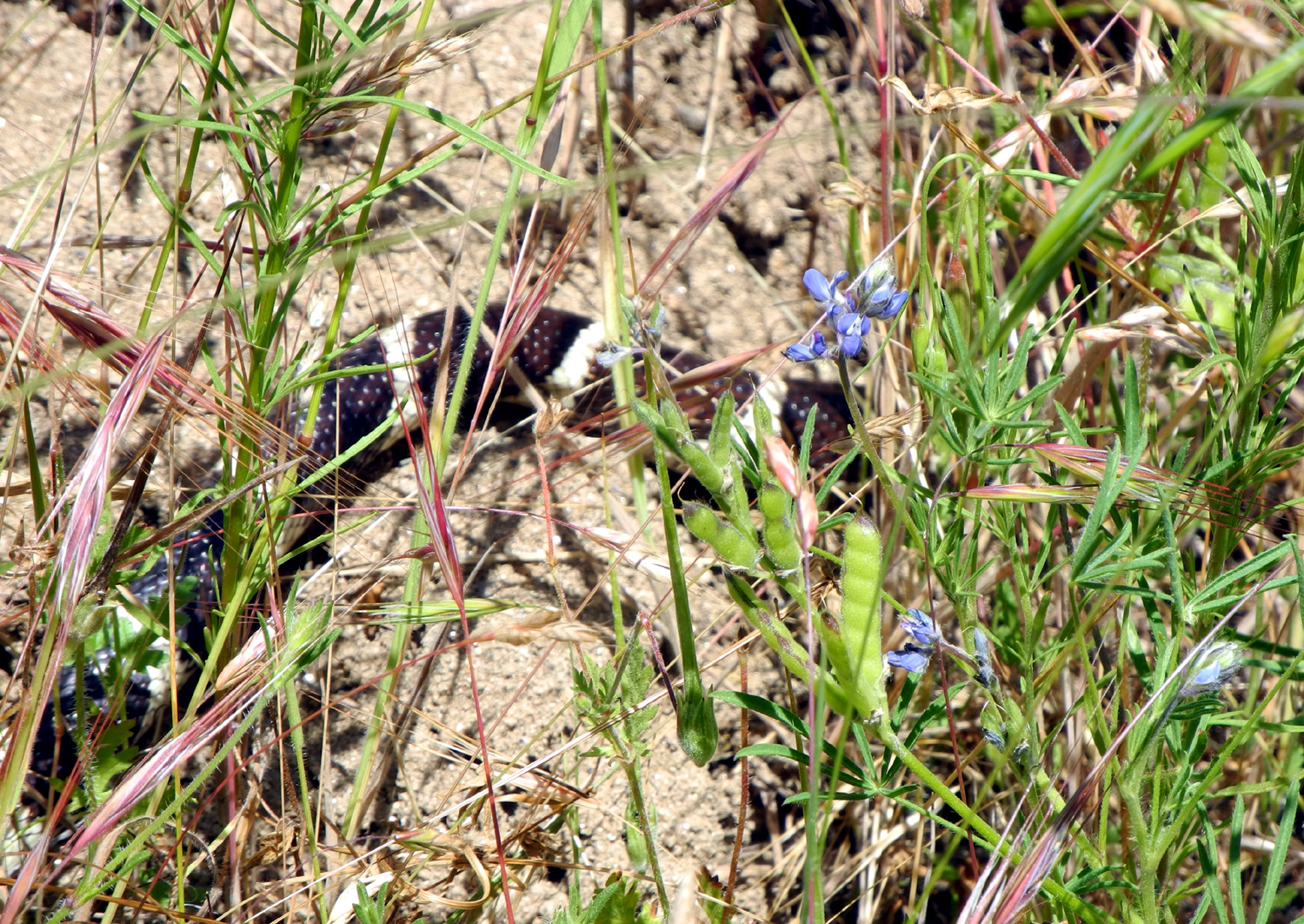
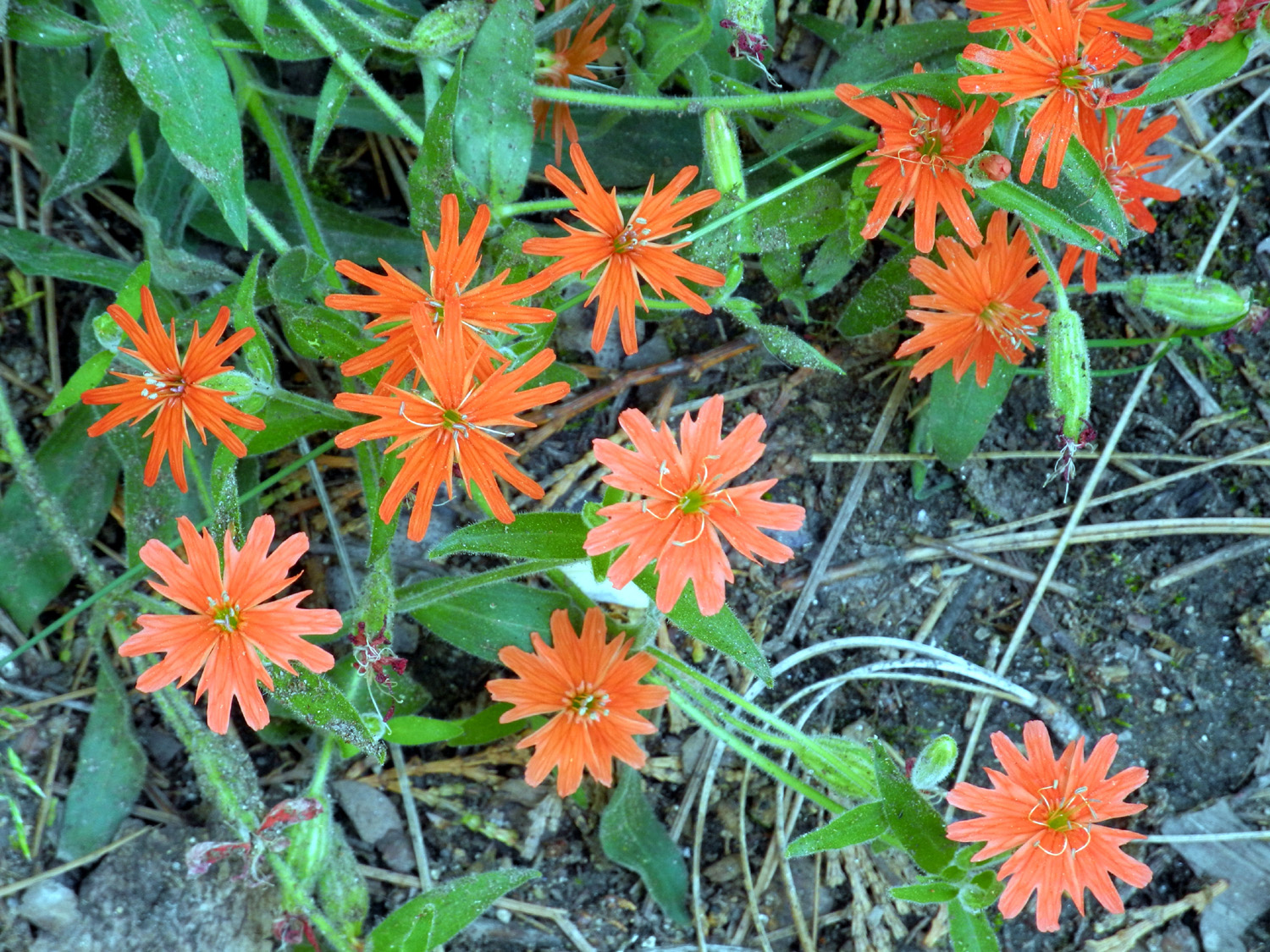
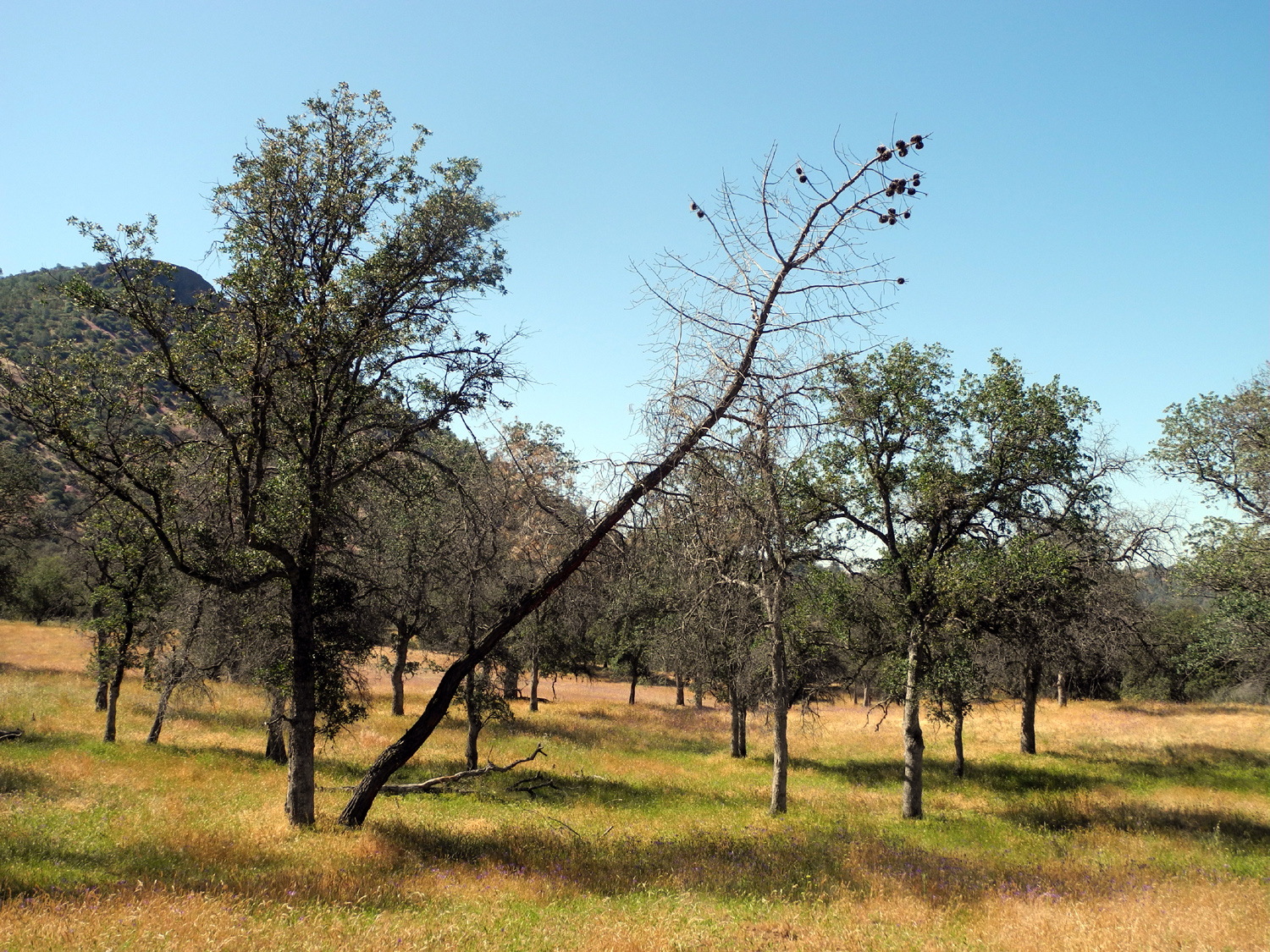
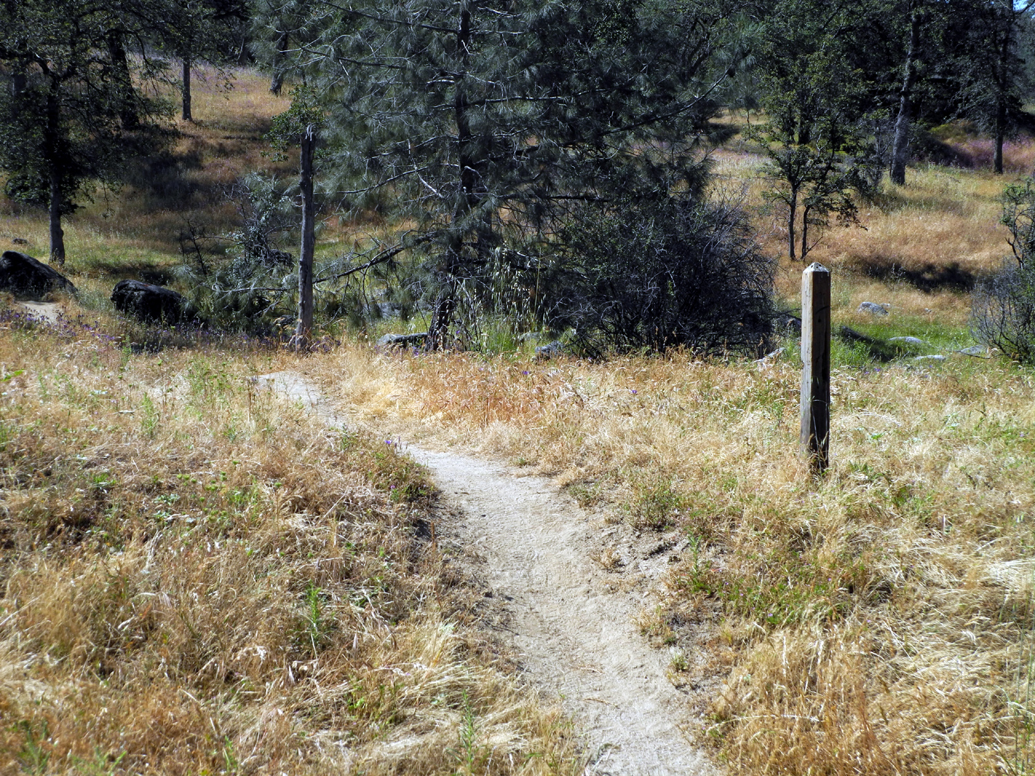
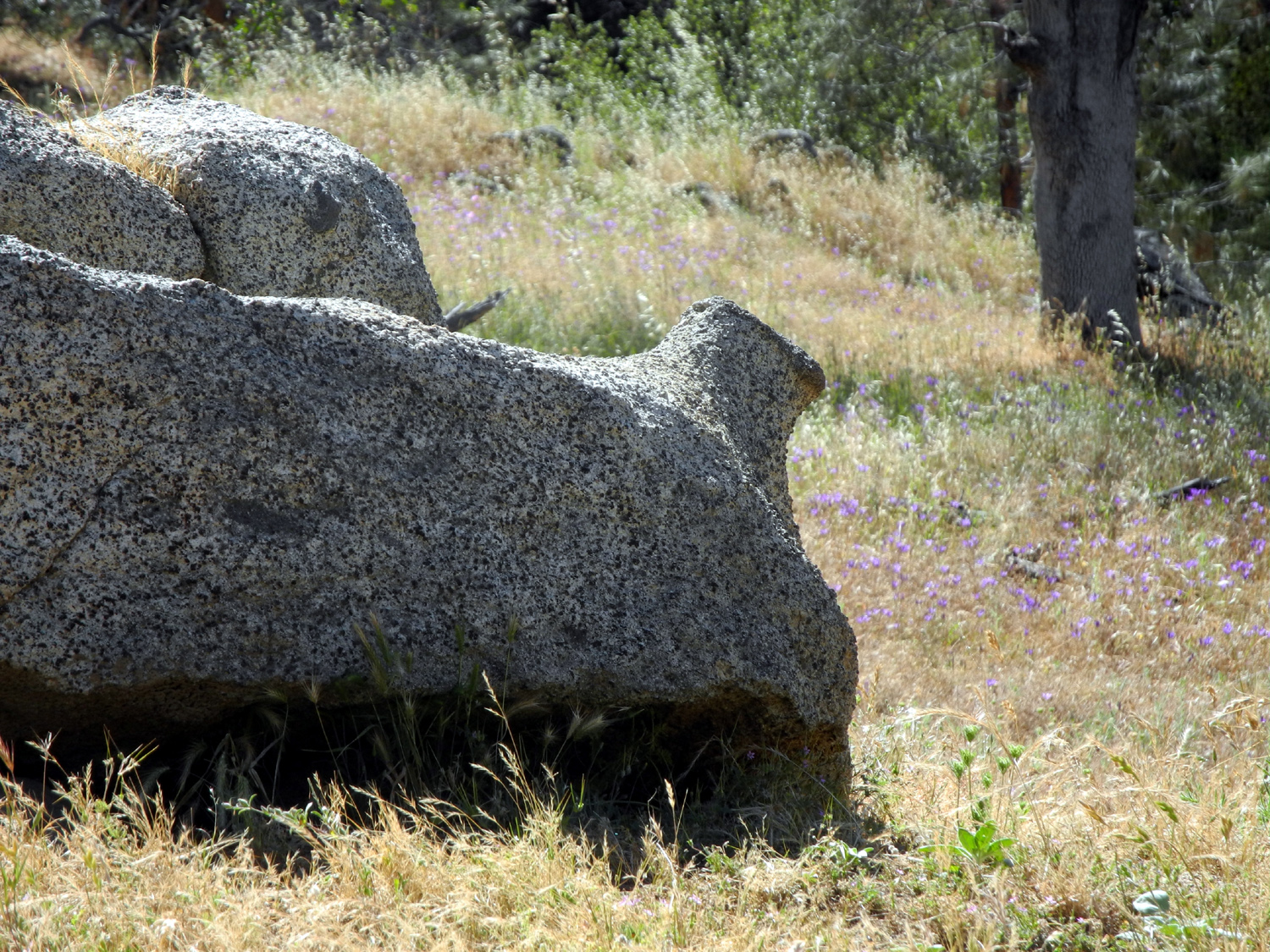
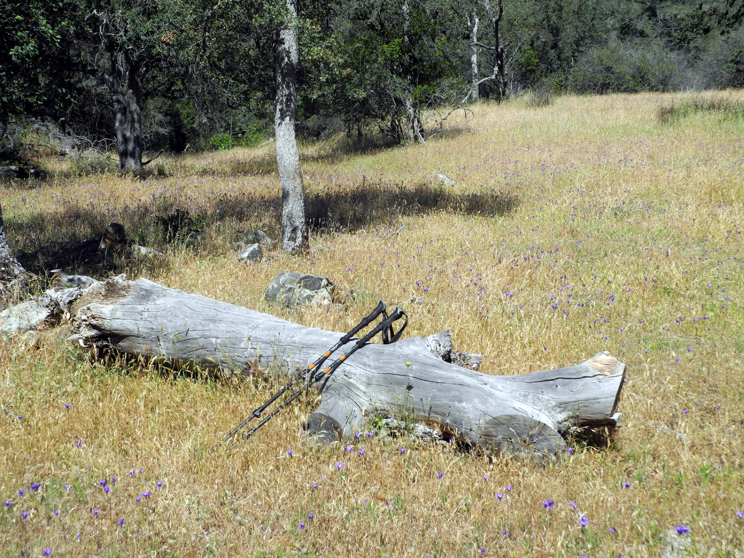
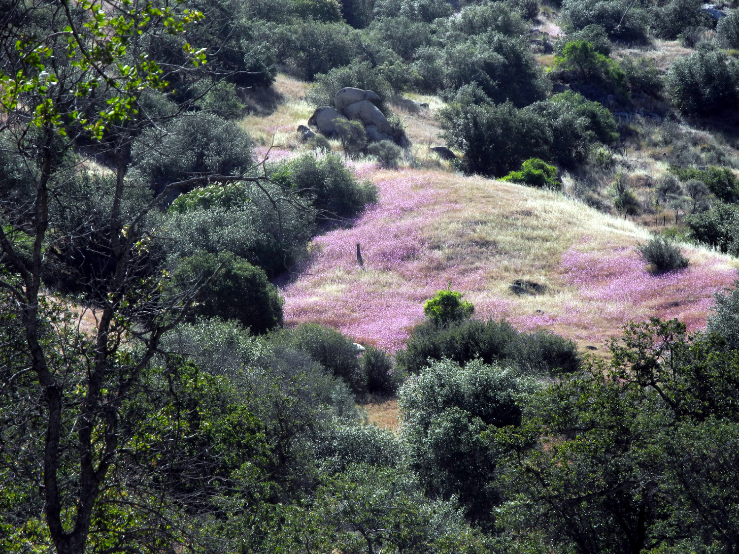
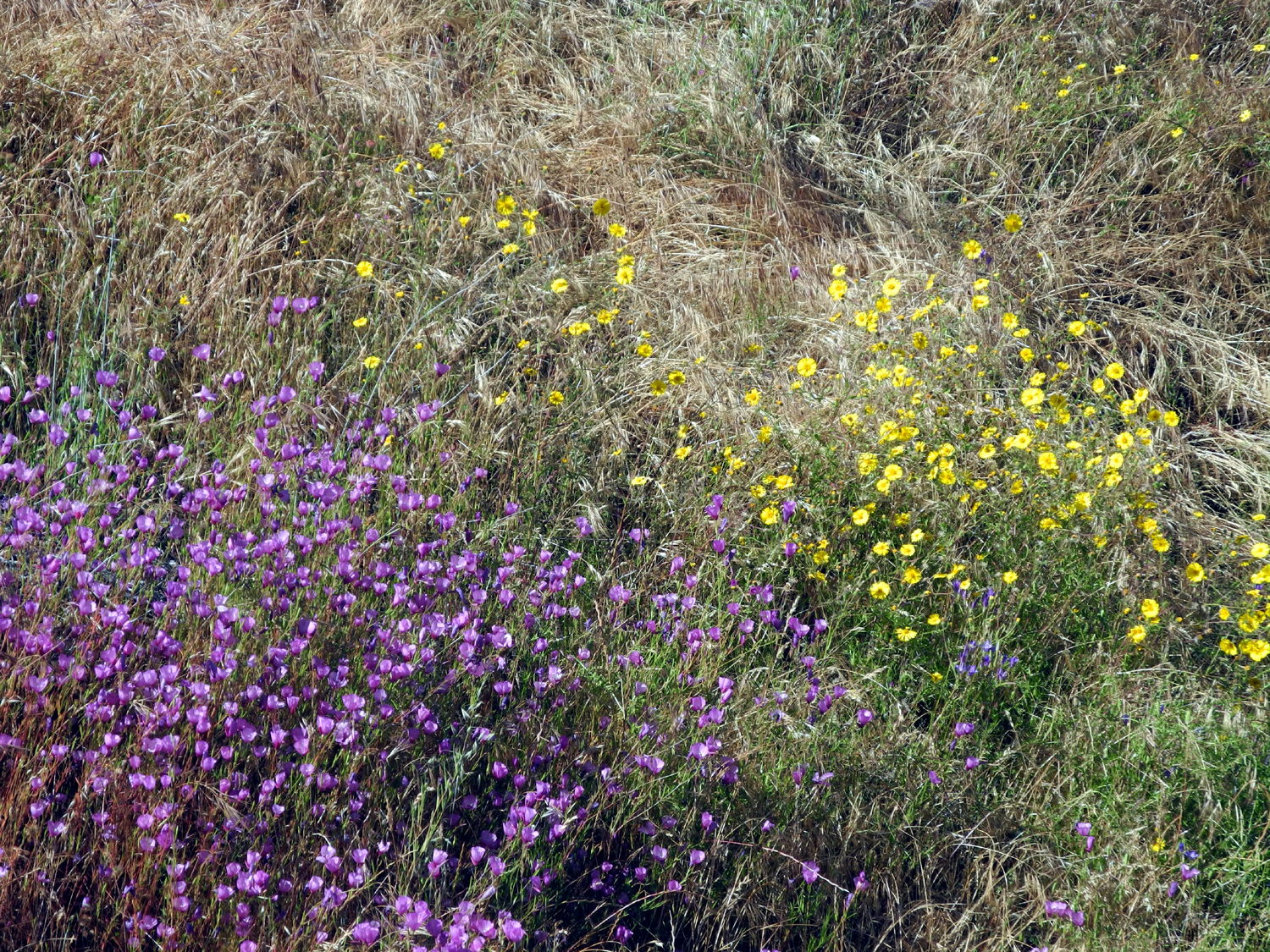
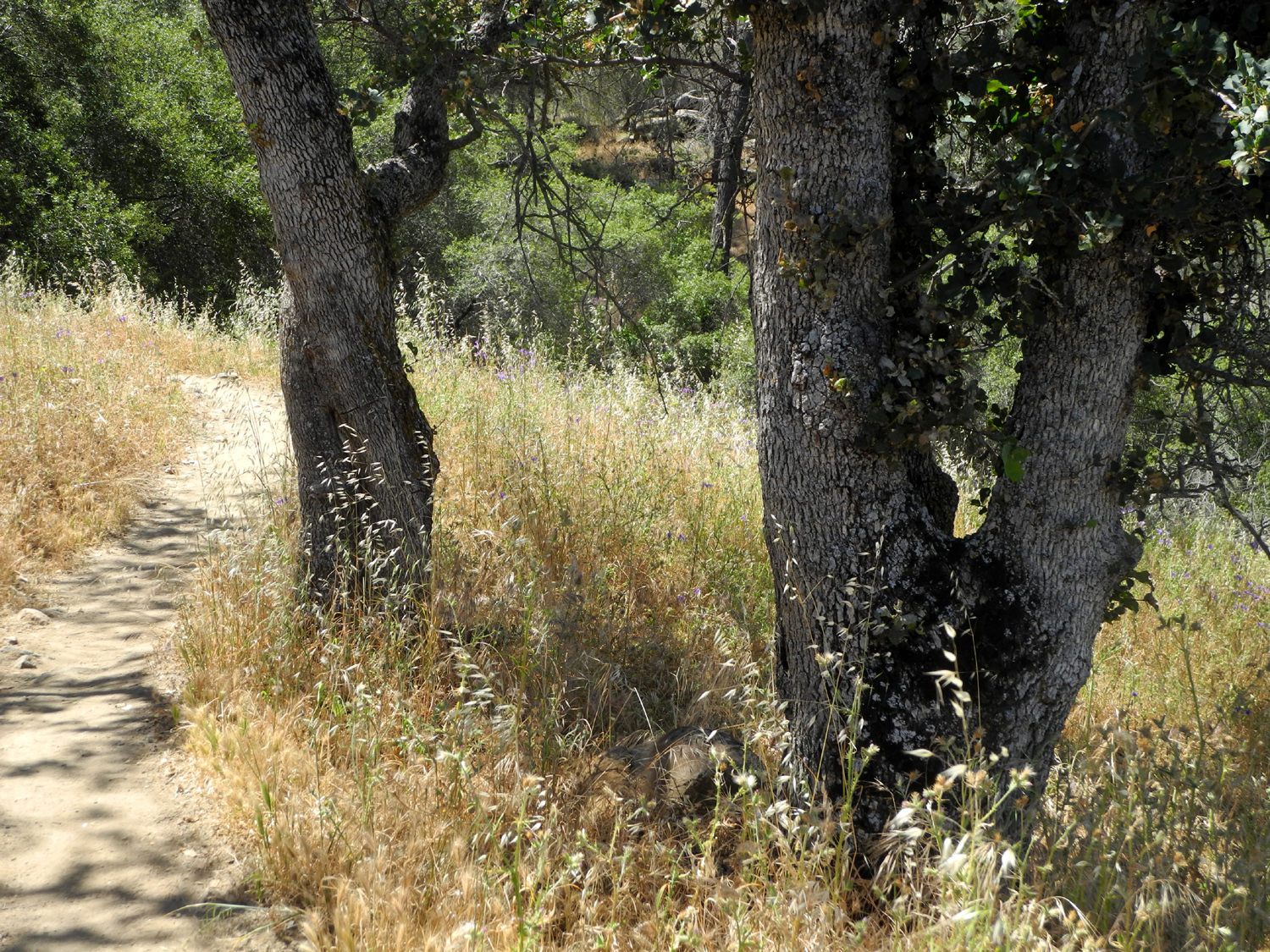
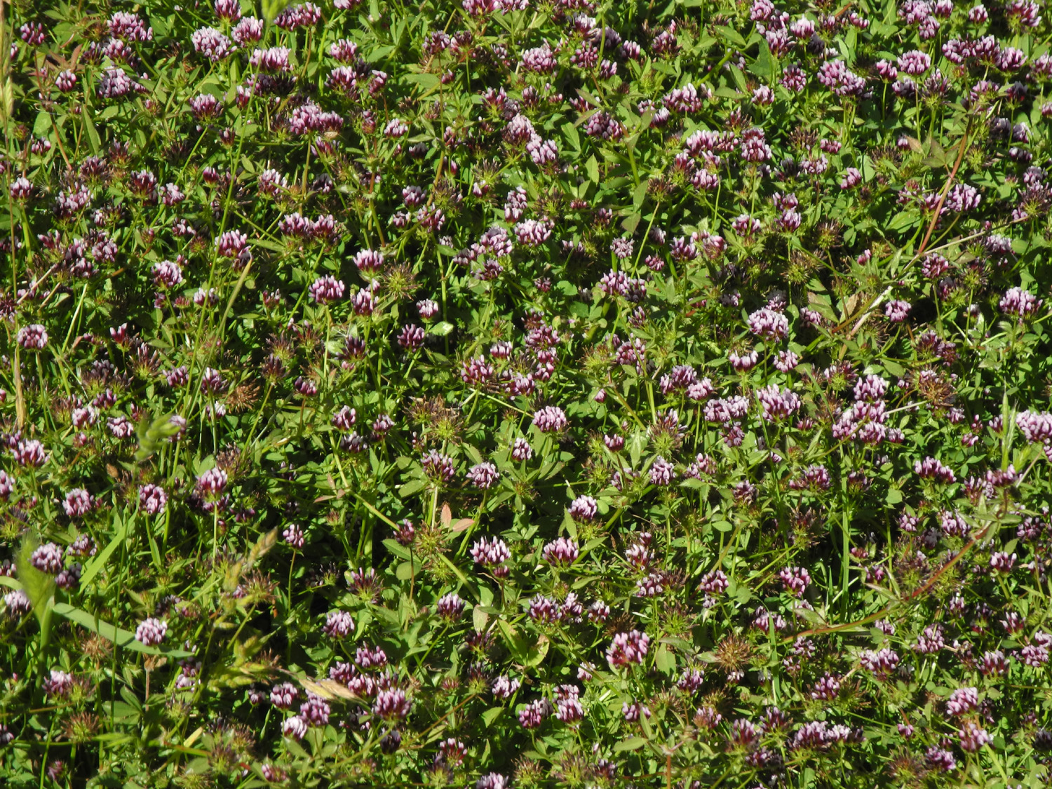
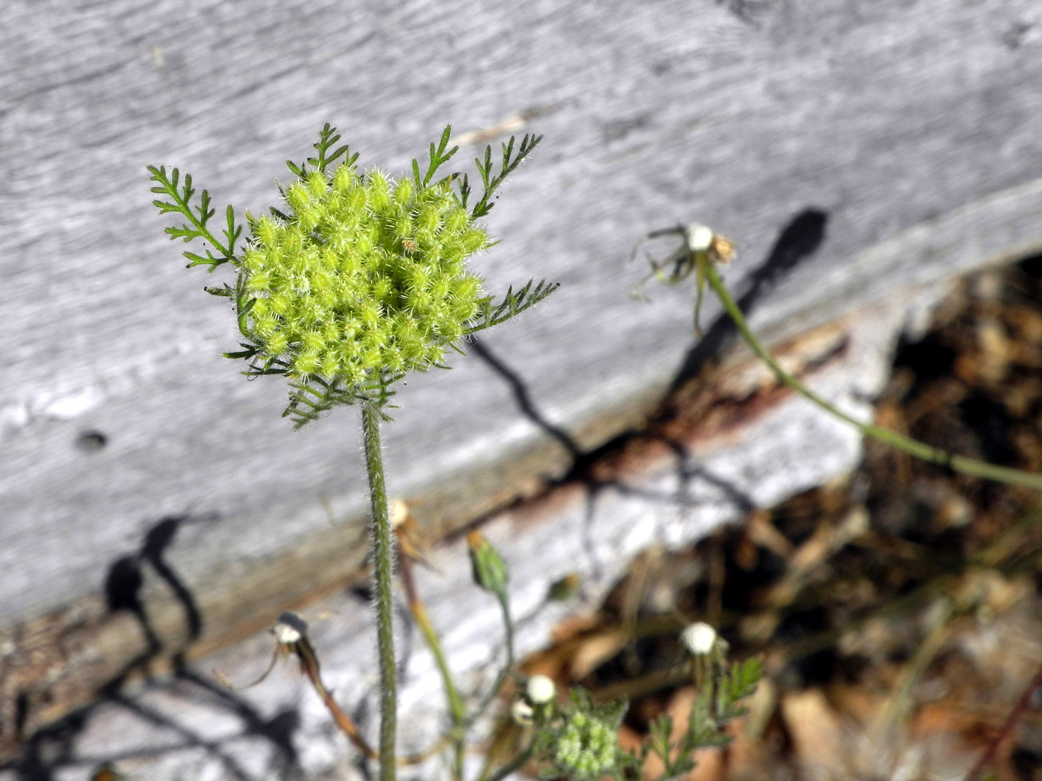
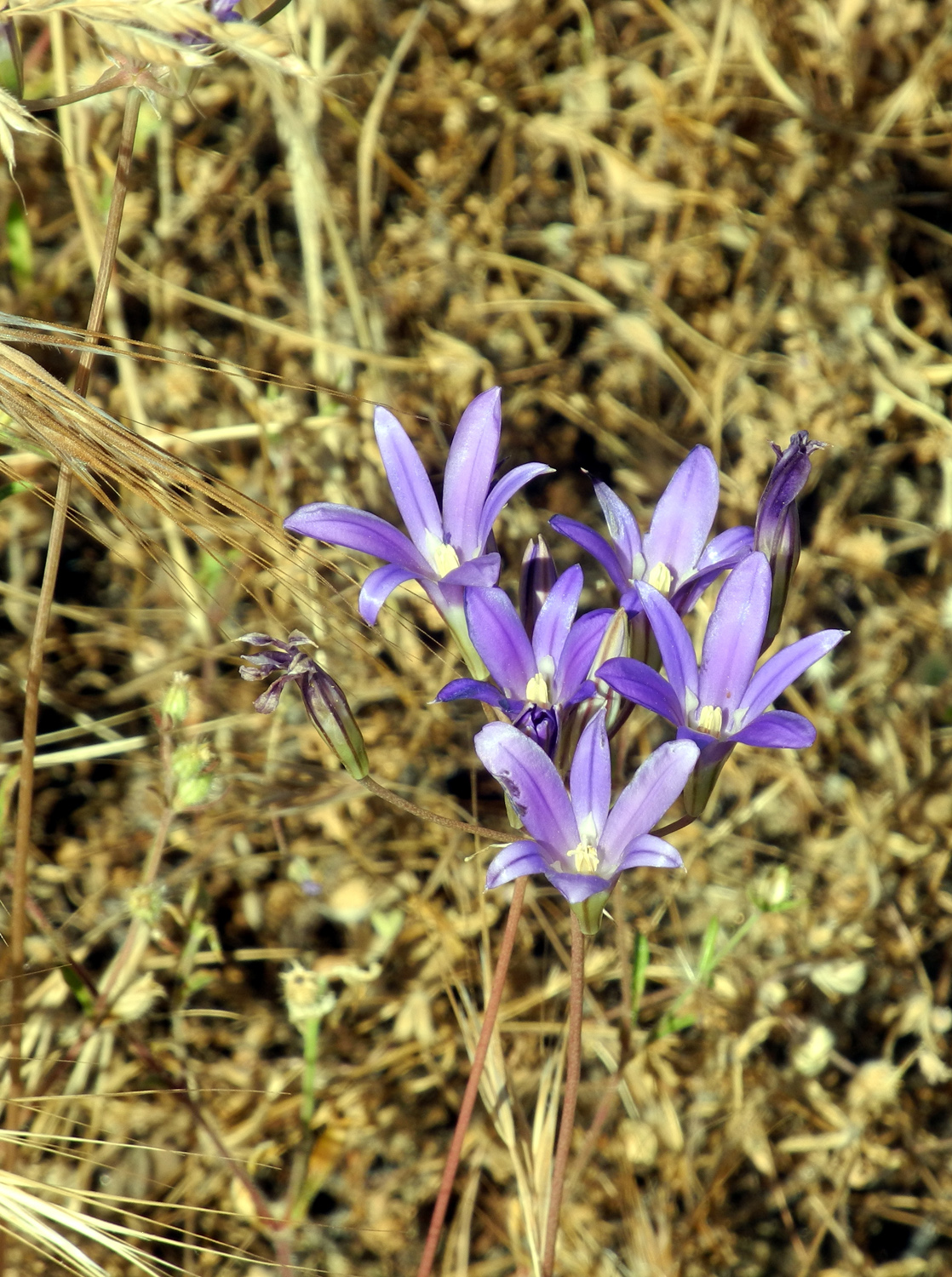
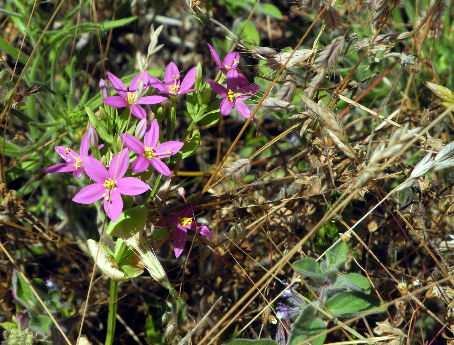
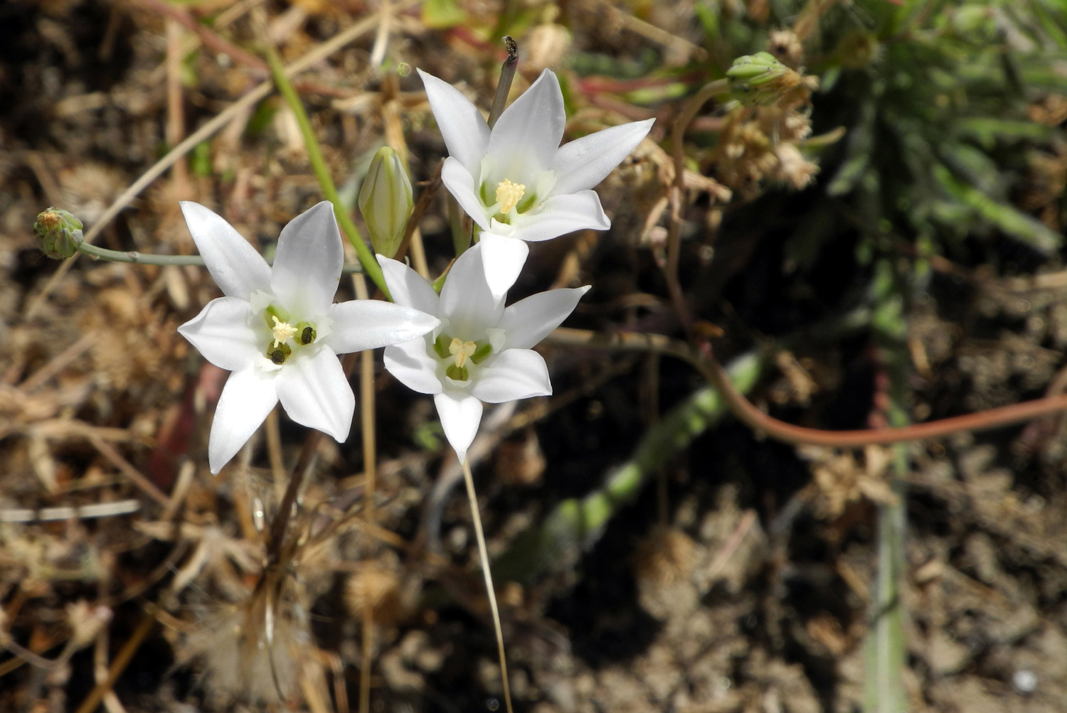
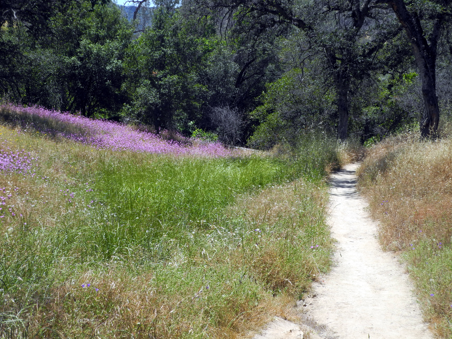
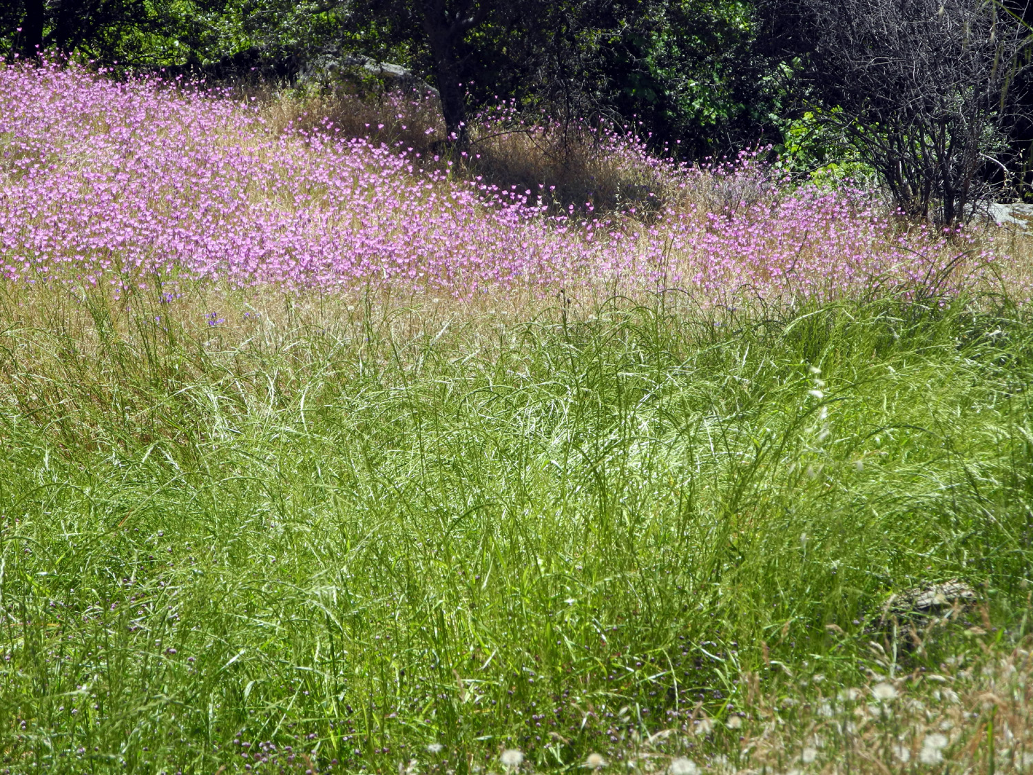
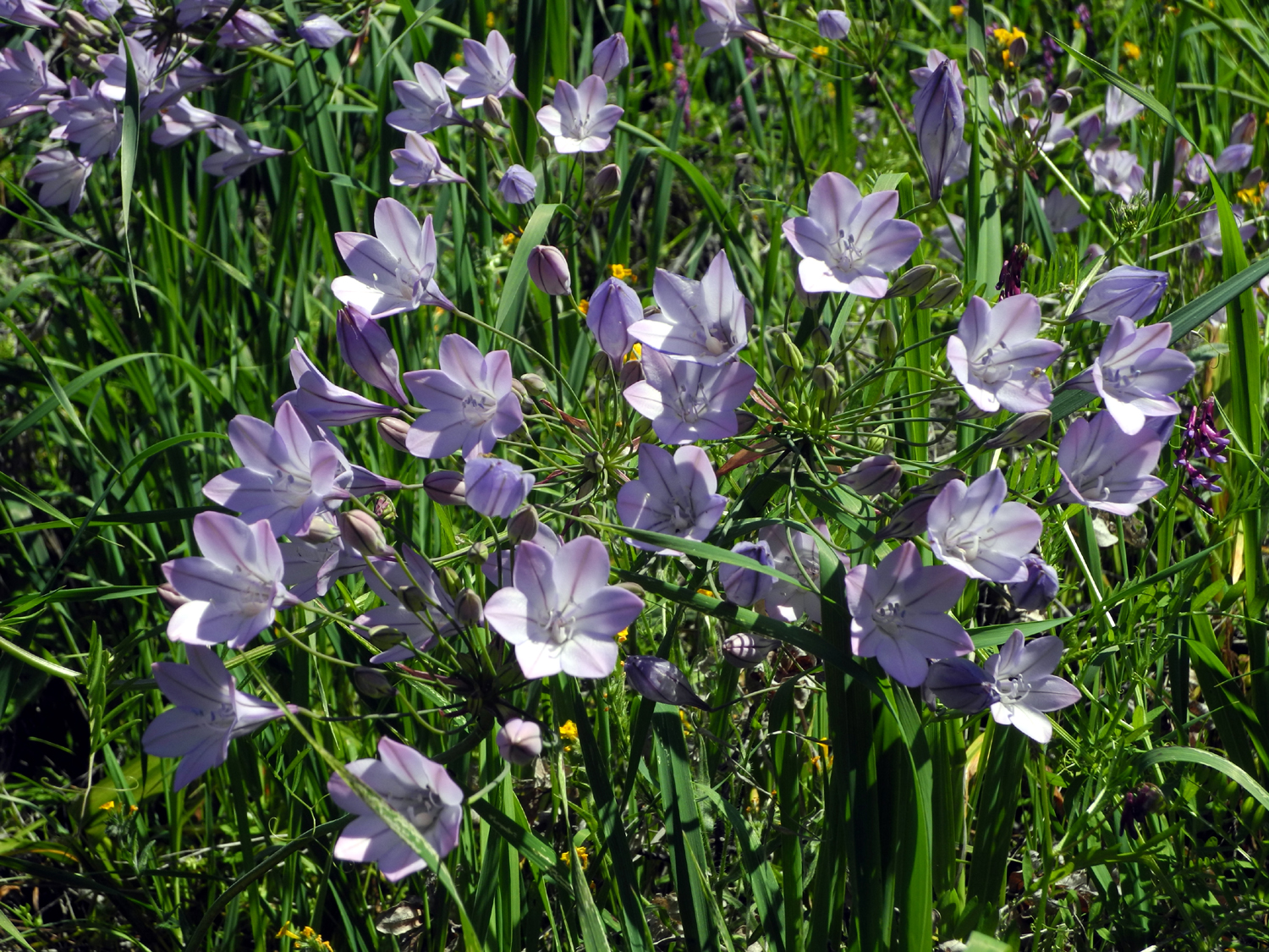
San Joaquin River Trail I'm calling this the last San Joaquin Gorge hike of the season. In fact, most years I wouldn't even consider hiking there this late. But this has been a special year - a wet year, a flower-filled year, a year in which I may have done more hiking during the winter-spring season than ever before. So on May 22, with relatively cool weather in store, I packed a lunch and drove north from town and into the foothills on Auberry Road. Just past the town of Auberry, at 2,100 feet, is the junction with Smalley Road. This route descends steeply down into the San Joaquin River gorge, arriving at a parking lot at 1,000 feet, and you are now at the Bureau of Land Management's San Joaquin River Gorge Special Recreation Management Area. No wonder those of us who are familiar with the place continue to use the original name of "Squaw Leap," political correctness be damned. I have hiked here many times since about 1980, in fact at least four times this year alone. There is a special menu of all my San Joaquin Gorge trips on my Travel Index Page. There are several hiking trails that start at the parking lot, and I have been on all of them this year, but I had already decided to concentrate on the San Joaquin River Trail. This goes north a short way from the trailhead, then turns west and parallels the river high up above the waterway (enough so that you can rarely see the river from the section I walk on). If you remember every word of my previous reports, you know that this trail goes about 11 miles down to the Finegold Picnic Area at the end of the Sky Harbor Road beside Millerton Lake. I usually hike about one to one and a half miles, then turn back. My goal of course was to enjoy a final stroll through the last of the spring wildflowers, and I was not disappointed. As expected, the hills above and the fields and banks along the trail were covered with Farewell to Spring, one of the last flowers to bloom. Having so many specimens to examine, I made an interesting discovery: There are apparently two noticeably different variations of this flower. At first I thought the differences were minor, but the closer I looked, the more different they appeared. One variety is a lighter pink color and has a dark red or pink dot at the base of each petal. The centers are white. The petals tend to slightly overlap, and they have wider leaves, and slightly thicker foliage than their counterparts. The ones without spots are a darker pink; the petals are adjacent or slightly separated, with a white section at the base, and dark red or pink centers. The leaves are slightly narrower. This brings up the difficulty of identifying wildflowers. On my various hikes it seems I always see something I don't recall having seen before. I have looked at a dozen websites that show photos and names of wildflowers, and it's surprising how often I don't see what I'm looking for. The situation is complicated by the fact that many flowers have more than one common name. For example, for the white early spring flowers most people call popcorn flowers I've heard snowflakes, snowdrops, and sheepherders. I also see "common" names for flowers that are clearly not the flower I'm used to calling by that name. And of course, there are many flowers that look almost the same, and ALMOST like the web photos, but not quite. So I just invent descriptive names like "little pink star-shaped flower." The most surprising thing related to flowers was the large number of purple brodiaea. We saw thick patches of these in the cool, shady drainages along the Edison Point Trail in March. This caused me to think these were exclusively shade-loving plants, but there were lots of them growing in the dry grass in open, sunny areas along the San Joaquin River Trail, and along Smalley Road. (Update: Just after finishing and posting this page, I was looking at a huge flower web site and ran across Ithurial's Spear. Guess what - it looks just like my late-season, sun-loving brodiaea. The petals are pointed and separated, while the flowers from Edison Point have rounded petals that slightly overlap. There are enough common characteristics that I believe they are part of the same family. Indeed, the web page refers to brodiaea as a "near relative." Another linked web site simply muddies the water, using the name Ithhurial's Spear with a photo that clearly matches the more rounded early flowers and using both the same scientific name of Triteleia laxa Benth, and Brodiaea laxa. It also leads to a whole page of Trieleia varieties, many of which I would just call brodiaea. Now we know much more than we ever wanted to about brodiaea, or perhaps less than when we started.) There were also many other flowers, mostly in small numbers, including mustang clover, gillia, and a few scraggly lupines. And of course, there were filaree. They are there at the start of the season, and there at the end. When the earth is a lifeless cinder after King of the World Trump's nuclear holocaust, there will still be filaree, drawing sustenance from the remains of The Donald's hair. The weather was warm, but there was a good breeze most of the time till about the last half mile of my return hike. There were a lot of cars at the parking lot, but most of the people must have gone down the Bridge Trail, since I saw only two bike riders on my trail. I did see some quail, a rabbit, and four helicopters that flew over. The grass and many other plants are dry and dying. Except for the flowering plants, the only green was in drainages and a few patches of tall wild oats. The green oat stalks were few; most of them were also dry and dropping their seeds. When I was starting to think about turning back, I found a nice resting rock where I could sit and have a snack. I walked about 200 yards past this, a total of 1.22 miles one way, then made my way back to the trailhead. I had already decided if I was up to if that I would walk a short distance down the Bridge Trail, so after a rest at the car, I left my pack there and went as far as the place I now call "Snake Bend." This is where I saw a snake on my last hike here, but he was not around this time. Of course, with the grass thick, tall and dry, there could have been a snake every ten feet and a hiker would rarely see one. In fact, I have no doubt I have walked past a dozen or so snakes over the years without seeing them, and I consider a sighting to be a rare treat. Some of my hiking companions would not use that word, but I think all my family would agree. This time when I got back to the car, I took my ice chest, folding chair and current book over to a picnic table, did some stretching, then had lunch. Going home I took an alternate route; instead of turning on to Auberry Road at Prather, I stayed on Highway 168 which goes down a steep stretch through Morgan Canyon, then winds down through the foothills to the valley, and back into Clovis not far from home. As I finish this, we are seeing predictions of temperatures well above 100 degrees, so my next hikes will definitely be at a higher altitude.
|
||
|
Photos (Click to enlarge; pictures open in new window) |
||
|
Kirch Flat Camp |
||
 |
 |
 |
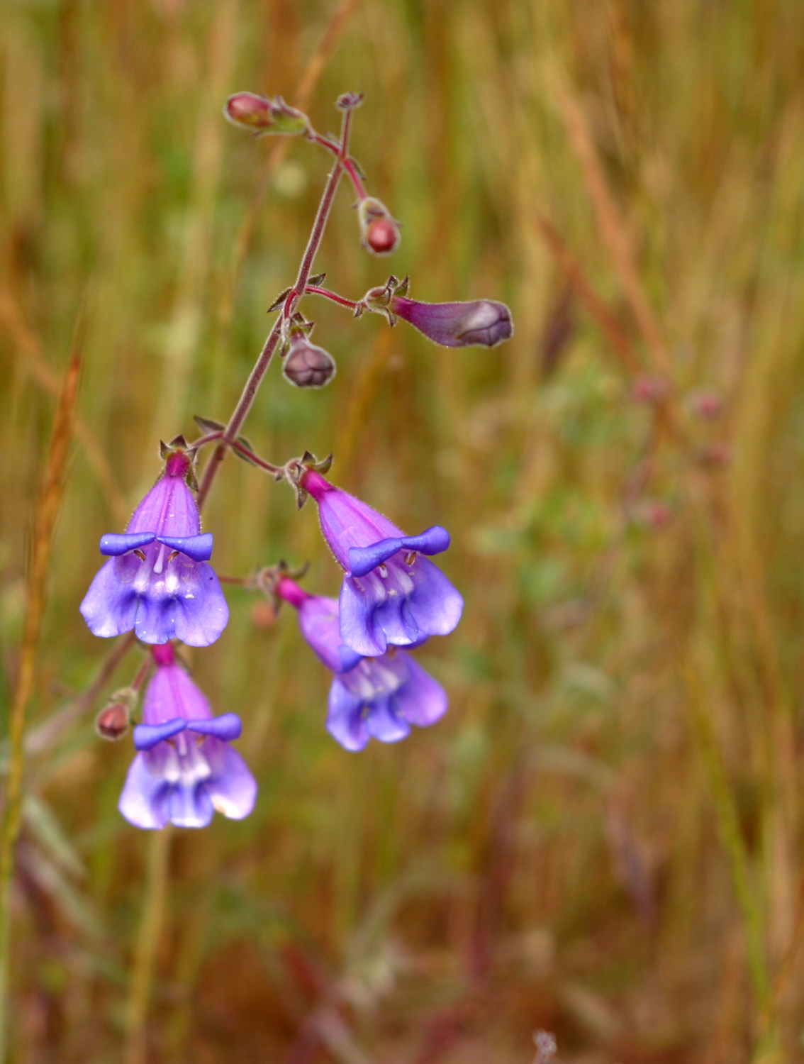
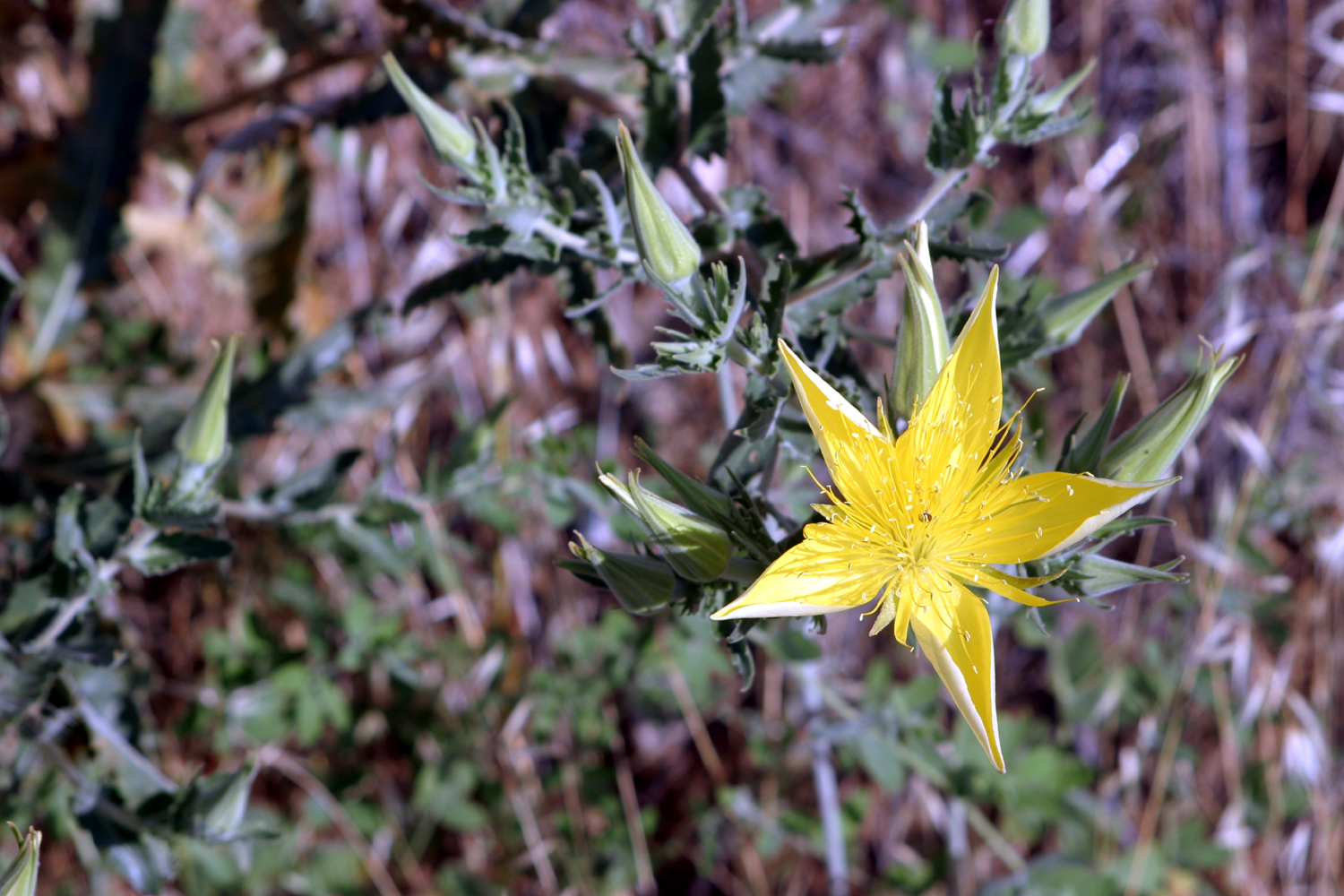
| Penstamen | Blazing Star | Can you name it? |
 |
 |
 |
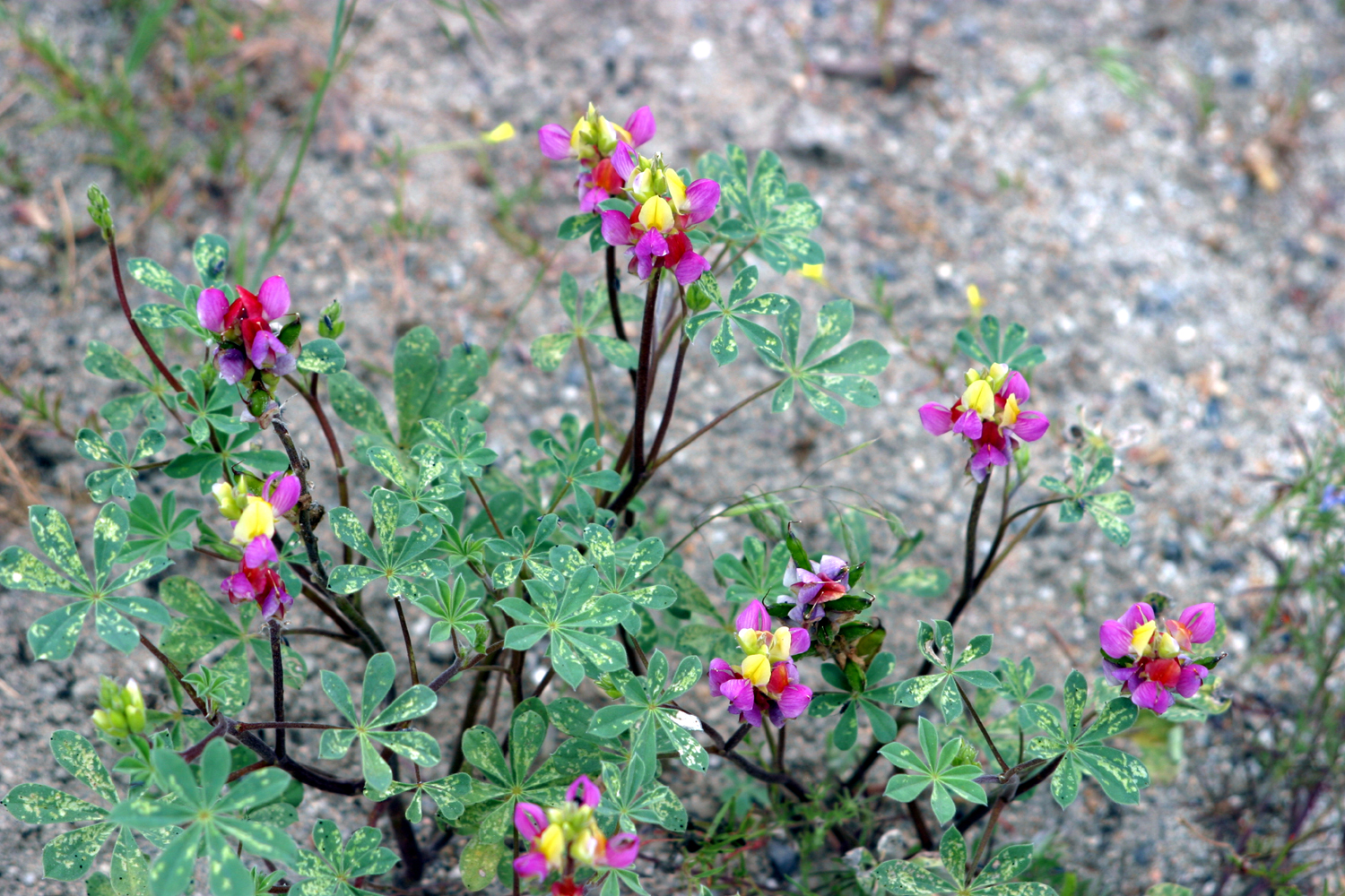
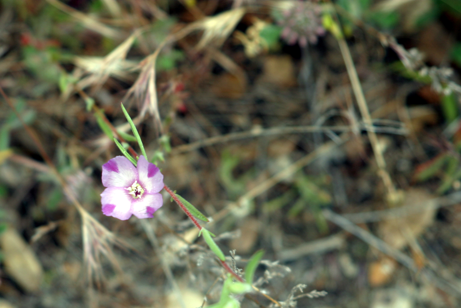
| Harlequin Lupine | Farewell-to-Spring | Another unknown |
|
 |
 |
| Teri and her grandsons | Dick and his great grandsons | Rocks need to be moved |
 |
 |
 |
|
Little brother tries anything Colton does |
So much sand, so few trucks | The big dig |
 |
 |
 |
| How lucky are boys
whose grandma will play in the sand |
The biggest sand pile of their lives | The impending storm |
 |
 |
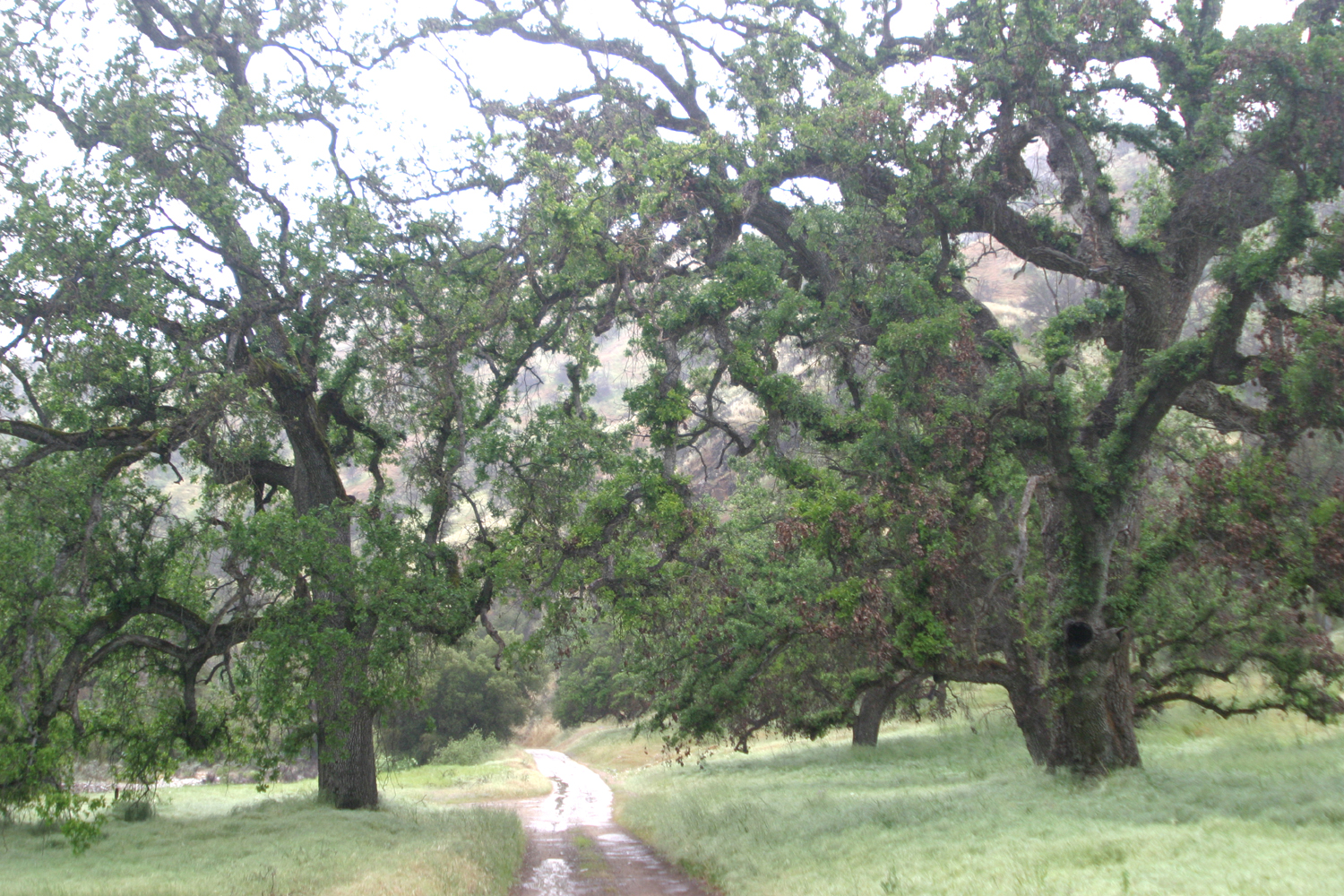 |
| The Kings River at Gravelly Flats | Scar from the Rough Fire above the Kings River | Rain and valley oaks on the Garnet Dike Road |
 |
 |
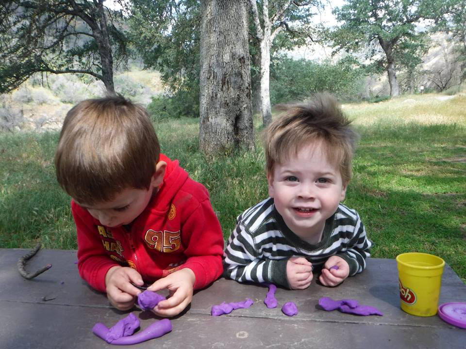 |
| A race up the path to the dots | Ready to run the dots | Colton and Jack and Play-Doh fun |
 |
 |
 |
| Dinkey Creek at Balch Camp | Finding just the right stick |
Walking the rocks at Patterson Creek |
 |
 |
 |
| Patterson Falls | Patterson Creek above the road |
Colton points out letters from his name |
 |
 |
 |
| A large supply of
excellent throwing rocks at Black Rock |
Bringing in the rock harvest | A wonderful flat rock in camp |
| Big Stump Basin | ||
 |
 |
 |
| The start of our hike | Snow on an old log | Teri on the trail |
 |
|
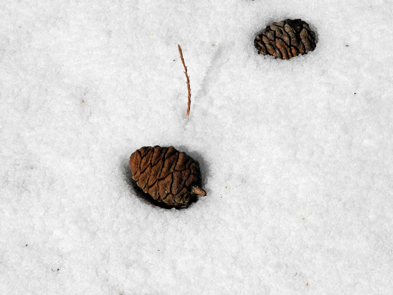 |
| Rail fence along the trail | One of many big stumps | Sequoia cones in the snow |
 |
 |
 |
| A burned out giant sequoia snag | Chunks of snow stuck to our boots | There was a sawmill
at this location in logging days |
 |
 |
 |
| Artistic pattern on sequoia stump | Snow-covered Mark Twain Stump | Bridge and creek near the stump |
 |
 |
 |
| A bear passed this way not long before we did | Sections of this log
became fence posts and roof shingles |
Bunch grass in snow |
 |
 |
 |
| Big tree by the start of the trail | Massive roots of the big tree | Sequoias in Grant Grove |
 |
 |
 |
| A bit of history | Remnant of early pioneer activity | This was a cold spot |
 |
 |
 |
| A tale of wasted effort | The Centennial Stump | House-size boulders at Kings Canyon Overlook |
 |
 |
|
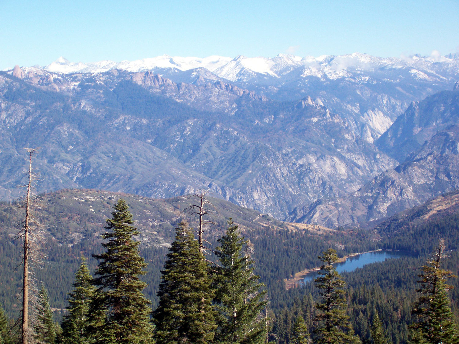
| The General Grant Tree | High Sierra from Kings Canyon Overlook | |
| San Joaquin Gorge Trails | ||
 |
 |
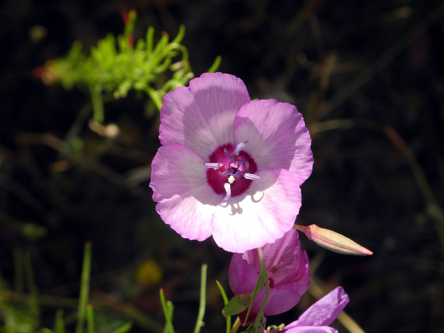 |
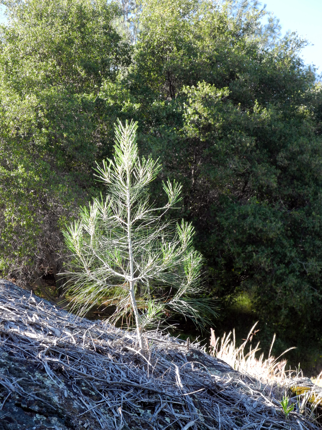
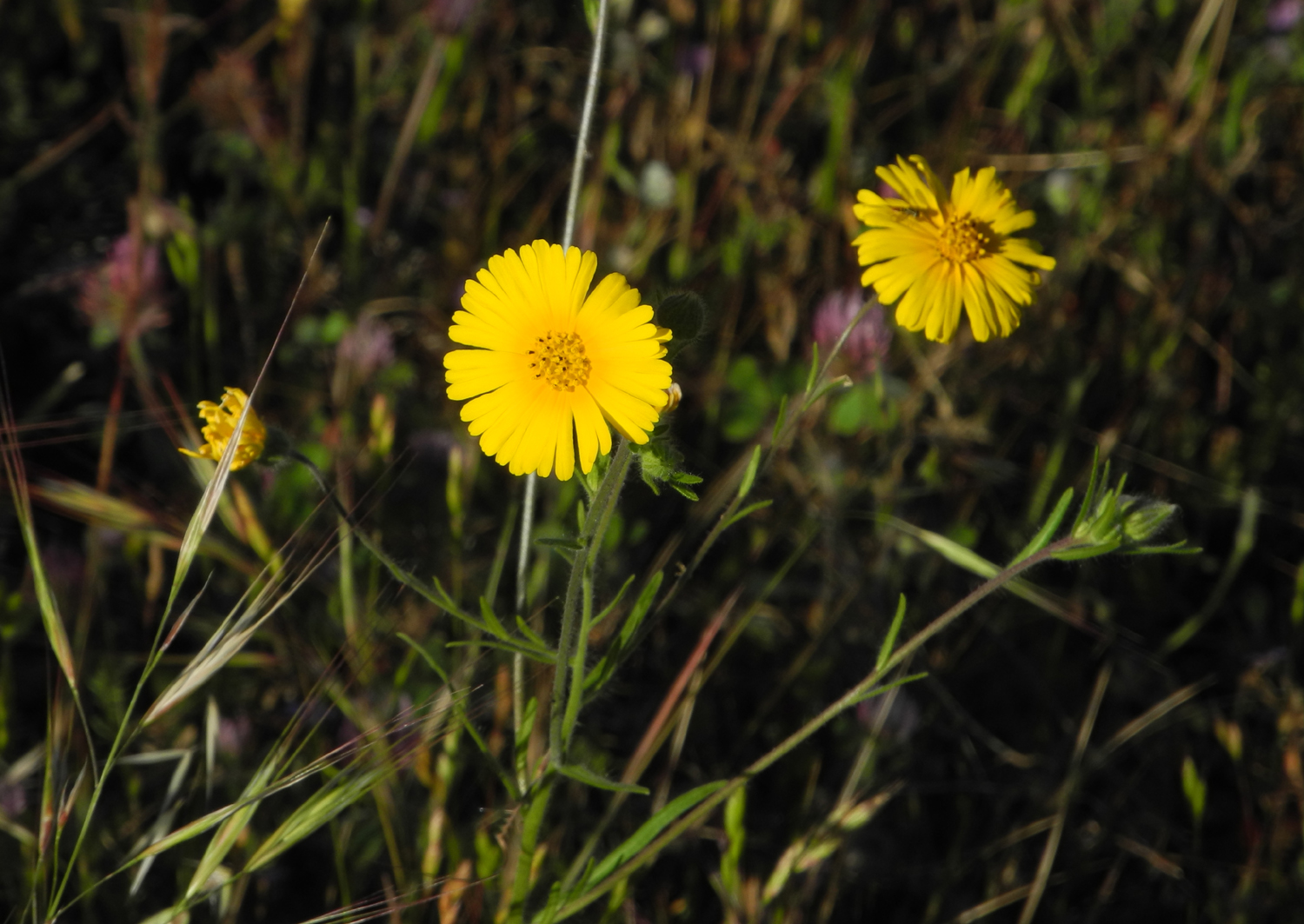
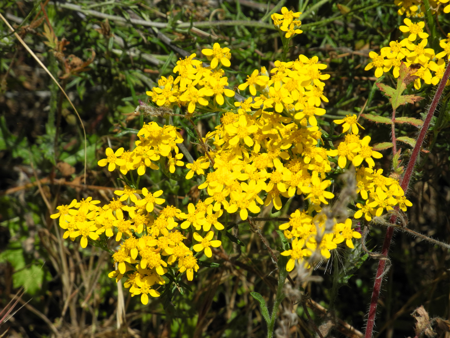
| Young bull pine beside the road into the camp | These daisy-like blossoms are common madia | Farewell to Spring, close up |
 |
 |
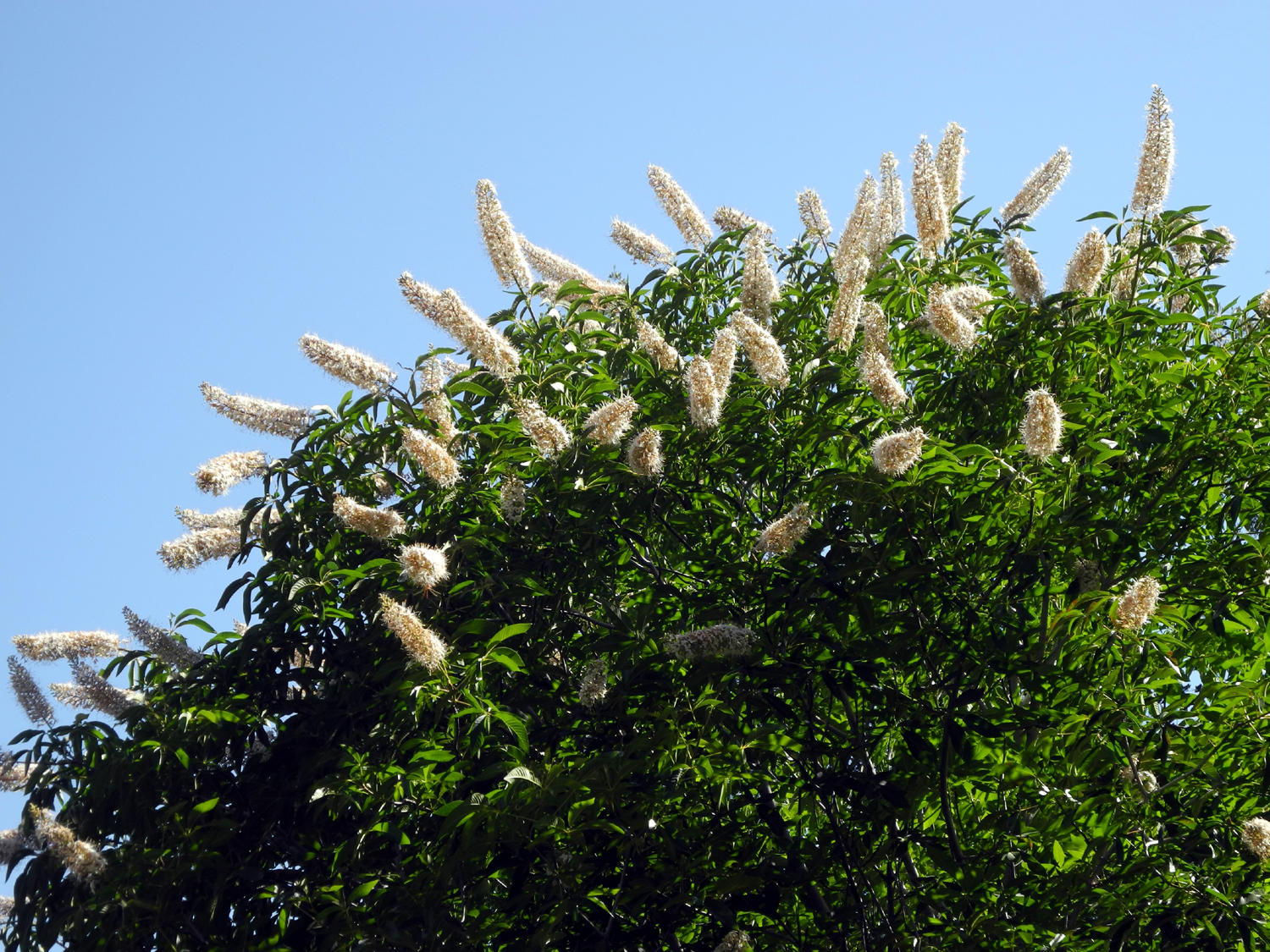 |
| Mustang Clover | Flowers along the trail | Buckeye bush in bloom |
 |
 |
 |
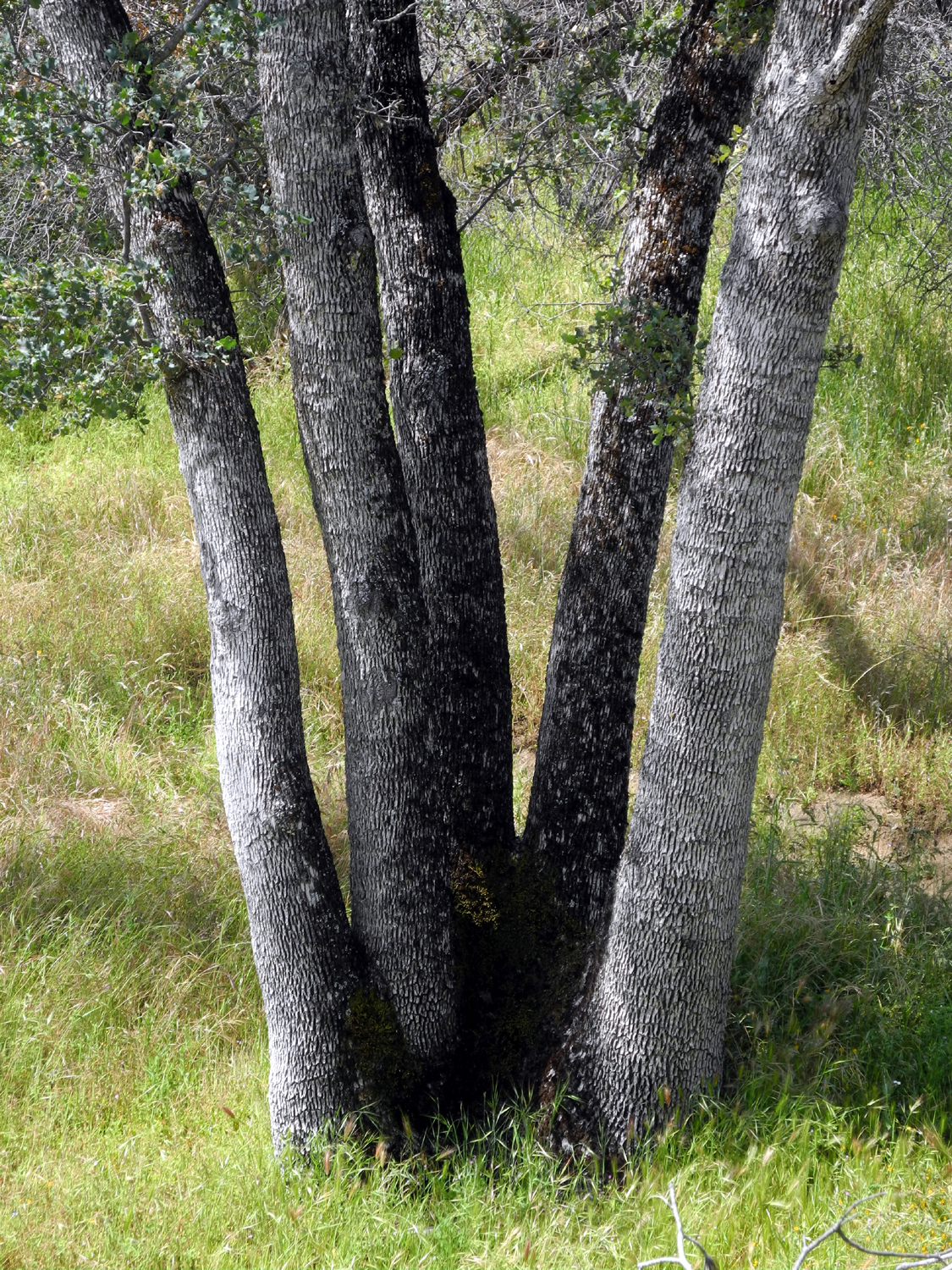
| This big live oak
makes a good backdrop for pink flowers |
My favorite tree on the trail | These flowers, known
as goldfields, appeared in a large mass, but in only one place |
 |
 |
 |
| Two beautiful but unknown flowers | This striking flower is elegant clarkia | |
|
 |
 |
| More Farewell to Spring |
Can you see who's hiding in the grass? |
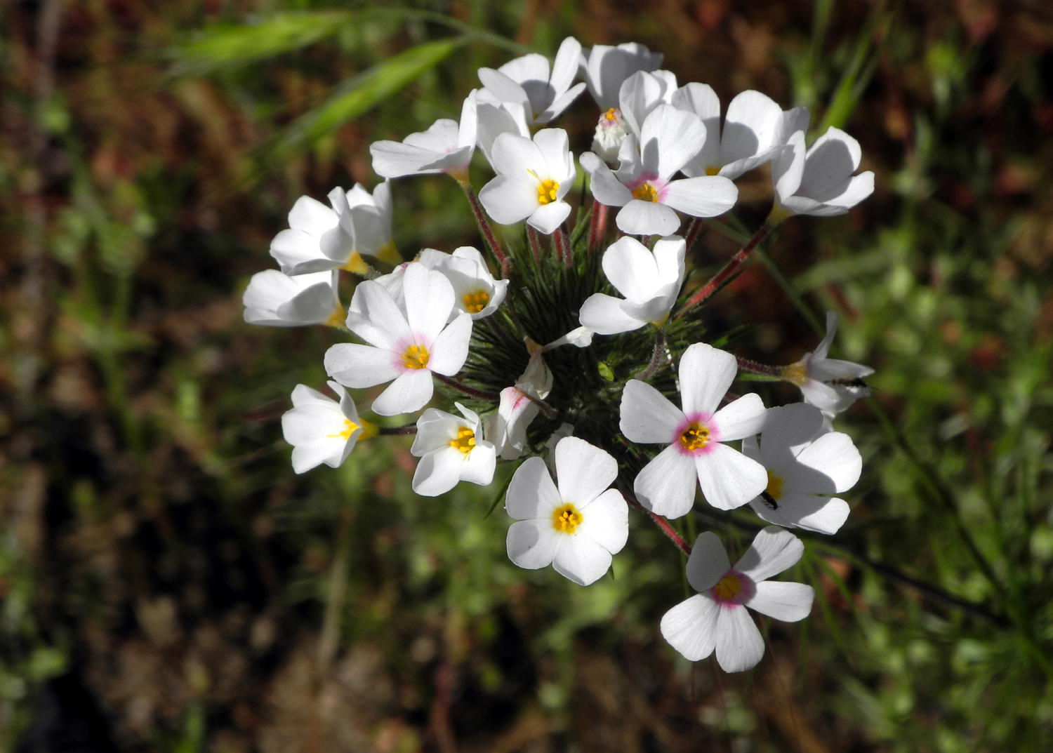
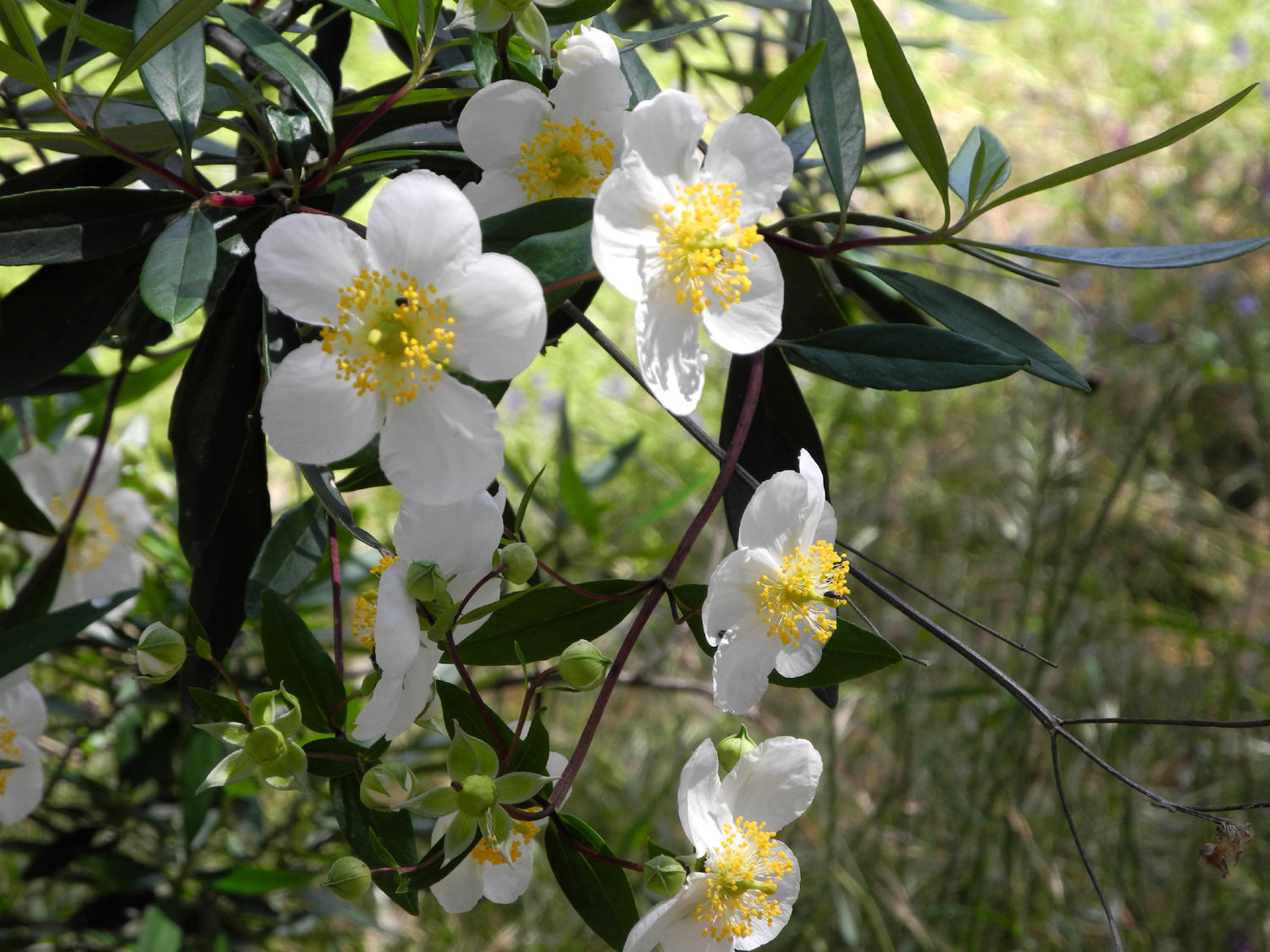
These showy 2-inch
blossoms are the rare Carpenteria |
| Corlieu Falls and Bass Lake | ||
 |
 |
 |
|
Butterflies were thick along the trail |
Corlieu Falls | Another view |
 |
 |
|
| Indian Pinks |
Indian Rhubarb grows right in the water |
Rhubarb close-up |
 |
 |
 |
| Lewis Creek below the falls | Canyon live oak | Teri at our turning back point |
 |
 |
 |
|
Dick, not ready to climb over this log |
We were DEFINITELY not ready to cross this log |
Red tail hawk watching for lunch |
 |
 |
 |
| Lupines at Bass Lake | It will take a drop
in the lake level for these ponderosas to survive |
Teri at Bass Lake |
 |
 |
 |
| View across the lake from west to east | Farewell to Spring on the North Fork Road | Corlieu Falls video (link to download video to your PC) |
| San Joaquin River Trail | ||
 |
 |
 |
|
Leaning pine near the start of the trail |
There should be a sign on this post reading "Place sign here" |
I call this "Knob Rock" |
|
 |
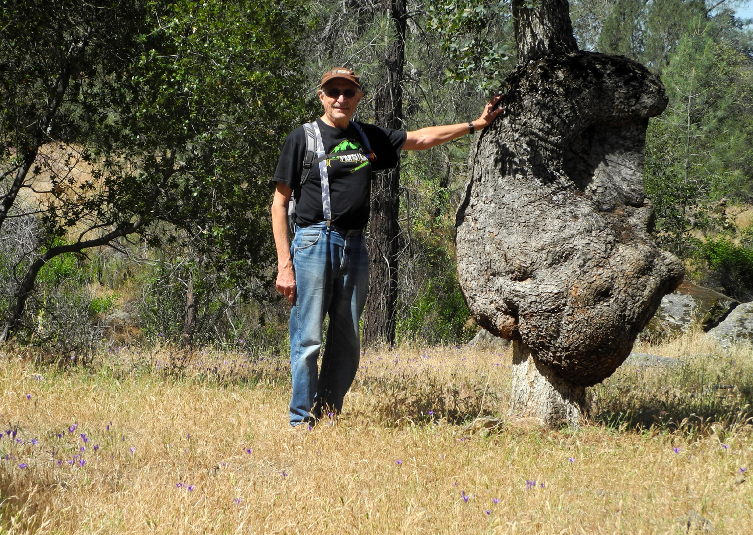 |
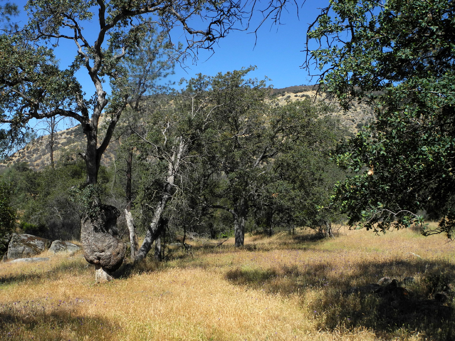
| Typical view with lots of flowers by the trail | The Resting Log near the Big Burl | Dick by the Big Burl |
 |
 |
 |
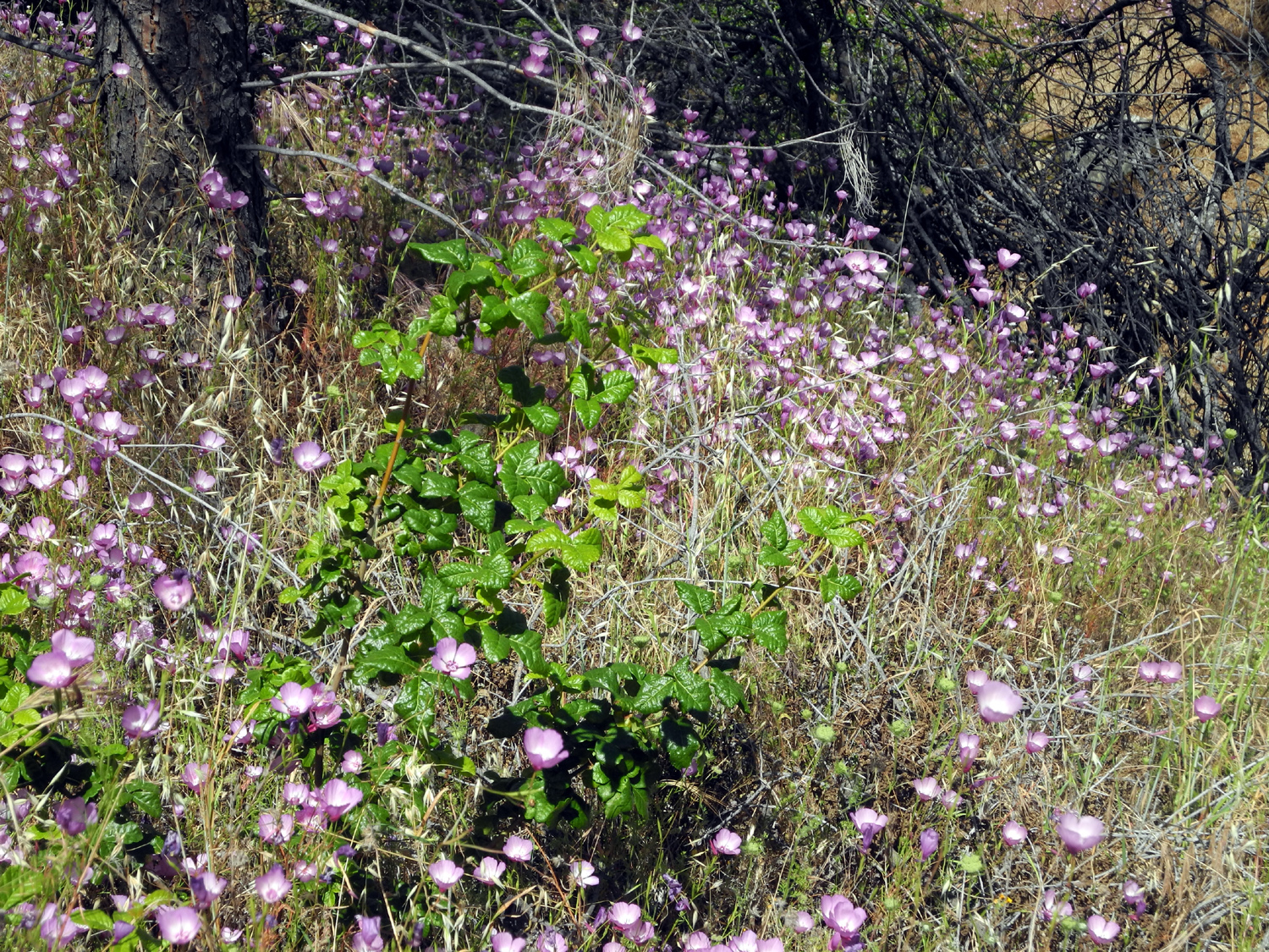
| Blue Oak with burl and surrounding terrain | Poison oak makes a nice contrast with the pink flowers |
There were scenes like this all over the hills above the trail |
 |
 |
 |
| Another color contrast scene | This forked blue oak is my official turning back spot | There were areas without flowers |
 |
 |
 |
| The spotted variation of Farewell to Spring | And the "spotless" variety |
Lots of clover blossoms in a damp drainage |
 |
 |
 |
| Rattlesnake weed AKA American wild carrot | Athurial's spear making
a final stand in the dry grass |
These look almost the same as fringed redmaids but not quite |
 |
 |
 |
|
This looked like a white variety of brodiaea |
A green drainage near the Bridge Trail |
More green and pink |
| Related Links | ||
| Kirch
Flat Campground |
Pine Flat Lake | Garnet Dike Rafting |
| Kings Canon National Park | Big Stump Trail | Mark Twain Stump |
| Sequoia Tree History | More Mark Twain Photos | Felling the Mark Twain |
| Mark Twain Stump Photo | All San Joaquin Gorge Reports | General Grant Tree |
| Other San Joaquin Gorge (Squaw Leap) Reports | ||
| Four 2012 Squaw Leap Hikes | 2012 Bridge Trail Hike | 2013 San Joaquin River Trail Hike |
| 2014 San Joaquin Gorge Campout | 2014 River Trail Hike | 2015 River Trail Hike |
| Thanksgiving at the Gorge | 2016 Bridge Trail Hike | 2016 February Campout |
| 2016 March Campout | Rambler Hike 2015 | Rambling in the Rain 2016 |
| Squaw Leap Backpack March 1980 | Backpacking 1981-82 | Backpacking 1982-83 |
| L/S Expedition | Backpacking 1984-93 | The Last Backpack Trip |
| 2016 Buzzard Road Hike | 2016 San Joaquin River Trail | 2017 Off-Trail Hike |
| More Related Links | ||
| San Joaquin River Gorge Special Recreation Management Area | Millerton Lake | San Joaquin River Trail |
| San Joaquin River | San Joaquin Gorge Photo Album | San Joaquin Gorge Slide Show |
| Temperance Flat Dam Proposal | Department of the Interior | Dick's Letter to Sally Jewell |
| Carpenteria | Corlieu Falls | Bass Lake |
| Lewis Creek Trail | Corlieu Falls Video | Ithurial's Spear |
| Dick's late-season brodiaea photo | Dick's early season brodiaea photo | Ithurial's Spear web page |