|
In November of 2014 I mentioned to my daughter Teri that I
would like to go to Arches National Park, and hike to Delicate Arch
one more time while I still can.
Within a
week she had made a reservation for us at the Red Cliffs Lodge, on
Highway 128 outside Moab. We got to talking about other places we
could go on the trip, and I mentioned my visit to the North Rim of
the Grand Canyon in
2003. She then made reservations for a cabin at the canyon, and
our big trip was planned.
At the time it was a long
ways into the future. But time has a
way of passing quickly, and after eleven months of anticipation, our departure date
arrived on Monday, October 12. Teri came over VERY early, I loaded
my stuff in her car, and we got on the road a little before 6 a.m.
Since I've traveled most of the route over a dozen times since I
retired, and written about it at least that many, I'll just briefly
state that we went south on California 99, east on CA 58, and
northeast on I-15, through Las Vegas, en route to Mesquite NV for an
overnight stop.
Our
route ran close to a place I've visited twice, Nevada's first state
park, the Valley
of Fire. I had not considered a detour to this
location, because it would add at least two hours to our total first
day travel time. However, as we approached the Nevada-California
state line, it was barely noon, so I mentioned the possibility, and
Teri enthusiastically agreed.
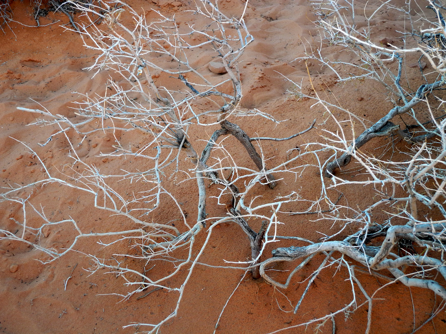
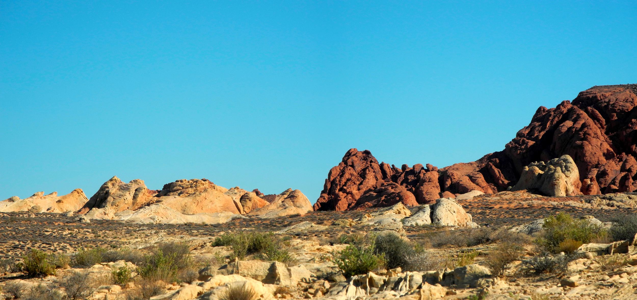
North of Las
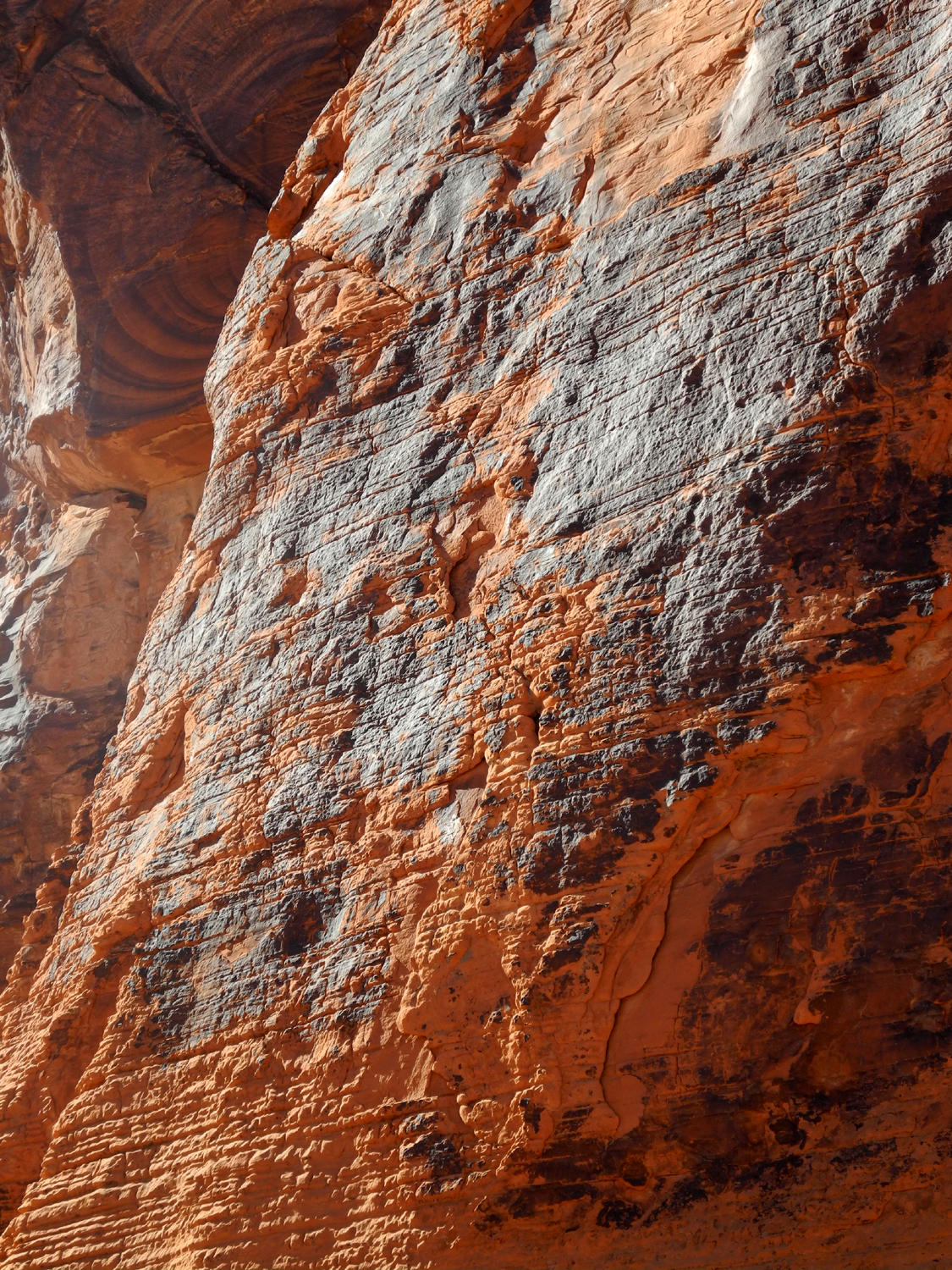
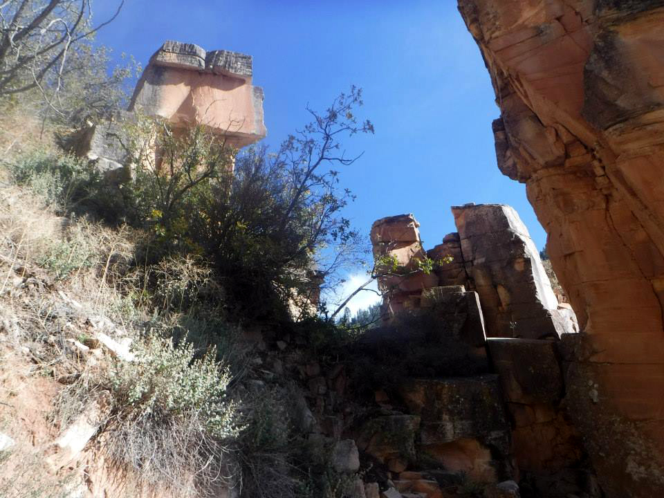
Vegas we left I-15 on Valley of Fire Highway and drove through rugged desert
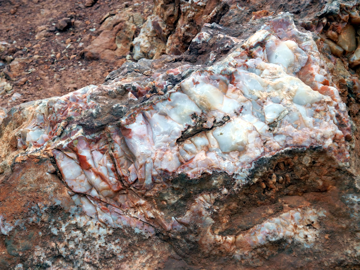
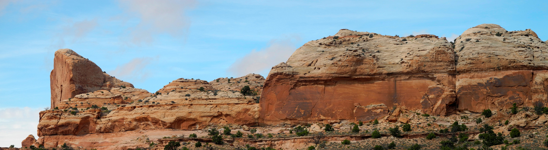
country to the park. This is a land of red, white and tan sandstone
cliffs, small canyons, and fascinating rock formations. Our first
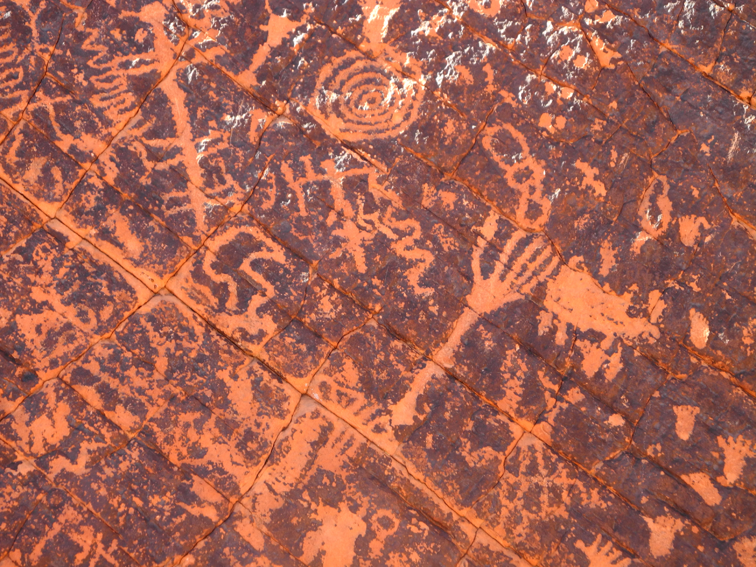
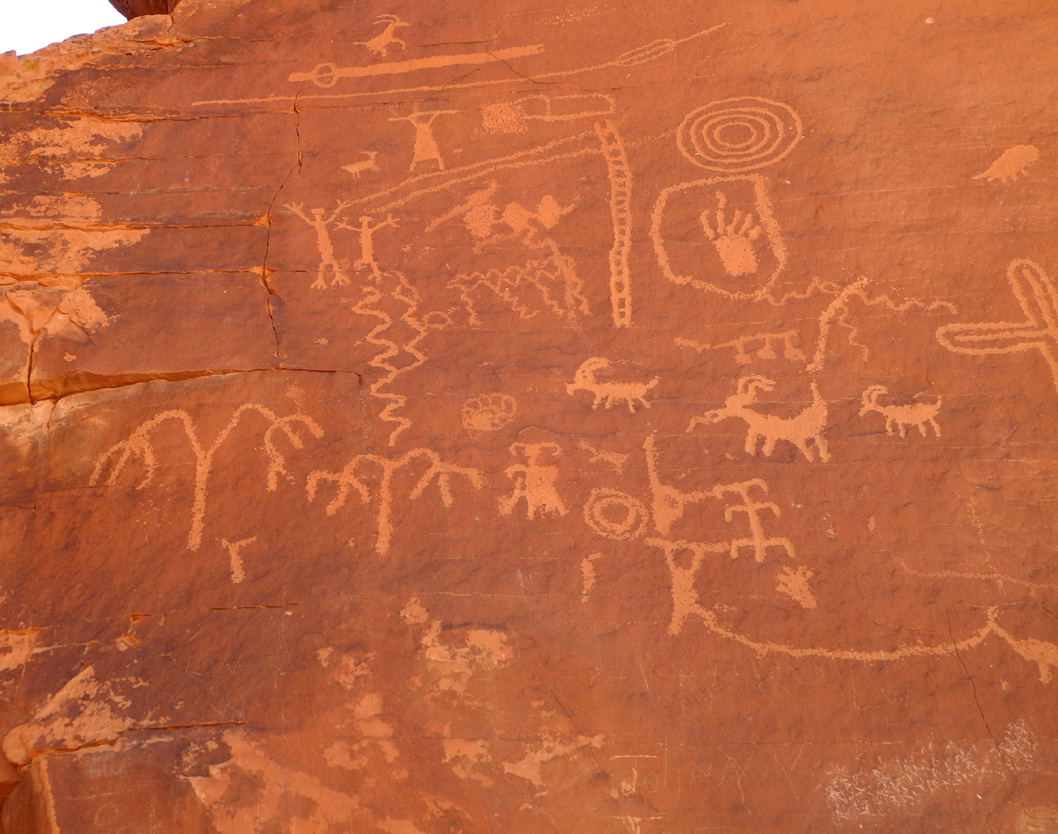
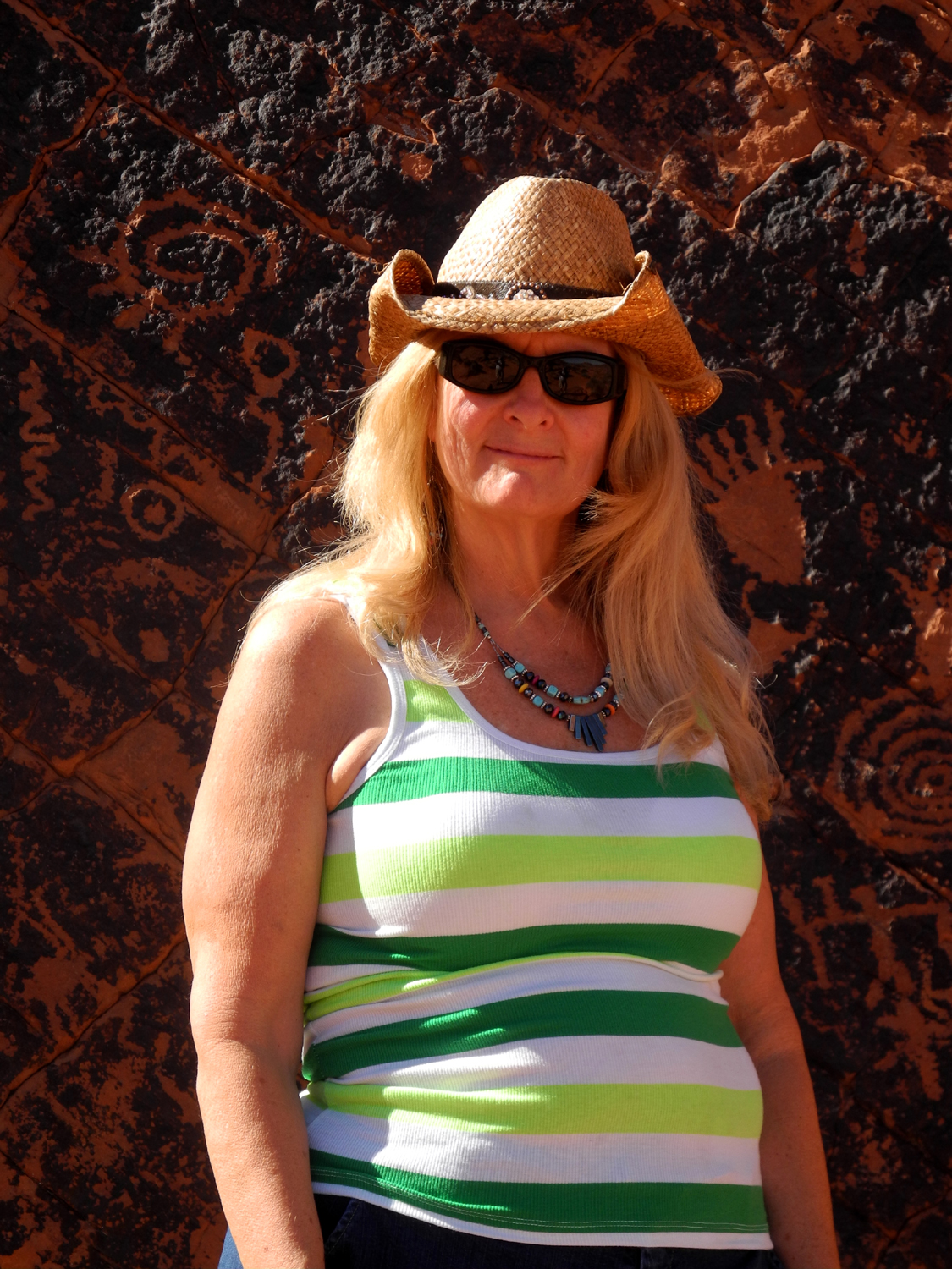
stop was down a side road to Atlotl Rock, where there are a number
of petroglyphs, said to date back 9,000 years. The main section is
reached by a metal stairway, and we made the climb. After viewing
the art and climbing back down, we walked around the rock and spotted other artwork just above
ground level at the back of the formation.
We drove on
to Arch
Rock, a small arch in the sandstone right beside the road.
We walked around this rock also, but went only a short distance, with
the temperature of 94 degrees discouraging extensive hiking.
Beyond this
was Rainbow Vista, where multi-color layers in the rock show the
evolution of the terrain. We walked a few hundred yards on a path
into the terrain here, finding some unique rock shapes and
examples of erosion.
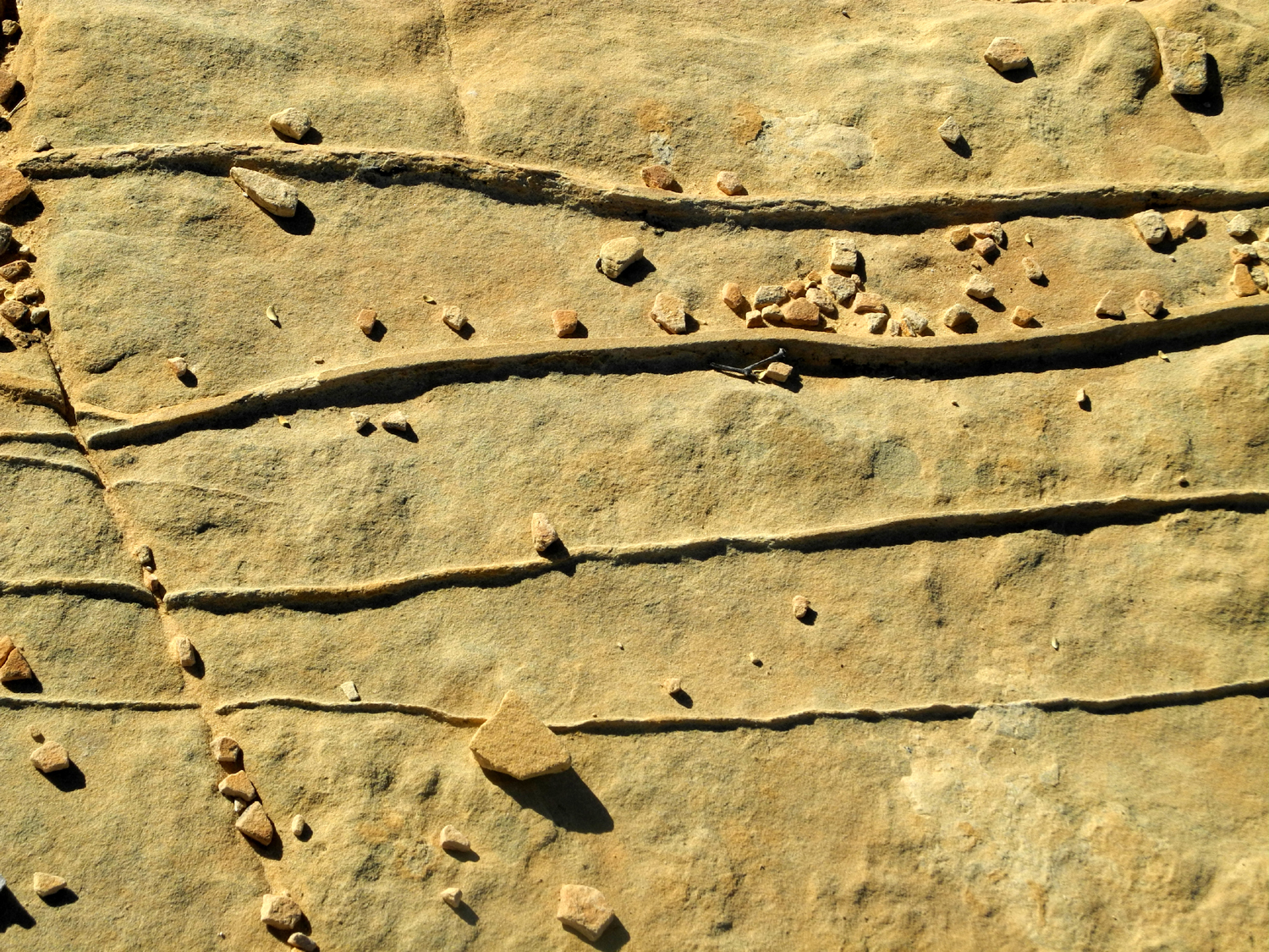
Our final
stop on the side road was a parking lot where we had an expansive
view of the surrounding desert floor, rocks, cliffs, and hardy
drought-tolerant plant life, as well as some interesting ridges in
the rock floor of the area.
We returned
to the main road and stopped at the visitor center, a very nice
facility with photos and an explanation of how the area was formed. Our
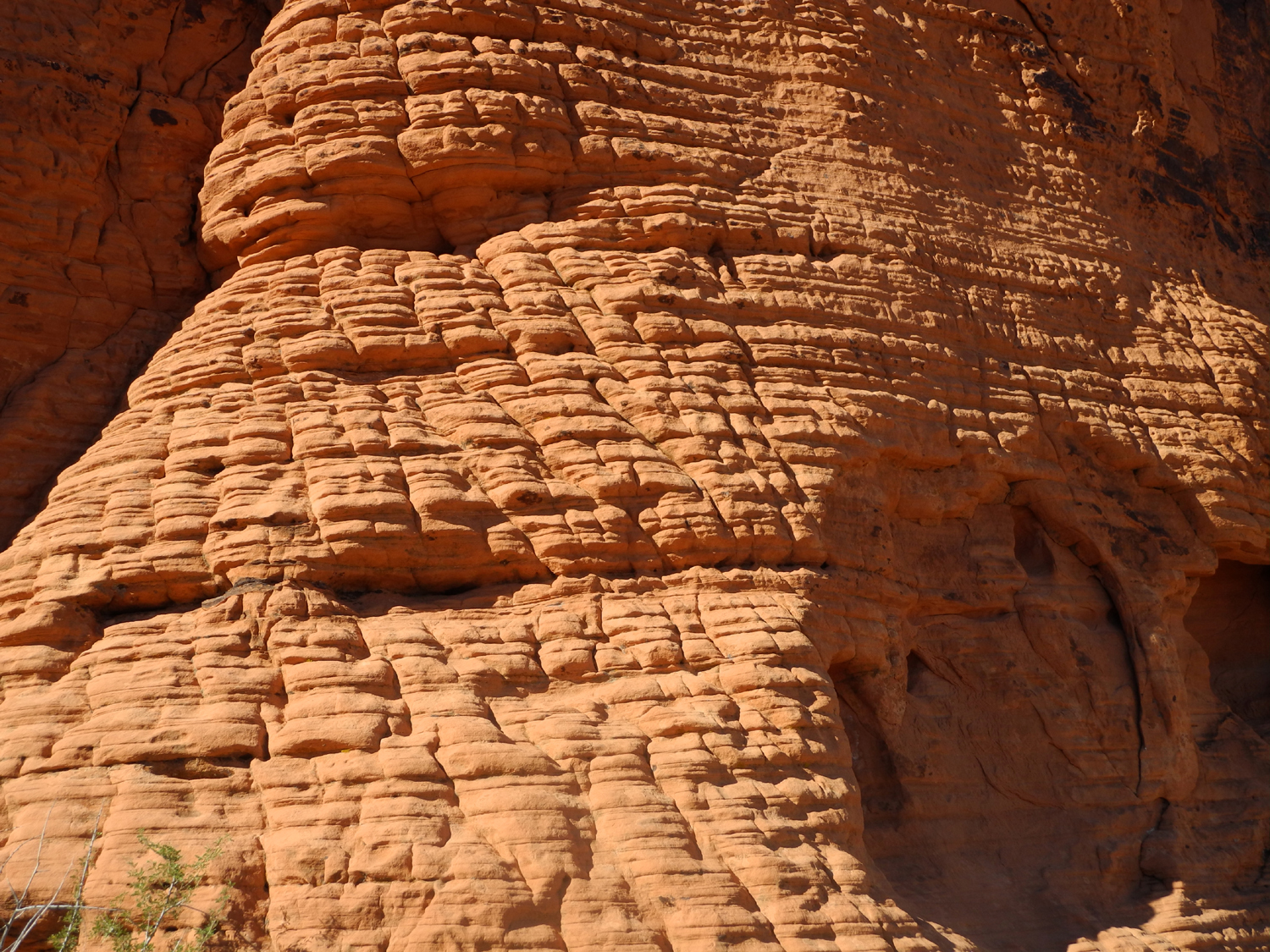
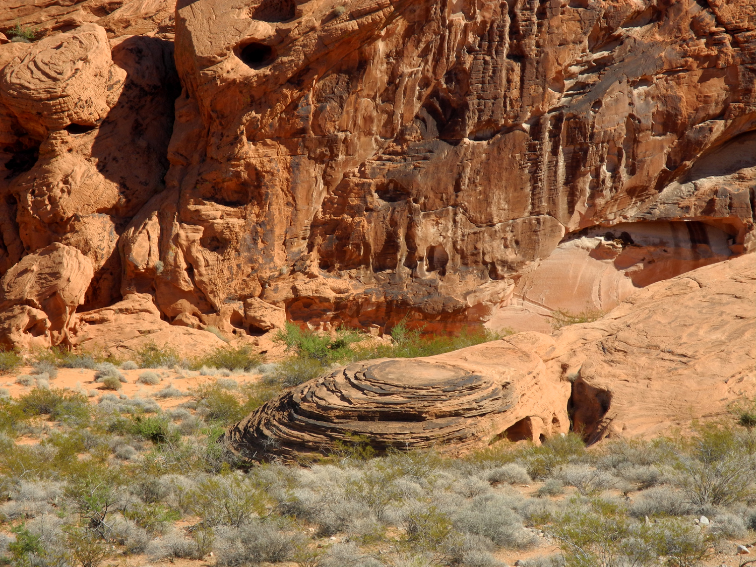
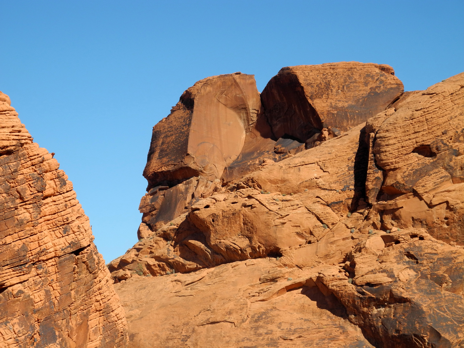
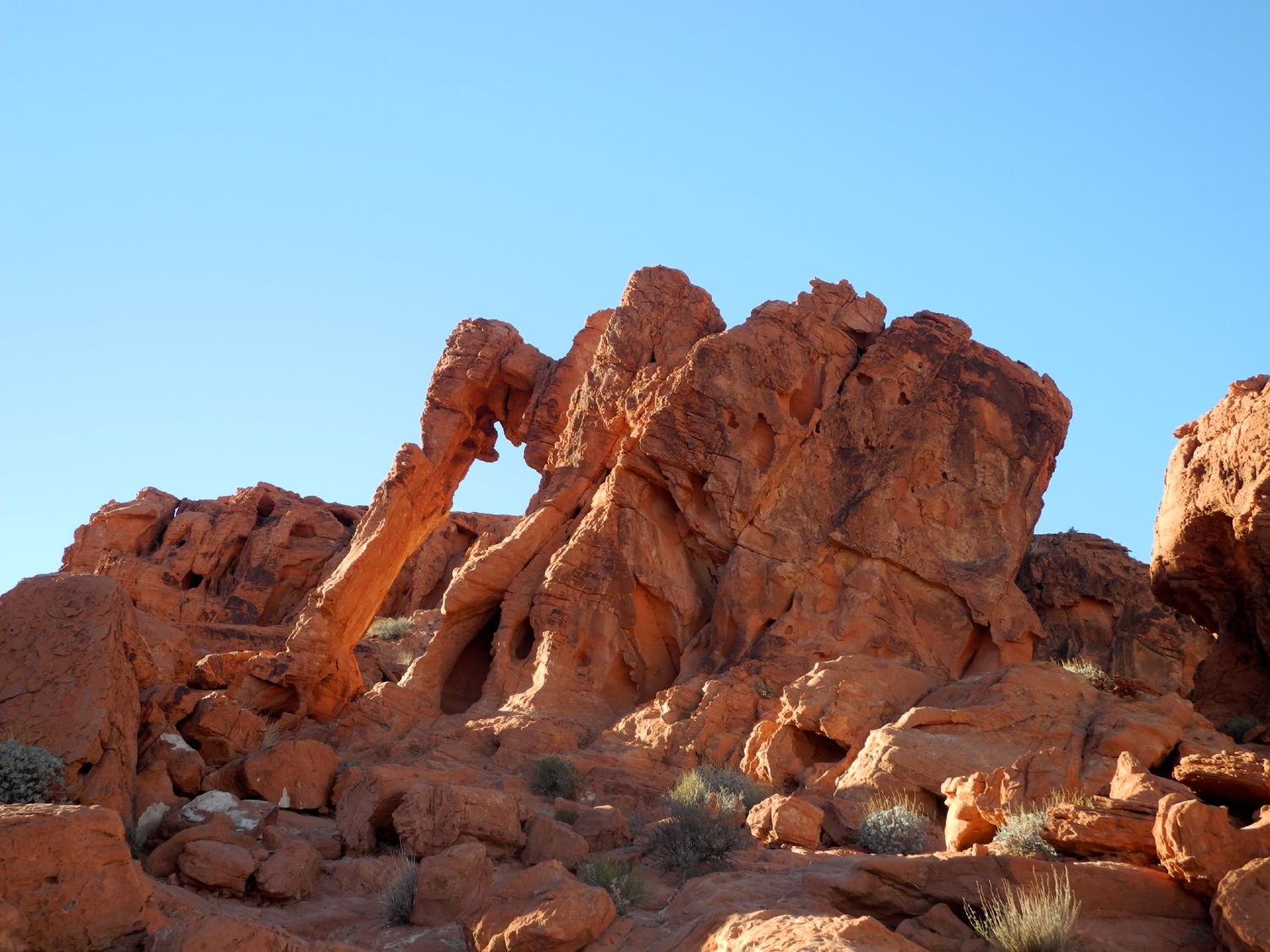
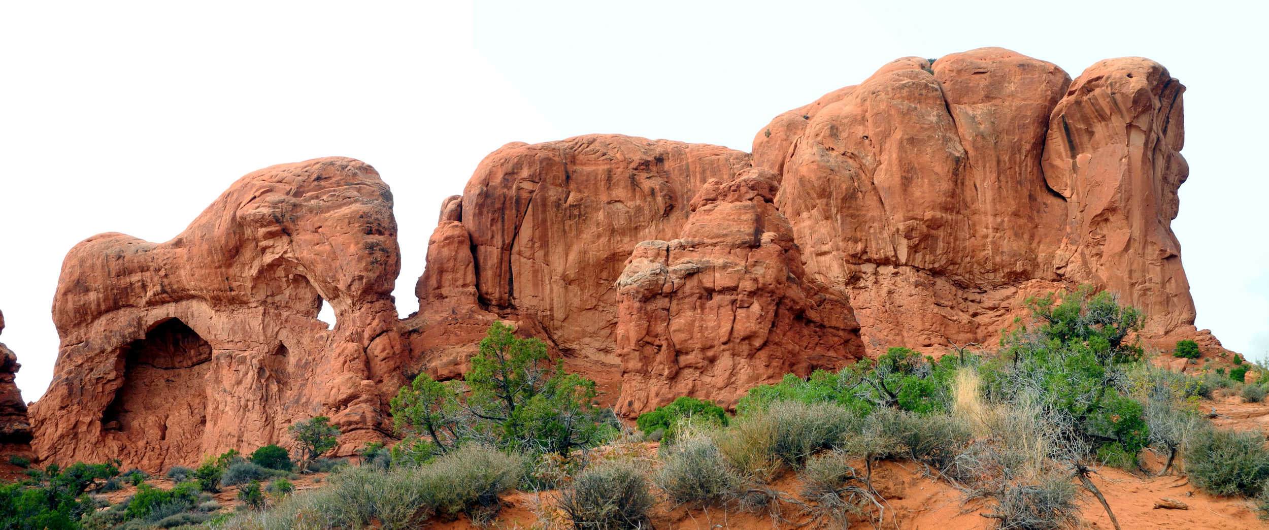
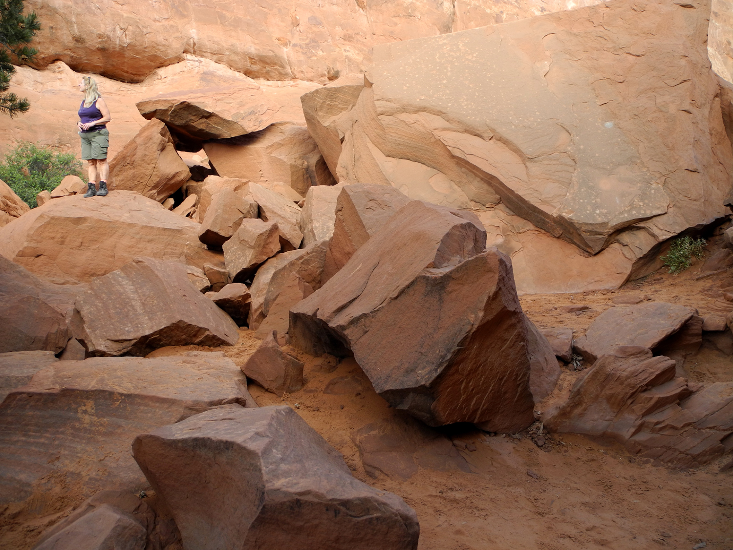
final stop was at Elephant Rock, which is best described by this
photo. It was about a quarter mile on a trail that ended right
at the road above where we were parked. You could see the formation
from your car, but there is nowhere to stop, and of course, the
exercise of hiking is part of our reason for traveling.
Our visit
was enhanced by the sightings of two lizards, and Teri was
duly impressed with the Valley of Fire, and glad we had the time to
add this extra location to our itinerary.
We drove out
of the park, then back to I-15 on Nevada Highway 169, a road that goes up the Moapa
River Valley, through Overton and Logandale. The latter is the location of a
bluegrass festival I attended in 2002 and 2003, when I made my
previous visits to the park. Along this section of our trip we were
lucky enough to see a roadrunner, the first one I had spotted for
about ten years.
From the
highway 169 junction with I-15, it was less
than 30 miles to our stopping place, the Virgin River Lodge in
Mesquite, right on the Arizona border. This was
just a quick overnight stop, so once we got checked in, we did not
leave the motel room. Teri had brought food for the entire trip, and
we had a light supper. We got a fairly early start the next day,
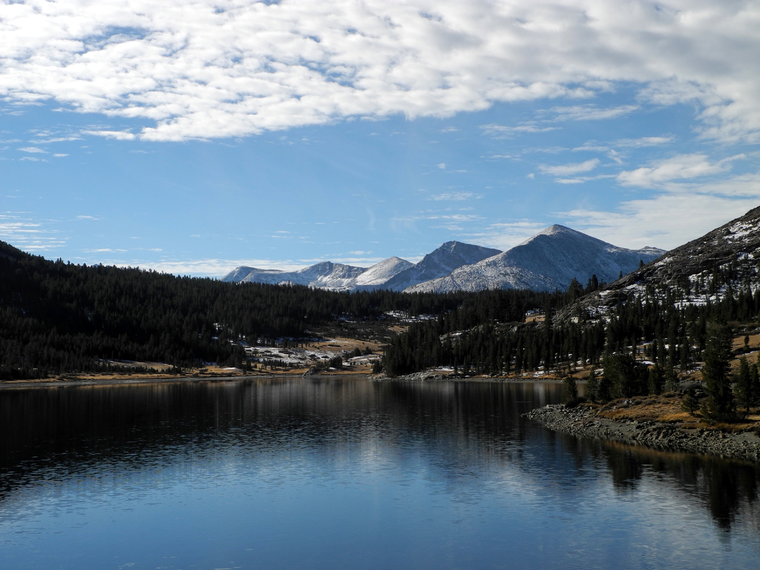
with our target being Grand Canyon Lodge on the North Rim.
Valley of
Fire Photos
Grand Canyon
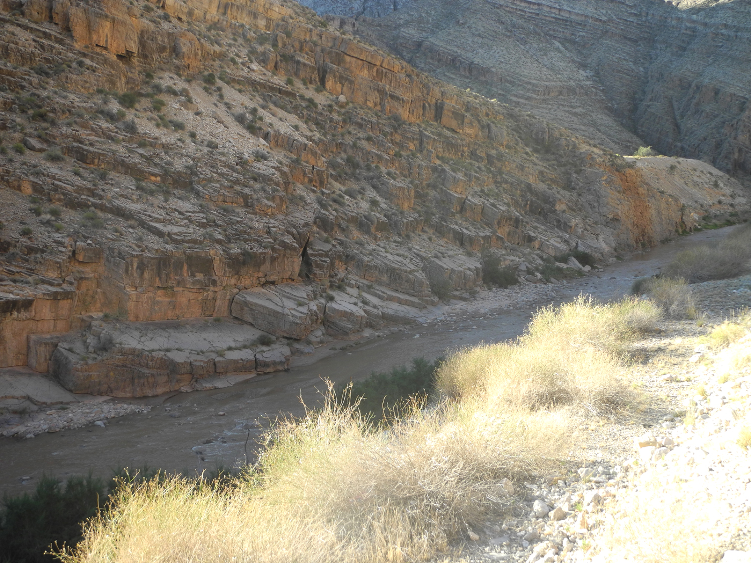
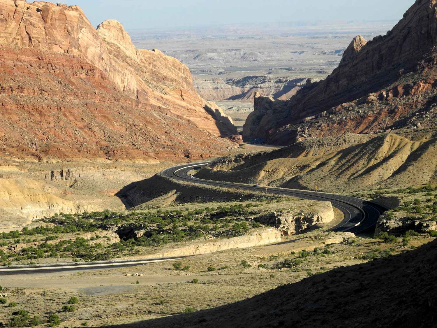
Just east of
Mesquite, I-15 goes across the northwest corner of Arizona for about
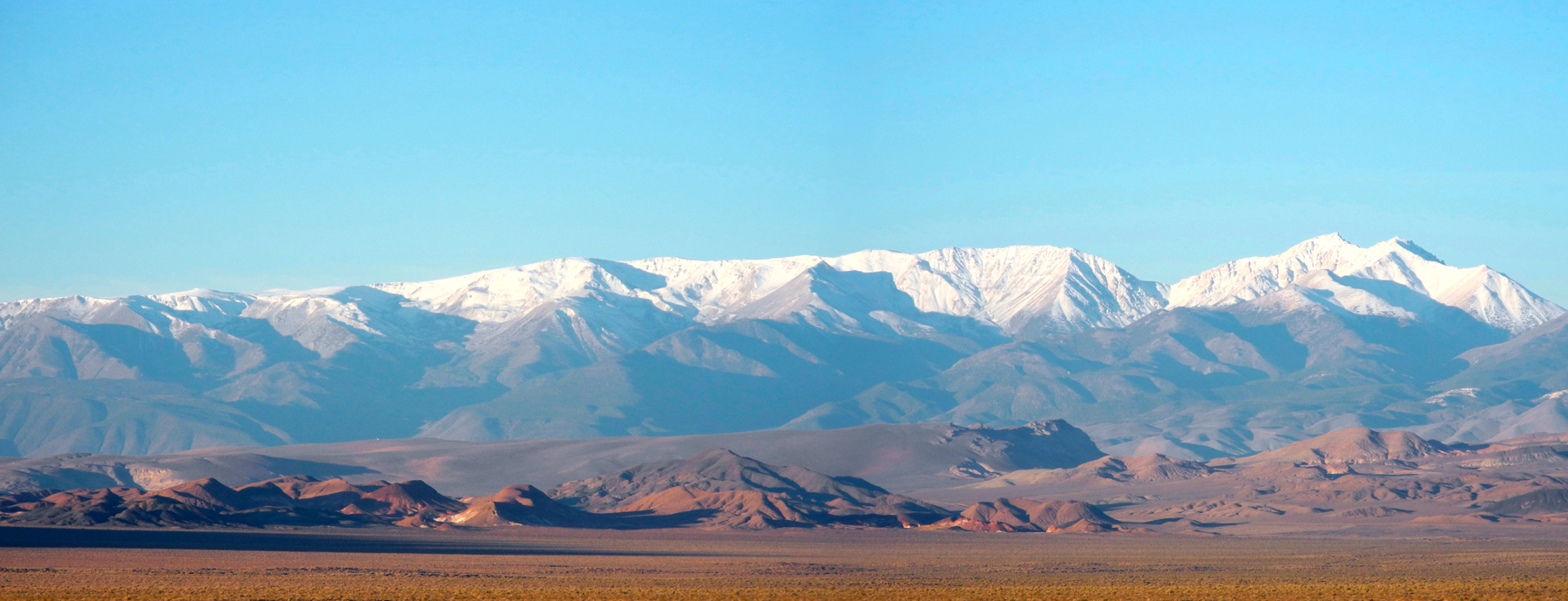
30 miles before entering Utah. In this section you approach a range
of mountains. Just as you are trying to figure out whether the
highway goes around them or over them, you enter the deep, narrow
gorge of the Virgin River. High rocky cliffs tower above the road,
and you get glimpses of the river many feet below the road.
We stopped
here to take a few photos, then continued into Utah and a short
distance past St. George. From here our route was Utah Highways 9
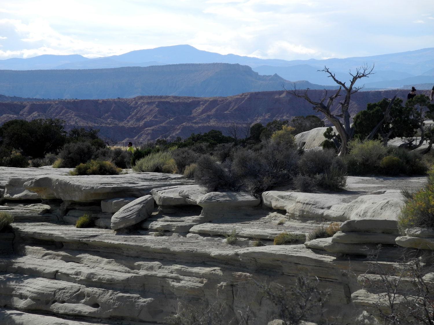
and 59, Arizona Highway 389, and then US 89A from the town of Fredonia.
From this point the road climbs up to the Kaibab
Plateau, with the
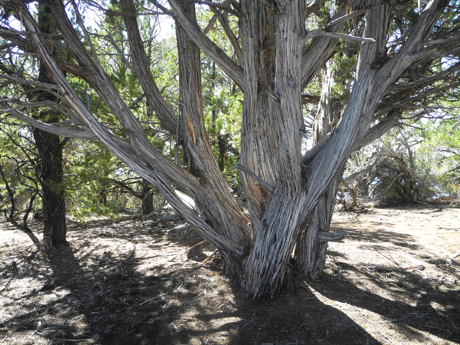
scenery changing from sagebrush and other desert shrubs to juniper
and piñon pine, then to ponderosa pine and finally firs and spruce
after entering the park. The elevation change is from around 4,600
at Fredonia to 7,800 along the roads on the Plateau.
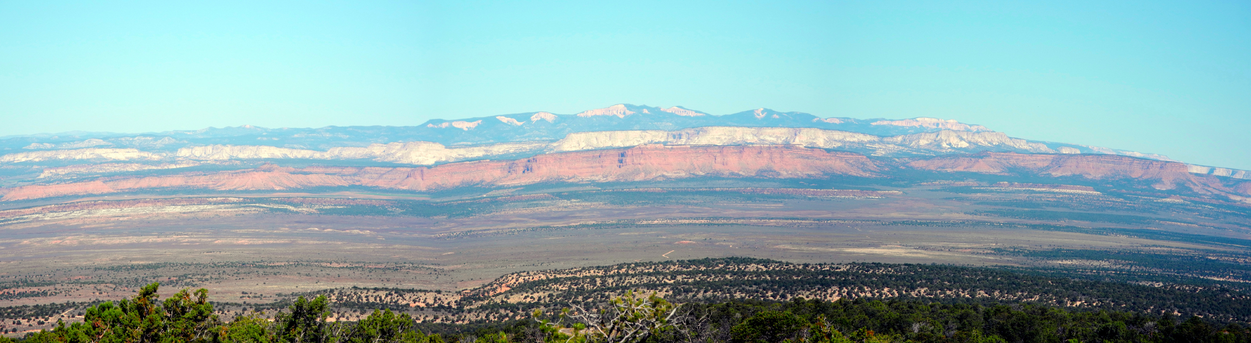
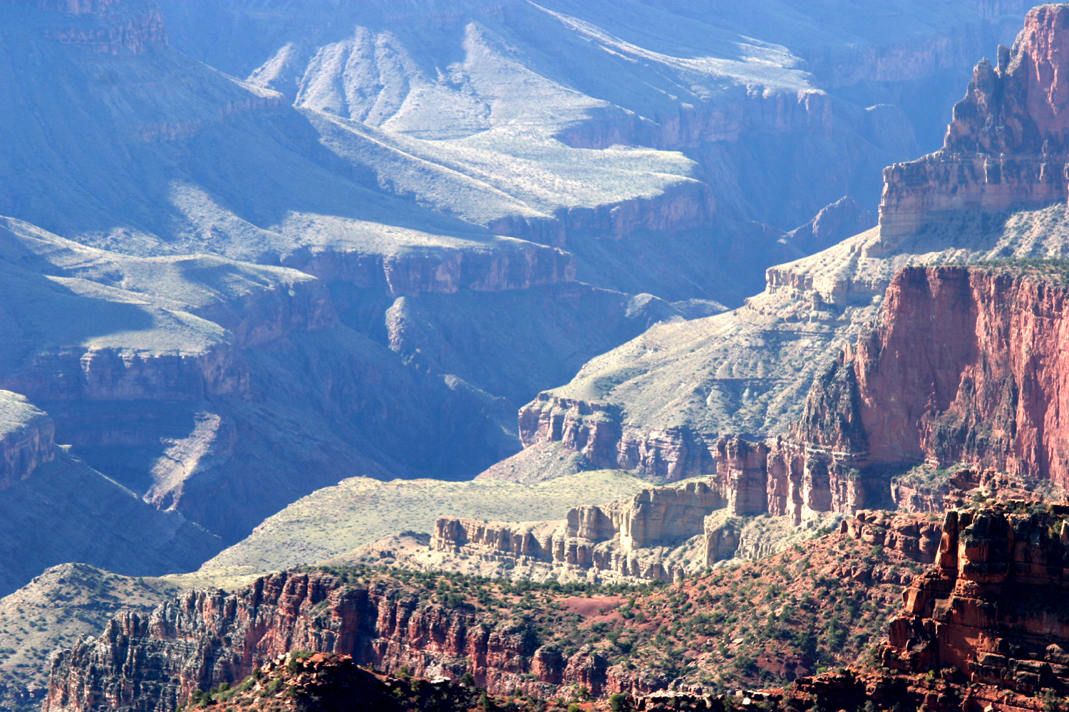
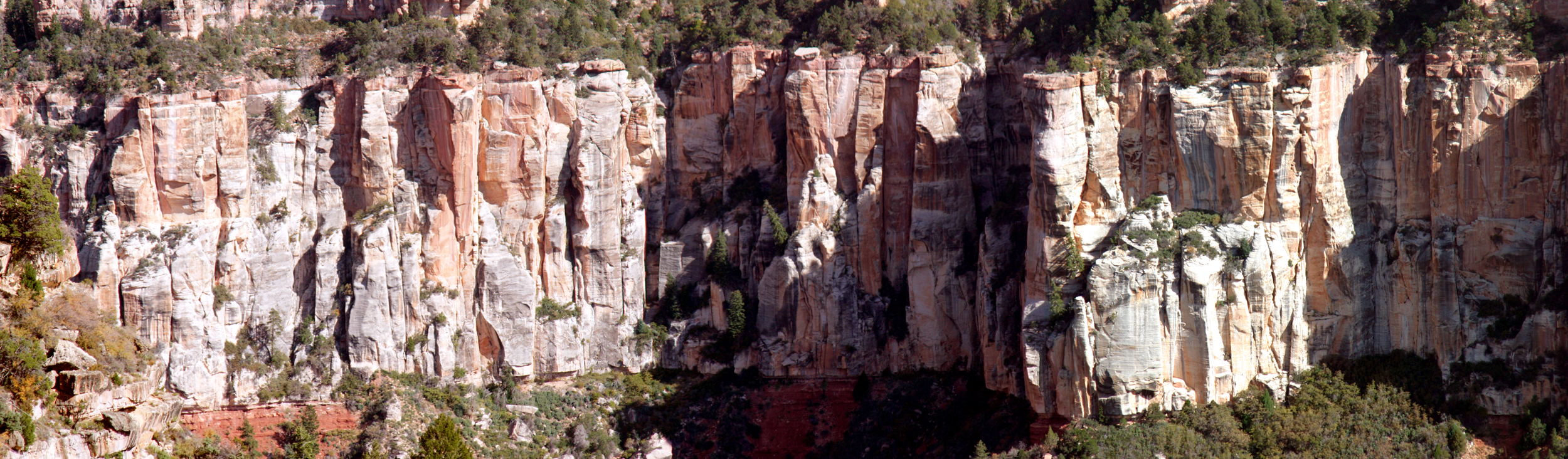
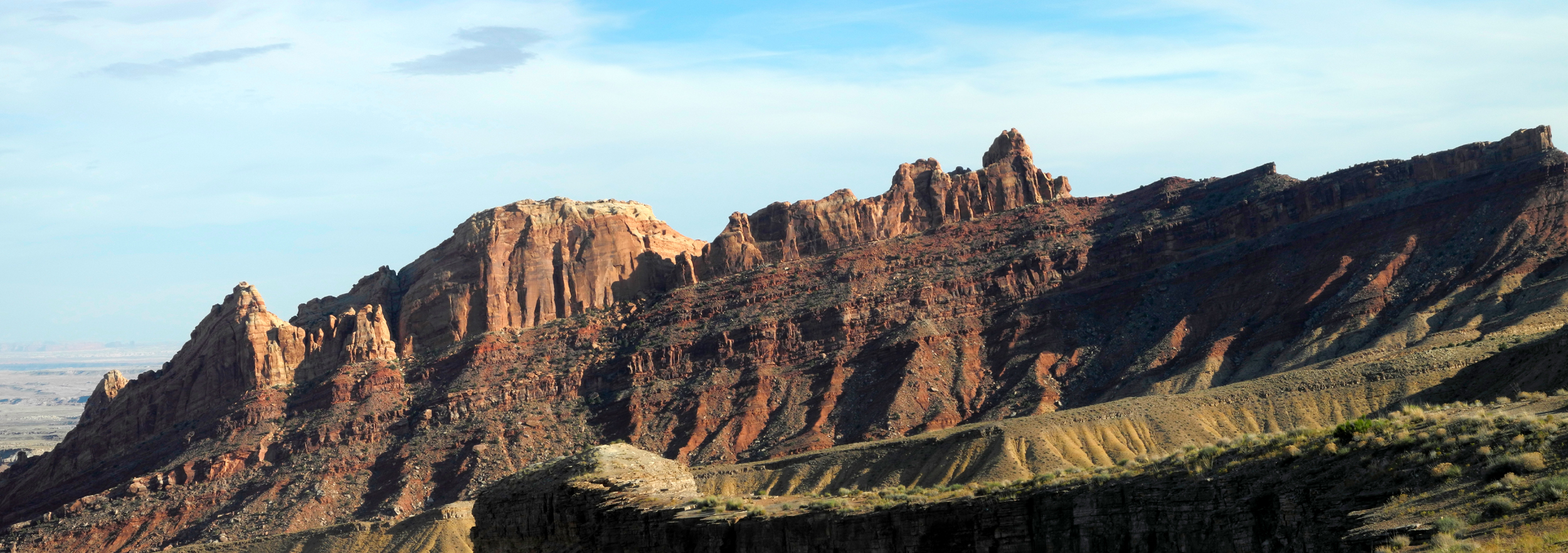
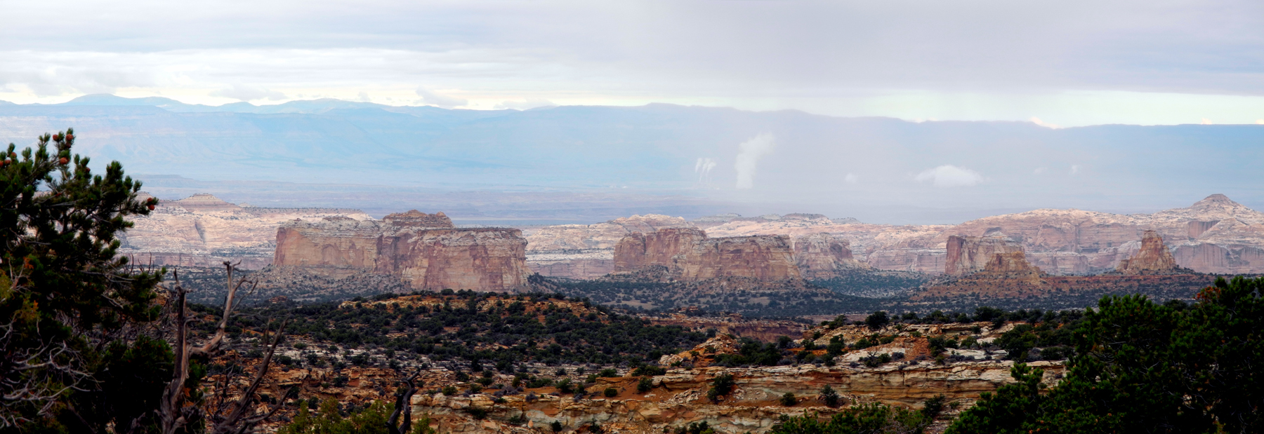
At an
elevation of 6,700 feet, we stopped at the LeFevre Overlook. From here we
could look back to the north at the area of the Grand
Staircase-Escalante National Monument, with multi-colored rock
cliffs spread across the landscape for many miles. These layers of
sandstone and other rock are part of the southern end of the Colorado
Plateau.
Next to the
parking lot, several Navajo women had set up tables and were selling
jewelry. In many such locations this activity is carried out in
defiance of signs prohibiting it, but at LeFevre Overlook it's
a legal, licensed activity. Teri picked out several items for
herself and for gifts.
We stopped
at Jacob Lake and went into the US Forest Service visitor center and
the store, where I was able to find a cuddly stuffed coyote for my
great grandson Jack's first birthday gift. From there we took the
Grand Canyon Highway, which ends at the edge of the North Rim. This
road goes through some very scenic areas, although one section was
distressing due the scars from a large forest fire that has left
many trees as standing, burnt sticks.
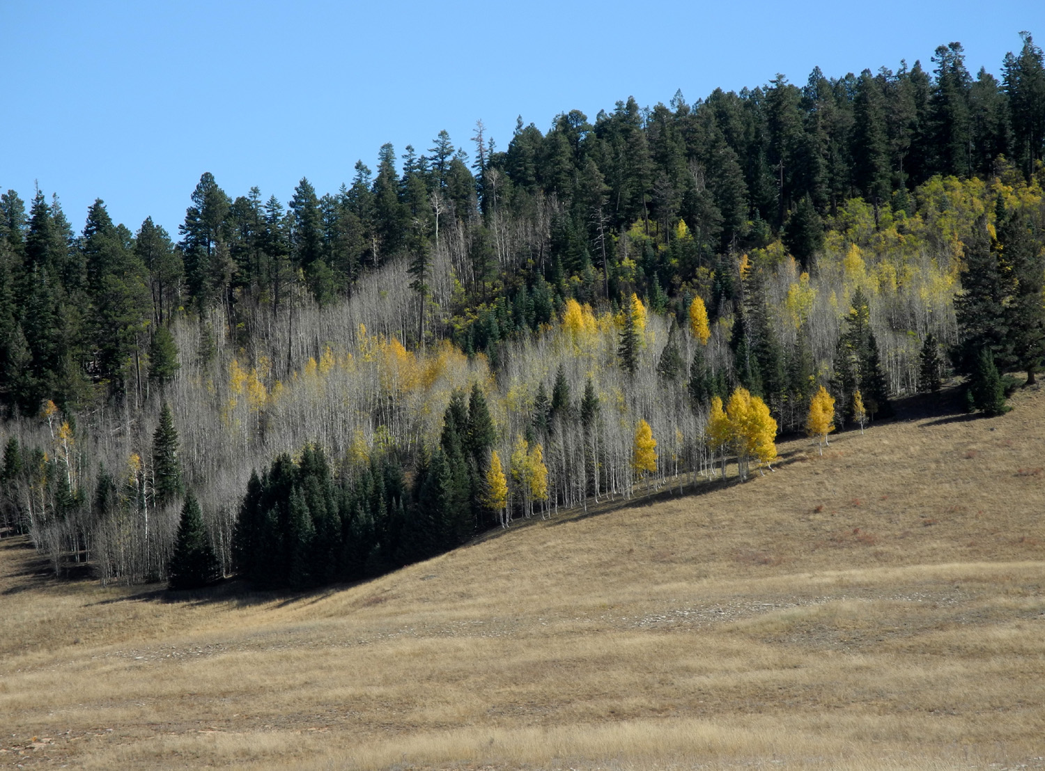
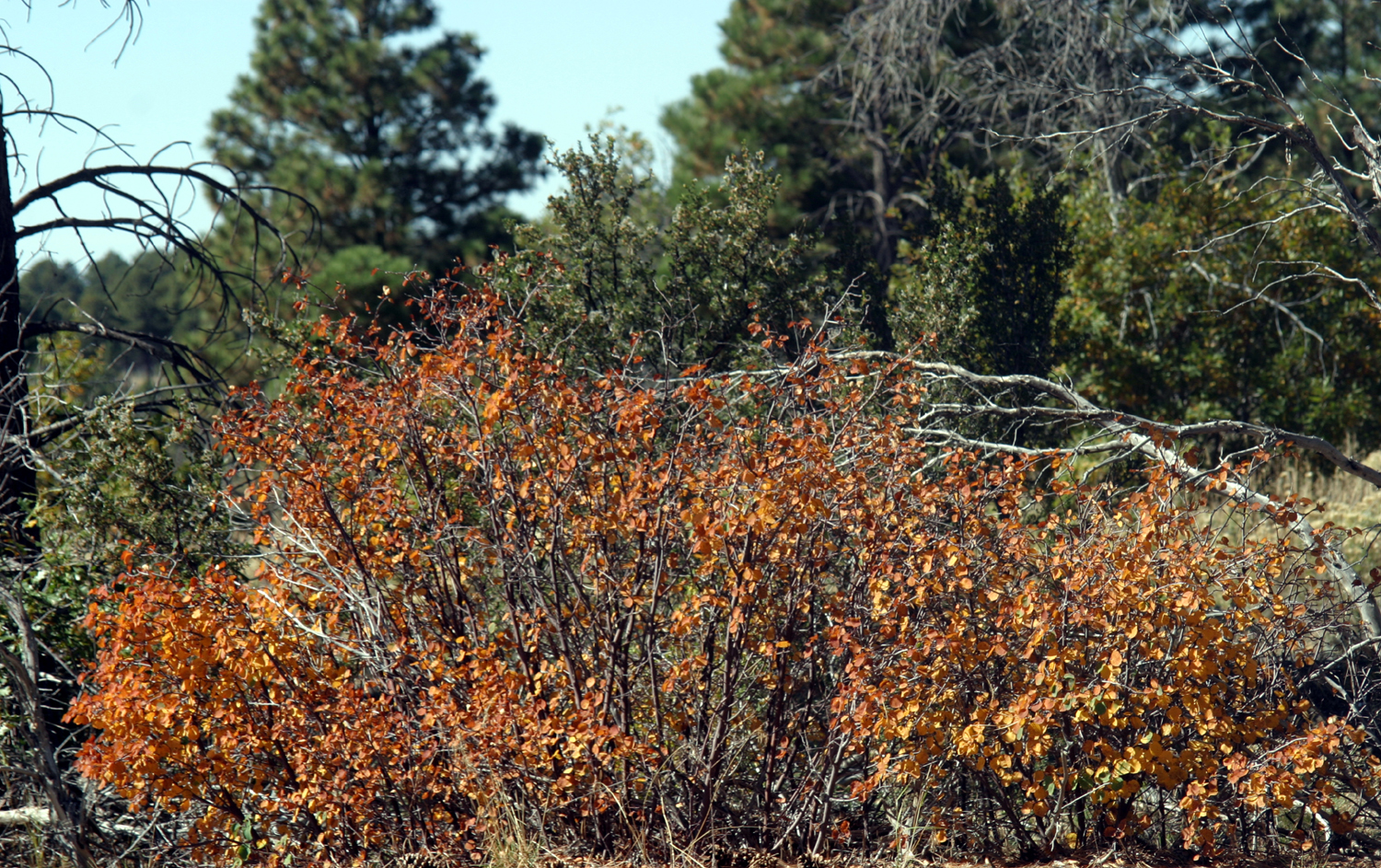
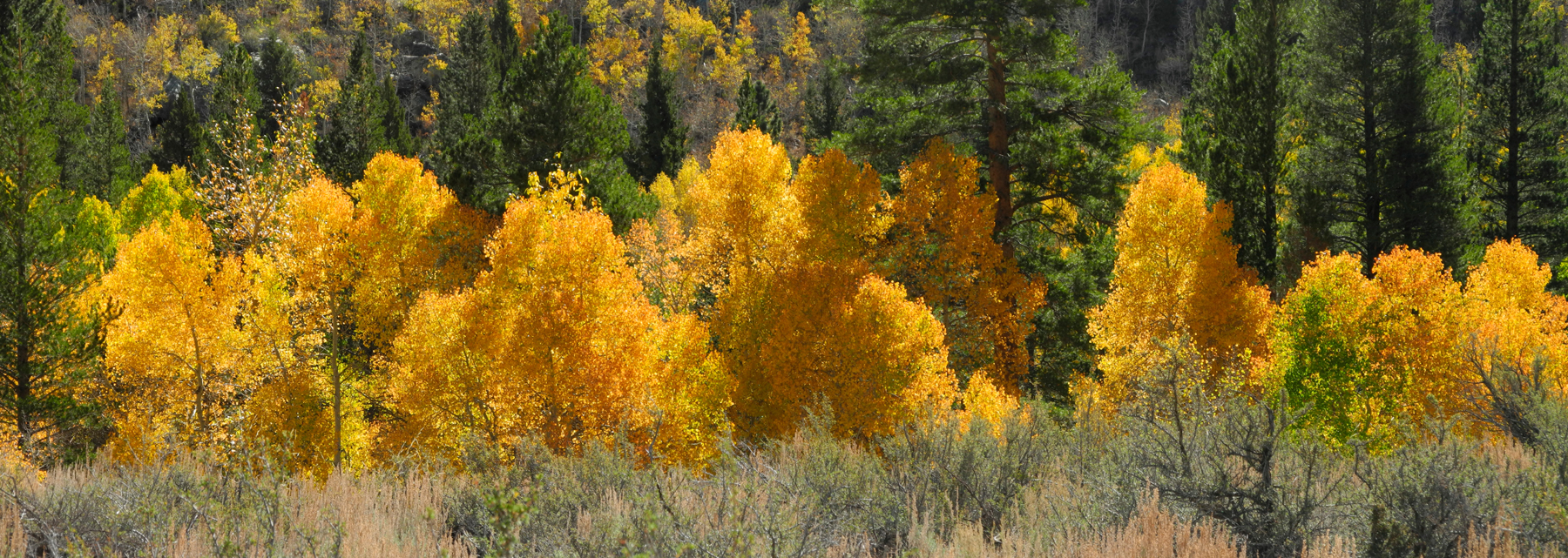
On the other
hand, we passed meadows, brown for fall, lined with golden aspen
trees, and several miles that I dubbed "the million-mullein
highway," due to vast numbers of this tall plant, which seems
to grow at every elevation in every state.
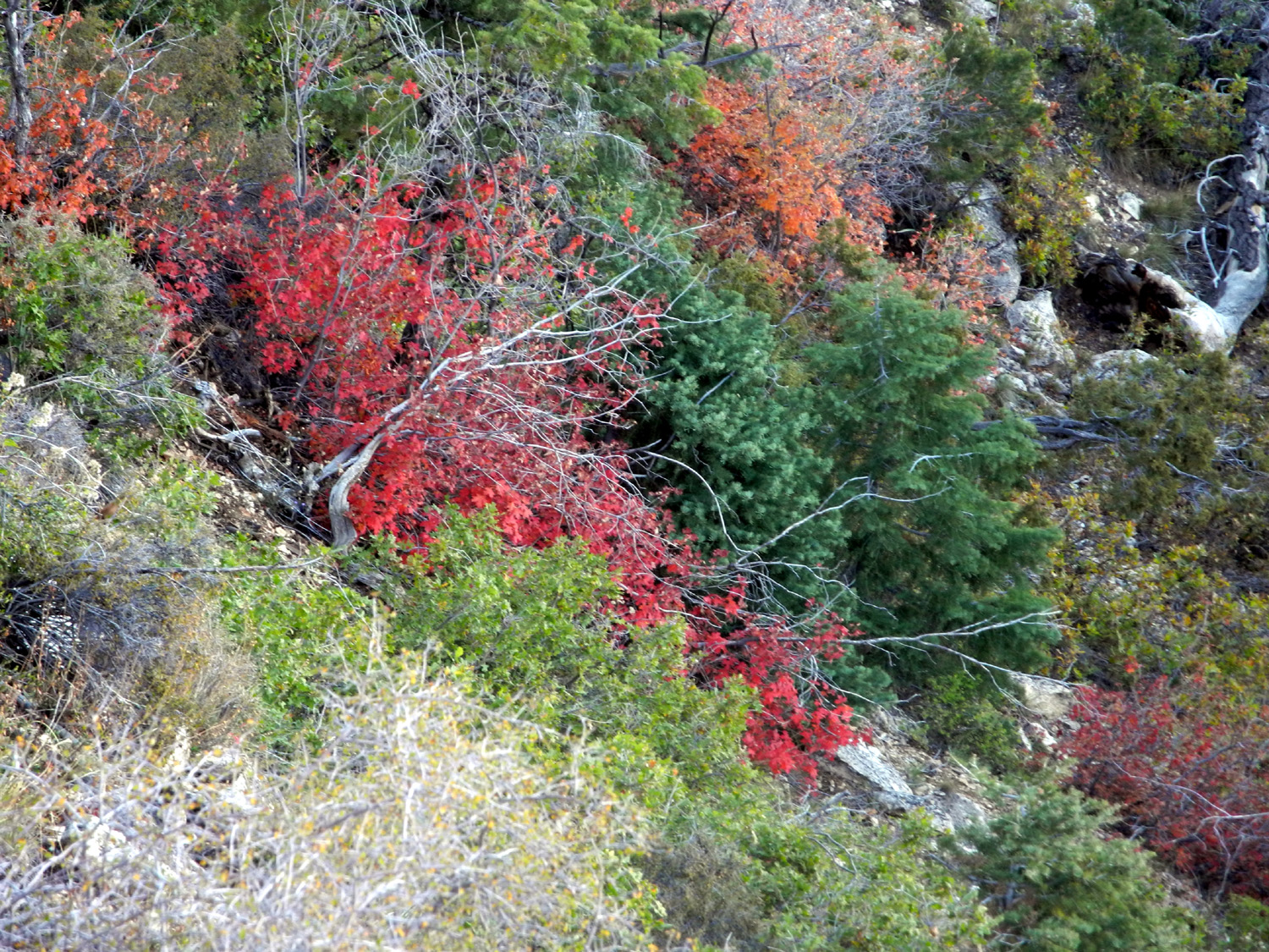
When we
entered the park itself, the trees became larger, with spruce and
fir dominating. The rim is slightly lower than the high point of the
highway, so the area surrounding the lodge is ponderosa forest,
giving way to piñon and juniper just below the rim.
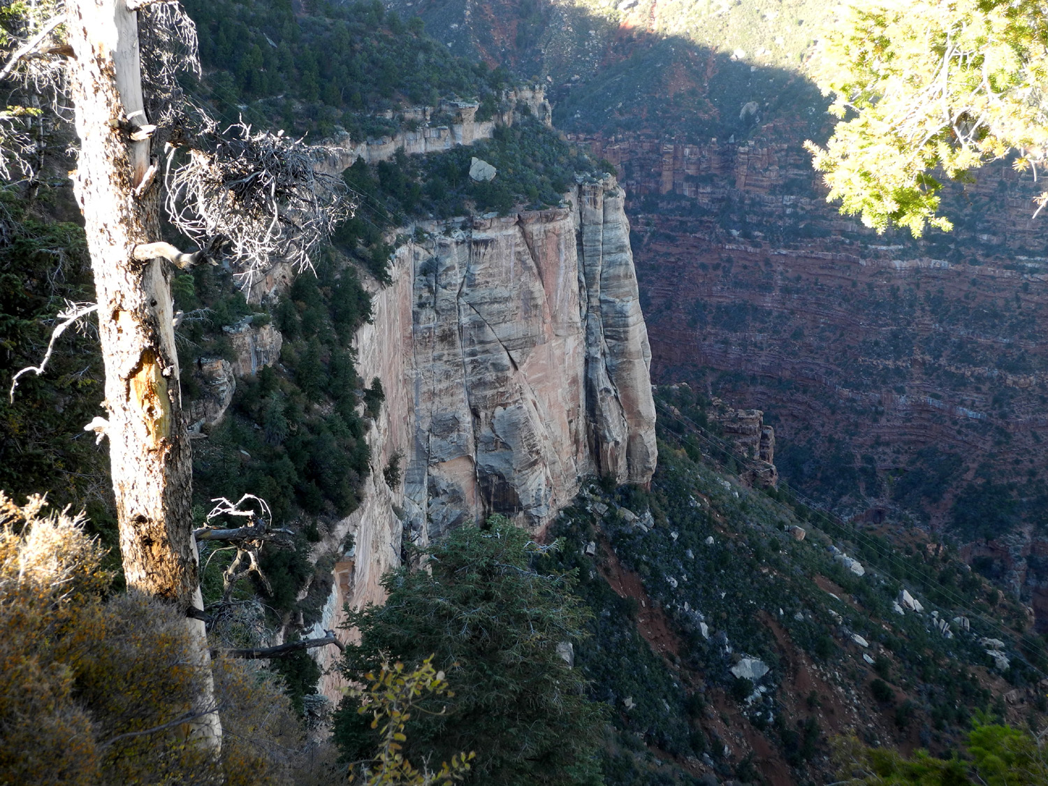
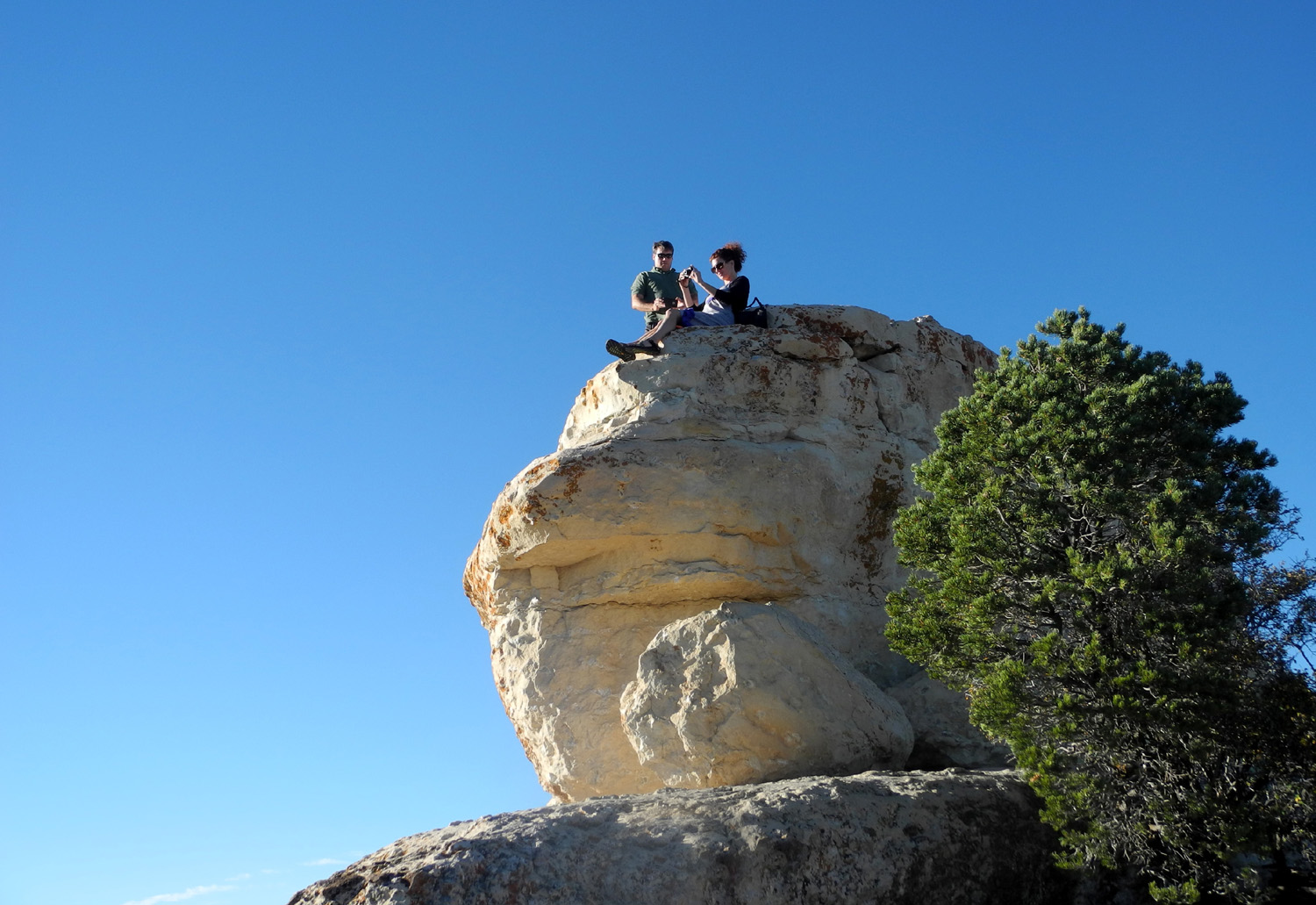
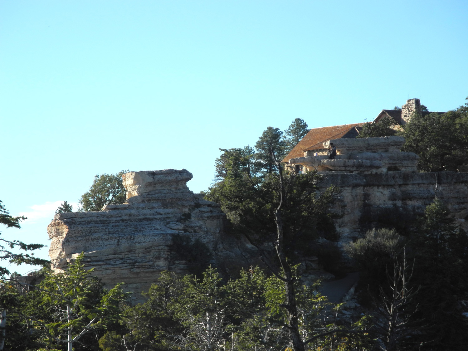
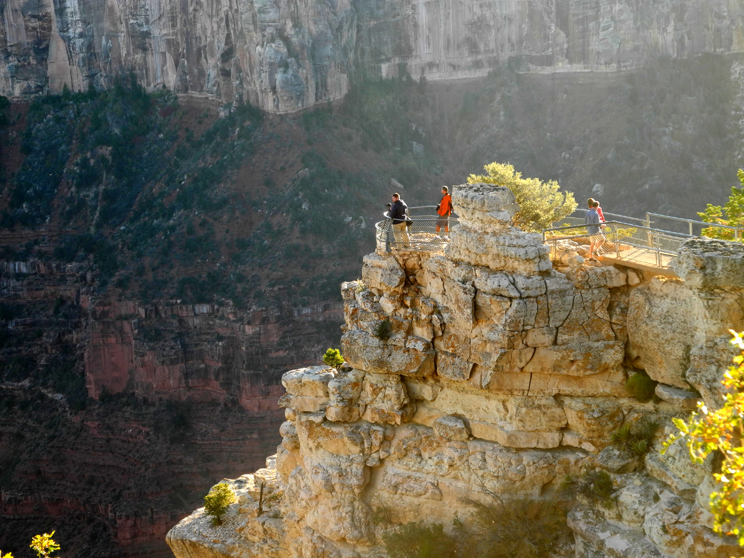
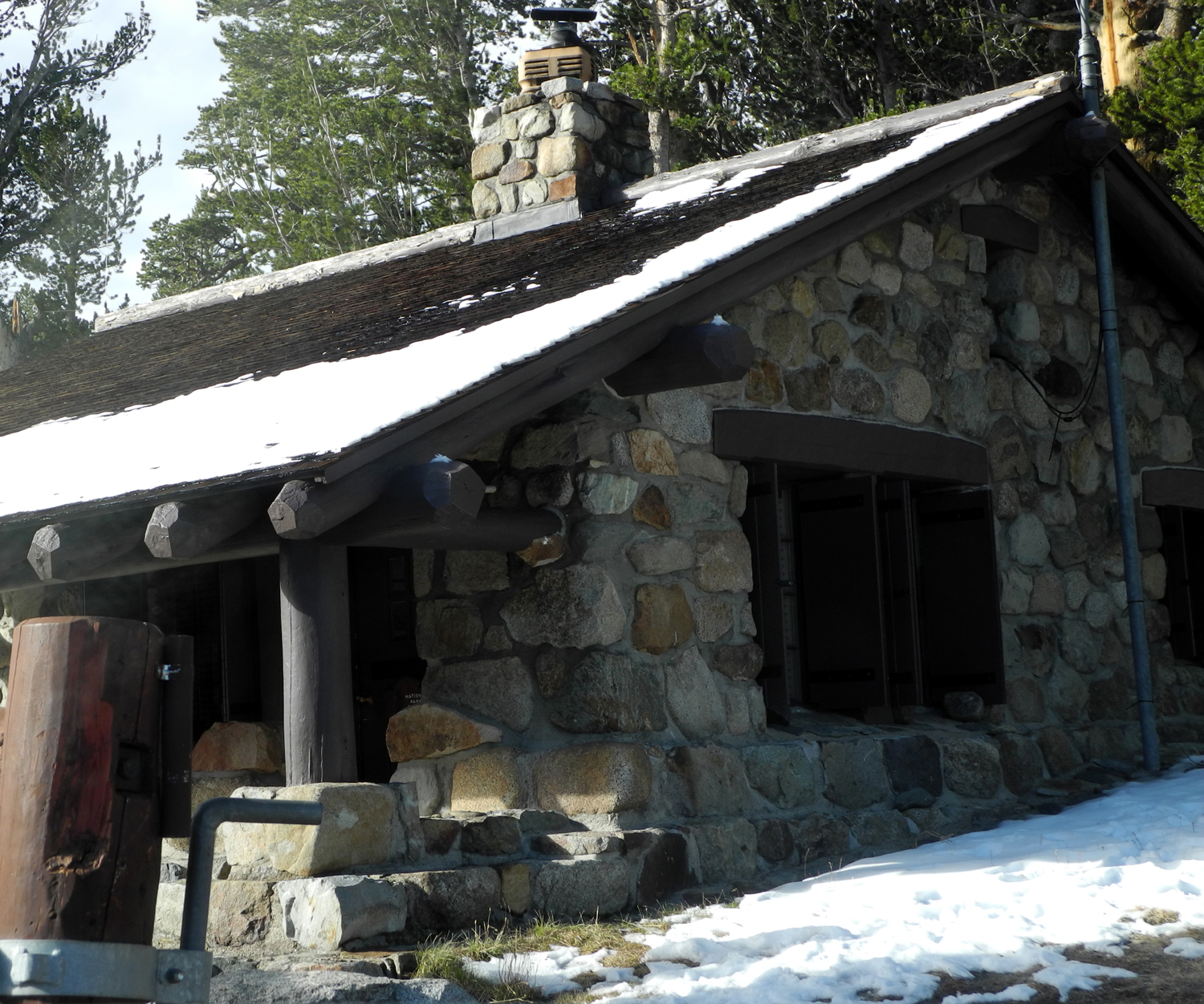
Once we
arrived at the lodge area, we found a parking spot, then walked down
the Bright Angel Trail, a paved path that goes down about 100 feet
below the rim, out to a point with a view of the canyon on three
sides. The trail is only a half mile, although the final return
approach is fairly steep. It connects with the Transept Trail, which
follows the rim for about a mile and a half, and ends at the
campground. Along this trail right below the lodge are two short
side trails that go down steps to vista points that are out from the
rim a short distance, and we went to both of these, but did not walk
the entire Transept Trail at any time.
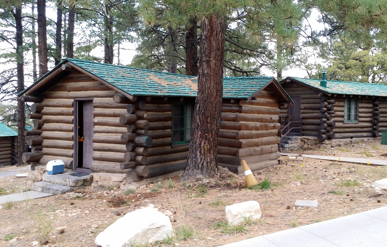
The facility
offers rooms in the main lodge (VERY expensive), and several
different size cabins. Teri had reserved one of the smaller cabins,
the only thing available at the time, even though she called ten
months in advance (!). These are quite small but very nice, log
construction chinked with concrete. I'm pretty certain they are pre-fab,
since constructing them on-site would have been a nightmare. Even
so, assembling had to be a challenge, with everything located on a
gentle slope with trees everywhere.
There was no
refrigerator or cooking facilities, but Teri had brought ice chests,
a camp stove, and a folding table to cook on outside. This didn't
work out - while cooking on the second evening, we were informed that absolutely NO outside fires of any kind
were permitted, a National Park rule.
We had warm
beef stroganoff, picking out the still too chewy noodles, and
ordered a pizza the next night.
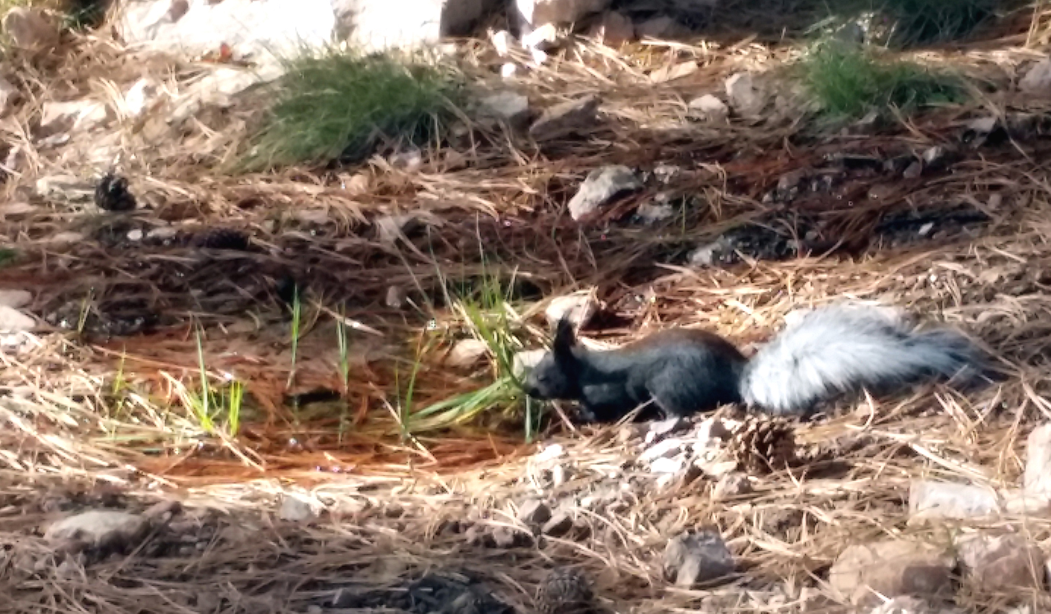
One of the
attractions of the Kaibab Plateau is a rare species of squirrel,
which evolved differently from its relatives due to the isolation of
the area. The Kaibab squirrel has tufted ears and
a white tail. We were
lucky enough to see one the first evening, watching as he ran around
the area near our cabin, then up a ponderosa to enjoy a snack of
pine stems.
We also saw
another one three different times. On our last morning he posed on
the porch of the cabin directly across from ours, ran up a tree with
a nut, came back down and got a drink from a seep that ran out from a
leaking pipe, then went right past our feet and up another tree.
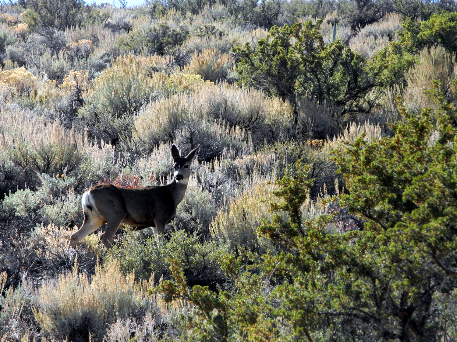
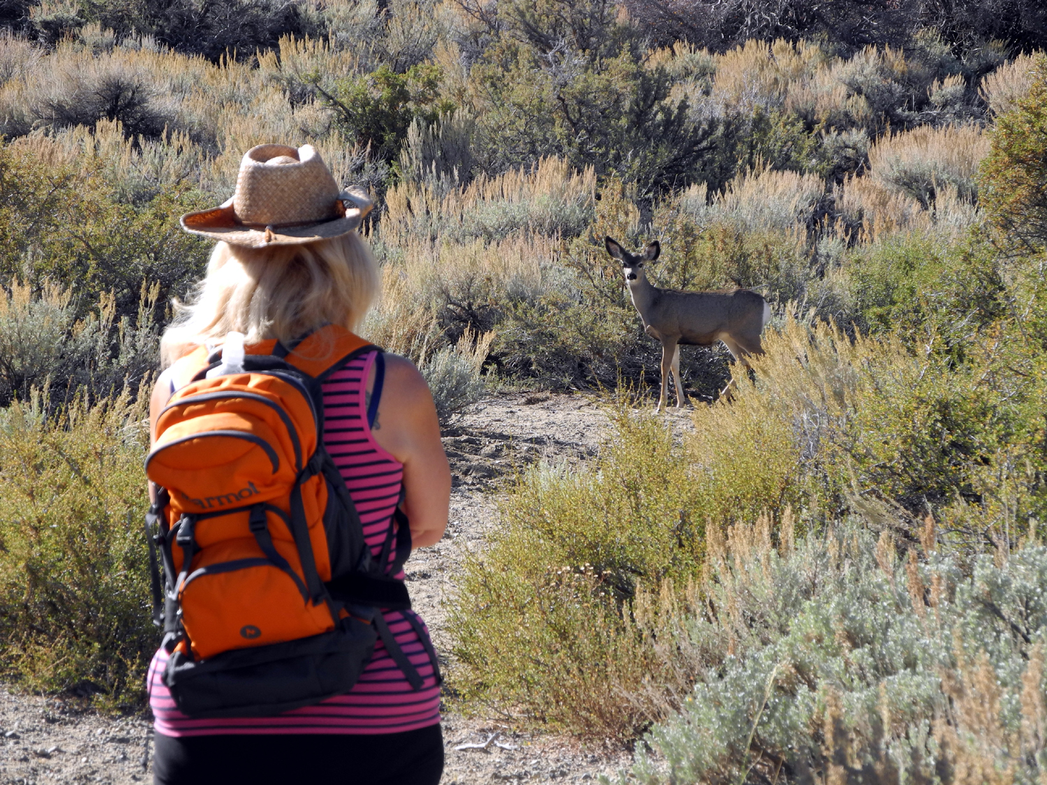
Speaking of
animal life, we saw other species of squirrels and chipmunks, bats,
and five deer meandering through the cabins
After supper
the first night, near sunset, we went out to the vista point below the lodge.
Throughout the day, the colors of the rock change as the sun moves
across the sky, and sunset is an especially nice time. The lodge has
a patio on the edge of the rim, as well as a lounge inside and
slightly higher, with large
windows, and many people were enjoying
the end of the day from these locations.
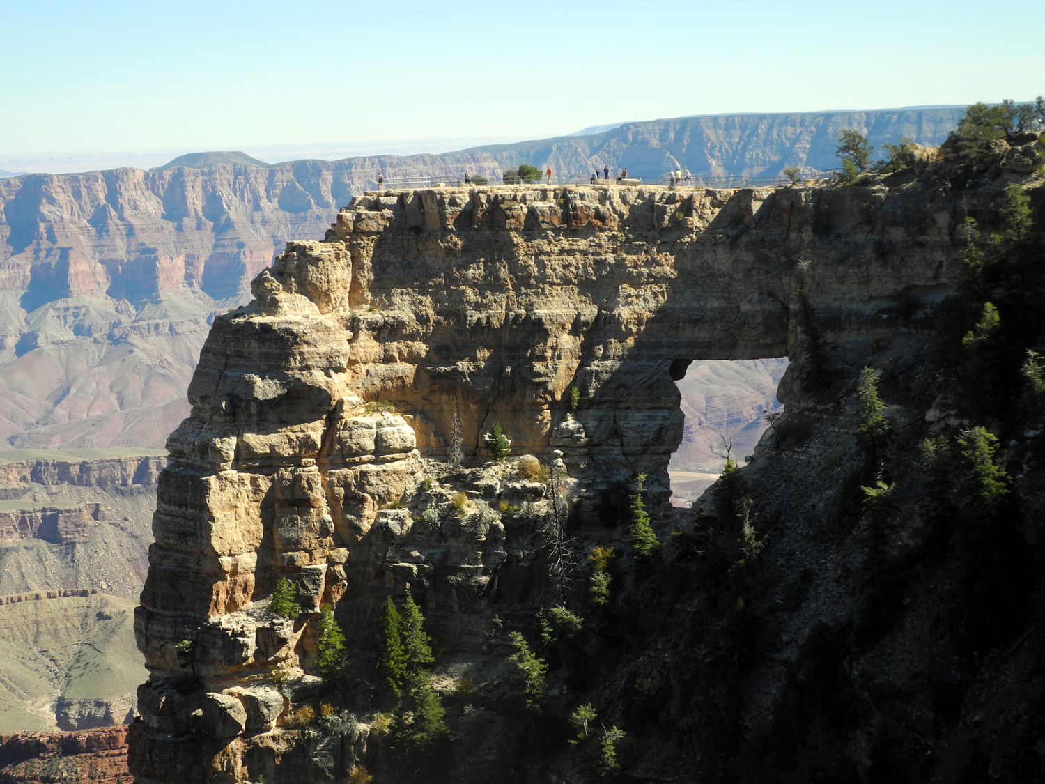
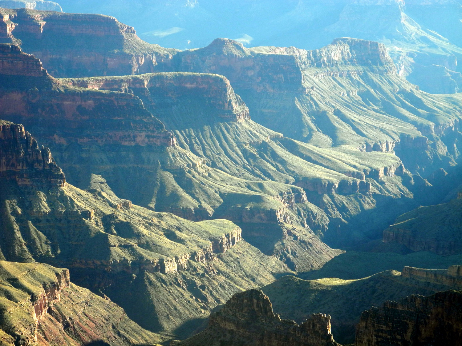
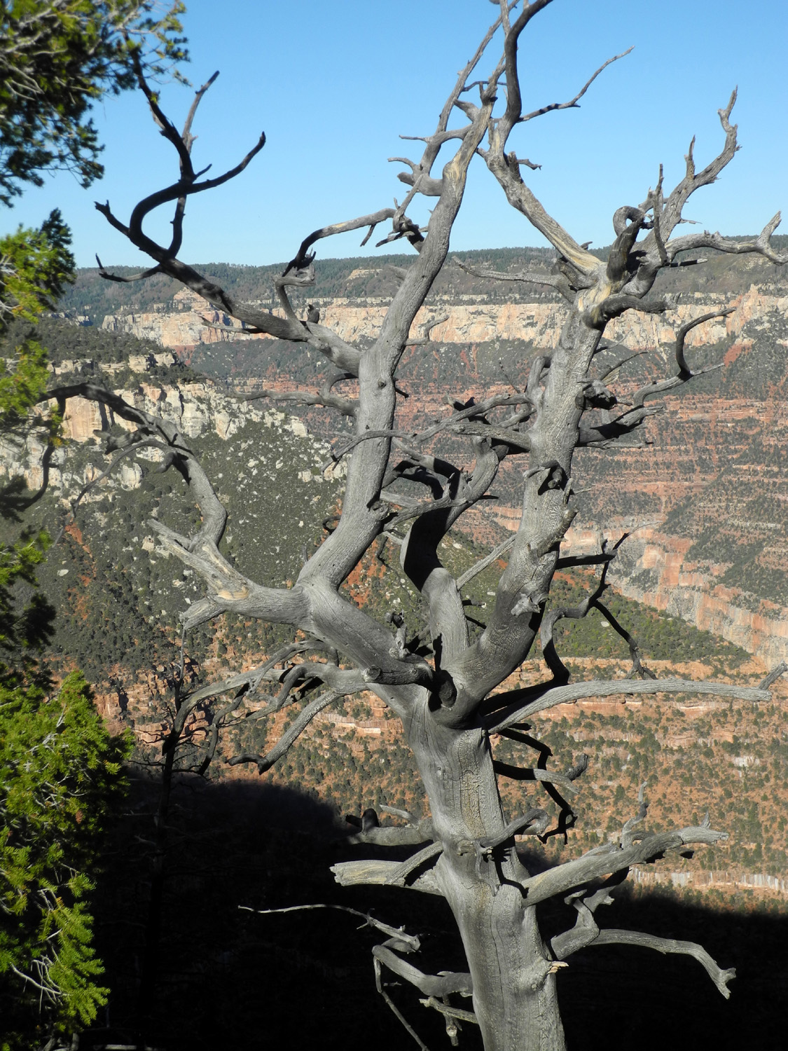
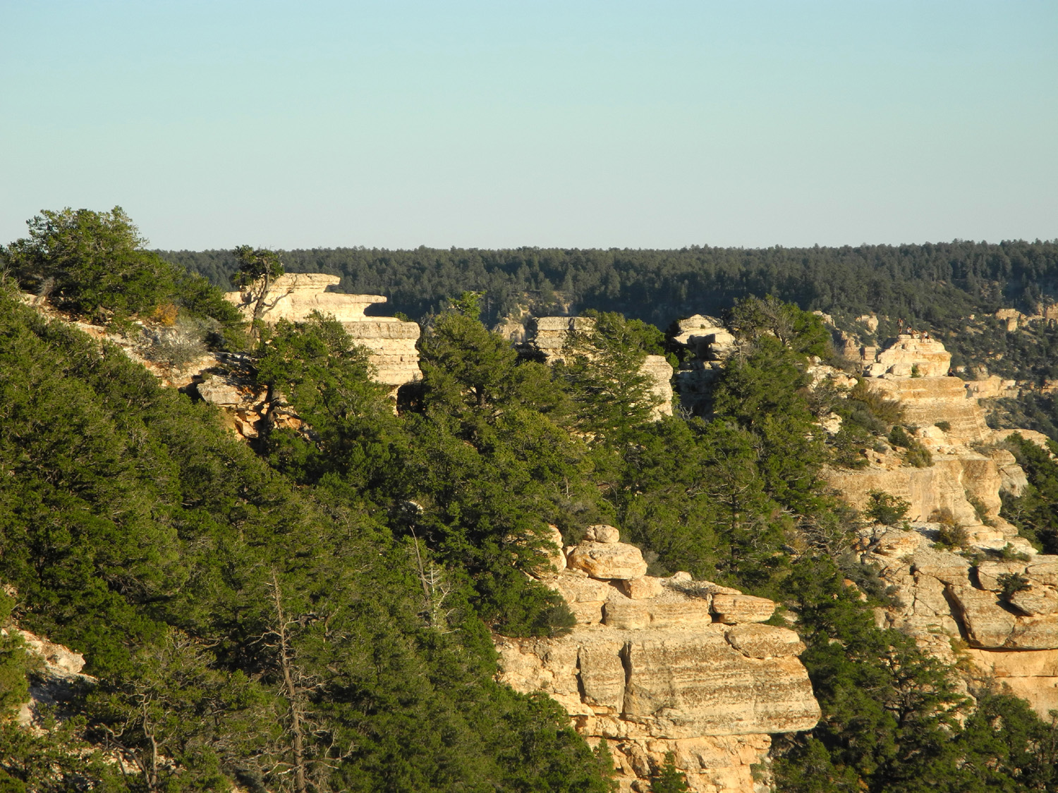
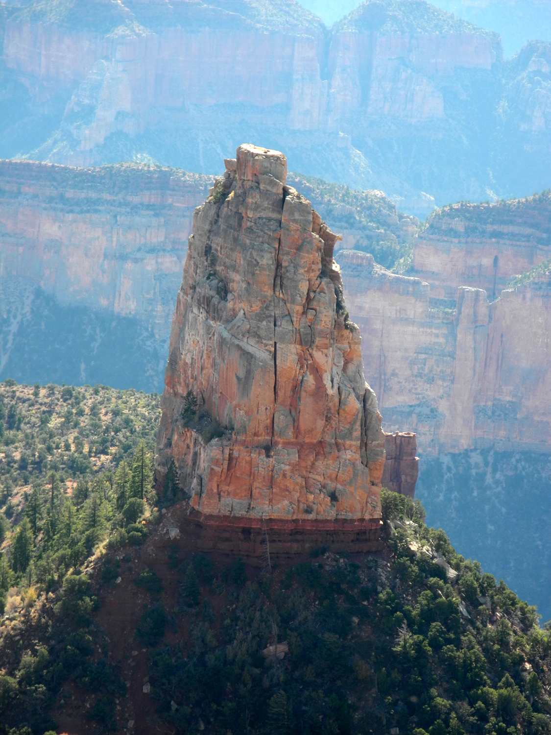
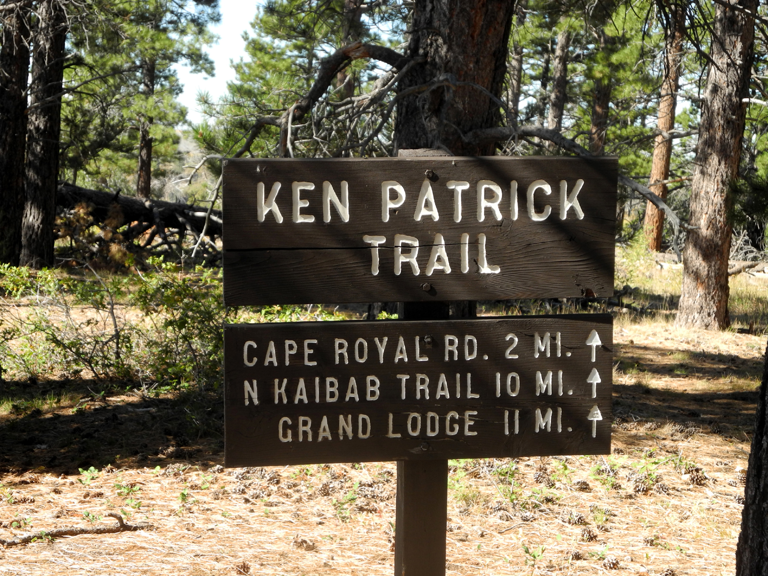
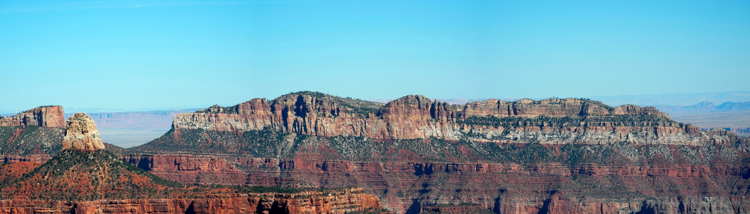
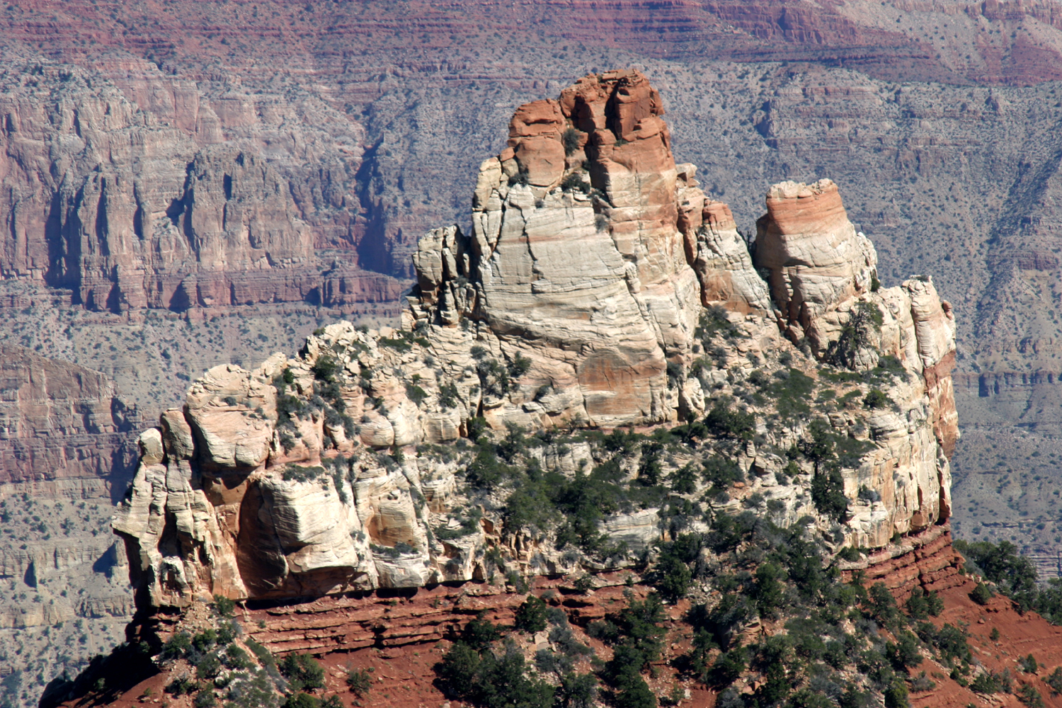
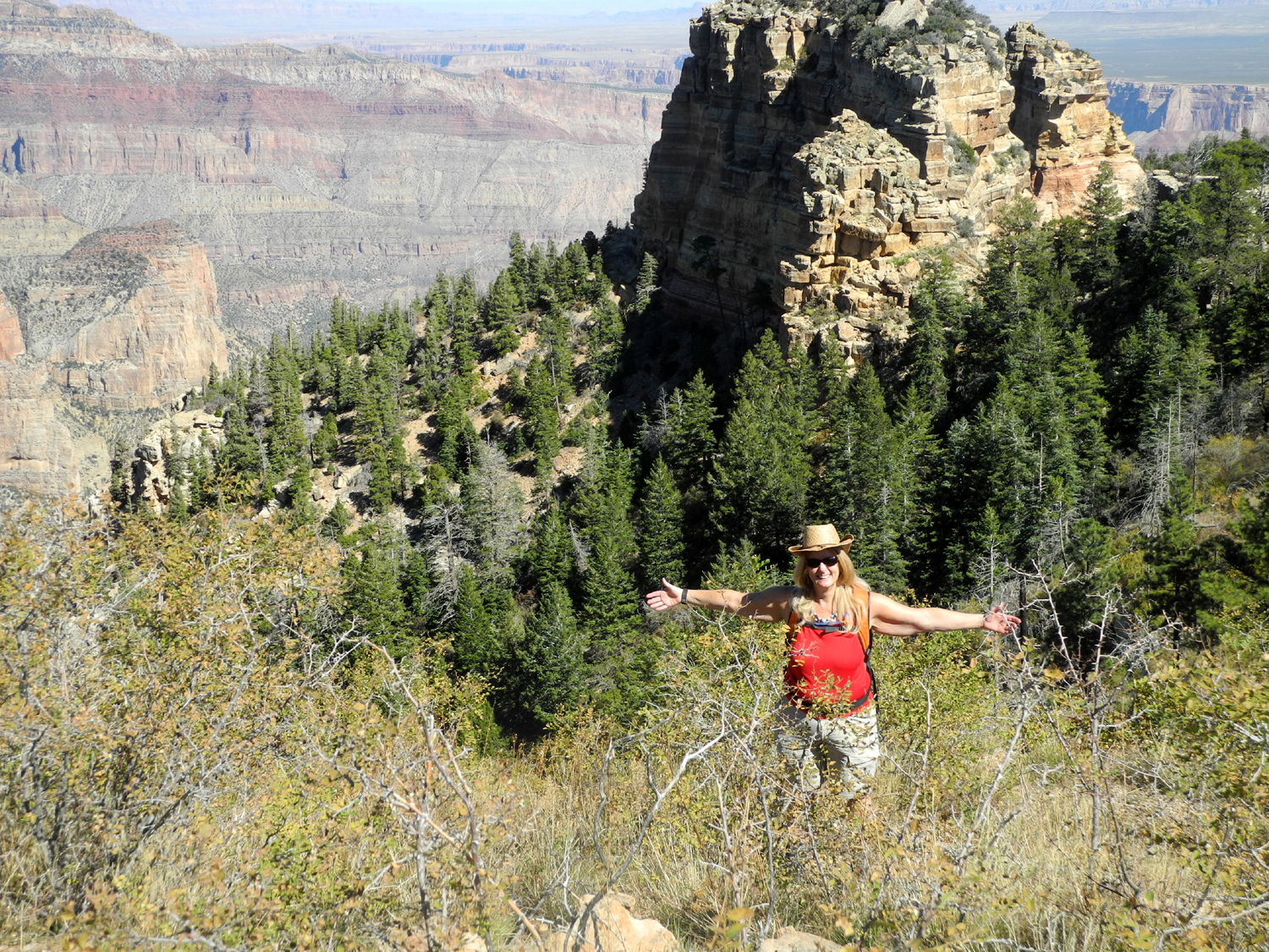
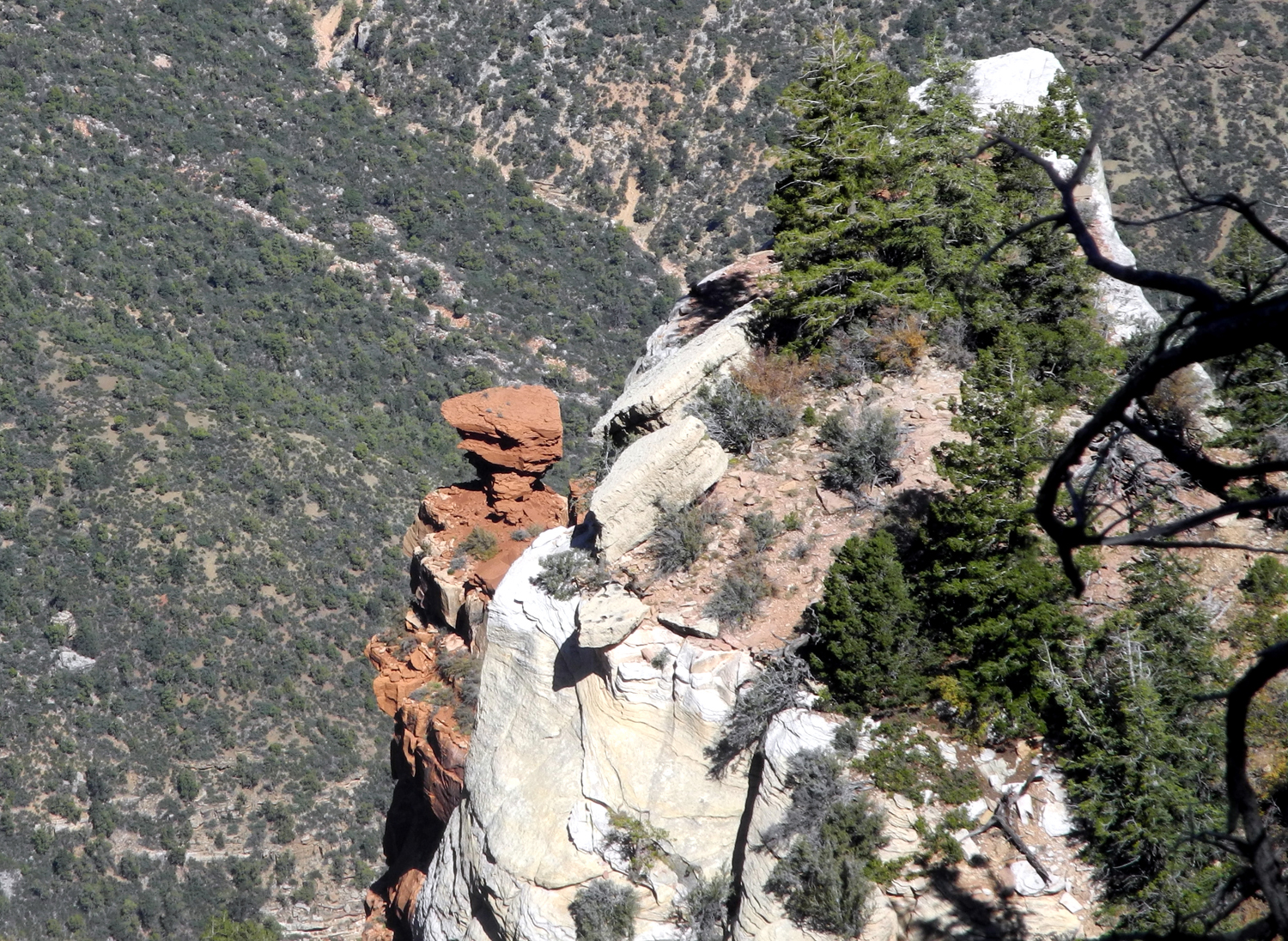
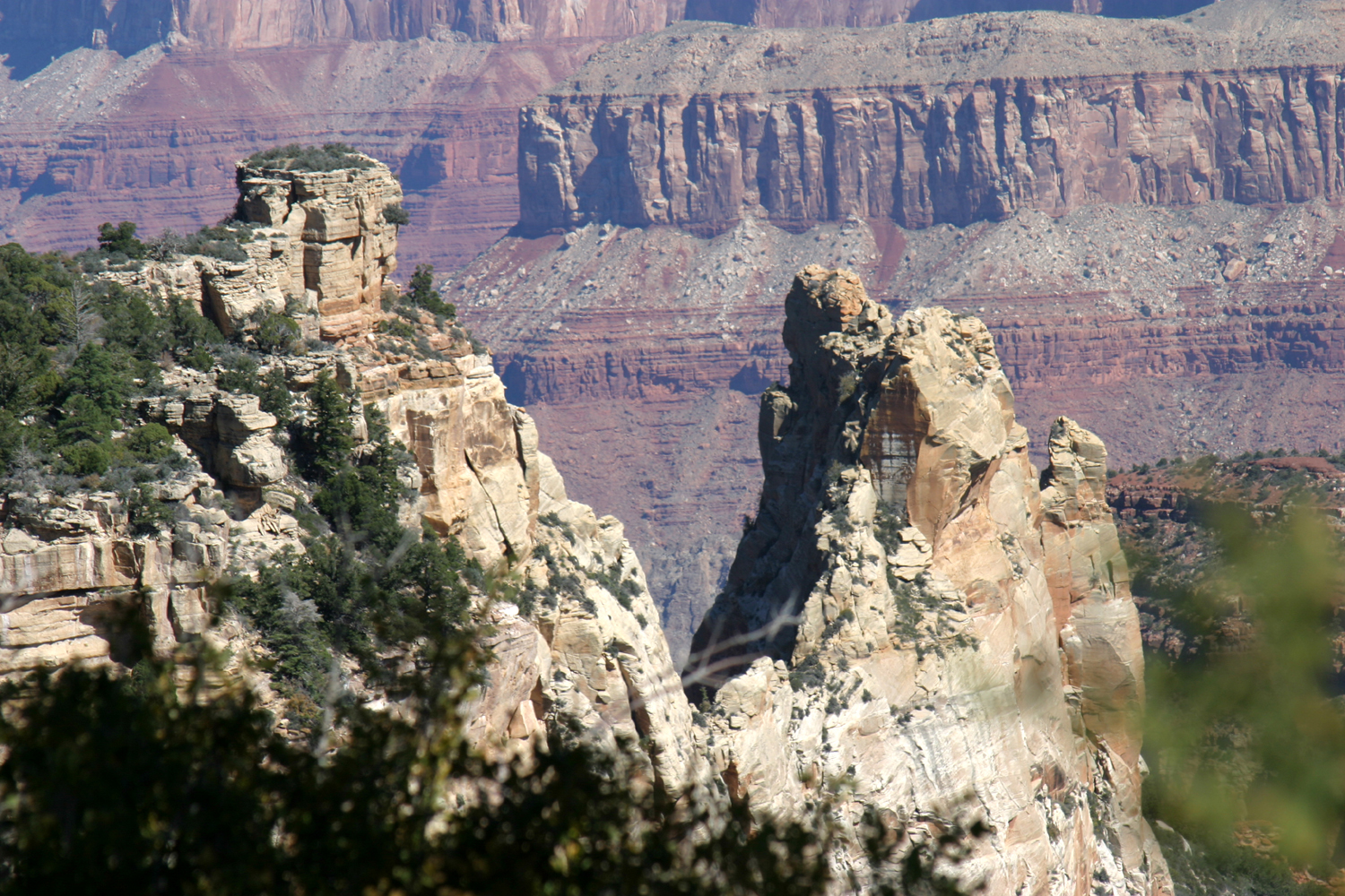
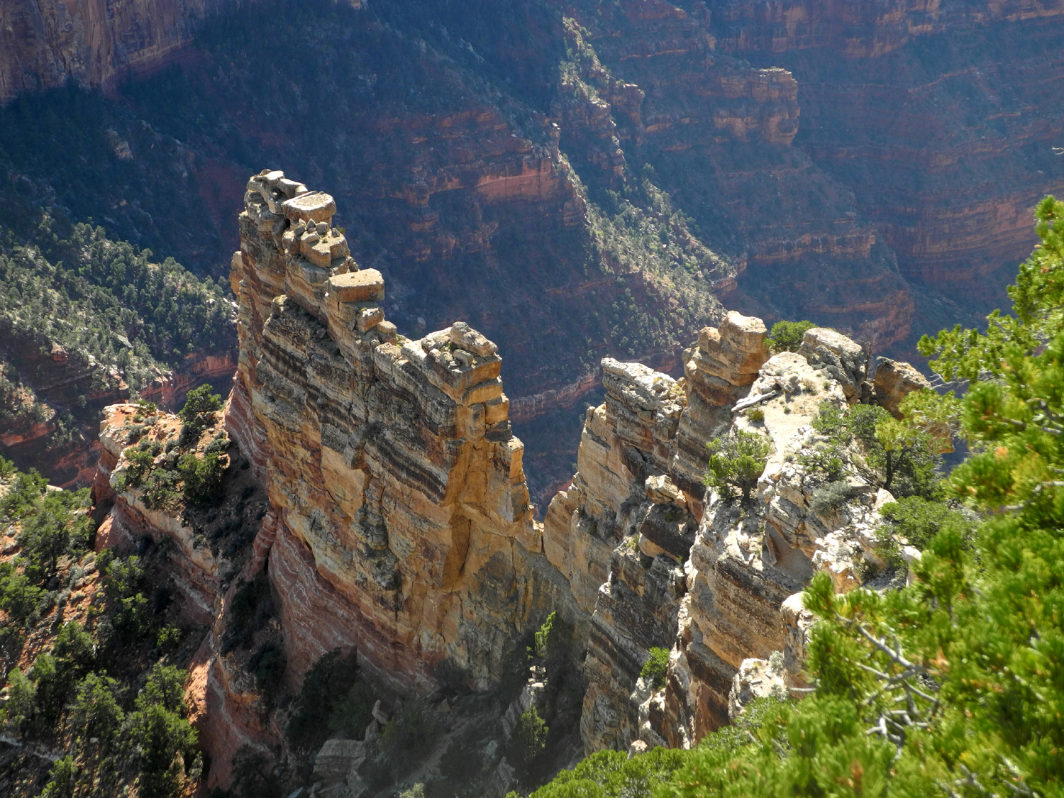
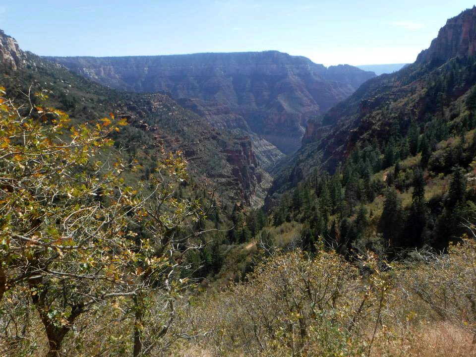
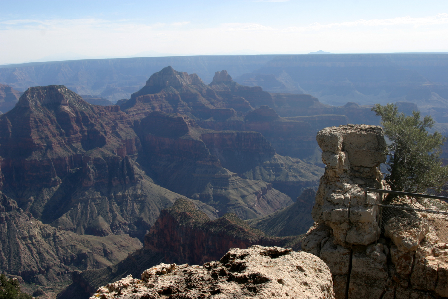
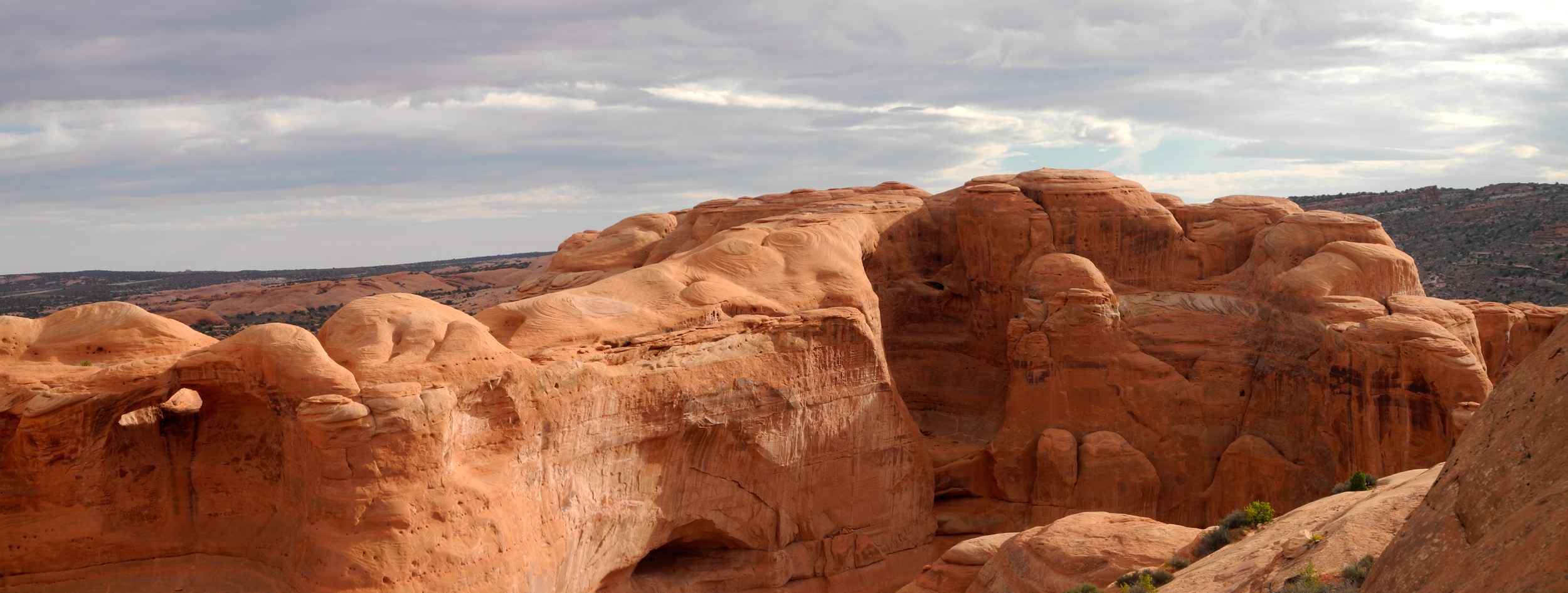
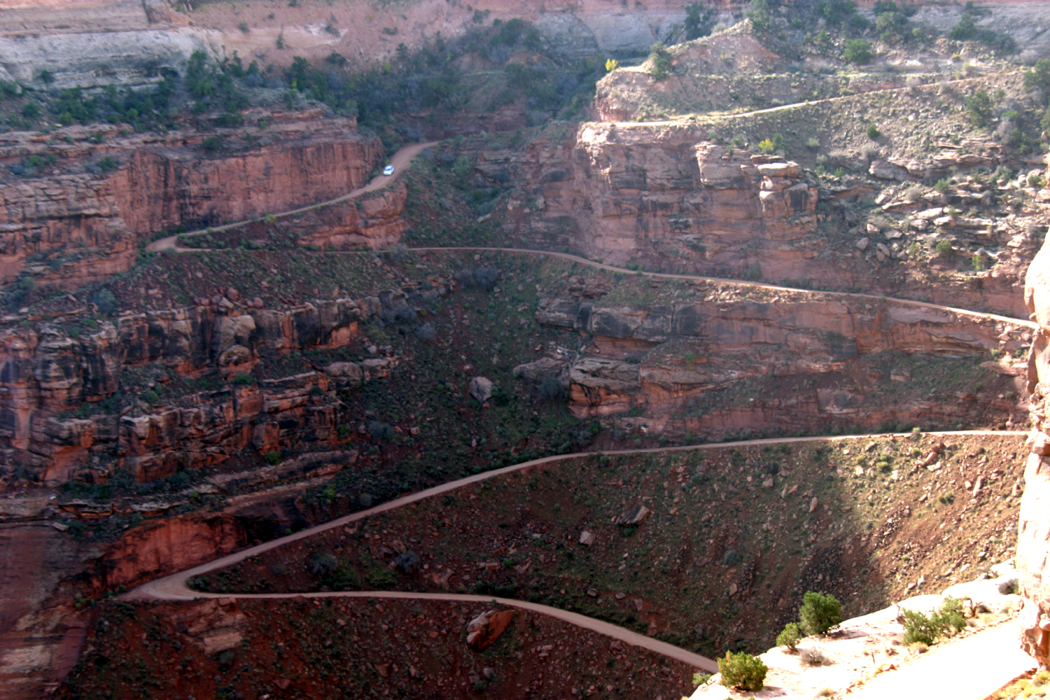
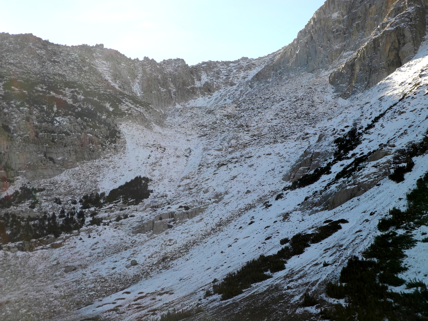
October 14, our first full day at the canyon, we visited what I call
"the peninsulas." Because of the higher elevation and
greater snowfall, the side canyons on the north rim have been cut
back much deeper than on the south, creating long, narrow points of
land perpendicular to the main canyon. From the lodge we drove back
the Grand Canyon Highway three miles, then five miles on a road that
goes mostly to the east, and another three miles to Point
Imperial,
the highest viewpoint on the rim at 8,803 feet. You can also take a
ten mile trail that starts near the lodge, and continues on past the
point for many miles. We went out the short path to the edge, and
also walked a short distance on the long trail, getting a slightly
different angle on things.
Along the
road to the high point, we went though another fire scarred area,
which I believe dates from about 2001.
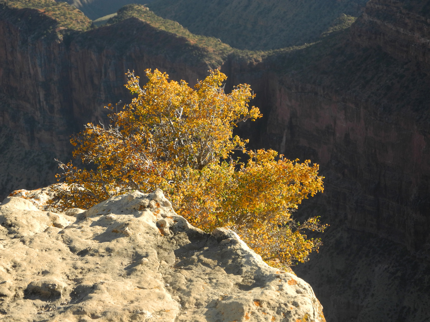
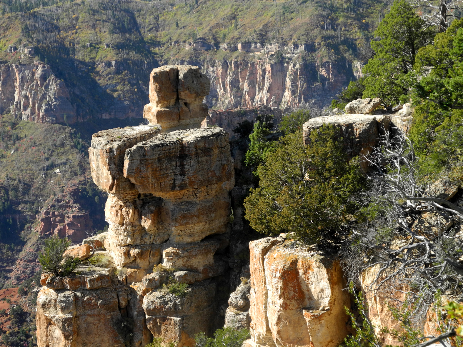
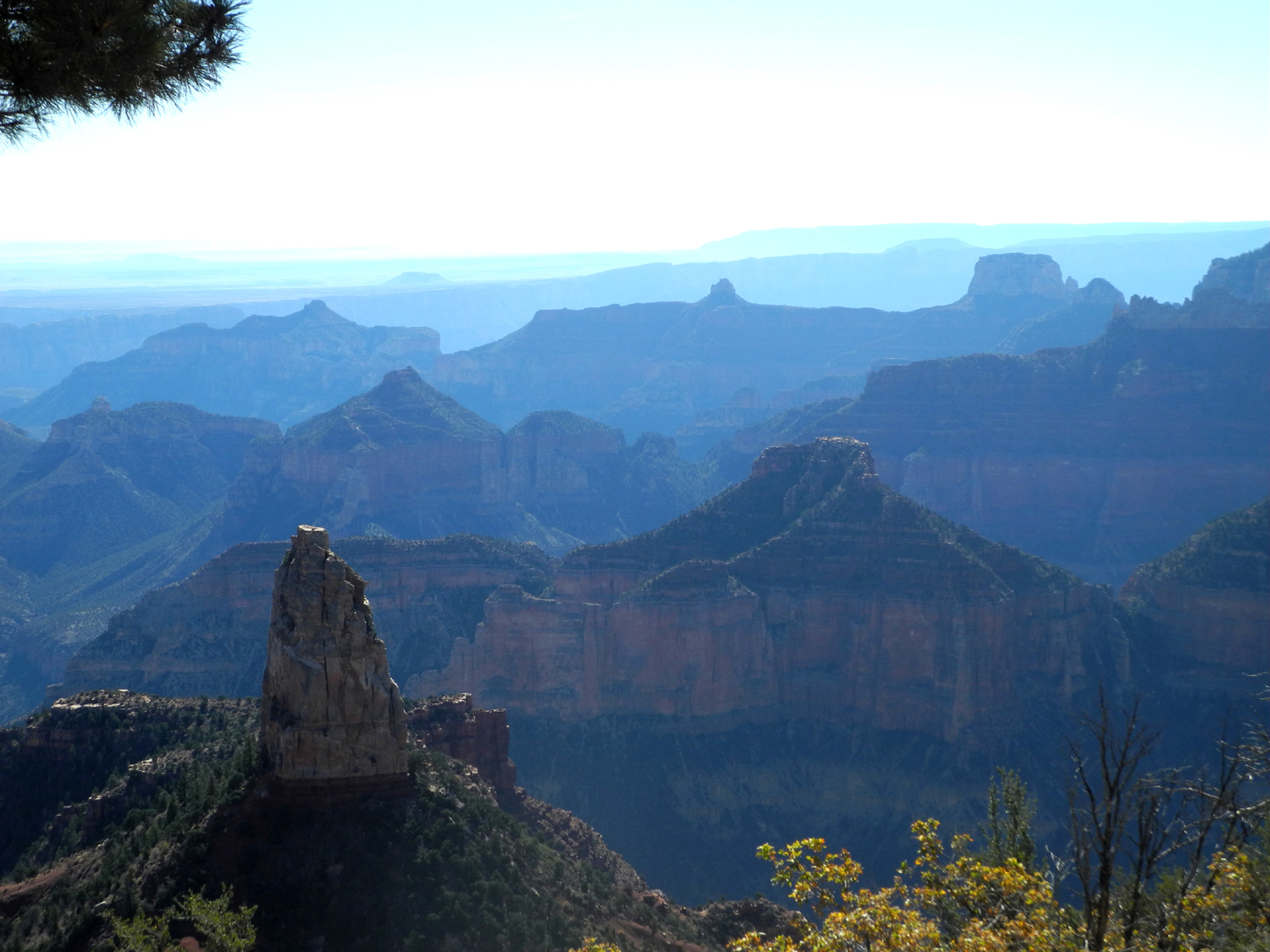
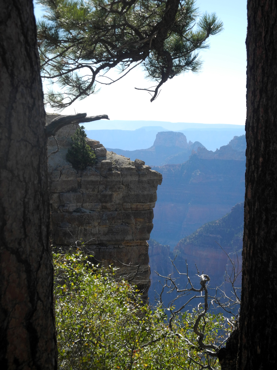
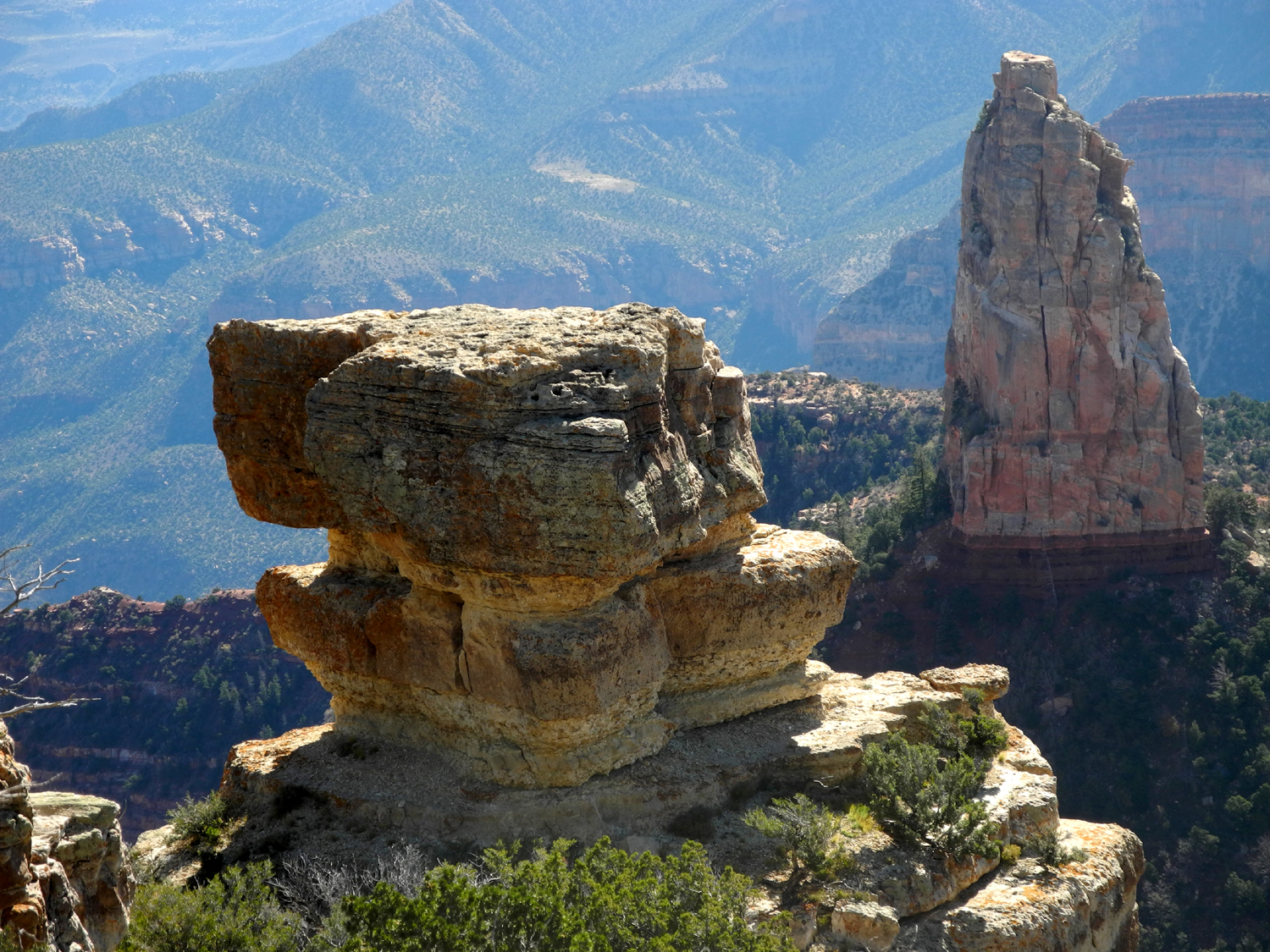
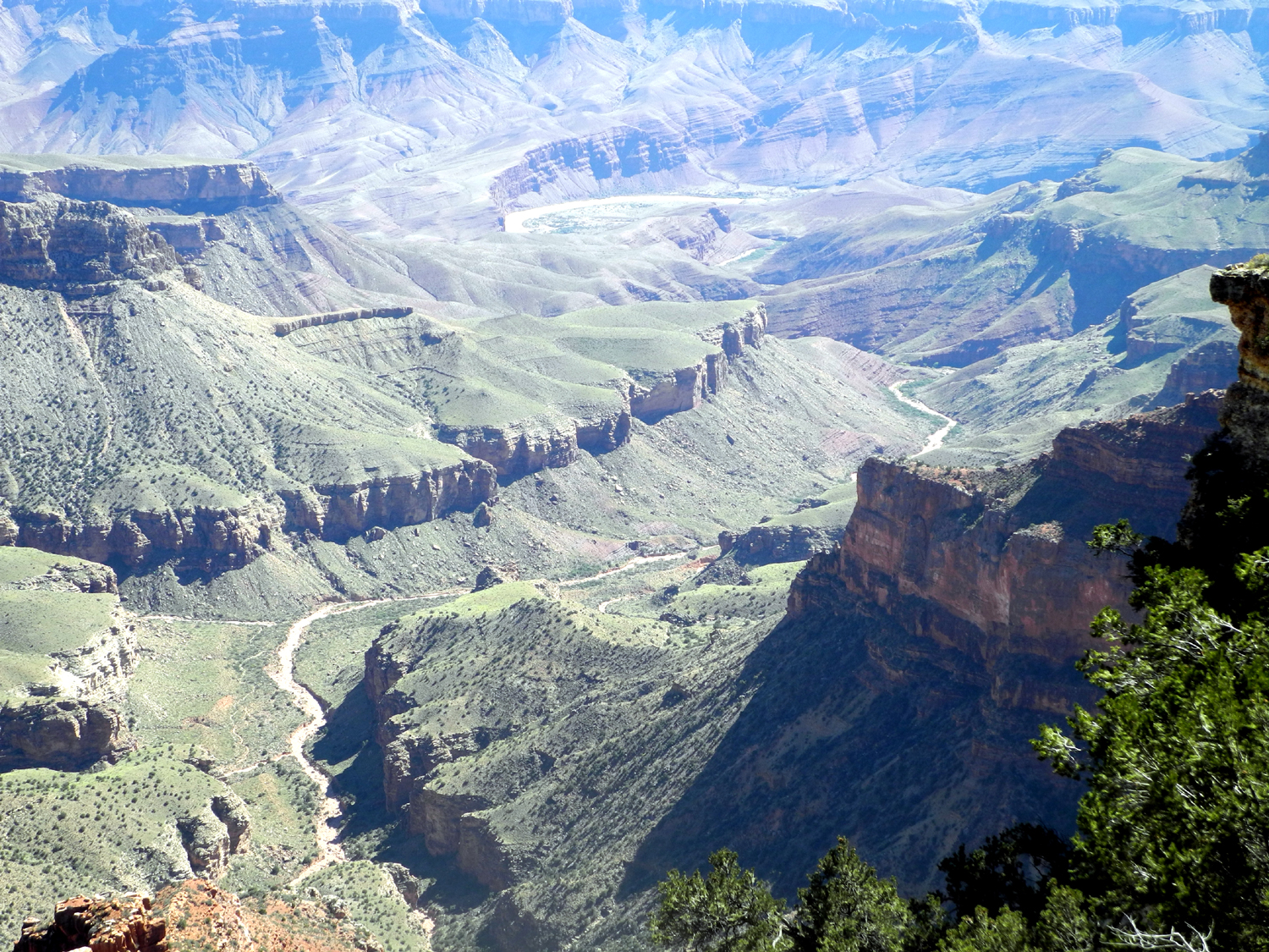
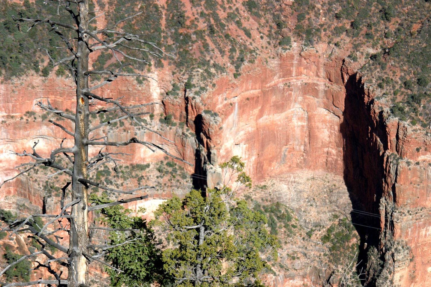
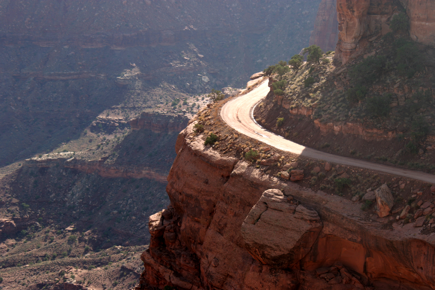
We retraced
our route from Point Imperial to a road that goes 15 miles to Cape
Royal, with a number of viewpoint stops along the way. We made all
the stops, some of which required only a short walk from the parking
area. At Roosevelt Point there is a trail of about a half mile to
the farthest point, but the longest "hike" was at the end
of the road at Cape Royal. As we started down this road I told Teri
we should stop at each point we came to, ending with Cape
Royal. She
asked why not do it the other way, but I just said, "wait and
see." She agreed with me that Cape Royal provided one of the
best views on the north rim, and was a fitting climax to the day.
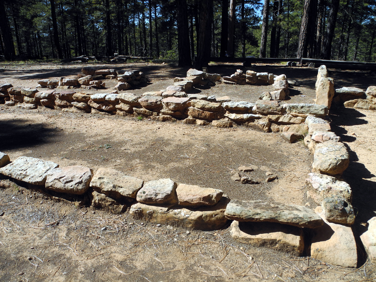
Probably in
second place was Valhalla Overlook, where you can see the Colorado
River. Back from the rim a short distance are the
ruins of Indian dwellings that were occupied during the summer
months; in the winter the natives descended to the river to avoid
the worst of the winter weather.
Although the
individual sections we walked were mostly fairly short, we managed a
total of 3.3 miles for the day, helping me to a record total for the
month and moving Teri that much closer to her
thousand mile goal. It also gave us a good appetite for our
pizza supper that evening.
The first
night, when we were out at sunset, we noticed quite a few stars
coming out as soon as it started to get dark, so on the second night
we waited until
full darkness and went out on the trail below the lodge.
We immediately had an amazing view of the Milky Way, and walking a
short distance from the lodge got us away from most ambient light.
We lay down on the rock and enjoyed the best star view I've seen
in a number of years.
For our
final day there we had planned to hike part way down the North
Kaibab Trail. This goes to the bottom of the canyon, but only
people who are crazy or in extremely good physical condition attempt
to go down and back in a day. There are several "official"
turnaround points, and we planned to go Coconino Overlook, a round
trip hike of one and a half miles, with an elevation change of 800
feet each way.
However, by
the time we got up, I was feeling the effects of the previous days'
activities, and decided to let Teri do the hike on her own, while I
stayed around the village. I have referred to Grand Canyon Lodge,
but the area also includes a visitor center (operated by the
National Park Service), a post office, and a number of commercial
facilities - a gift shop, upscale restaurant, coffee shop/bar, cafe
with pizza and sandwiches, and a general store with groceries and
camping supplies.
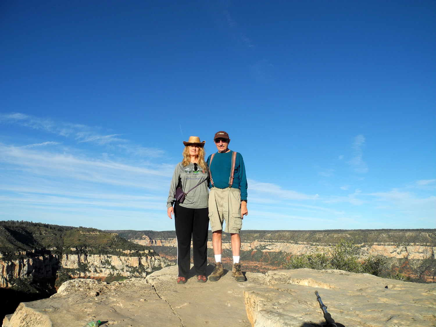
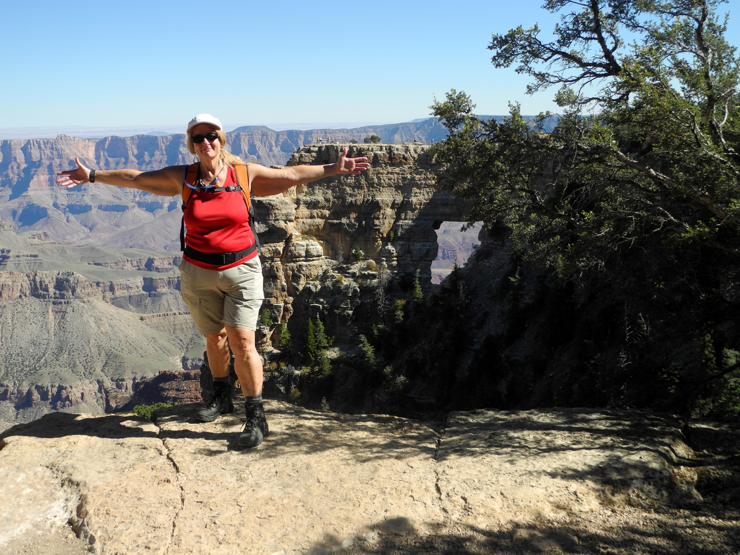
Although I
went into the gift shop and visitor center, my main activities were
reading and photography. In addition to the Nikon Coolpix camera
that I take on all trips, I had brought my larger Canon SLR with a
telephoto zoom lens. I took this and my tripod down to the vista
point near the lodge and took a number of photos, then moved down
the trail a ways for a different angle. I was attempting the
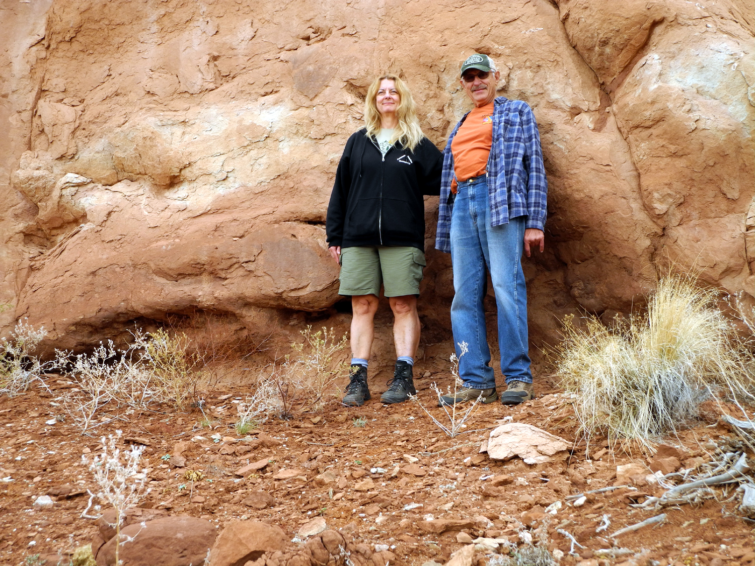
mandatory "Dick on the Rock" photo, but having trouble
getting into position before the self-timer went off, when a very
nice lady offered to take the picture for me.
On my second
photo walk a young man named Lance volunteered for the same task,
although his aim was a little off and Teri and I went to the same
location later that day, again getting help from a fellow tourist
who operated the camera, doing a better
job.
I also met
an interesting pair of hikers at the upper end of the Bright Angel
Trail, a man and his 83-year old mother, who had just taken up
hiking. She was wishing aloud that she had brought her hiking poles
and we discussed the benefits of these tools, and she vowed to
always have them with her on future walks.
Meanwhile,
hiking solo Teri was able to go to the second stopping point on the
Kaibab Trail, the Supai Tunnel, a four mile round trip hike with an
elevation change of 1,450 feet. She had a great time, took some
nice photos, and learned a few things. She is planning to hike to
the bottom in 2016, spend several days there, and hike back out.
Although she has been running, hiking and walking far more than I do
to get in shape, she reported that she needs a lot more training to
manage the uphill hike. She also ended her hike with just a few
drops of water left, although she took close to a gallon - and this
in the relatively cool fall season.
Through this
day the weather had been clear and warm, with bright blue skies.
Rain was predicted for Friday, October 16, our departure day,
and clouds began rolling in during the night. We had got as much
packed as possible the night before, so we just had to do last
minute stuff in the morning. While we were taking things to the car,
a few drops of rain started to fall. We got everything loaded and
said a reluctant goodbye to the canyon. Everyone there had to do the
same thing that day - it was the final day before all facilities
closed for the winter, since the plateau gets around six feet of
snow.
Grand
Canyon Photos
On the Road
As far as
Kanab, we drove back along the same route we'd traveled to the park.
Here we stayed on US 89, which took us all the way to I-70. I had
driven much of this route, but the section from Kanab to the
junction with Utah 14 was new to me. All of it was scenic, with
typical Colorado Plateau features - canyons, mesas, sandstone of
various colors, and sage brush. We crossed the Virgin River twice,
at Mt. Carmel and Orderville.
A bit
farther north, the road follows the Sevier River, which flows north, makes a
loop after crossing the interstate, and flows south and slightly
west into a lake near Delta Utah, about 30 miles west of I-70 on
US50.
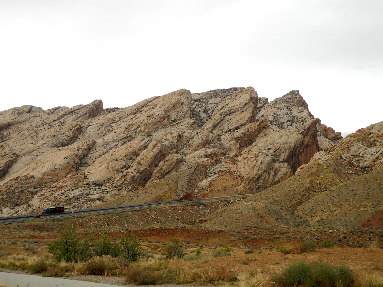
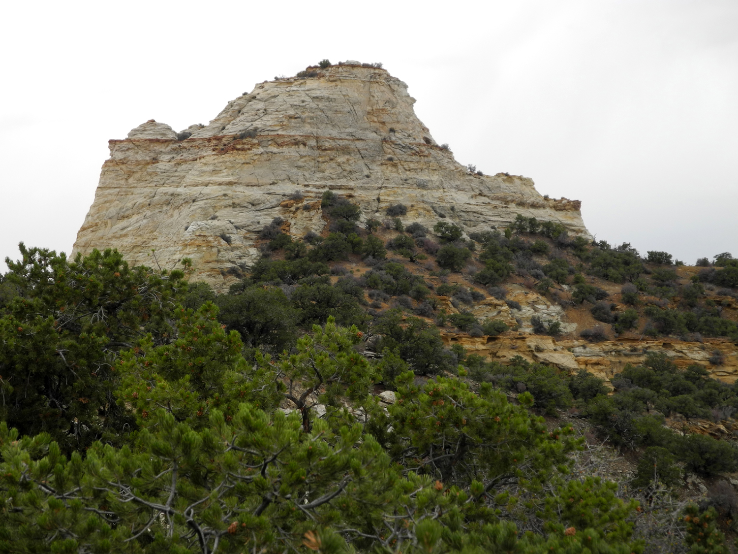
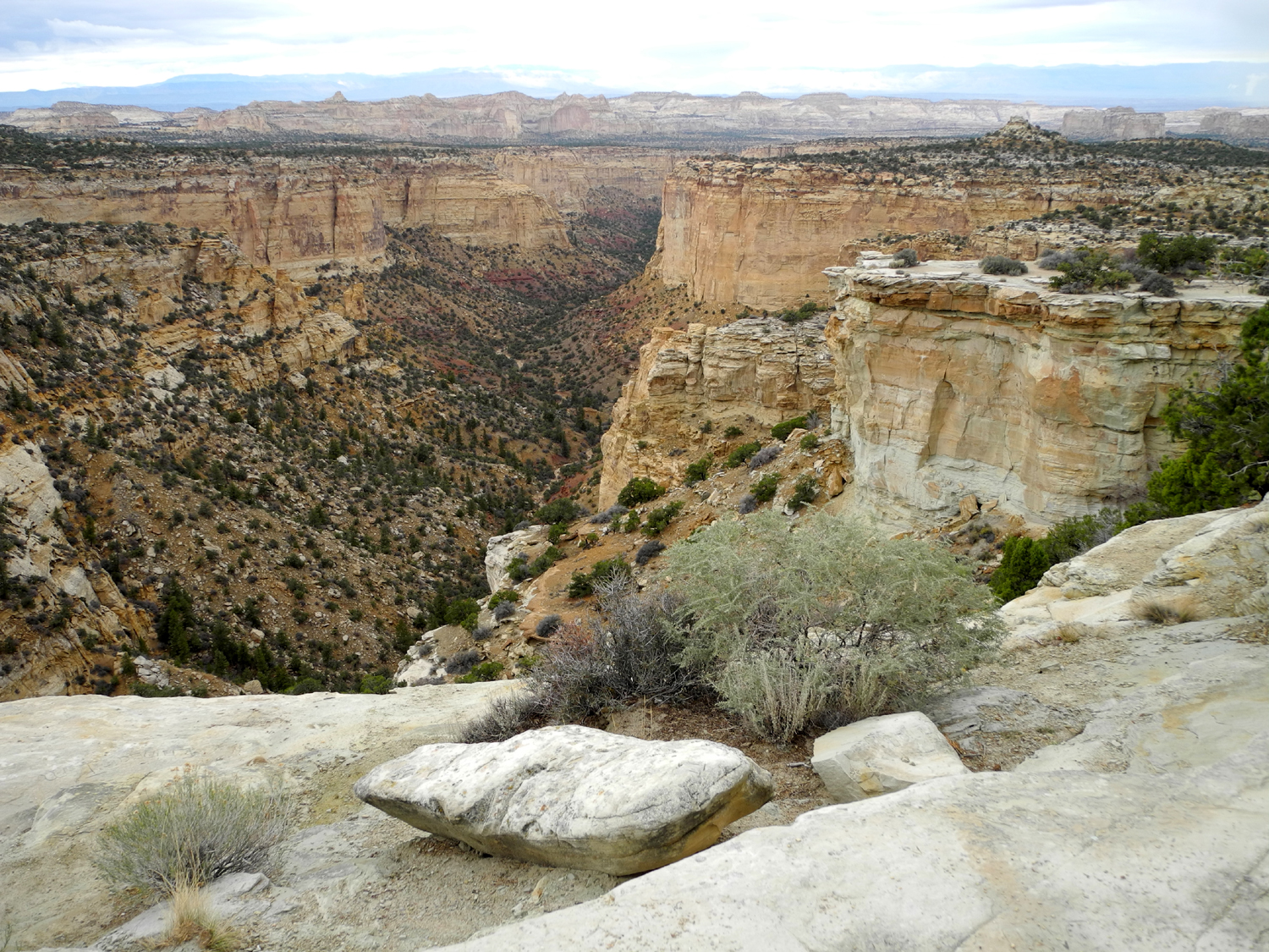
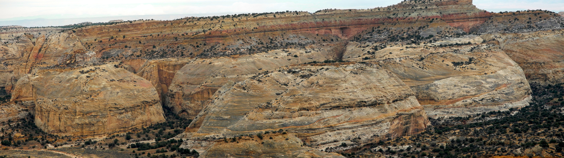
There are a
number of scenic viewpoint stops on I-70, mostly in the "no
services available" stretch between Utah Highway 10 and US 191.
We stopped at most of them. These areas are similar to what we saw
and would see in and near the national parks, but each is somewhat
different and each offers something new to enjoy.
Where 191
comes in from the north near Green River, Utah, it is contiguous
with I-70 for about 25 miles, then heads south to Moab, the final
leg of our journey. Besides the parks, the Moab area offers
opportunities for off road vehicles and bicycling, and fans of all
these choices seemed to be arriving in Moab at the same time we did
- Friday night at 5:30. Although the road to our final stop went
east from 191 before entering Moab proper, we needed gas, so we
drove slowly about a half mile to the first available station and
took care of that.
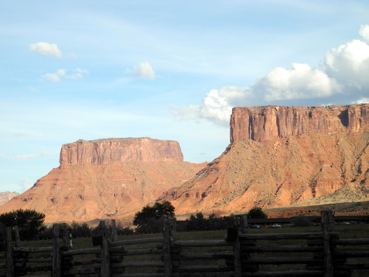
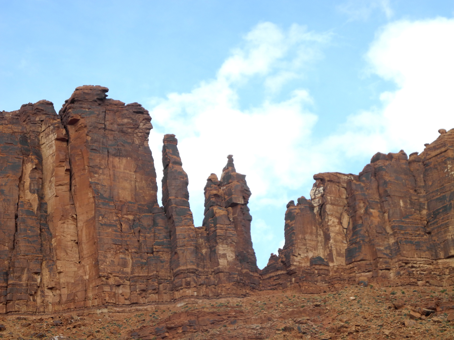
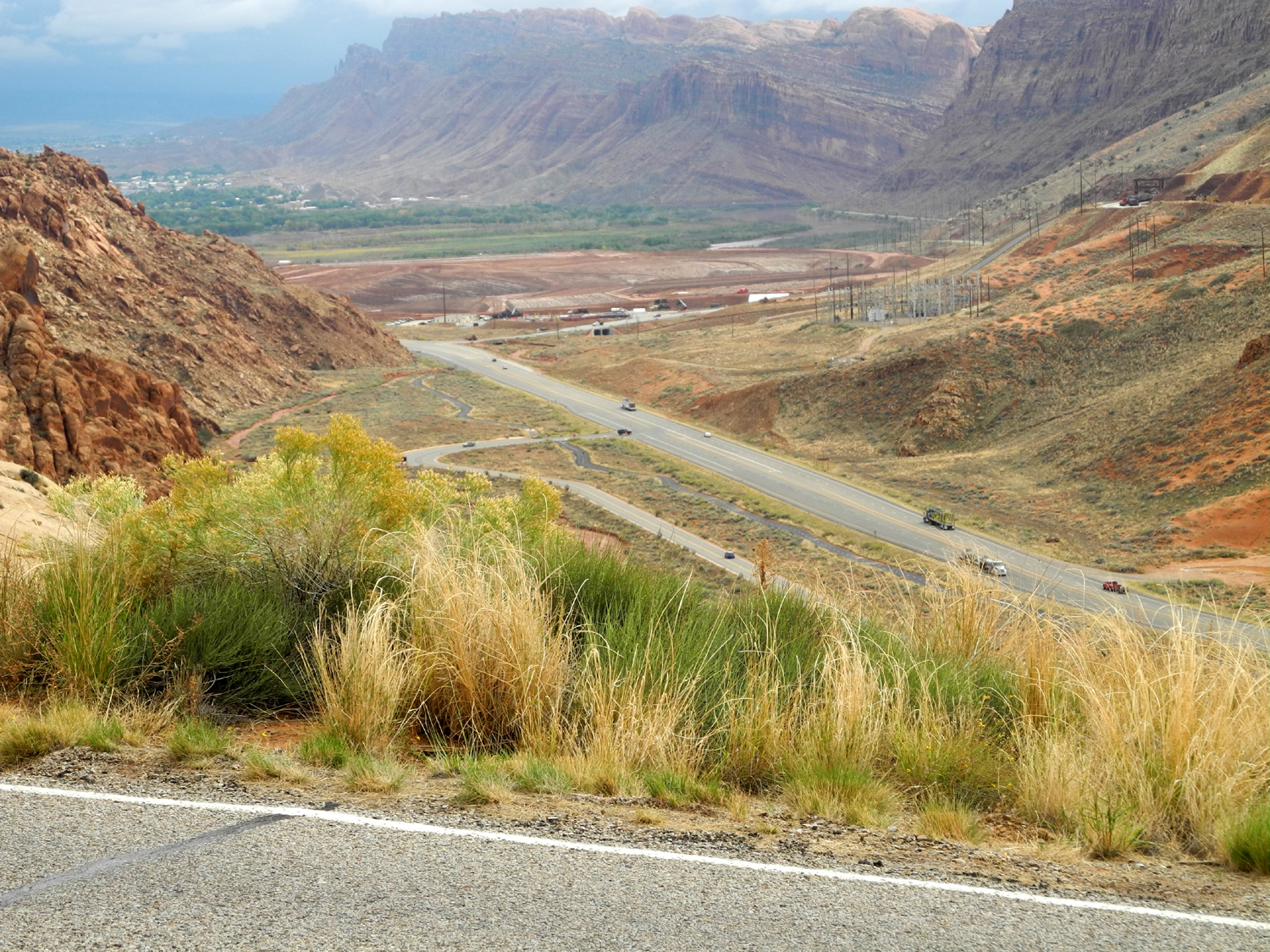
Back up the
road, we turned east at the Colorado River on Utah 128, heading for Red Cliffs Lodge, 14 miles up the canyon. Every bit of the way is
through a deep gorge, with red and white sandstone cliffs and many
dramatic rock
formations. The area around the lodge was more of the
same, looking like the perfect setting for a western movie. In fact,
the ranch where the lodge is located and the surrounding country
figured in many films, and somewhere close by is the cliff where
Thelma and Louise took their flying leap.
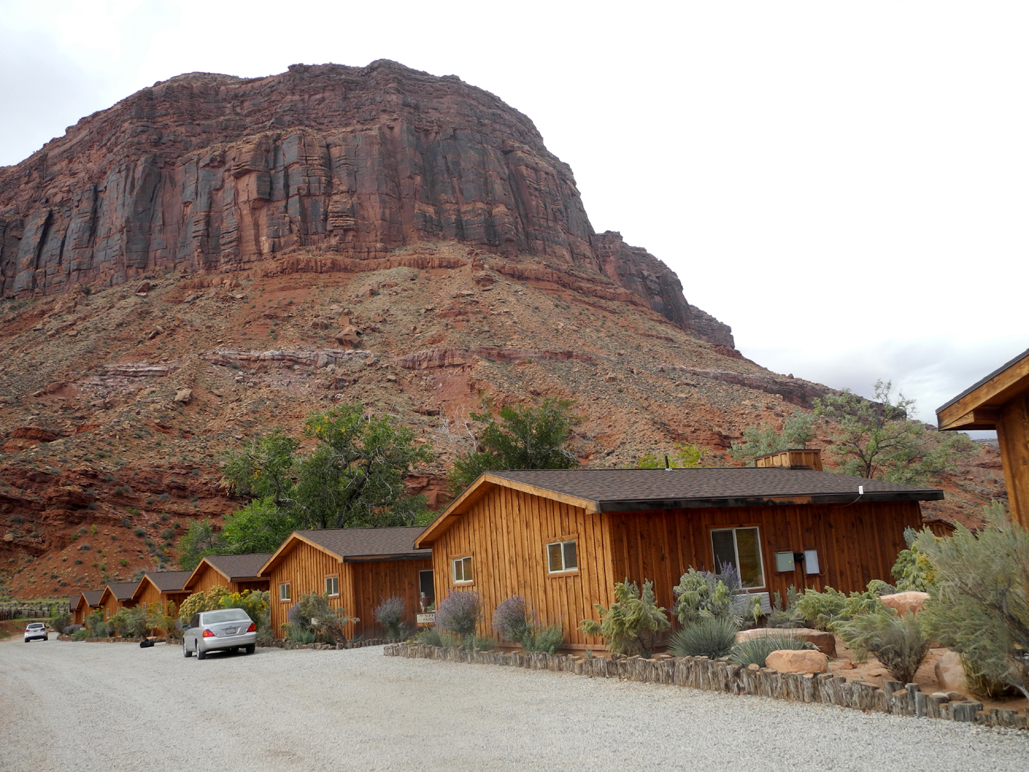
Our
accommodations here were much more comfortable than the cabin at
Grand Canyon - a large living room/kitchen, two bedrooms, patio
facing the river, and a kitchen with a microwave and small
refrigerator. Still no cooking allowed, but the patio provided
enough privacy in case we wanted to fire up the camp stove (I am NOT
admitting that we did).
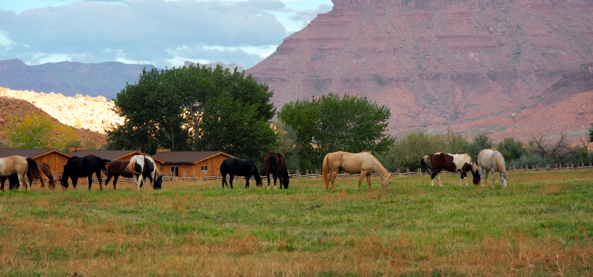
We were also
delighted to see a herd of horses in a large pasture across the
ranch road from us. They were sometimes shut in a corral at night,
but during the week we got several good looks and some photos.
I-70
Eastbound Photos
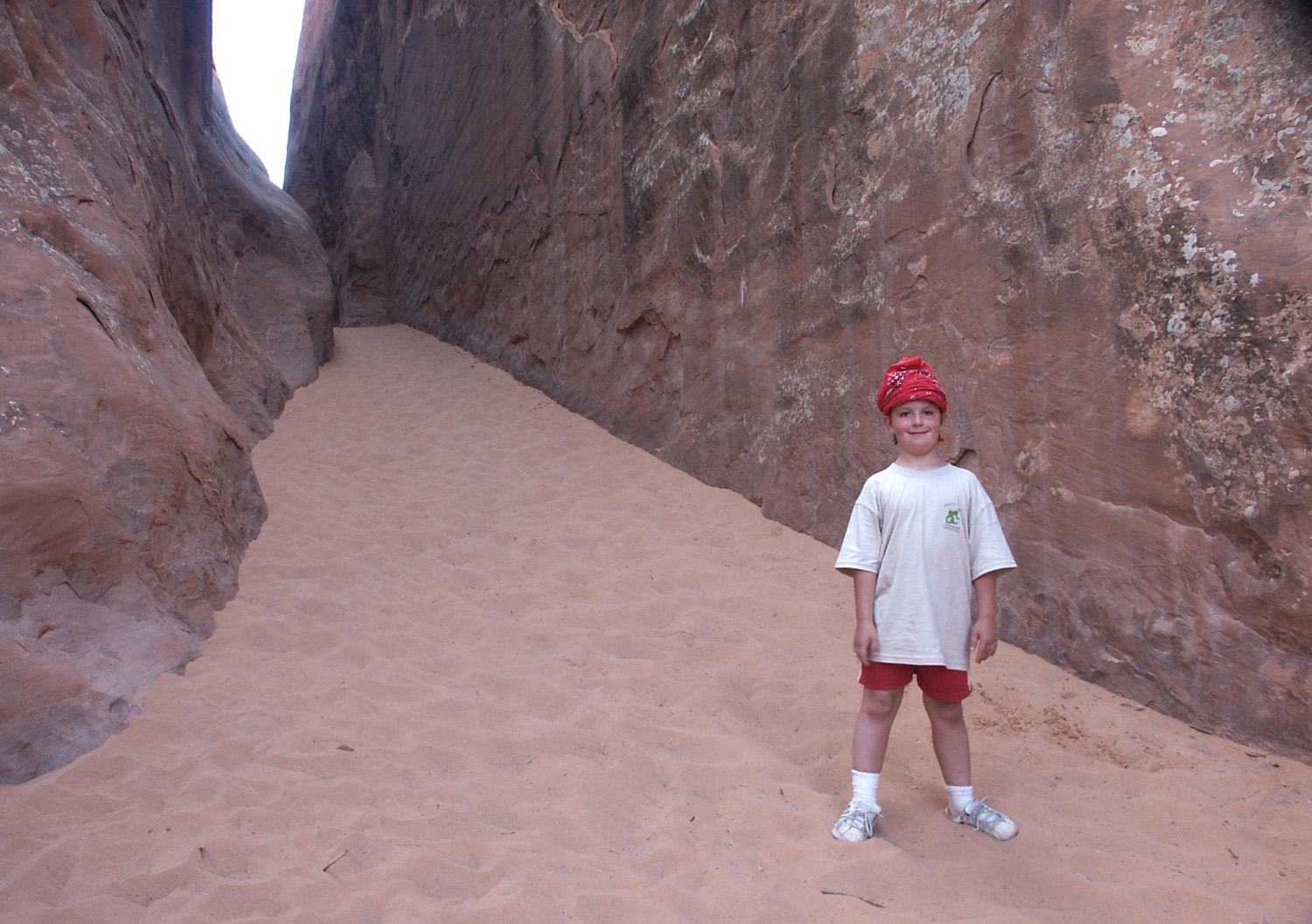
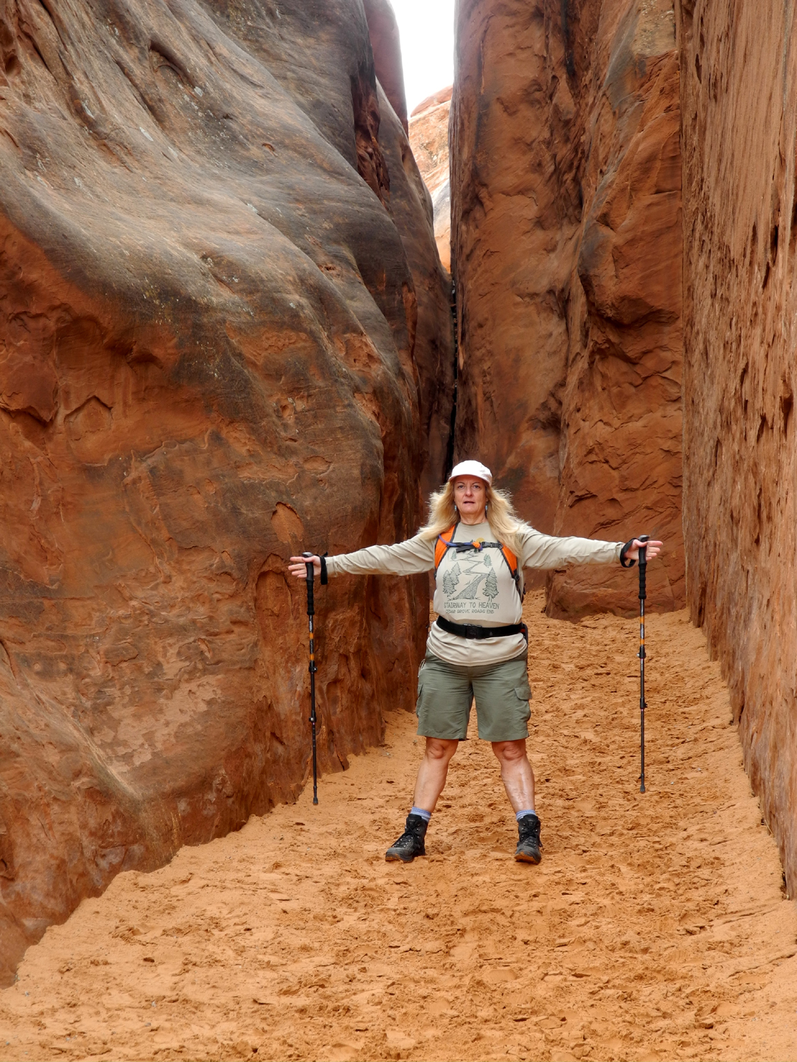
Arches Day 1
We got
settled in, unpacked our luggage, and enjoyed the view from the
patio, before getting to bed at an early hour. As the date for our
trip approached we had been looking at the web site for the parks,
and saw a warning for Arches that parking lots fill up early and
there are long lines at the entrance station. In addition, the
trailhead parking lot for the iconic Delicate Arch would be closing for repairs on Monday for several weeks. Therefore, we needed to
make that hike Saturday or Sunday, and getting there early would be
a good idea.
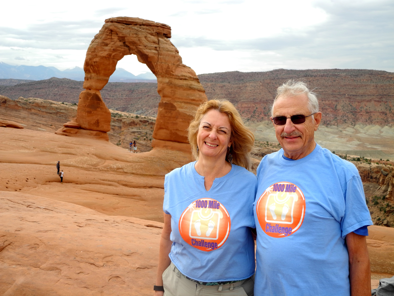
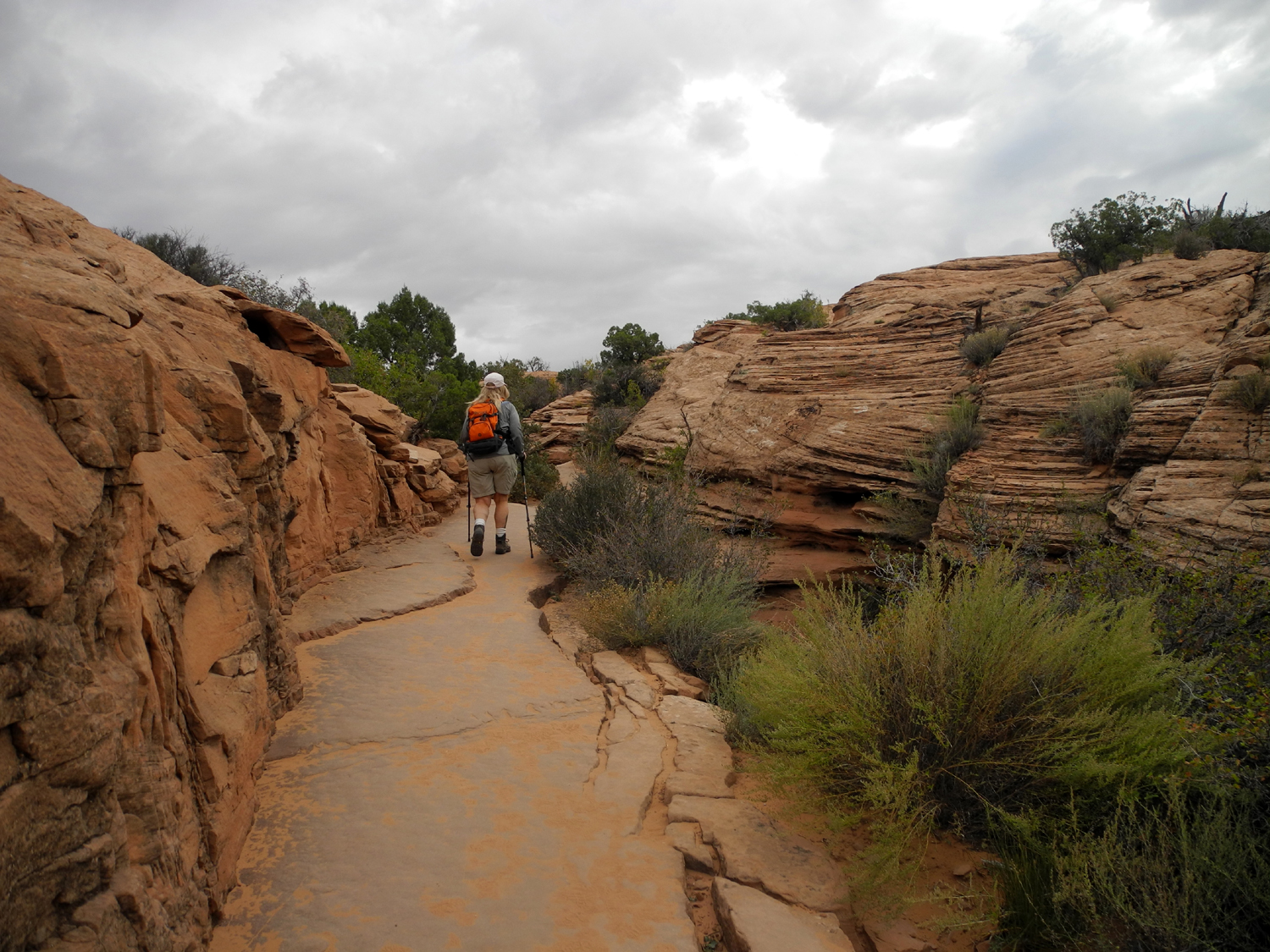
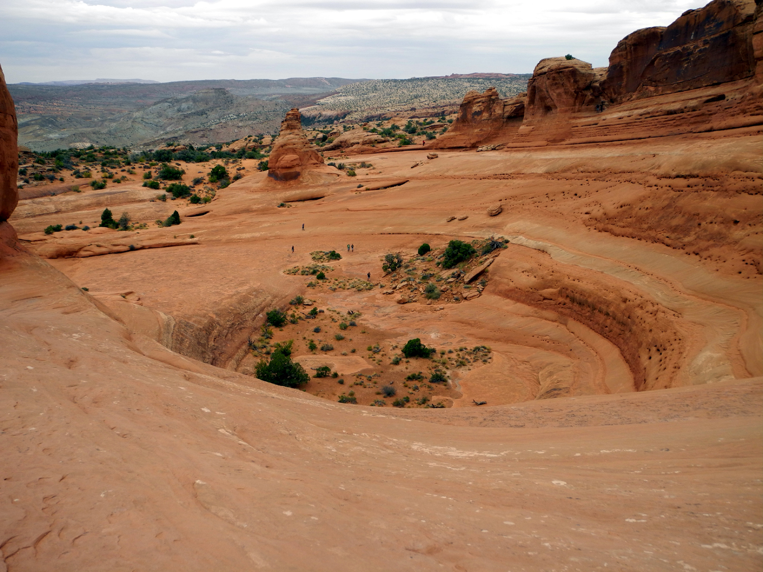
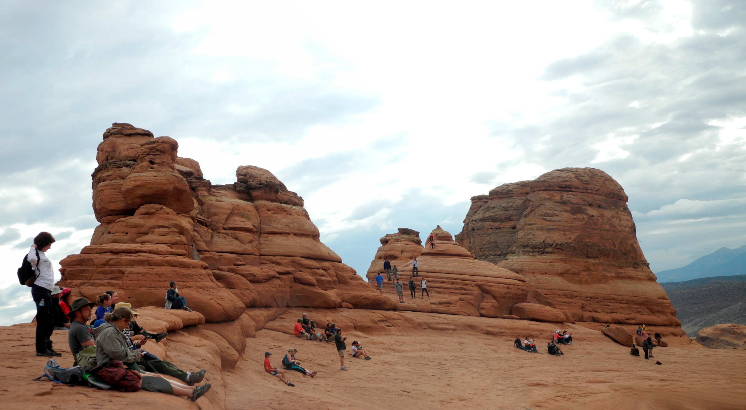
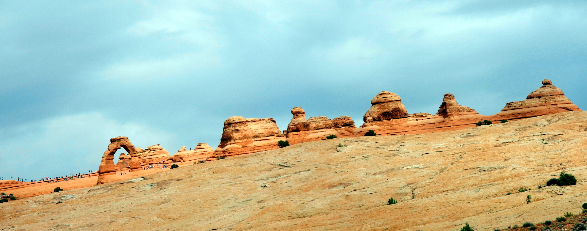
We got up
early, had breakfast, and drove the 20 miles to the park, then a few
more to the Delicate Arch trailhead. The main parking lot was about
half full, and an overflow lot was empty, but we were happy to be on the trail around
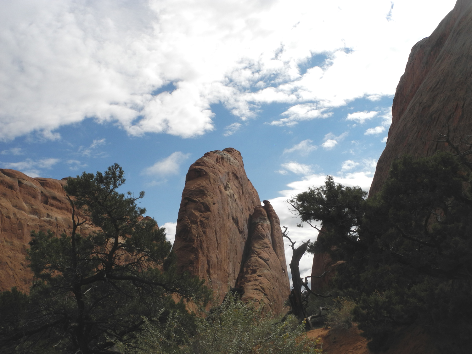
8:30. The trail, which I had hiked in 2002, is about a mile and a
half, mostly uphill, but not very steep. The first part goes up over
a ridge, then down and across a wash, and back up. After the first
half, much of the trail is on
sandstone, with rock cairns marking
the way. There are endless amazing views along the way, so we took
it easy, took lots of photos, and arrived at the arch after about 90
minutes.
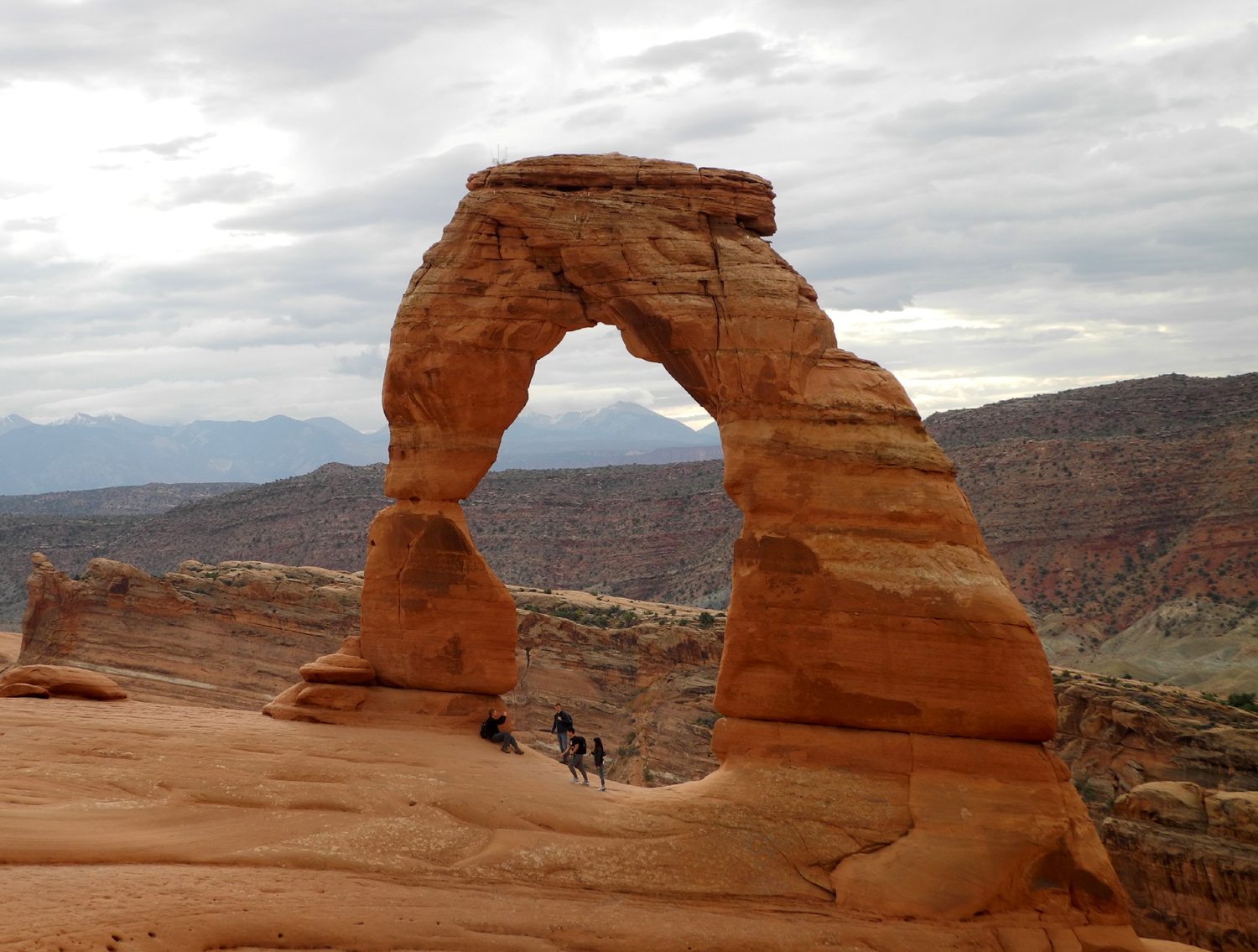
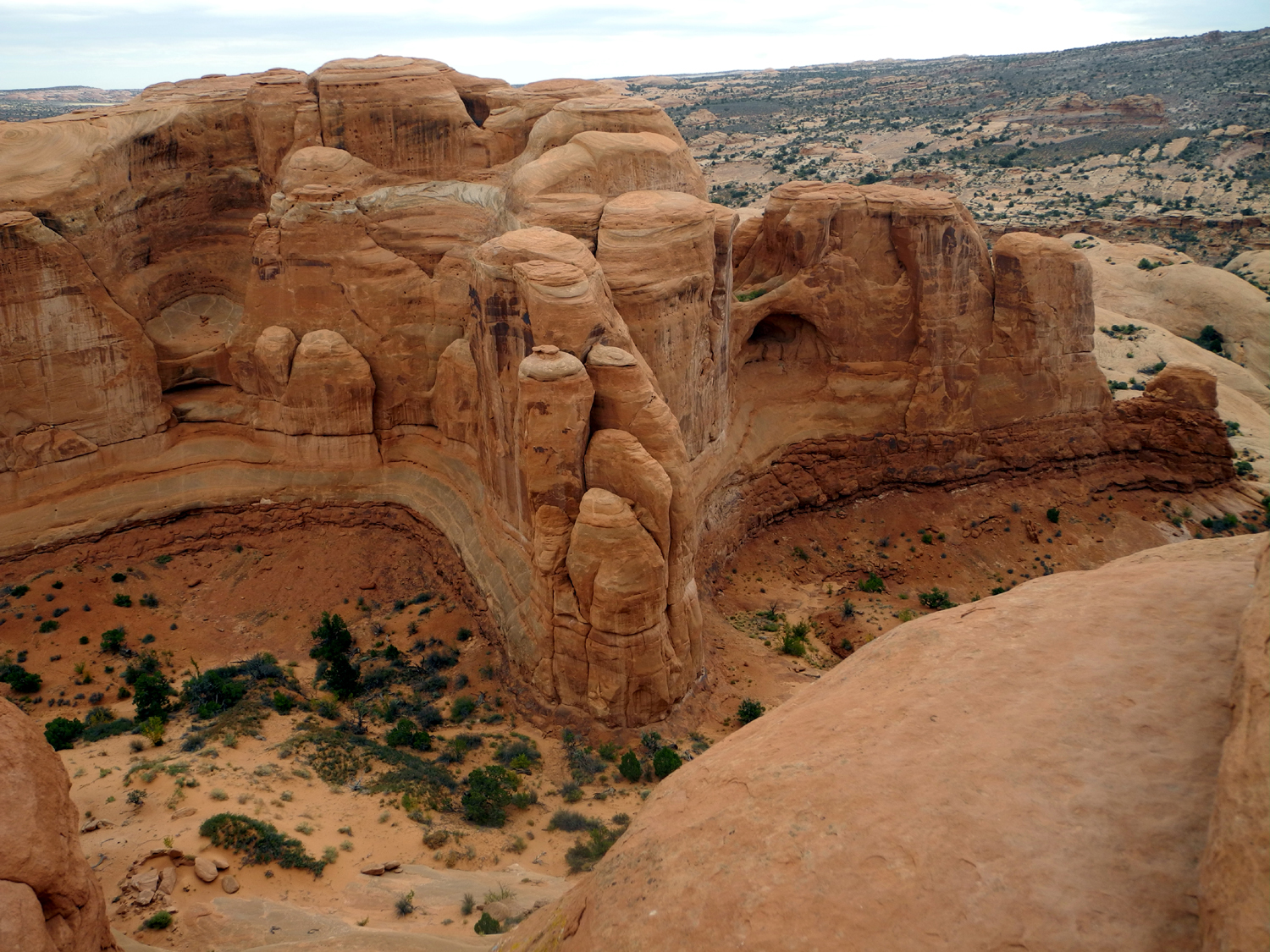
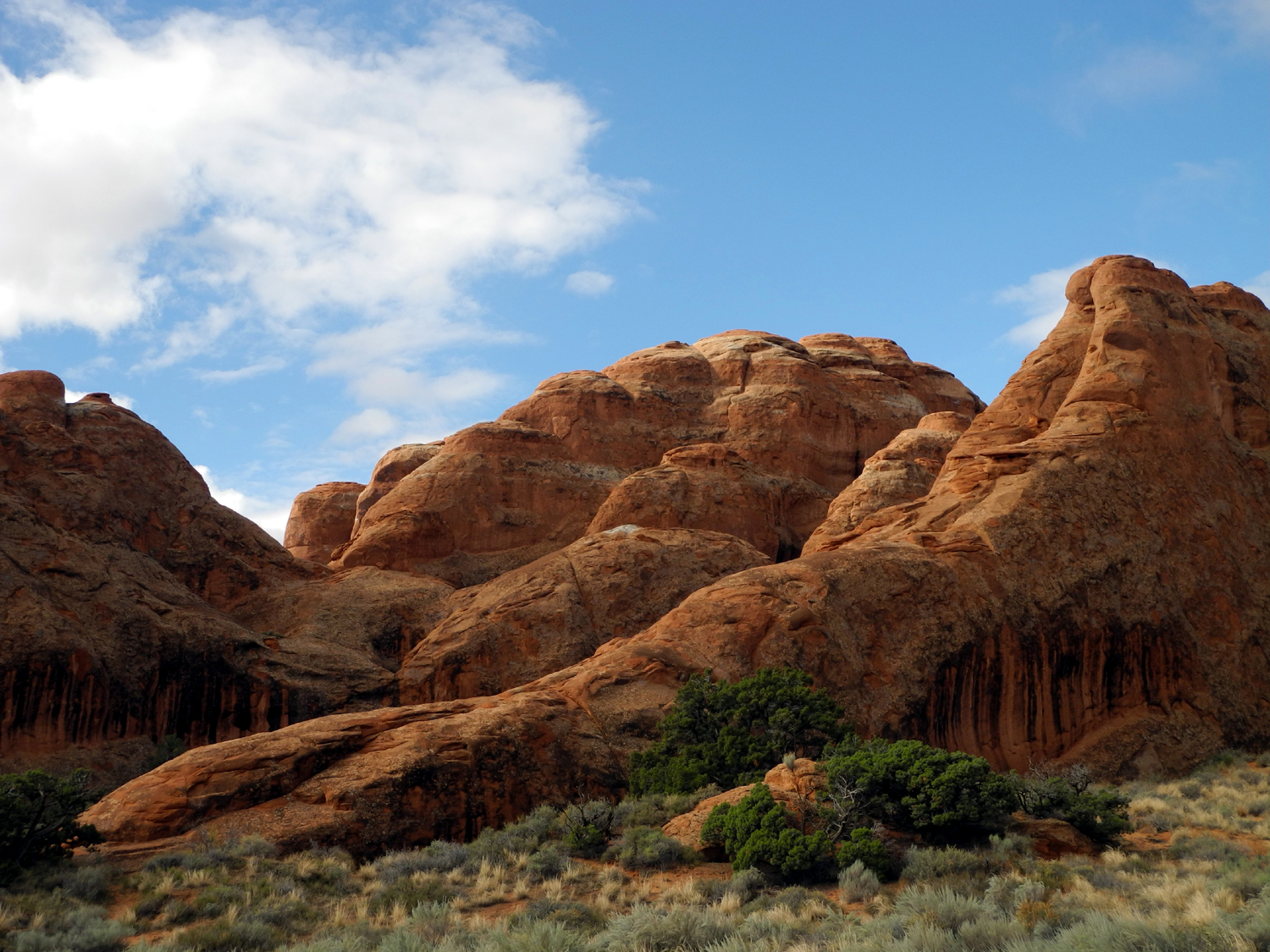
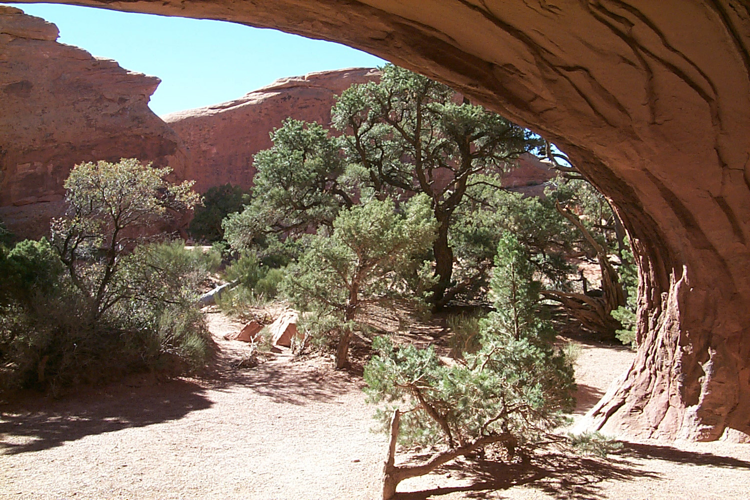
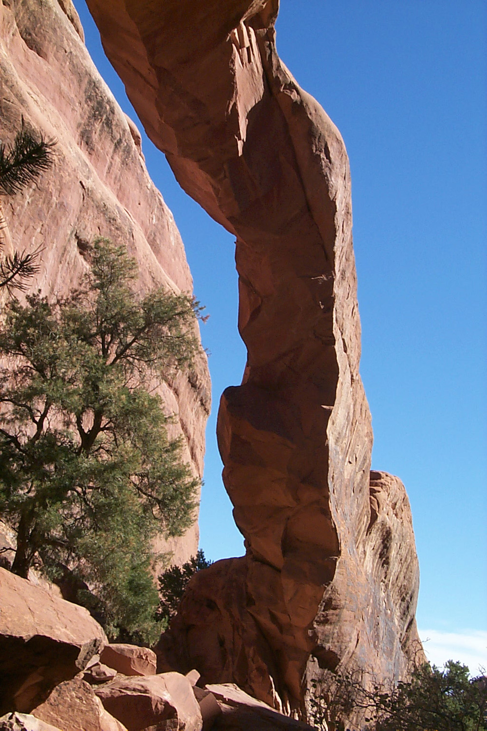
Delicate
Arch is familiar to many from its appearance on Utah's license
plates and as the official logo for the National Park Service early
in this century. It is perched on the edge of a cliff, with an
inverted cone shaped bowl next to it. There are no other named
arches nearby, but there are plenty of amazing sandstone formations,
especially along a wash that runs on the "back" side of
the arch, opposite the trail approach.
We probably
spent at least an hour there, taking pictures, getting our photos
taken with the arch, taking pictures for others so the entire group
could be in the photo, and walking around the area. It's fairly easy
to walk around from where the trail comes in to the arch. All of the
walking area is solid sandstone, slightly tilted in spots, and
usually fairly narrow. We went to the arch and under it, but there
were people going to the far side and down below, places where Teri
and I did not feel comfortable walking. We had wonderful views from
the places we did go.
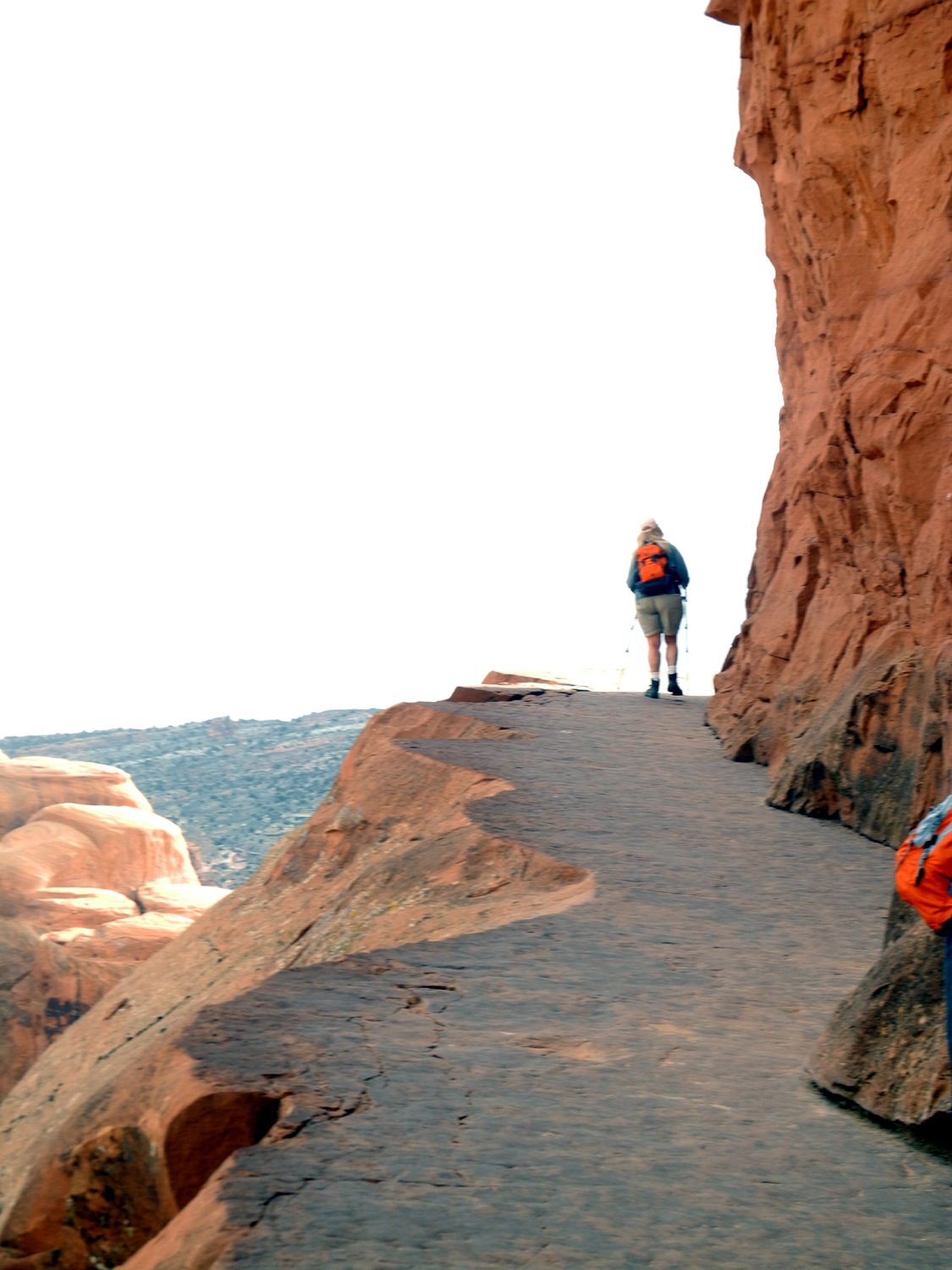
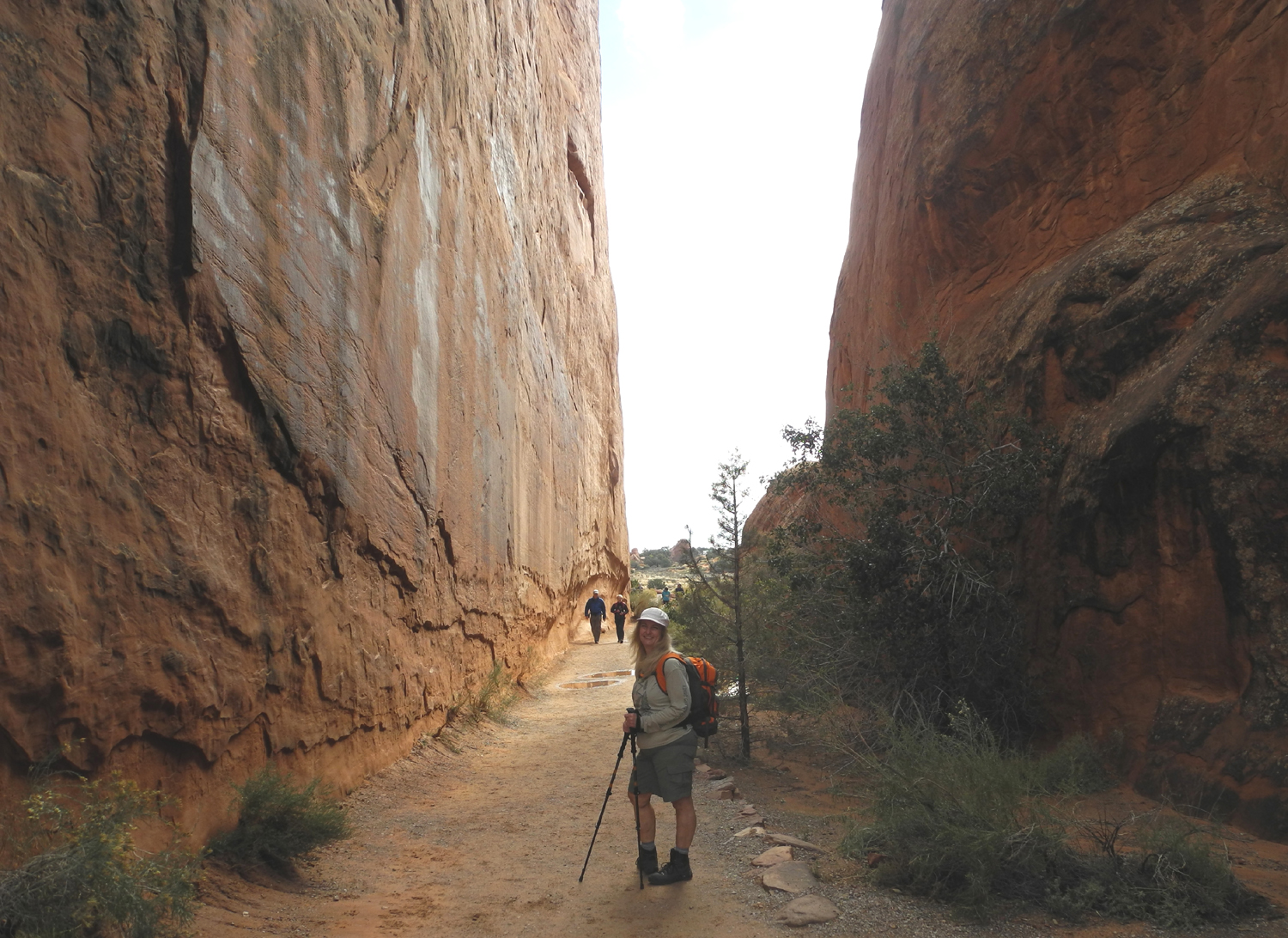
Eventually
we had to take a last look, and start back down the trail. Although we
saw a lot of people on the trail going up, and there were several dozen at
the arch at any one time, the real crowds were
going up the trail
as we went down. When we were able to get a view of the parking lot
from above, the wisdom of our early departure was revealed - both
the main lot and the overflow lot were essentially full.
The road to
the parking lot continues on another half mile or so to a place
where the arch can be seen without hiking. There is a half mile
trail up to a ridge directly across from the arch, but we were not
ready for anymore walking. Instead we took the 700 foot trail that
leads to the view, and got our final look at the centerpiece of Arches
National Park.
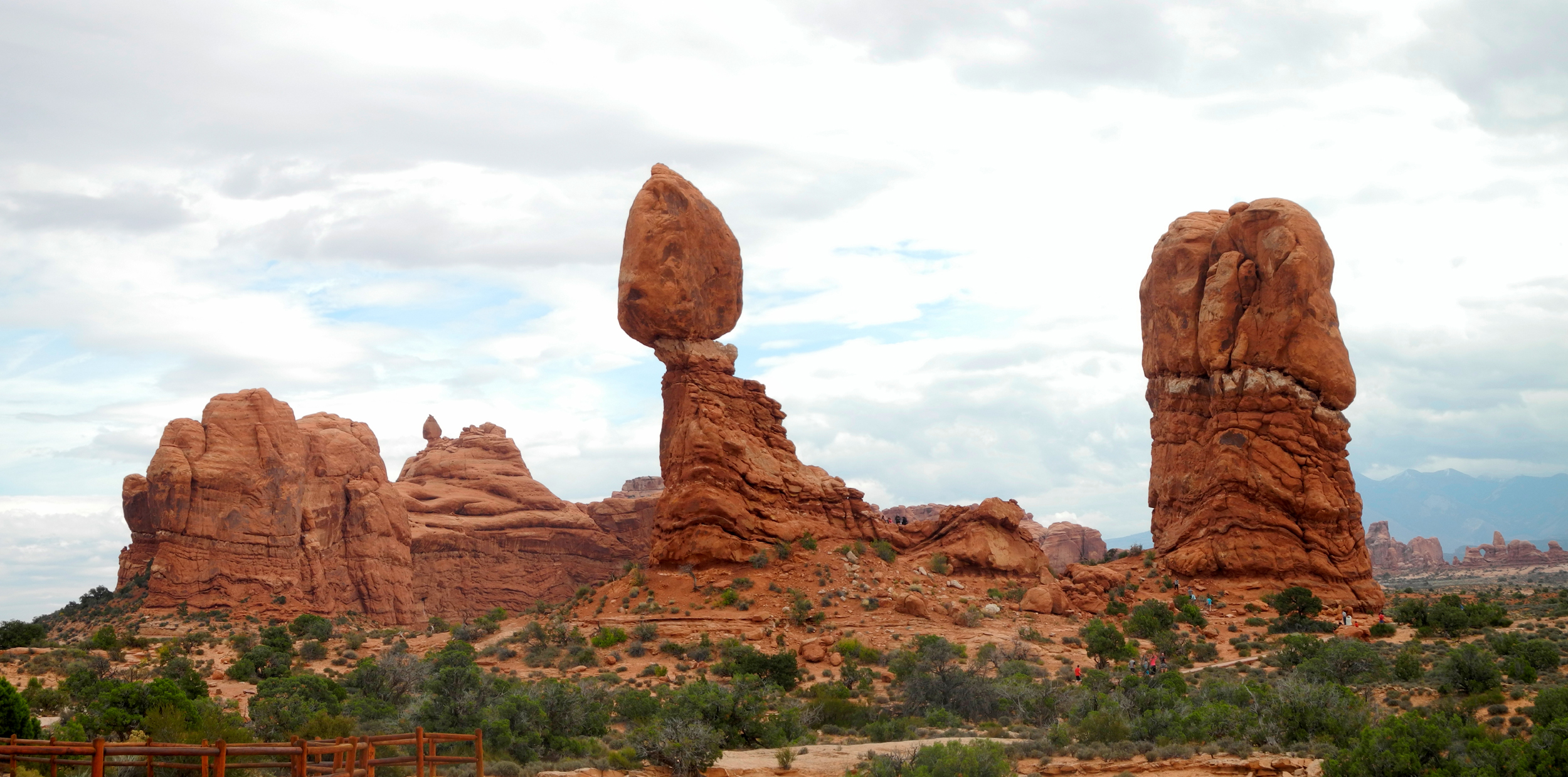
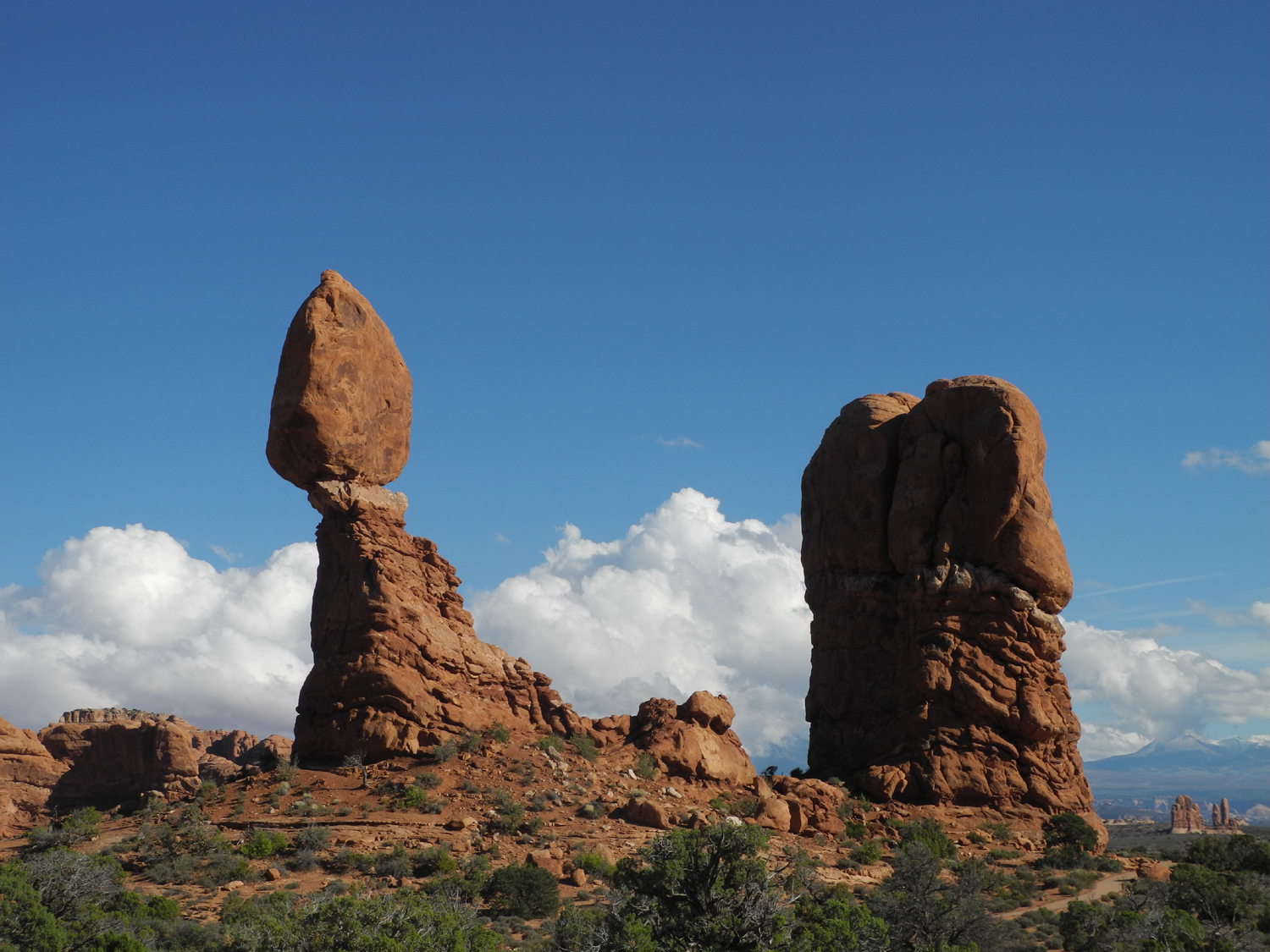
Driving back
out to the park entrance, we stopped at Panorama Point, where we had
a view into the Salt Valley, which runs across several miles of the
park, as well as a distant look at Balanced Rock. Continuing on out
the road, we stopped briefly at this dramatic rock
formation, but
decided to wait till another day to take the trail around it.
We made two
more stops. At Petrified Dunes Vista you look over an expanse of
rounded sand dunes that have been cemented together over the years,
but our attention was drawn by the great wall of sandstone that
parallels the road for a mile or two opposite the dunes. Finally we
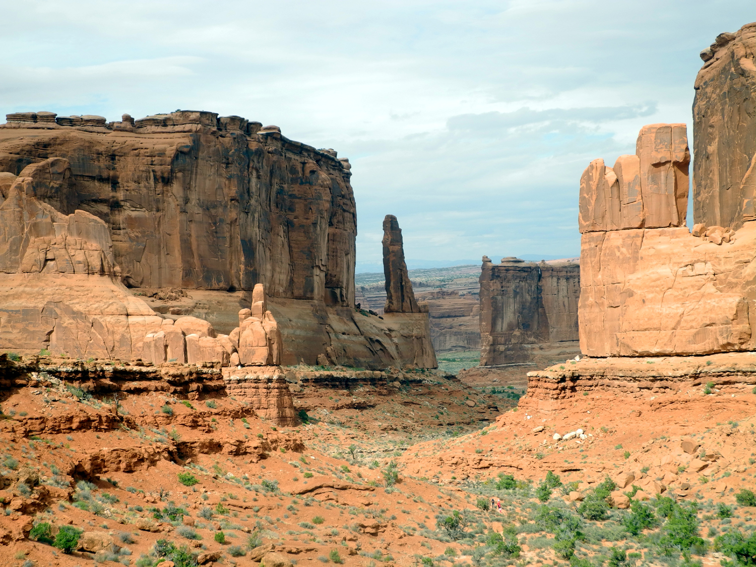
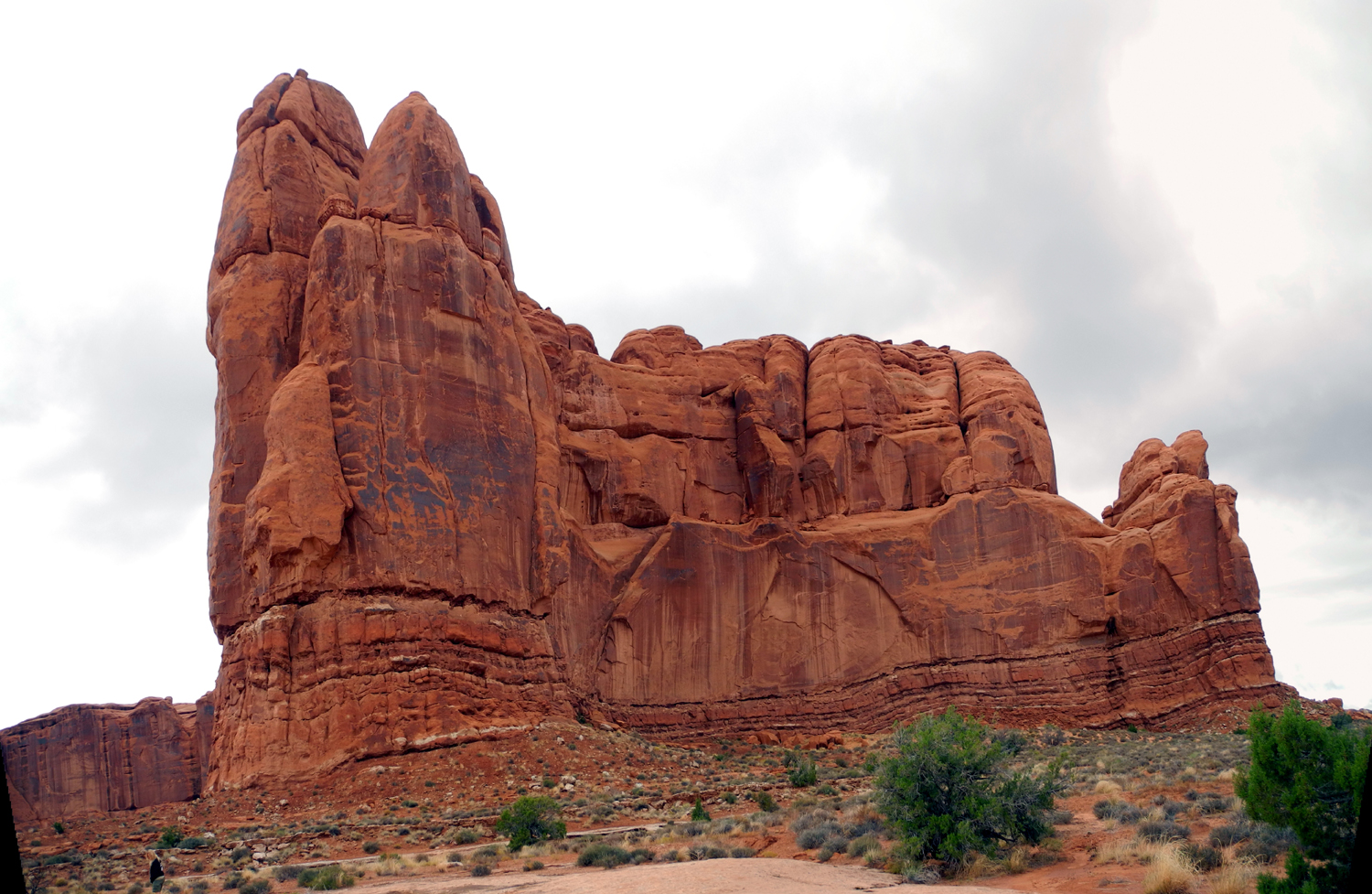
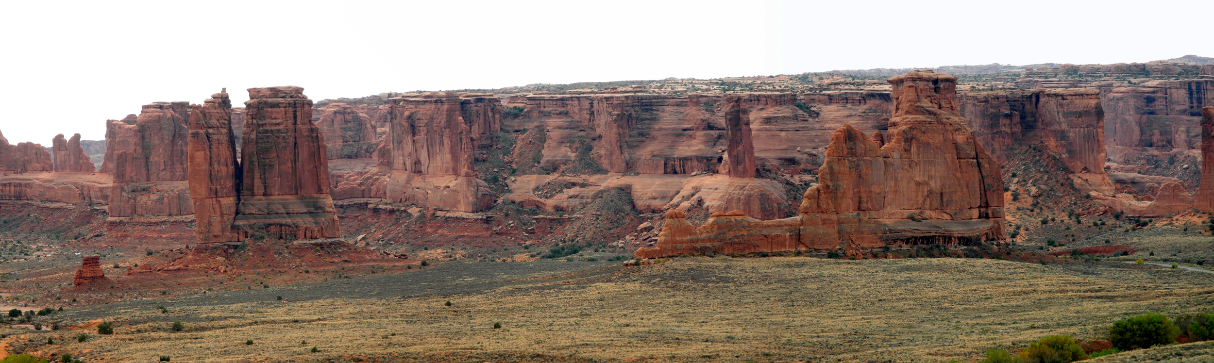
pulled into the parking lot at Park Avenue. Here rock formations
give the impression of a row of buildings perched on a wall of
sandstone that runs down into a valley. There are also other
fantastic formations in the area, and a one-mile hiking trail down
the valley.
When we
neared the park entrance, we stopped at the visitor center to read
information and see displays relating to the history and geology of
the region. I also added an Arches National Park shirt to my excessive
collection of t-shirts.
It should be
noted that, while there were plenty of people and cars in the park,
we found a parking place everywhere we went, and the lines at the
entrance station were only three or four cars long.
That
night there were a few sprinkles, but it was nice the next day. We
still had four days in this area, with plans for two more visits to
Arches, and one to Canyonlands. Activities for the fourth day were
left open, which worked out well. The terrible act of setting an
alarm during vacation, our early start, and a fairly strenuous hike
convinced us to spend the next day around the lodge. The property is
quite large, and we did a couple of good walks, although nothing
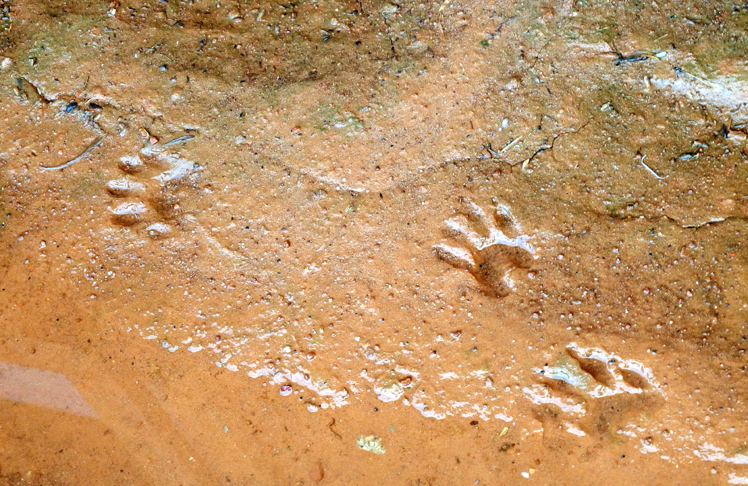
that could be called a hike. When we first went out, we saw raccoon
tracks in the dirt right next to the cabin, but we never saw the
perpetrators.
We
read, napped, watched the river, and just generally enjoyed our
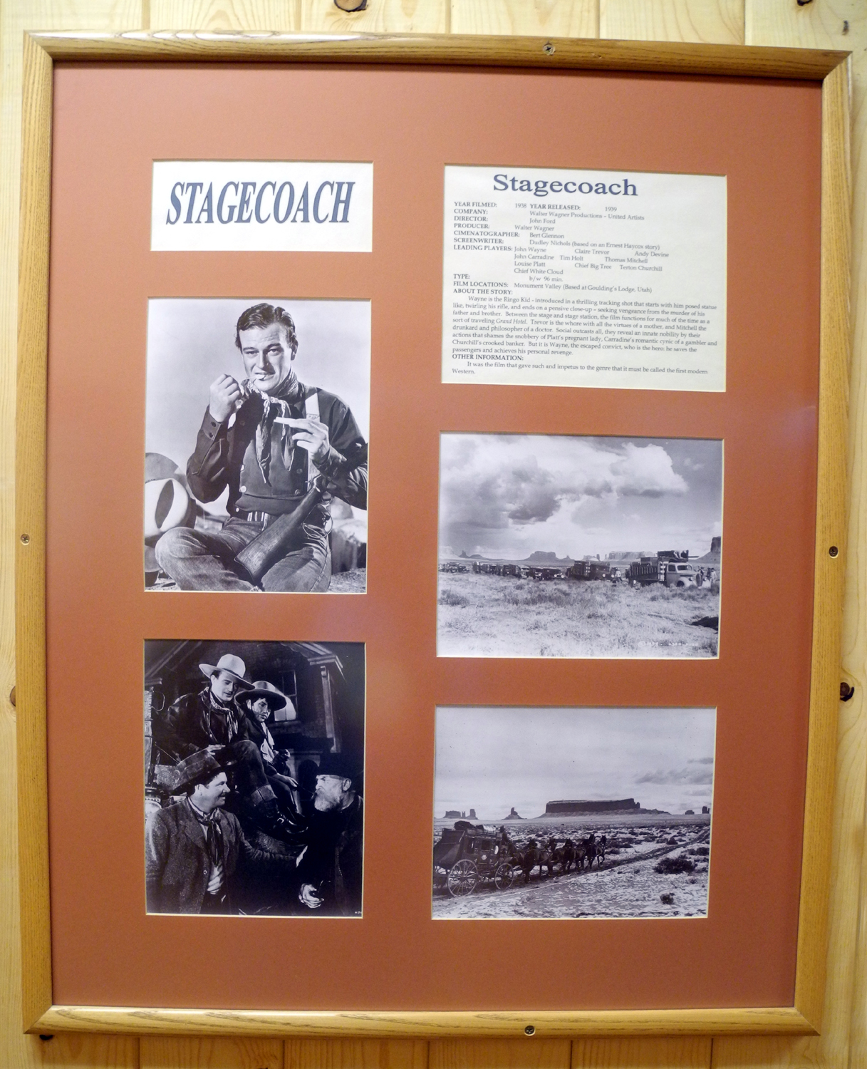
surroundings. On one of our walks we visited the movie museum at the
lodge. This is an excellent facility, with photos and information
about movies filmed in the area. The museum focuses on all of
southeastern Utah and the Four Corners area, which includes Monument
Valley, famed director John Ford's favorite location. Displays
include a number of original movie posters, including Stagecoach, the
film that made John Wayne a star.
Late
in the afternoon Teri realized she needed to get a new supply of the
decongestant she is using, something that can be purchased over the
counter, but only at a pharmacy, so we drove into Moab. It turned
out that neither of the town's two pharmacies is open on Sunday, so
we got some groceries, and did some souvenir shopping. Teri got
t-shirts for her husband Tim, and son Mikie; I got shirts for my
great grandsons Colton and Jack.
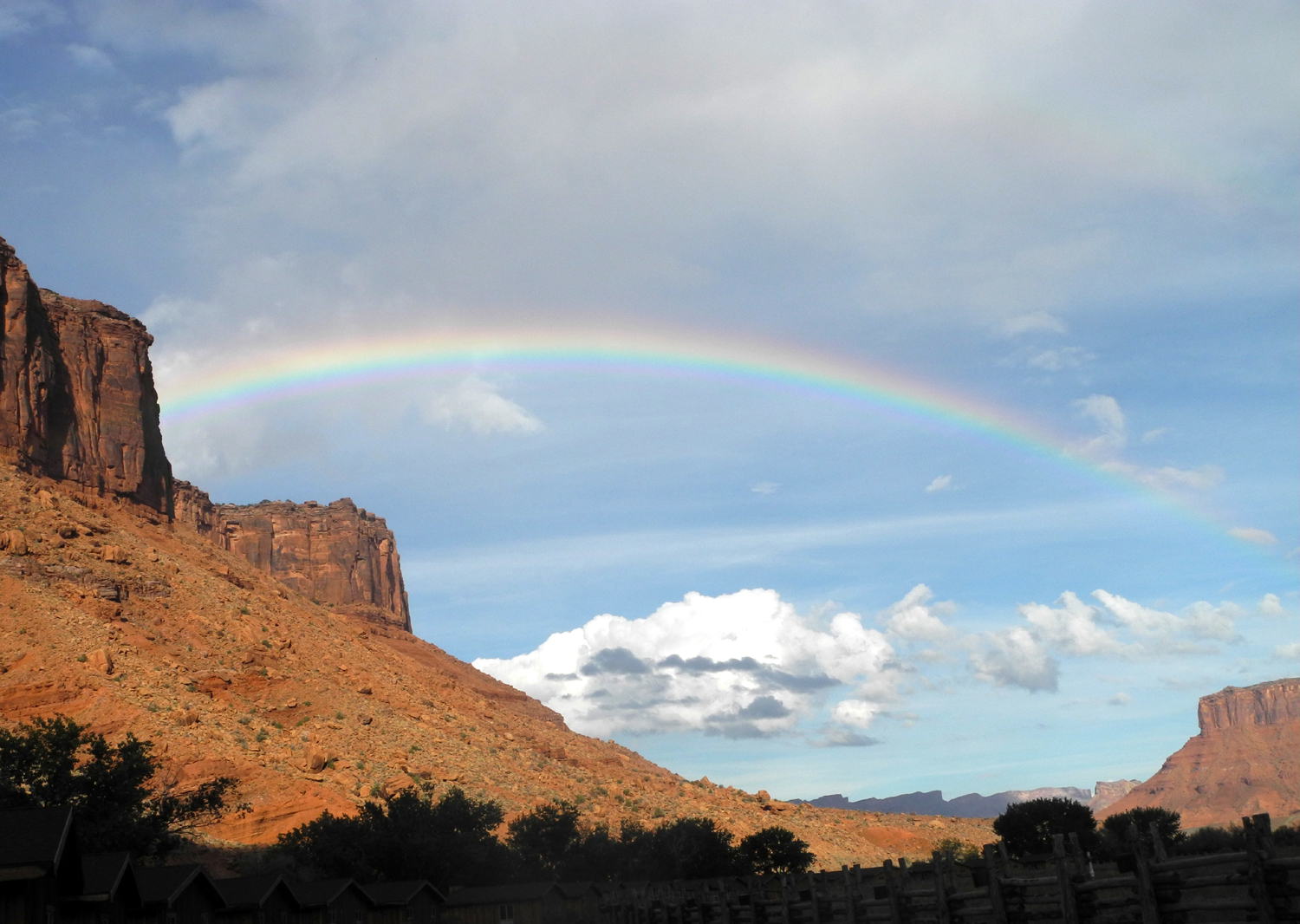
We
returned to the lodge, where Teri fixed a delicious fajita dinner.
We had rain going to and coming from town, and not long after our
return we stepped outside to discover a rainbow over the sandstone
cliffs.
The next day
was our day to see as many of the arches and other features as we
could, but limiting ourselves to short hikes. This was no problem,
since the Windows Section offers four major named arches, all
visible from the road, but all better enjoyed by taking the short
trails that give you a closer look. In addition, the road beyond the
turnoff to Delicate Arch has another three short trails to
significant arches.
Arches Day
1 Photos
About The
Arches
At this point I'd like to digress and offer some general
comments about arches, and mention some of the more significant
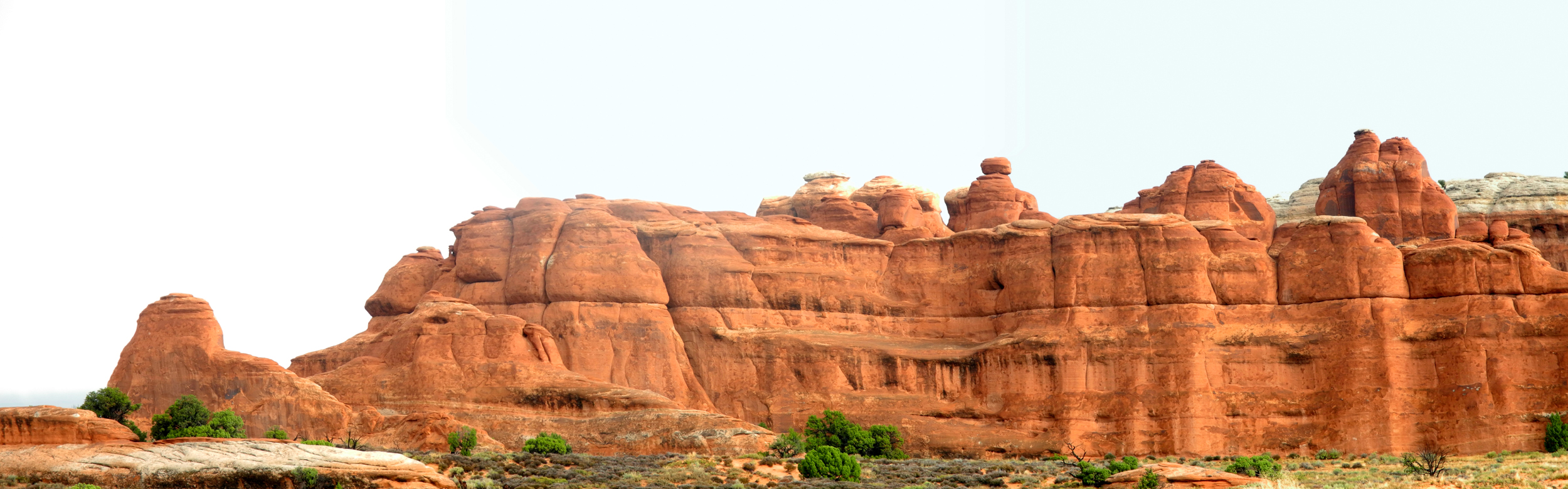
ones. With the greatest concentration of natural stone arches
in the world, Arches National Park contains over 2,000 arches.
Needless to say, no visitor sees all of them, and even if you were
willing and able to hike over every foot of the park, you could
easily miss some of them.
In the past
there was discussion over what constituted an arch, and whether an
opening was an arch, a bridge, a window, or just a hole in the rock.
A definition was established - an arch must be at least three feet
in any one direction. With no requirement as to width, there are
some very narrow arches where you have to put your eye right up to
the rock to see light through them.
Natural
bridges are formed by water, and span a current or former waterway.
There's no official definition for windows, but the term often
defines an arch high up in a narrow fin of rock, or an opening that
frames a particular scene.
With someone
to drive and someone to look around at the scenery, Teri and I saw a
number of arches that I had not noticed when I drove past them on my
previous visits. We also saw most of the major named arches in the
park. Delicate Arch is probably the best known, and it's certainly
scenic, but we enjoyed some others just as much. Delicate Arch is kind of
off by itself, with only a few small nameless arches nearby.
In the
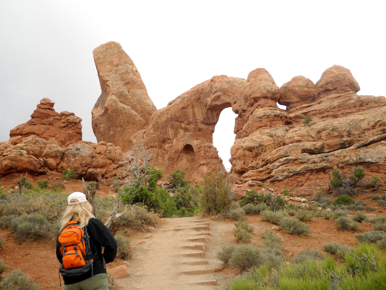
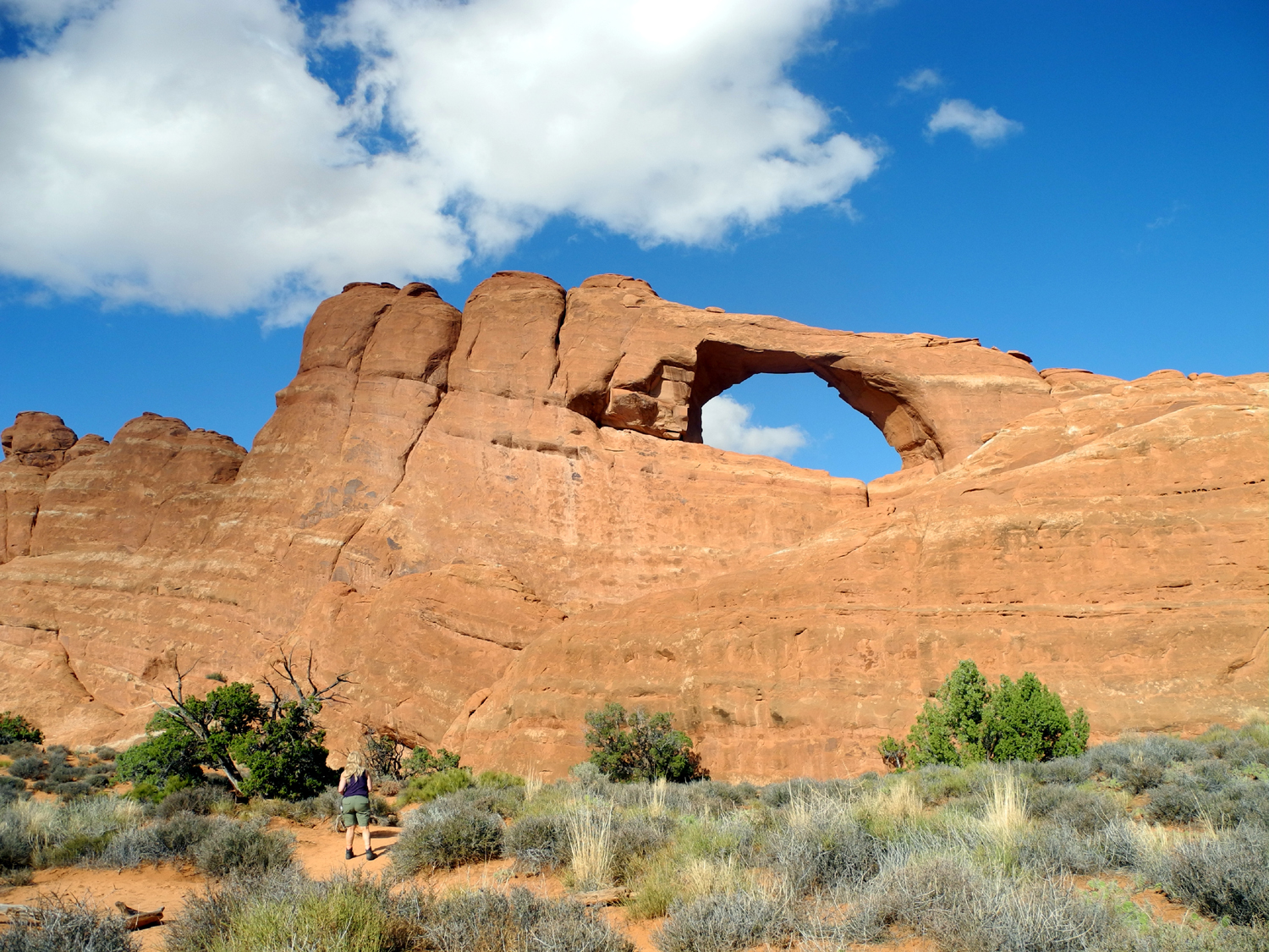
Windows Area there are several major arches: North and South Window,
Turret Arch, and Double Arch. You can see all these arches driving
by in a car, but taking the short trails for a close-up look is very
much worth the effort. There are several other nameless lesser
arches visible in this location.
Along the
road beyond the turnoff to Delicate Arch are three major arches, one
visible from the road, and all reached via short trails. We visited
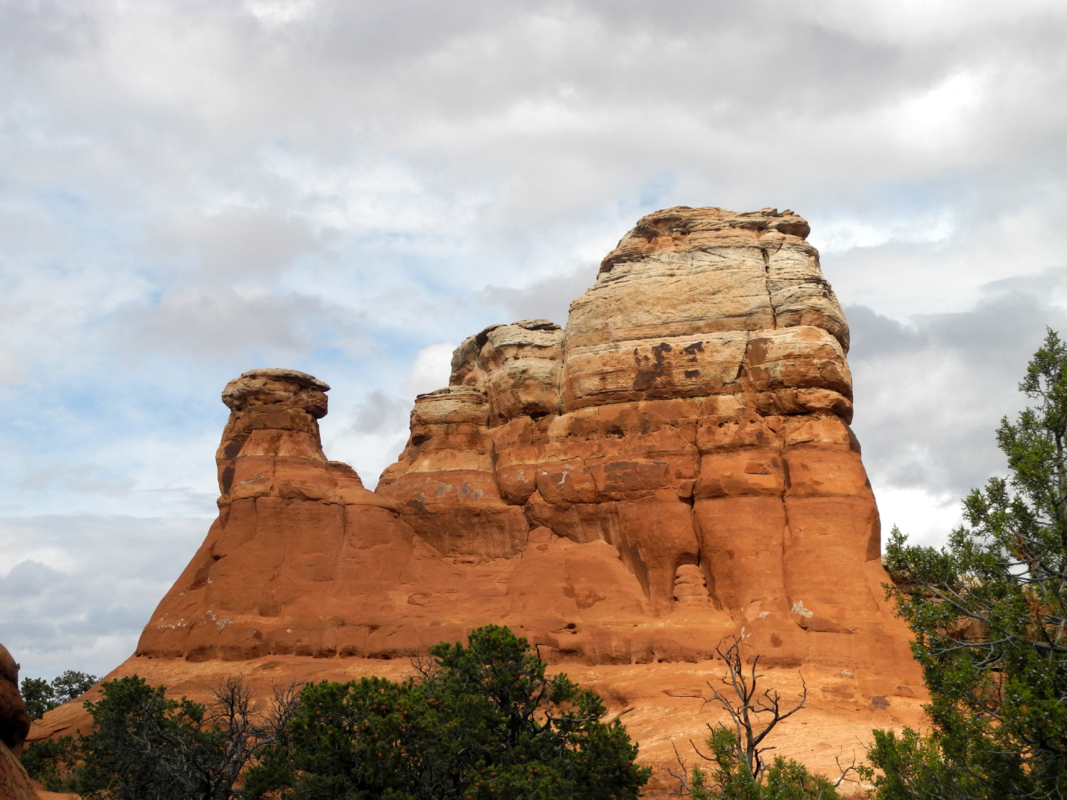
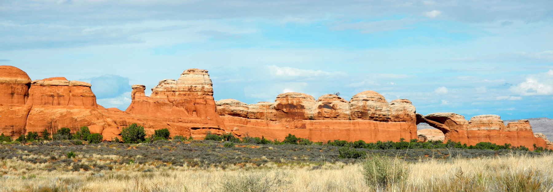
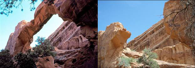
all three, Sand Dune, Broken, and Skyline Arch. Demonstrating that
the earth is not a finished product, the latter arch doubled in size
in 1940 when tons of rock fell from one side of the existing
opening.
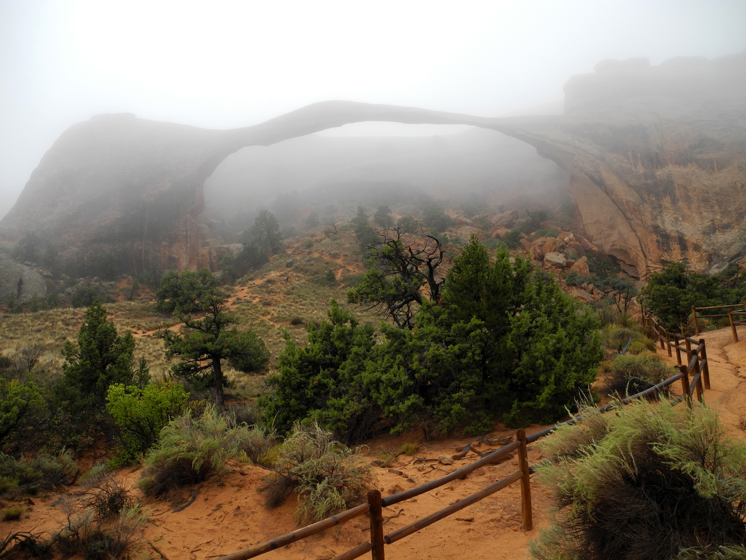
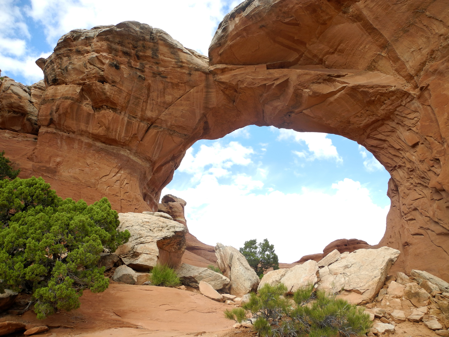
On the
Devil's Garden Trail, which starts from the end of the road, you can
see the longest arch in the park, Landscape Arch, a rather thin span
the length of a football field. Side trails off the main path lead
to Tunnel Arch, Pine Tree Arch, Navajo
Arch, and Partition Arch. The
latter can be seen at an angle from the trail near Landscape Arch.
The trail also leads to Double O and Private Arches, which we did
not visit and which I have never seen. Landscape Arch also has had
recent rock falls since 1990, one of them witnessed and
photographed. Along the trail to Double O is the remains of Wall
Arch, which was standing when I visited in 2002 and 2004, but which
collapsed several years ago. (Rainbow
Arch, a small feature just above the visitor center, collapsed
some time during the winter of 2017-18.)
One of the
best arches is also one of the most difficult to get to, requiring a
drive of about seven miles on a rough dirt road, and a three mile
round trip hike. I made the journey to Tower Arch in 2002, but we
did not have the time or the inclination to take Teri's Toyota
Avalon on that road.
Red Cliffs
Lodge & Colorado River Photos
Arches Day 2
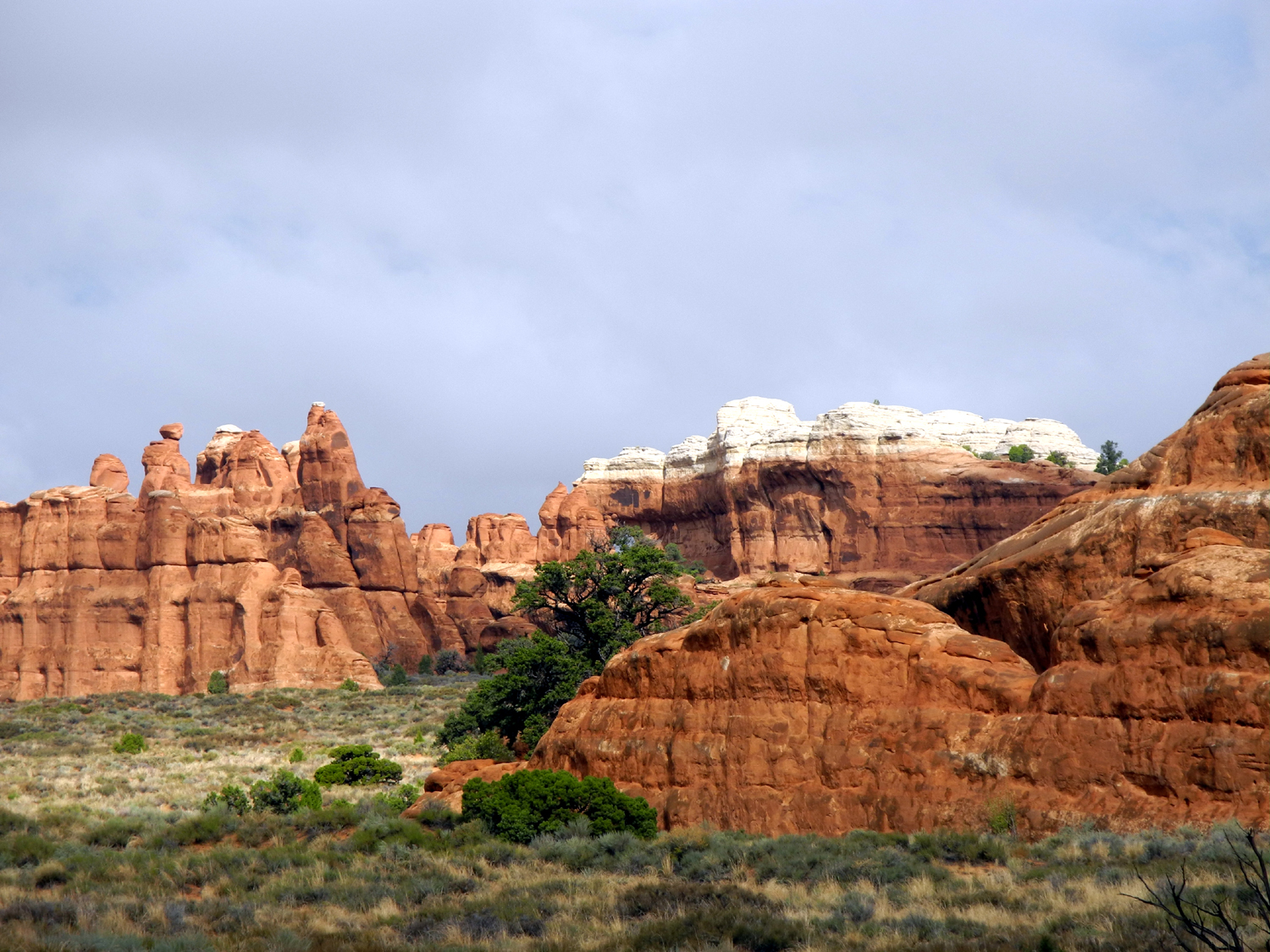
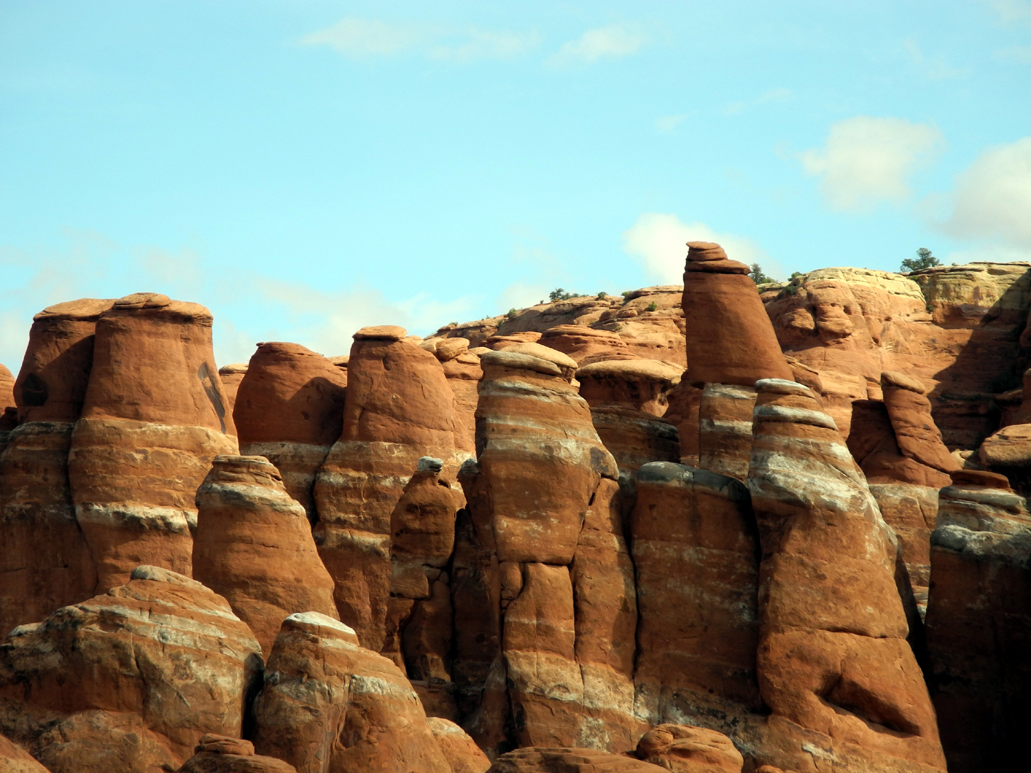
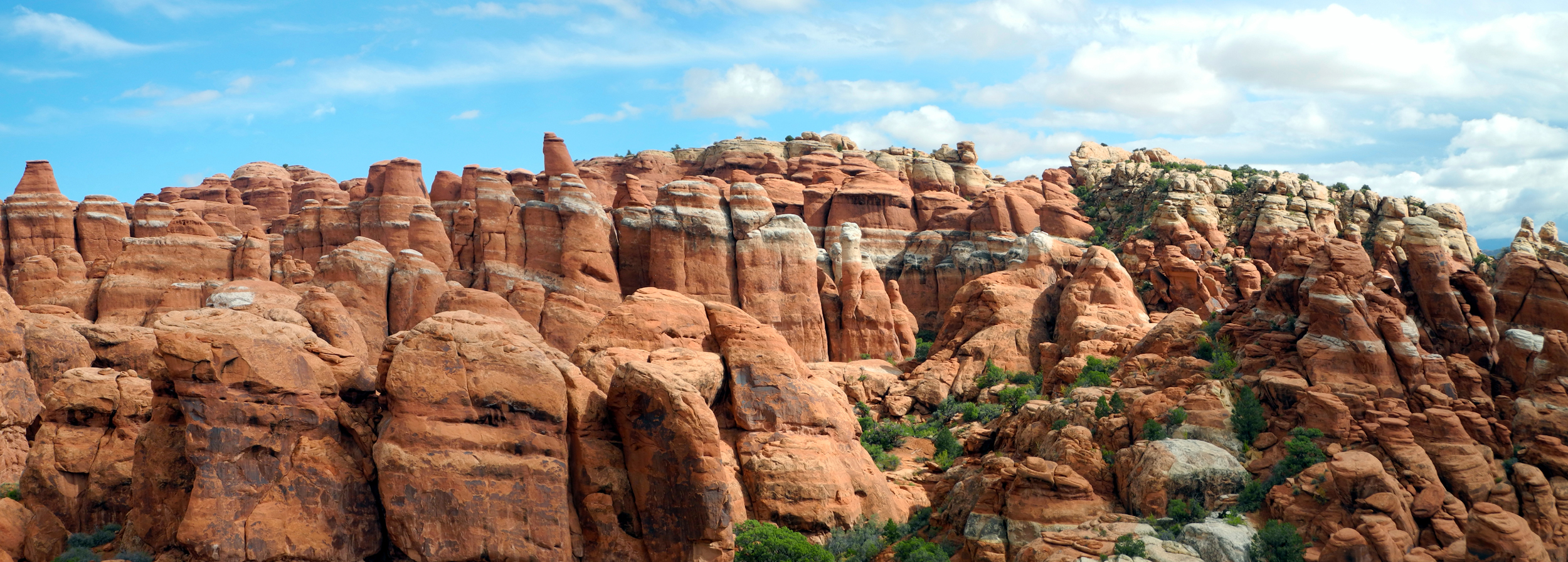
Our
first stop on Monday was the Windows
Section, about a mile off the
main road. In our advance research we had learned that part of the
parking lot in this location is closed for repairs, so finding a
parking place
could be a problem. It turned out that there were people coming and going
all the time, and we soon found a spot right next to the Double Arch Trail.
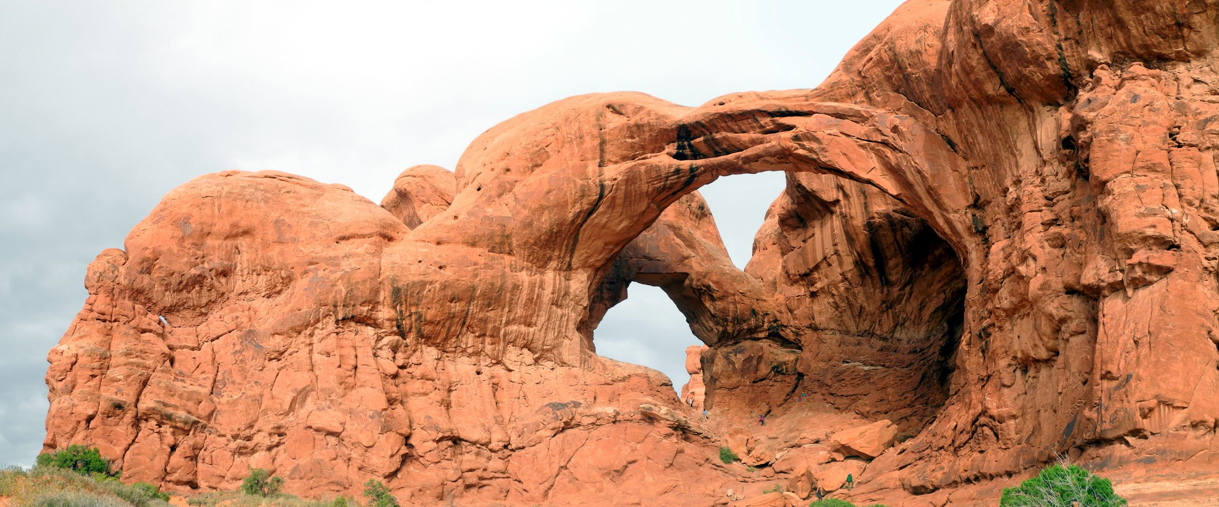
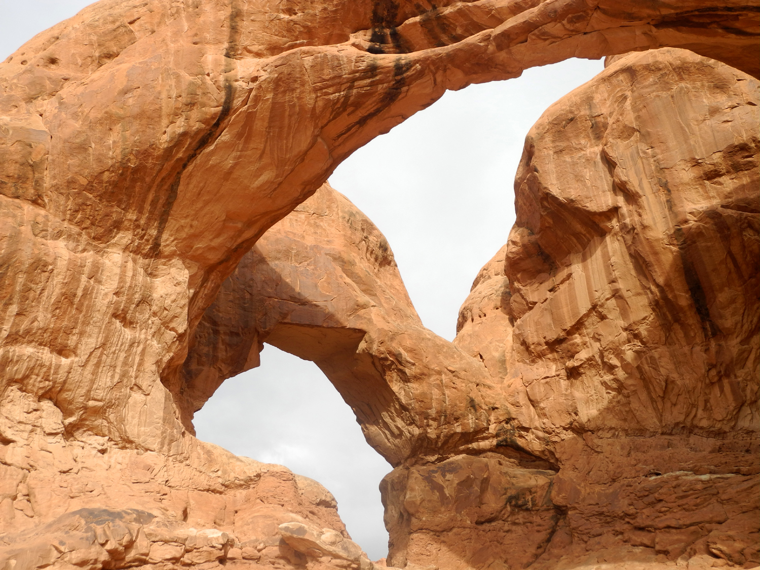
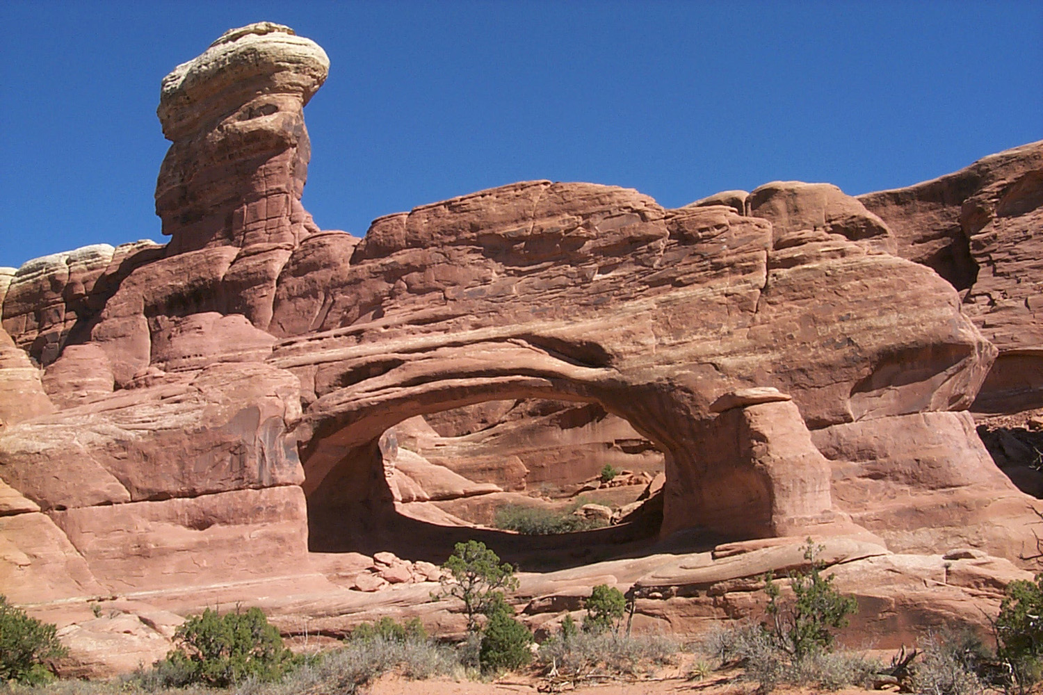
Double Arch is one of four (or maybe two of five) named arches in
this area, and the trail to it offers views of at least two other
arches. The trail is short, and the arch is spectacular, two huge,
adjacent openings with very thick, sturdy-looking rock. (Appearances
mean nothing when time and water do their work, however).
To
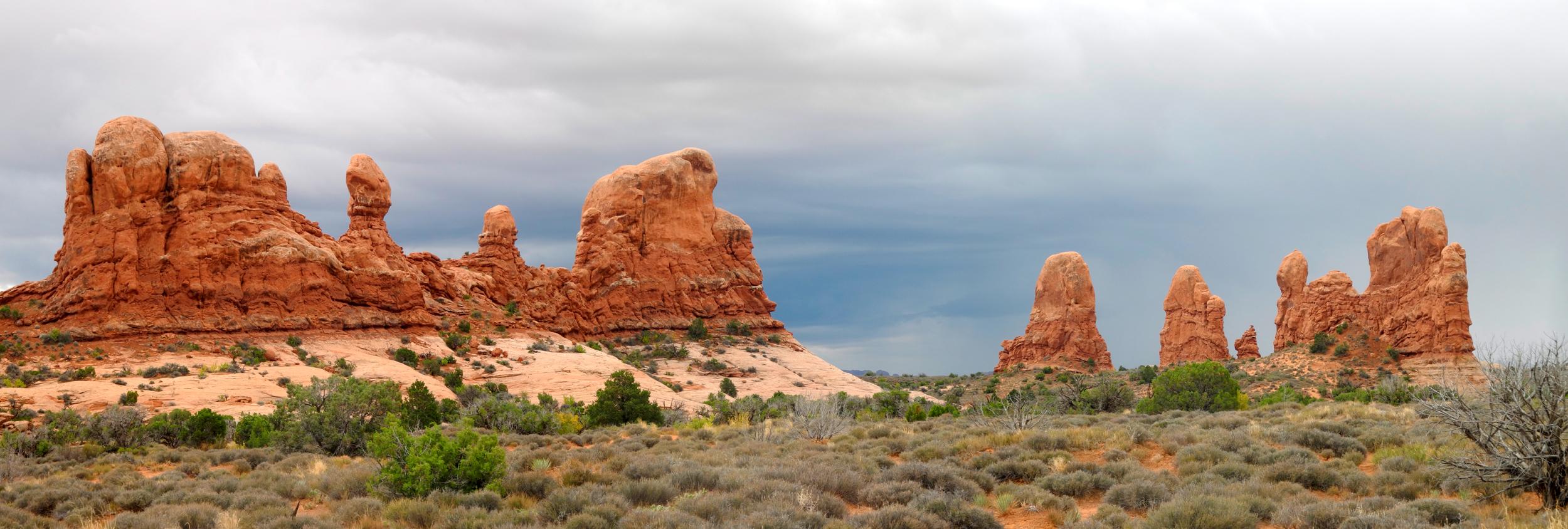
the west side of the trail is a series of huge rock formations known
as Parade of the
Elephants, and they live up to their name in
appearance. There is a small arch in this formation, and another
nameless one to the east of Double Arch.
You
can walk up to and into the arches, depending on how much rock
scrambling you are willing to do. Teri went well into the first
arch, and I got very close and took pictures.
After
returning to the parking area, we took a trail that goes uphill from
the lower lot to the upper, and walked on the trail that goes to
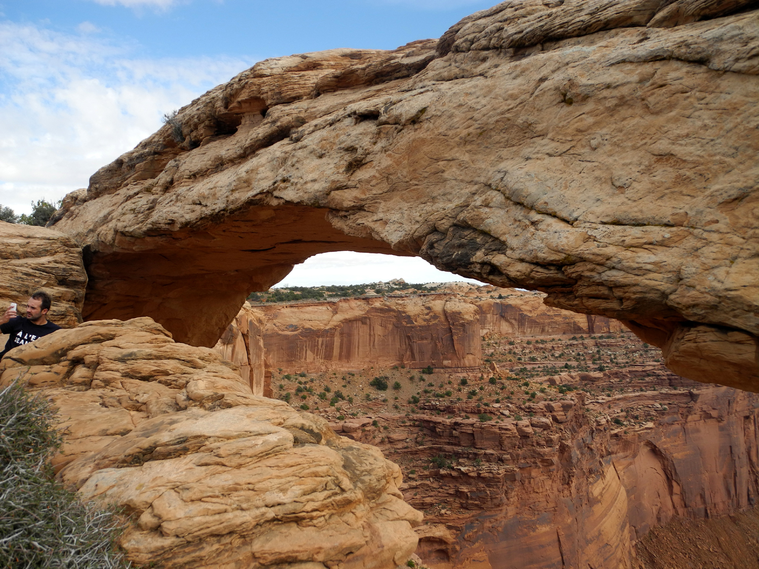
Turret Arch and the Windows. Turret Arch has a small tower as part
of the rock formation, and also a small companion arch. I had never
walked up this part of the trail, so I enjoyed my closest look ever
at this arch.
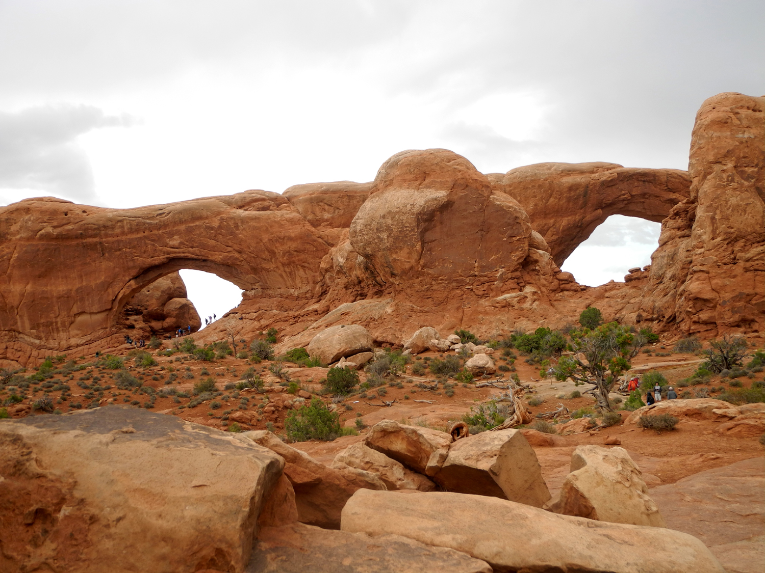
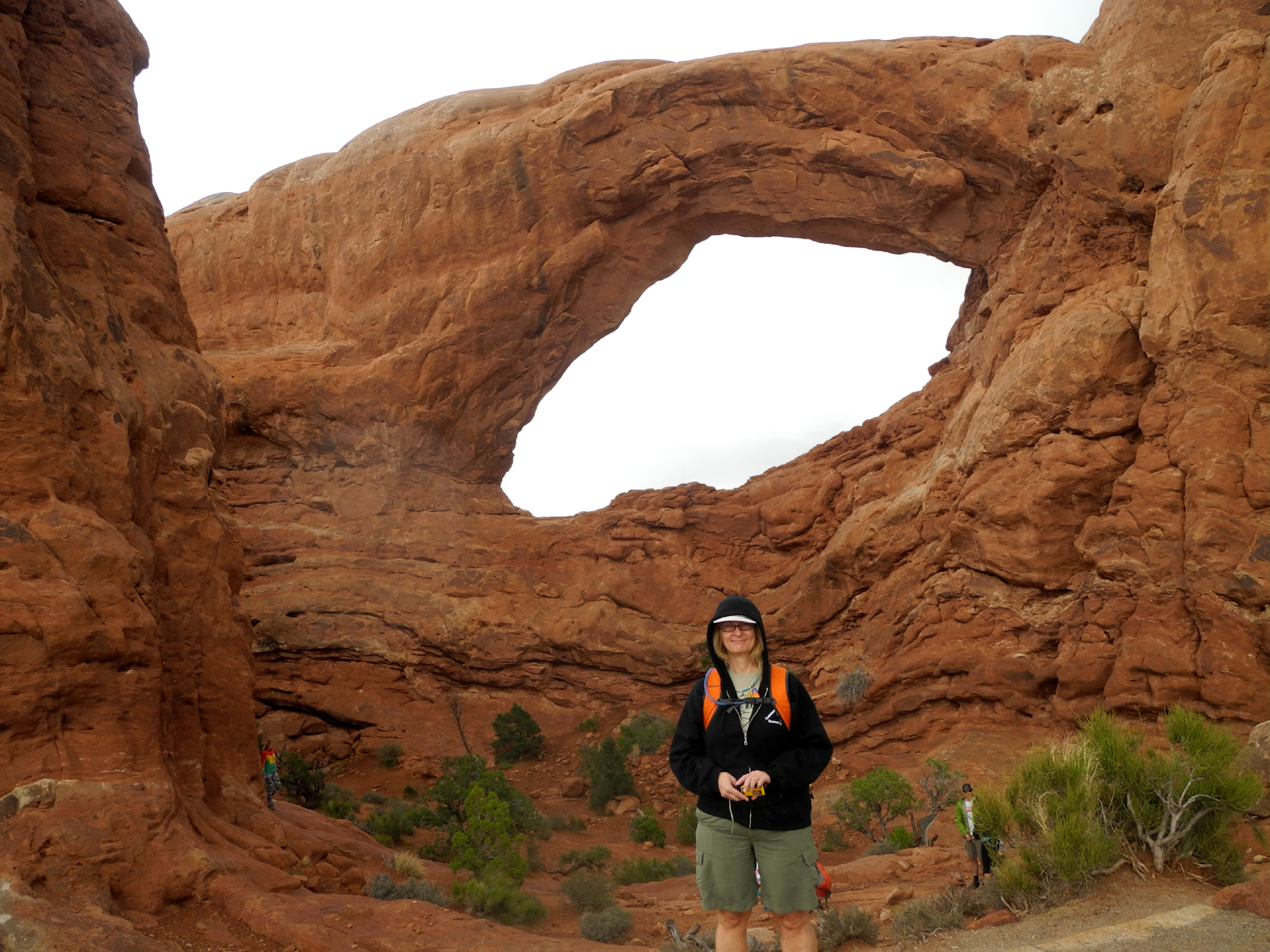
The
trail then goes up to the South Window, and again we went inside,
despite some worrisome cracks in the rock that have so far held up
through all my visits. The Windows are two somewhat symmetrical
openings, about fifty feet apart, in a large sandstone wall. From a
distance they look somewhat like a pair of glasses, giving them the
alternate name of The
Spectacles.
A
trail goes all the way around the Windows, but we skipped that and
took the trail that returns to the parking lot. There's a side trail
to North Window, but we also bypassed that one.
Driving
back to the main road we noticed a small arch high up in the wall to
the west, Pothole Arch. I had not seen it before, and we didn't
stop then, but we did
make a quick visit there our last day.
Continuing
into the park, we discovered that the road to the Delicate Arch area
was closed due to flooding along the road. On Saturday we had driven
through two areas where water flows across that road, but at that
time there was no problem. The trailhead parking lot had closed that
day for repairs, but the flooding meant that for several days
visitors could not even drive to the view point.
Looking
at the park map I had noticed an arch I had not seen before, Sand
Dune Arch. It's not visible until you get right by it, but the trail
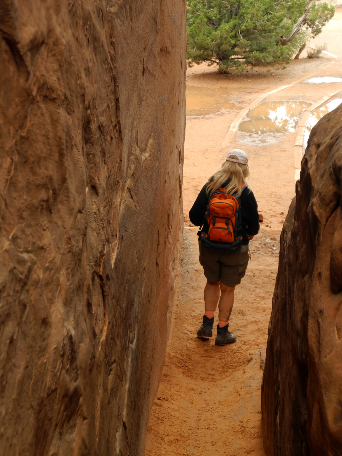
is a short walk from the parking lot. Along about this time Teri
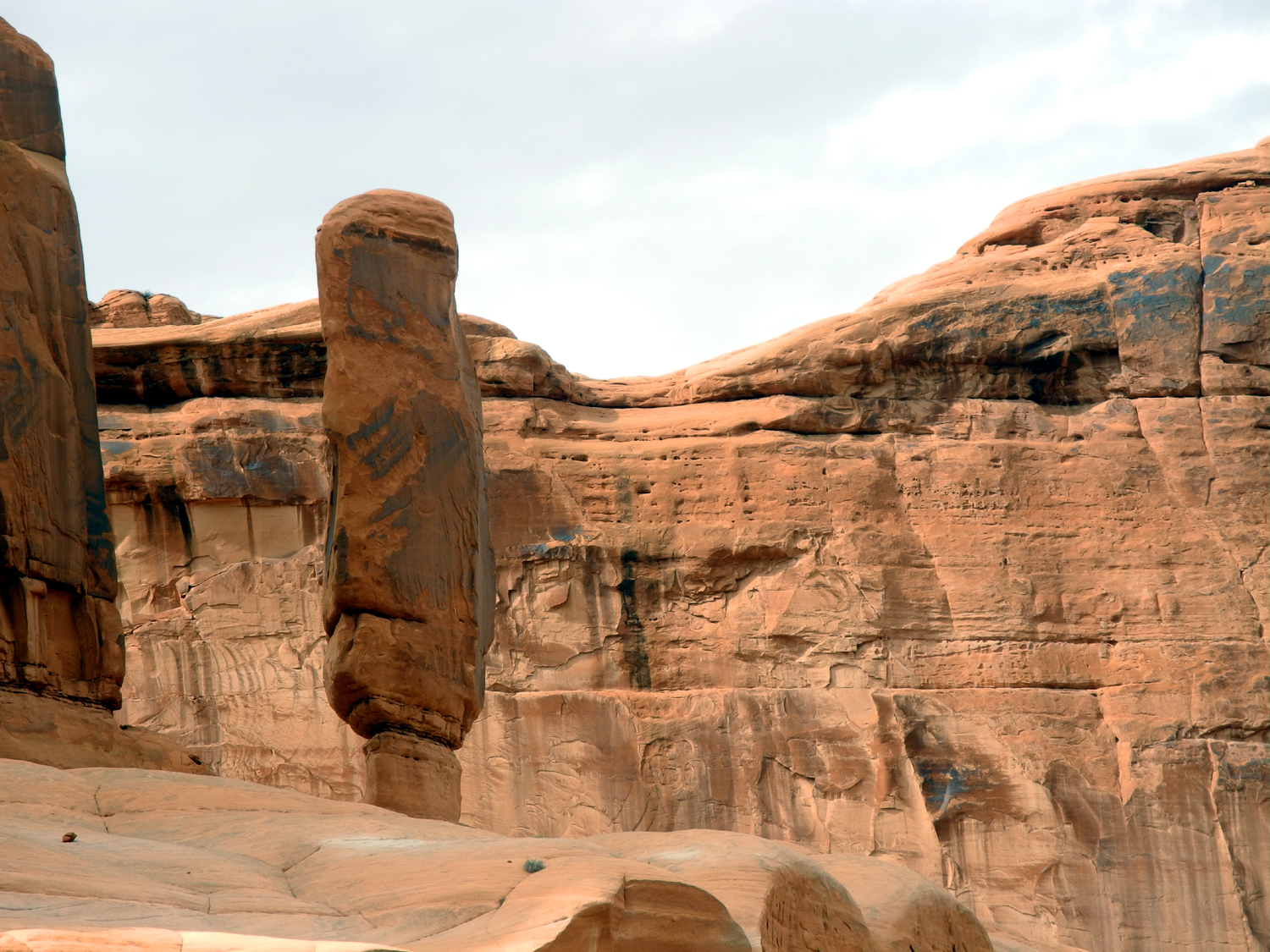
became a fan of fins, tall, thin slabs of rock that appear in
various locations throughout the park. The walk to Sand Dune was a
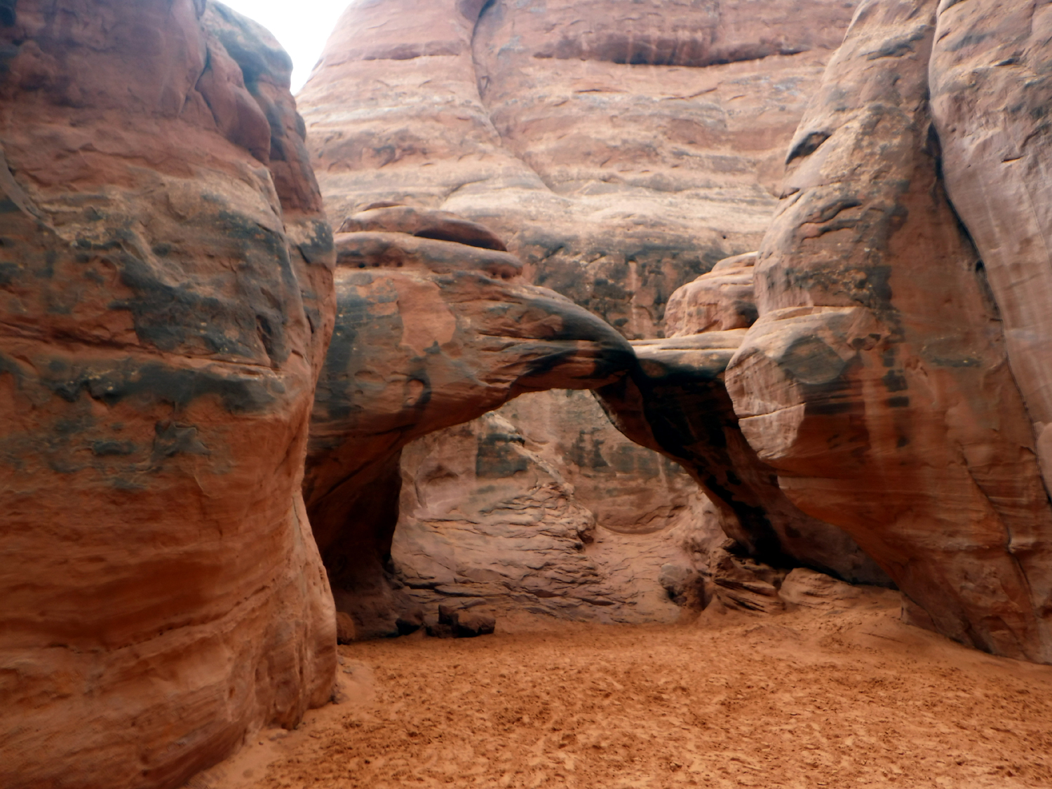
narrow passage between two large fins, and the arch itself is set
back in an alcove.
Sand
Dune is on a short side trail, and the main route goes about a half
mile to Broken
Arch. As the park literature points out, it's not
really broken, but does have a big notch at the top. This trail was
mostly through a flat area covered in sage brush and other small
desert vegetation, but the last few hundred feet went through some
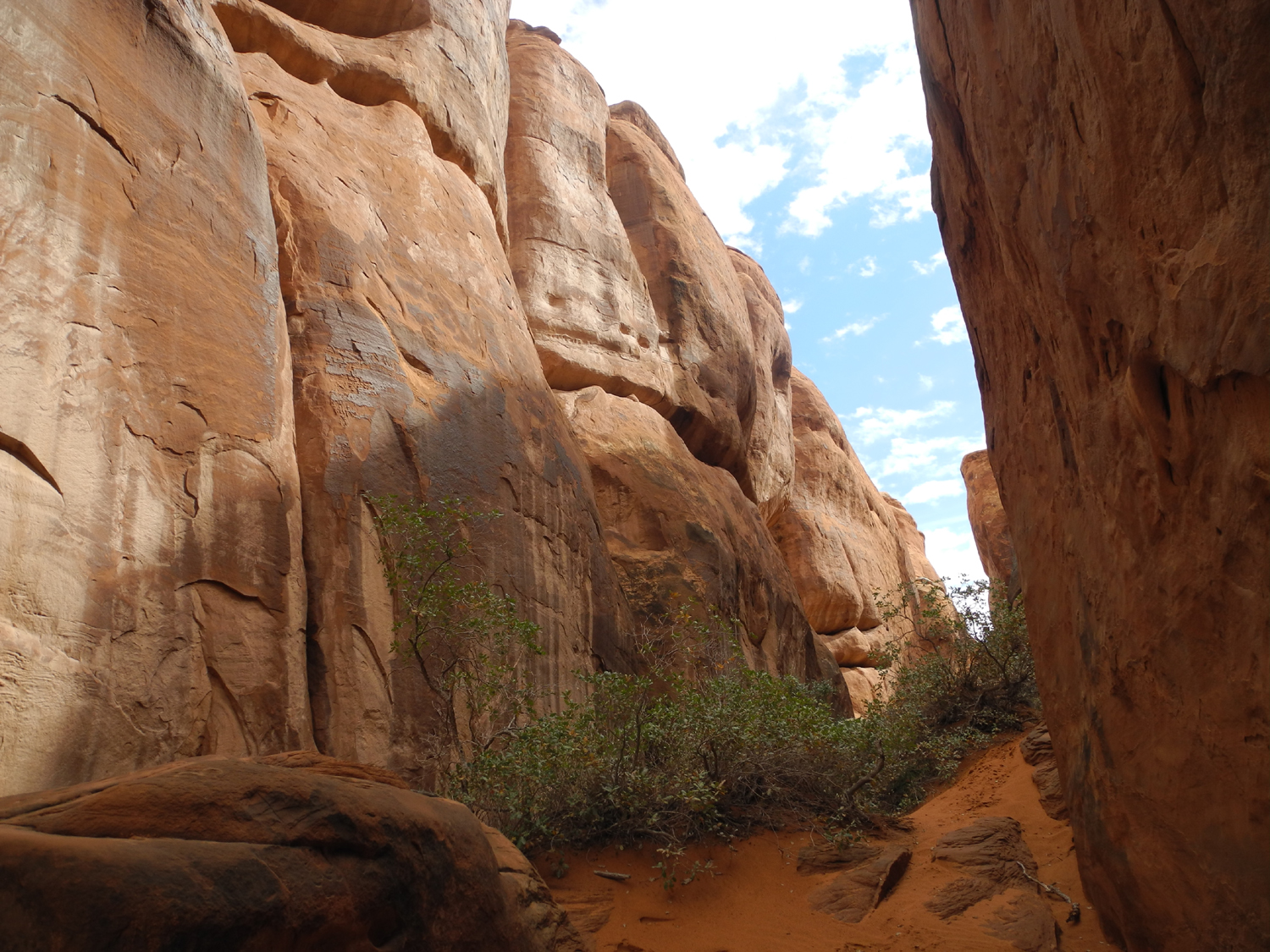
nice rock formations, and down across a wash. The trail continues
through the arch and on to the park's only campground, but we
returned the way we came. I had been to Broken Arch, but had
forgotten how nice the overall setting was, and we both enjoyed this
hike.
This
left us with one more arch stop for the day. Skyline Arch is visible
from the road, and I had never walked the half mile trail up to the
arch. Seeing it up close, I realized that this arch is much more
impressive when you are standing next to it. It is located high up
in the top part of a large sandstone wall, with a sheer cliff of 50
feet or more below the arch. Piled at the base of the cliff are
the huge rock chunks that fell from it in 1940.
After
this walk, we turned the car back toward the park entrance, making
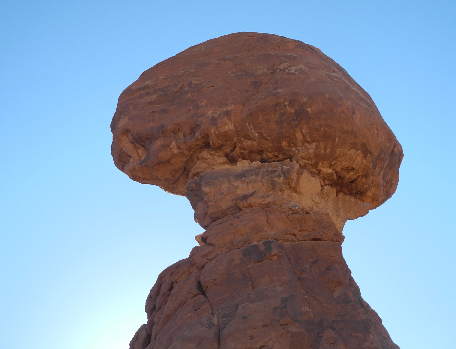
one more stop, at Balanced
Rock. This fantastic formation is 128
feet high, with a 55 foot high boulder perched on a small pedestal.
It looks ready to fall any day, and indeed, a small version of it
nearby collapsed years ago. It would be good to avoid this location
when it does fall - the boulder weighs in the neighborhood of 3,500
tons. There is a nice trail that goes all the way around the rock,
and from one side it looks a lot more solid than the other.
This
ended our third day in this part of Utah, with a visit to nearby Canyonlands
National Park and another good hike in Arches still on our schedule.
That
evening we were treated to a very loud thunderstorm, with the crash
of thunder following lightning flashes by just a few seconds. Later
in the night it was clear with a bright moon, but lightning flashes
were visible down the Colorado River canyon. The storm by that time
was far enough away that no thunder could be heard.
Over
the several days that we stayed at Red Cliffs Lodge, we noticed
almost daily changes in the river. On Monday night it was running
higher and the water was noticeably brown. On Tuesday morning the
flow was the same, but it was less brown. A tributary that comes in
from the north, possibly Courthouse Wash, was flowing more this
morning that at any previous time.
Arches
Day 2 Photos
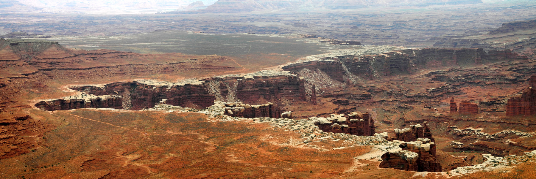
Canyonlands
The
best rain effects were yet to come, but first was our trip into
Canyonlands National Park. Located west of Arches across US Highway
191, Canyonlands is divided into three major areas, Island in the
Sky, the Needles, and the Maze. Getting from one to the other
requires leaving the park and driving up to 100 miles. The Maze is
mostly inaccessible except by 4-wheel drive. The most frequently
visited section is Island in the Sky, which is approached via Utah
Highway 313. Traveling this route, there is a change in elevation
from around 4,000 to 6,000 feet.
For
many miles the road goes through Bureau of Land Management
territory, which includes a campground, and some nice views of
sandstone cliffs and other formations. The most dramatic are The
Monitor and the Merrimac, two large buttes that resemble the famous
Civil War ships. There's a viewpoint with a restroom where you can
get a good look at these. We were south of the formations; there are
bike trails in the vicinity which start off US 191 on the north
side.
The
road through the park runs across a long, semi-level plateau flanked
by the Colorado and Green Rivers. Along the way are a number of
places to stop and enjoy views into the canyons below, but only one
place where you can actually see a river.
When
you come to a viewpoint into the terrain below the south side of the
plateau, you look down on another level of flat territory about
1,200 feet below, with canyons cut into it that go down still another
2,000 feet or so. Across from the visitor center the view includes a
look at Shafer
Trail, a 4-wheel drive road that descends through a
series of dizzying switchbacks to the plateau below. This route was
built during uranium mining days in the 1950s, and is now used by
hikers, bikers, and 4-wheel drive vehicles. Down on the lower
plateau it joins the White Rim Road, which is level much of the way, and winds through the
park for about 100 miles. This route also dates from uranium
prospecting days.
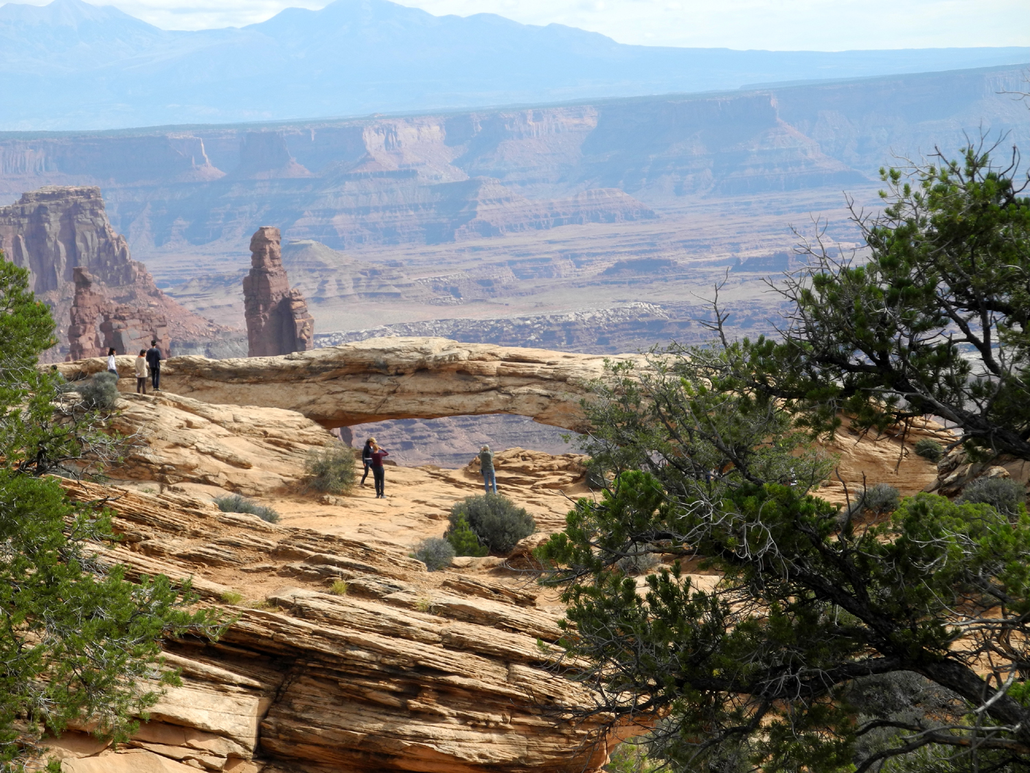
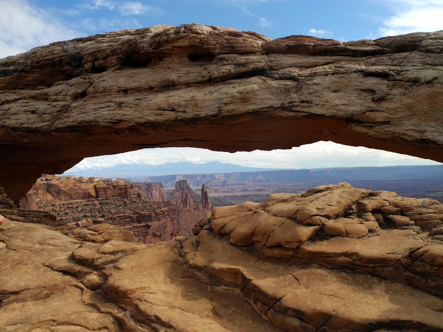
The
next stop for us beyond this was the trail to Mesa Arch. This trail
goes a half mile out to a nice arch right on the edge of the cliff.
It may not be as impressive as some of the formations in its
sister park to the east, but its location and the view through it
into the canyon make it stand out. We were fortunate enough to be
there when a ranger was leading a group of kids on the hike, and she
pointed out another arch in a rock formation in the canyon.
Just
past Mesa Arch a side road goes five miles out to a viewpoint and
trail head. We went on this road just a short distance and turned
left on another road that
goes to Green River Overlook, the only place you can see the river
from close to the road. The view down to the next level here is
fairly dramatic and you can see sections of the river. Like the
Colorado, it was actually brown.
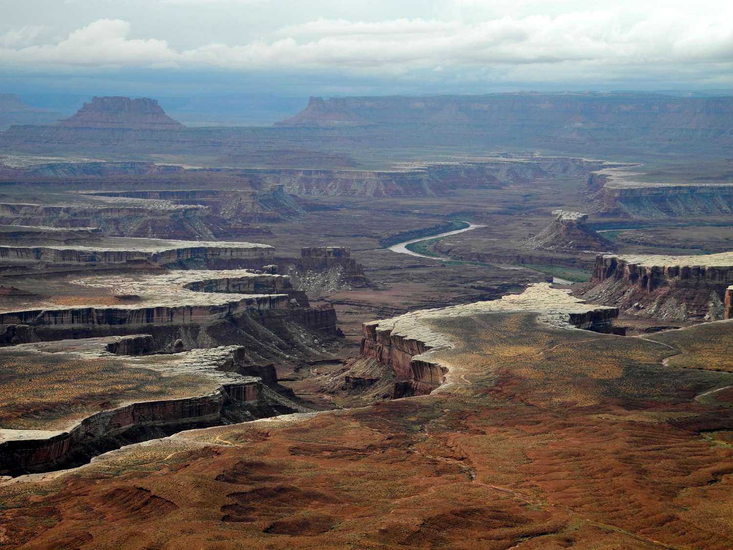
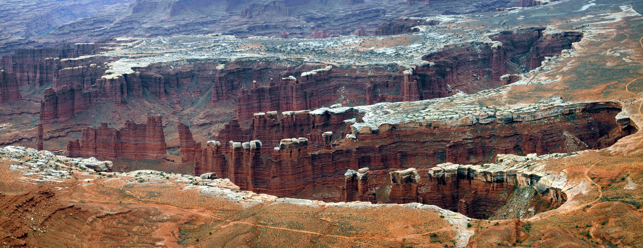
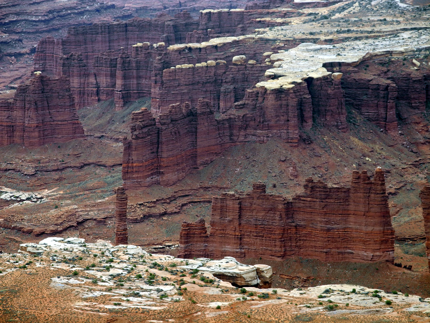
Back
at the junction, we continued to the end of the main road, another
eight miles to Grand View Point Overlook. As if nature had saved the
best for last, this is the most striking vista in the Island in the
Sky. We looked down 1,300 feet to the White
Rim, a hard layer of
white sandstone that forms a sharply defined rim above the next canyon, known as
Monument
Basin. Within the canyon, vertical
fractures in the sandstone have caused the rocks to erode into
steep-sided walls, columns and pinnacles.
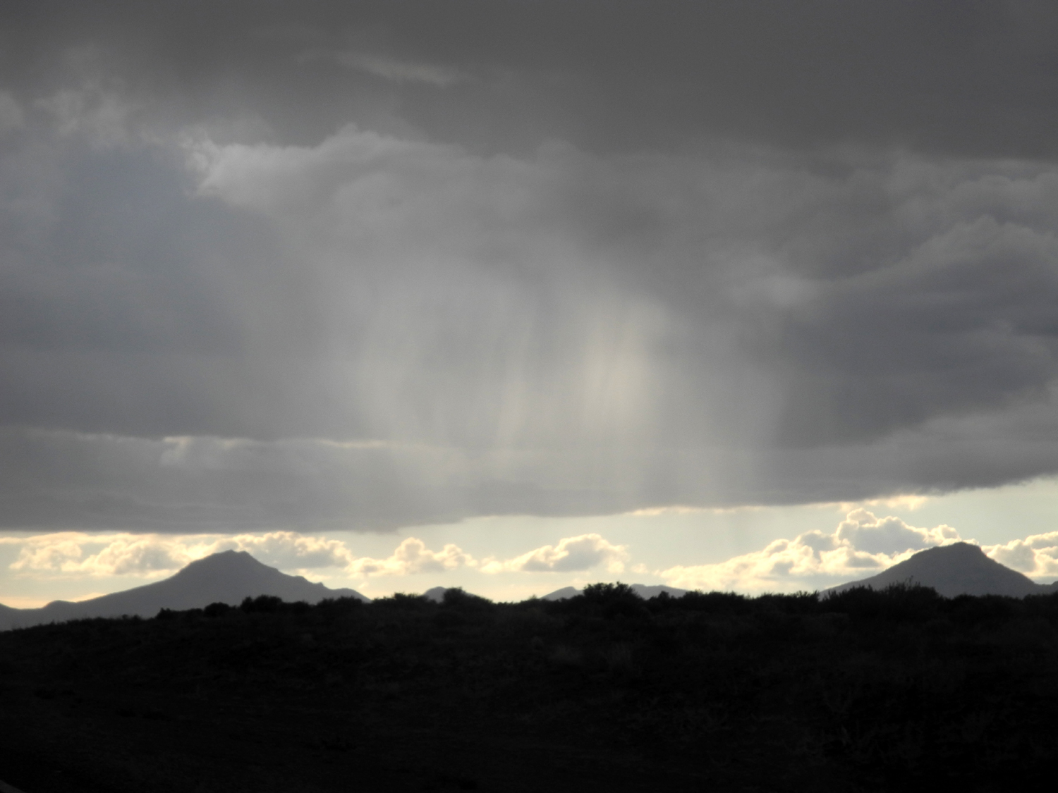
While
we were enjoying the view here, we started seeing lightning, with
dark clouds off to the west. It became cooler and windy, and by the
time we reached the car, it had started sprinkling. We were ready
for lunch, which we wisely ate in the car. I had to get out to get
something from the trunk, and by this time the wind was blowing the
rain nearly sideways. I got back in with my left side wet and my
right side still dry.
A
couple parked next to us, put on rain jackets, and went out toward
the vista. They were back within five minutes, jumping in the car
immediately without taking off their rain gear. Another couple
arrived and did the same thing, returning to their car even faster.
Our trip
home brought us some sights and experiences we never expected and
gave us an appreciation for good luck and timing. Along the road
there were puddles and swampy areas in many locations. The rainfall
had been heavy enough that normally dry washes along the way were
flowing, including one that poured over the rocks in a small
waterfall, and one that dropped over rocks on one side, then ran
through a culvert, hit a rock, and shot up into the air higher than
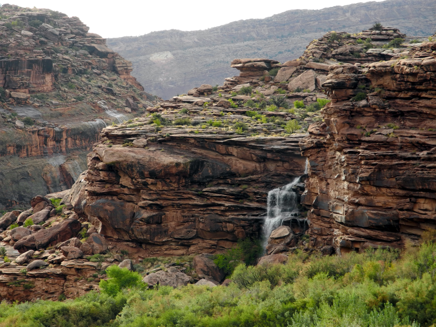
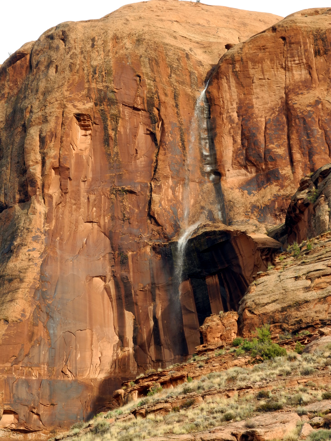
the road surface.
A little
farther along we stopped at a vista for Shafer Canyon, where we
noticed a waterfall coming over a cliff nearby, about 50 feet high.
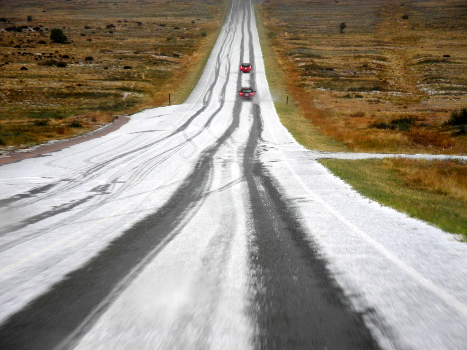
After we drove past the visitor center and out of the park, we
started seeing something white along the road, which we though might
be hail. With no traffic behind us, Teri stopped the car, and we saw
that it was indeed patches of hail by the edge of the road and in the
grass nearby. A mile or so farther on we came over a hill, and
before us the entire roadway had a layer of
hail, with two tracks
worn in it by cars that had gone out ahead of us. There were tracks
on the inbound lane also, but much less well defined, since it was
late in the day, and the storm had probably caused some visitors to turn
back.
Our
enjoyment of weather phenomena was not over. When we approached Moab
we drove into town to fill the gas tank. Near the north end of the
city there was a heavy flow of reddish water across the road, not
deep enough to stop traffic, but causing everyone to slow down and
proceed with caution.
Since the
entire 14-mile route up the Colorado River canyon to our lodge is
lined with cliffs, we were on the lookout for more waterfalls, and
we were not disappointed. We saw at least three waterfalls,
including one that hit a rock platform half way up the cliff,
forming an upper and lower
fall. This one also ran from the base of
the cliff toward the road and over another small
cascade. All of
these falls were gone when we drove out the next morning, so once
again we profited from good luck and good timing. By the lodge, the
river was running brown and higher than ever.
Canyonlands
Photos
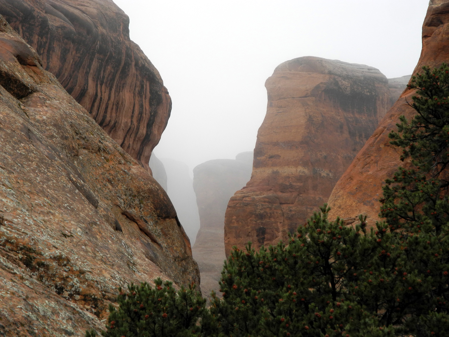
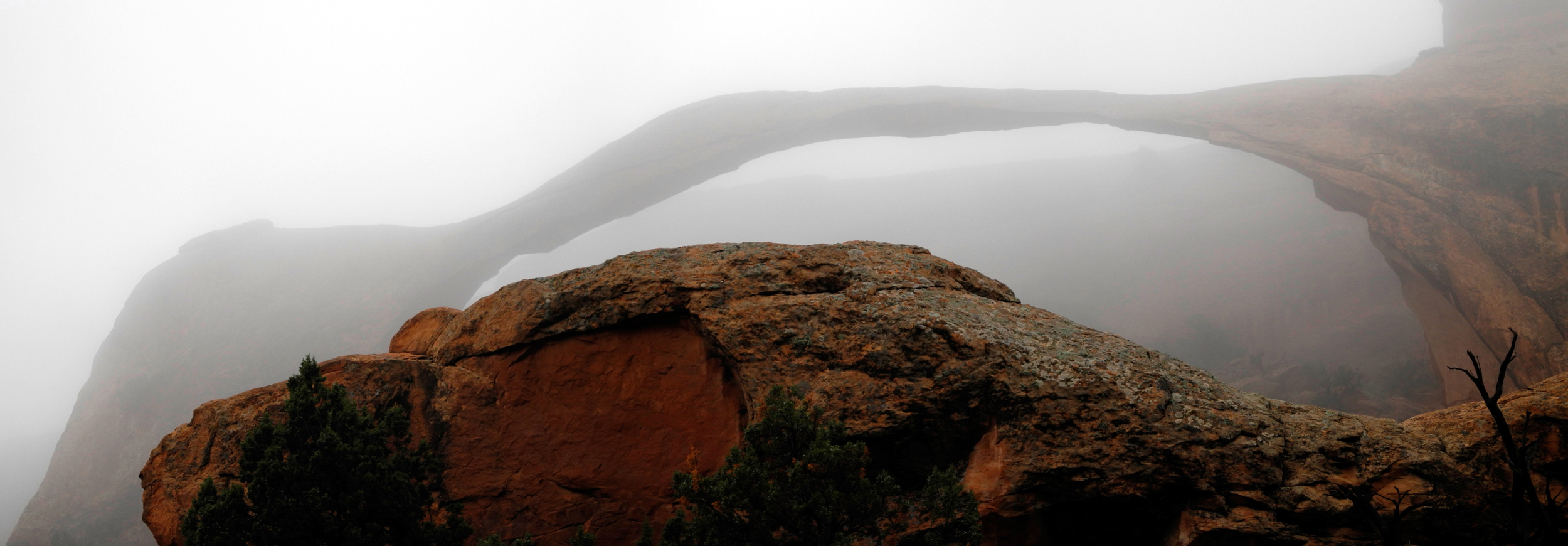
Arches Day 3
The next
day, our last before starting home, we had two goals: Hike the
Devil's Garden Trail at least to Landscape Arch, and see everything
we had missed the previous days. It was threatening rain when we got
up, and we had rain or sprinkles while driving into the park. The trail we
wanted starts at the end of the road, and goes near a number of
arches. Taking the entire trail, including all spur trails to points
of interest and the primitive loop trail would have been a 7.2 mile
round trip. Although the .8 mile stretch to Landscape Arch is
relatively level and easy, the loop trail requires hiking on
"narrow ledges with rocky surface hiking and scrambling on
slickrock." In addition, it is hard to follow in places. We had
no intention of attempting this adventure.
It was still
sprinkling when we started our hike, but we had our ponchos, and
were undaunted. It was also very cool, and I wanted to put my hands
in the pockets of my poncho. I was carrying only one hiking pole, so
I was able to have one warm hand at a time.
The rain
diminished to a mist, and after we had been hiking for a while, Teri
said, "There it is - I hope this mist clears." I looked
and did not see the arch, and thought that she was mistaken, but as
we went on, it became barely visible through the mist. She explained
that
she saw it briefly, then it disappeared.
Despite the
poor visibility, we took photos from various angles, and agreed with
several other hikers that the conditions created a special kind of atmosphere. After we had been in the area for a while, the arch
became more and more visible, and by the time we left the area, we
had a clear
view.
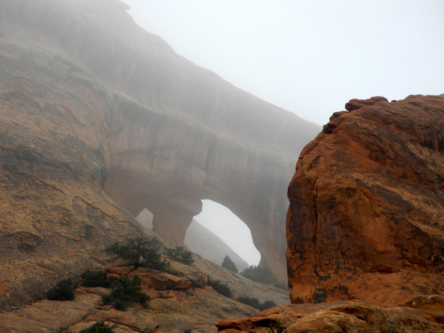
We were also
able to see a double opening in the rock a ways beyond Landscape,
and looking at the map we determined that this was Partition
Arch,
which can be seen close up by taking one of the spur trails beyond
where we turned back. I visited this arch as well as Navajo Arch on
a separate spur trail in 2002.
I had wanted
to continue on the trail at least to the location of Wall Arch,
which had collapsed since my last visit in 2004. However, we had
trouble finding the trail, and it went up a difficult route on the
rock. Sandstone becomes very slick when wet, and neither of us were
comfortable trying to continue beyond that point.
By this time
the rain had stopped, so we took off our ponchos, and enjoyed a snack
while resting. About half way between the trailhead and Landscape
Arch, a side trail goes to two other arches, and we visited both of
them. Tunnel Arch is fairly small, but the rock it goes through is
thick, making it one of the deeper arches and no doubt giving rise
to the name. There is another smaller arch nearby, which we named
Little Tunnel Arch, because it goes through the same thick
wall.
A little
farther on is Pine Tree
Arch, so named because there are several
trees growing under it, including piñon and juniper. Across from
this arch is a high rock fin, adding to the beauty of the area. At
the start of the trail we had noticed what appeared to be an arch in
the rocks east of the trail, and we realized on our return that we
had got a preview of Pine Tree Arch. We also realized that Tunnel
Arch went through a wall that ran along the main trail, and we
looked for it on the way out. We could see the opening, but could
not see through at that point, so it would not stand out as an arch
if you had not made the trip to view it from the other side.
Throughout
the hike, the arches are only a small part of the fantastic
landscape we enjoyed. There are fins, towers, spires and many more
fascinating formations.
When we got
back to the car and were taking off our packs, we were visited by
the Free Sandwich Man. Actually it was someone who was with a bus
carrying a group of students from a university in St. George. They
had two large sandwiches from a Moab bakery that no one wanted, and
we were happy to accept them. We realized that they were bigger than
we could eat, so we split one. Soon three young men came along
starting their hike and Teri said we could give them the second
sandwich. It turned out that they had come out with nothing but
water, and were already realizing their mistake, so they were
delighted to receive the sandwich. Of course, we realized without
discussing it that it would produce very small portions when divided among three
20-somethings.
After
finishing our free lunch, we started back out of the park, with a
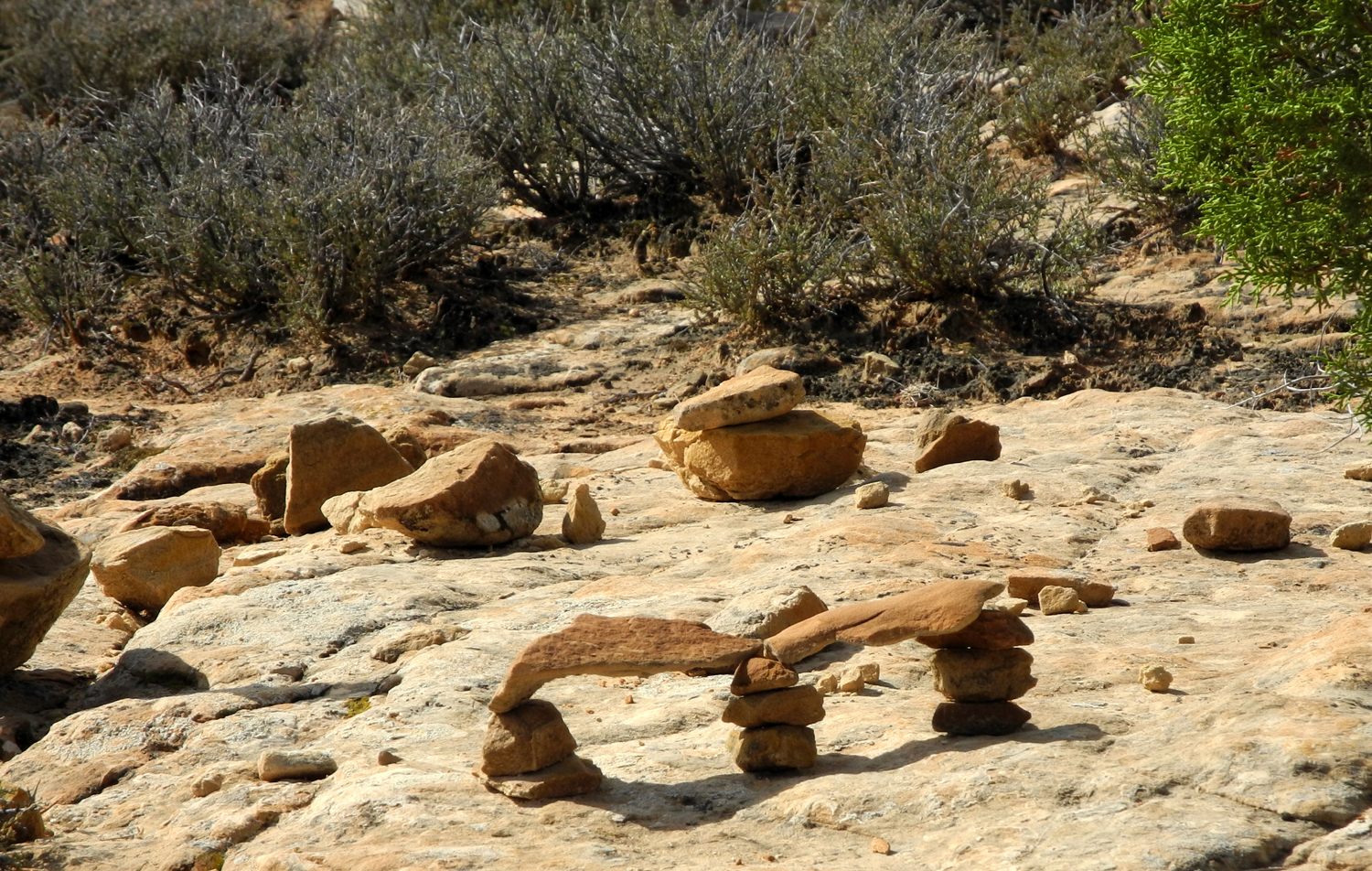
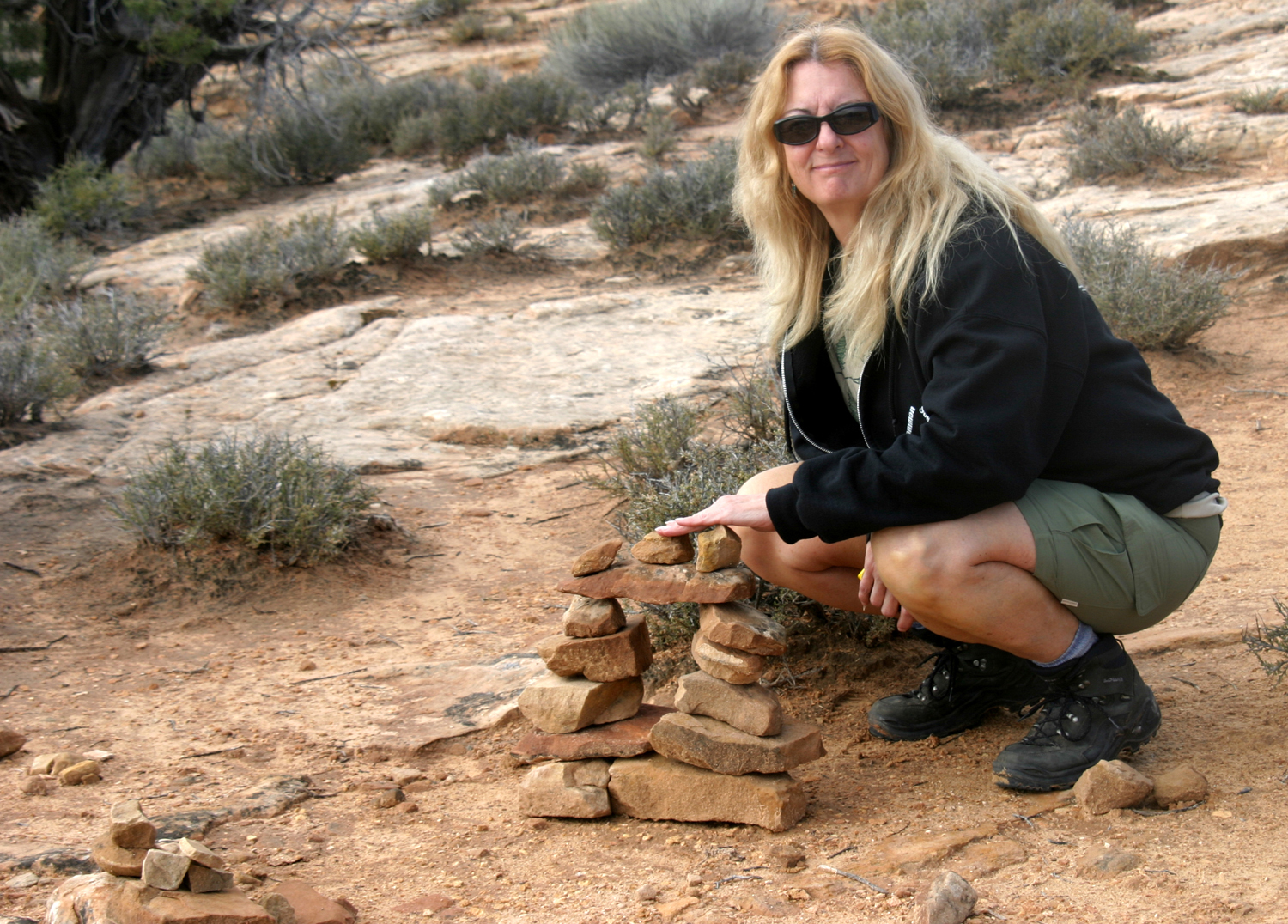
couple of stops planned. The first one was at the Fiery Furnace.
This is an area of tangled and twisted rock
formations, narrow
passages, and pinnacles. The complexity of this area is best
explained by the fact that foot travel in the area is limited to a
ranger-led hike, with advance registration required. However, you can walk a
short trail to an overlook with a good view. Along the way some park
visitors with lots of time have constructed tiny arches using rocks
from the area. One mini-arch even had a smaller arch on top of it.
Next we went
down the Windows road a short distance to Pothole Arch. This small
feature is high up on the cliff and hard to see and photograph.
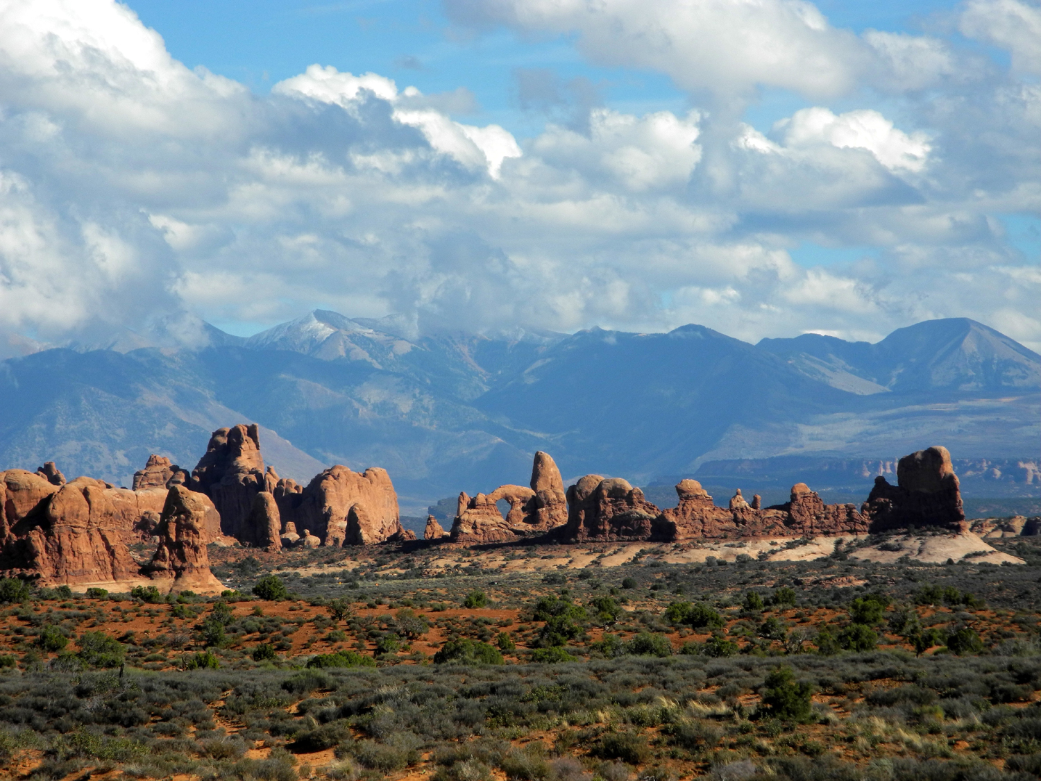
South and
slightly east of the park is a high mountain range, the La
Sal Mountains. These are visible from many places in
Arches, Canyonlands, and the surrounding area, and they can be seen
through Delicate Arch, a scene that has been photographed countless
times. Due to the clouds we had most days, we never had a good view
of the La Sals, although we were able to see parts of them all the
time. We could see that the highest peaks, reaching up to 12,700
feet, had snow when we arrived, and the snow was down lower the last
day after the storms.
Our final
stop was along the Great Wall, a series of sandstone cliffs that
rise 50 to 100 feet above the surrounding terrain, along the north
side of the road between Balanced Rock and Courthouse Wash. We found
a place where we could park and walk over to the cliff via sandstone
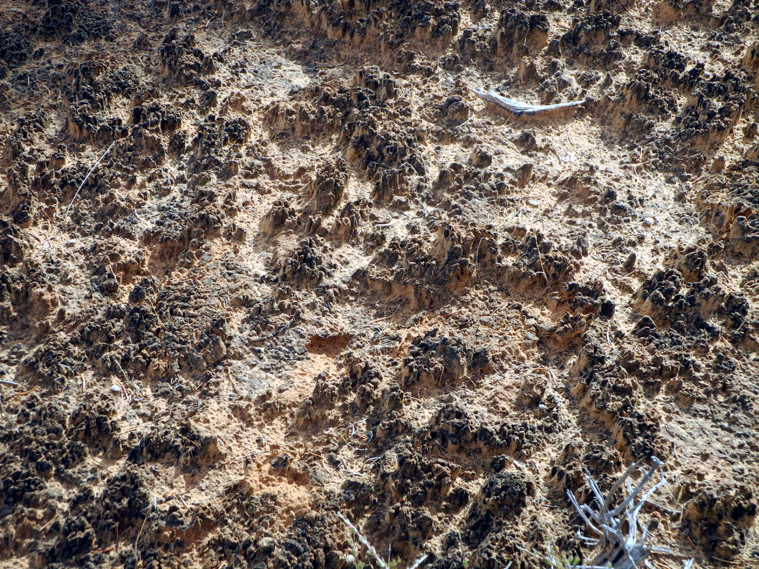
and washes. Off-trail travel is limited to rock and washes because
of the cryptobiotic
soil
which occurs in many places
in this region. This consists of microscopic bacteria that bind
grains of sand together, making a stable location for algae, moss
and fungi to grow. This soil traps water and provides a safe place
for seedlings to get a start. If the soil is disturbed by feet or
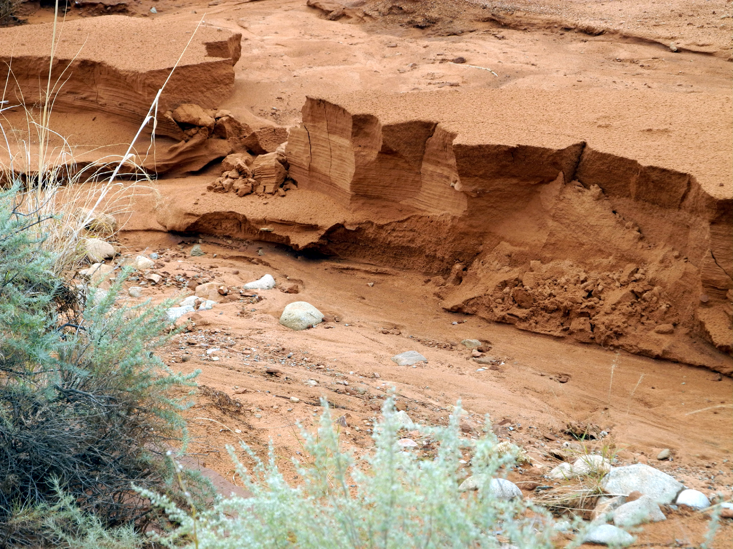
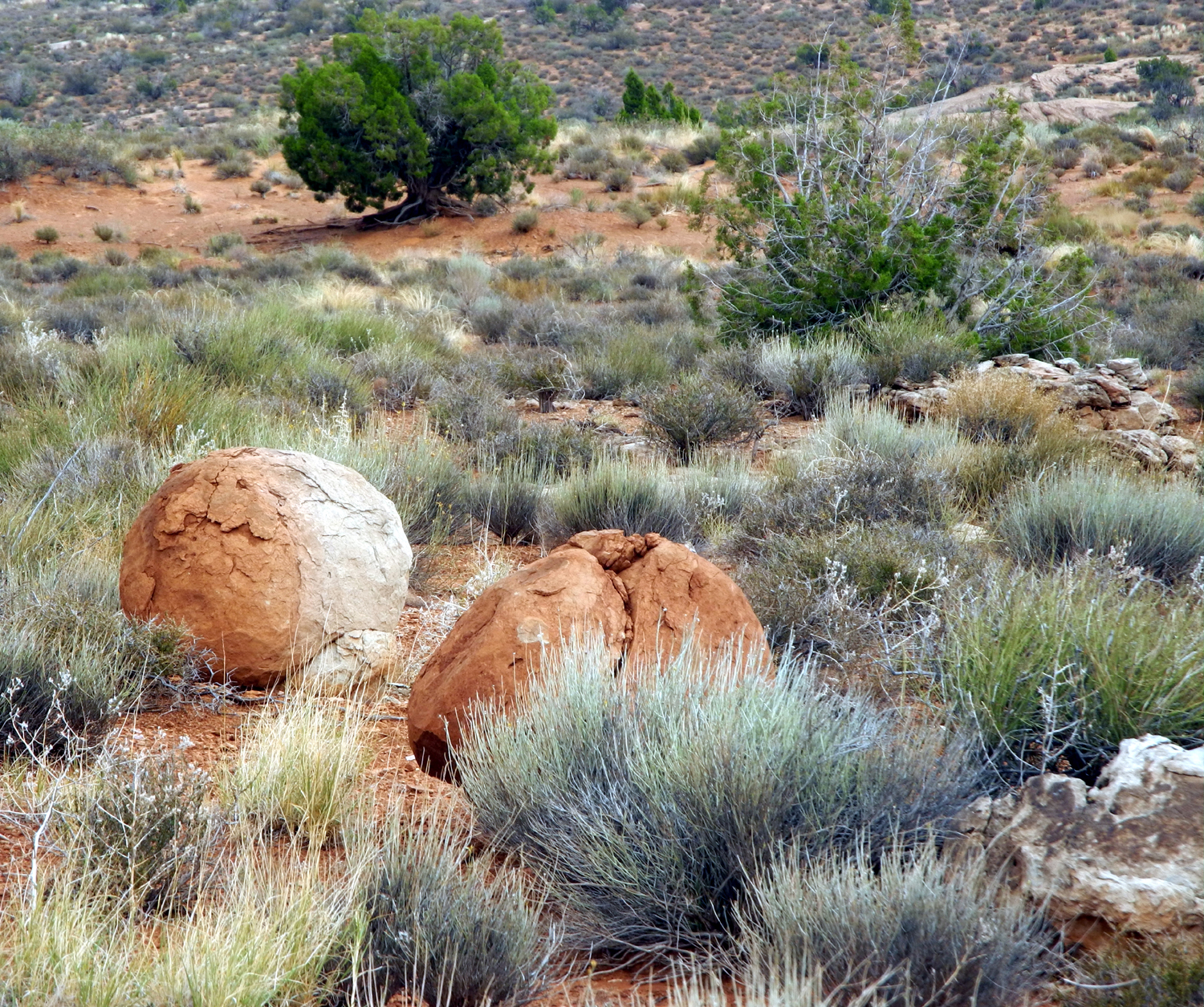
anything else, it takes 50 to 100 years to recover.
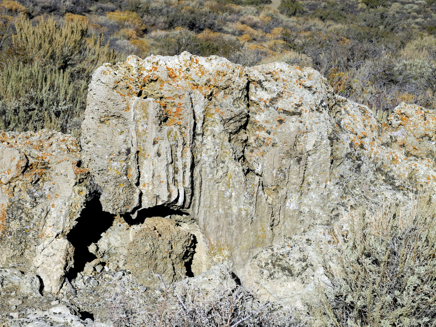
We wandered
around at the base of the
cliff, where Teri gathered and
photographed some interesting rock
specimens. Heading down the road
again, we stopped to photograph a formation known as The
Penguins.
Here we had a view of US 191 and the park entrance road. We then
made another stop at the Visitor Center, since Teri wanted to make a
last-minute purchase. I took our final photos
in Arches National Park, of the road and cliffs above the center,
after which we headed for Red Cliffs Lodge. As we
drove along the river, we noticed that it was running higher than it
had been in the morning, as runoff upstream along the tributaries had
made its way to the canyon.
That evening
we got everything packed except what we needed in the morning, and
made preparations for our homeward trip. Since we had added an
unscheduled stop
at the beginning of our adventure, Teri suggested we do the same on
the way home, and spend a day at June Lake
in the eastern Sierra, one of her favorite spots. We decided to make
a long drive on Thursday, all the way to Tonopah, NV, a little over
500 miles. Then we would have a fairly short run into eastern
California. The next day we would return home through Yosemite via
Tioga Pass.
Arches Day
3 Photos
The Road to Tonopah
We reversed
our direction on US 191, and decided to stop for gas and a bathroom
break at a mini-mart where we came to I-70. I went inside while Teri
started to operate the pump, but when I came out, she was on
her way in and said, "I didn't get gas." Suspecting the
reason, I took at look at the pump - $4.72 per gallon! It's
not far in any of three directions to towns with normal prices, so
this place is taking advantage of those who foolishly let their tank
get too low at the wrong time. Fortunately, we had plenty of gas to
get to Green River and beyond.
The next
part of our trip was a repeat of the section of I-70 that we had
traveled eastward. I drove this section so that Teri could better
enjoy the views along the way. In the most scenic area there are vista points on
both sides of the highway, and we stopped at all but one of them.
The first one we came to is one of the most impressive - the San
Rafael Reef. Briefly this is the steep edge of an uplift, the San
Rafael Swell, a line of steep "shark tooth" sandstone
hills. The geology of the area is explained very well and briefly here.
We made
stops at several other places, all of them providing
delightful and dramatic
views. At one of them some Navajo ladies
were selling jewelry, so Teri added a few more items to her collection.
Where I-70
turns southwest toward I-15 and the US89 junction where we had
joined it previously, we turned north on US 50 at Salina, UT. From
here 50 goes northwest, joins and is contiguous with I-15 southbound
for a few miles, then heads west across Utah and into Nevada. Along
this route we were once again following the Sevier
River, where it turns west and south after its long northward
run. It ends in the Sevier Lake southwest of Delta UT, after
providing irrigation for this agricultural region.
At Delta US
50 is joined by US 6 and both roads are contiguous into eastern
Nevada, where US 50 goes northwest at Ely and US 6 continues mainly
westward. Although we did not have the type of dramatic scenery in
western Utah and Nevada that we had enjoyed on the Colorado Plateau,
we still appreciated what there was to see.
This country
is the Great
Basin, and is marked by "basin and range" topography, with the
roads going up over mountain passes, usually around 6,000 feet, then
down across nearly level basins where the road may be perfectly
straight for 15 miles. Highway 50 is known as "the loneliest
road in America," but Highway 6 must surely be a close second;
it is not unusual to travel ten miles without seeing another
vehicle.
There is
also a serious shortage of towns and services. We had just passed
Ely when I noticed that Teri's fuel range display showed 150 miles,
and saw a sign indicating that the mileage to Tonopah was slightly
more. Having driven this
route several times, I did not think there was any place to get gas
till Tonopah, so we went back a mile or two and gassed up at Ely.
This proved wise; there are only two "towns" on the map,
and they proved to be nothing but place names without any
businesses.
We enjoyed
the trip, driving through piñon and juniper forest in the mountain passes,
and sage brush and other small plants in the basins. Along
the way we saw a number of free range horses, which I assume to be
the wild mustangs that are found in Nevada. We also had a good look
at a coyote who crossed the road in front of us, then turned to
check us out as we went by. At one point where the road descends
from a pass, there is a section of irrigated farm land, which
included a large grassy field with at least 20 deer grazing.
Apparently they do not realize that they are a browsing animal who
should be feeding on brush.
We had rain
some of the time, with some spectacular clouds late in the day.
Eventually we arrived in Tonopah, an old mining town, got checked
into our motel, and enjoyed an excellent Mexican dinner at El
Marques.
Heading
West Photos
Eastern Sierra Stopover
The next day
we had a relatively short drive to June Lake in the eastern
Sierra.
Shortly after entering California, we left US 6 and took California
120. This route goes through the tiny towns of Benton and Benton Hot
Springs, climbs up through an area with rugged rock formations, and
enters a pure ponderosa forest, before dropping down near Mono
Lake and connecting with US 395.
Our
destination, the village of June Lake, is located on CA highway 158,
known as the June Lake Loop, which goes east from 395 just north of
the 120 junction, runs into the mountains and past several lakes,
then comes back out to 395 about 10 miles farther south.
But before
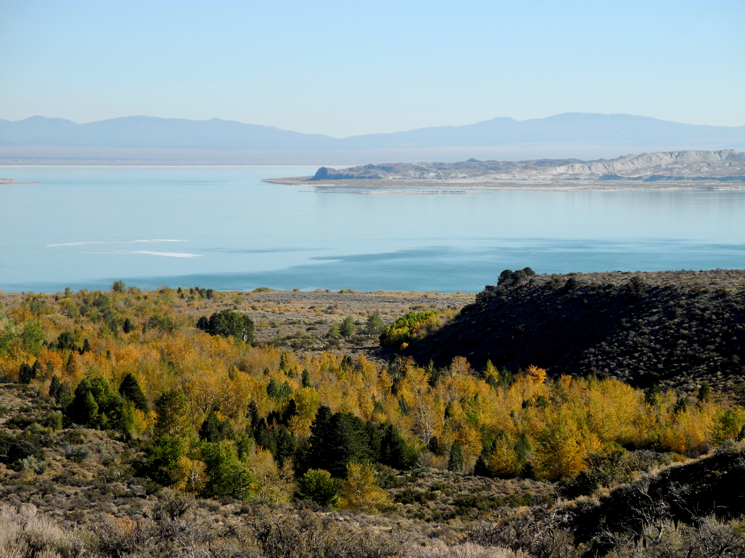
going that way, we first made a stop at the Mono Lake Basin Visitor
Center in Lee Vining. After looking around inside, we walked toward
the lake on a paved trail. It soon became dirt, then we found
ourselves walking through the sage brush on small game trails. We
had hoped to get to the shore of the
lake, but when we came out on
an overlook with the lake in sight, we could see that it was still a very long
way, so we took pictures, enjoyed the view of the tufa and the
lake's islands, and started back up the hill. Along the way we saw
three deer, very close
up, as well as a cottontail rabbit.
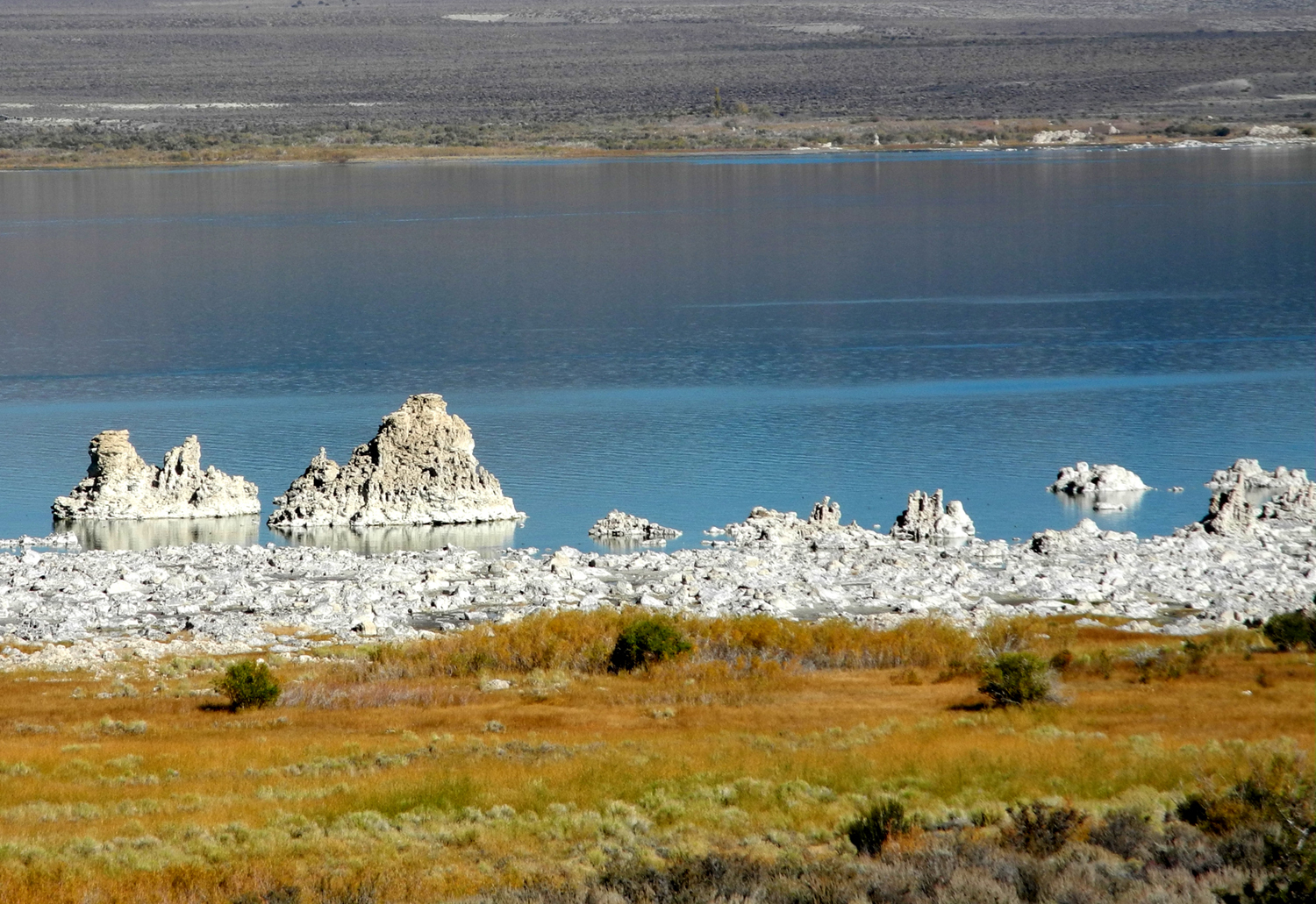
Tufa
develops under water, and the formations next to the lake were
exposed when the water level dropped after source streams were
diverted to Los Angels in the middle 20th century. In addition to
these relatively recent formations, there are some examples
of tufa dating from the last ice age, when Mono Lake was five
times bigger than today. The drop in the water level left these
remnants exposed, high up the slope from the beach-side tufa of
today.
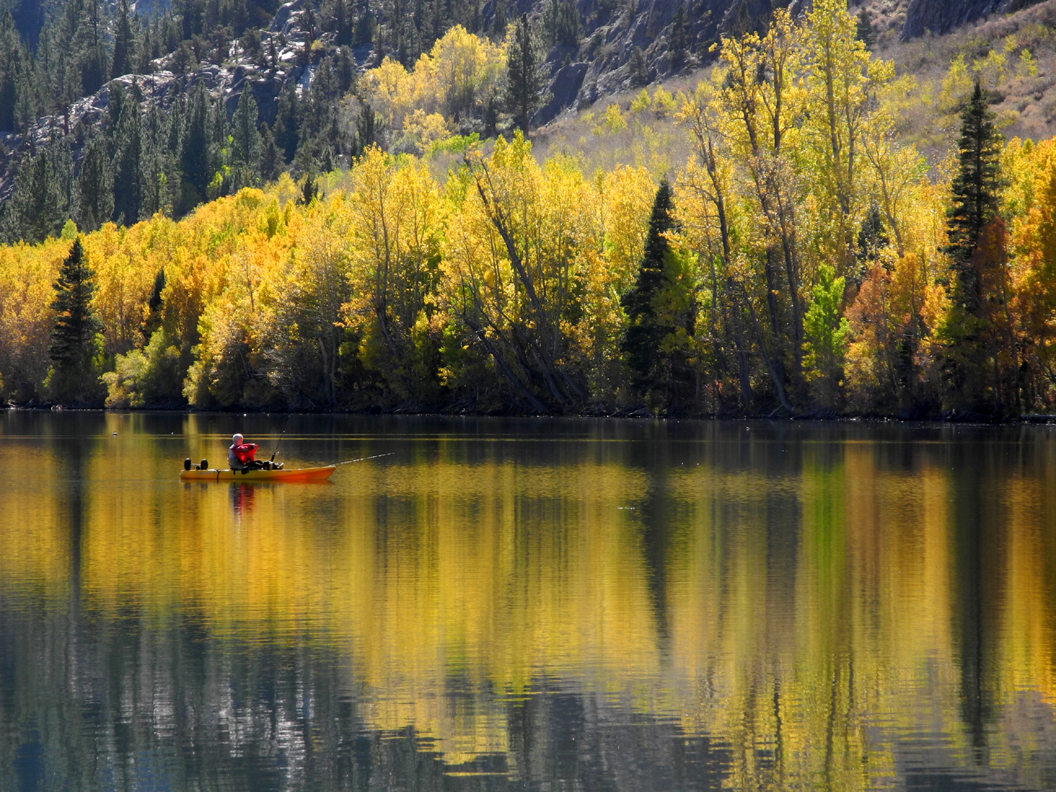
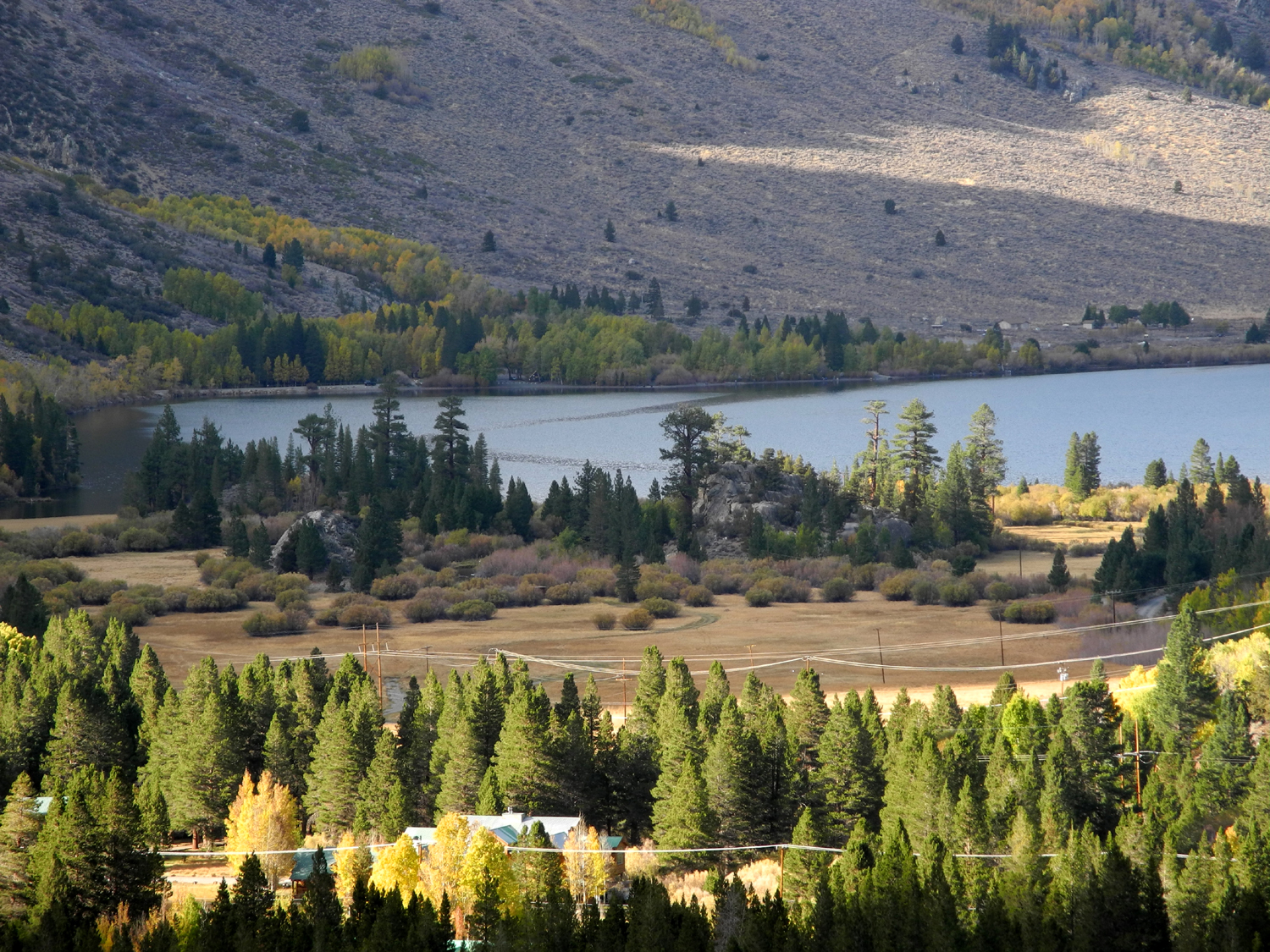
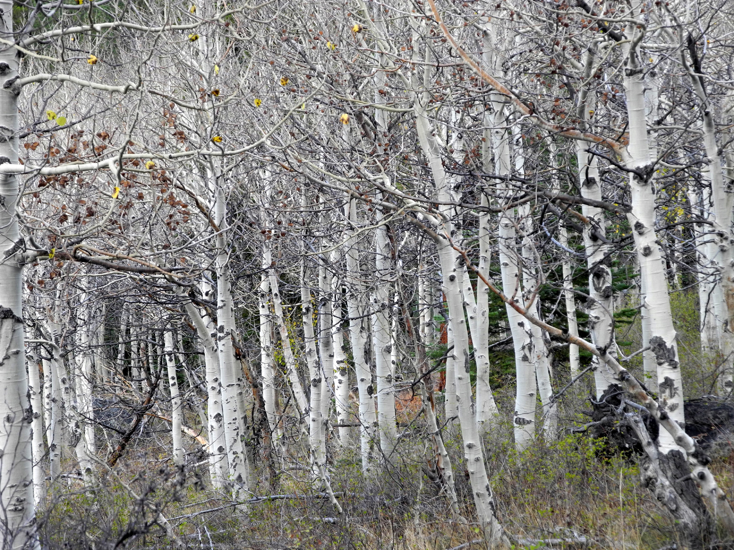
Heading
south and on to the June Lake Loop, we stopped briefly at Grand Lake
and Silver Lake and walked around a bit, enjoying the view of aspens
turning to gold up on the mountain side. After we got checked into
the Whispering Pines Motel, we drove the short distance to the main
part of town and had a good dinner at a local restaurant.
After that
we took a real hike, on the Fern Lake Trail. We went only a short distance, about
six tenths of a mile, with a 600 foot elevation gain. Going up we saw
four deer, and along the way we had a good view of Silver Lake with
the mountains above it and the forest of evergreens and aspens.
After our
hike we had
planned to visit the local ice cream parlor, since we hadn't
indulged in our favorite dessert any time on the trip. Unfortunately
it was closed, so we made do with a visit to the grocery store.
There we each chose a pint of our favorite Hagen-Daze flavor, and
went back to the motel to eat it. On the way we took the road that
goes all the way around June lake, where we saw another green field
being grazed by about 15 deer.
The fact
that fall was well underway and that we were up in the mountains was
brought home strongly the next morning when we awoke to a low
temperature of 32 degrees.
Yosemite via Tioga Pass
We ate
breakfast in the room, and got our stuff loaded in the car for the
final leg of our journey home. We had already checked to make sure
that Tioga Pass over the Sierra was open. It rises to nearly 11,000
feet, and there was indeed some snow around for several miles up and
over the pass, but it was sunny and the road was clear.
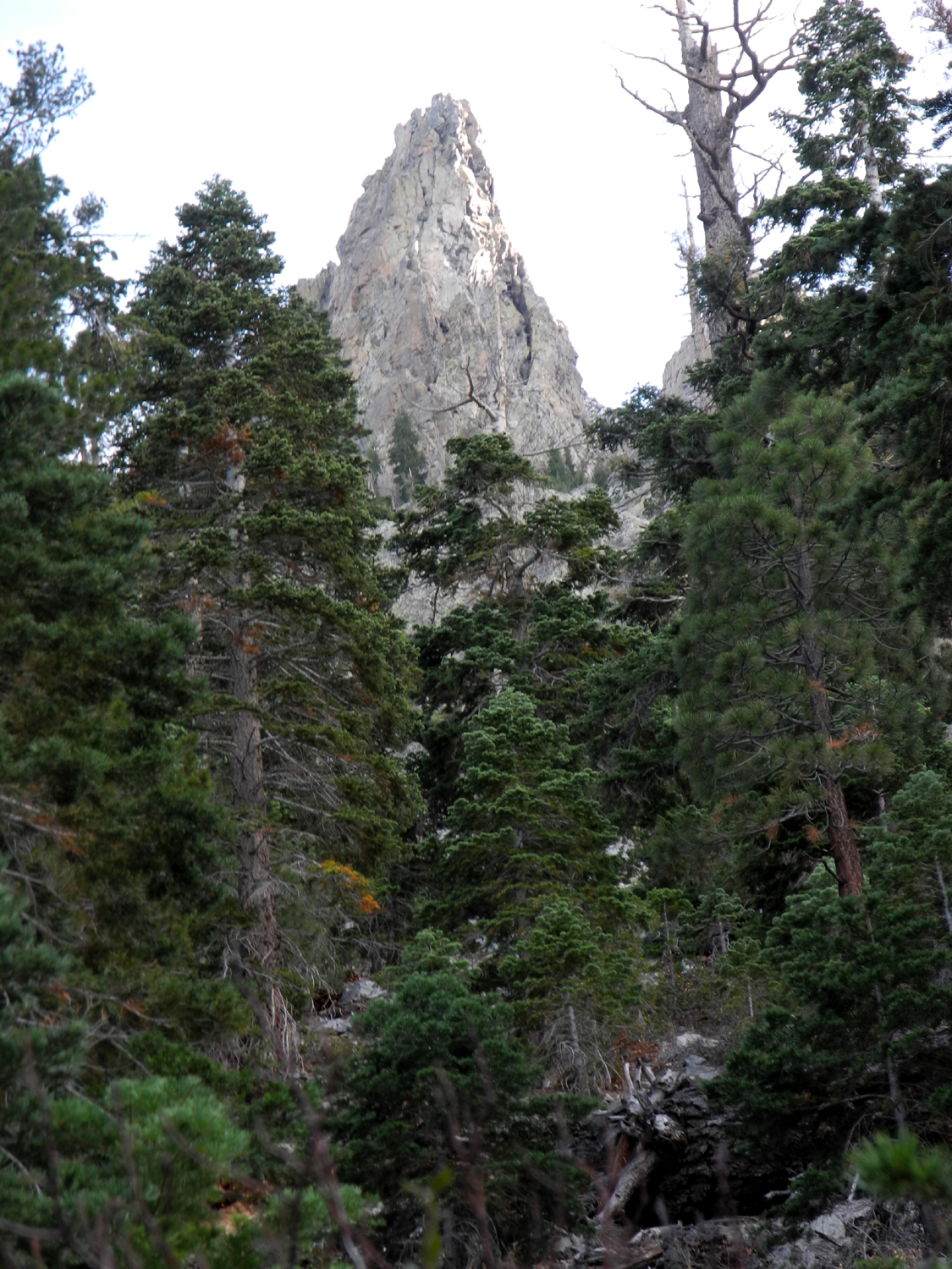
It's a short
but steep climb from Lee Vining to the pass, with great scenery
along the way. We stopped briefly at Ellery
Lake, a man-made lake
for hydroelectric production that takes advantage of the steep grade
to send water down a 3,740 foot penstock, with an elevation drop of
1,659.
At this
point there was snow very close on the slopes above the lake, and
soon we had snow right by the road, as well as on the roof of the
stone building at the entrance station. From here the road passes
through Tuolumne Meadows, where we had the unusual sight of no
people and no cars, all facilities being closed for the season.
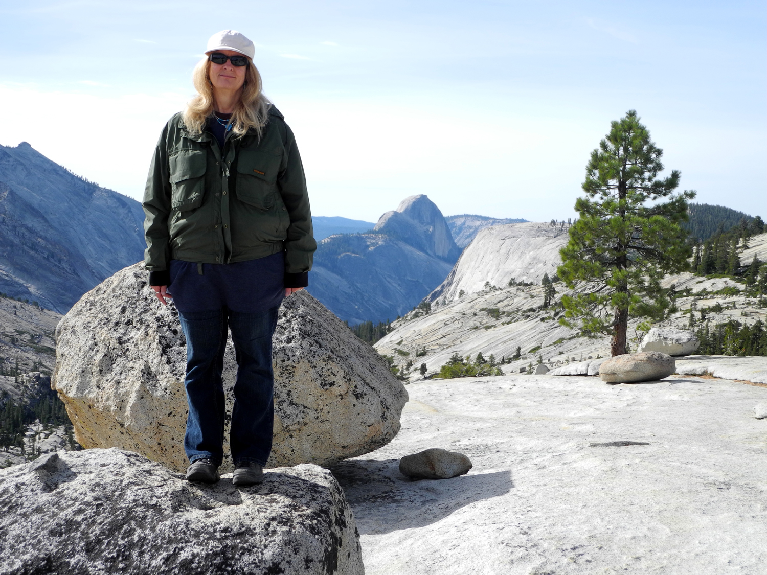
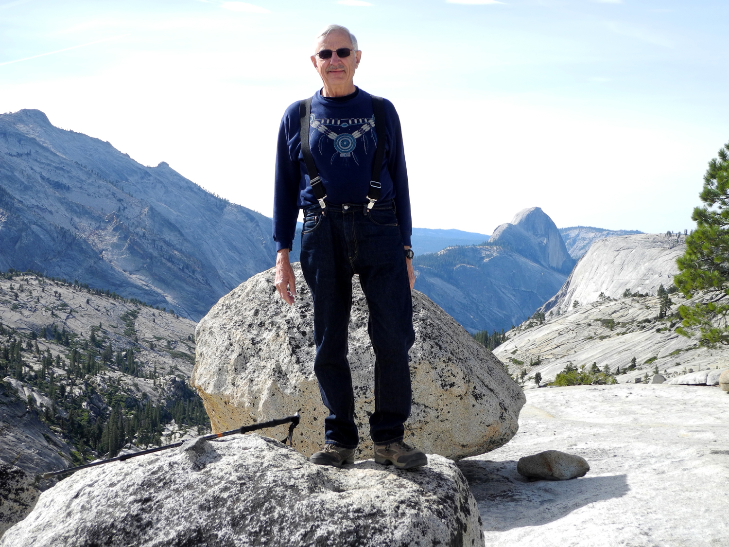
Past the
broad meadows and domes in this area is one of the best vista points
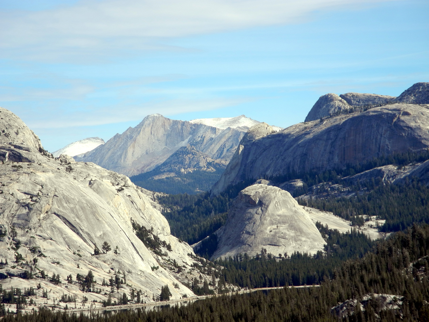
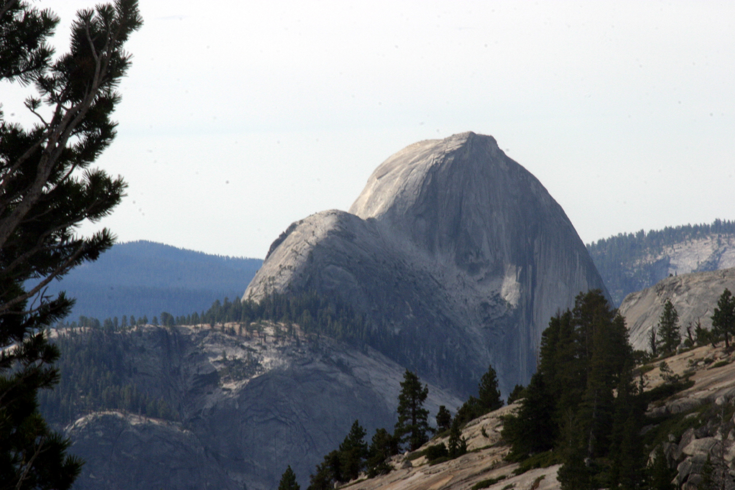
in Yosemite National Park, Olmsted Point. Here you have a view down
the Tenaya Creek Canyon toward Yosemite Valley, with a different
angle on Half Dome at 8,800 feet, and 9,900 foot Cloud's Rest
directly across the canyon. On a previous stop here Teri had
discovered a trail that leads away from the main observation point
by the road, to an open spot on the granite where you get a good
look east at Tenaya Lake and the mountains above
it, and another
different look at Half Dome. A trial that goes all the way to the
valley branches off from this path.
From this
point on we drove the rest of the way on the Tioga Pass and Big Oak
Flat Roads down to
Yosemite, then toward home on Highway 41. We made only a couple of
rest stops and couple of looking around stops, plus lunch. The main
vista stop was above the Wawona Tunnel, where you can see the major
features of the
valley. We also had a view across the Merced River canyon of the last section of the
Big Oak Flat Road where it goes through a series of short tunnels just
before reaching bottom.
We stopped
in Wawona and laid out our picnic lunch on a table right beside
the South Fork of the Merced River, where we had our final wildlife
sighting, a grey squirrel busily preparing for winter. We also
visited and walked across the old covered bridge there which dates
back to pioneer days in the late 19th century. From that point it
was only about 90 more minutes before we pulled up in front of my
condo to complete our 13-day journey.
One of the
things we learned was the benefit of having two drivers. I have
driven through most of the places we went, but was always the only
driver. As a passenger, I was able to look around, study rock
formations, take a look up a canyon, and generally see a lot more
than I had before. To give Teri the same opportunity, I drove out the
Colorado River route and into Arches one day, half the Canyonlands
drive, and
through the most scenic part of our homeward trip through central
Utah.
Now we have
a long list of other places we'd like to visit. Hopefully I'll be
writing about those some day.
June Lake, Mono Lake &
Yosemite Photos
--Dick
Estel, November 2015
|


