|
2022 Rambler Hikes Page 3 |
|
|
Rambler Hikes 2017 Rambler Hikes 2018 Rambler Hikes 2019 Rambler Hikes 2020 Rambler Hikes 2021 |
|
|
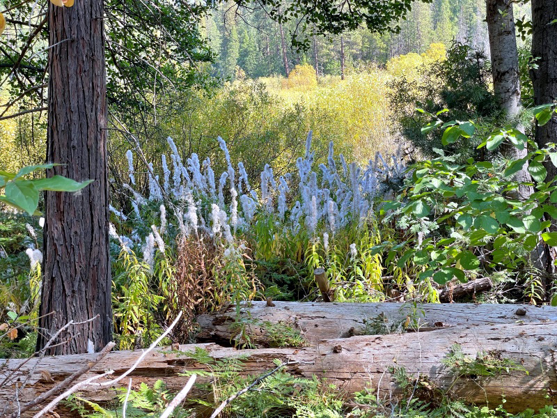
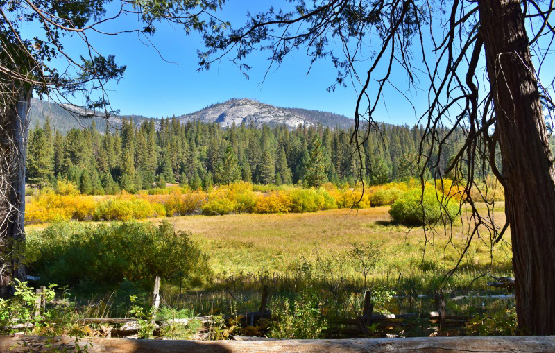
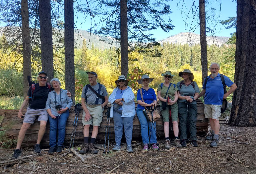
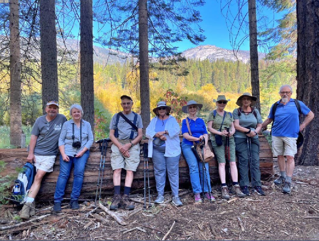
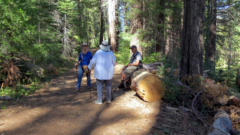
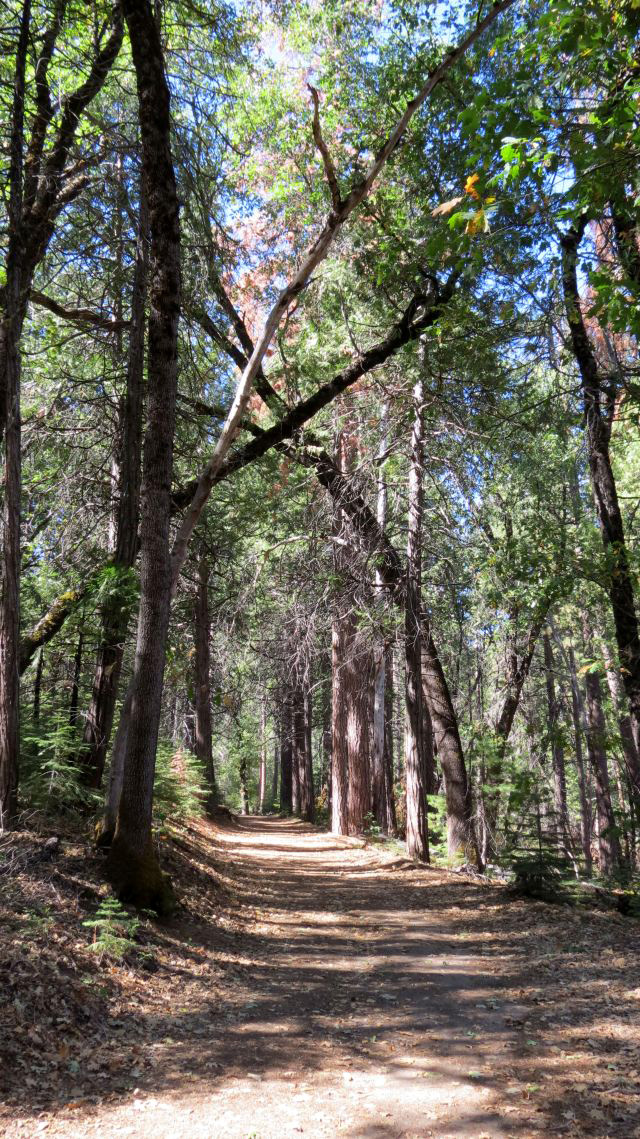
Wawona Loop Helen Hunt Jackson wrote a poem, October's Bright Blue Weather, which begins: O suns and skies and clouds of June, The Ramblers enjoyed that weather on October 12 when we hiked at Wawona after having to cancel our September outing. The sky was indeed blue and cloudless, the weather perhaps a few degrees warmer than ideal, but a far cry from the triple digits that baked us most of September. We walked on the Wawona Meadow Trail, a four-mile loop that circumnavigates the big meadow across from the historic Wawona Hotel. We didn't go all the way, each of us choosing the distance that we were comfortable with. We had one of our largest-ever groups, eleven in all, and without any discussion, divided ourselves into three groups. Don McClellan and Dave Smith have mobility issues and sat in their folding chairs at the trailhead, an approach any of us would have enjoyed. The "slow group," Dick Estel, Susan Crandall, Sue Wirt and Jackie Taggart, hiked at our own pace, and covered 2.6 miles in our round-trip effort. The rest - Wes Thiessen, Jim Tuck, Andy Crandall, Ardyss Webster and Carolyn Amicone, effectively covered half the loop, logging a bit over four miles in their "out and back" journey. Susan and Andy live in Mariposa, and met us in the hotel parking lot. The rest of us arrived in four different vehicles. We have to walk across the highway and a short jaunt across the golf course on the original road to Yosemite that comes in from the west (no longer accessible). At the trailhead we go south, parallel to the meadow, and are immediately immersed in a forest of pine, fir, cedar, black oak and dogwood. Views across the meadow include leaves changing color, evergreens, and Wawona Dome. |
|
 |
 |
| The wide, easy Wawona Loop and the surrounding forest | The view across the meadow with Wawona Dome on the skyline |
|
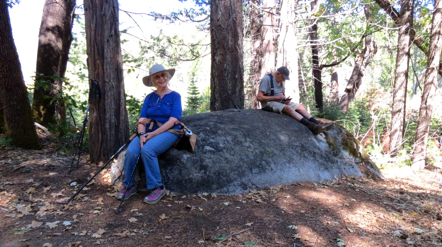
I did not take my camera, having decided to "live in the moment." This is something I learned on a backpacking trip many years ago. I went about a quarter mile off the trail to photograph a waterfall. As soon as I took the photo, I turned to leave, then I realized the photo would be only a pale reflection of reality. I sat down and enjoyed the cliffs, waterfall and creek for five or ten minutes, then went on my way. Fortunately, Wes, Susan and Andy all took photos and have been very generous in allowing me to use them. At the place where the "slow group" stopped, there was a big boulder. I was able to climb up and sit on the edge, and in doing so, I discovered that it had Indian grinding holes, something I had not noticed on any of my previous hikes here. What the other group did can only be speculated by viewing their photos. |
|
 |
 |
| Jackie and Dick rest on a big boulder | Wes delights in "forest bathing" |
|
|
|
|
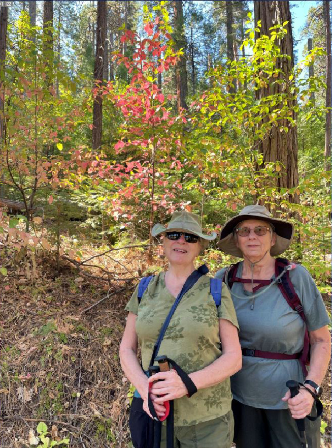
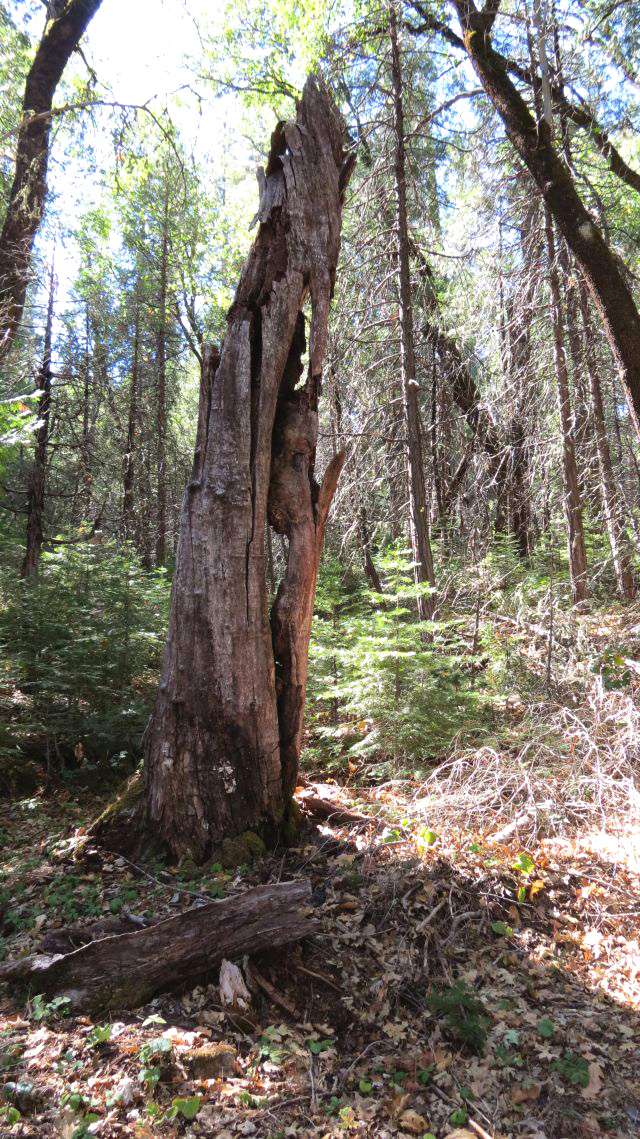
We were a bit disappointed that the dogwood leaves had not fully changed to their fall colors, not too surprising considering how hot it has been this summer. We did find a few that had taken on a pink tinge. And the ferns and willows displayed a good amount of yellow. |
|
 |
 |
| Carolyn and Ardyss in front of one of the few dogwoods with good fall colors | Ferns along the edge of the meadow are turning yellow |
|
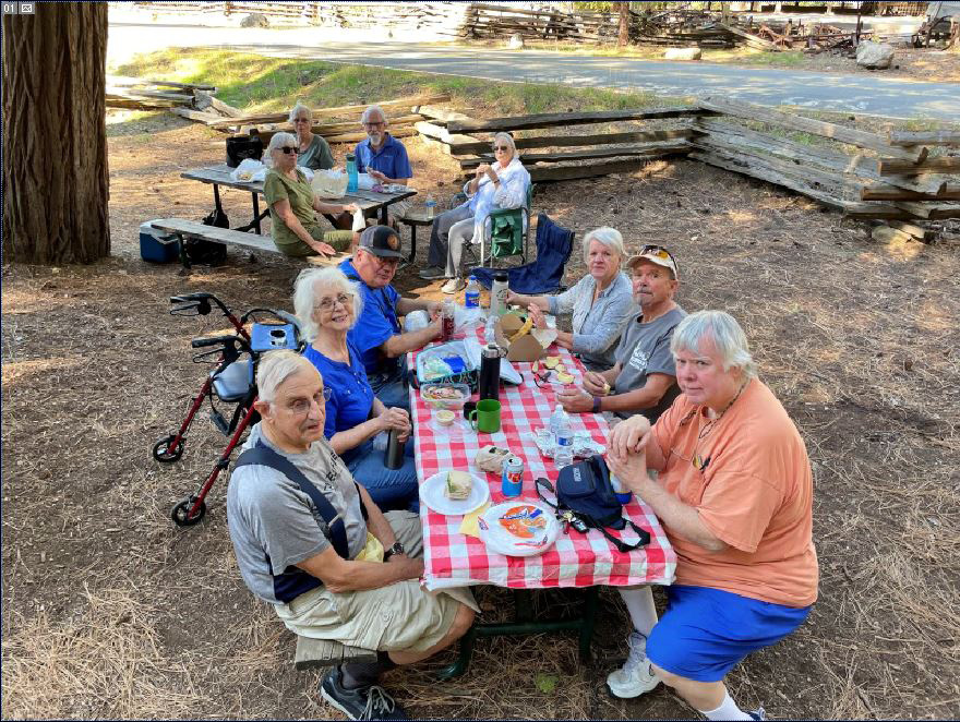
As my group started back, the advance party was also returning and began catching up with us. We found Don and Dave relaxing at the trailhead where we had left them, and all returned to the parking lot. We then drove the short distance to the Pioneer History Center, where we found picnic tables and the covered bridge (dating from 1879) over the South Fork of the Merced River. We had brought our own lunches and finished off the day with a picnic and good conversation. Most of us went inside the bridge, observing the huge beams that brace the structure. |
|
 |
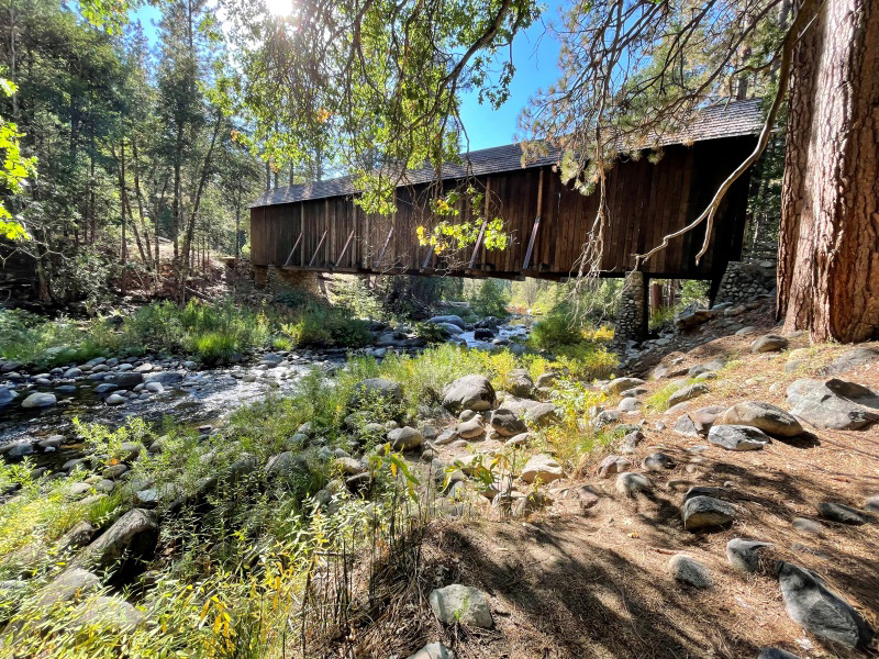 |
| The Ramblers, except for Wes, who took the picture | The historic Wawona Covered Bridge |
|
In keeping with long-standing tradition, we'll give Wes the final words: "The Japanese practice of shinrin yoku, or Forest Bathing, is good for both physical and mental wellbeing. It is proven to reduce stress hormone production, improve feelings of happiness and free up creativity, as well as lower heart rate and blood pressure, boost the immune system and accelerate recovery from illness."
--Forest Holiday --Dick & Wes, October 2022 |
|
| Mariposa
Museum
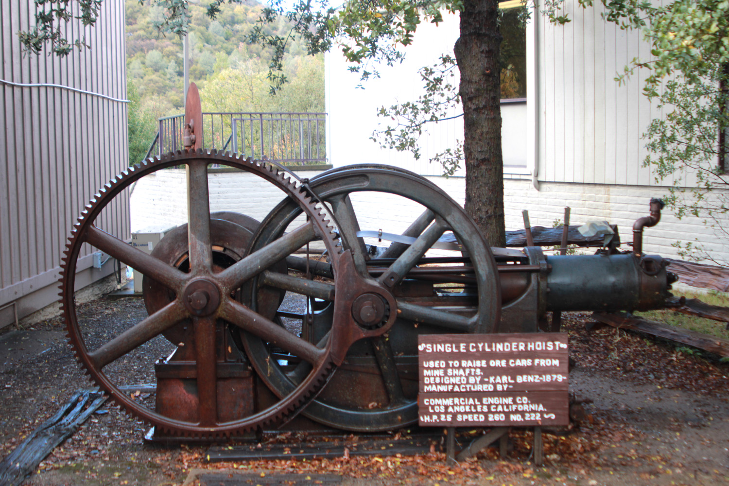
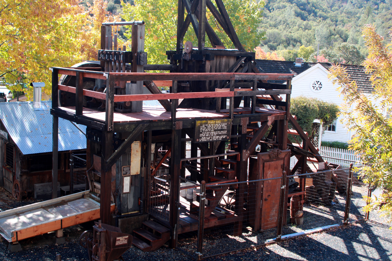
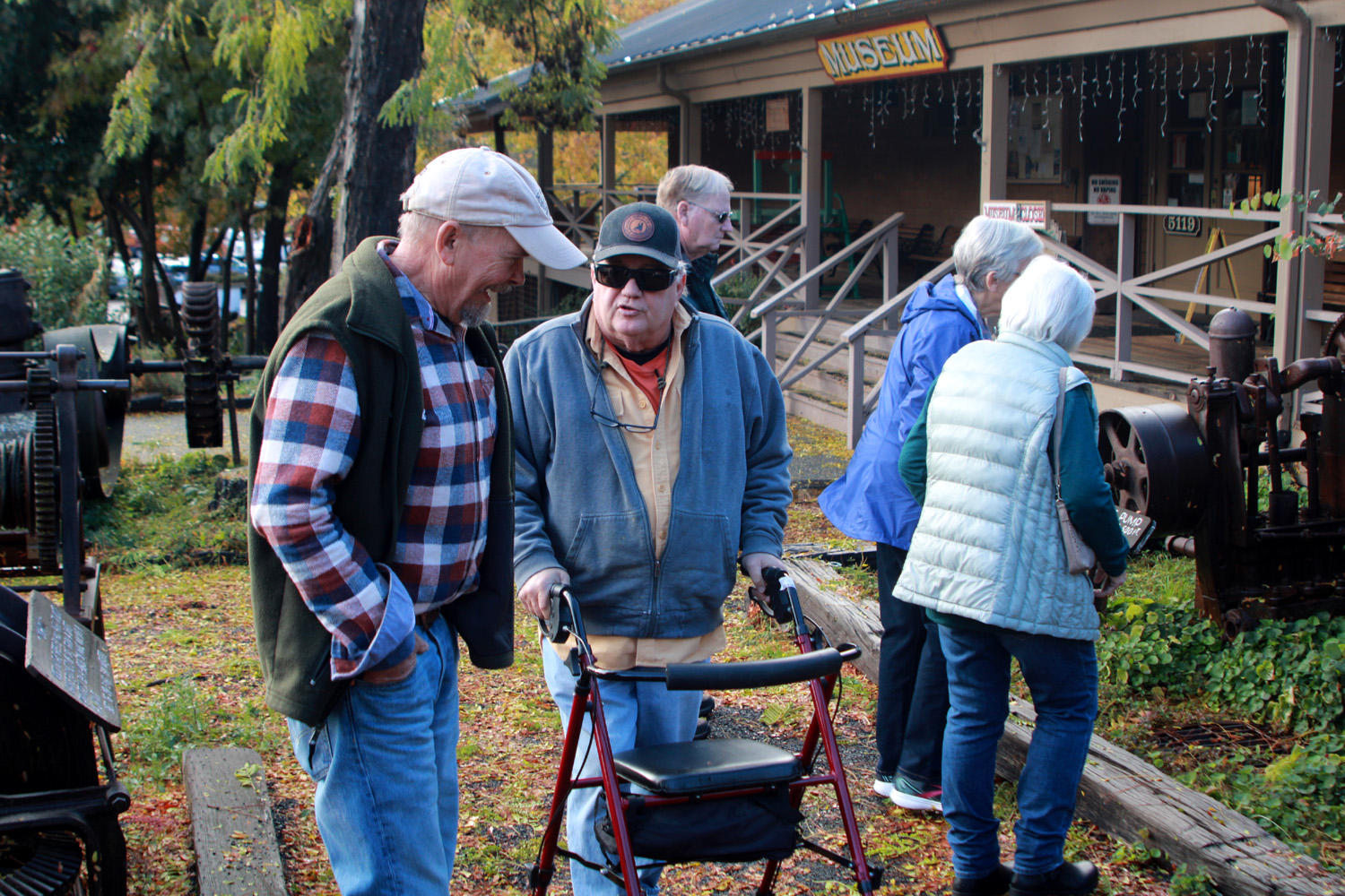
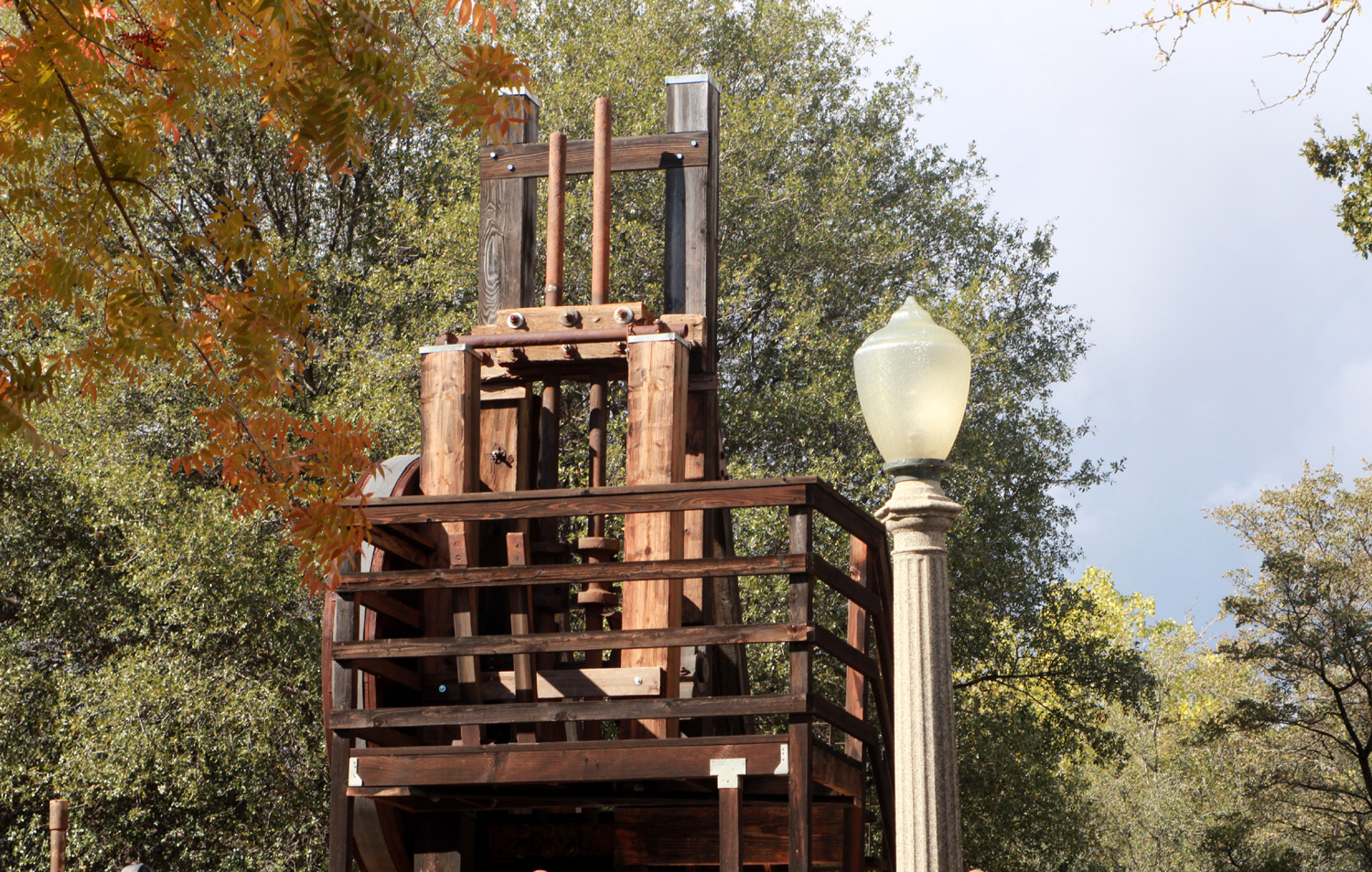
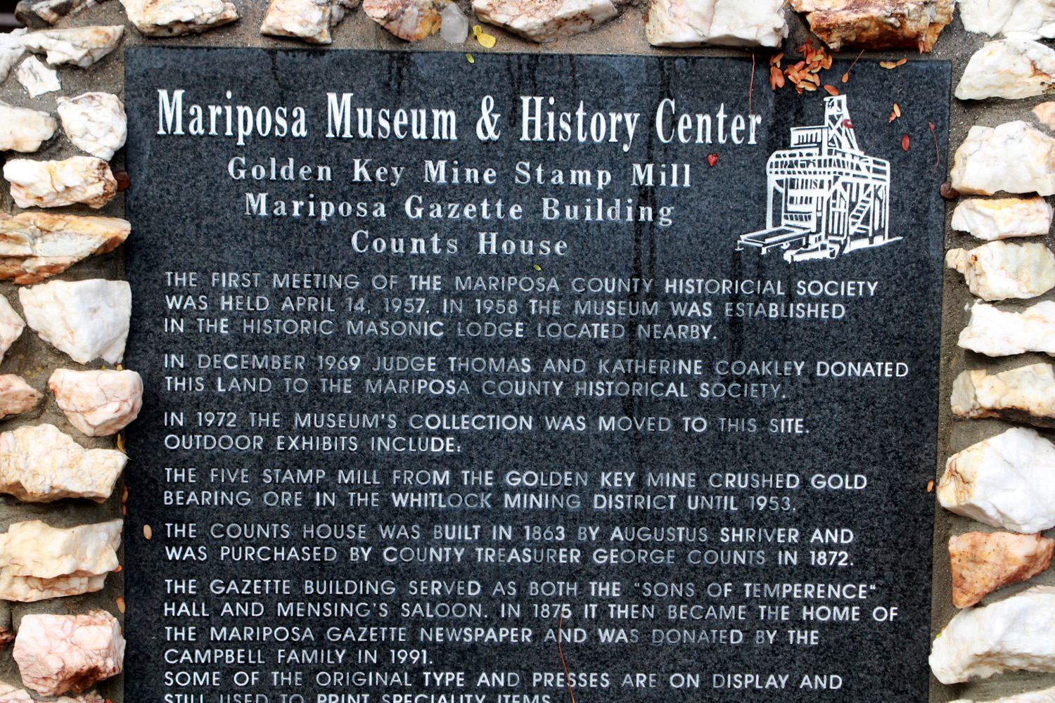
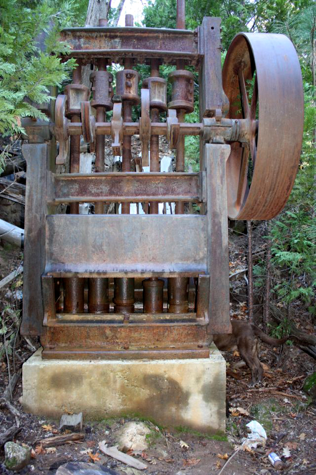
For our November 2022 hike the Ramblers did something completely different. We didn't hike! Since the Ramblers have few if any rules, our monthly activity does not have to be a hike, although at least 90 times it HAS been a hike. In fact, hiking was part of the plan for this outing, although a minor part. But I should start at the beginning. I grew up in rural Mariposa County, six miles from the town of the same name. Since my parents passed I have not had much reason to go there, but I did learn on one of my visits that there is now a walkway along Mariposa Creek, which runs through the main part of town parallel to Highway 140/49. My thought was to check out this area, and then maybe visit some of the tourist-oriented shops, and spend some time in the Mariposa Museum and History Center. This facility has been described by no less than the Smithsonian Institute as the "best little museum of its size west of the Mississippi." We had only four traveling up from the valley - Ardyss, Don, Allen and Dick. We drove to Oakhurst on Highway 41, then turned west on Highway 49 which took us to our destination, a historic mining town dating from about 1850. We parked at the museum, and a few minutes later were joined by Susan and Andy, long-time Mariposa residents, who had a drive of two minutes. As befits a town that came into being because of the California Gold Rush, many of the exhibits relate to mining. There is a huge collection of mining artifacts arranged around the outside of the building, and we spent some time looking at these. Mariposa is near the southern end of the Mother Lode, a vein of gold-bearing quartz that stretches from Nevada City in the north to Oakhurst, with Highway 49 connecting the historic mining towns of the Sierra foothills. Getting gold out of the rock in Gold Rush days consisted mainly of crushing the quartz ore to sand-size particles, then washing the lighter weight material out to leave the heavier gold behind. Various machines were involved in this process, the most dramatic being the stamp mill. This device has two or more thousand pound weights (stamps) each at the bottom of a metal shaft. A steam-operated cam shaft lifts each stamp in turn and allows it to drop eight inches, 100 times per minute, onto the ore to be crushed. The resulting particles are washed across screens that trap heavier material (gold) while the waste is carried off. The stamp mill pictured was used in the Golden Key Mine at nearby Mt. Bullion, and reassembled on the museum grounds by Harry Odgers, a long-time miner, with the help of many volunteers. It is operational by arrangement or at scheduled times. A similar stamp mill still sits on the hillside above the east side of town, at the mouth of the Mariposa Mine. This mill was operated briefly when I was in high school, and the sound could be heard all over town. |
|
 |
 |
| The
5-stamp mill. Top of rods from stamps visible upper left behind railing |
Full view of the stamp mill |
|
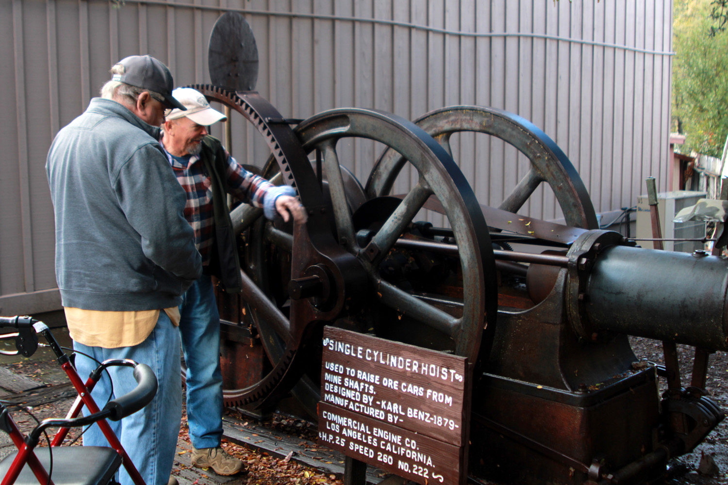
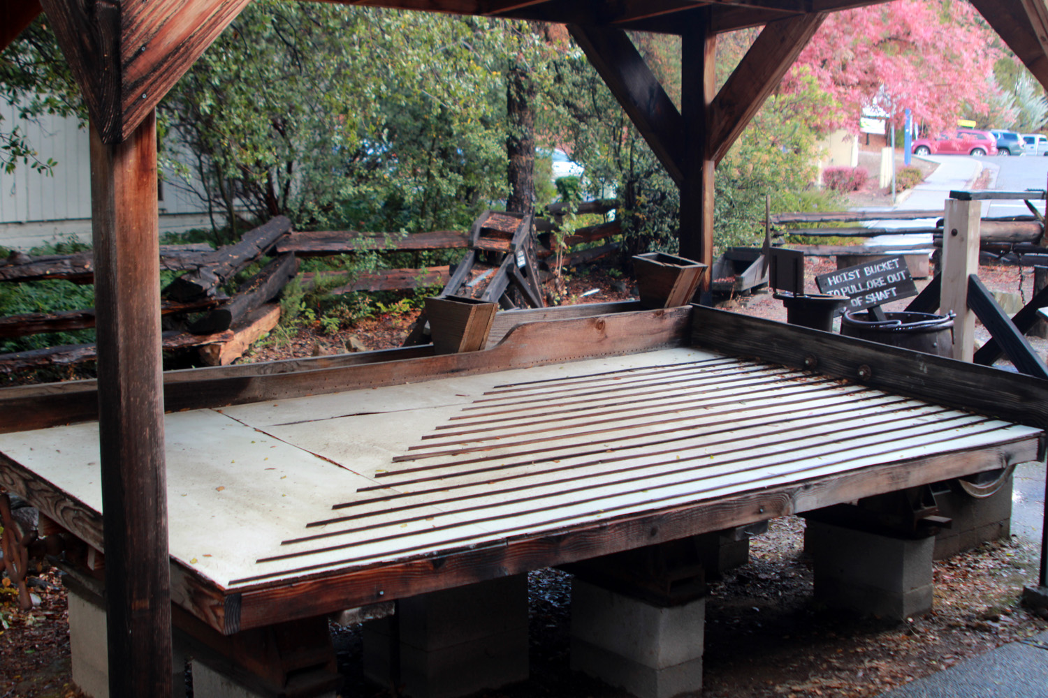
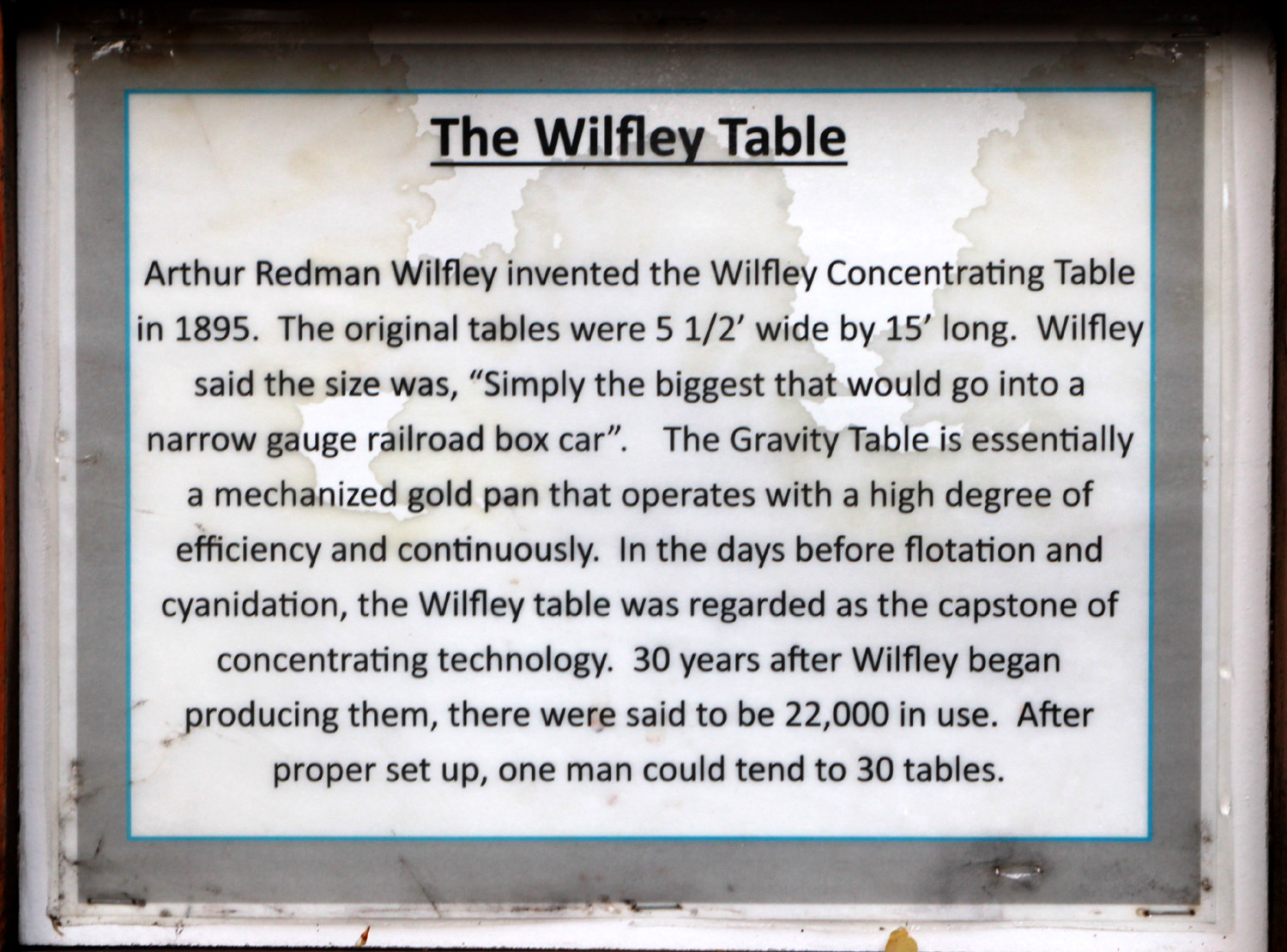
Don and Andy are both mechanically adept, interested in how things work, and had a good time admiring and discussing the various pieces of equipment on display. Of course, Andy had been to the museum many times, but it was Don's first visit. Except for the Crandall's, it was the first time any of us had heard of or seen a Wilfley Table, although its principle was immediately clear to anyone familiar with gold prospecting methods, since it's essentially a mechanized gold pan. |
|
 |
 |
| Don and
Andy admire an early product from Karl Benz of Mercedes-Benz fame |
The Wilfley Table tilts and rocks to separate gold from lighter material |
|
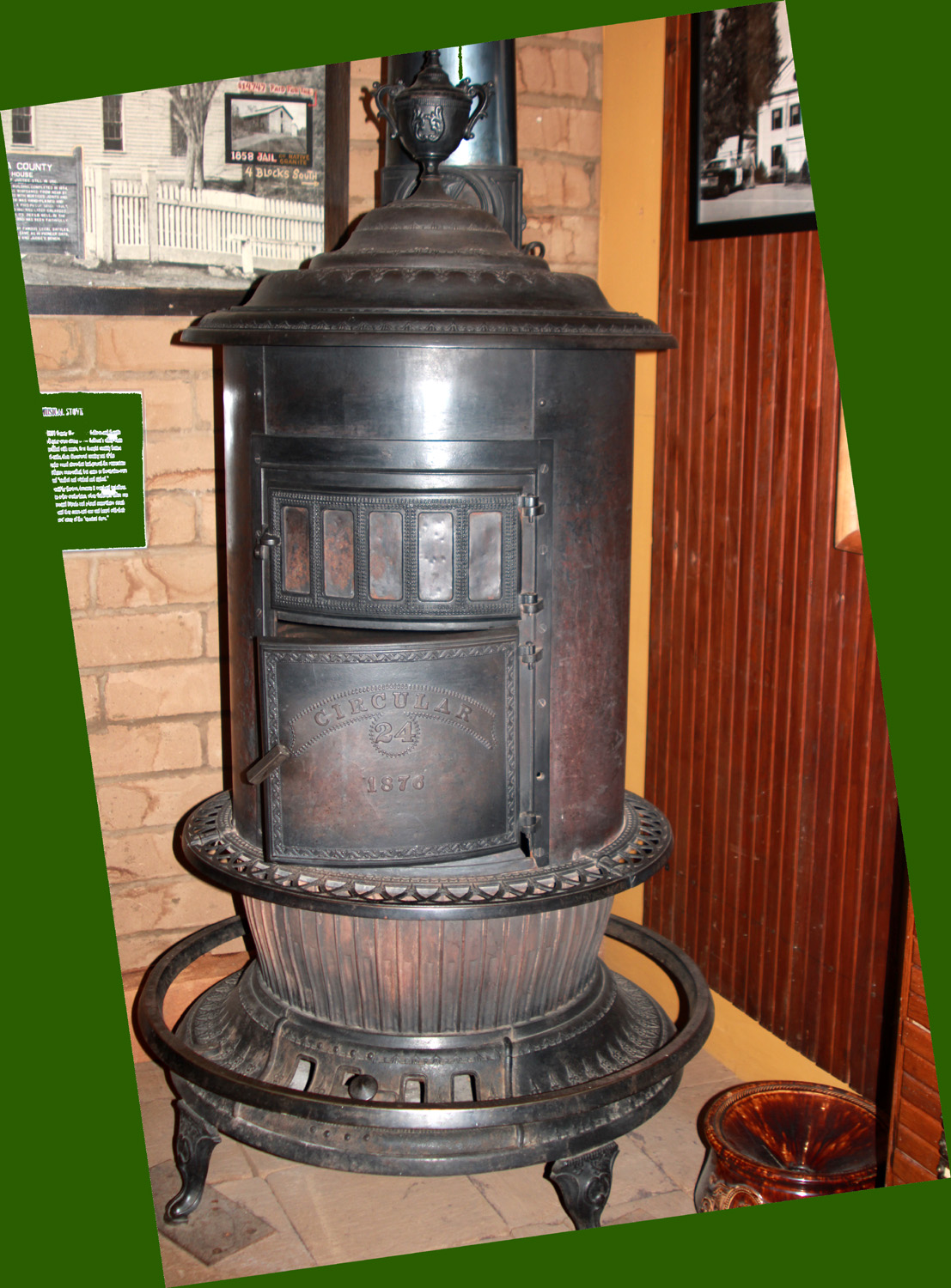
Eventually we made our way inside the building where we were greeted by volunteer Adele Marks. I had met her and her late husband, Reed, about 20 years earlier when they were the campground hosts at Nelder Grove. She guided us around the museum, providing information about the exhibits beyond what was written on the signs accompanying the displays. The museum is arranged in sections that focus on various subjects. Near the entrance is a re-creation of the Gagliardo store from Hornitos. Some merchandise from gold rush days was still part of the inventory when the store closed in the middle of the 20th Century. Mrs. Gagliardo had preserved all the receipts and other records from the beginning and these are also part of the display. It was not feasible to take photos inside. It would also make this report unbearably long to describe all the displays. They include sections about the county courthouse, (in continuous use since 1854), the lumber industry, and of course, mining. This includes a working model of a stamp mill about two feet high. I particularly enjoyed a newly opened section that focuses on the Native Americans who have lived in the area for thousands of years. Some of them were my classmates from first to twelfth grade. I also was transported back to my childhood by the sight of a massive wood stove that had been in the courthouse. In the 1940s and maybe early '50's, my mother helped count ballots on election night, and I would keep warm standing by that stove while I waited. |
|
 |
 |
| Stove from the historic courthouse | Ramblers exploring the outside exhibits |
|
Thanks to the Crandall's membership in the historical society, we were allowed to enter the vault, where fragile documents and other artifacts are stored in a state-of-the-art climate controlled room. Like most museums, this one owns many more items than they can display at any one time. I can't show you the exhibits, but I CAN say that if you are ever within easy driving range, a visit to this amazing historical treasure is well worth your time. About that creek-side hike. When we were ready to leave the museum, our only thought was lunch, so we drove to the nearby Miner's Roadhouse for a delicious meal. It's been one of Mariposa's most popular restaurants for decades, previously known as Miner's Inn, the same as the nearby motel. When lunch was over, we were all ready to return home so we said our goodbyes to Susan and Andy, and drove south and east on Highway 49. There was a layer of snow along two sections of this route, where the road reaches about 3,000 feet in elevation. We had a scenic drive home, with everything washed clean by the recent rain and a light sprinkle that accompanied us part of the way.
---Dick Estel, November 2022 |
|
| Finegold
North
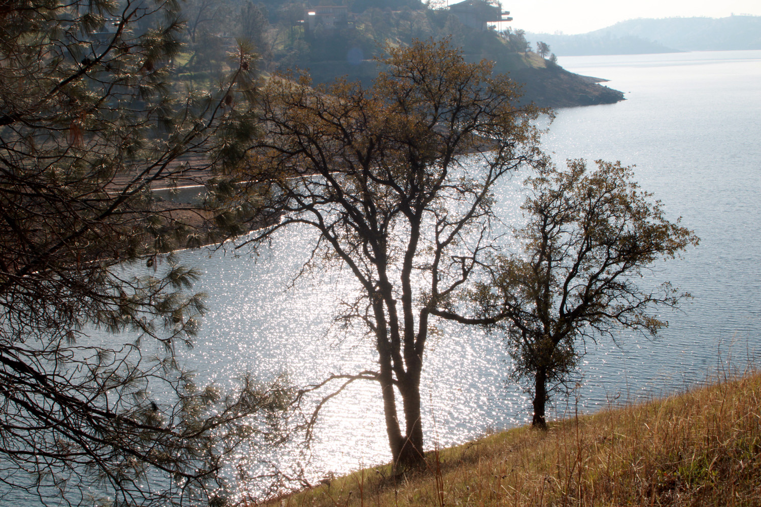
The Ramblers are a fluctuating group, with the number of hikers ranging from two to a dozen. Six or eight has been the usual number on most recent hikes, but we were reduced to three on December 15 - Ardyss, Jackie and Dick. Those who had something preventing them from joining us missed a refreshing stroll in cold sunshine, with a sparkling Lake Millerton, green grass getting started on the hills, geese down by the water, and, in a Rambler first, a cat. He did not actually hike with us, but greeted us when we arrived at the parking area, and was waiting at the trailhead when we finished our hike. He was friendly and looked well-fed, and probably lives in one of the mini-mansions nearby. |
|
 |
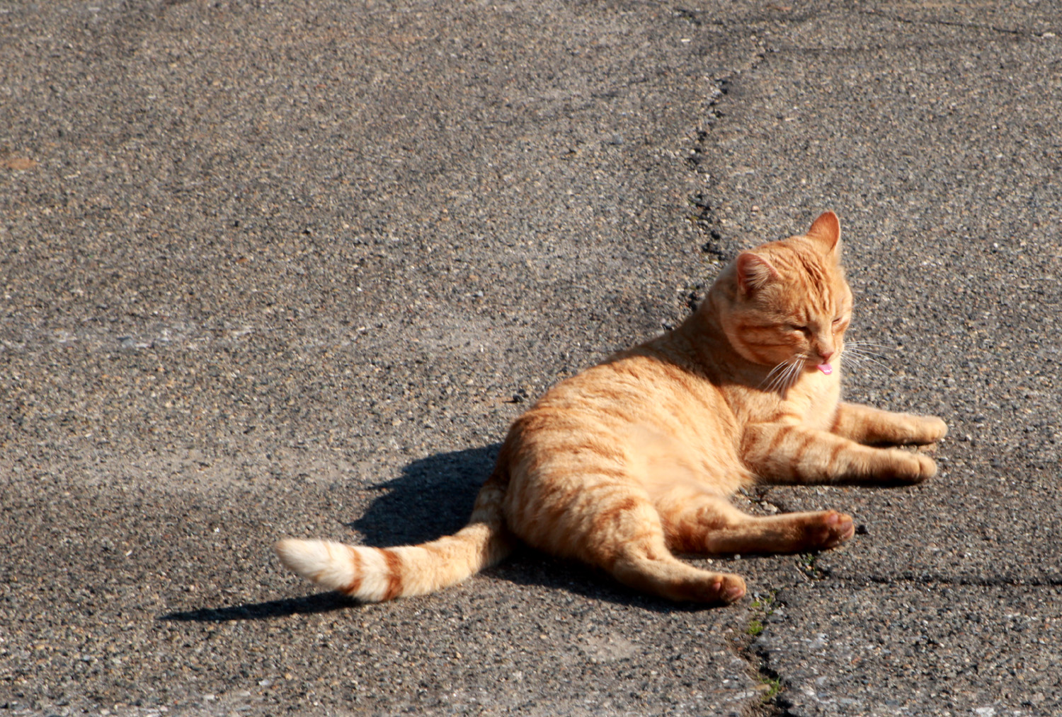 |
| Millerton Lake, shining in the sun | The official trailhead greeter |
|
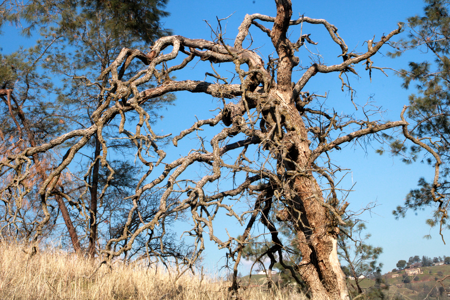
This hike starts at the end of Sky Harbor Road, an in and out dead end route that starts next to the Table Mountain Casino on Friant Road and ends at the Finegold Picnic Area. Near the end of the road is a residential development of upscale houses with million dollar views of the lake. It has always struck me as a dangerous place to live, since there is only the one route in and out, unless of course you have a boat. Rather than an official trail, we follow a combination of fisherman's trails, cow paths and an old road, going down from the parking area toward the lake, then around the north side of a ridge that divides the main lake from a little cove. The "real" trail goes up hill in a southerly direction from the picnic area, and eventually ends at the San Joaquin River Gorge recreation area, a distance of about twelve miles. This hike was not only new to both Jackie and Ardyss, neither of them could recall ever being on the Sky Harbor Road. It's a winding two-lane road, with almost constant views of the lake. In the right season it's lined with wildflowers, but none were in evidence this time. There was a lot more water than we expected after several years of drought. Millerton is at 60% of capacity, compared with nearby Pine Flat at 20% and Shasta in northern California at 31%. When we first spotted the geese they were right by the trail, but as we approached, they slowly drifted down toward the lake. These are called Canada geese but they seem to have found a permanent home in the Fresno area, appearing in large numbers in parks, school yards, and the lawns around public buildings. I think the ones we see now are 9th or 10th generation pure American. Trees in the area we walked through are mostly blue oaks and bull pines, with a few shrubs of various sorts, including one with red stems that I don't recall seeing anywhere else. There are some bush lupines beside the trail, but of course it's too early for them to bloom. |
|
 |
 |
| A gnarly dead blue oak | There are a lot of these unknown shrubs on the hills by the trail |
|
When we finished our hike, our lunch destination was the Pizza Factory in nearby Friant. Although Don could not hike with us, we had made arrangements to call him when we were close to the car so he could join us for lunch. This set off one of those "comedy of errors" sequences that seems to plague the Ramblers at least once a year. When I tried to call Don, I had no service. As we drove back out Sky Harbor Road and on to Friant Road, I stopped several times and tried to call, each time without success. Finally, about a mile from Friant, my phone began to emit the beeps that indicated news alerts were being received so I stopped once more and finally reached Don. I was concerned that we would be waiting 20 or 30 minutes for him to drive from his home west of Highway 41. However, he informed me that he was driving down Willow Avenue and was only a few yards from Friant Road. When we parked at the Pizza Factory, it was less than ten seconds before Don pulled in beside us. We enjoyed a good lunch and a wide-ranging conversation, occupying our table for close to an hour after we finished eating. We agreed that we had brought 2022 to a successful conclusion with this last hike of the year. --Dick Estel, December 2022 |
|
| Photos (Click to enlarge; pictures open in new window) | ||
| Wawona Loop Mariposa Museum Finegold North | ||
| Wawona Loop | ||
 |
 |
 |
| A log full of Ramblers | Wes, Susan and Don | Jackie, Sue and Dick can always find a resting log |
|
 |
 |
| A cedar tree flanks
this view of willows and meadow plants heading into fall |
This rotting snag
stands in front of patch of young firs |
An inviting path to serenity now |
| Mariposa Museum | ||
 |
|
|
| Info about the stamp
mill and historic buildings on the museum grounds |
Lots of power needed
to raise heavy buckets of ore from deep in the ground |
A two-stamp mill |
 |
 |
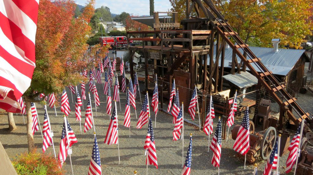 |
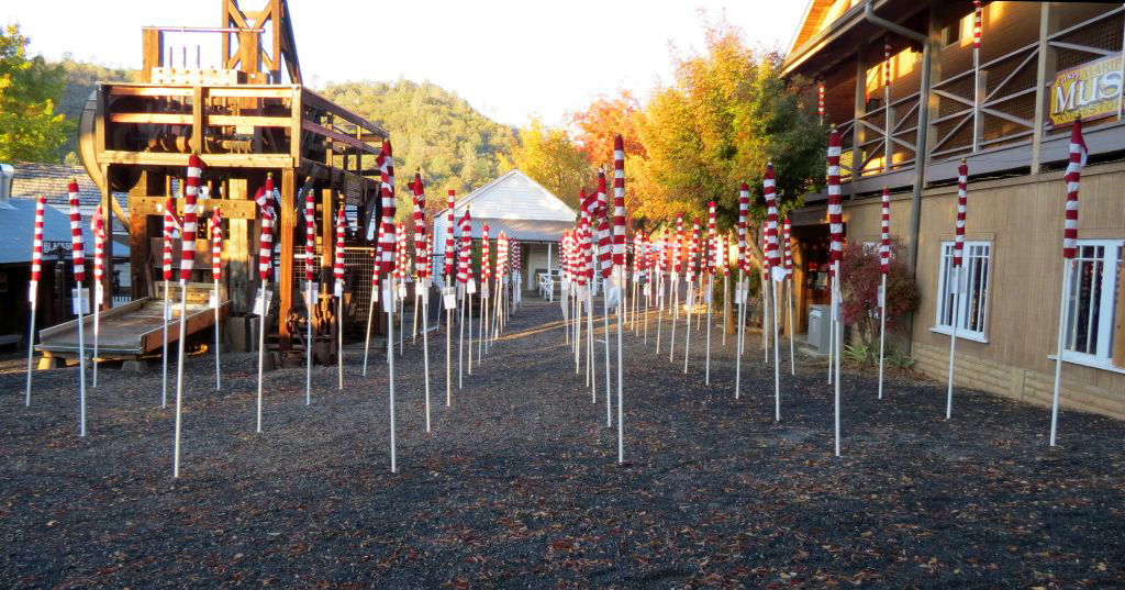
| Stamps, Mariposa Mine (about 1999) | Flags furled, annual
Mariposa Field of Service (for Veteran's Day) |
Flags unfurled (flag photos by Susan) |
| Finegold North | ||
|
 |
|
| Jackie
and Ardyss make their way down the steep beginning of the trail |
Americanized Canadian geese | Most photos of Dick show him resting |
| Related Links | ||
| Go Pro with Wes | Helen Hunt Jackson | Wawona Covered Bridge |
| Wawona Meadow Trail | Wawona History | Ramblers First Wawona Hike - with only two of us |
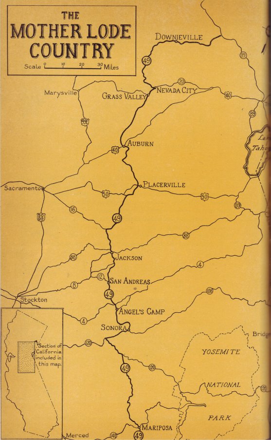
| Mariposa Museum and History Center | Mother Lode Map | Mother Lode |
| Stamp Mill out in the Wild (by Susan) | Photos from Mariposa Mine | Photos from Old Mariposa |
| California Gold Rush | Hornitos | Mt. Bullion |
| Pine Flat Reservoir | South Finegold Picnic Area | Pizza Factory - Friant |
| Lake Millerton | ||