

Dick's Adventures of 2018 - Part 3 |
||
|
Adventures of 2016 Adventures of 2017 2018 Part 1 2018 Part 2 2018 Part 4 2018 Part 5 2018 Part 6 |
||
|
San Joaquin Gorge Bridge Trail Lewis Creek Trail Courtright Family Camp New Trail Discovery Sentinel Dome, Mariposa Grove and Nelder Grove |
||
|
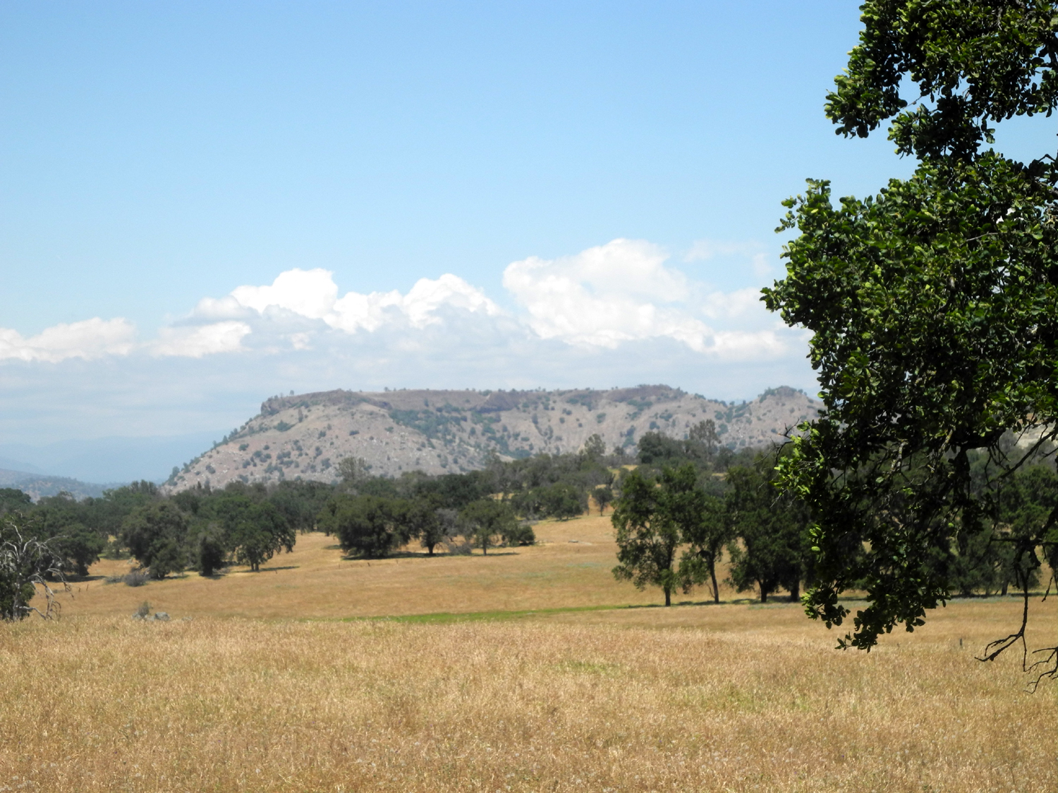
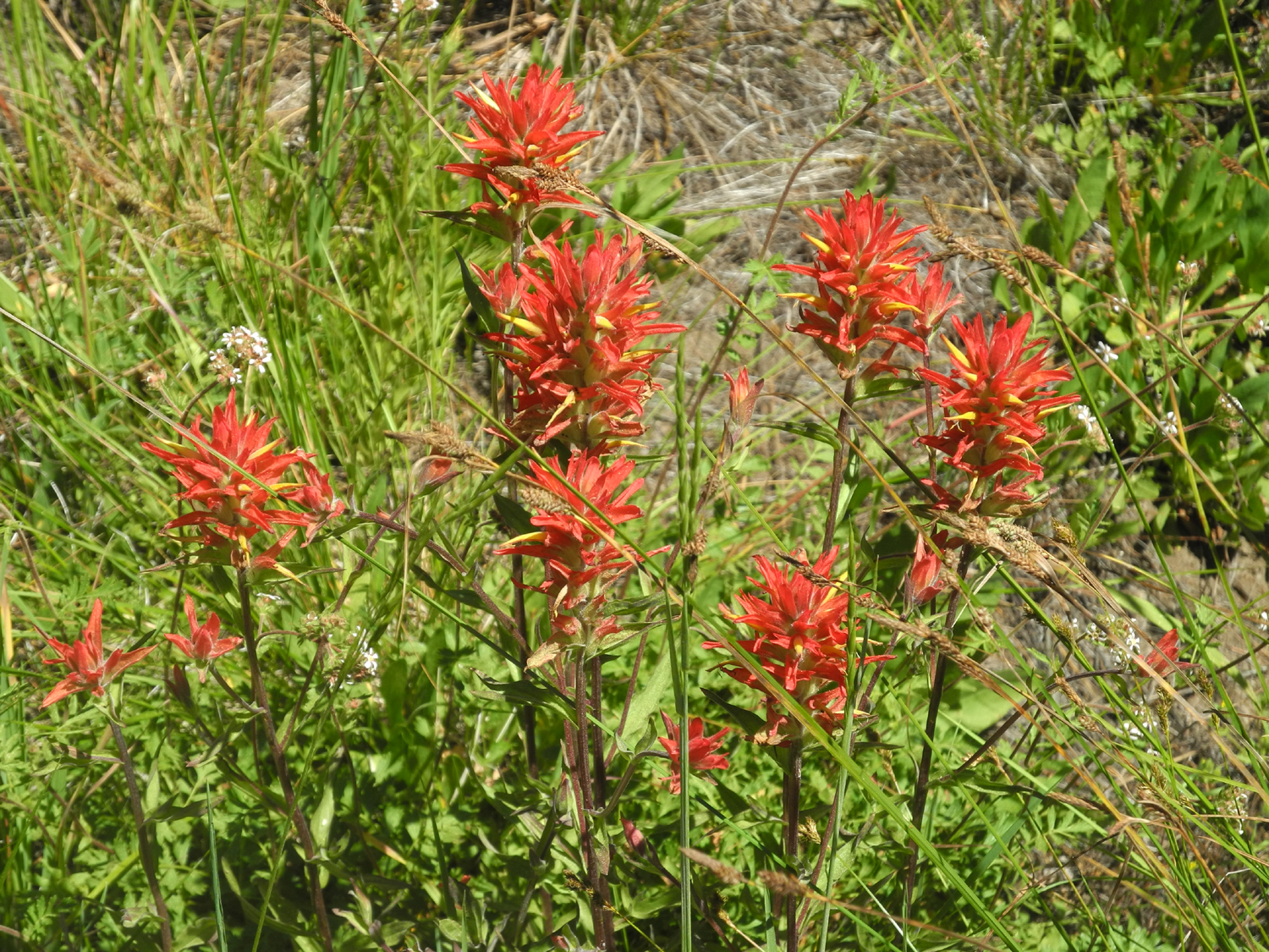
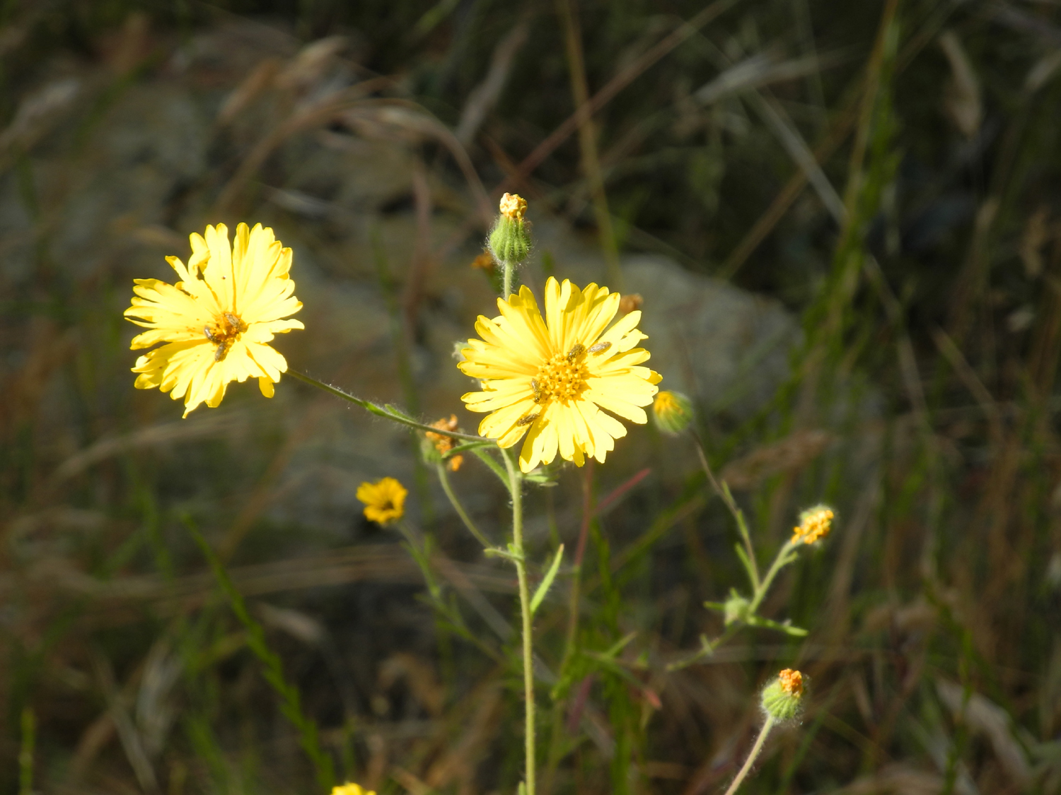
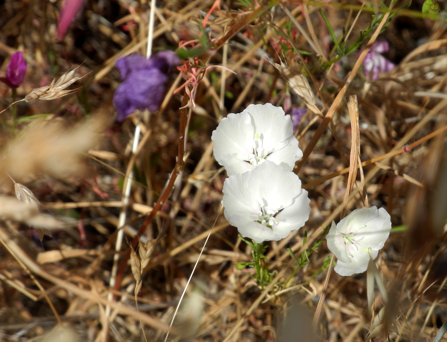
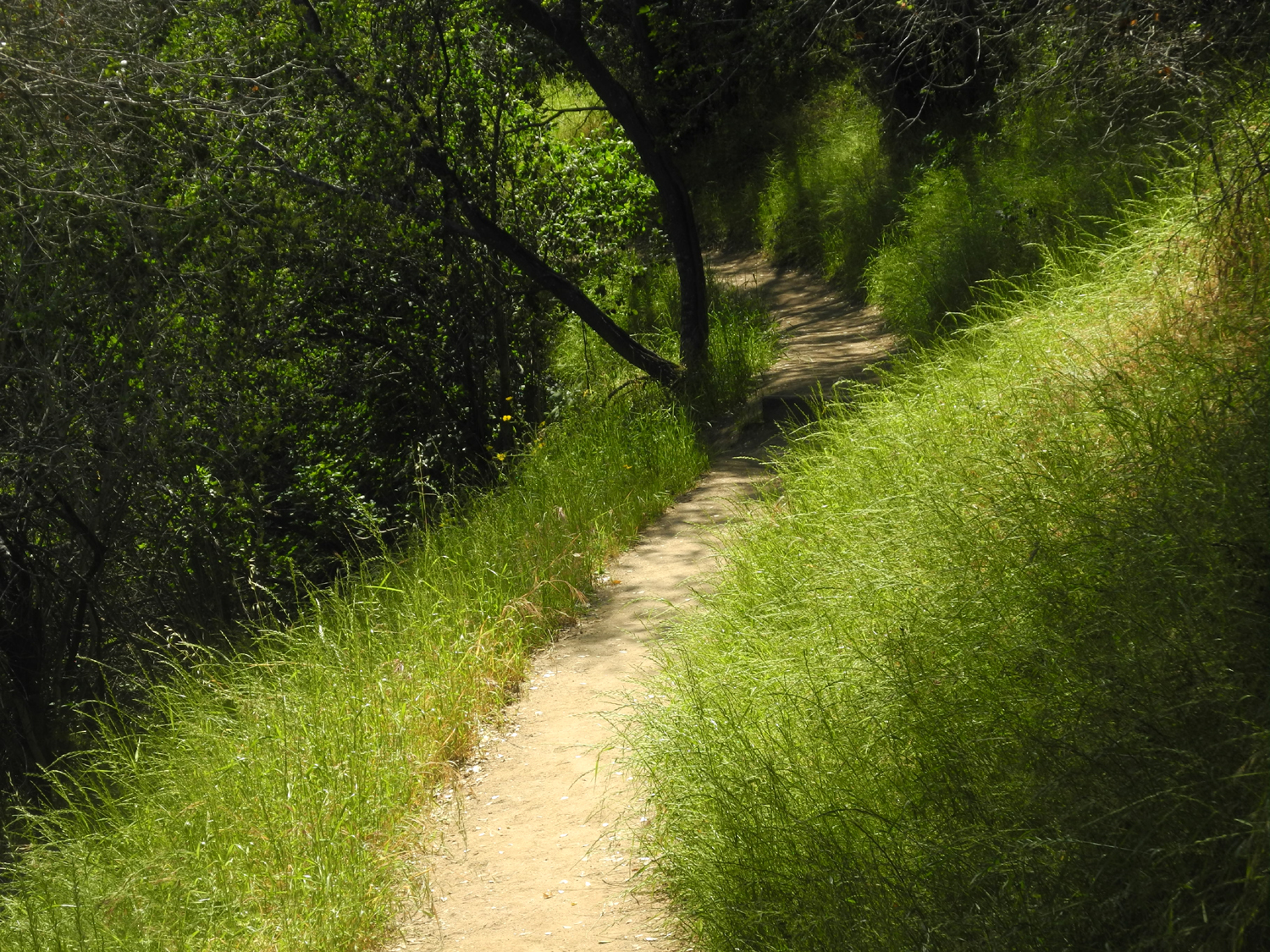
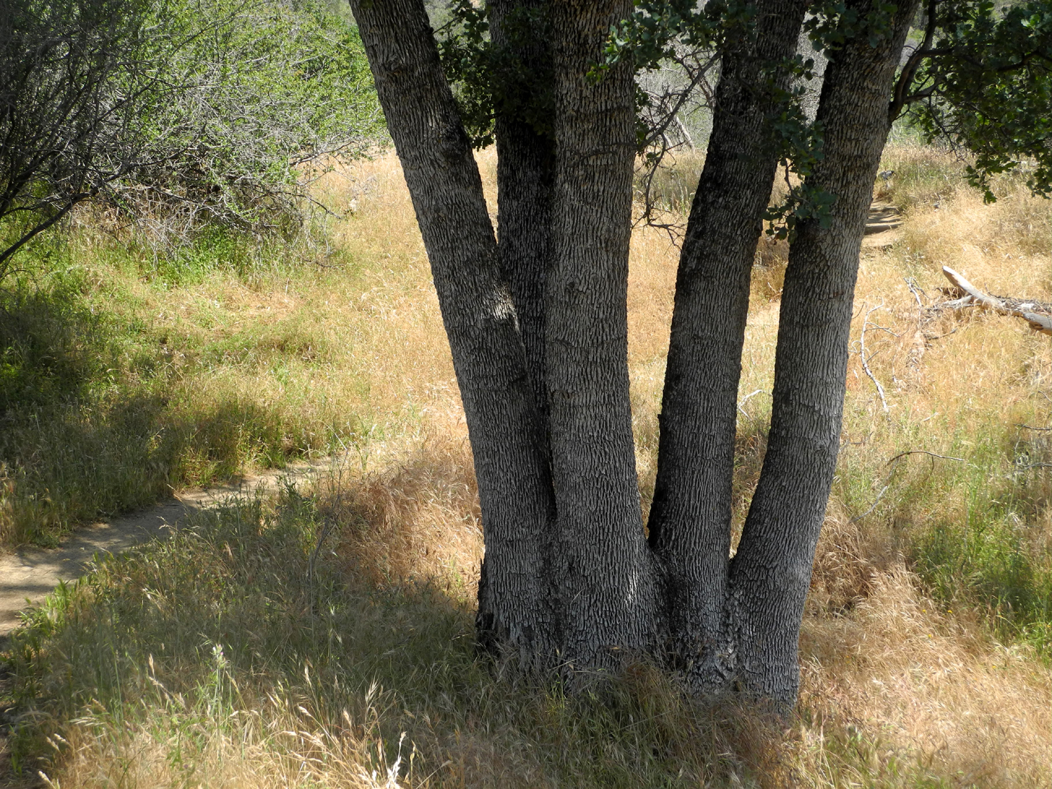
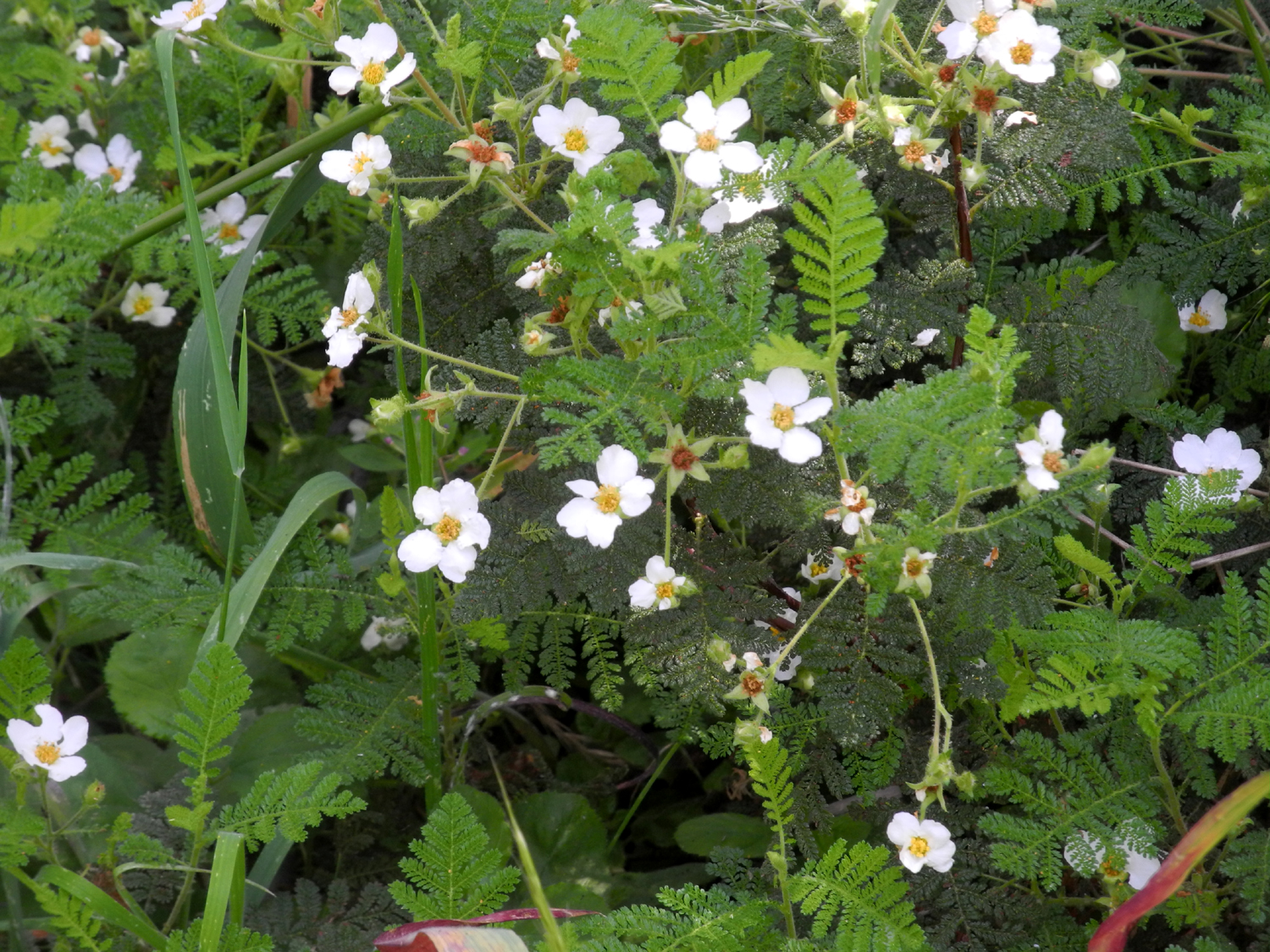
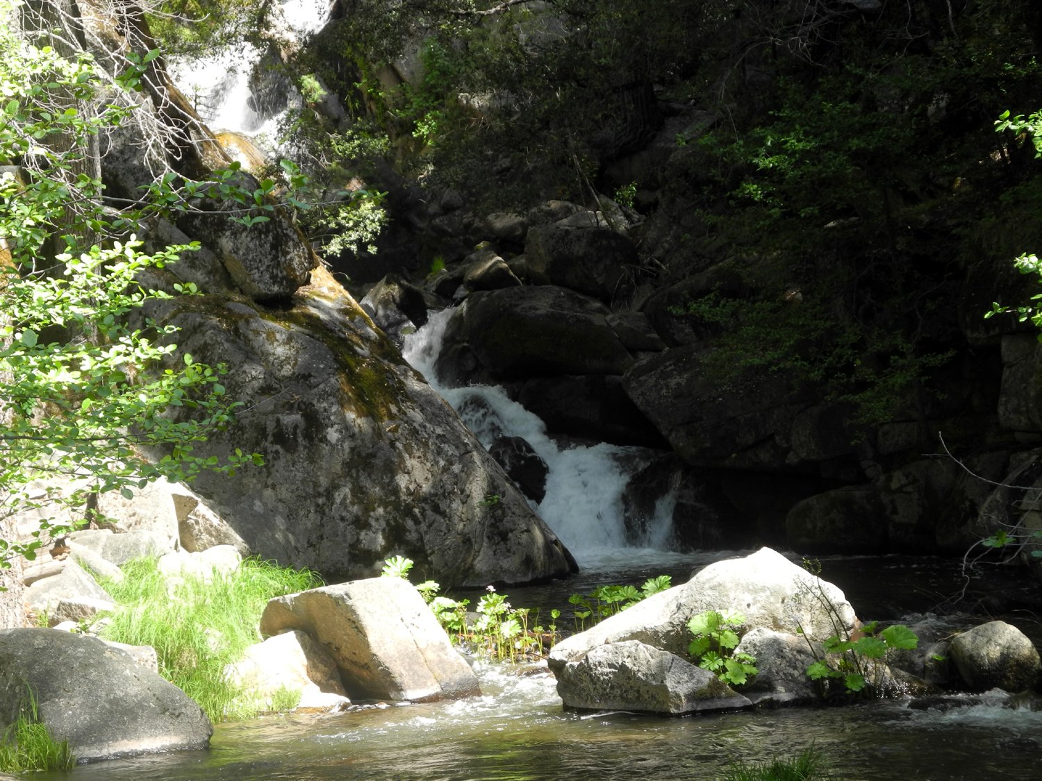
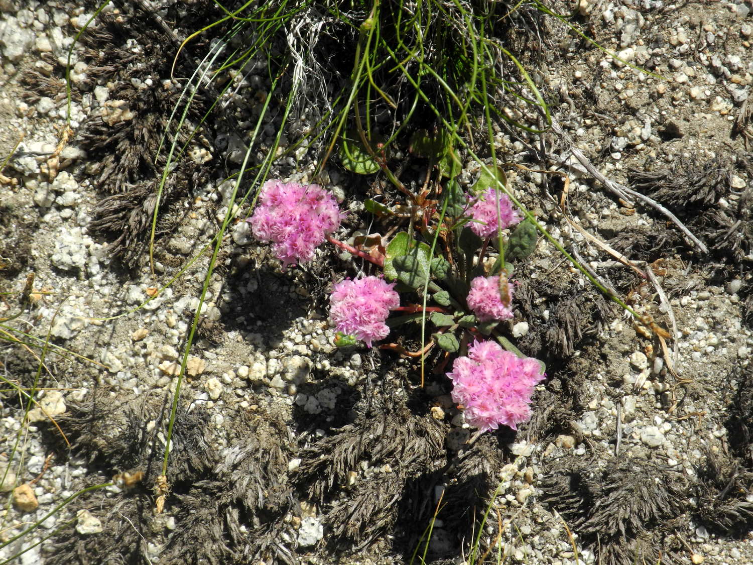
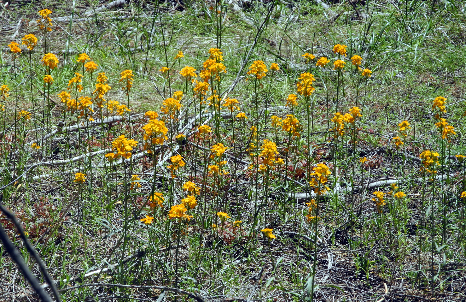
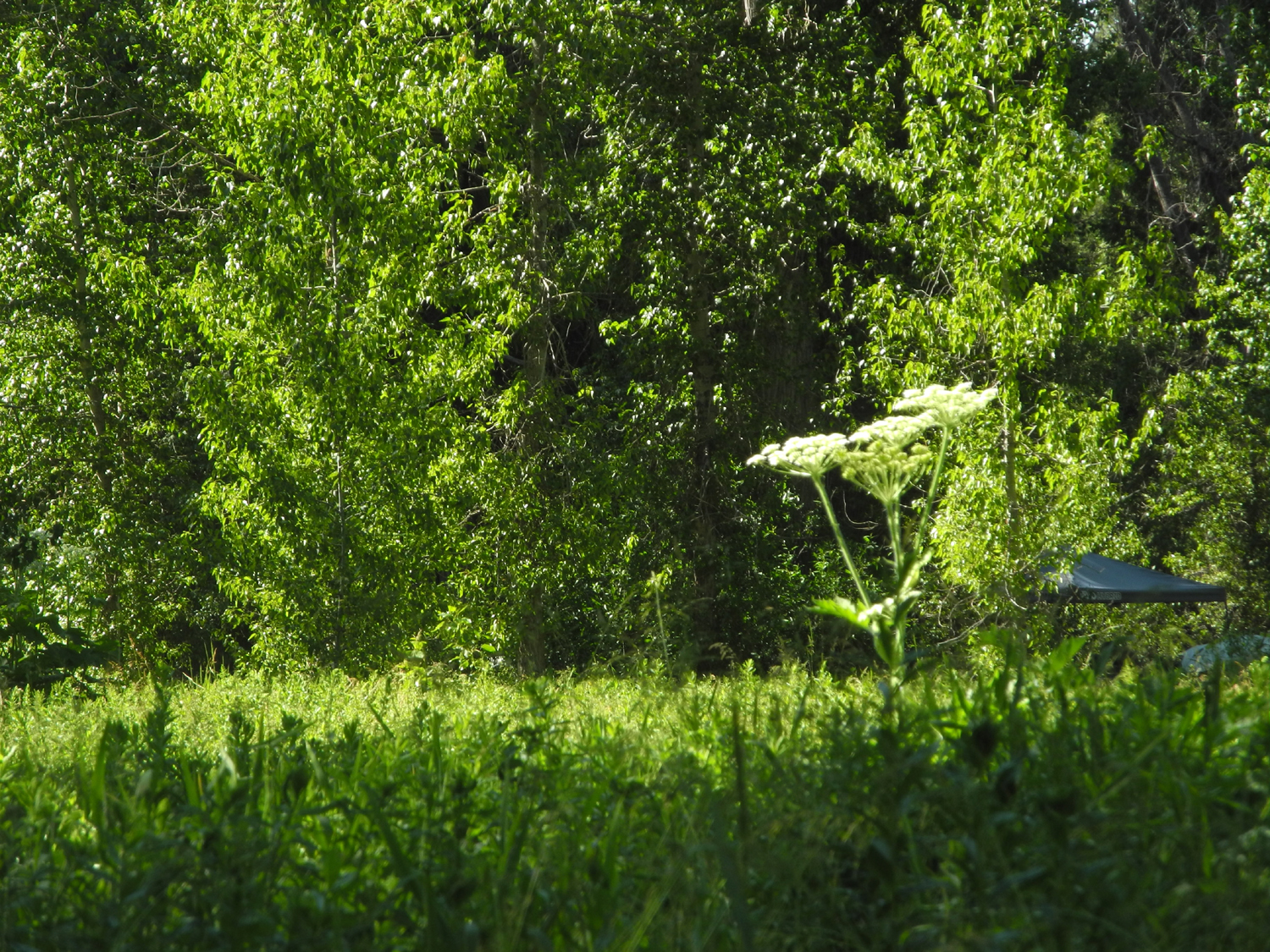
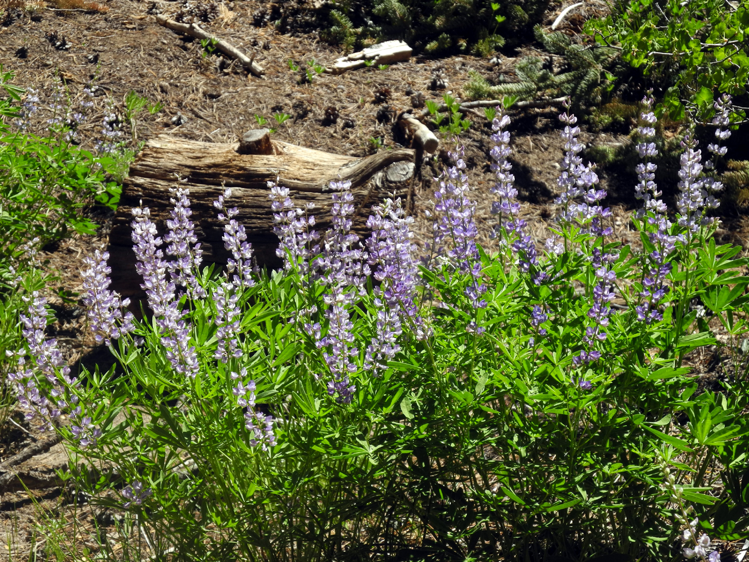
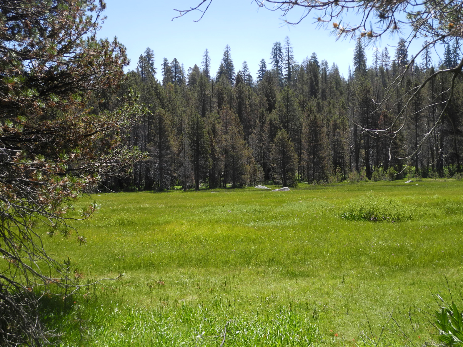
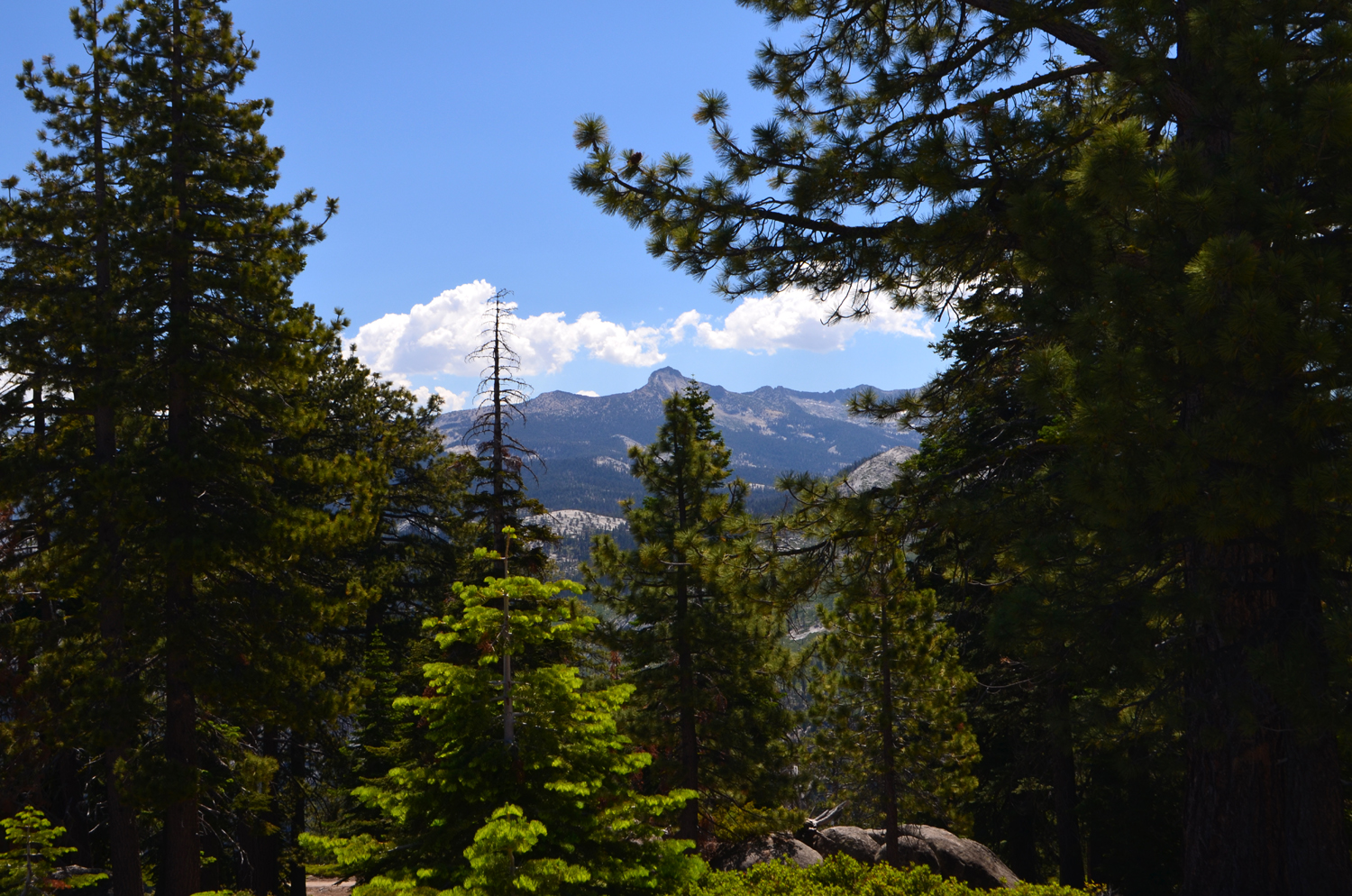
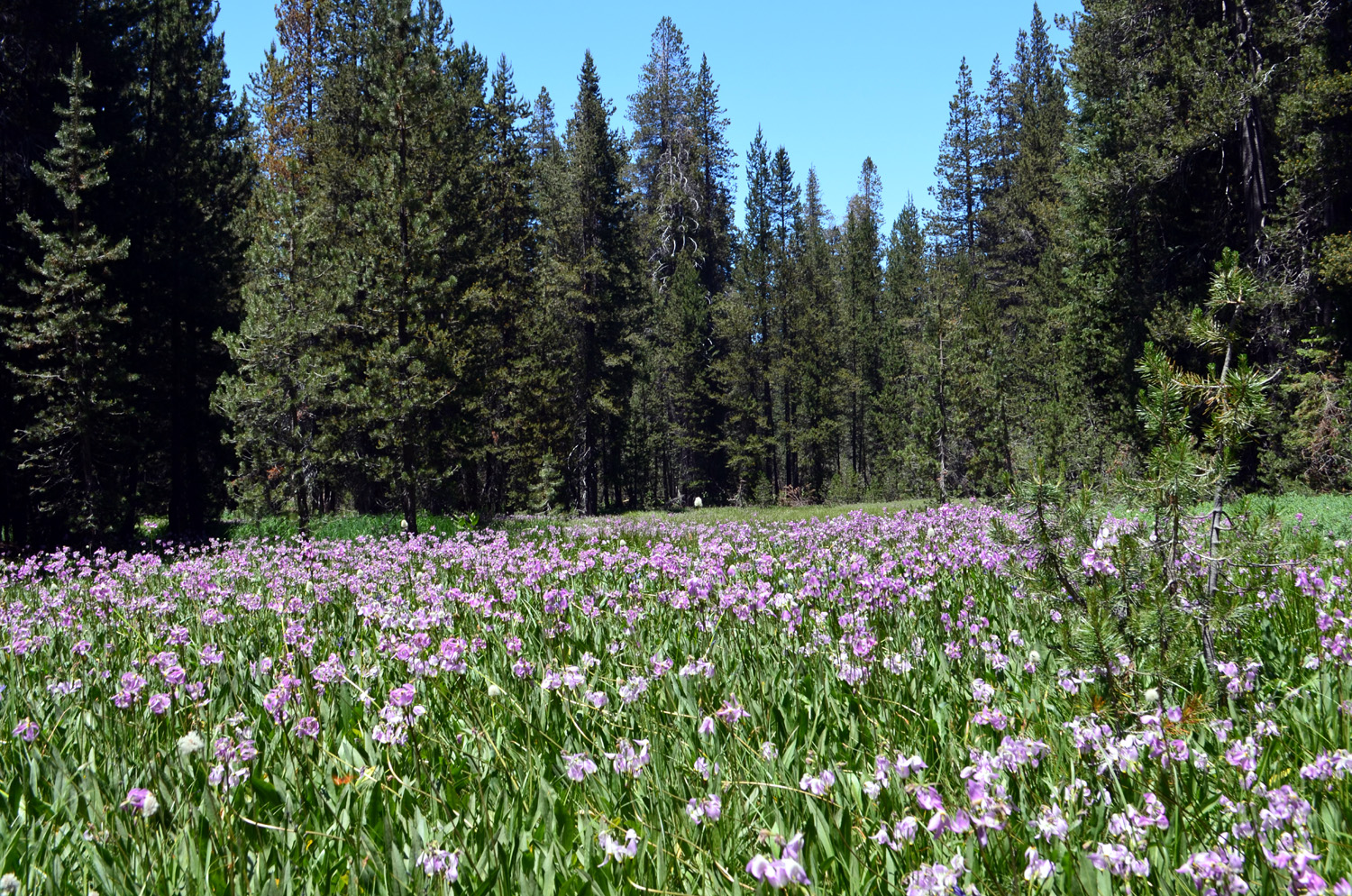
San Joaquin Gorge Bridge Trail Regular readers of these reports know that I have to visit the San Joaquin River Gorge several times each fall/winter/spring, and on May 15 I made what will no doubt be the last trip for this season. I hiked the upper (San Joaquin River) trail in February with the Ramblers (Wes, Colton and I), the Bridge Trail by myself in April, and the upper trail later in April with Ramblers Wes and Sue. My goal this time was to see the late-season wildflowers on the Bridge Trail, and there was a bumper crop. |
||
 |
 |
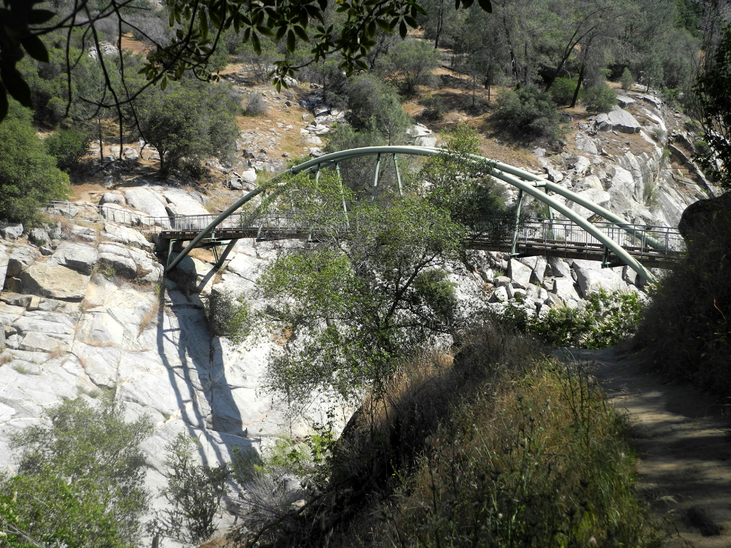 |
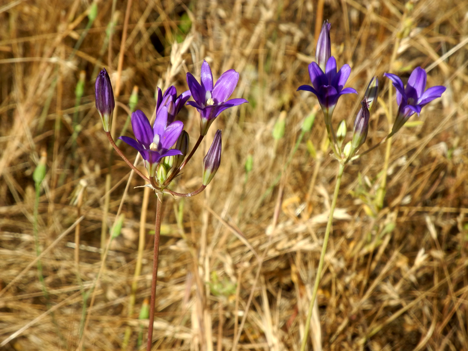
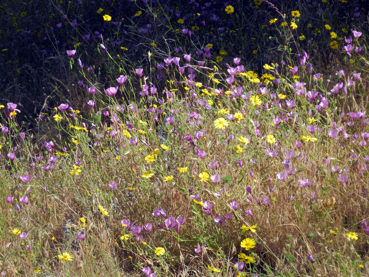
| Athurial's spear, a variety of brodiaea | Pink farewell-to-spring and yellow common madea | The bridge from the Fresno County side of the San Joaquin River |
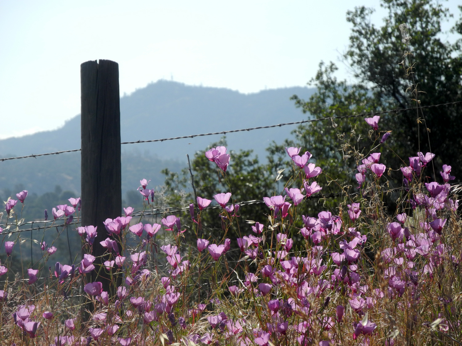
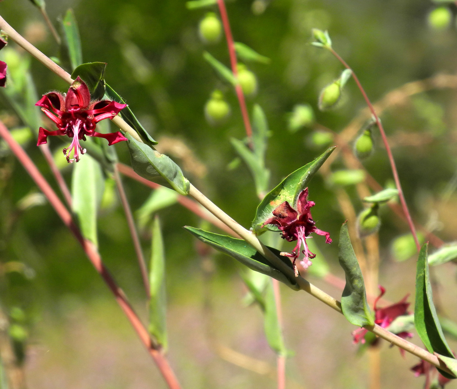
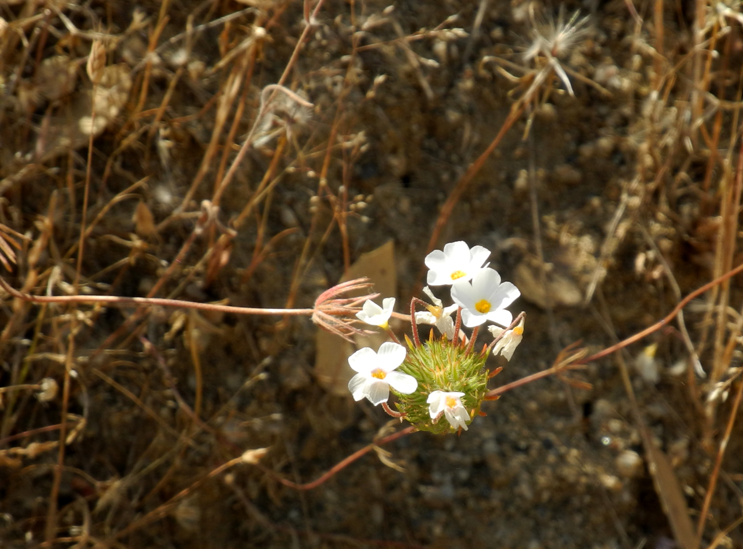
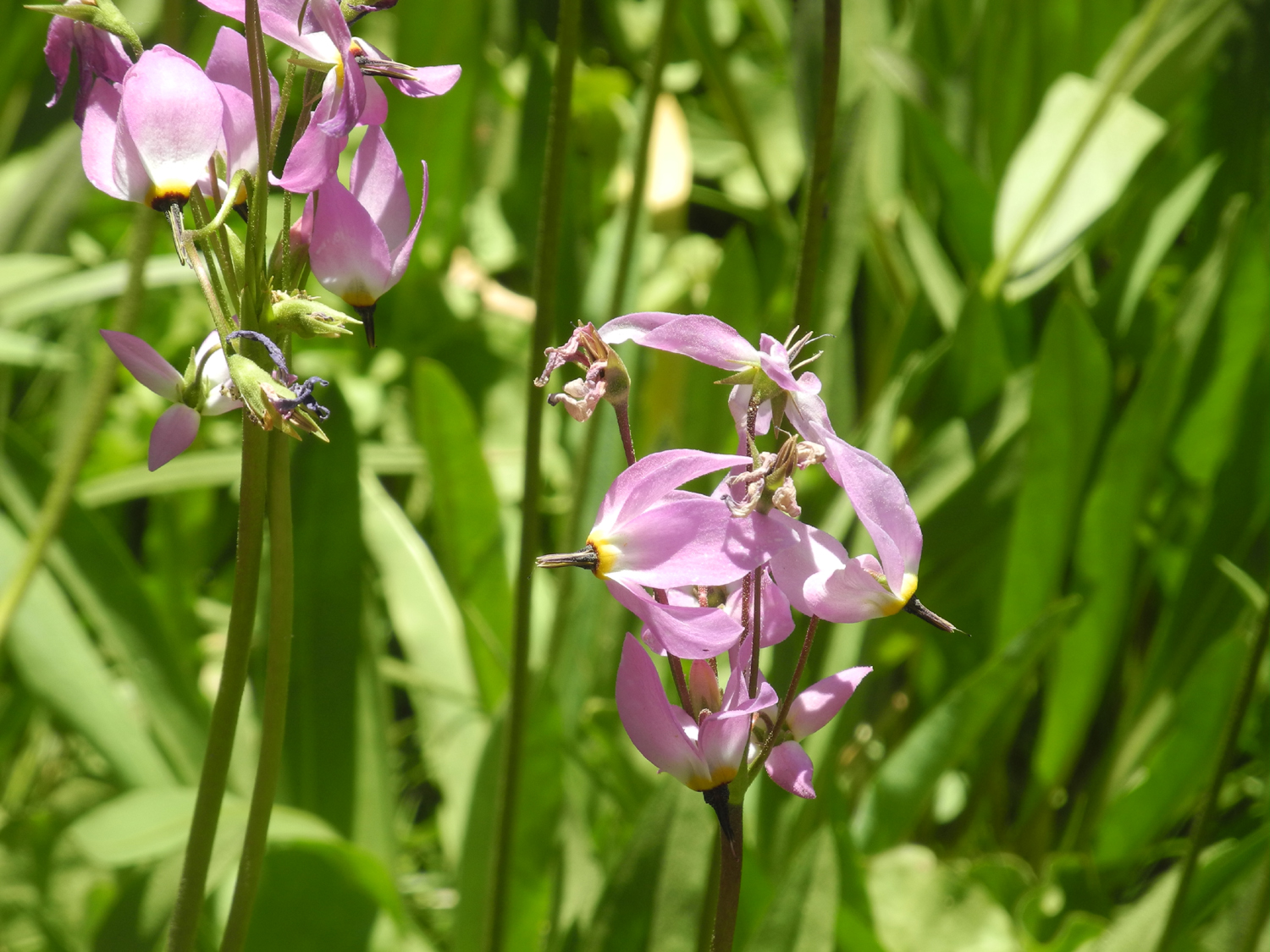
The two flower species that dominated the scene were farewell-to-spring and common madea. This made for a nice pink and yellow color pallet, with a fairly heavy sprinkling of white mustang clover, and samples of a number of other varieties. My favorite was Athurial's spear, a deep purple variety of brodiaea that blooms late in the season after its various cousins have gone to seed. A seemingly rare blossom, elegant Clarkia, appeared in larger numbers than I've ever seen before. Other flowers included milkweed, buckeye, owl clover, yellow clover, and datura. There were more than the usual number of the flowers known as Chinese houses. These pink or purple blossoms resemble an Oriental pagoda, and prefer shady slopes along roads and trails. Two common flowers, climbing brodiaea and purple vetch, were at the end of their season, with limited numbers, and blossoms fading fast. A very few fiddlenecks were hanging on as if to remind hikers that they are the number one flower earlier in the season. I saw one plant with three blossoms that appeared to be a white mutant variation of farewell-to-spring. The weather was very cool when I started out in the morning, and there was a strong breeze at the bridge. It warmed up to the point that I had to get out my bandana and wipe my face and head several times on the return trip. The sky was clear all the time, although clouds were visible above the higher mountains from the road up to the area. I went past the bridge about a quarter mile, and stopped for lunch. Three pairs of hikers went past while I was resting, part of at least a dozen in all. I may have seen almost that many lizards. Snakes: People sometimes mention that my hiking areas are snake country. When I was a kid, we had about 150 acres of other people's land next to our house where we could wander freely. I don't think I ever went out without my parents reminding me to watch out for snakes. Although my dad dispatched about eight rattlesnakes on and around our one-acre property over a 15-year period, I NEVER saw one while I was out walking. We did see a couple dozen others, mostly king snakes, gopher snakes and what we called a striped racer. On my hikes as an adult, I've seen probably four rattlesnakes. I left them alone and they did the same for me. On my hikes at the San Joaquin Gorge, covering a period of just under 40 years, I have seen ONE live snake. Snakes are very good at not being seen, so the fact that I don't see them is proof to me that they are out there. I hope to see a few more. When
I got back to my car, I changed to dry socks and tennis shoes and a
dry t-shirt, and made it home without incident, already thinking
about finding a cooler place for my next hike. I finally got some
photos I've wanted to capture for several years, the "back
side" of Squaw Leap mountain from Auberry Road near the
Hurley CalFifre Station. --Dick Estel, May 2018 |
||
|
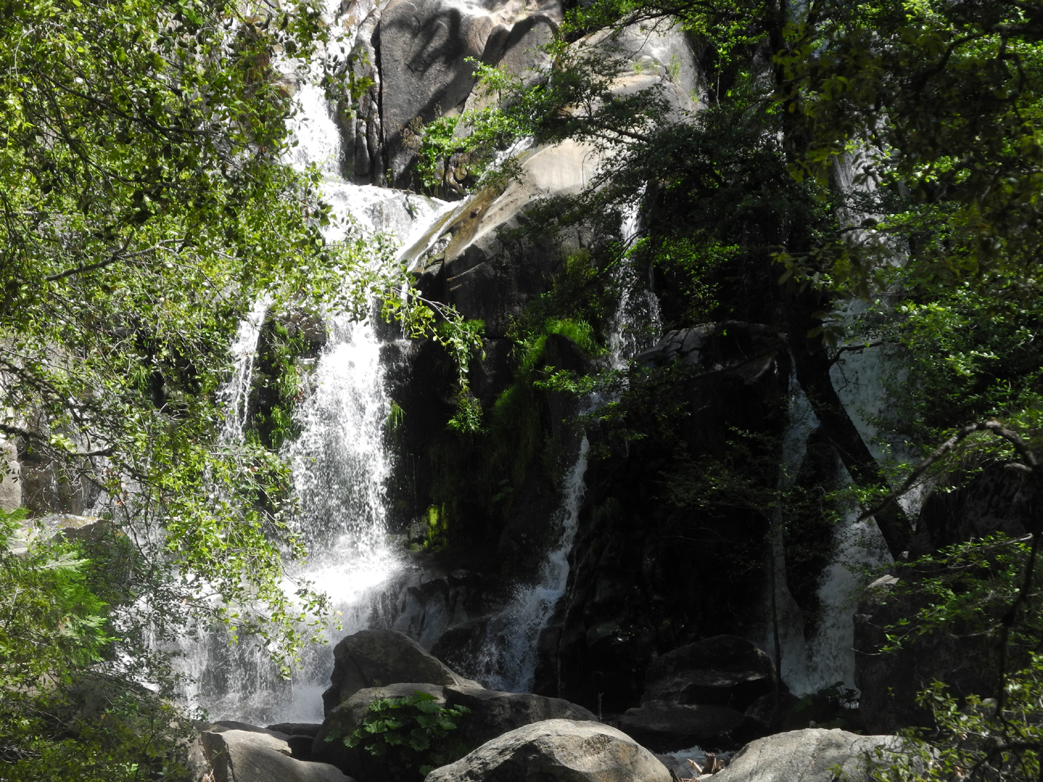
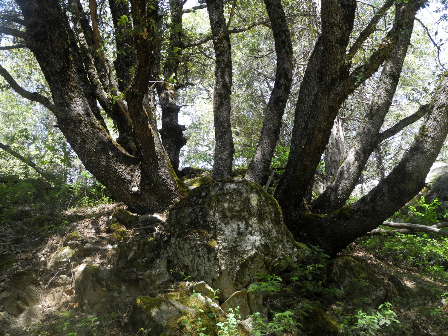
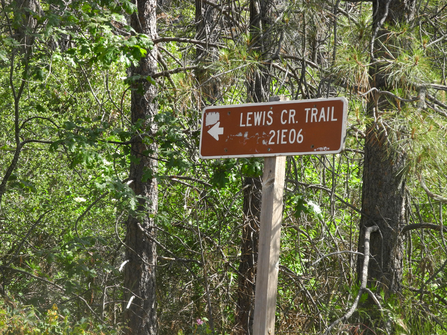
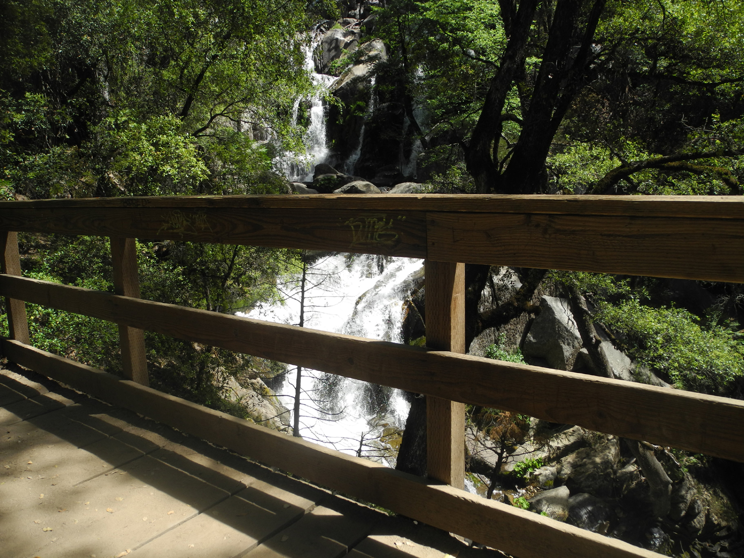
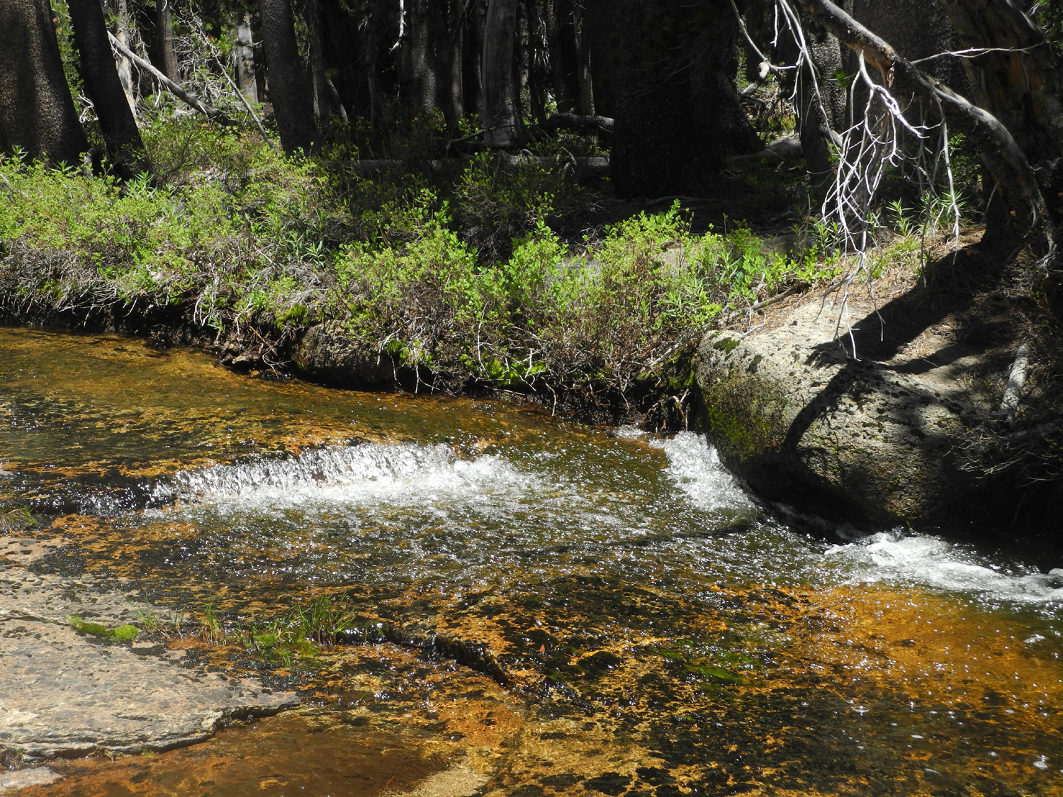
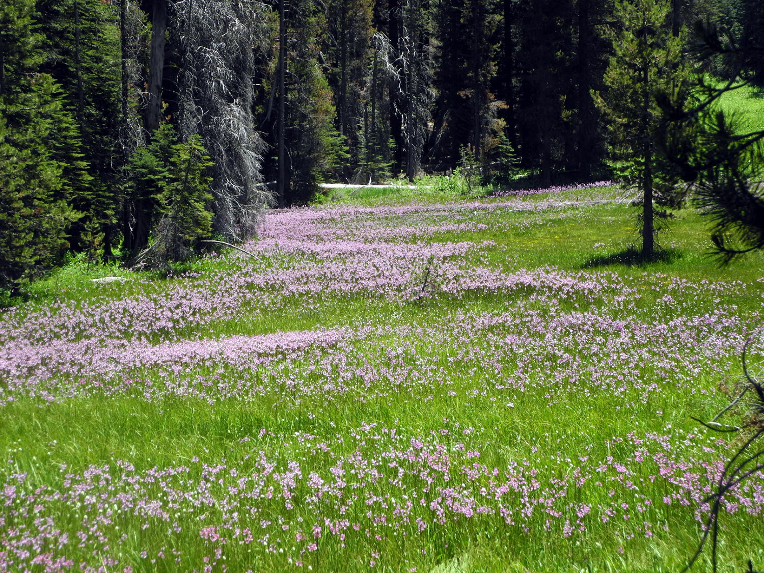
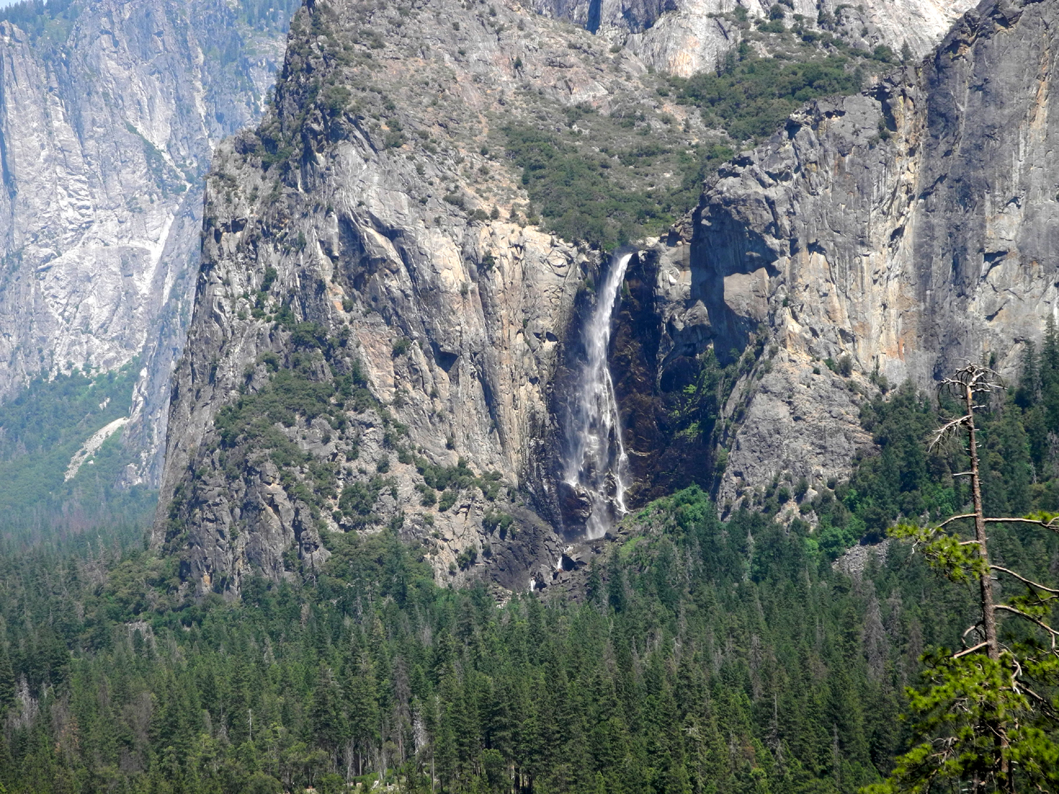
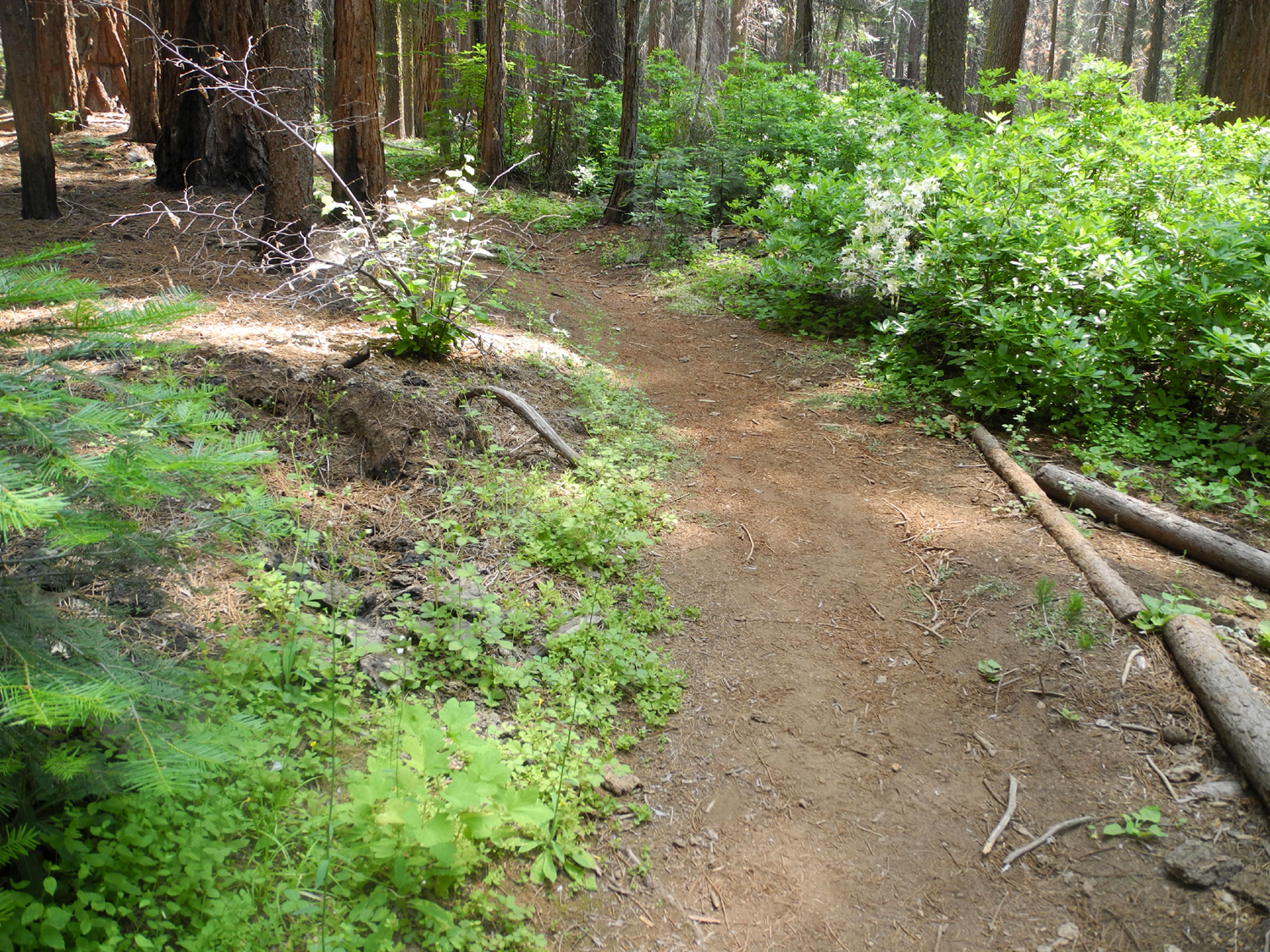
Lewis Creek Trail The Lewis Creek Trail leads off State Highway 41 about halfway between Fresno and Yosemite. A short distance from the road it forks, with the west fork going about a quarter mile to Corlieu Falls. To the east the trail crosses Lewis Creek, with a hike of a mile and a half to Red Rock Falls. I've taken the Corlieu route several times, most recently in April 2017. I've gone the other way twice, once with the Ramblers and once with my daughters, reaching a place we think was Red Rock only on the second try. With four consecutive days open on my calendar in early June, but several ambitious hikes ahead, I wanted to do a short excursion, and drove up the highway to the trailhead on June 5, with Corlieu as my destination. |
||
 |
 |
 |
| Corlieu Falls | Larkspur | Multiple trunks are common on canyon live oak |
|
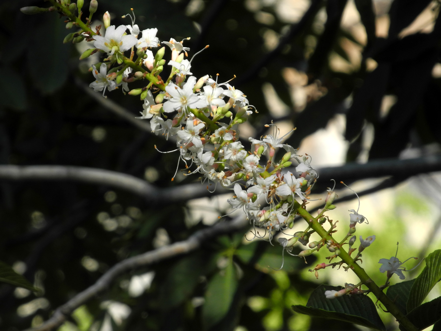
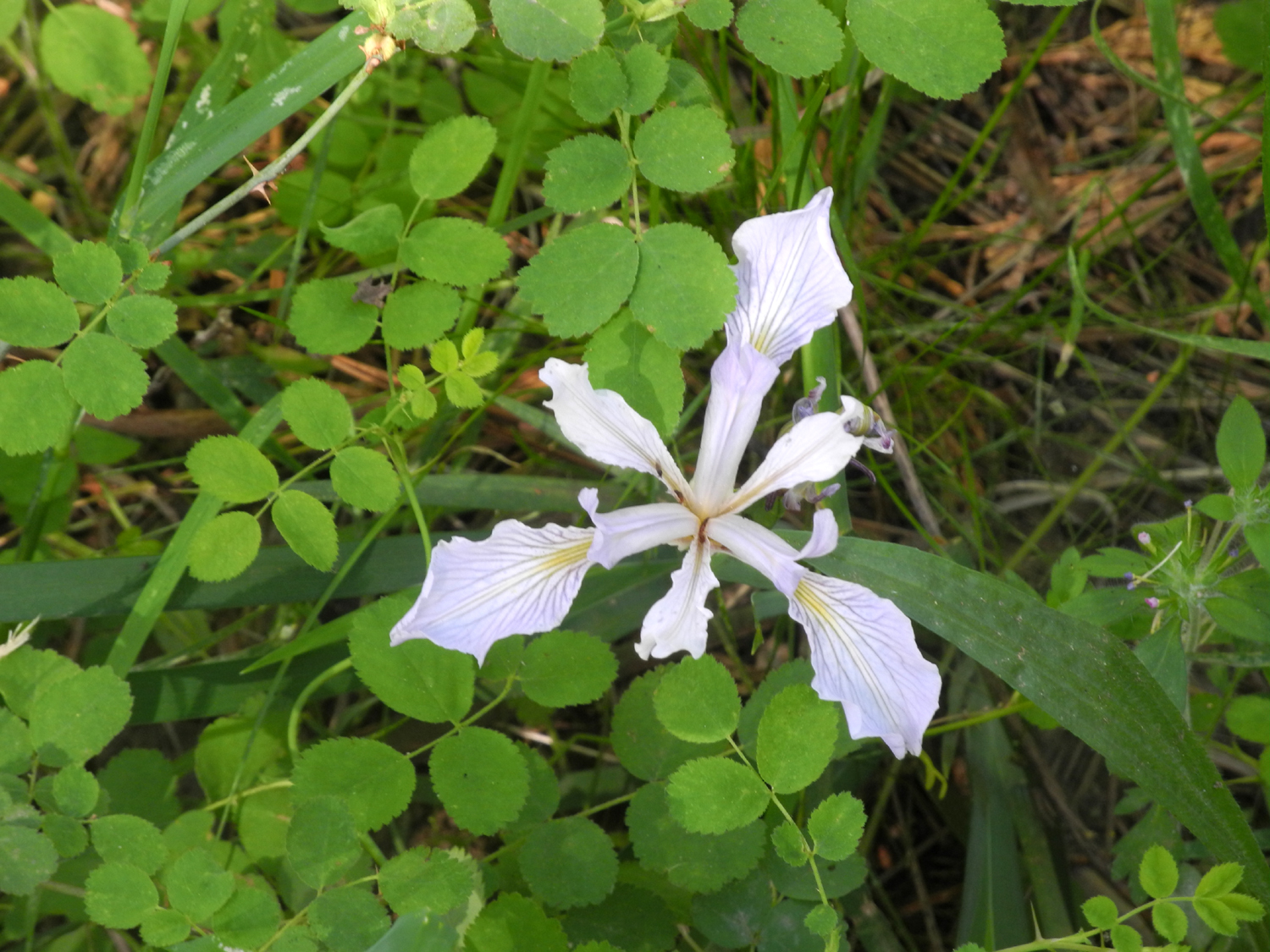
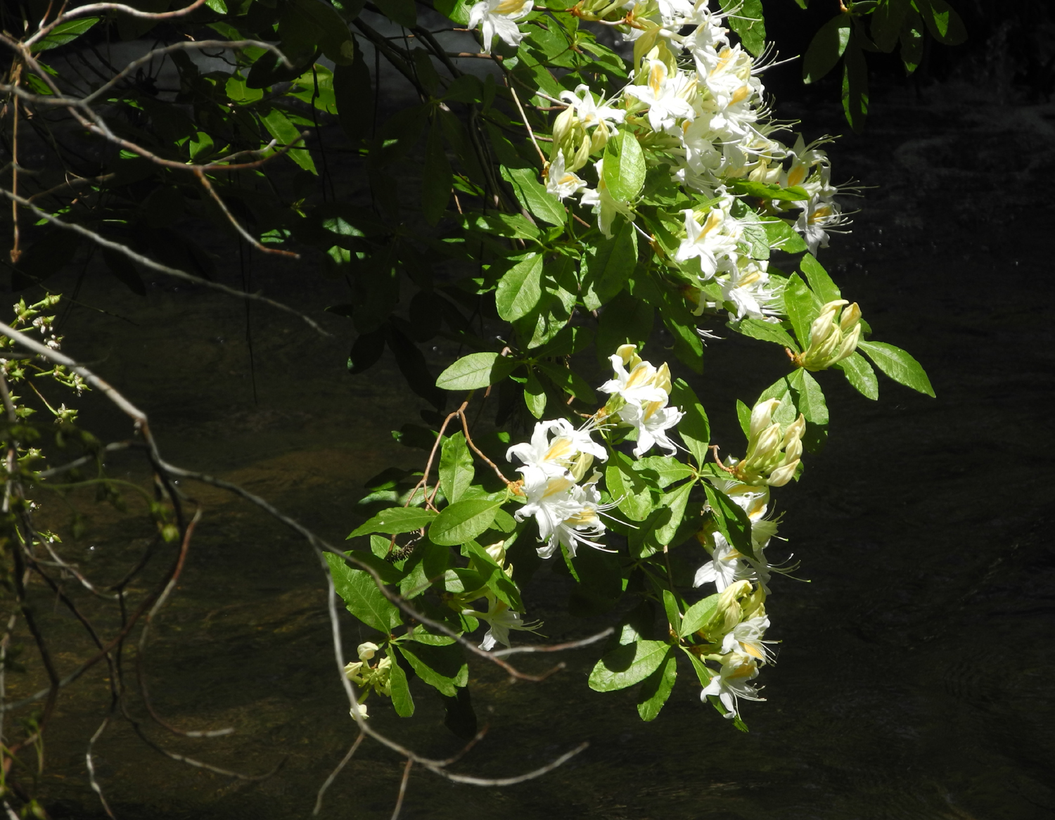
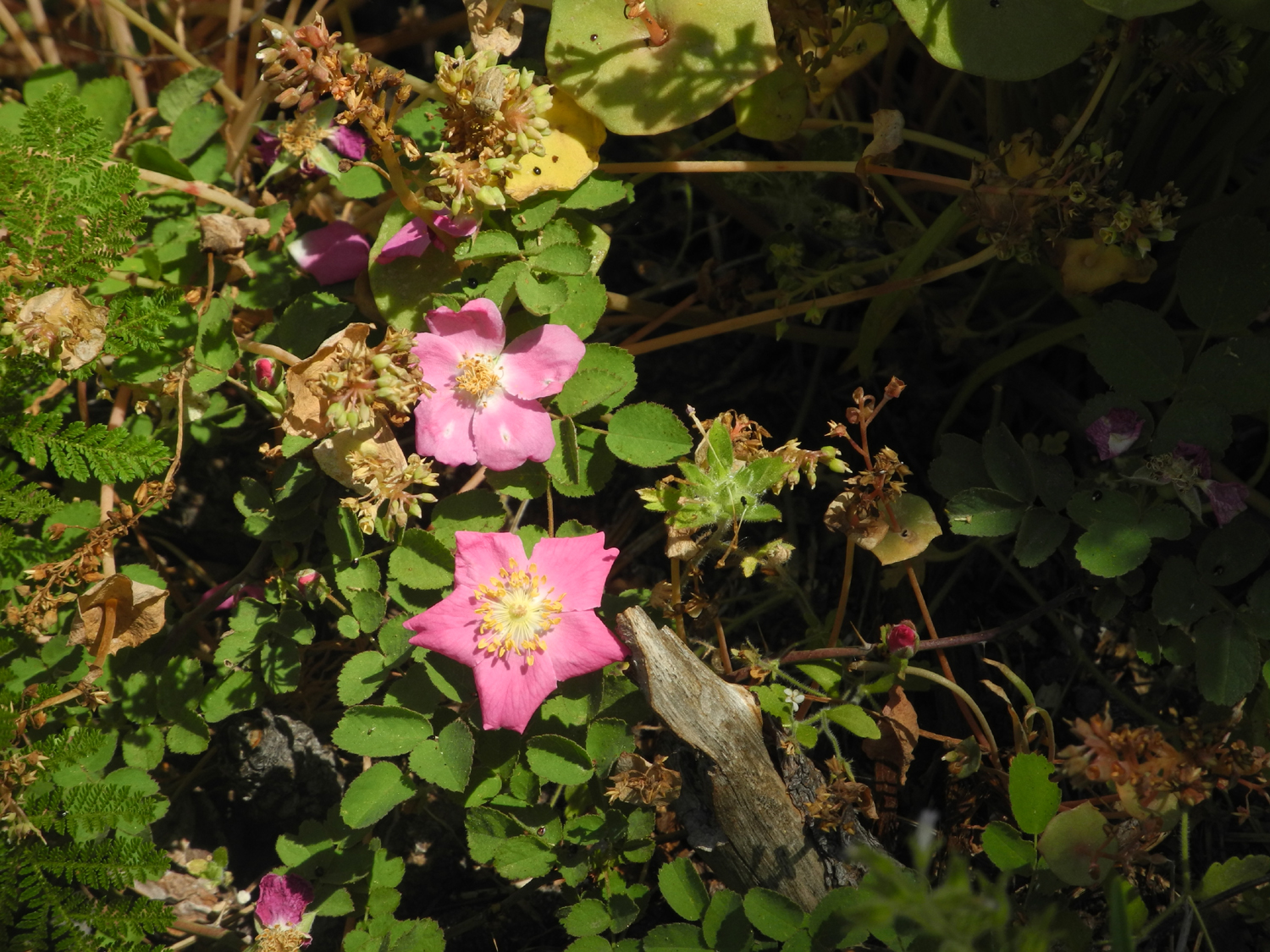
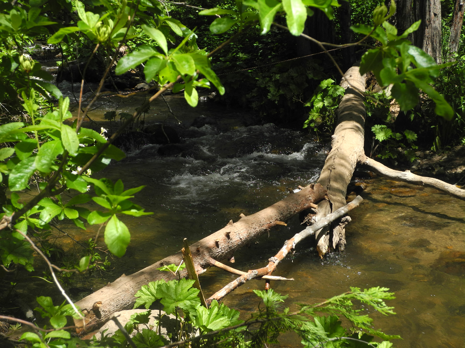
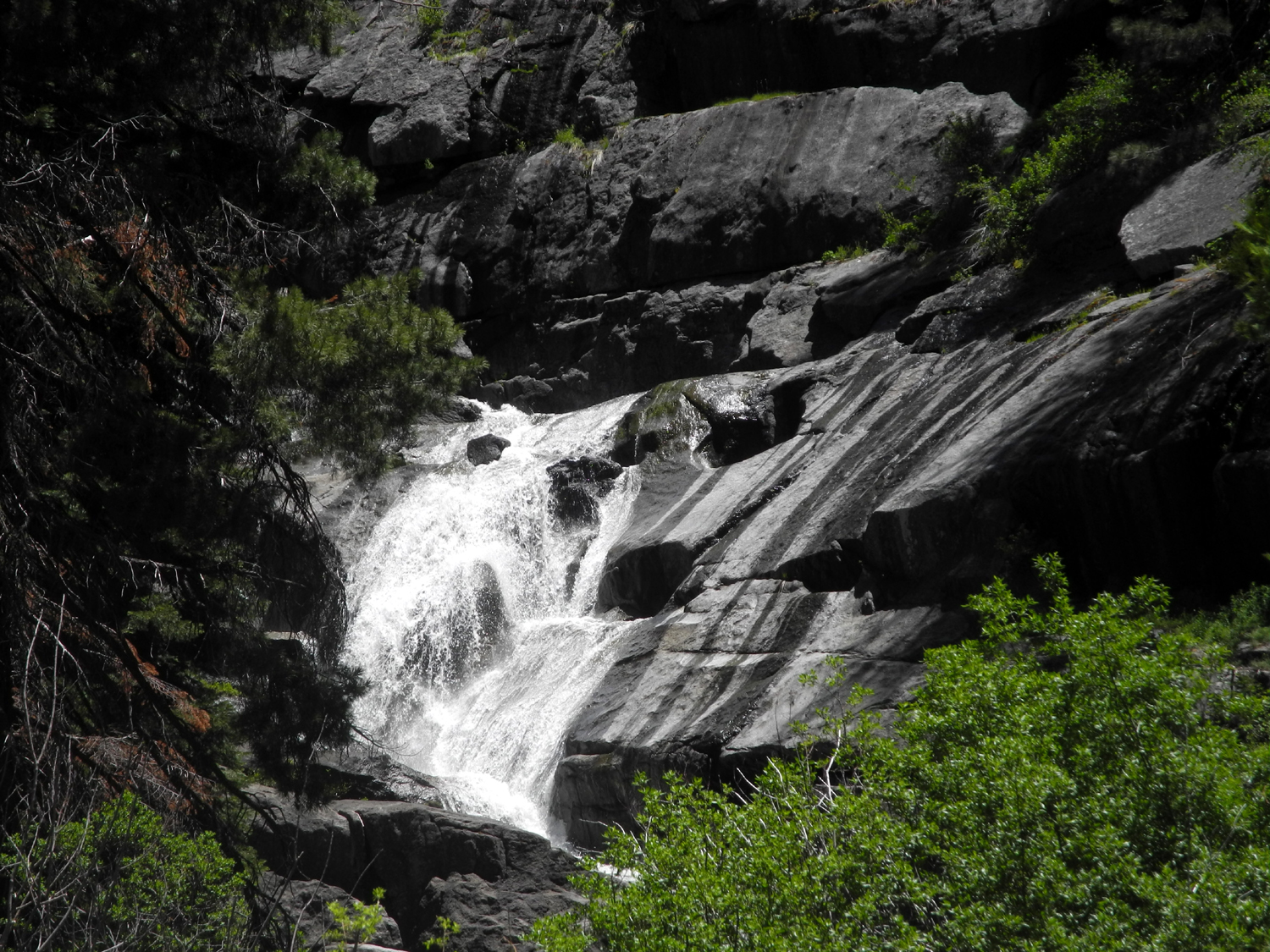
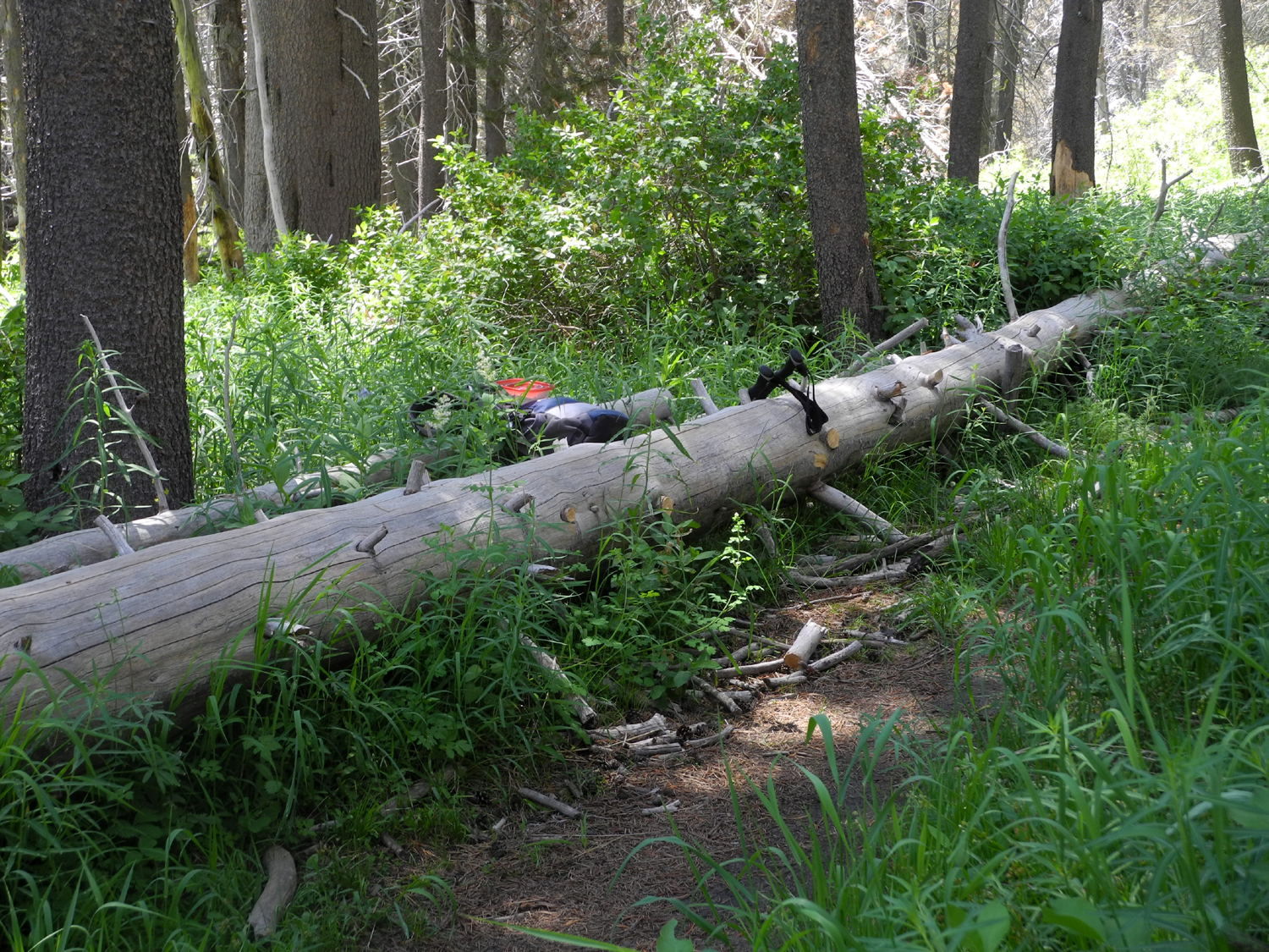
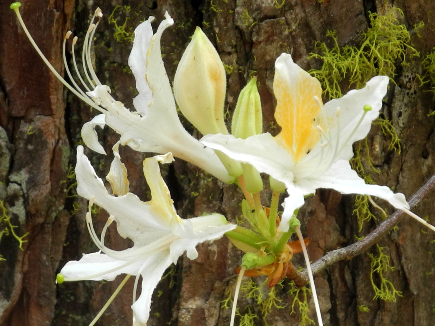
Although it was a weekday, there were a half dozen other parties of two to five on the trail, all of us enjoying great weather. It was a little warmer than I expected, mainly because I had been looking at the weather forecast for 5,000 feet instead the actual elevation of 4,000 feet. But it was delightful and much of the trail is shaded by large ponderosa pines, cedars and canyon live oaks. Of course, there were a number of wildflowers blooming along the highway and the trail. Most common along the trail were bear clover and wild strawberries, plus a nice display of wild iris, larkspur, wild rose, Indian pinks and a number of the well-known "unidentified" varieties. The falls drops down 80 feet in a series of cascades. It's a delightful sight when the water is at mid-level, as it was this time, and a dramatic, crashing torrent during spring runoff. Its low elevation means it becomes fairly small and less impressive in late summer. At the best spot for viewing the falls, the US Forest Service has built a nice wooden viewing platform, complete with a bench, and virtually every hiker stops here for a rest and some photos. The trail is fairly steep down to the platform, and the next two hundred yards or so, then it goes right next to the creek and becomes a gentle downhill walk. I think the trail goes into Cedar Valley, a private residential development along the creek, but I'm not sure of the distance. The elevation change is about 500 feet from trailhead to the bottom of the falls. People taking shortcuts have created what looks like the real trail at one spot, but it's no more difficult than the official route, as I discovered when I took it by accident coming back up. It's easier to keep to the real trail on the downward journey. When I returned to the trail junction, I went down about 100 yards on the east fork to the creek, just to check on the status of the crossing. There used to be a bridge, and there are plans to replace it (In 2016, says the USFS website, but you know, funding, environmental reports, etc. etc.). Our first crossing of the creek was on a makeshift "bridge" of stumps, with the water fairly low; and the next time, a rock-hopping crossing with even lower water. Teri and I visited this spot some time in the last year or so, when the water was too high for safety, although a log and a rope across the creek just upstream were available for the adventurous. This time, the log was gone, replaced by two smaller logs, one resting on the other, about five feet from the rope. Fortunately, I had no plans to go that way. However, I did get to see some western azalea in bloom next to the creek. This trail continues into Sugar Pine, a residential area that used to be a lumber camp, about a mile off the highway. On my way home I stopped at daughter Jennifer's to drop off some stuff I had for her. She and husband Rod were both at work, but I enjoyed another batch of wild flowers along Road 620 - Mariposa lilies, harlequin lupine, Athurial's spear, and farewell-to-spring. Since I had got an early start, I got back to Fresno just after the lunch rush at Sweet Tomatoes, where I enjoyed a well-deserved lunch - lots of greens, topped off with frozen yogurt for dessert.
--Dick Estel, June 2018 |
||
|
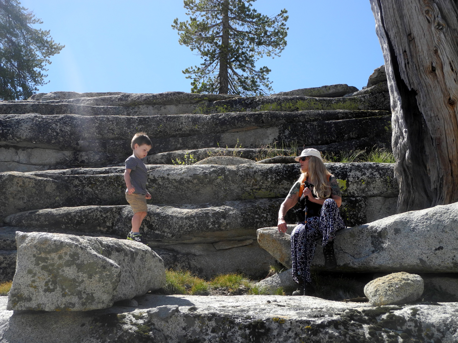
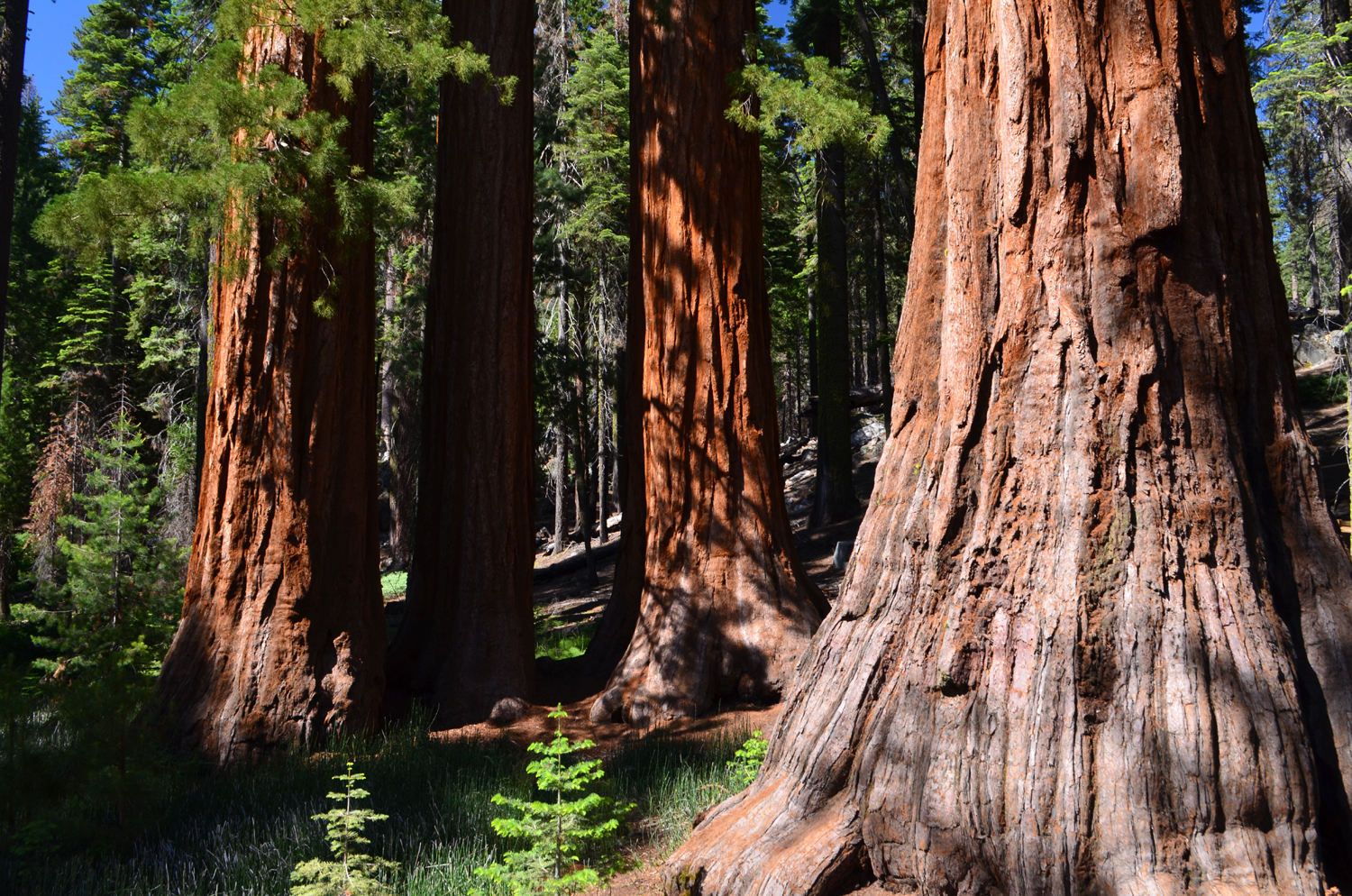
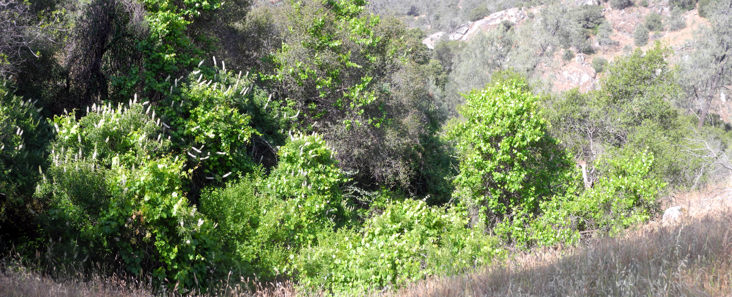
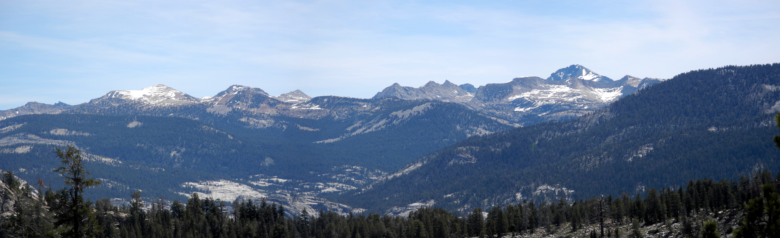
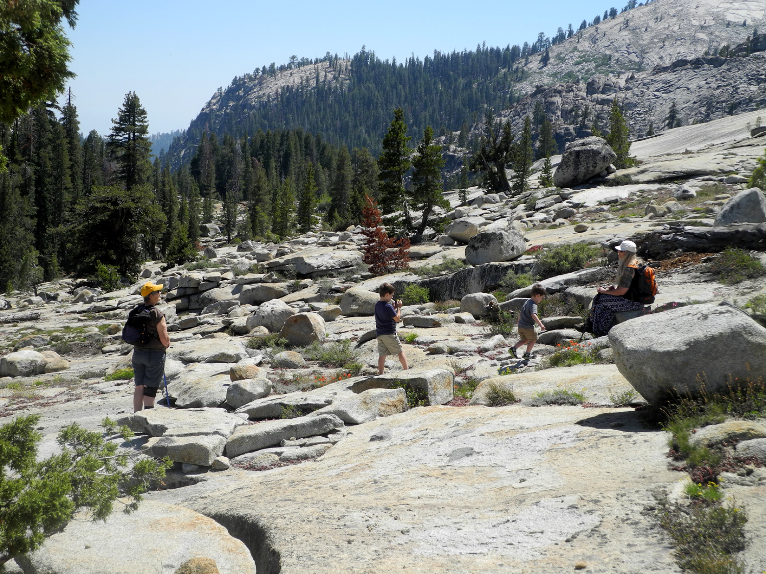
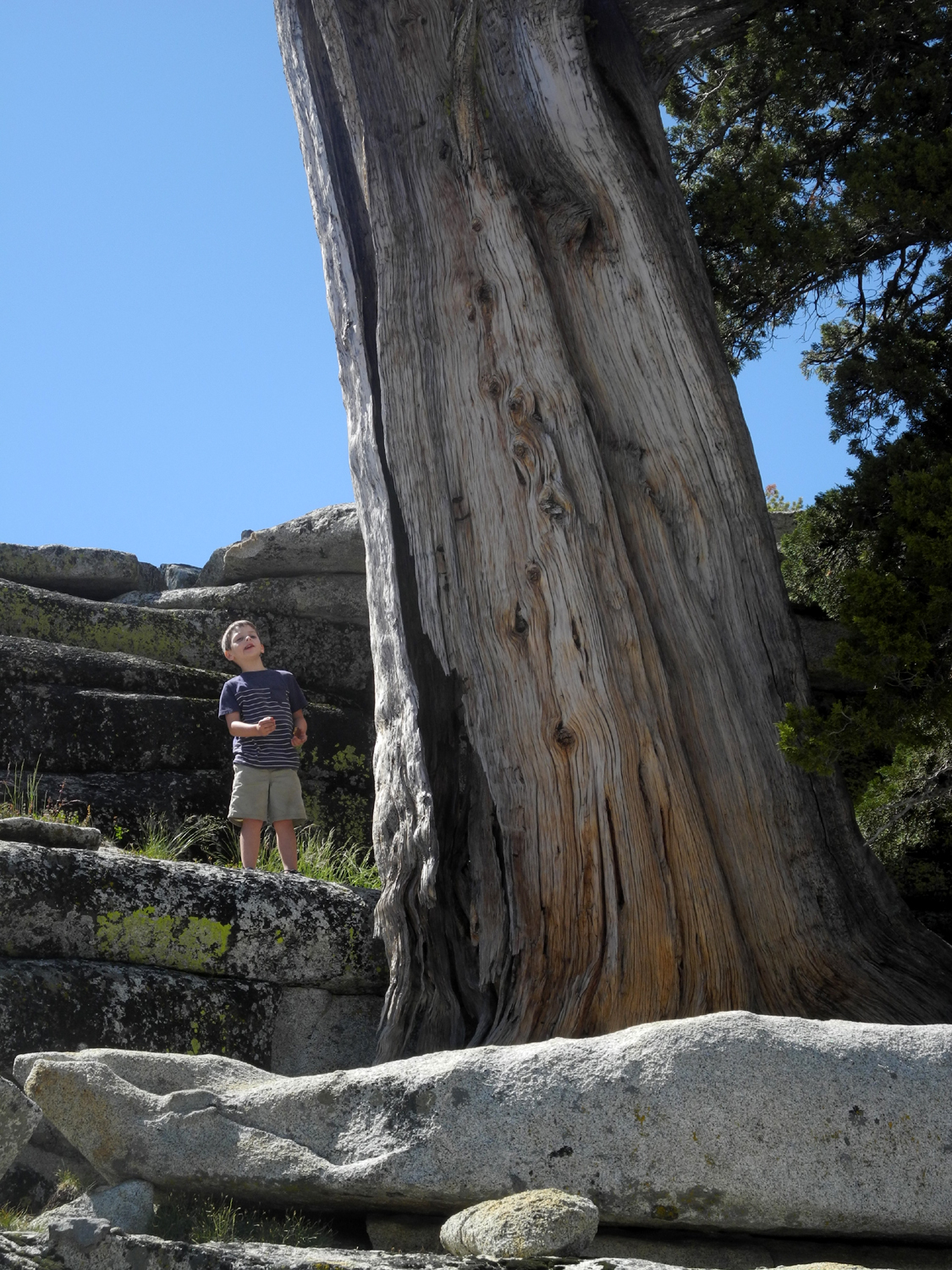
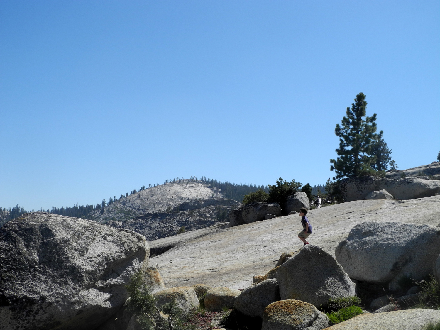
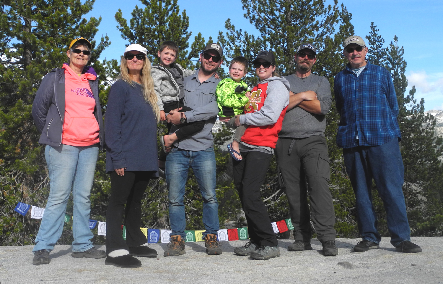
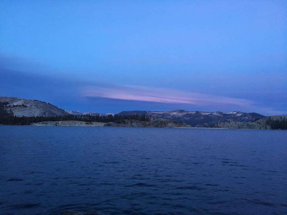
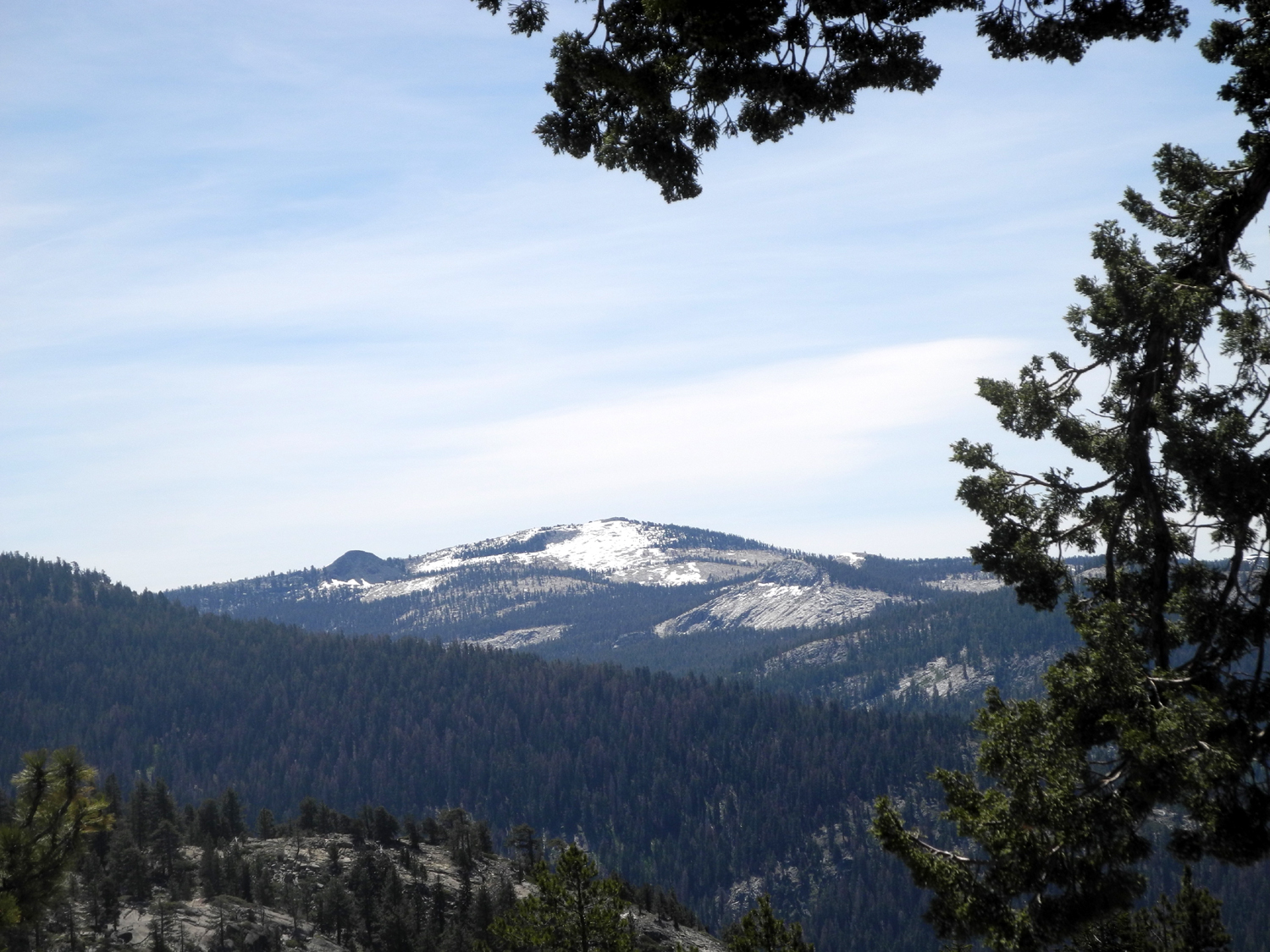
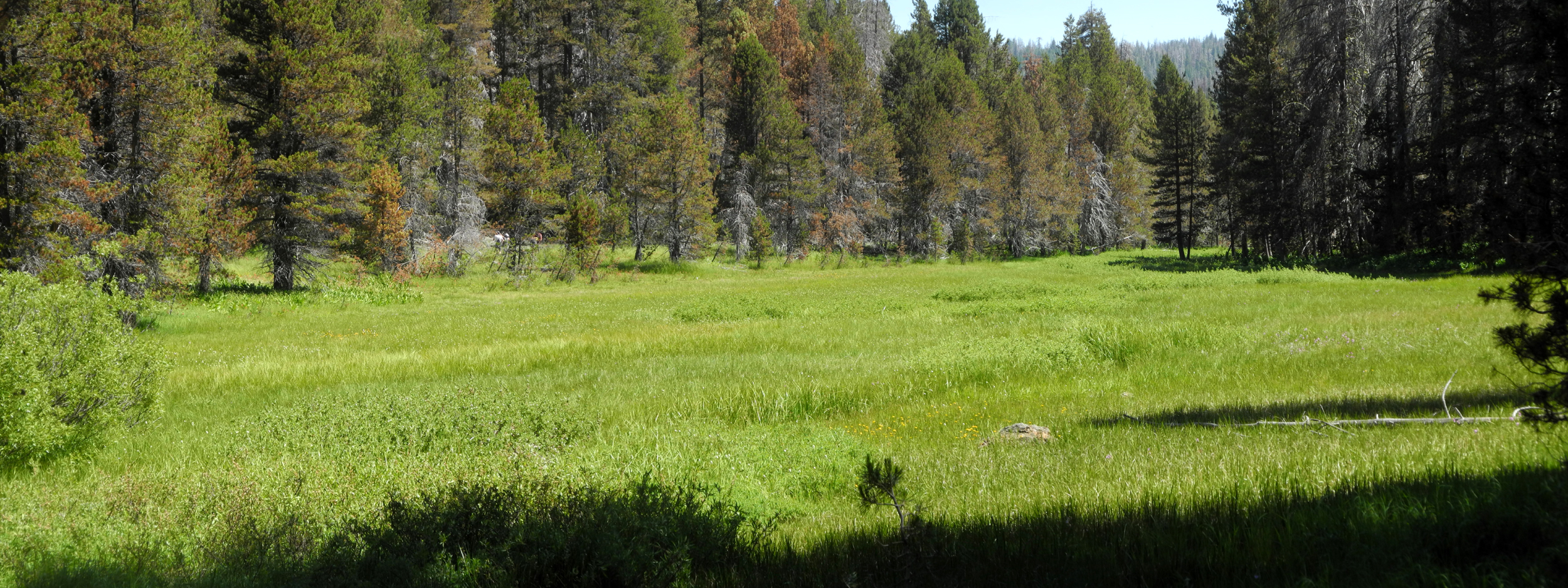
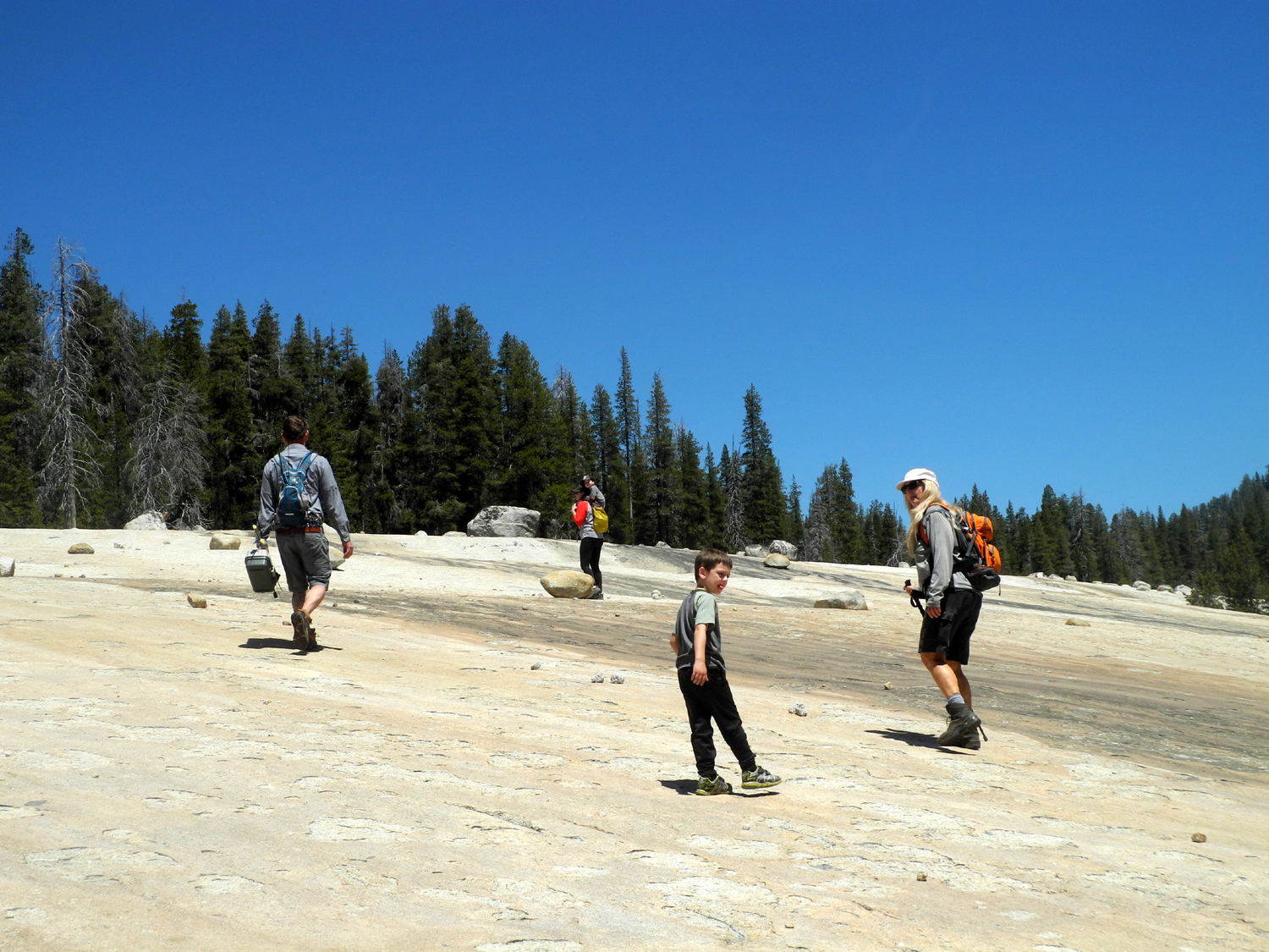
Courtright Family Camp Our family has been going to the Courtright Reservoir area since the early 1970s, and we never tire of it. Each new family member that comes along seems to agree with this viewpoint, so it was a delight to go there June 8 with four generations. Besides the lake, it's a land of domes, dramatic granite slopes, and exfoliating rock that creates "shelves" and little cliffs, filled with flowers and juniper trees. |
||
|
 |
|
| Double Dome as seen from our camp | Jack and Teri on the hike up the rocks | Nature's landscaping |
|
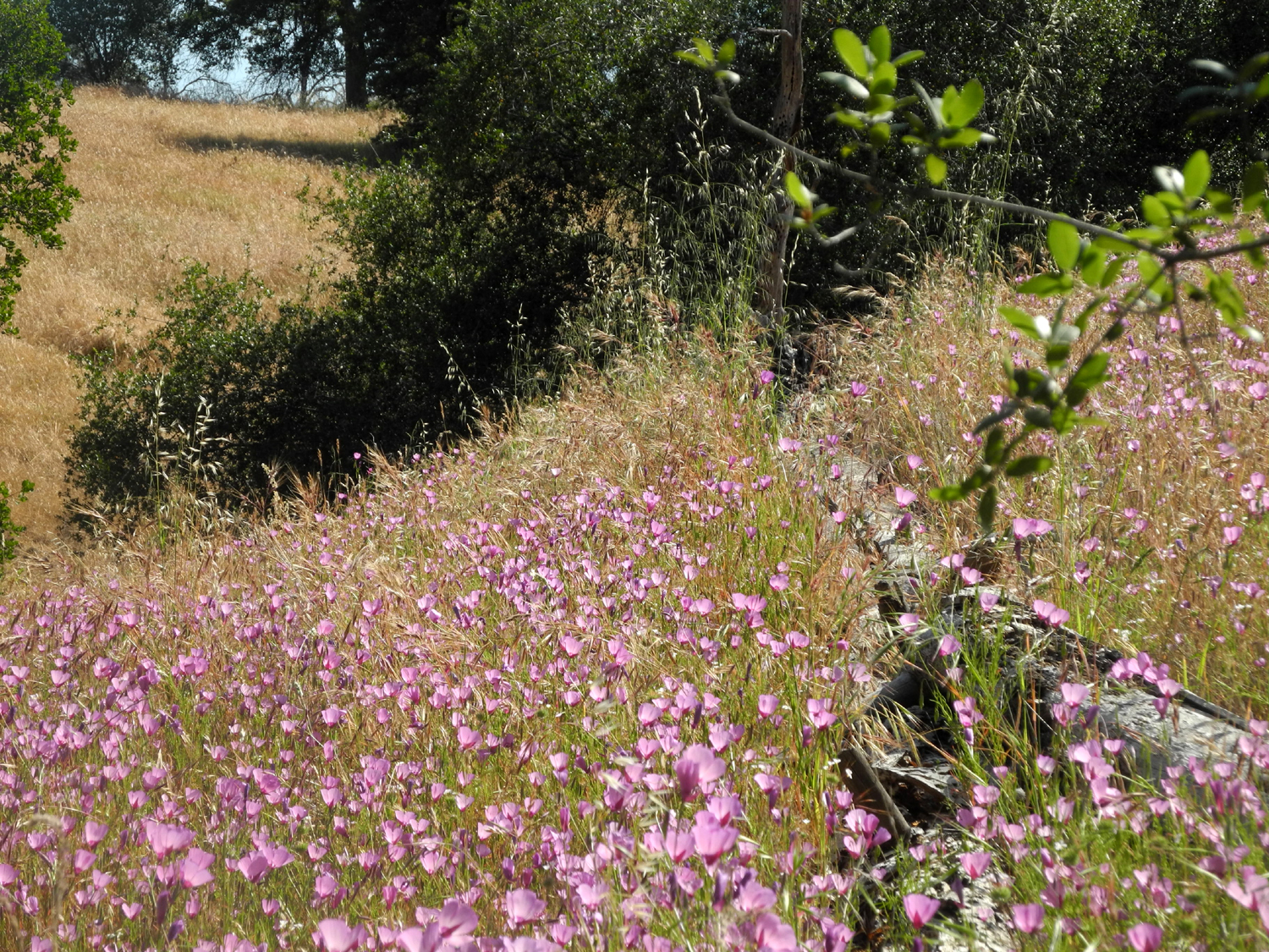
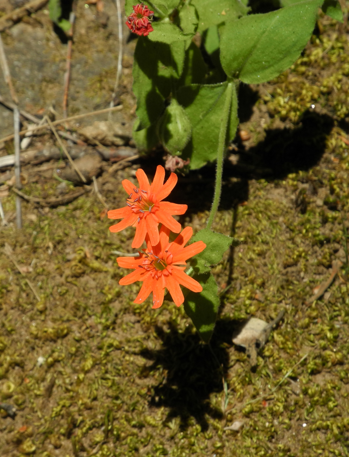
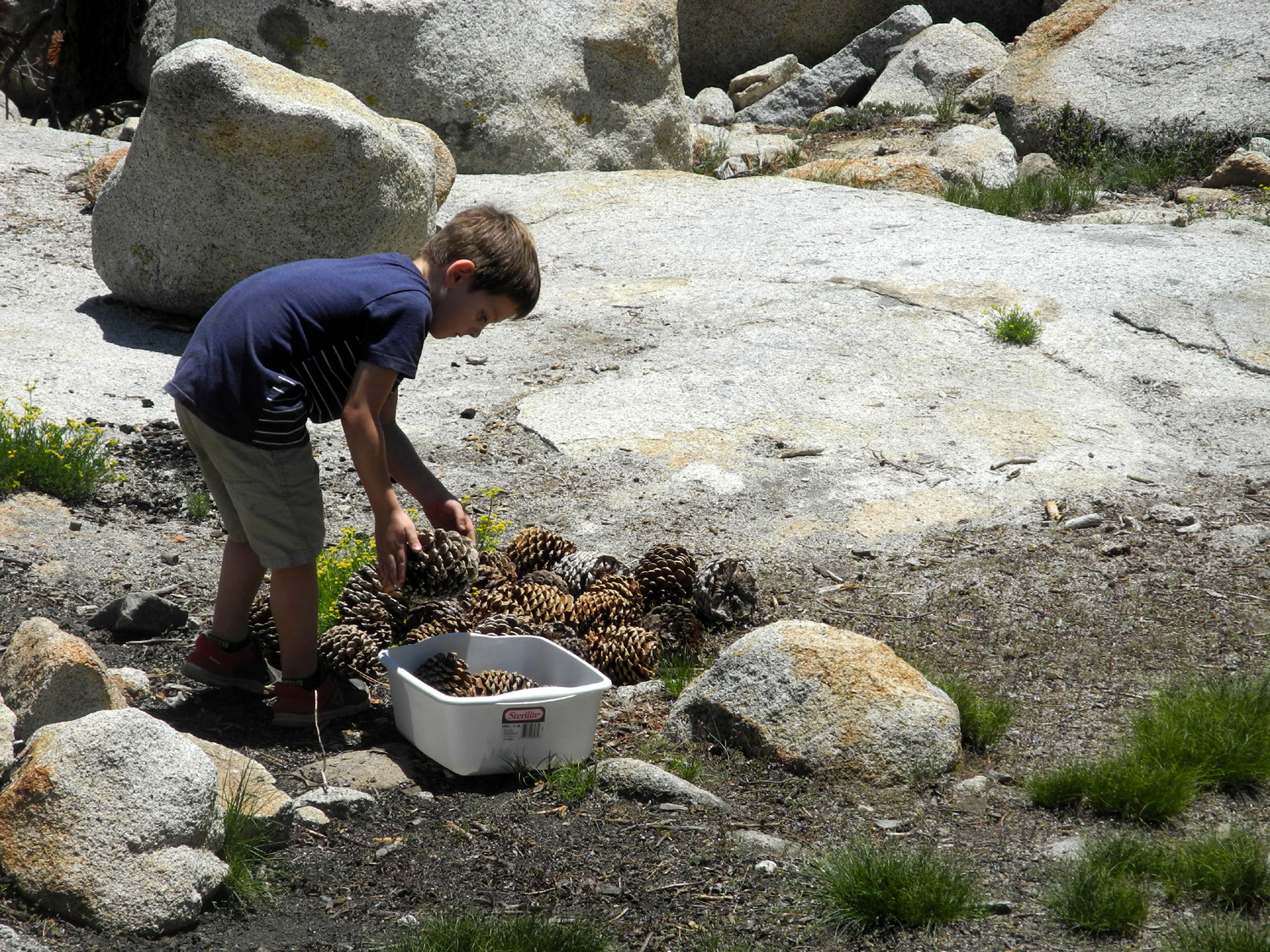
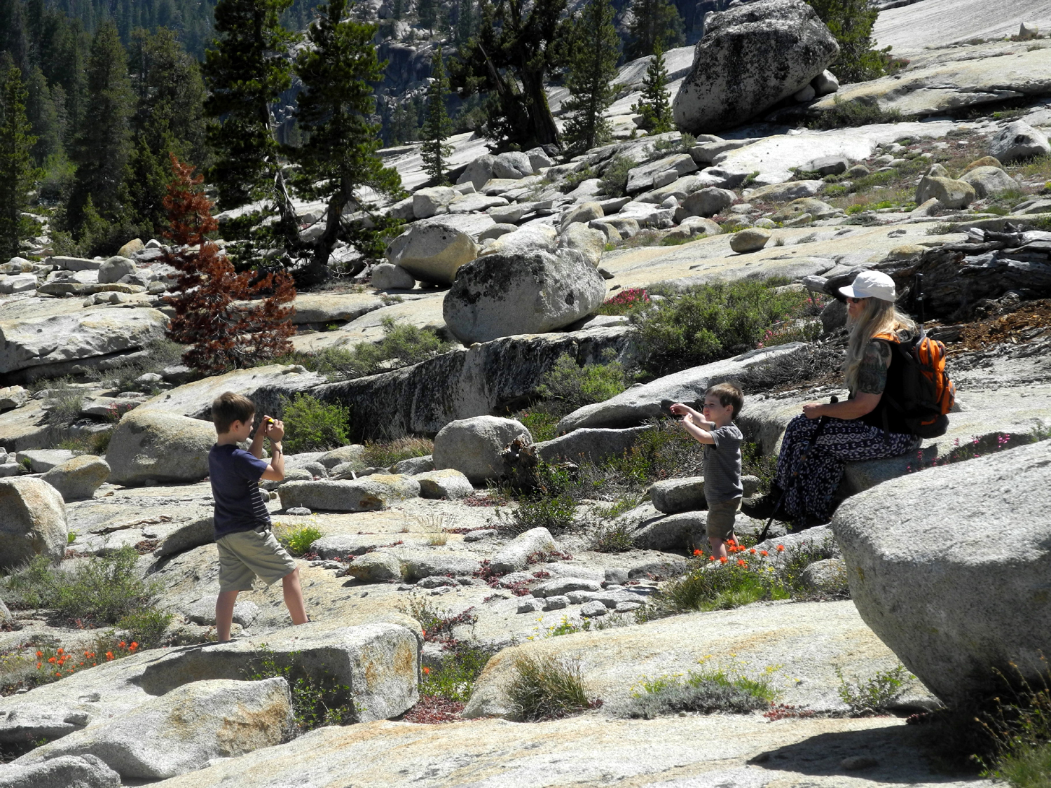
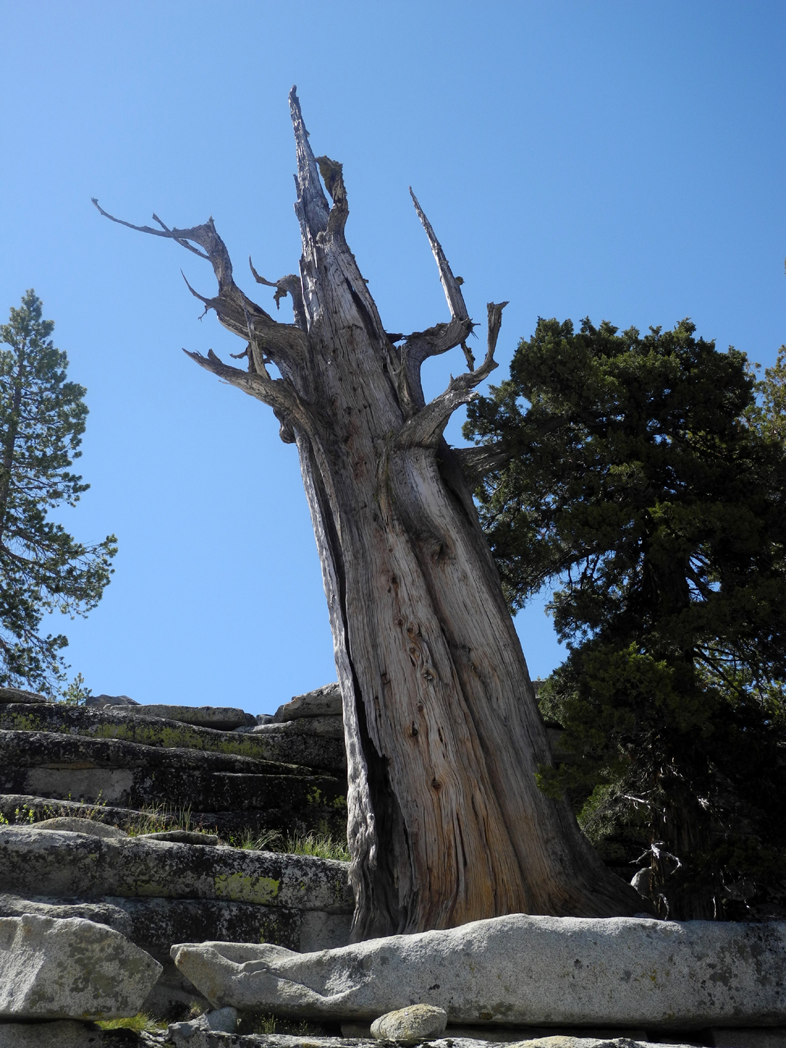
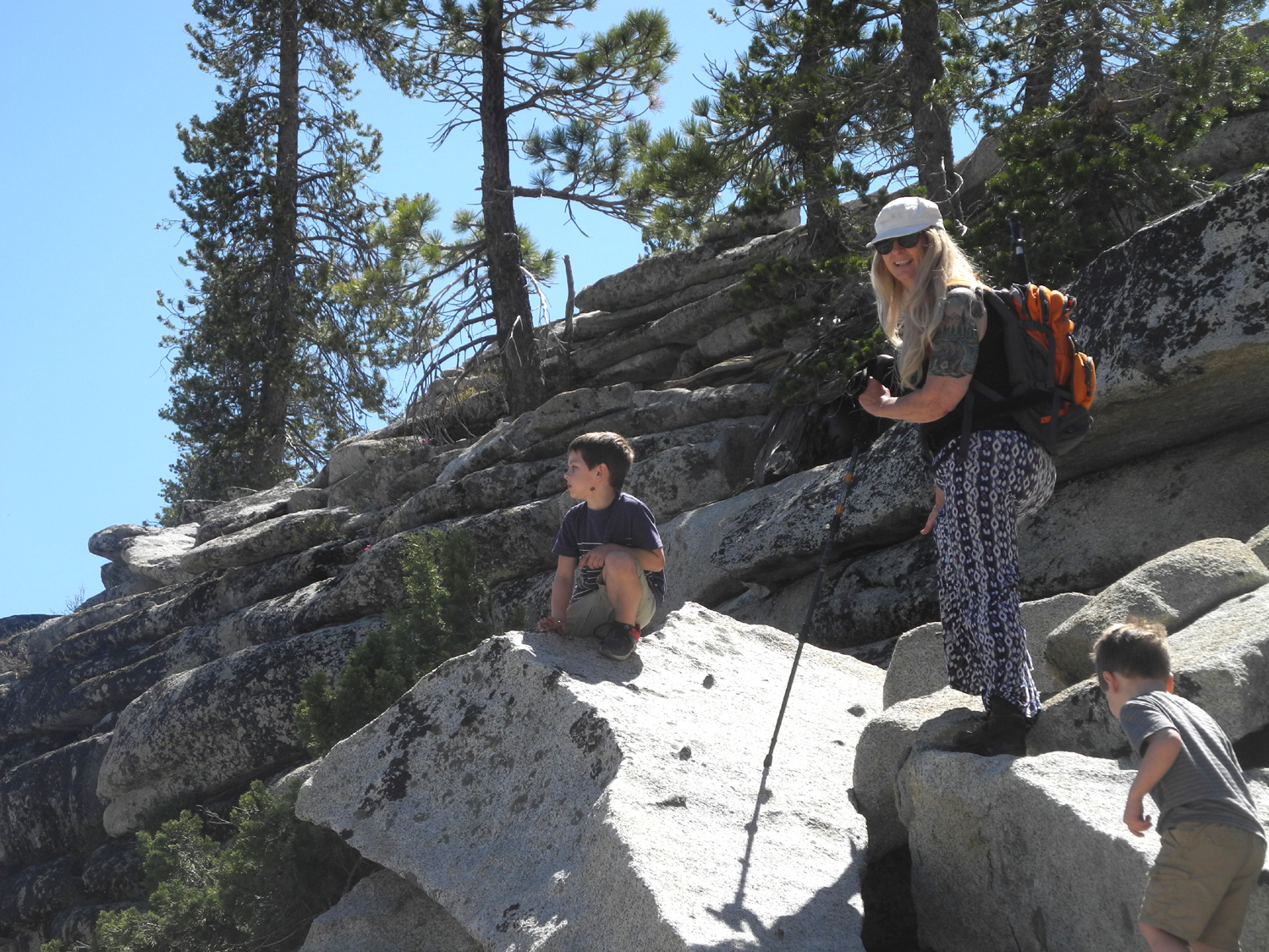
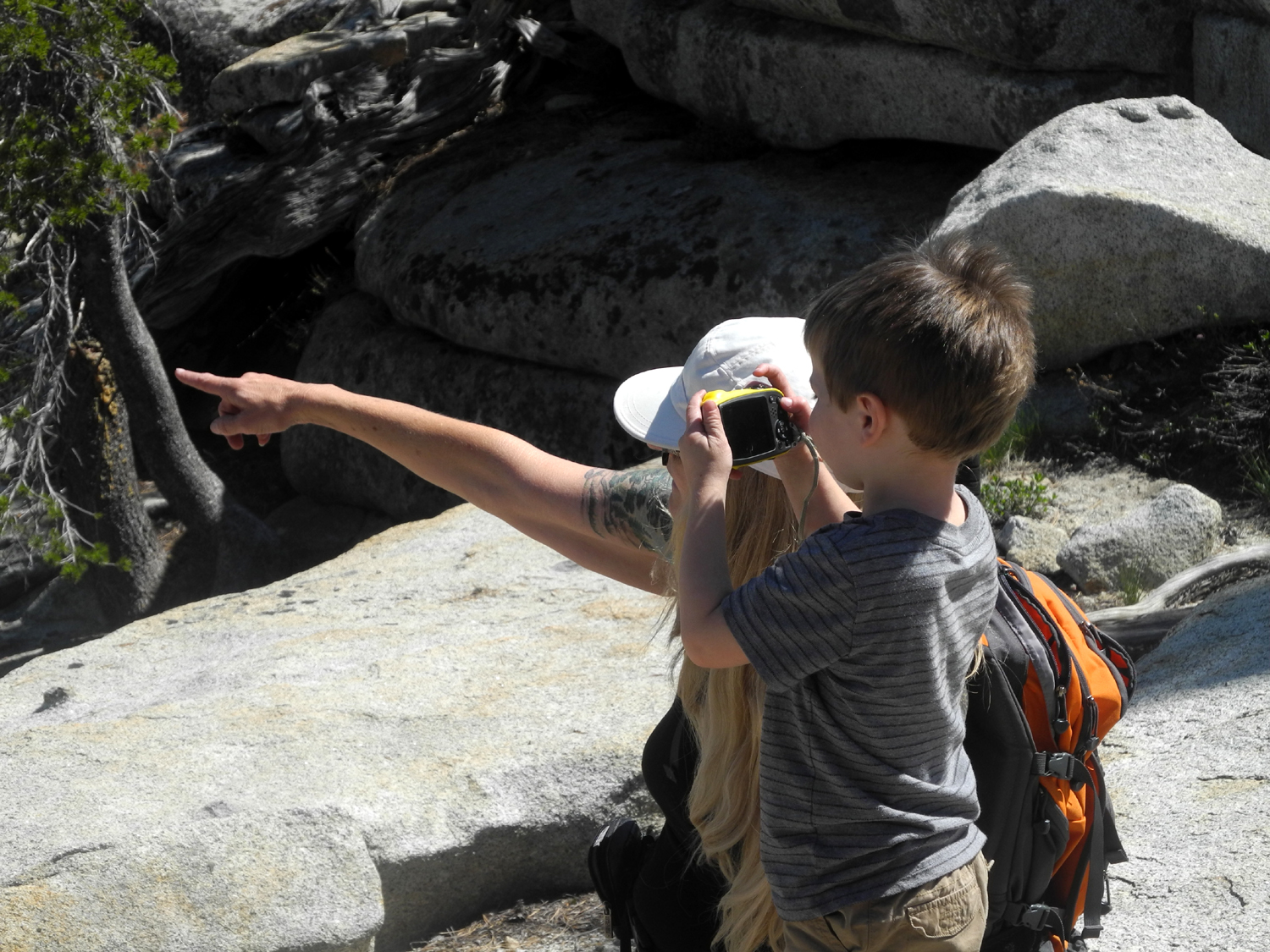
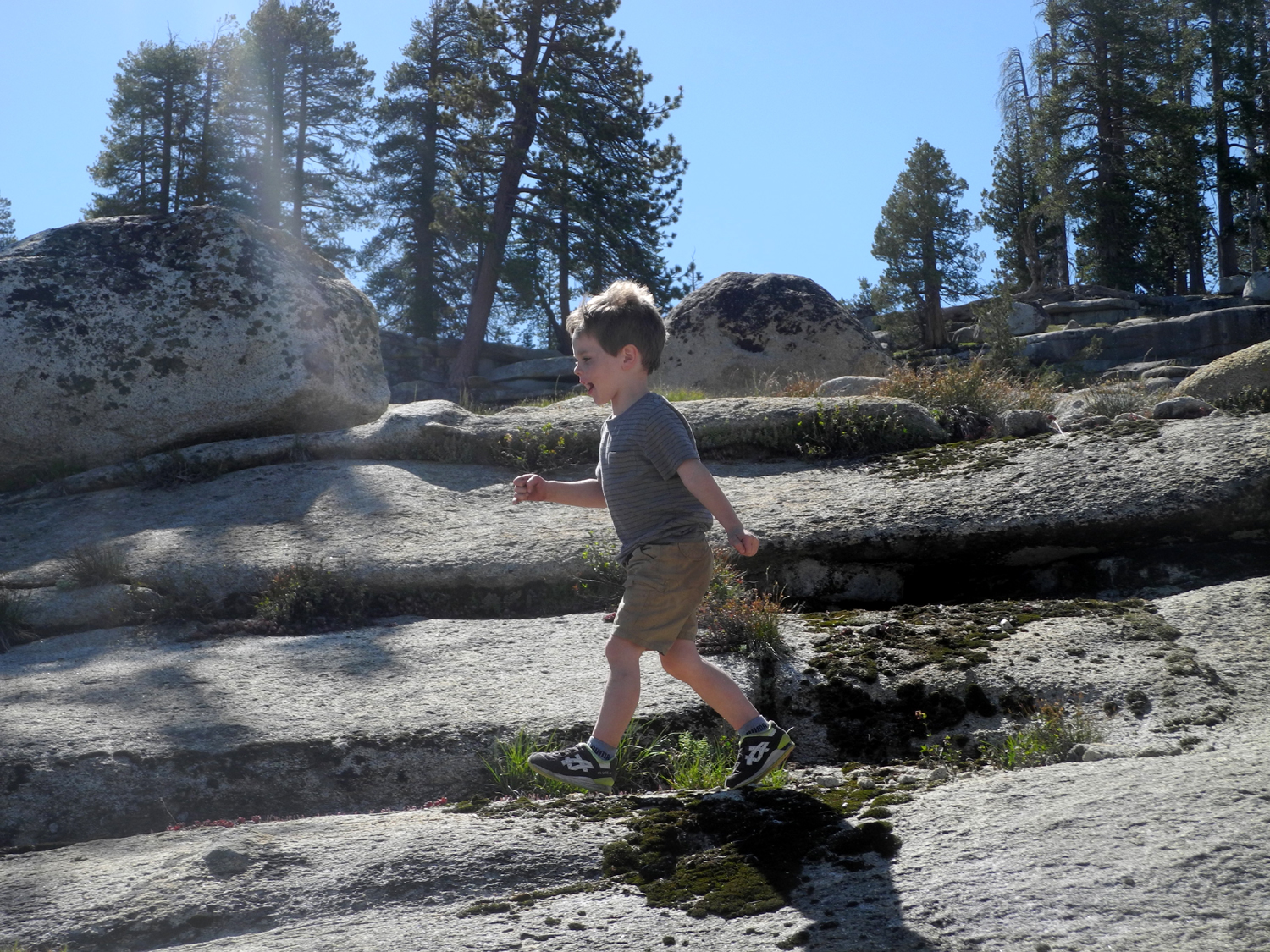
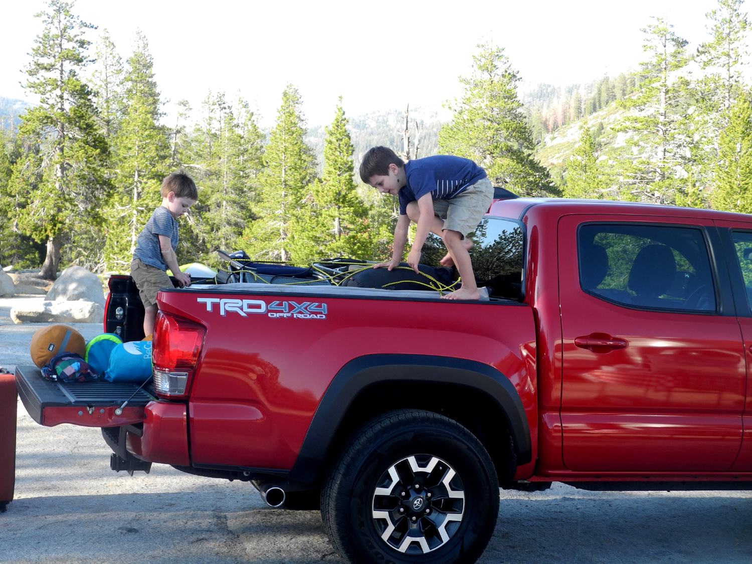
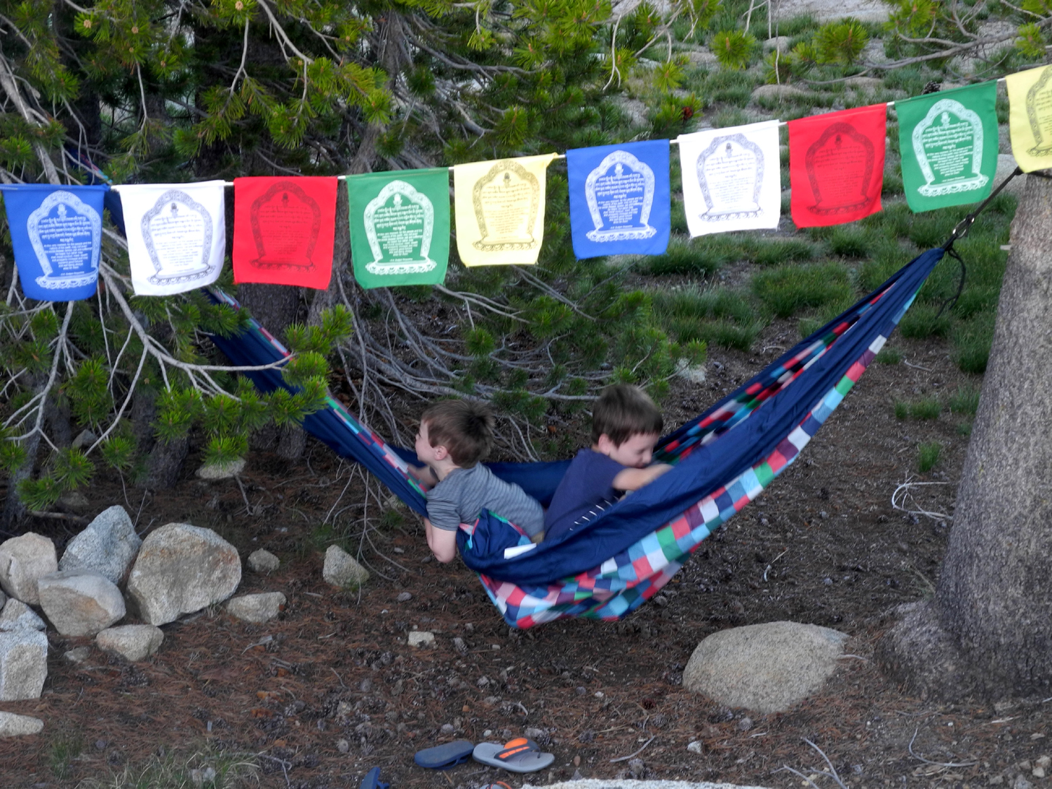
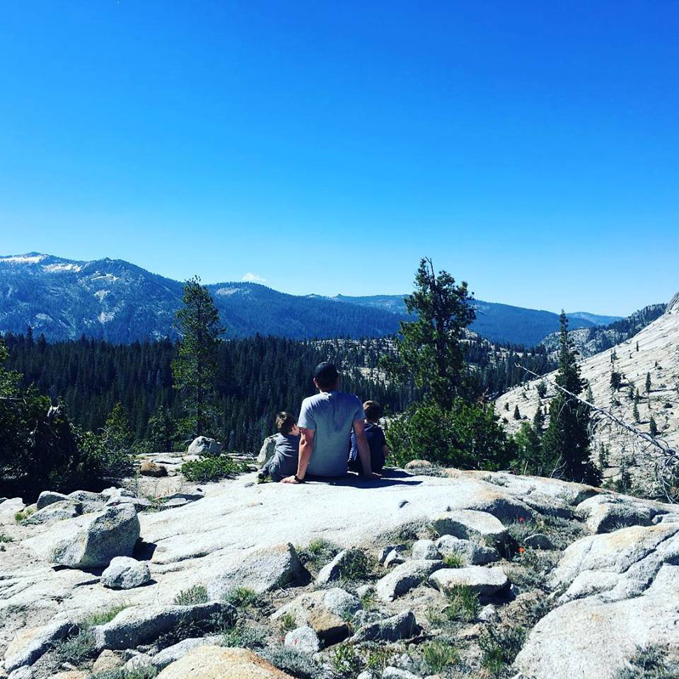
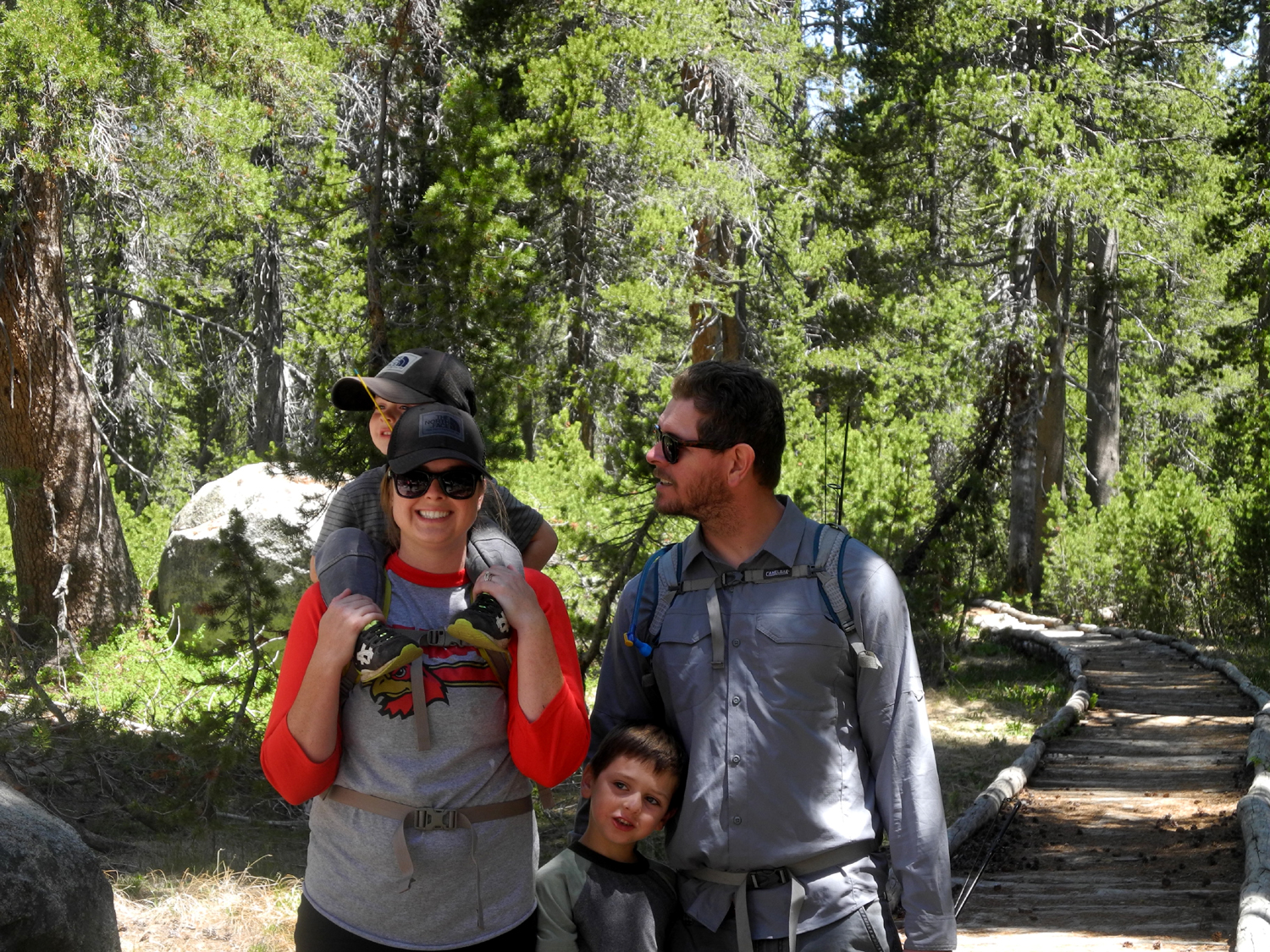
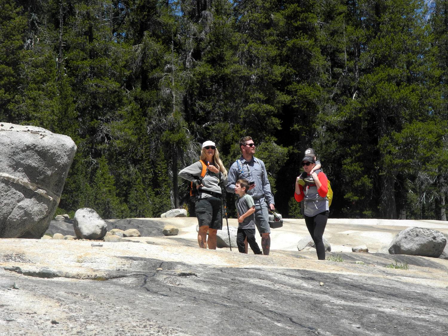
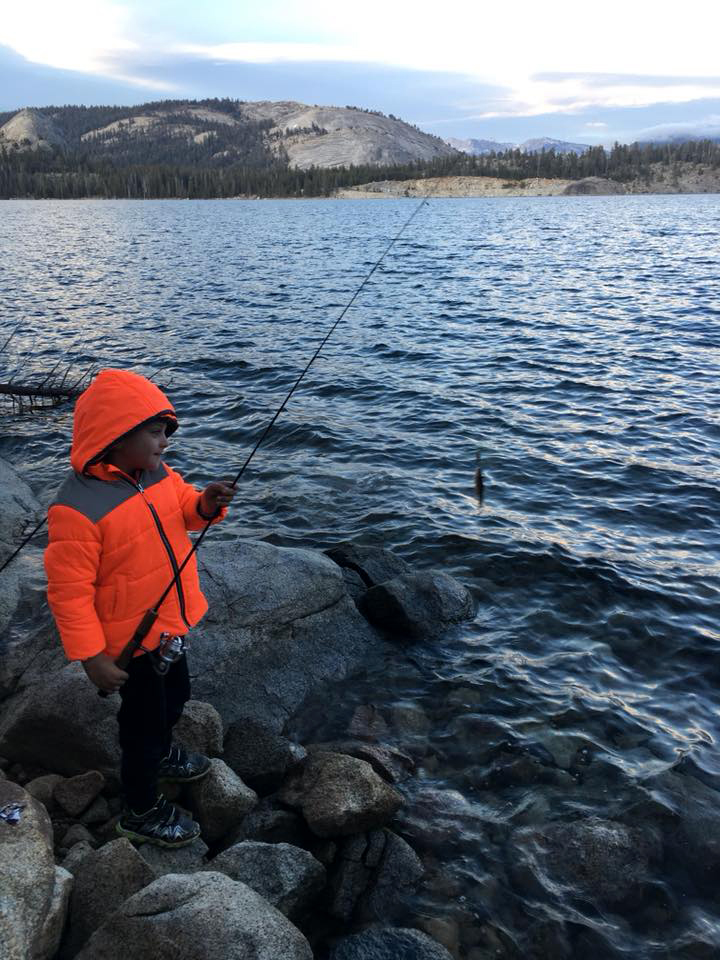
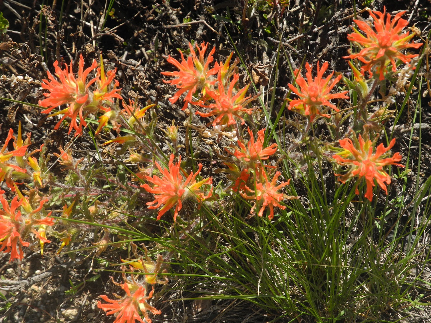
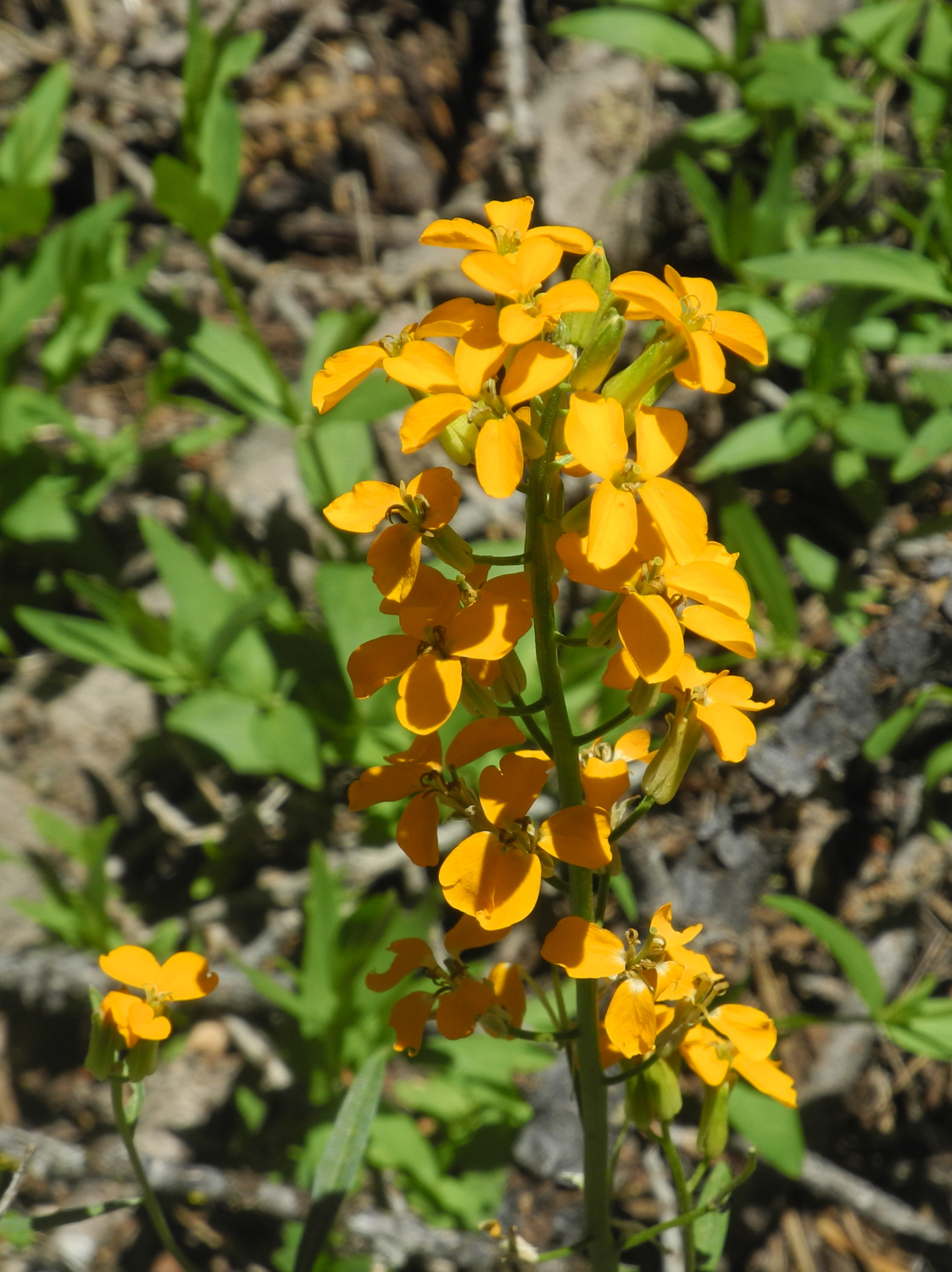
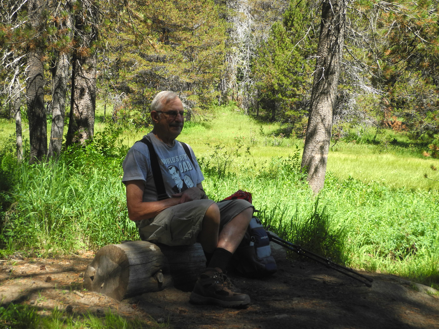
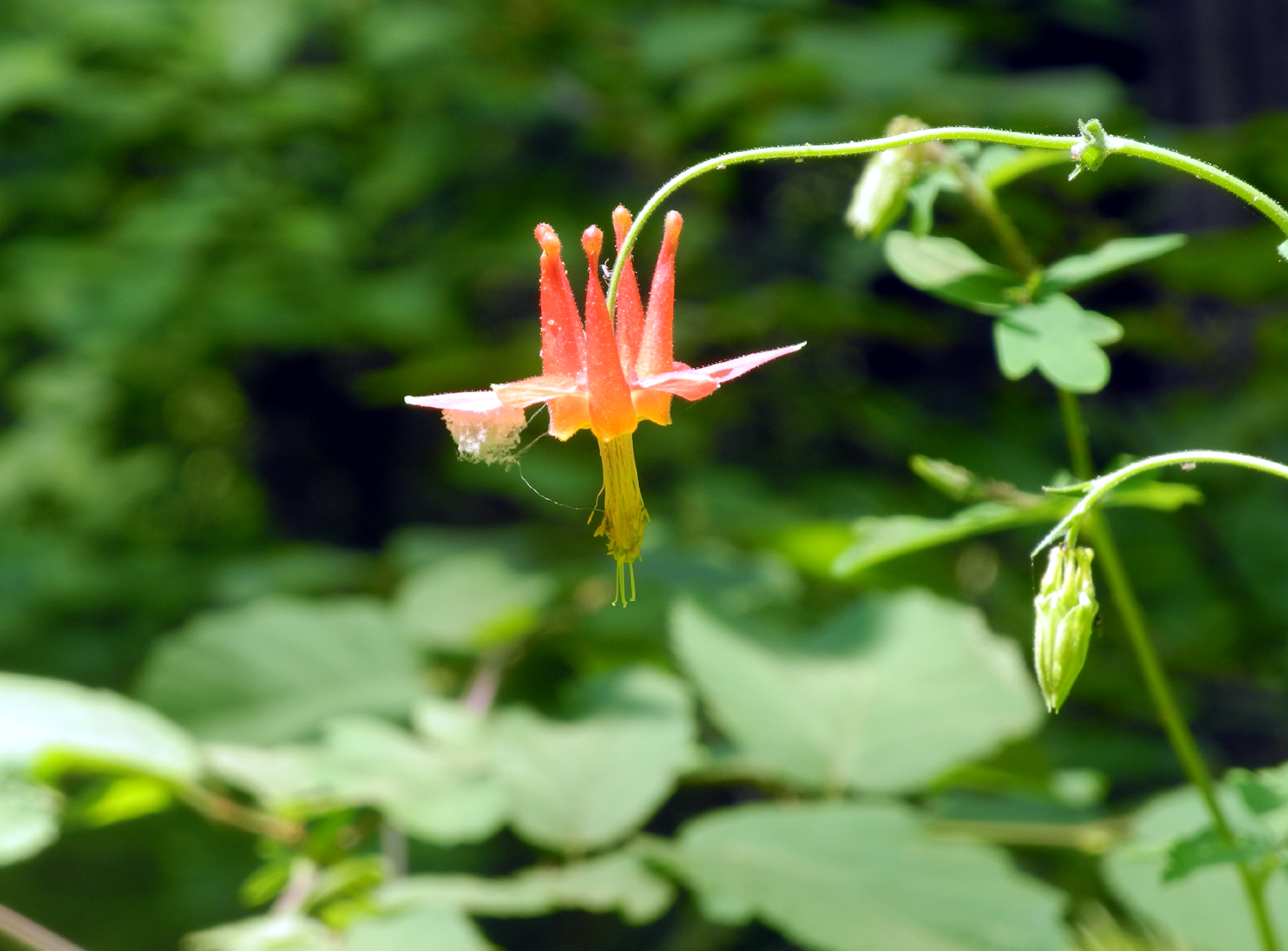
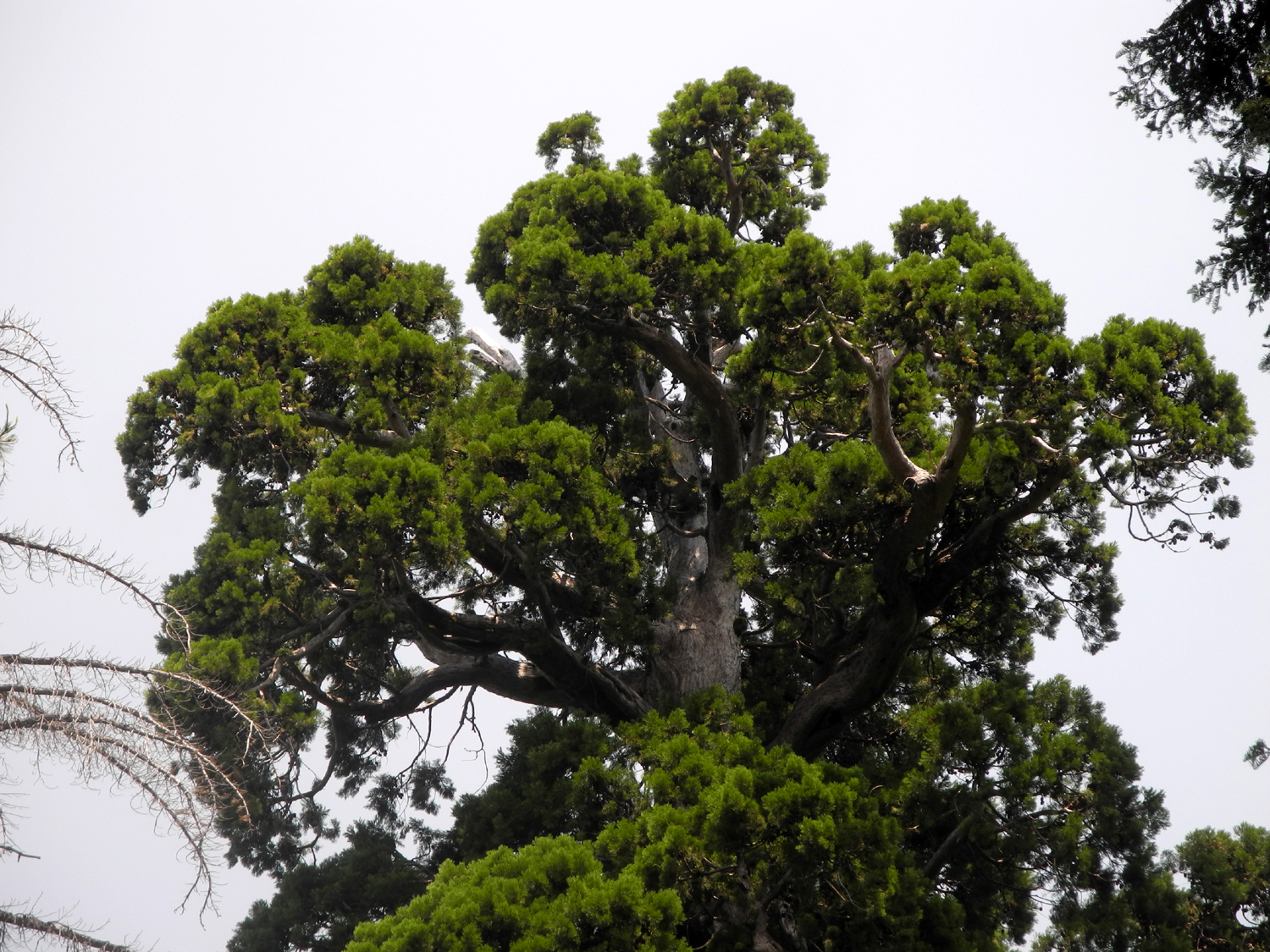
I drove up in my camper pickup on Friday, June 8, stopping at McKinley Grove between Dinkey Creek and the Courtright turnoff to take some photos of the giant sequoias there. I arrived at Courtright, drove across the dam on the road to the Maxson Trailhead, and occupied our favorite camping spot, a large, semi-level granite outcropping just off the road about an eighth of a mile from the parking lot. Teri arrived about an hour later in her motor home with grandsons Colton and Jack, and her friend Sandy drove in not long after. We all got our "housing" set up, with Sandy in a tent, then set off on our first hike. Across from our camping spot is a ridge that lies between the road and the lake, and we've enjoyed making our way up it several times. Since there are places where layers of rock create small cliffs and walls, it's necessary to do some route finding, which to me is half the fun. It was the boys' first time on this hike, and as I expected, Colton had no trouble keeping up and enjoyed himself greatly. At first Jack was a little hesitant and didn't like going up hill, but he quickly learned how to find the best routes for a 3-year old and soon got into the spirit of adventure with the rest of us. In a couple of places Teri helped Jack climb up a rock by holding her hiking pole out for him to hold on to, and soon Colton was doing the same for his little brother. About half way to the top is a large dead juniper that I have named the Sentinel. The top of it has branches sticking out and up, with pointed ends, typical of both living and dead trees of this species. We stopped at this point to take pictures, and Colton made his way up several rock layers to stand next to the tree. One of the dangers of hiking up granite slopes is places where there are loose particles of rock that can slide as you step on them. Colton and Jack made good use of a place like this, sitting down and sliding down several feet, and of course, putting a bit of wear and tear on the seat of their shorts. They also gave us a few heart-stopping moments when they realized they could run and skip down the slope when we started back. Teri and I were glad their mom was not with us to see this. We made it back to camp safely, and it was time for dinner. I had ordered two pizzas the day before so we would not have to bother with cooking the first day, and this was well received by all. Not long after this Johnny and Brittany arrived, and were greeted by their sons as if the time of separation had been weeks instead of ten hours. Jack and Colton climbed into their pickup and helped unload, while Johnny and Brittany set up their family-size two-room tent on a flat grassy spot at the base of our big rock camp area. Next to the tent Johnny strung a hammock which provided endless entertainment for the boys. There was a strong breeze much of the day, and as the sun got down low, the temperature dropped quickly, getting into the low 50s well before dark. Johnny had brought his chain saw and cut some rounds from a fallen lodgepole pine near the camp, then impressed the boys by splitting most of them with one blow of my splitting maul. Sandi and I had provided store-bought kindling and almond wood, and Colton gathered up a couple dozen pine cones from another fire ring and brought them to our camp to help get the fire going. If you remember your physics training, you'll recall that hot air rises and cold air sinks. This results in the wind blowing upstream in the daytime, and downstream at night. Around the time we start our campfires, the wind starts to change. So it blows first in one direction, than another, before finally getting settled down. It seems always to follow one person no matter which way they move, and the victim the first night was Sandi. However, eventually equilibrium was reached and the air was still for quite a while, with smoke going straight up. Once it got completely dark all us except Sandi went out on the rocks away from camp, laid down in a flat area, and enjoyed the brilliant star view. The Big Dipper and Scorpio were clearly visible, and everyone but me saw a few meteors. However, I saw a very good one later during the night when I got up to go to the bathroom. Everyone enjoyed the fire, with various people drifting off to bed at different times. Jack faded out first, but Colton hung in until ten p.m., at which time Johnny took him down to the tent, where he was soon asleep. By this time the temperature was in the low 40s, and eventually it got down to 34. I'm used to getting out of the truck in the morning, heating water on a propane stove, and finding a sunny spot to have my tea. This time we were fortunate to be able to go into Teri's motor home in the morning, and take advantage of the propane heater. People came to life one by one, and eventually Johnny fixed bacon and sausage. Thanks to the motor home generator, we were able to make toast the easy way. Not long after breakfast we had our first day visitors, Curtis and his girlfriend Meagan. Johnny and Curtis played hockey together starting around age 12, and have been close friends ever since. Our guests had to head home early for a graduation, so after a short visit, they drove to the other side of the lake to get in some fishing. Meanwhile the rest of us set out for the day's hike - back the trail and four-wheel drive road north from our camp, then to an unofficial camping area close to the lake. The boys (except me) carried fishing poles, and Brittany carried Jack. The rest of us managed the hike OK, but when we reached the Big Granite Slope about a mile in, I decided not to go any further, and wished everyone good luck. I explored this area a little, getting a nice photo of some patches of green grass that grew in a semi-level spot filled with soil and decomposed granite, and watered by a trickle flowing down the rock. About halfway back to camp I met our second daytime-only guest, Dustin. He and Johnny were in YMCA Indian Guides together from about age 8, and they and Curtis are frequent backpacking and fishing buddies. We chatted briefly, and I let Dustin know where the others were headed and he continued on. I got back to camp and just sat and rested for a while, then tried to nap, with no success. Not long after that Teri and Sandi returned. They had gone all the way to the lake, but were ready to come back before the others were. They also met up with Dustin and had a nice chat. Finally the Upshaw's arrived back at camp, with Jack sleeping soundly draped over his Dad's shoulder. They put him in the tent and he slept another half hour or so. Dustin had arrived at the lake about the time they were ready to leave, so he stayed behind to fish a while. Teri had brought tri-tip for dinner, and Johnny and Brittany had fixed a potato dish. They put the barbecue behind a large rock out of the wind and got it going. It took a while to cook everything and by the time it was ready, everyone was hungry and greatly enjoyed our meal, with Jack and Colton having hot dogs. Dustin made it back to our camp, but could not stay for dinner. It started getting cold earlier the second night, and by the time we finished eating, we were ready for the campfire. Johnny could not resist cutting and splitting some more wood, but after we got the fire going, he and Colton drove to the other side of the lake to fish for a while. Despite keeping the fire going good till after 10 p.m., we had wood left over. I took two boxes home and we still left some behind. Most everyone went to bed a little earlier the second night, probably due to having exercised a little more and for some of us, having two days of fairly strenuous activity behind us. We went for simplicity with Sunday breakfast, with most of us having the cereal of our choice. We slowly but surely gathered up the tons of stuff scattered around our camping area, and amazingly, got it all back into our respective vehicles. Sandi was the first to depart, followed not long after by Teri. I asked the Upshaw's to take a short walk with me to see an especially magnificent juniper tree, only about two hundred yards from camp. You can stand on a rock that drops off 20 or 30 feet, and look right across at the very top section of the tree, which has several rugged, dead limbs, typical of many older junipers. Everyone agreed the walk was worth it, and of course, Colton wanted to venture as close to the edge as possible. We made it back to camp without mishap, and started for home. As often happens, I was distracted from making a quick, non-stop journey. On the Courtright Road I saw a deer. Then I had to stop at one place to photograph a big patch of high-altitude lupines, a slightly more violet color than most of the foothill varieties. A year or two ago driving down the road not far from Dinkey Creek, we had noticed a good view of Bear Creek where it tumbles down a series of cascades before crossing the road. By the time we saw this, there was no place to pull off the road. On this trip I found a place where I could see the falls, and was able to park and walk a short distance and get a good view, although not a great photo. I stopped again just a short distance closer to the creek for a look at the lower section of the cascade. I then vowed I would continue home without further stops, but I came around a curve and saw one of the biggest patches of western wall flowers I've ever encountered, so I had to make one more stop. At the
end of the journey I was tired, delighted at having spent several
days with family and
friends, and thankful to Teri for organizing
the outing. --Dick Estel, June 2018 |
||
|
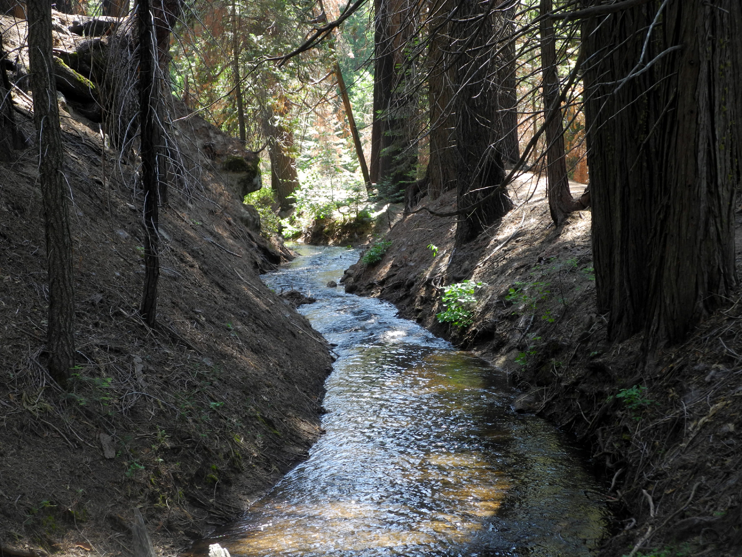
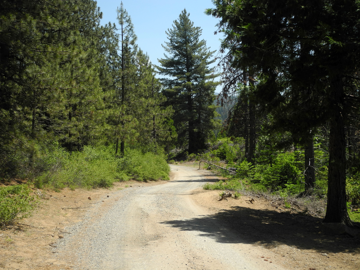
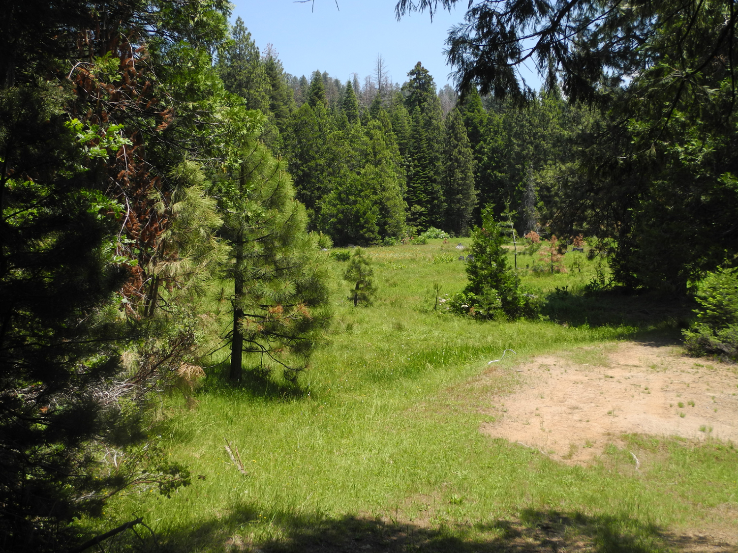
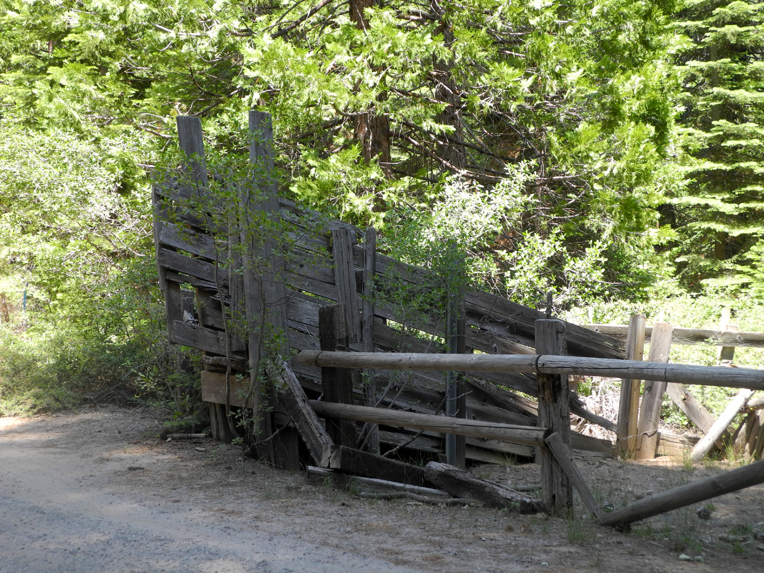
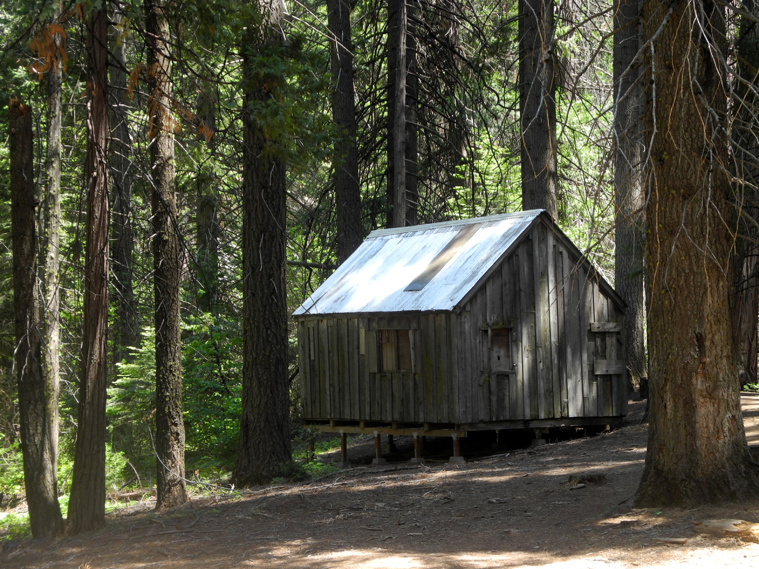
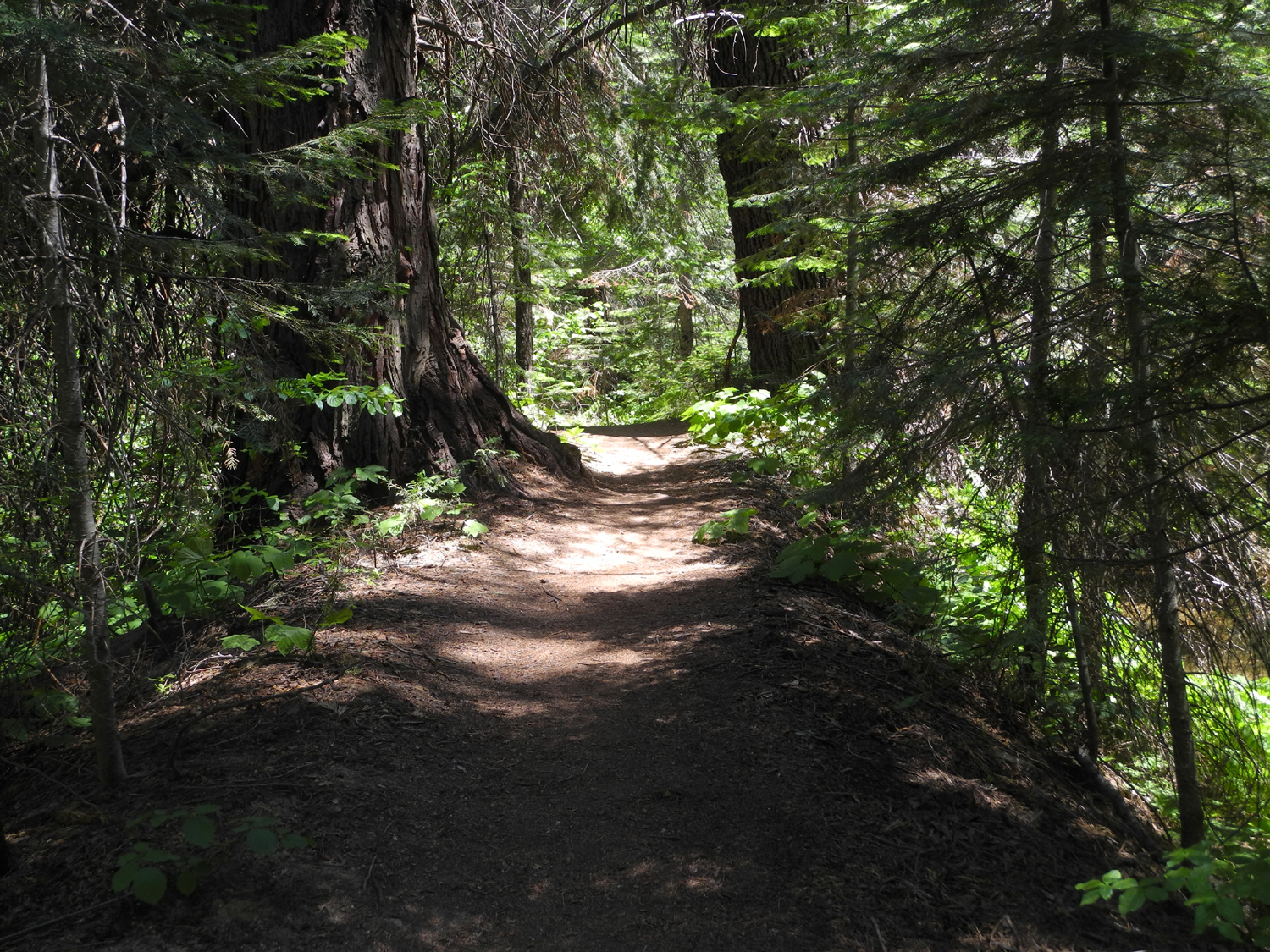
New Trail Discovery I'm not sure if this was an unexpected adventure, a comedy of errors, or what. The explanation is long and possibly boring, so I'll save it for the end, and by the time you get there, you can decide if it matters or not. I had planned to camp at Nelder Grove, but instead ended up at Summerdale Campground, on State Highway 41 just past Fish Camp. I hiked in three places I had never been before, learned some things, and saw lots of flowers and other scenery. |
||
 |
 |
 |
| Water ditch off Big Sandy Road | El Capitan and Half Dome in Yosemite | Applegate's paintbrush in McGurk Meadow |
|
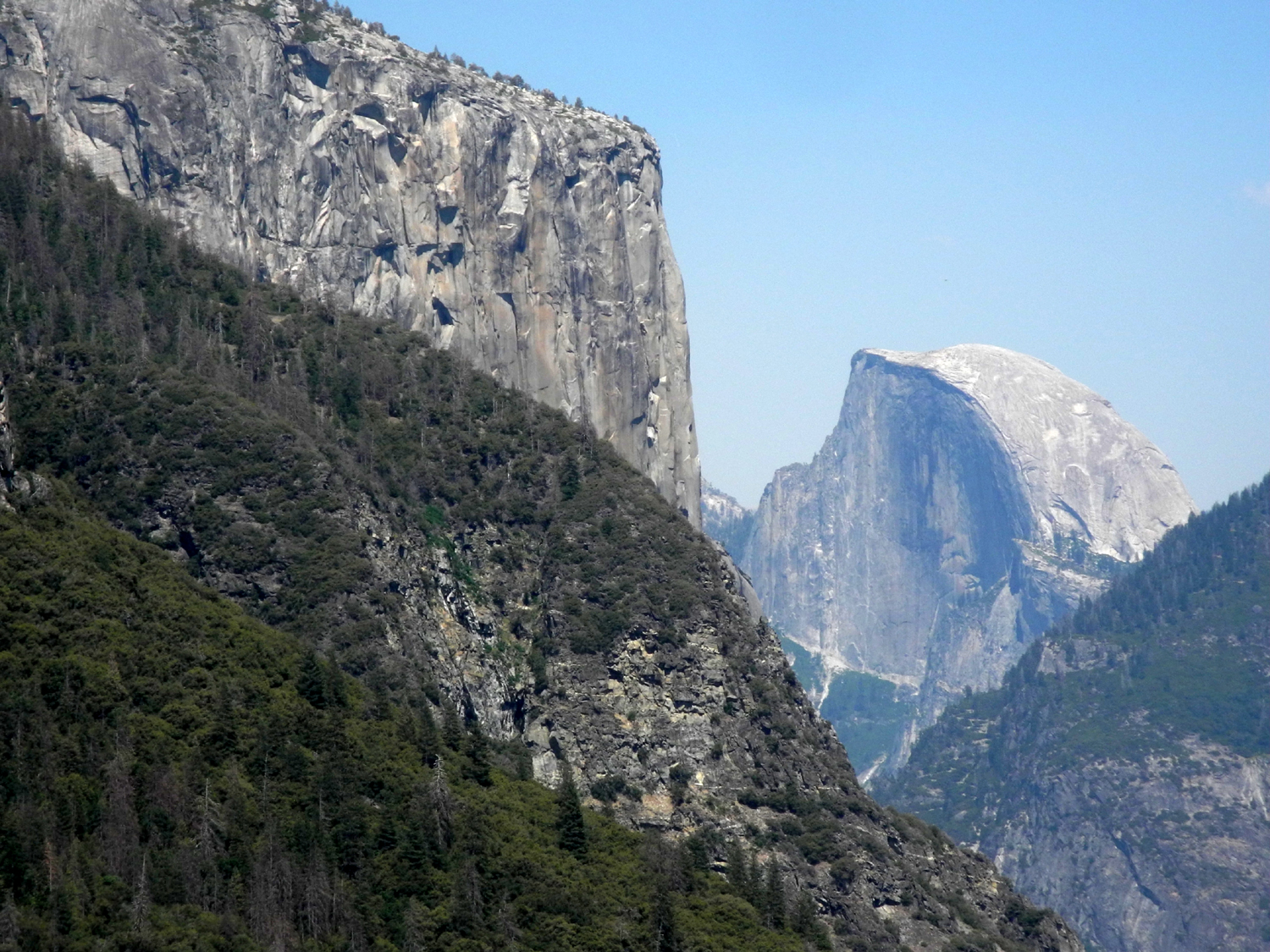
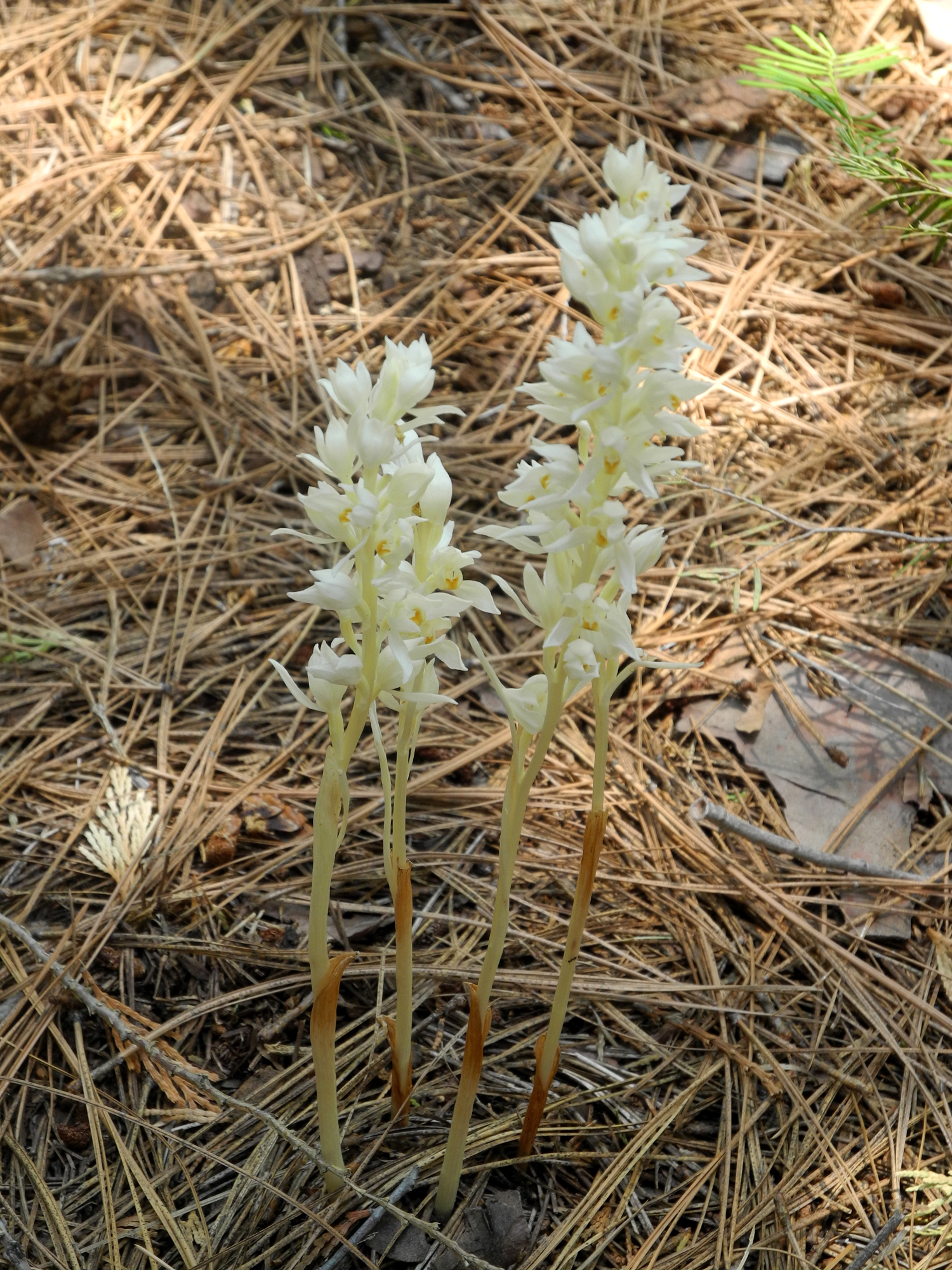
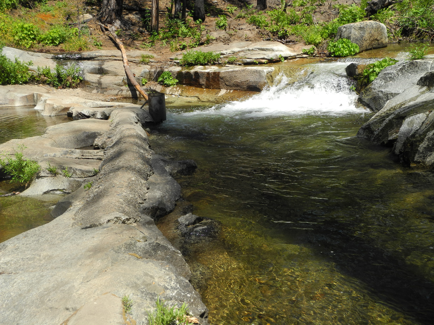
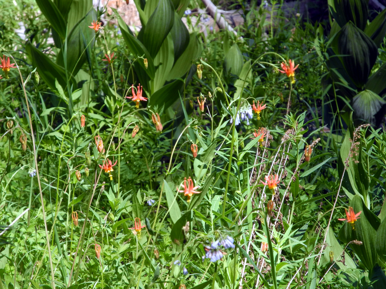
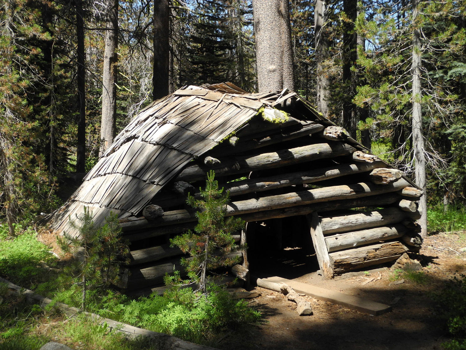
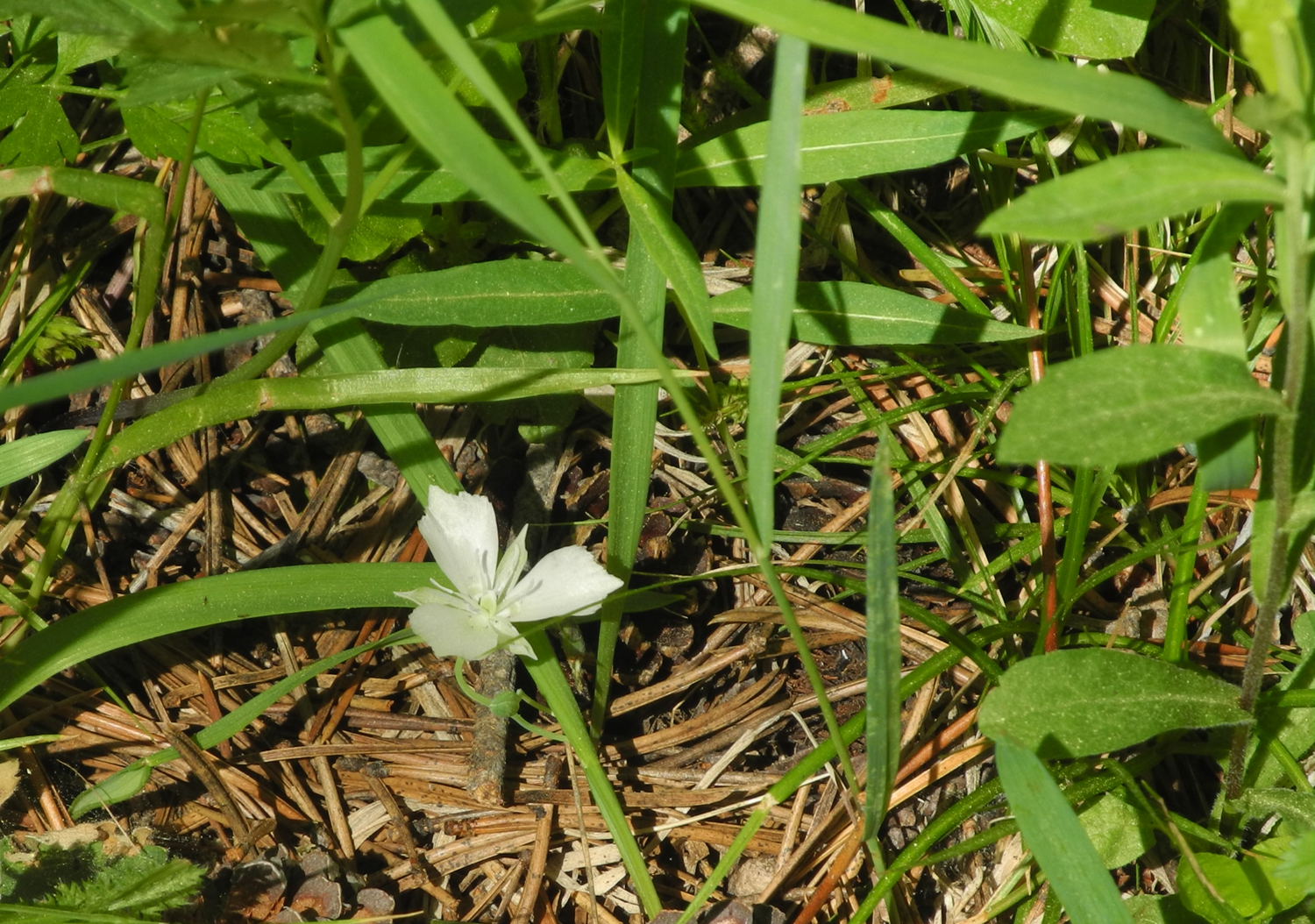
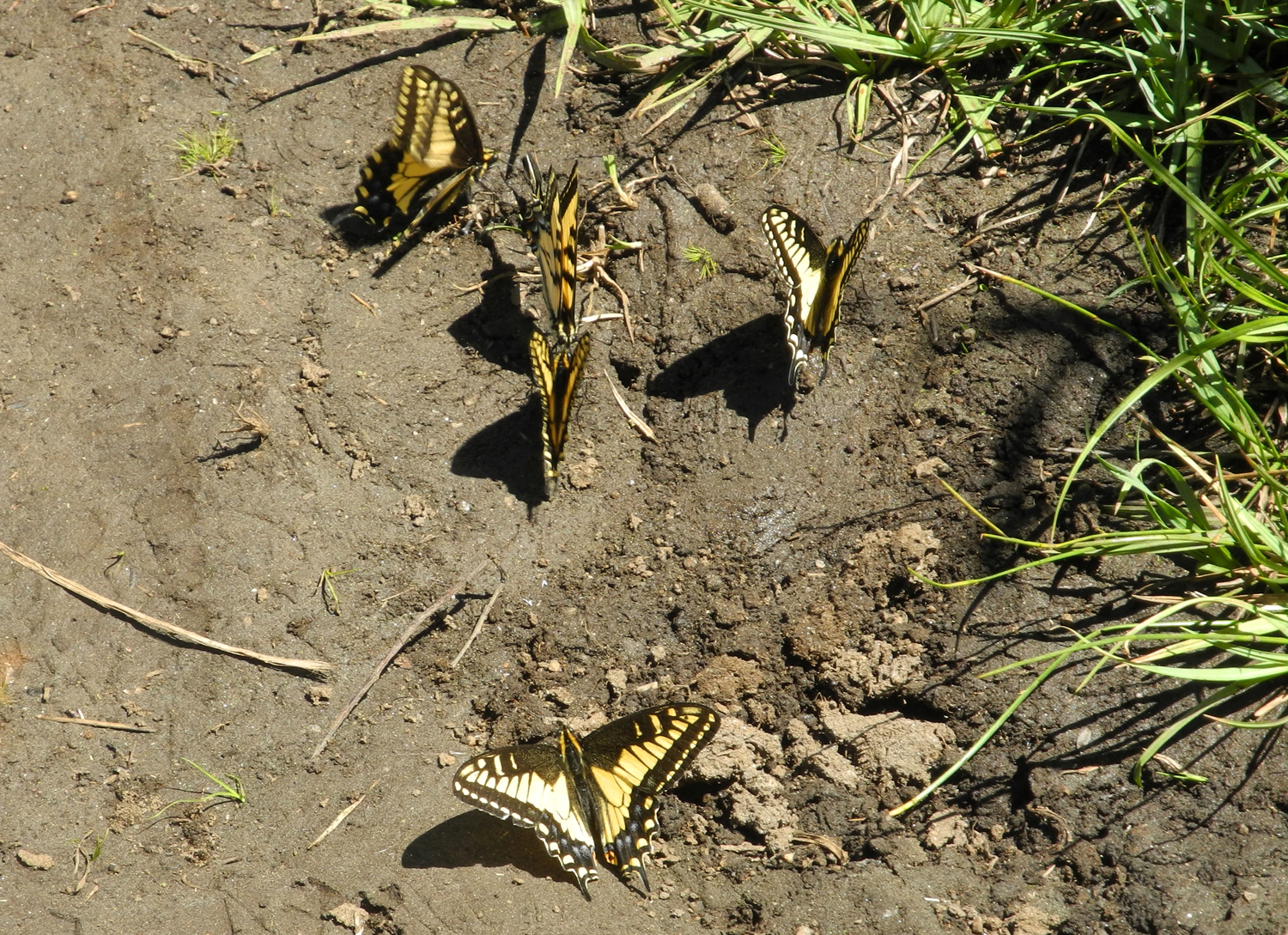
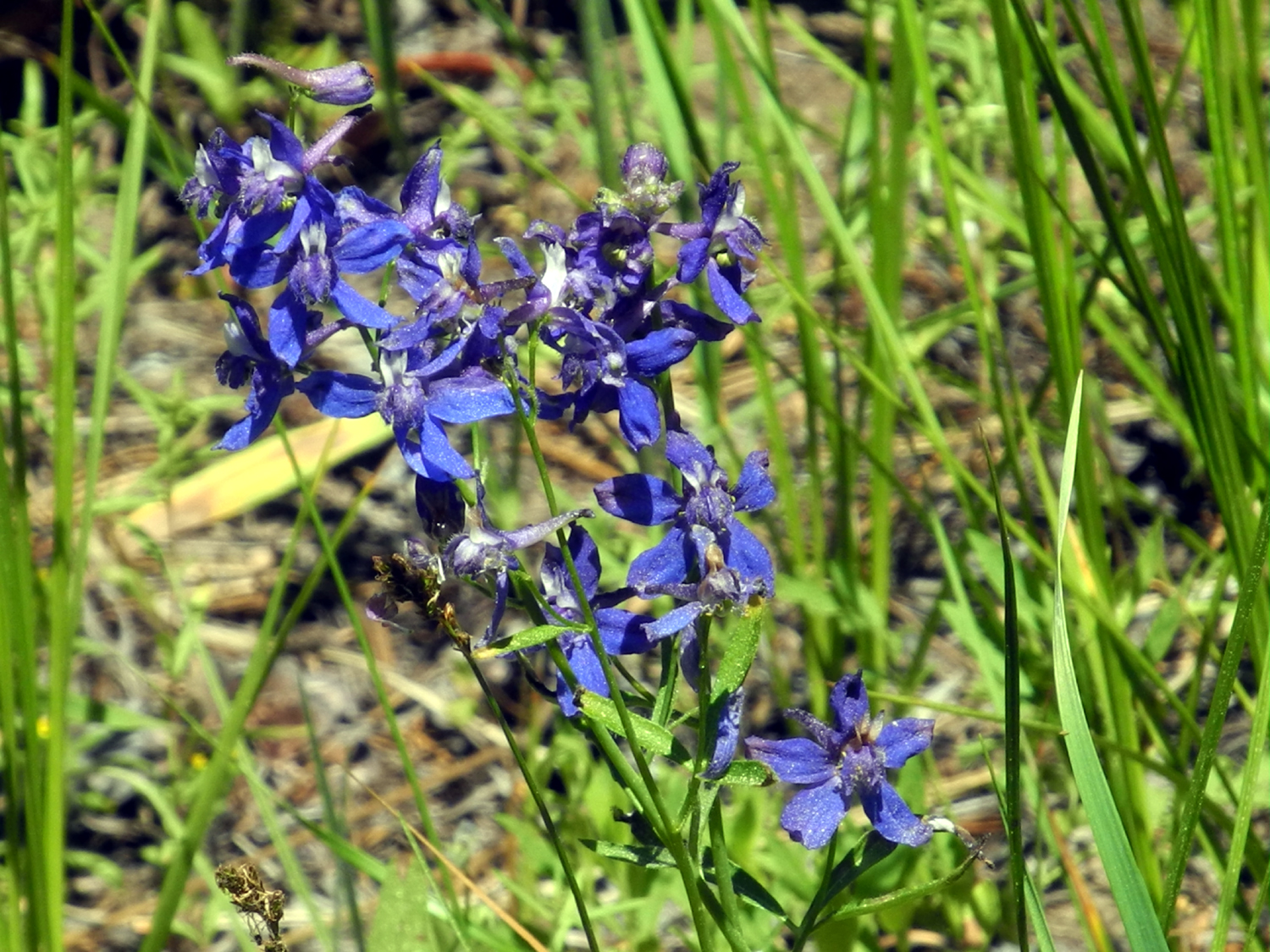
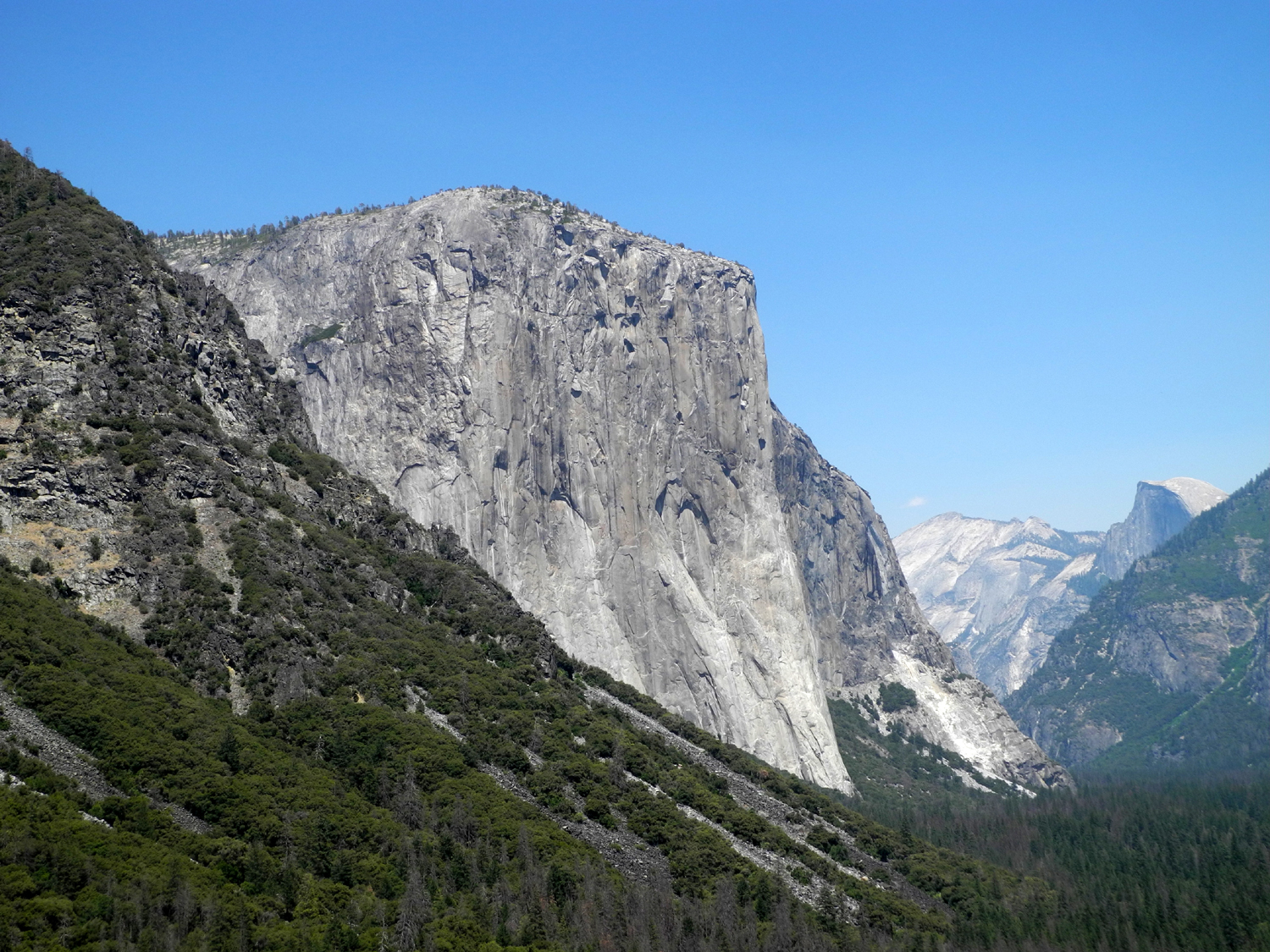
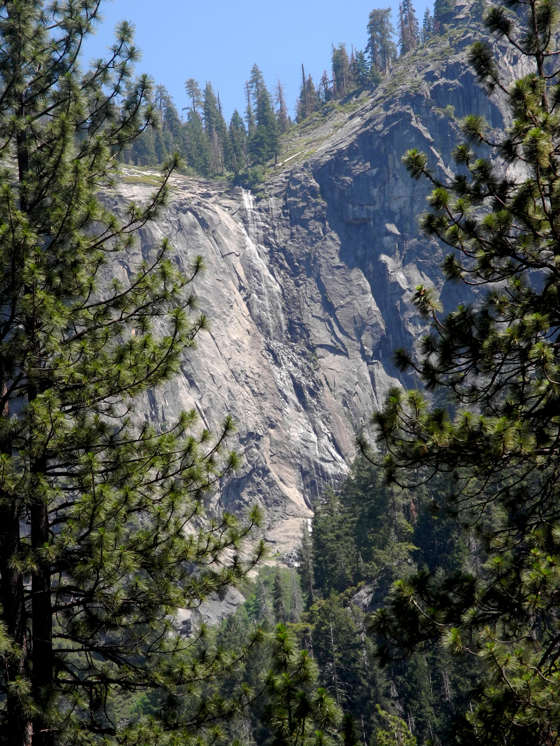
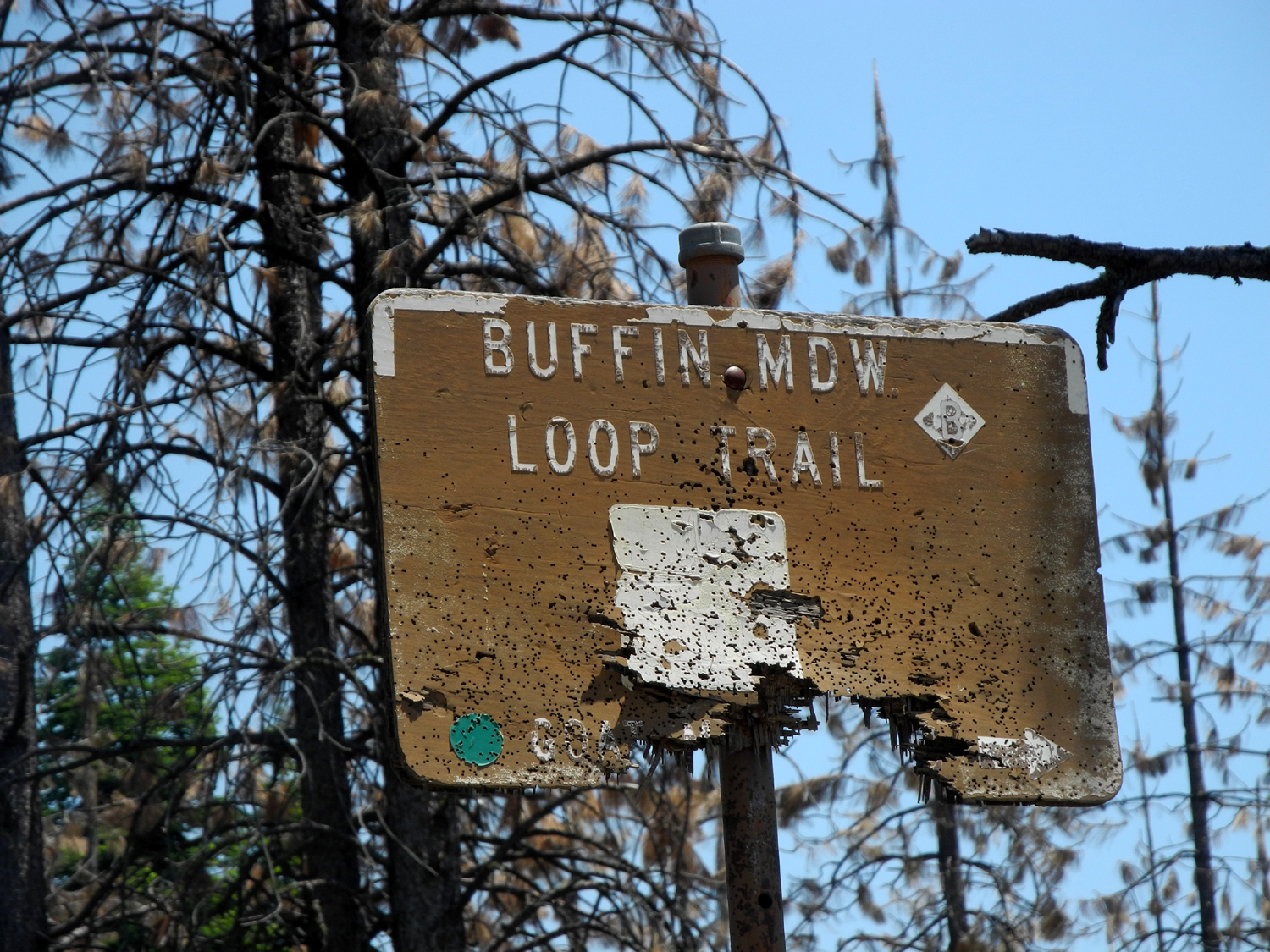
I drove up in my pickup on June 25, and got the last available campsite. This was not my preferred type of camping, being in an area in which 30 or so parties are living in close proximity. Usually when my family goes camping, we don't want any other campers within sight. However, I accepted my fate. The particular site I had was also very bad for my camping style. It was a narrow parking spur, with about 18 inches on either side of the truck, so that I had to be very careful not to fall off the pavement when getting stuff out of the cab. Since I have to get up several times each night, I place a plastic milk crate at the back of the truck to step up and down on. At this site the area back of the truck dropped off at a sharp angle. I finally was able to position the truck so that I could use the four by four wooden barrier at the back of the parking spot to climb on. But enough of the bad. Since I had not planned to camp at this location, I had no hiking destinations in mind. However, I have driven on the forest roads that go in from the highway on both sides, and decided to re-visit one of the worst roads I've ever driven on. Lest you question my sanity, I did NOT intend to drive as far as the very bad section that is stuck in my memory, since once was enough. In our visits to Nelder Grove in the 1970s, we naturally explored the various roads in and out of the campground and in the vicinity. For reasons now forgotten, we found ourselves on the White Chief Mountain Road, we being myself, my wife, and two young daughters. The road got worse and worse, but our VW bug could handle places I would not care to go with a "normal" sedan. We came to a place where I thought we might have to turn back, but we ended up putting branches and maybe some boards into a very bad, rocky spot, and made our way through, eventually reaching the highway in "downtown" Fish Camp. I decided to drive in on this road from Fish Camp and see if I could find a place to do some hiking, knowing I would not go anywhere near as far as the spot that caused us trouble 40 years ago. The first part of the road is paved and has some residences. It soon turns to dirt, and not long after that I came to a fork. There was worn old sign that read "Buffin Meadow - easiest." This "easy" route had a lot of ruts and rocks, and I would not care to try the "hard" fork, but it was far from the worst road I've driven on in the last few years. Eventually I came to a junction where the road became much better, and there was a sign reading "Buffin Meadow Loop Trail." Considering the physical condition of both these signs, I later concluded that the "easiest" description may have applied long ago, but no longer. I stopped here and looked for a trail, but there was no sign of one. Eventually I concluded that the reference was to a 4-wheel drive trail, although the road was easily passable by most any vehicle at this point. I walked down the road and after a few hundred yards spotted what was probably an old logging road, now a wide trail, and went that way. There were vehicle tracks farther in, but it was very narrow, and any vehicle going down that way would get scratched by brush on both sides. I arrived at a beautiful meadow. The road continued on above the meadow, but there was a short route into it, which soon led to a wet, swampy area which was as far as I went. The area was a riot of flowers of various types, some familiar and some not, including quite a few western azaleas in bloom. I spent some time here taking photos and just enjoying a place I had never seen before. Beyond the meadow, the trail started to rise, so I assumed it would take me back to the same road, but it fizzled out. I looked up through the trees and realized I was just a short distance from the road. Walking through the fallen logs and brush, I discovered an amazing plant, somewhat like something I've seen before that is similar to snow plant but grows tall. These were completely white, stem and blossoms, and about one to two feet tall. I reached the road and returned to my truck. Instead of going back the way I came in, I took the other road, which looked to be in much better condition. It was in fact a very good dirt road all the way, and came out on Highway 41 right at the Yosemite National Park Border, about a half mile beyond my camp. I later learned that this route is the Mt. Raymond Road. It was still early, so I drove back toward Fish Camp and on the other side of the "town" turned left on the Big Sandy-Jackson Road. I had been on this road from both directions several times, and it was always easily passable, although in one place it was necessary to drive through a creek. About two miles in I came to an old corral and cattle chute, and of course, stopped to take photos. I realized there was a creek just past where I parked, so I walked up to take a look. It proved to be a man-made ditch carrying a pretty good flow of water through a culvert under the road. Two men parked just past the crossing and went upstream. I followed them to see what I could see. Right around the corner was an old cabin, so I took photos then walked around to the other side if it. Here I found a good trail running along the bank of the ditch. This was high up on the side of what was obviously a natural drainage, and was relatively level, with just enough slope to allow the water to flow easily. There were many wildflowers along this way, and it was nearly all easy walking, with a couple of narrow spots where you had to walk close to the drop-off. About a half mile in I saw a small waterfall, and realized I was at the point where the creek was diverted into the ditch. There was a low concrete dam across the creek above the drop-off, and a gate in the ditch to allow water to flow down the creek or into the man-made waterway. I saw quite a few other people on the trail, including some carrying inner tubes. They said they were headed for a spot upstream from the falls. The road I drove in on goes to two campgrounds, Big and Little Sandy, and I had always assumed that was the name of the creek which ran by Big Sandy camp. However, looking at the map later and matching it to the terrain I had visited, I now realized that the creek was Big Creek, which crosses the highway at Fish Camp, runs on the west side of Summerdale Camp, and eventually flows into the South Fork of the Merced River. I finished my hike and drove back to camp, where I just relaxed and read the rest of the day, with a walk around the campground loop road. It got cool enough that I put on a long sleeve t-shirt, then a flannel shirt. During the night it got down to 40 degrees, which seemed MUCH warmer than the 30 degrees at Courtright a few weeks earlier. I wear a hooded sweat shirt in bed, but didn't need an extra blanket and didn't keep the hood on all the time. I had decided that I would go into Yosemite on Tuesday and hike a trail that leads off the Glacier Point Road near Bridalveil Campground. I saw by the map that I could follow this trail and its branches to Glacier Point (10 miles), Sentinel Dome (also too far), Taft Point (six miles or so), or Dewey Point. My hiking friend Wes had mentioned this location and had hiked there in the last year or so and I hoped that it might be only two miles or less from the trailhead. When I saw the mileage sign, alas, it was 3.8 miles, a round trip that would be about twice as far as I am prepared to tackle. However, the name of the trail was McGurk Meadow, so I assumed I would at least see some green grass and flowers. It turned out to be a delightful place to hike. The first part of the trail was relatively level, passing through a forest of pines and firs. Then the route started down what I named The Hill of Lupines. For a half mile or so, thick patches of lupines appeared on both sides and up the slopes nearby. Other flowers added variety from time to time. As the trail got near the meadow, I saw an old, badly leaning cabin, which I have to assume was where Mr. McGurk lived, probably grazing cattle or sheep in the meadow. Fortunately the area has fully recovered from any destruction caused by these creatures, and I was treated to the sight of a brilliant green meadow, perhaps 300 yards wide and extending in both directions as far as I could see - at least a mile or more. Wild flowers, both familiar and unknown, were thick everywhere. There were lots of shooting stars, royal blue larkspur, several species of white and yellow flowers, and my favorite, a flower that was new to me with long, spiky, orange petals that somewhat resembles Indian paint brush. Research on wildflower identification sites later indicated that it was probably Applegate's paintbrush. Where the trail went through the meadow, there was a bridge across a small creek which had attracted dozens of butterflies. There were at least three different kinds of larger butterflies and possibly as many as a hundred small blue ones that fluttered all around me as I disturbed them walking on "their" trail. Beyond the meadow, the trail went through a thick forest of lodgepole pines, but the forest floor played host to many kinds of tall green plants, so it was almost as if the meadow continued into the trees. At one point I had to scramble through trees to get around a fallen log blocking the trail. A short distance farther I found a good resting log and stopped to have my lunch, then started my return hike. I met a number of people on the trail, including a group that started just ahead of me, and of course, were soon out of sight. A half mile in or so I met one of them coming back. "Forgot the lunch," he said. When he caught up with me again I learned that they were going to Dewey Point. A couple of groups I met on the way out soon passed me again, indicating that they had probably only gone to the meadow. But a father and son, about ten, that I talked to while hiking in, had already been to Dewey Point and were returning. I recalled that I had done a couple of eight-mile round trip hikes during 4-H camp in Yosemite at about that age. These included the top of Yosemite Falls and Glacier Point, both four-mile hikes up from the valley floor and another four back down. Ah, youth! Driving to the trailhead, I had passed a meadow with a striking growth of pink flowers, so I stopped there on the way back. They proved to be shooting stars, as thick as I have ever seen, in several huge patches at both ends of the meadow. While there I offered to take a picture for a family so they could all be in it, and learned that they were visiting from Israel. It was still fairly early, so when I got back to the main road, I turned right toward Yosemite Valley. I did not plan to go all the way to the bottom, but instead stopped just past the Wawona Tunnel, to enjoy the iconic view of the valley including El Capitan, Half Dome, and Bridalveil Falls, Countless postcards, tourist photos, and now cell phone images have captured this spectacular vista. An informational sign that identified various landmarks showed the photo of an ephemeral, or seasonal, waterfall, the Silver Strand. I looked toward the direction indicated and saw that it still had a small flow of water. After enjoying the view and observing the coming and going of other park visitors, I started back toward camp. Not far past the west side of the tunnel there is another good view, dominated by El Capitan and Half Dome. It's high enough and far back enough that little of the valley can be seen, and only the very top of Bridalveil is visible. I had run out of paper towels (used as napkins and multiple other purposes), so I made a quick stop at the Fish Camp General Store before heading back to camp for the night. I can highly recommend this place - they were friendly and helpful, and acted as if they had been awaiting my arrival all day. My final night at camp was uneventful, with the usual eating, reading, and walking around the campground loop road. I took my time getting loaded up and ready to go in the morning, and made a short stop to visit daughter Jennifer and her husband Rod at their place above Oakhurst. I would be returning for cat sitting and more hiking in a few days. Can another travel report be far behind? When I
drove home, there was no sign of smoke in Oakhurst, and Rod and
Jennifer were not aware of any fire. When I got home I checked the
Internet and found the same story. Although there was no date on it,
I soon recognized it as the Sky Fire of 2015. Even so, there COULD
have been smoke at Nelder, since there was a fire far to the east
between the North and Middle Forks of the San Joaquin River. And by
going somewhere I didn't want to go, I discovered several new places
to hike. --Dick Estel, July 2018 |
||
 |
 |
 |
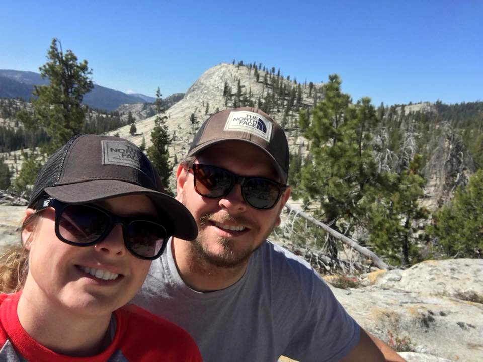
| East side of Sentinel Dome from the trail | Wes and Dick on top | Yosemite Falls and high country to the north |
|
Cat Sitting & Sentinel Dome |
||
|
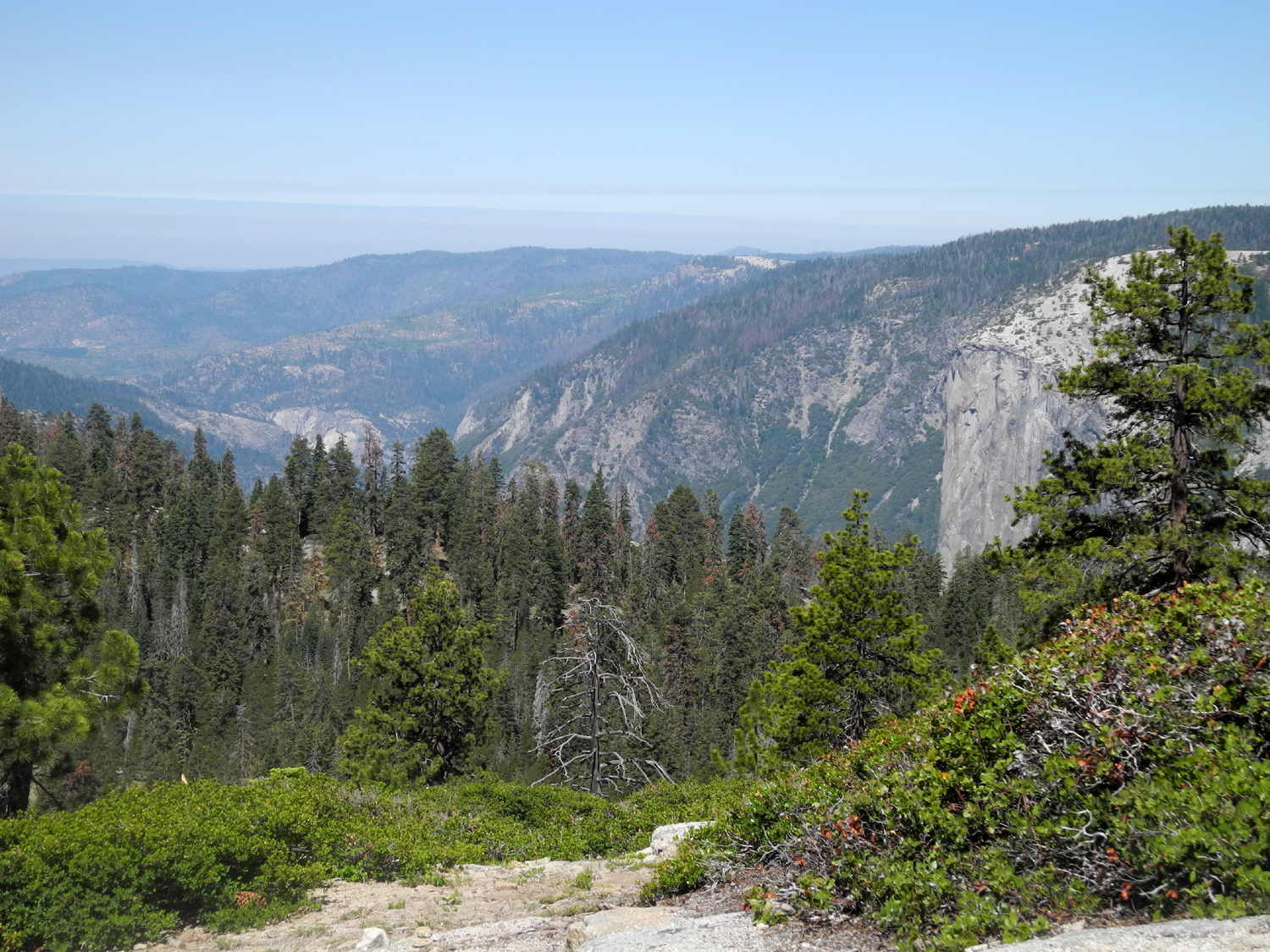
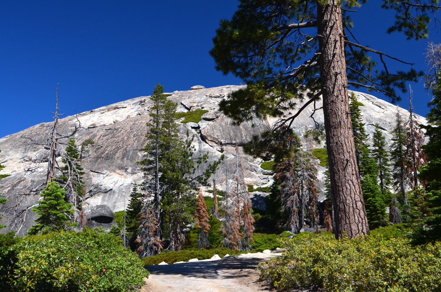
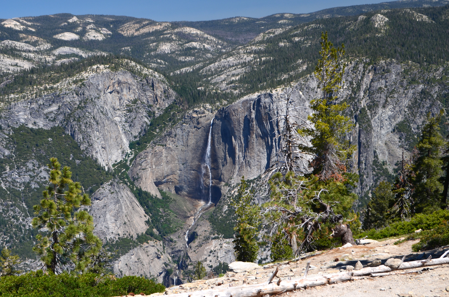
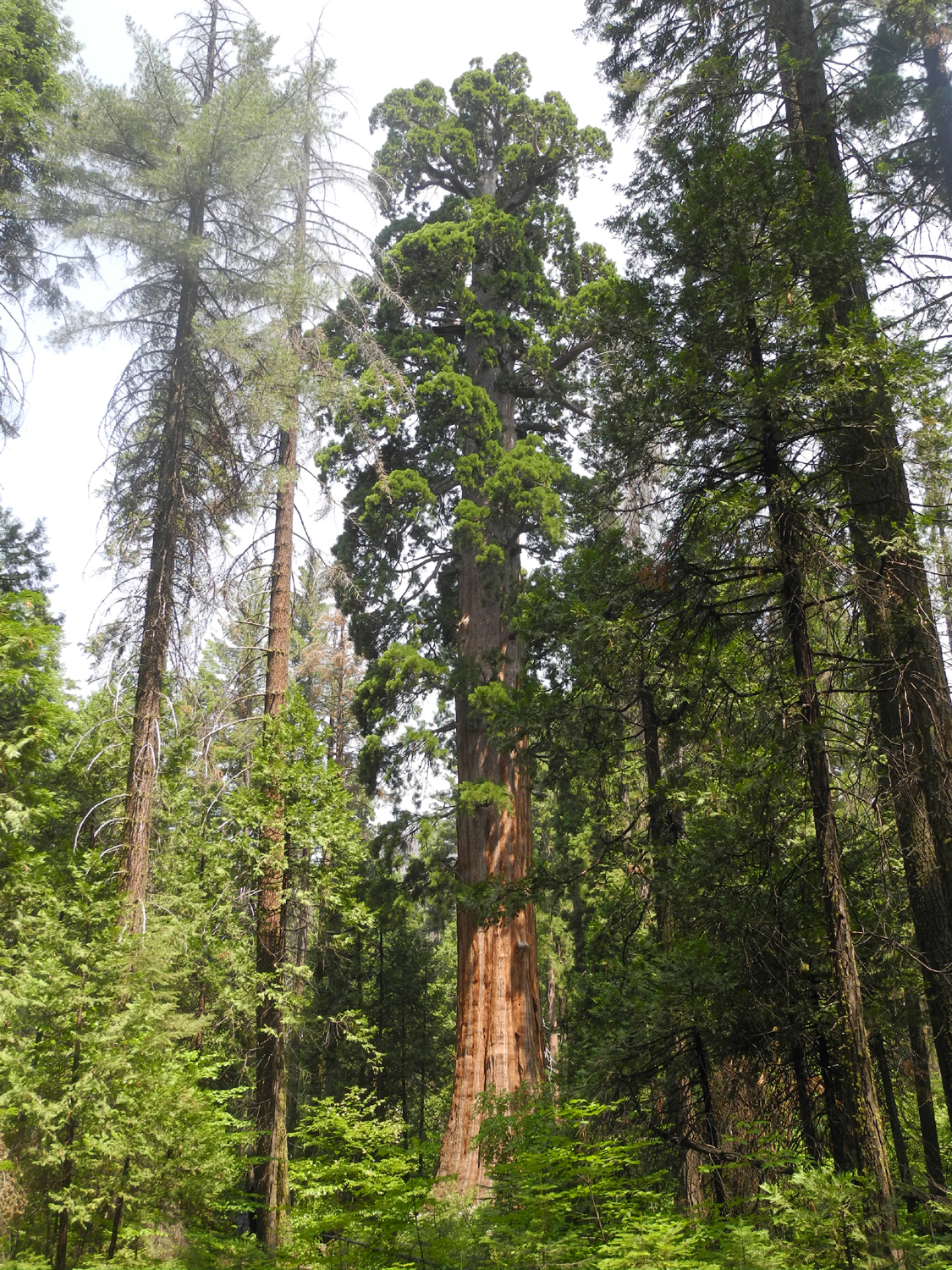
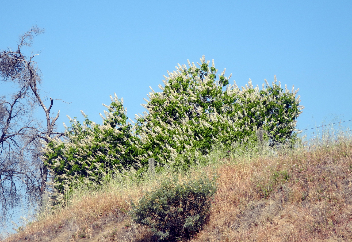
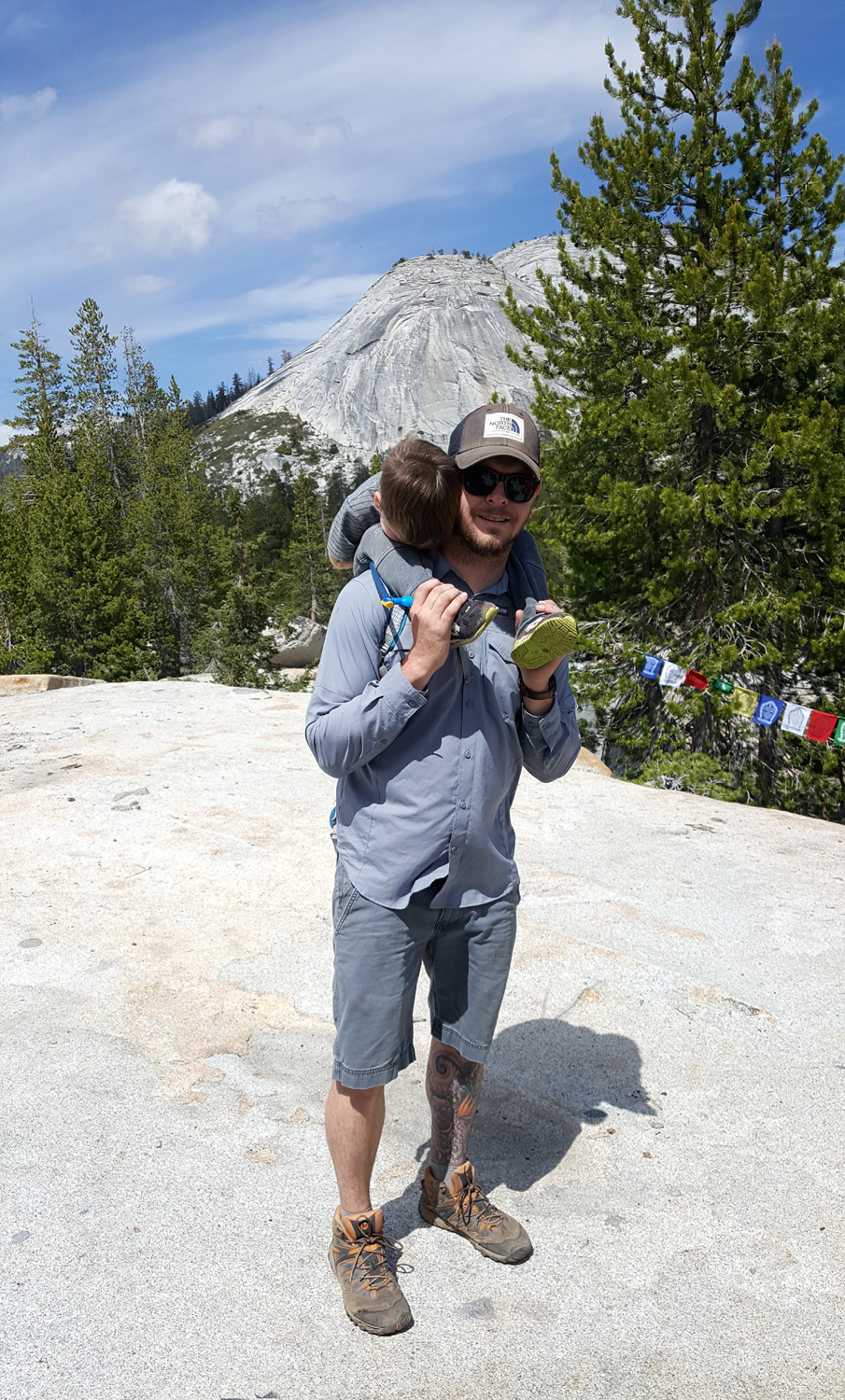
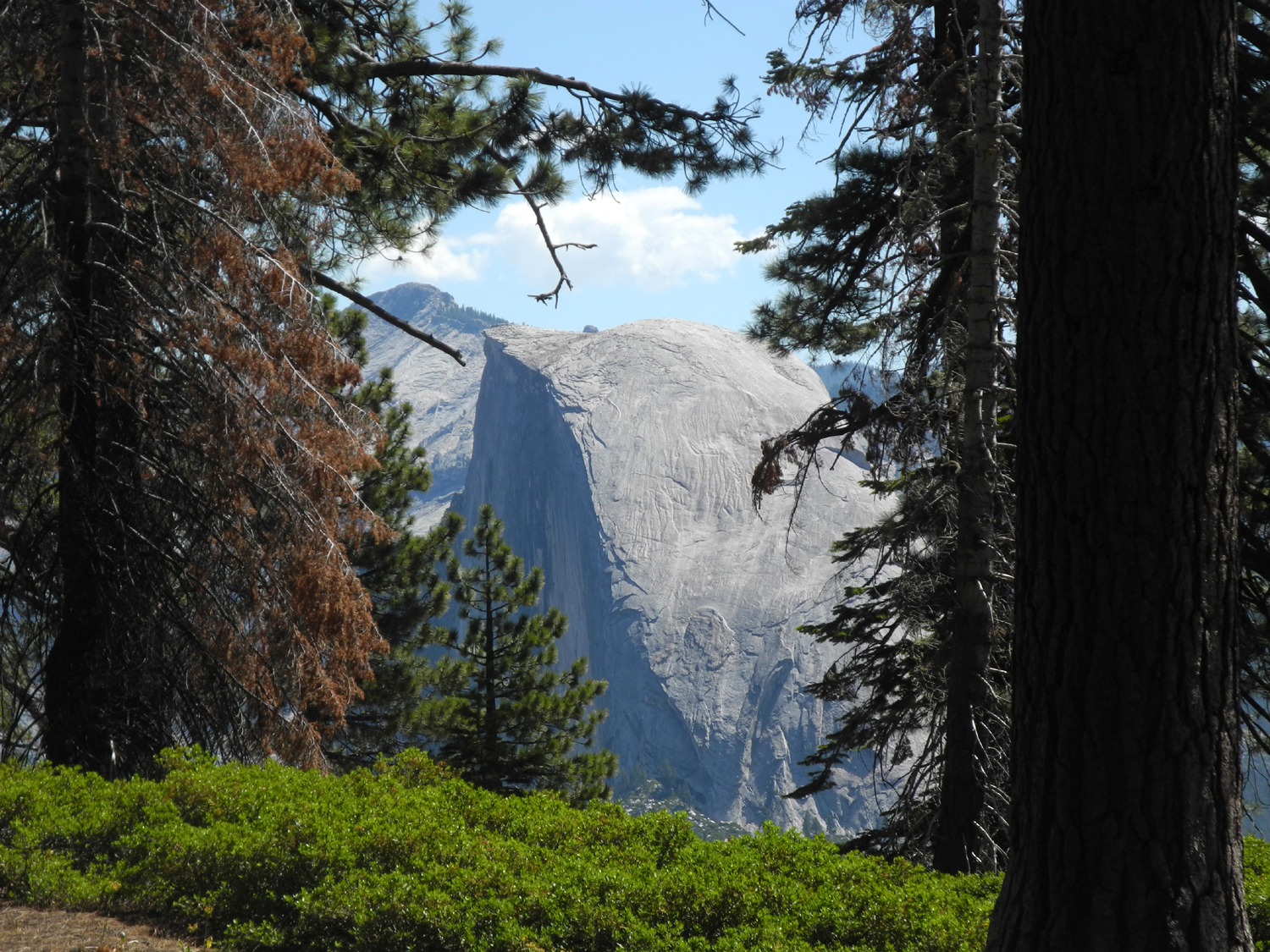
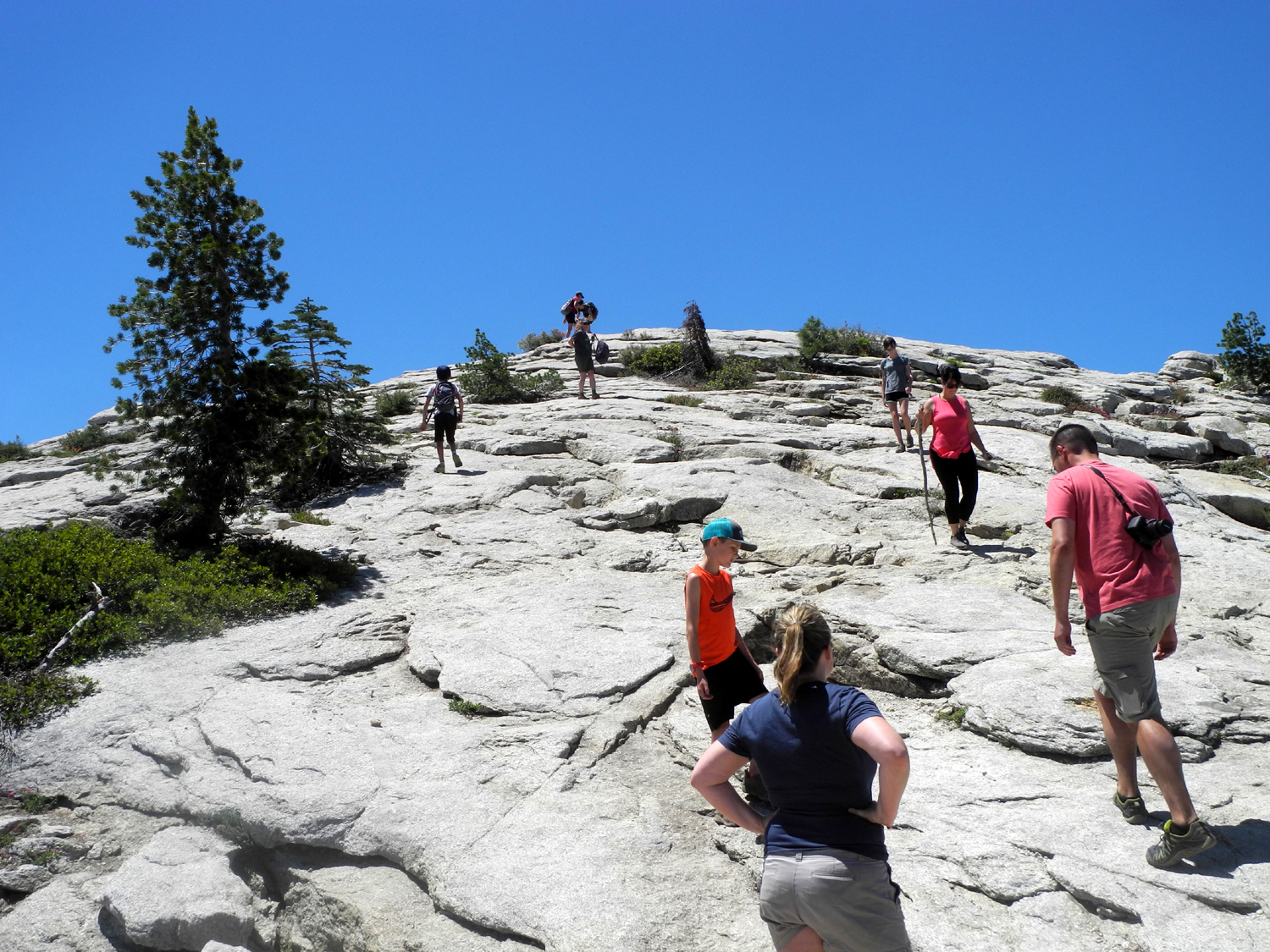
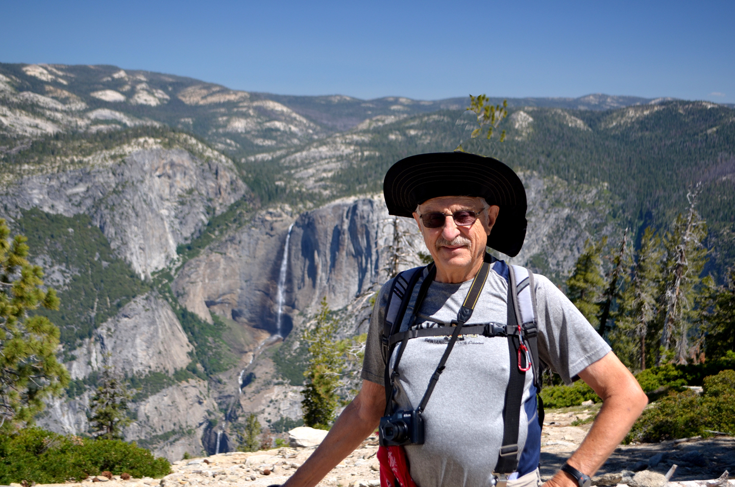
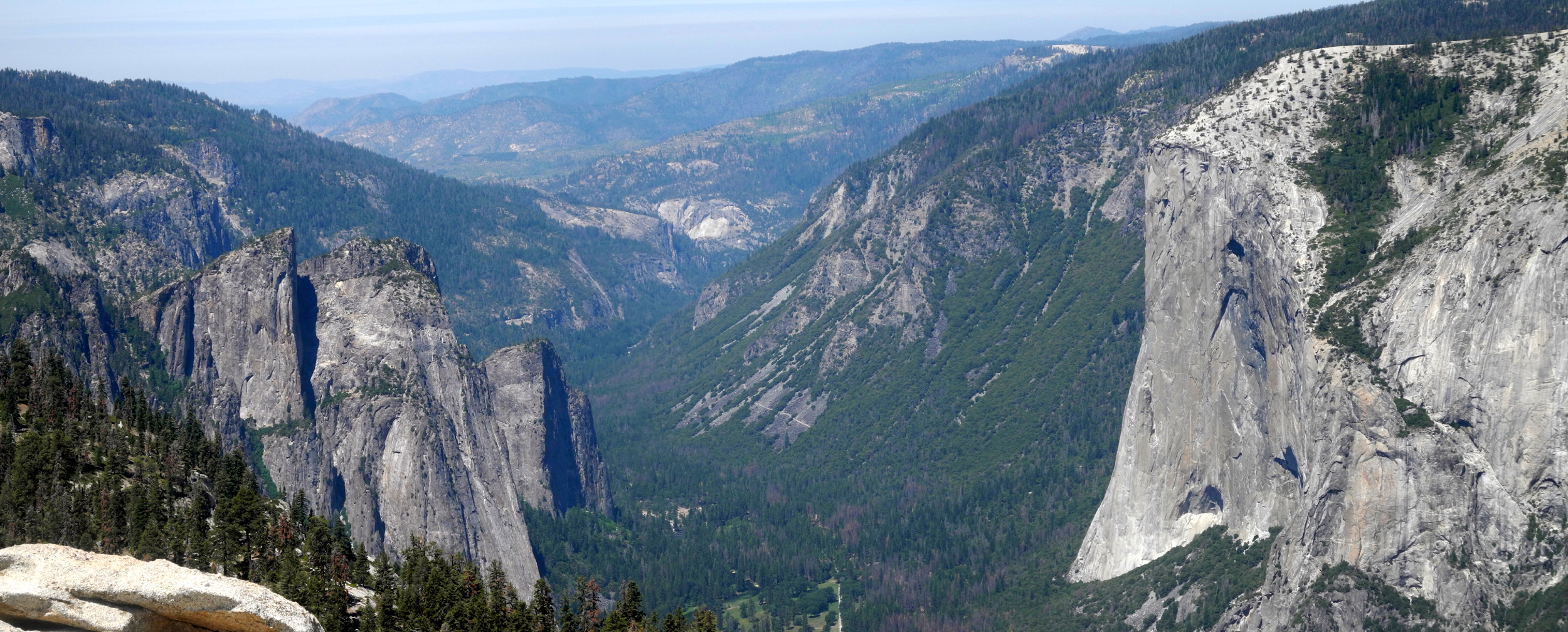
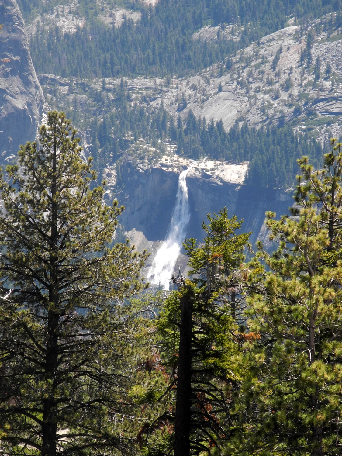
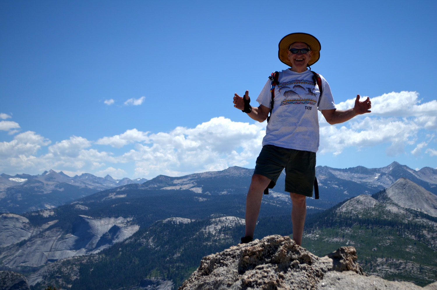
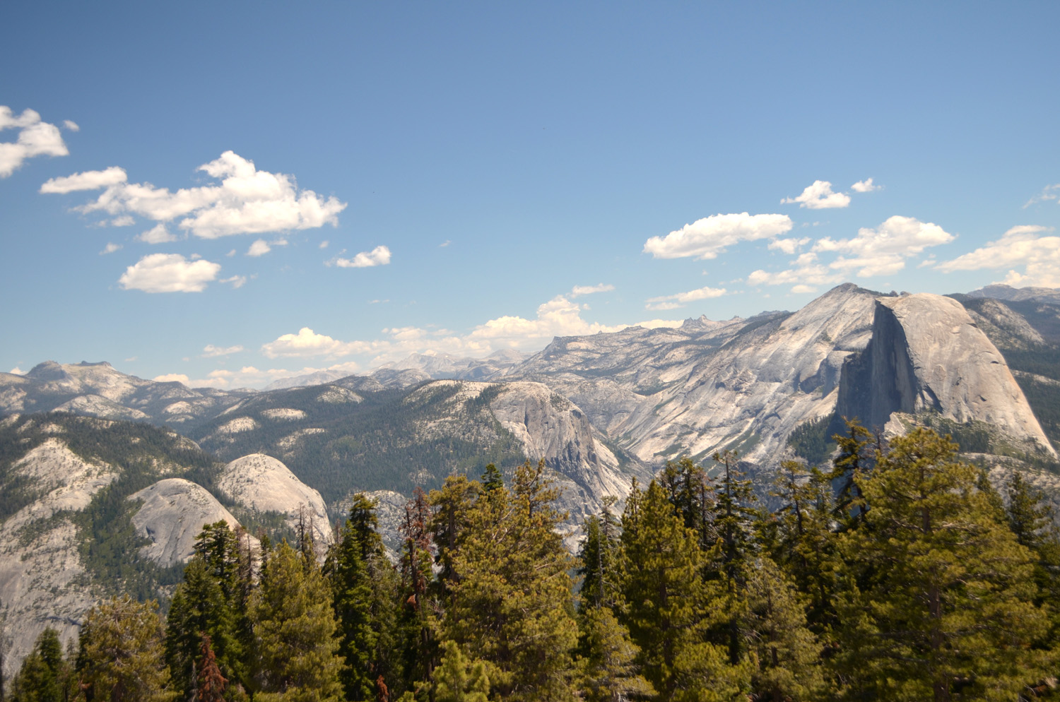
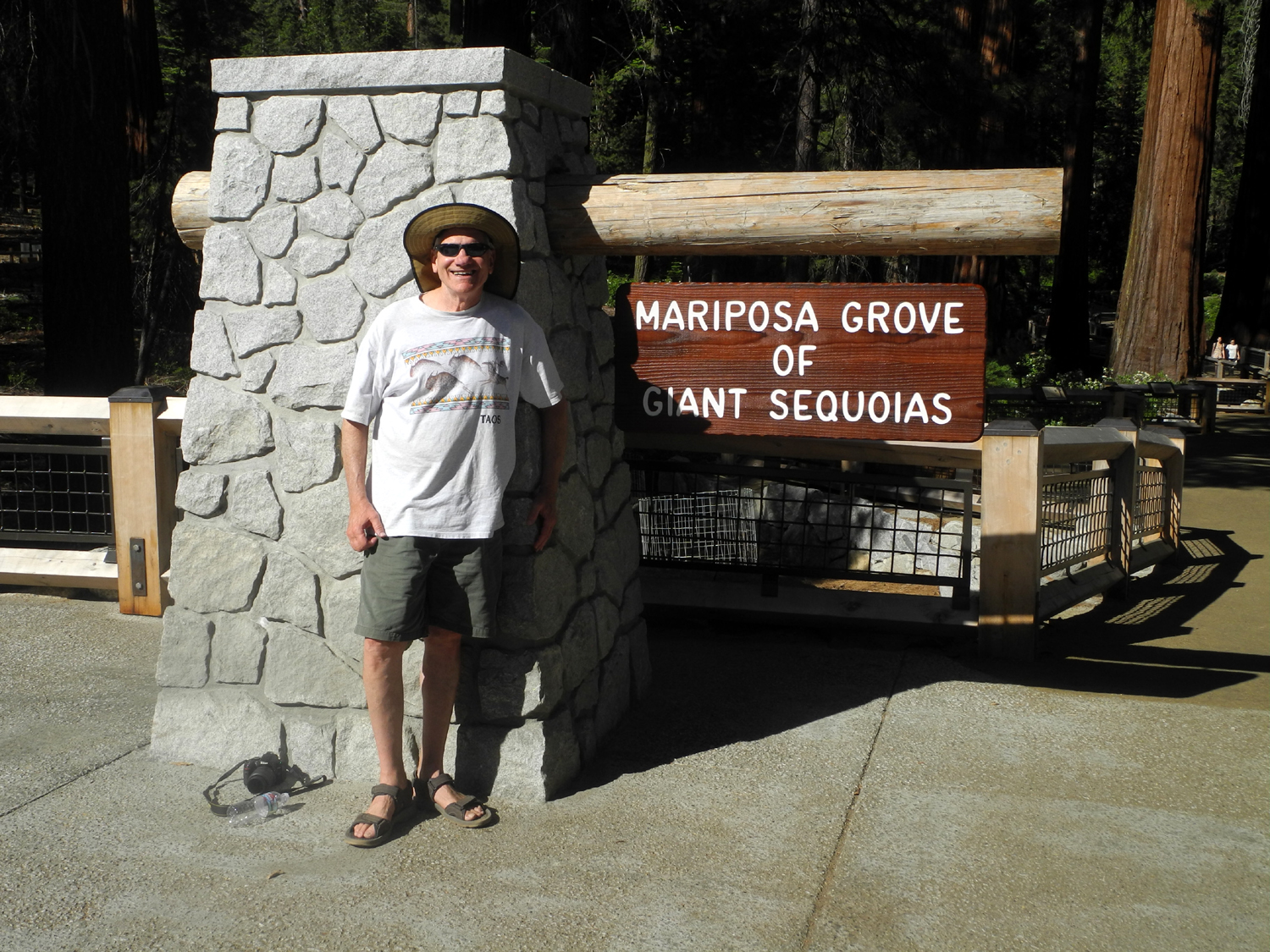
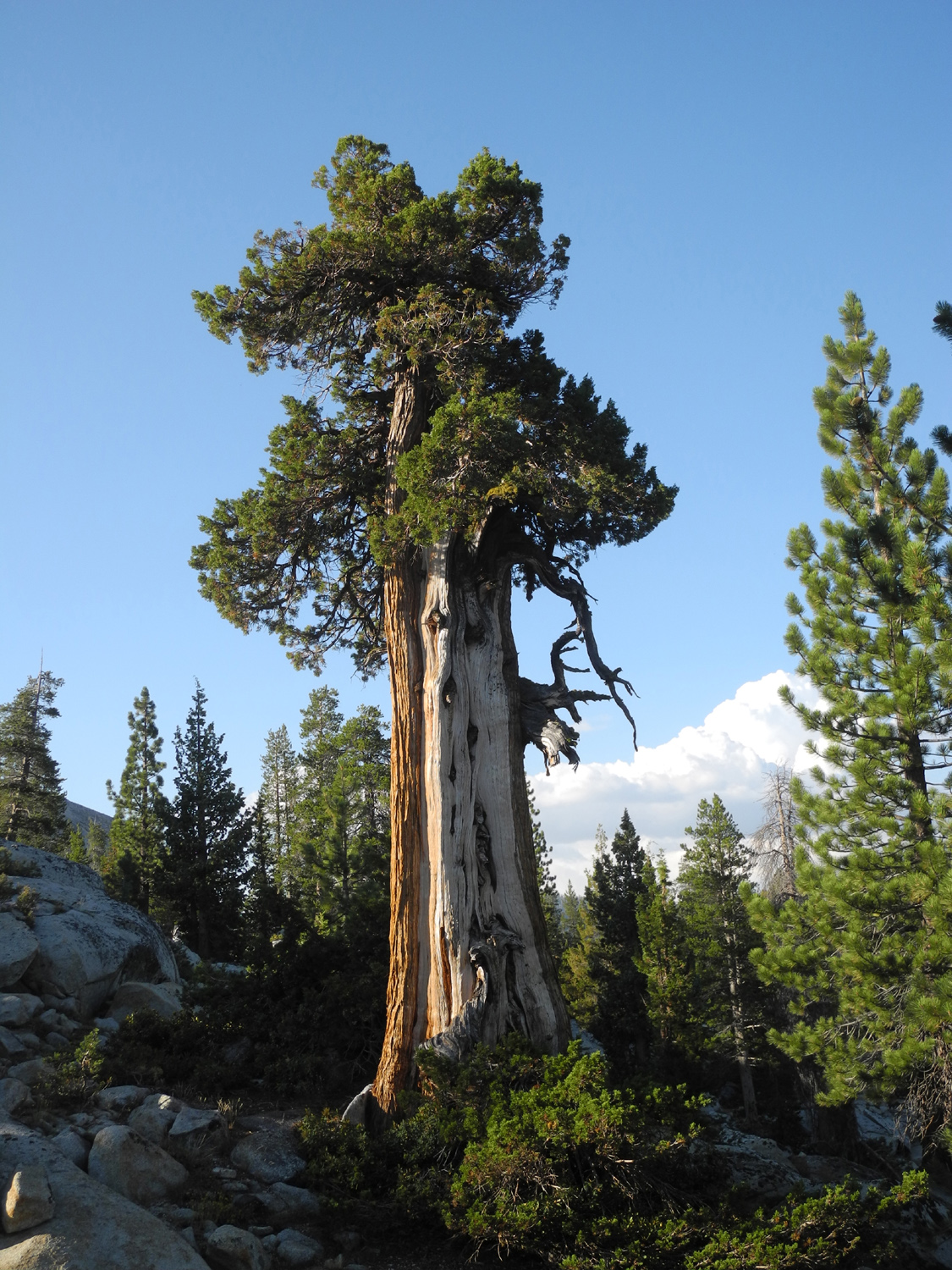
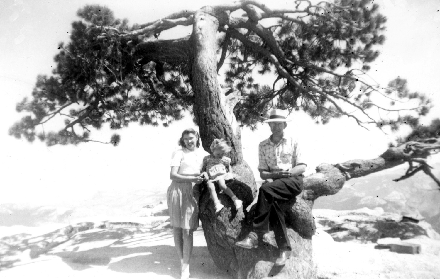
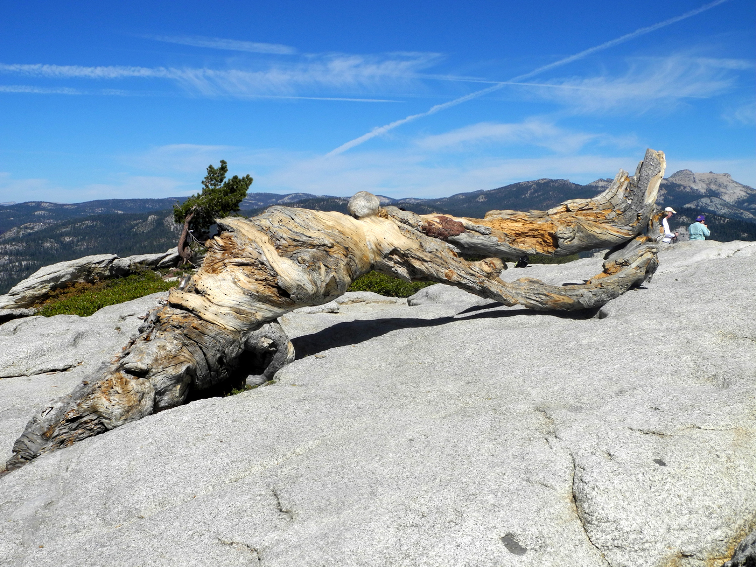
A cat-sitting assignment for Rod and Jennifer is more a vacation than a job. They live on five acres near Oakhurst, at the 3,000 foot elevation, so when I stay there, I'm half way or more to some of my favorite hiking spots. Once I make sure there is food and water, clean out the litter box, eat breakfast, and dispose of any dead bodies the kitties have left as a gift in the garage, the rest of the day is free. When I was asked to be on cat patrol the first four days of July, I called Wes Thiessen, my hiking buddy from the Ramblers, and suggested a hike to Sentinel Dome in Yosemite. We would also have time to do anther short adventure, perhaps to the newly-opened Mariposa Grove of giant sequoias. The Ramblers had made the Sentinel Dome hike in 2014, one of our earliest outings, but I had not been to the Mariposa Grove for several decades. Rod and Jen take care of the cats before they leave, so I don't need to get there till late afternoon. With no hiking plans that first day I left home around noon and got there in the early afternoon. I brought my things in, walked around the property, and ate restaurant leftovers I had brought with me. After that, I took it easy, knowing I would have to get up early on Monday. Parking at the trailhead is at a premium, so Wes arrived a little before 8 a.m., hoping we could get to our starting point by 9:30. We actually arrived a little before that, to find all the "official" spaces taken. Fortunately there is room to park along the road at several places in both directions from the trailhead, and we were able to get a spot that was fairly close. The hike itself starts off with a gentle up and down stretch through a forest of red fir, sugar pine and Jeffrey pine. Various flowers decorated our path. As the trail approaches the base of the dome from the south, there are views across the lower part of Yosemite Valley to the west, including the upper half of El Capitan. On the other side we could see the peaks of the Clark Range, including Mt. Clark and Mt. Starr King, as well as the top of Half Dome. The trail winds around to the northeast side of the dome, where hikers can take a trail to Glacier Point, or follow the route around the base of the dome and along the Yosemite Valley rim to Taft Point and other destinations. There's not really a clear trail up the dome, so visitors going to the top make their way up to the top by choosing what seems to be the best route across the sunny granite. The view at the top is 360 degrees of magnificent Sierra Nevada scenery, highlighted by Yosemite Falls down in the valley, and Nevada Falls up the Merced River canyon below Half Dome. Decades ago one of the required photo opportunities on the dome was a gnarled old Jeffrey pine, turned into a large bonsai by the harsh weather conditions at 8,000 feet. This photo shows my parents and sister by the tree at its best in 1945. Eventually drought killed the tree in 1977, and it fell over in 2003. Wes and I took photos of each other and the scenery, took photos for other people; had others take photos of us, and enjoyed a snack. Eventually we reluctantly took a last long look around and started our walk back to the trailhead. |
||
|
Meadow Flowers and Mariposa Grove |
||
 |
 |
 |
| Shooting stars along the Glacier Point Road | The venerable Grizzly Giant | Sequoias in Mariposa Grove |
|
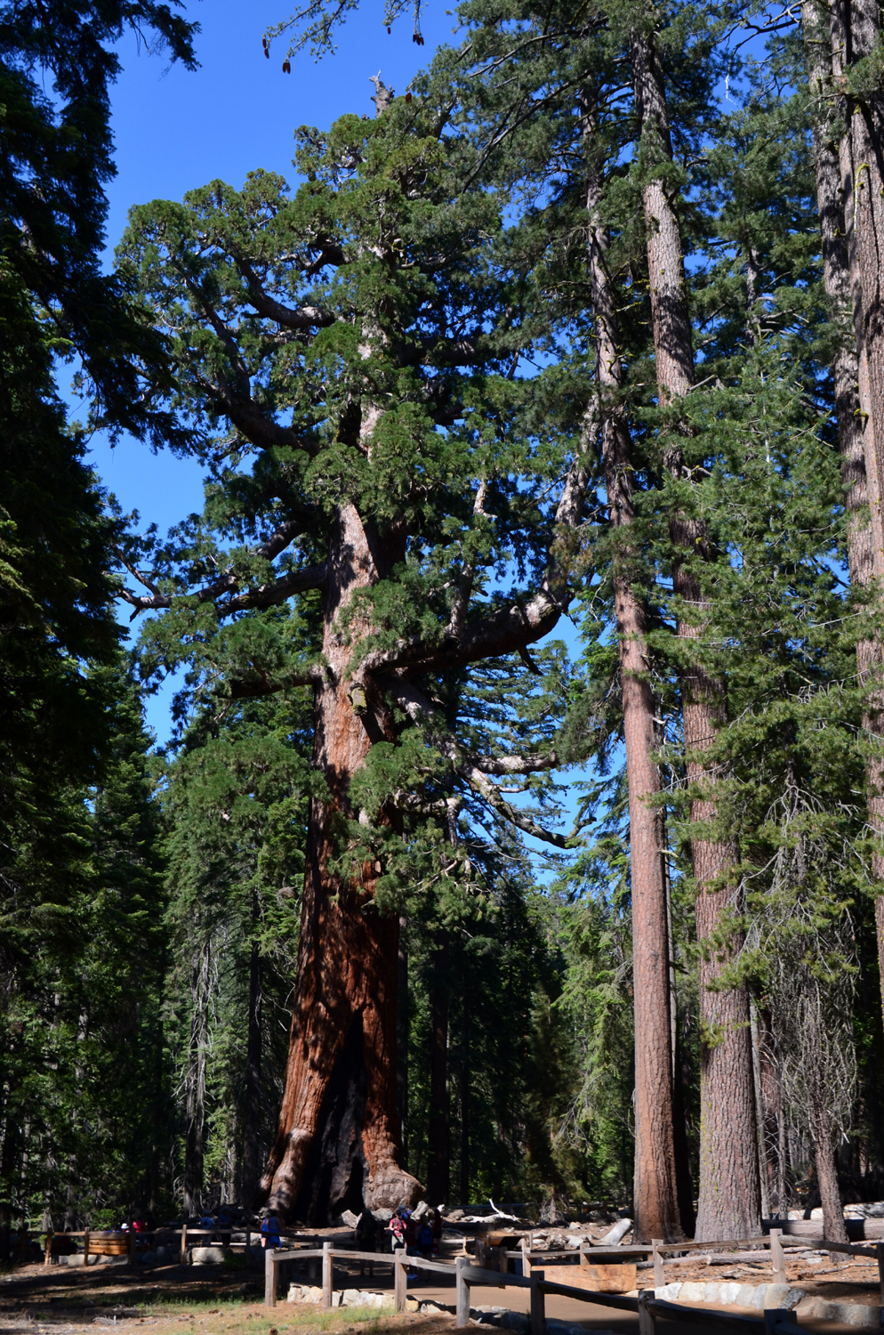
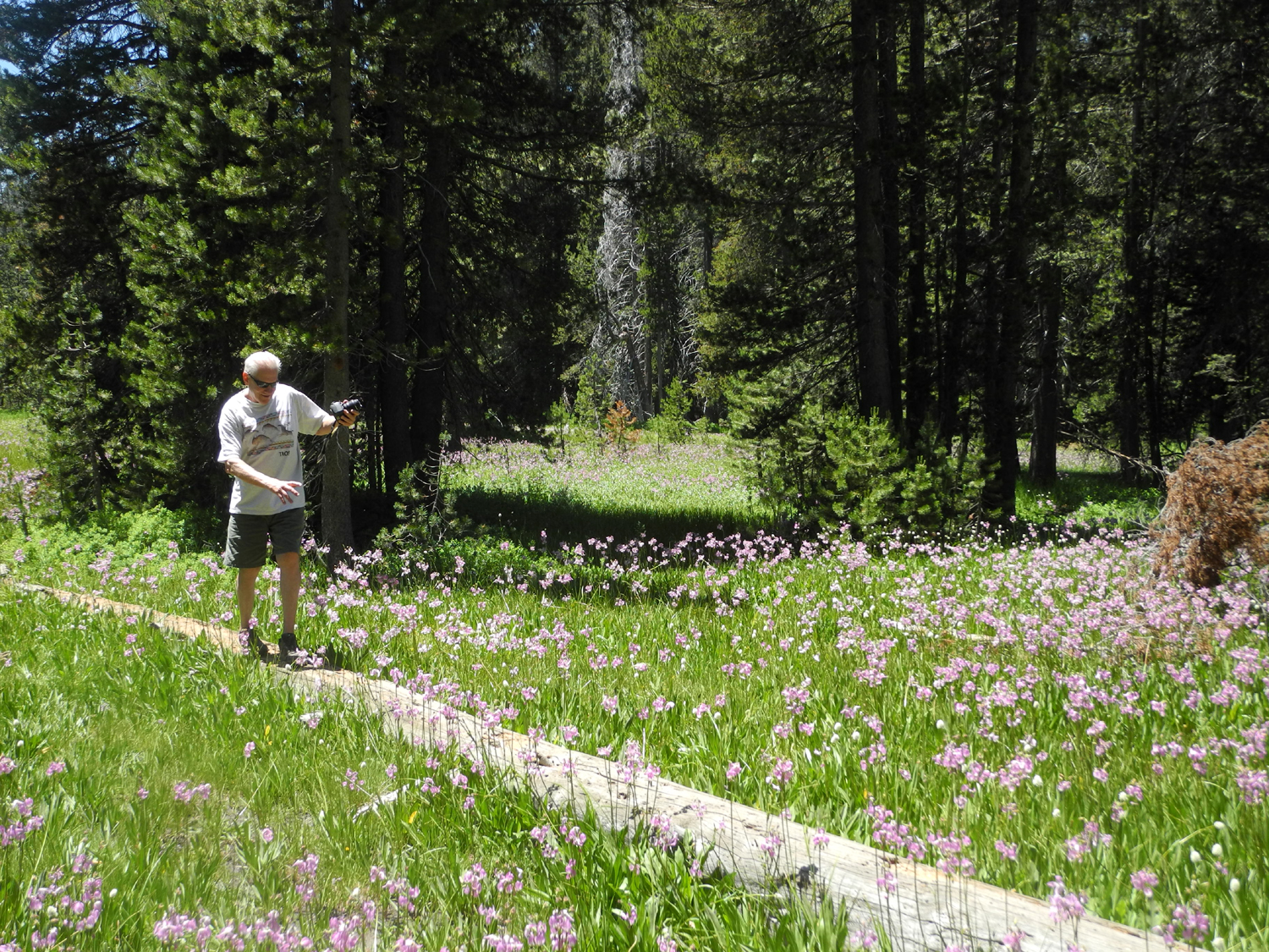
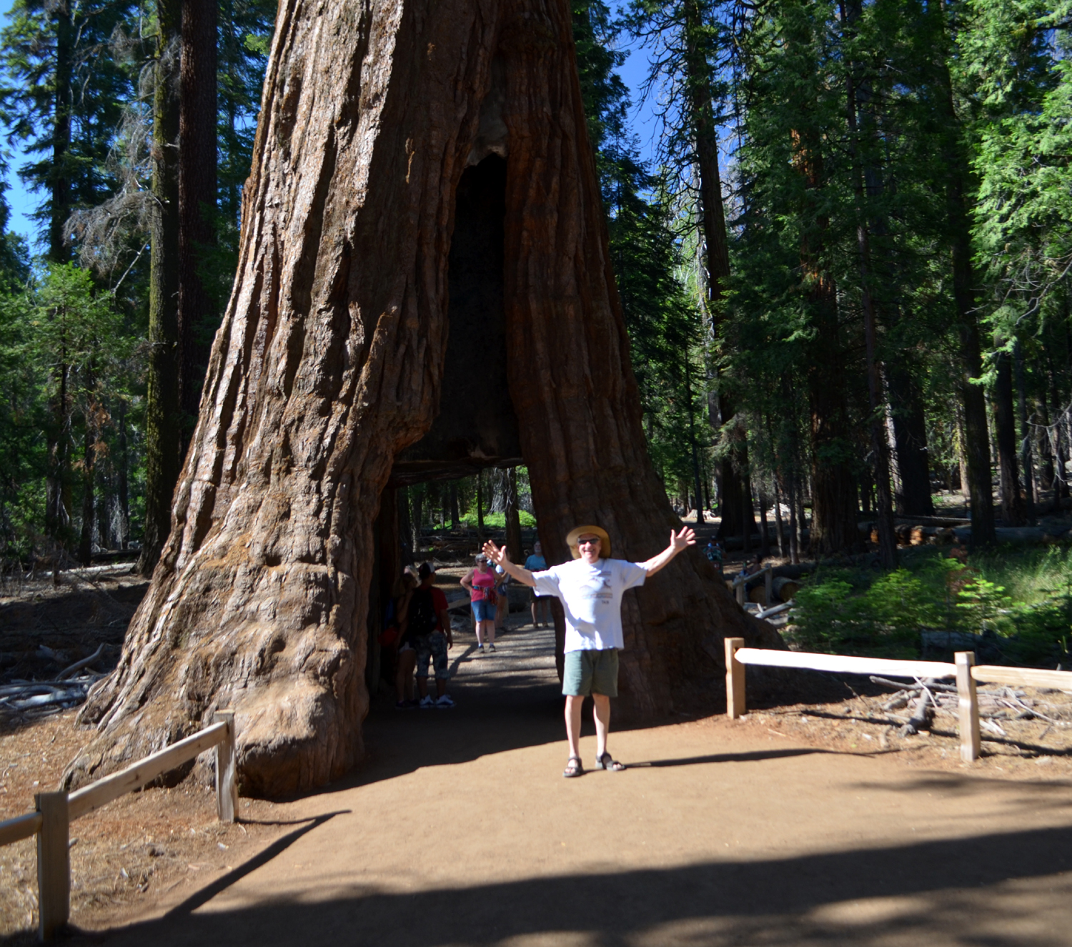
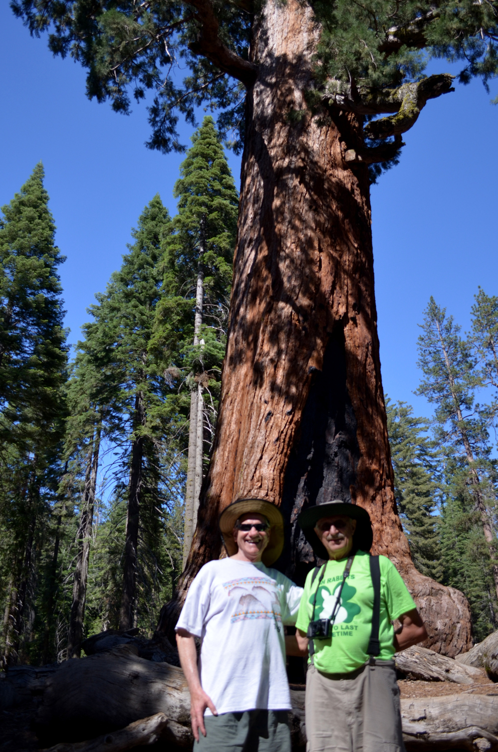
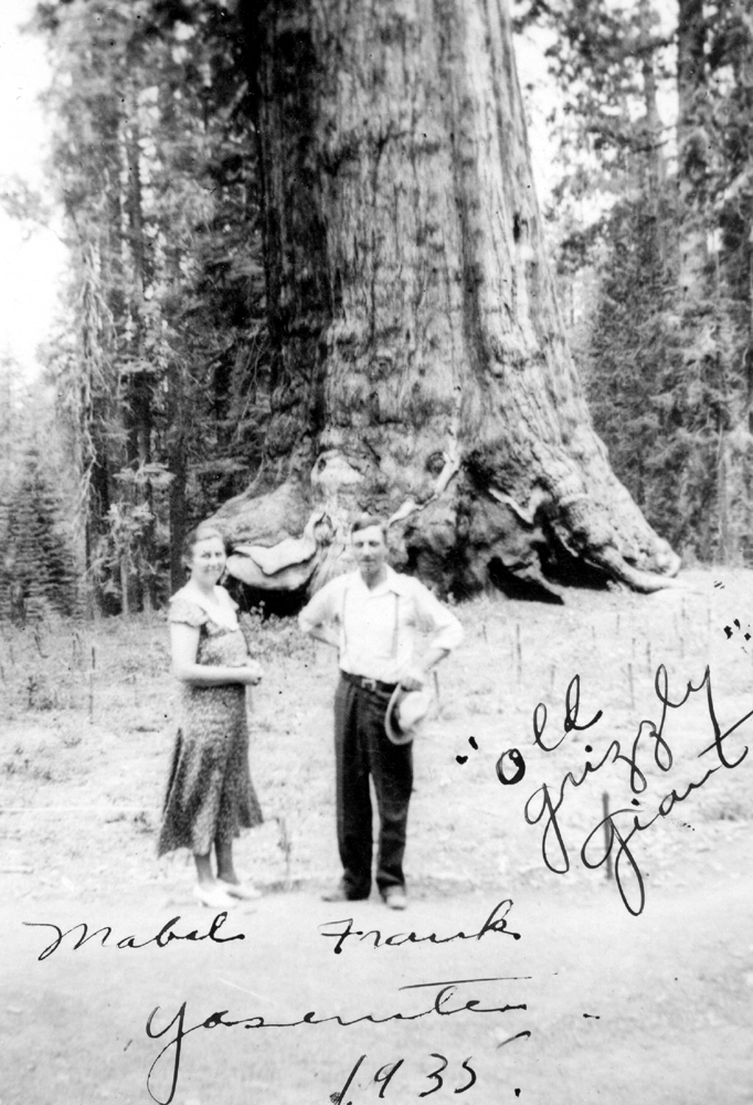
Driving in, I had pointed out the meadow full of shooting stars where I stopped when I hiked near there in June. We were going to stop on the way out, but spotted a meadow on the right side of the road that looked even better. We stopped and Wes got up close with the flowers, getting some nice shots. We continued on to the main road, and stopped at Wawona for lunch at the historic lodge. After an excellent meal we headed for the park entrance and went around the new traffic circle into the parking lot for the Mariposa Grove of giant sequoias. This feature had been closed for three years for a major restoration project, which included removal of all pavement and a gift shop close to the trees, and the construction of new trails, with bridges and boardwalks over sensitive wet areas to allow water to flow naturally. The parking lot holds 300 cars, and from here you can hike to the grove (over a mile and a half) or take a free shuttle that runs every ten minutes. We chose the latter, and were delivered to the starting point for four miles of trails through the trees. We went as far as the Grizzly Giant, one of the largest and most dramatic looking trees in the grove, a little over a mile and a half round trip. In the restaurant I had showed Wes a photo of my grandparents at the tree in 1935, soon after their arrival in California from Ohio. Thinking about the many vehicles that have driven over the pavement right next to these shallow-rooted trees over the 80 plus years since then, we were very satisfied with the time and monetary investment that went to help preserve the grove for future generations. After an enjoyable tour through the trees and fields of lupines and other flowers, we took the tram back to the parking lot, and started down the hill. Wes dropped me off at my mountain retreat and continued his 50 mile drive back to Fresno. |
||
|
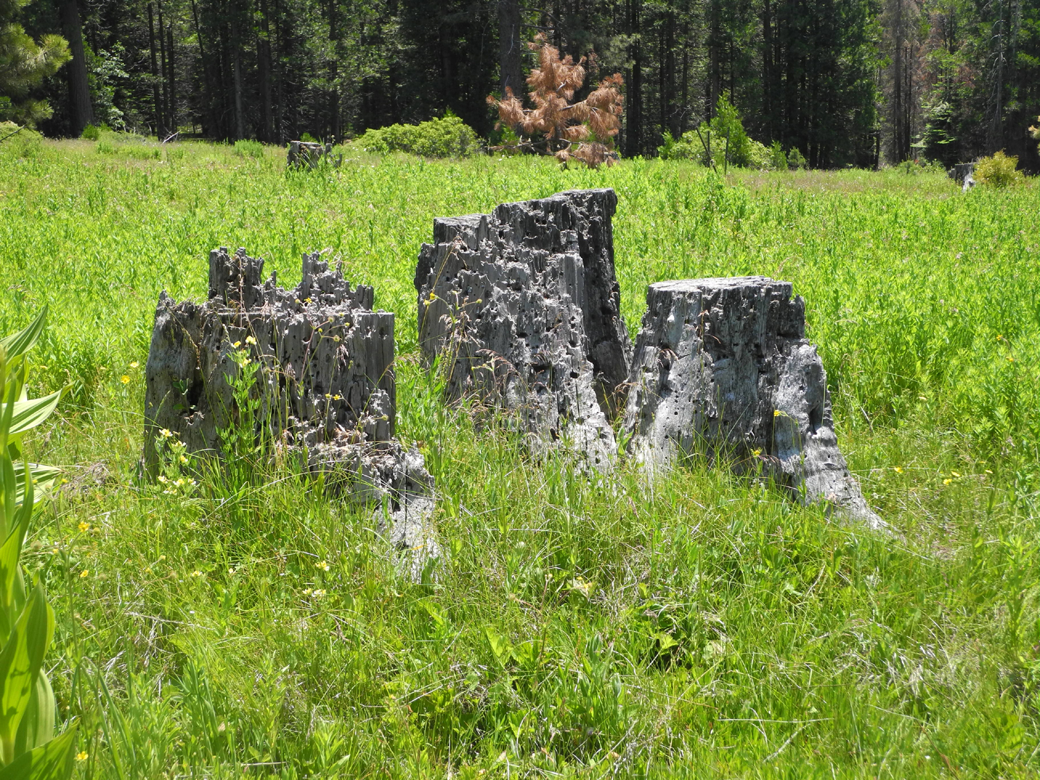
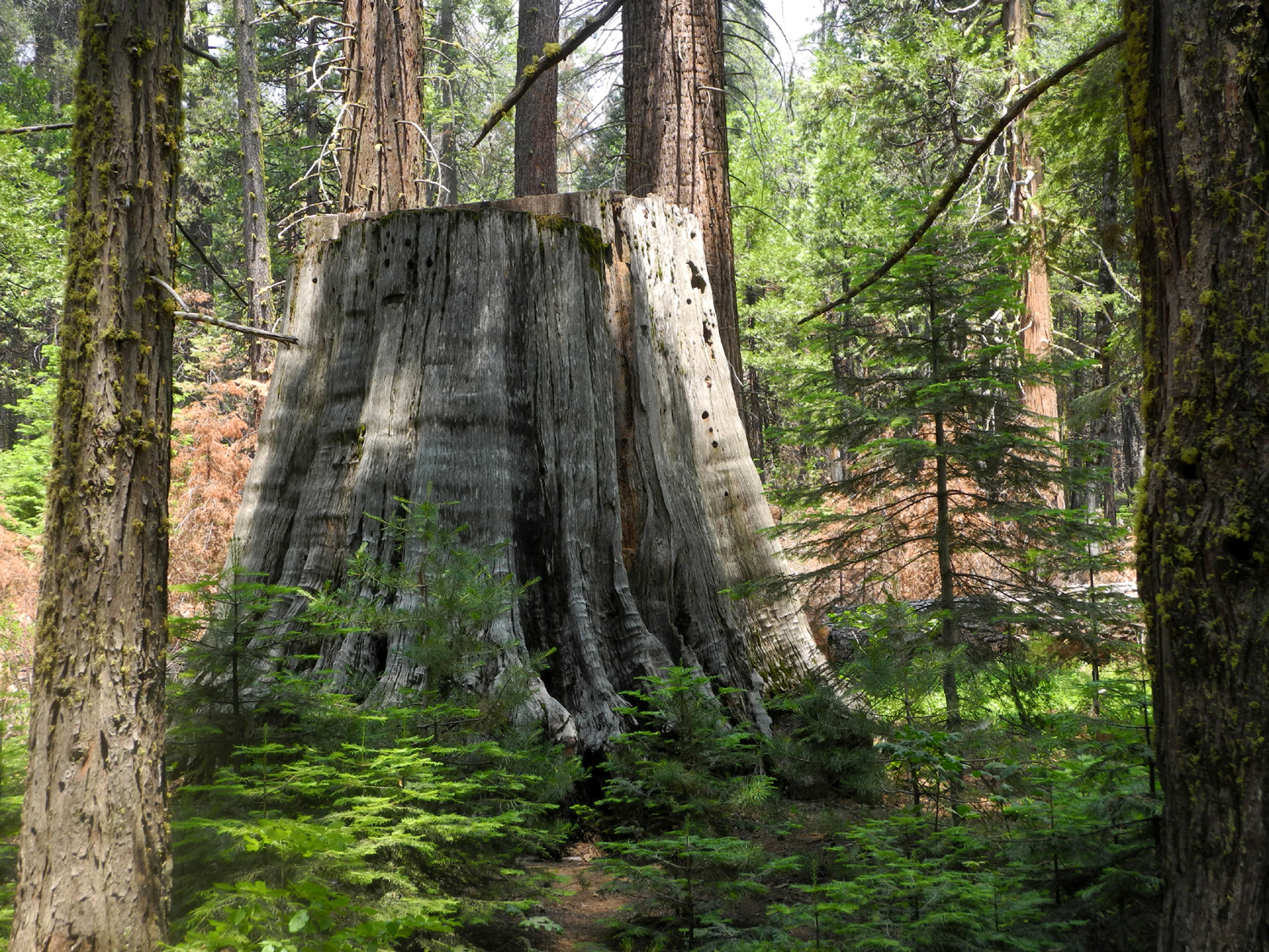
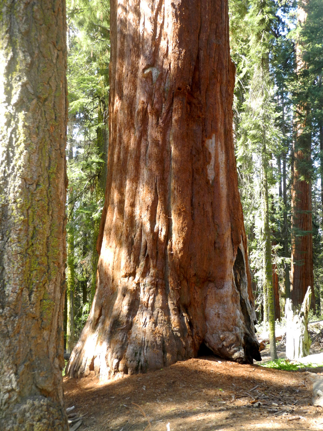
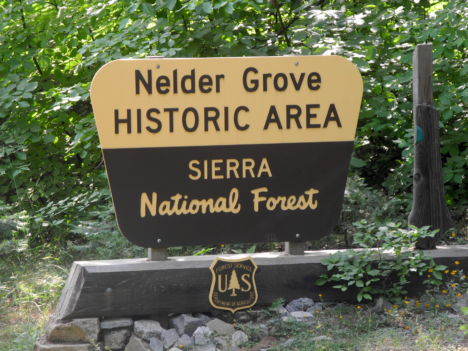
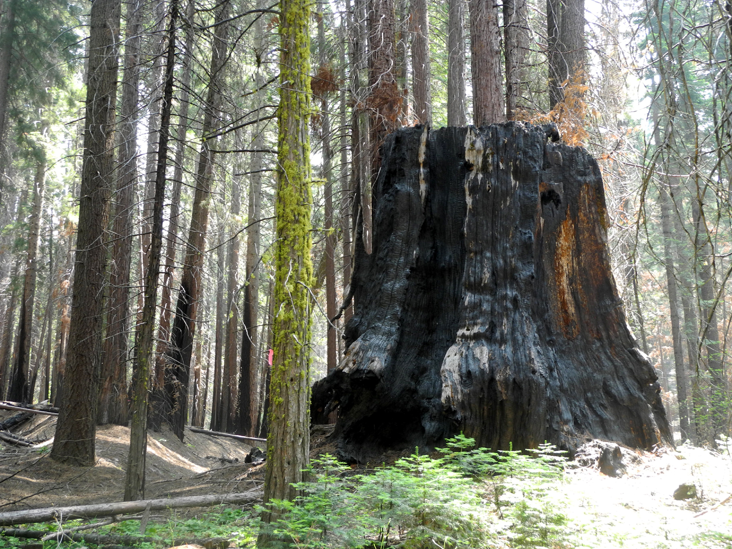
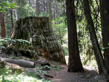
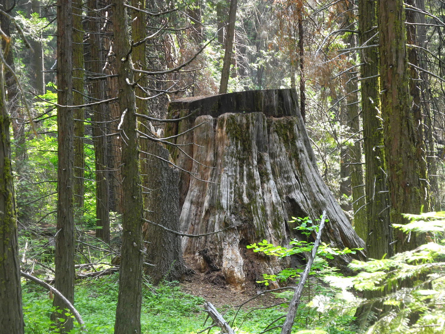
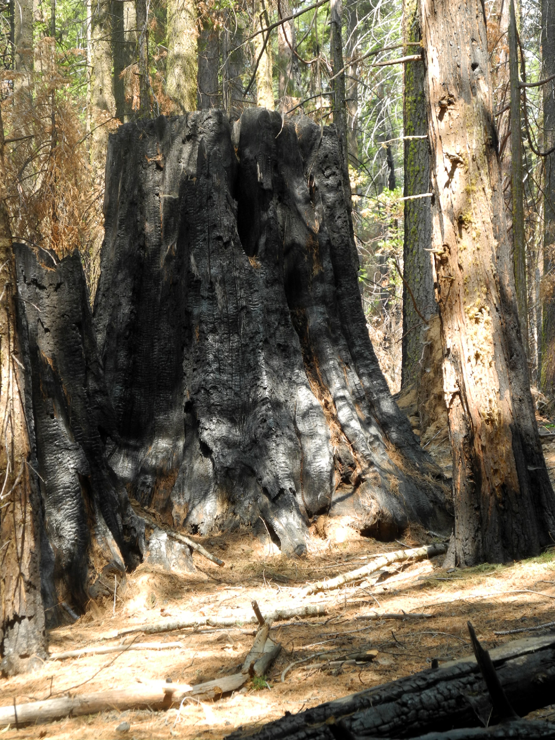
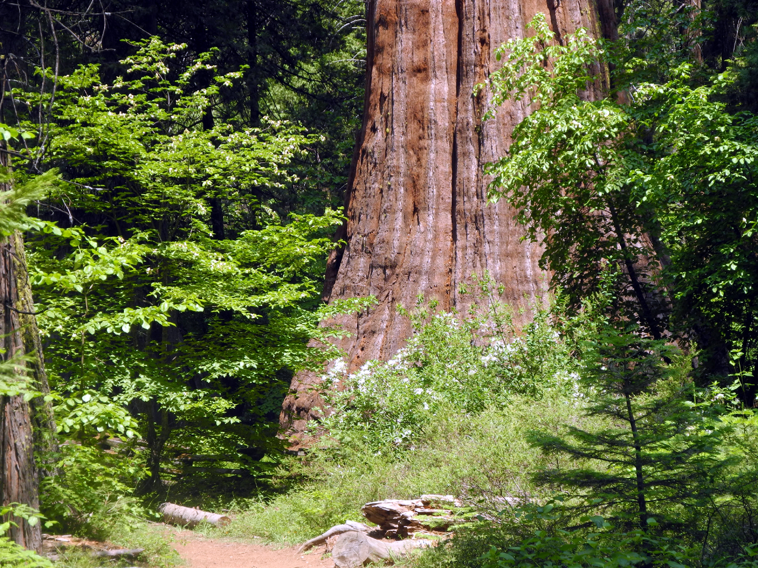
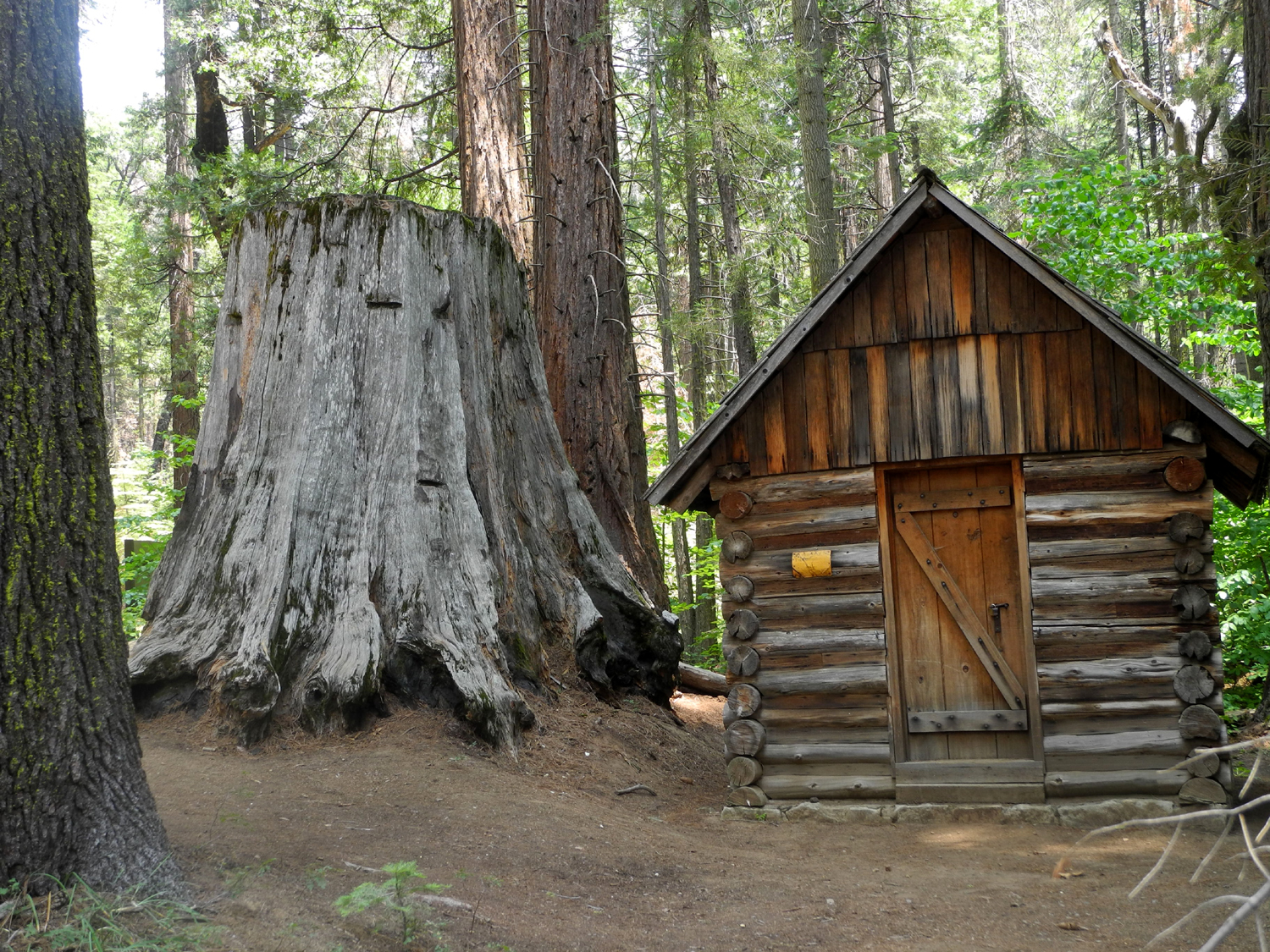
Nelder Grove: Giant Trees and Stumps |
||
 |
 |
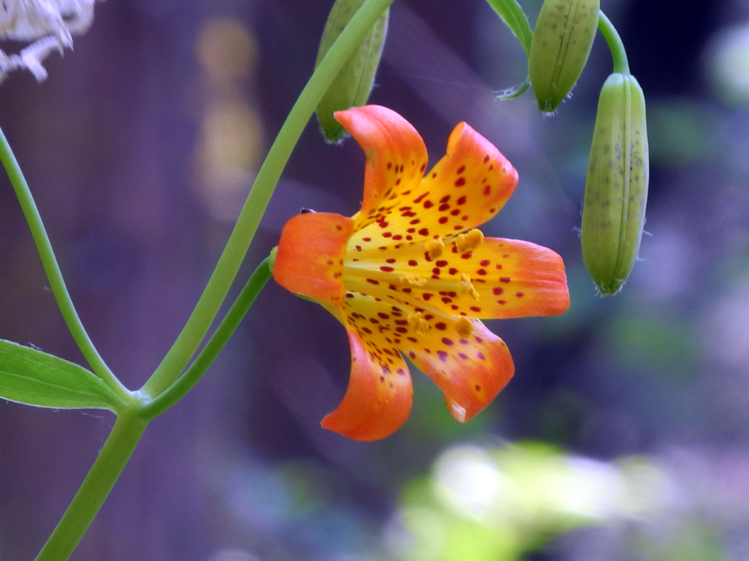 |
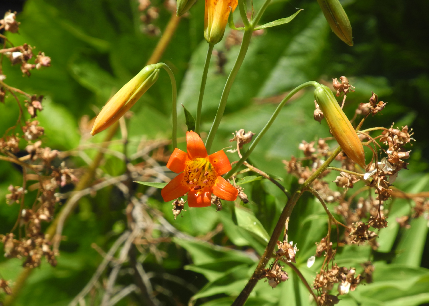
| One of two big stumps next to the Bull Buck Tree | Full view of the Bull Buck | Brilliant orange flower along the Chimney Tree Trail |
|
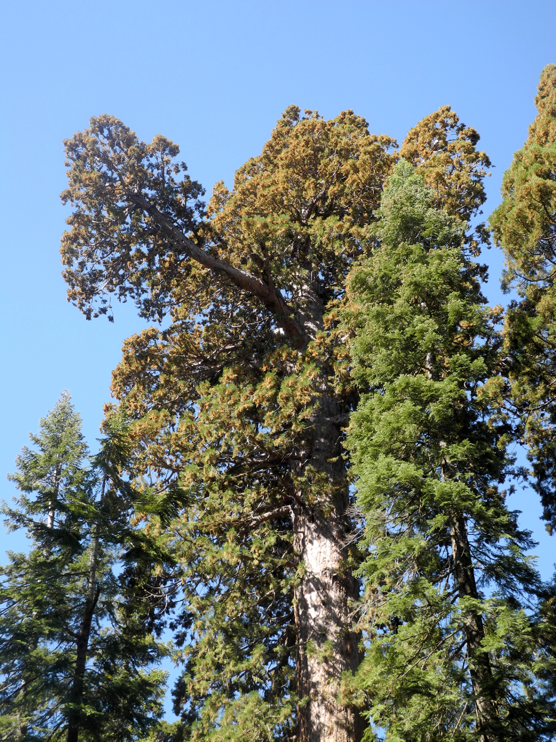
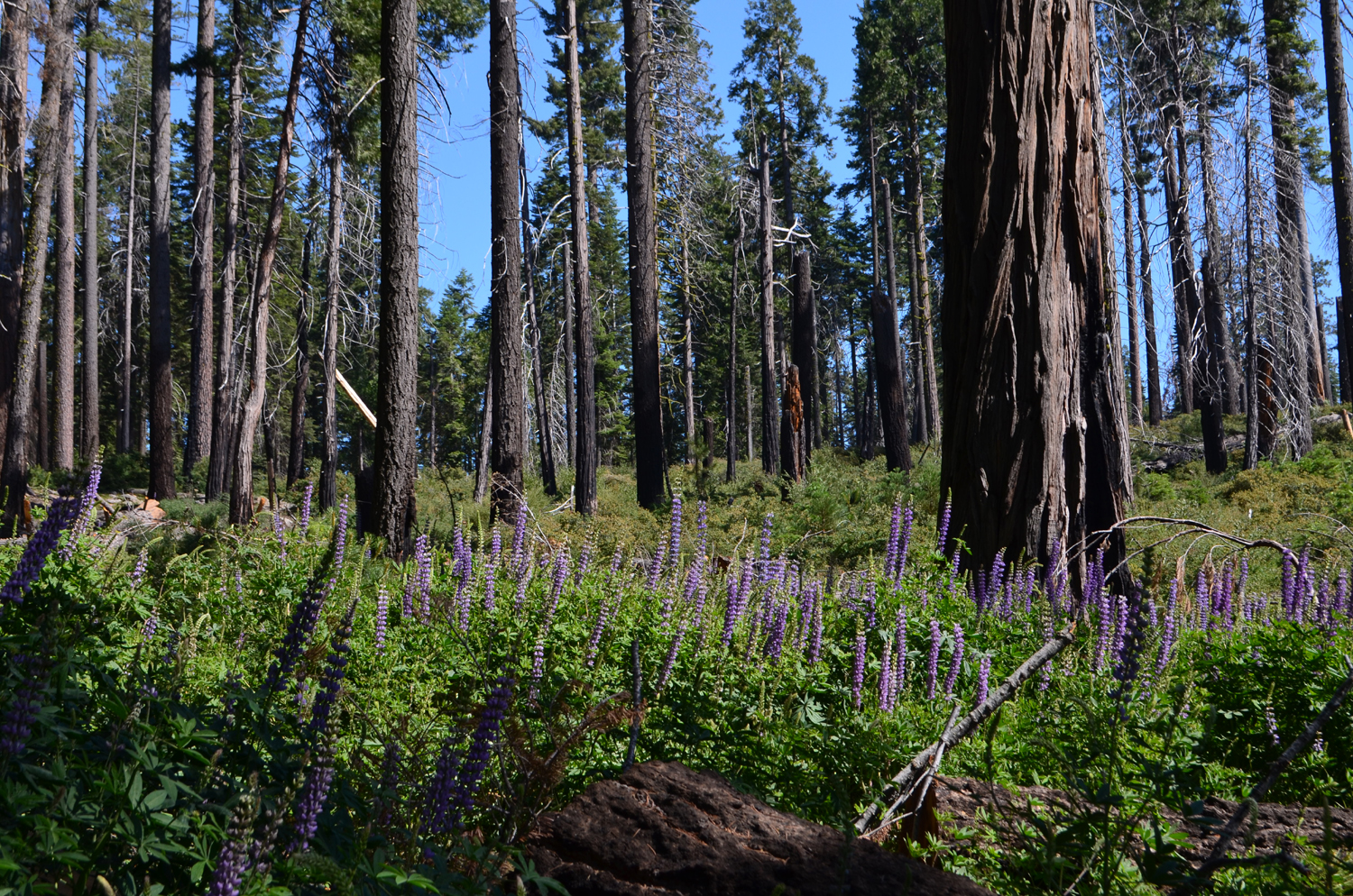
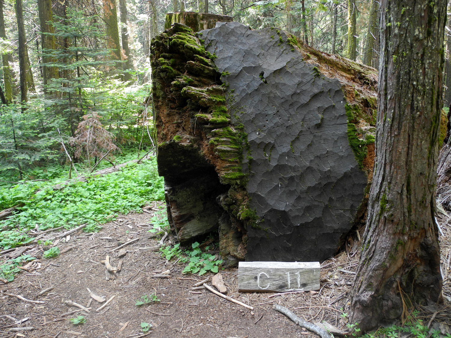
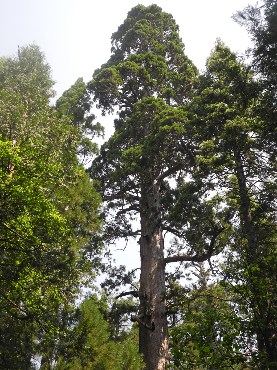
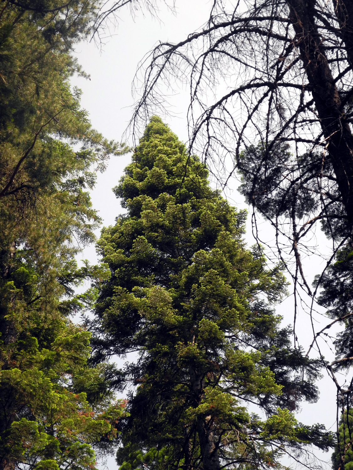
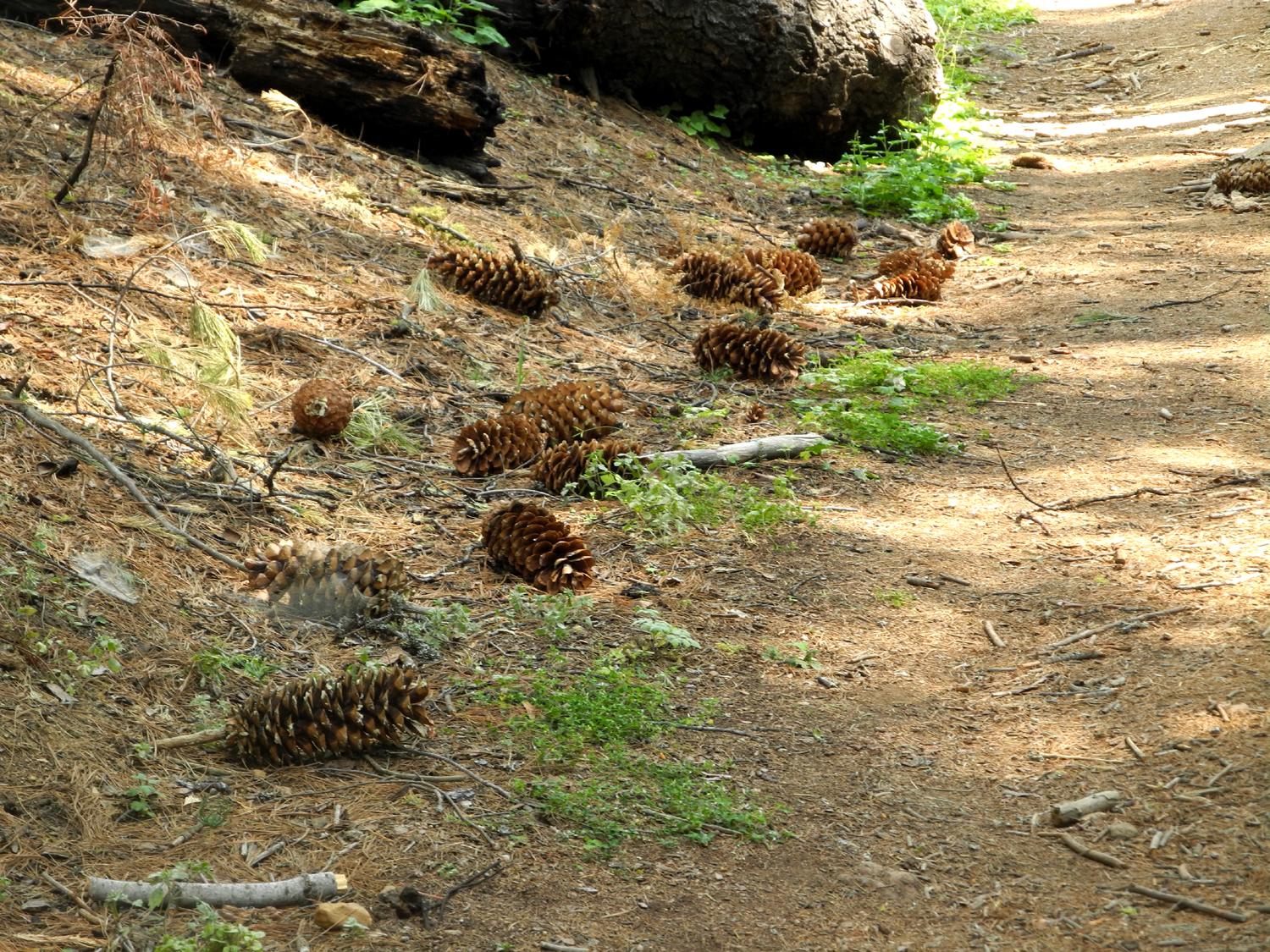
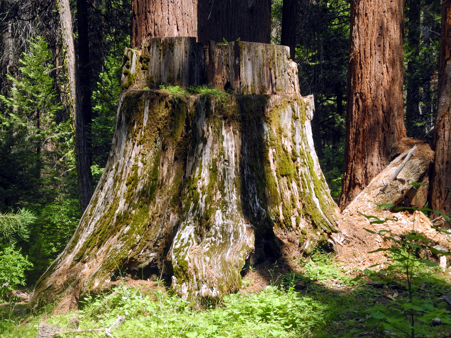
I still had a full day in the mountains, so on Tuesday I went to Nelder Grove. When I was going to camp there in June (which didn't happen), I had planned a fairly ambitious exploratory hike that might involve some rough cross-country travel. I considered doing that hike this time, but after hiking over four miles in Yosemite the previous day, I did not want to tackle something that difficult. Instead I hiked the Chimney Tree Trail, a loop that starts between the exhibit area and the campground, and joins the short trail from the camp to the Bull Buck Tree. There are a half dozen or so large sequoias along this route and hundreds of younger ones, along with the usual pine, fir and small bushes. There are also a lot of stumps, reminding visitors that this area was heavily logged in the 1890s. These stumps are mostly ten to fifteen feet high, and in a few cases, the tree that grew there is still lying on the ground where it fell. The wood of the sequoia is very brittle, and the trees would often shatter when they hit the ground, rendering them useless for lumber. Sections of these trees were often used for shakes and posts. I have photographed some of the stumps in the past; this time I attempted to photograph every stump I saw, and have included several of them in the photo section of this report. Along the first part of the trail, the pine and fir forest on the upper side showed signs of recent fire. The large trees were still living, and the area had an open, natural look. I don't think this was from the Railroad Fire of last year, but rather from a prescribed burning program intended to reduce the fuel load and consequent danger of big fires that destroy everything. Reducing the amount of brush and small trees also encourages germination and growth of sequoias. The route also has some wildflowers, although the profuse numbers of early spring have lessened considerably. The trail crosses California Creek, and runs near it in other locations, and for the most part it is a cool, shady route. Of course, when I came to the junction, I turned left and visited the Bull Buck Tree for the umpteenth time and could not resist photographing it once again. When the Ramblers were here in May, the base of the tree was set off by dogwood blossoms. These have now been replaced by western azalea. When I got back to the campground I went along the path that runs on the east side of the creek, where the Ramblers explored in May. This time I went almost to the end of the trail, far enough to see that it angles away from the creek and works its way down to the road that goes beyond the campground approach. I turned back, but before reaching the campground, I crossed the creek and went up the Big Ed Trail past the tree of that name and through the exhibit area back to my car. In previous writings I've commented on some of the changes that have taken place in Nelder Grove since my first visit about 1968. Most of them are the result of human efforts to return the area to a more natural state. The effectiveness of this effort can best be understood by realizing that almost none of the photos presented with this report would have been possible in those early years. The pines, firs, cedars and brush were so thick that nothing could be seen that was not in the campground or right by the road. Of the five stumps visible near the exhibit center, only one was visible back then. The Bull Buck was accessible but surrounded by smaller trees that prevented a view of the entire tree. And most of the trails did not yet exist. When I finished my hike, I realized that I had expended sufficient energy to be hungry, so driving back down Highway 41 I bypassed the road to Rod and Jennifer's and drove into Oakhurst for an excellent lunch at El Cid Mexican Restaurant. The
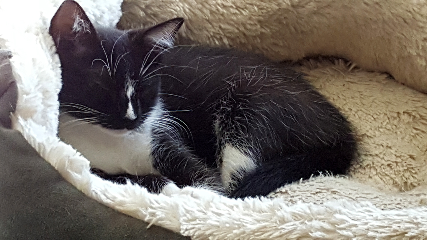
rest of my stay was fairly routine. One thing new was that I was
able to pet and photograph Pebbles and Bam Bam, Rod and Jennifer's
two older cats who are shy about strangers and have never let me
touch them in the past. Of course, there was constant entertainment
provided by newest
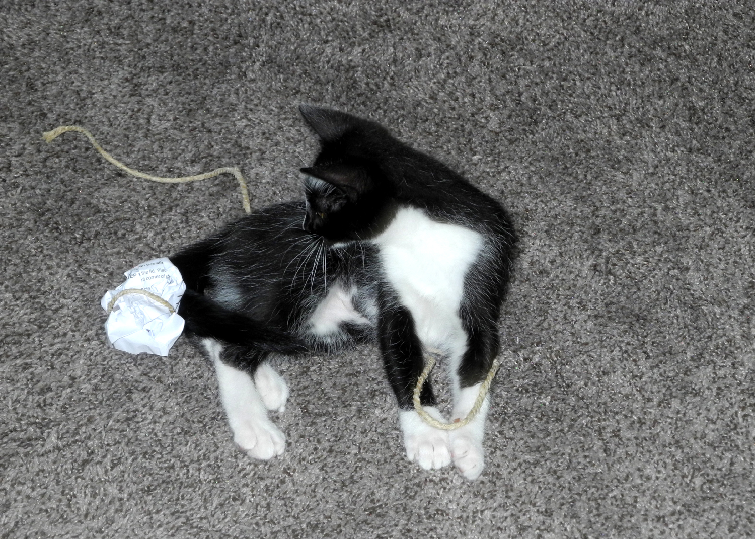
kitty Stryper, as she chased strings and other toys. I got up on Wednesday, the Fourth of July,
did the usual morning chores and had breakfast, and got back home in
the early afternoon. --Dick Estel, July 2018 |
||
|
Photos (Click to enlarge; pictures open in new window) |
||
|
|
||
|
San Joaquin River Gorge Bridge Hike Lewis Creek Courtright Family Camp |
||
|
San Joaquin River Gorge Bridge Hike |
||
|
|
||
 |
 |
 |
| Farewell-to-spring along Auberry Road | Common madea | A few streaks of green grass remain, but most of it is quickly turning brown |
 |
 |
 |
| Farewell-to-spring The "plain" variety and the spotted ones are common. This was the first time I'd seen the white version, possibly a mutation | ||
 |
||
| Buckeye and wild grapes in the drainage we call Grapevine Canyon | ||
 |
 |
 |
| Typical scene along much of the trail | Squaw Leap table top mountain from the trail | Milkweed blossom up close |
 |
|
 |
| The striking blossoms of elegant Clarkia | Chinese houses | Buckeye on the hilltop |
 |
 |
 |
| Buckeye blossom up close | Mustang clover | Still lots of green in this cool, shady section of the trail |
 |
 |
|
| Five-trunk blue oak on the Ridge Trail | The river as seen from the bridge | The "back side" of Squaw Leap from Auberry Road |
| Lewis Creek Trail | ||
 |
 |
 |
| The beginning | Bear Clover AKA Mountain Misery | Wild Iris |
|
 |
 |
| Suggested names welcome | Indian pinks | The falls and the viewing platform |
 |
|
 |
| Corlieu Falls | Lewis Creek below the falls | Western azalea |
 |
 |
|
| Wild rose | How you're expected to cross the creek | |
| Courtright Family Camp | ||
 |
 |
|
| Sequoia at McKinley Grove | Top of tree, with huge horizontal branch | Double Dome from our campsite |
 |
||
| The LeConte Divide, separating the Kings River and San Joaquin River drainages | ||
 |
 |
 |
| Colton loves shoveling dirt | Gathering pine cones for kindling | Sandy, Colton, Jack and Teri on the rock slope |
 |
 |
 |
| Junior photographer at work | The Sentinel Tree | View from the tree - Mt. Goddard at left |
 |
 |
|
| Flowers abound in the rocks - pussy paws, penstemon and wavy leaf Indian paint brush, and more paint brush | ||
 |
 |
 |
| Up the rock steps | Colton and the Sentinel | Teri and her grandsons |
 |
 |
 |
| Jack likes to take pictures too | A helping hand from big brother | Running and skipping down the rock |
 |
 |
 |
| Jack at full speed | Helping unload the truck | Fun in the hammock |
 |
 |
 |
| Brittany and Johnny | Johnny and sons enjoy the view | The Upshaw's ready to cross the boardwalk |
 |
 |
 |
|
At this location the trail heads into the forest and to the lake |
Trickles of water encourage patches of green on the Big Granite Slope | This little creek runs close to the trail at this point |
 |
 |
 |
| Jack, flopped on pop | Starting the campfire |
Sandi, Teri, Colton, Johnny, Jack, Brittany, Dustin, and Dick |
 |
 |
 |
| A late afternoon fishing trip | Courtright sunset | The falls on Bear Creek |
 |
 |
 |
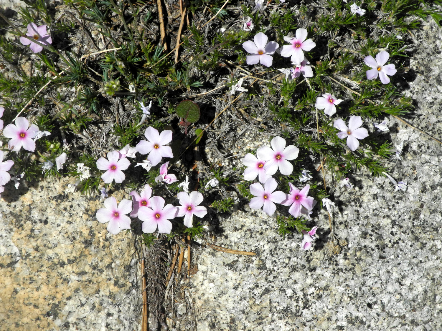
| Wavy leaf Indian paint brush | Mountain phlox | Purple lupines |
 |
 |
 |
| A big bunch of western wall flowers | A closer look | Snow on the mountains above the North Fork of the Kings River |
| Trail Discovery Photos | ||
 |
 |
 |
| My campsite at Summerdale Campground | Meadow area of the campground | White Chief Road |
 |
 |
|
| Buffin Meadow | Corn lilies in the meadow | Ancient stump |
 |
 |
 |
| Who can identify this unusual plant? | Cattle chute on Big Sandy Road | Corral by the cattle chute |
 |
|
 |
| Cabin just off the road | Ditch carrying water diverted from Big Creek | Trail along the ditch bank |
|
 |
 |
| Bright orange flower along the ditch | Small waterfall on Big Creek | Diversion dam to send water down the ditch |
 |
 |
 |
| Watergate controls where the flow goes | The places you can go on the McGurk Meadow Trail | It was the season of a million lupines |
 |
 |
 |
| Western columbine along the trail | Cabin near McGurk Meadow | Resting by the meadow |
 |
||
| McGurk Meadow in Yosemite National Park | ||
 |
 |
 |
| A delicate white meadow flower | Butterflies were thick on the trail through the meadow | Larkspur |
 |
 |
 |
| View from the north side of the meadow | Three choices are offered: Climb over, go around, or turn back (I chose "go around") | My lunch and resting log |
 |
 |
 |
| Shooting stars in meadow by the Glacier Point Road | El Capitan with Half Dome in the distance | Bridalveil falls drifts in the wind |
 |
||
| The famous Tunnel View of Yosemite Valley | ||
 |
||
| Silver Strand, a seasonal waterfall still flowing in July | ||
| Sentinel Dome, Mariposa Grove, Nelder Grove and Cats | ||
 |
|
 |
| Along the trail | Southern Yosemite Valley and El Capitan from the trail | Half Dome from the Sentinel Dome Trail |
 |
 |
 |
| Mt. Clark | Hikers heading for the top of the dome | Dick with Yosemite Falls in the background |
 |
||
| Panoramic view of lower Yosemite Valley with El Capitan at the right and Three Graces on the left | ||
 |
 |
 |
| North Dome and Basket Dome | Nevada Falls, still running good in July | Unidentified but delightful |
 |
 |
|
| Wes on the rock | North Dome, Basket Dome, Mt. Watkins, Half Dome, Cloud's Rest, and lots more | |
| Meadow and Mariposa Grove Photos | ||
 |
 |
 |
| Wes in the meadow, shooting shooting stars | Shooting stars by the thousands | Shooting star close-up |
 |
 |
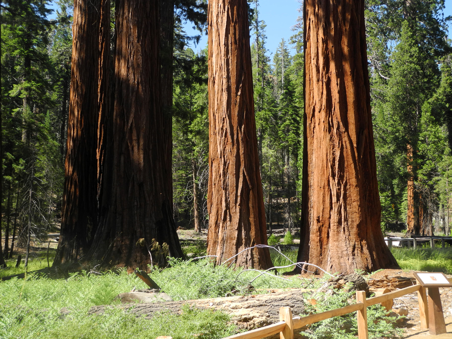 |
| Wes at the Mariposa Grove parking area | Lupines in the grove | Some of the 500 mature sequoias found in the grove |
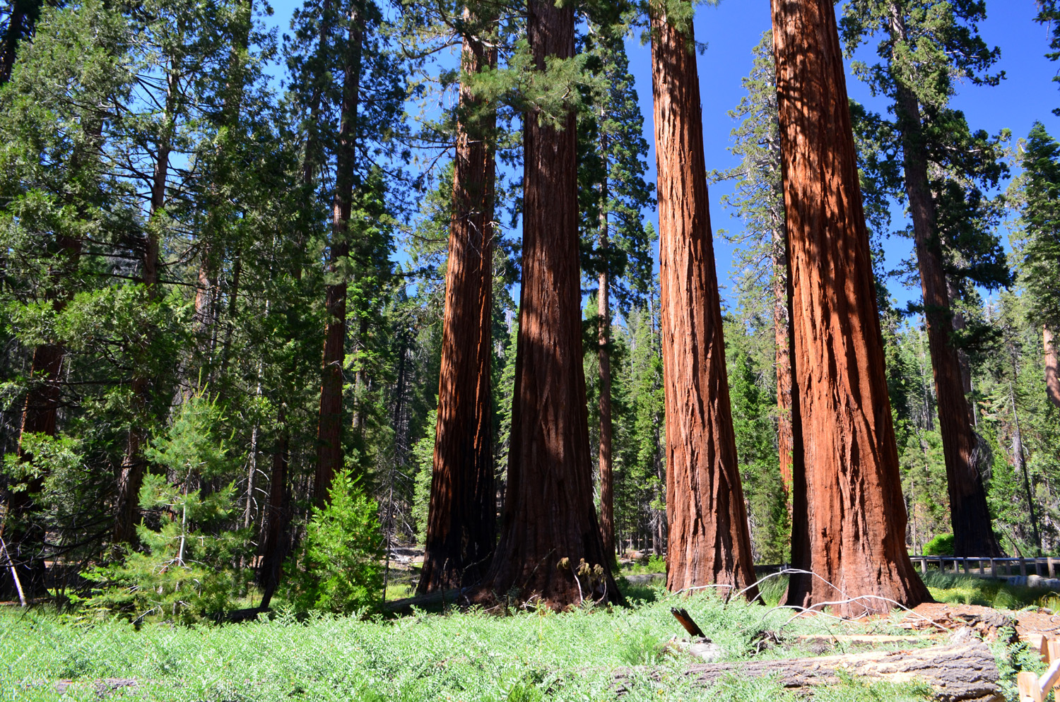 |
 |
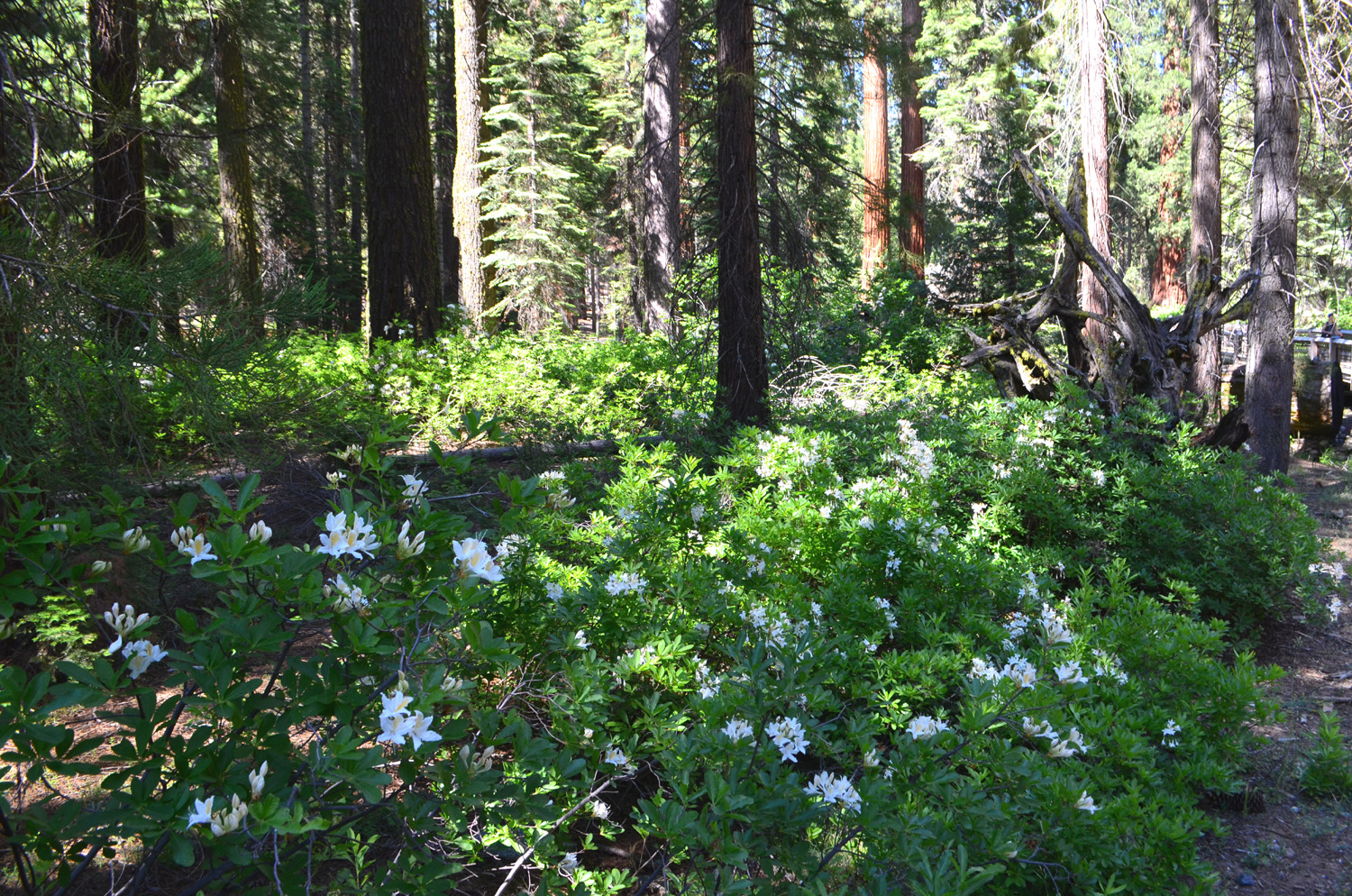 |
| A wider view with even more sequoias | Wes at the California Tree | Azaleas in the grove |
| Nelder Grove Photos | ||
 |
 |
 |
| Nelder Grove sign | Forest opened up by prescribed burning | Tree cut by ax |
 |
 |
 |
| The Old Forester | Fir tree along the Chimney Tree Trail | Lavender lupine |
 |
 |
 |
| Western azalea | Columbine | Sugar pine cones |
 |
 |
 |
| A sampling of he many big stumps in Nelder Grove | ||
 |
 |
 |
| More stumps | ||
|
 |
 |
| Stump on west side of road at exhibit area | Crown of the Bull Buck | Base of the Bull Buck with azaleas |
 |
 |
|
| Along the trail | Stump next to cabin moved in from a nearby meadow | |
| Cats | ||
 |
 |
 |
| Stryper and her favorite string | Stryper at rest | A rare photo of Pebbles |
| Related Links | ||
| San Joaquin River Gorge Special Recreation Management Area | All my reports on hiking and camping at San Joaquin Gorge (Squaw Leap) | Snakes of California |
| San Joaquin River | Lewis Creek Trail | Corlieu Falls |
| Red Rock Falls | Courtright Reservoir | McKinley Grove |
| Colton & Jack Rock Sliding | Colton Running Down the Rock | LeConte Divide |
| Maxson Trailhead | Dick's Juniper Photo Page | Juniper Slide Show |
| Courtright Area Slide Show | Summerdale Campground | Fish Camp |
| McGurk Meadow Trail | Yosemite National Park | Sentinel Dome |
| Mariposa Grove | Wawona Lodge Restaurant | Ansel Adams Jeffrey Pine photo |
| Nelder Grove | El Cid Mexican Restaurant | Dick's Early Writings on Nelder |
| Grizzly Giant | ||