
|
Dick Estel's Early Camping Trips |
||
In my report on The Early Trips, I covered travels back as far as 1940, when I was 18 months old, through 1978. Then I covered The Later Trips, which were trips with my grandson Johnny (AKA JD) from 1990 to 1999. This report covers other camping trips, from childhood through the 1990s, most of which were before I had a travel trailer. I’ve been camping so many times, it’s hard to remember details of any but the most recent trips. However, there are some events that stand out, and I’ll try to briefly outline those. Backpacking came later, and I kept a log of those trips, so it’s a little easier to dredge up those memories. Still, there were so many that not all of them deserve mention. This article was originally posted in May, 2009; there was a major update in December, 2012 and another in April 2015. We did
not go camping when I was growing up. We lived in the rural When I was ten, I joined the 4-H club, and this organization
sponsored a three or four day camp every year in Although these trips were quite different from my early adult camping experiences, I enjoyed them greatly. As you can imagine, they were highly organized, with a dozen or more adult leaders, and at least a hundred kids, ranging in age from ten to eighteen. Unlike my later camping, much of the “dirty work” was done by someone else. The tents were already set up when we arrived. Although we had to stand in line for meals, all the cooking and cleaning was done by someone else. And naturally, most of the activities were planned and directed by – you guessed it – someone else. The
major activity was hiking, and each day we could choose from several
half day hikes around Common destinations included the Government Center (site of the museum, headquarters and various stores); Happy Isles, where the state of California operated a fish hatchery, Mirror Lake, a wide spot in Tenaya Creek at the upper end of the valley, and the Vernal Fall bridge, which offered a view of the lower of the two great falls on the Merced River. On one day each year we went on an all day hike, an adventure most of us looked forward to. This started with us standing in line a second time after breakfast to get a box lunch, then heading off for one of several more challenging destinations. Older
kids (and I can’t recall now where the line was drawn) could go to
the top of Half Dome, guided by a vigorous young adult leader
(I’ll discuss my own hikes to Half Dome in my backpacking report).
However, looking back, the hikes we younger kids took would be more
than I’d like to try today. Over the years we hiked to Little
Yosemite Valley, above Vernal and
Once I left 4-H, my camping days were over until I got married, unless you count our week-long bivouac exercise in Army basic training (I don’t). I was
already living in Bakersfield
when Jackie and I got married in June, 1963. Near the end of
September, while the weather was still very hot, she suggested we go
camping. Her family had done lots of camping when she was younger,
but I had not even considered it after my 4-H days. However, I was willing to give it
a try, so we headed into the extreme southern Sierra Nevada
on Highway 178, passing Lake
Bypassing an official campground, we set up our weekend home at a flat spot along the road, near a tiny creek. We had our kitten, Suzie, with us, and I remember tying her to a heavy piece of wood so she wouldn’t wander off. She seemed to enjoy the outdoor experience, until we started home and dropped down into warmer air (the temperature exceeded 100 degrees in Bakersfield that weekend, the last day of September). We hiked around, and drove up some dirt roads, including a stop at a beautiful meadow near 10,000 feet, where we were quickly driven back into the car by thousands of large, blood-thirsty mosquitoes. During
our time in Bakersfield, we went to that same area several times, usually staying at
Tiger
Flat Campground. We also went to Balch
We also
explored areas to the south of us in the Tehachapi Mountains, staying at a campground in
Also
off I-5, but a few miles up into the mountains in Los
In 1966
we moved to Fresno, and about the same time, our daughter Jennifer was born. It was
now time to find some new camping spots. Although I had attended Fresno
State College for four years, I had never gone to any of the popular
recreation areas in the Sierra Nevada
east of Fresno. So over the next few years, we discovered the best spots in
Sequoia and Kings
Canyon
National Parks, the Shaver
Lake and Huntington
Lake areas, and the Our
first visit to what became one of my very favorite places was a day
trip. I had read a little description of the Nelder Grove of giant
sequoias on my map of the Sierra One particular trip ended in a rather adventurous manner. We met my parents at the small campground in the grove, and spent the night. When we left the next day, we found our usual access road blocked by an overturned logging truck. None of us were familiar with the roads in the area, so it must have been instinct that caused my father to turn on to the “right” road, which led him out to Highway 41 in a few miles. I, on the other hand, studied my map, and observed that I could go back into the campground, take the road which went up the mountain to the upper part of the grove, and connect with roads that led out to the main highway. What the map did not show was that several miles of this road were suitable for four wheel drive vehicles only, so we found ourselves basically letting our 1966 Plymouth Valiant roll down a rocky downhill trail, riding the brake all the way, till we came to a somewhat better dirt road that led us out to civilization. Unfortunately
for adventurous souls like myself, the road to the upper grove is
now closed and available only for hiking. And the “right” road
that my father took, which was newly created and not even on my map,
is now paved and is the standard route to the grove. Another
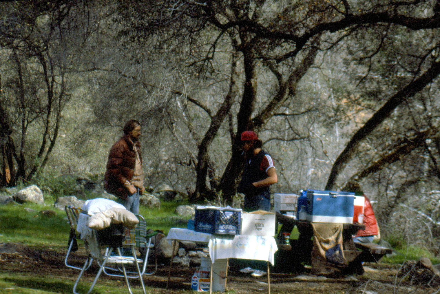
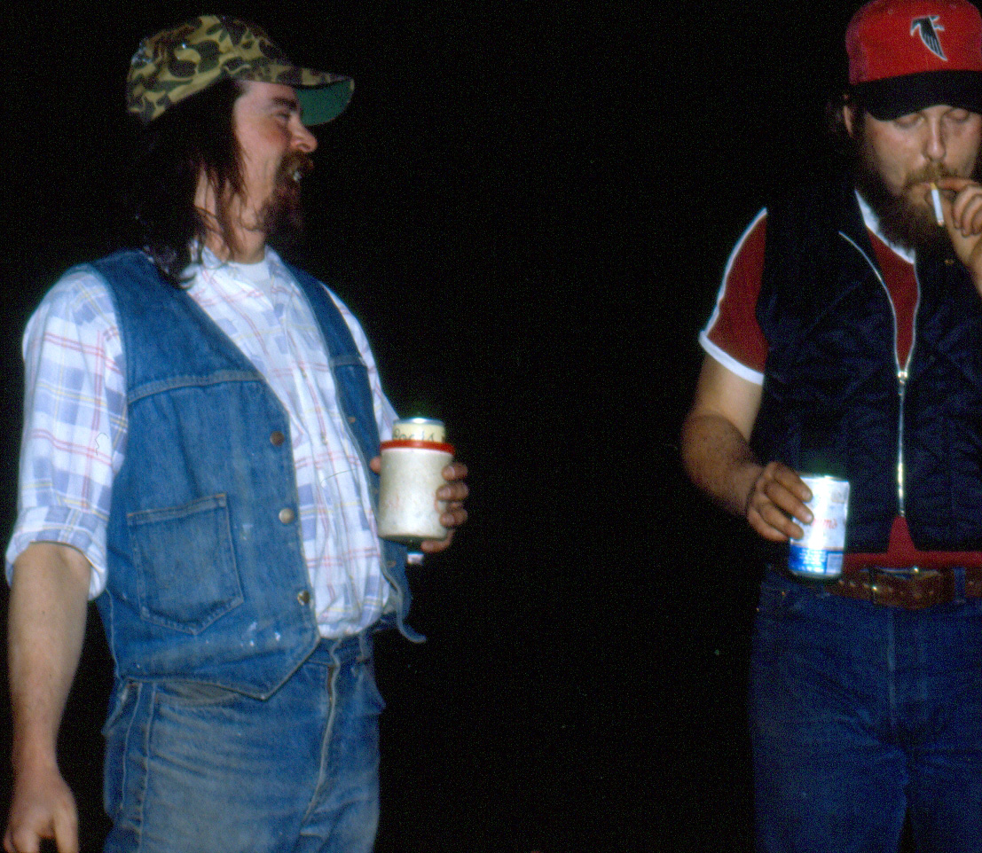
time we camped at Nelder Grove, we were joined by our good friends,
who I’ll call the Mr. Jones was fond of a few drinks while camping, then a few more drinks. After he had so indulged, we went for a drive (with me at the wheel). Mr. J decided to enhance the outdoor experience by riding on top of the car, clinging to the luggage rack of my Opal. Of course, we were driving slowly on dirt roads, but it was an event my daughters still speak of with amusement. It also serves as a good measuring tool – if someone is so inebriated he wants to ride on top of the car, its best to let him – otherwise he might want to get behind the wheel! I have made many other trips to Nelder, with my wife and kids while I was married, with my kids after our divorce, and later with my two grandsons. (A delightful and much more recent camping trip there with my GREAT grandsons is recounted here.) Recently most of my trips to Nelder have been day trips, but there is one other camping trip worth recounting. As I
have mentioned, there was a road that left the campground, and wound
up Speckerman
I had visited this area by myself, and with my daughters when they were young, and thought it would be a nice place to camp overnight. Around this time we had discovered the joys of candy-ass backpack trips. This is where you find a place that you can reach in a half hour or less, hike in, and spend the night. Redwood Glenn seemed perfect for this purpose, so one summer day my daughter Jennifer, our friend (and her former boyfriend) Tim, and I headed up the road to Nelder Grove, parked my Datsun pickup at the head of the road, and hiked in, at least a full half mile, and set up camp. Late in the evening, just before dark, we decided our camping trip would be enhanced if we had some beer. So we made the short hike out to the pickup, drove the 11 dirt road miles out to the highway and the few paved miles up the road to Fish Camp, and gathered the needed supplies. If my memory is correct, when we got back, we drove in to camp, thus reducing our return hike to the few dozen yards from the tent to where we parked, and enjoyed the rest of the outing. The first candy ass backpack trip was to a nearby area. On the road to Nelder there was a rough dirt road that led in to a nice meadow, then a little father to another meadow, with an old, partly collapsed cabin, leading me to name it Cabin Meadow. By the time I had been backpacking for a few years, the access road had been blocked off, so Tim and I chose this as our destination for a short pack trip (this one close to a mile!) Some of our activities during this trip: Watching a herd of cows munch their way slowly up and down the meadow (which we called “cow soccer”), walking through the lower meadow when it was so thick with flying ladybugs that several ran into us with each step (one even flew into Tim’s ear, but came right back out, after a few panicky moments); and stepping into a damp, sandy area which proved to be just short of quicksand (no one got sucked under). Getting
back to a more or less chronological report, I’ll touch on some of
the other favorite spots we “discovered” in the mountains east
of A bit of explanation: Highway 168 runs from Fresno to Huntington Lake, passing Shaver Lake. Both lakes are part of the Southern California Edison’s Big Creek Project, which included construction of dams and tunnels in the early part of the 20th century. At Shaver Lake, a right turn puts you on the Dinkey Creek Road, which goes 15 miles to a developed camping area that includes rental cabins, campgrounds, a store, and a ranger station. Another
right turn at Dinkey Creek puts you on the McKinley
Grove Road, which leads to Courtright
and Wishon
Reservoirs, part of the
Pacific Gas & Electric hydro system. If you know anything about During these years I started exploring the side roads in this area, leading to one of our more fortuitous discoveries, the camp site we called Bear Creek. Now there are almost as many “Bear Creeks” as there are bears in the Sierra (and everywhere else that bears are found), but this particular one is accessible by turning off the north side of the road a few miles past Dinky Creek, and driving into the forest on a mostly unpaved road, then turning down an even narrower dirt road that ends at a primitive camp site on the north bank of the creek. The creek eventually flows into Dinkey Creek, crossing the McKinley Grove road a mile or two past the original turn-off. When I first arrived at this spot there was no one around, but there were some “homemade” wooden benches, shelves and a sort of table. The creek runs through a long, straight channel with a solid rock bed, into a pool that is deep enough for swimming. The section above the pool is quite shallow, so the water has a chance to warm up slightly. I was camped elsewhere, but immediately decided that this would be my next camping spot. The kids and I went there a number of times over the years, but eventually we discovered other places, and quite a few years passed without a trip to Bear Creek. When I did drive in there once, I found quite a few people camped there, so like many hidden spots, it had been found by more and more people over the years. We did go there for swimming a couple of times while we were camped at Stargazer Rock, trips that I’ve described more fully in 2005, 2006, 2007 and 2008.
But I’m getting a little ahead of myself here. My first camping in this area was at lower elevations, closer to Shaver Lake. There were two official campgrounds along the Dinkey Creek road, and I tried them both. I remember one trip when I camped at the second one, about 6,000 feet at Bald Mountain Summit, during a particularly cool period. I was very cold at night, and I ended up moving down to the lower one, Swanson Meadow at around 4,000 feet, the second night. Another
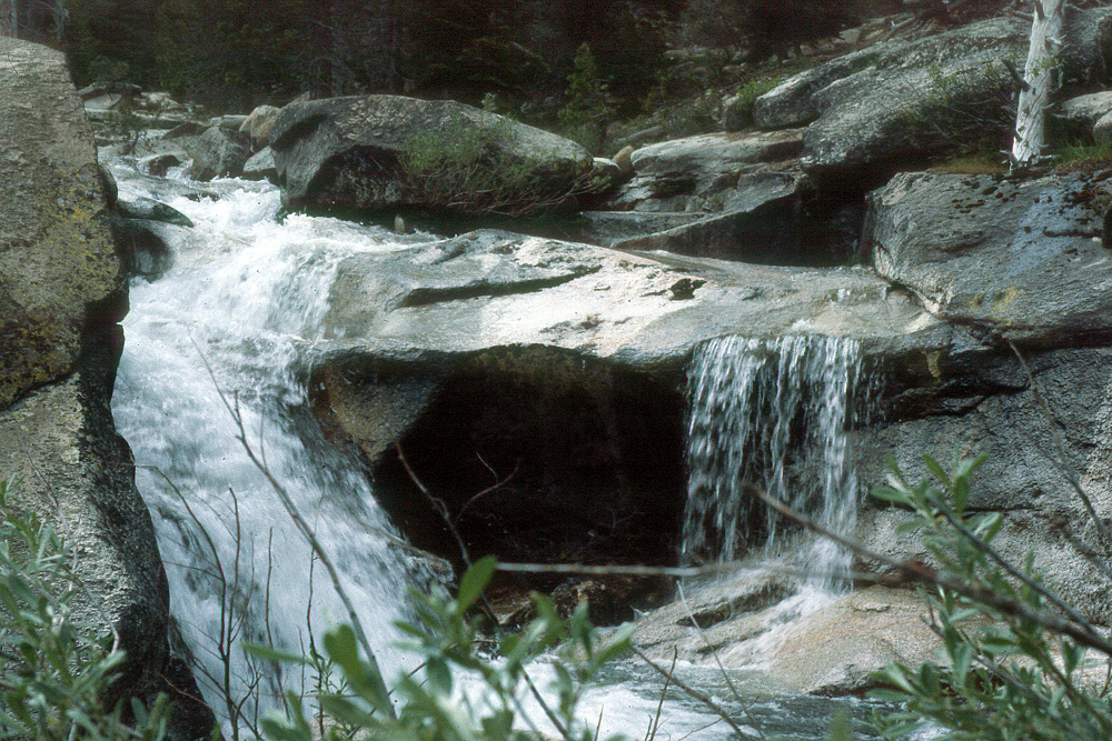
small stream, Laurel Creek, runs more or less parallel to and west of Bear Creek. This creek
also crosses the McKinley Grove road maybe a mile or less from the
Bear Creek Crossing. When I first found Bear Creek, I was camped on
the dirt road close to This was an undeveloped site that had been used for camping many times, and there was at least one other party camped across the road from me at the time. The most notable feature in the area was the old log foundation of a building of some sort. There were also various metal objects left behind by logging operations, mostly rusted pieces of cable. For the first and only time I brought my cat, Furry Lewis, with me. Like most pets, he enjoyed exploring new territory, but stayed close to camp. During the first night I was awakened by some small noise, and next to my bed Furry had caught a mouse, no doubt saving me from a vicious attack. One
thing I almost always do during camping trips is drive around
exploring the area. It was on this trip that I turned down a road
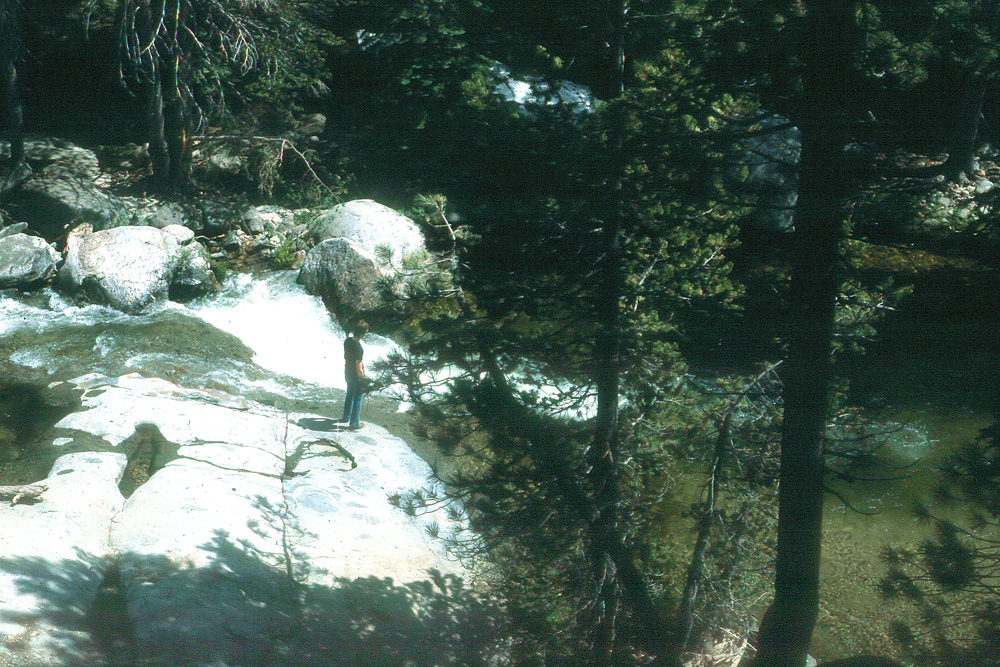
with a sign “ Also in this general area I found a nice spot along Dinkey Creek, known as Ross Crossing, several miles downstream from the official Dinkey Creek Campground. It was at this location that I started my brief experiment of swimming in water that was way too cold for me. I went into the creek, and found that I could stand to stay in a while, although it was way colder than anything I had ever been in before. I had a thermometer with me, so I also began a long-term practice of checking the water temperature, and learned that it was 63 degrees. This seems fairly balmy for air, but remember, you are putting your 98.6 degree body into water that is over 30 degrees colder. Over the years I found that 63 was the lower limit; when I went into a river that registered 61, I had to get out quickly. The lowest temperature I ever registered was in the upper Kings River during the spring snow melt, 41 degrees. If you fell in, I believe that would be cold enough to paralyze you before you could swim out, no matter how good a swimmer you were.
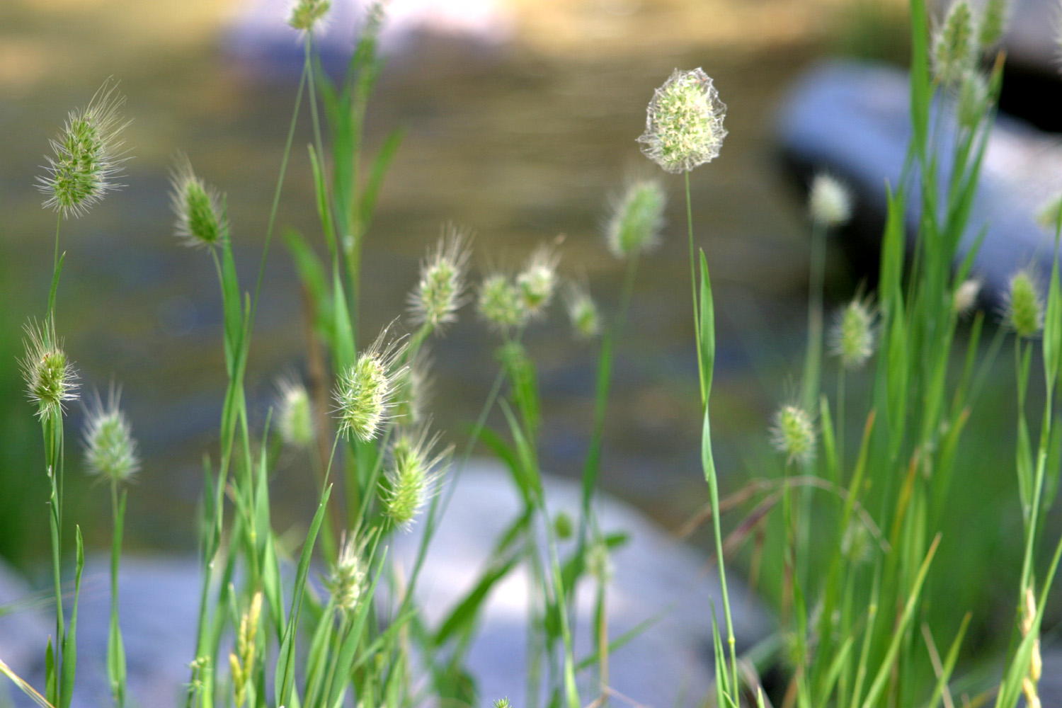
Before I discuss my next camping area, I am going to digress for a brief essay about meadows. The definition of this land feature seems to vary from region to region, but in the Sierra Nevada, meadows usually involve considerable moisture. They are open, relatively level patches of land, ranging in size from a few square feet to a stretch of land a mile or two long. By definition a Sierra meadow is an area where it is too wet to support the growth of trees, so they are normally bright with green grass and other low plants, flowers, and a few small bushes near the edges. A small creek runs through most meadows, and there is often a large marshy area. It is not unusual to be walking through the grass on solid ground, only to sink into water up to your ankles. Since rainfall in the area comes mostly from November to May, meadows tend to be green and damp in the spring and early summer, dryer and sometimes brown in late summer and fall (especially at lower elevations). Over the long term, the nature of meadows is to disappear, although various factors keep many of them in existence for centuries. Trees grow in the drier land near the edges of the meadows, and begin to use more water, allowing the meadow to dry out at the edges. Trees then move into the area a little farther, drawing even more water, gradually shrinking the size of the meadow. On one backpack trip I talked with a back country ranger who had spent the morning pulling up small lodgepole pines in a nearby meadow. He had mixed feelings about his project, recognizing that he was interfering with nature, but also cognizant of the value of meadows as a habitat for various plant and animal species. All this leads to the time I camped on an island in a meadow, or something close to it. I went up the road past Huntington Lake, commonly called the Kaiser Pass Road, over the pass at 9,000 feet, and down a few miles to what looked like a nice spot near the road by a big meadow. I had to carry all my stuff from the car two hundred feet or so across a narrow strip of meadow between the road and my “island,” but then I had a few hundred square feet of solid ground, with a beautiful view. The main thing I remember about this trip was that it was quite cool even in the warmest part of the day (it was probably near the 8,000 foot level). When I sat in my lawn chair to read, I had to keep moving it into the sun, since there was a noticeable temperature drop between sun and shade. Looking
at the notes I have on camping trips from these long ago days, there
are a lot more outings, but only a few worthy of further discussion.
One of the most memorable, though not exactly the most fun, was
camping in the rain at what I call California Flats. This is an area
along California Creek on the road that runs from People
have built fire rings and created a de facto campground in this area
over the years, but there wasn’t much more than a small clearing
with a primitive fire ring when we went there in October of 1983.
"We"
includes Jim and Sandy McGee, their daughters Rachel and Angie, and
another friend, Gary Reed (Mikie
and I visited Sandy and her now grown daughters in Oklahoma in 2004). Coming
down the grade into Oakhurst on State Highway 41, you get a good
view of the higher mountains, and it looked very much like it was raining
or soon would be in the upper elevations. Nevertheless, we had
loaded our gear and driven 45 miles, and we were not going to be
stopped. When we
arrived at the camp it was cool and cloudy, and within a very short
time a light ran began. For the next several hours we kept hoping
that the rain would soon back off, but it never did, although it was
never very heavy. It had rained there not long before, so all the
wood was already wet, and getting a fire going kept us busy and kept
our minds off the fact that we were unable to do anything except try
to get a fire going. Once we
got a small (not warm) fire going, we piled damp pieces of wood all
around on the fire ring to dry out. As they dried, we put them in
the fire, and began drying more. In case you’d like to try this
some day, be aware that it took about four hours to get a really
good, warm fire going. During
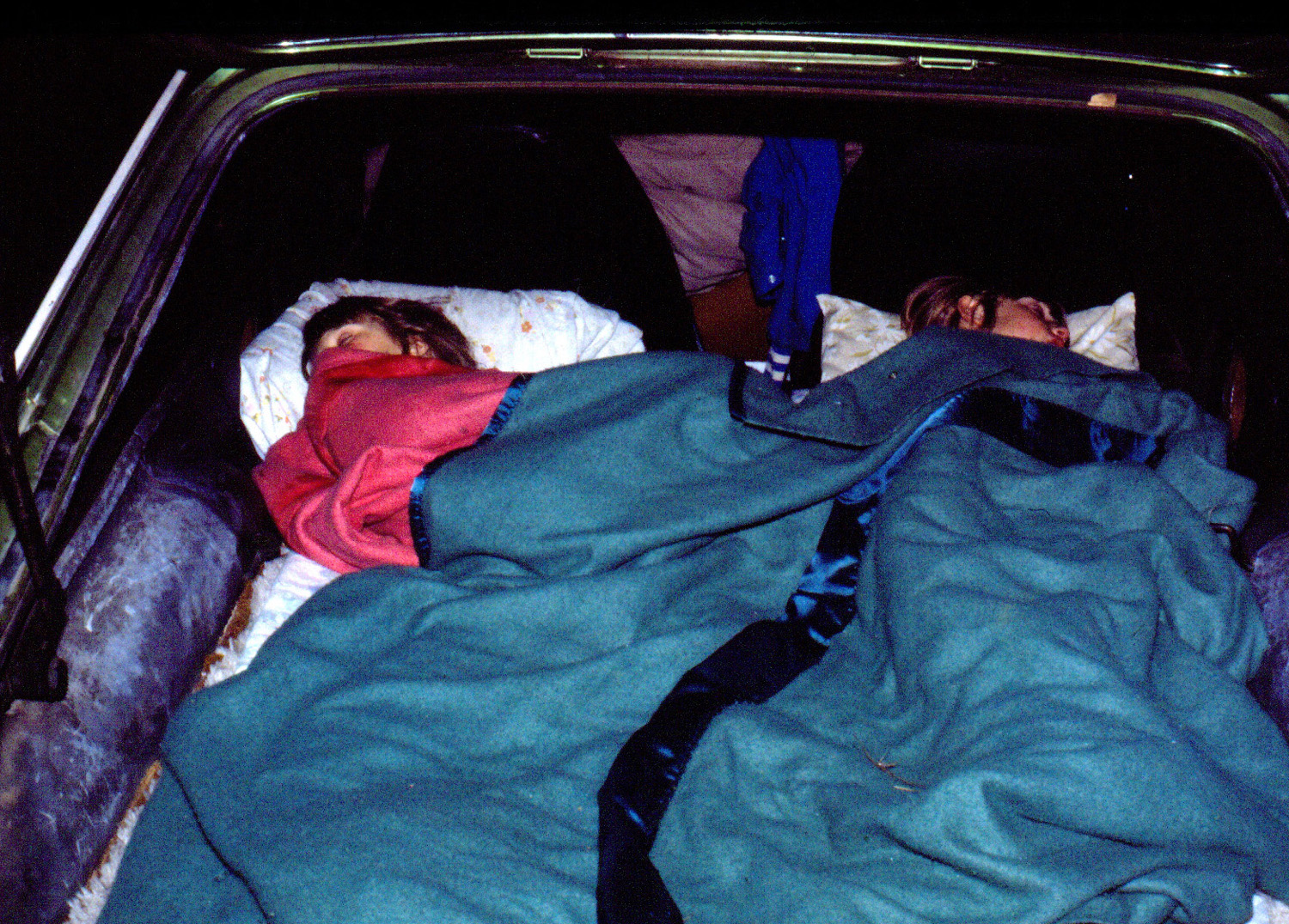
all this time we had rain off and on, ranging from a slight mist to
a steady rain (never a downpour, thankfully). Jim backed his
hatchback vehicle up close to the fire, and his daughters sat in
there. I stuck my umbrella down the back of my jacket so I had some
protection and kept my hands free to hold a beer and put wood on the
fire. I had a tent, so I didn’t have any problems at night. I don’t remember what Jim, Sandy and Gary did, but probably the McGees all slept in the car. We woke up to clear blue skies, although a few clouds drifted in during the morning. We drove to Nelder Grove and enjoyed the clean, cool air, but we all agreed that we never wanted to camp in the rain again. I did camp at that location another time or two, but it’s not really that nice a spot.
On the
other hand, Mill Flat Campground is a beautiful spot, at least
for winter and early spring camping. In fact, this was the first
place I ever camped during any season other than summer. I had
always just had the idea that camping was a summer activity, but one
year it occurred to me that our Sierra foothills at 2,000 feet or
lower are very nice in fall and winter when it’s sunny, and at that elevation snow is
a rarity. Mill
Flat Creek runs out of I had
some time free during the Thanksgiving weekend, so I located this
spot on the map, and set out. It’s very close to Kirch
Flat Campground, which
I have written about as Frog
Camp – you take the Trimmer Springs Road
around the north side of Pine
Flat Reservoir. Past Kirch Flat the
road crosses the river, then a mile or so above that it crosses back
and follows the North Fork. Instead of crossing the second bridge, I took a dirt road that
goes up the south side of the main river, arriving at Mill Flat
after a three mile drive that climbs up and down the canyon,
offering some spectacular views of the river. The
road leaves the river at this point and follows Mill Flat Creek for
a while, eventually coming out on Highway 180, the road from There was one unexpected and not all that fun aspect of my first trip to Mill Flat - in the middle of the night two or three large stake trucks came up the road, stopped just above the camp, and dumped 20 or 30 head of cattle out. They wandered through the camp during the night, but didn't really cause any problems. This was the first of many trips to Mill Flat Camp, including a number of times that I have driven there while exploring out of Kirch Flat. On another trip, with Jim McGee and Gary Reed, a man drove in, parked, and walked over to our campfire. He said he was waiting for some friends, and wanted to get warm and visit a few minutes. During our conversation he said that he and his friends were poachers from a small town in the valley, and that they frequently hunted there, taking animals out of season or animals that had no season. We were not thrilled with this, but since they had guns, we said and did nothing.
Lone
Sequoia Campground was another place I camped at a few times, the
first time with my wife and daughters when they were quite young.
It’s located a couple of miles off Highway 41, between Oakhurst
and Lone Sequoia was the only place outside the national parks where we saw bears. I was across the road gathering firewood when I heard my daughters yelling. I hurried back, and saw a bear cub up a tree. He quickly came down and ran off, but of course, where there is a cub, mama is nearby. My older daughter had wisely climbed into the car, but my younger daughter took the event in stride, announcing “It was only a baby bear.” Another time we returned from a drive to see a porcupine waddling out of our tent; and we also saw a pair of foxes on the road. We also were told by another camper (a different time) that they had seen a bear near their camp. By the way, although this location is far from the nearest sequoia groves, there is indeed a lone sequoia growing there, although it’s small and we didn’t find it till several years after our first visit. By this time the forest service had removed the tables and “decertified” this as an official campground. This is something they have done in quite a few places, even though we need more places for people to enjoy the outdoors, not fewer.
Switching
back to the However, there is a side road that goes north, paralleling the north fork of the Kings, and eventually comes out at Wishon Reservoir. I would categorize this as a four-wheel drive road, although it’s just barely passable with a passenger vehicle, such as the Datsun pickup I owned at the time. Just a mile or so in on this road there is a primitive campsite with a good fire ring, where I have camped a number of times. Long Meadow Creek, a small stream with a pool suitable for wading, crosses the road near the camp, but the best feature of this area is the rocky dome-like terrain between the road and the river. You can make your way out through what I call Wishon Domes, eventually reaching a cliff overlooking the river. You are a few hundred feet above the water here, and trying to descend would be foolhardy, but staying in the upper part of it is perfectly safe. One
time when I was camped here, I took my sleeping bag, a chair, water,
snacks, and a few other items and hiked out into the dome lands
about a half mile or so. This was in August, at the time of the
Perseids meteor shower. I set up camp in a flat, sandy spot
which was open on all sides (no big trees to block my view). I went
to sleep for a while, waking up around Staying
in the Pine Flat area, I am going to say a bit about some nice
camping spots along Big Creek, on the Blue Canyon Road.
Driving around Pine Flat, there are two large streams that run
into the lake from the north – Sycamore Creek and Big Creek. There
is an old roadway along Sycamore Creek, but it is not accessible to
vehicles, and I don’t know where or how far it goes. However, the
road along Big Creek goes for a number of miles, and eventually
joins Highway 168 a little below For the the first six miles or so, the road follows the creek and is relatively level, then the road leaves the creek and begins to climb up into the foothills, quickly ascending to about 3,000 feet. Here it rejoins the creek again. I had gone up this road to a big dry meadow near the 2,000 foot level, where I set up camp a few hundred feet from the road. During this and later visits, I experienced the most unusual weather conditions I have ever encountered. A partial list includes: Snow (in December) with a low of 19 degrees Rain drops in the late afternoon when there were no clouds (just some high mist) Fog that drifted up to the edge of the meadow where it drops off, but did not venture into the meadow A fierce wind that came up at sundown and blew all night, rocking the pickup I experienced this last event the first time I went there, in January 1984, accompanied by Tim, who was later to become my son-in-law. We huddled by the fire until bedtime, and he tried to set up his bed on the downwind side of the truck, but it was pretty much impossible to escape the wind. I assumed this was an unusual event that would not likely be repeated, so I camped there again in April, and again was nearly blown away. Tim, my daughter Teri, and her husband at the time were joining me on the second day, but when they arrived, I told them we needed to move down to a lower level. I think the weather here is related to the terrain - the large, open field drops off suddenly on the south, and has high hills on the other three sides. These weather conditions caused us to name this spot Minnesota Flats. We drove back down the
Blue Canyon Road
to a place where people had created a primitive camp site near the
creek. That spot was occupied, so we went up a little dirt track on
the other side to a flat spot about 50 feet higher. There was an old
cement foundation at this spot, so it became Concrete Flats. We
camped here a lot of times – it was nice and flat, you could back
the truck in between a couple of sections of concrete and have a
solid place to set things, and it offered the usual low foothill
green grass and wild flowers for winter and early spring camping. In
fact, this was the first place my older grandson, Johnny, ever went
camping, at age eight months, in April of 1985. One
time we were visited by a ranger, so I asked him the purpose of the
concrete foundation, and he said it was once a slaughter house.
However, we had the good fortune to meet Jim Montgomery, one of two
brothers who lived in a ramshackle cabin nearby, able to stay there
because they owned a mining claim. When I mentioned the
slaughterhouse theory to Jim, he scoffed and said “that guy
doesn’t know what he’s talking about; this was a tungsten
mine.” Sadly, the last time we went there to camp, it was covered with garbage, and we moved on to another spot, so we haven’t camped there since some time in 1995. However, my notes showed at least 14 overnight stays there, and I also made a number of day trips for sight seeing and wood cutting.
I have
to give a brief mention of a camping trip to Chilkoot Campground, on
the Beasore Road, which leaves Road 274 on the east side of Bass
Lake, and goes east into the mountains a long ways. In June, 1991 Teri, Johnny and I went there on my
first camping trip with a trailer. I remember the main thing that
impressed us was that we slept later than usual, being inside where
it was warm and dry. Finally,
transitioning into the modern era, in July, 2000, we had our first
campout at what has now become Stargazer Rock, on which I have reported
annually since 2005. Teri and Mikie went up first in their Toyota 4-Runner, while Tim and I came up later in my 1990 Ford truck (no trailer). We went up Highway 168 past Shaver Lake, then took a road that goes out of a snow play area, and joins the Rock Creek Road (which comes in from the Dinkey Creek Road). During this trip, we drove up to Bear Creek, which I had first visited about 25 years earlier. I probably had not been there for 15 years or more. There were people camped there, but we went down by the creek; Tim fished, Teri and I read, and Mikie slept the whole time. (In 2020 I complied a more detailed report on our first few trips to Stargazer Rock.) There were many other camping trips, with a constantly varying cast of characters, although my favorites were those with my daughters, first as children, then later with their boyfriends, husbands, and/or kids. Many of the places I have mentioned became favorites for a time, and we camped at each of them repeatedly. I don’t have a record of every trip, but I was amazed to discover that I camped at Concrete Flats at least 14 times, and certainly there are other spots that came close to double digits. I had intended to include camping and backpacking trips in one report, but this has gone on so long that I am going to do a separate report and web page on backpacking. --Dick Estel, May 2009 December 2012 Update: When I reviewed this page recently, I realized that I had pasted text from my notes at the top, intending to include more camping trips, and had inadvertently uploaded the page in that form. I will offer just a few highlights of those trips. Cold Springs Meadow: This big meadow is at about 7,000 feet in elevation, up the road past Chilkoot Campground. I camped there a time or two in the 1970s or 1980s, but the most memorable trip was with Johnny (age 5) in 1989. During our stay there we counted 27 log trucks going by. We hiked down the road toward a small store nearby, or at least I hiked. Johnny rode his scooter two miles down the road and a trail, and then pushed it all the way back up. Rod & Jennifer's Cabin: Not a camping spot, but an actual cabin, where my younger daughter and her husband lived when they worked in Kings Canyon-Sequoia National Parks. This was in the employee residence area, and was a primitive accommodation. This was where we celebrated my 50th birthday, with a surprise visit from my Dad and Mother, who were camped nearby in their motor home. I slept in my pickup, and I think everyone else, maybe excepting 5-year old Johnny, stayed up most of the night. Gravel Flats: This is a big flat area on the north side of the Kings River, about three miles up the dirt road that leaves the Balch Camp road where the road crosses the river. In 1992 we went there for Martin Luther King weekend. Accompanied by daughter Teri and grandson Johnny, I took my trailer. We were joined by Johnny's friend Jeremy, as well as Keith Sohm and Jeff Adolph, two men I knew from the local computer club. They had known each other since junior high days, and had camped together many times.. In 1993 we went there with the same cast, minus Jeremy, for President's Day weekend. Although it was foggy back in Fresno, we enjoyed bright sunshine. Driving up the dirt road in the evening, I reached a spot where there was loose sandy soil on hard-packed dirt, and I could not get traction. A couple came down the road in a 4-wheel drive Toyota, so we hitched the trailer to their vehicle and they pulled it past the bad spot. Gravel Flats has since been developed as a group camp, with toilet and picnic tables. For
MLK weekend 1994, we had our first campout at Kirch Flat Campground,
located just above the upper end of Pine Flat Reservoir. Jeff joined
us, and Johnny brought Kyle, a friend from Indian Guides. Tim and
Teri came up for some 4-wheel driving the second day. We drove up to
Goofy Smith Flat, where the boys climbed up the steep hillside.
Back in camp, they slept in their own camp down by the river the
first night, and set up their own camp in the campground and cooked their
own supper the second night. We came home to learn of a big earthquake in We had hoped to make the MLK weekend campout an annual event, but weather, different interests, and scheduling problems ended it at three years Chilkoot: In October 1994, Johnny and I camped here with the trailer. We drove up to Cold Springs Meadow in the afternoon, where we experienced snow pellets as we were leaving. Sitting around the campfire that night, we had snow pellets mixed with rain droplets just before dark. At night there was a big, hard wind; then it got calm, with the temperature dropping to 29 degrees. Courtright Four Wheel Drive Camp: I had camped at a forest service campground in the trailer at this magnificent mountain lake a few years earlier, but the most memorable trips were those when we went to a primitive camp about two miles back the four wheel drive road on the east side of the lake. We went there in 1996, but I do not have notes on that trip. On July 3-4, 1999, I went there with Teri & her family and Johnny's friend Dustin. They went up Thursday night, and I went Saturday, meeting Tim at the trailhead to catch a ride in to the camp. We
had a giant beach
bonfire Saturday night, under the direction of Johnny and Dustin; four teenage
kids camping nearby came over, along with some younger kids who left
early. The old folks went to bed before
Big Basin: I lived in Salinas for a little less than a year in the early 1970s (while keeping my house in Fresno, where I returned after my time in the foggy coastal area). I made a number of day trips to nearby Santa Cruz and Monterey. One day I decided I should go overnight to the redwoods, so I found Big Basin Redwoods State Park on the map (and in the Santa Cruz Mountains). I had little or no camping equipment, but I had an Opal station wagon in which the back seat could be folded down. I grabbed some food to go, and drove up to Santa Cruz and into the mountains. I don't remember much else about this trip, except that I believe I did some walks through the redwoods. Pinnacles National Monument: This was a more organized trip, again starting from Salinas. I had a folding cot, the weather was nice, and I preferred to sleep outdoors when possible. I drove north and east toward Hollister, and got on State Highway 25, which goes south parallel to US 101. About half way between Hollister and the junction with State 198, a road goes west into the mountains and what was then Pinnacles National Monument (now National Park). I set up camp in a low elevation campground among live oaks, and set out on a loop trail that goes into the rocky crags and by the pinnacles themselves, a group of rock towers (note that this link includes photos that are NOT in the Pinnacles area). Because it was not an area where bears were considered a problem, I left food and other stuff out on the picnic table when I went to bed. I was awakened by a noise, and got up to find two raccoons helping themselves to my bag of chocolate chip cookies! The other special memory of this trip was that there was a redtail hawk perched on virtually every other fence post along Highway 25, appropriately so since these are the Gabilan Mountains.. Mountain Home State Forest: At least two or three times, in years that I can no longer recall, I camped in Mountain Home State Forest, a sequoia grove in the mountains of Tulare County, above Porterville. This relatively small area has some of the largest and oldest of the Sierra redwoods. It is located near the Wishon Fork of the Kaweah River. I camped there one time with my friend Gary Reed, and another with my daughters. On this trip Jennifer and I walked out into an open area near camp at night, and saw one of those magnificent meteors that went almost entirely across the sky. Discussing this recently with Jennifer she commented, "It was one of those where you could say, 'Look!' and the person would easily still have time to look up and see it." Mountain
Home is not far from Balch Park, mentioned near the beginning of
this narrative.
|
||
 |
 |
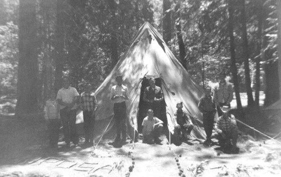 |
| Dick at Bridalveil Falls, 1944 | Dick and his dad Bob at Wawona Point, 1945 | 4-H Camp in Yosemite, early 1950s |
 |
 |
 |
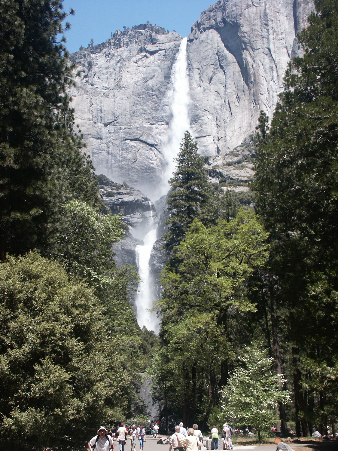
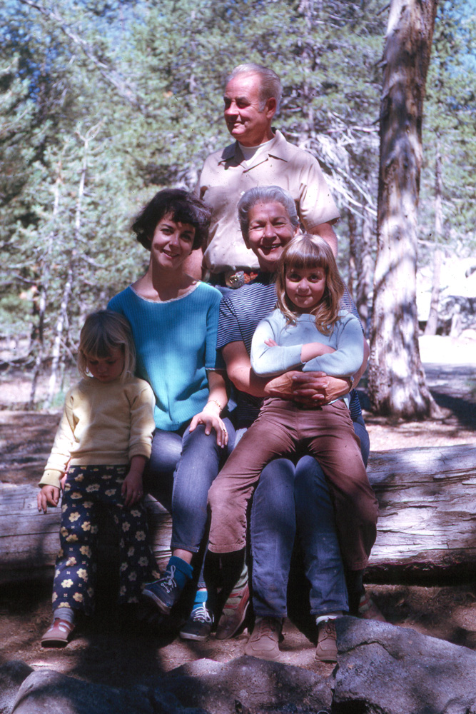
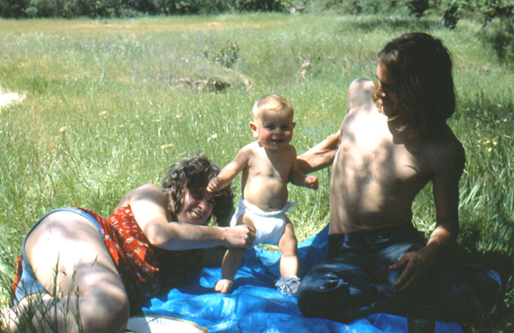
| Yosemite Falls - timeless | Jennifer, Jackie, Jack, Helen (Jackie's parents), Teri, 1970 |
Jennifer on the rocks at Yosemite Creek, 1970 |
 |
 |
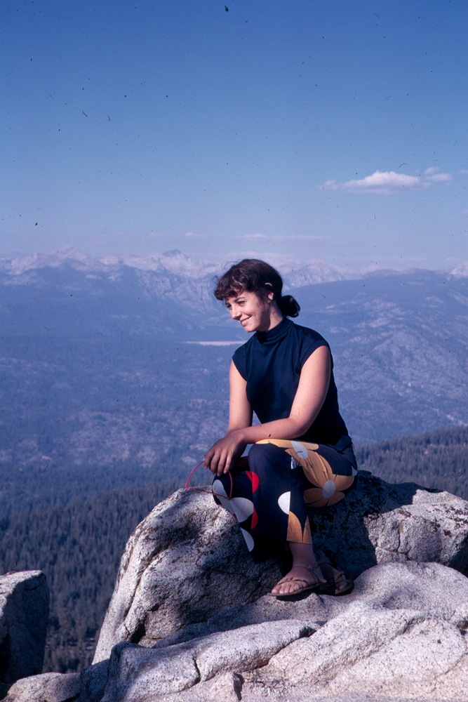 |
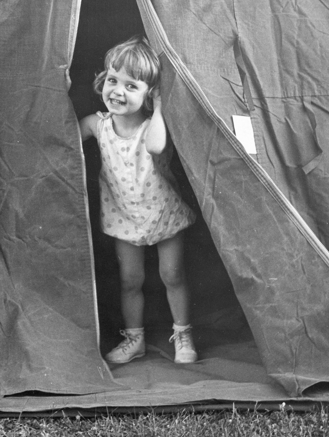
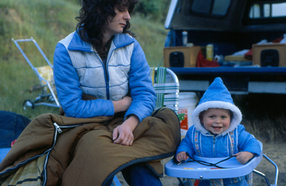
| Teri & Jackie at Tiger Flat, May 1966 | Teri in the tent, about 1966 | Jackie at White Bark Vista, 1969 |
|
 |
 |
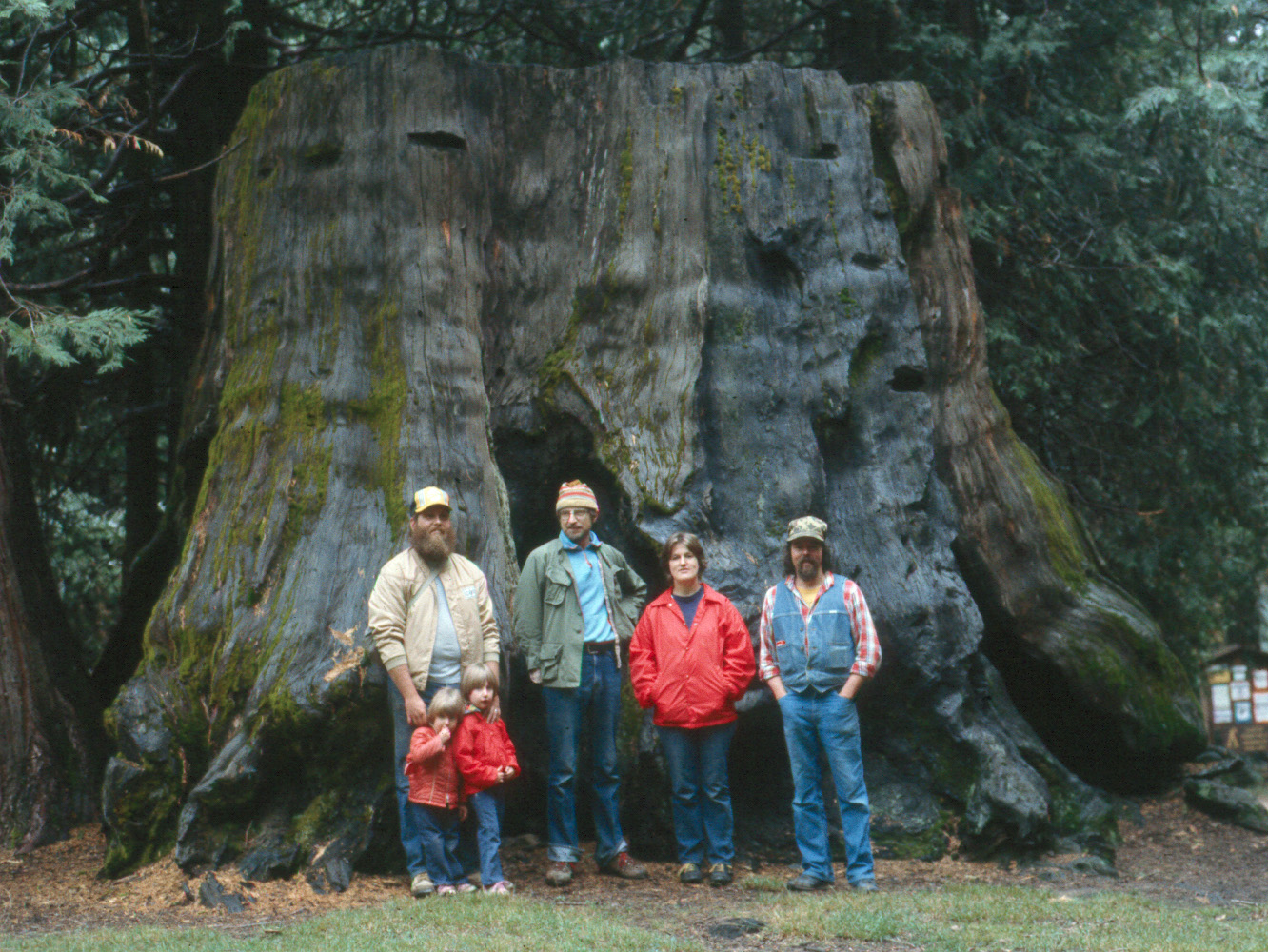
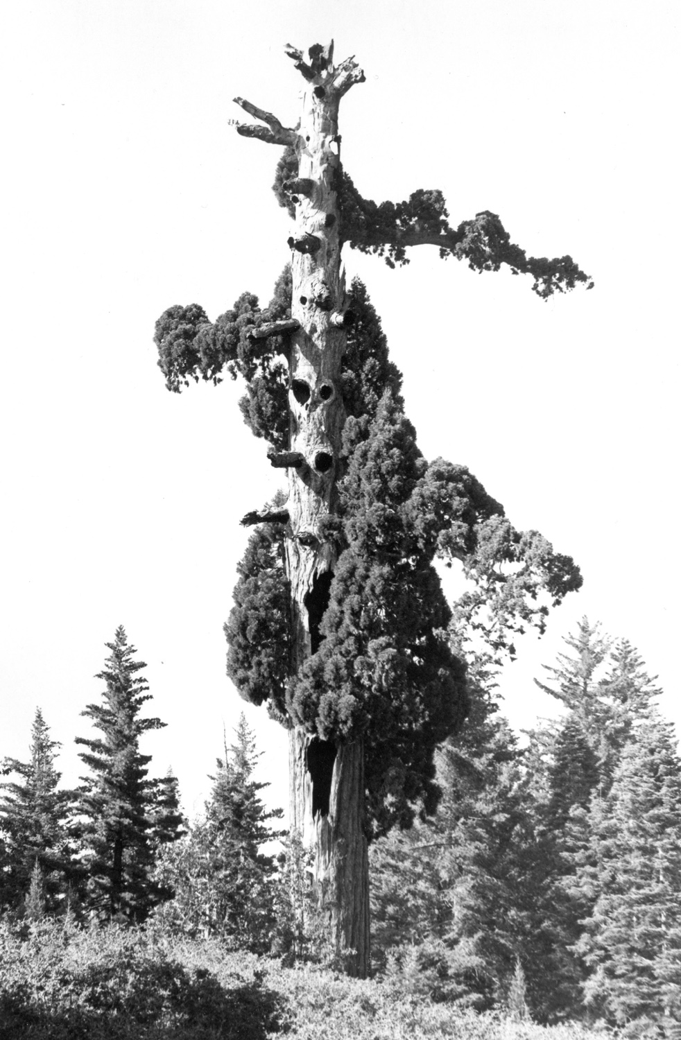
| Dick's photo expedition to Nelder Grove, 1969 | Jim
McGee, Dick Estel, Sandy, Angie & Rachel McGee and Gary Reed at stump in Nelder Grove, 1983 |
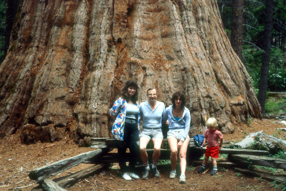
Jennifer, Dick, Teri, Johnny at Bull Buck Tree in Nelder Grove, 1987 |
 |
 |
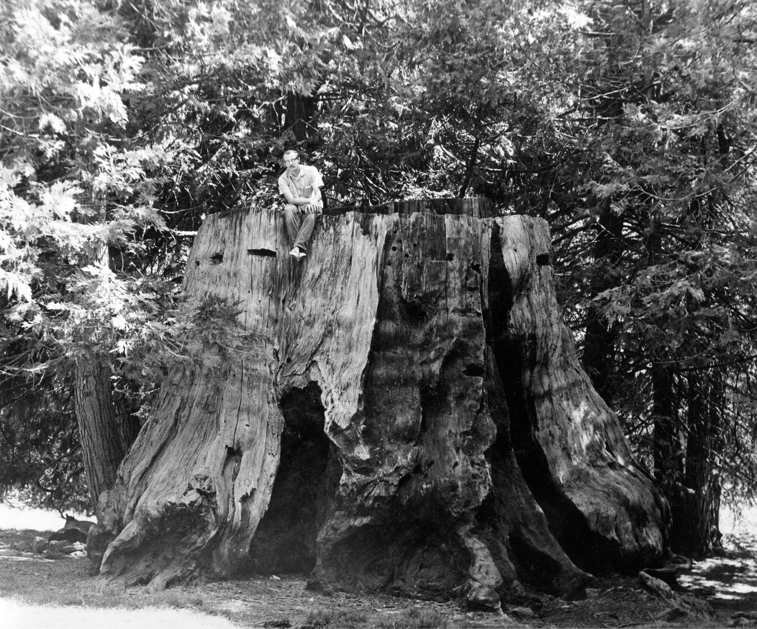 |
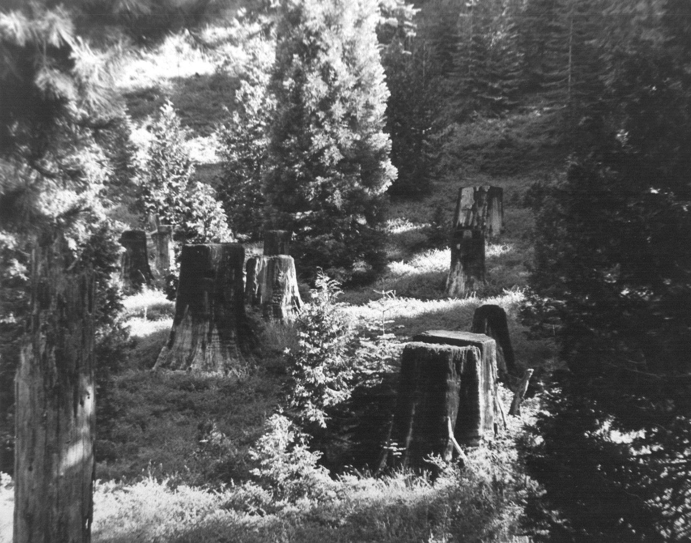
| Stump field at upper part of Nelder Grove | Old Granddad Tree, Nelder Grove | Dick on stump in Nelder campground, 1969 |
 |
 |
 |
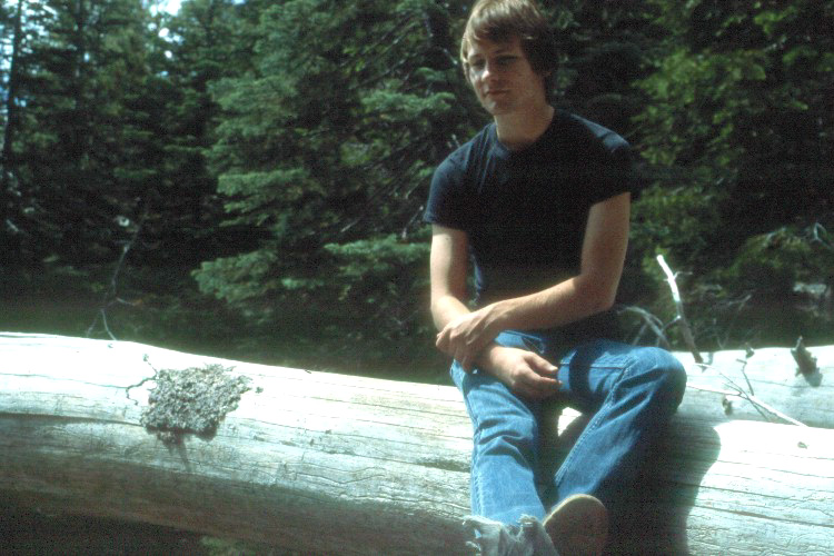
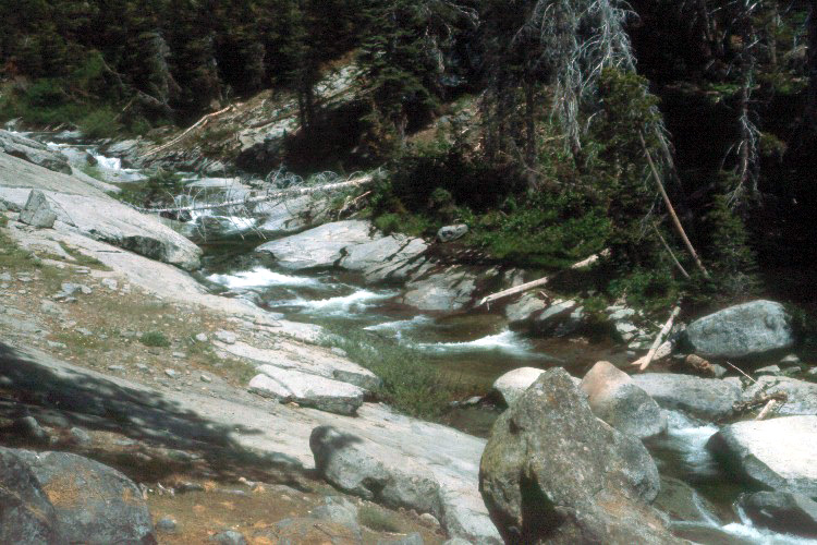
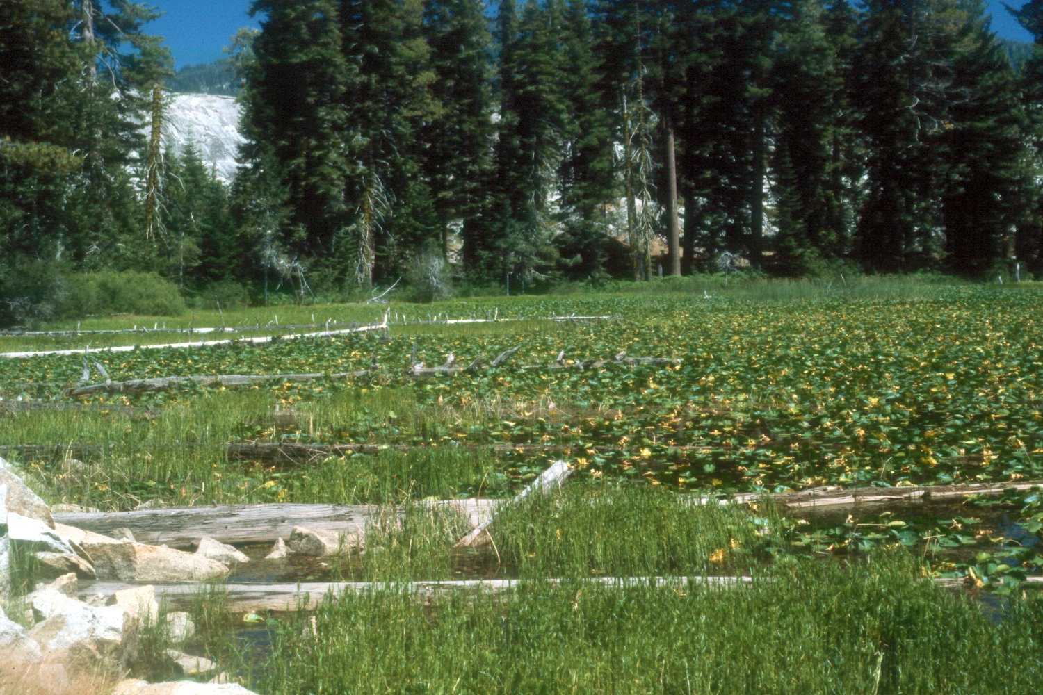
| Rod Neely at Bear Creek, 1983 | Bear Creek's rocky channel | Bear Creek |
 |
 |
 |
| McGee girls sleeping in the hatchback | Ruby Creek, near Bear Creek | Along the road to Goofy Smith Flat |
 |
 |
|
| Grass at Mill Flat Creek Campground | Gary Reed and Jim
McGee at Mill Flat Creek Campground |
Dick, Jim and Gary |
 |
 |
 |
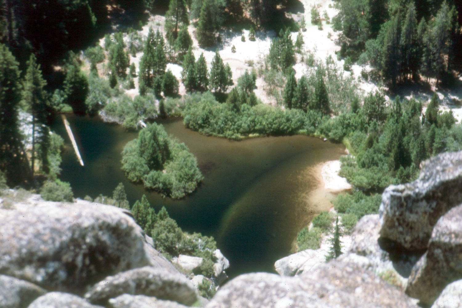
| Dick at the edge, Wishon Domes | The north fork of the Kings is down in that gorge |
Jennifer at a place we called Greenlawn Meadow |
 |
|
 |
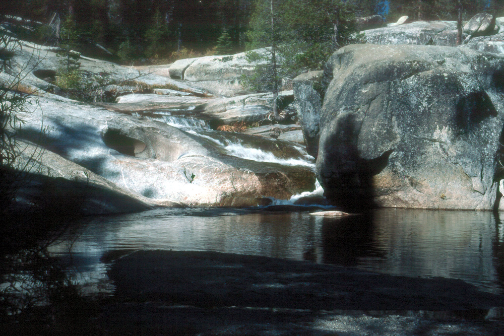
| Granite Gorge & Hell Hole | Pool in Granite Gorge | Lilly pond near Wishon Domes campsite |
|
 |
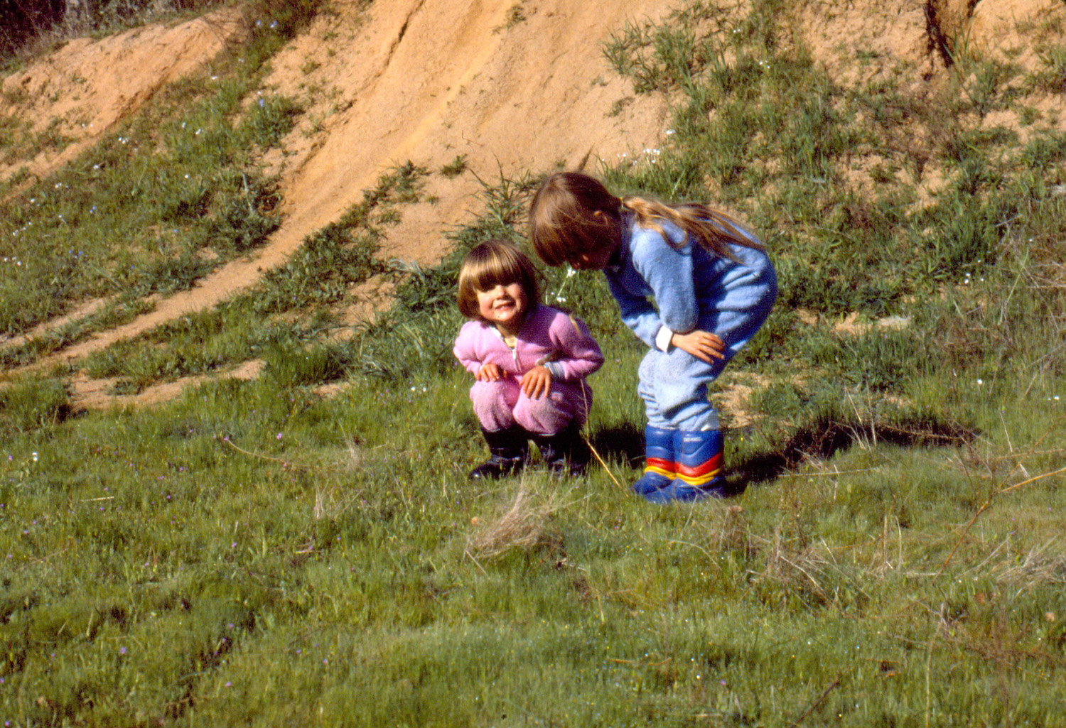 |
| Mikie out in the domes, 2002 | Long Meadow Creek | McGee girls at Concrete Flats |
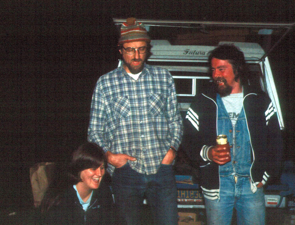 |
 |
 |
| Sandy McGee, Dick Estel, Gary Reed | Teri, Little Johnny & Big Johnny at concrete flats |
A cold morning at Concrete Flats |
 |
 |
 |
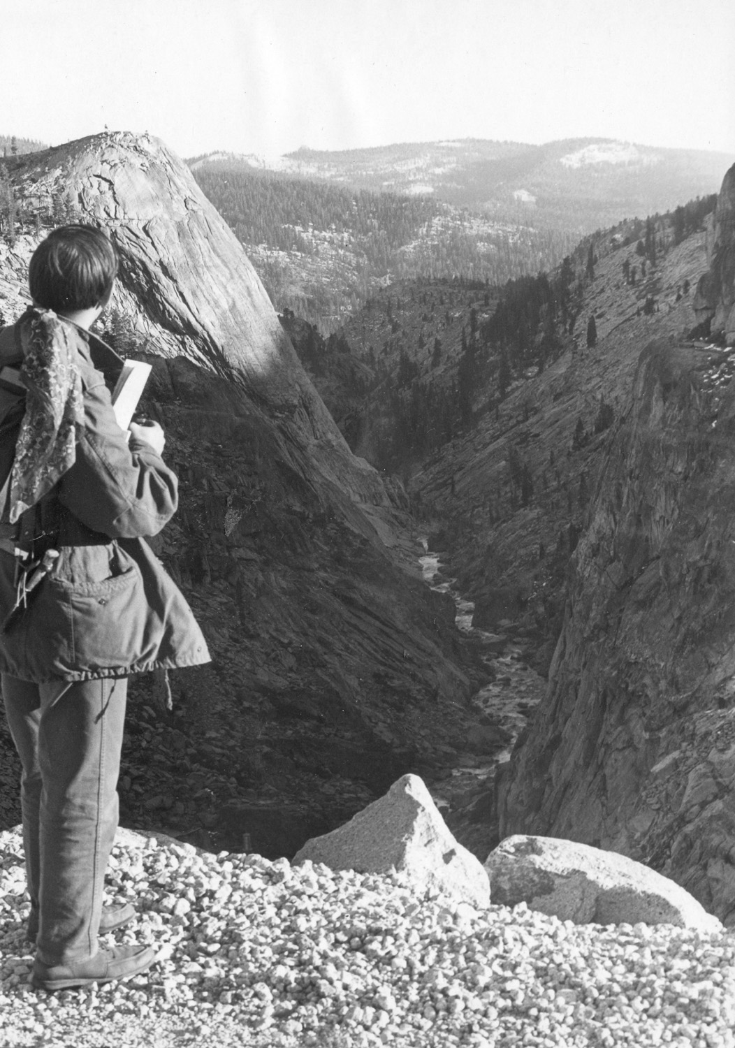
| Bob & Hazel Estel at Nelder July 2001 | Lew Koch looking down Helm Creek, below Courtright Reservoir |
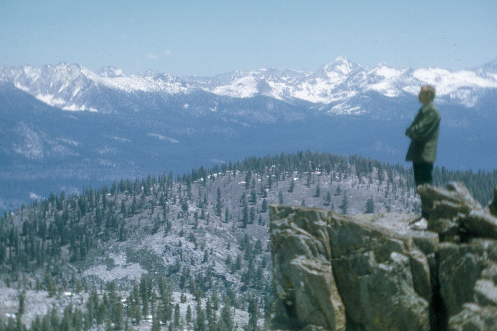
Dick at White Bark Vista |
 |
 |
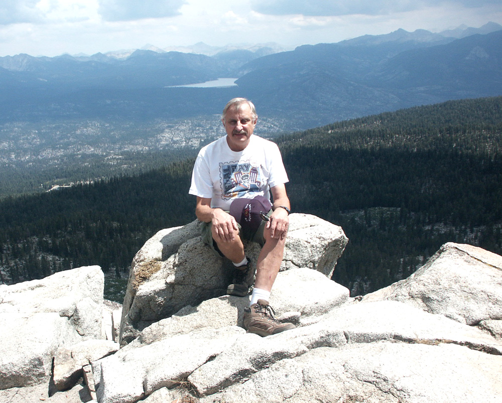 |
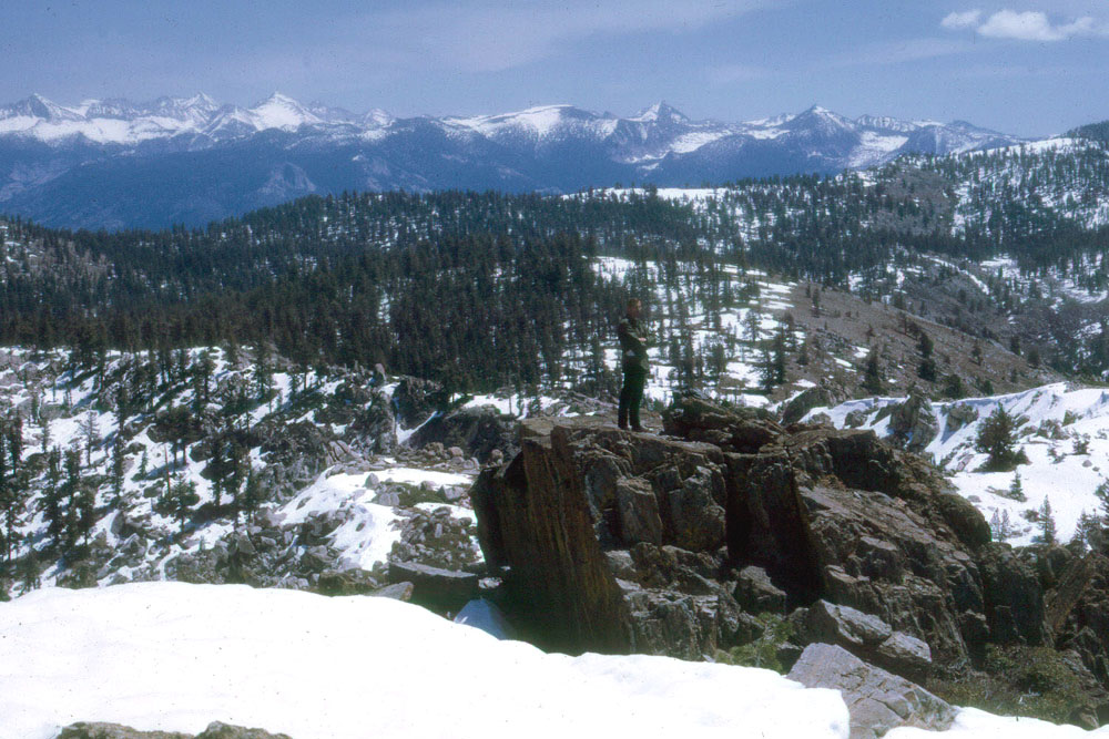
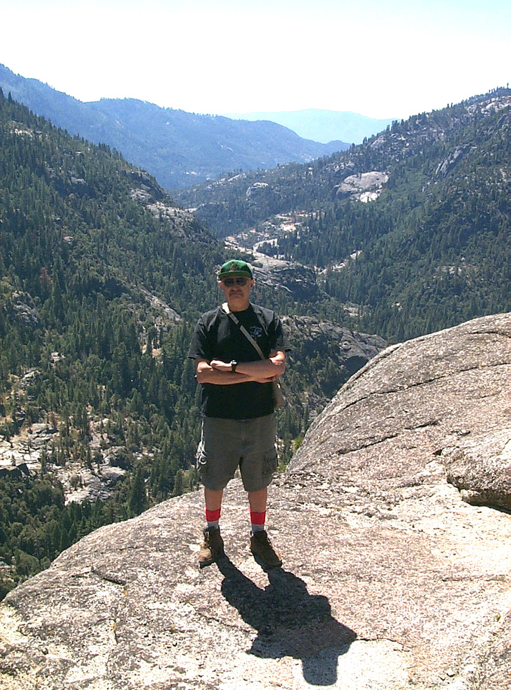
| Dick near Kaiser Pass | Dick at Courtright | At White Bark |
|
Lake
|
|
Mt. Pinos Webcam |
| |
Los
|
Tiger Flat Campground |
| Sequoia
|
|
Sequoia and Kings Canyon National Parks |
| McKinley Grove | Courtright Reservoir | Wishon Reservoir |
| Mariposa Grove | Huntington Lake | Shaver Lake |
| Big Creek Project | Fish Camp | Nelder Grove |
| Florence Lake | Edison Lake | More Nelder Grove |
| Kaiser Pass Road | Ross Crossing | Sierra Meadows |
| Mountain Home State Forest | Chilkoot Campground | Pinnacles National Park |
