
`
|
Dick's Adventures of 2024 - Part 1 |
|
| Photos Related Links More Travel Reports | |
| Adventures
of 2016 Adventures
of 2017 Adventures
of 2018 Adventures
of 2019 Adventures
of 2020
Adventures of 2021 Adventures of 2022 Adventures of 2023 2024 Part 2 Finegold North Sycamore Fire Road Secret Trail at Finegold Pine Flat & Big Creek Road |
|
| Finegold
North (Photos by Teri and Dick) This
is one of my made-up names, and a short hike on an unofficial trail.
From Auberry Road a short distance into the foothills you can turn
left on Millerton Road; or you can access it from Friant Road near
Friant Dam. Near the Table Mountain Casino, turn on to Sky Harbor
Road, which goes up a hill, then winds around above Millerton
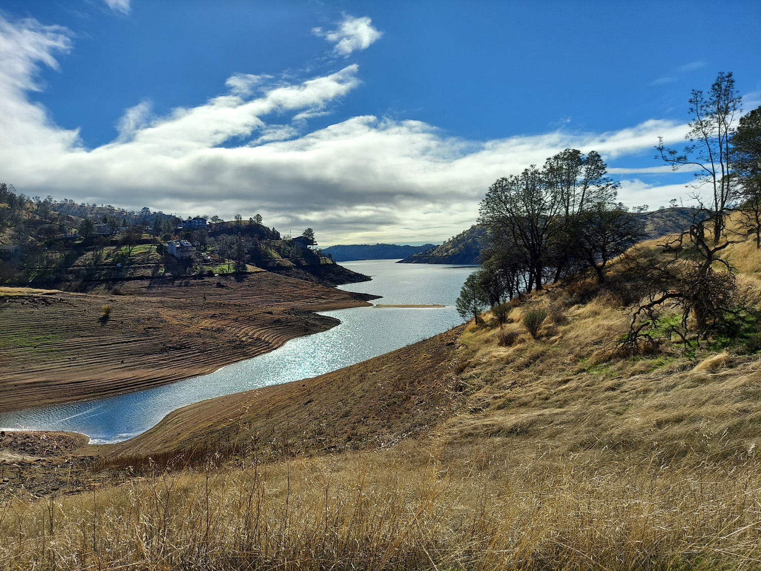
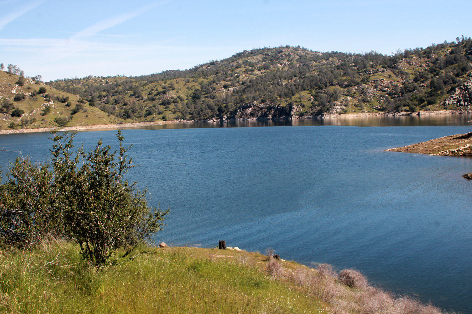
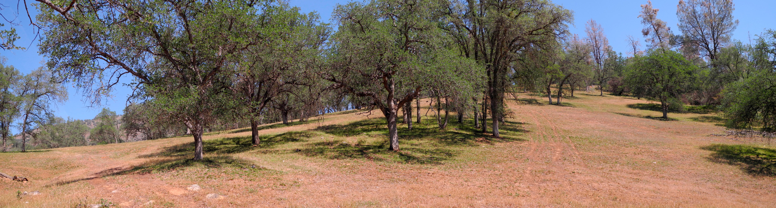
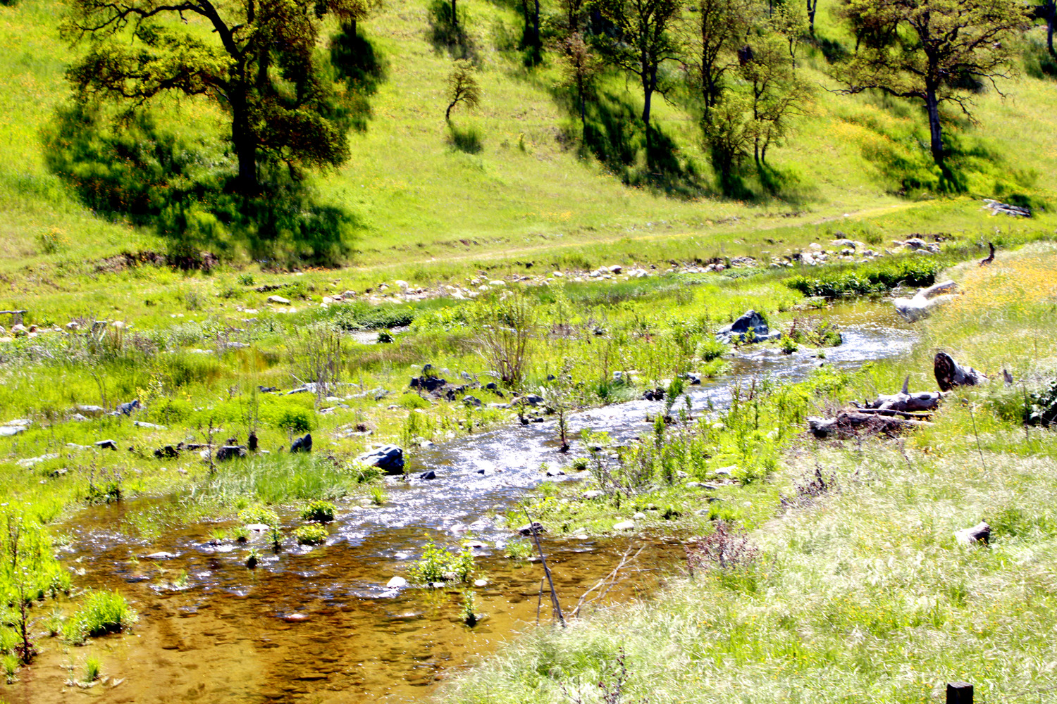
Lake That route has become too steep for me, so I have been going down from the turnaround north to a fishermen's trail/cow trail/old road that goes around a little divide between the lake and a small inlet. I've been there solo, with the Ramblers, and with daughter Teri. On this hike we didn't take many photos, so I have recycled some from earlier hikes, with the year of origin identified. On January 13 Teri, her mom Jackie, and I went to Chowchilla for the Chamber of Commerce Banquet, where my younger daughter Jennifer was being honored as Teacher of the Year. We got back to Teri's at 10:30, and as planned, I stayed overnight. The next morning, after a breakfast of oatmeal, we drove out to Sky Harbor (as planned) and hiked the trail north of the road. The trail is mostly level with a few gentle ups and downs, but it starts out with a rather daunting 30-foot descent from the end of the pavement. I get a good grip on my hiking poles, proceed very carefully, and have never had a problem on this section. The recent rains have made the trail damp, which improves footing. When it's dry, it's easy to slip on the loose soil. At the bottom, he trail goes directly north and becomes completely flat for a hundred yards or so as you pass the inlet. Water is not up that far at this time due to the low lake level. Another short, moderately steep climb brings you to an old road that goes west and around the point of land between the inlet and the main lake. |
|
 |
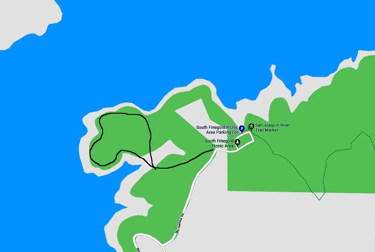 |
| Where the trail goes out toward the western-most point of the divide (from 2018) | Our trail is the black line on the left (from 2020) |
|
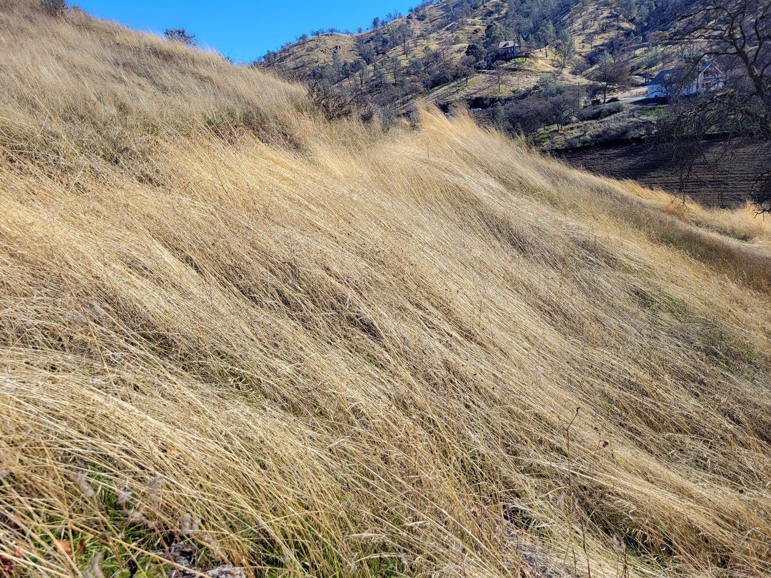
The weather was all we could ask for - blue sky with white clouds, increasing slightly as the day went on. There were lots of cars lining the road, and we got in a few hundred extra steps walking from where we parked. For only the second time, we encountered other people on "our" trail, a couple with a kid and a dog. They went down the steep hillside off the trail to the lake, and out on a little spit of land that jutted out into the water. Under the "always something new" category, we observed large areas of the tall, dry grass that had been flattened down. It was the type of thing you see where cows lie in the grass, but the hillside was too steep for that, no cows were in evidence, and the area was much larger than what a cow or two does. We speculated that there could have been a strong wind that knocked the grass over, but it may always be a mystery. |
|
 |
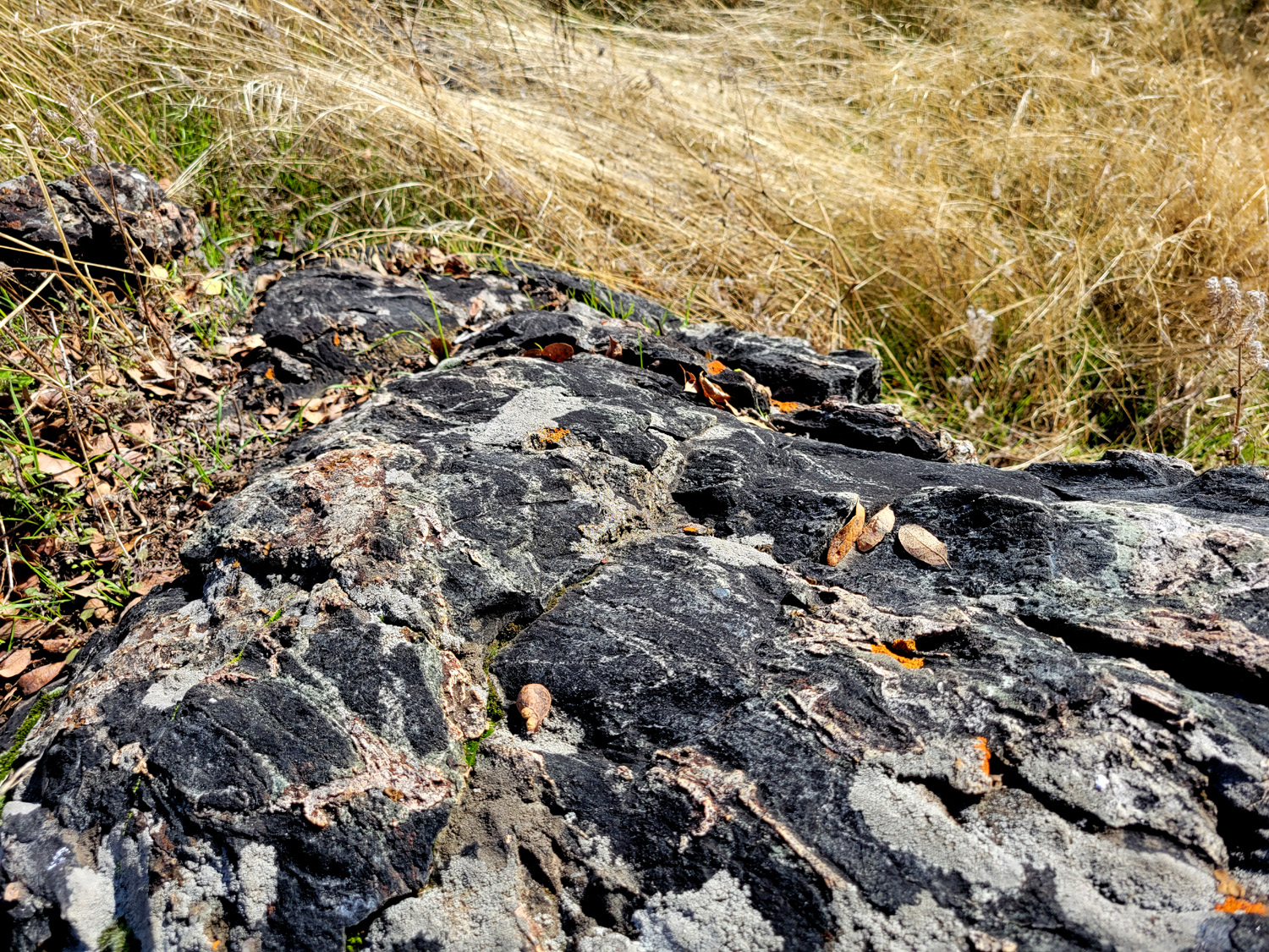 |
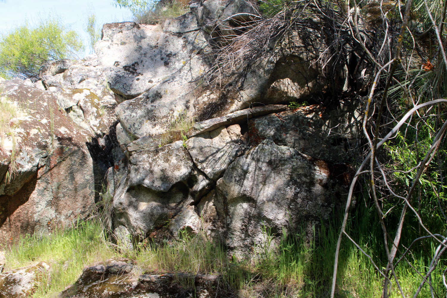
| Flattened grass below the trail | Dramatic black and white rock |
|
There were plenty of rock outcroppings, trees and small bushes along the trail, and of course, constant views of the lake. A dead tree that fell across the trail a few years ago was held up by branches, but has dropped down a bit and now requires a bit of bending to get under. Some bushes with red stems grow along a 50-yard stretch of the trail, but they remain unidentified, and we've never seen them anywhere else. |
|
 |
 |
| The Ramblers in 2020 at a tree that fell and created a tunnel on the trail | There are a lot of these unknown shrubs in one short stretch along the trail (2022) |
|
|
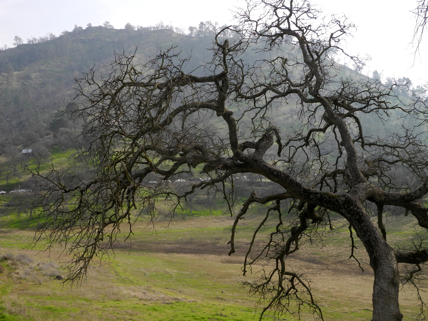
| Low winter sun makes the lake glow | Cars
parked on Sky Harbor Road in 2019 are visible through the branches of this leafless blue oak tree |
|
When we returned to the car, we had walked a mile and a third, and enjoyed California's mild January weather. Colder days and more rain were ahead, but we would be inside in our comfy chairs and wrapped in blankets when that happens. --Dick Estel, January 2024 |
|
|
Sycamore Fire Road
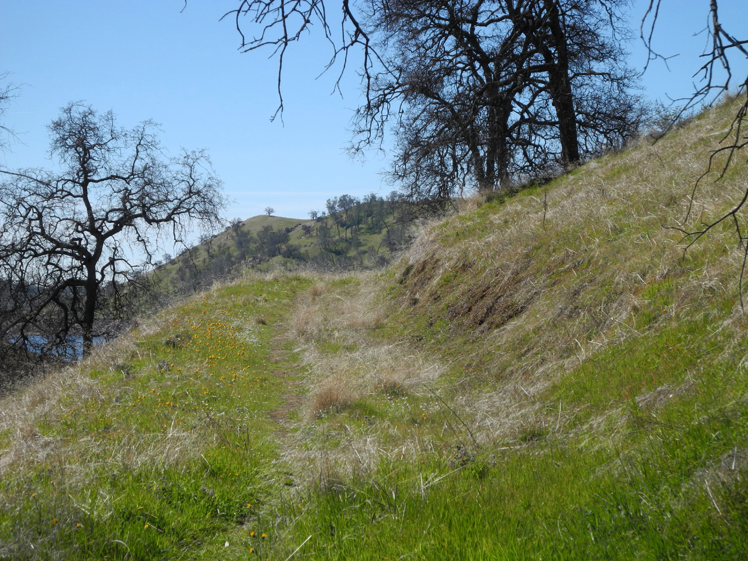
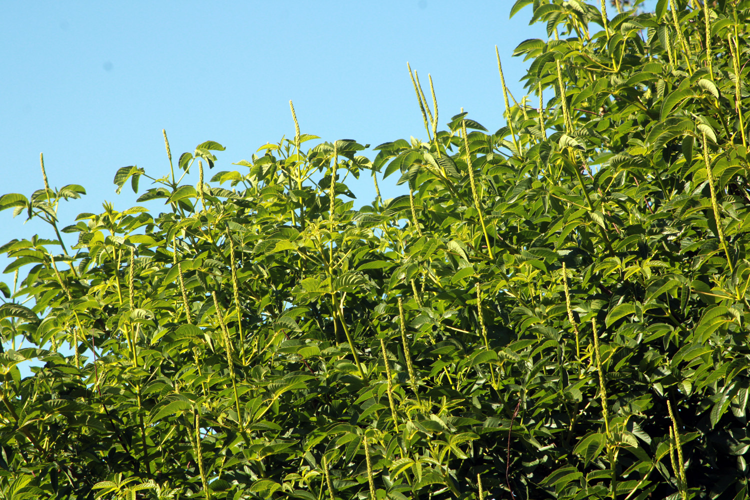
The next Ramblers hike is not until April 18 and during the first week of the month, I was getting restless. The weather was expected to be warm through Wednesday, with a high of 80. The next day it would drop into the mid 50's as one more winter storm tried to delay the arrival of spring. I decided I would hike at Sycamore Fire Road, another of those "old favorites" I've visited and written about many times. The first time was in April 10 years ago, a bit later in the month than this year. I got started from home a little after 9 a.m. on April 3, giving my brand new Honda CR-V Hybrid its first real test (I went over the 100 mile marker just before reaching the trailhead). Calling this hiking place a road is a little generous. It IS in fact an old road, but at its best is now more of a cow path. There is no official maintenance, although some fallen trees that blocked the trail have been removed. There's always evidence of other hikers having been there, but it looks as if 4-wheel drive enthusiasts have given up on the challenges offered by trees across the route, with new ones coming down every year. |
|
|
|
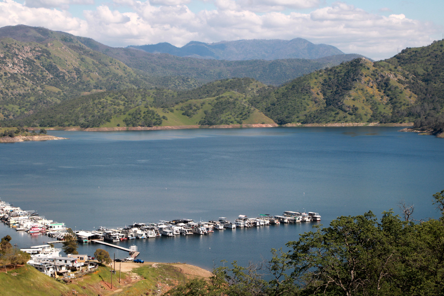
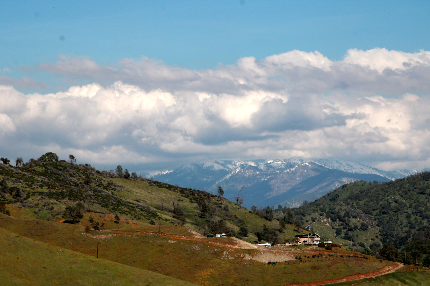
| Pine Flat Lake and Island Park Marina | Sierra snow and the hills above the lake |
|
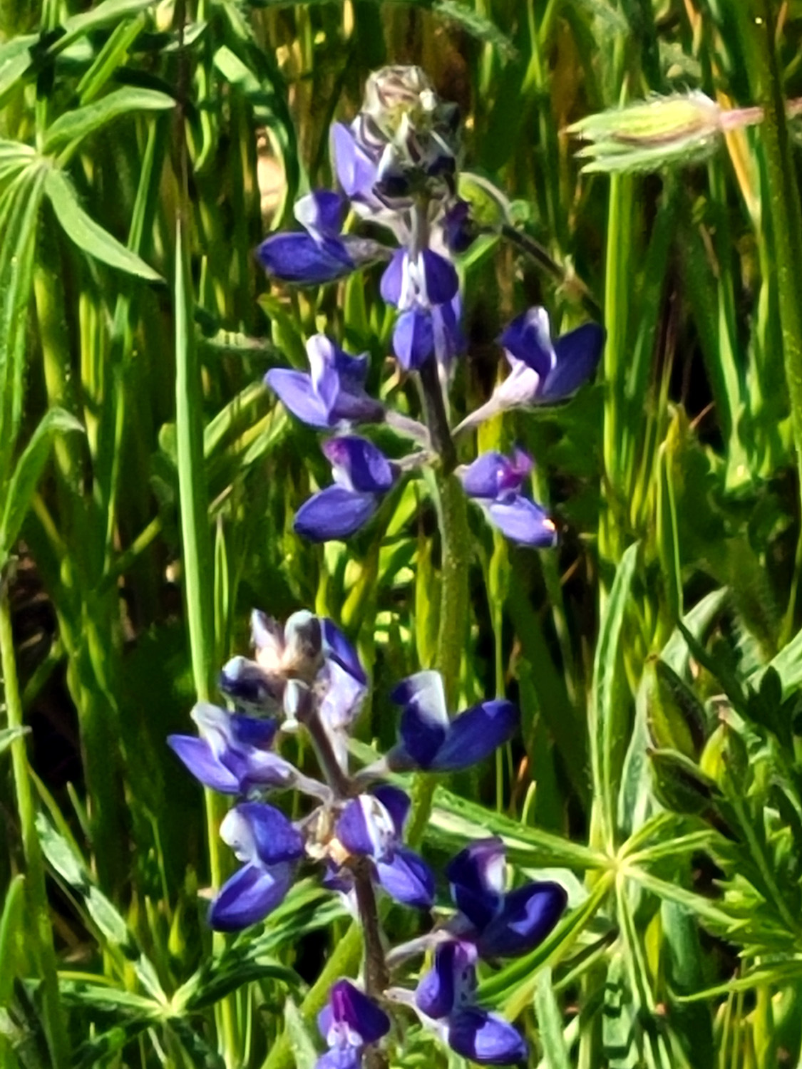
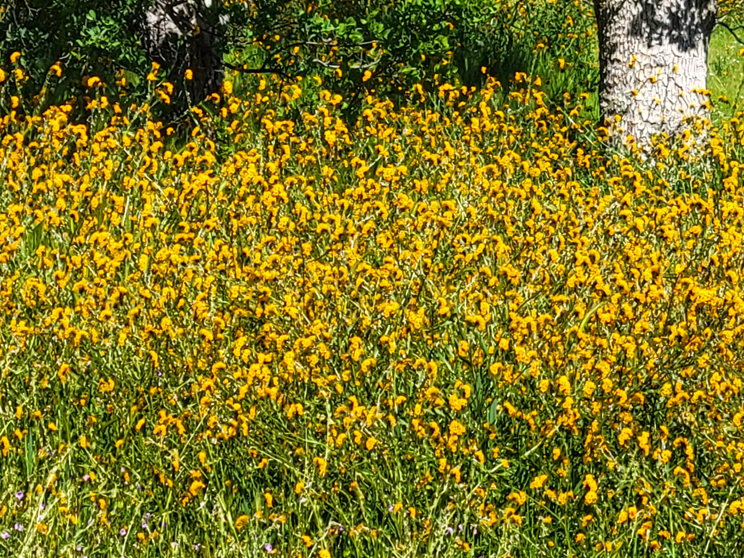
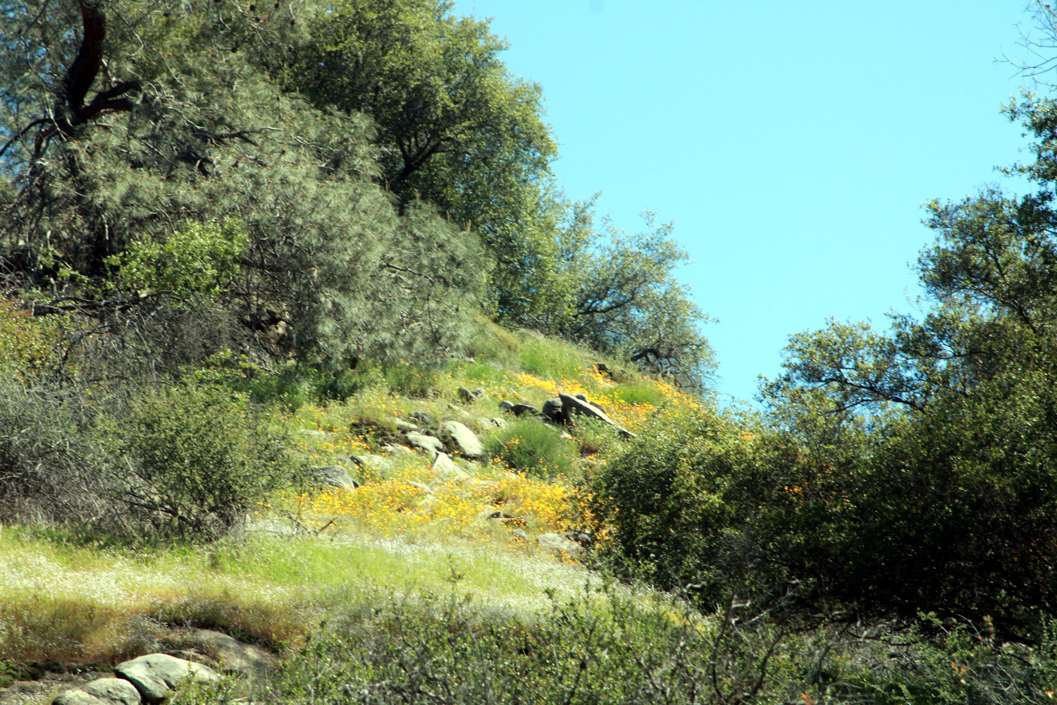
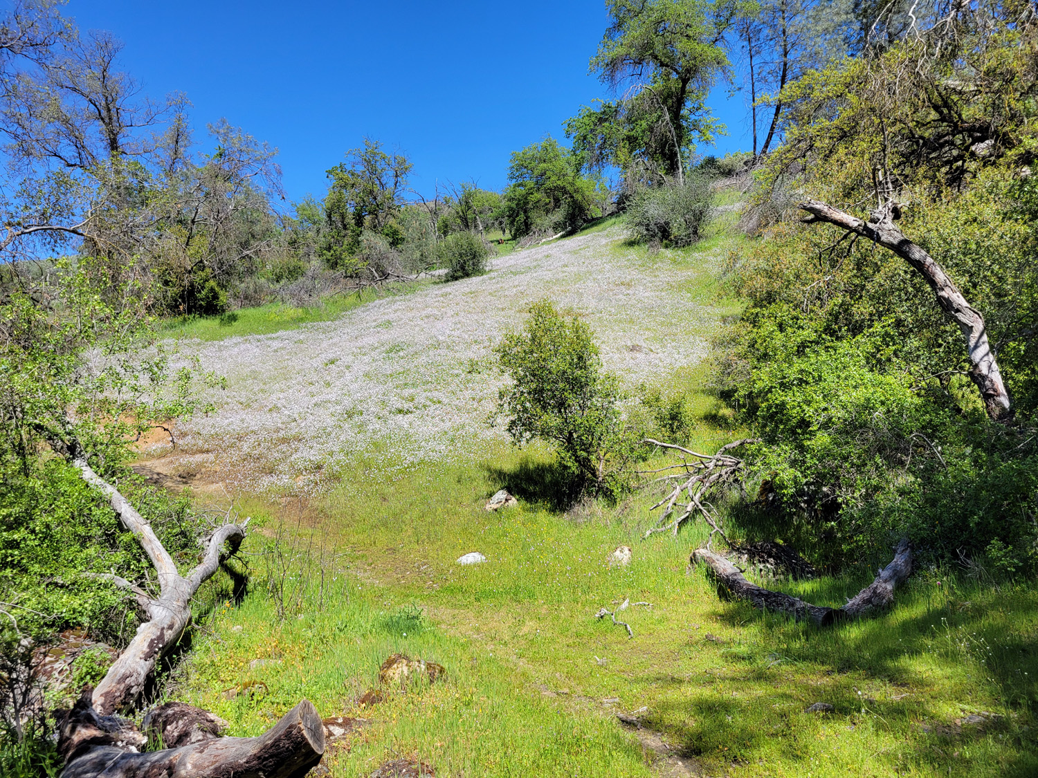
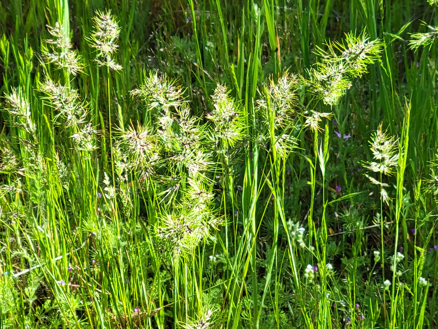
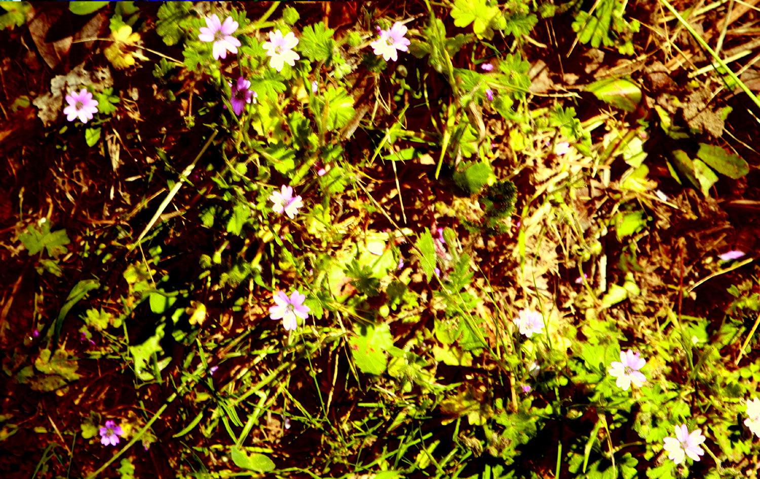
However, there is no shortage of wildflowers. Along Trimmer Springs Road there were many poppies, especially after I got past the Edison Point trailhead. Fiddlenecks and bush lupines at the lowest elevation were fading, but were very good farther up. Just past Piedra, where the road parallels Hughes Creek, there were the expected popcorn flowers, but in small numbers, and where the road goes up over a ridge and down to the lake, there were a few Chinese houses in a location where they are always found. At the top of the ridge massive numbers of fiddlenecks were in their proper place. |
|
|
|
| Chinese houses along the main road | Filaree (AKA storkbill) gone to seed |
|
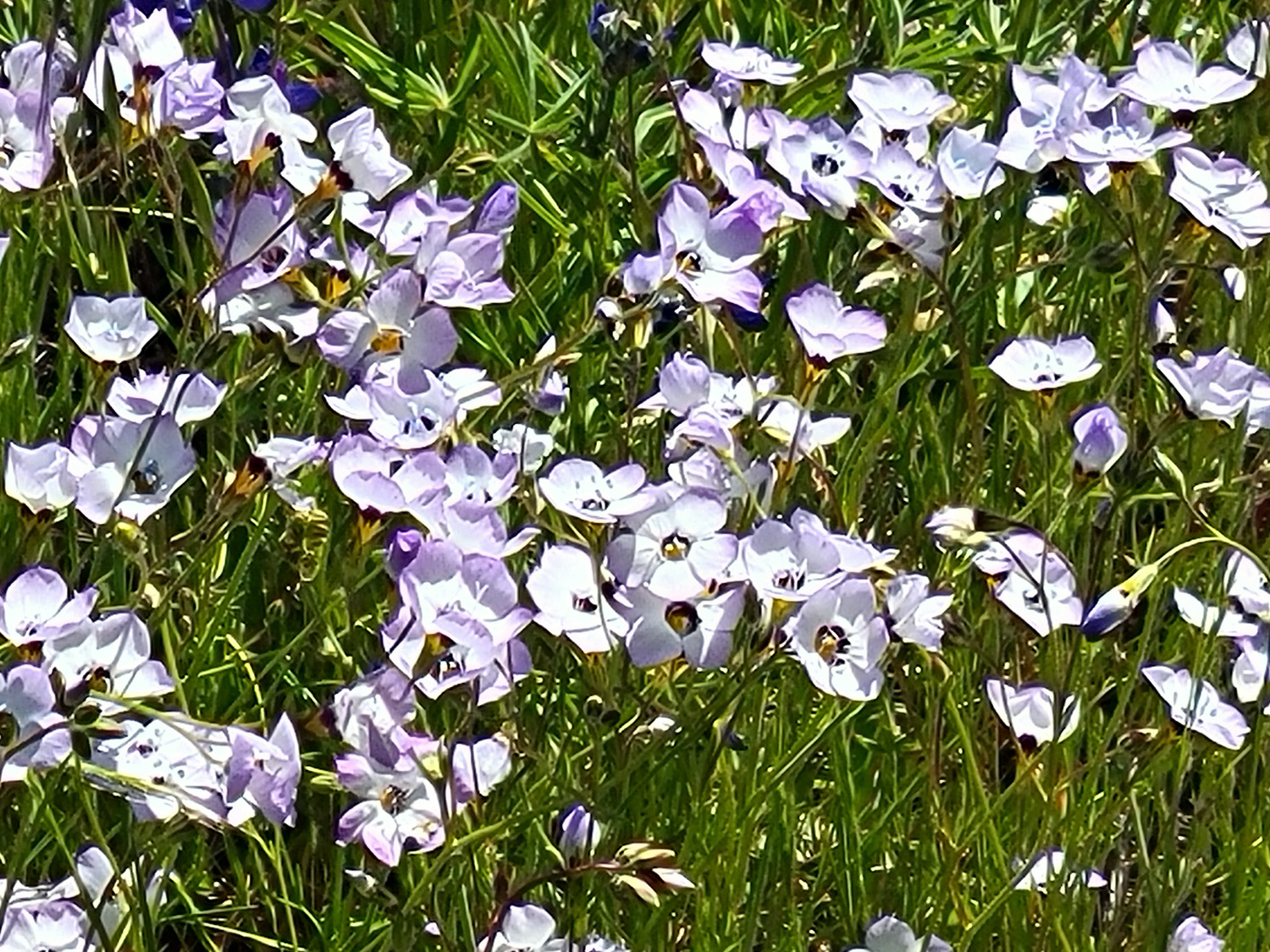
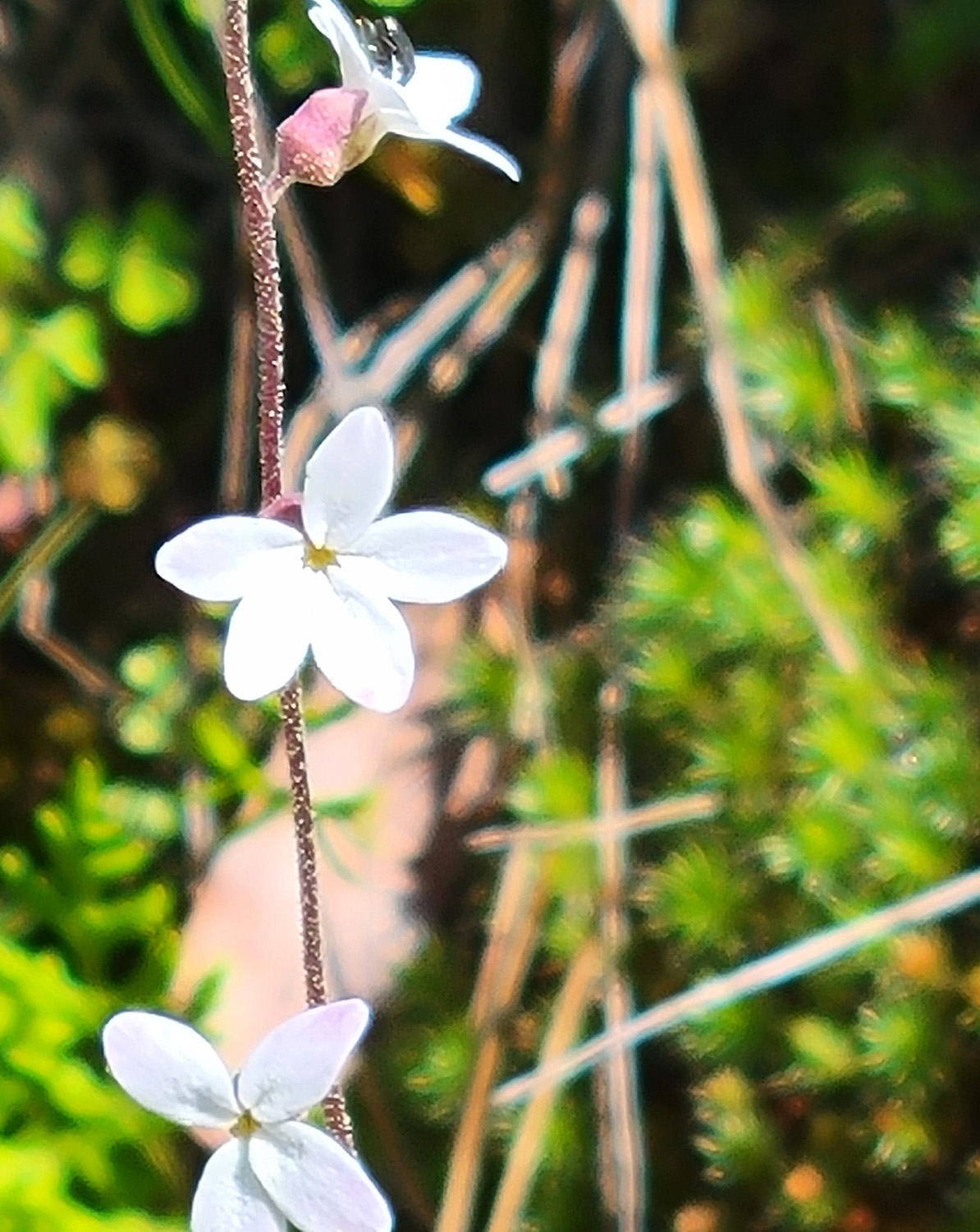
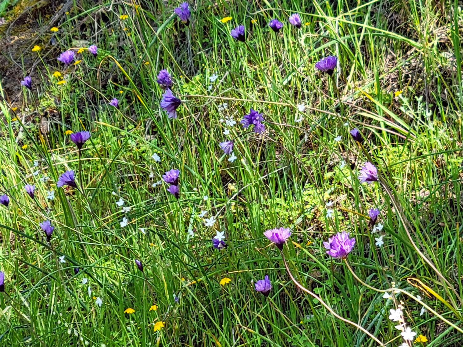
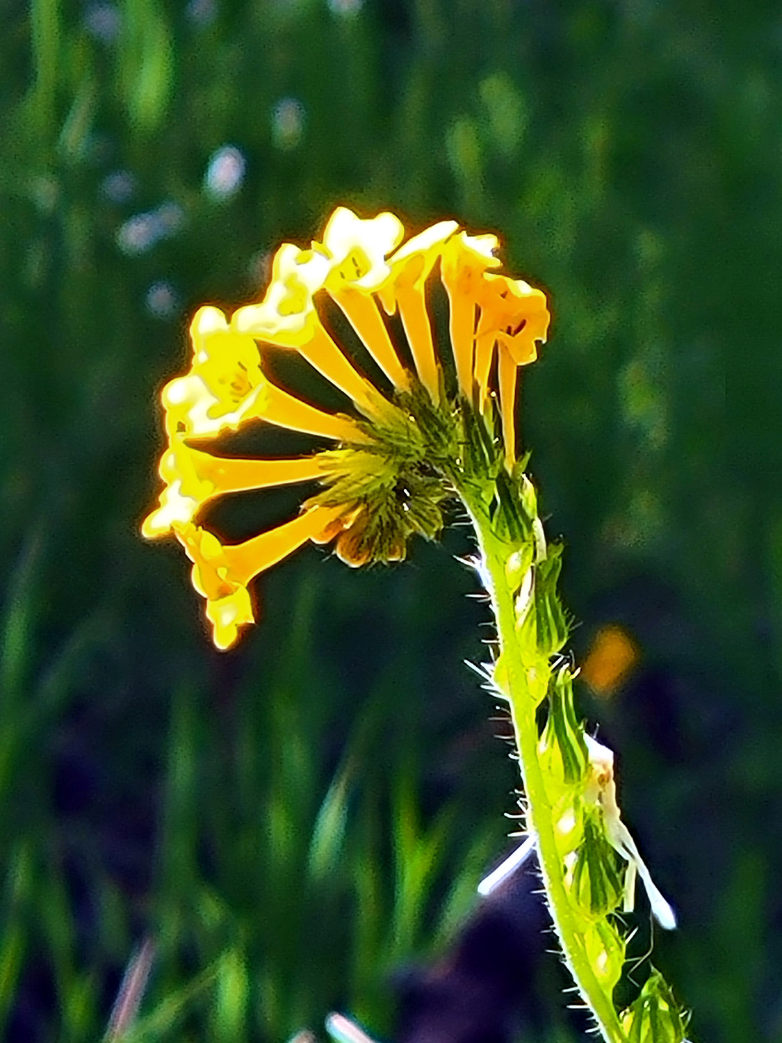
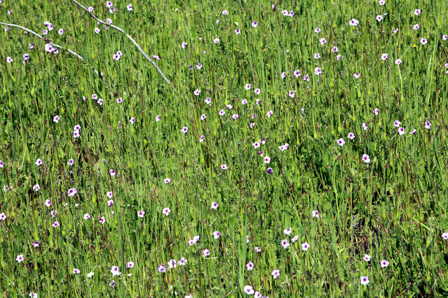
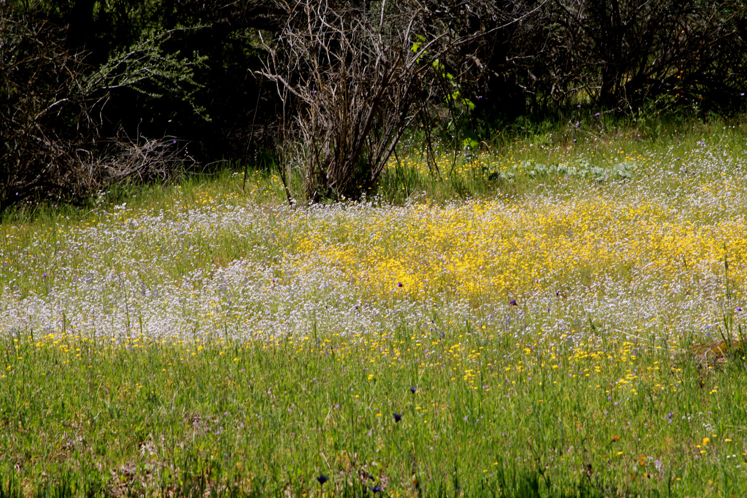
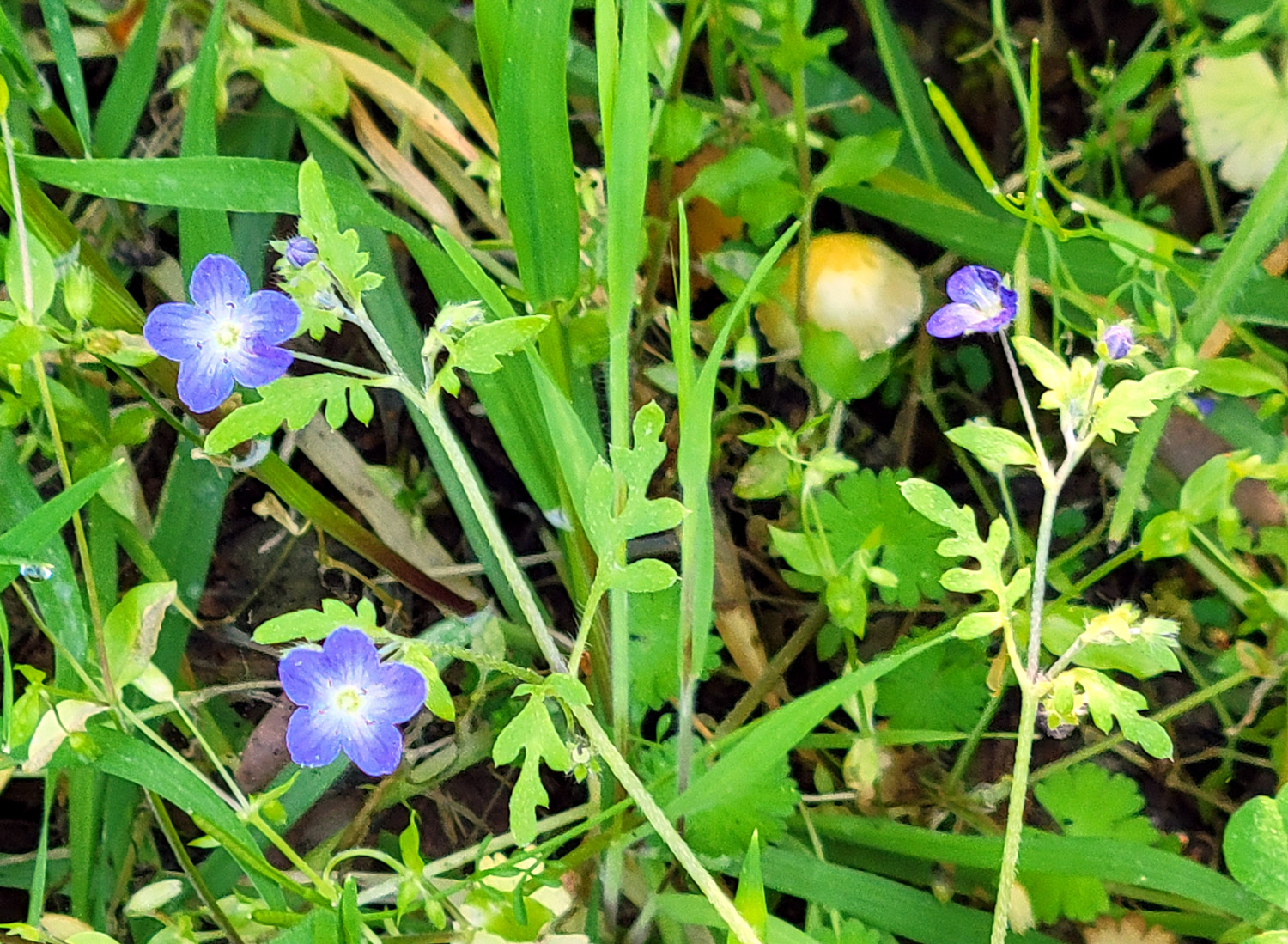
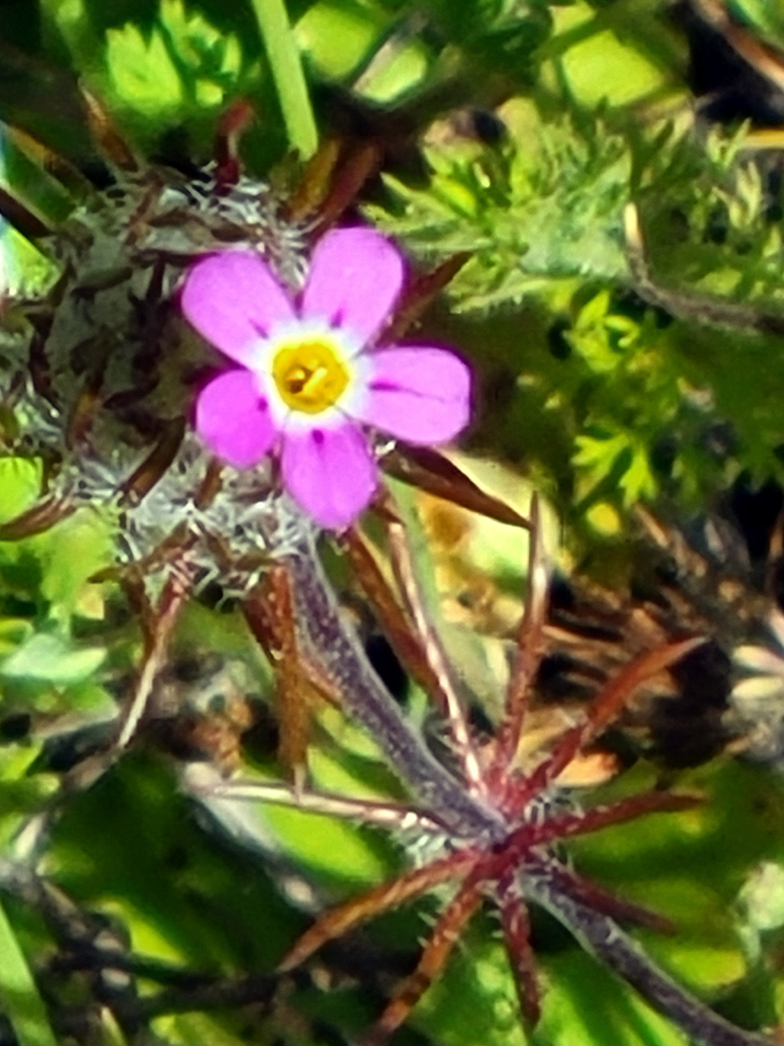
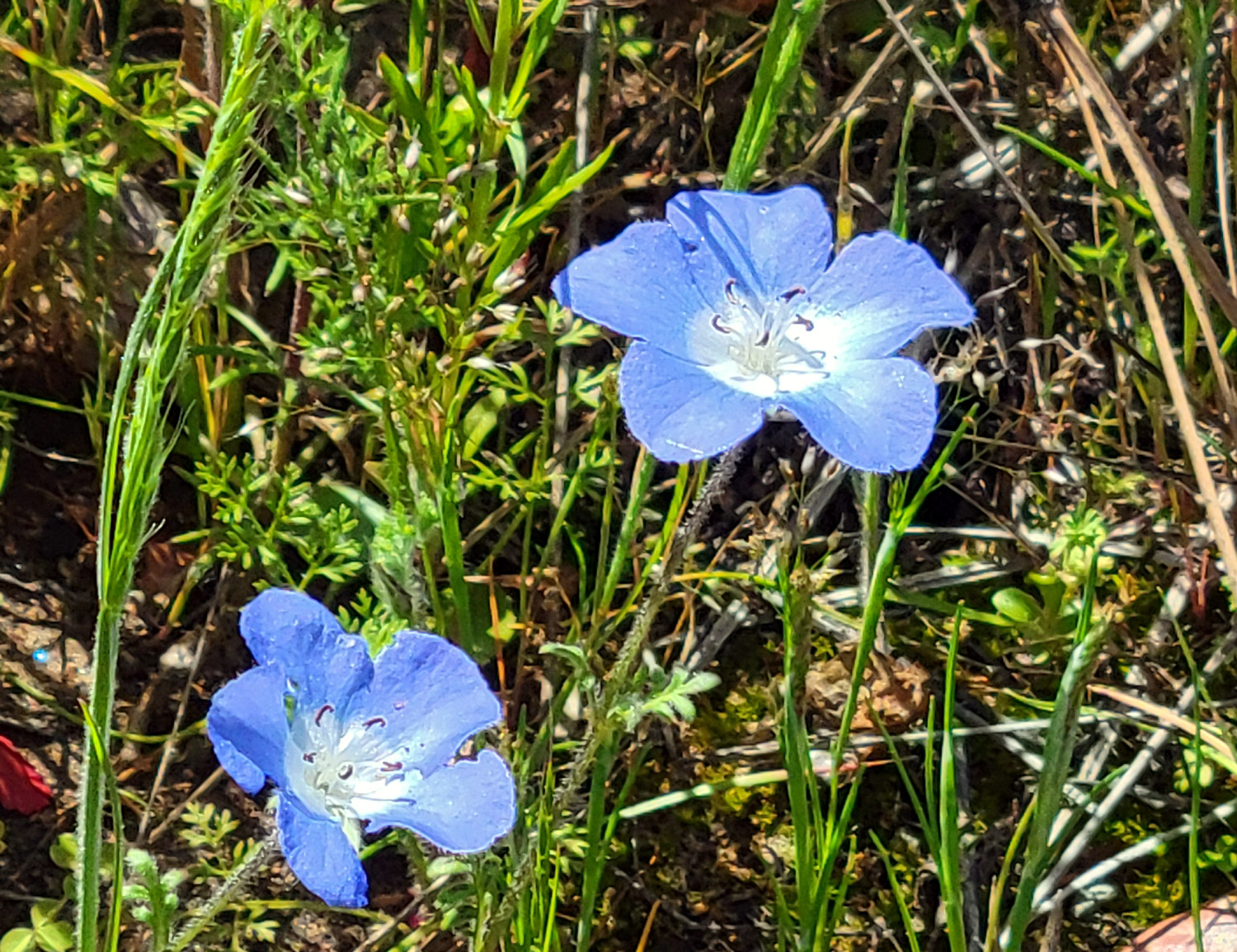
However, the number of species really increased along the trail itself, although most were relatively few in number. This did not apply to the bird's eye gillia, which appeared in massive clusters, just as they had last year. I could go on and on about the flowers, but I'll just stick to a few thousand-word photos, except to note that at the one place where we always see baby blue eyes, they were out in record numbers. |
|
|
|
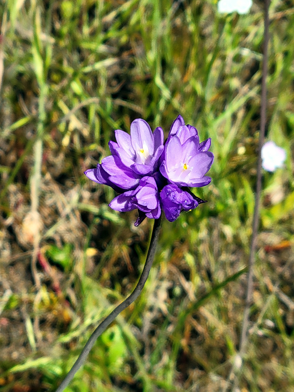
| The most common flowers were bird's eye gillia | Harvest brodiaea, AKA pretty face |
|
|
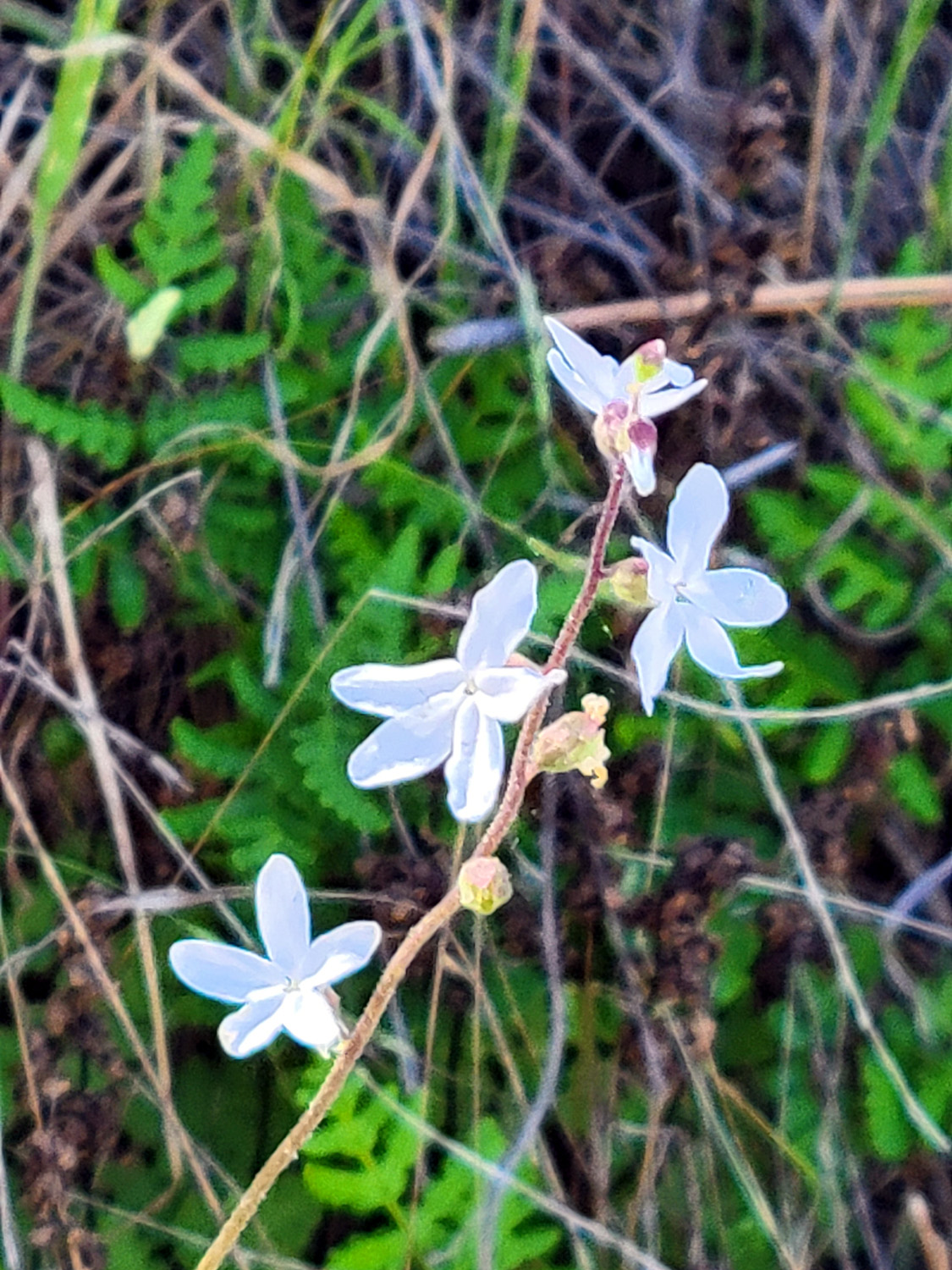
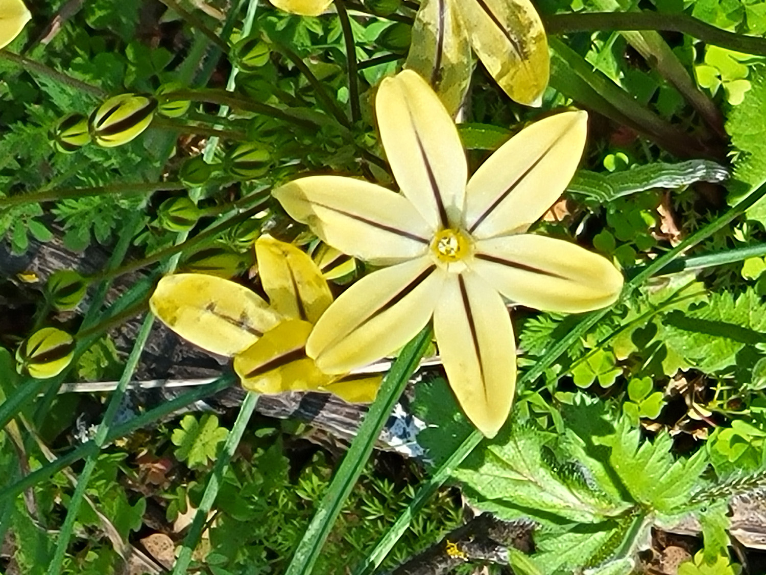
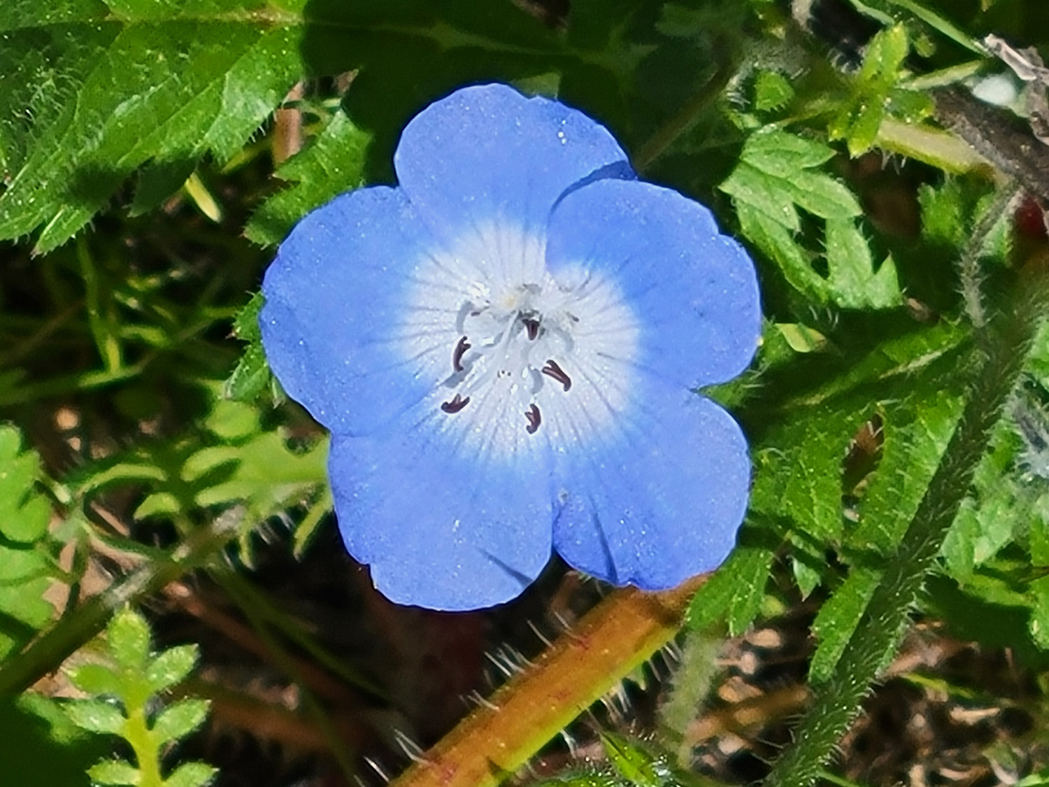
| Dove lupine | Delicate blossoms of Sierra star |
 |
 |
| Blue dicks, with a few daisies and Sierra star | Baby blue eyes |
 |
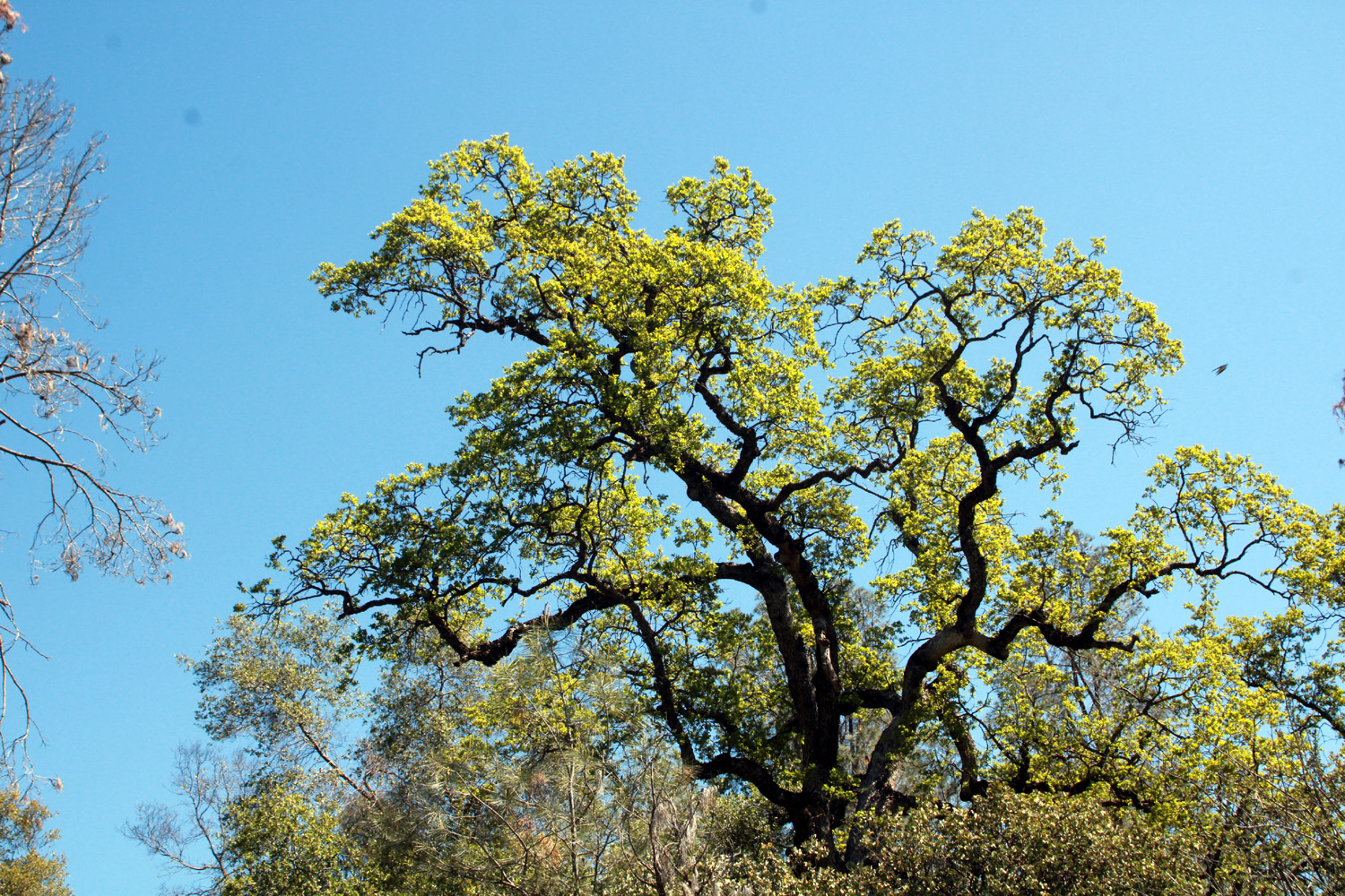 |
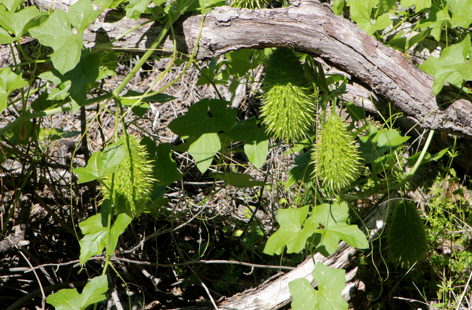
| Wild cucumber seed pods - definitely NOT edible | Blue oak in its spring greenery |
|
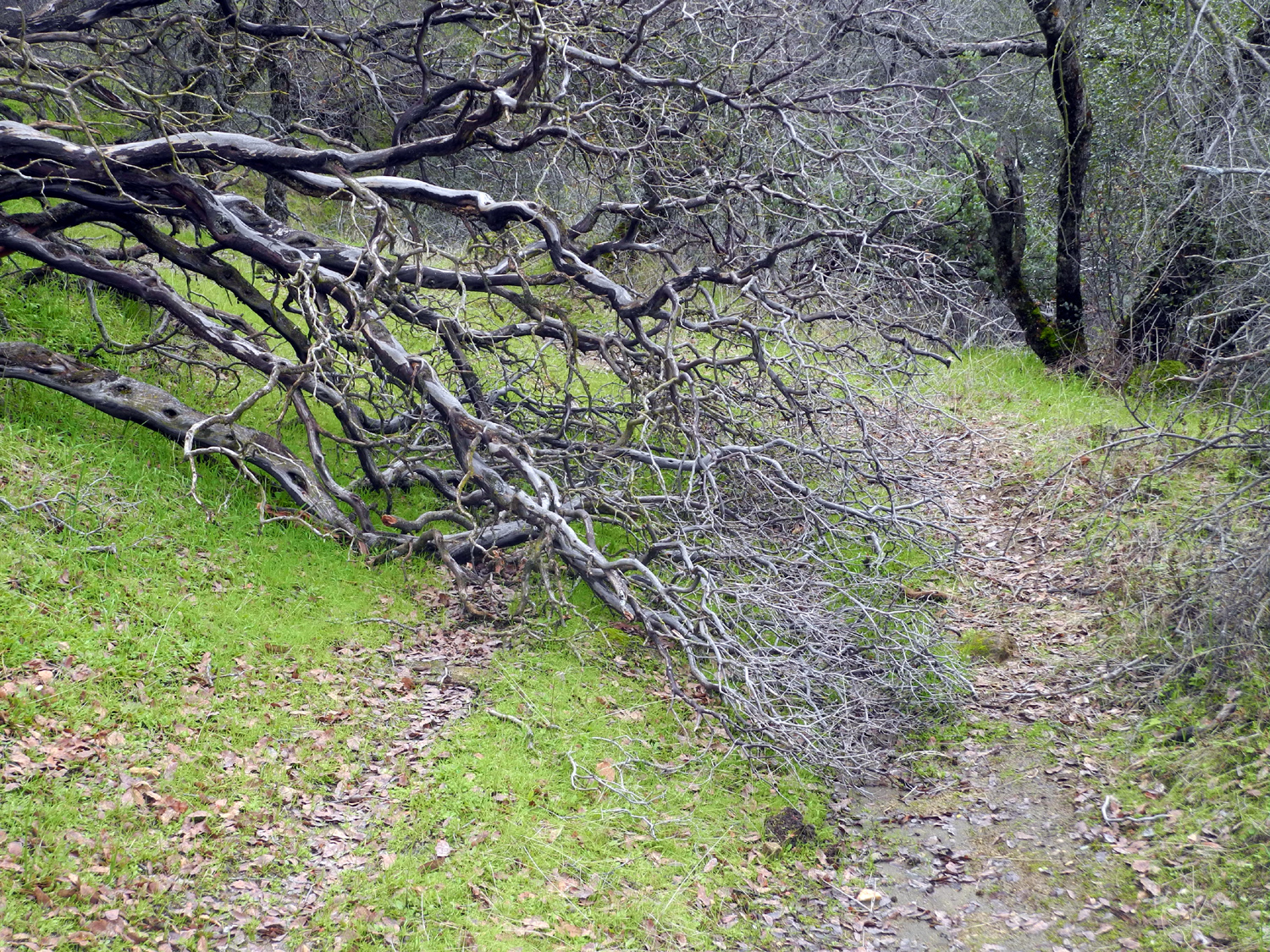
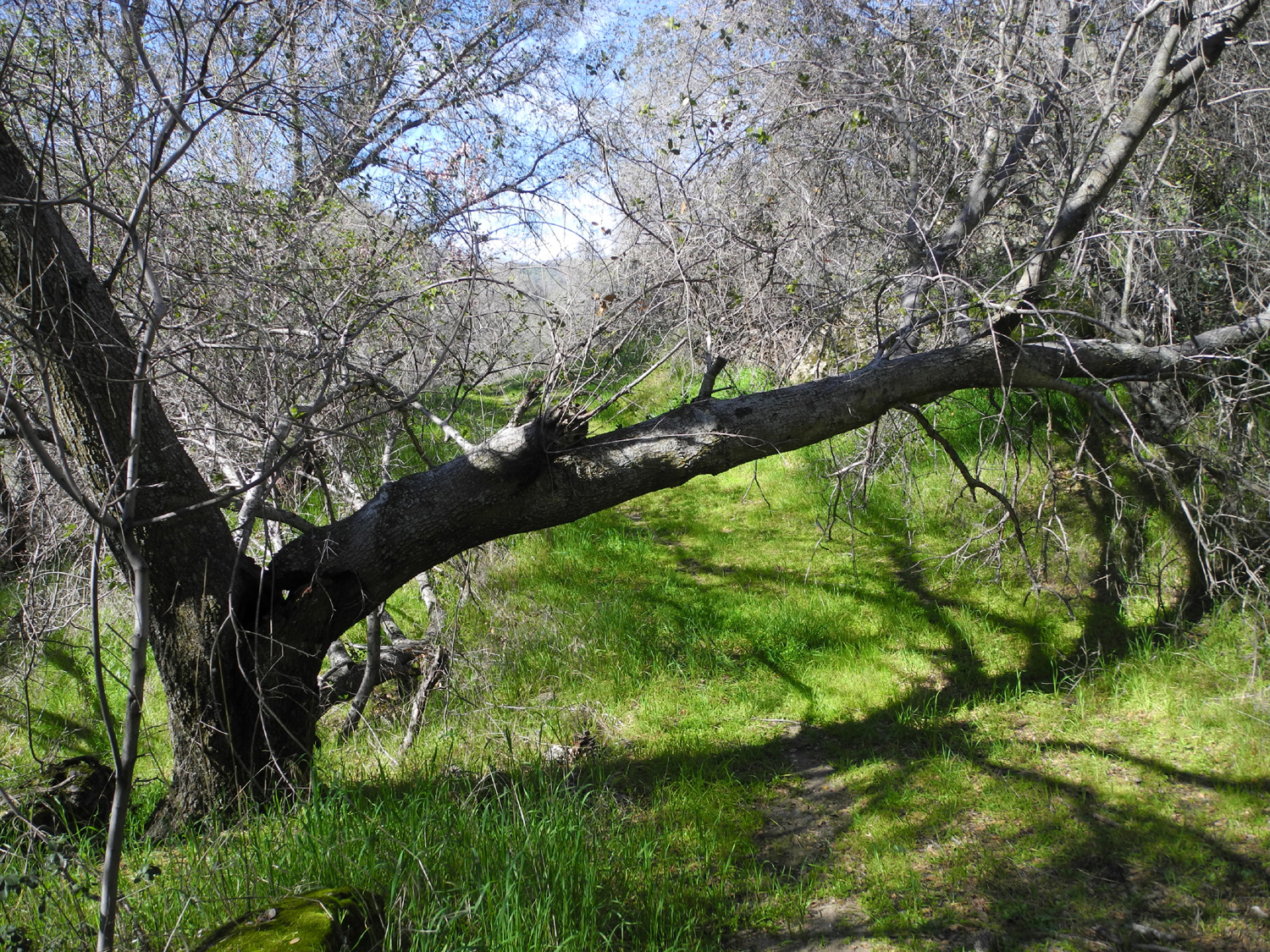
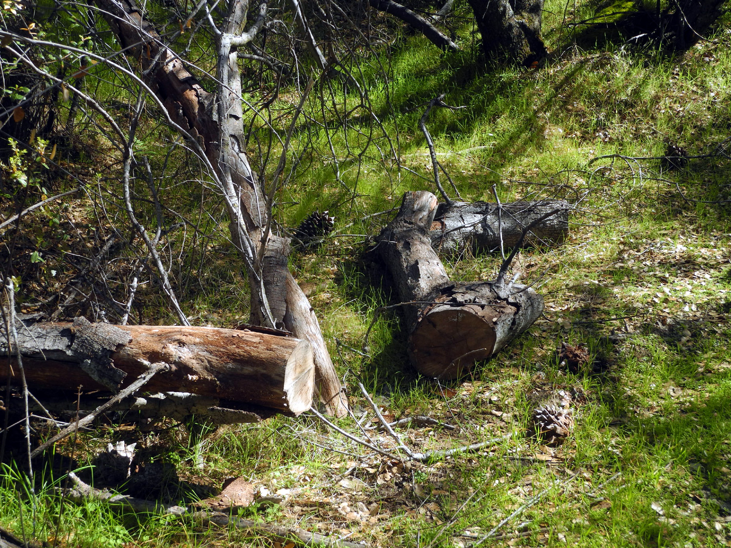
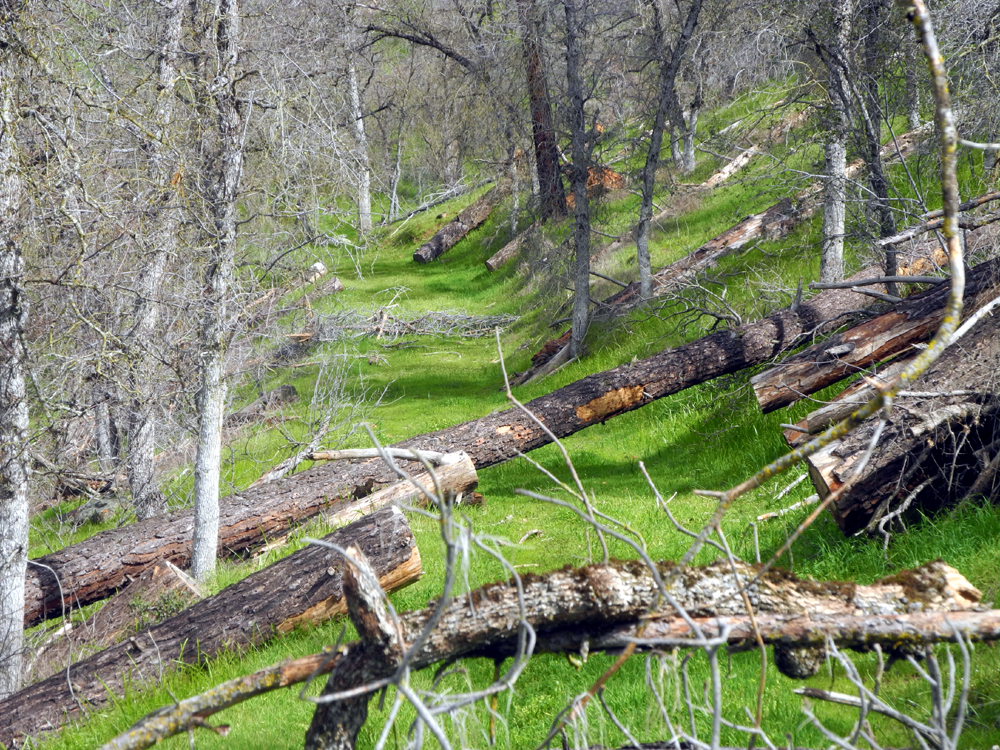
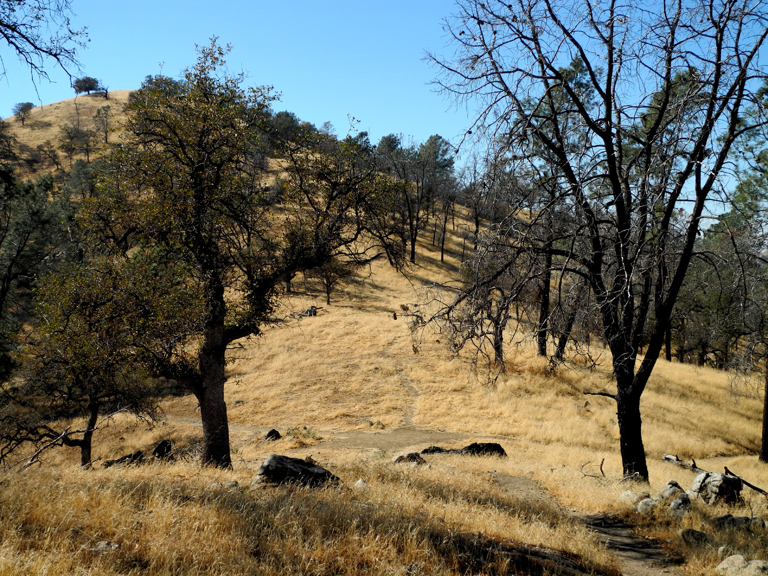
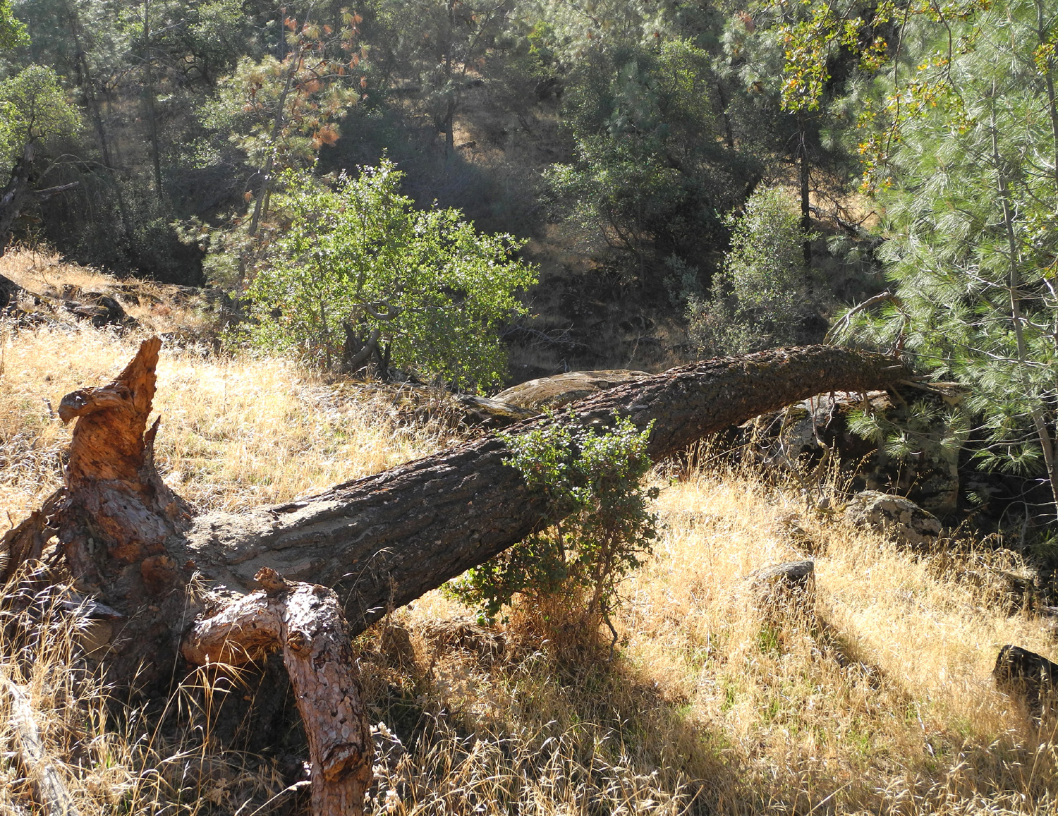
I've written about this hike a number of times, and there's really not much new to say, so I will babble on about the condition and evolution of the trail over the ten years I've been going there. At first it was clear that the route had been used by 4-wheel drive vehicles (which I will abbreviate 4WD), despite the difficulty of access. The beginning of the trail is blocked by four stout concrete posts, but 4WD users were undaunted, and made a bypass up the hill to the right and around the barrier. There were several places where trees had fallen across the trail, but visitors were not deterred. If the tree was too big or brushy to just step over, hikers had created detours close to the trail. The 4WD detours often required finding a route between the rocks and trees, sometime as much as 50 to 100 feet away, and a good distance up or down hill from the trail. In more recent years I think the 4WD people have given up, since I've not seen any vehicle detours around recent tree falls. On most of my hikes, there were newly fallen trees to contend with on each visit. Some blocked only part of the trail and did not require a detour, but others have proved more challenging. This live oak trunk cracked and came down part way but stayed up at such an angle that I could easily duck under it. A couple of years later it had dropped down to where I could not get under, and getting over was very difficult. Fortunately someone came in with a chain saw and solved the problem. A bull pine with two big trunks required a bypass at first, but on my recent hike, it had been breaking down, possibly helped by hikers' boots, so that I could get through between two sections of one trunk, and easily step over the other. Although I've mentioned 4WD and hiker detours, this is a very low-use area. In all my adventures there, I've encountered other hikers just one time. Lack of traffic allows grass and flowers to grow right in the trail, but there is never any danger of getting off the route. Just past where I turned back on my first hike, there is a large open area with lots of grass and a few trees, and no discernable trail. When I finally decided to walk through this area, I spotted a very obvious road going east. There were so many trees across this section that I hesitated to continue, but I did and was glad, since I came to a creek crossing with the biggest flow of any of the five streams that cross the trail. On my 2024 hike, most of these logs have rotted or been moved, and there was only one actually blocking the trail. An old man could easily step over it. (I know this story is true, because I was that old man.) When I did this hike last year, I did not go as far as I usually have in the past. When I reached the steep hill that goes into an area where the trail is not really obvious, I rested on a log, then turned back. This year I vowed even before I left home to push on to what I call Best Creek, the biggest (and best) creek on the hike. That daunting hill looked steeper and longer than ever, but I gripped my hiking poles, gritted my teeth, and forged upward. I crossed the open grassy area, and got on the section that is the most clearly marked stretch of old road on the entire route. With only the one tree to step over, this section was almost restful. In the past I have gone beyond the creek, but the first part is another extra steep section, and I was pleased with what I had accomplished to this point. I rested on a log, enjoyed the scenery, and started back. Going down the steep section below the big grassy area is a little difficult with gravity trying to "help" you get down, but I made it safely through that spot and back to my car. As I neared the trailhead, I'm pretty sure I heard a rattlesnake sound a warning in the grass off to the side of the trail. I had brought lunch and drove about a mile to the wide entry to one of the old campgrounds, where there was room to set up my chair and eat lunch in the shade. I resisted the temptation to walk in a short distance on the road, because I will be hiking in this location with the Ramblers later in April. I drove home with only a couple of stops to take more photos, which was just as well, since I managed to take a total of 166 photos on my camera and cell phone. Only a select few appear in this report and below. --Dick Estel, April 2024 |
|
|
Secret Trail at Finegold
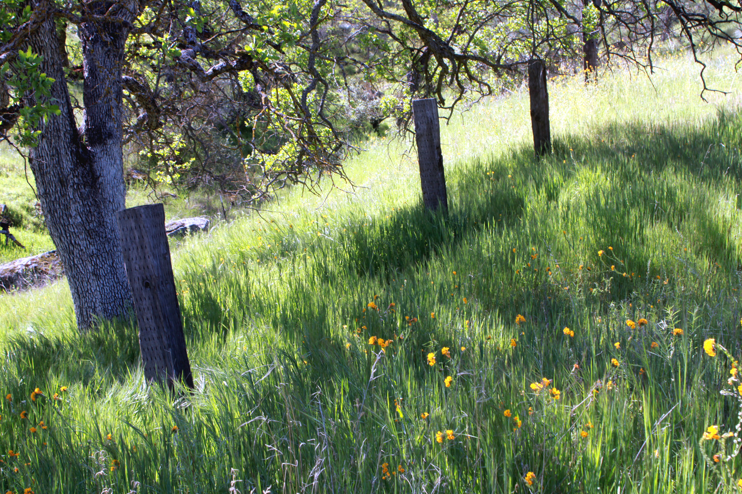
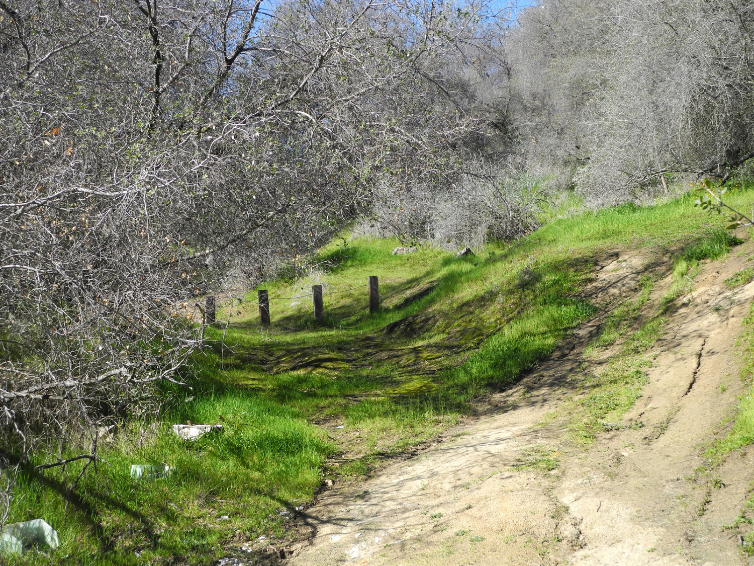
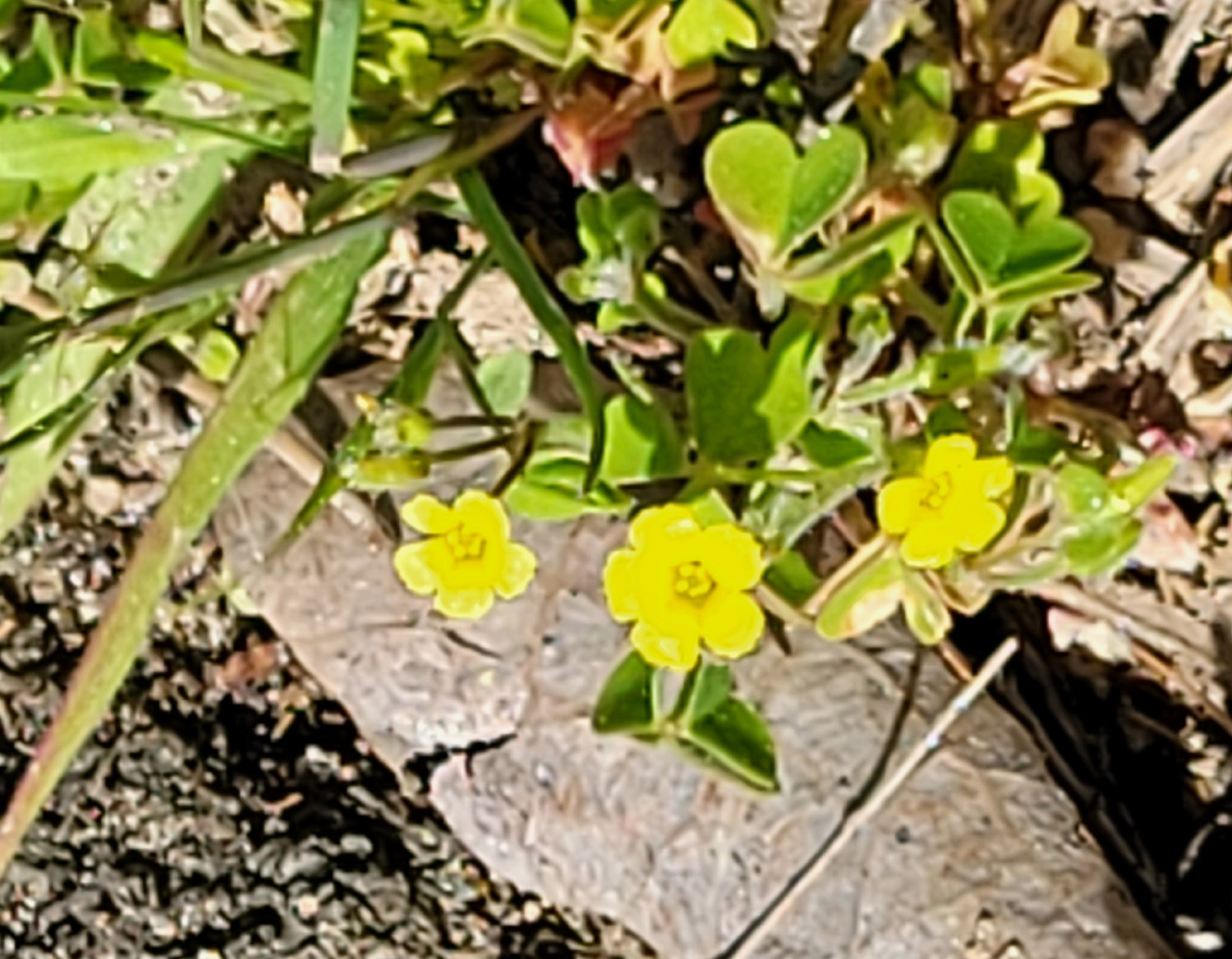
OK, it's not much of a secret, but more about that later. On April 10, a week after my hike on the unofficial Sycamore Fire Road, I found myself on another unofficial trail, this one at the Finegold Picnic area at the end of Sky Harbor Road, next to Millerton Lake. There is one official trail here, the San Joaquin River Trail, which goes about 12 miles to the San Joaquin River Gorge Special Management Area. I've hiked up to a mile and a half in and back on this trail, but of course, 12-mile hikes are long in my past. I also sometimes hike a mile or so in and out on the other end from the Gorge parking area. There's another trail here I've hiked a number of times, including in January of this year. It goes down from the parking lot and around a point of land between the main lake and a little cove below the road. I call it Finegold North. And there is one more unofficial trail which I had partially explored in 2012. From the parking area a path leads to a group picnic shelter a couple hundred yards away. A clearly marked trail goes beyond this point, parallel to the lake. In 2012 I went a short distance on this route and then headed up hill from the lake. I ended up reaching the knoll above the saddle on the San Joaquin River Trail from the "back way." After the trail started up the "trail" disappeared and I was going cross country over fallen logs and around brush, an adventure I did not care to repeat 12 years later. But the "good" trail follows the hills above the lake an unknown distance, and I walked a total of eight tenths of a mile before turning back. |
|
|
|
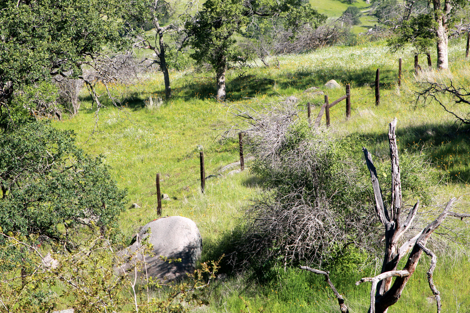
| Millerton Lake from the Finegold group picnic area | Posts without a fence |
|
I rarely encounter others on these unofficial trails, but just after going through a gate a short distance from the picnic shelter I realized I was not alone. A woman came through the gate and was catching up to me, so I stopped to let her pass. Of course, we said hello, and she said, "I recognize you." It turned out she was Karen B., who I had known in the Westerners International organization that I belonged to for a while. She had also worked with the county retired employees association board, of which I am a member, on a ballot measure supporting the county library. We talked for several minutes and I learned that she lives there at Sky Harbor, although she is selling her house. She said she will miss being able to step out her door and walk on the trails. |
|
|
|
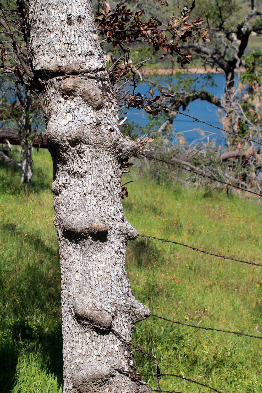
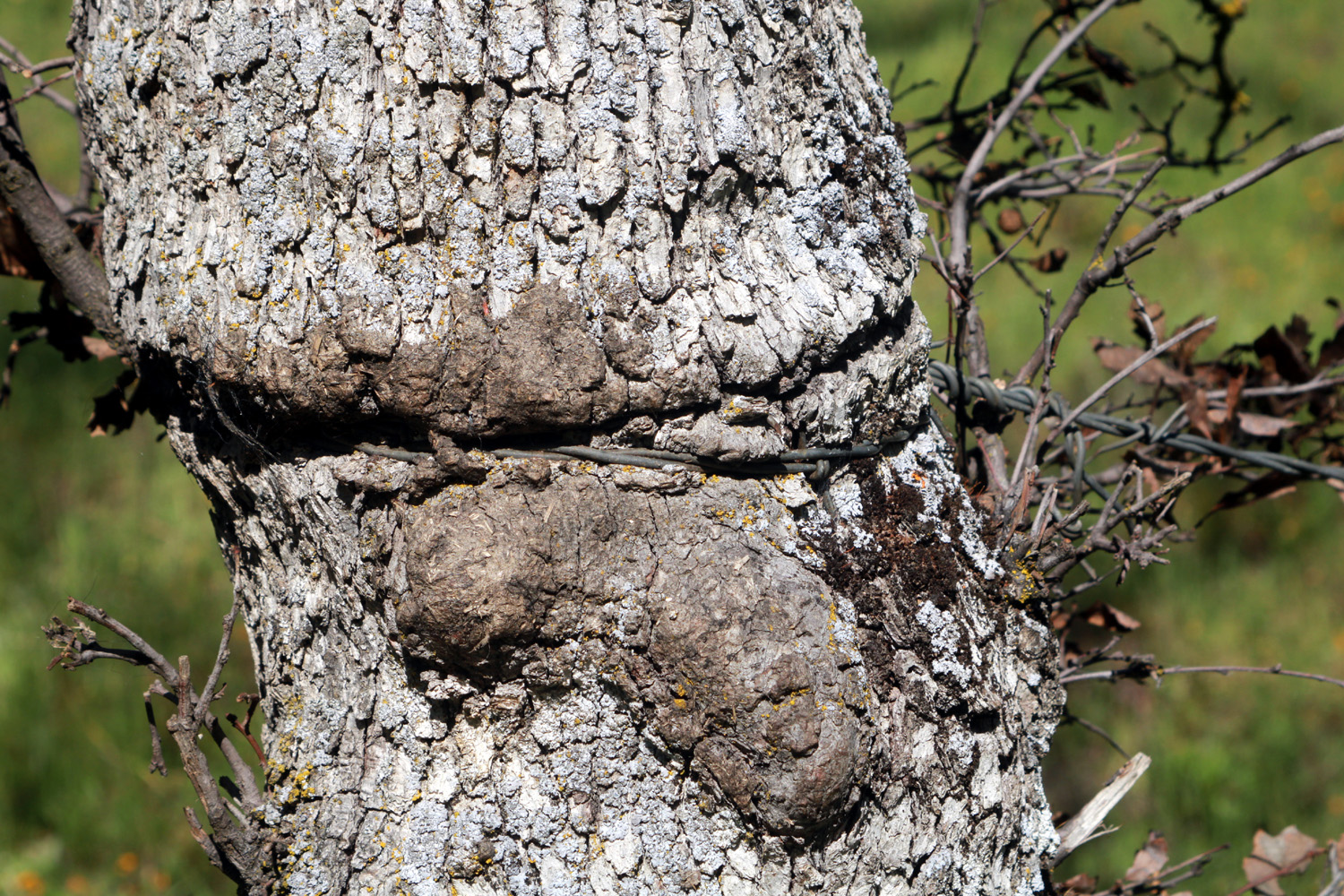
| About a fourth of the posts in this fence are trees | The tree grew over the wire, but now appears to be dying |
|
As we said goodbye, she told me that there were bedrock mortars where a drainage comes down into the lake, a short distance up the trail. I continued to follow the trail, enjoying the various wildflowers along the way, till I came to a large rock formation. I did not see the native grinding holes, and did not want to try to climb up in the rocks looking for them. Instead I sat on a log, enjoyed a snack, and got ready to return to the parking lot. |
|
|
|
| Jumbled rock formation where the trail goes through a drainage | Close-up of fiddleneck blossoms |

|
|
| There were only a few purple brodiaea | Popcorn flowers are mostly done, but this one still looked great |
|
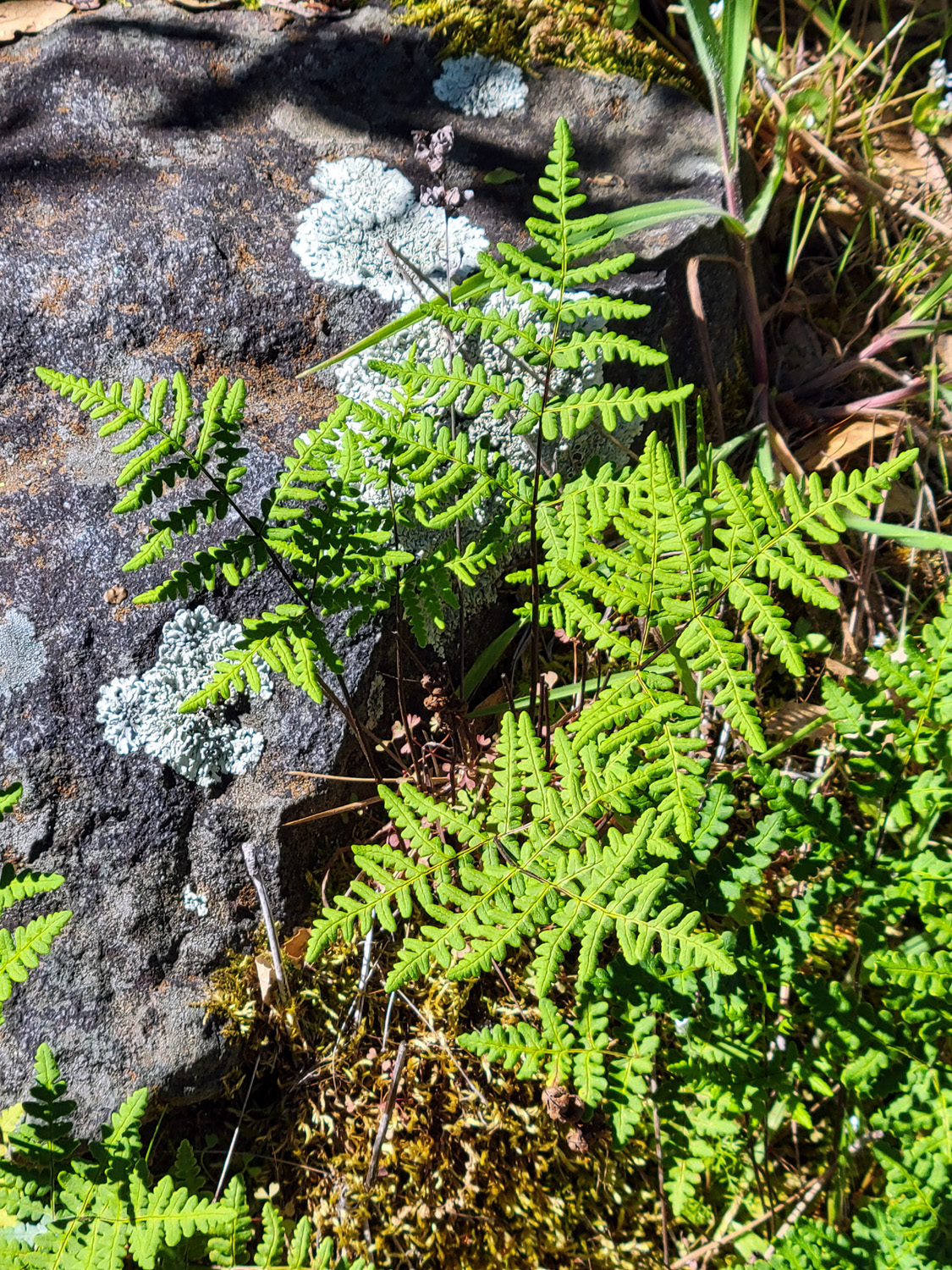
I struggled to come up with one of my personal names for this trail. It's obviously not a complete secret, but it gets very little use, so it's kind of a secret from most visitors to the area. I hope to visit again and explore a little further, and maybe that will inspire a better name. In the meantime, Secret Trail will have to do. I should mention, for those who are inclined to follow this old man's footsteps, that there are a couple of very steep spots. They are short, not more than 30 feet, but I had to take great care when going down, and go a bit off the trail in one spot to find better footing. As usual, going back up was much easier, although it put great demand on the lungs. This is just a hap-hazard cow path/fisherman's trail - no engineers labored over the drawing board to make steep descents easier. The grass was still green, the flowers were a delight, and all in all it was a very satisfactory outing. --Dick Estel, April 2024 |
|
|
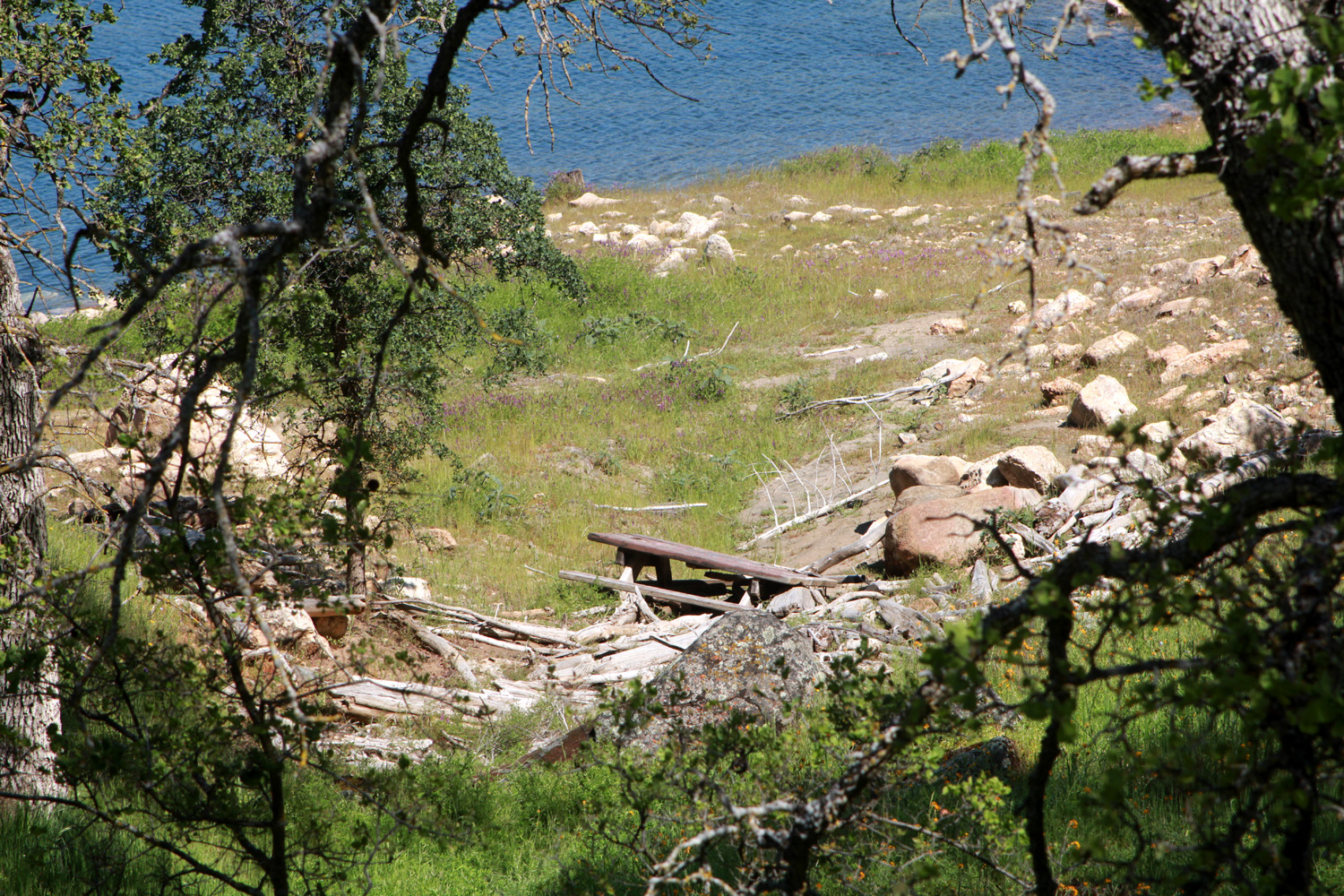
Pine Flat & Big Creek Road
This adventure was somewhat like what I call a Drive & Hike, where you drive somewhere, do a short hike, drive farther on and hike again, and repeat until it's time to go home. Since it was a low-elevation destination, with temperatures at least 90 degrees, I knew there would not be much hiking. It was more like Drive & Shoot, stopping many times to photograph flowers and other scenery. I left home at 8:45 the morning of May 15, heading for Pine Flat Reservoir on the Kings River. I would follow Trimmer Springs Road along the north shore of the lake, and then drive up the unpaved Big Creek Road to an area where I have camped many times in the past. The first part of the drive is through farm land, mostly grapes and citrus, but as the road starts to rise slightly above the level of the San Joaquin Valley, the river comes into view. The road is close to the river for several miles, and it was clear that it was running very swift and high. |
|

|

|
| The Kings River, seen through the branches of a huge valley oak | The surface looks smooth, but it's suicide to get into the water |
|
The road turns north away from the river, then up and over some hills and wanders here and there, until it comes down to the lake near Kirkman's Point. I stopped here to take in the view, and saw that the lake was the fullest I can ever remember. This was underlined where Trimmer Springs crosses Sycamore Creek. In a normal year with good rain, the lake comes up this branch, and ends a few or a few hundred feet downstream from the bridge. On this date, not only was the water up past the bridge, it completely covered a series of small rapids in the creek that are almost always visible. |
|

|

|
| The lake is right up to the highest high water line | Fishermen take advantage of the full lake near the Sycamore Creek bridge |
|
|
|

|

|
|
Just
above the Sycamore Creek bridge: compare
May 2024 photo on left with March of 2023. |
|
|
Beyond Sycamore Creek, it's about four and a half miles to Big Creek, the second large tributary that enters the lake from the north. The configuration of the land here is such that the lake does not rise above the bridge, but it was up to the high water mark just below, leaving a couple of trees that thought they had grown on dry land standing in the water. The creek was running high and fast, and goes over a lot of small rapids and one fairly impressive drop big enough to call a waterfall. |
|

|

|
| The highest point reached by the Big Creek branch of the lake | The creek flows rapidly over rocks and rapids for several miles along the road |

|

|
| Water flows over an old weir at this location | This is the biggest natural drop along the road |
|
By the time I reached Big Creek, I had already stopped a number of times to admire and photograph wildflowers and other scenery. Some people might have told me I would not see any wildflowers this late in the season. And I didn't, except for farewell-to-spring, blazing star, buckeye, elderberry, Athurial's spear, moonflower (Datura), filaree, common madea, Clarkia, poppies, yerba santa, mustang clover, Chinese houses, clover, Mariposa lily, western wall flower, purple vetch, Fremontia, yellow flowering bush, pale yellow flowering bush, a mullein-like plant with yellow flowers, and unknown yellow flowers growing where water seeped out of the road bank. |
|
|

|
| Appropriately, the most common flowers were farewell-to-spring | Yerba santa is a common shrub throughout the Sierra foothills |

|

|
| A look through several websites failed to identify this flower | Blazing stars were showing off along Trimmer Springs Road |
|
From the bridge a dirt road goes more or less north along the creek. If you keep driving long enough on this road, you will eventually arrive at Highway 168 a few miles below Shaver Lake. Most of my past trips in this area have been much shorter. We used to camp several times a year in the winter and spring at a place we named Concrete Flats. A hundred yards or so up a steep dirt track from Big Creek Road, we discovered the remains of some kind of structure. There were some flat concrete slabs (hence the name), and piers with bolts sticking up, which probably once anchored a wall. If you want to read more about this, I've written about camping here in my Camping Trips page. There is also an unofficial but more developed camp site on the other side of the road next to the creek, but it is far from flat. Seven tenths of a mile past the campsites the road crosses the creek on a bridge, and goes away from the waterway for several miles, rejoining it about 1,000 feet higher in elevation. We've camped up there too. I've always said it is six miles from where Trimmer crosses Big Creek to Concrete Flats. I'm not sure how I came up with this number, maybe by counting the mile grid lines on the USFS map. I thought about checking it with my vehicle's odometer, but this thought always came to me when I was sitting around the fire at camp, or home watching TV. Before I left on this trip, I decided I would record mileage at a number of places, and finally get an accurate reading. So, showing how good I am at using other methods, from the bridge across Big Creek on Trimmer Springs Road to the now impassible "driveway" in to Concrete Flats, the actual mileage is 2.5 miles. With a maximum speed of ten miles per hour most of the way on this rough road, it seems like six. I drove past the camp and just across the bridge, where I set up my chair in a more or less shady spot, and enjoyed lunch, with a nice breeze keeping me cool. From the middle of the bridge I photographed a big triangular boulder that is suspended above the creek by other boulders. I also spotted something I have never seen on a trip of this sort, a bunch of bananas someone had tossed out beside the road. Bear in mind this was over three miles from the paved route, up a rough, lightly traveled dirt road. Go figure. |
|

|

|
| In my younger days, I climbed down from above to stand on this boulder | Yes, we have some bananas |
|
On my way up from Trimmer Springs Road, where a fair-sized tributary runs into Big Creek from the west, I encountered a U.S. Forest Service work crew. They were hoeing vegetation and other tasks I could not identify as I drove. There were at least six crew transport buggies and about ten pickups, plus another work truck of some sort. They were wearing full yellow Nomex turnout gear, and I could not help feeling a bit sorry for them, at work in 90 degree sunshine. When I came back out the crew of about 25 were gathered in a circle around the management people, who were holding forth on important topics, no doubt related to their primary job of fire suppression during the long hot season ahead. I saw quite a few cows along the dirt road, but the only wildlife was a huge number of swallows at the Sycamore Creek Bridge. I was standing on the bridge, and they came out and were flying around, chirping and darting toward me, obviously wanting to chase me away from their nests. I made a few more stops on my way home, hitting places I had missed or where I could not readily stop earlier. I covered a total of 103 miles, and was adventuring from 8:30 a.m. to 4:15 p.m., a long workday for a retiree. Despite little walking, I was quite tired and slept well that night. --Dick Estel, May 2024 |
|
|
Photos (Click to enlarge; pictures open in new window) |
||
|
Sycamore Fire Road Finegold Secret Trail Pine Flat & Big Creek Road |
||
|
Sycamore Fire Read |
||
 |
 |
|
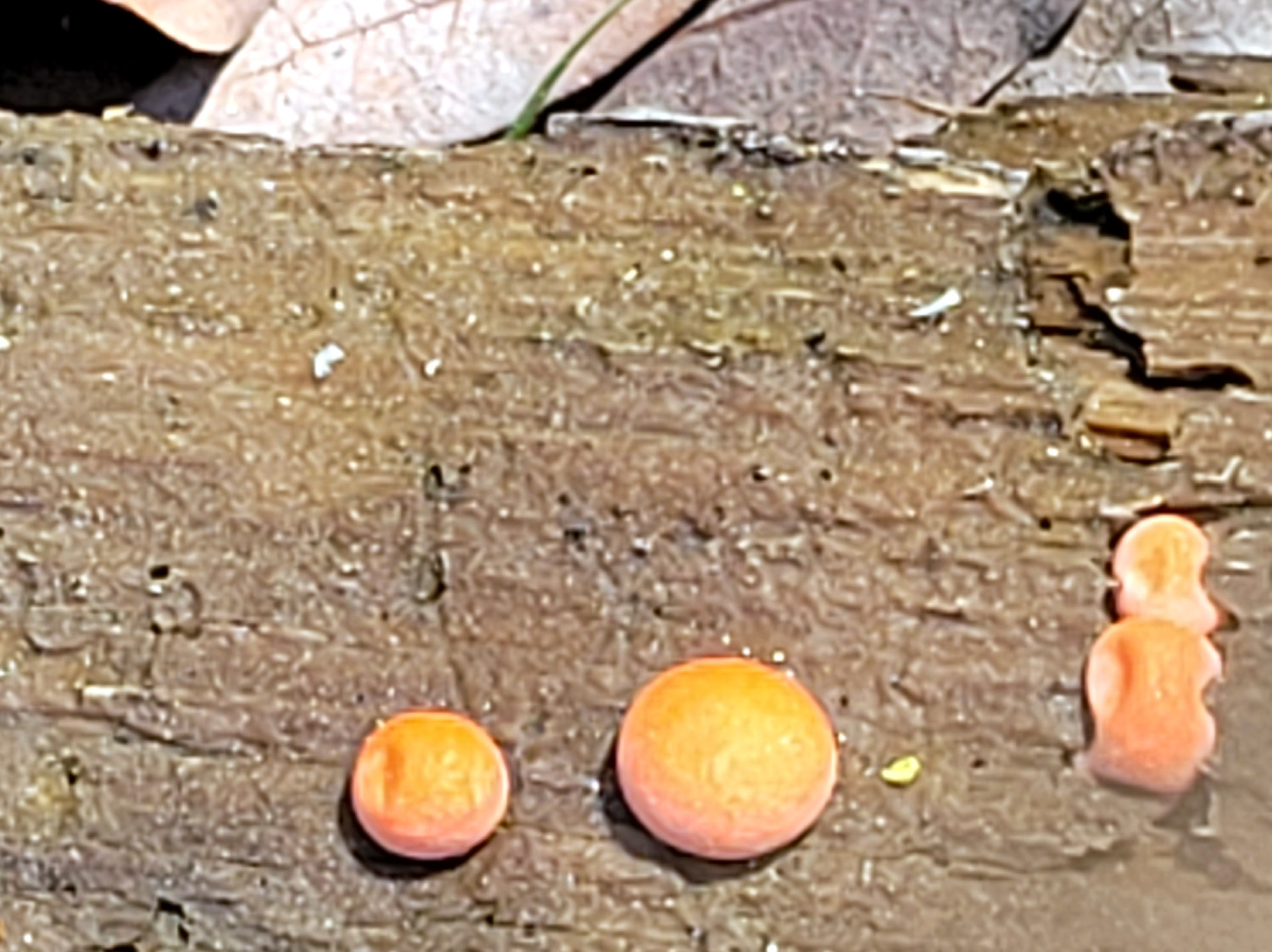
| Blue dick | Fiddleneck, up close | A delightful fern near the trail |
 |
 |
 |
| Odd orange fungus on a dead log | Mass of fiddlenecks at the Sunny Slope area | A field of filaree blossoms |
 |
 |
 |
| Poppies above the start of the trail | A nice white and yellow display | Hills near and distant show patches of poppies |
 |
 |
 |
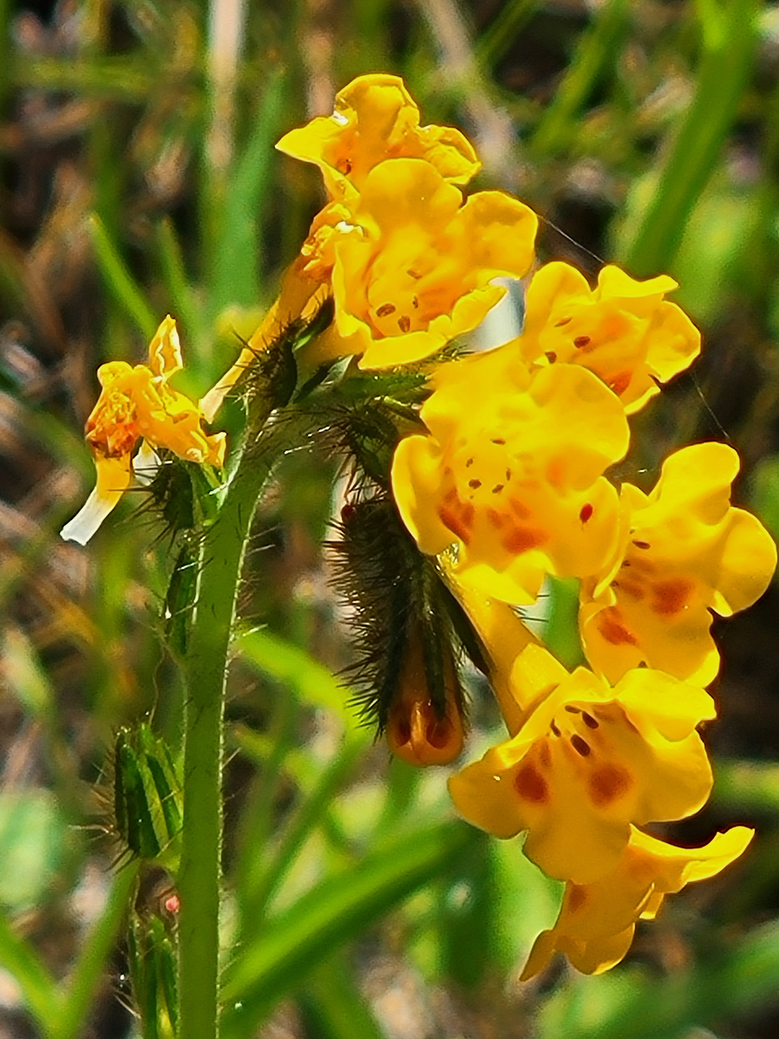
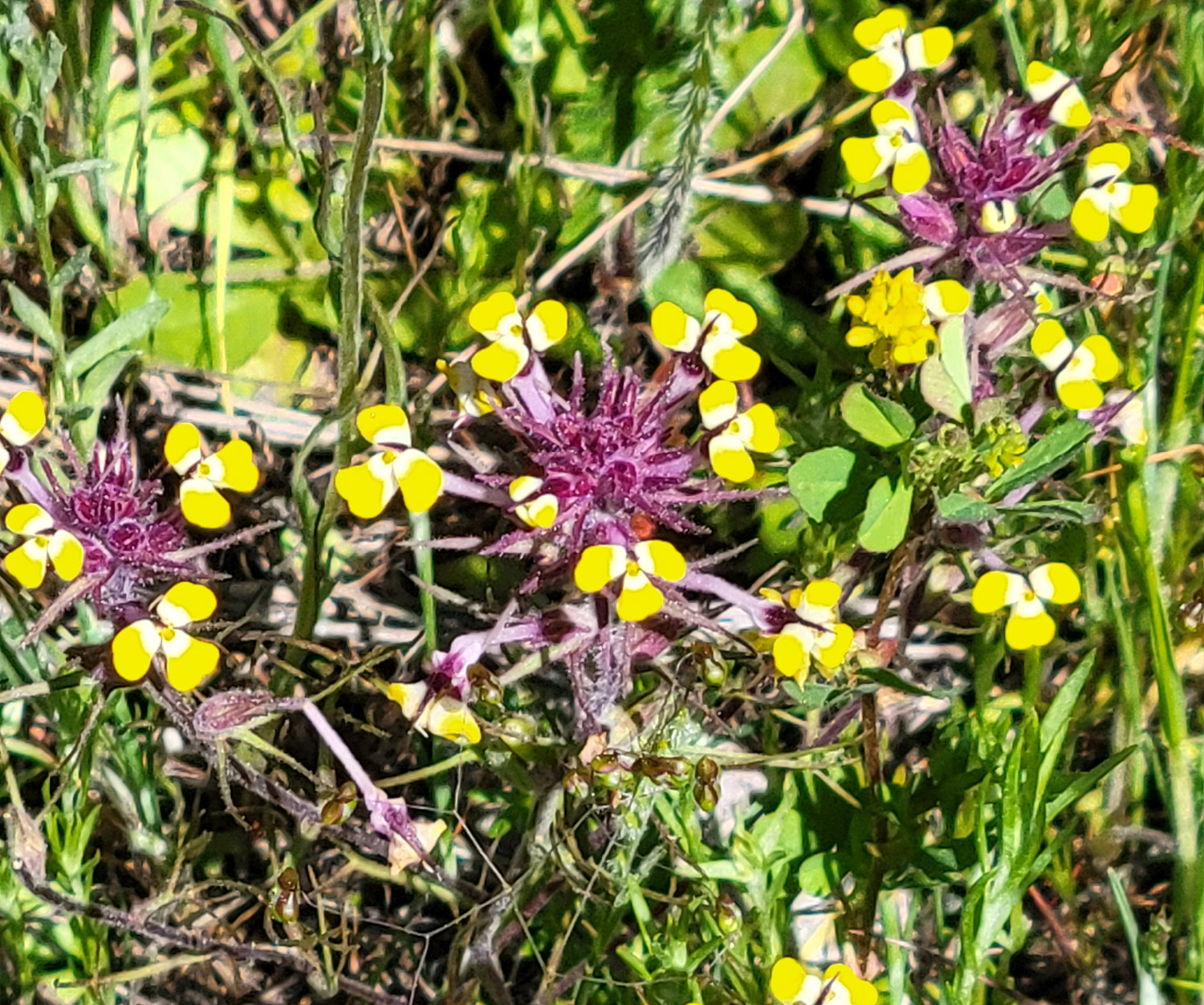
| The rare plant known as ham & eggs | A hillside of bird's eye gillia | These unknown
flowers are about a quarter inch in diameter |
 |
 |
 |
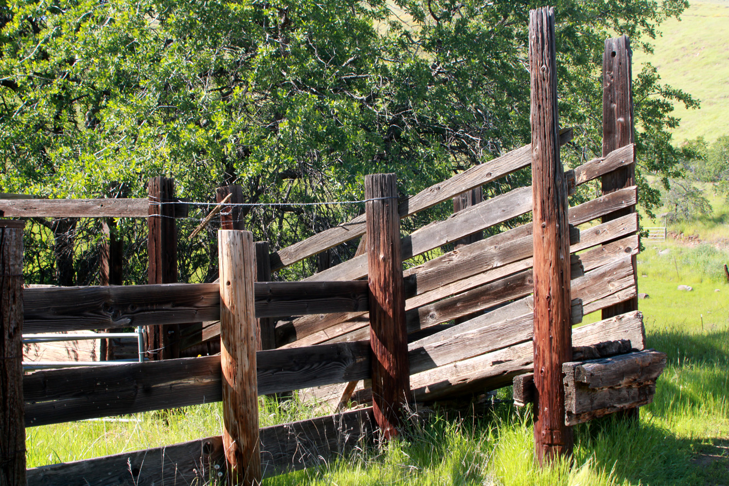
| I always have to photograph old cattle chutes | Scene below Trimmer
Springs Road where it rises up from the valley |
Buckeye blossoms
getting started near Trimmer and Sunny Slope Road |
| Finegold Secret Trail | ||
 |
 |
|
| Yellow-throated gillia | Last year's wildflower | Usually scarce,
Sierra star appeared in large numbers along the trail |
 |
 |
 |
| An old favorite, baby blue eyes | Maybe some kind of clover, very small | Fluffy-looking grass seeds |
 |
 |
 |
| These little pink
blossoms are barely a quarter inch in diameter |
This is no picnic | Little Dry Creek
runs along part of Auberry Road on route to Sky Harbor |
| Pine Flat & Big Creek | ||
 |
 |
 |
| A view of the Big Creek bridge | Some of the places you can go from the bridge | A small section of the weir across Big Creek |
|
 |
 |
| Another view of the waterfall | Buckeye blossoms are at their peak | Blazing star |
 |
 |
 |
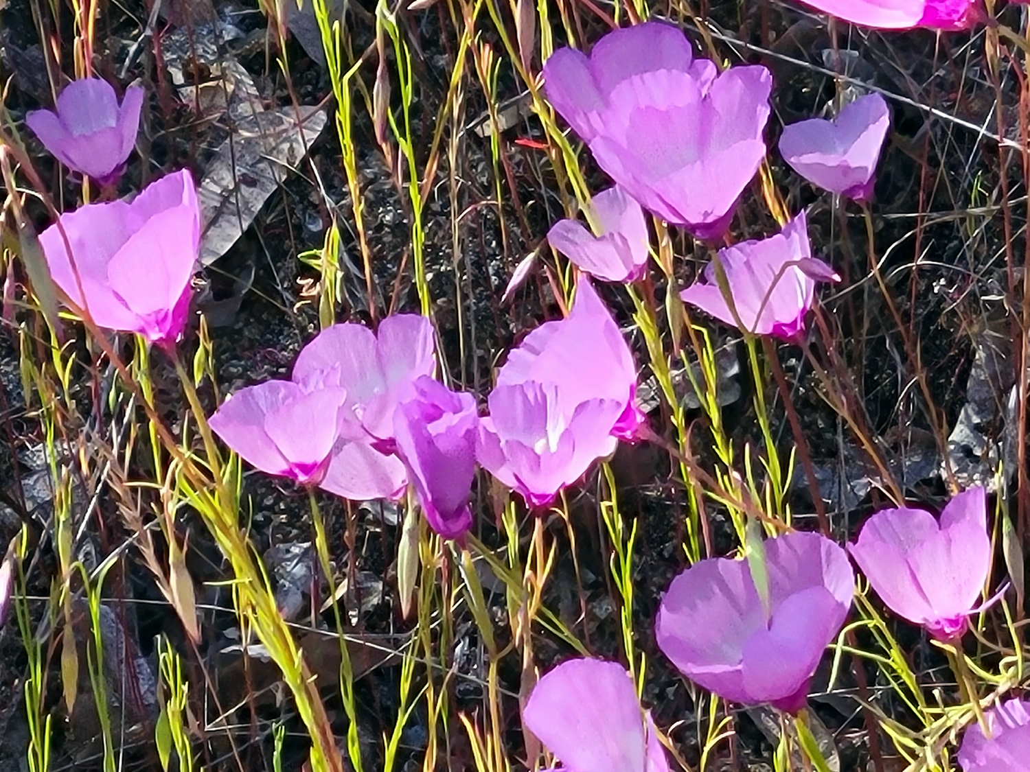
| A single farewell-to-spring blossom | Fremontia or flannel bush | One of my favorites - Mariposa lily |
| Related Links | ||
| Millerton
Lake |
Millerton State Recreation Area | Sky Harbor |
| First Finegold West Hike | First Ramblers Hike at Finegold | Another Ramblers Hike |
| Pine Flat Reservoir | Sycamore Creek | Trimmer Springs Road |
| Pincushion Peak | Westerners International | San Joaquin River Trail |
| San Joaquin River Gorge | San Joaquin River Gorge Special Management Area | Kings River |
| Fremontia | Yerba Santa | Pine Flat Big Creek Travel Log |