|
Every Friday
I go to lunch with four other gentlemen who are all retired from the
Fresno County Department of Social Services. At our May 13
gathering, Frank Puglia announced his desire to go to Miami Creek,
which runs more or less parallel to state Highway 41 in Madera
County, above the town of Oakhurst. I
had been to this creek on camping and day trips with my daughters
when they were very young, and was interested in seeing the area
again, so we made plans to leave at 8 a.m. Monday, May 16. The party
was also to include Pat Hendrix and his son Teddy, who is in town
for a month or so, helping his father move.
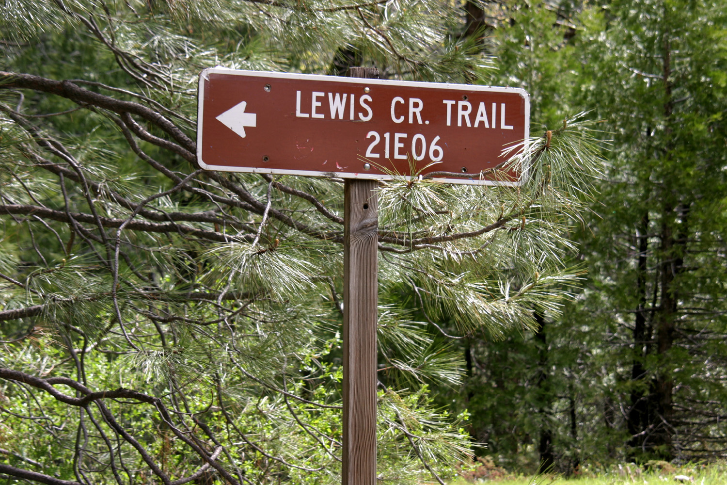
We had
also discussed following a trail that starts by the highway and goes
down to Lewis Creek, which Frank thought was a fairly short walk,
leading to a waterfall. I recalled seeing a sign for the trail, but
none of us could recall exactly where it was, although we knew it
was above Oakhurst, past the Bass Lake road. After a false stop at
an unpaved turnout, which offered only a steep hillside covered with
brush, we came to a wide, paved turnout, with a big sign reading
"Lewis
Creek Trail." (For the record, it's 7.5 miles from the
junction of Highways 41 and 49 in Oakhurst.)
Pat had
hip replacement surgery in December and is not up to this type of
walking, so stayed in the car. We brought a chair for him, but it
was between 45 and 55 degrees out, so he didn’t want to sit outside.
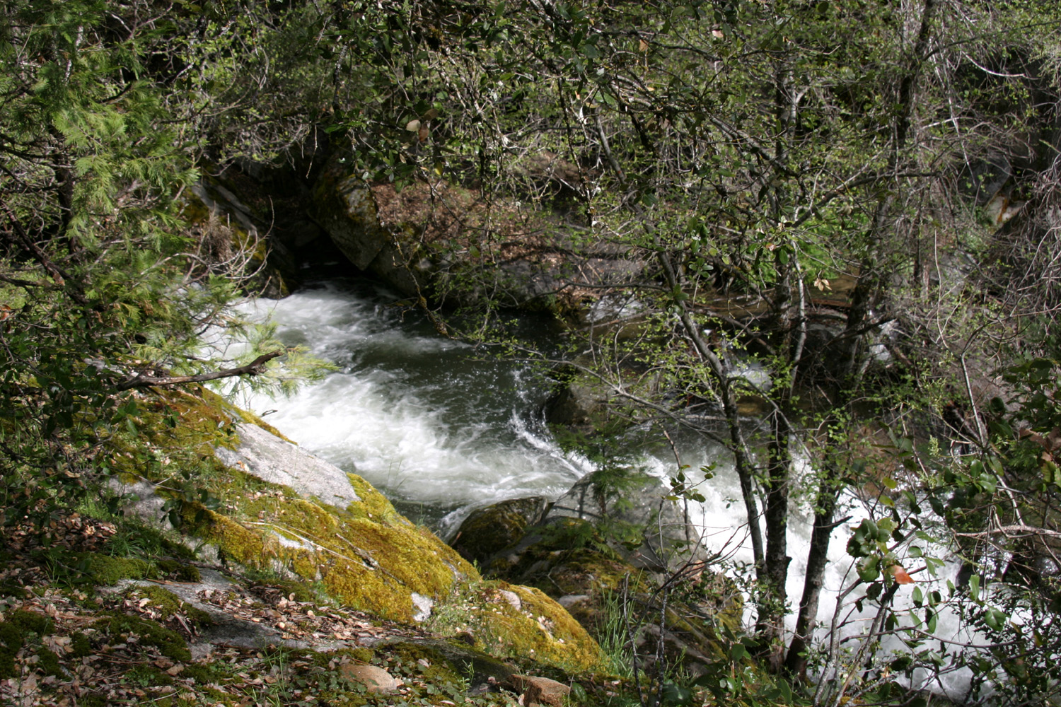
Frank,
Teddy and I started down the trail, and immediately noticed a few
tiny patches of snow along the way. We could hear the creek from
where we parked, so we knew we didn't have far to go, and within a
short time we could see the
creek, big and full, tumbling down
the steep canyon in cascades and small falls.
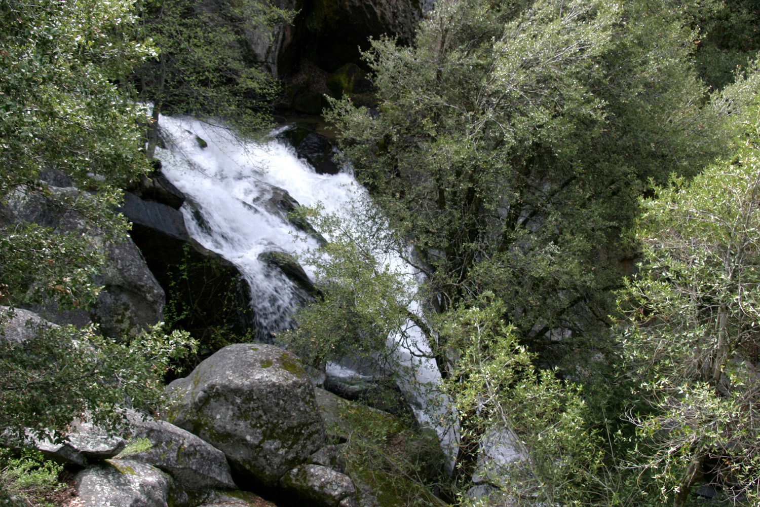
Although
we took a lot of pictures, it was hard to get a good shot of the
creek, due to the trees, and due to the fact that we were well above
the creek in most places. We made our way down to where we could see
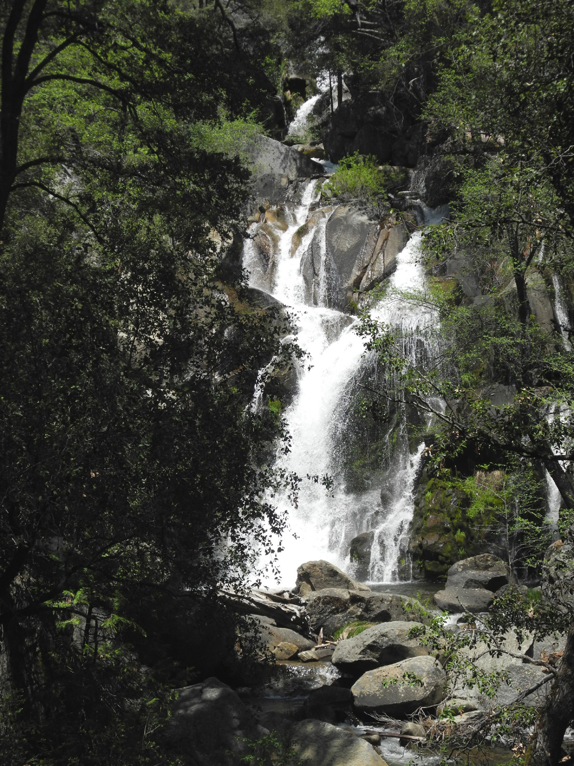
a fairly good
falls, which presumably was Corlieu
Falls. The trail
was getting steeper and wetter, so we didn't go all the way down.
Later my daughter described the trail as "very steep, and you
have to hold on to branches to make your way" - a recipe for
disaster for geezers like Frank and me (apparently the trail has
been improved recently, and there is now a viewing platform at the
bottom).
(Update:
In 2013 I made two more hikes to Corlieu Falls, reaching the
viewing platform, and on the final hike going down to where the
creek levels out below the falls. This provided much better views
of the falls than we had on my first visit.)
We
returned to the truck and continued up Highway 41, searching for the dirt road that goes in to
Miami Creek. I spotted the road I have used, but Frank said that was
not the way he had gone. We finally saw the right road, just as we
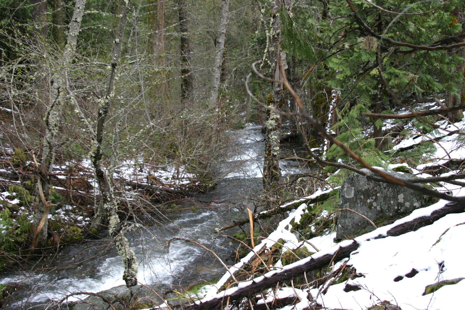
went past it. We turned around at the Westfall US Forest Service
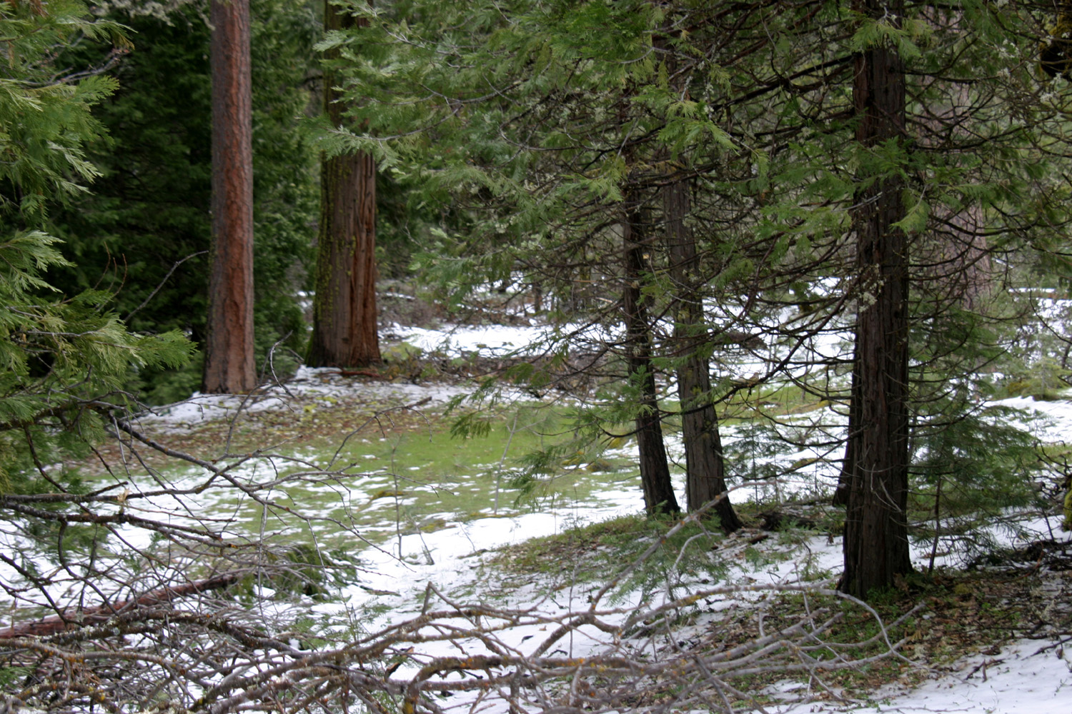
station, and headed down Miami Mountain Road. About a half mile up
the highway from the Lewis Creek trail there was snow on the ground everywhere, from
a storm the day before, and the road was wet but not muddy except in
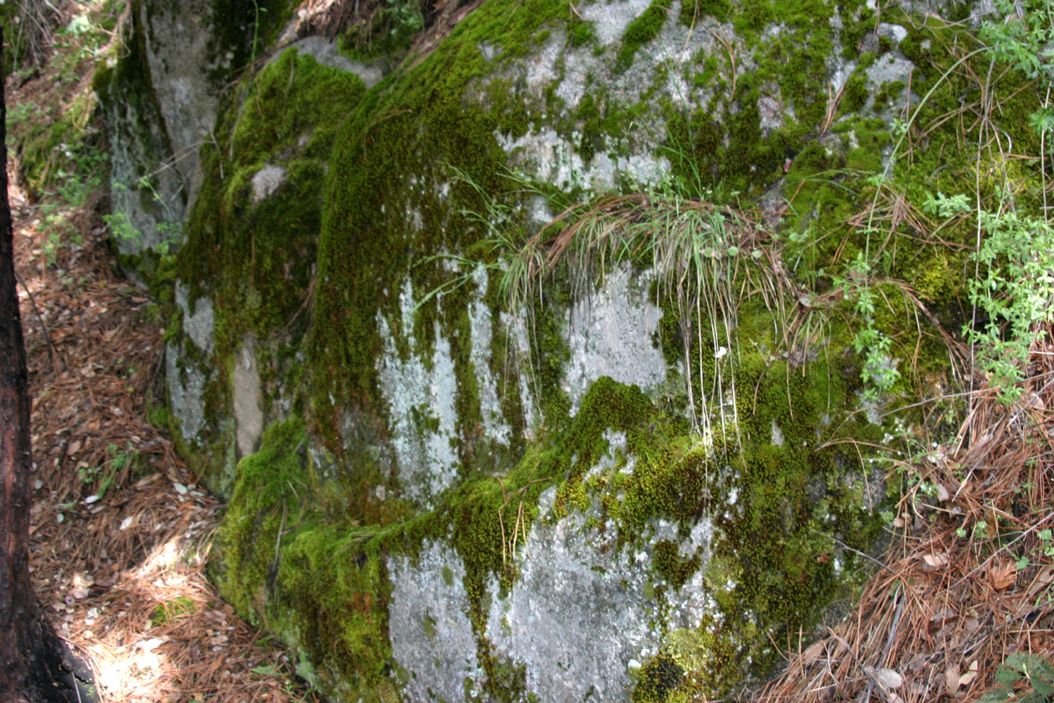
one brief 50 foot section. We made it to the creek without incident,
parked, and walked through snow and wet ground downstream along the
creek for a short ways. Frank, Pat and Teddy had been fishing in
this area years ago, so were familiar with the
surroundings.
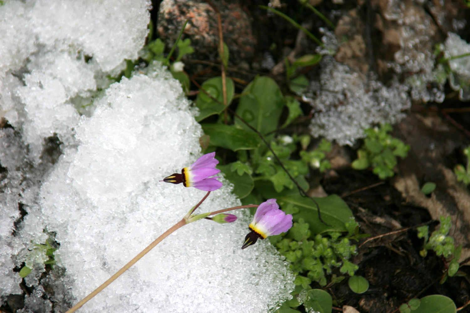
It was
cold but sunny, and the scenery was all you could ask for. I spotted
a couple of Shooting
Stars, one of our most beautiful wild flowers,
growing out of the snow (actually they were probably blooming before
the latest storm). The creek is not very big, but was running pretty
good, and had some nice pools and cascades.
Going back out to the highway, we slid a little going through the
short muddy spot, but made it through thanks to traction control
features built into newer vehicles. We turned east at Road 222 (Bass Lake Road), and went to
Ducey's Lodge for lunch. This is part of a resort complex that
includes cabins, chalets and a fairly good restaurant.
To add
some variety to our trip, we did not return to Highway 41 at this
point, but continued south on Road 274, which flanks the eastern
shore of Bass Lake, then heads down to North
Fork, a former logging
town a short drive from the lake.
Some
time ago Pat and Frank had been looking for Manzanita Lake, said to
be near North Fork. They got directions at the grocery store and
drove up Road 222, for the two mile ride to the lake. They missed the
turn and went on up till they came to what they described as a
flume. We had the impression it was something remaining from logging
days, but this was not actually so.
Following
the same route, we drove past the lake (on purpose this time),
connected with another road, and found the flume. We got out and
walked up a hill to where we could see the top. It is actually a
more or less modern facility, with water running through a ditch,
then into the flume to cross above the road. Presumably it carries water to the power house from the lake.
We
headed back toward Manzanita Lake and North Fork, but once again
legitimately missed a turn, and ended up on Road 221. Like the other
roads we had been on, it comes out to the North Fork Road (200), but
misses Manzanita Lake and North Fork. We gave up on Manzanita Lake, turned right, and drove through green foothill country
back to Highway 41, then home.
Our
definition of "adventure," after some discussion: You
don't necessarily end up where you were going, but you end up somewhere
interesting.
--Dick
Estel, May 2011
|


