

|
New Mexico Adventure 2026 |
|
| Photos Related Links More Travel Reports | |
| Adventures
of 2016 Adventures
of 2017 Adventures
of 2018 Adventures
of 2019
Adventures of 2020 Adventures of 2021 Adventures of 2022 Adventures of 2023 |
|
| NOTICE:
Due to the large size of this report, the additional photos that normally appear at the bottom of the page are on a separate page Photos by Teri and Dick |
|
|
Sedona Verde River Train Montezuma Castle Farmington Salmon and Aztec Ruins The Road to Taos Taos Pubelo Rio Grande High Road Rio Grande Gorge Heading Home |
|
|
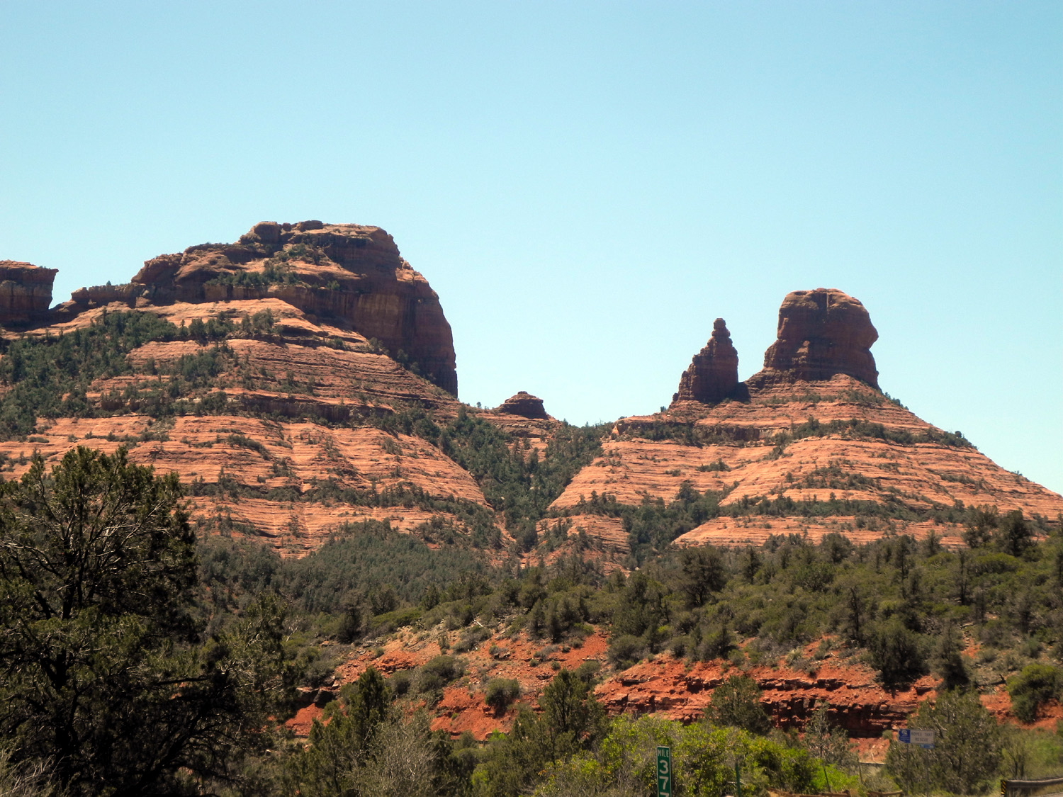
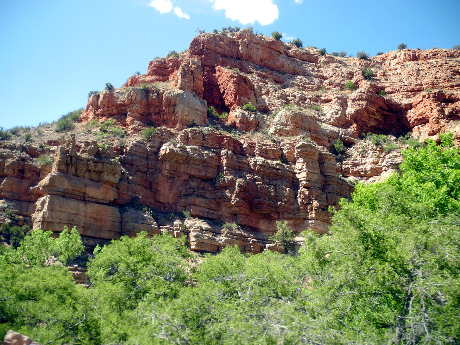
In late 2025 my daughter Teri and I were discussing possible destinations for a 2026 Vacation Road Trip. I mentioned that I had driven across New Mexico several times, but had never stopped anywhere except for one night at a motel while heading east or west. Before I knew it she had made reservations and planned an itinerary that would take us to Farmington for three nights and Taos for four. Why those locations? New Mexico, our 5th largest state in area, offers many attractions for the tourist - Carlsbad Caverns, White Sands, Santa Fe (oldest state capitol in the USA), Roswell (don't pick up hitchhikers - they may be aliens!) We would visit none of those, although we passed by Santa Fe on the Interstate. By odd coincidence I was acquainted with two men who had graduated from high school in Farmington, although both are long gone from the Land of Enchantment. Like many other places we would drive through or visit, it is a significant place name in "Hillerman Country." If you are not familiar with Tony Hillerman's series of novels about two Navajo detectives and their travels throughout the big reservation that sprawls across all of the Four Corners states, you have missed a treat. I probably know more about the geography of this area than any place outside of California. And I certainly learned a lot more on this trip. Farmington is also near a number of places worth a visit, including Ship Rock (the town and the rock), Aztec Ruins National Monument, Navajo and Apache reservations, and a half dozen place names that were familiar to me from the Hillerman books. But to get to New Mexico, we first would have to pass through and stay overnight in Arizona (6th largest state), which also offers lots of places to tempt the traveler. We left home early on May 13th, driving south on CA99, east on CA58 and farther east on I-40 at Barstow. East of there we discovered miles of solar panels taking advantage of the desert sunshine. We stayed that night in Kingman AZ, childhood home of Andy Devine (look him up, kids). Much of our route that day and throughout the trip would take us along what is left of the iconic Route 66, but Kingman is known for being located on the longest continuous stretch of the road still in existence. The next day we continued east on I-40 and turned south at Flagstaff toward Sedona. I have always been skeptical about visiting this location, because of its association with the "magic" of crystals and other ridiculous bull poop. However, I was glad we went this way - the red rock and other formations make it a place of special scenic beauty, no silly mystical stuff needed. |
|
 |
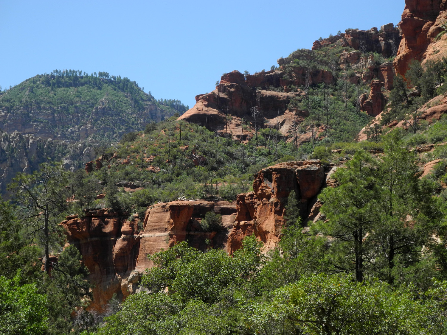 |
| Rock formations on the road to Sedona | Along the road to Sedona |
|
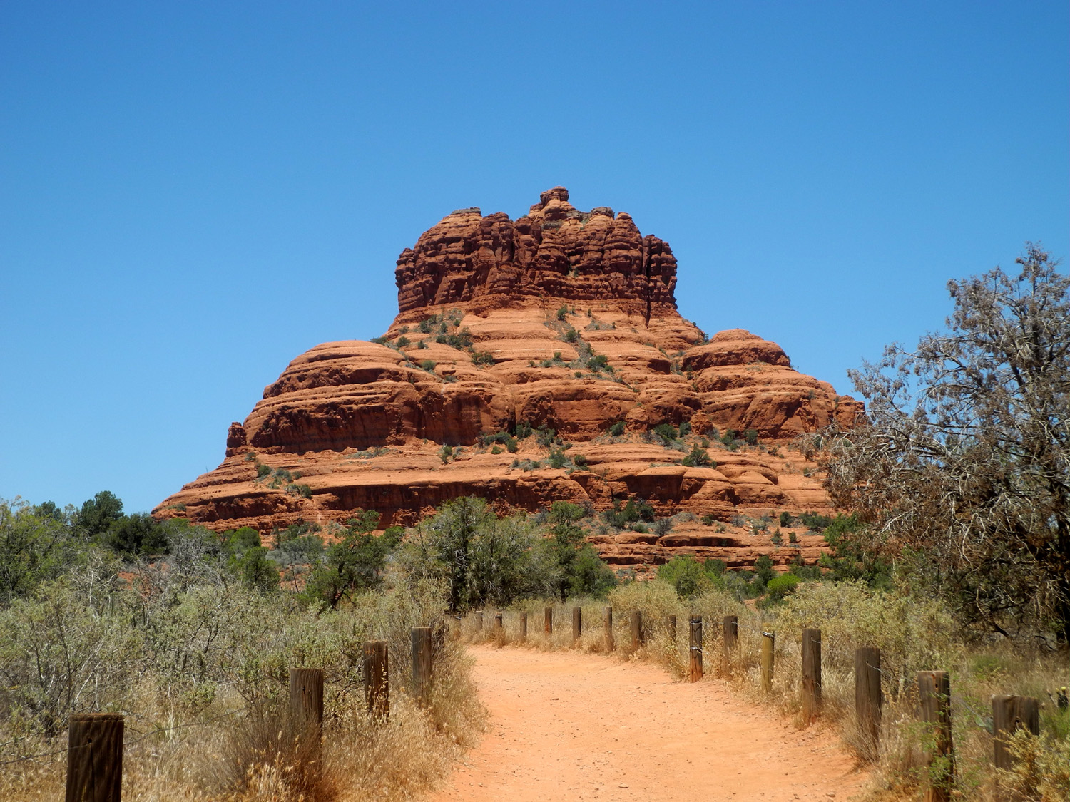
We
stopped to do a short hike at Bell Rock. We did not hike on a trail.
We hiked on the Bell Rock Pathway (it was much like a trail). Along
the |
|
 |
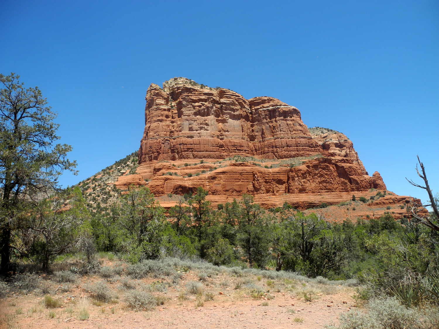 |
| Bell Rock at Sedona | Courthouse Rock, right next door |
|
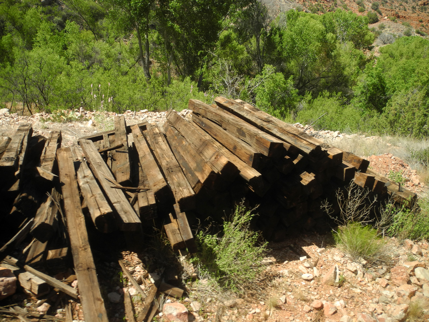
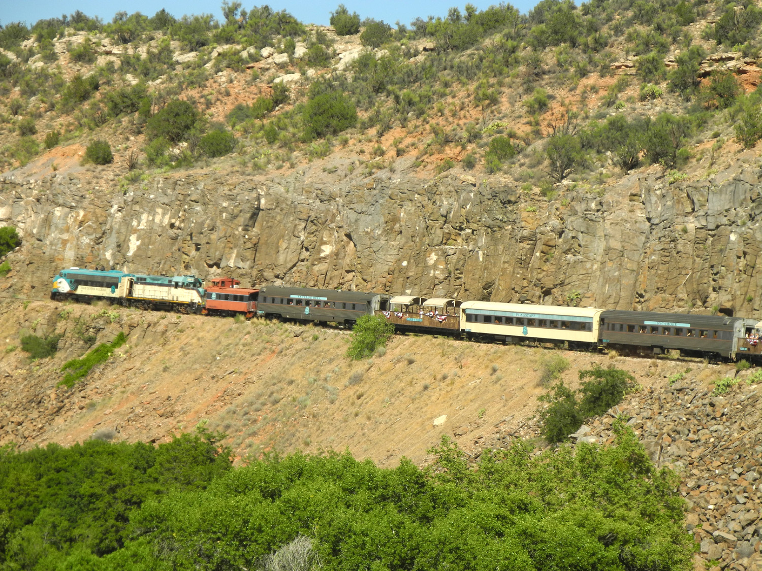
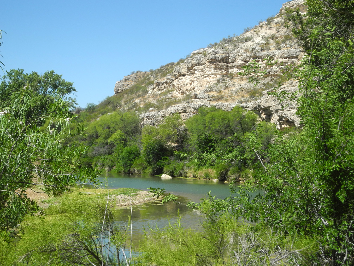
The next morning we drove to nearby Clarkdale, where we would board the train for a ride up the Verde River Canyon. With an hour to wait, we chatted with a mother and daughter who were originally from California. Mom now lives in Apache Junction AZ, east of Mesa, while the daughter lives in Reno. They get together for a shared vacation whenever they can. Our ticket price included a "snack," which was really a full lunch for Teri and me - cheese, crackers, grapes, salami, a brownie, and sparkling cider. The beginning of the route is through level, open country, but it soon enters the canyon, offering views of red rock cliffs, foxglove blossoms beside the line, and piles of old railroad ties. Our favorite views were those of the train when it went around a bend. The end of the line was at Perkinsville, named for an early 20th Century cattle rancher. The railroad was built in 1912 to service a copper mine and smelter. It still hauls freight between Clarkdale and Drake, which like Perkinsville is essentially a ghost town except for the railroad junction. At Perkinsville the engine is moved on a siding to the opposite end of the mile-long train for the return trip back to Clarkdale. |
|
 |
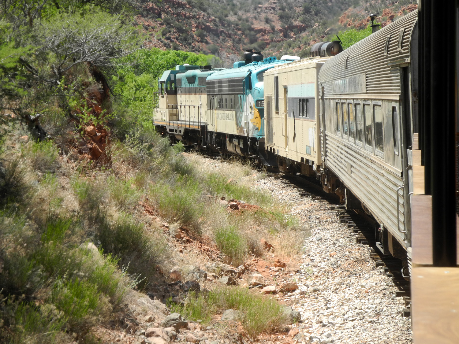 |
| Along the railroad line into the Verde River Canyon | The Verde Canyon train |
 |
 |
| Old ties along the road | The train from Clarkdale to Perkinsville |
|
The next morning we checked out of the motel, said goodbye to Cottonwood, and made the short drive to Montezuma Castle National Monument. This is actually a native cliff dwelling high up above Beaver Creek, dating from around 1100. There are other badly deteriorated dwellings next to it, all visible via a short walk along the creek. By the way, this reference to Montezuma and to Aztecs later in this report are pure baloney. The Spanish invaders assumed that everything north of Mexico City was built by the Aztecs, whereas the Aztec empire did not arise until 200 to 400 years after people of what is now Arizona and New Mexico had built their great engineering works. |
|
 |
 |
| Montezuma's Castle | Beaver Creek near the cliff dwellings |
|
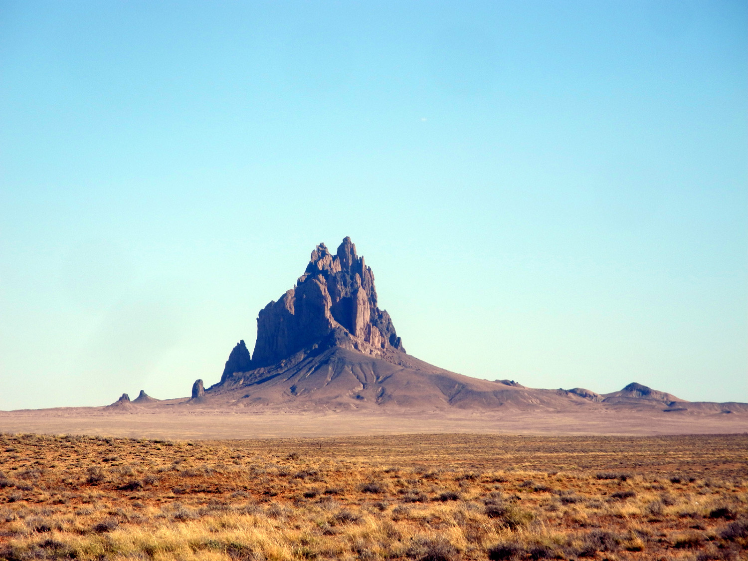
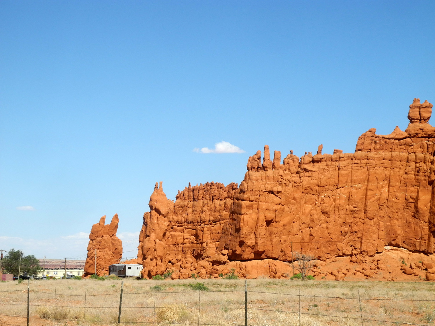
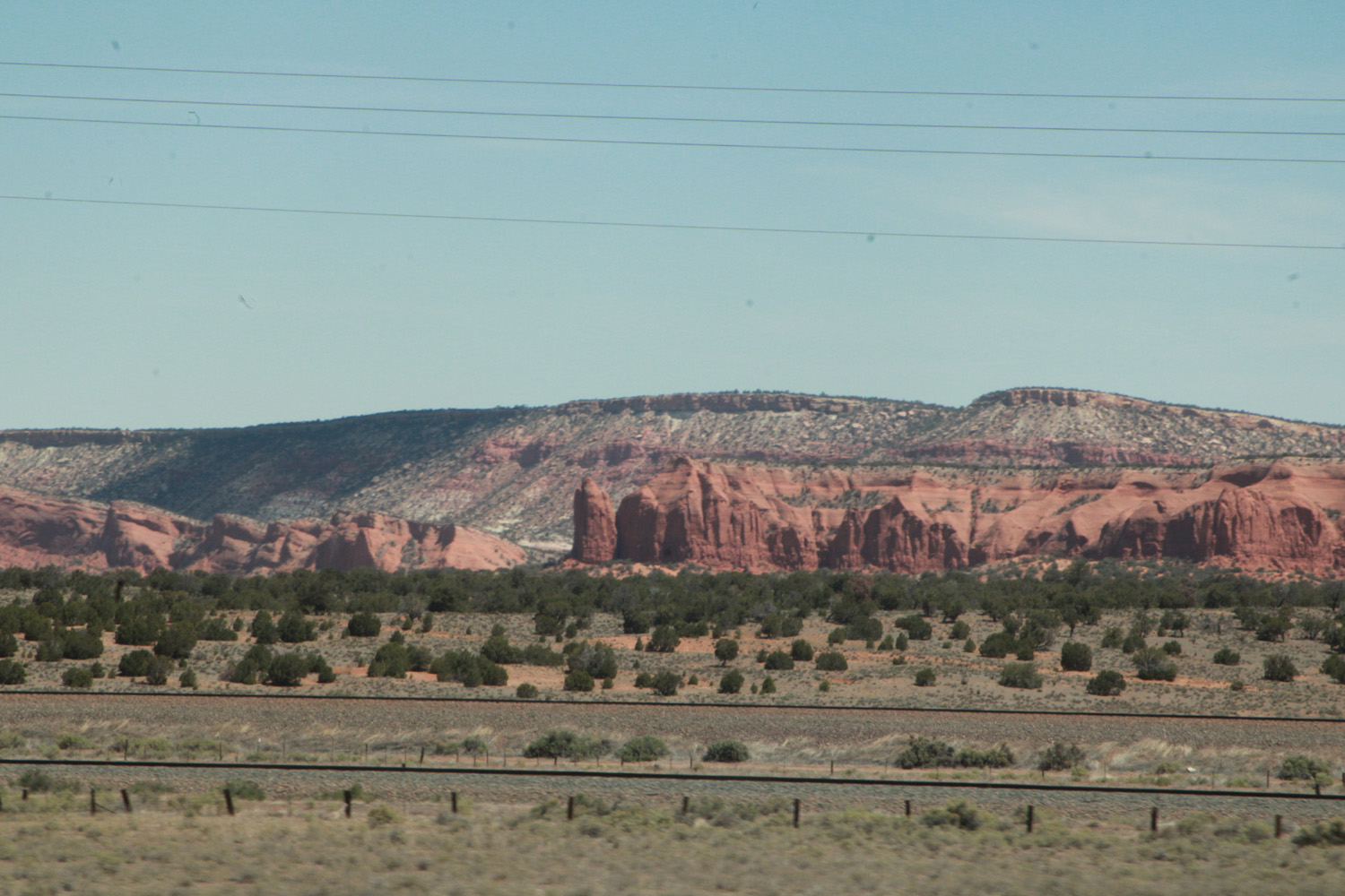
This was our final stop in Arizona, and we set off on US64 for northwestern New Mexico. We passed a number of Hillerman place names, most notably Ship Rock. The rock itself is a volcanic plug that rises more than 1500 feet above the desert floor, with no other hills or similar features nearby. The rock and the town are significant locations in several Hillerman novels, particularly The Fallen Man. I recommend this and all his works, as well as the follow-up series that his daughter Ann started after his death. We were able to get a good look at Ship Rock from the highway, but it is sacred to the Navajo and other tribes and climbing it is mostly discouraged. Even to approach the base you must travel with a native guide. Farther on you will see the red sandstone outcrop of Baby Rock. A close approach is probably discouraged here, with a barbed wire fence along the road and local residences right up against the rock. |
|
 |
 |
| Ship
Rock, west of Farmington (There's an even better photo on line here.) |
Baby Rocks |
|
A few more miles of travel brought us to Farmington, our destination for the day, where we would spend three nights. For no particular reason I had thought of this as a very small town, but a few moments of research revealed that it has over 48,000 residents. The city is quite spread out, and why not, considering the thousands of acres of available land in the area. Teri had made reservations at the Towneplace Suites, where we each had our own bedroom plus a full kitchen. After a relaxing evening and good night's sleep, our first excursion was to the Salmon Ruins, named for a 19th century pioneer family who homesteaded at this location. It also featured extensive artifacts constructed by the pueblo people who occupied the land at the start of the second millennium. These people used locally sourced rock and mud mortar to build an extensive complex. There are also artifacts from the homestead era, including rough board buildings and fences made from sticks. |
|
 |
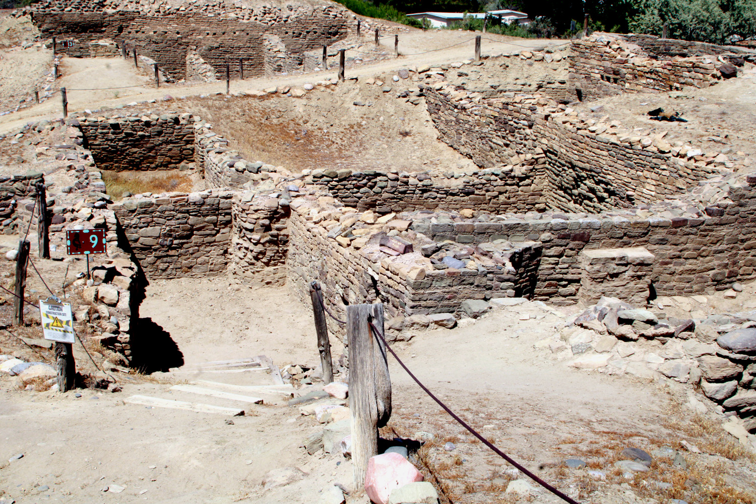 |
| Probable kiva in Salmon Ruins | Pueblo construction at Salmon site |
 |
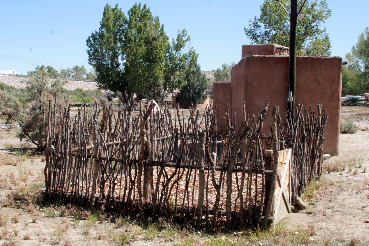 |
| Structure from 1800's homestead | Lots of handy sticks make good fences |
|
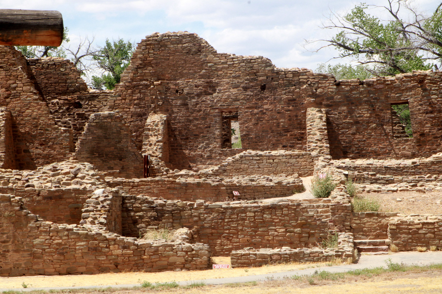
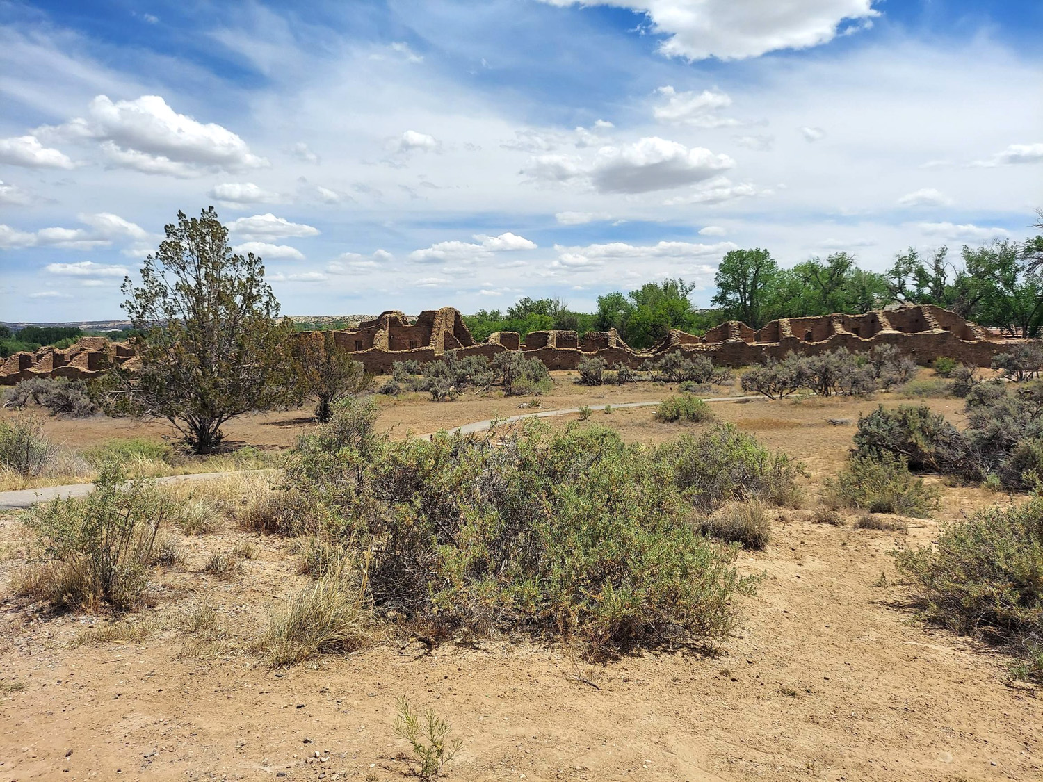
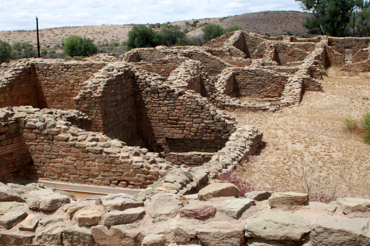
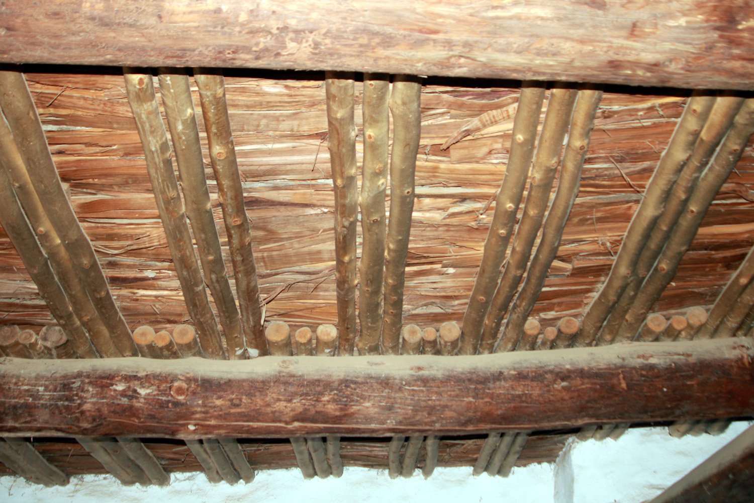
From the Salmon area we drove to Aztec Ruins National Monument (remember - nothing to do with actual Aztecs). This location was even more impressive than the last, with a huge multi-room structure and some of the best-preserved examples of Chacoan architecture in the region. Like most ancestral Pueblo sites, most of it was constructed between 1100 and 1130, and abandoned after 1300. Walking through this large, spread-out complex, you can't help but admire and respect the skill and effort required to build it. Different rooms provided living space, storage, and ceremonial areas. The three-part ceiling consists of heavy logs, lighter poles, and a top layer of what seems to be boards, all formed by hand. In one place there was a low, narrow passage-way through at least three chambers, from inner-most to the outer wall. Bending low and shuffling, I triumphantly managed to walk through this "tunnel." All of this was built without any type of power equipment and some of the materials were transported from as much as 20 miles away. The thing that raises the most questions, even among experts, is why it was abandoned so soon after it was erected. |
|
 |
 |
| Early residents built a huge "apartment" complex | Brick and mortar construction with primitive material |
 |
 |
| Think of the effort required to shape and raise this roof | I made it through these three low doorways |
|
As we drove away, Teri asked what I had in mind for dinner. My response was that I wanted to sit down while someone else fixed and served my meal., so we went to Fiesta Mexicana, and both of us came away with enough food for another delicious supper. |
|
|
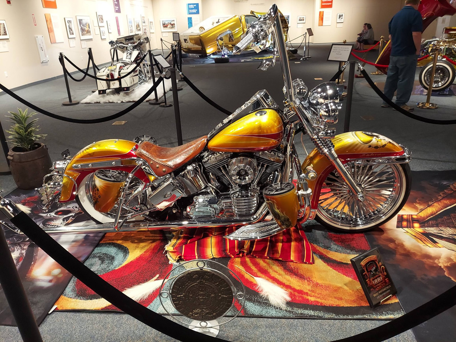
The next day, our last in Farmington, was low-key. After living in shorts and t-shirts, we woke up to a cold, cloudy windy day. We just did a little shopping and a lot of resting. In downtown we went into the Dusty Attic, where I found a birthday gift for someone (can't reveal the details here). We also went to a place that advertised "hundreds of things," but it was more like thousands - lots of yard figures and stuff that defied description. Our favorite was a herd of metal possums. We also went to the Farmington Museum, which featured a low-rider exhibit. Other than a room devoted the oil, gas and coal industry, the museum did not have much else. It was this industry that changed this village of a few hundred in 1950 to the small city it is today. |
|
 |
 |
| A herd
of possums, not the strangest artifacts in this sprawling outdoor store |
Low rider motorcycle in Farmington Museum |
|
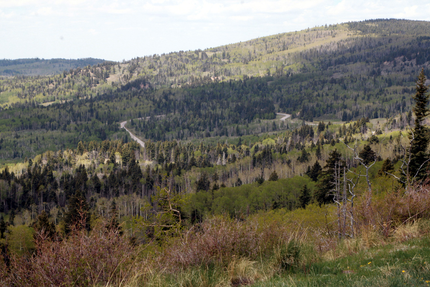
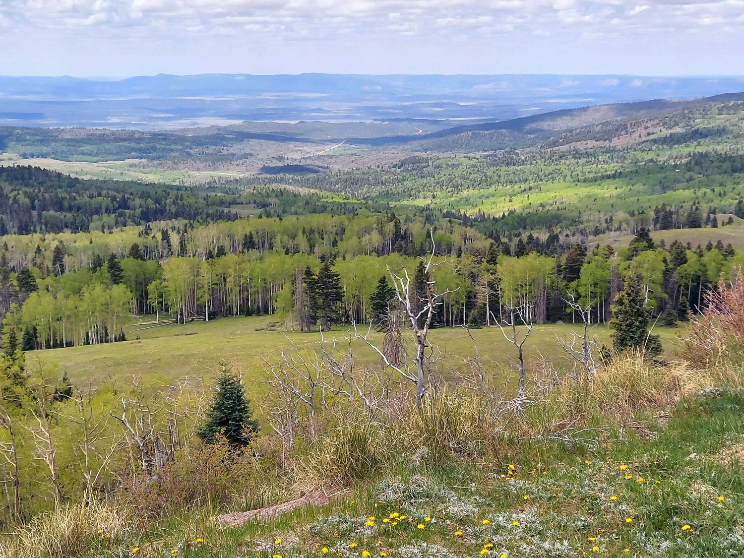
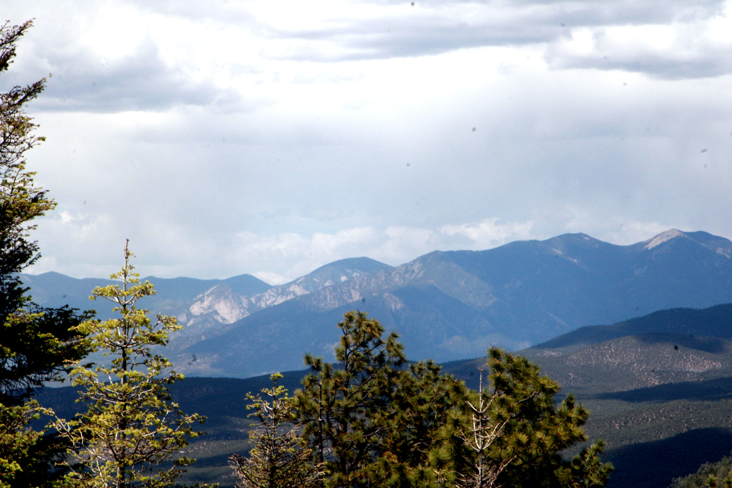
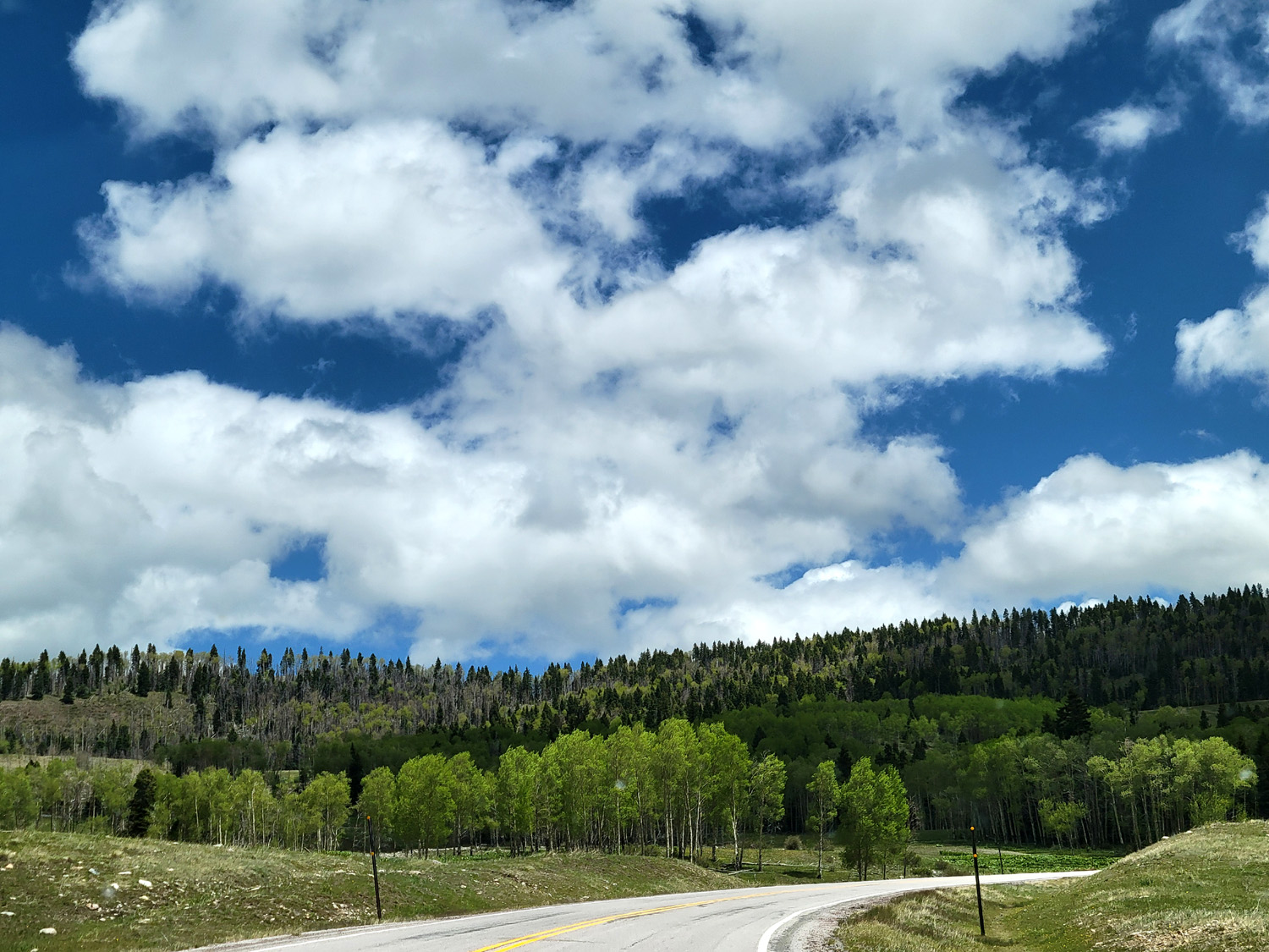
In the evenings, when we had a TV with access, we watched a few games of the Stanley Cup playoffs. Our favorite teams had been eliminated or did not make the playoffs, so we had to content ourselves with rooting against teams that had done us dirty. The Buffalo Sabres had made the playoffs for the first time in 15 years, so we cheered for them as underdogs, but we saw them eliminated by the Montreal Canadiens, my very LEAST favorite team. It did me good to see them banished by the Carolina Hurricanes the day after our return home. Now it's Carolina and Vegas in the final. Since Las Vegas beats my Sharks regularly and since they swept grandson Mikie's Avalanche in the first playoff round, we are cheering for a team from the far south0east that usually is not even on our radar. They are 12-1 in playoff games this year, so we have high hopes. On May 19 we left Farmington and had the most scenic drive of the entire trip. We traveled on US64 (the Commodore Highway) through the Carson National Forest, reaching the 10,000 foot level at one point. We drove through alders, aspens, and various evergreens, often with expansive views of the country below. We stopped to eat our lunch at a big, wind-swept meadow featuring sloped shelters. They could not stop the wind, and we ate in the car, but were enthralled by the view. There were still some patches of snow in shaded areas. |
|
 |
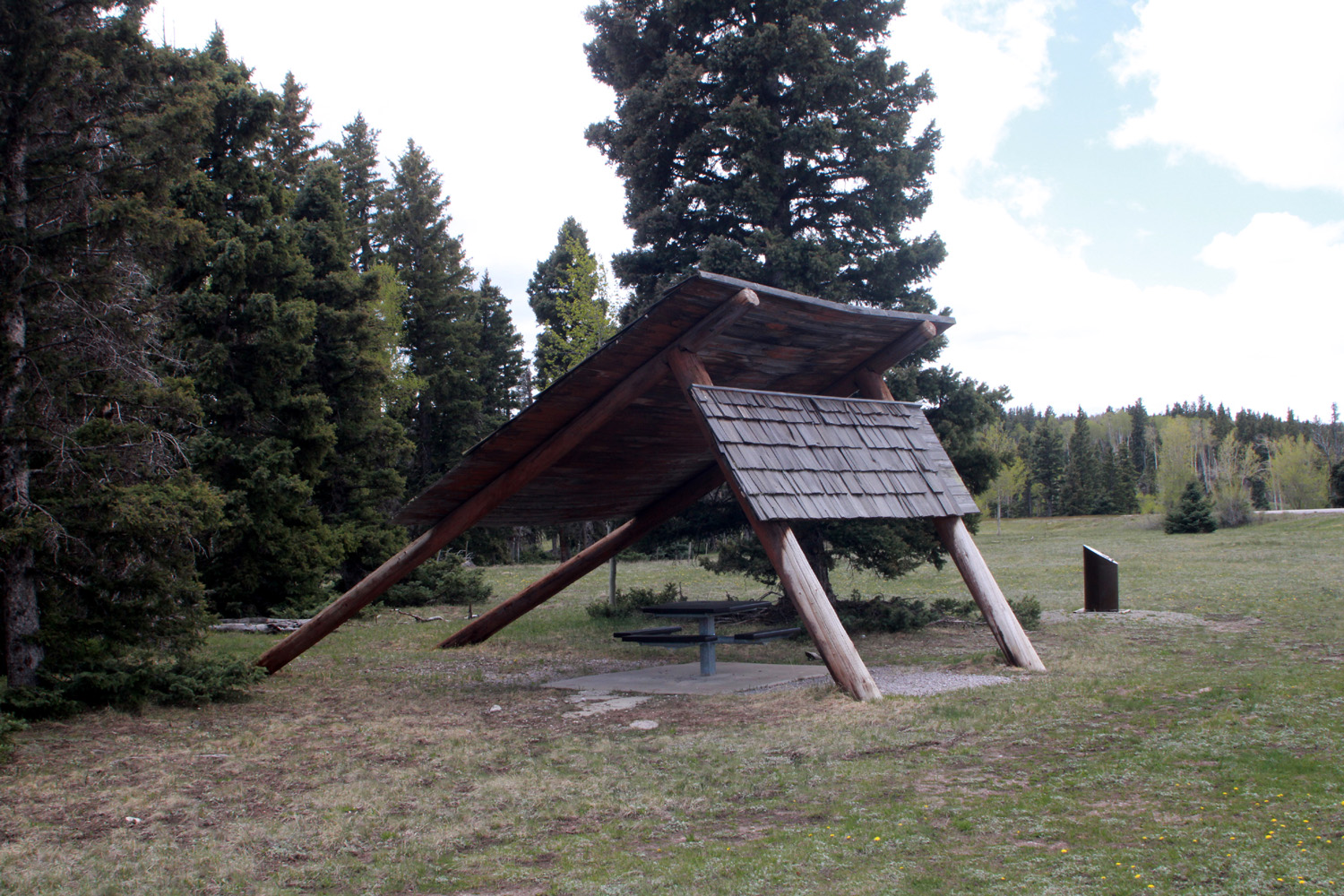 |
| Vista from US64 in the Carson National Fores | Not sure how much shelter these odd shelters actually provide |
|
|
 |
| Land and sky are both scenic | Echoes of Yosemite? |
|
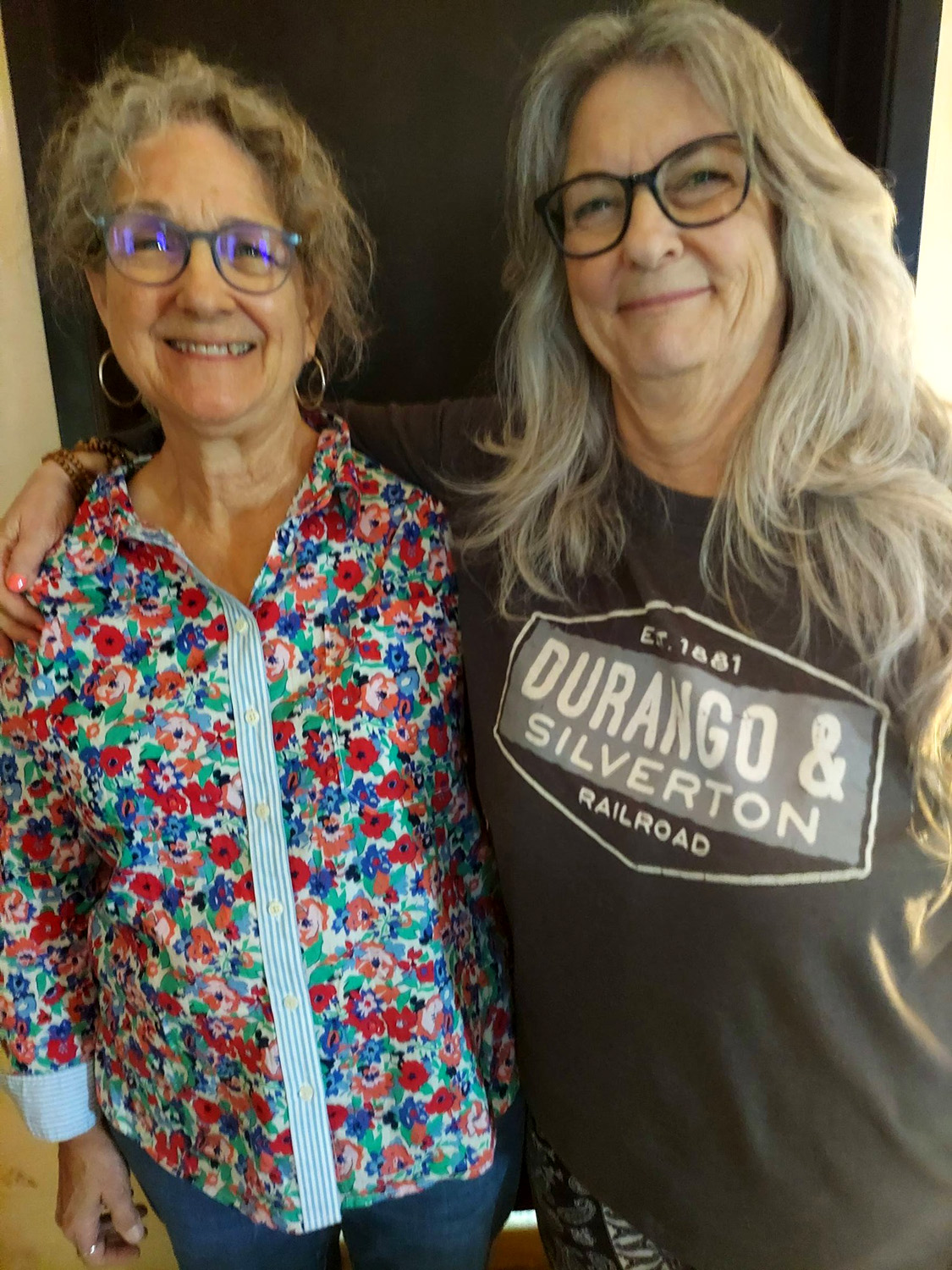
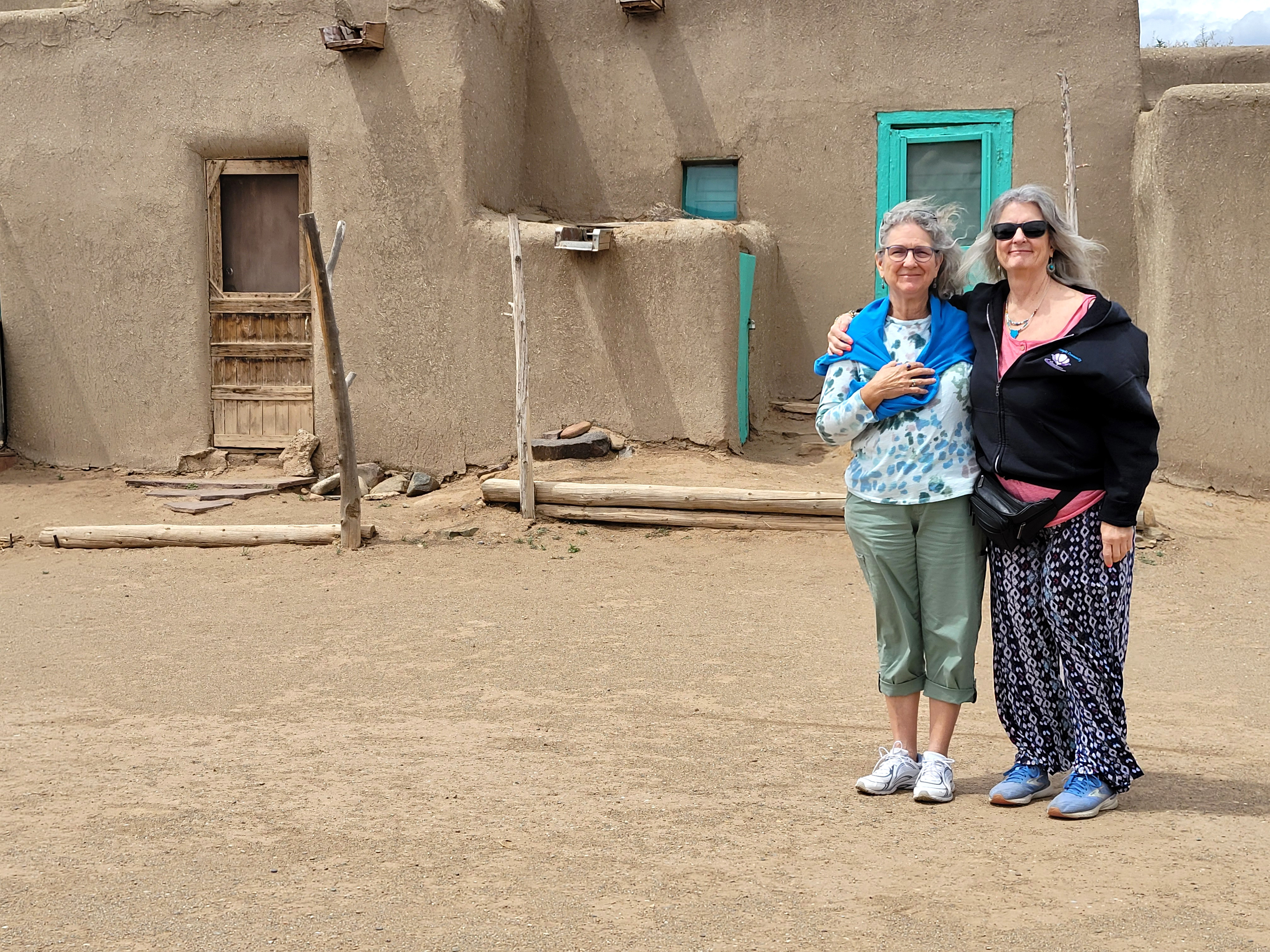
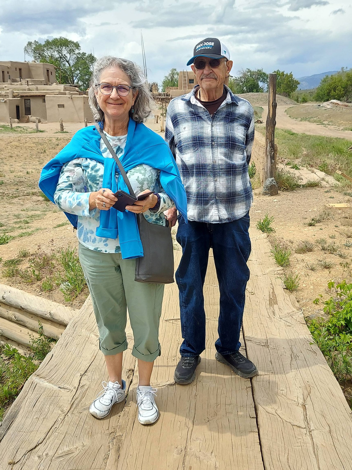
From our high point we dropped down just below 7,000 feet at Taos, where I witnessed a warm and touching reunion. Teri's good friend Monica had moved from Fresno to east Texas a few years ago, to be closer to her kids in Louisiana. As planned from the start of our preparations, she drove over and spent the next four days with us, accompanied by 12-pound Ollie, a little white dog.. We were at the Taos Pueblo suites, where Teri and I had a two-bedroom unit, with a spacious living room, while Monica was in her own separate unit. Teri's and Monica's initial hug lasted so long I thought I might have to pry them apart, but they soon settled down and began visiting as if they'd never been separated. We walked to a nearby restaurant and had a nice dinner. |
|
 000 000
|
|
| Monica and Teri, together again at last | Our living room in Taos |
|
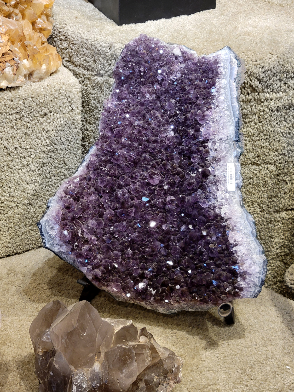
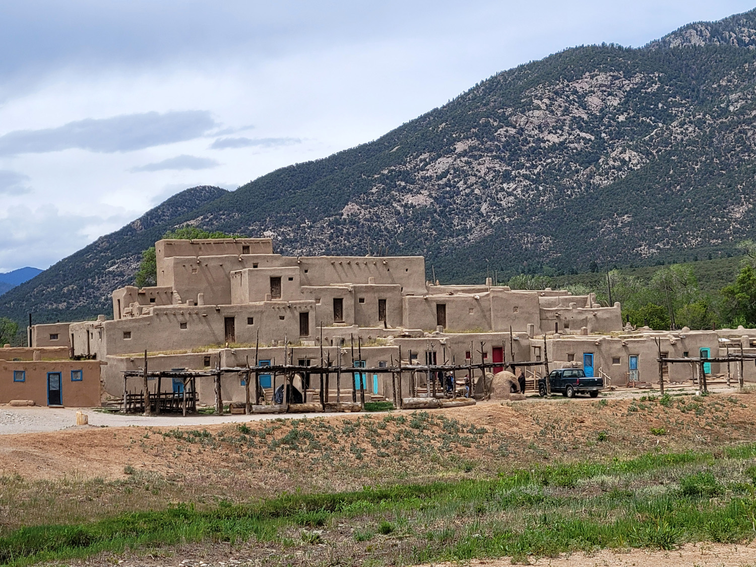
The next day we went to Taos Pueblo, a native site that has been occupied for about a thousand years. We arrived about 10:30, but were turned away; a funeral was in progress and the place was not open to outsiders till noon. We were only a short distance from town, so we went back to Taos and spent a couple of hours looking into some shops, and having coffee and ice cream. We returned to the Pueblo, paid our $22 per person entry fee (senior discount) and walked into the complex. There are a number of different buildings, most of them private residences. About a quarter of the people have a business in their homes, selling crafts, food and other items, and we went into several of those. I asked a man in the first one how old their homes were. He said some were built in 1000, but his was newer, dating from 1200. We had a short, pleasant humorous conversation with one woman about Columbus' "discovery" of America, which in fact took place at least 15,000 years after the first residents arrived, I bought a t-shirt and Teri got me a roadrunner magnet. I have more than anyone needs of both those items, but we could not resist. There was no electrical power at the place I bought the t-shirt; the lady there used the old-school paper form, all written by hand, no machine to scan the card. Today's credit cards don't even have the raised letters and numbers needed to imprint the account information in those devices. The bank billed me with no problems. |
|
|
|
| Huge crystal in a store in Taos | The big building at Taos Pueblo |
|
|
| Monica and Teri at Taos | Monica and Dick on the bridge over Red Willow Creek |
|
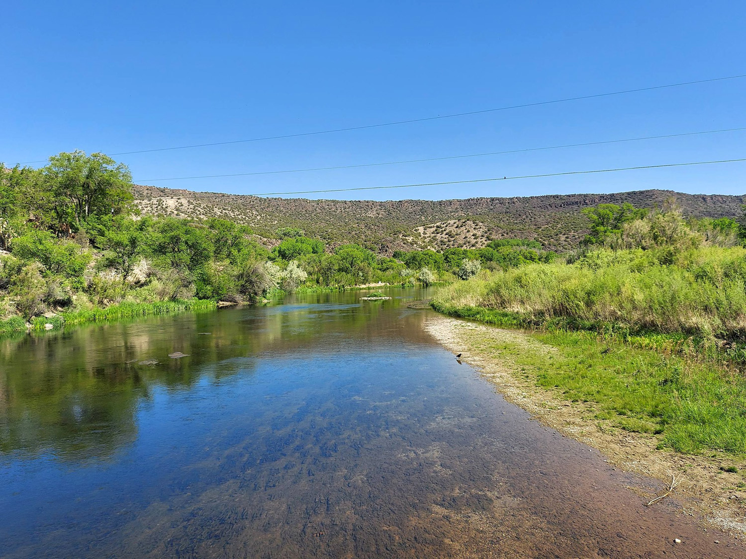
The rest of the day was our usual late afternoon and evening - low key, with supper in the room, reading and relaxing. The next day we drove south out of town to the Rio Grande Gorge. Our first stop was to be the visitor center, on New Mexico Route 68. The GPS directed us to turn west and took us across the gorge on a narrow bridge to? Nowhere. We went back to the highway, and spotted the visitor center about a hundred yards past where we had turned, on the EAST side. We spent a short time there, then returned to to the "wrong" road, skipping the bridge and continuing parallel to the river. We parked and walked a short distance up a trail, but it was steep and rocky, and no country for old men. Our plan was to continue down the highway and take the High Road back to Taos, turning off highway 68 on to route 76. Here we were in the Sangre de Cristo Mountains, which run from near Santa Fe into southern Colorado. The High Road winds through the mountains, high desert, forests, small farms, tiny isolated Spanish land grant villages and Pueblo Indian villages. It took us up above the 8,000 foot level. At Trampas we stopped to photograph the San Jose de Gracia Church that dates from the mid-1700's, and also patronized a small market in Truchas. It was a delightful, scenic drive, and our good mood was only improved when we enjoyed an excellent Mexican dinner at the Guadalajara Restaurant back in Taos. Once again we had a relaxing evening, looking forward with a mix of eagerness and sadness to our final full day in this unique country. |
|
|
|
| Ollie Dog proved to be a good hiker | The mighty Rio Grande |
|
|
|
| San Jose de Gracia Church in Trampas | Vista in the Sangre de Cristo Mountains |
|
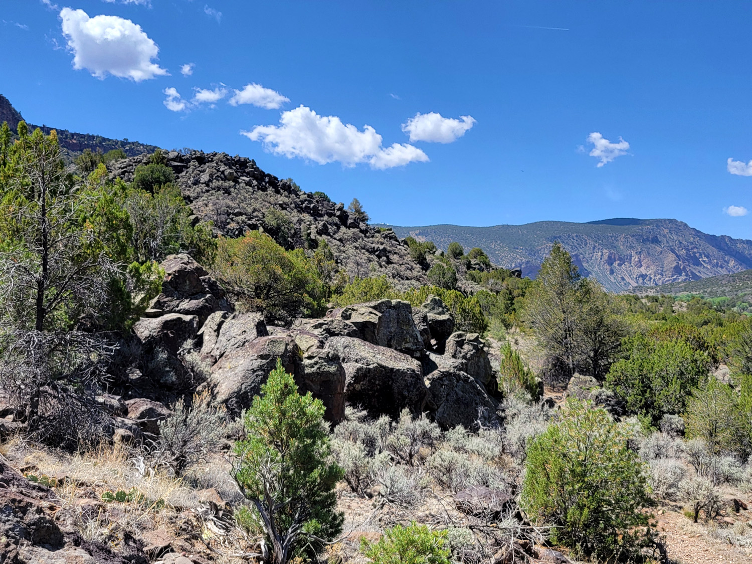
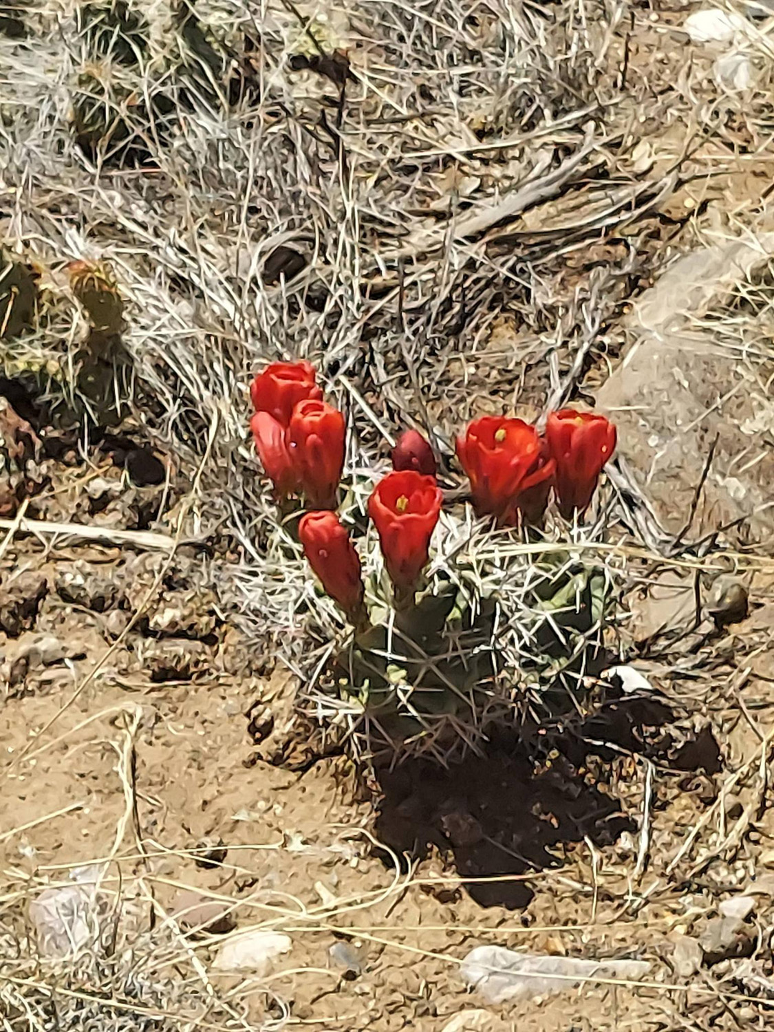
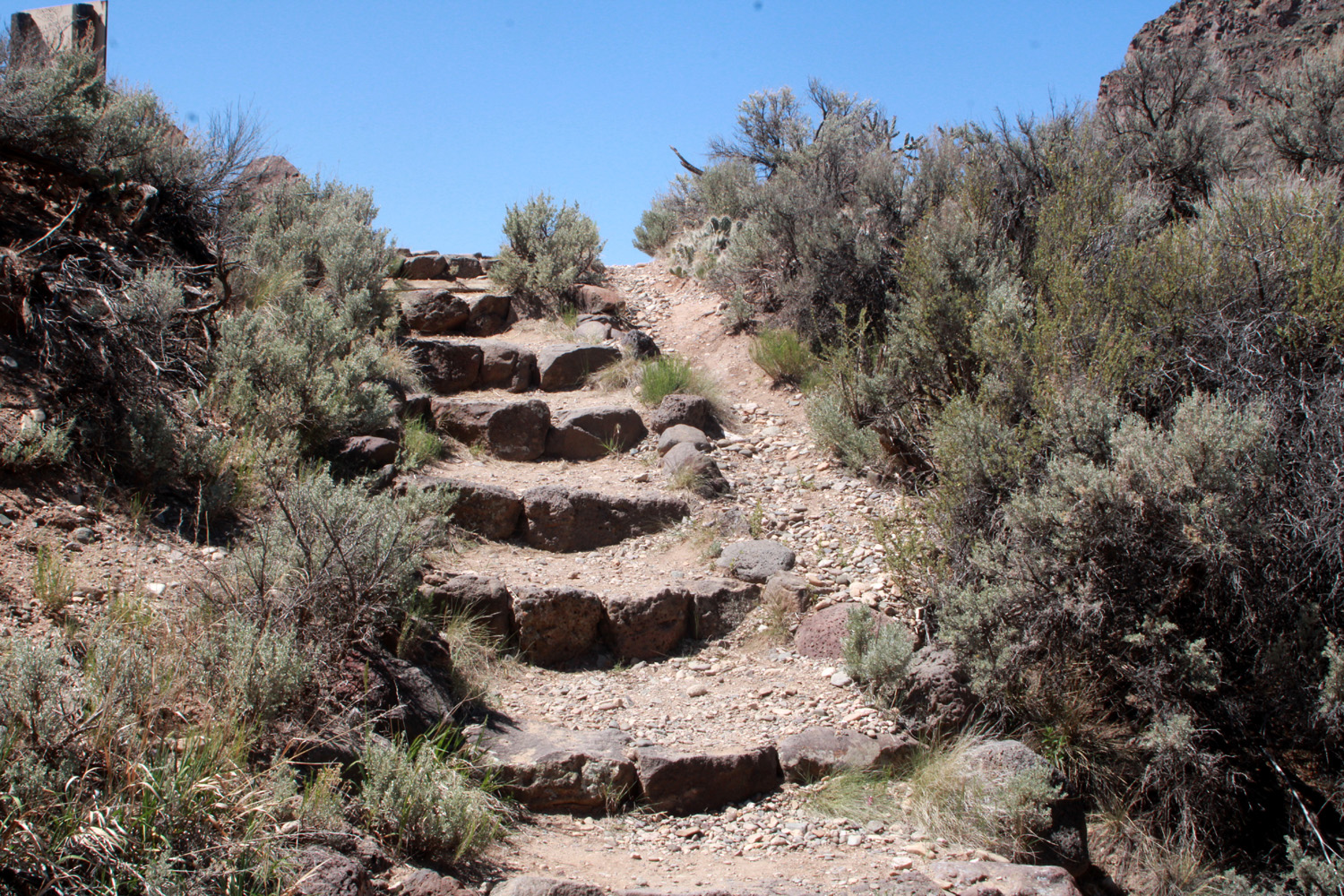
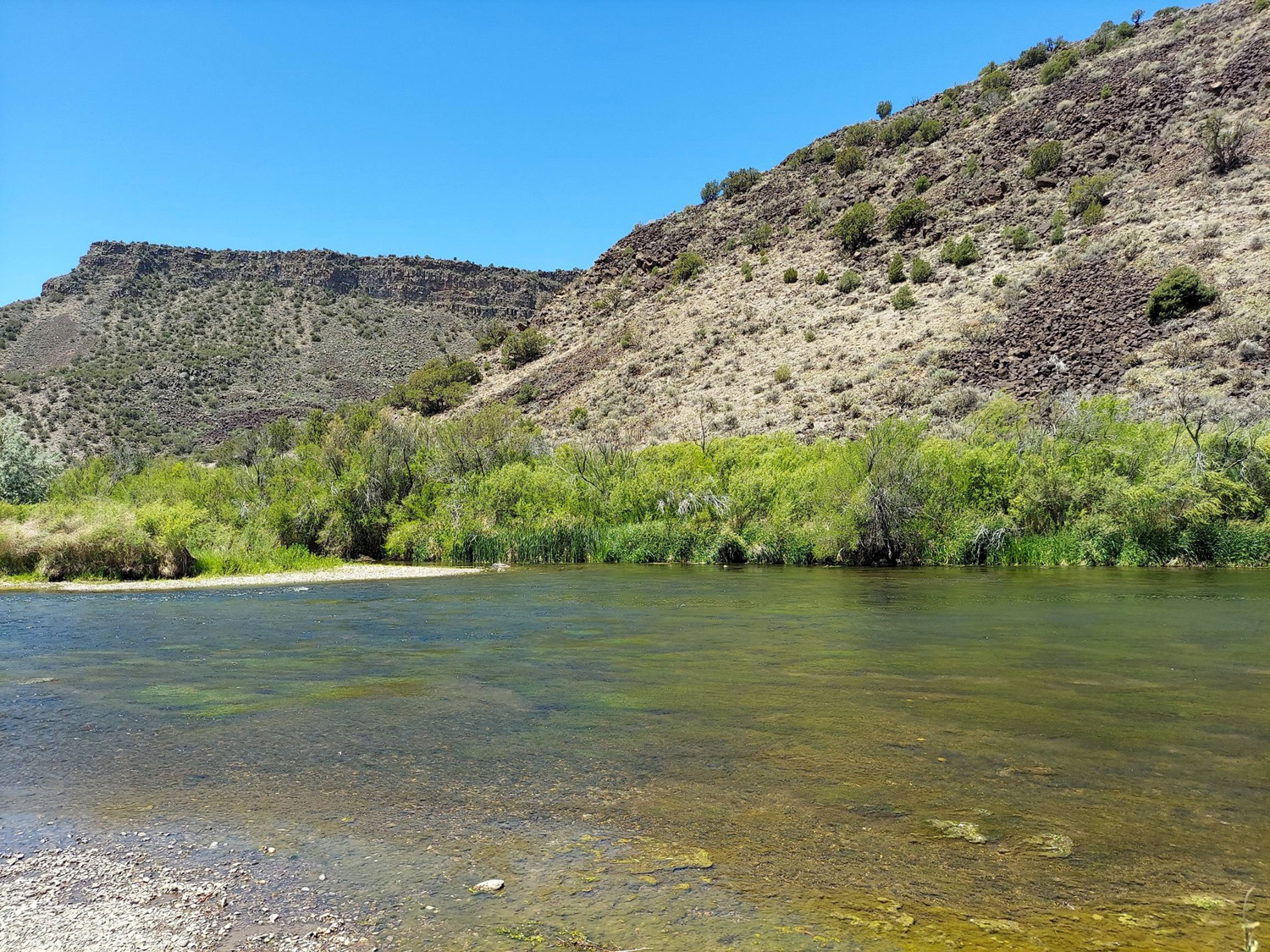
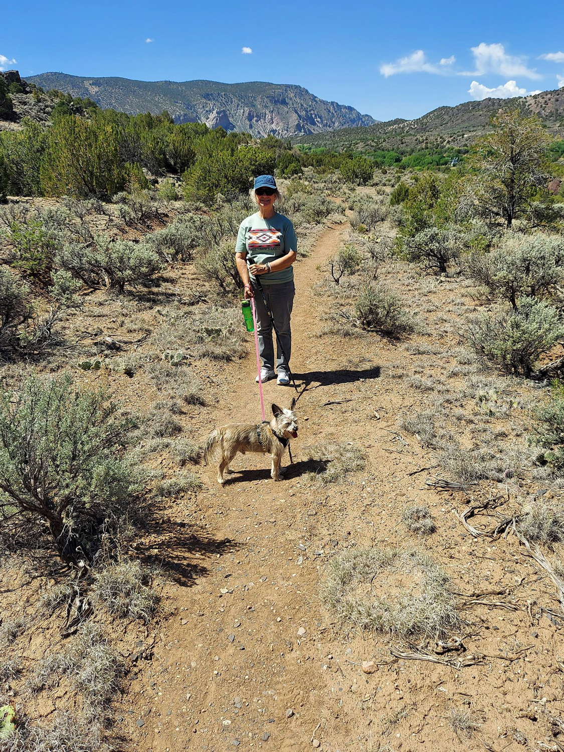
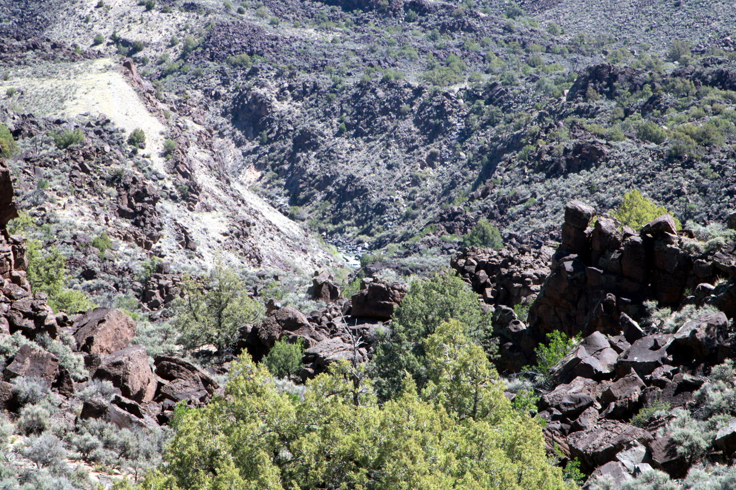
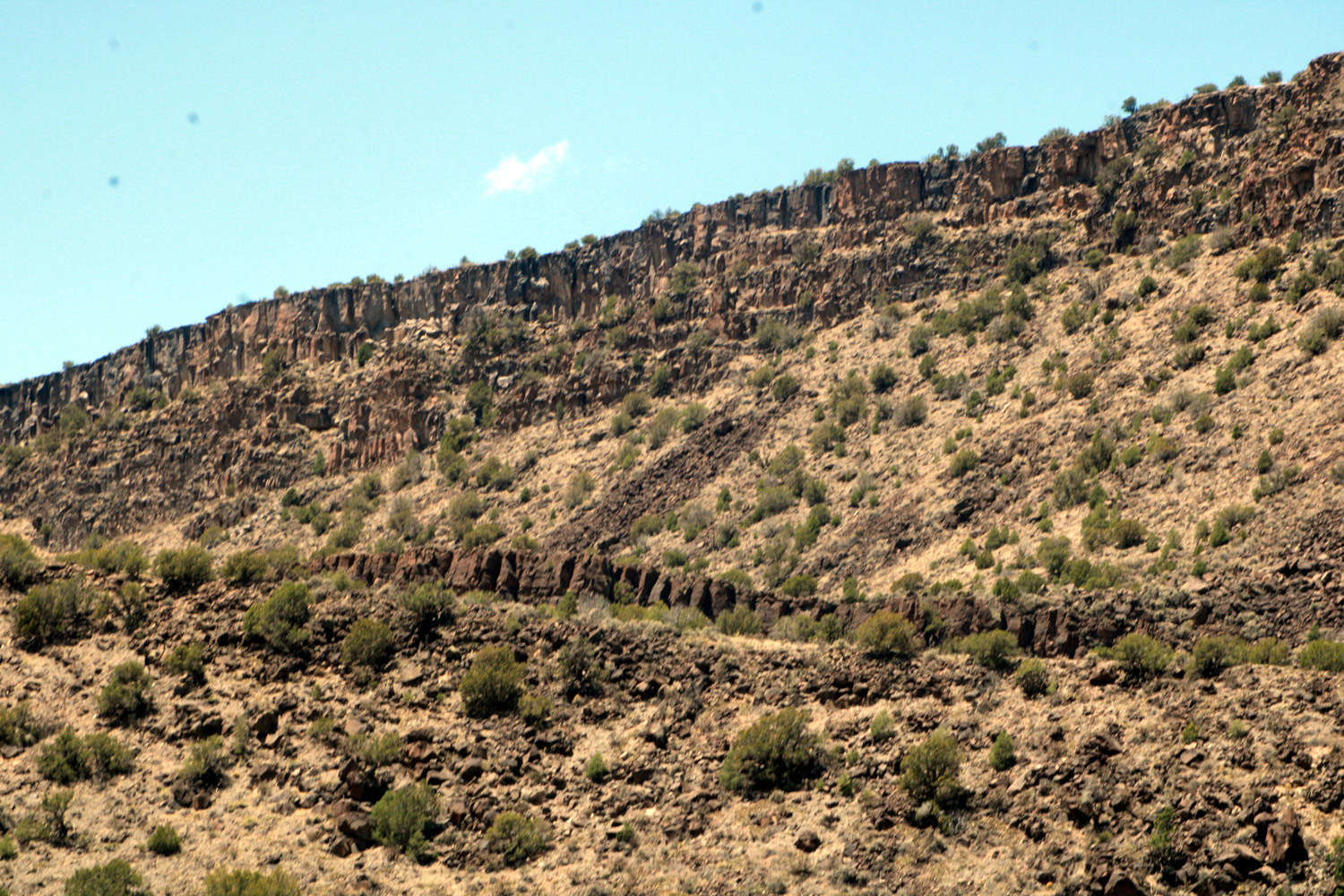
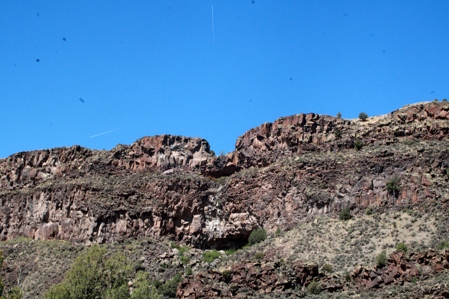
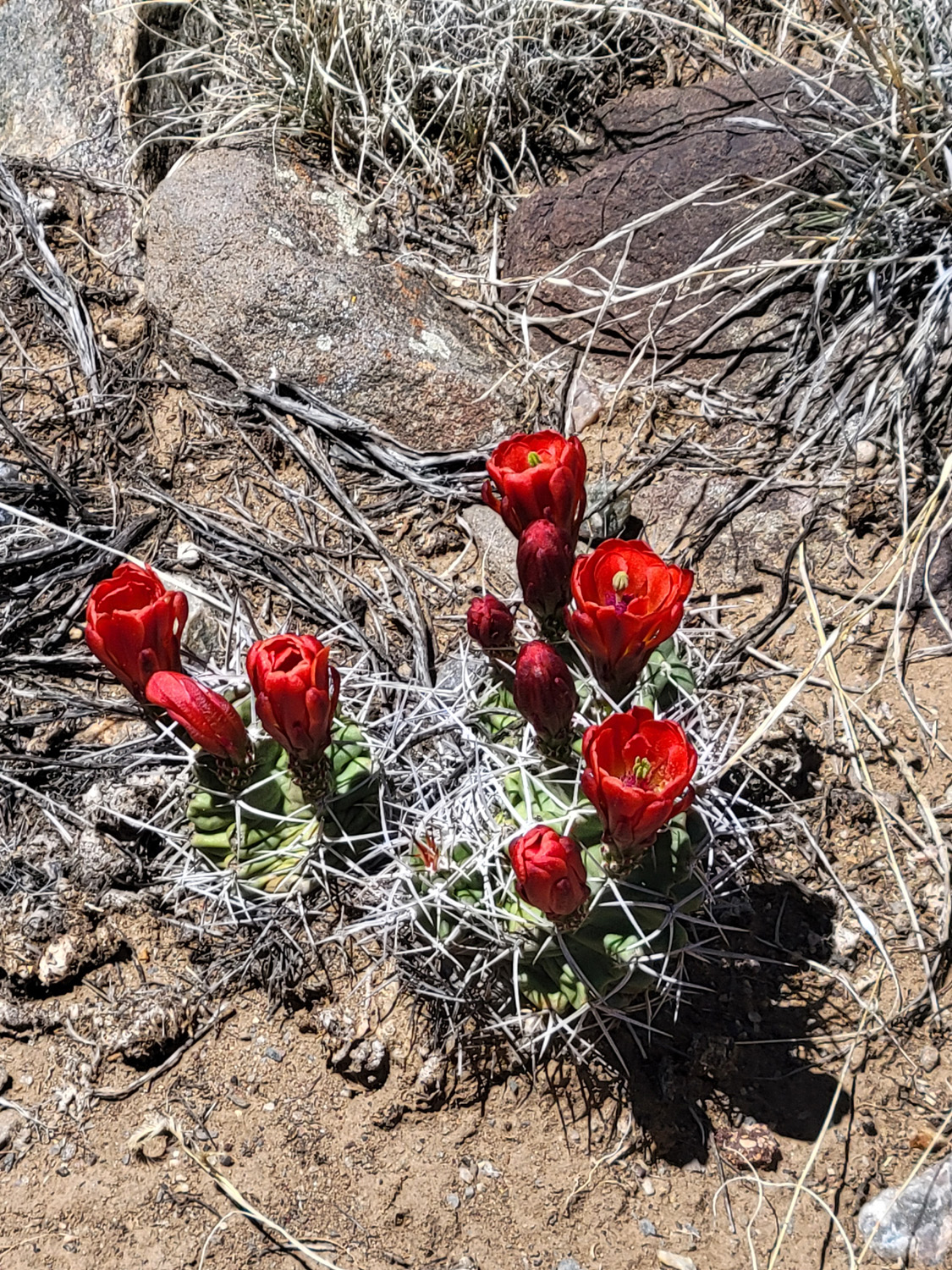
On May 22, our last full day in New Mexico, our plan was to finally hike at the Rio Grande Gorge. We were aiming for the Vista Verde Trail, which promised a good view into the gorge. Again, there were steep, rocky sections that were unsafe for me. The map showed us a trail that ran through four campgrounds east of the river, and we entered it at Lone Juniper Camp, the 2nd farthest north. This proved to be just right, and we enjoyed probably a one mile round trip walk among cactus, huge shattered black boulders and high desert vegetation. There was one cactus with red blossoms; all the rest were yellow. We did have a view down into the gorge with a glimpse of the river at one point, but for the most part we were too far back from the edge to see the water. Nevertheless, we had dramatic views of the cliffs above and the rugged country around us. Olliie proved to be a very good hiker. One might think he'd be handicapped by having such short legs, but all of us humans are very slow hikers, and he seemed to enjoy the outing as much as we did. At one point he dug a small hole and squeezed into it to keep cool. When we got back to town, we rewarded ourselves with ice cream, then had another quiet evening, while getting packed up to go. |
|

|

|
| Walk with care on this trail | Broken brownish black boulders were everywhere |
|
|
| A tiny section of the river is visible in the very middle of this scene | Cliffs and rock above the Rio Grande Gorge |
|
|
| A dramatic skyline | The only red blossoms on our last day's hike |
|
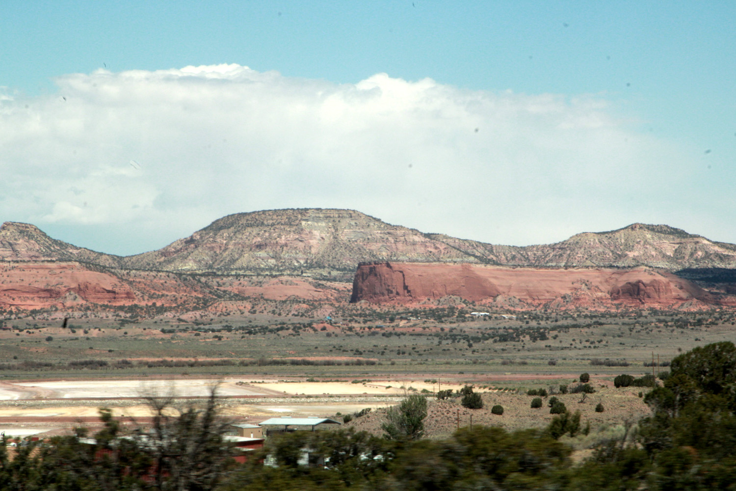
The next morning we reluctantly said goodbye to Monica, who was headed for Amarillo TX for the first day of the drive home, while we had reservations in Seligman AZ. We drove south and slightly west, eventually taking I-25 at Santa Fe, then got on I-40 at Albuquerque. Along this route New Mexico is a land of mesas, red sandstone, and the usual pinyon and juniper. We drove across more than 2/3 of Arizona to Seligman, home of the Route 66 Motel and the Roadkill Cafe ("you kill it, we grill it.") We got food from the cafe and ate in our room. Teri had a burger (beef, despite the whimsical name on the menu), and I had chili with onions and cheese, all very delicious. |
|
|
|
| Typical scene along I-40 in New Mexico | Truly a land of enchantment |
|
|
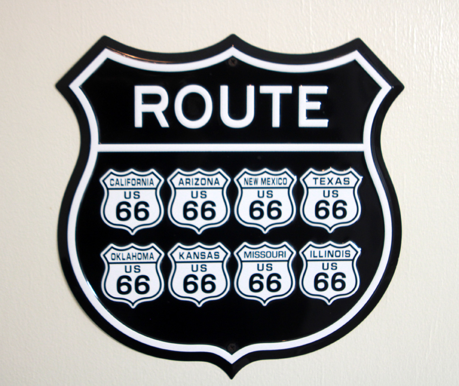
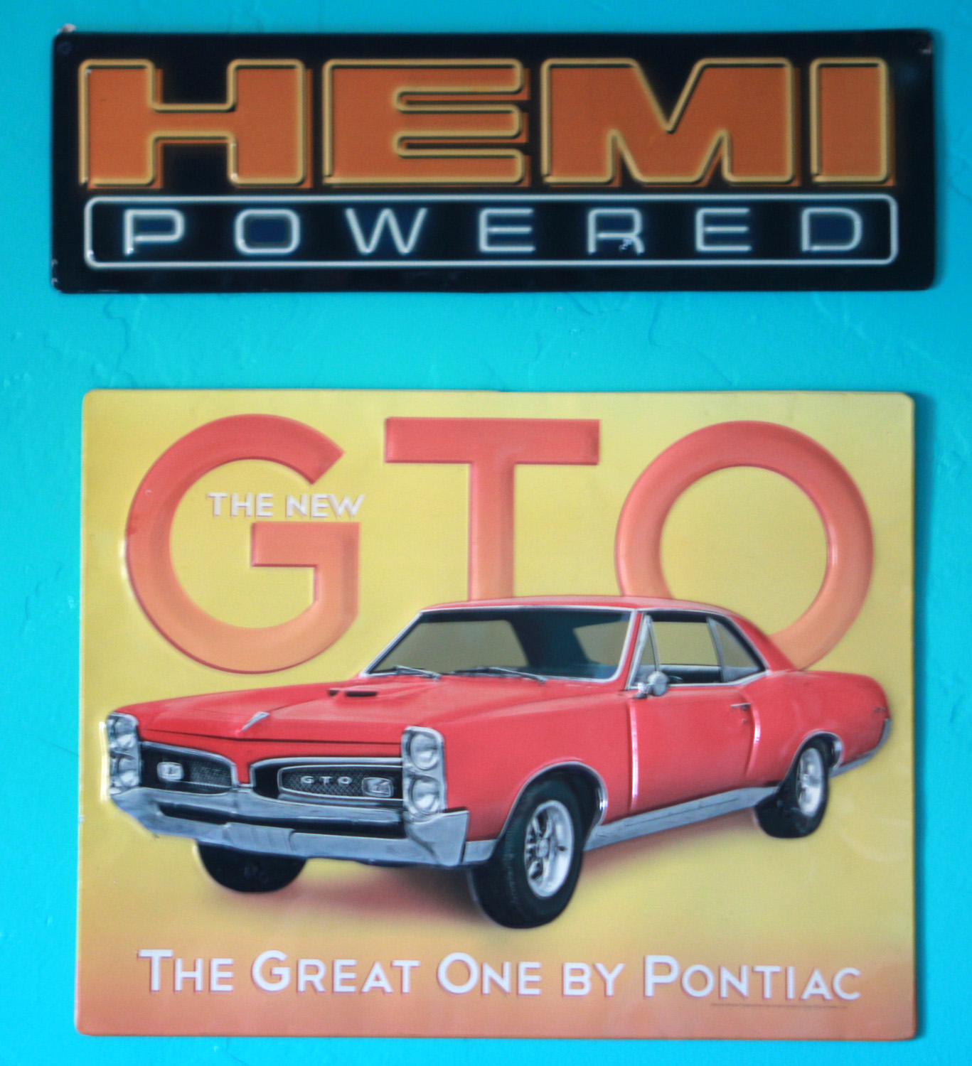
| All the states where you'll find Route 66 | Artwork on the motel walls related to cars and the iconic highway |
|
Our drive was about 530 miles, so we were definitely ready for a rest. Our final day's drive was almost as long, but we got a good start and got home around 3:30 p.m. Teri delivered me and my stuff to my condo in Clovis, and I still had enough energy to put most of it away. I did not have the energy, or perhaps the interest, to go through my mail, which grandson Johnny had brought in and left on my coffee table. I had been going to bed fairly early, but this night I stayed up till my normal time, about 9:30. |
|
|
Final Thoughts: Arizona is the Land of Roundabouts. We must have gone through at least twenty of these traffic circles while driving in the state. The pueblos of the southwest, mostly occupied from 1000 to 1300, are referred to as "ancient." But considering that the people we call Native Americans or American Indians began to migrate into North America between 15 and 20 thousand years ago, aren't they really sort of modern? Our European ancestors considered these people to be ignorant savages. It's true they did not have the technological equipment and skills of some other cultures. But they still did an amazing job of engineering, design, and construction in building multi-story structures. Speaking of which, the people of Taos Pueblo maintain their buildings by applying a fresh coast of adobe mud every few years. The word "desert" is applied rather carelessly to many areas. I remember reading, LONG ago and I know not where, that a desert was land where less than 25% of the area could support plant growth. Although the definitions I reviewed on line do not give such a percentage, all use the phrase "sparse" or "very sparse" vegetation. That certainly does not apply to this area by the Rio Grande Gorge. In the past I have walked freely off the trail among the cactus and bushes in the desert east of Phoenix. I would certainly not venture into much of the landscape of this part of New Mexico. --Dick Estel, June 2026 |
|